
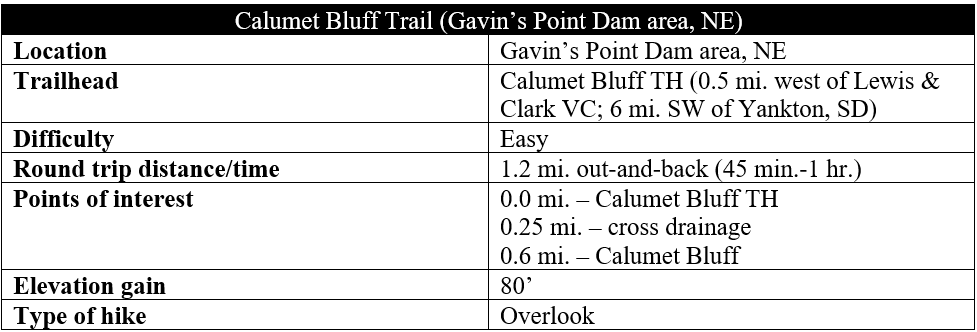
During the first summer of the famed Lewis & Clark Expedition in 1804, the travelling company camped for four nights at the base of a high bluff along the Missouri River, described by the party as “composed of a yellowish red, and brownish clay as hard as chalk.” Here the expedition met several times with local Sioux and Yankton tribes before moving on, heading further upriver en route to the Rocky Mountains. The cliffs here came to be known as Calumet Bluff, which is now part of protected parkland between a base for the U.S. Army Corps of Engineers and the Lakeview Golf Course in northeast Nebraska. A short hike—about 1.2 miles round-trip—leads to and from the bluff and offers scenic views of the Missouri River floodplain and Lewis & Clark Lake, a man-made reservoir on the border of Nebraska and South Dakota.
The hike
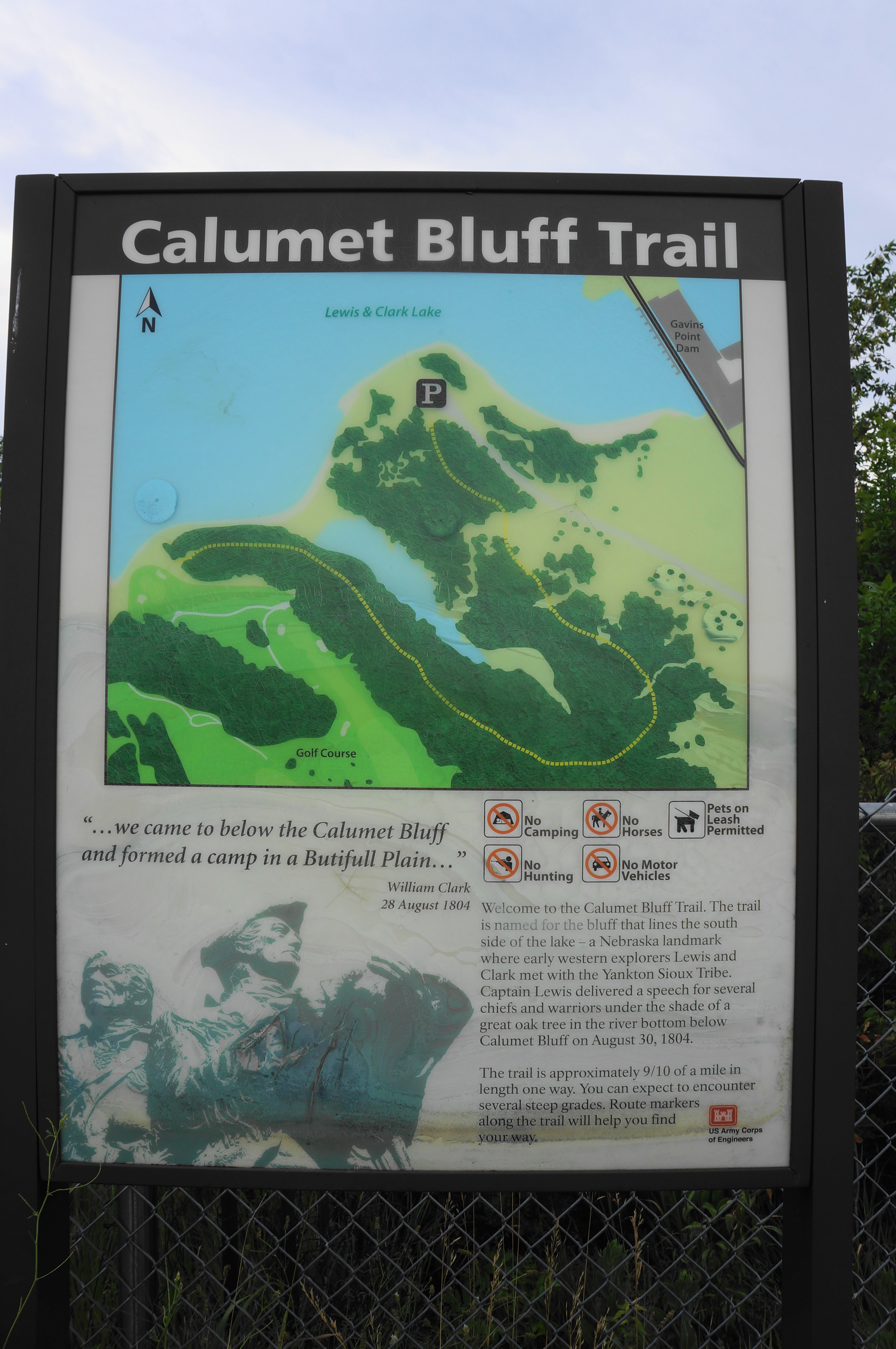
Most visitors to the area will want to stop at the Lewis and Clark Visitor Center, operated by the U.S. Army Corps of Engineers and situated on a headland just downstream from Lewis & Clark Lake and the Gavin’s Point Dam, on the Nebraska side. Here visitors can explore the exhibits and take in the splendid views across the lake to South Dakota. The Calumet Bluff Trail begins at the end of a road about a half-mile drive south and west of the Visitor Center. (Note: Leaving the visitor center, follow the access road back to Route 121, then take the first right, past the base and playground.) Park at the end of the paved track, at the precipice of a bluff in itself. There is parking for a handful of cars.
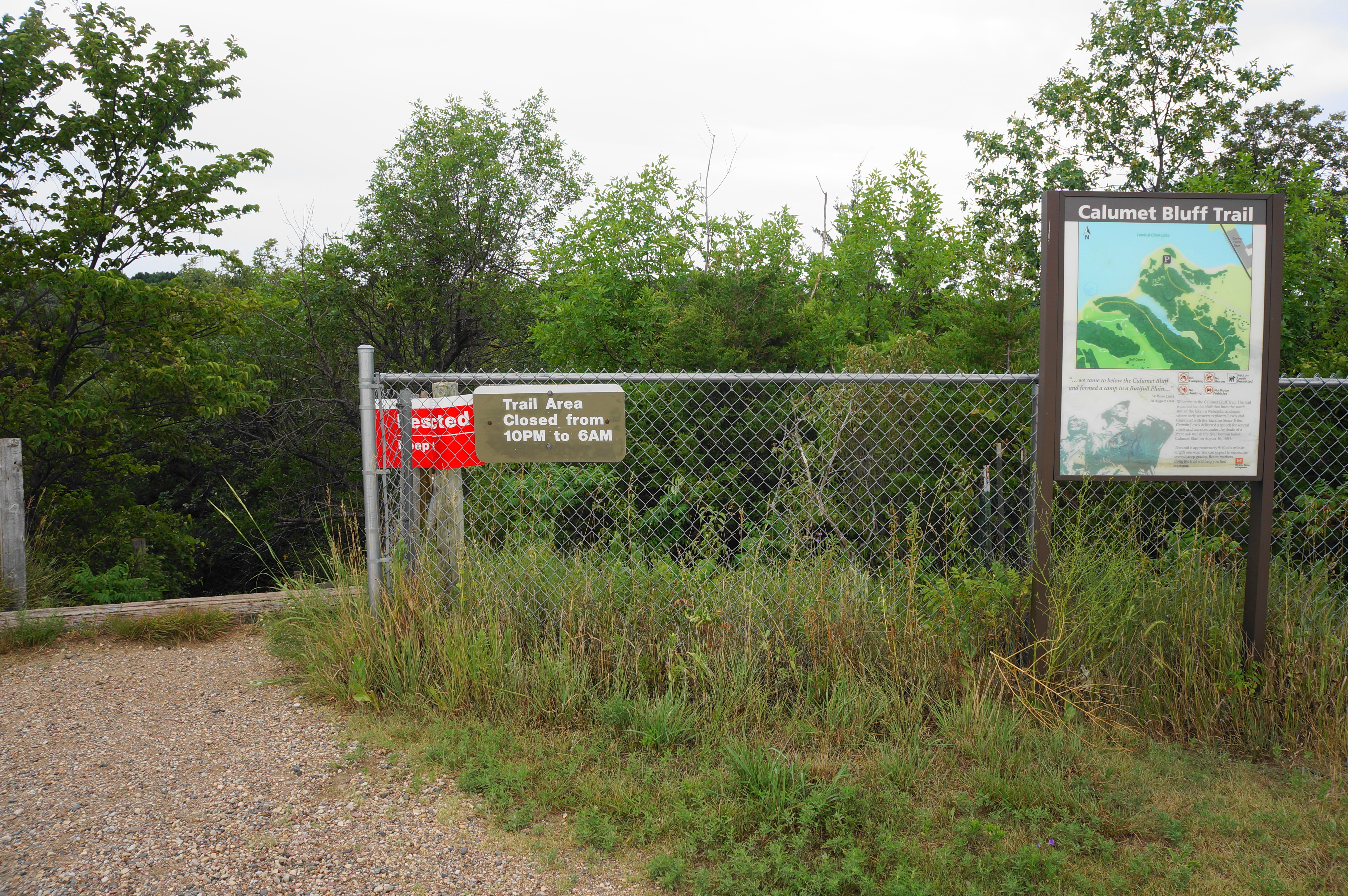
From here, look for the Calumet Bluff Trail, heading west and south from the parking area. (Note: Though the sign claims the trail is 9/10 mile one-way, it is actually much closer to 6/10 mile.) Immediately, the singletrack trail drops down a set of stairs and weaves through thick brush cover, with oaks, ash, and red cedars lining the hillside.

The trail itself resembles a wavy horseshoe, weaving south and east before dropping to a drainage and rising back west and north to the bluff. After a brief open section with some cottonwoods at around 125 yards, the trail returns to thick forest cover and descends steadily. Come to a bench on the right at ¼ mile, after which the Calumet Bluff Trail begins a surprisingly steep downhill that requires careful footing to avoid loose rock and tree roots.
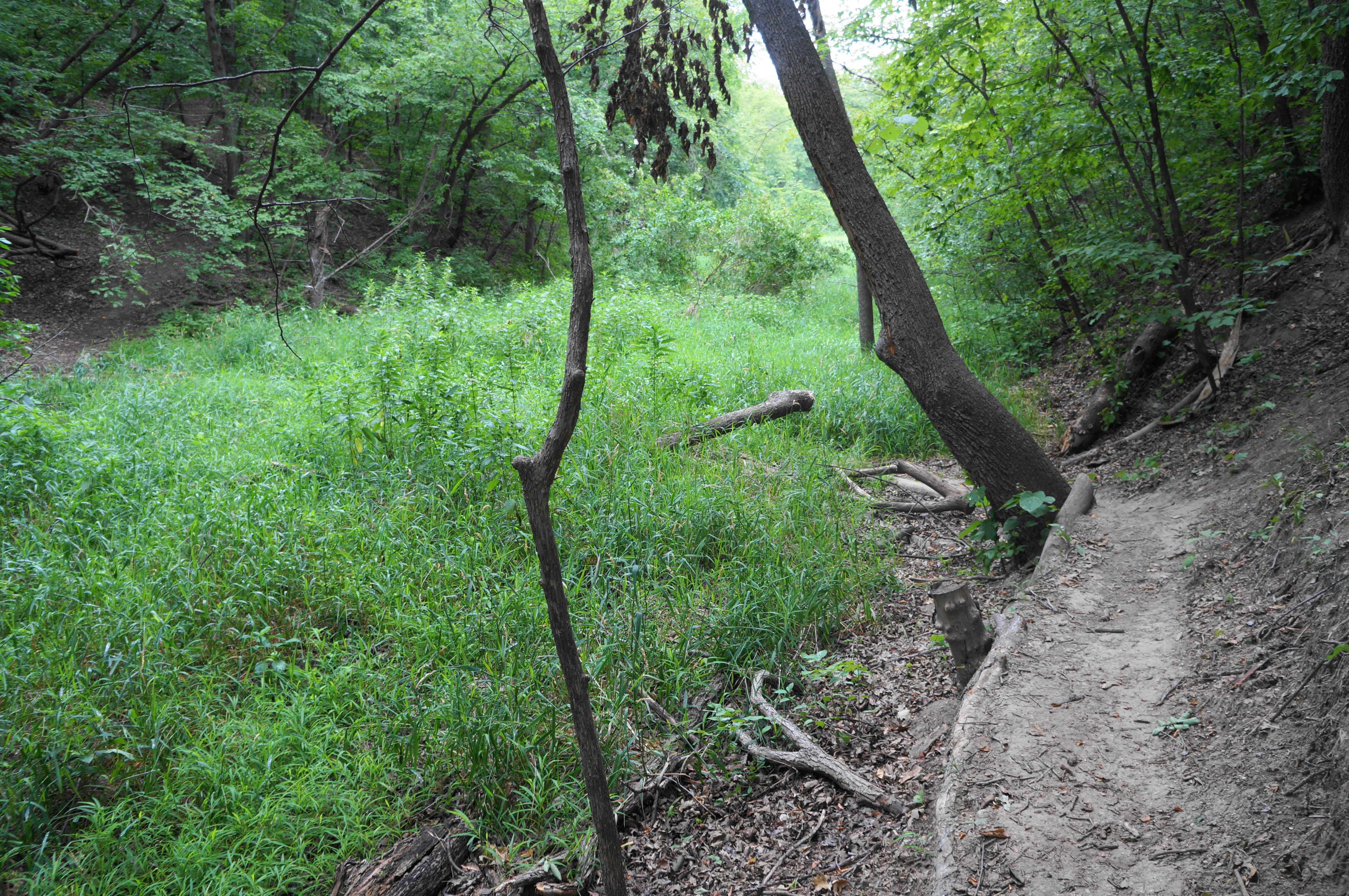

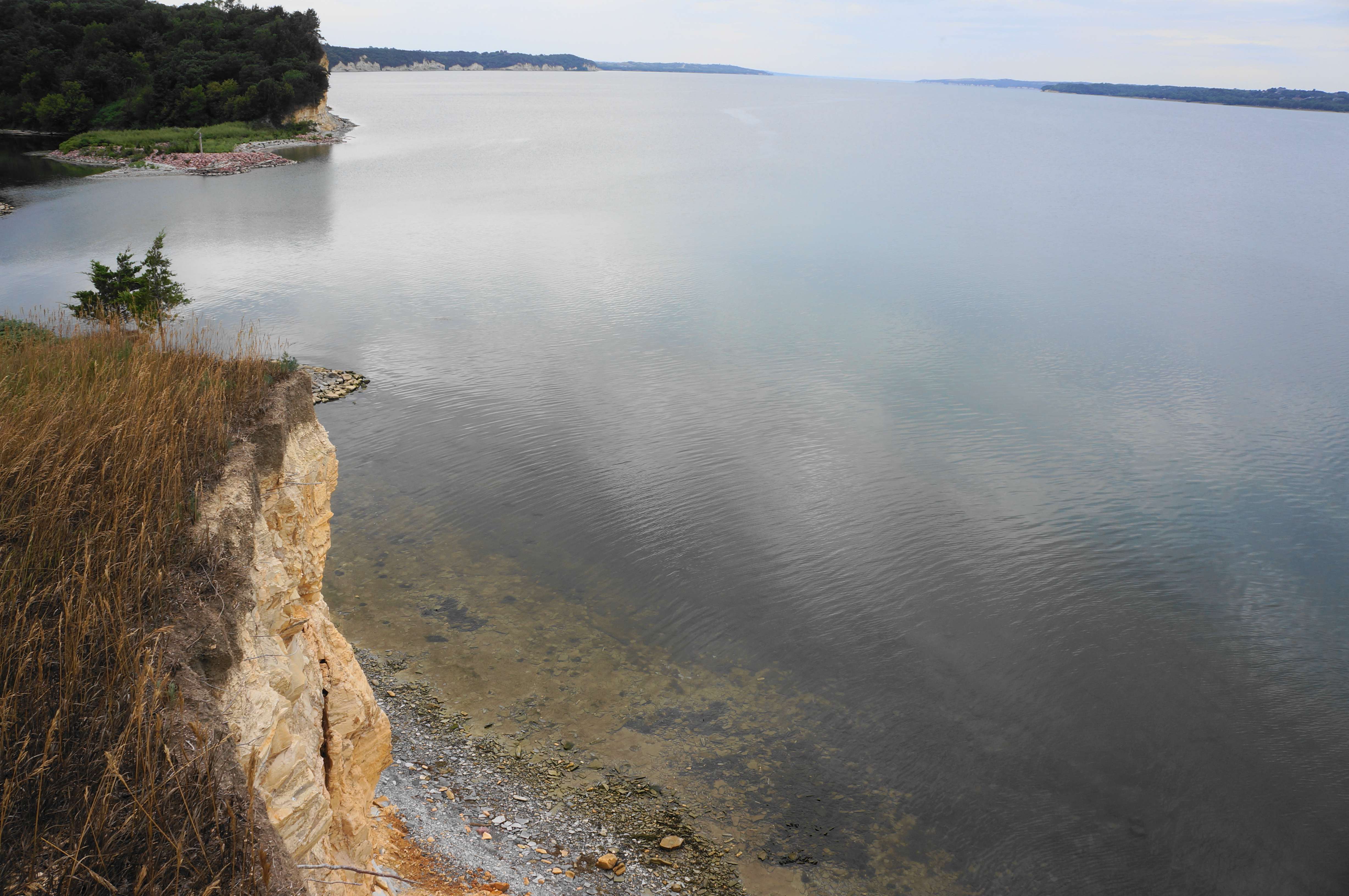
Soon the path cuts right and traverses the grassy drainage, just upstream from a boggy inlet fed by the floodwaters of Lewis & Clark Lake (currently out of view). What comes down must come back up, and the trail enters a steep but punctuated uphill stretch before settling into an up-and-down walk approaching Calumet Bluff. Follow the narrow path as the flood area below becomes more prominent, and the beginnings of the cliff structure of Niobrara chalk become visible off to the right. At about ½ mile, the trail briefly splits—but soon the two paths reunite and continue north and west.
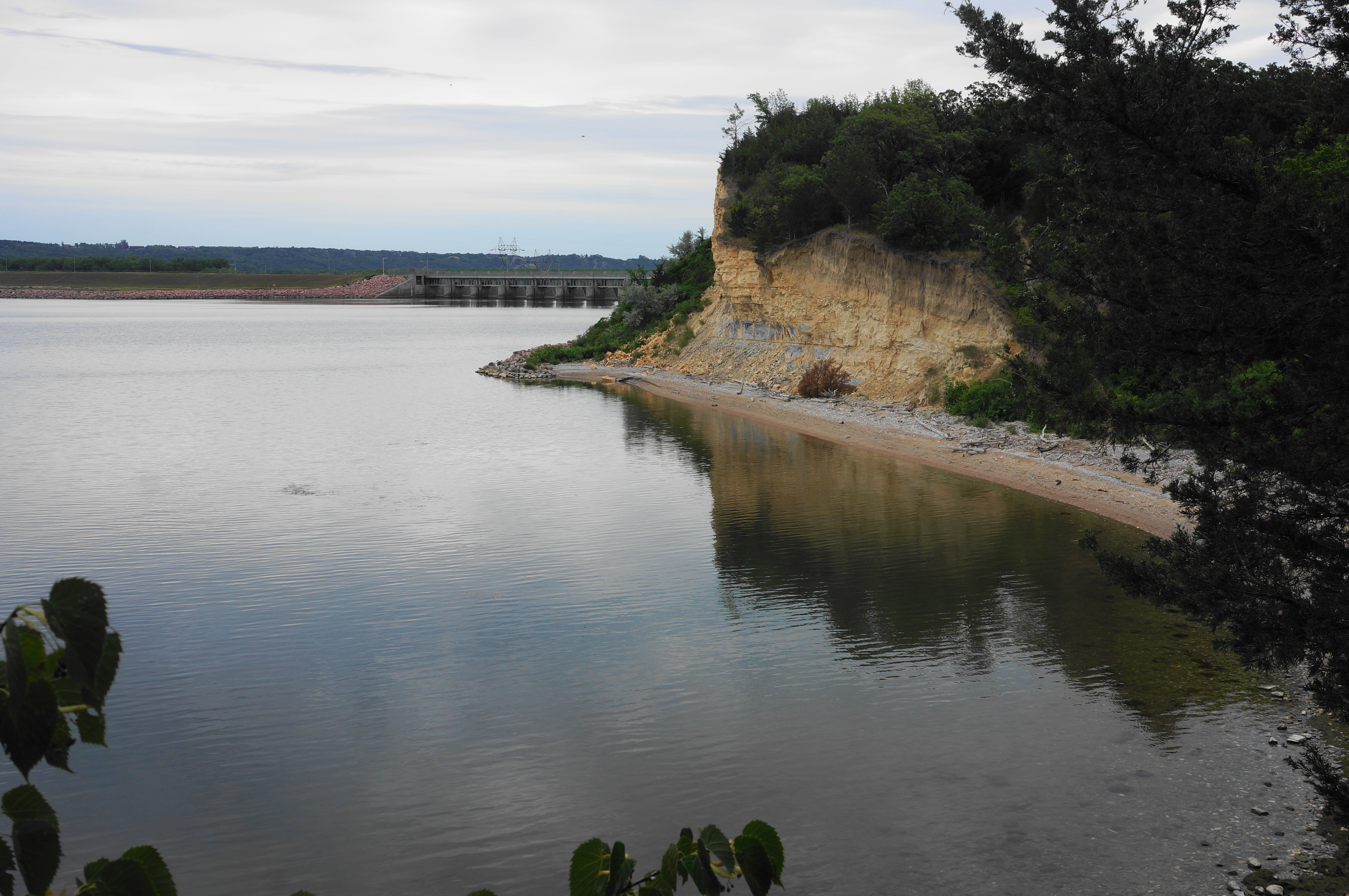
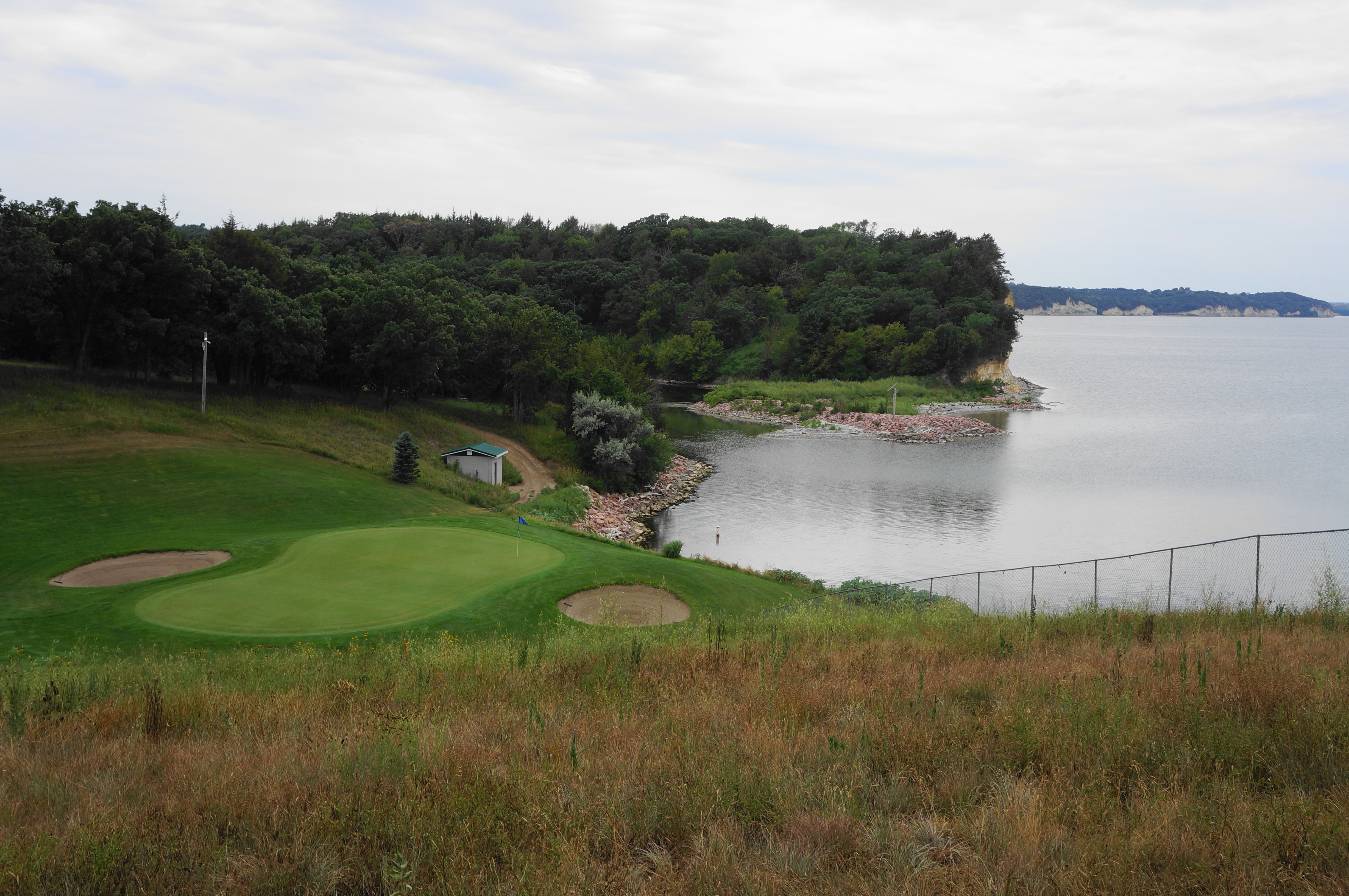
The Calumet Bluff Trail ends at a clearing and bench, overlooking Lewis & Clark Lake and, curiously, a nice lakeside par-3 on the Lakeview Golf Course. While the high point of the bluff is restricted and off-limits to hikers, it is possible to walk through the clearing to the precipice of the cliffs, with views back to Gavin’s Point Dam and the eastern end of the lake. One can also peer east and south across the lake to South Dakota and the popular Lewis & Clark Recreation Area.
The likely site of the Lewis & Clark camp was just below the bluff, although today the floodplain is submerged by the reservoir. Lewis and Clark described the bluff as being of “a whitish color, and about 70 or 80 feet high” (although later they described the same cliffs as “composed of a yellowish-red and brownish clay”). At their camp below the bluff, the group experienced “a violent storm of wind and rain” the night of August 28, 1804, accompanied two days later by a fog “so thick that we could not see the Indian camp on the opposite side.” After meeting and exchanging gifts with the local Yankton tribe, the expedition continued upstream on September 1, 1804.

Having reached the terminus of the trail, hikers must now retrace their steps to return to the trailhead, this time involving a steady downhill to return to the drainage above the marshy inlet, in addition to the final uphill back to the start. All told, the 1.2-mile hike should take most hikers an hour or less.
