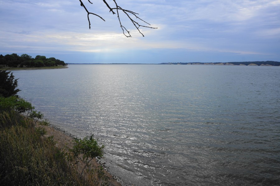

Created by the Gavins Point Dam on the Missouri River, Lewis and Clark Lake spans more than 31,000 on the border of Nebraska and South Dakota. While the massive reservoir conceals the original river embankments, it is paralleled on both sides by Niobrara chalk cliffs, sandy beaches, and flooded wetlands, making the lake one of the most popular destinations in the area. On the South Dakota side, the Gavin’s Point Nature Trail in Lewis and Clark Recreation Area traces a brief loop around a protruding headland above the reservoir, featuring expansive views and diverse terrain. This 1.1-mile hike is mostly easy and family-friendly, with occasional interpretive waysides and lots of benches and gazebos where hikers can rest.

The hike
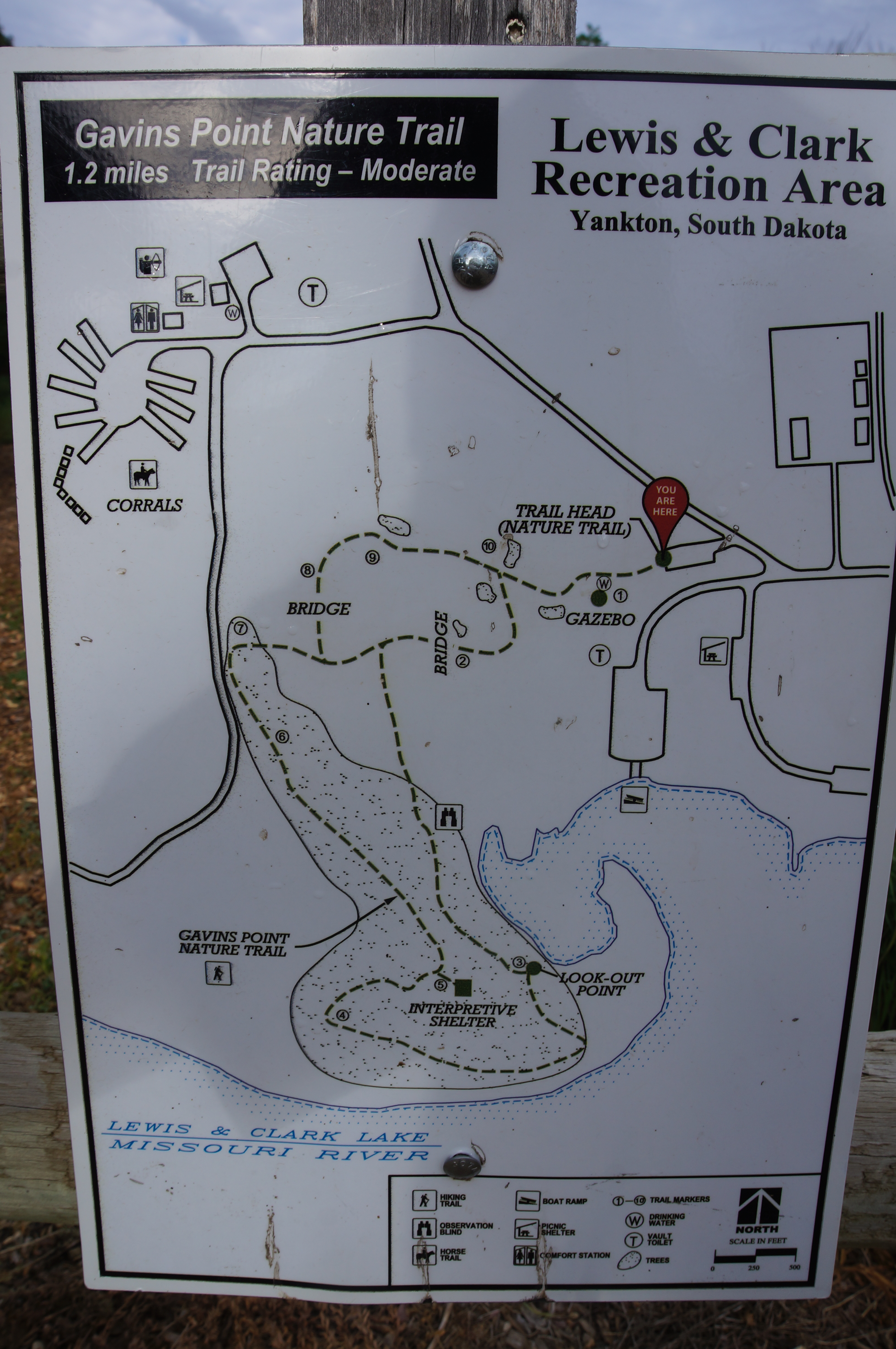
Lewis and Clark Recreation Area is notable mostly for its small lakeside resort and absolutely massive and overpriced campground: this state park site—a short drive west of Yankton, South Dakota—is mostly a zoo of campers, boaters, picknickers, and bikers. But the western flank of the park, farthest from the main entrance, includes the protected Chalk Bluffs area and a network of quiet and moderately scenic hiking trails. The shortest hike is the Gavin’s Point Nature Trail, beginning at a small, marked parking lot off Gavin’s Point Road, just before the drive bears northeast toward the archery range and Chalk Bluffs Multi-Use Trailhead.
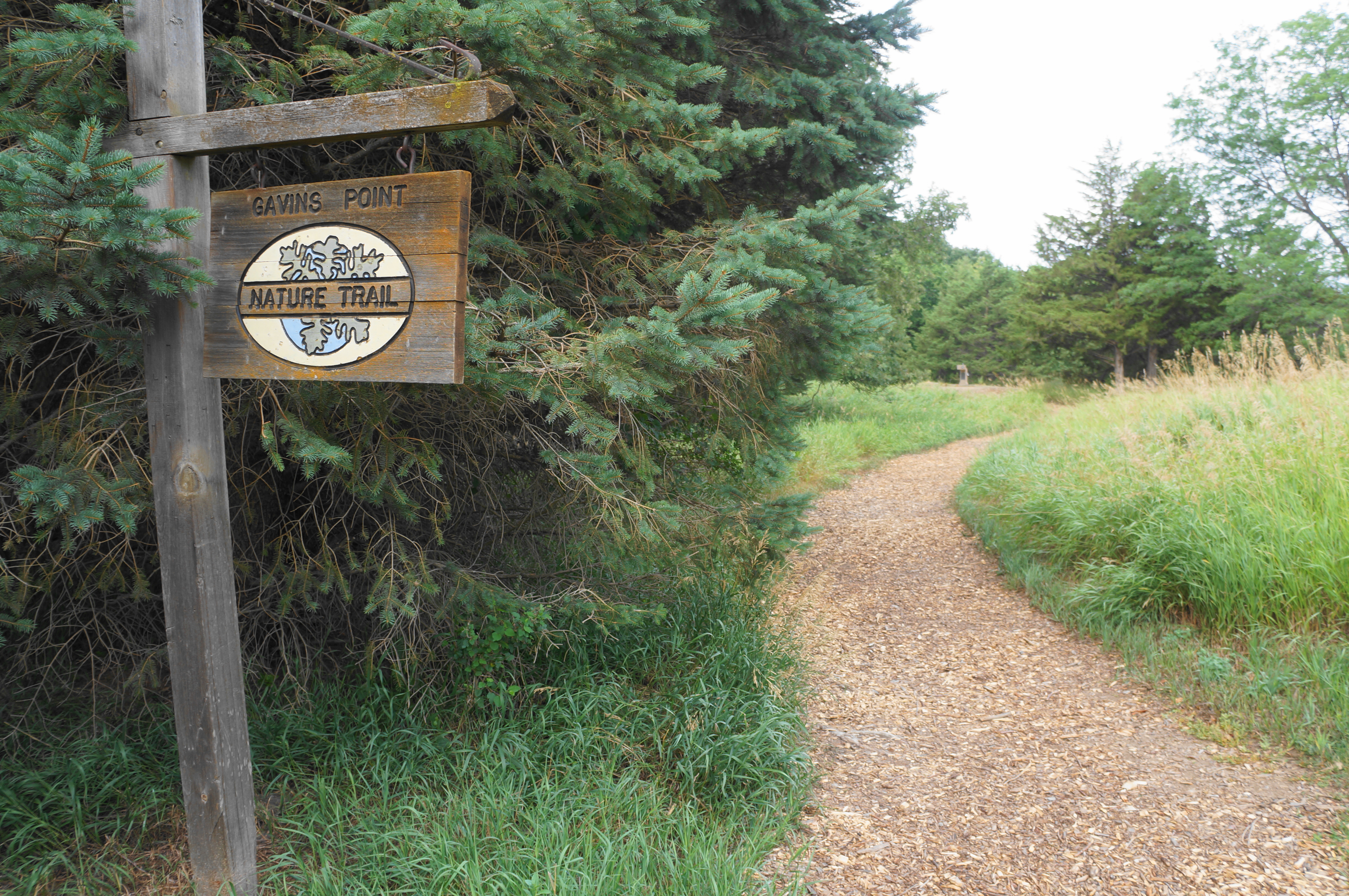
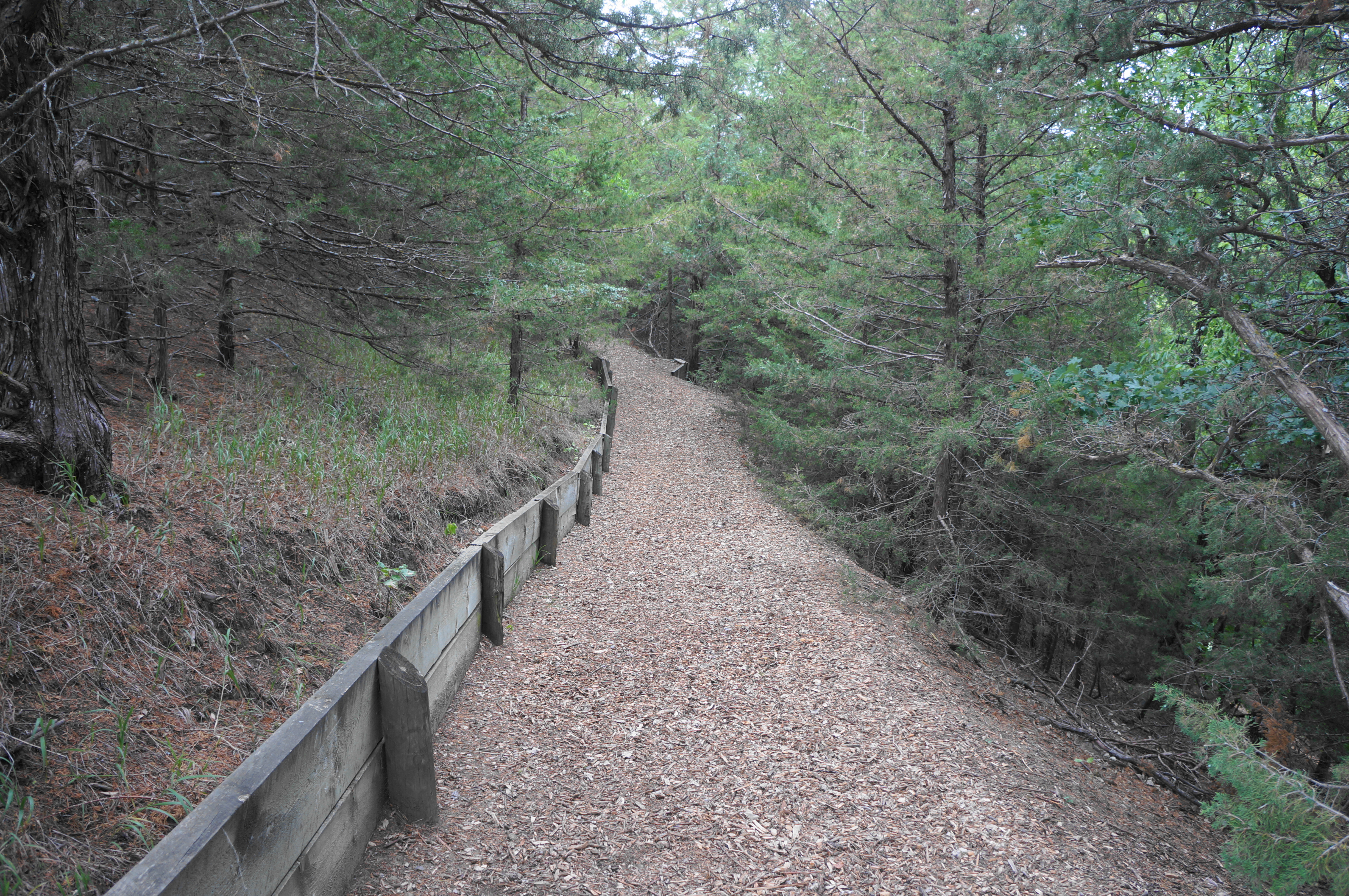
Find the mulched path as it leaves the fenced parking lot, passing a clutch of conifers on the left. Within 50 yards, the wide track passes a water fountain and gazebo with partly-obscured views on the left; continue straight on the clearest onward path, ignoring a more faded tail ruts heading right, toward Gavin’s Point Road. Head downhill, into the spotty forest, dropping to a trail junction in view of a marshy basin below.

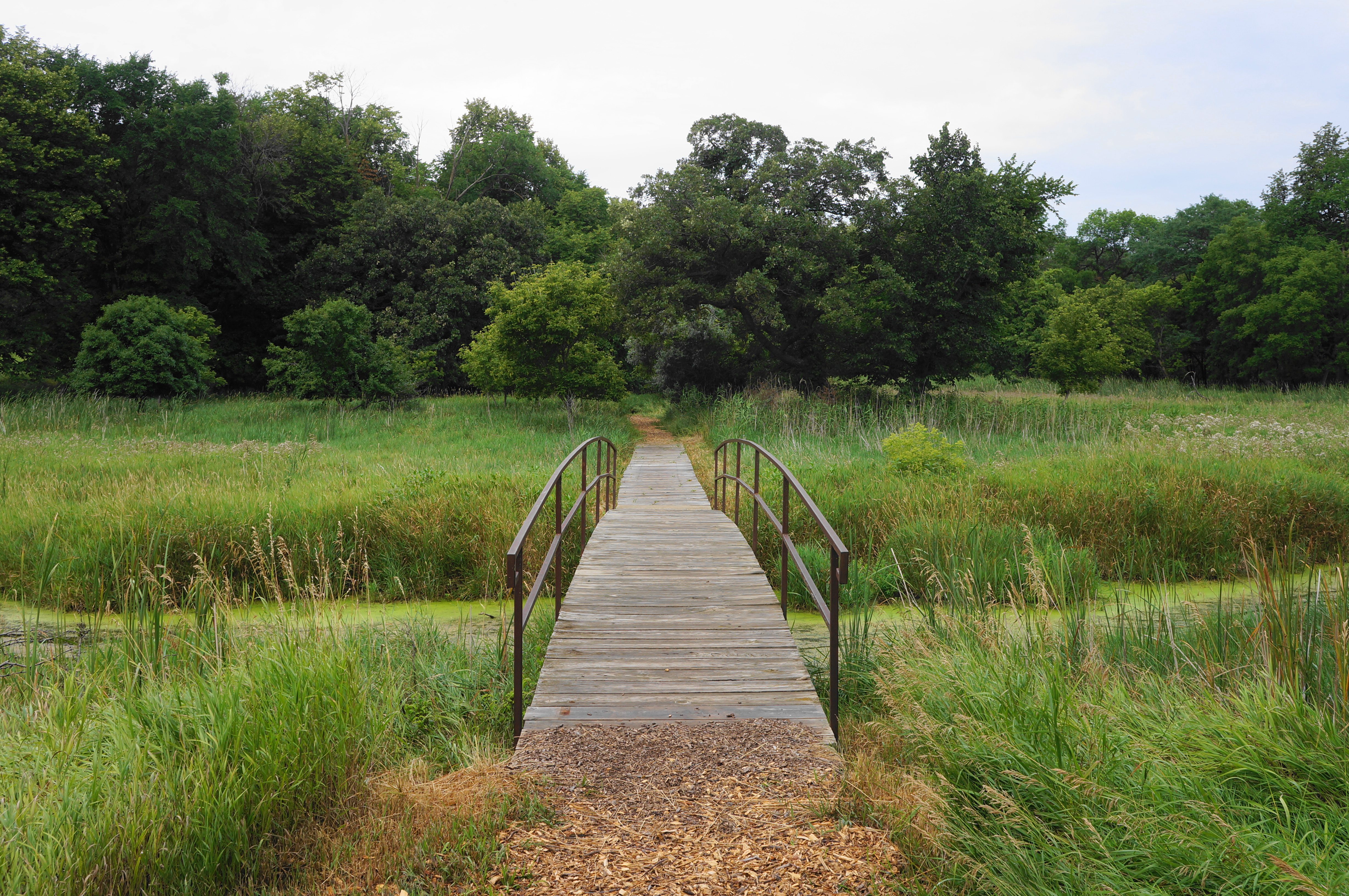
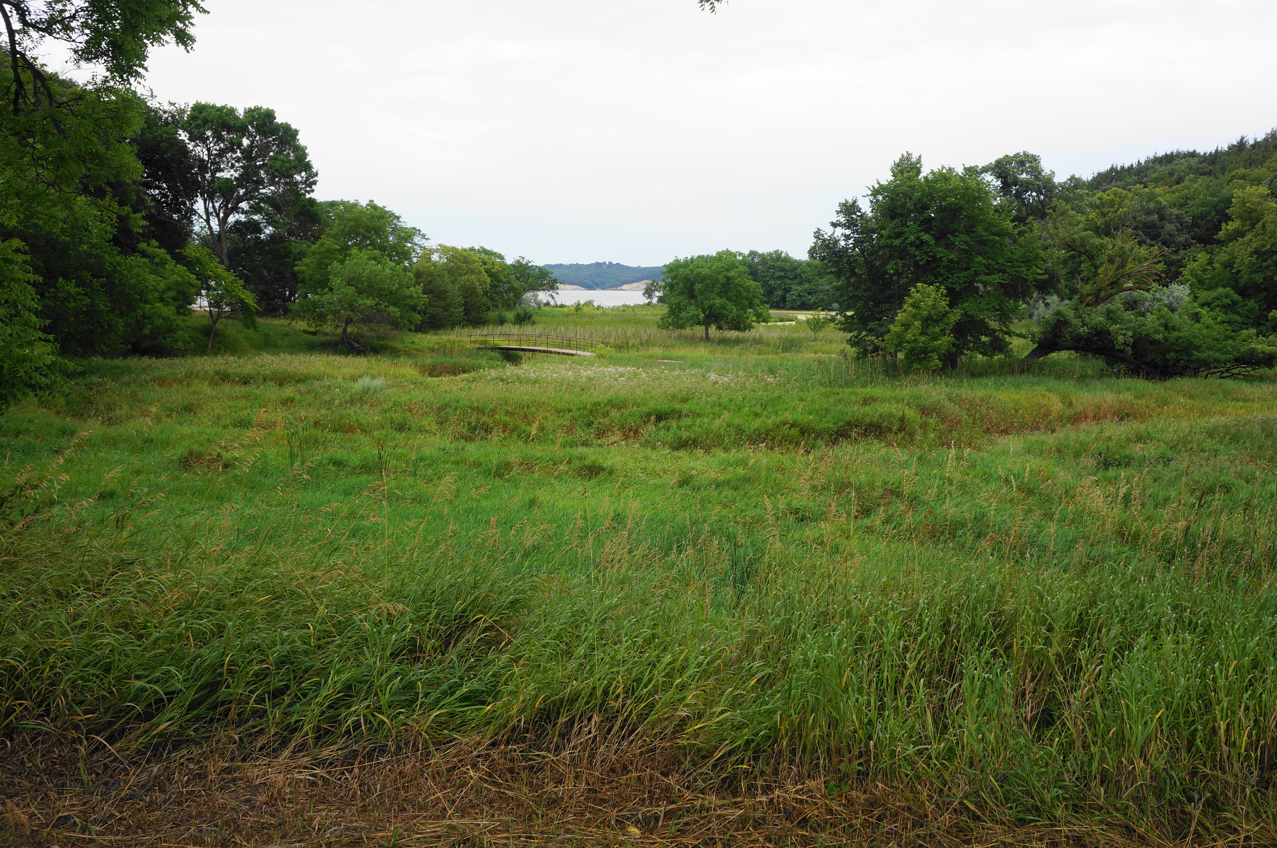
This is the start of the loop portion of the Gavin’s Point Nature Trail, and hikers can head either way. Yours truly headed left first, cutting back eastward briefly before descending to a spot almost level with the lakeshore and marsh. Stay right at another unmarked junction, heading over a wooden bridge with metal railings, offering passage over a mucky inlet that supports the surrounding bog.
From here the nature trail continues west, approaching the edge of a largely deciduous forest again. Come to a third fork and bear left again, with the onward tread sloping upward to climb the headland at Gavin’s Point. Views of Lewis and Clark Lake are still largely obscured by the foliage of oaks, hackberry, ash, and maples, with pines and cedars becoming more prevalent. The trail skirts the east-facing slope of what is fast becoming a relatively high bluff, well above the lakeshore. After a high crest, the path comes to a small bench and fenced vista point, overlooking the marsh and western fringes of the vast campground system at Lewis & Clark.
Now treading west, the onward path enters a sea of eastern red cedar—which is not, in fact, a cedar but a juniper—a coniferous tree native to the area. Off to the left (south), one can sense the presence of the lake, although it remains very hard to see through the thick woods. Soon a flurry of spur trails, however, allow hikers to approach the crest of the cream-colored bluffs, with views across Lewis & Clark Lake to the Nebraska side. The calm and vast reservoir is dammed a couple miles downstream, but imagine that this was once just a river valley where the famed Lewis & Clark Expedition passed in August-September 1804, staying for four nights at Calumet Bluff, an upland visible in the distance off to the southeast (on the Nebraska side).
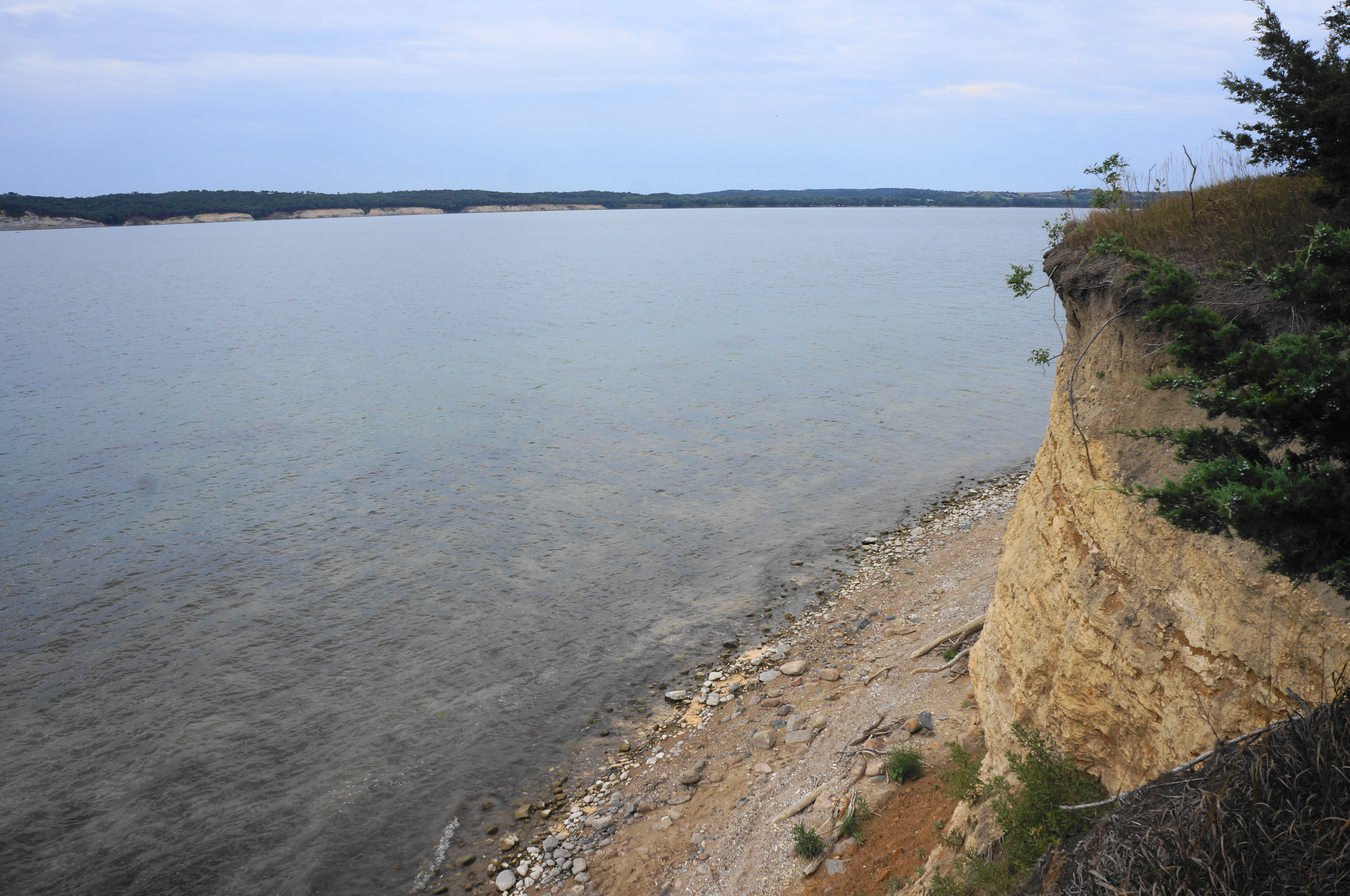


Continuing on, the trail is not yet done climbing, coming to a sharp right-hand bend at around 0.55 miles. Before heading right on the mulched right, briefly detour left on the spur path that culminates at a point with the most expansive views on the hike. This time hikers can see westward, almost to the end of the reservoir, with intermittent cliffs lining both shores.


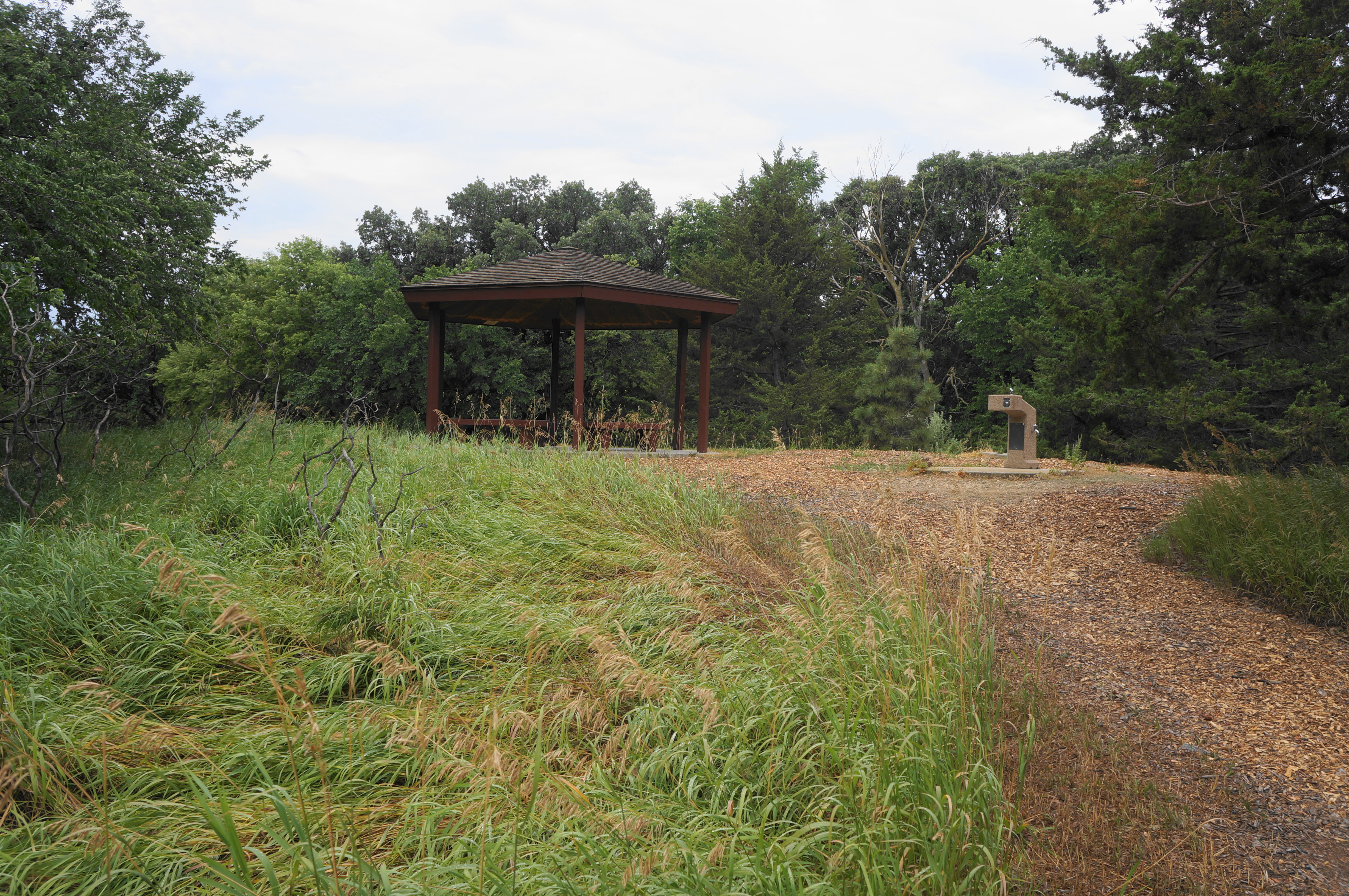
From this vista point, return to the main trail and continue uphill as the route bends north and east, climbing the steepest incline of the hike. Follow the cedar-lined track to a high point with another pavilion and several interpretive signs, these ones with much more information on the local history and Lewis & Clark Expedition. Enjoy the views again, this time looking east toward Calumet Bluff and the dam.


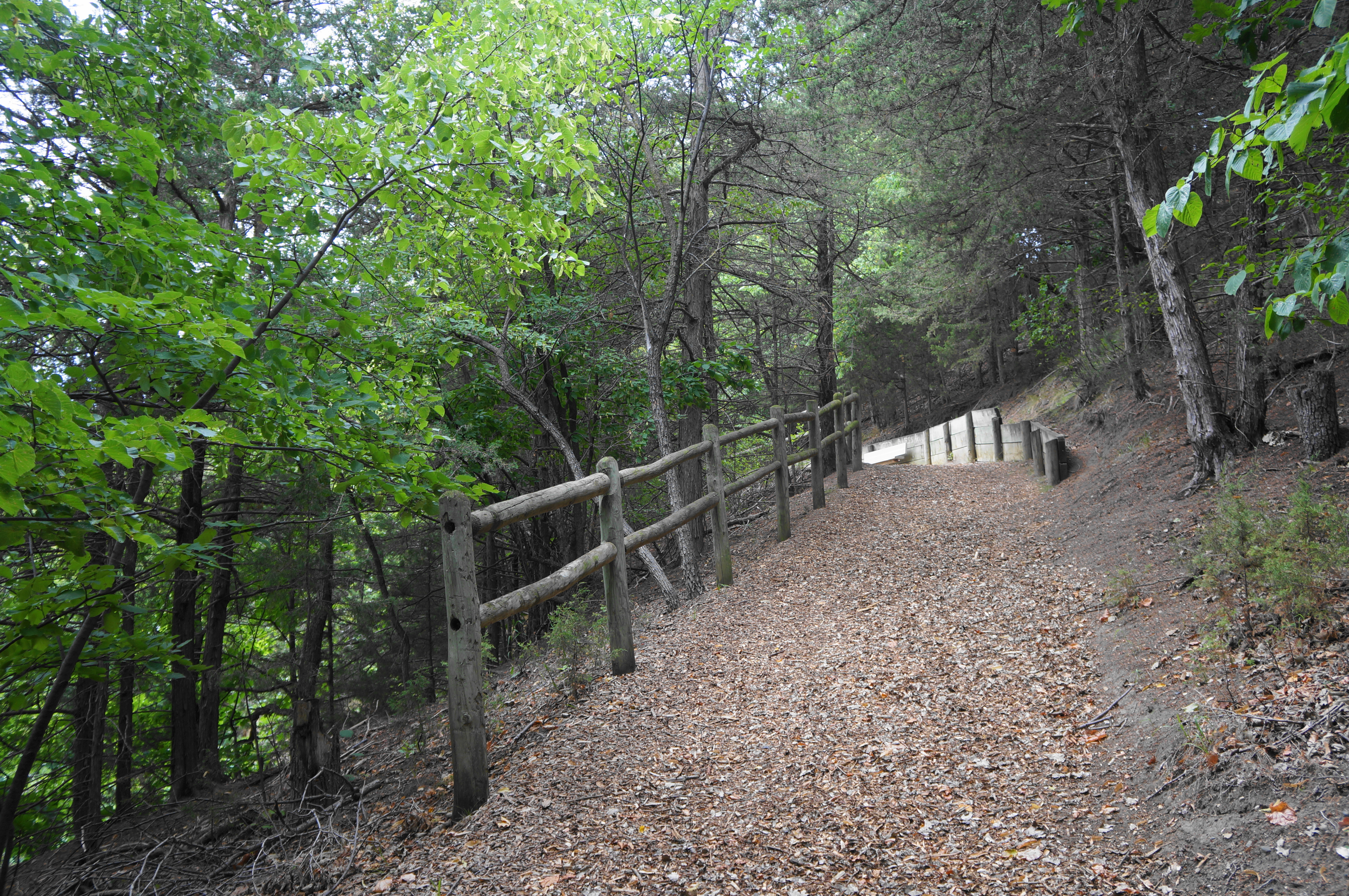
From this interpretive shelter, the onward route is slightly confusing. The main, wide route appears to double back west and continue climbing—although offering nice views, this is not the way. Instead, find a thinner but well-trodden track that descends into the thick woods from just behind the pavilion, dropping steadily, back toward the marsh.
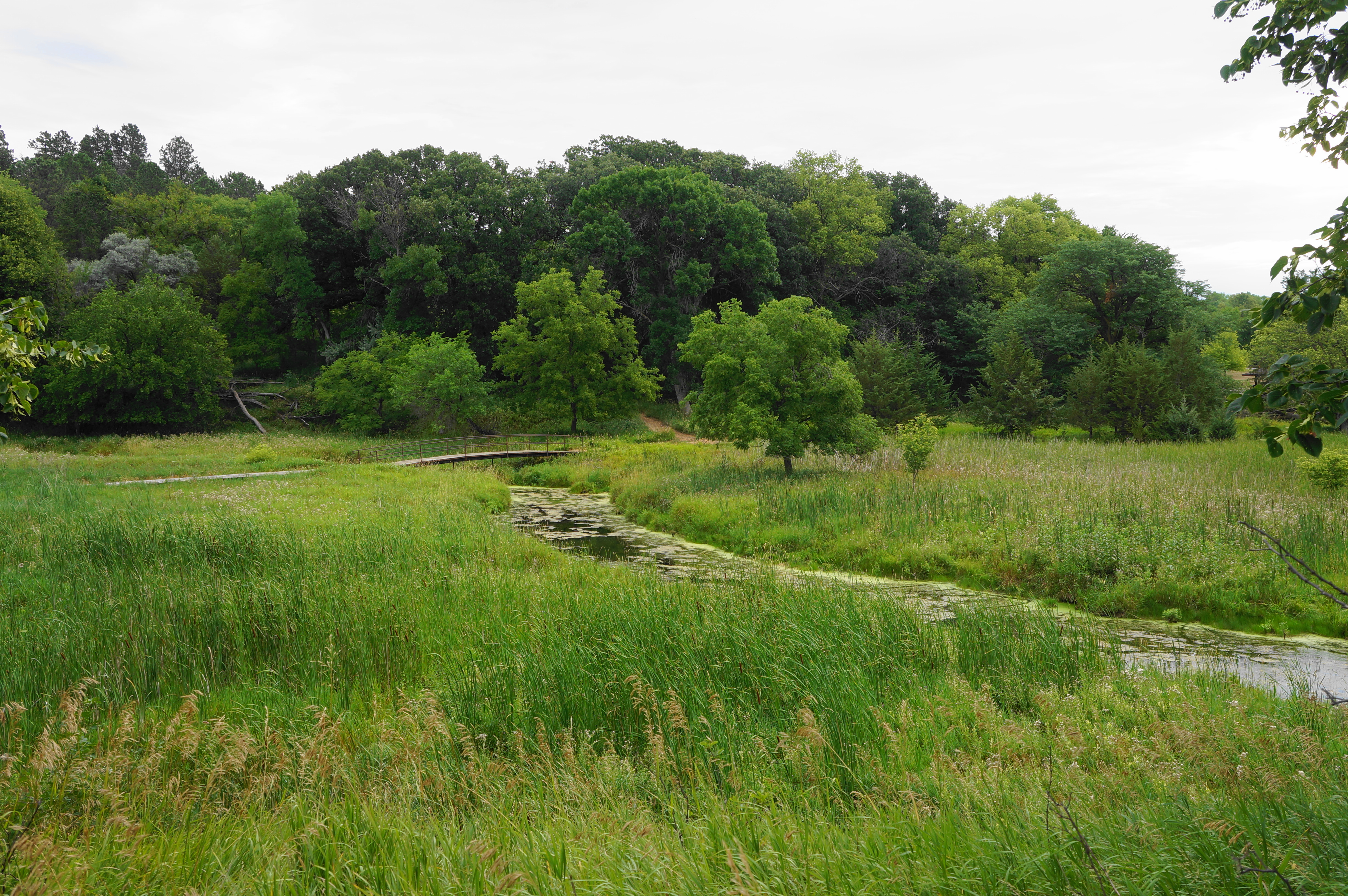
After a steady descent northwest, the trail comes within striking distance of Gavin’s Point Road on the left and reaches a junction at 9/10 mile. Stay right, returning to an open field with the bridge over the inlet visible off to the east. Come soon to another junction; this time, head left, descend a short staircase and traverse a boardwalk section. Thereafter, the mild trail winds east, passing another bench with marsh views on the right.
Quickly the nature trail returns to the initial junction, with the loop portion now complete. From here it is a brisk 150 yards, partly uphill, back to the trailhead. All told, the Gavin’s Point Nature Trail clocks in at about 1.1 miles and, despite a few ups and down, is rated as easy. Allot perhaps an hour to this hike to fully appreciate the diversity of flora and wetland and bluff landscapes. More ambitious hikers can couple with a set of longer trails in the Chalk Bluffs area further west.

Pingback: Calumet Bluff Trail (Gavin’s Point Dam area, NE) | Live and Let Hike