
With a system of dams effectively flooding much of the Missouri River shoreline where Meriweather Lewis and William Clark once camped during their 1803-6 expedition, there are few places left where one can walk, with certainty, in the footsteps of the famed explorers. One such spot, however, is Spirit Mound, an elevated hillock just north of the Missouri near Vermillion, South Dakota. Here visitors can enjoy the same vista enjoyed by Lewis and Clark in August 1804, with a few key changes: the natural prairie, teeming with roaming bison, has been replaced by endless farmland, with small homesteads dotting the landscape. The 1.5-mile round-trip Spirit Mound Trail is a worthy destination for visitors to the Missouri National Recreational River and an intriguing stop on the Lewis & Clark National Historic Trail.
The hike
The Spirit Mound Trail is short and straightforward, beginning and ending at the only parking area at Spirit Mound Historic Prairie, a state park in South Dakota that is also affiliated with the Missouri National Recreational River. The 320-acre tract of land appears to be just another patch of treeless fields, except for one peculiarity: a suddenly high mount, a moderately imposing hillock that rises above the grassland. The summit is visible from the start.

The entirely shade-free walk begins as a wide, graveled track, cutting through a partly-restored prairie, recovering from being former pasture land. The human history of Spirit Mound dates to before the founding of the United States, when Native Americans in the area described the place as the “mountain of evil spirits” or “hill of little people” who would shoot anyone who came near.

Despite these ominous warnings, Meriweather Lewis and William Clark set out to summit the mound on 25 August 1804, ascending in full heat. From the top, Clark later wrote, one could see the “most butifull landscape,” with bison herds seen in all directions. In addition, the members of expedition claimed to see elk, badgers (or possibly coyotes), bats, and a variety of bird species.

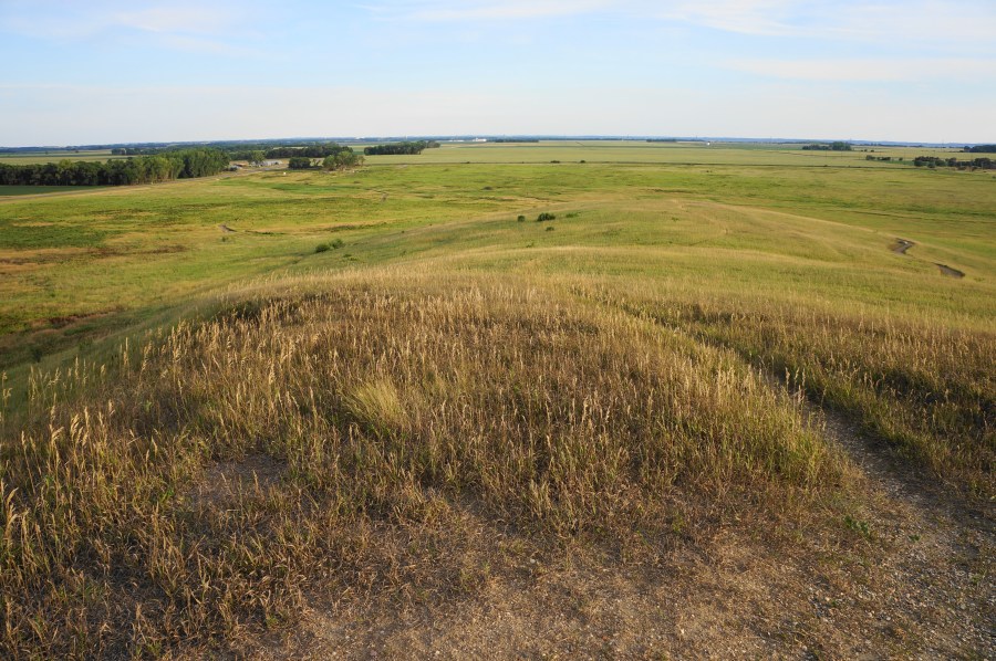
The wildlife today is much more subdued, although the prairie is slowly coming back to life, despite being surrounded on all sides by roads and farmland. The Spirit Mound Trail tracks northward, passing various interpretive waysides and a stone marker distinguishing this as a site visited on the Lewis and Clark expedition.
Stay straight as the trail traverses reed-clogged Spirit Mound Creek (often dry or close to it) before approaching the northern fringe of the ovular mound. Soon the trail begins to ascend gently, wrapping around to the west side of the mound, which is composed of Niobrara chalk that escaped erosion from the continental ice sheet. Soon hikers will pass a glacial erratic, a large granite boulder used by geologists to help identify past ice flows.

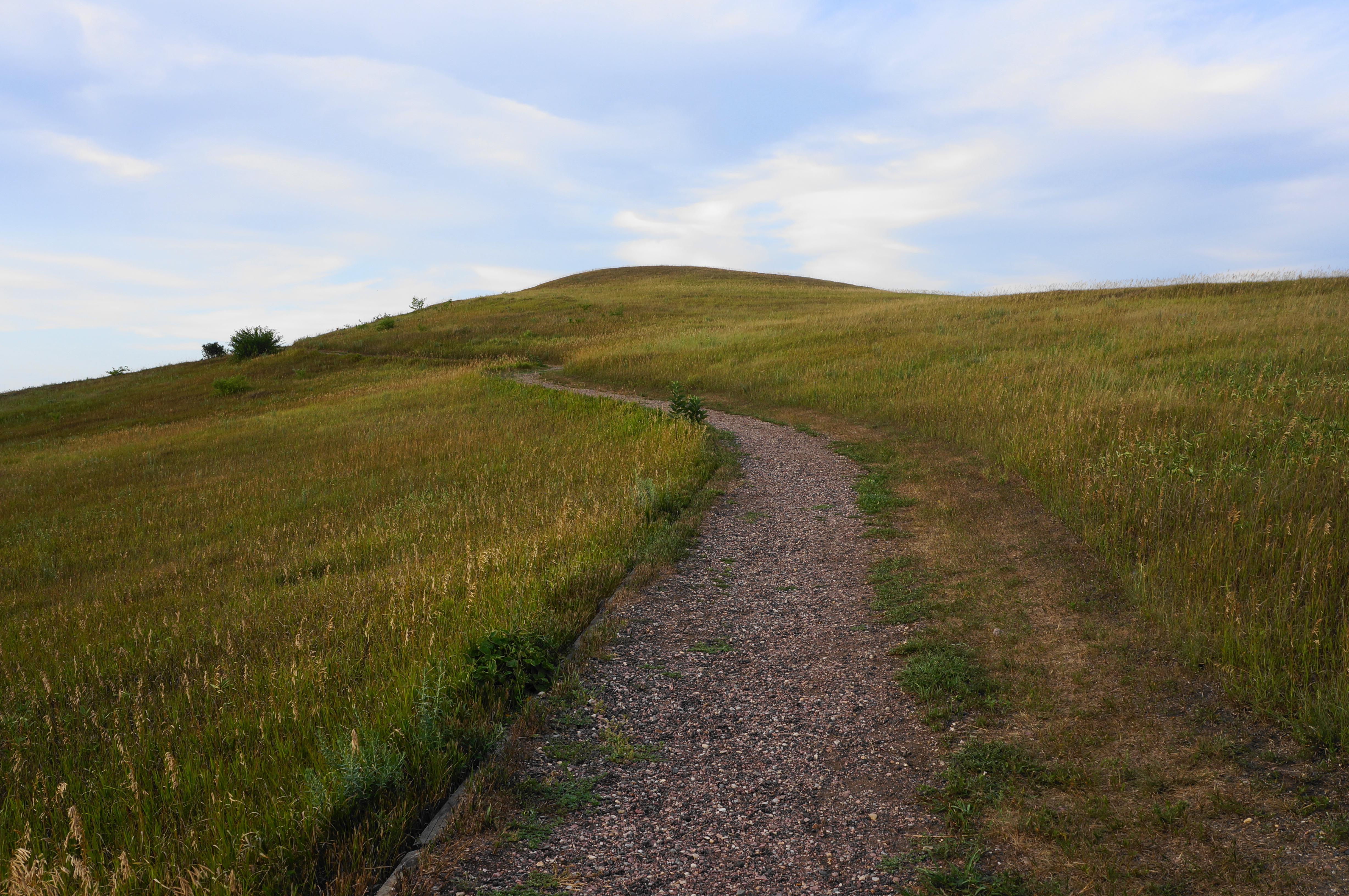
The onward route—narrowed slightly but still quite wide—ascends steadily but at a relatively mild incline, but the views improve significantly. Eventually, on clear days, one can see as far west as the James River and as far south as the Missouri River Valley, with the bluffs of northern Nebraska beyond.


The finale of the hike is a hairpin bend east and then south, rising a set of steps to the summit of Spirit Mound. Here one will where there is a wooden bench and 360-panoramic views. It certainly ain’t Yosemite or the Grand Canyon, but the vista from Spirit Mound is one of the best in the area. It certainly felt that way to the Lewis and Clark expedition, which enjoyed the views but “found none of the little people.”
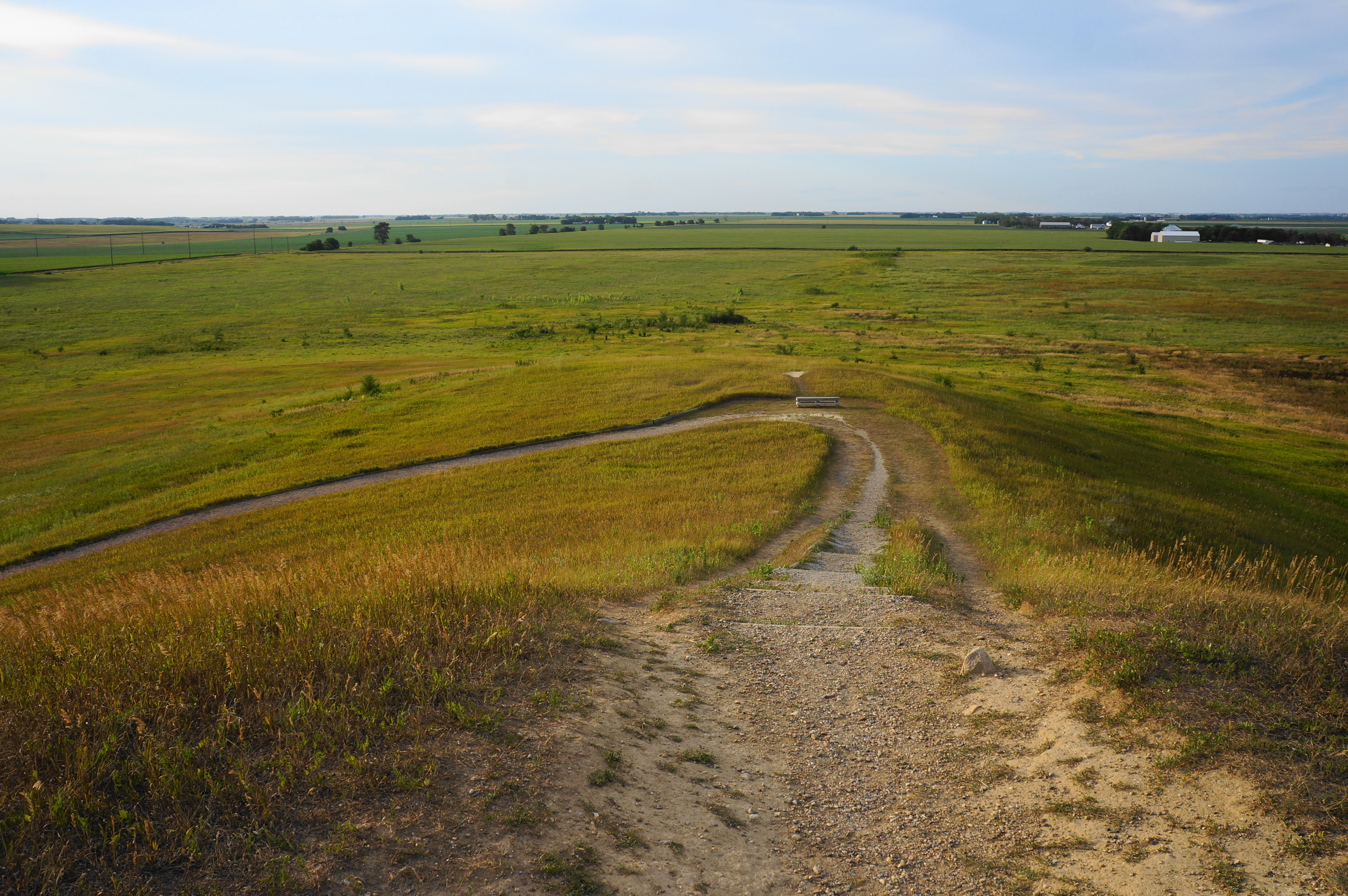

Once ready, return the way you came, walking back down the mound to the drainage and parking area. Allot around 45 minutes to an hour for this easy and family-friendly hike.
