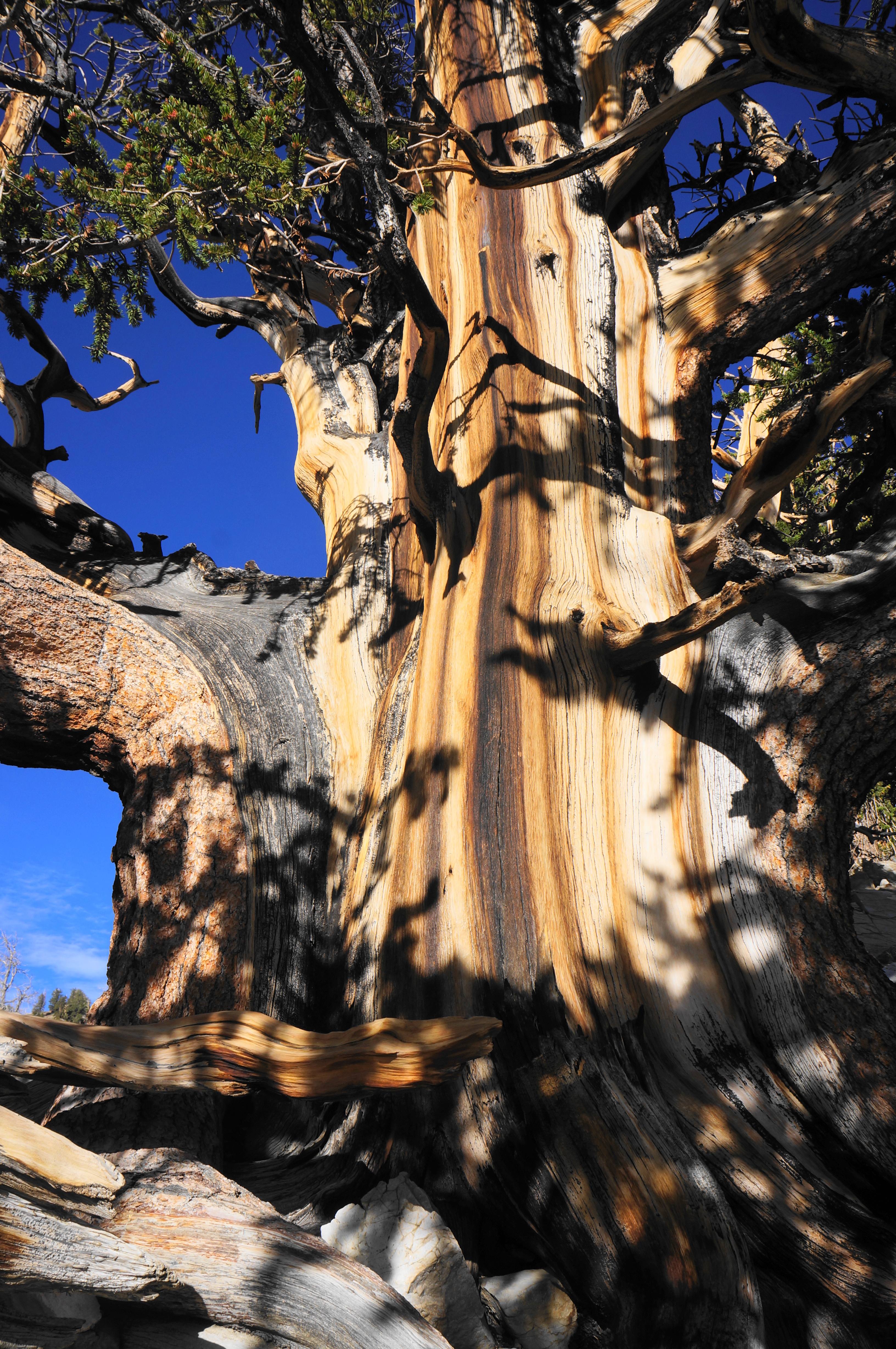
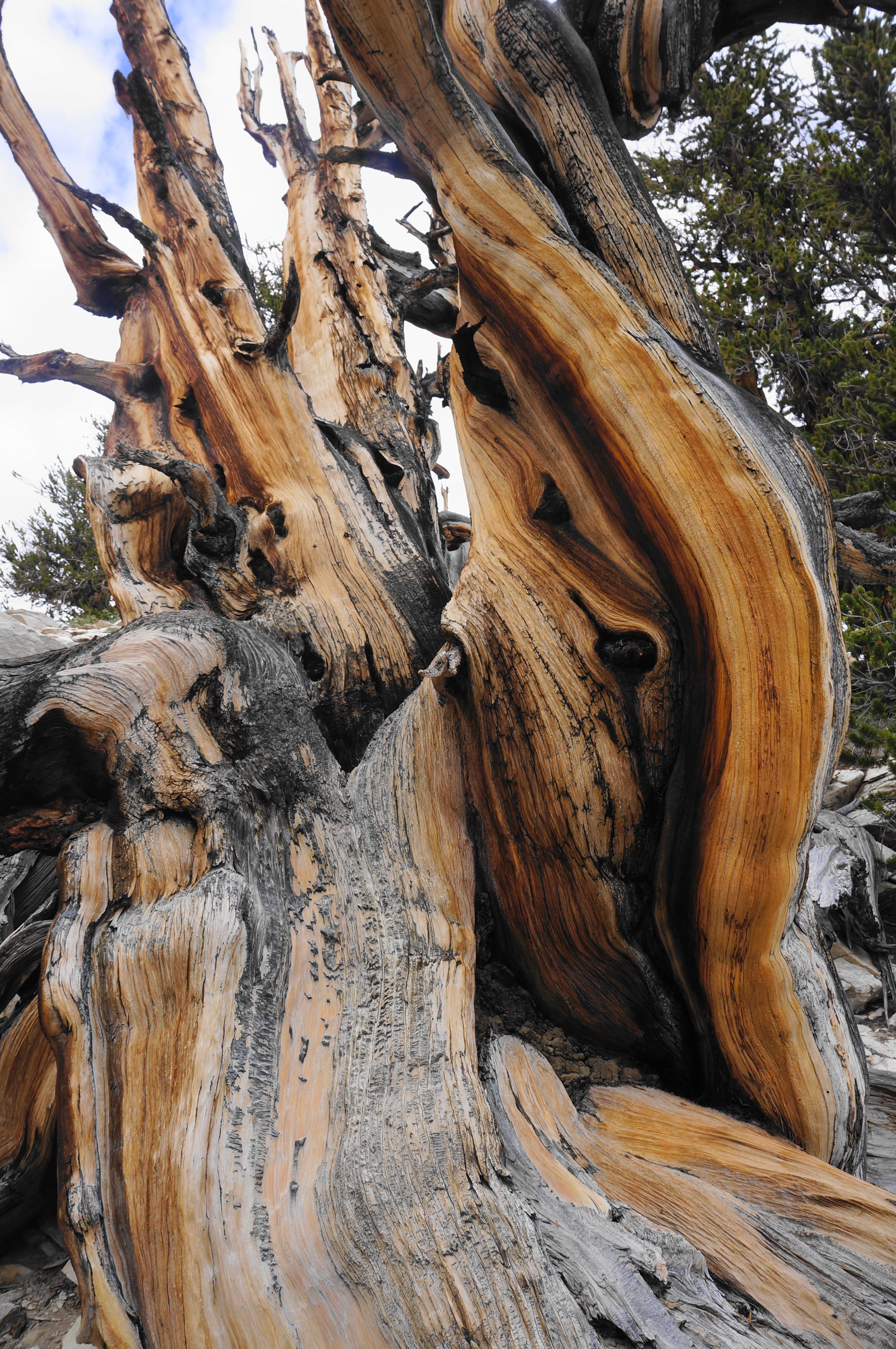
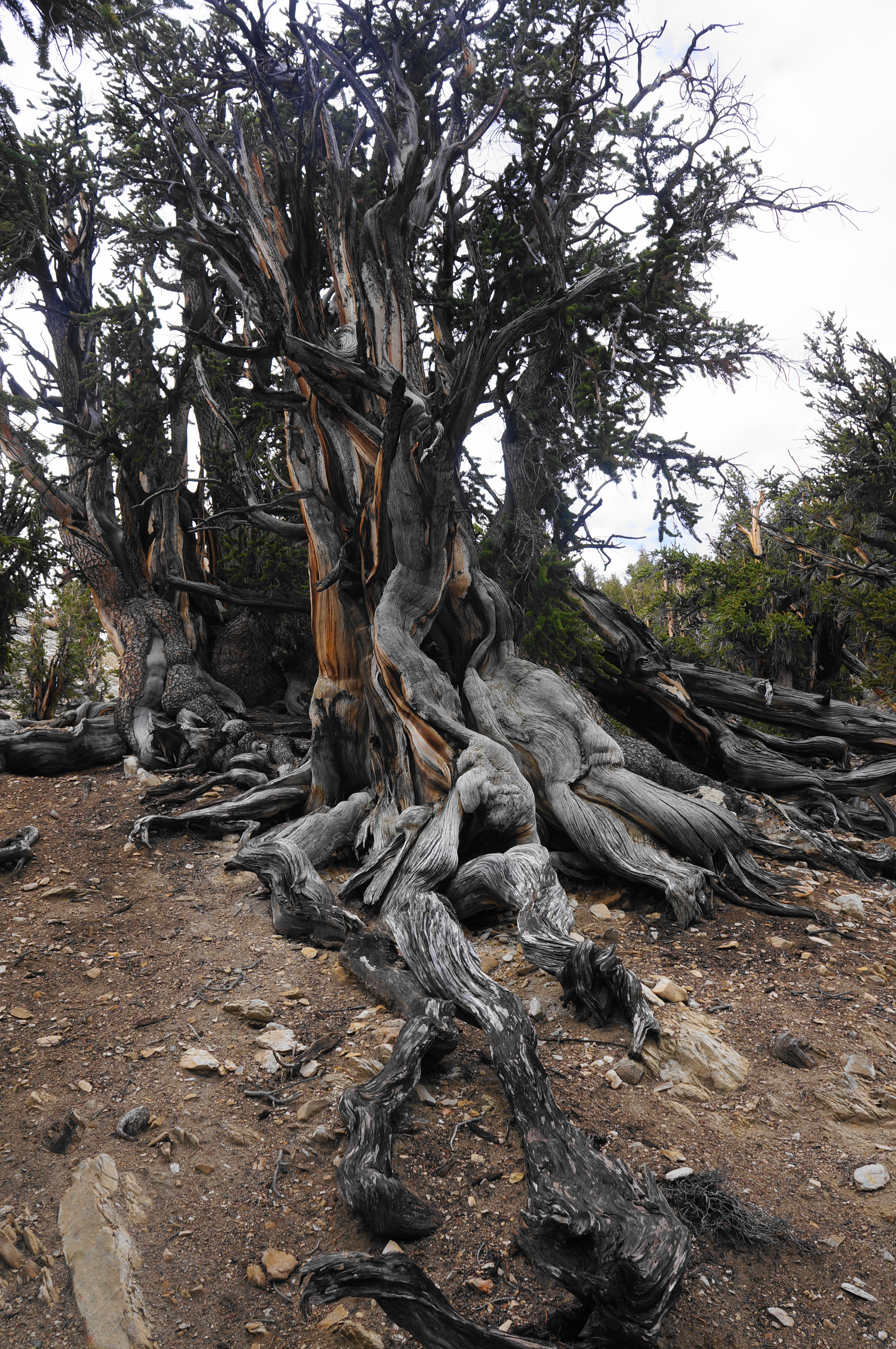
With wily limbs, wild shapes, and colorful bark, the bristlecone pines of California’s White Mountains are notable not only for their curious disposition but also their incredible longevity: with some living bristlecones thought to be as much as 5,000 years old, these are, simply put, the oldest living trees on earth. Counterintuitively, these Great Basin bristlecones (Pinus longaeva) owe their durability to the harsh environment in which they grow: the high elevations, forbidding cold, and high winds compel the trees to grow very slowly, producing stunted but very dense trunks that can resist the wears of insects, fungi, erosion, and rot. With living trees spanning as much as 5,000 years of history—and many dead trunks dating back further—scientists were able to use bristlecone cores to refine carbon dating measurements. This in turn allowed for more precise estimates of archaeological sites as far and wide as Stonehenge in ancient Britain.
Today, Great Basin bristlecone pines—considerably older than their Rocky Mountain cousins—are found only in three Western states: California, Nevada, and Utah. Perhaps the best spots to see them are eastern Nevada’s Great Basin National Park (see my 2020 blog post here) and the White Mountains in California’s Inyo National Forest.
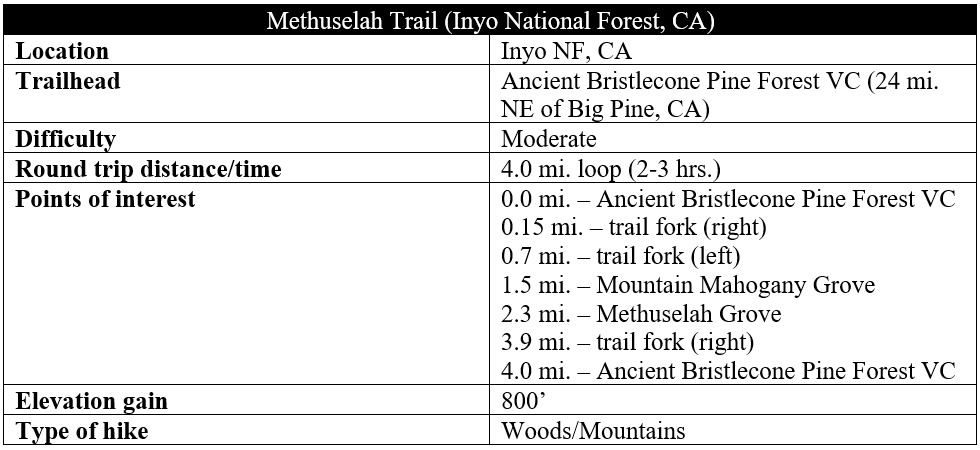
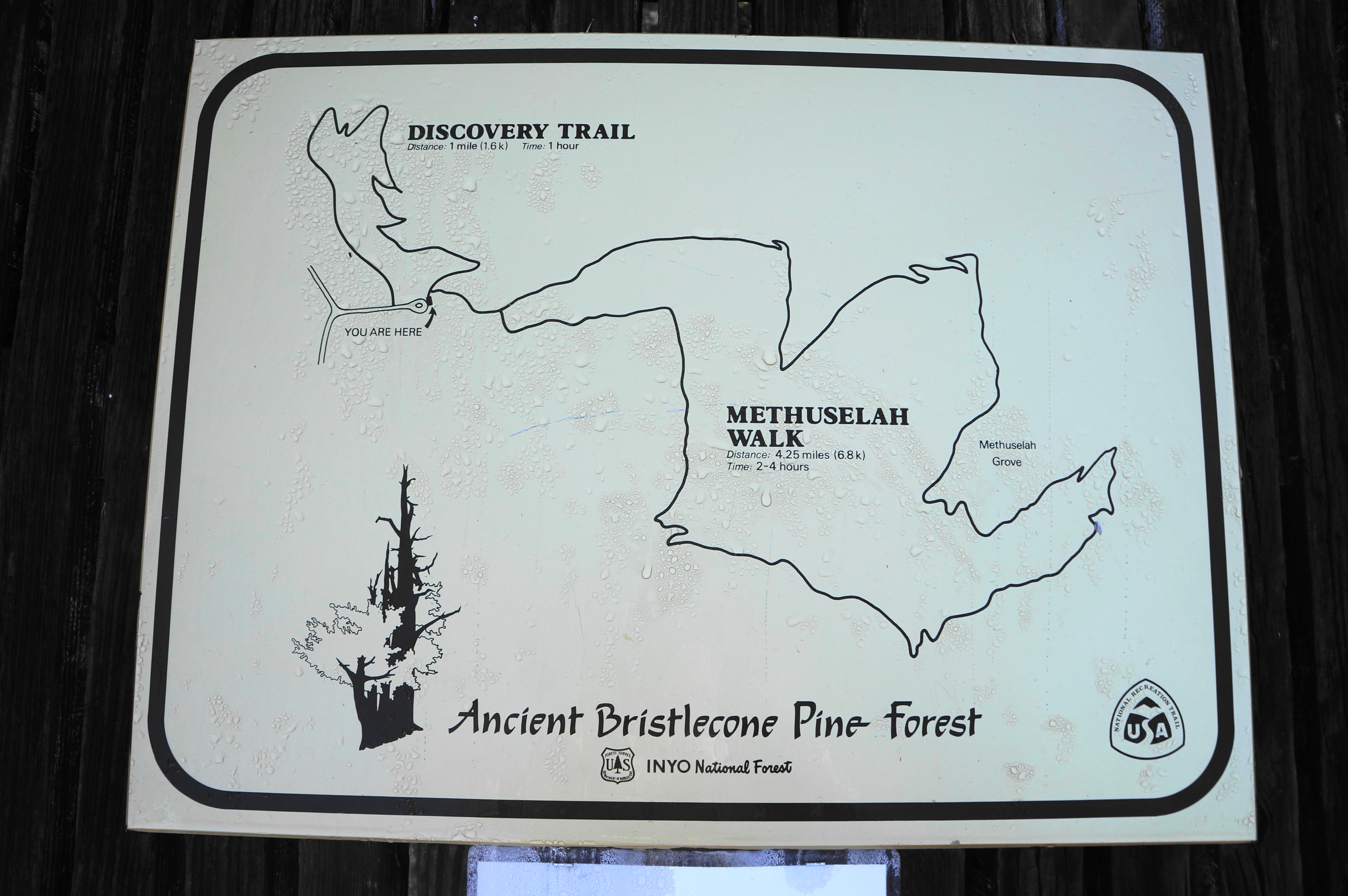
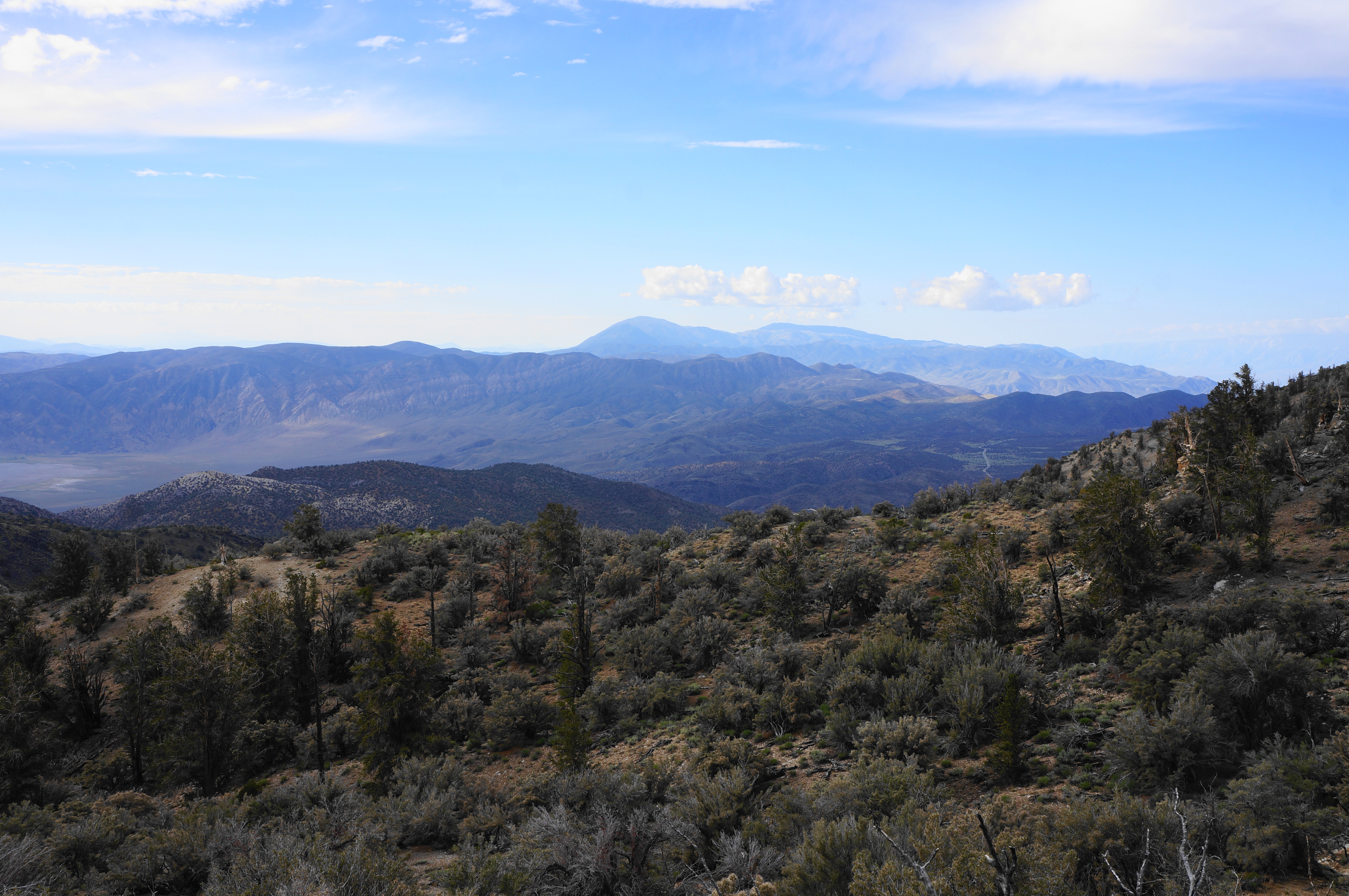
At Inyo, the main Ancient Bristlecone Pine Forest (see map here) is situated high up in the mountains above Owens Valley, a 45-minute drive from Big Pine, California, or an hour from the much larger town of Bishop. The winding pavement of White Mountain Road culminates at Schulman Grove and the Ancient Bristlecone Pine Forest Visitor Center; from here, three loop trails of varying difficulty offer up-close looks at the age-old trees. The best—and longest—hike is the Methuselah Trail (a.k.a. Methuselah Walk), a four-mile, moderately-difficult journey that drops and gains 800 feet in elevation and sports panoramic views to the Sierra Nevada, Inyo Mountains, Death Valley National Park, western Nevada, and beyond.
Note: On this hike, I sported my new adidas ALL SZN fleece hoodie and Ripstop golf pants, which doubled as fine hiking pants for my brisk, early morning walk at 10,000 feet. The hoodie and pants were provided as a gift as part of a collaboration with adidas.
The hike
The Methuselah Trail is situated in Inyo National Forest’s White Mountain District. There is really only one way up to Schulman Grove and the Ancient Bristlecone Pine Forest, and this is via White Mountain Road, a 10-mile, winding track from California State Route 168 that rises to more than 10,000 feet in elevation. Considerably drier than the neighboring Sierras, the White Mountains have relatively sparse vegetation, especially on the high crest. But as one turns right into the parking area at Schulman Grove, the trees return in force, with the friendlier eastern slope boasting both bristlecones and limber pines, the only two conifers that can handle the harsh weather and alkaline dolomite soil of the area.
The grove is named for Edmund Schulman, the researcher and dendrochronologist who spent years exploring these slopes, coring and dating bristlecones, including the famous Methuselah Tree—at one time thought to be the oldest living organism on earth. Today’s new Ancient Bristlecone Pine Forest Visitor Center—rebuilt after an arsonist burned it down in 2008—boasts an impressive array of exhibits, including a terrific geology display, information on Schulman’s expeditions, and a great introductory video.
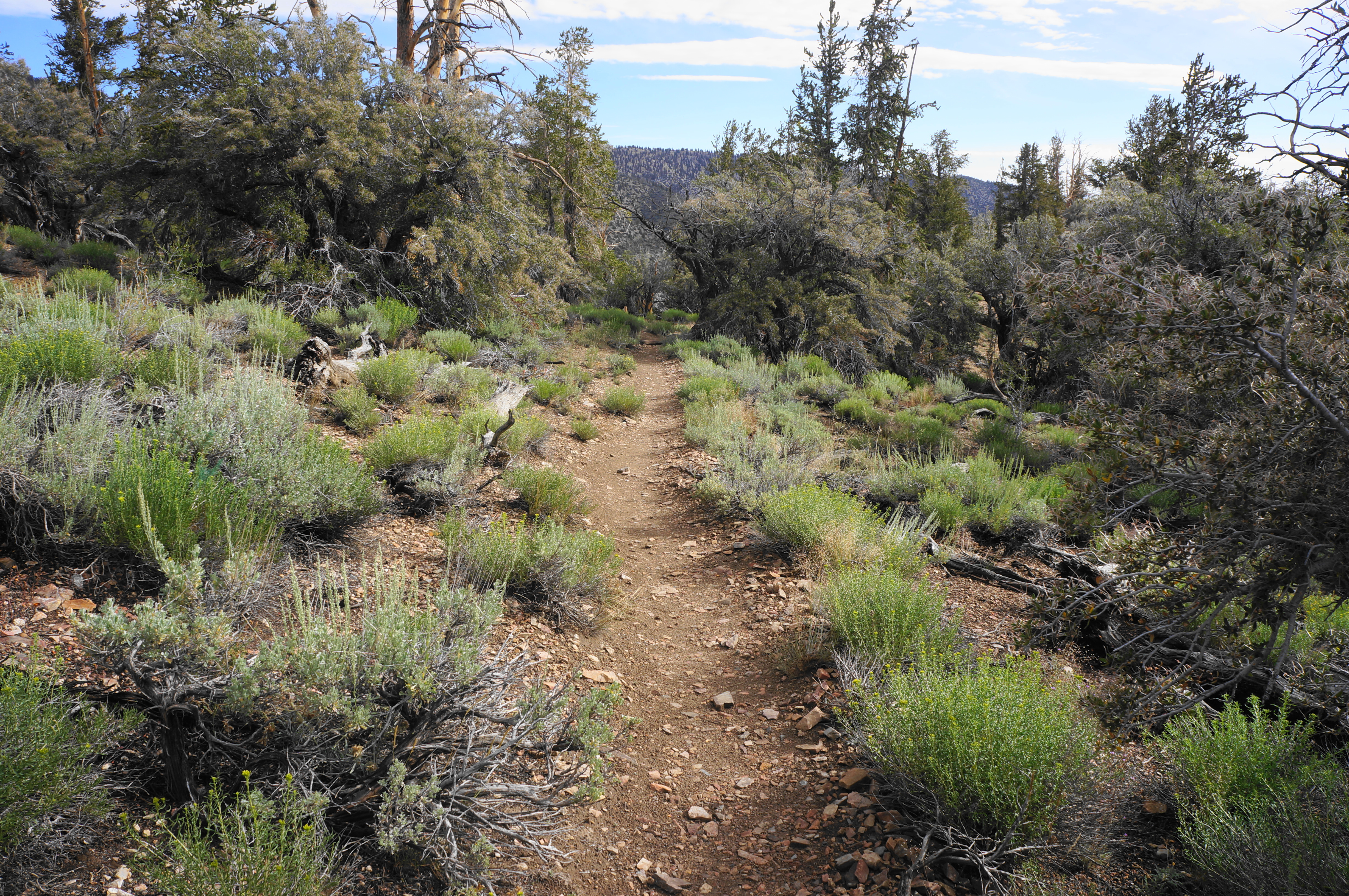
The exhibits and video are one thing—but seeing the actual, live bristlecones up-close is another. To do so, make your way from the visitor center, past the wooden deck, to the start of the Methuselah Trail, which diverges from the shorter Discovery Trail (1 mile) just beyond the parking lot. Grab a brochure ($2—well worth it) for the Methuselah walk and set out on the pebbly trail.
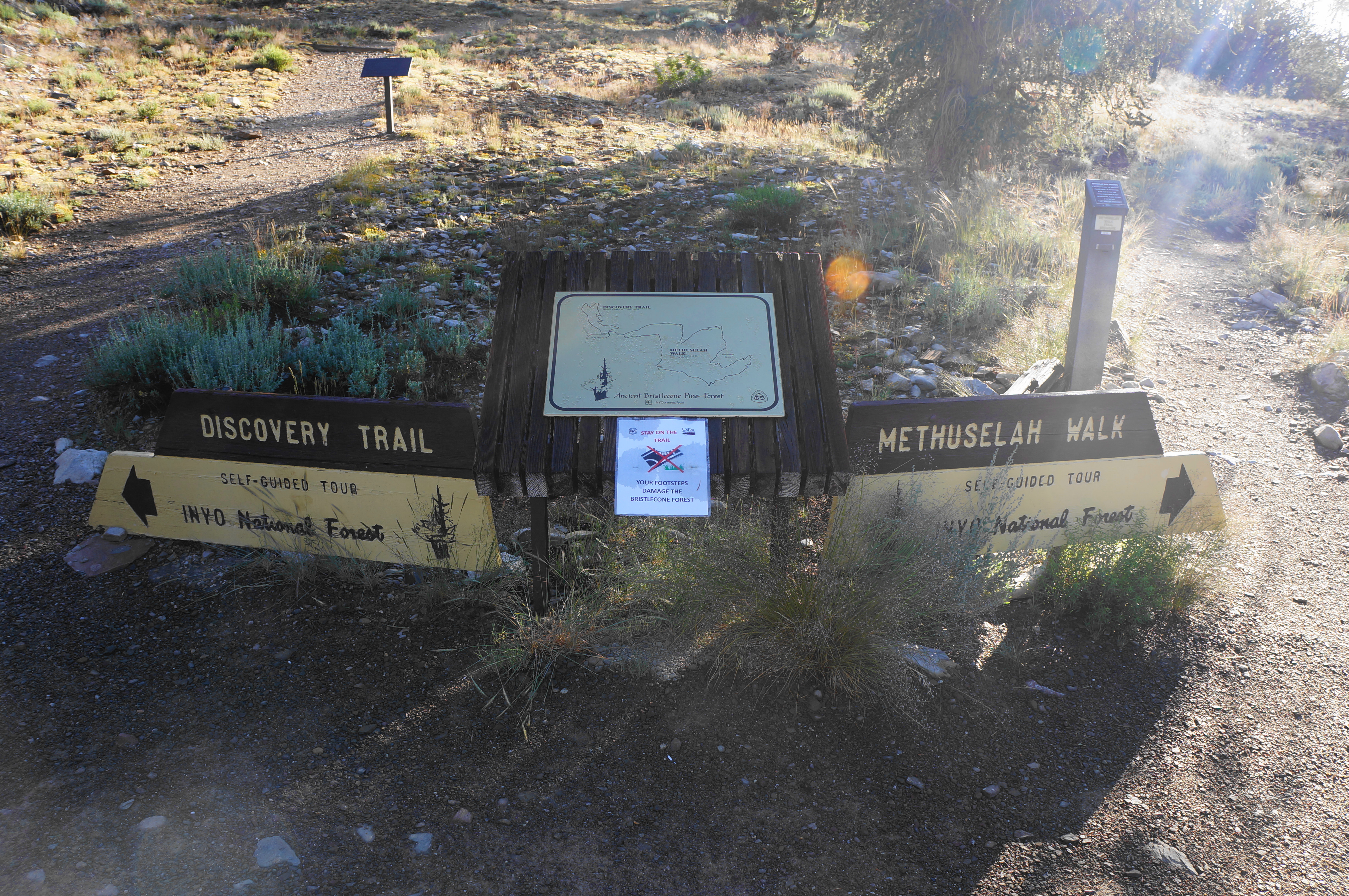
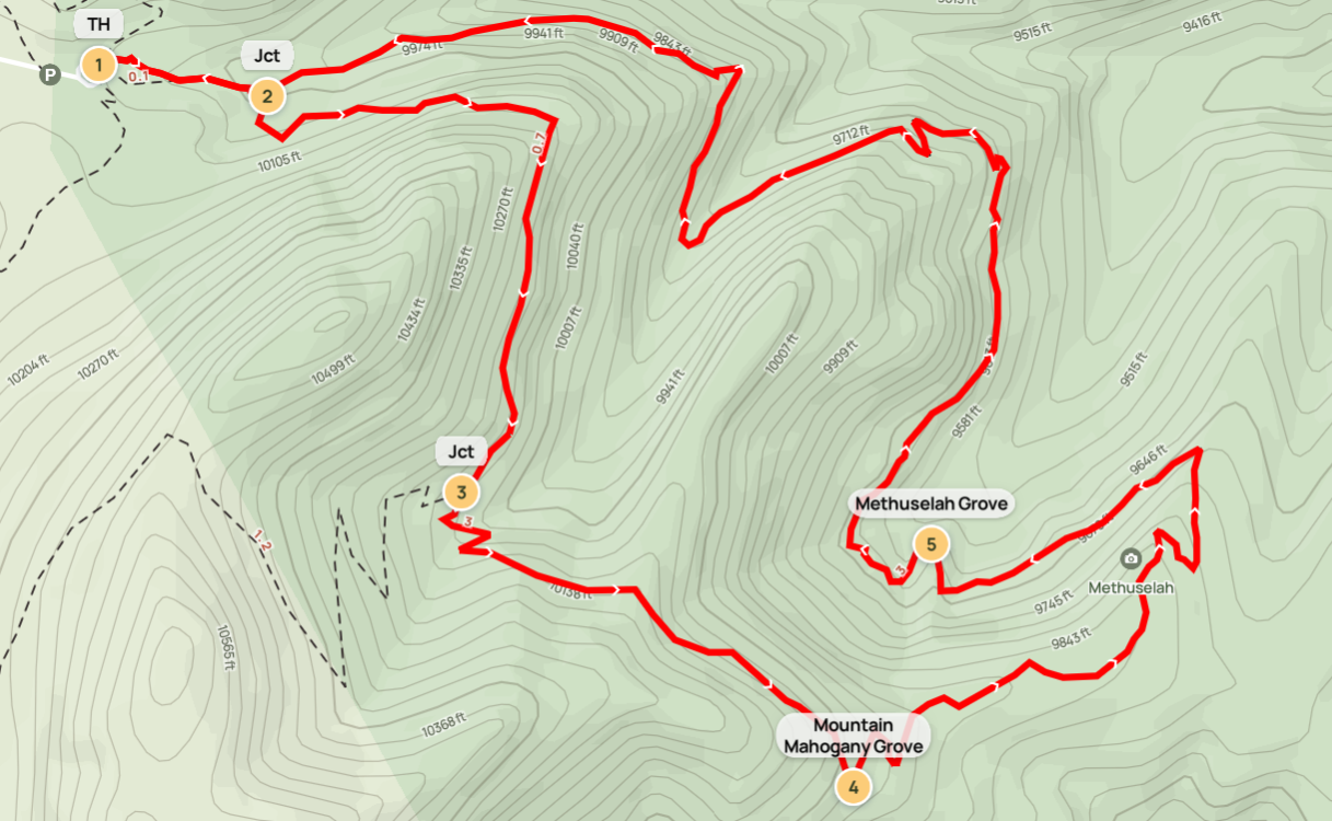
With regular signs and the detailed brochure, the Methuselah Trail has all the trappings of a nature trail—but it is perhaps considerably more rugged than expected. After an initial jaunt, crossing a (usually) dry streambed, leave the Visitor Center in the rear mirror and continue to a junction at around 300 yards. This is the start of the loop portion of the 4-mile hike.

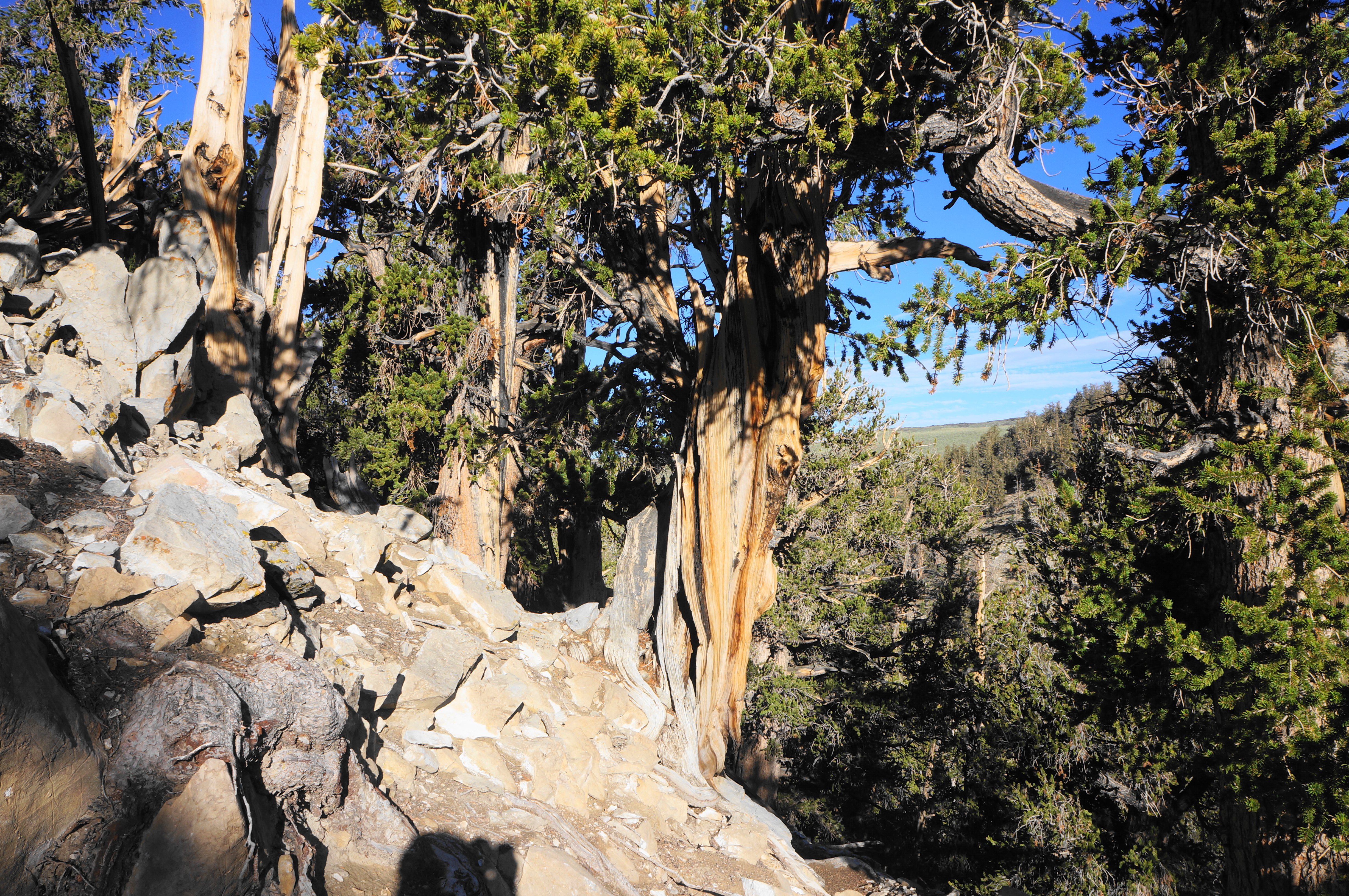
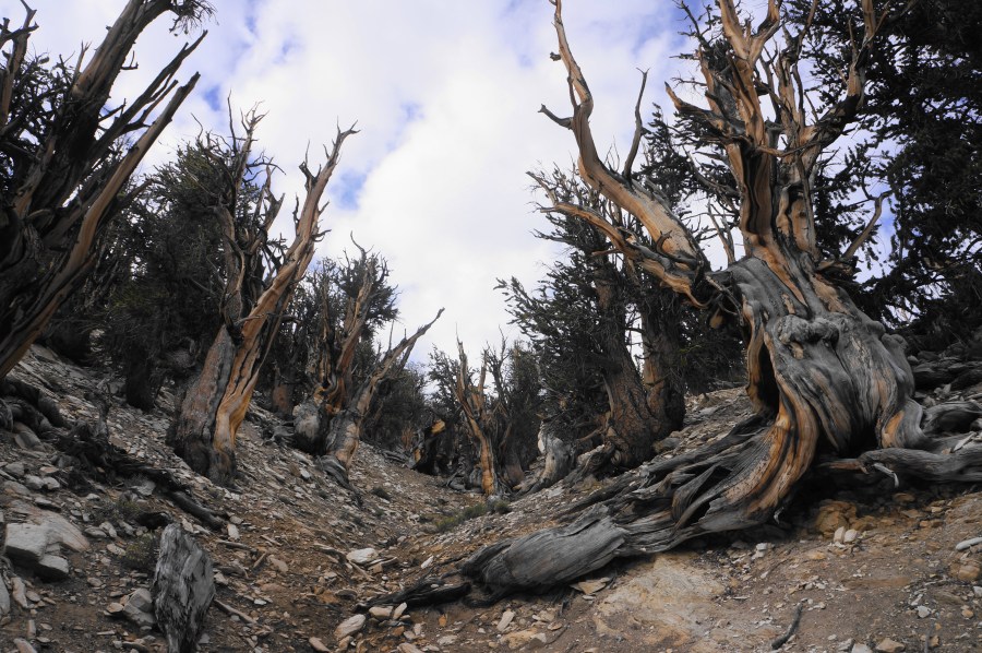
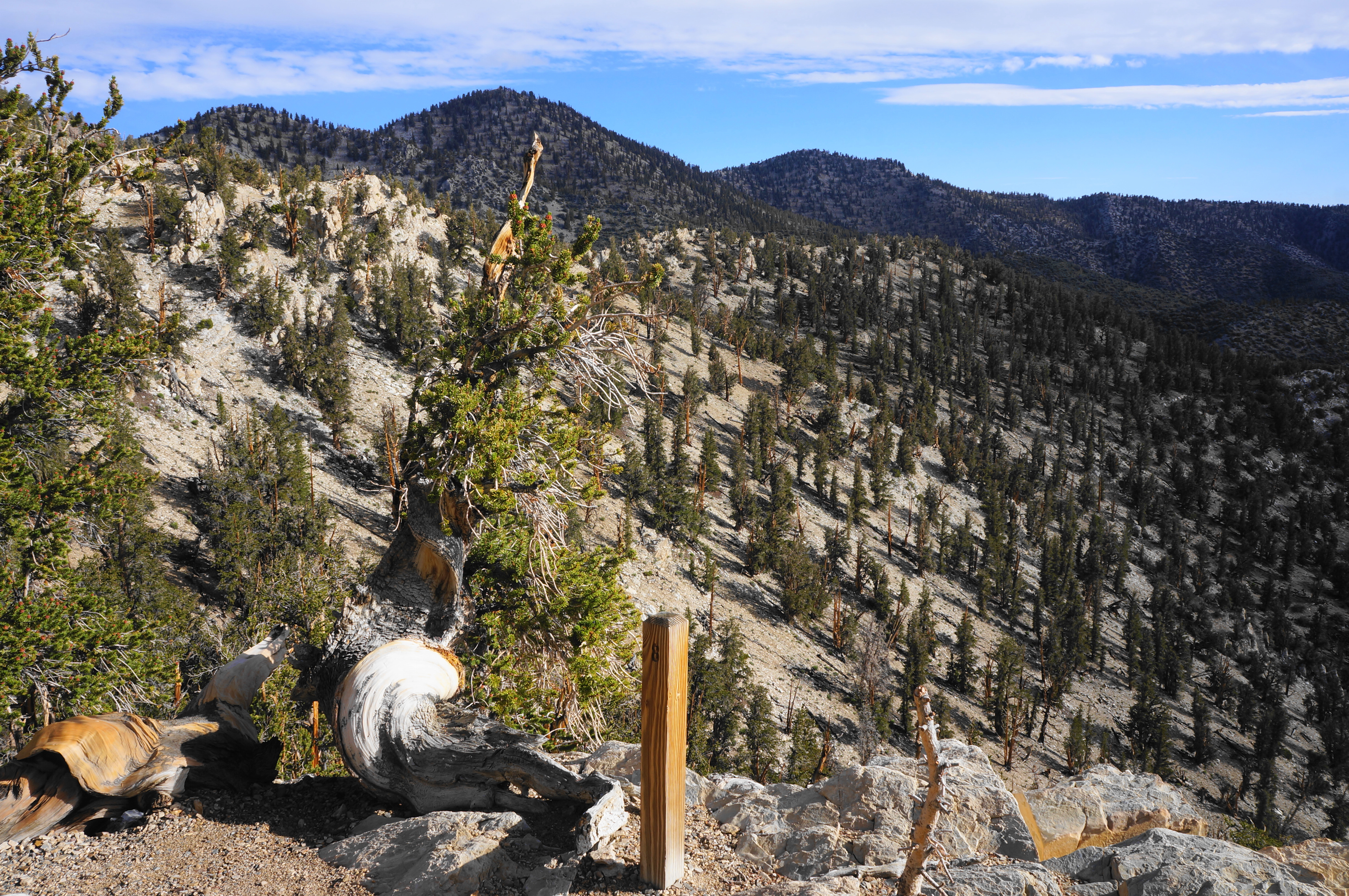
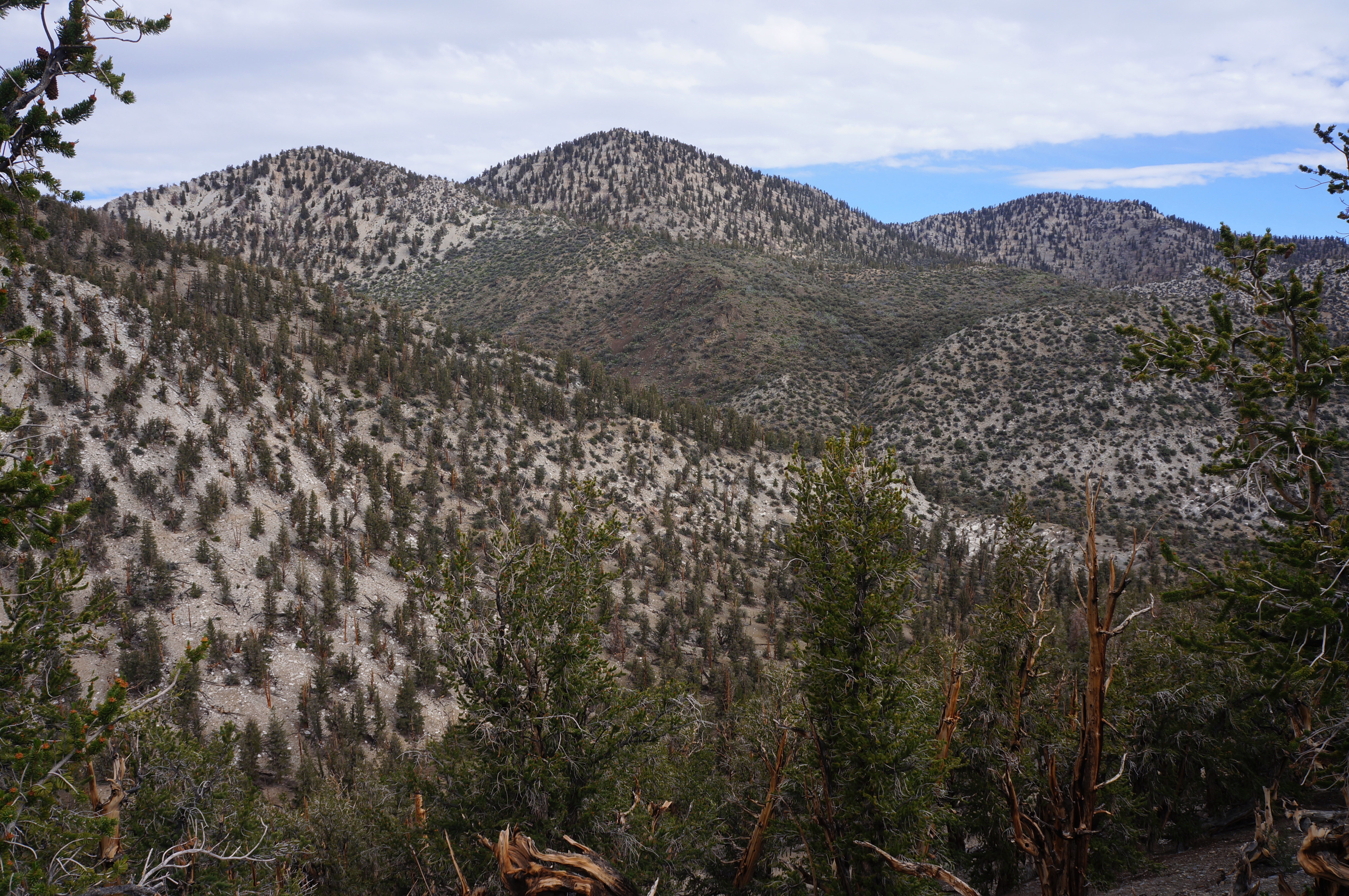
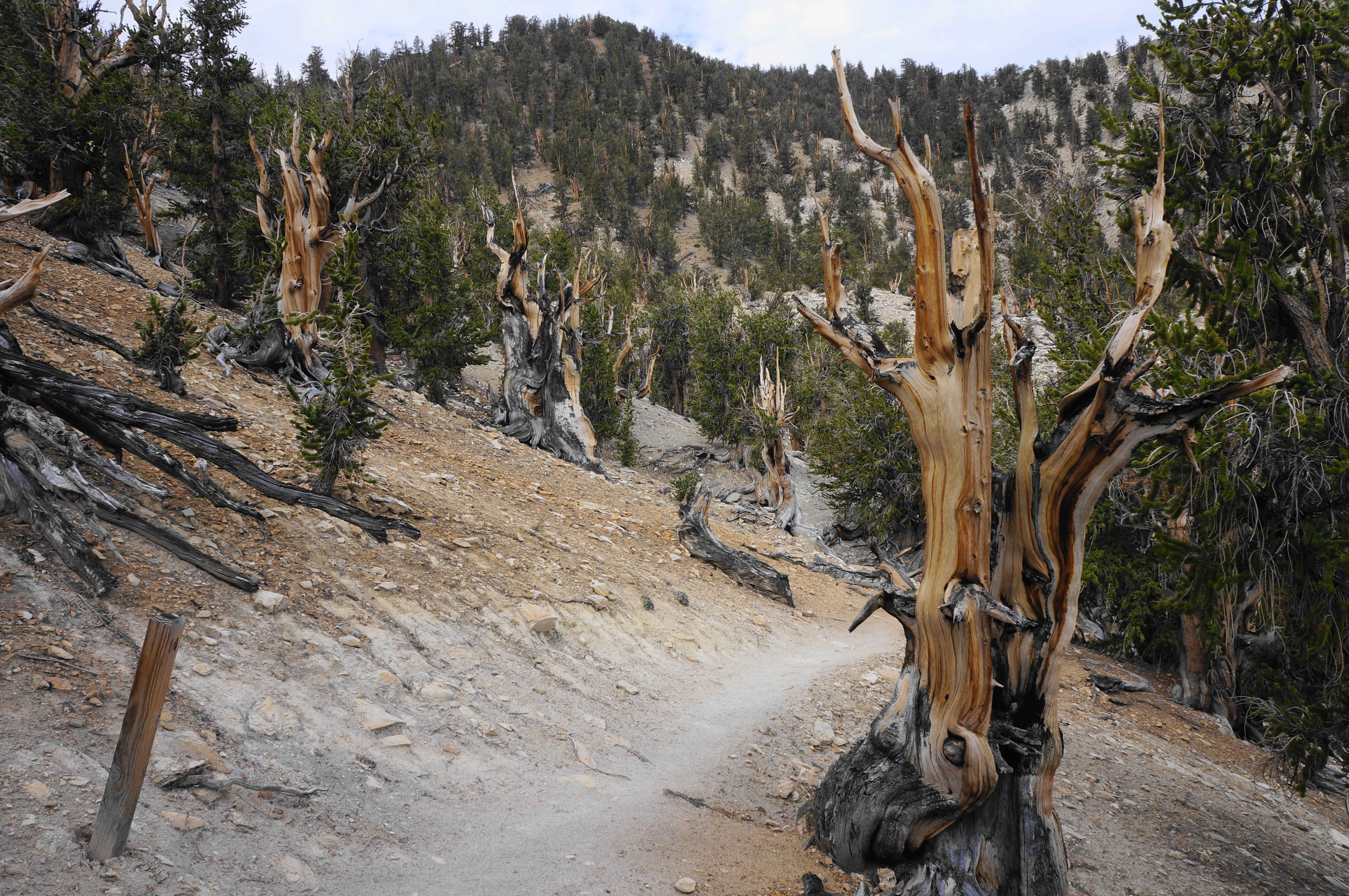
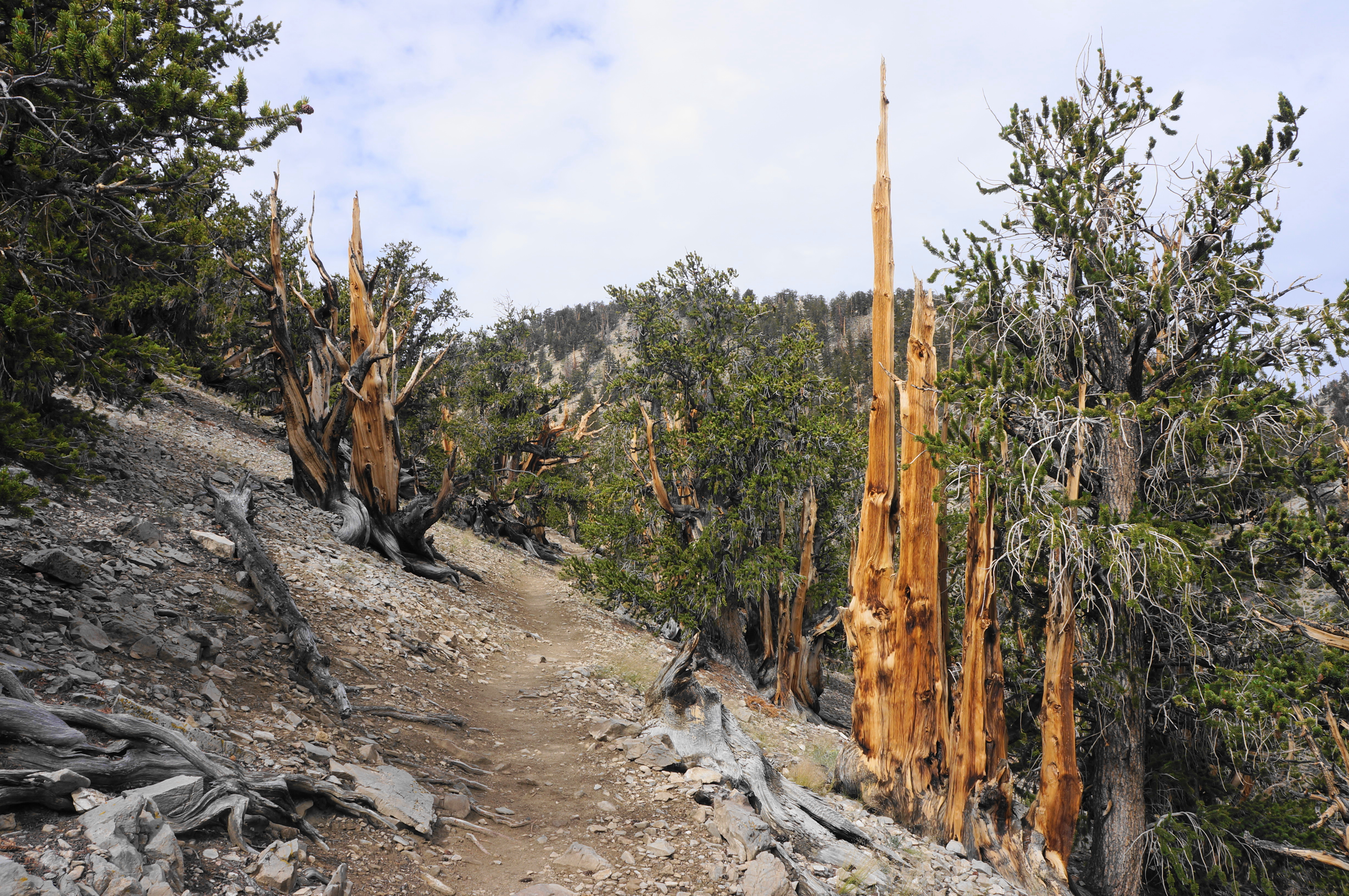
Bear right first, leading into a rather stout uphill section that skirts a north-facing hillside—this cues the bristlecones, which thrive on north slopes because they retain snow for longer, allowing the pines to absorb additional moisture. The gnarly trunks rarely rise more than 20-30 feet, but the conditions have turned these ancient trees into hearty warriors. Even the specimens that have lost their needles are likely still alive, growing ever slowly amidst the sandstone and dolomitic soil. There is no underbrush to compete with.
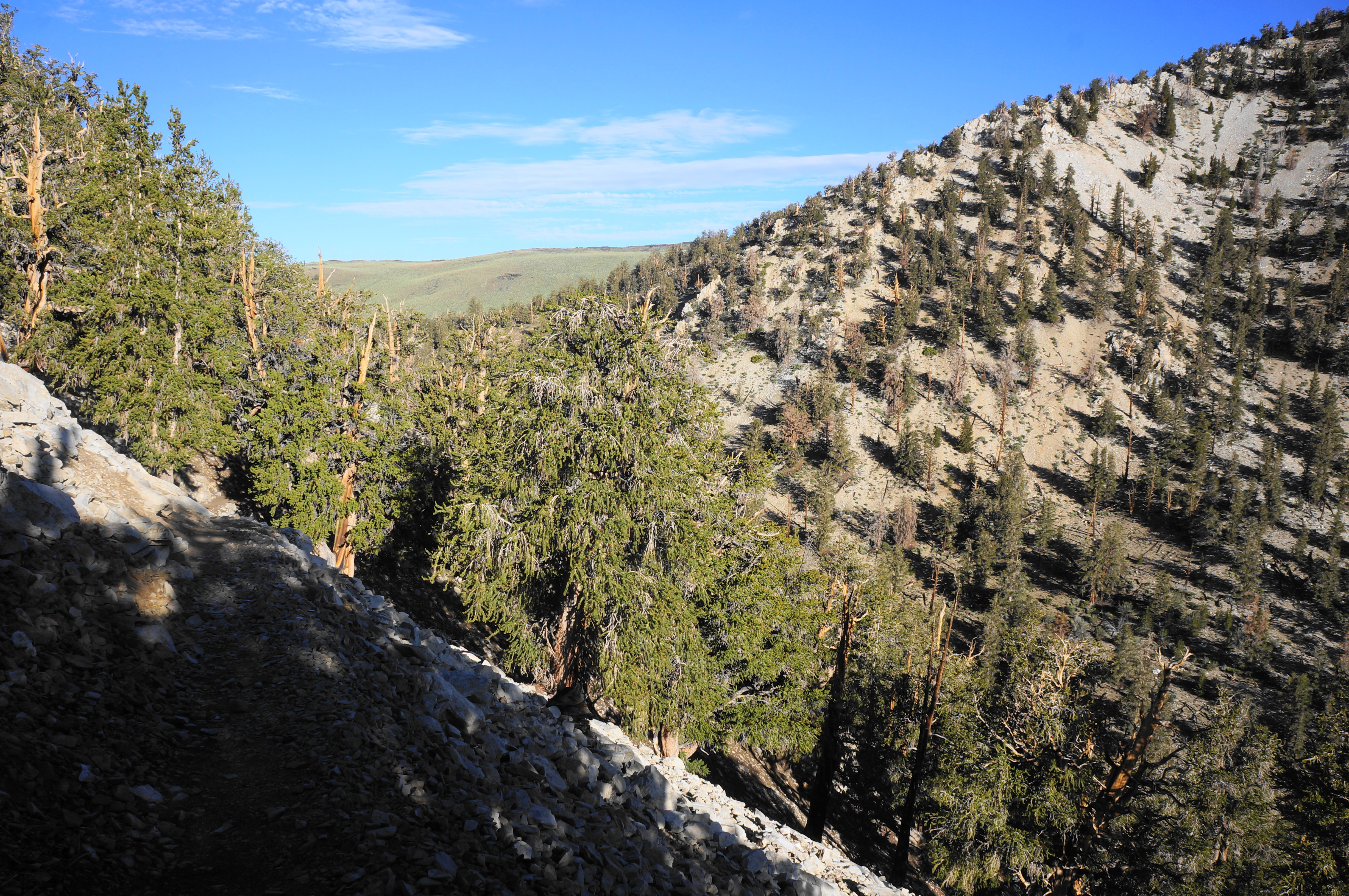
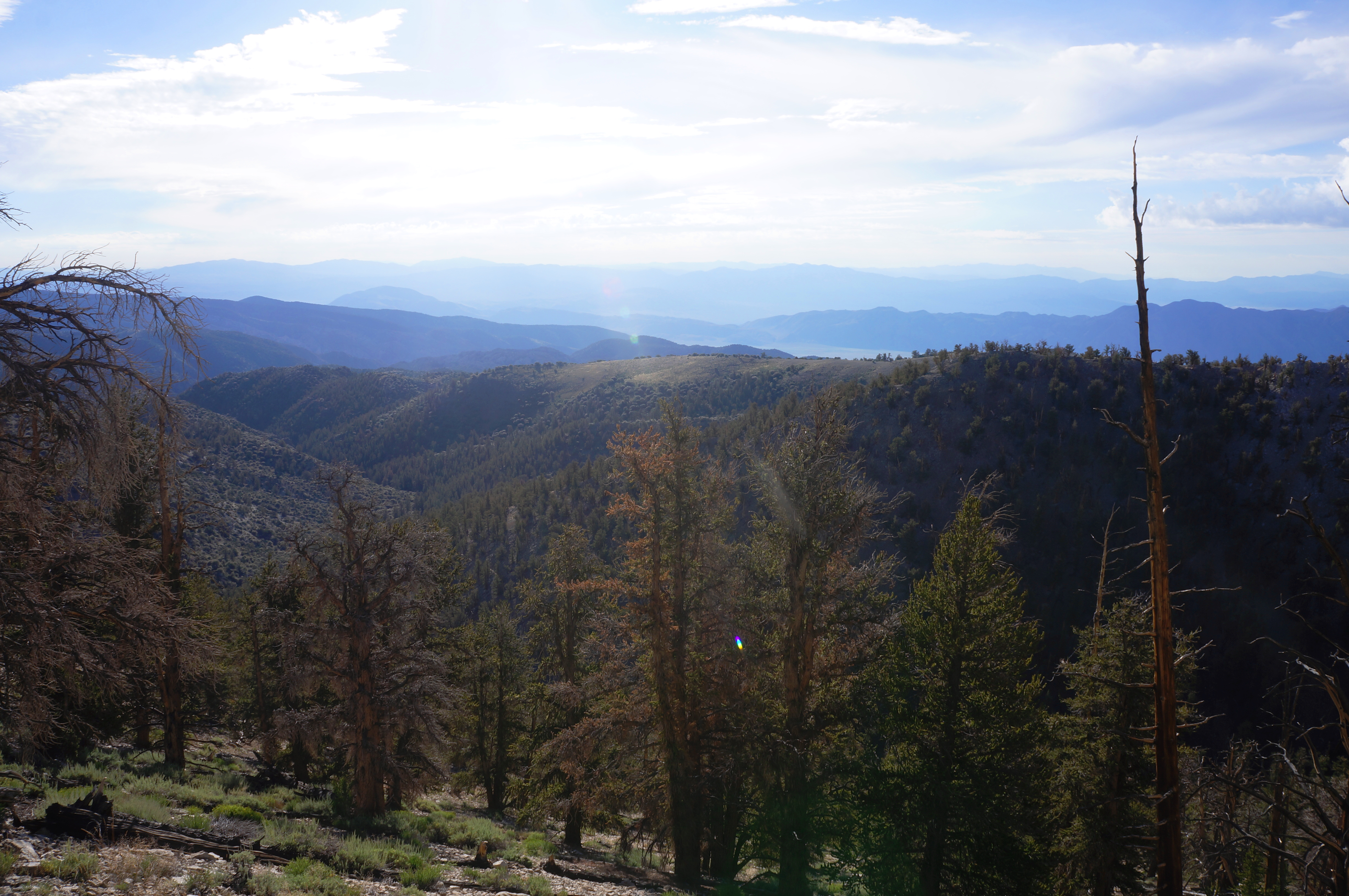
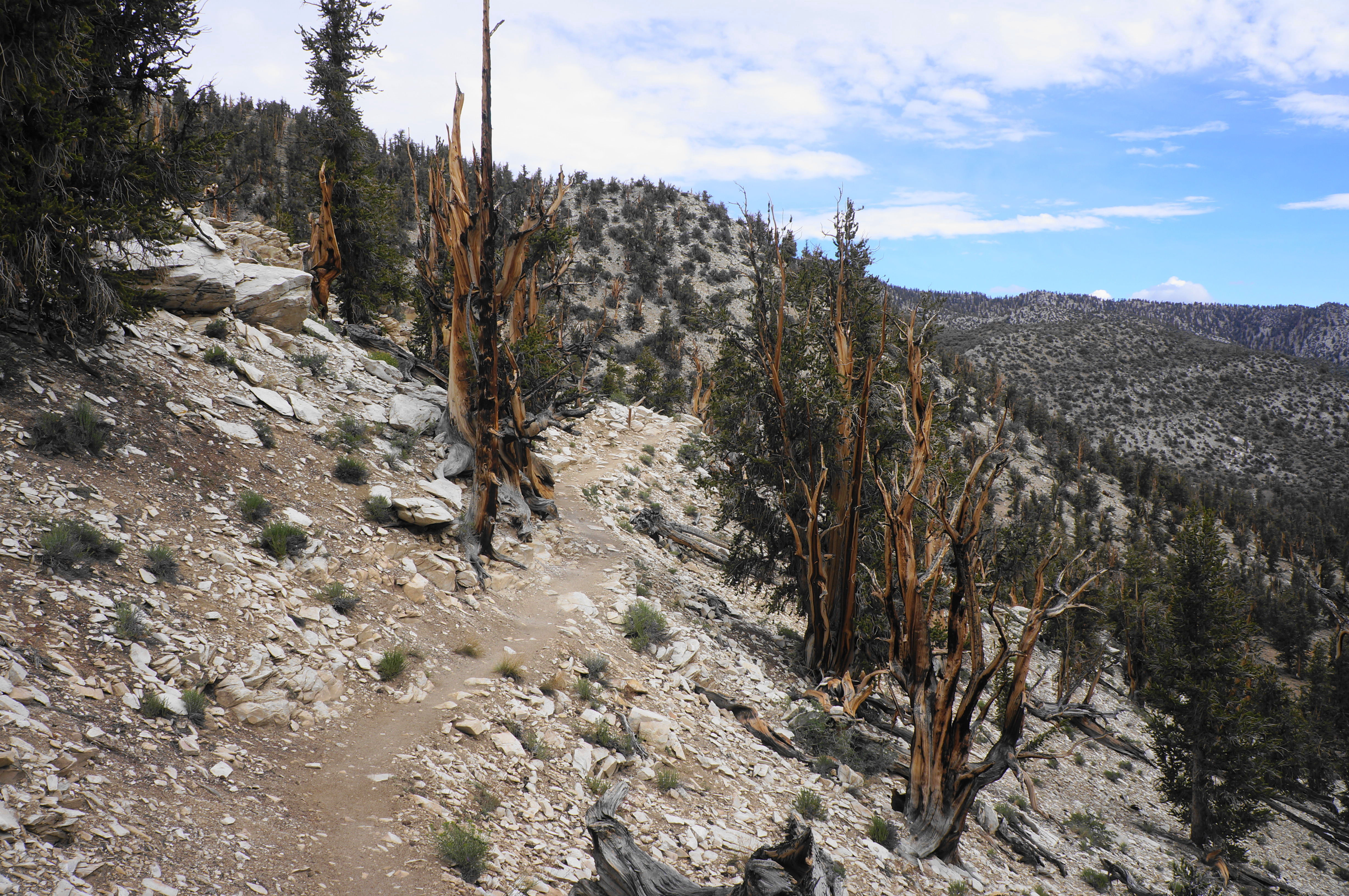
Pass trail markers 3 and 4 (consult your brochure) before rounding a right-hand corner with the first good views east across the White Mountains to the ranges beyond. Past the desolate Deep Springs Valley, the northern fringe of the Inyo Mountains gives way to Eureka Valley and, in turn, the Sylvania Mountains, Last Chance Range, and the Grapevine Mountains. These north-south strips mountains continue in a sequence for hundreds of miles eastward, across Nevada and Utah, in what is called the Basin and Range Province. Heading off trail for a better view is not allowed, but there is a bench on the right from which to enjoy the view.
From here, continue as the trail bears south, high above a drainage feeding into South Fork Birch Creek. The bristlecones continue to dazzle on the right, although they are fewer in number, as this slope gets more sun and less persistent snow.

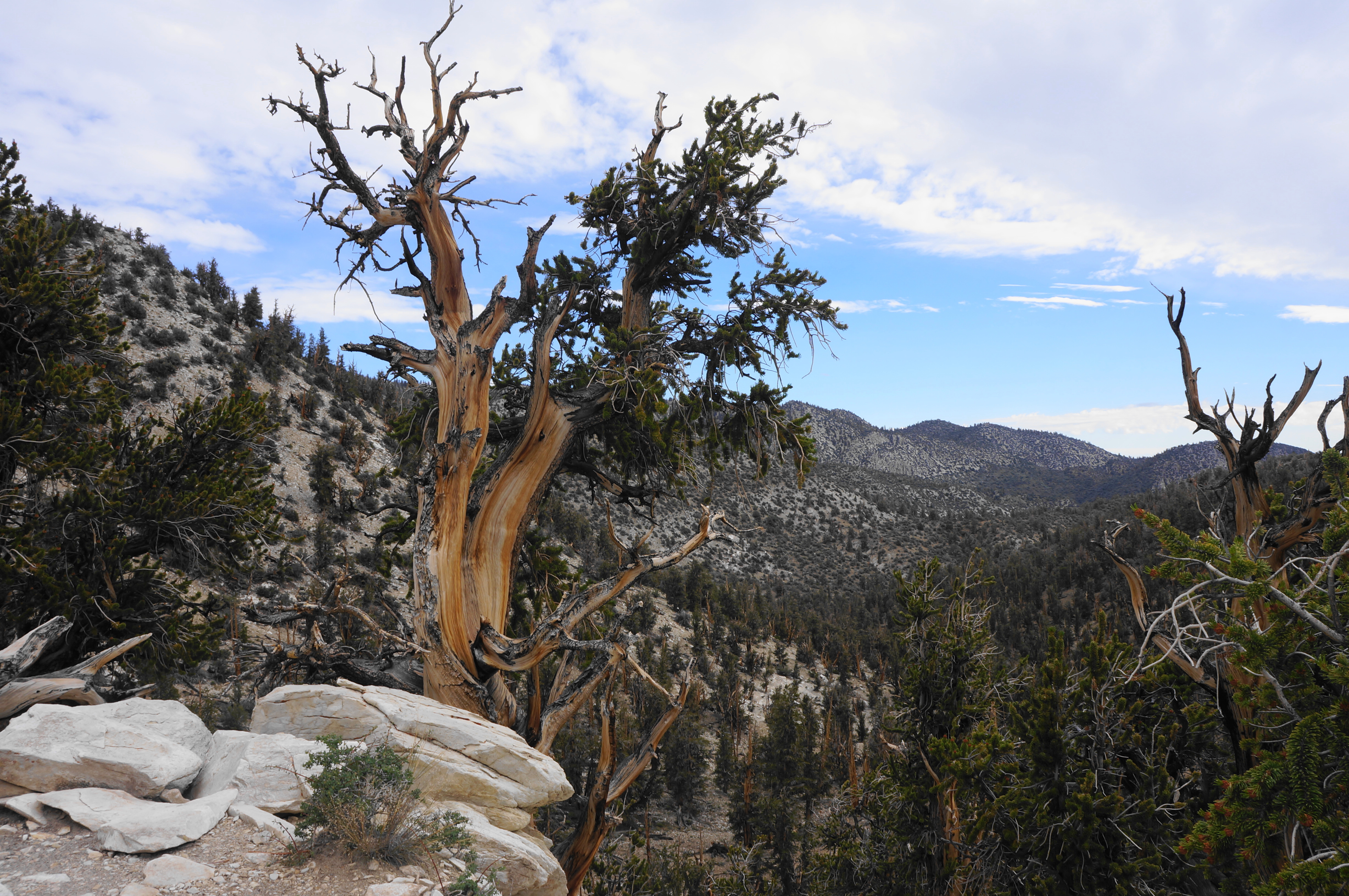
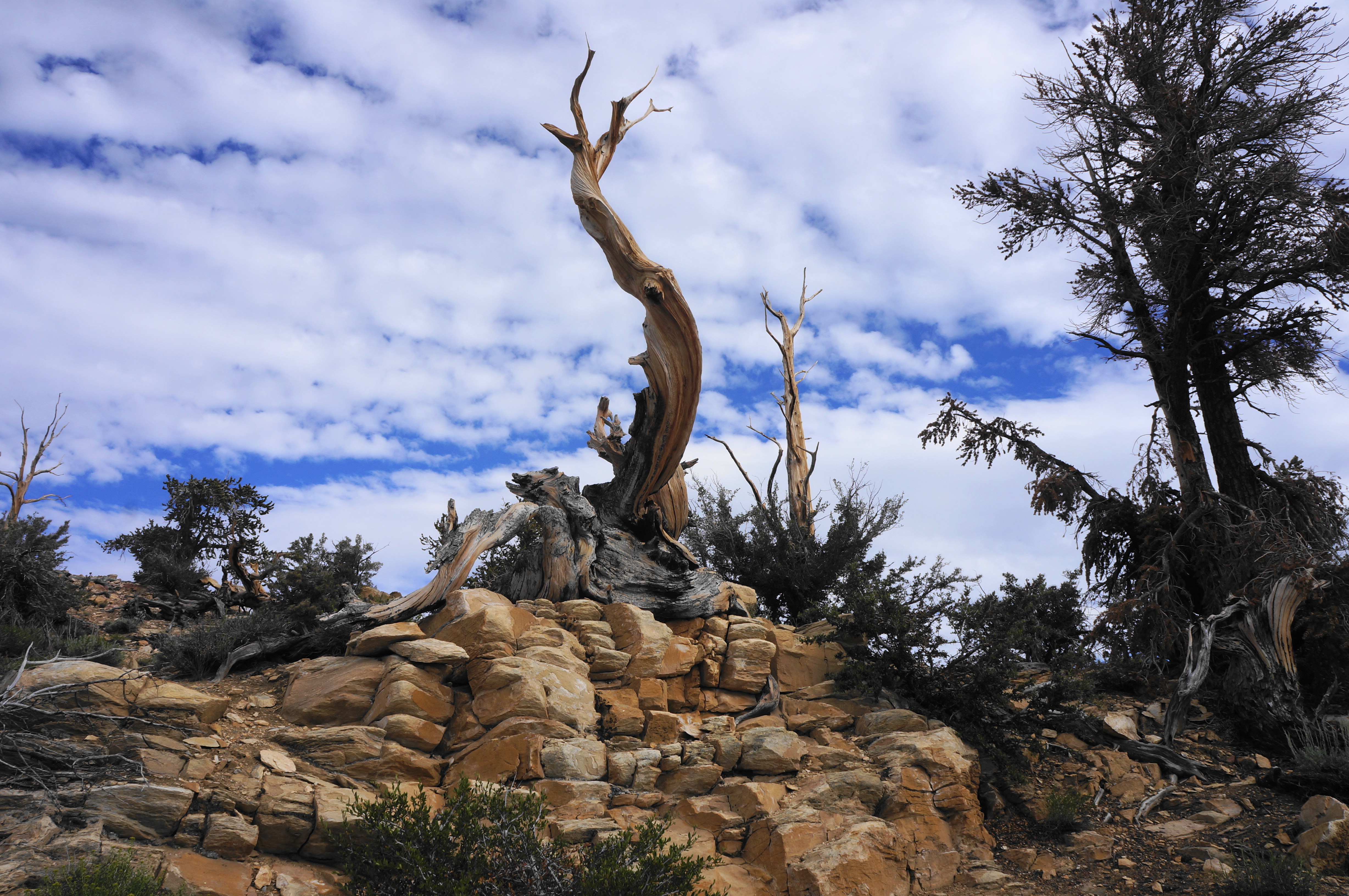
A level path gives way eventually to a brief descent, a couple of wiggles, and another impressive batch of bristlecones at ¾ mile. Stay left at the junction with the Bristlecone Cabin Trail (a shorter, 2-mile loop), then skirt a two-pronged drainage before skirting the base of some higher sandstone outcrops. Ascend a set of switchbacks to return to unobstructed vistas, with one spot boasting a particularly iconic bristlecone, gnarled and clinging to the cliff’s edge (at signpost #8).


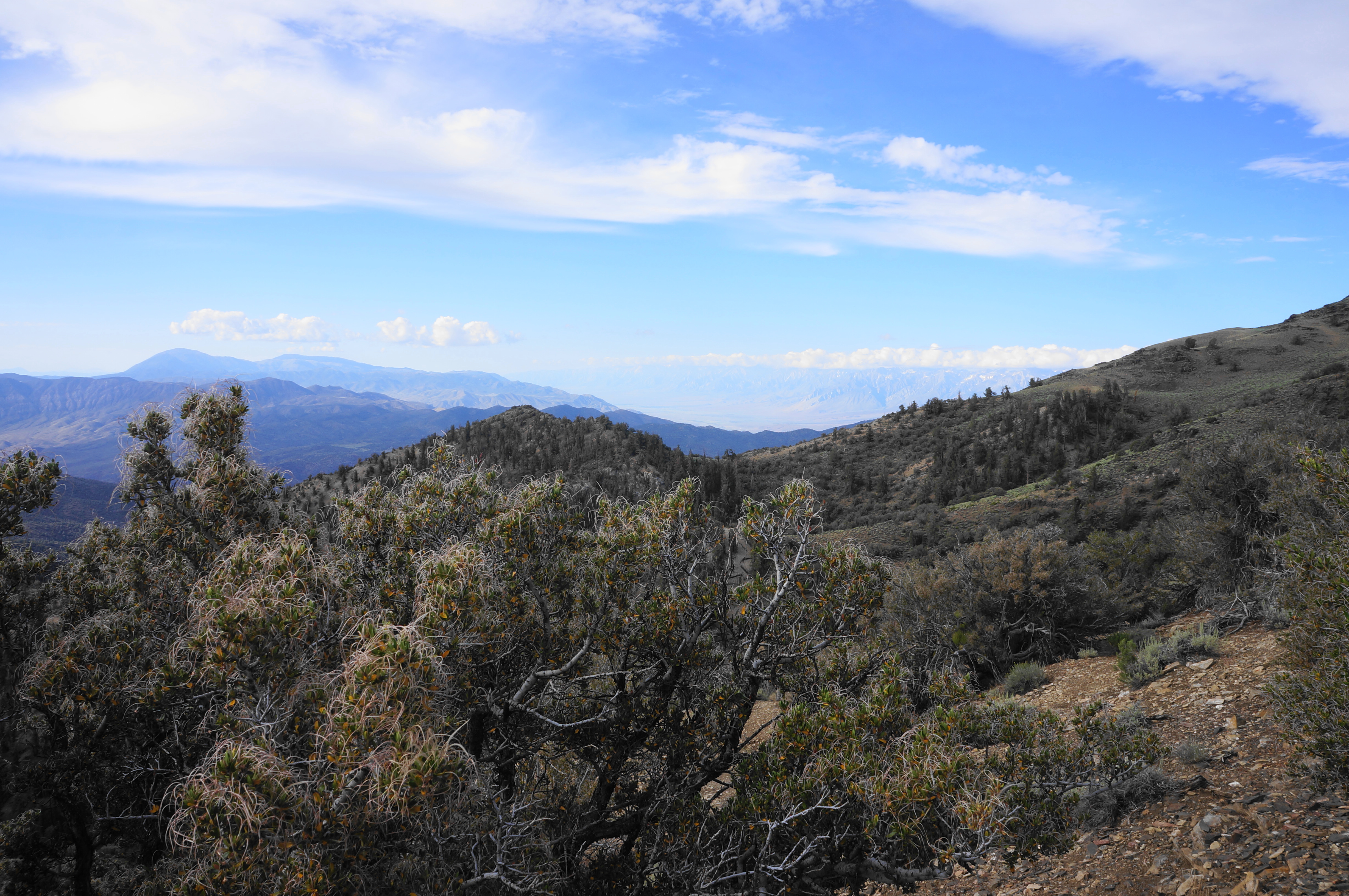
After a right-hand bend here, continue southward and eastward, now descending at a decent clip. Around signpost 9, the terrain takes a dramatic turn. Gone are the bristlecones and in comes sagebrush and mountain mahogany, as the south-facing slope and more favorable soil sustains greater diversity of plant life. Here one also gets the hike’s best views of the Inyo Mountains to the south, as well as a peek across Owens Valley to the mighty Sierra Nevada.
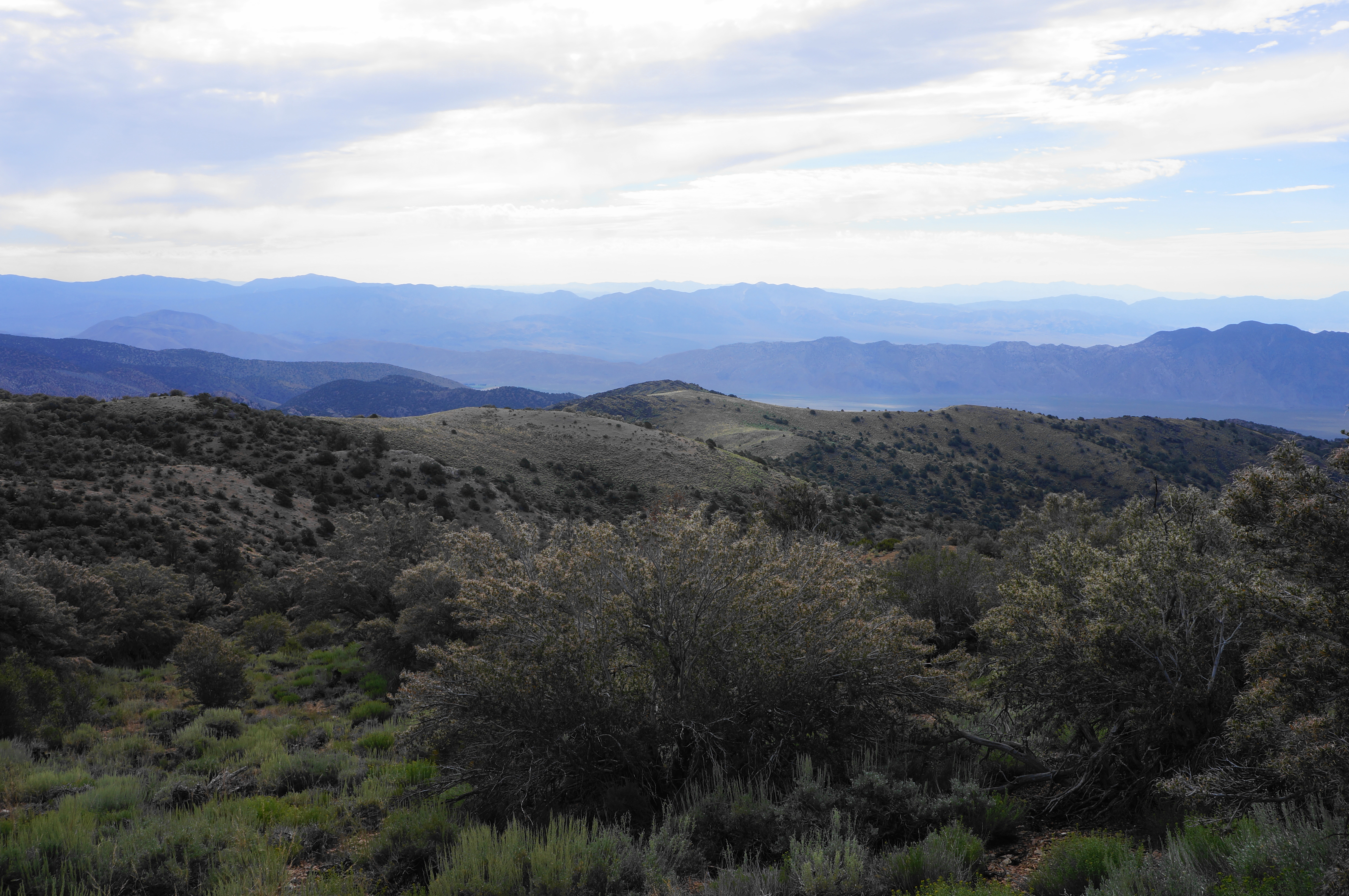

Two switchbacks lead into a milder descent across a brushy shelf, with views to a bald ridge to the east. The sagebrush begins to thin as one heads through Mountain Mahogany Grove, and bristlecones start to reappear, including one oft-photographed spiral atop a sandstone crag.
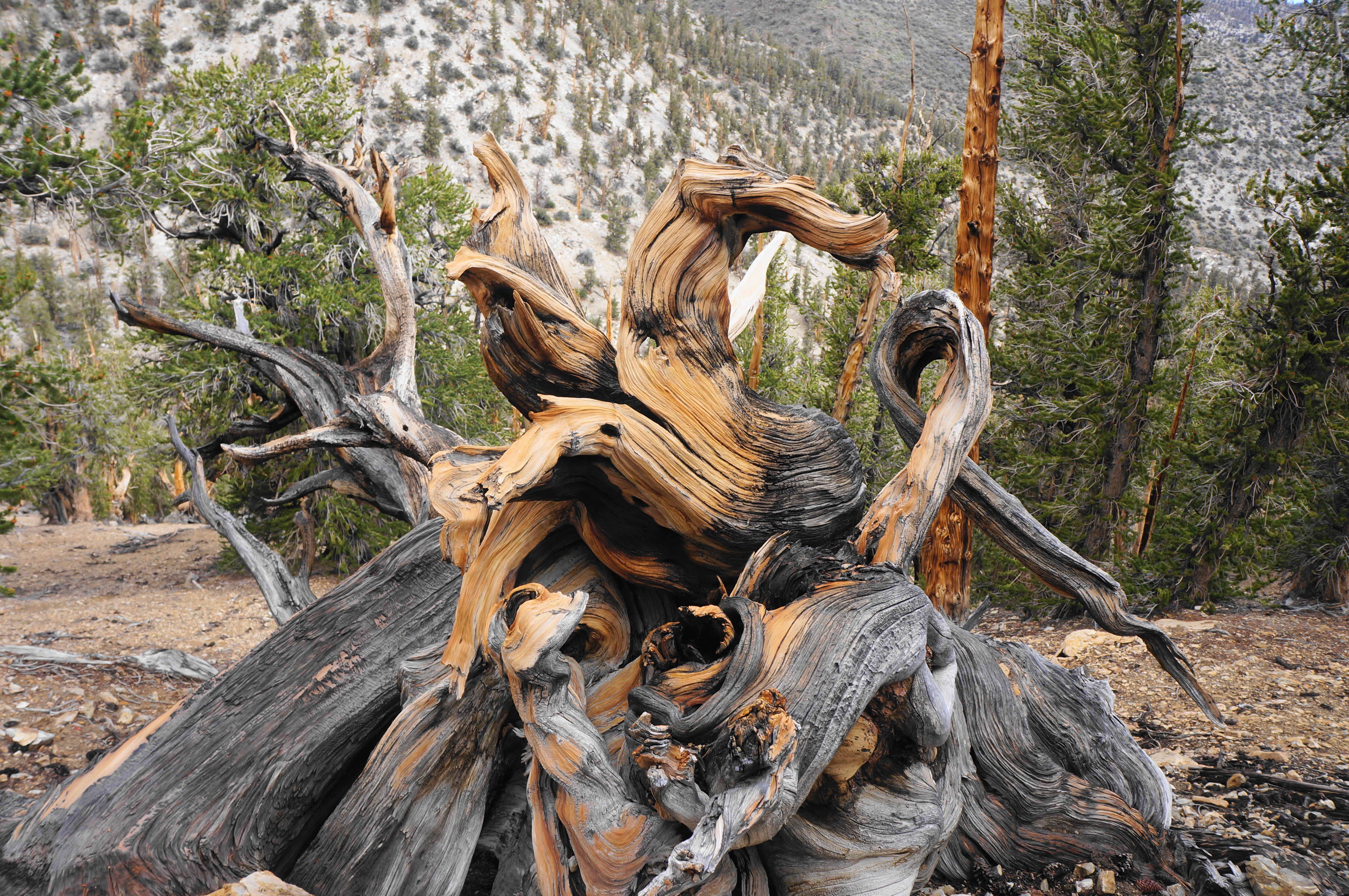
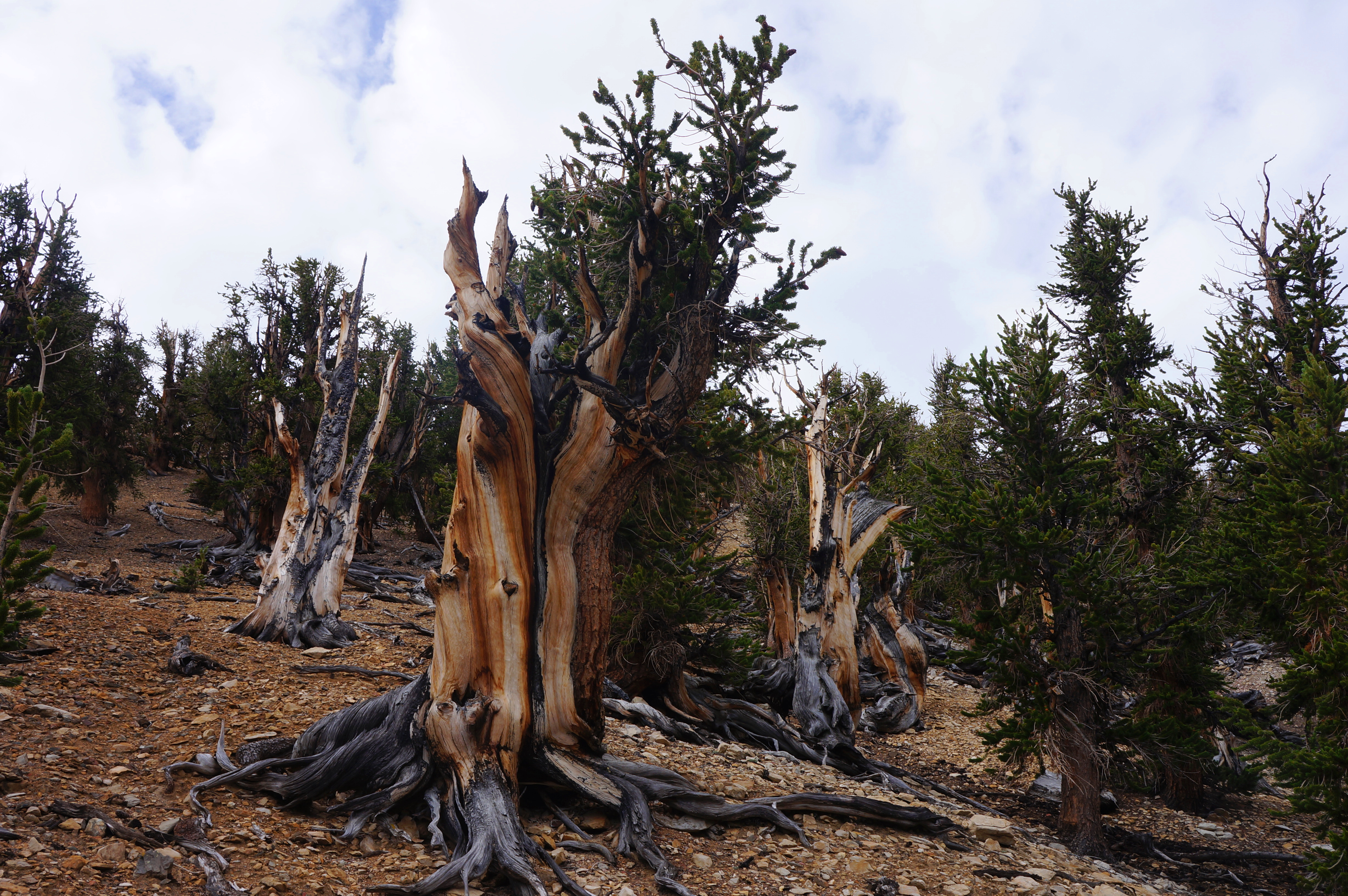
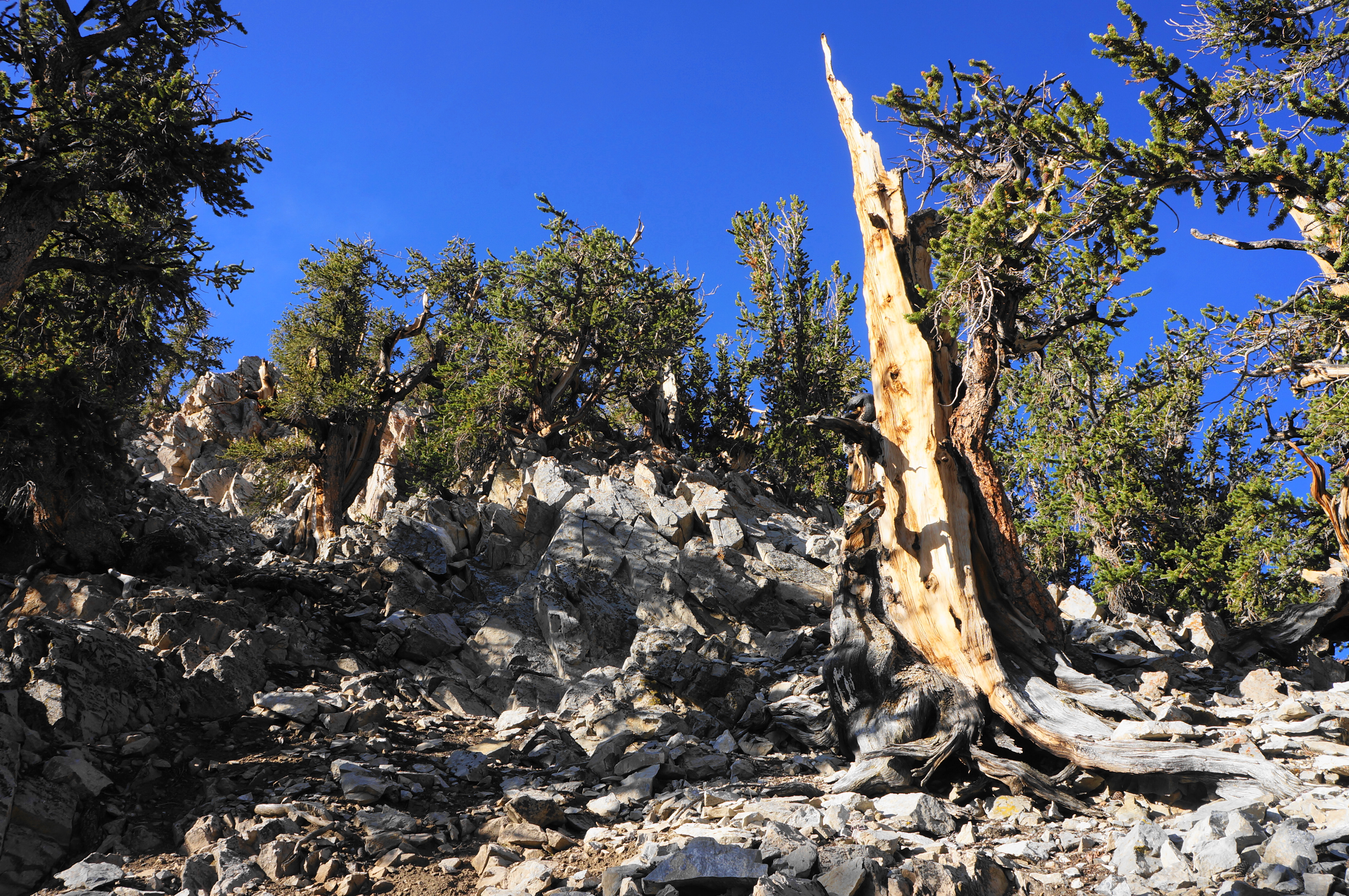
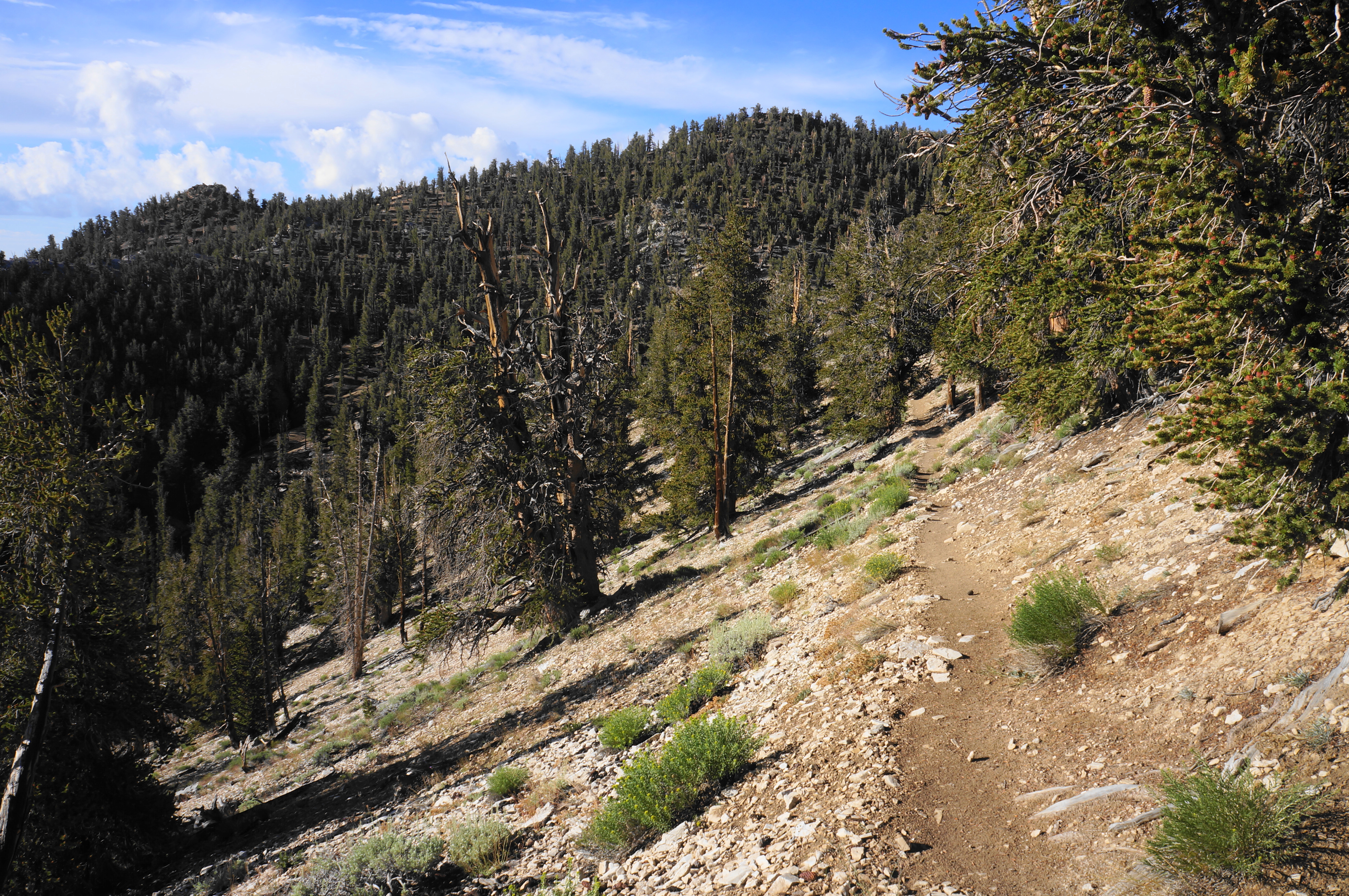
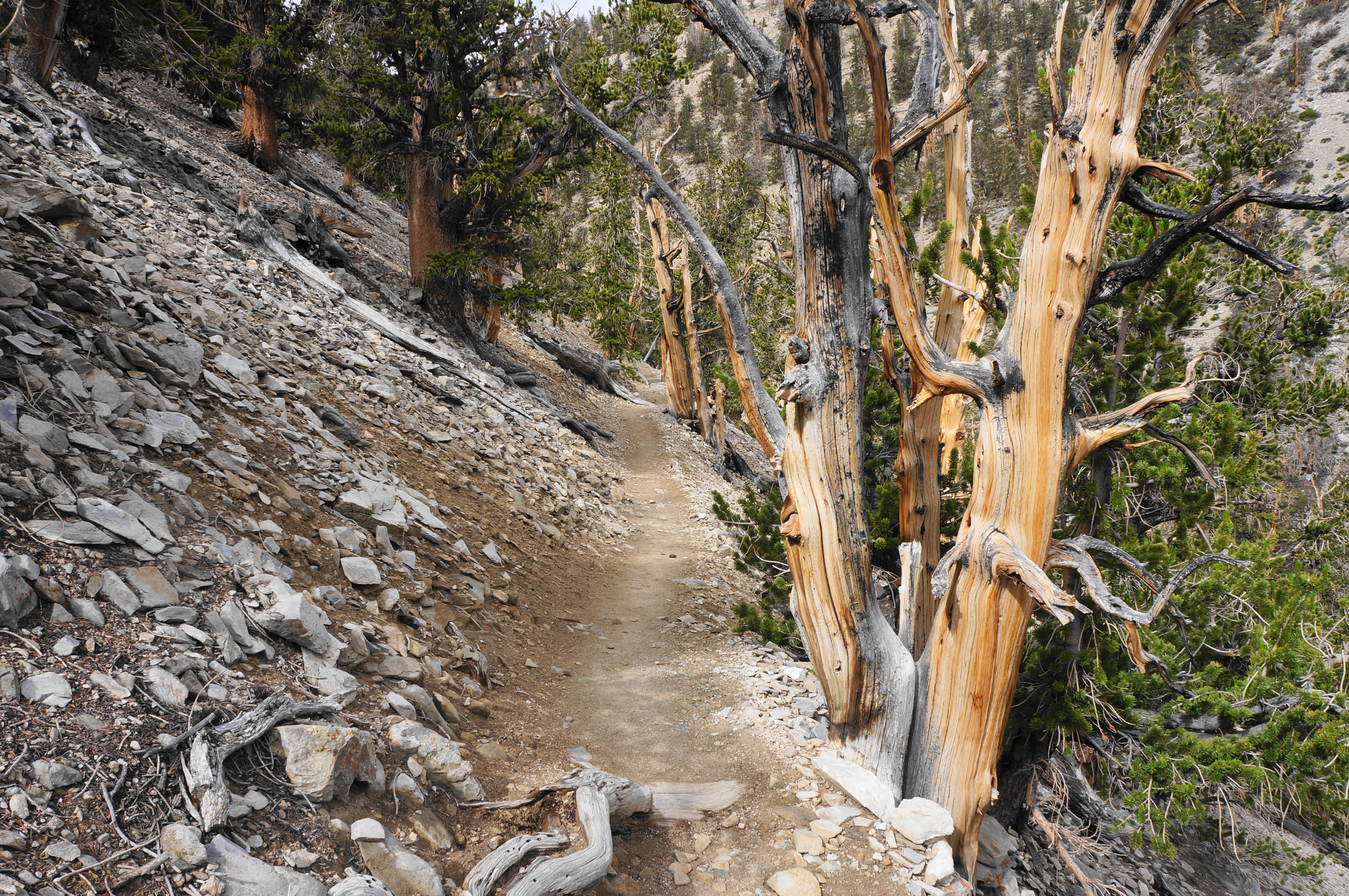
The views west return at around 1.8 miles, and the trail drops back into a drainage bearing the perhaps the most stunning collection of bristlecones in the world: the Methuselah Grove. The wild trees here cluster in large numbers, growing seemingly right out of the chalky sandstone. Perhaps the most scintillating spot is a point, at about 2.5 miles, where the trail traverses a drainage lined with heavily-varnished bristlecone pines on either side.

The stunning trees continue to mesmerize as the trail ascends the opposite slope, skirting the cream-colored cliffs. It is in this grove that the aforementioned Dr. Schulman, in 1957, began discovering the oldest trees ever measured, including the famed Methuselah Tree (unmarked for its protection). Schulman had peculiar names for the various tree shapes, including the imaginative “Eagle’s aerie,” “massive slab,” and “pickaback.”


Now heading steadily northward, the bristlecones continue to dot the hillside around seemingly every bend, and there are open views down the South Fork drainage. It is not until around 2.9 miles that the uphill returns in earnest. Climb up and around a left-hand bend, heading westward along another north-facing slope. Naturally, the bristlecones are found here in numbers as well.

After a set of switchbacks, pass a bench on the left and settle into another very pleasant flat stretch, hugging a mountainside. The mild track rounds a corner and clears a drainage just before signpost #23, with the incline returning as hikers quickly make up some of the 800 feet in elevation lost on the hike.
Round another sharp left-hand turn and ascend to the loop’s penultimate bench. The bristlecone-lined ravine below becomes thinner and thinner, and hikers eventually come nearly level with the wash. Pass a final bench on the left as the gentle path treads westward. By 3.9 miles, the loop section comes to an end, and familiar territory lies ahead. Bear right and proceed up the final 300 yards of the Methuselah Trail, returning to the parking area and visitor center.
All told, the hike clocks in at around four miles (1/4 mile shorter than advertised on some maps, but in line with the distance noted on the brochure). This is 2-3 hours well-spent, rambling amongst the ancient trees, a wonder often forgotten among the many beautiful spots in California.
If you still have the energy, try your hand at one or both of the other two trails at Schulman Grove, or—if the road is open (it was not in summer 2023)—continue north to Patriarch Grove, home to the world’s largest—though not oldest—bristlecone. With camping nearby, it’s easy to spent two or more full days exploring the White Mountains.

Pingback: Top 10 Hikes in 2023 | Live and Let Hike
Pingback: One of the best hikes in the world is a 2-hour U.S. trail with mountain views and the oldest tree on Earth - Family Vacations US