
Abutting neighboring Tilden Regional Park to the south, the East Bay’s Wildcat Canyon Regional Park is lesser-known but arguably wilder and more dramatic, subbing out Tilden’s woodier landscape for treeless, windswept pastures with wide-reaching views. Access is by way of El Cerrito, San Pablo, and Richmond to the west; most hikes start at the Alvarado Staging Area, situated at the point where Wildcat Creek exits the Berkeley Hills. A second staging point, at Rifle Ridge Road in El Cerrito, offers access to the heart of the park. While traversing primarily wide fire roads (like Tilden), the 25 miles of hikes in Wildcat Canyon often feel more rugged, challenging, and—outside the popular Alvarado area—more secluded. With elevations ranging from 100 to 1,100 feet, expect to get a decent workout in this northernmost section of the Berkeley Hills.
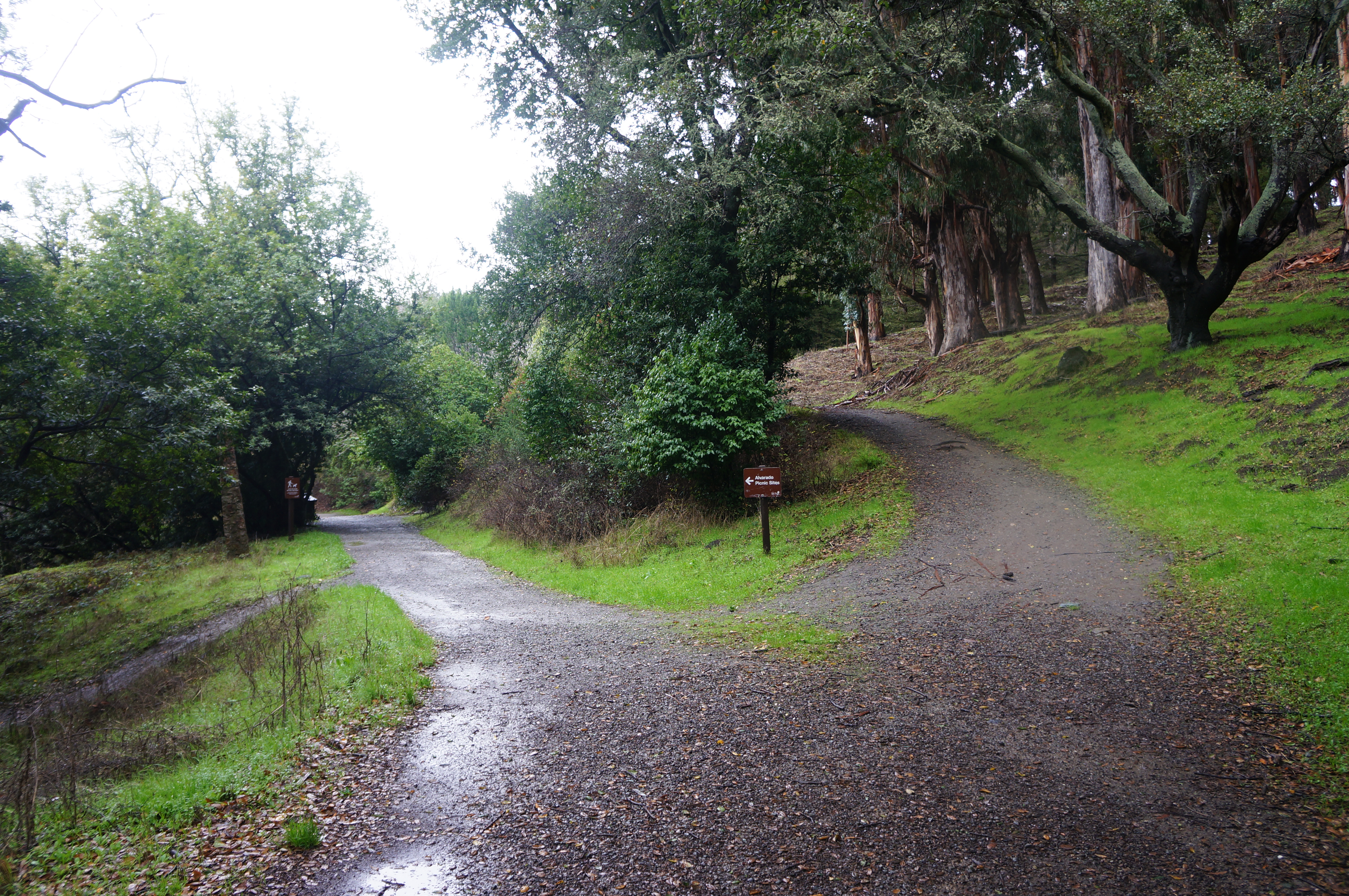
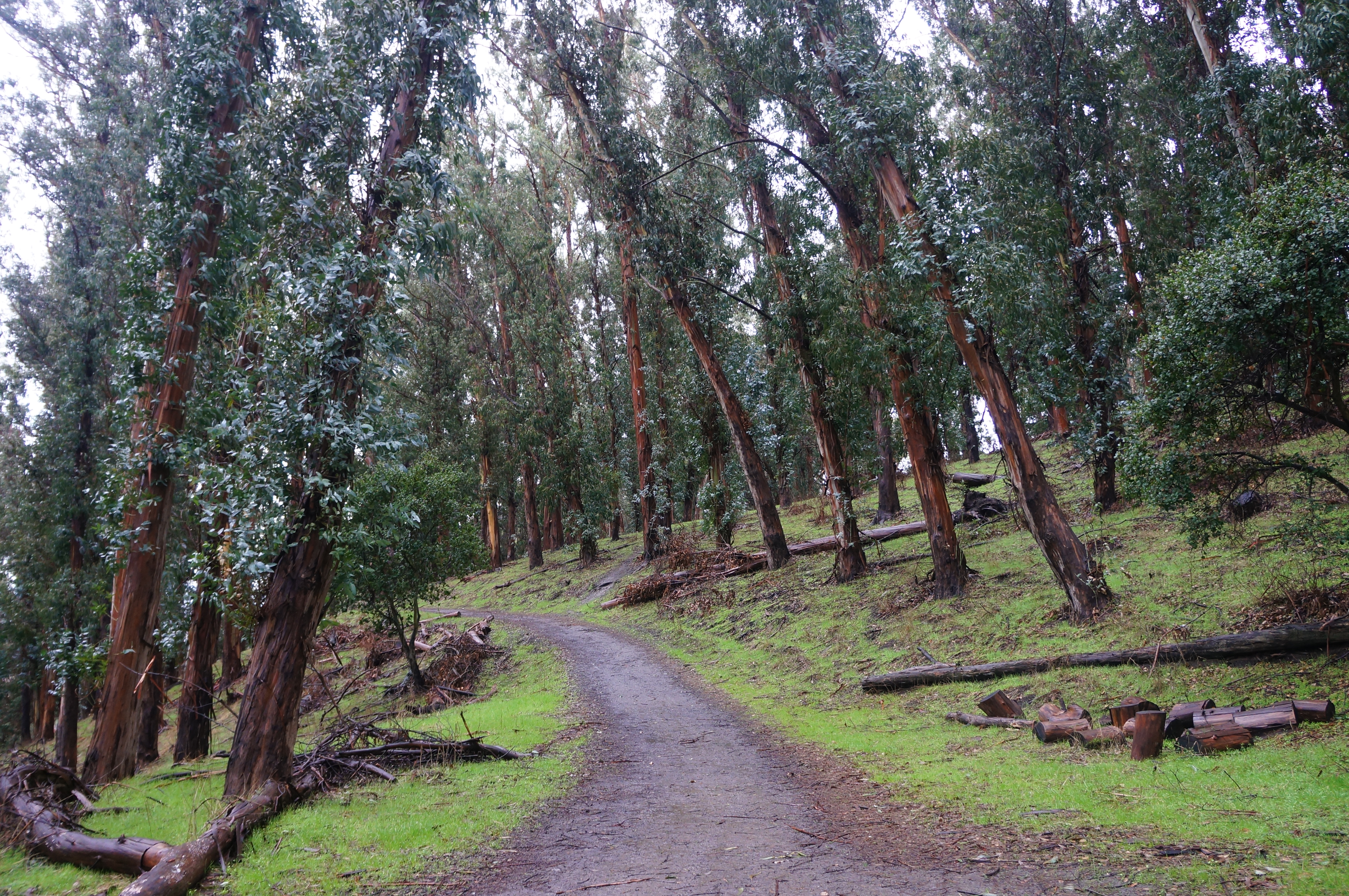
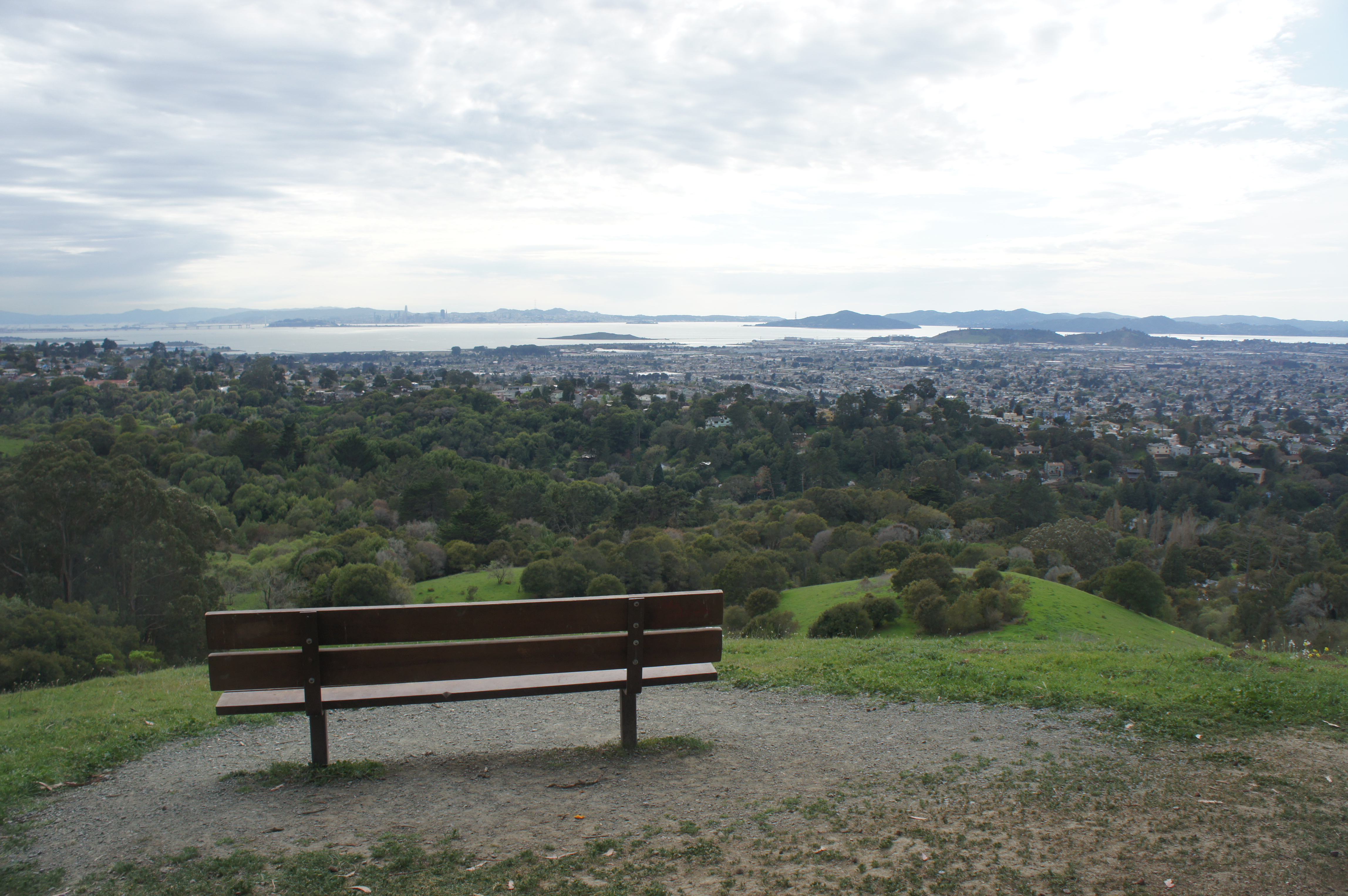
The oldest part of Wildcat Canyon, Alvarado Park, was initially a private park (first called Grand Canyon Park before it was renamed in 1926), served by its own streetcar line from 1909. Later, it was acquired by the City of Richmond and absorbed into neighboring Wildcat Canyon Regional Park. The 42.5-acre unit features stonework dating to the Great Depression, as well as a modern picnic area, playground, and maze of interlocking trails, zig-zagging through the Wildcat Creek drainage and the eucalyptus-dotted hillside. The initial trio of trails described below explore this small unit, enough to entertain for a few hours to a half day.
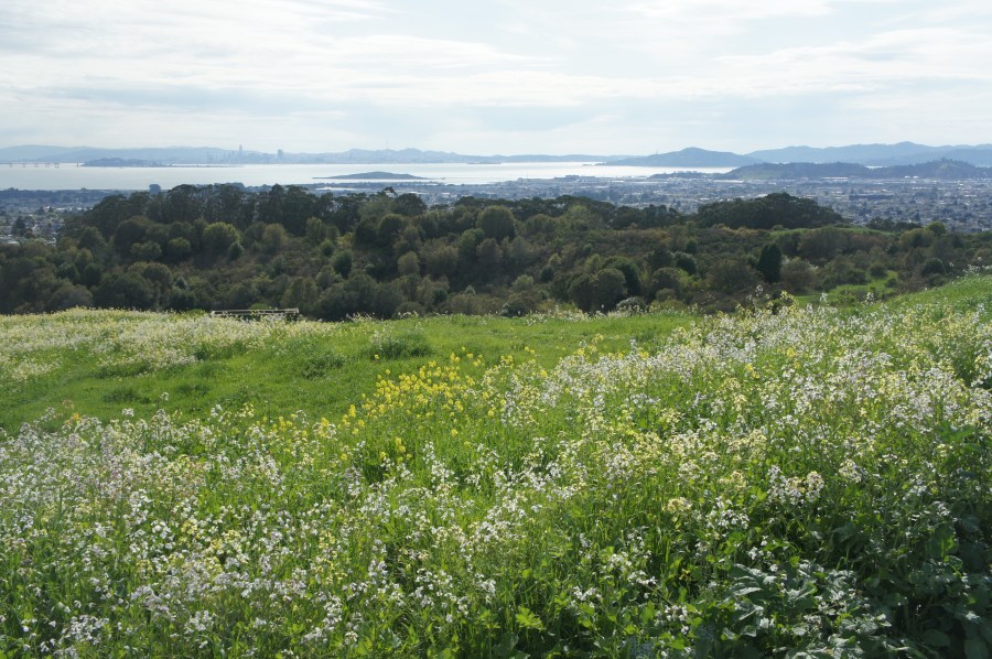
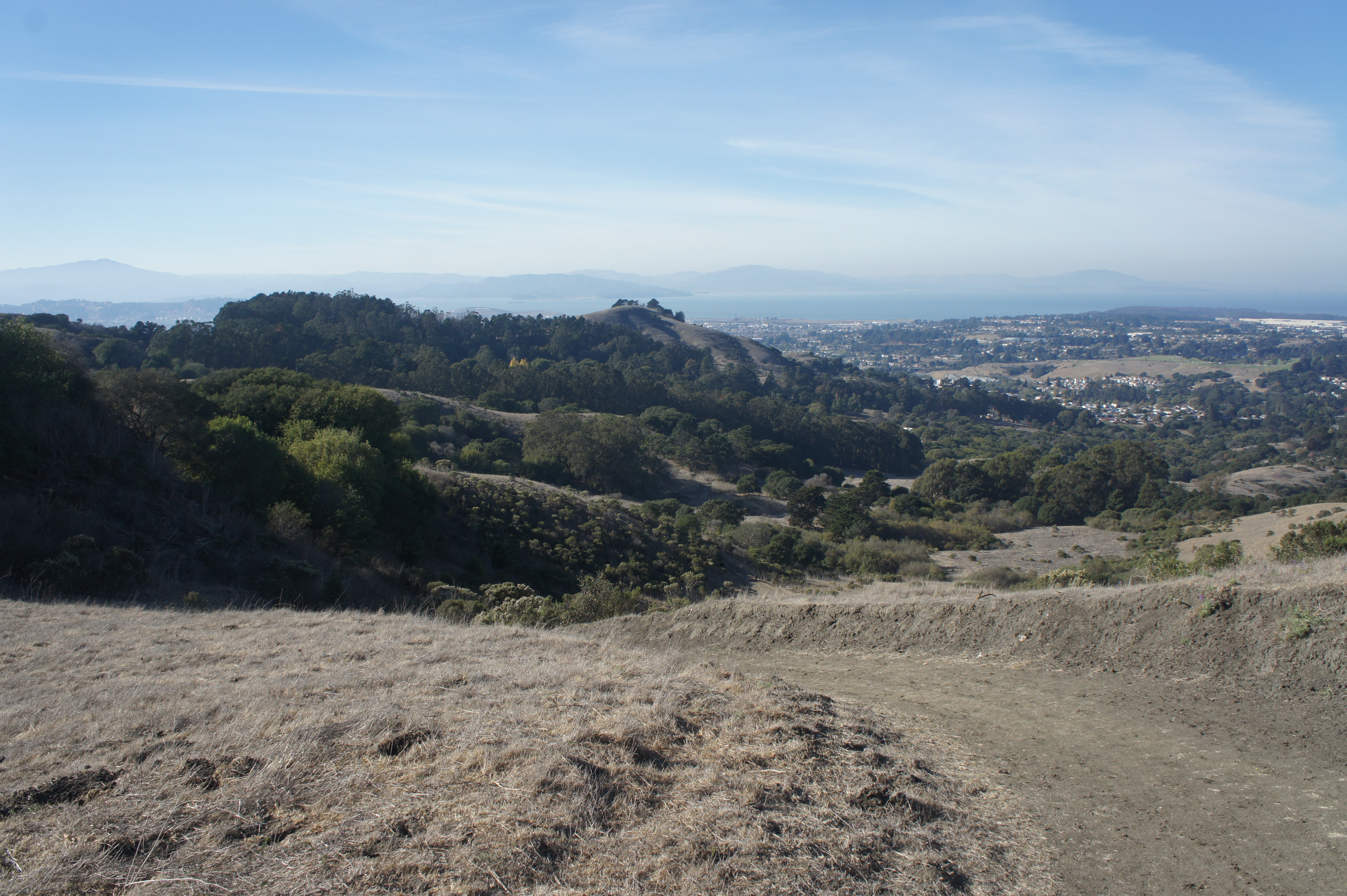
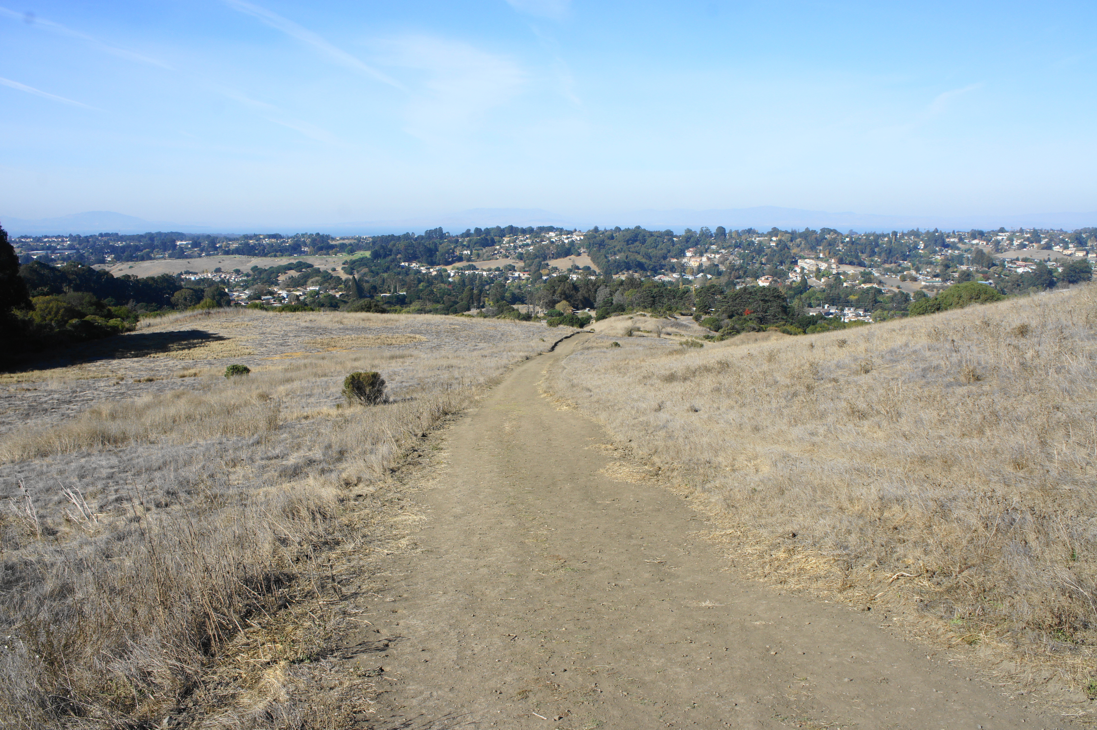
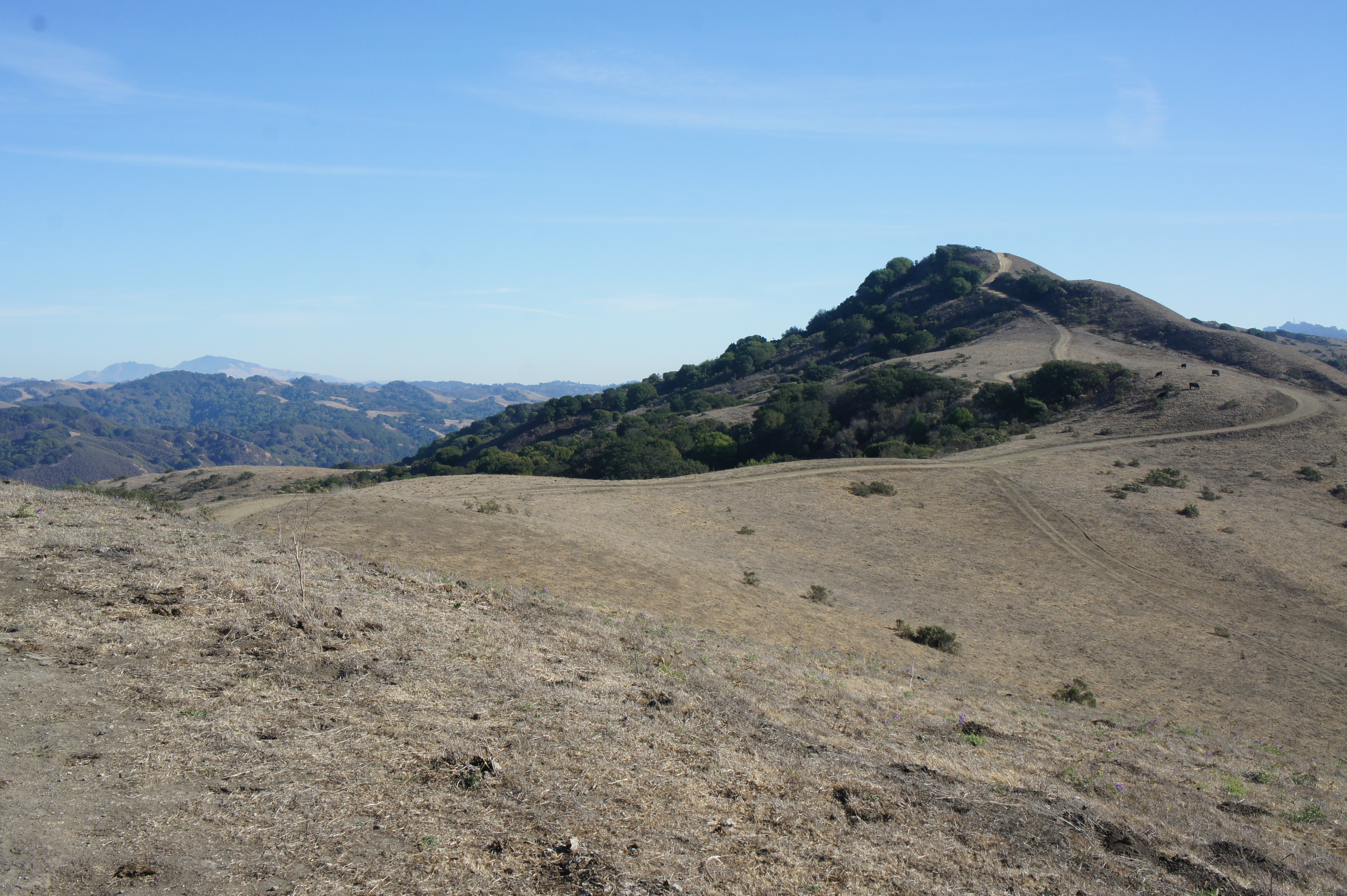
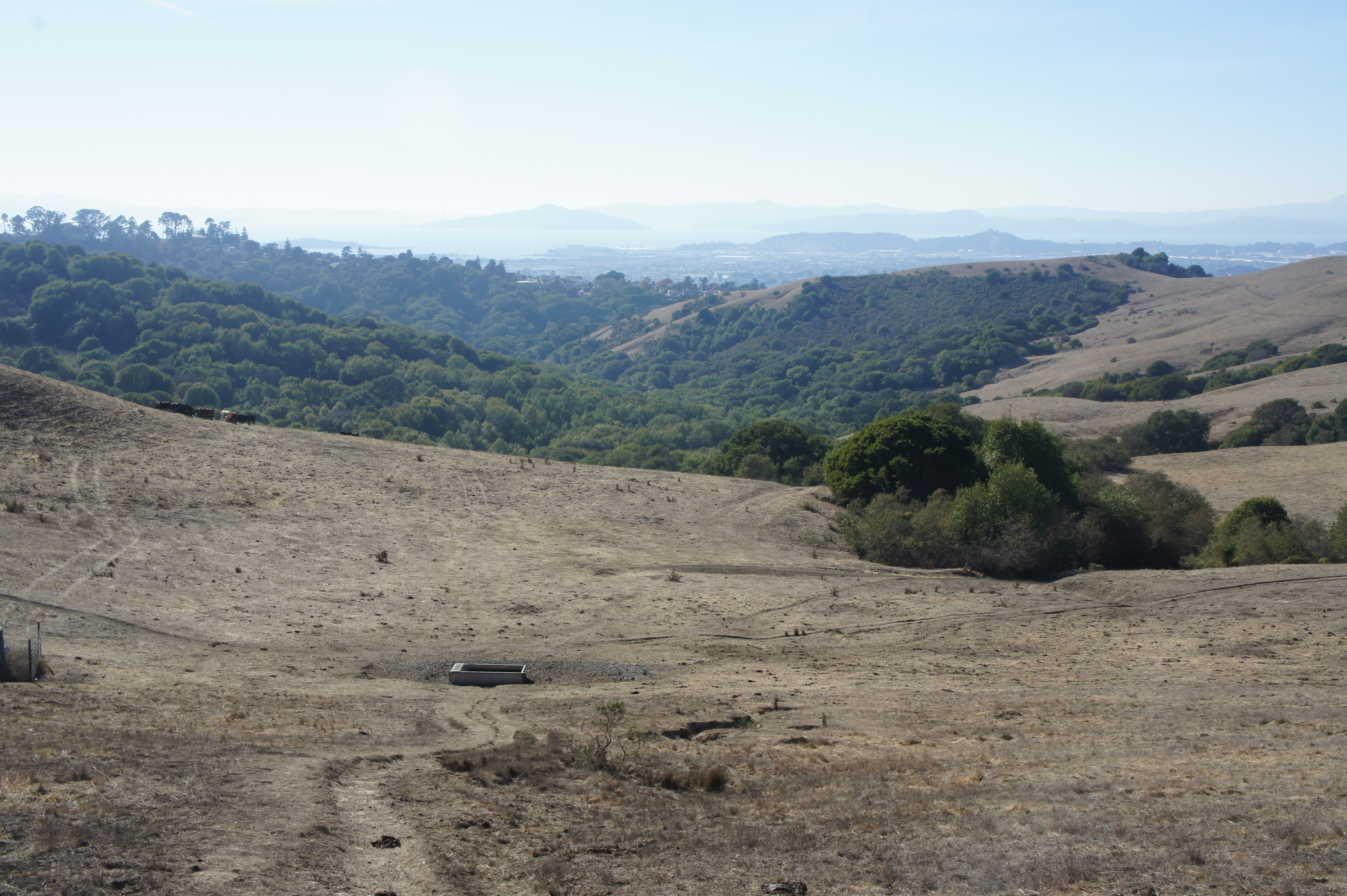
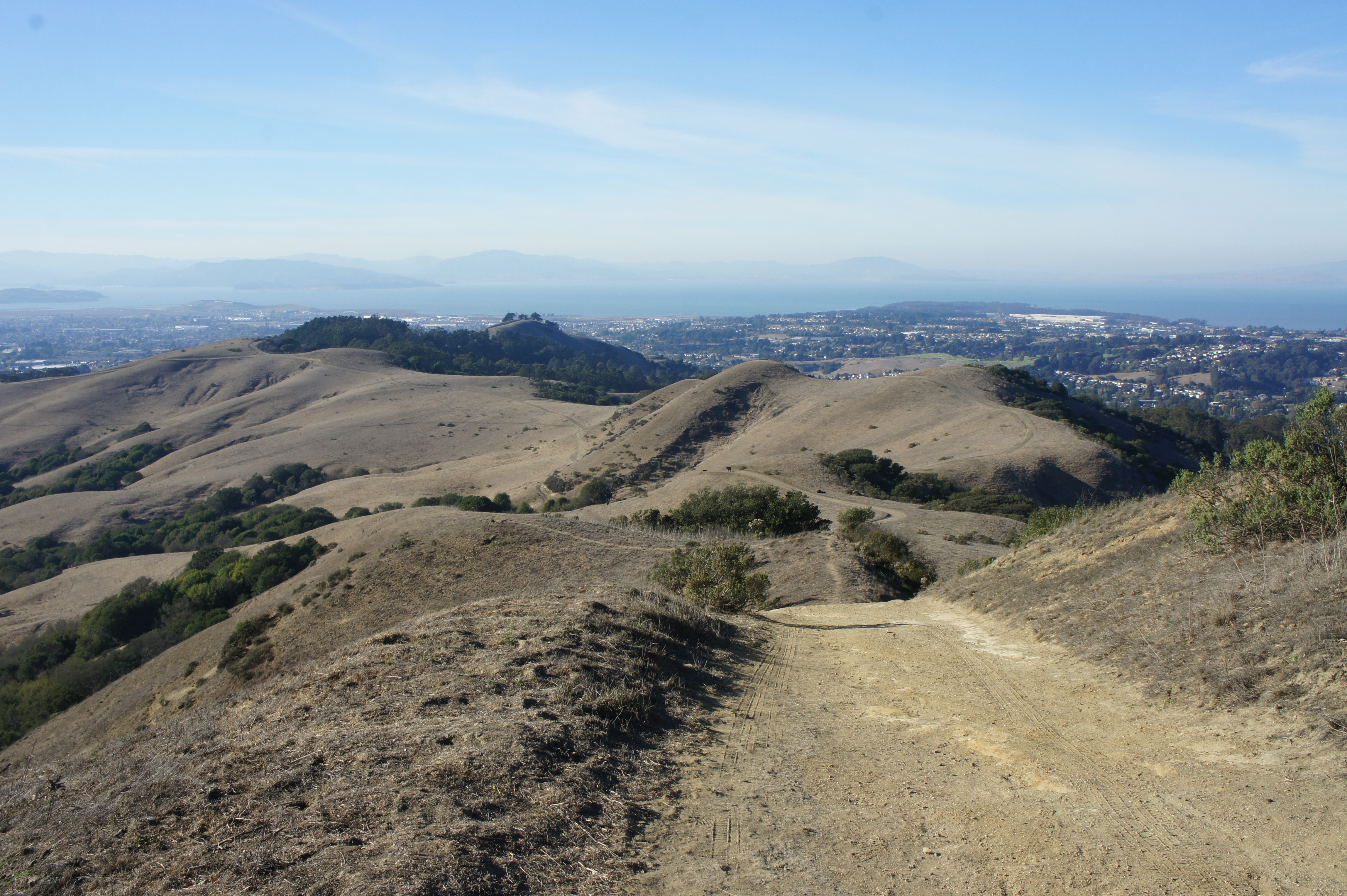
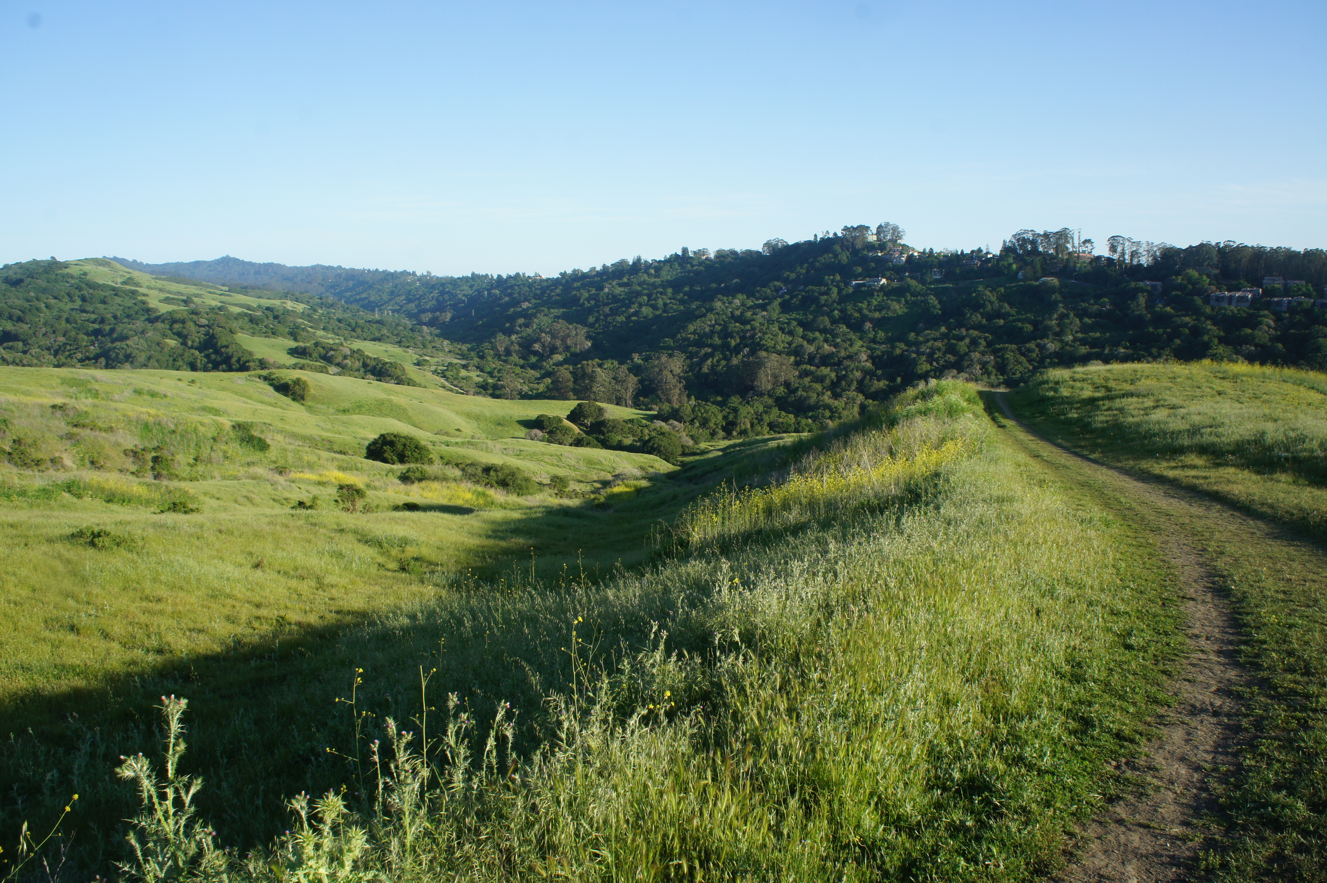
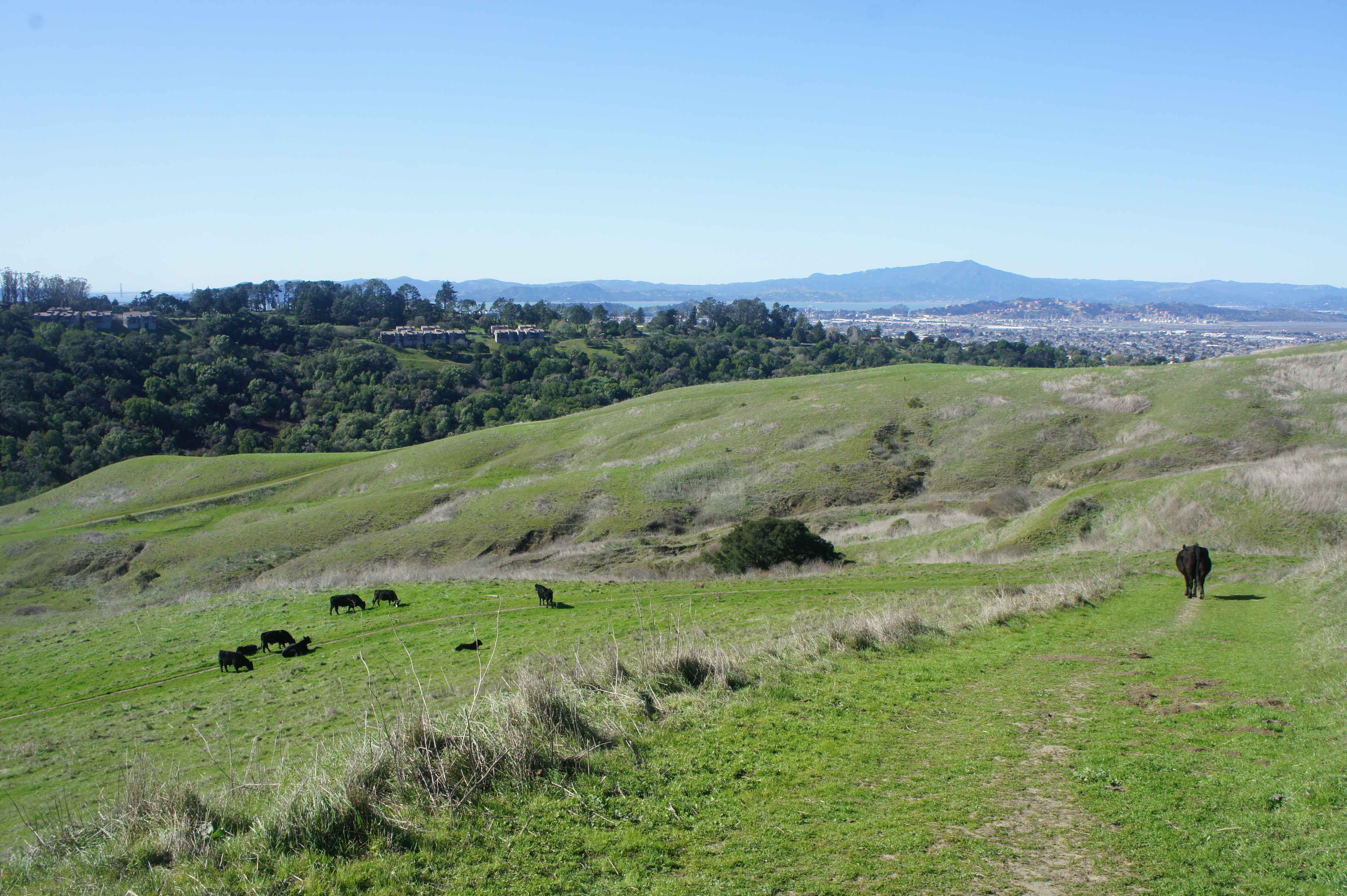
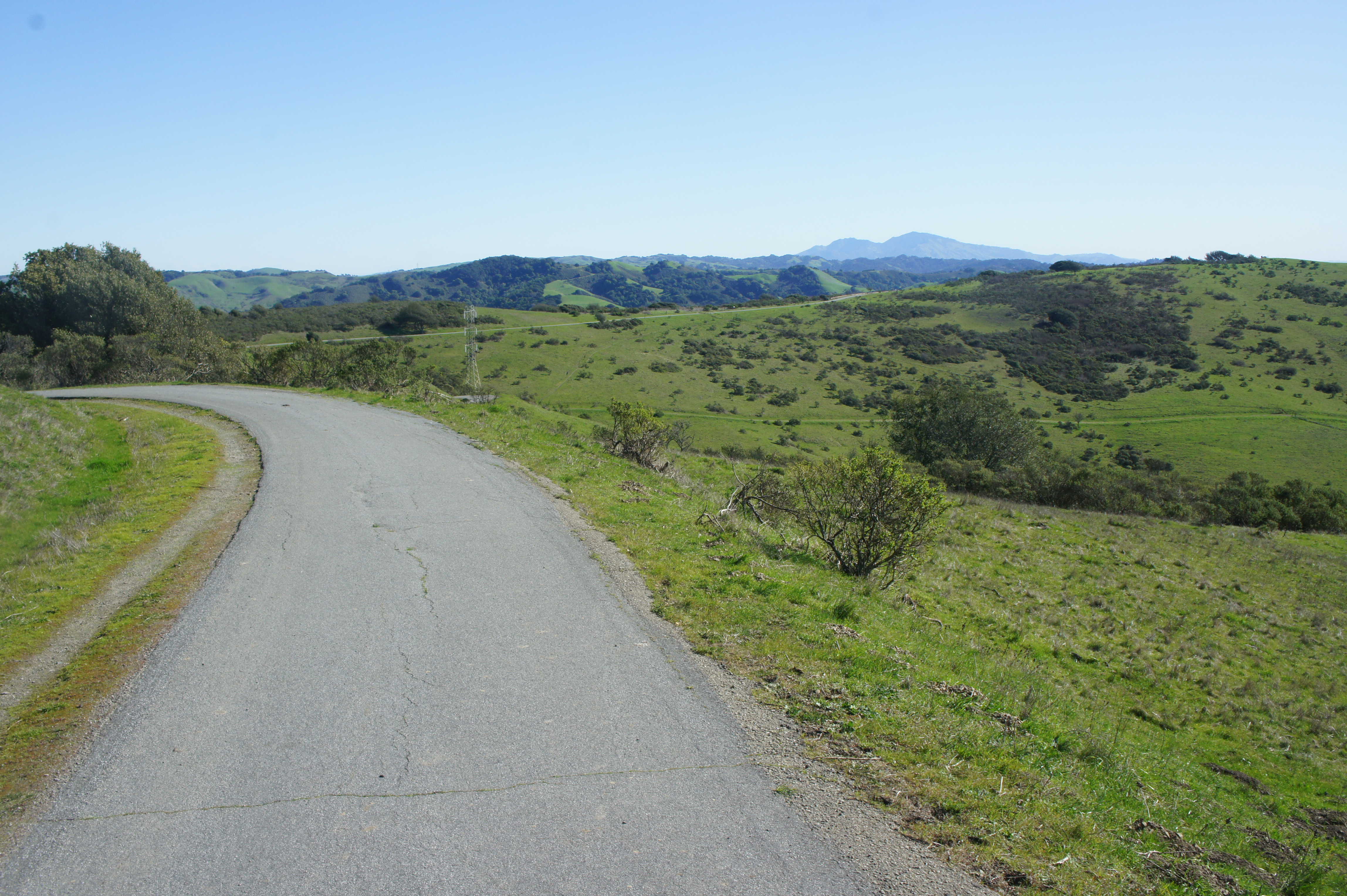
Longer hikes can be found in the broader Wildcat Canyon Regional Park. The main geographic feature is the bulky San Pablo Ridge, which towers several hundred feet above the Wildcat Creek drainage and extends southward into Tilden. The ridgetop has some of the area’s best panoramic views, especially west to the San Francisco Bay and Marin and north and east across the Carquinez Strait. Expect little shade on the hilltops, but a dense mix of bay laurel, live oak, and even deciduous varieties in riparian areas along Wildcat Creek. The descent from Rifle Ridge Road is particularly pleasant as it descends a woody slope.
Below I describe 12 hikes of varying difficulty, starting from three different trailheads.
Alvarado Staging Area
Alvarado (see map here) is the primarily staging point for hikes into Wildcat Canyon and is situated off Park Avenue in the heights above the City of Richmond. An initial entrance into Alvarado Park is rarely open to vehicles, but parking can be found about ¼ mile further east. Pull into the park on Wildcat Canyon Parkway and find a long stretch of parking spots on the left. For hikes in Alvarado Park, one can park near the entrance; for longer treks into Wildcat Canyon, it’s better to drive to the end of the parking to the east. There is a restroom partway up the road.
Alvarado Park: Alvarado Picnic Area Loop (0.5 mi. loop)
Difficulty: Easy
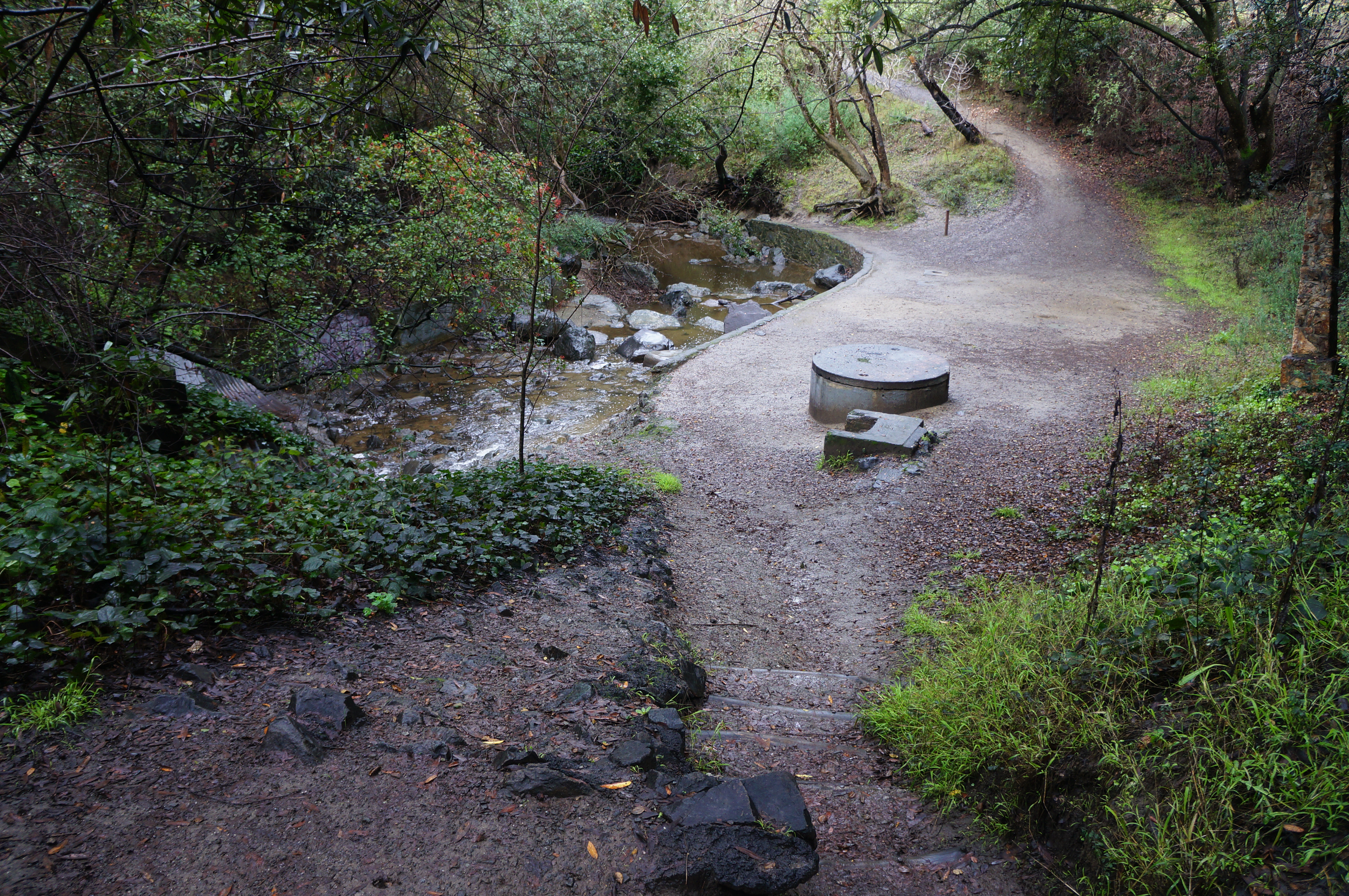
The shortest option on offer, this lovely circuit parallels Wildcat Creek and passes several picnic areas in Alvarado Park. From the staging area, walk back toward the entrance and find a sign, just before the bridge, directing hikers toward the Alvarado picnic areas. Take this path, then bear left and drop to a vantage overlooking the creek where it empties out of a drainage tunnel. Bear right, descending briefly to creek level, then rise again and stay left at two forks in quick succession. Parallel the stream and come to the playground and picnic areas at about 2/10 mile; take a hard left, cross the road bridge, and bear left at the “Camp Buckeye” picnic spot, set in the shade of a large stone outcrop. Follow the path westward along the south banks of the creek; the narrow trail traverses mild inclines before returning to the initial basin at the drainage tunnel. Bear right and return to the start, capping off the ½-mile stroll.


Alvarado Park: Lower Alvarado Loop (0.7 mi. loop)
Alternative Trailhead: North Arlington Boulevard
Difficulty: Easy
The most memorable part of Alvarado Park is the mature eucalyptus grove, which can be seen on this slightly-longer circuit beginning and ending at Alvarado Staging Area. Follow the first 2/10 mile of the hike described above, then continue straight through the picnic areas, following signs for “Camp Bay,” which is a modest picnic area set in a bowl below North Arlington Boulevard. Bear right from Camp Bay and enter the eucalyptus grove, staying straight at subsequent junctions until returning to the initial split near the trailhead. From here it is a short walk back to the parking area.


Alvarado Park: Upper Alvarado Loop (1.0 mi. loop)
Difficulty: Easy
This more challenging option weaves through the web of interlocking trails below a canopy of eucalyptus, with peeks of views to the broader Wildcat Canyon area. Take the wide path heading uphill from the west end of the parking area, entering the eucalyptus grove and bearing left. Stay left at the next two forks, then bear right just before the main track turns to pavement. Bear west on the shady path and take a hard right at the next junction, rising almost to the yellow house at the park boundary. From here the track bears east, paralleling the fenceline and narrowing as it bobs up and down through the eucalyptus stand. Stay on this trail until a junction at 7/10 mile with some limited views south and east to San Pablo Ridge and Wildcat Canyon. Bear right and descend sharply back to the initial junction, then head left to descend to the start.


Bonita Trail Loop (1.0 mi. loop)
Alternative Trailhead: Monte Cresta Avenue
Difficulty: Easy
Wildcat Canyon is best-known for its bald hills and sweeping views, and the short Bonita Trail Loop offers a small teaser of this landscape. From the staging area, follow the road eastward to its end, then take the wide and popular Wildcat Creek Trail before quickly turning left on the Bonita Trail, which rises mildly but steadily toward Monte Cresta Avenue. Just before the cul-de-sac, bear left on a connector trail leading back toward Alvarado. Staying left at the next junction, hikers get their best views of Wildcat Canyon, the Bay, and the city of San Francisco in the distance. Follow any route amid the many interlocking trails to descend through the eucalyptus-studded Alvarado area to return to the start.


Bonita – Monte Cresta – Belgum Trail Loop (2.5 mi. loop)
Alternative Trailhead: Monte Cresta Avenue
Difficulty: Moderate
This longer circuit combines sweeping views of San Francisco Bay with biodiversity that ranges from scrubby chaparral to pines, eucalyptus, and even a handful of palm trees. From the staging area, continue to the end of the road and onto the wide Wildcat Creek Trail, then bear left on the Bonita Trail. Climb 200 feet in elevation to the Bonita Gate, then bear right on the Monte Cresta Trail, which begins as a paved road. Bear right as the trail continues as a gravel track at ¾ mile, then peek through a brief gap on the left with eastward views of Martinez and the Carquinez Strait. From here, the untarnished views of the Bay to the west improve with each step, and the Monte Cresta Trail skirts a forest of splendid pines and eucalyptus. After a steep ascent, the hike reaches around 800 feet in elevation then drops to a fork at 1.5 miles. Bear right on the Belgum Trail, following it downhill—past the palm trees and the Belgum Sanitarium—to return to the Wildcat Creek Trail. Head right, then left at the next junction, to return to the staging area.


San Pablo Ridge – Wildcat Creek Trail Loop (5.7 mi. loop)
Difficulty: Moderate
Arguably the best half-day loop in the park, this 5.7-mile circuit combines views from San Pablo Ridge with the mild straightaways of the Wildcat Creek Trail. Follow Wildcat Creek Parkway to its end, then walk ¼ mile to the base of the Belgum Trail; head left and ascend, passing a spur to the ruins of the former Belgum Sanitarium, once an extravagant property used by patients with “nervous disorders.” Climb further as the tree cover fades, coming to a windswept ridge with scenic views; bear right at the fork with the Monte Cresta trail, then left and right 2/10 mile further. Trace San Pablo Ridge as the trail rises in spurts to one of the park’s high points at 1,057 feet. Descend and ascend again before reaching a fork with the Mezue Trail at 2.5 miles. Bear right and take this track all the way down to the bottom, culminating at a gate and junction with the Wildcat Creek Trail. Bear right and follow this mild track for nearly two miles, ending back at the Alvarado Staging Area.


Clark-Boas Trailhead
Not well-advertised, this second trailhead (see map here) includes a few parking spots at the end of Clark Road in El Sobrante, outside the park boundary. Follow the road to its end, past Wildcat Canyon Community School on the right. From the small parking area, continue on the Clark-Boas Trail—a fire road—to access the northern reaches of Wildcat Canyon Park.
Clark-Boas Trail to Green Ridge Trail (2.2 mi. out-and-back)
Difficulty: Moderate
This short out-and-back climbs the Clark-Boas Trail to the crest of San Pablo Ridge before edging eastward and north to the end of the Green Ridge Trail, which ends not-so-excitingly at a fence at the park boundary. There are increasingly impressive views as the Clark-Boas Trail climbs steadily to a gate entering the park at 6/10 mile and then to a 4-way junction 200 yards later. Bear left on the San Pablo Ridge Trail, which descends to clear a hillside and then forks again, with the Green Ridge Trail heading left for 2/10 mile to a gate, with private property beyond. Turn around here and return the way you came.
Clark-Boas Trail to Oil Well Trail Loop (2.4 mi. stem-and-loop)
Difficulty: Moderate
Instead of ending at an underwhelming side trail, try instead this longer and more scenic circuit, which drops to popular cattle watering hole and climbs to sweeping views along San Pablo Ridge. After the initial ¾-mile climb on the Clark-Boas Trail, stay straight at the 4-way junction, descending gradually along the Old Well Trail to a brushy ravine. After crossing the usually dry streambed, bear left up to the watering hole and ascend the cattle trail heading sharply up to a saddle on San Pablo Ridge Trail. Bear left on the wide path, which briefly ascends before dropping sharply to a junction with the Green Ridge and then Clark-Boas Trails. Return down the latter back to the trailhead.

Clark-Boas, San Pablo Ridge, and Old Nimitz Way Trails (6.5 mi. out-and-back)
Alternative Trailhead: Rifle Range Road
Difficulty: Moderate
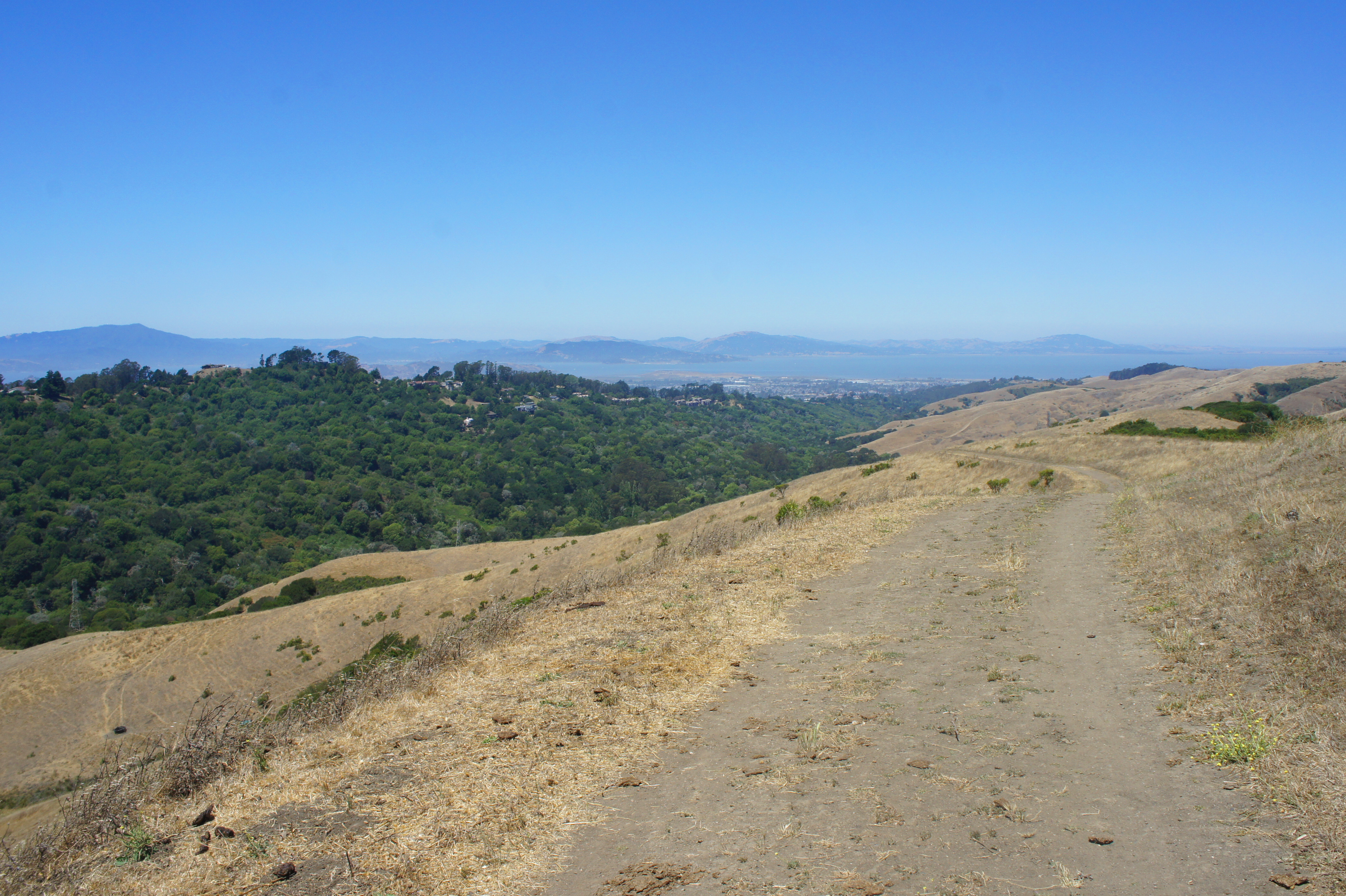
The 1.1-mile Old Nimitz Way would be a decent hike if it were not for the disappointing dead-end at the park’s northern boundary, requiring hikers to retrace the whole tread back up the hill. (Note: On Google Maps, the route appears to link back with the Green Ridge Trail to form a nice loop, but part of this is on private property with locked gates.) Thus there’s really little point in doing this track, except for completeness’ sake. But the 2.1-mile journey to the start of Old Nimitz is pleasant enough. Take the Clark-Boas Trail to its end, then head left on the San Pablo Ridge Trail and climb a series of steep hills (including a 1,057’ high point) with fine panoramic views of the Berkeley and Briones Hills and North Bay. Old Nimitz Way takes off to the left at the corral at 2.1 miles, descending gradually for 1.1 miles to the dead-end gate; there is decent shade in the afternoon and nice enough views—of Sobrante Valley, Briones, and San Pablo Reservoir—but nothing special compared to the more impressive San Pablo Ridge Trail. Return the way you came, completing a 6.5-mile out-and-back.


Rifle Range Road
This final trailhead (see map here), at the end of Rifle Range Road in El Cerrito, provides the quickest access to the rugged interior of Wild Canyon Regional Park. Parking is roadside here, with the sole access trail continuing as a fire road that snakes down the woody hillside to the canyon bottom. Several of the park’s most rewarding hikes begin from this spot.
Leonards – Mezue Trail Loop (3.1 mi. stem-and-loop)
Difficulty: Moderate
In a park with mostly longer loop options, the Leonards – Mezue Trail circuit is an exception. After descending the Rifle Range Road Trail into Wildcat Canyon, bear left on the Wildcat Creek Trail, then right on Leonards Trail. This scenic path ascends 500 feet in 8/10 mile, yielding scenic views of the Berkeley Hills, Richmond, North Bay, and beyond. At the top of the ridgeline, excellent vistas open up to the north and east. At 1.5 miles, bear left on the Mezue Trail, which winds westward amid rolling hills then descends another scenic ridgeline back to the Wildcat Creek Trail. Bear right on the wide path, then follow the Rifle Range Road Trail back up 300 feet to the trail’s start.


Havey Canyon – Nimitz Way – Leonards Trail Loop (4.9 mi. stem-and-loop)
Difficulty: Moderate
This moderately-difficult circuit runs through the heart of the park, climbing from Wildcat Canyon to San Pablo Ridge with sun-soaked views of Richmond, San Francisco Bay, Marin, and beyond. Start by descending sharply on the Rifle Range Road Trail for 6/10 mile, then cross Wildcat Creek and bear right, before quickly veering left on the Havey Canyon Trail. This track ascends mildly through a brushy drainage before popping out into the open at around 1.7 miles. Follow the path to its end at Nimitz Way, a paved—then graveled—path bearing west along San Pablo Ridge. Enjoy terrific views of the Bay to the west, as well as the Briones Hills and Mount Diablo to the east. At the old corral at 2.9 miles, bear left, then left again on the Mezue Trail, descending a grassy ridge. Head left on the Leonards Trail at 3.3 miles and follow it back down to Wildcat Canyon. Head left on the Wildcat Creek Trail, then right on the Rifle Range Road Trail, following it uphill back to the trailhead.

Conlon – Wildcat Creek Trail Loop, including Wildcat Peak (7.1 mi. stem-and-loop)
Difficulty: Moderate
While most climb scenic Wildcat Peak (1,211’) from neighboring Tilden Regional Park (see hike here), this terrific alternative approach is longer and more gradual. Drop down the Rifle Range Road Trail to the Wildcat Creek Trail, then bear south for 2/10 mile to the junction with the Conlon Trail. Heading left on Conlon, follow the mildly sloping path as it ascends a scenic ridgeline with expansive views of San Francisco Bay before bending left to a junction overlooking San Pablo Reservoir and the Briones Hills. Follow the southbound Nimitz Way (paved) for 4/10 mile, entering Tilden Regional Park, then ascend to the shady Rotary Peace Grove and Wildcat Peak summit, which offers one of the best panoramas in the Berkeley Hills. From here, descend the winding Wildcat Peak Trail toward Jewel Lake, and stay right at the next three signed junctions. Follow the wide and relatively level Wildcat Creek Trail back to the Rifle Range Road Trail and ascend back to the start, capping off a terrific 7.1-mile stem-and-loop.


Pingback: Hikes in Wildcat Canyon Regional Park – Stay and Permit Hike - Yosemite Fitness
Pingback: Top 5 Hikes in Wildcat Canyon Regional Park – Live and Let Hike
Pingback: Top 10 Hikes in 2024 – Live and Let Hike