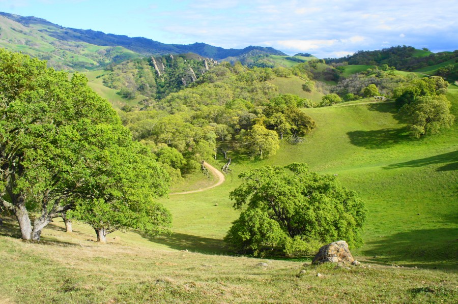
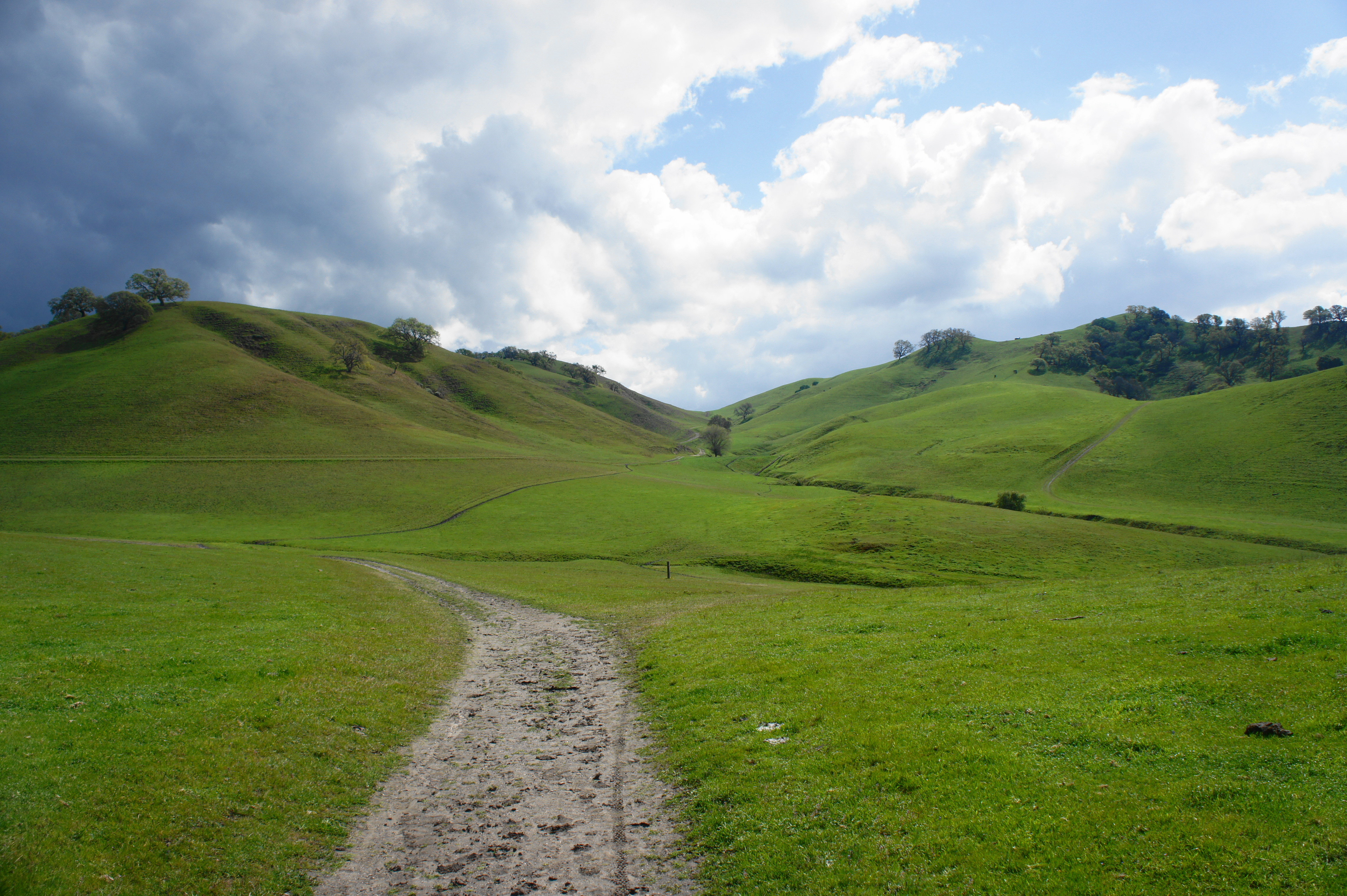
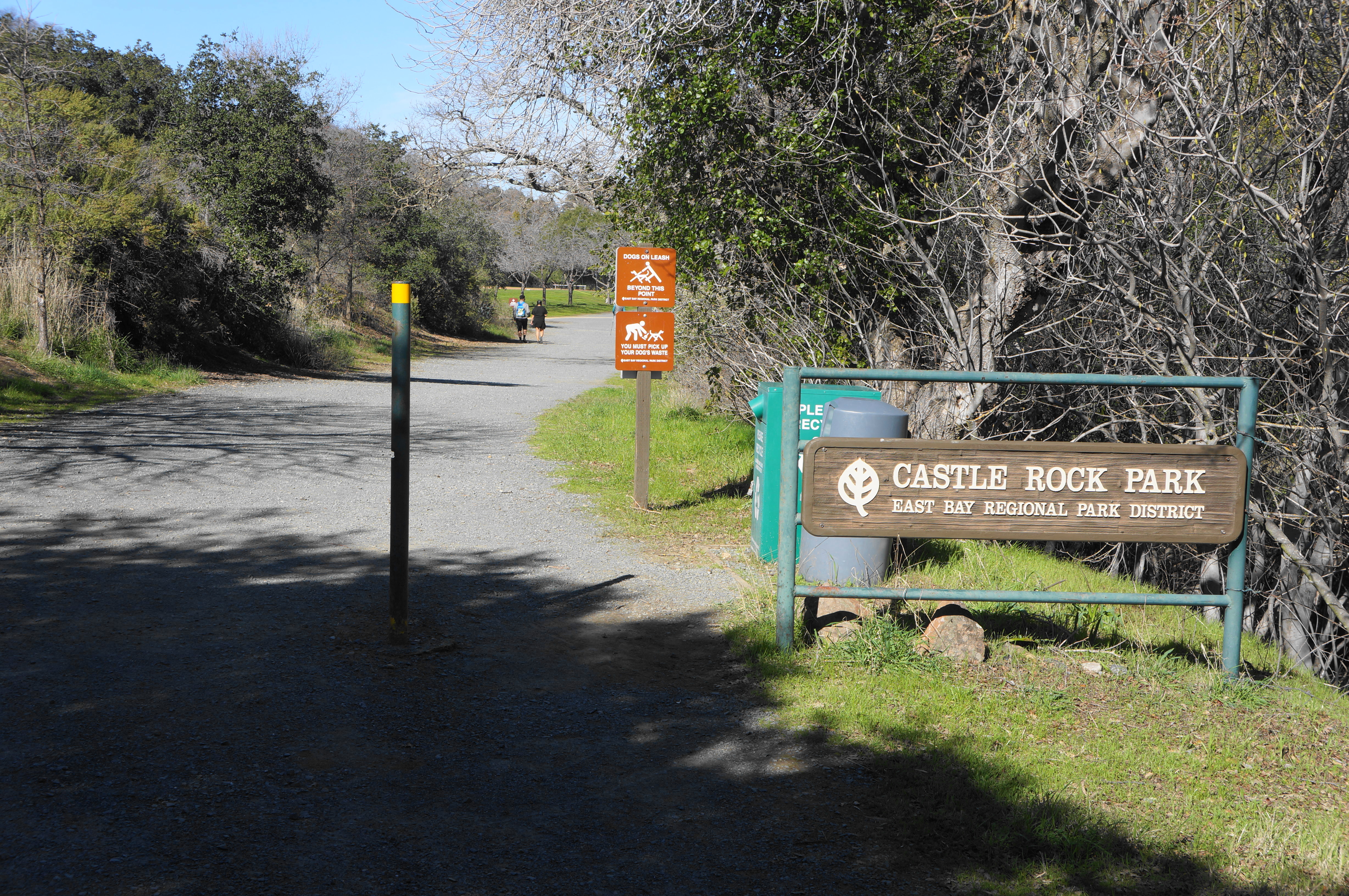
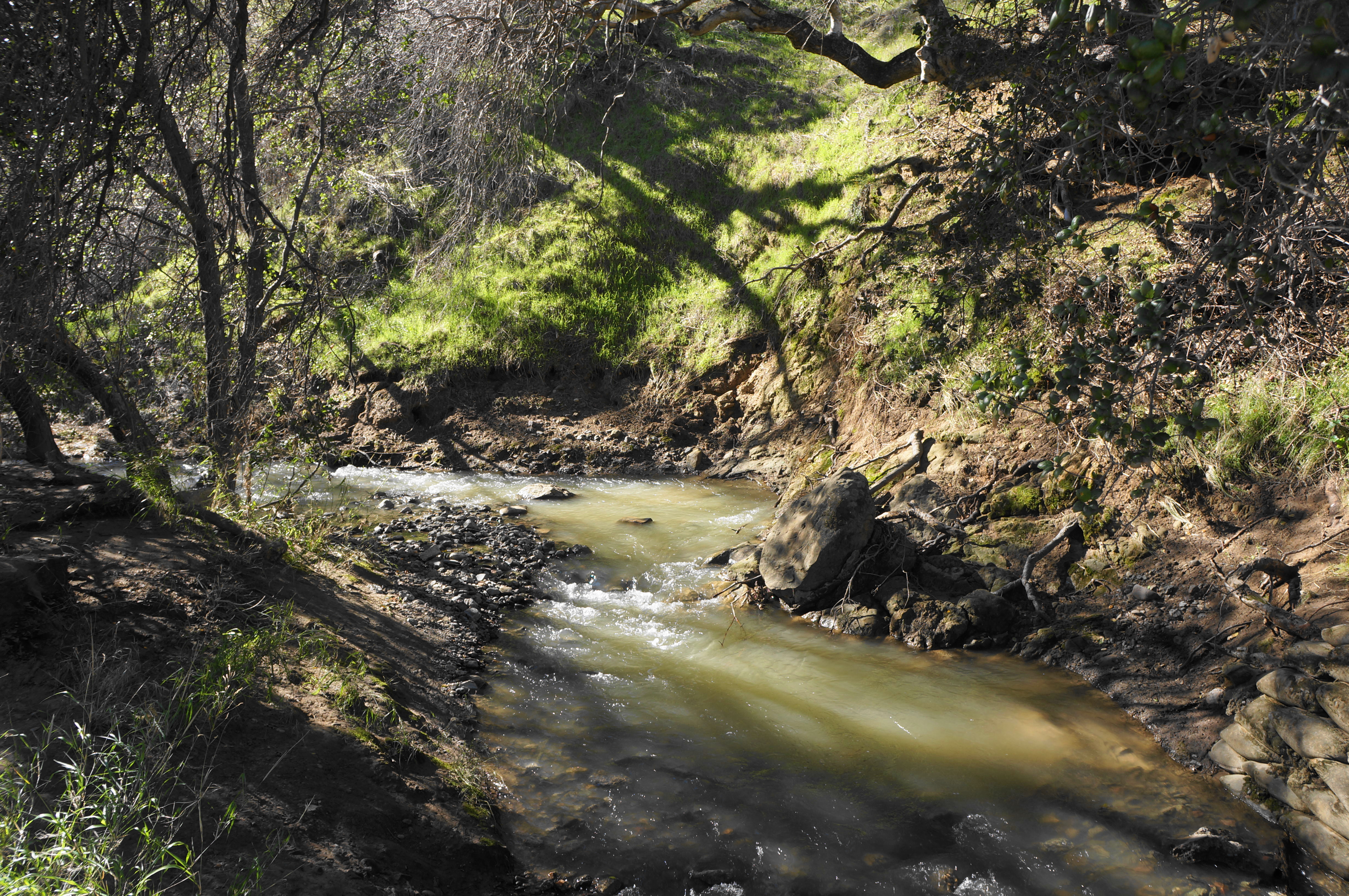
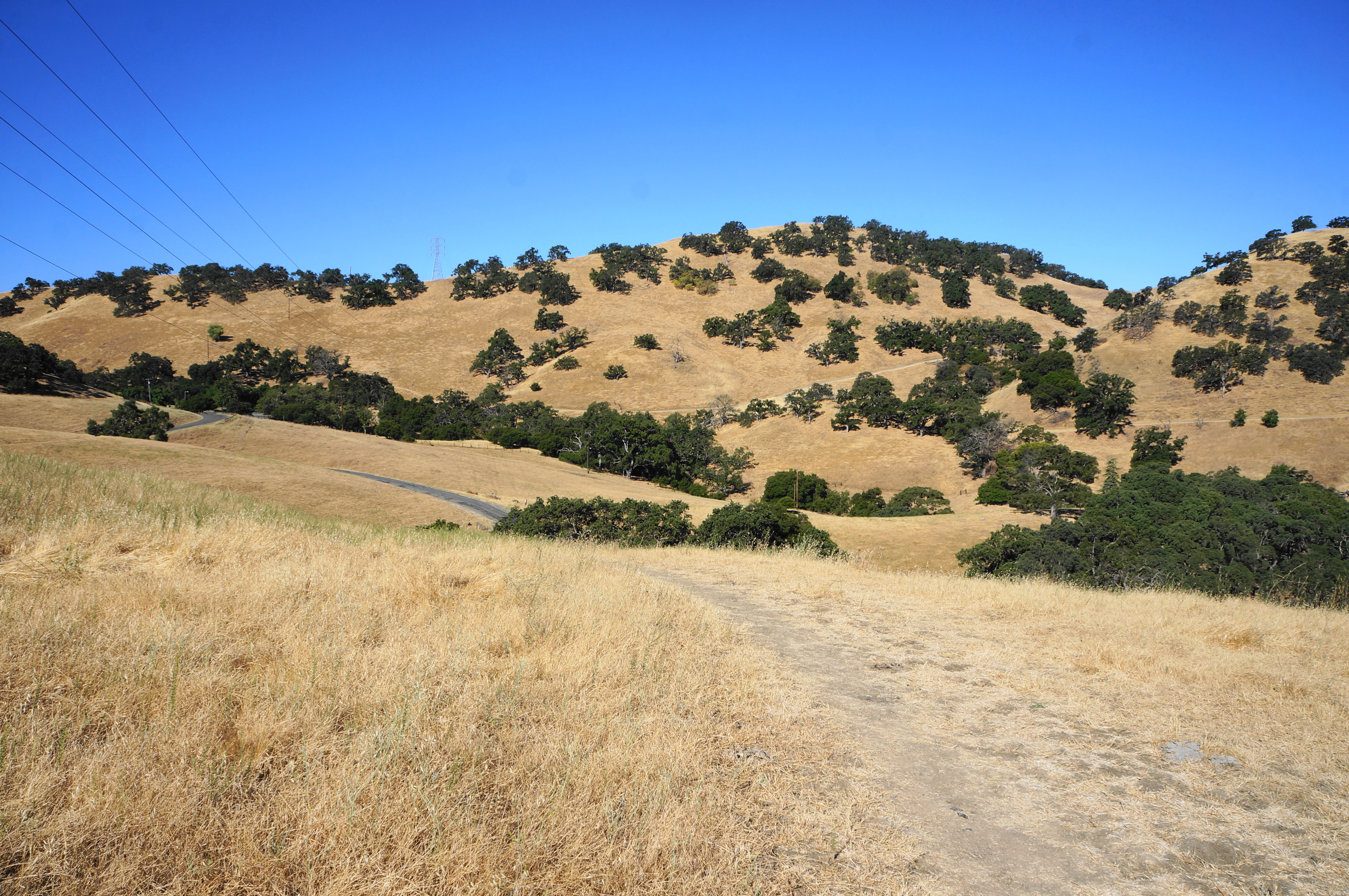
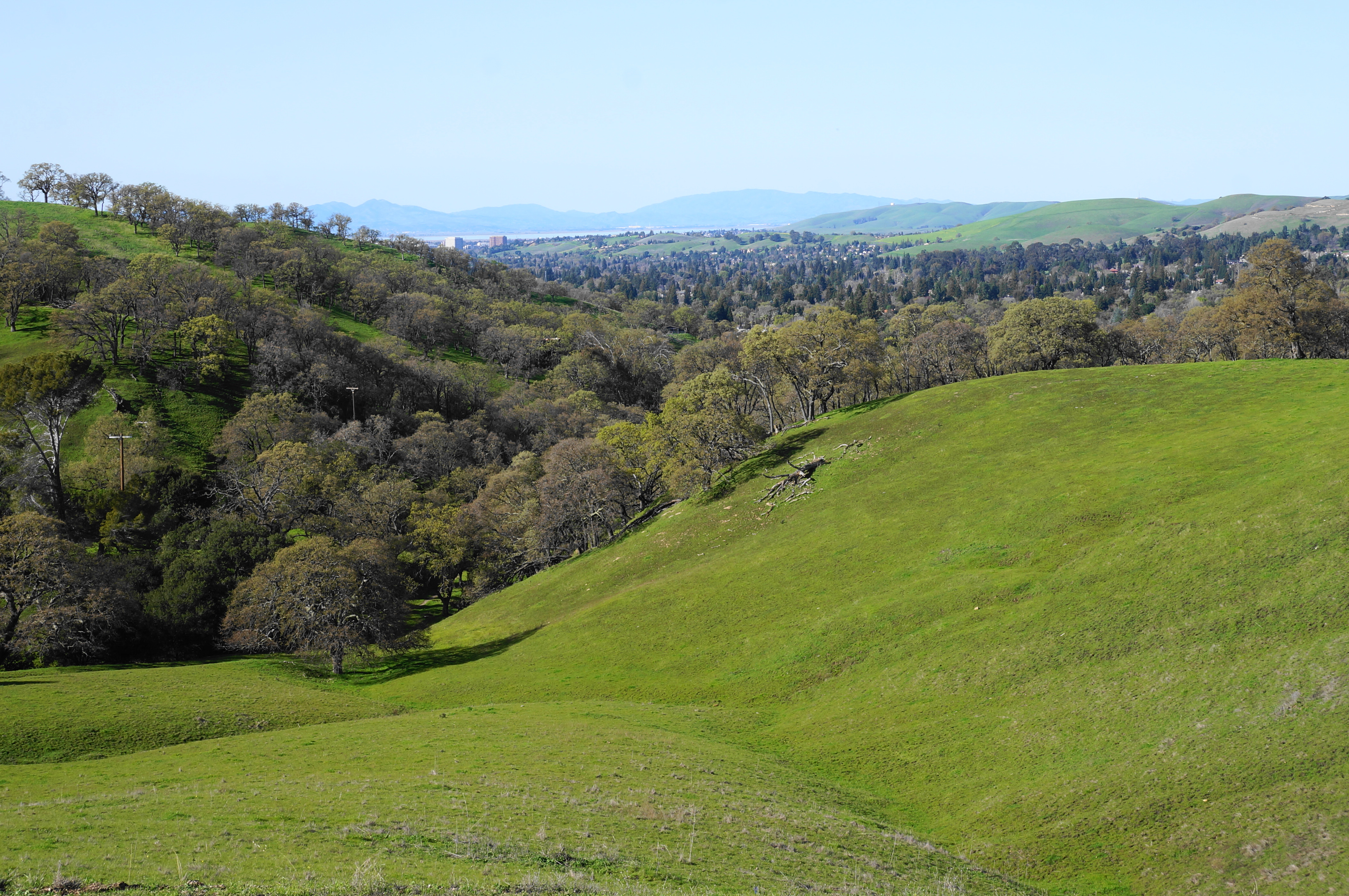
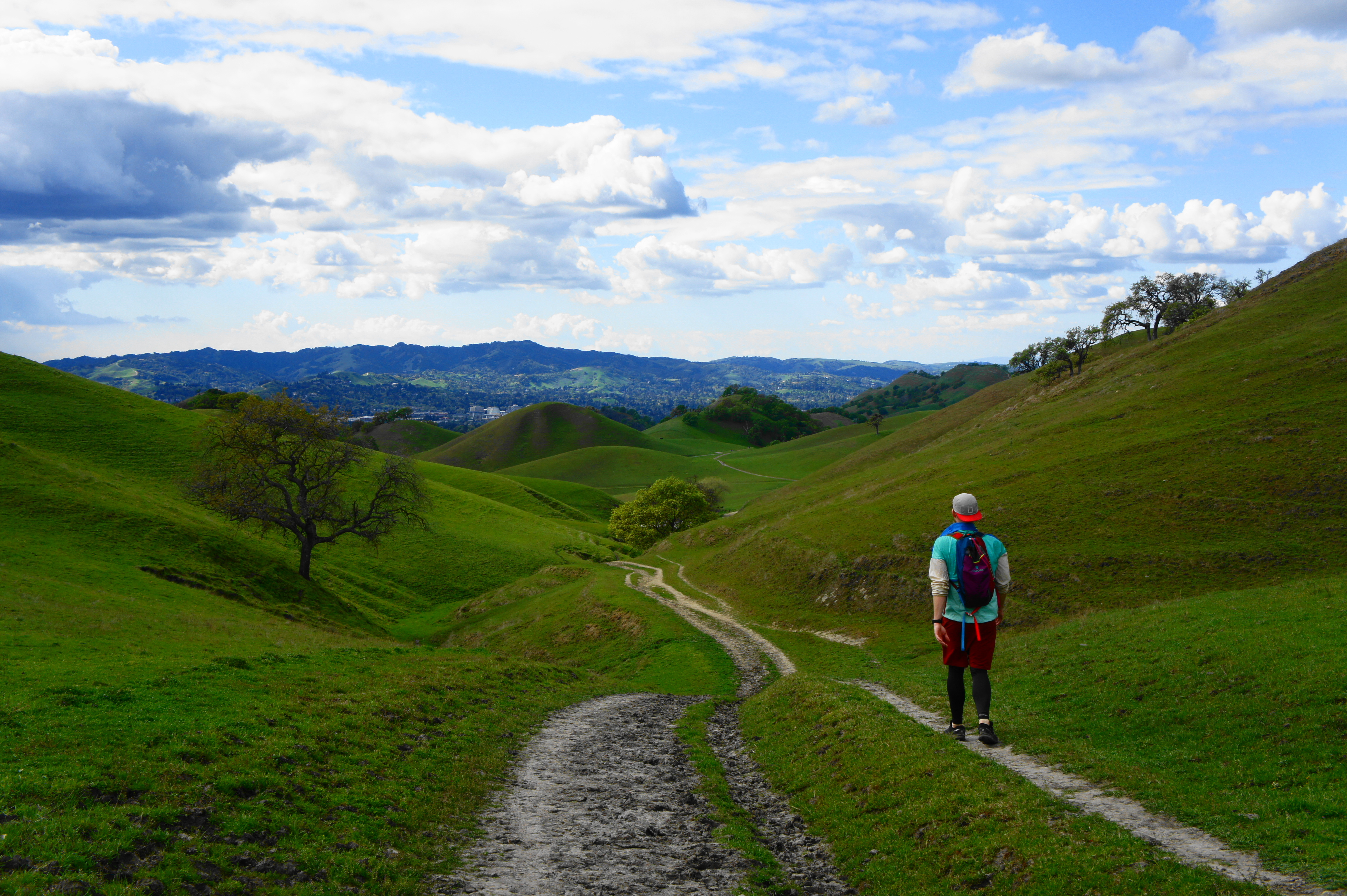
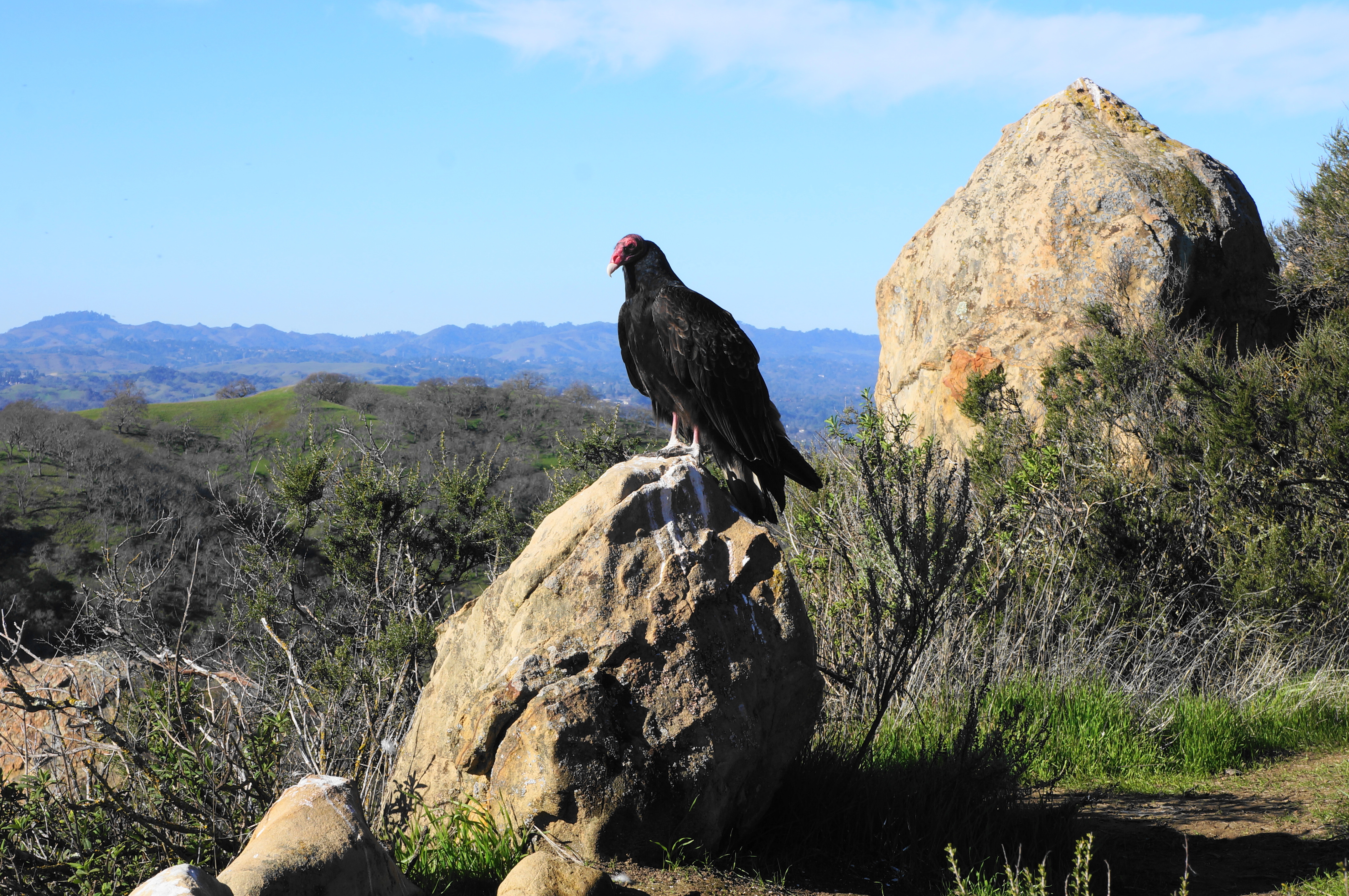
Covering a portion of a scenic hogback fanning out westward from Mount Diablo, Diablo Foothills Regional Park is—at 1,060 feet—relatively small and has only one peak that exceeds 1,000 feet. Yet, at least in winter and spring, the area is exceptionally picturesque. The terrific trail network, set in the shadow of the mighty mountain, traverses rounded hills, windswept grasslands, shady valleys, and craggy ridgetops. The park also subsumes the smaller Castle Rock Regional Recreation Area, which contains picnic areas, sports fields, and a small swimming pool – a popular spot for weekenders. The main geographic features are charming Pine Canyon (fed by Pine Creek, which maintains a decent flow through early summer) and intimidating Shell Ridge, a camelback composed of rock around 12 million years old.
Trailheads are relatively few, with most concentrated along or near Castle Rock Road in Walnut Creek. Orchard Staging Area (map), the largest parking lot by far, is located near the end of Castle Rock and is bustling on weekends but is seemingly closed during the week. For weekday access, drive to the nearby Castle Rock Trail Staging Area (map), much smaller but about ¼ mile closer to the Castle Rock picnic areas and southbound hiking trails. (Note: If full on a weekend, park at Orchard Staging Area and follow a ¼-mile track along the road to the Castle Rock parking lot.) An alternative option is the parking lot at Old Borges Ranch (map) just outside the park boundary in the adjacent Shell Ridge Open Space. Finally, the southern reaches of the park are most easily accessed from the Livorna Staging Area (map), situated along Livorna Road in a ritzy Alamo neighborhood.
Wherever one starts, once on the trails, loop options abound, with opportunities also for longer journeys into neighboring Mount Diablo State Park or Shell Ridge Open Space. Ten route options, mostly loops, are highlighted below. (Note: Most stay within the confines of Diablo Foothills, but this is also a good access point for the China Wall and Castle Rocks areas of Mount Diablo State Park.)
Castle Rock – Stage Road Trail Loop (1.1 mi. loop)
Trailhead: Castle Rock Trail Staging Area
Difficulty: Easy
The shortest and easiest loop on offer, this 1.1-mile route cuts around and through Castle Rock Regional Recreation Area. From the staging area, look for a trail heading east up an oak-laden slope; take this path as it bears south and intersects with a wider track; bear left and follow the Castle Rock Trail for ½ mile, enjoying views across the valley to the striated hills. Stay right at a junction at ½ mile (the singletrack trail headed right appears permanently closed), then drop to a gate and junction. Swing left, pass through the gate, and follow the wide Stage Road Trail through the heart of the park. Pass two picnic areas on the right and a baseball diamond on the left, then stay straight as the route becomes paved and crosses Pine Creek. From here it is a short and level walk back to the start.

Castle Rock – Borges Ranch Trail Loop (1.25 mi. loop)
Trailhead: Orchard Staging Area
Difficulty: Moderate
This combo of trails forms a circuit in the northern reaches of the park, traversing a low pass and two sides of the ridgeline with modest views. From the Orchard Staging Area, head west on a clear path, through a set of gates, and rise to a junction, bearing right to surmount the low saddle. Stay right and descend to the ranch area—with distant views to Concord and Solano Country—then cut right on the Borges Ranch Trail at about 4/10 mile. Follow this track, paralleling Borges Ranch Road and Castle Rock Road, as it rounds a right-hand bend and returns back to Orchard Staging Area, completing a 1.25-mile walk.


Northgate Trail (2.0 mi. stem-and-loop)
Trailhead: Orchard Staging Area
Difficulty: Easy
A relatively uninteresting track that encircles a smaller tract east of Castle Rock Road, the Northgate Trail is nonetheless popular with horseback riders and connects to the entry station for Mount Diablo State Park. From Orchard Staging Area, walk out to the road, cross it, and find the start of the Northgate Trail, wedged between two private horse stables. Follow the gravel track to a short bridge, then bear right at the fork, following and crossing (3 times) Pine Creek before emerging out into the open and rising gently to North Gate Road. Bear left on the road and follow it for 6/10 mile to the Mount Diablo North Gate Entrance Station, where the trail continues left, paralleling a fence. Descend to a point where the trail takes a hard left (pass through a gate), then rise partway up a ridge before dropping again to another gate at 1.7 miles. From here it is a short jaunt, behind the horse stables, back to the start of the loop. Head left, cross the bridge, and return to Castle Rock Road.


Castle Rock – Shell Ridge Loop (2.25 mi. loop)
Trailhead: Castle Rock Trail Staging Area
Difficulty: Moderate
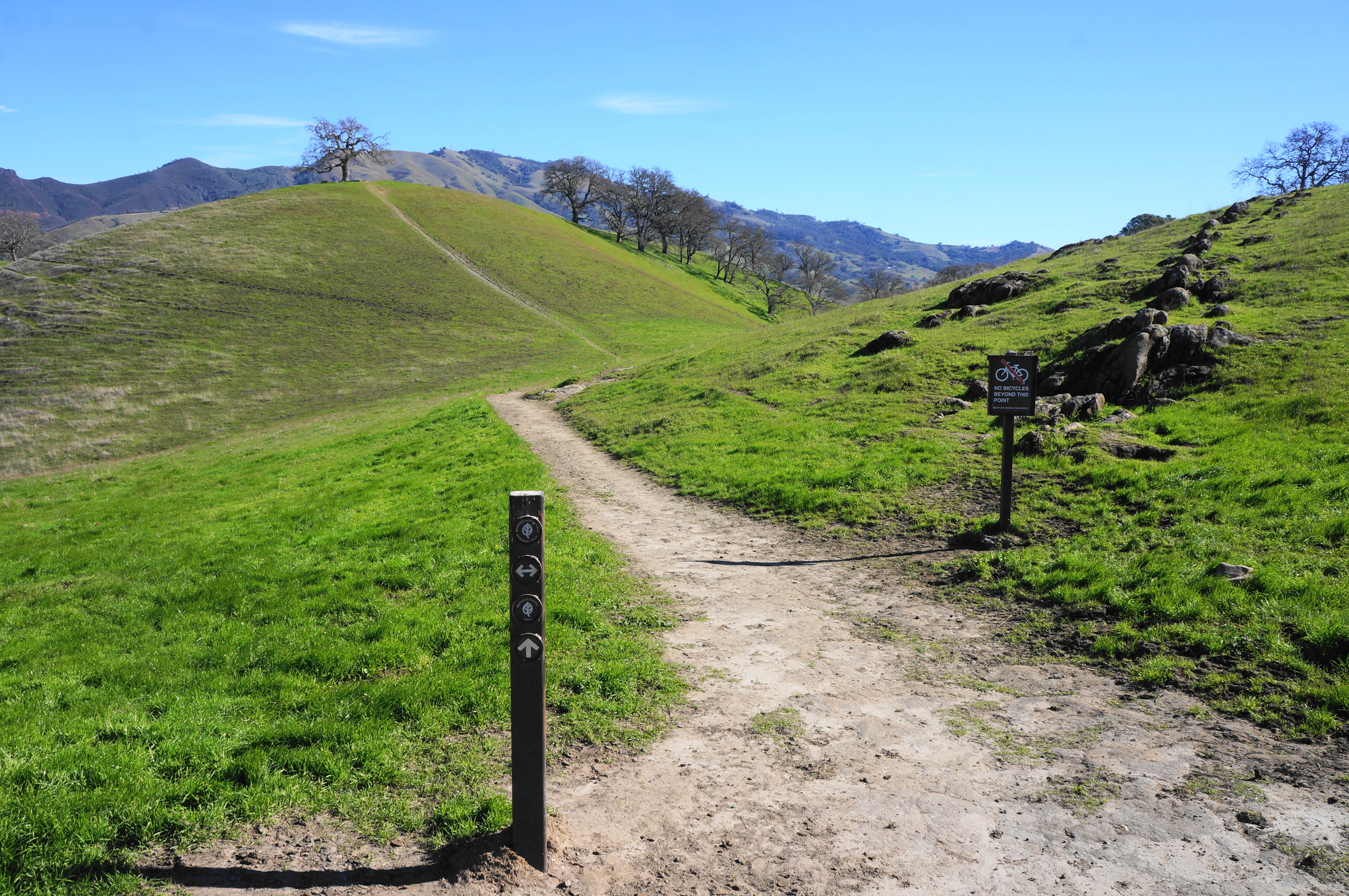
Considerably more interesting—and challenging—than the first three hikes above, this loop offers sweeping views across the foothills to Mount Diablo, in addition to a robust workout. From the staging area, find a marked singletrack heading south, then merge with a wider dirt track; this is the Castle Rock Trail, which bears south, dipping into Pine Canyon. Follow it for 6/10 mile, then take a right on the Fairy Lantern Trail, which gently ascends a tributary ravine. Stay right at the next fork, then left, ascending the steep Shell Ridge Trail, cresting a high point at around 1.4 miles. Enjoy the grand views of Mount Diablo, Castle Rocks, and beyond as you drop to another fork. After bearing left, traverse the ridgetop to the Diablo Scenic Trail, which heads right and descends sharply—be very careful—back toward the start. Stay right at the next two forks to return to the staging area.


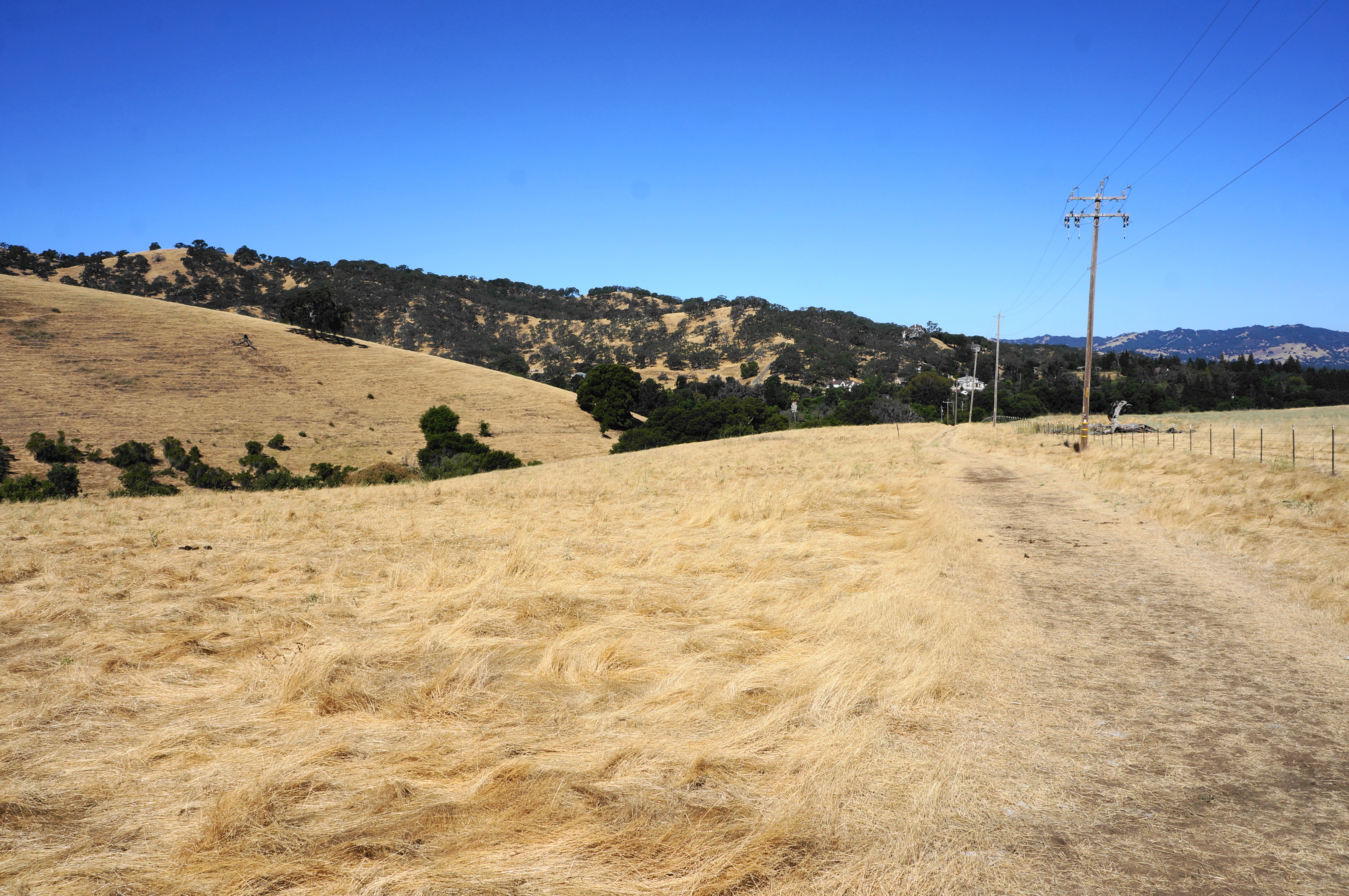
Hazard Hill – Franco Ranch – Foothills Trail Loop (2.4 mi. stem-and-loop)
Trailhead: Livorna Staging Area
Difficulty: Moderate
Dipping into neighboring Shell Ridge Open Space, this moderately-difficult circuit ascends quickly to open highlands with excellent views of Mount Diablo and surroundings. Start at Livorna Staging Area in suburban Alamo, following the Foothills Trail out of a residential neighborhood, then descend to clear the Hazard Creek drainage and climb the sun-soaked hilltop to a gated junction with the Hazard Hill Trail. Bear left, dropping to the Franco Creek drainage, then bear right and ascend the Franco Ridge Trail into the rolling hills. Head right at the next two junctions, bearing east and dropping close to Bullfrog Pond, where a narrower singletrack leads south, ascending to a low pass at 1.6 miles. Bear right again, climbing further along a scenic ridgeline, then drop back to the original junction. After another right, return 4/10 mile to the staging area.


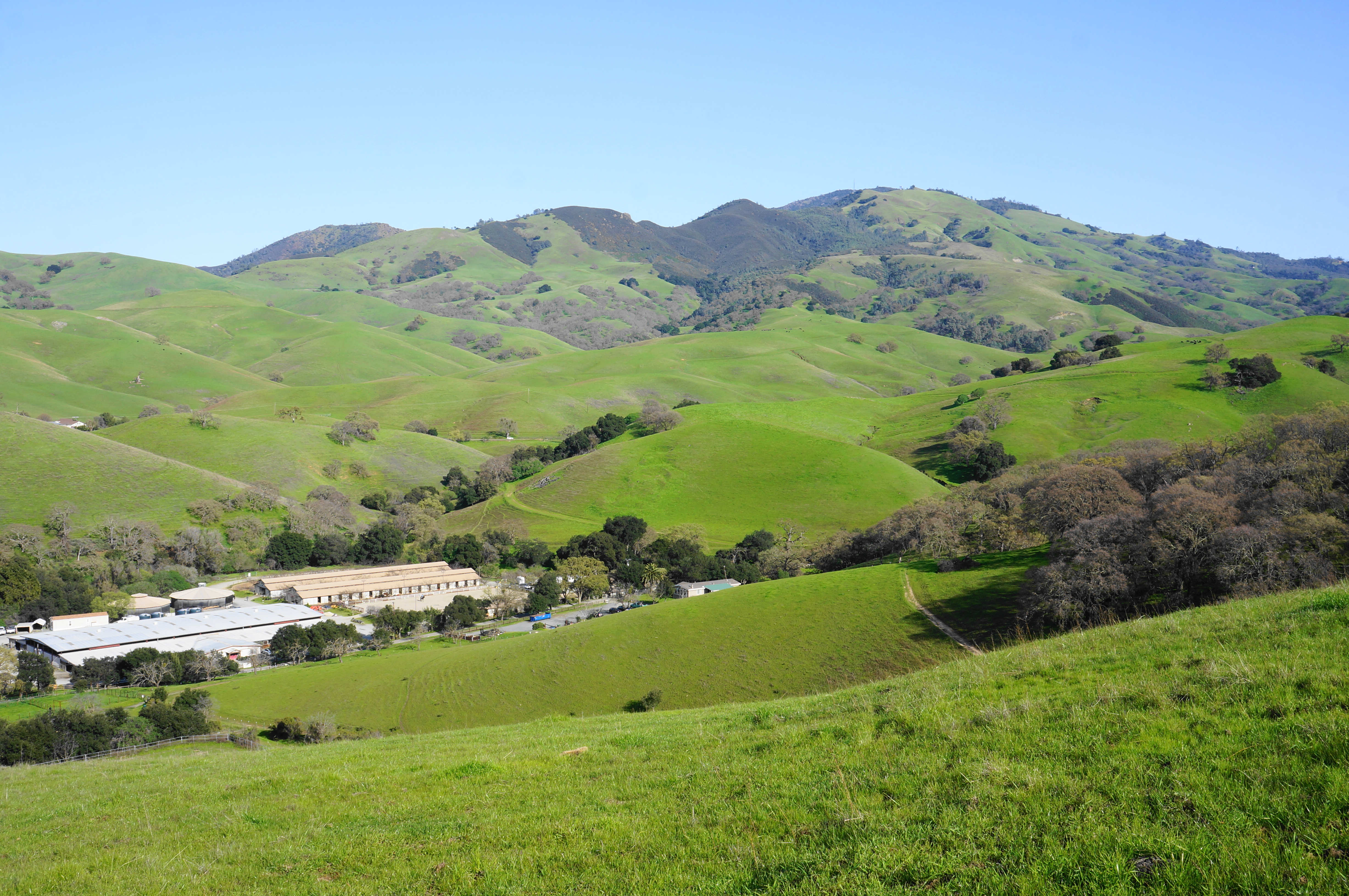
Borges Ranch – Shell Ridge Loop (2.5 mi. loop)
Trailhead: Old Borges Ranch
Difficulty: Moderate
Entering the park from the west, this alternative route climbs Shell Ridge from Old Borges Ranch, traversing several ups-and-downs over the course of a scenic 2.5-mile trek. From the parking at Old Borges Ranch in the adjacent Shell Ridge Open Space, head north on the grassy Borges Ranch Trail, bearing right to descend to Bob Pond and Hanna Grove Picnic Area. Cross the street, finding a thin trace—appearing as little more than a cattle track—which parallels the road and enters Diablo Foothills Regional Park. Eventually the narrow track widens and climbs away from the road, ascending to a junction at 4/10 mile; stay right, ascending further to Shell Ridge. Bear right on the Shell Ridge Trail, rising to heights overlooking Pine Canyon. Then bear left at the next junction, dropping and rising again, before taking the Shell Ridge Loop Trail left down into a secluded gully. Stay left, then take the next two rights, following the wide, old ranching track to Portuguese Gap. Pass through the gate, reentering Shell Ridge Open Space, skirt Buckeye Hill, and take a right at the final junction, descending to the trailhead.

Buckeye Ravine Trail Loop (2.8 mi. stem-and-loop)
Trailhead: Castle Rock Trail Staging Area
Difficulty: Moderate
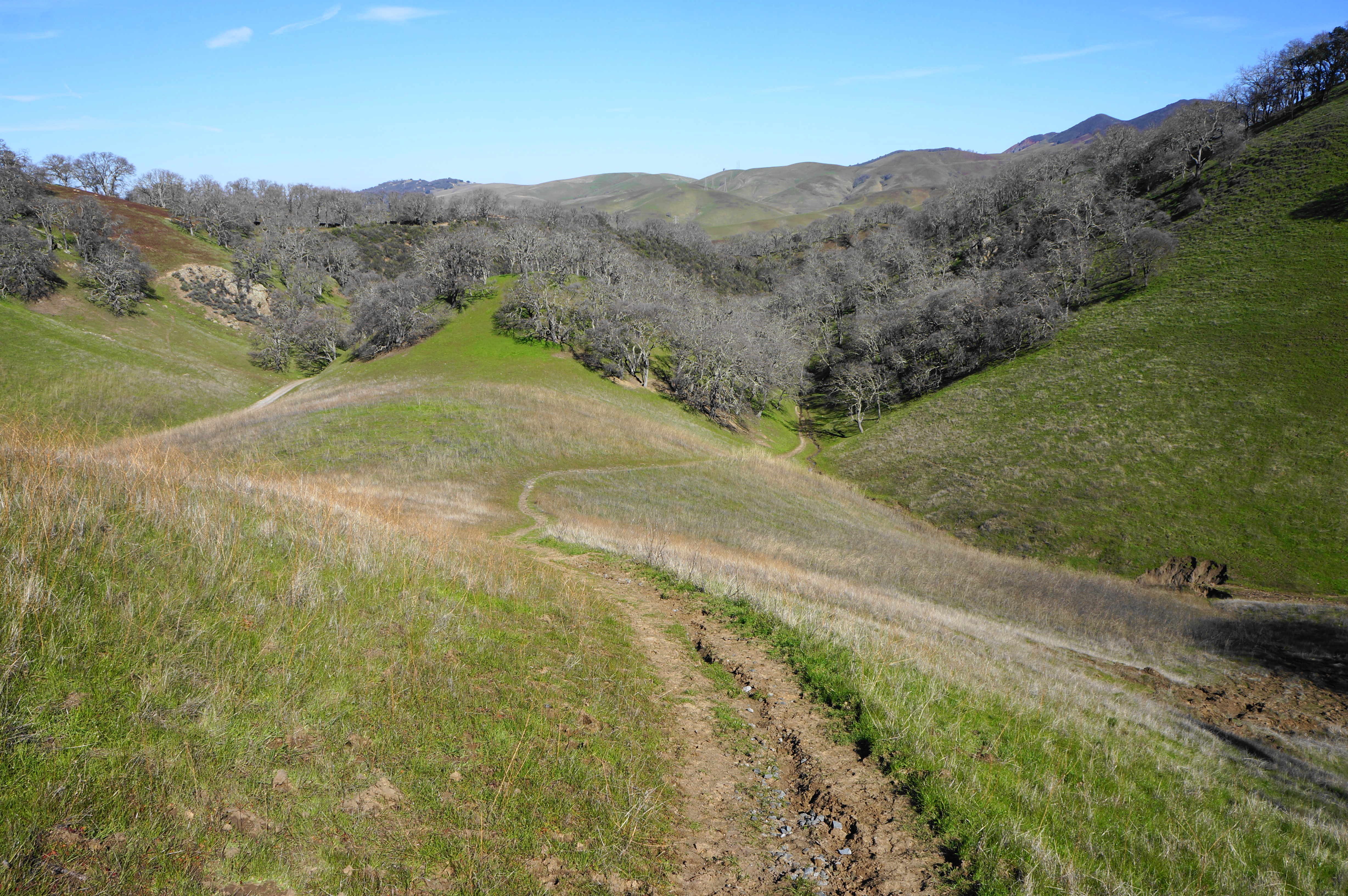
The Buckeye Ravine Trail—actually two unconnected trail segments—follows two pleasant tributaries of Pine Creek through Diablo Foothills. The east end of the southern segment features arguably the area’s best views of the towering Castle Rocks. From the parking lot, take either the Castle Rock Trail or Stage Road Trail south for ½ mile into Pine Canyon, then bear right soon after on the Buckeye Ravine Trail, which mildly climbs a woody gully. Go left at the next two junctions, ascending a thin singletrack that climbs steeply at the end, emerging out into the open pastures. Take a left on the Briones-to-Mt. Diablo Regional Trail, skirting a hillside, then head left on the Buckeye Ravine Trail continuation, another thin singletrack. This section drops steeply into an oak-studded ravine, with the reward of unobstructed views to Castle Rocks at the mouth of the tributary. Head left and follow the Stage Road Trail back to the start.

Foothills – Hanging Valley – Alamo Trail Loop (3.2 mi. loop)
Trailhead: Livorna Staging Area
Difficulty: Moderate
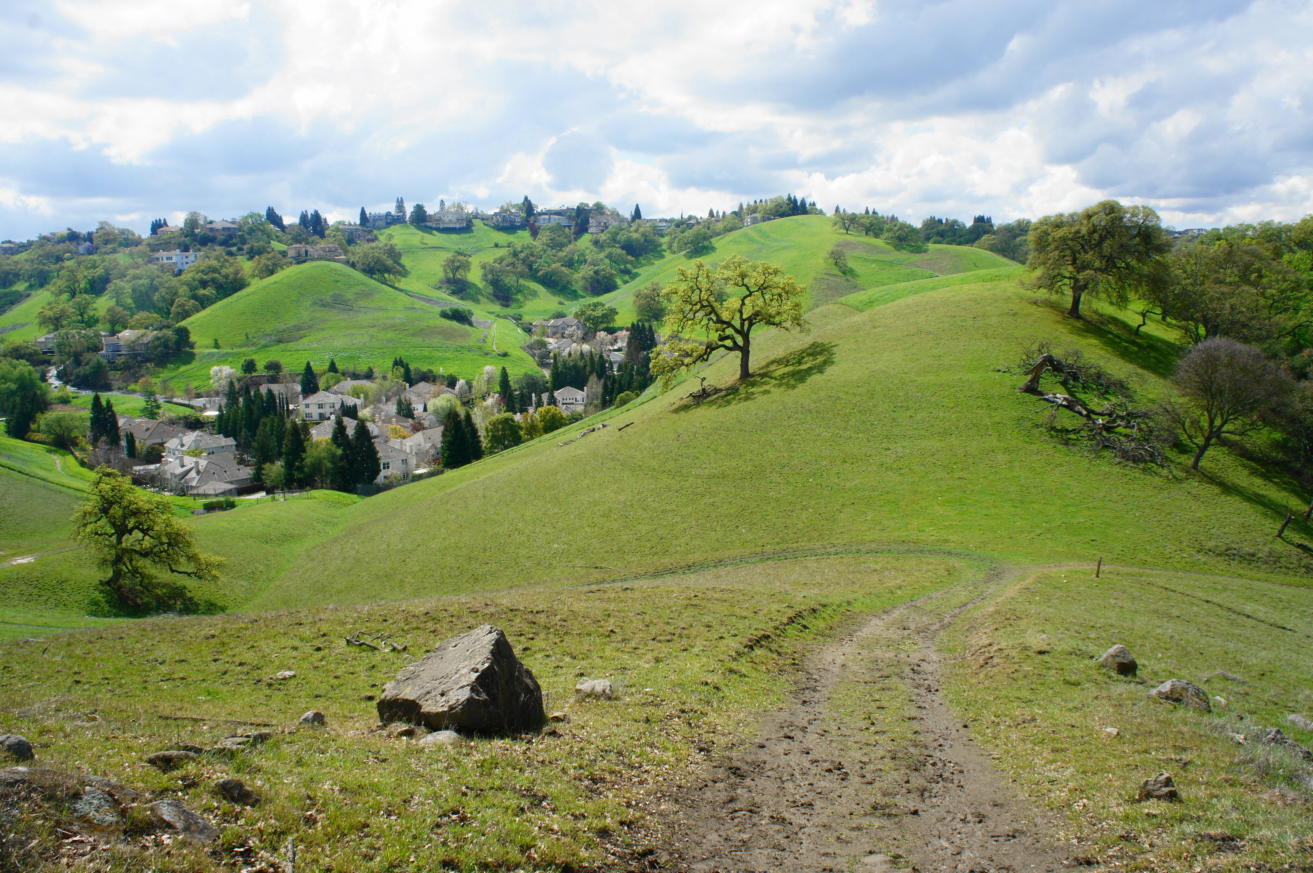
This outstanding loop, easily accessible from suburban Alamo, traverses similar territory as the Hazard Hill hike above but adds a scenic stretch through the heart of Diablo Foothills Park. Starting from the Livorna Staging Area, follow the Foothills Trail for 4/10 mile, rising to an open hillside with terrific views of Mount Diablo, Las Trampas, and the Briones Hills. Stay on this path as it ascends to clear a high ridge, then drops to a junction at 8/10 mile. Stay right, climbing again, before dropping again to another junction at the one-mile mark. Stay straight on the Foothills Trail, then wind around to the north side of an EBMUD water tank and descend into a beautiful, secret valley surrounded by elegant hillsides. Follow the Twin Ponds Trail down into the valley, then continue straight on the Hanging Valley Trail, which climbs steeply to a ridgeline at mile 2. From here, drop into a picturesque ravine (aside from the mud and cow droppings), bearing left at the fork at 2.25 miles. From here, follow the Alamo Trail, which follows a small valley wedged between subdivisions, for nearly a mile back to the staging area.


Diablo Foothills Loop (5.8 mi. loop)
Trailhead: Castle Rock Trail Staging Area
Difficulty: Moderate
See full description in a previous post titled Diablo Foothills Loop (Diablo Foothills Regional Park, CA). This loop has a little of everything, including a lengthy jaunt through woody Pine Canyon, a close look at the China Wall, and a lovely up-and-down through the sun-soaked hills. If you have time for a 3-5 hour hike, this is the one to do.


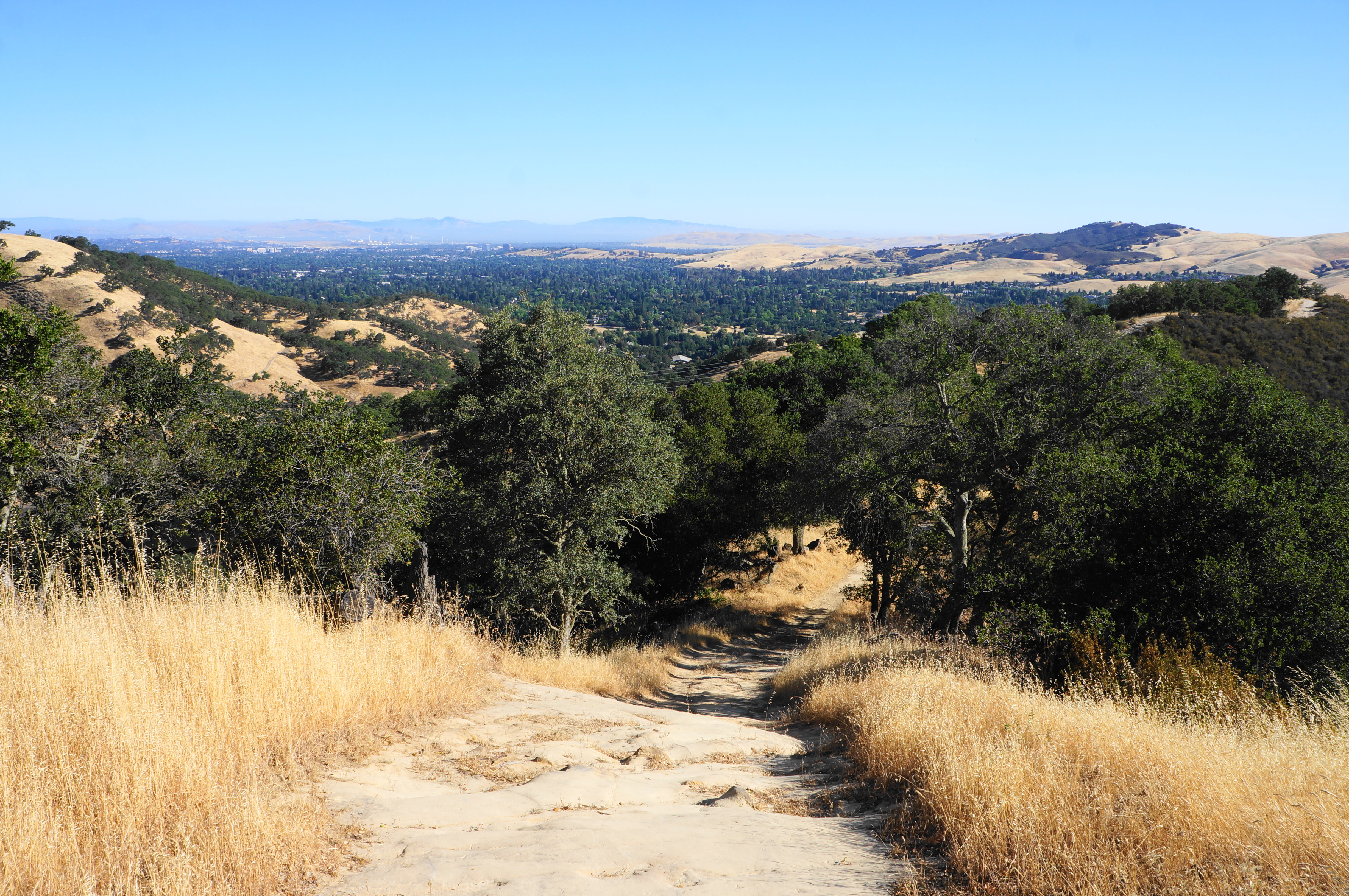
Castle Rocks via Castle Rock Regional Recreation Area (6.7 mi. out-and-back)
Trailhead: Castle Rock Trail Staging Area
Difficulty: Moderate
The feature that gives the park its name is actually found in neighboring Mount Diablo State Park, but Castle Rock Regional Recreation Area offers an access point from August 1-January 31. (Note: The Castle Rocks area is off limits due to peregrine falcon nesting from February through July.) Follow the Stage Road Trail into Pine Canyon for 2.1 miles, crossing Pine Creek several times. Take a left on the Sunset Trail, which climbs a thin ravine for 4/10 mile to a high gap; head left twice in quick succession to find the Castle Rocks Trail, which climbs to a vista of Mount Diablo and then traverses a ridgeline above the sandstone spires. The trail crests the high point (around 950’) at 3.25 miles, then ends shortly thereafter at the park boundary. Retrace your steps back to the start.


Perfect hiking areas. Some of the terrain is similar to Cowiche Canyon, in Yakima County, Washington state.
Nice photos!
Pingback: Top 10 Hikes in 2024 – Live and Let Hike