Long before the Napa area became renowned for wine-making, author Robert Louis Stevenson—of Treasure Island fame—spent an extended stay here on the slopes of Mt. St. Helena, one of the highest peaks in northern California’s Mayacamas Mountains. The trip in 1880 inspired The Silverado Squatters (1883), one of Stevenson’s lesser-known novels. Today, the mountain is preserved as part of Robert Louis Stevenson State Park, a rugged 5,000-acre tract with some of the area’s most challenging and rewarding hiking. East of Route 29 (Lake County Highway), the up-and-down Table Rock Trail leads into the Palisades, a scenic set of volcanic crags. On the west side of the highway, a robust climb of more than 2,000 feet culminates at the 4,343-foot summit of Mount Saint Helena. A favorite of local peak-baggers, the challenging 10-mile out-and-back to the apex of Mount Saint Helena has epic panoramic views of Napa Valley and surroundings. Wait for a sunny day for the best experience!


The hike
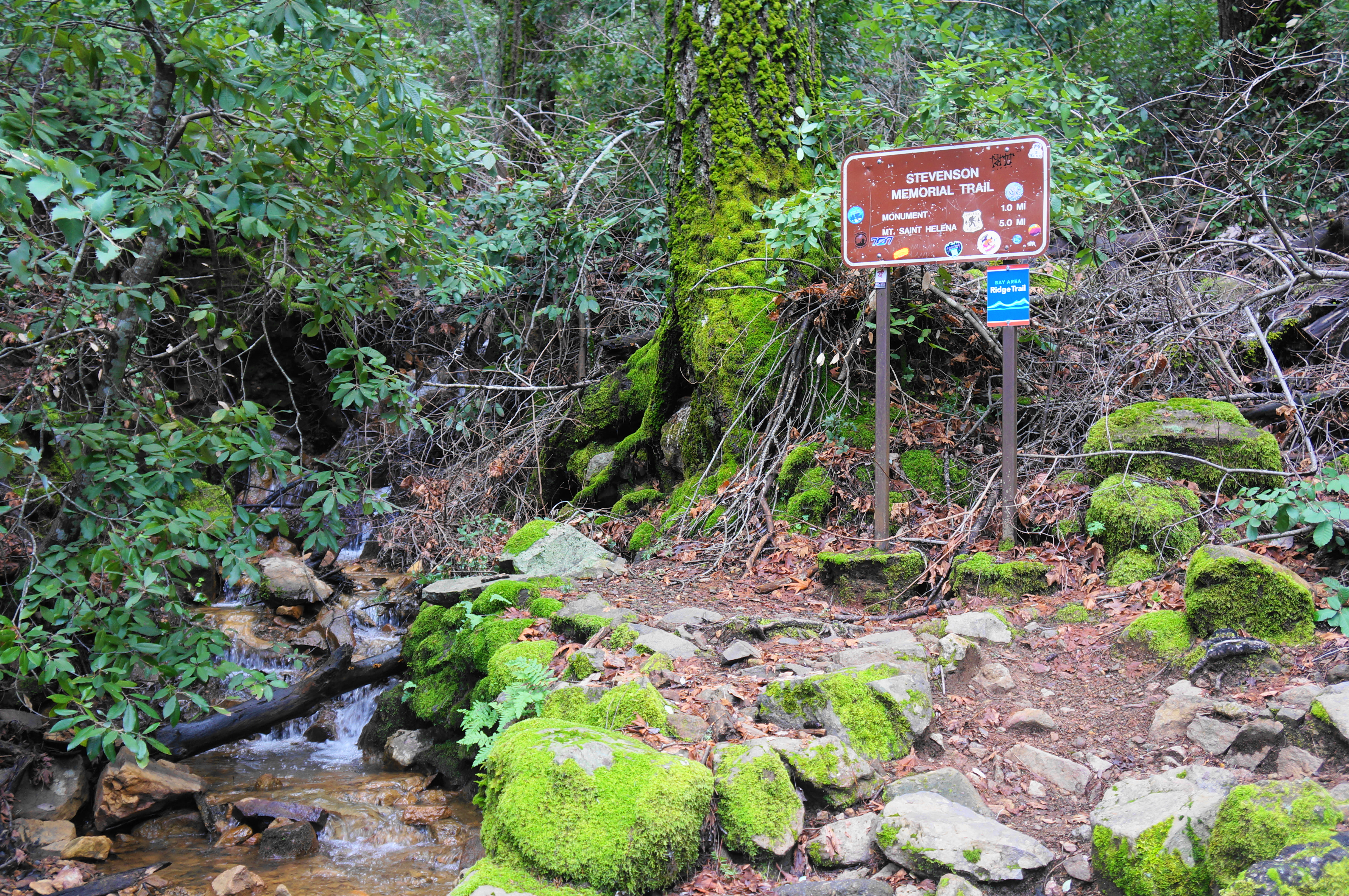
To reach the trailhead, drive 8 miles north on Route 29 from downtown Calistoga, trading in the trendy wineries for rugged landscapes. The main parking area is on the east (right) side, at the crest of the ridge, a gap between Mount Saint Helena and the Palisades. There is not a ton of space, but usually enough to accommodate visitors, save for perhaps on a very busy summer weekend. When ready, carefully cross the road to the west side, finding the start of the Stevenson Monument Trail, a narrow track that offers a shorter passage to the wide Mount St. Helena Trail.
After an initial staircase, cross over piped water, passing a small grassy lawn and picnic area to the right. With the thin stream on the left, the onward route rounds two or three initial, short switchbacks, then settles into a gradual uphill, with a larger drainage down to the right. Under the canopy of pines and bay laurel, switchback left at the 300-yard mark, then approach a bench and right-hand bend at ¼ mile.
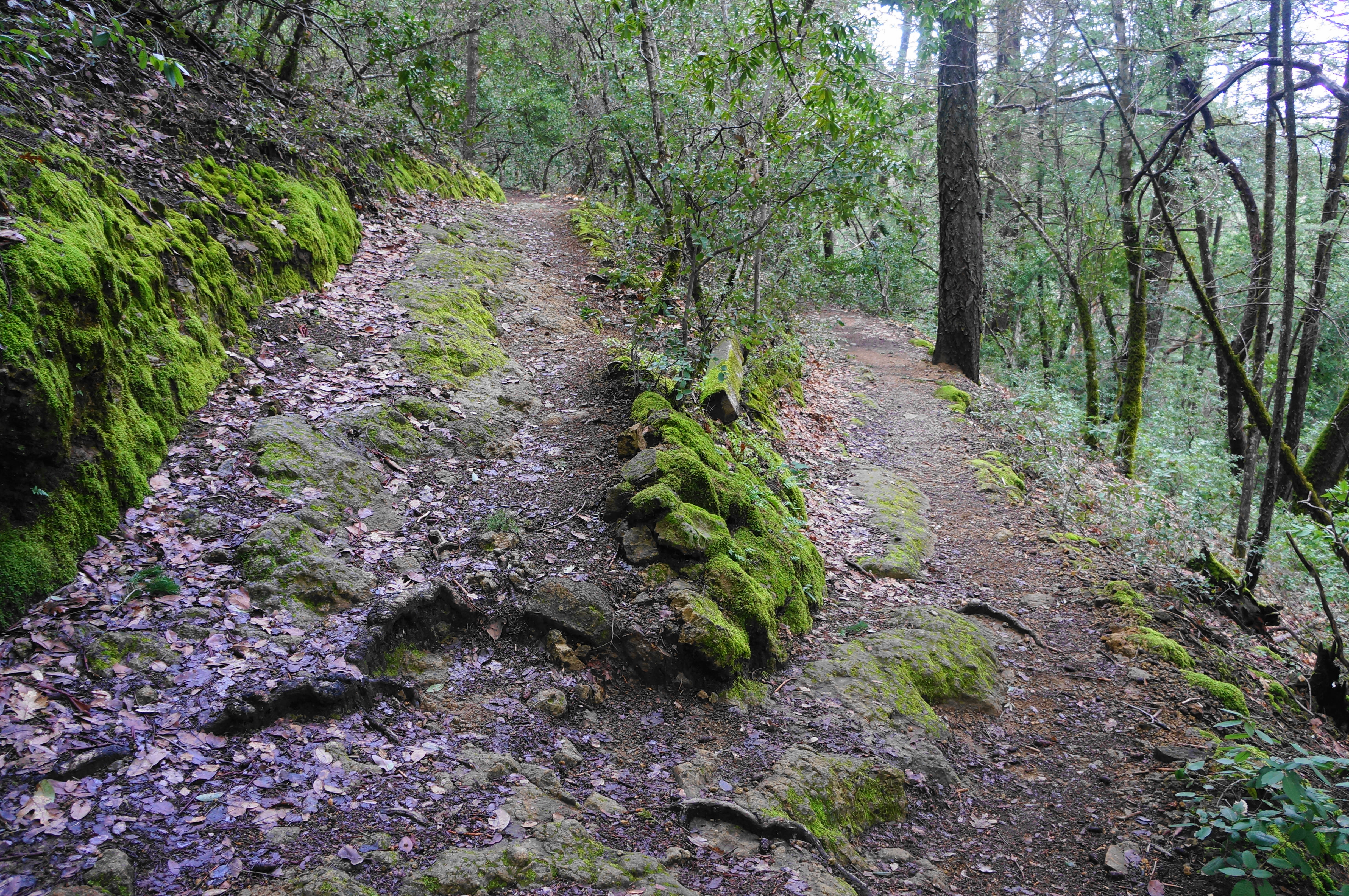
Steadily climb through a nice collection of madrones, coming again to another left-hand switchback, then another right-hand turn overlooking a different gully down to the left. The trail gets rockier, with chunky boulder blocks in the next section, leading into another switchback and ascent. Nestled among the manzanitas, follow a sudden hairpin right, now approaching the ½ mile mark.
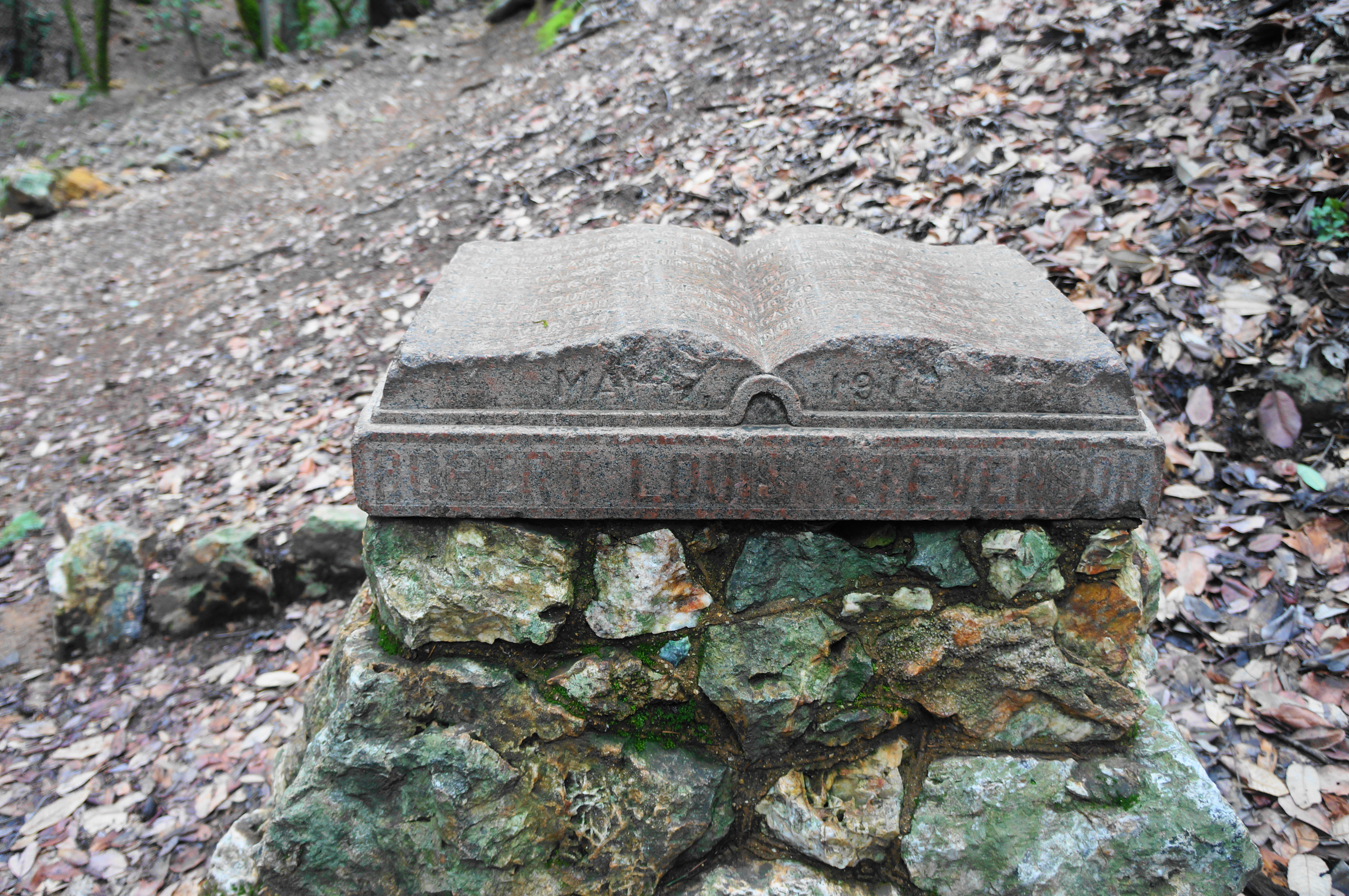
Take another left and begin a curve south and westward, leading into a short, 30-yard downhill that bottoms out in an agreeable ravine (usually sans water). Here one finds the 1911 Stevenson Monument, which marks the approximate spot of the 19th century cabin where Robert and his wife spent their honeymoon in 1880.
From here the trail continues, hugging the right flank of the gulch, then rising more steeply up a hillside dotted with jagged rocks. Carefully climb up to a partly-obscured view, then ascend a steep slope to the end of the Stevenson Monument Trail at 8/10 mile. Here the path empties out at a wide, gravel track: this is the Mount St. Helena Trail (and a commonly-used utility road).

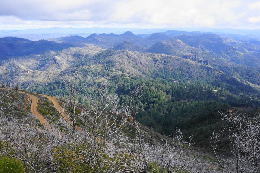
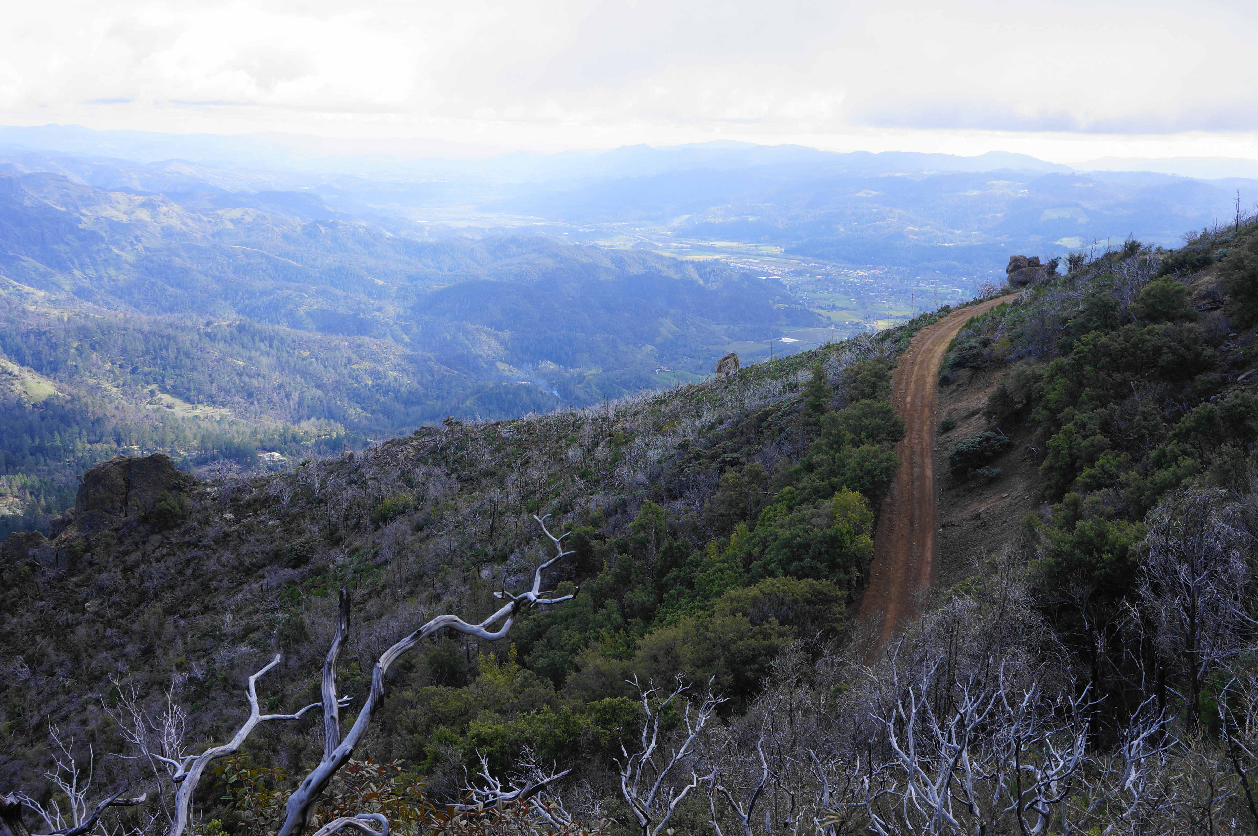
Bear left on the road, settling into a lengthy but relatively mild climb. Leaving behind the thick forest, the trail wraps around to the south-facing slope, where hikers can get their first views down to Calistoga and the Napa Valley, with the Sugarloaf Ridge area beyond.

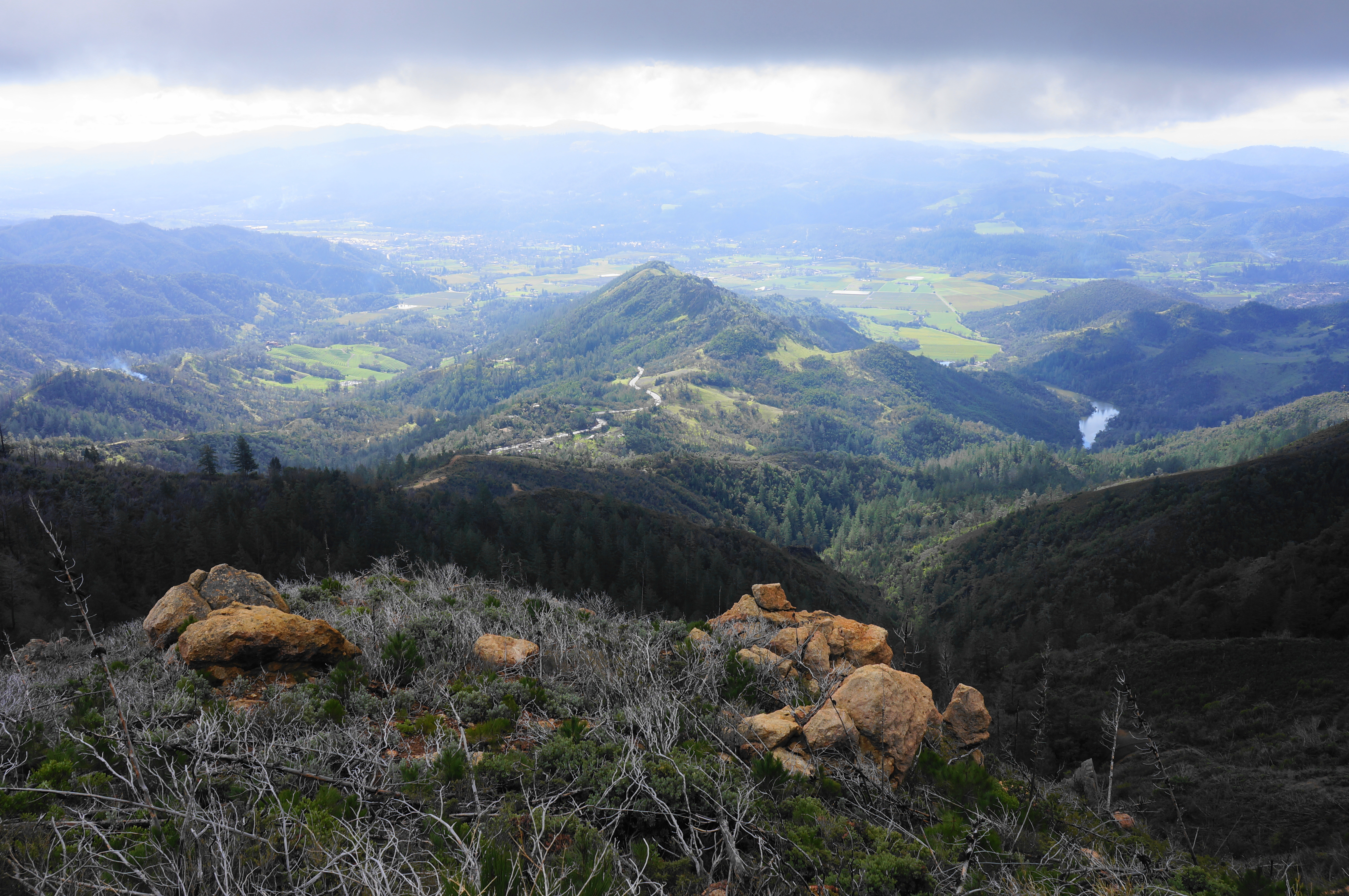
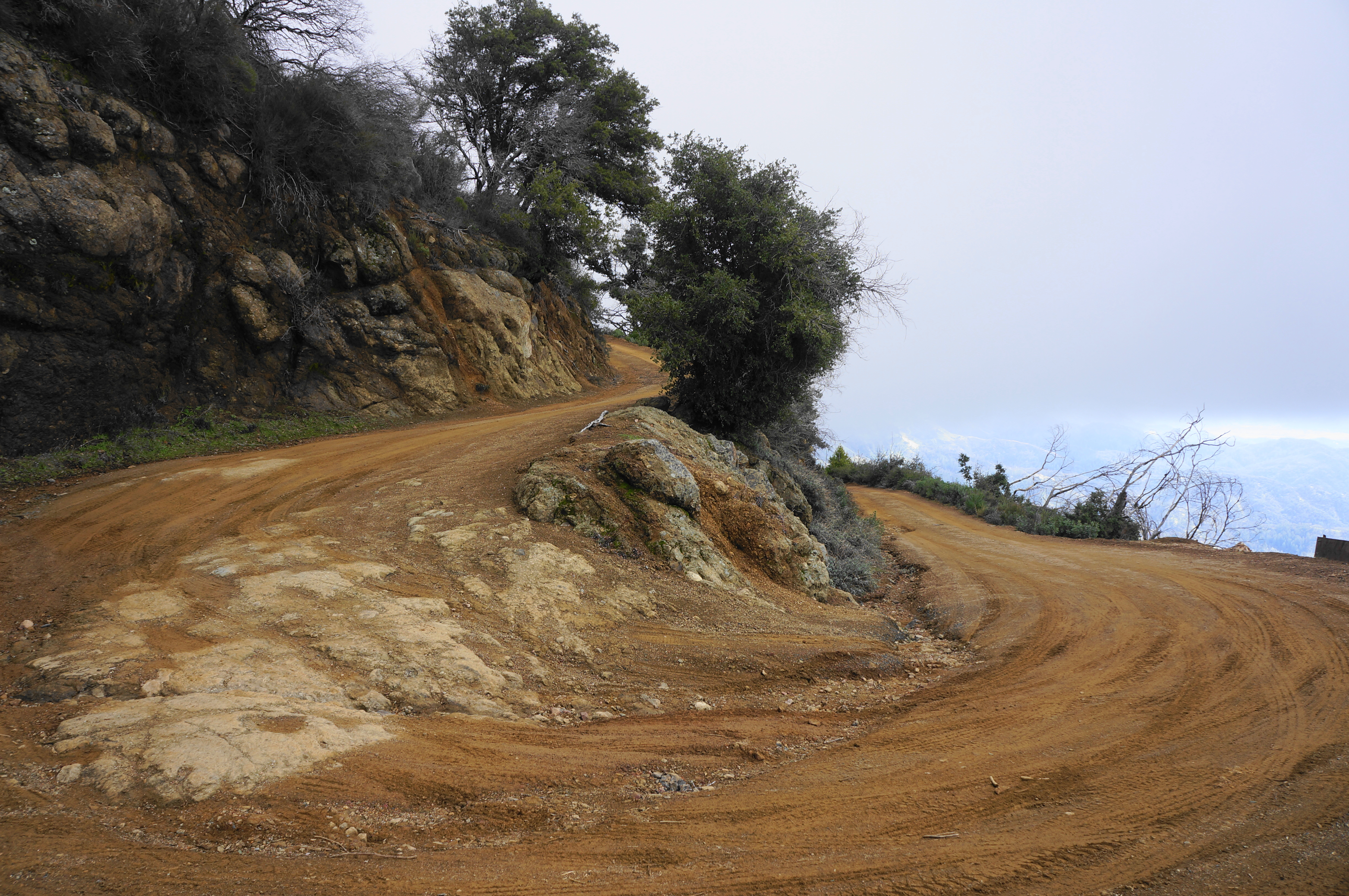
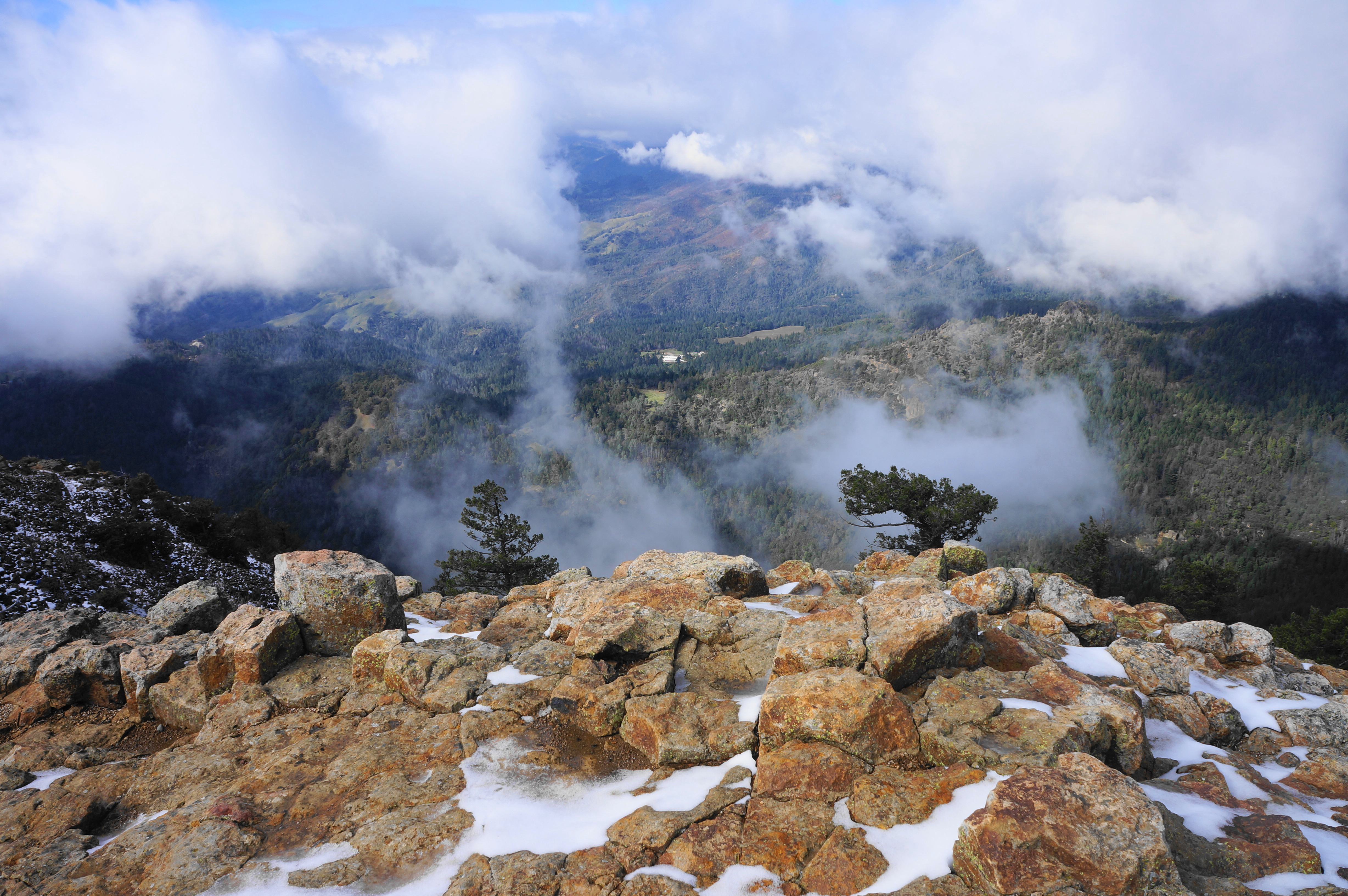
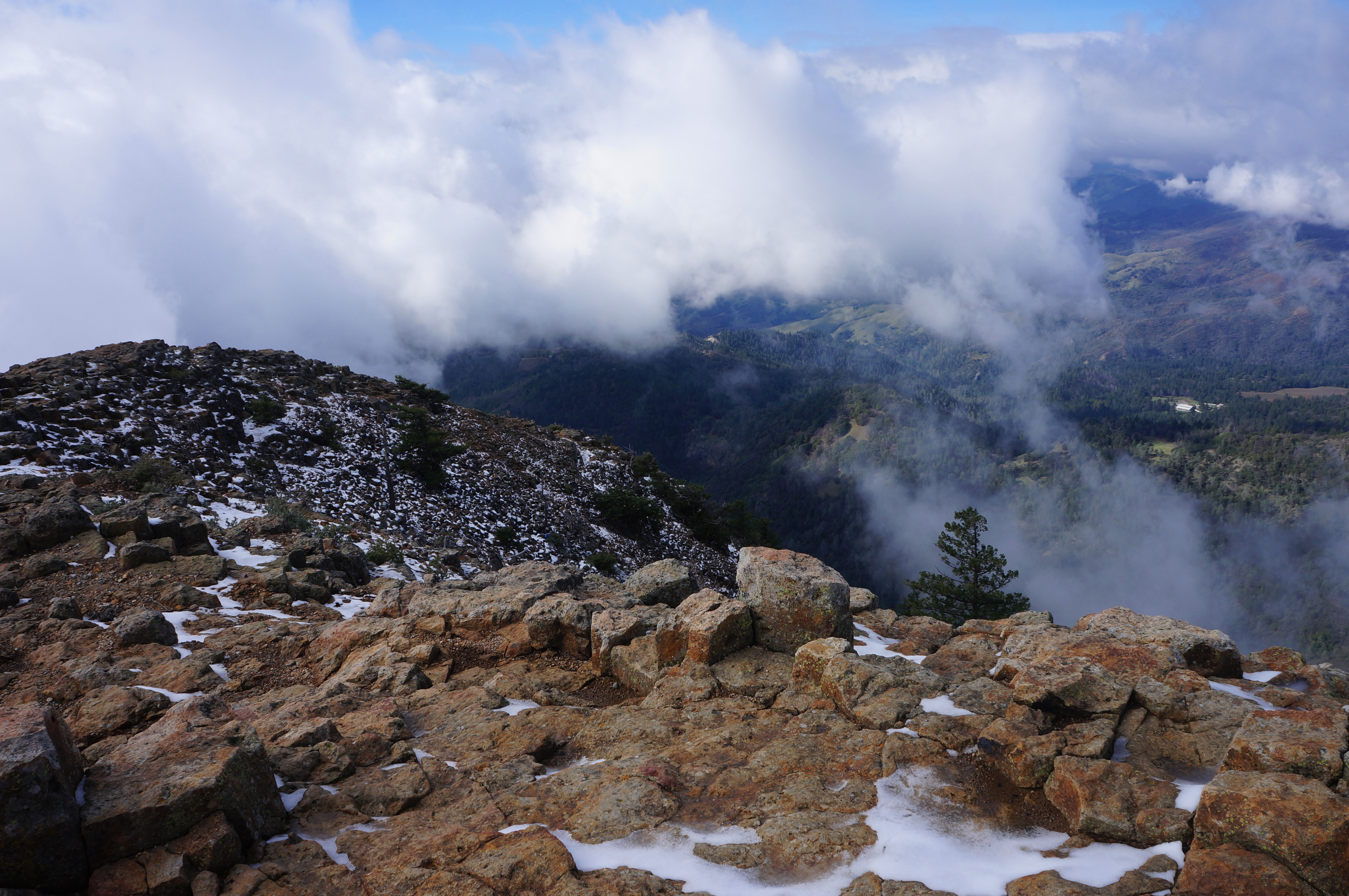
The road routes west for more than a half-mile until reaching a hairpin bend at the base of a curious feature called the “Bubble Wall”—a pockmarked chunk of volcanic tread frequented by rock climbers. Follow the turn right and uphill again toward a burned area with scores of charred manzanitas. This time the views are best to the east, with the Palisades unfolding in the distance. Round a left-hand bend at 1.8 miles, then skirt a rock escarpment and reach another sharp right turn before heading into another hairpin at 2.2 miles. The views improve here with every step, with no obstructions from the scrubby landscape (except if, like me, you get stuck with a persistent morning fog).

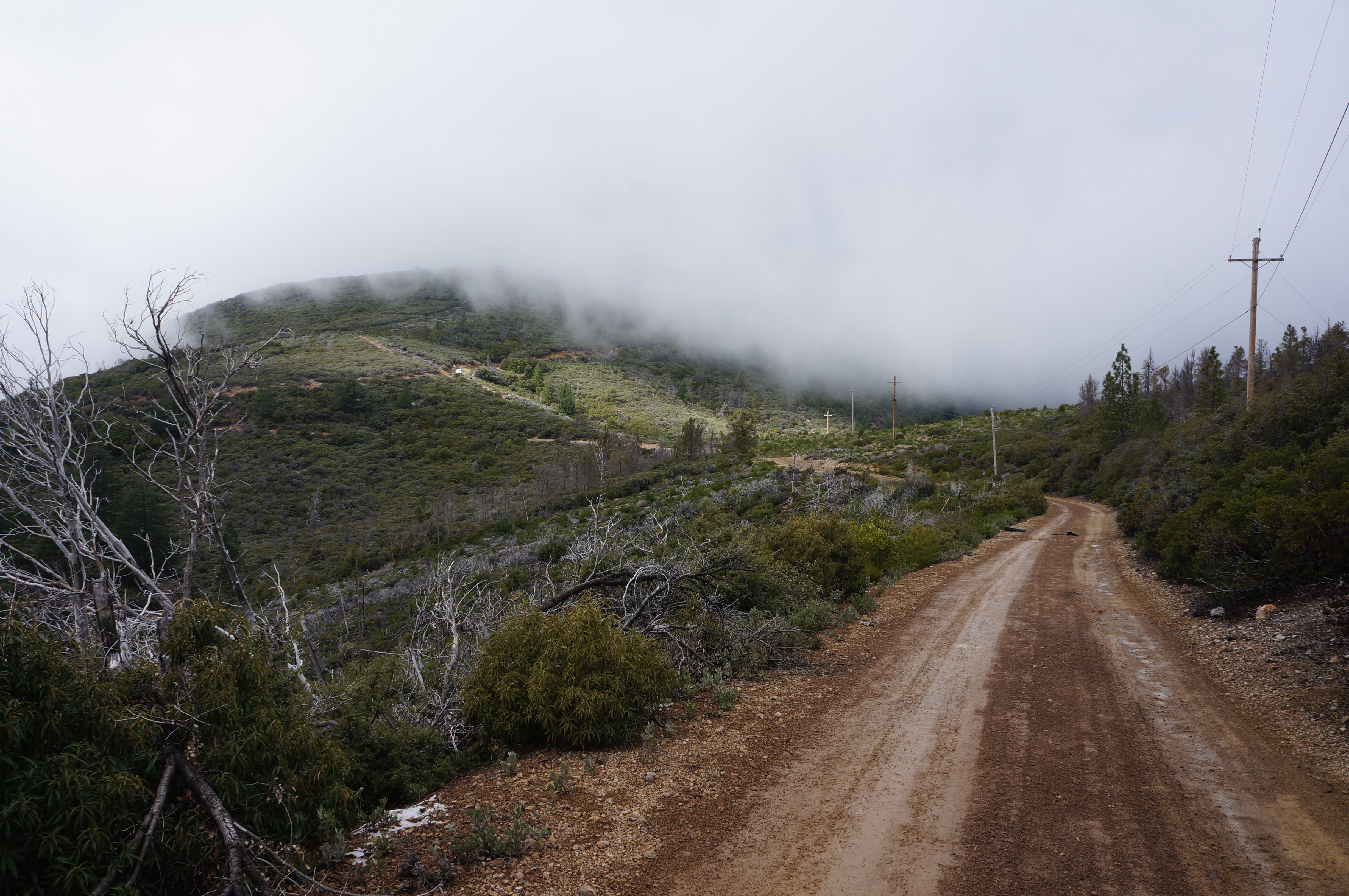
Round a final sharp turn at 2.6 miles, then pass under power lines and edge over to the north flank of the massif, where the trees return again in earnest. Rising gradually amid the mixed conifers, push northwest and climb to a high saddle at 3.4 miles.

Here the route splits, with a spur heading left to the summit of Mount Saint Helena’s South Peak (4,003’). Most, however, will push on to the higher North Peak, still another 1 ½ miles further—bear right (or straight if you could the rough path heading right) and actually descend briefly into a basin that boasts the unassuming headwaters of the Napa River.


After flanking the left side of a hill, come to another high gap and continue around a sharp right-hand bend again, followed by a gentle incline. Come to a sign marking private property, with a hiker easement offering passage beyond. Pass through trees again and come to a third saddle. Continue straight, toward the summit.

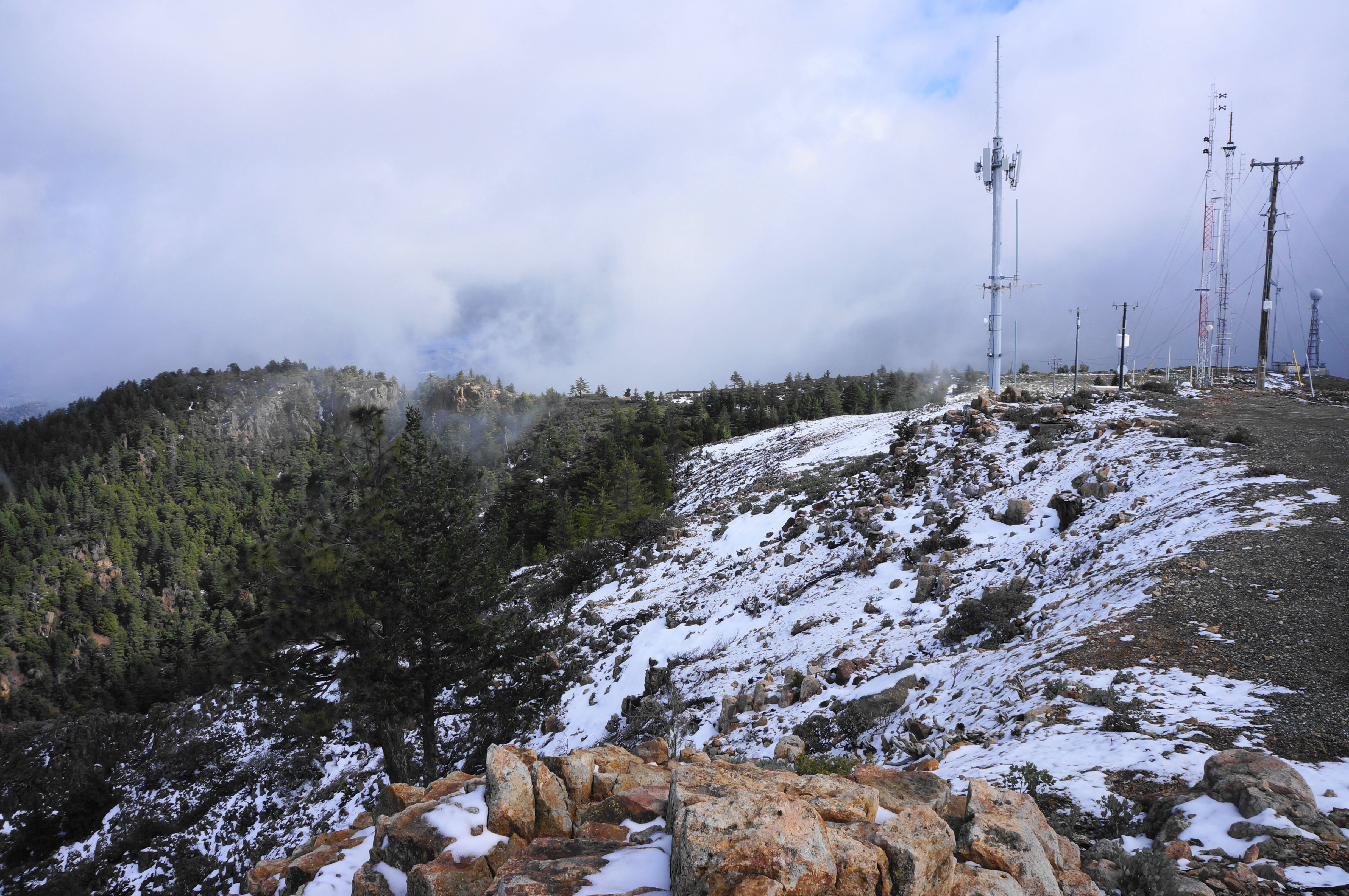
At 4.75 miles, pass under power lines and enter the final stretch, a ¼-mile sun-exposed ascent toward the comms towers at the top of the mountain. After reaching the towers, the trail continues just a hair further, rounding to the high point with a craggy top.
At the summit, the newest views are to the north, where the summit gives way to a rugged drop toward Kellogg Creek below. Beyond lies Goat Roost Rock (3,228’), Flag Peak (2,759’), and other lesser peaks. Beyond, one can see in the direction of Hidden Valley and Clearlake. Of course, there are also the views back to the Napa Valley, a perennial crowd-pleaser and one that you can continue to enjoy on the return back to the trailhead.

When ready, reverse course and follow the same route back five miles to the start. (Note: Be sure to pay close attention for the junction with the Stevenson Memorial Trail, 8/10-mile from the end; it can be easily missed.) The total, 10-mile round-trip is moderately strenuous and can be completed in around 4-6 hours.


Pingback: Top 10 Hikes in 2024 – Live and Let Hike