
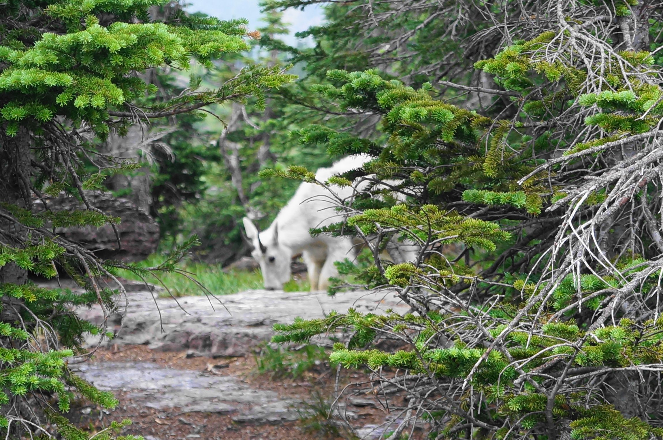
Fast-forwarding a couple of days in early August, we zipped across southeast Washington and northern Idaho to reach Montana’s Glacier National Park. For such a hard-to-reach destination, this place is teeming with visitors in summer, with trail crowds the likes of which I had never seen. Good luck finding parking at one of the park’s major destinations—such as Logan Pass or Apgar Visitor Centers—though fortunately there is a shuttle bus on Going-to-the-Sun Road in the summer. Our first of three days in the park was spent orienting ourselves, and we were met with a nasty rain shower.
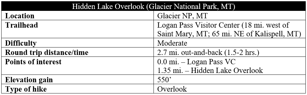
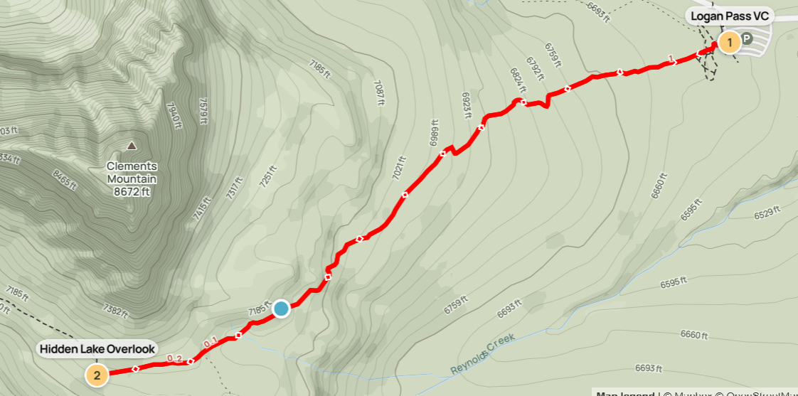
The apex of Glacier National Park’s Going-to-the-Sun Road, which bisects the park, is Logan Pass (6,646’), home to a busy visitor center and a handful of hiking opportunities. By far the most popular hike from here is the 2.7-mile out-and-back to Hidden Lake Overlook, which culminates at a viewpoint with a stunning look down to the namesake lake. Also known as the Hidden Lake Nature Trail, the walk ascends more than 500 feet over the course of 1.3 miles and, despite topping out at 7,100 feet above sea level, feels much higher.
The hike
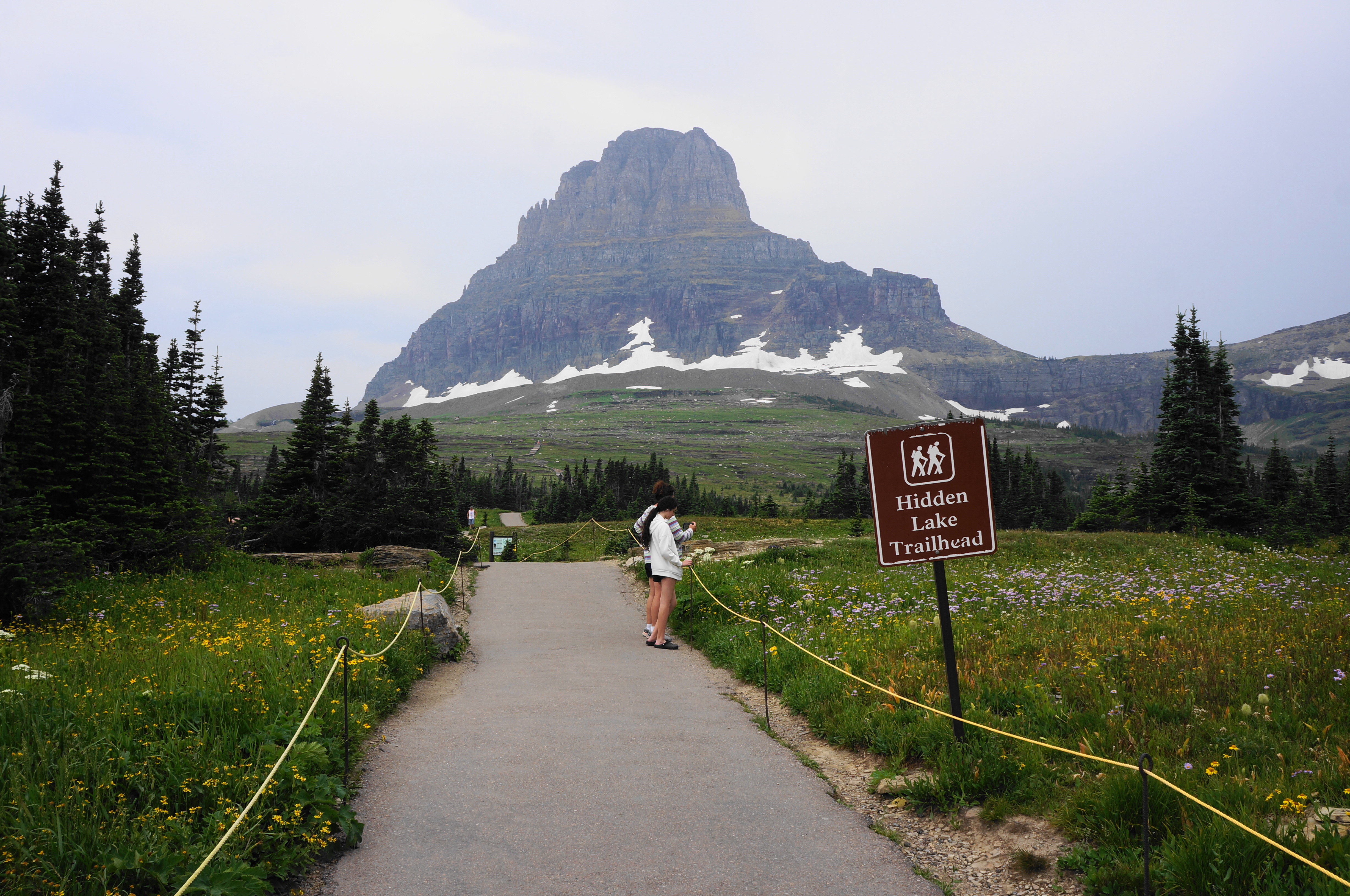
The Hidden Lake hike starts from behind the Logan Pass Visitor Center, immediately ascending through the alpine moraine. It begins as a paved path, rising mildly before turning into a wooden boardwalk. Stay on the trail to avoid disturbing the tundra, which soon becomes interspersed with stone shelves that are navigated with intermittent stairs.
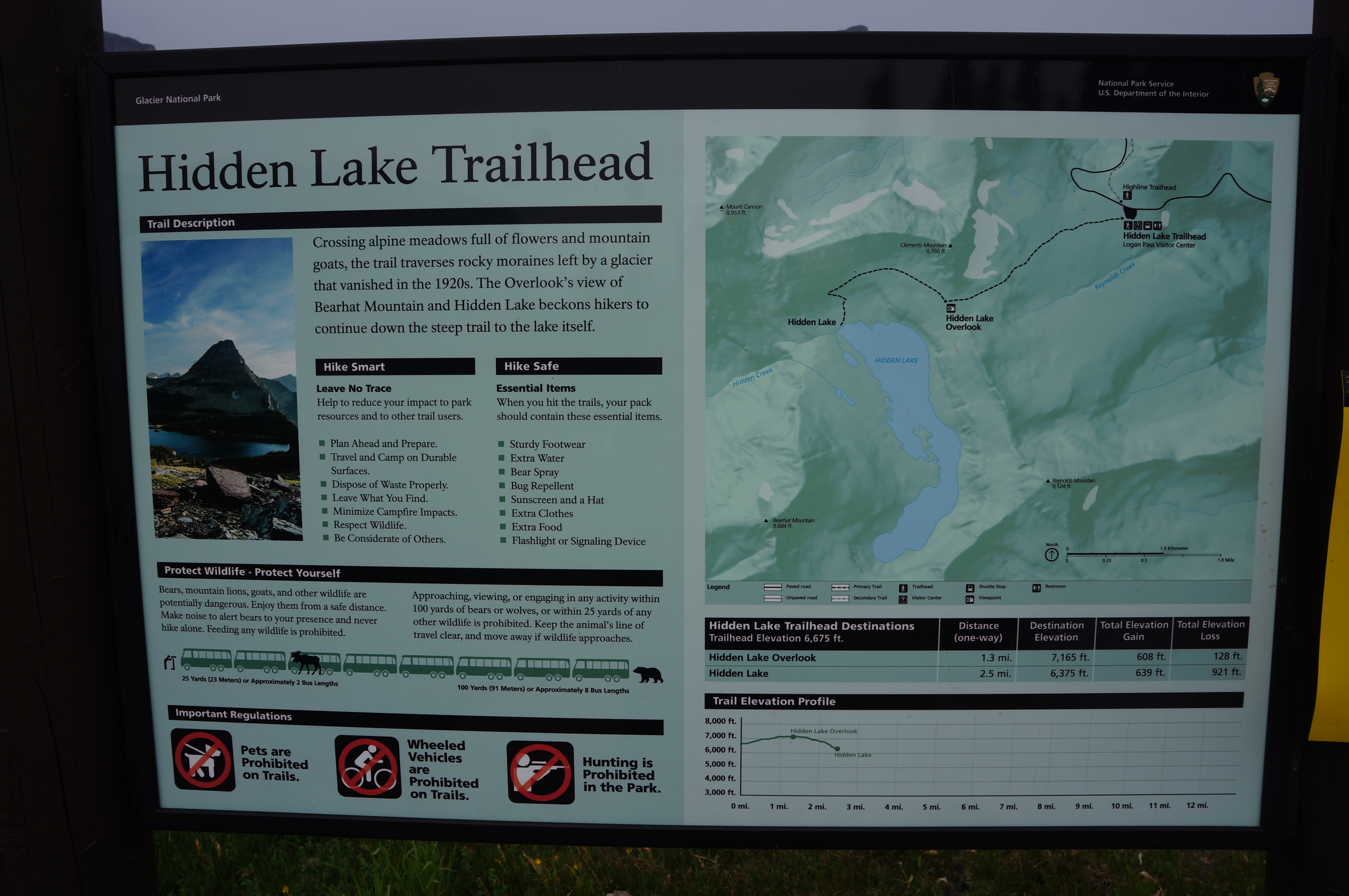
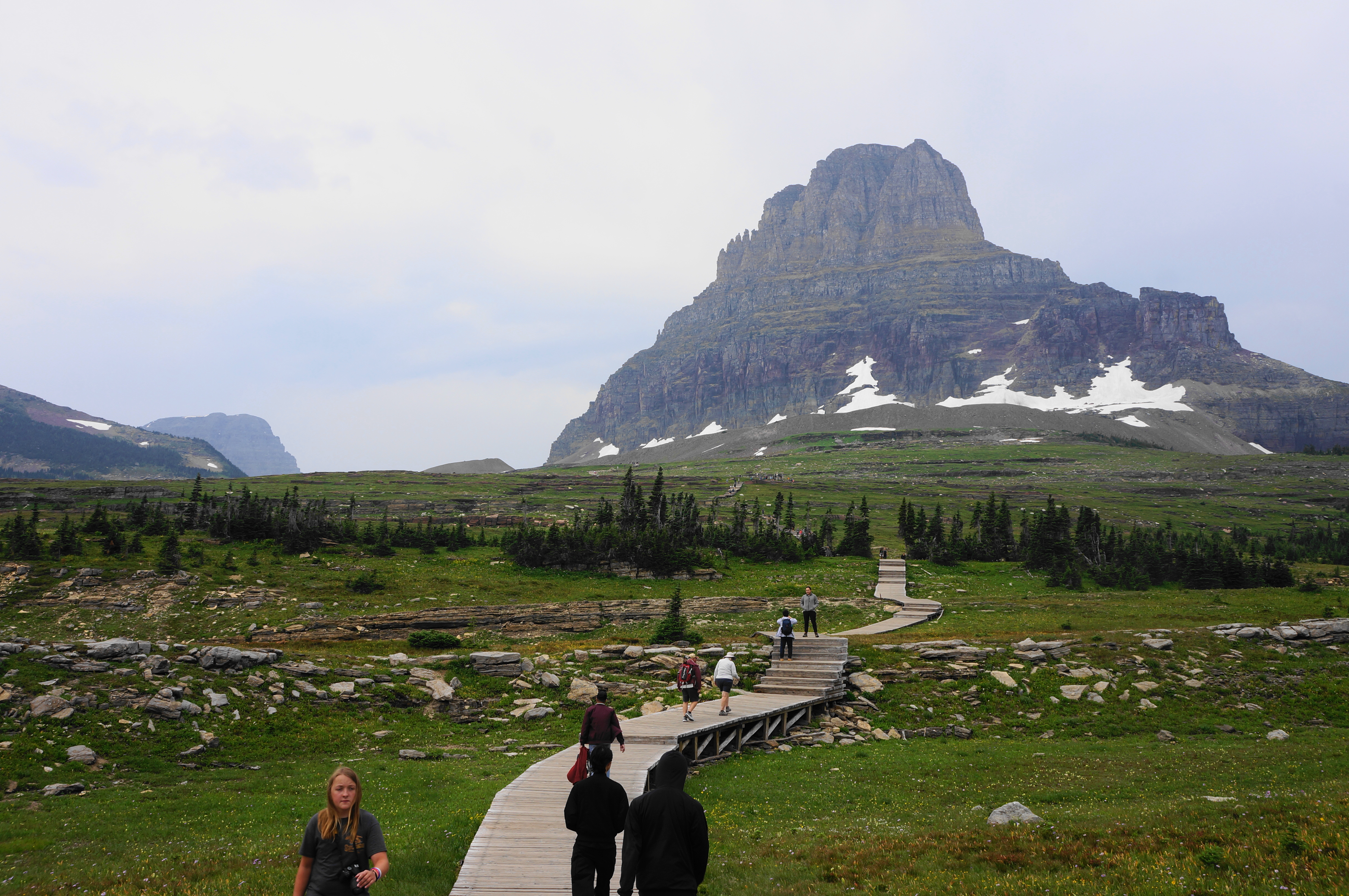
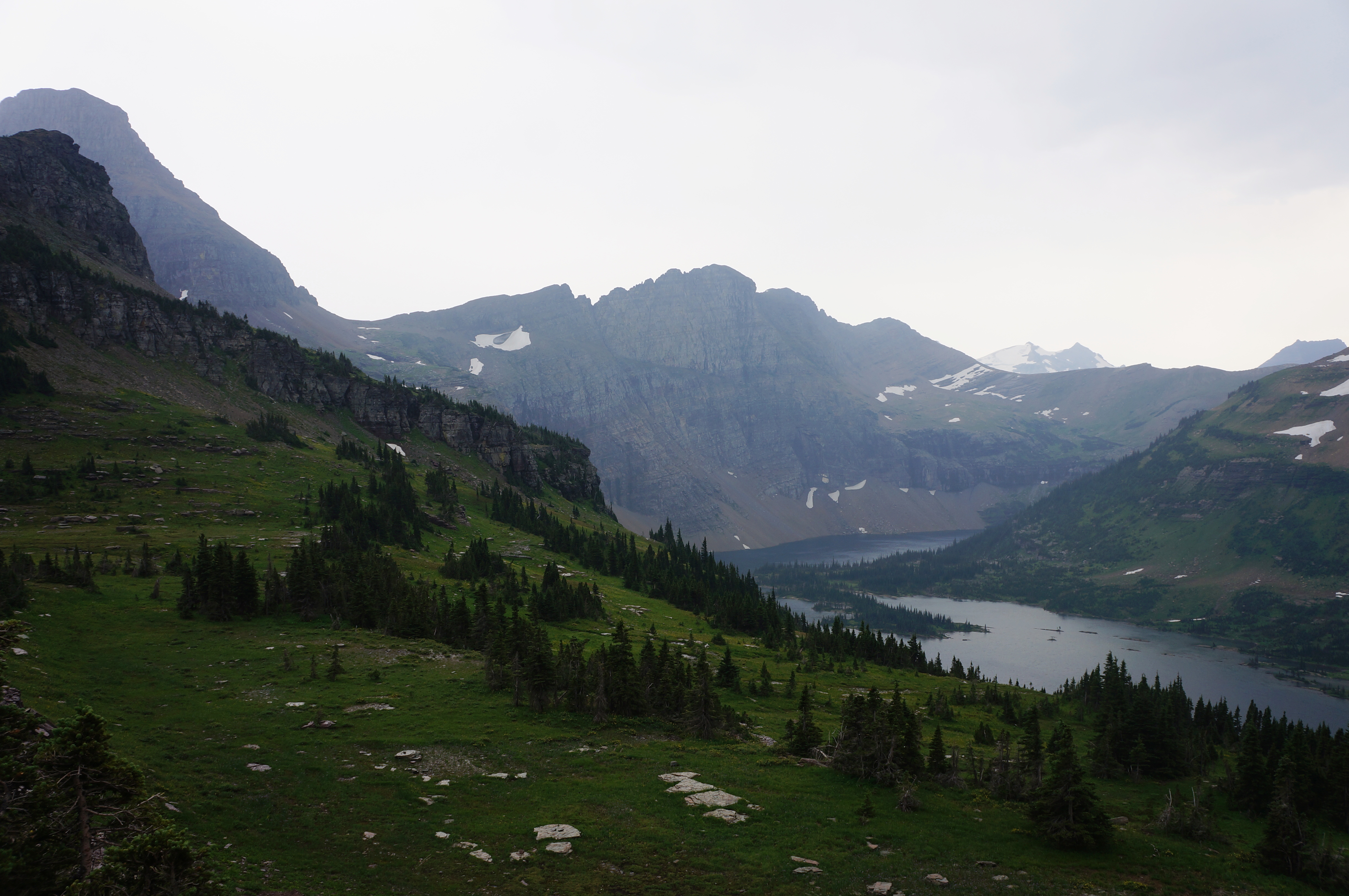
After this initial climb, the trail levels a bit around 3/10 mile, allowing hikers to take in the surroundings. The intimidating peaks ahead to the west is Clements Mountain (8,760’), with neighboring Mount Oberlin (8,180’) (relatively easily climbed though now seemingly off-limits?) to the north. Then there is Reynolds Mountain (9,125’) and Heavy Runner Mountain (8,016’) to the south, with the St. Mary Valley unfolding beyond. Across the pass and valley are Pollock Mountain (9,190’), Piegan Mountain (9,220’), and Going-to-the-Sun Mountain (9,642’).
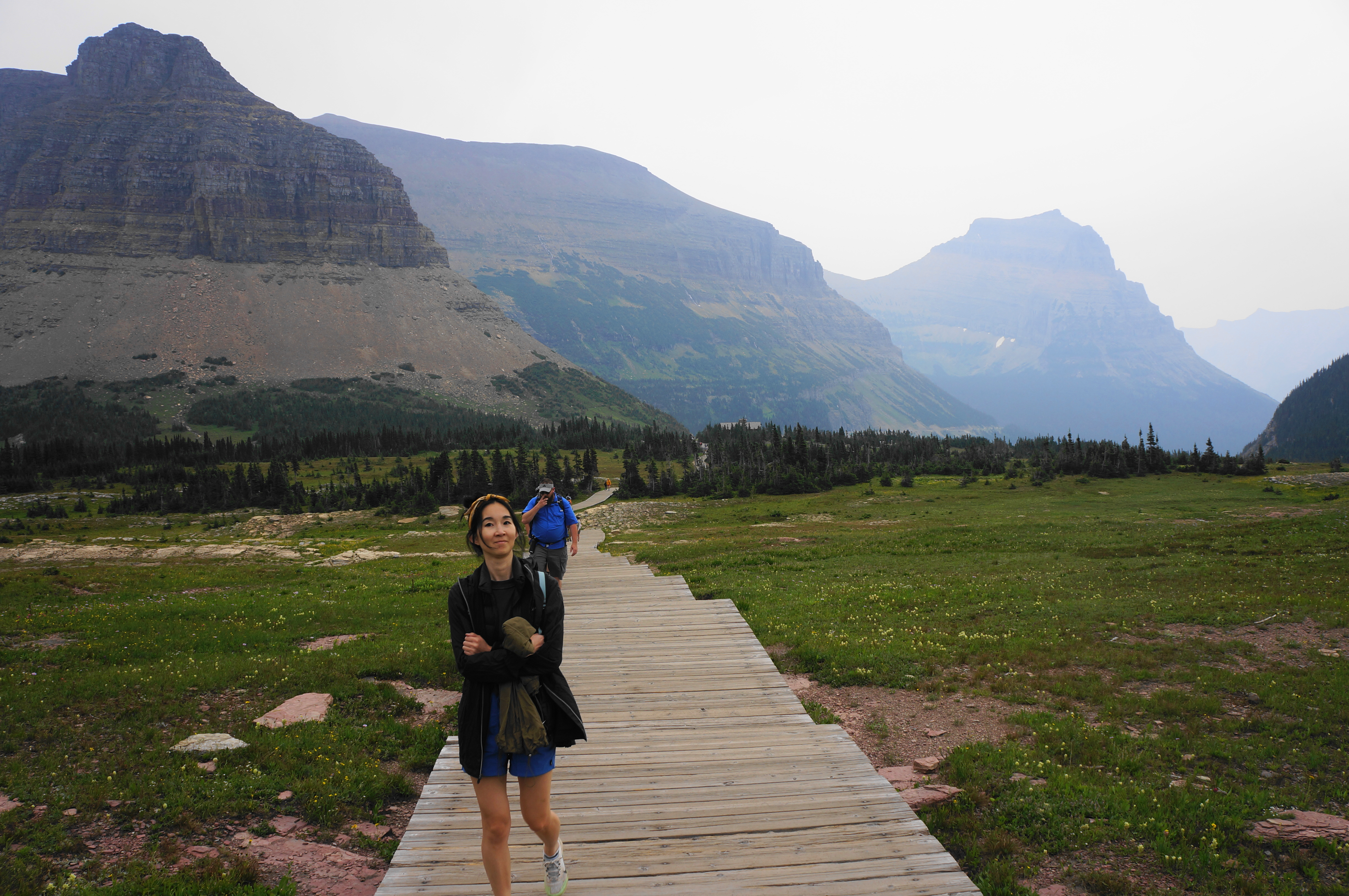
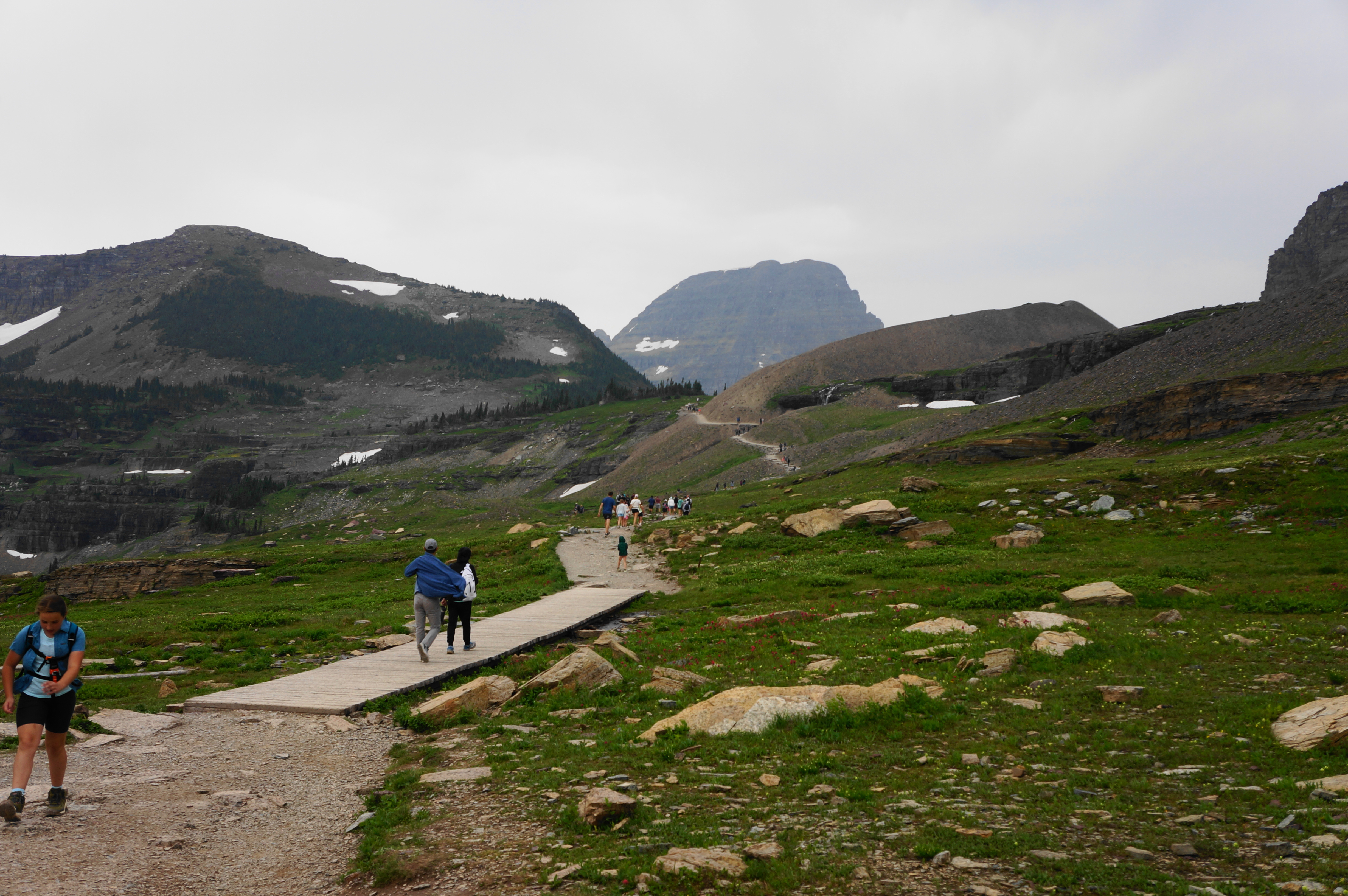
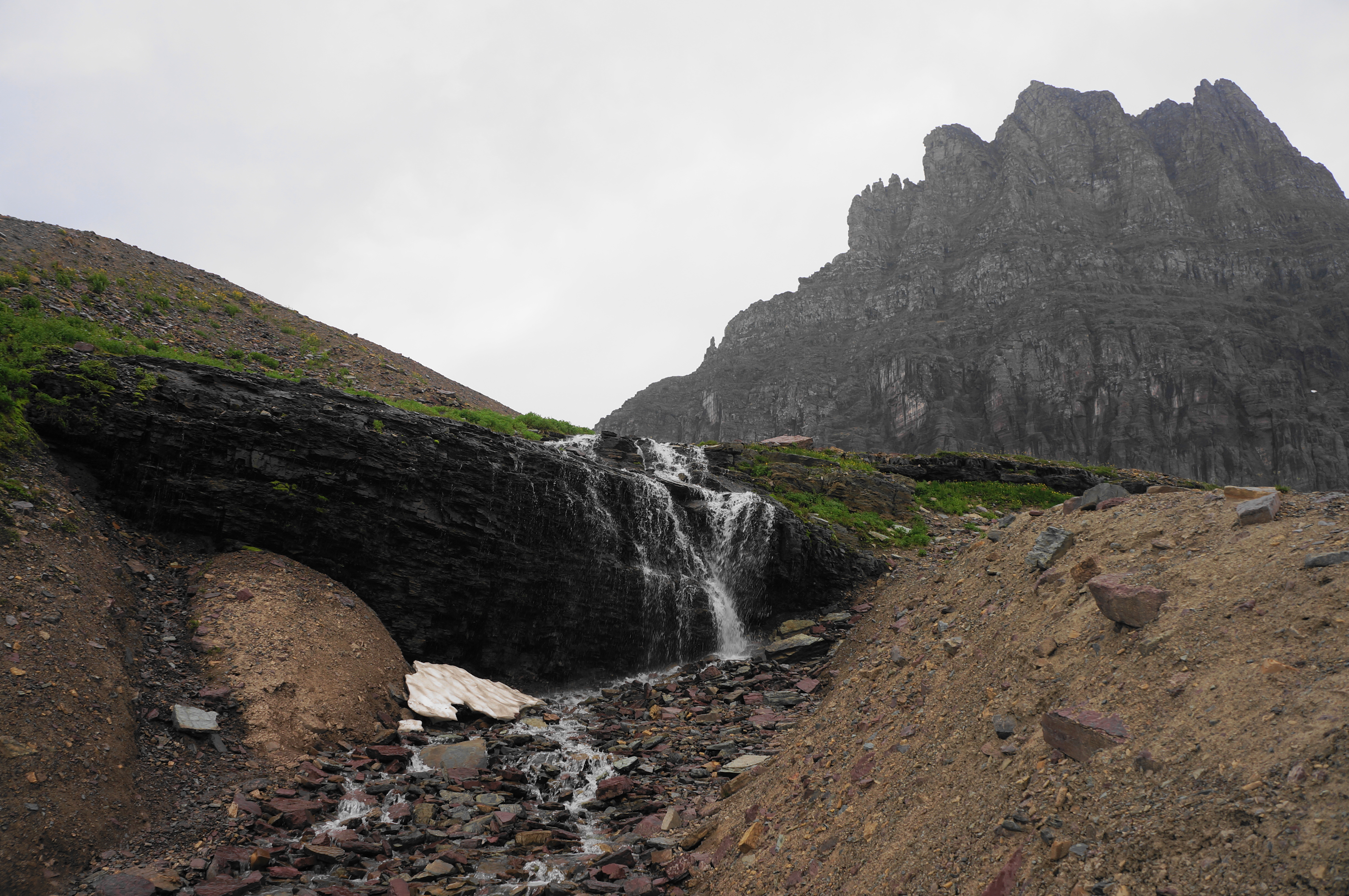
In short, the open views along the hike are spectacular, and they are made better when visitors enter the Hanging Gardens area, where the trail turns to dirt and snow-fed streams off to the right form beautiful, silvery cascades. Here the route hugs an east-facing hillside, rounding back toward the resumption of hearty, windswept pines.
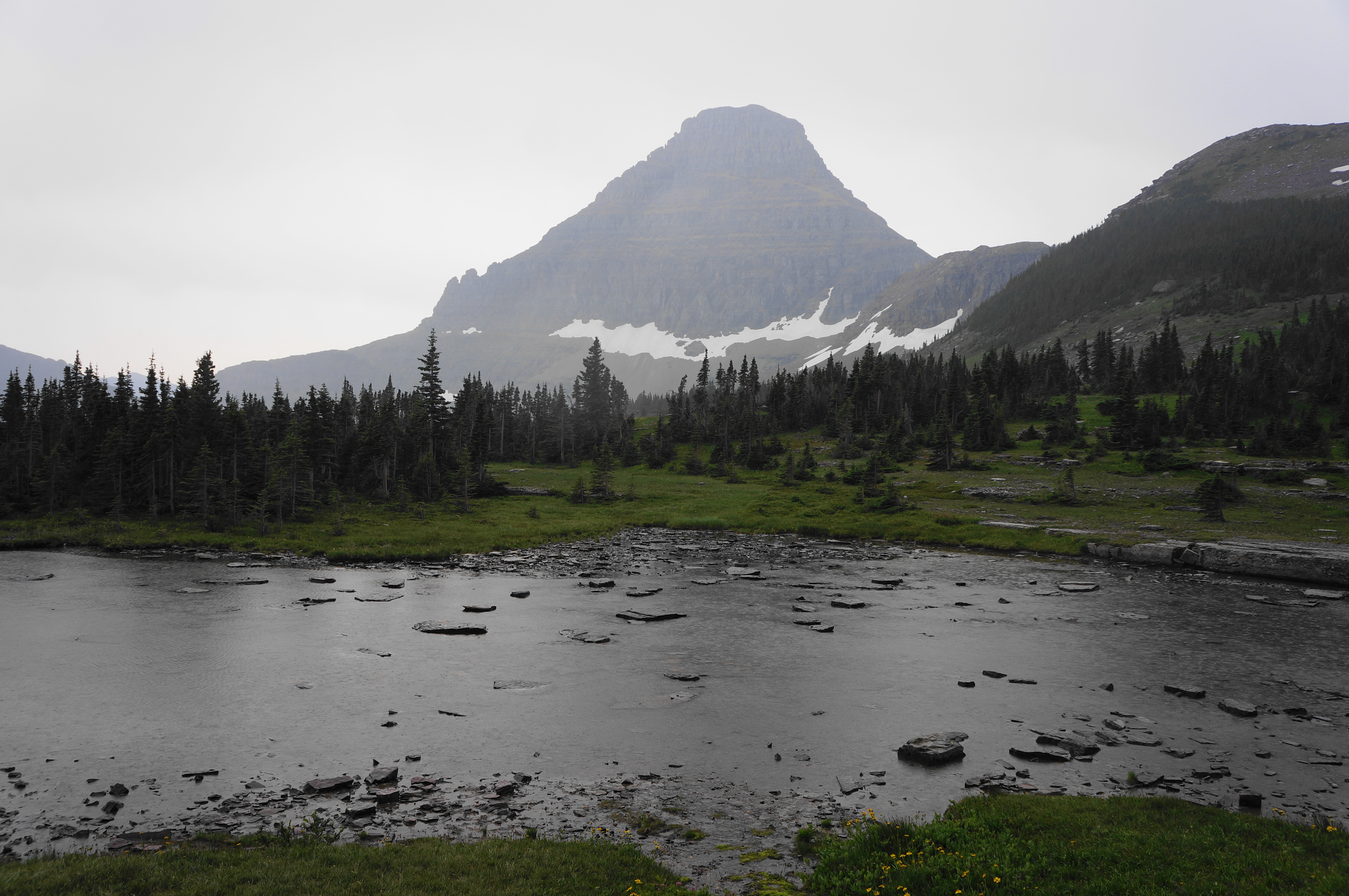
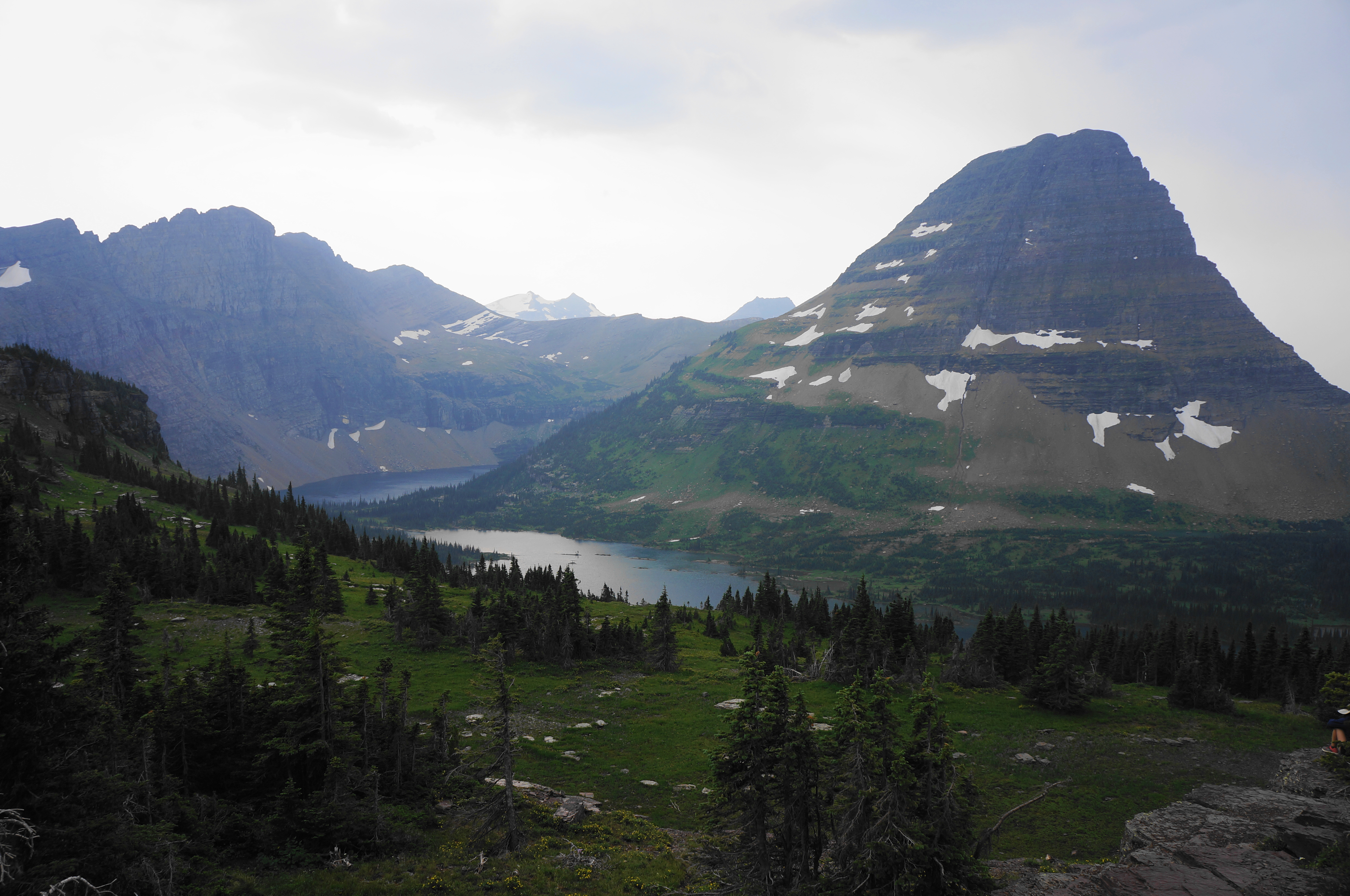
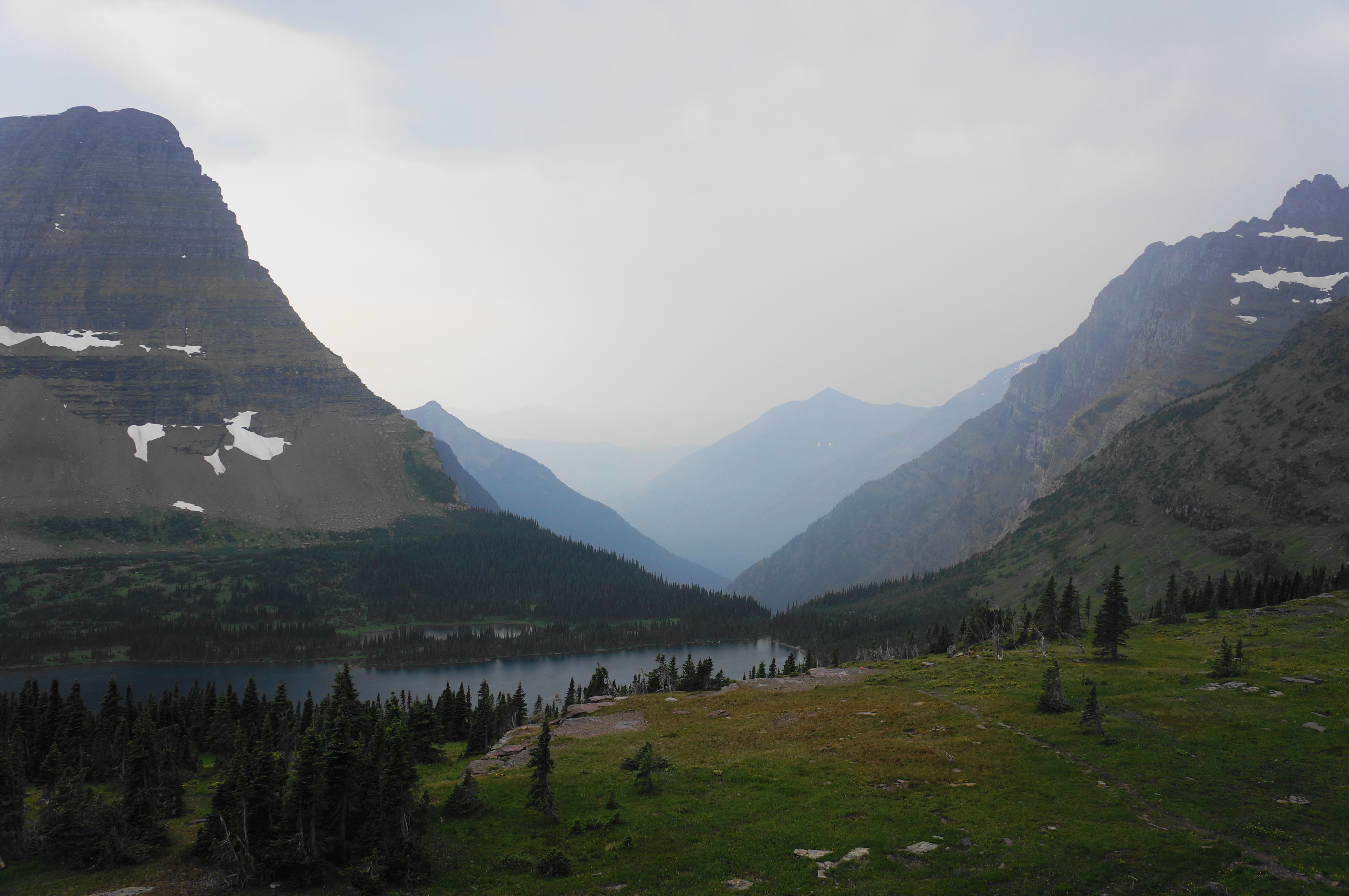
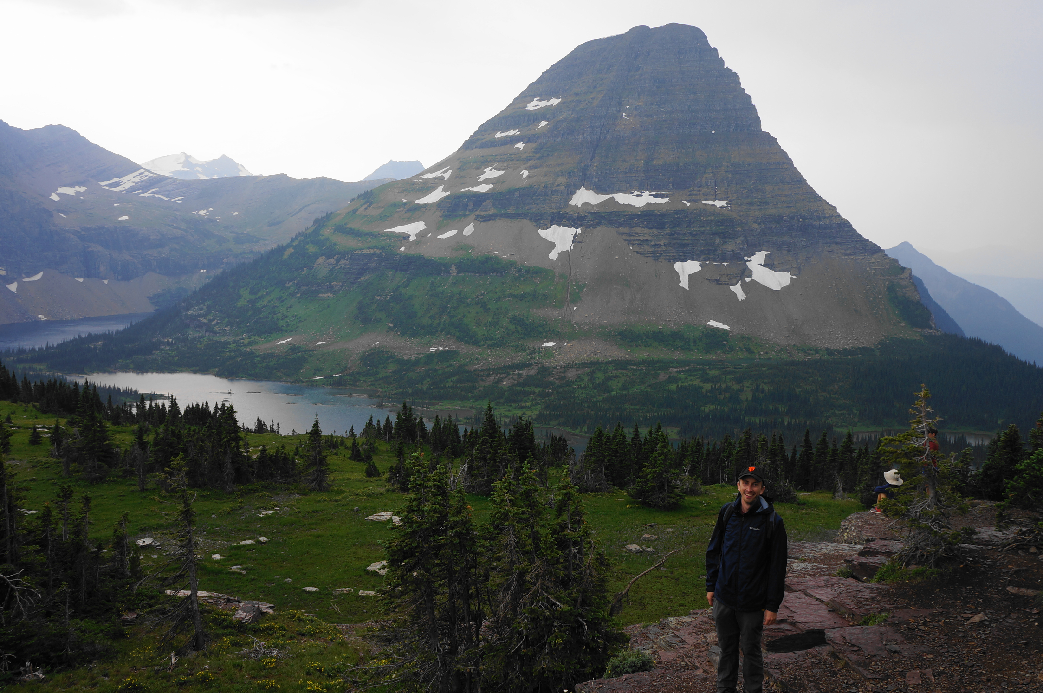
Crest Hidden Lake Pass—and the Continental Divide—at around 1.2 miles, with a seasonal pond off to the left. From here there is another short boardwalk, followed by a return to rock. A partial downhill leads to the overlook, where there is a short roundabout set amidst a patch of conifers. There are multiple spots to peer down to the lake—once-hidden, now-revealed—below.
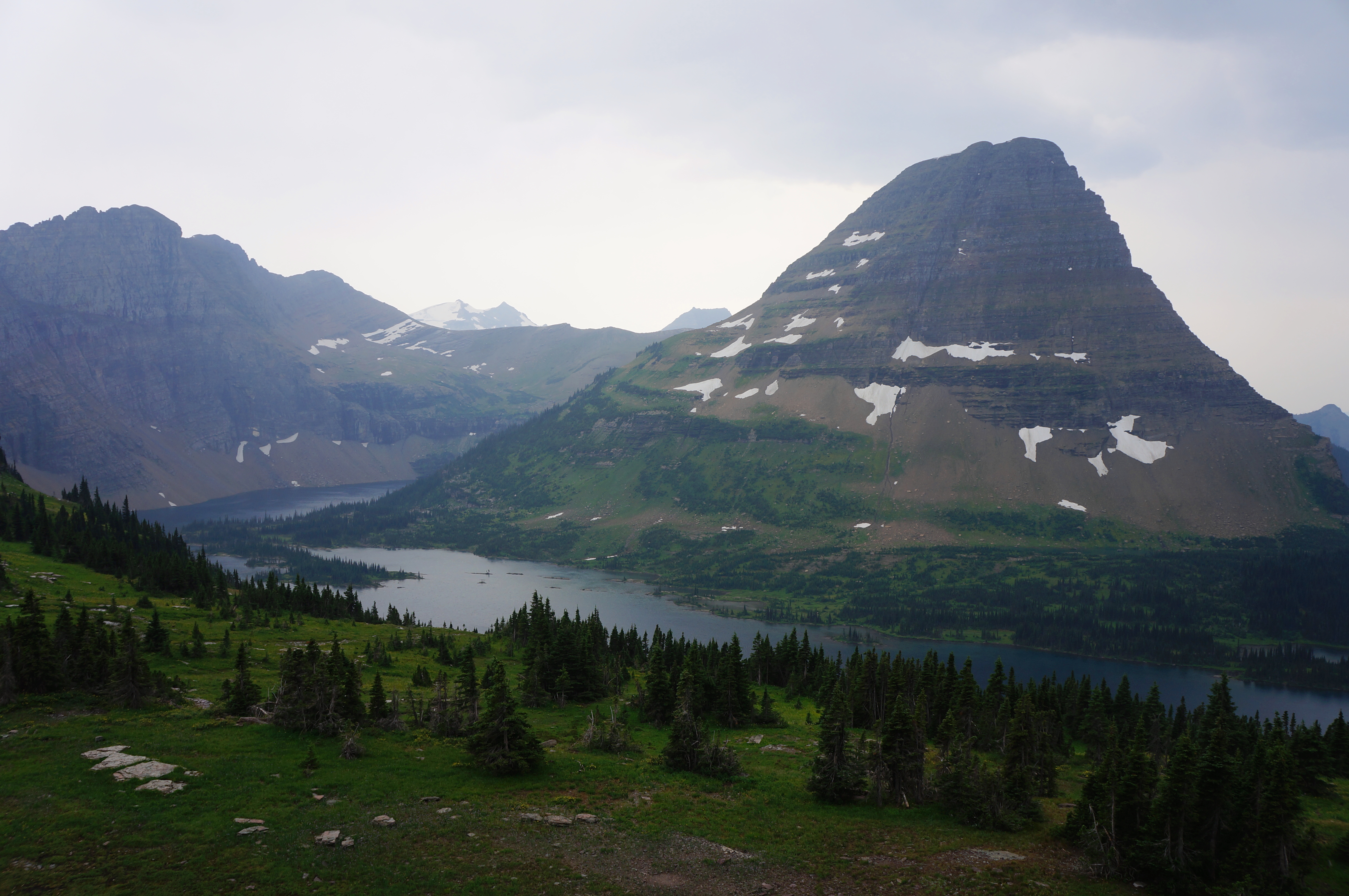
Hidden Lake is set in a splendid bowl below Bearhat Mountain (8,684’), which, like many peaks in Glacier, is sharp and precipitous. Due west, the lake empties into Hidden Creek, which quickly drops out of view, forming a sharp canyon between Bearhat and Mount Cannon (8,952’). Due south, the Continental Divide continues, interspersed with high peaks with often-perennial snow.
It is possible to proceed beyond Hidden Lake Overlook to the shores of the water below. Doing so, however, requires descending and regaining 700 feet in elevation, so most visitors pass. For those ready to return, retrace your steps, carefully descending 550 feet back to the trailhead and visitor center.

Pingback: Top 10 Hikes in 2024 – Live and Let Hike