After dropping Lisa at the airport in Missoula, I was riding solo for the rest of the cross-country trip, and after the 2.5 days in Glacier National Park, I set off southwards to explore a few other mountain ranges in Montana. After spending a stormy night at a USFS campground outside Florence, Montana, I went exploring in the Bitterroot Range in the morning…
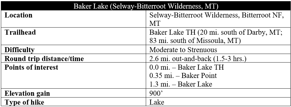
While many visitors to Montana flock to Glacier and Yellowstone National Parks, the western half of the state boasts dozens of different mountain ranges, each dotted with sharp peaks and alpine lakes. South and west of Missoula, Montana, the north-south Bitterroot Range forms the boundary with Idaho and has countless hiking opportunities, especially in the rugged Selway-Bitterroot Wilderness. The price of remoteness, of course, is that trailheads are difficult to access. A relative exception is Baker Lake Trailhead, set nine miles up a dirt but accessible track on a ridgeline partway up into the Bitterroots. From here a short but challenging ascent leads to Baker Lake, set in a sub-alpine basin below Trapper Peak (10,109’), the highest in the Bitterroot Mountains. (Note: Ambitious hikers can continue on to Middle and Gem Lakes, although the route is unofficial and unmaintained.)

The hike
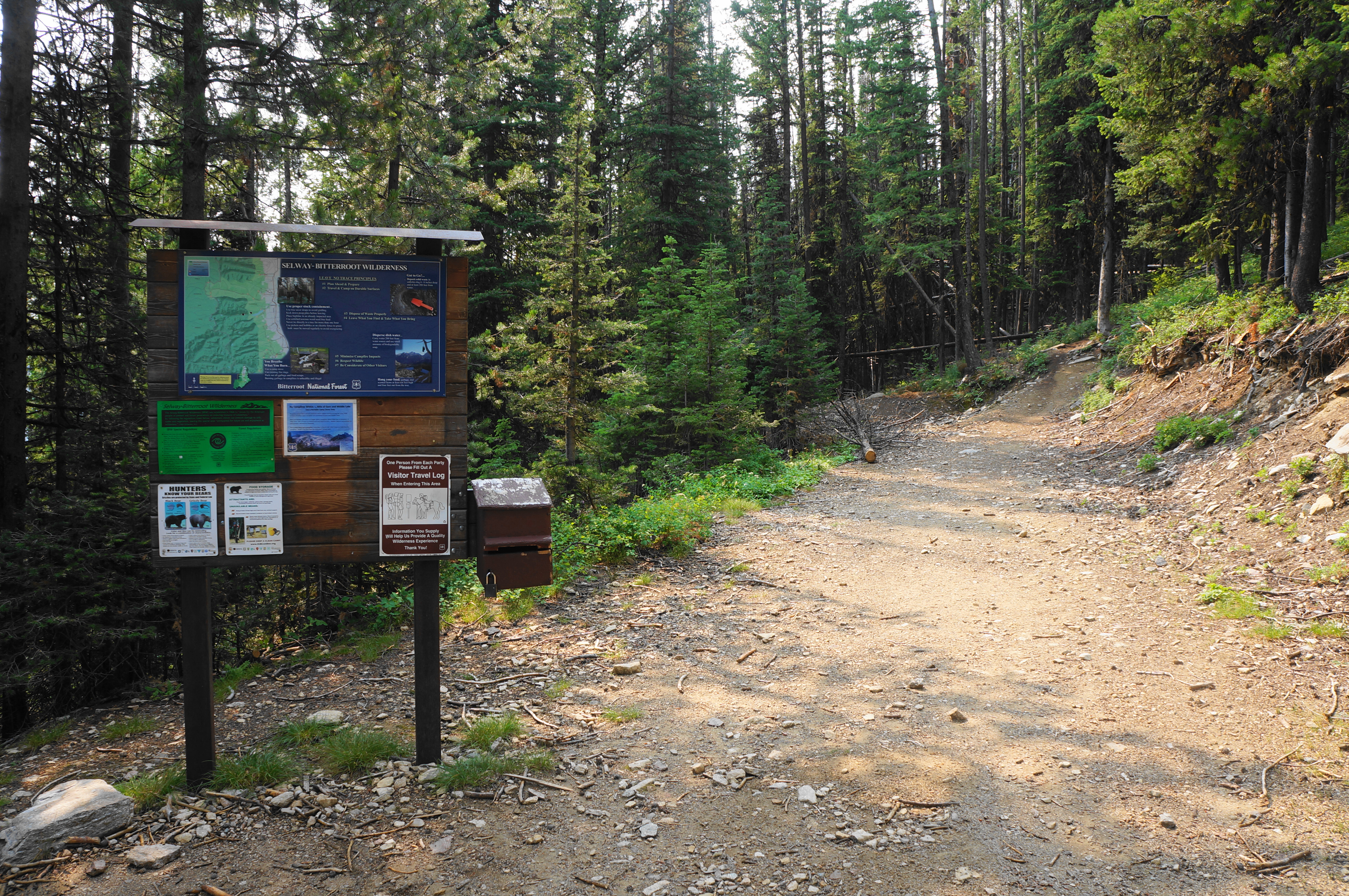
Reaching Baker Lake Trailhead in Bitterroot National Forest requires some patience, but the access road is improved and generally accessible to all two-wheel-drive cars. Veering off US Highway 93—the main thoroughfare in Bitterroot Valley—bear southwest on State Route 473 (West Fork Road). Then, at a horse ranch, bear right on Forest Road 363, beginning a nine-mile climb on a dirt track. Drive up a dusty ravine, then bear right at the fork, ascending more sharply and beginning a series of wiggles and switchbacks. Stay right at the next junction and continue for five miles to a scenic pulloff with dramatic views down to the Trapper Creek drainage to the north. Then continue another mile southward to the end of the road: Baker Lake Trailhead.
There is a trail wayside and travel log at the start. Register and read the bear notices, then proceed up the initially wide path, which quickly turns to a much narrower and strenuous climb over protruding roots and rocks. The challenging route bears south, then west, passing a boulder pile at around 2/10 mile before rounding a set of very steep bends and switchbacks.

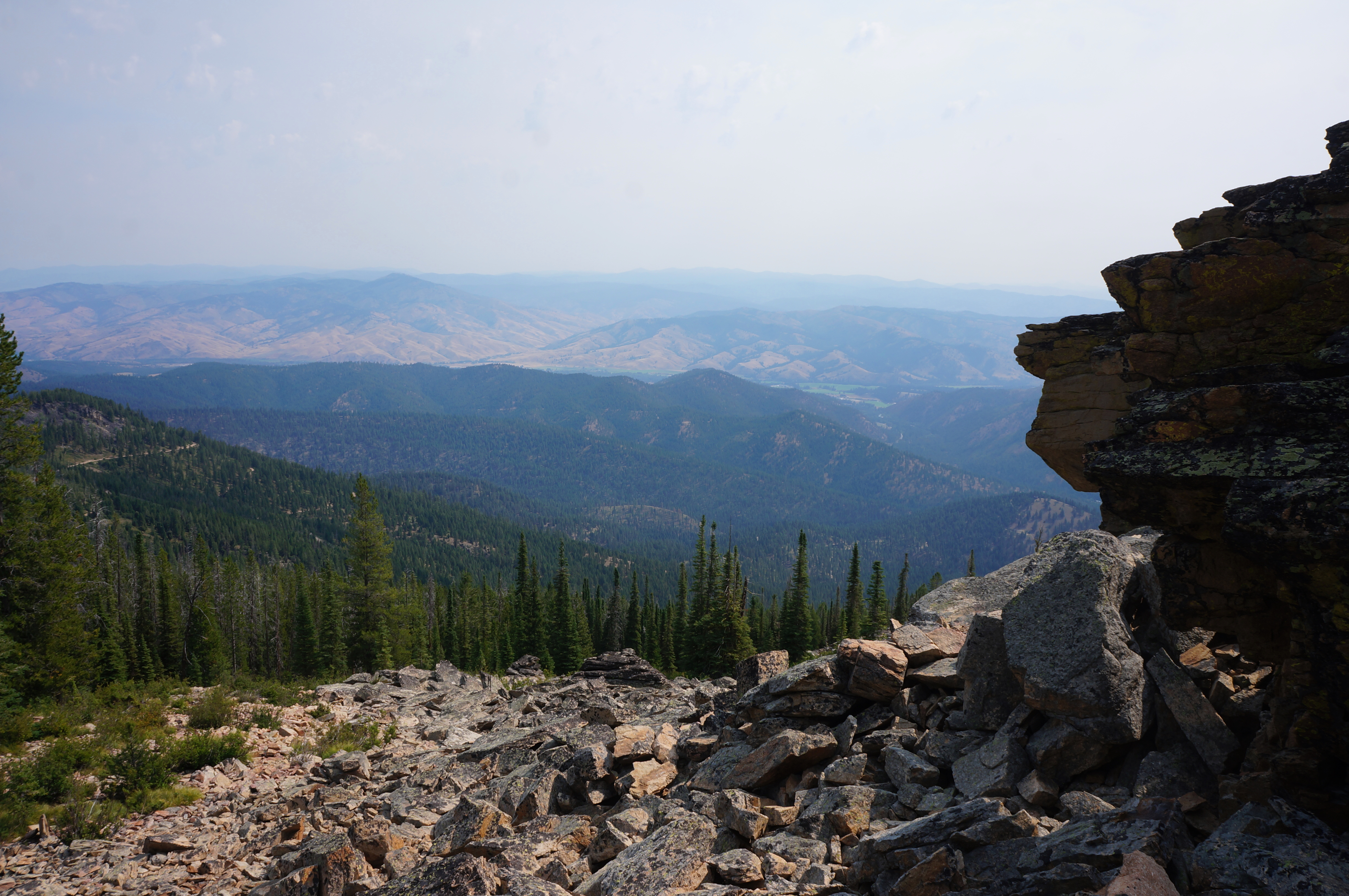
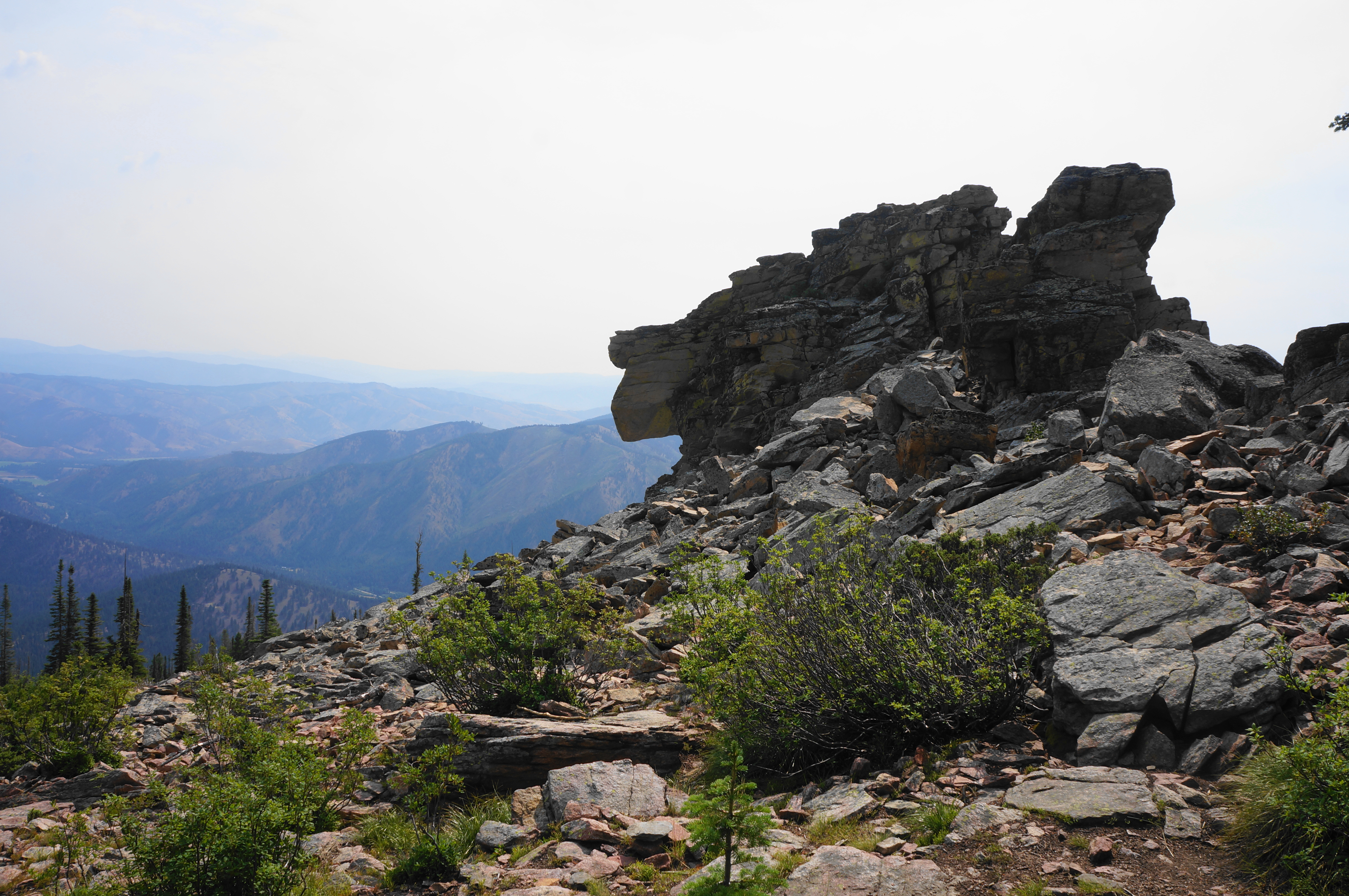
At around 1/3 mile, there is an unmarked junction, but stay right on the main track. About 75-100 yards further, however, take the spur left, routing to the base of Baker Point, a worth detour. Here, set atop a bald outcrop, hikers get sweeping views south and east across the Bitterroot and West Fork Valleys.
Back on the trail to Baker Lake, the path leads westward up the spine of a ridge with sparser pine cover. Here the incline lessens slightly but continues as the trail swings around the south-facing slope above the Baker Creek drainage, with sporadic views. At about 6/10 mile, there is a brief respite from the climb and the trail levels off.
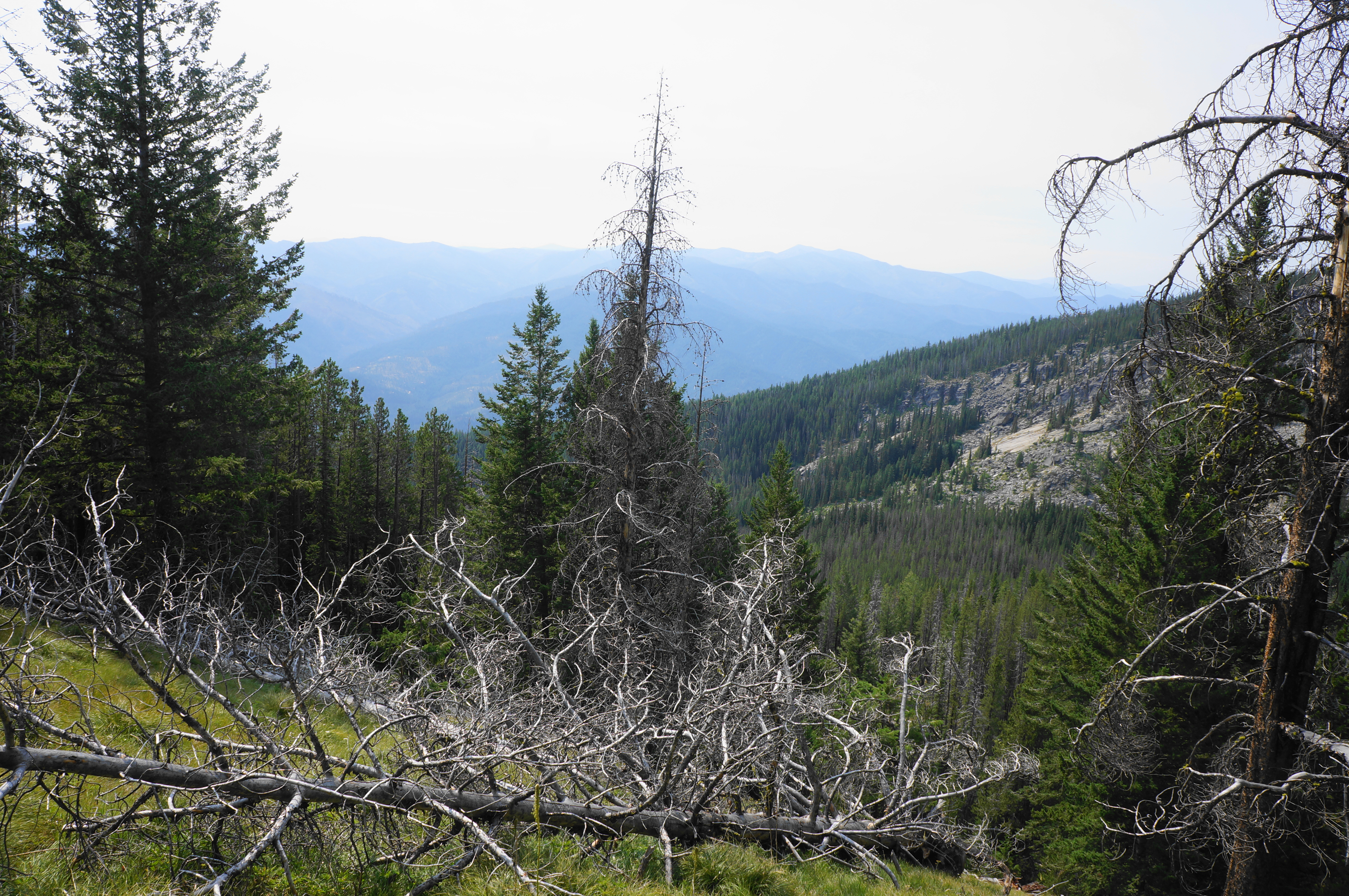
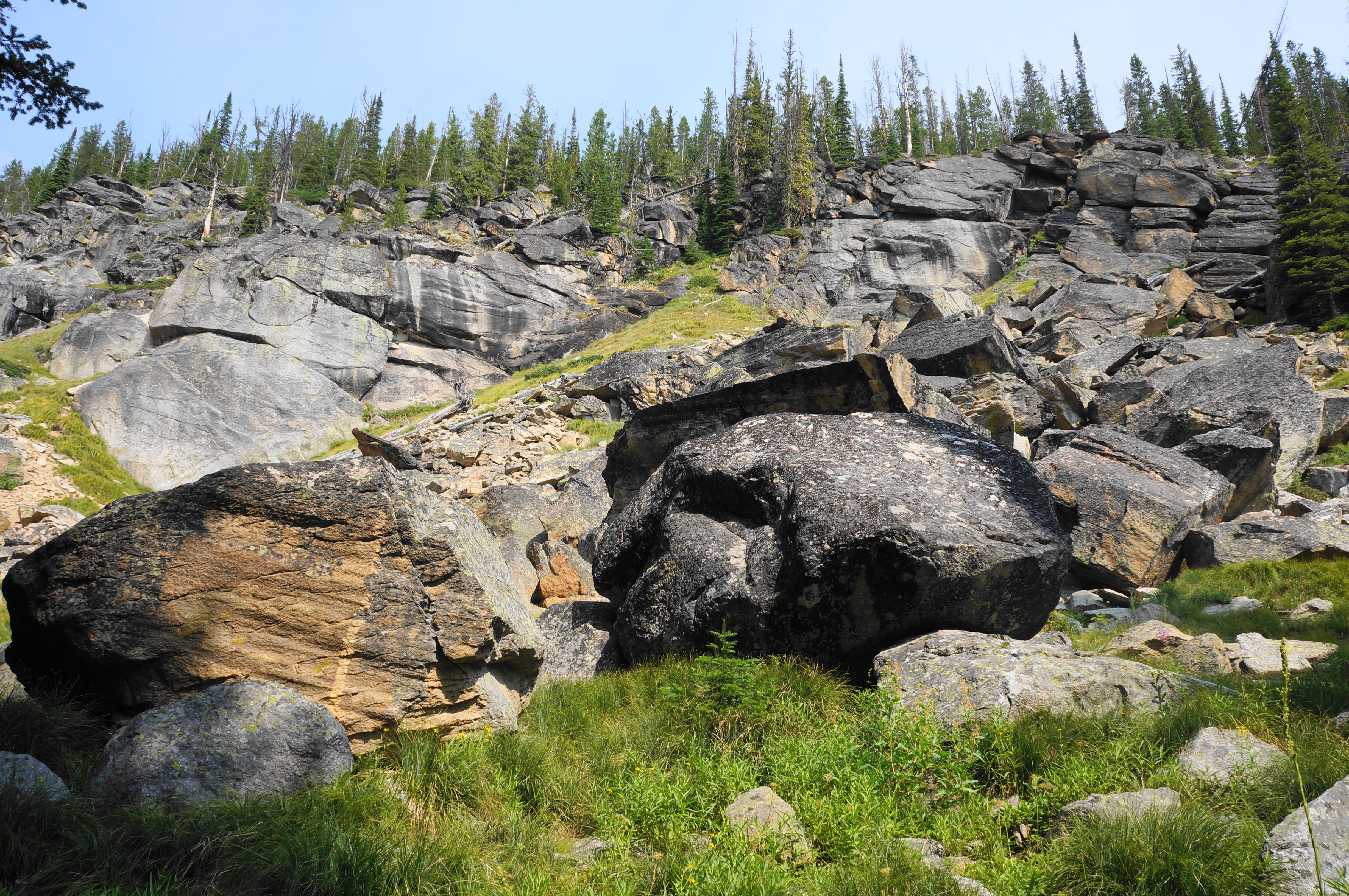
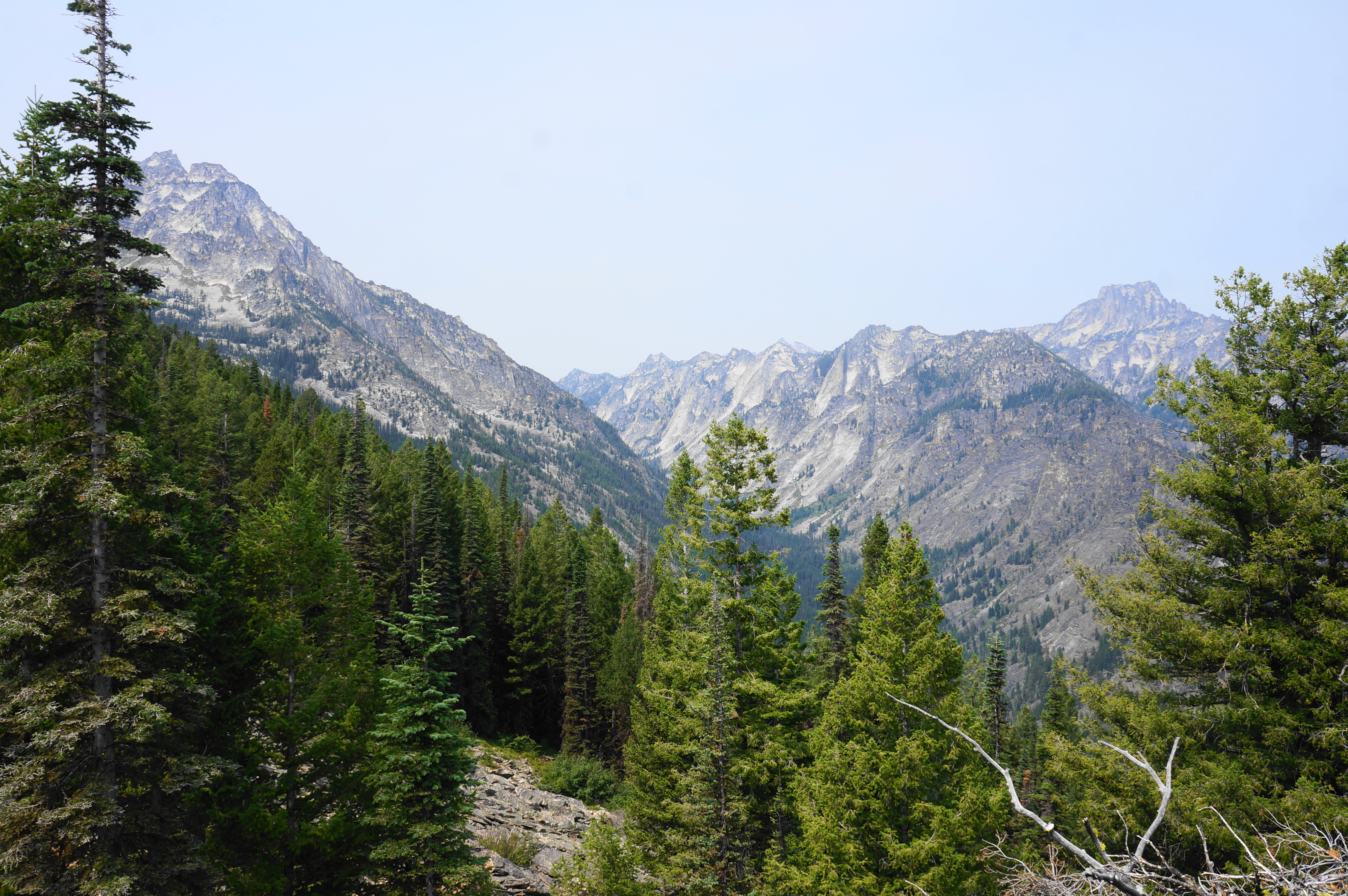
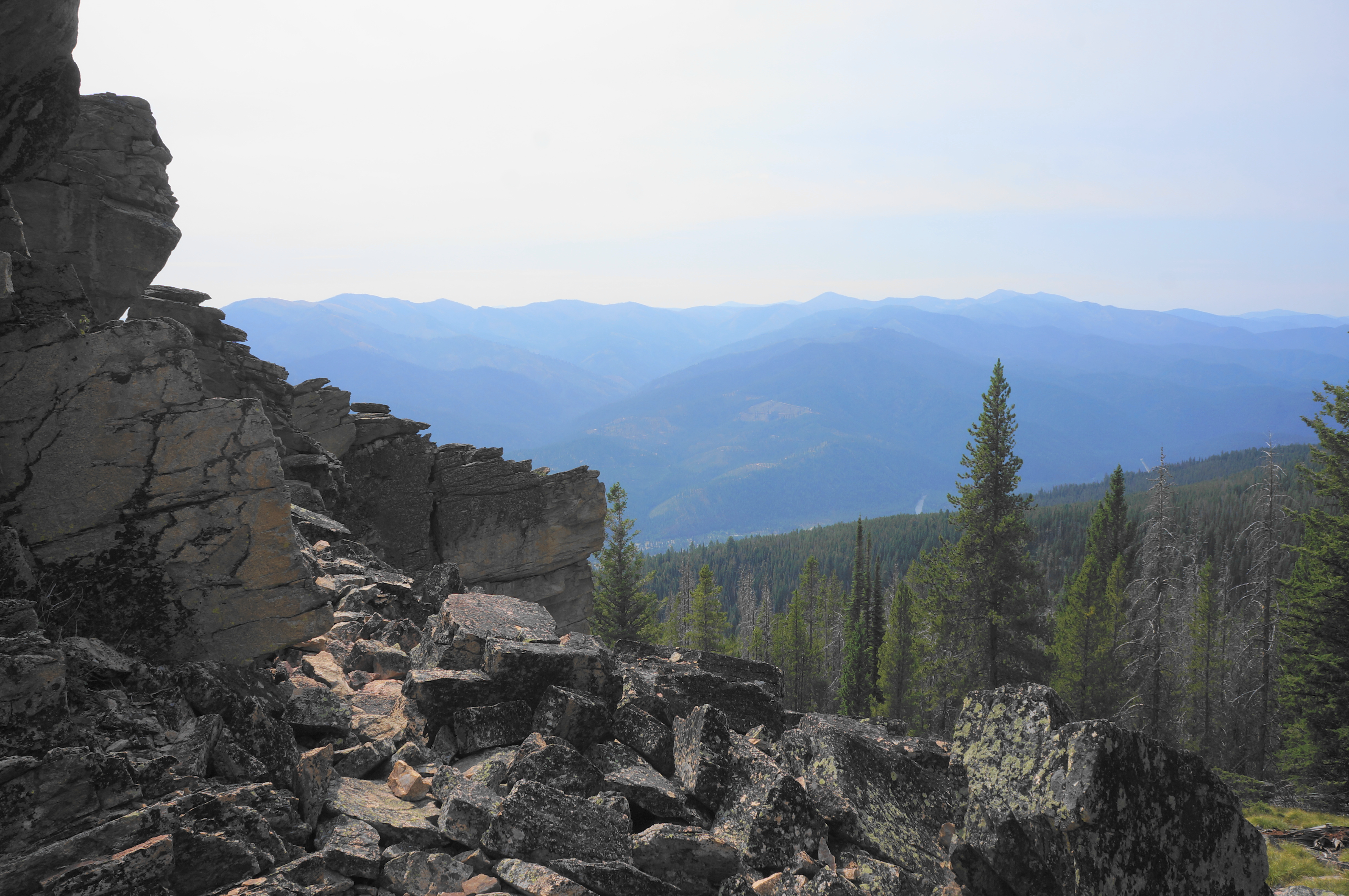
Passing a couple of open windows with views, the track skirts a set of chunky boulders stained with black streaks. By now hikers have proceeded nearly a mile. The final stretch, however, requires another steep ascent through a moister, brushy area (surely attractive to bears). Here onward passage can get a little confusing: as some social trails start to tread downhill toward Baker Creek, generally try to stay up on the granite tops. The trail never crosses the stream en route to the lake.

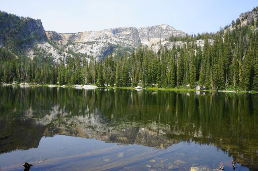
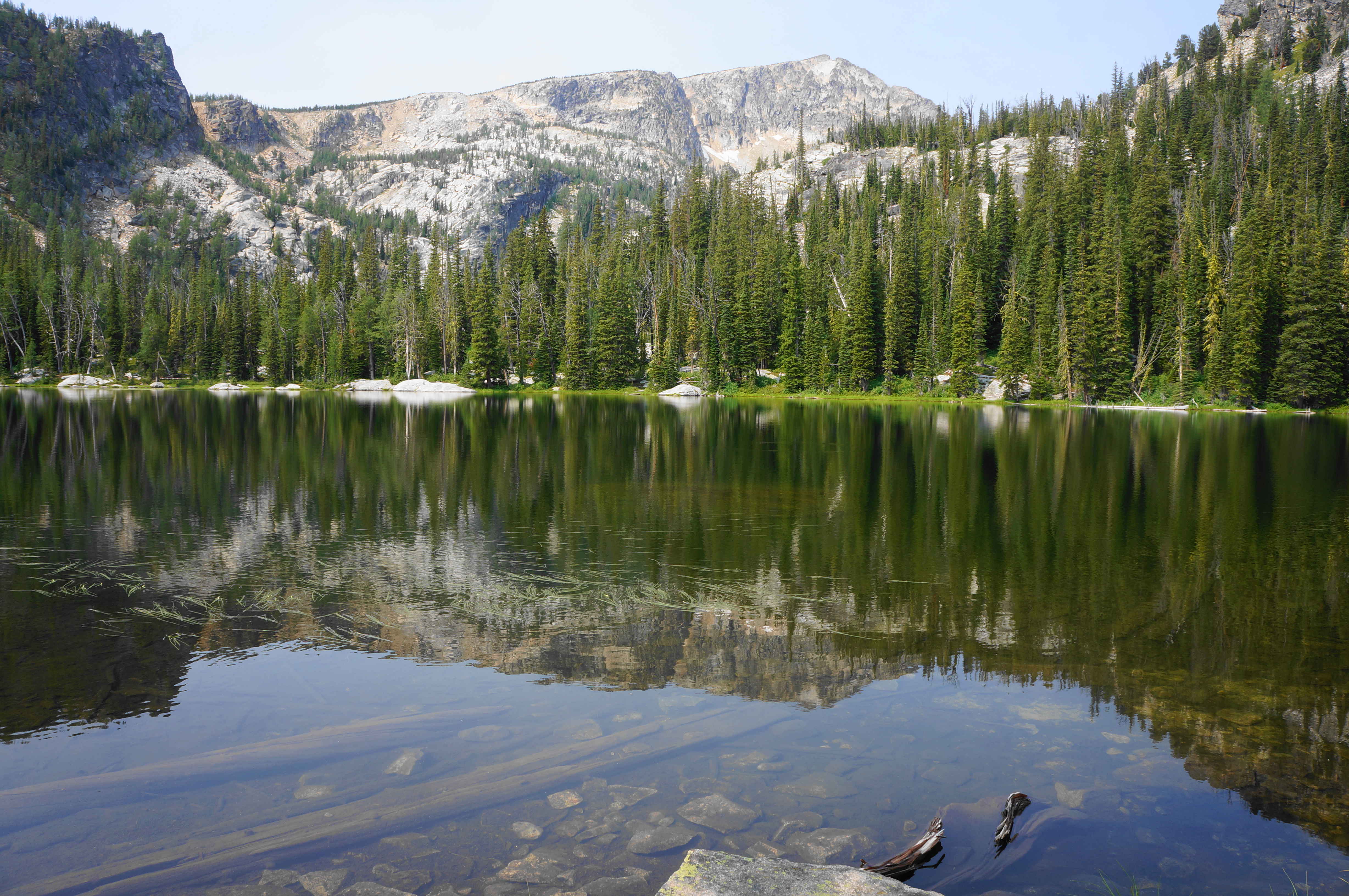
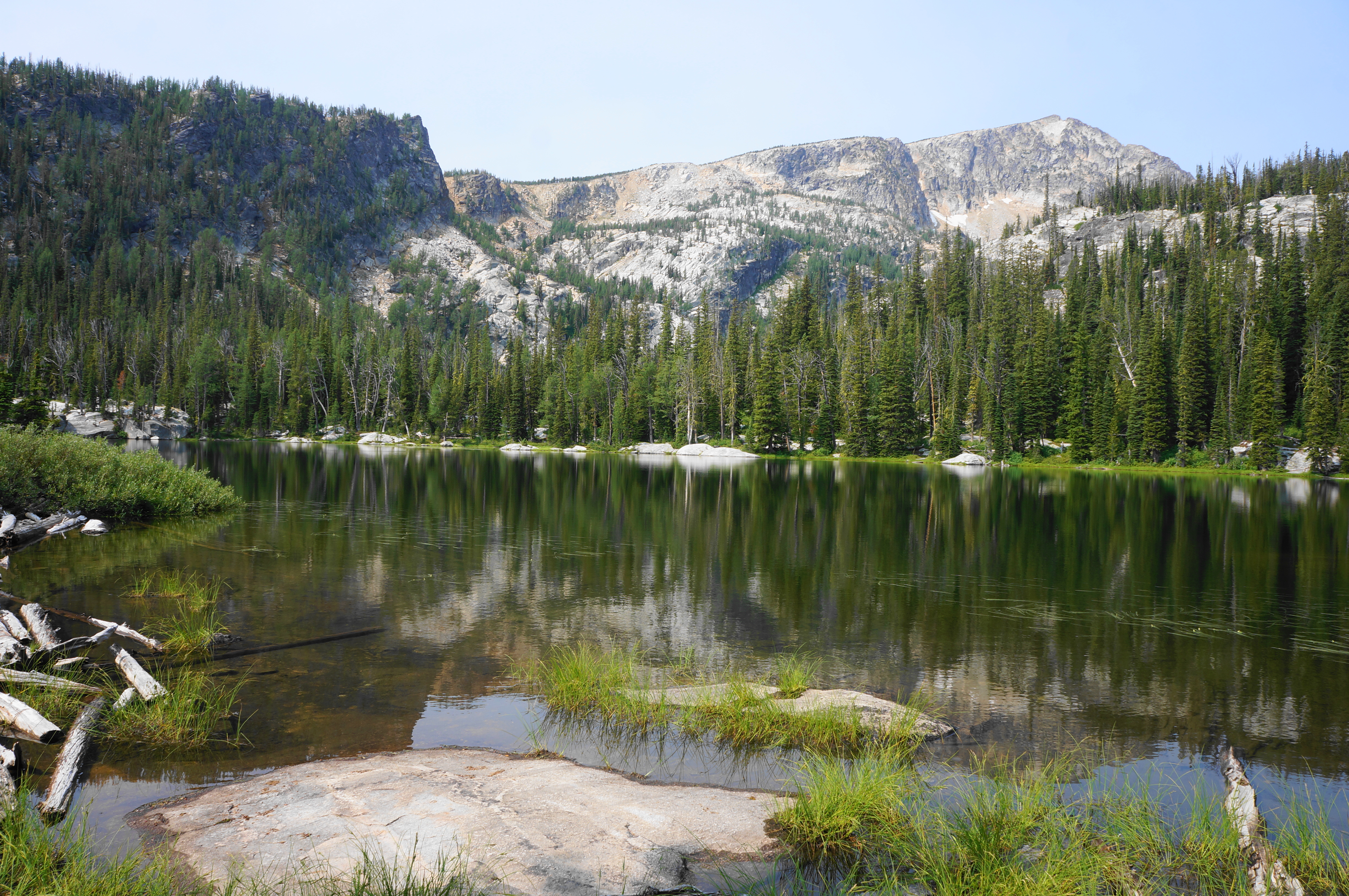
At about 1.3 miles, the trail reaches the basin in which Baker Lake is set and finally comes to its grassy shores. The lake is not above tree line but is set against a dramatic backdrop of Trapper Peak, a hulking mass high above. Look for the reflection of the peak in the lake’s morning stillness. There are plenty of nice spots to sit and admire the view, and it is likely possible to circumnavigate the lake.

Ambitious hikers can continue beyond to the next shelf above Baker Lake—to Middle and Gem Lakes. Others should return the way they came, this time descending steeply back to the trailhead. Expect to take at least 1.5 hours and perhaps as many as 3-4 for the round-trip out-and-back.

picturesque! Self-Sustaining Eco-Village Becomes Reality 2025 marvelous
Pingback: Top 10 Hikes in 2024 – Live and Let Hike