At 7,241 feet, Black Elk Peak is South Dakota’s highest point and the tallest peak in the United States east of the Rocky Mountains. The mountain (formerly known as Harney Peak) was a sacred place for the native Lakota and tops a band of craggy granite in the southern Black Hills. As far as state high points go, the peak is reasonably accessible – but it requires at least six miles of hiking from nearby Sylvan Lake in Custer State Park. I highly recommend turning the trek into a 7-mile loop, allowing for views to nearby Little Devils Tower and Cathedral Spires. Even as the Black Hills on the whole are no match for the Rockies, the granite needles here come close to rivalling the geological splendor of the West. I would rate this hike as moderate for fit hikers, but perhaps strenuous for those not used to lots of steps, elevation gain, and 7-mile walks.


The hike
Alas, while beautiful, the Sylvan Lake area in South Dakota’s Custer State Park is one of the most crowded places in the Black Hills, making parking on a busy summer day quite challenging. Plan to arrive early (e.g., 6 or 7am) to secure a spot at the Sylvan Lake Day Use Area, situated at the end of a spur road on the east flank of the lake. Several trails take off from here, but make your way to the (well-signed) start of Trail #9, the primary thoroughfare heading for Black Elk Peak (though you will take an alternative route on the way back).
Sylvan Lake to Black Elk Peak via Trail #9 (3.25 miles)
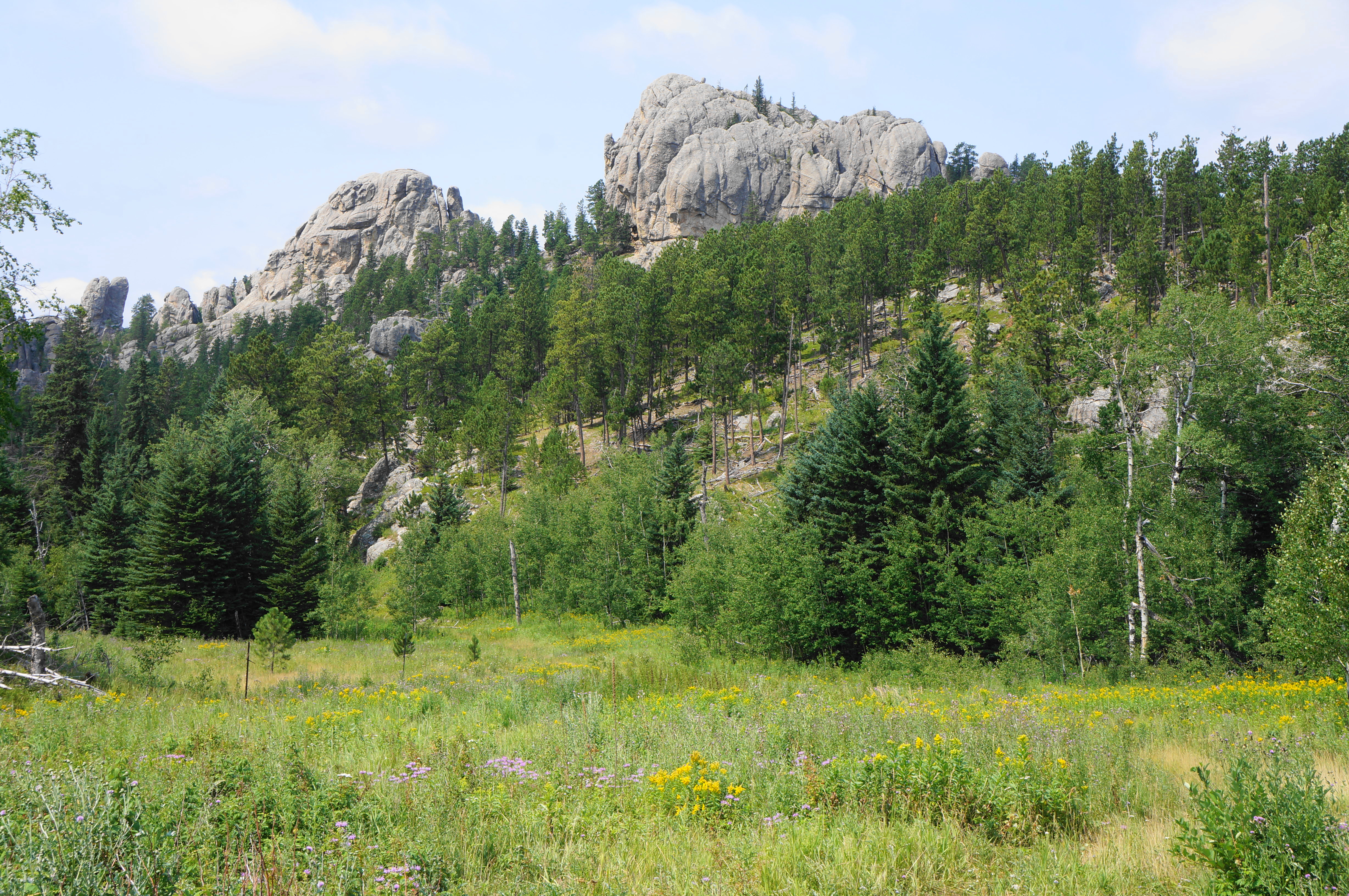
The wide gravel track splits after a few dozen meters; bear right to begin a gradual ascent, weaving in and out of patches of pine and spruce. Rock outcrops dot the landscape on the left, while the terrain opens up into a patchy meadow to the right. Enjoy a brief respite after about 1/3 mile, then continue climbing, making your way toward a high ridgeline and the state park boundary. At ¾ miles, hikers reach the saddle, with Black Elk Wilderness beyond. Here hikers can see a chunks of craggy granite ahead, although the summit of the peak remains obscured.
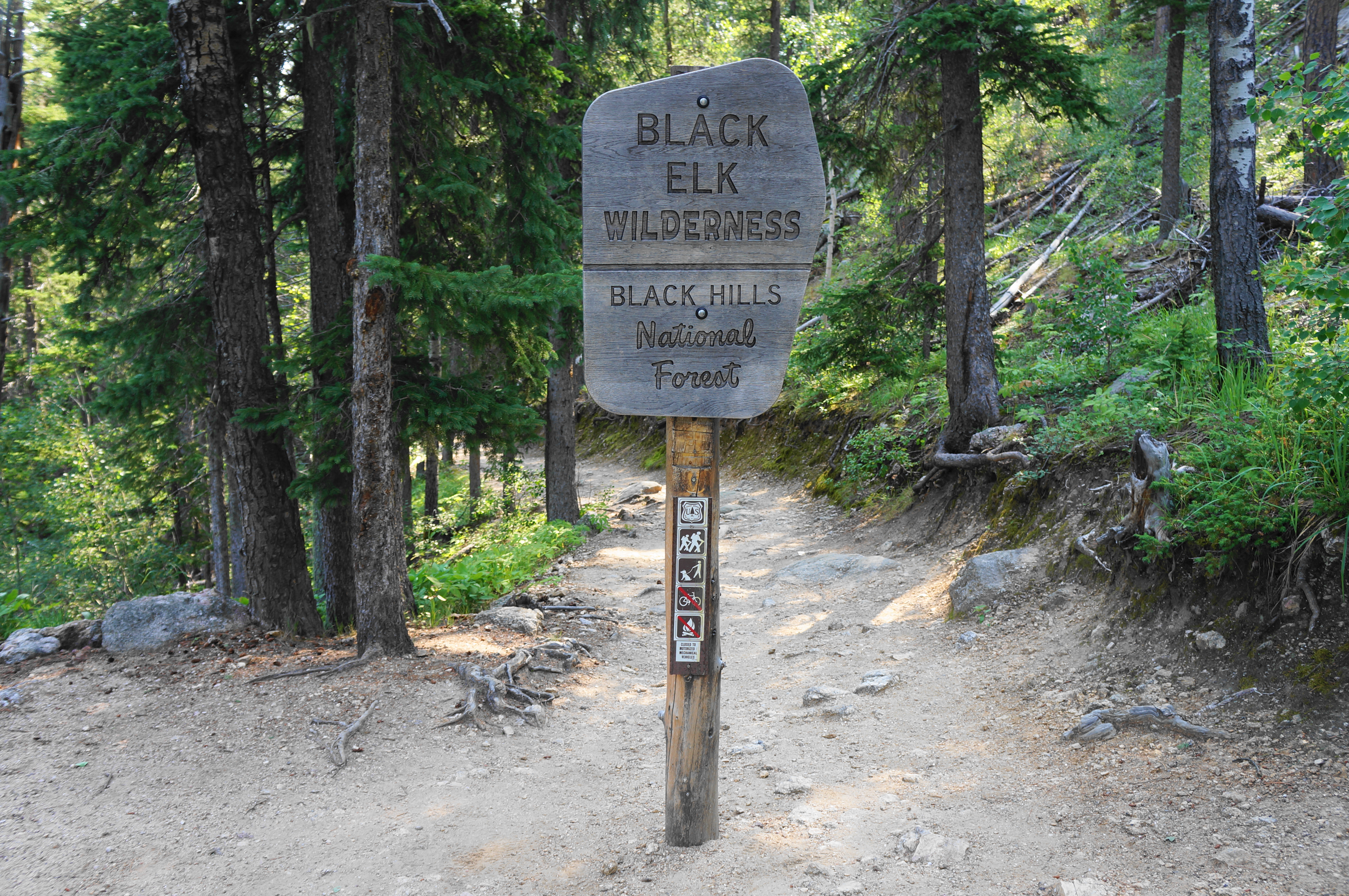
Bear right at the junction, staying on Trail #9 as it redoubles back into Custer State Park. Mount a mild slope to another set of vistas, this time offering a distant look at the destination: the stone viewing tower atop Black Elk Peak, still a couple miles further. In the foreground, the terrain gives way to a woody ravine, which the trail descends to meet soon thereafter. Aspens become a more common sight as the trail levels off and then drops again, coming into a marshier basin. The track so formally leaves Custer State Park and enters Black Elk Wilderness, a 13,000-acre tract that contains arguably the best scenery in the Black Hills.


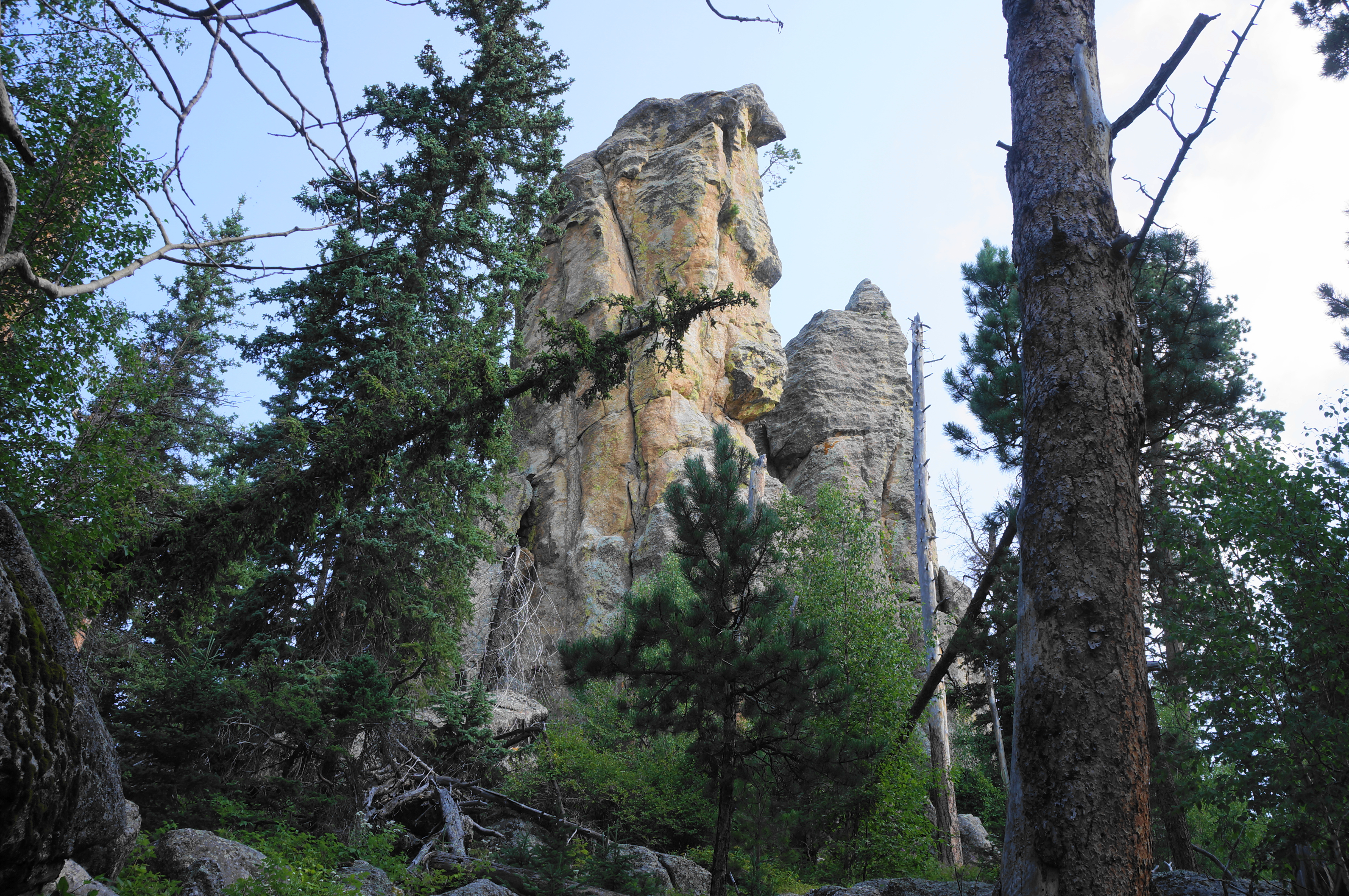
A few minutes later, cross a small footbridge over a mild stream and stay right at the junction with the Lost Cabin Spur (Trail #2B). A mild uphill returns as the trail gradually climbs out of the woody drainage basin; two large boulders on the left signal the start of a steeper incline with some wooden and stone steps. Pass twin pinnacles on the left again and make a more rigorous ascent to another saddle, set below the peak.

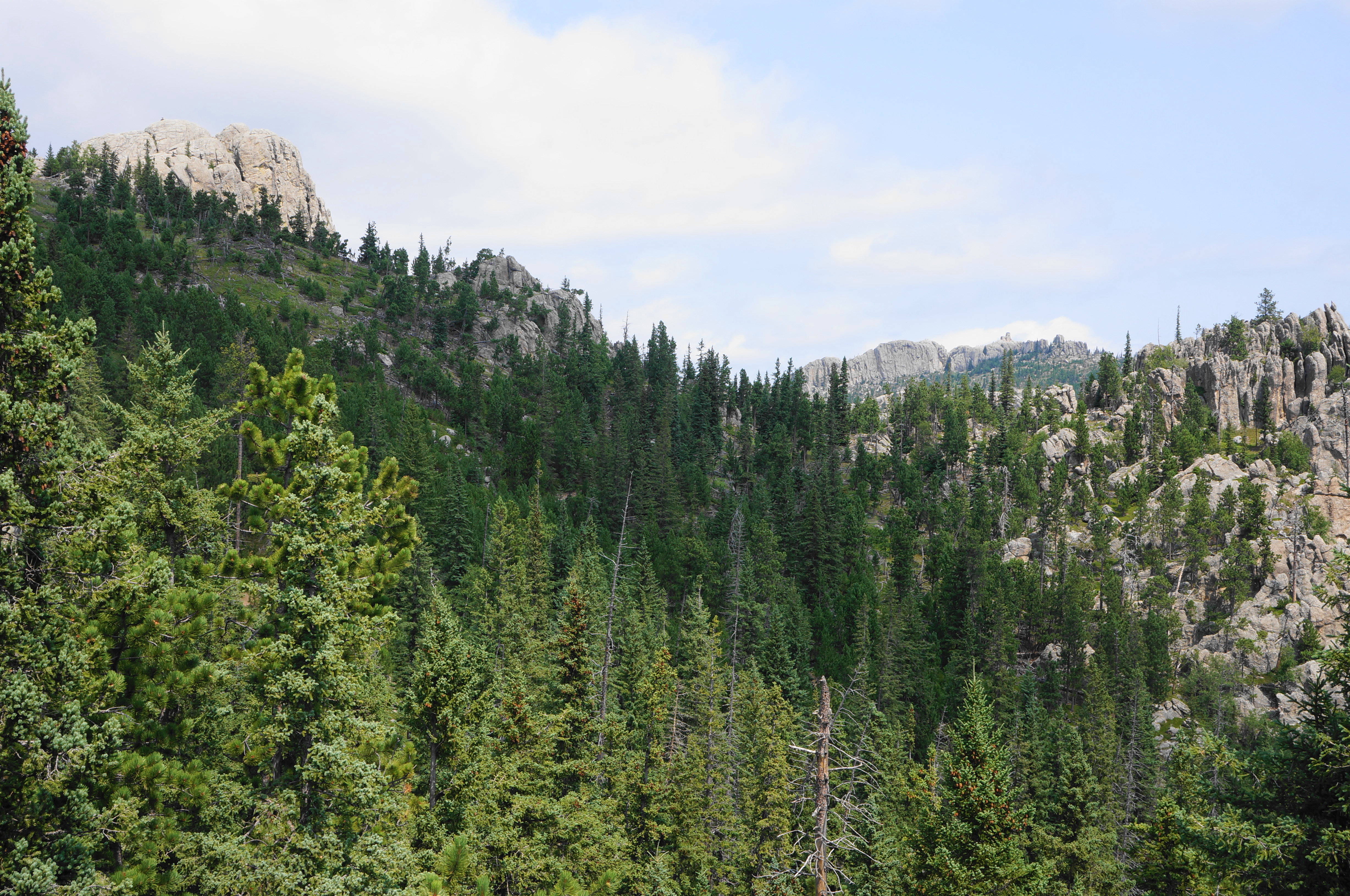
Here you will find a junction at 2.8 miles with Trail #3 (Norbeck), a route you will use later on the return journey. But for now, stay left on Trail #9. With the trees thinning and elevation rising, hikers will now enjoy sweeping views, including a look east toward the Mount Rushmore area and the Great Plains beyond.

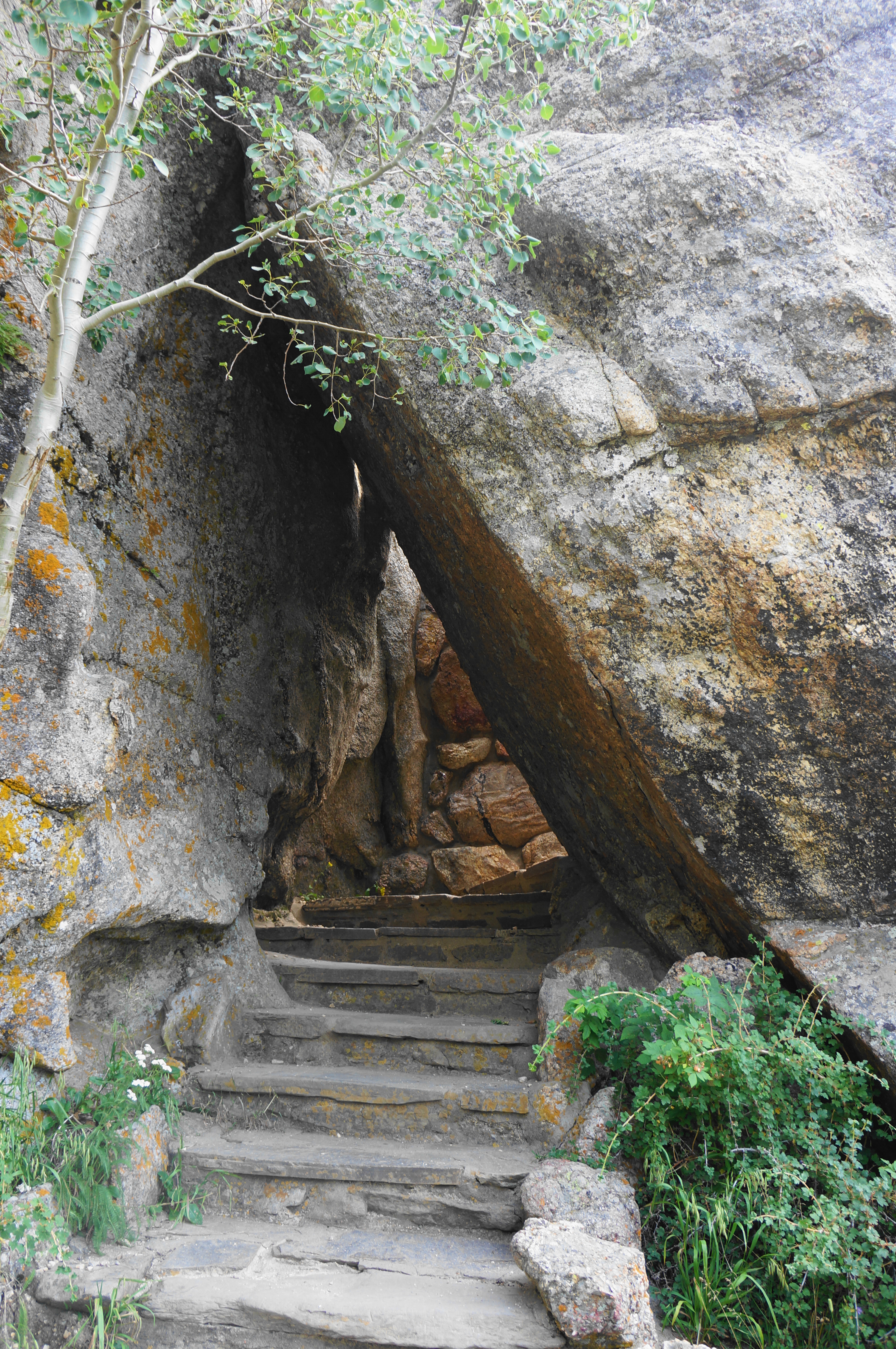


Ascend steps and bends to another junction at 3.1 miles. With the observation tower atop Black Elk Peak now in view, bear left (foot traffic only) and round to the west side of the mountaintop before coming to the iconic final stretch: a lengthy staircase, followed by an ascent through a narrow notch. A short tunnel leads to a metal staircase that bridges a crevasse. Back in the sun, a spiraling staircase threads the granite spine and ends at the Black Elk Peak Fire Tower, constructed by the Civilian Conservation Corps in the 1930s. This is the highest point in South Dakota—and the highest between the Rockies and the European Pyrenees!

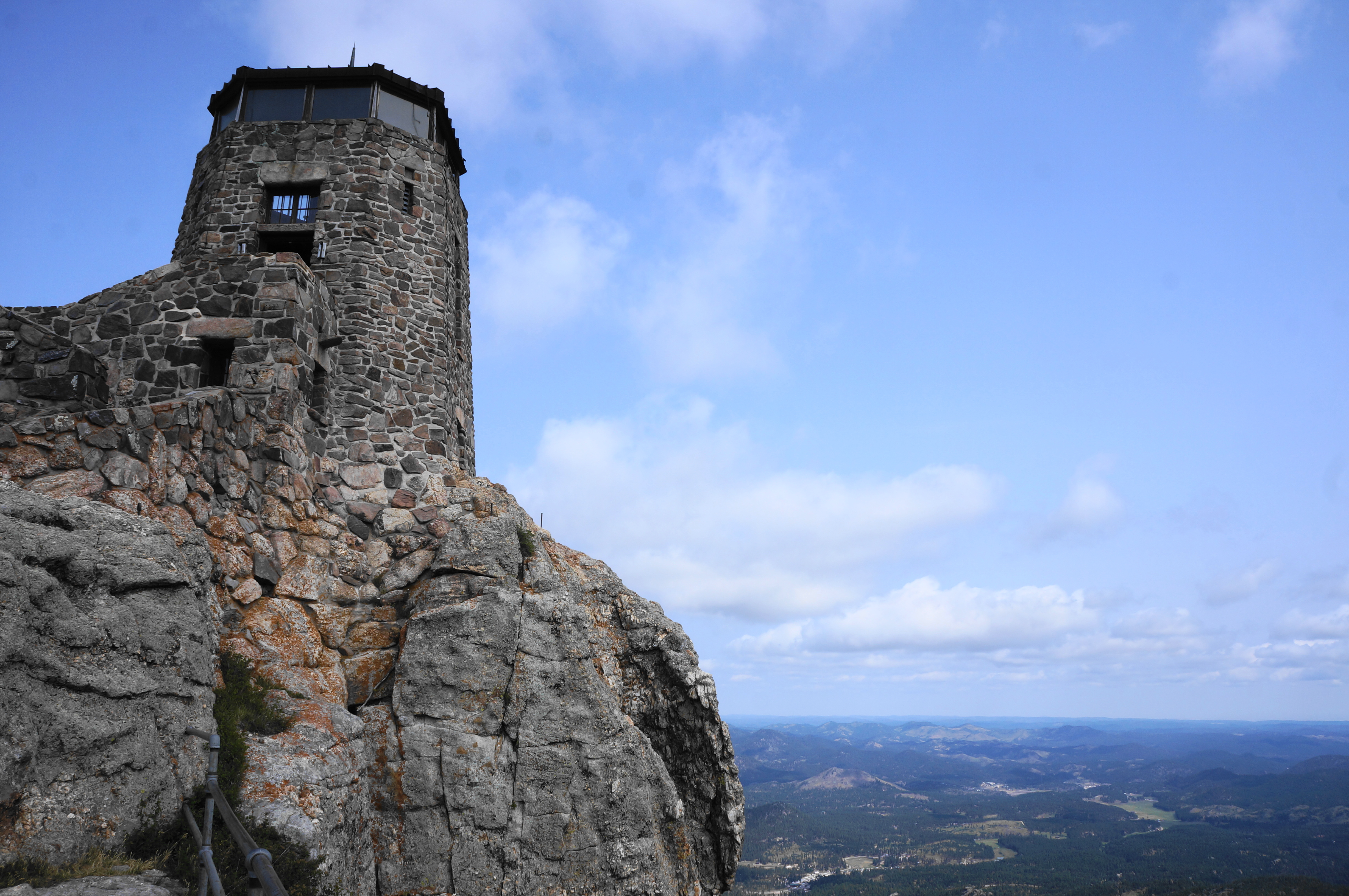
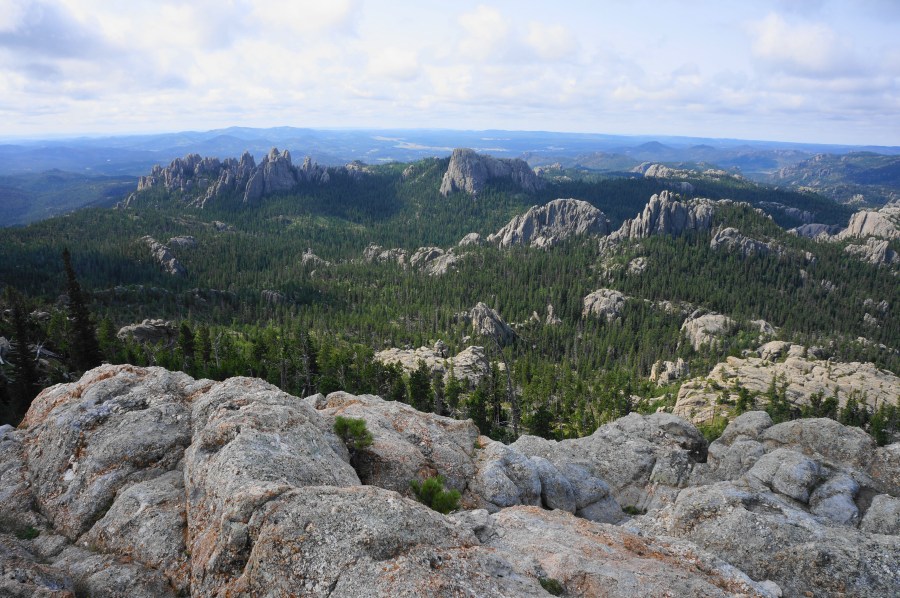
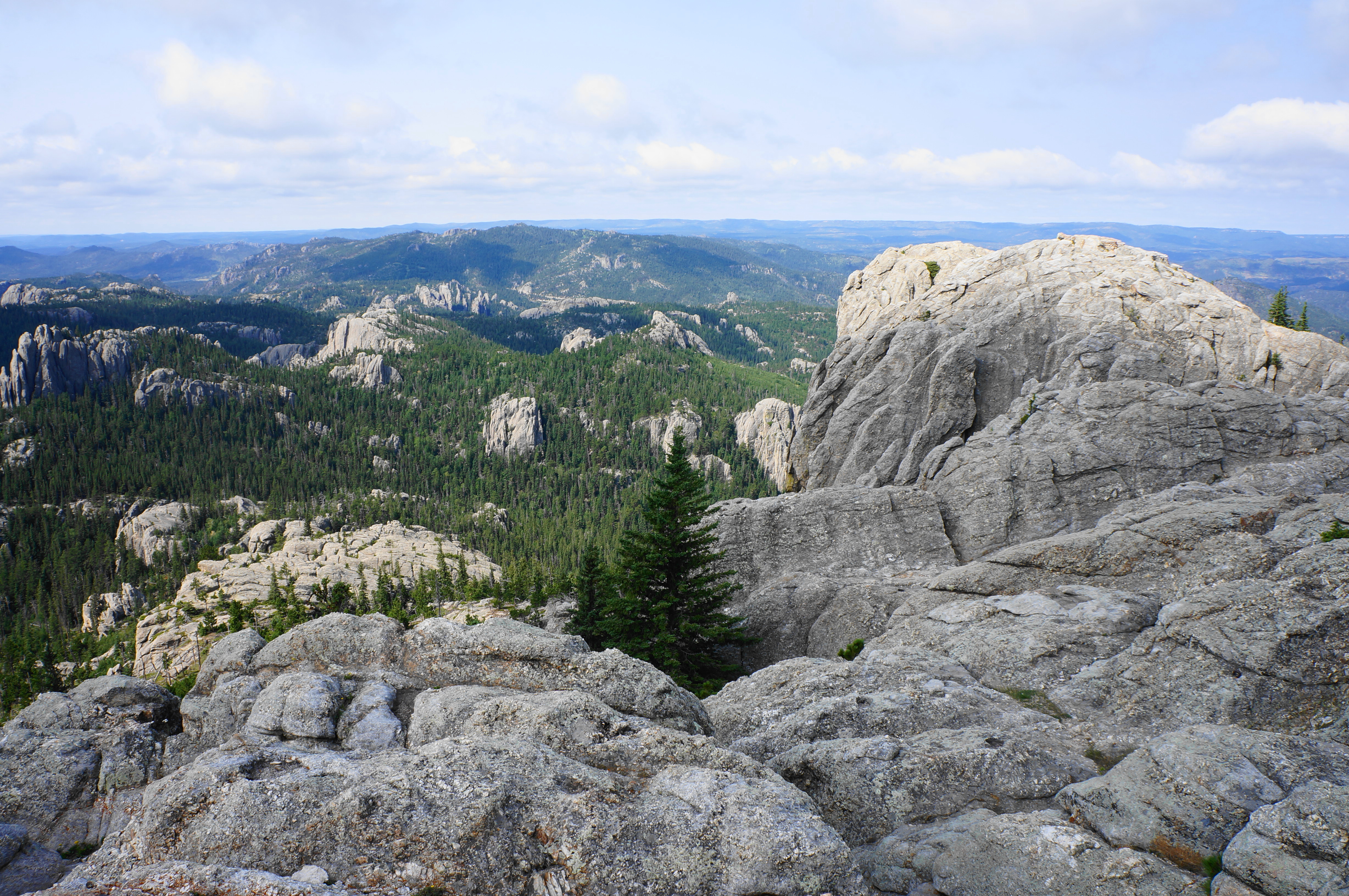
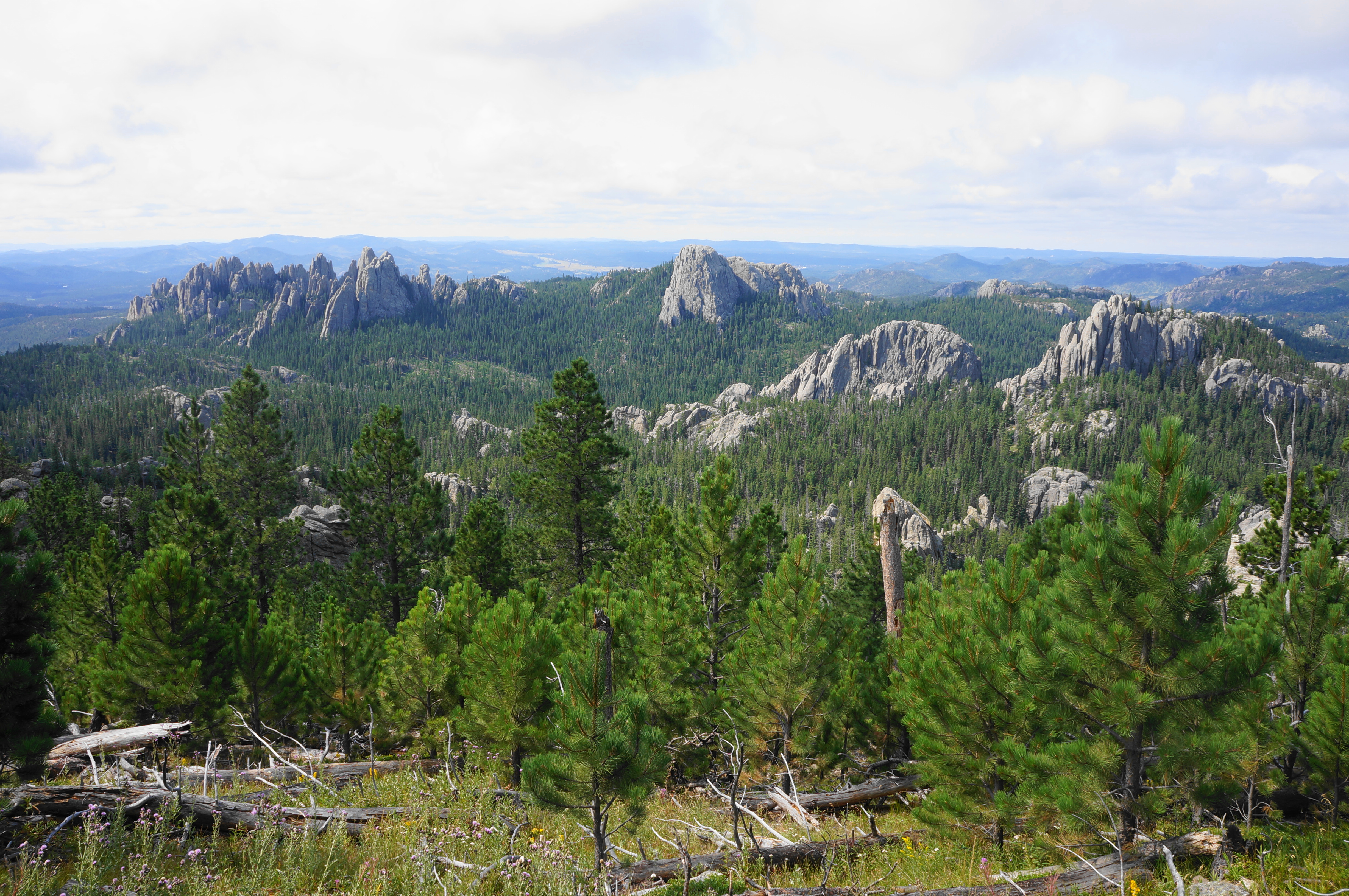
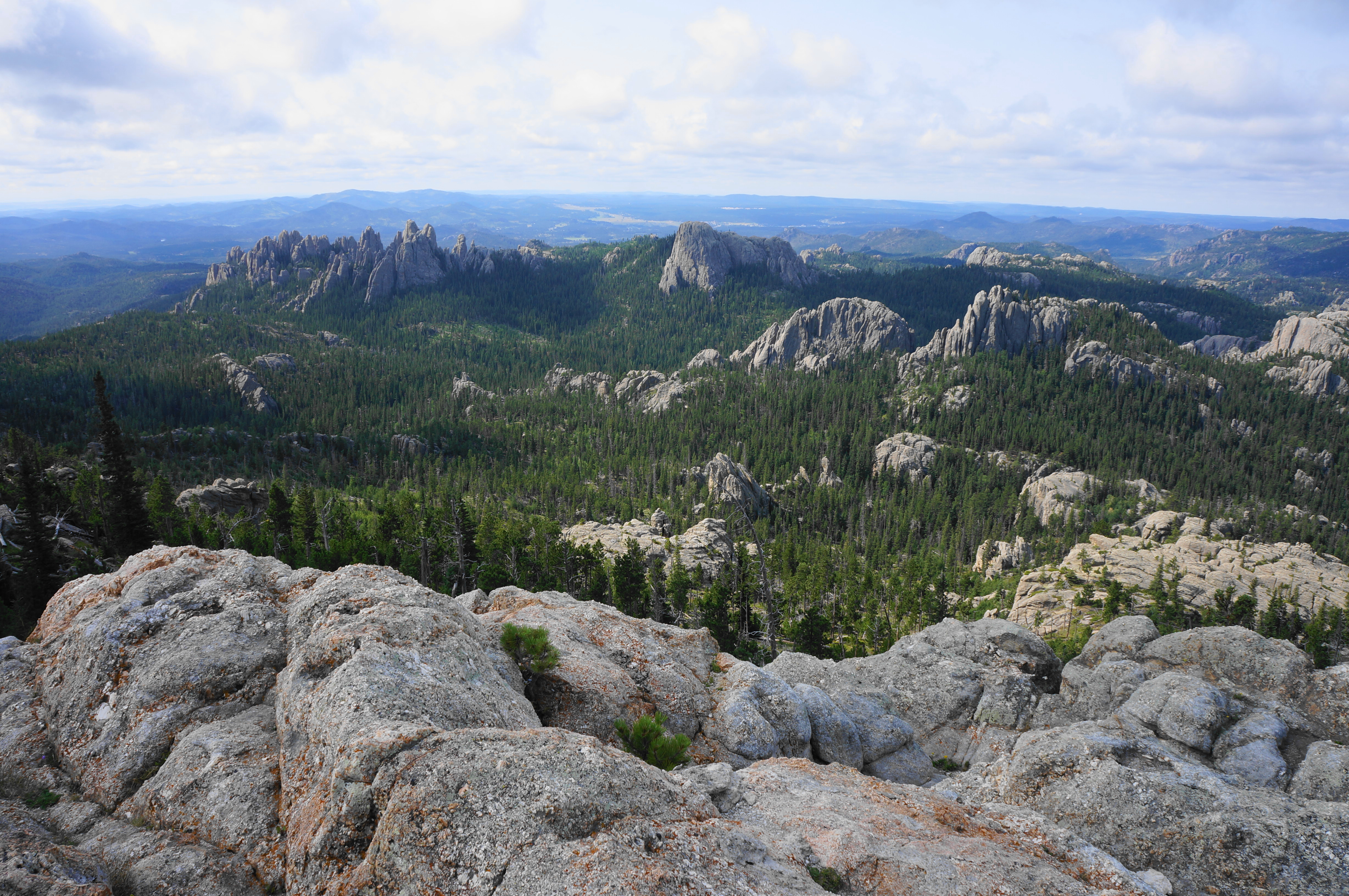
The views, of course, are panoramic, spanning in all directions. One can see Cathedral Spires, Little Devils Tower, and Custer State Park to the south and west. Black Elk Wilderness unfolds to the north and east, with the vast Great Plains of South Dakota beyond. On very clear days, you can reportedly see as far as four adjoining states—Montana, Nebraska, North Dakota, and Wyoming. The lookout tower itself is modest but impressive for its stone handiwork.


Black Elk Peak to Sylvan Lake via Trails #3 and #4 (3.75 miles)
When ready, retrace your steps, descending back through the notch and returning to Trail #9. Bear right at the first junction, then come down to the second. This time bear left, starting down Trail #3, also known as the Norbeck Trail. This alternative route is ½ mile longer but worth the extra effort. Here the track bends east, then south after a right-hand switch. Dropping in and out of patches of pines, come to a junction with Trail #7 (Grizzly Bear Creek Trail) and stay right.
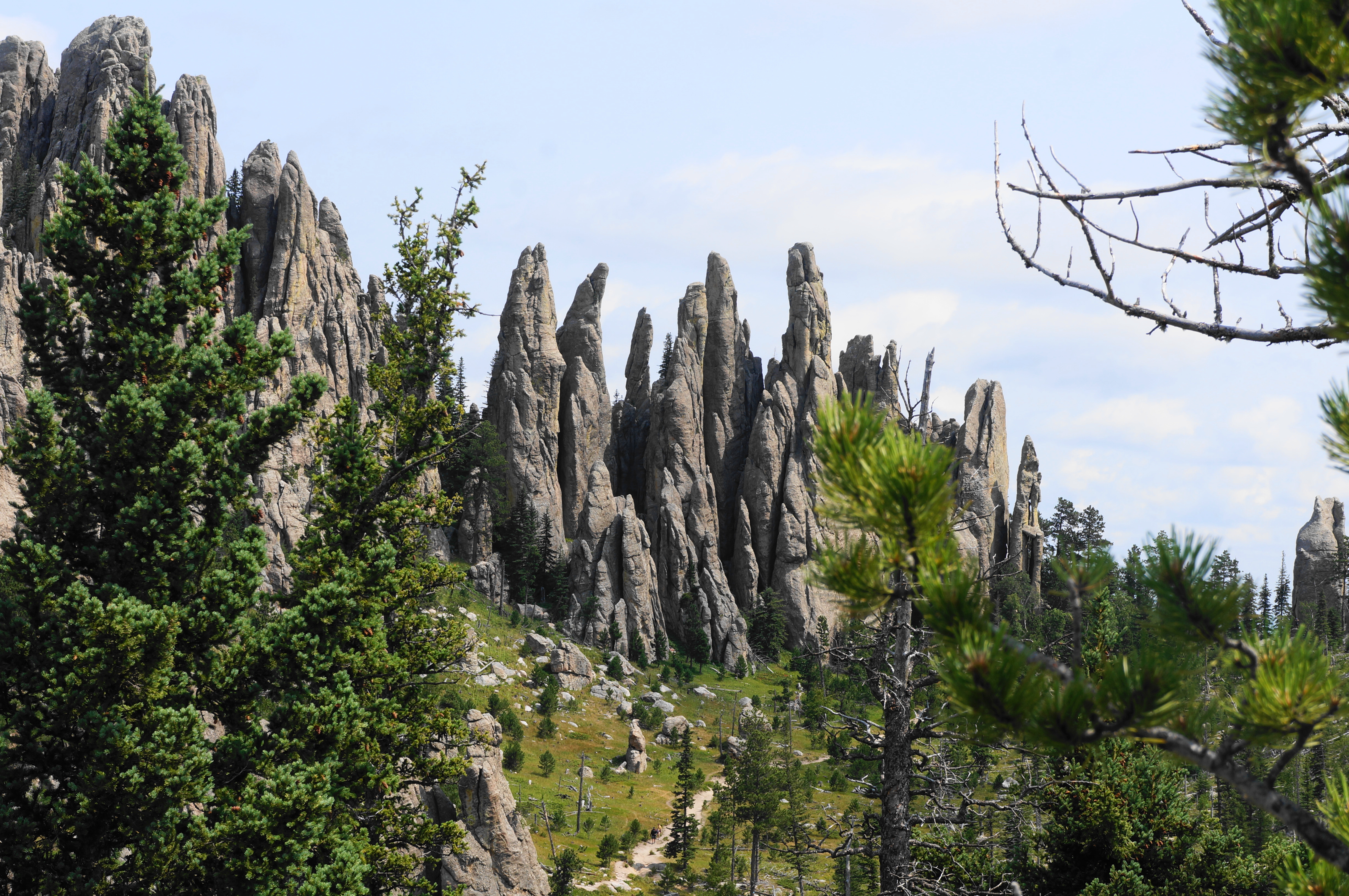
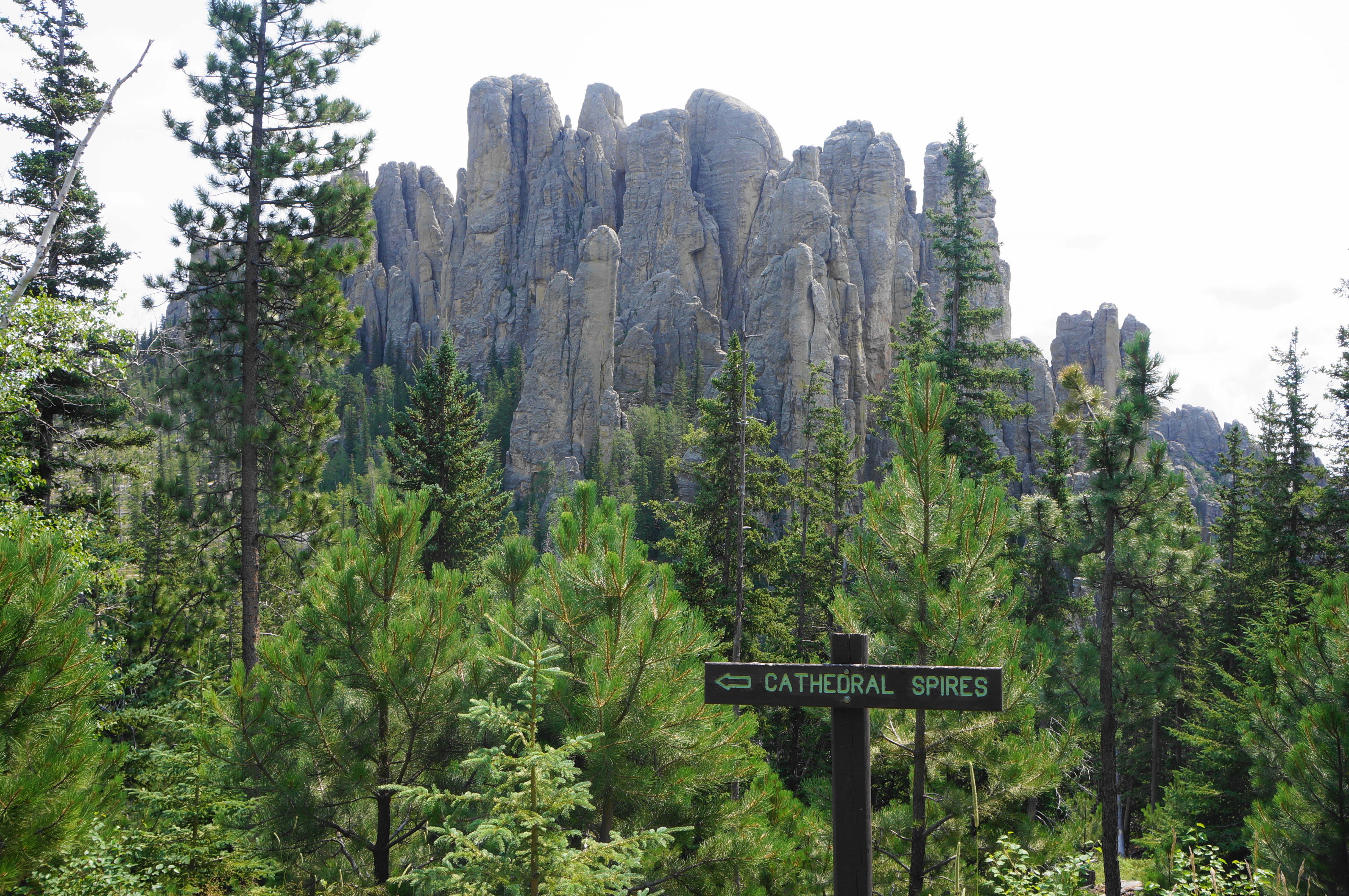
Coursing a relatively level ridgetop, the very mild meander snakes closer to Cathedral Spires and Little Devils Tower. A slight uphill offers partial views back toward Black Elk Peak, then a descent runs straight toward the epic spires. Stay right at the next junction, leaving the Norbeck Trail in favor of Trail #4 (a.k.a. Little Devils Tower Trail). Ascend briefly, then descend again, passing a monolith on the left. The trail leads right, but a short spur left offers good views of the backside of Cathedral Spires.

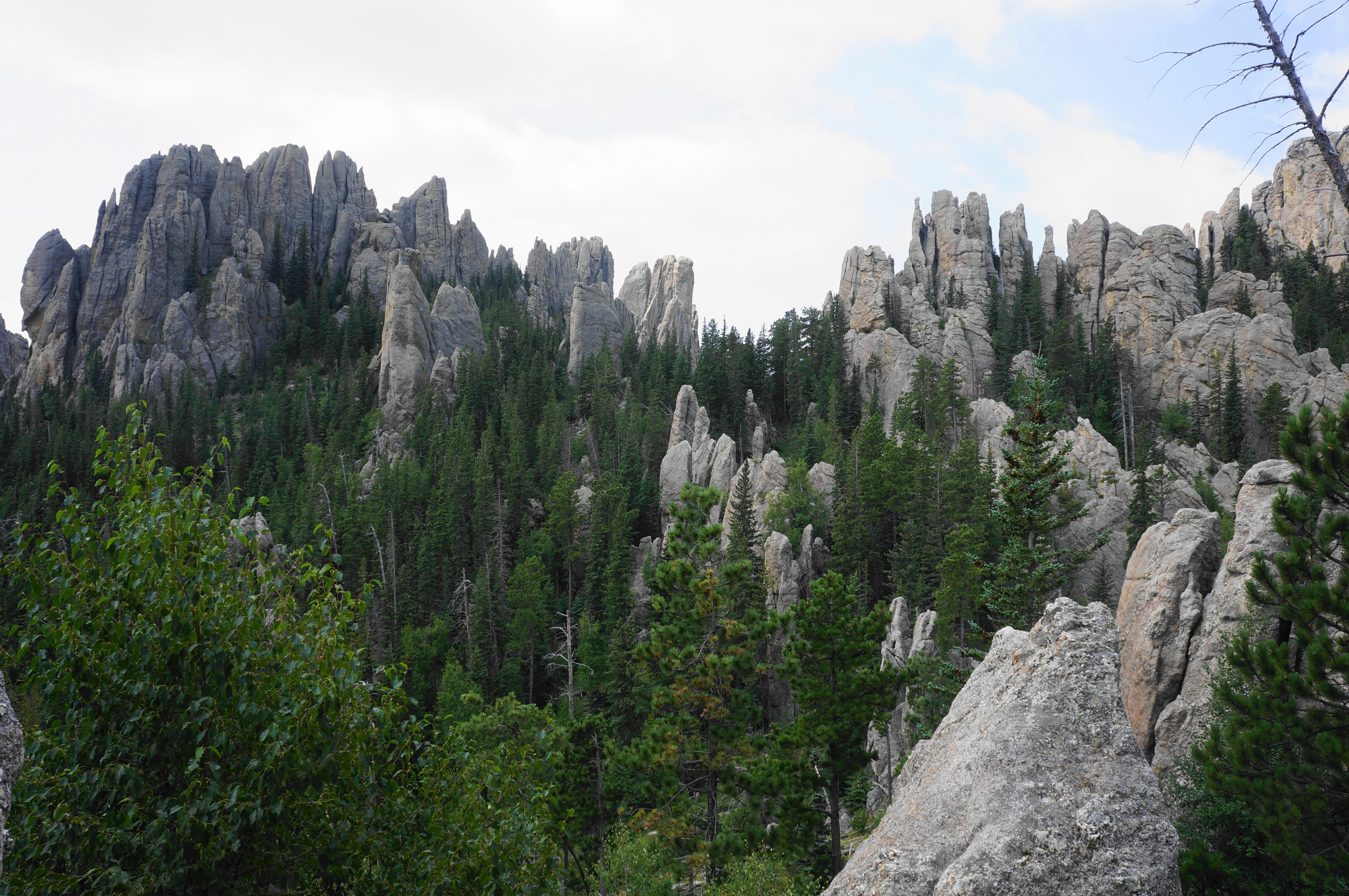
As the trail approaches the spires, it suddenly climbs sharply again, coursing westward to bypass the outcrops. The woods obscure most views for the next ¼ mile, but soon hikers crest another pass with a look to Little Devils Tower—a massive hunk of granite quite different from its actual namesake. There is also another great view east to the main batch of pinnacles. Come to another junction, this time with the spur to Cathedral Spires, which hikers can take if they have the time and energy. The main route continues to course southward, coming soon to a junction with the Little Devils Tower spur at 5.5 miles.


Stay left and begin a steady descent, weaving into a drainage that feeds Sylvan Lake. Drop through a stand of aspens and enjoy the meadows teeming with wildflowers as Trail #4 (blue blazes) courses westward and south. Coming closer to the Needles Highway (Route 87), stay left at an unmarked junction and continue for another few minutes to the Little Devils Tower Trailhead, an alternative parking area with a much smaller (but often less-noticed) parking lot.

There is one section left, and find the trail continuation across the parking lot. The wide track ascends briefly into the ponderosa pines again. Stay right at an unmarked junction, then bear northwest, rising to a low pass. Drop through a shallow canyon for about ¼ mile before ending abruptly at the Sylvan Lake parking area, where you began 7 miles ago. If you have extra energy, try the nearby Sylvan Lake Loop or Sunday Gulch Trail.


Nice post and great photos! Brought back happy memories when we did this some years back! Thanks for sharing!
Pingback: Top 10 Hikes in 2024 – Live and Let Hike
Pingback: Breathe Deep: The Most Refreshing Hikes Near Rapid City - Vicinidi