
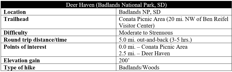
Hikers in South Dakota’s Badlands National Park with a knack for wayfinding and adventure should prioritize the out-and-back jaunt to Deer Haven, a juniper-studded amphitheater in the park’s lesser-visited Sage Creek Wilderness. Here the wily badlands give way to an evergreen oasis that is ideal for backcountry camping but also day-hike exploration. There is no “official” trail—but it is relatively straightforward to follow a well-used social path for 2.25 miles to the basin just below Deer Haven. But the final climb requires some creativity, perseverance, and stamina as the trail fades, giving way to a relatively free-for-all up to the junipers. For extra credit, continue up and over the next shelf for plateau views across the wilderness to the north.

The hike
Set along the easternmost fringes of the Sage Creek Wilderness in Badlands National Park, the foray into Deer Haven is among the most “official” of the unmaintained hikes in the park: there is at least some formal acknowledgement of it by the National Park Service and a decent amount of beta on the Internet. But be prepared with a good map/GPS and hike description nonetheless. This is desolate country.
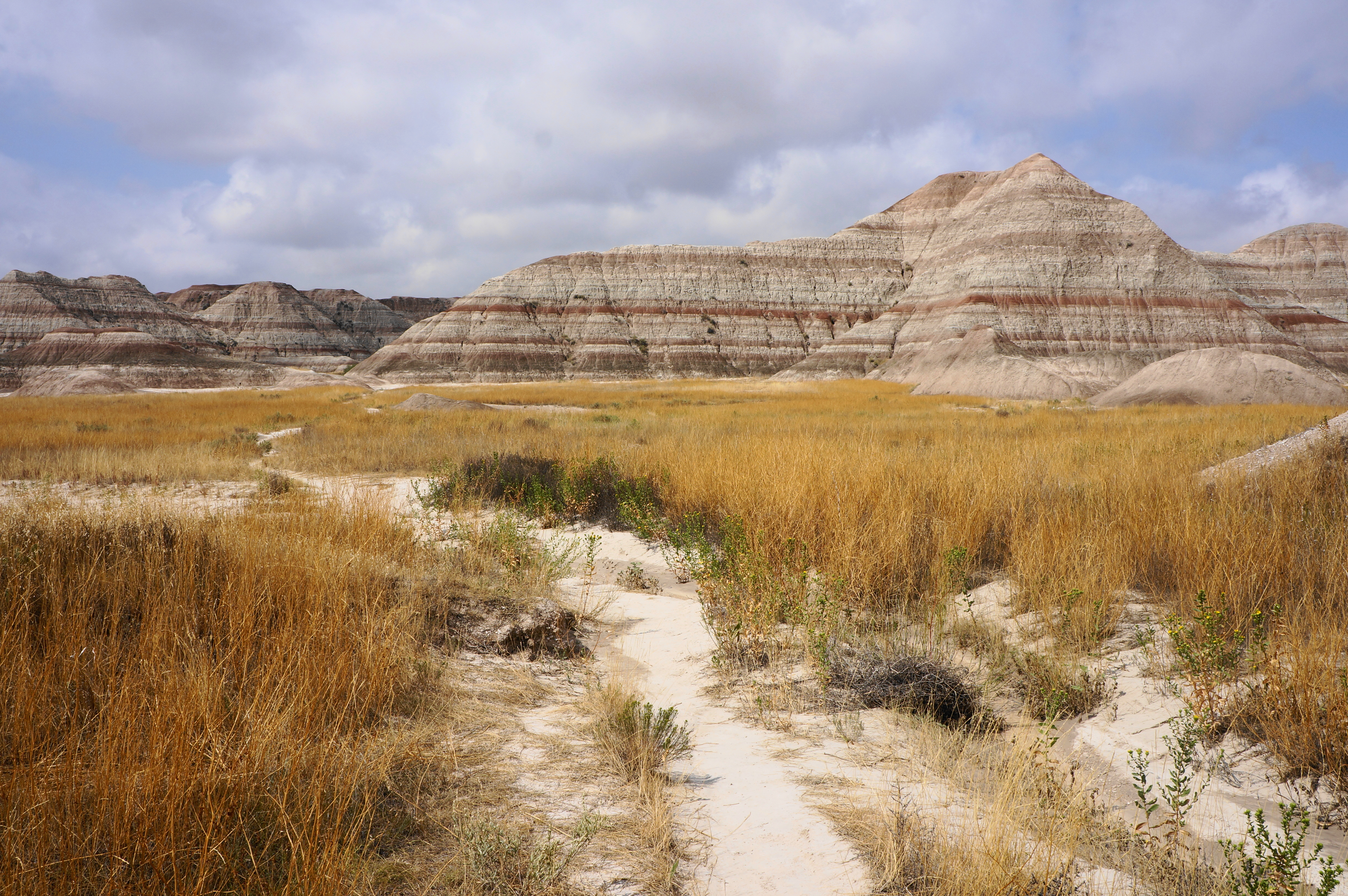
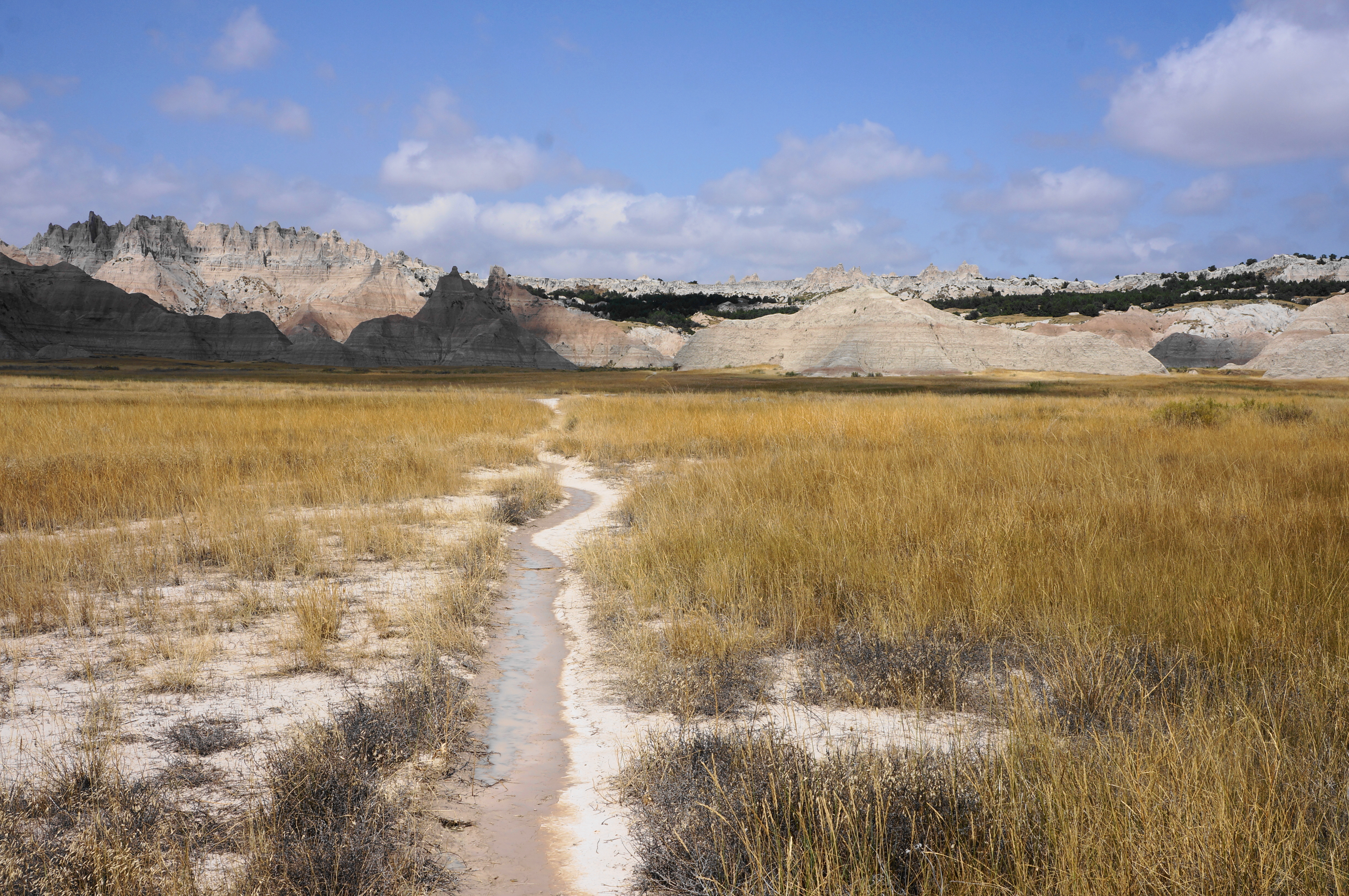
Start at the Conata Picnic Area (see map) off Conata Basin Road, a partly-paved track connecting the Badlands Loop Road with State Route 44. The sun-soaked picnic area is set at the base of the striped badland formations, with neat streaks of ruby hues cutting up the dreary cream colors. Begin at the trail sign and backcountry register and follow the sandy path leading westward across an open plain. Trace the trail up and over a small hump to reach a second drainage basin. Ignore the social trail heading right; stay left as the route courses south, staying down on the flats and avoiding the temptation to head straight into the alluring but dizzying sandstone formations.


Soon connect with another social path coming in from the left (this is an alternative route back to the trailhead) and rise mildly to another large, grassy plain. Pass reeds and a small clump of verdant trees on the left, then traverse a mucky drainage that skirts a badland snugly on the right. Cross more grasslands and rise to a small gap between some modest formations.

There is more open prairie beyond, with the spires and pinnacles off to the right becoming more rugged and intricate. The route splits again; stay on the path left that, though further from the badlands, ultimately is a more direct route to Deer Haven. A roughly 1/3-mile section among higher grasses ends by skirting another 25-foot badland on the right.

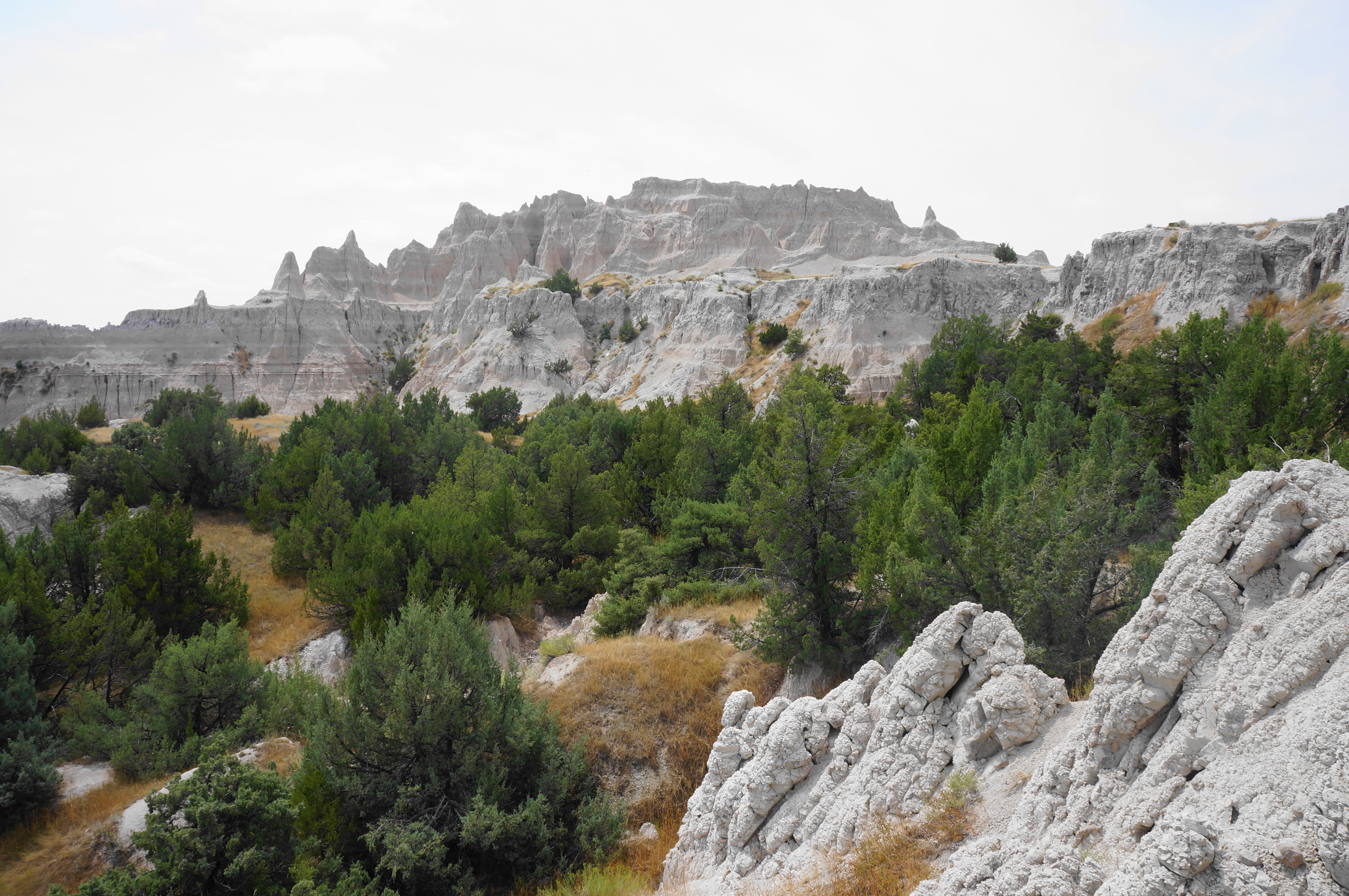
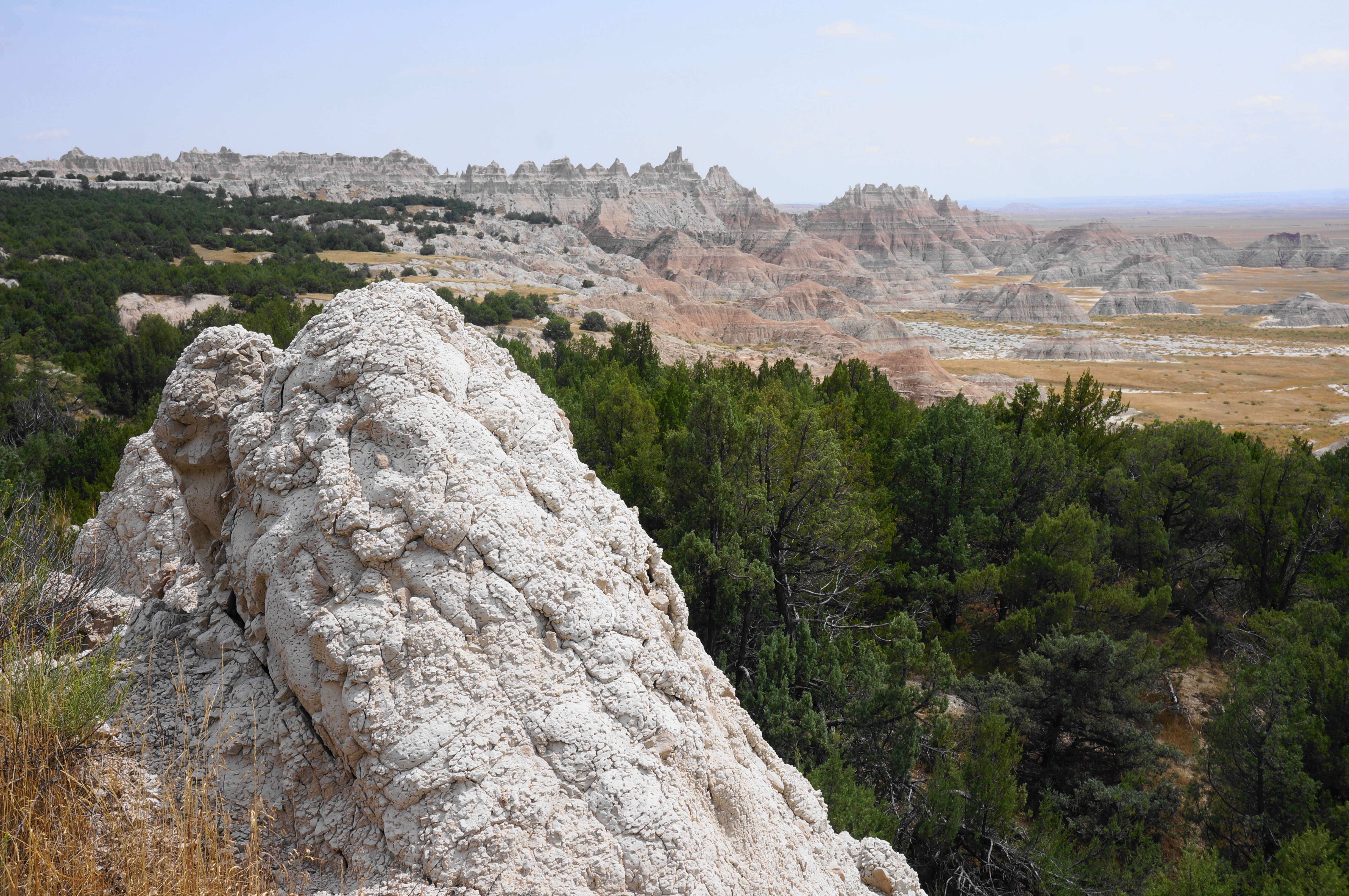
Rounding the corner, it is a 1/10 mile or so until you finally can see your destination ahead: a streak of deep green junipers, a relatively unusual contrast from the hills largely devoid of vegetation. It is still a good distance away, but the awesome castle spires on the right entertain as hikers make their way northwest. It is around ¾ mile to the base of the climb, first passing through short grasses, then taller brush. The path effectively ends at a wide, chalky drainage, but it is easy enough to follow the wash through a gap in the direction of the trees.
At some point here, the trail reportedly cuts east and finds a passage up and over the badlands. But such a path was not found by yours truly, and based on my sleuthing on the Internet, it seems few others have either. The most logical course is to the follow the wash as long as you can, until it splits into two narrower ravines. This marks the start of the climb.

As I said, it’s a bit of a free-for-all. But there is the illusion of predictability at least at the start, where a faded social path mounts a slope between the two arroyos. Soon it becomes choose-your-own-adventure, however, and it becomes difficult to avoid cutting through brush or, soon enough, the juniper forest. One thing definitely not to do is to follow the base of the washes, as they soon become clogged in nasty, steep badlands that are difficult to navigate. Better to keep to the hillside, no matter how clogged.

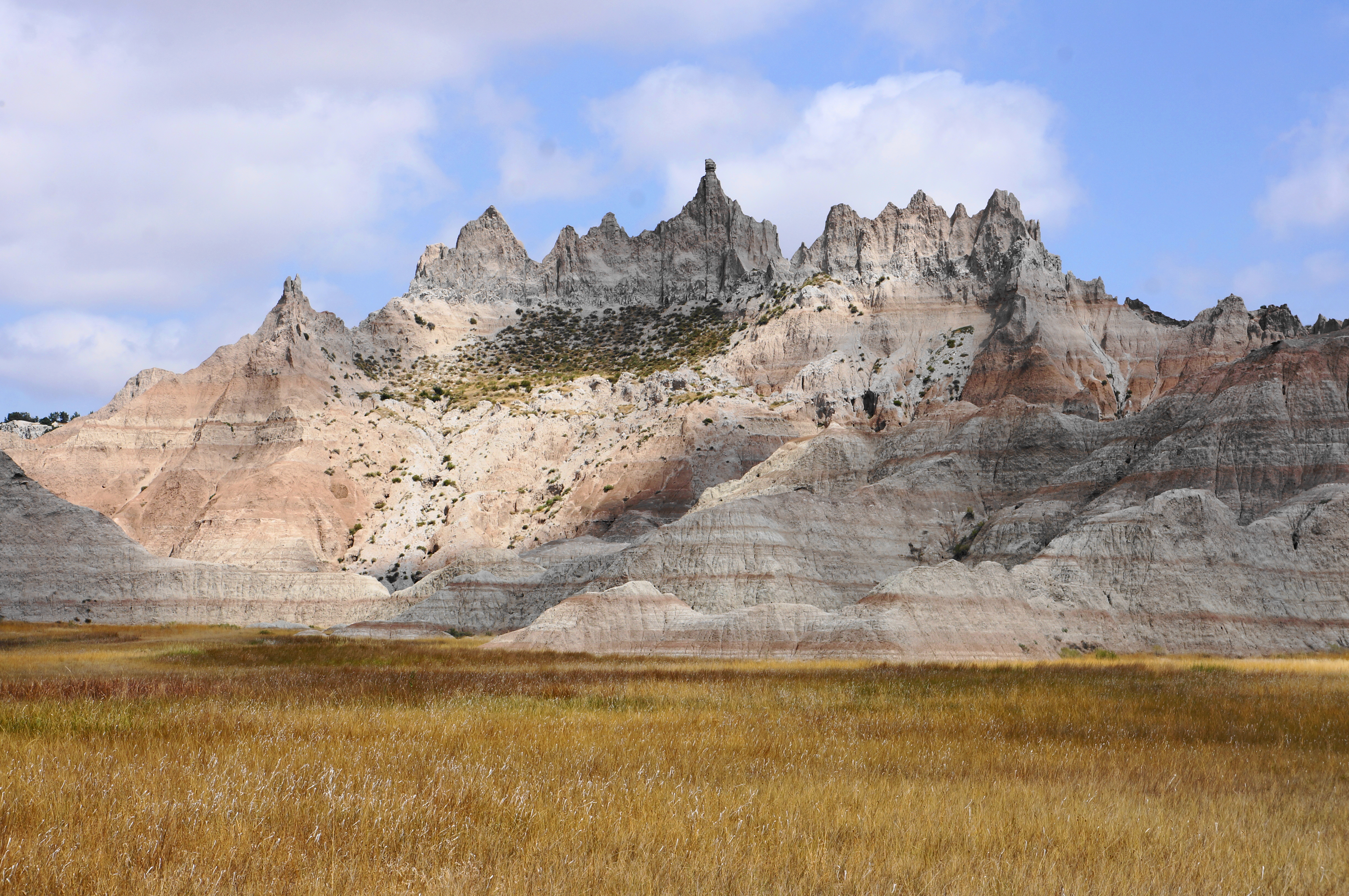
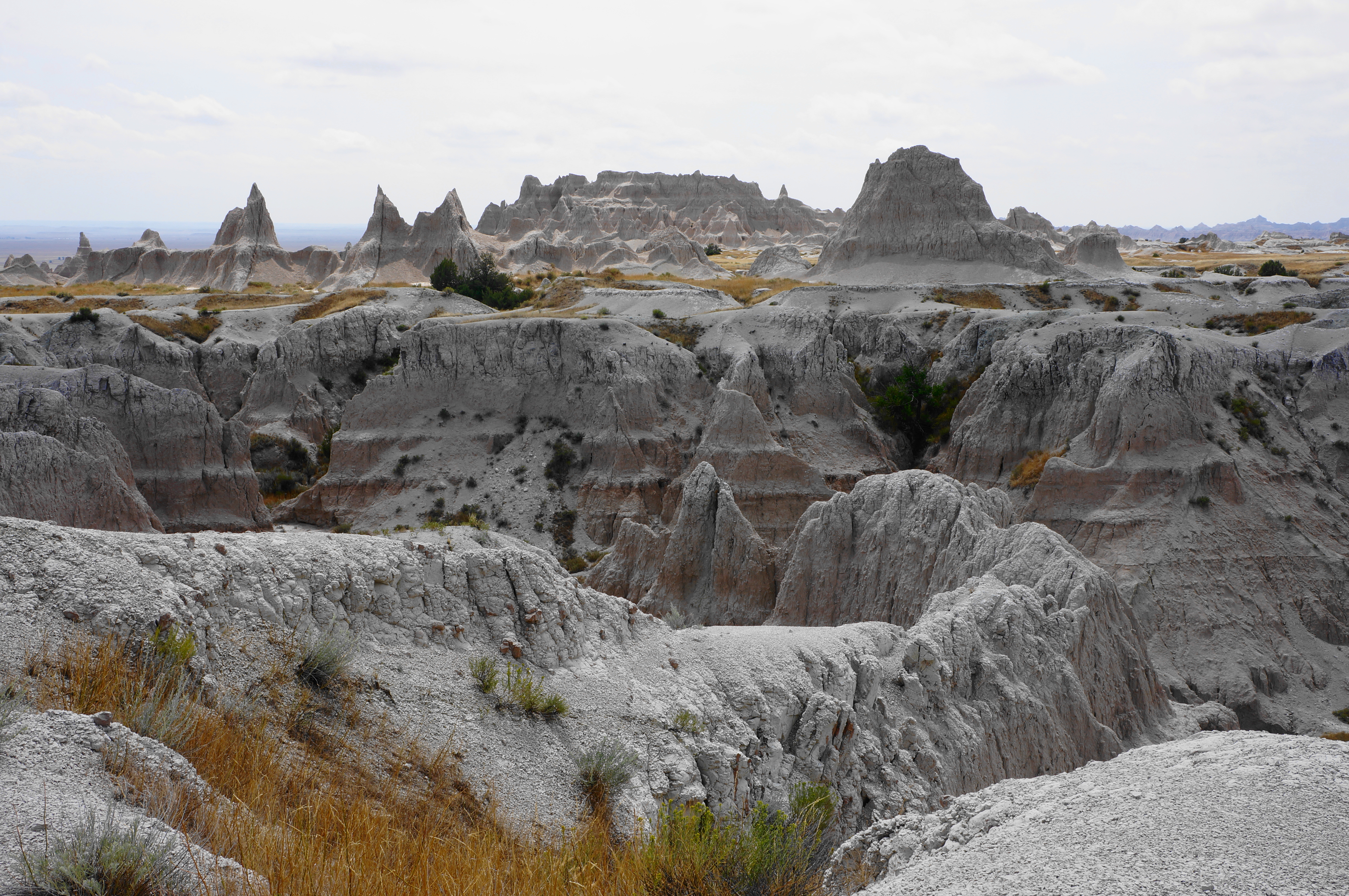
Eventually hikers are also supposed to make a cut east at some point to reach an open grassy meadow, an ideal camping spot. But I had no such luck in knowing this at the time and in the end essentially followed deer trails up the pitch northwest to the base of a more sheer badlands wall. Here the views back across Deer Haven and to the wily badlands beyond are simply superb.


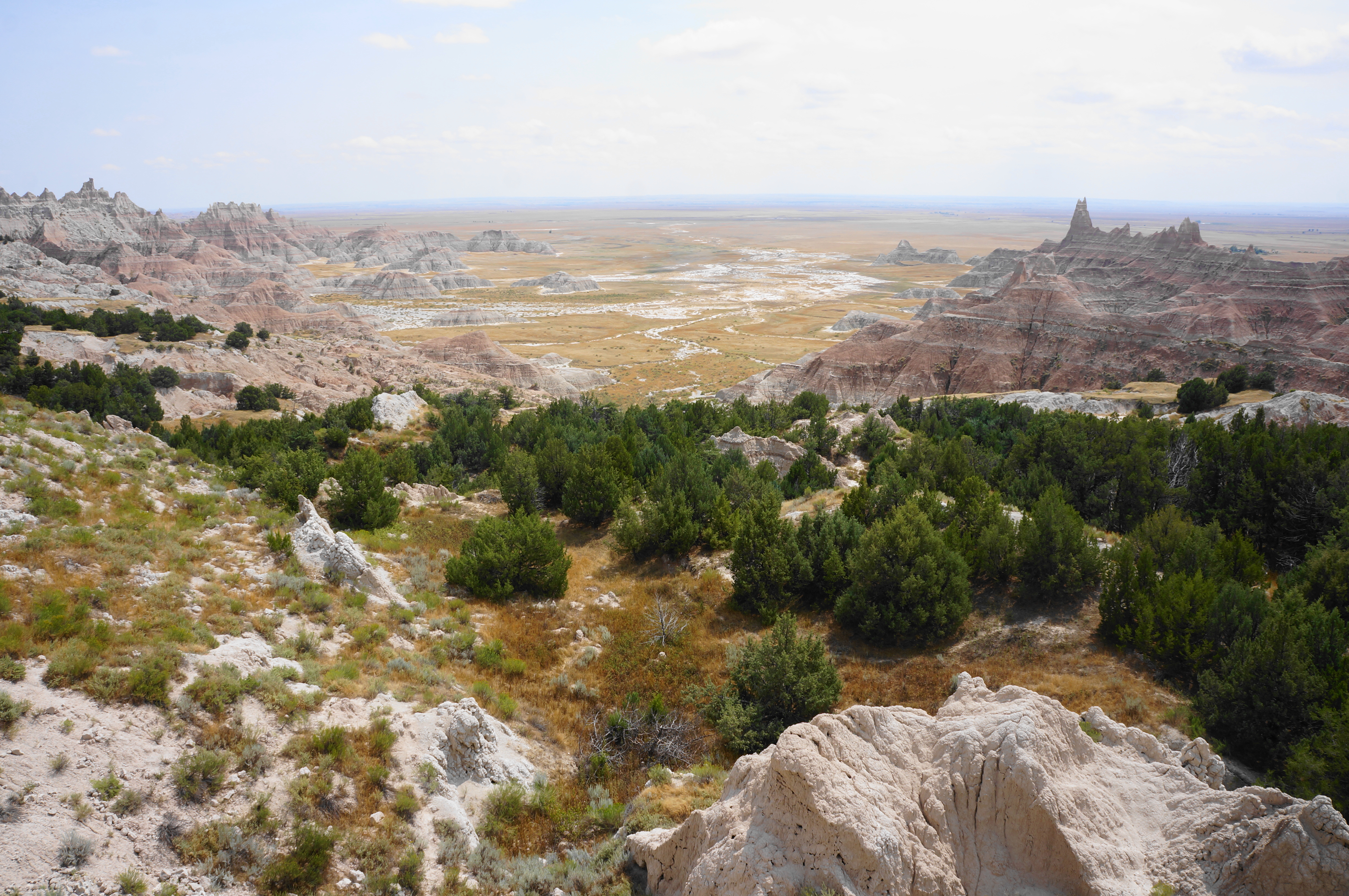
The even-more-ambitious among you can proceed further, finding one or two of the notches that offer passage—perhaps a Class 2 scramble over scree and up a shelf—through the wall and on to the hightops. Once clear of the climb, the tread is surprisingly easy: a flat and pleasant plateau with vistas both south and north. The latter views extend all the way to the Pinnacles area and across Sage Creek Basin to the main badlands below Big Badlands Road.


It is possible to explore further atop the plateau or down on the juniper level. But when ready, make your way back down the crumbly slope and return to the basin. Finding the route back toward the trailhead is challenging, but it’s tough to get too far afield: remember that the path roughly hugs the edge of the badlands—without going over them. By now hikers are probably a little wiped, and the end of the 5-mile trek (plus exploration at Deer Haven) comes with a return to the Conata Picnic Area.
Many choose to spend the night at Deer Haven, making this a multi-day hike. But it’s possible to do within 3-5 hours or so, leaving time for additional exploration around Badlands thereafter.


Pingback: Top 10 Hikes in 2024 – Live and Let Hike