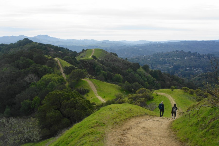
Spanning 1,600 acres in the East Bay’s Contra Costa County, Briones Regional Park is a wonderland of woody valleys, rolling hilltops, and sun-soaked ridges with panoramic views of the Berkeley Hills, Carquinez Strait, Mount Diablo, and Ygnacio Valley. Once owned by a 19th century rancher, the Briones Hills are now laced with fire roads that form one of the area’s most extensive hiking networks. In a series of recent posts, I have catalogued 27 possible hikes from six different staging locations—Alhambra Creek (map), Bear Creek (map), Briones Road (map), Lafayette Ridge (map), Springhill Road (map), and Reliez Valley (map). Each is easily accessible from neighboring towns—including Lafayette, Martinez, Orinda, and Pleasant Hill—making Briones a favorite local destination for a morning stroll or afternoon jaunt.
In this post, I offer a (subjective) list of my top 10 favorite hikes in Briones, ranging from relatively short loops to most-of-a-day traverses. All are best done in the winter or spring when precipitation and cooler weather turns the seasonally dry and baked hillsides into a lush and verdant landscape.
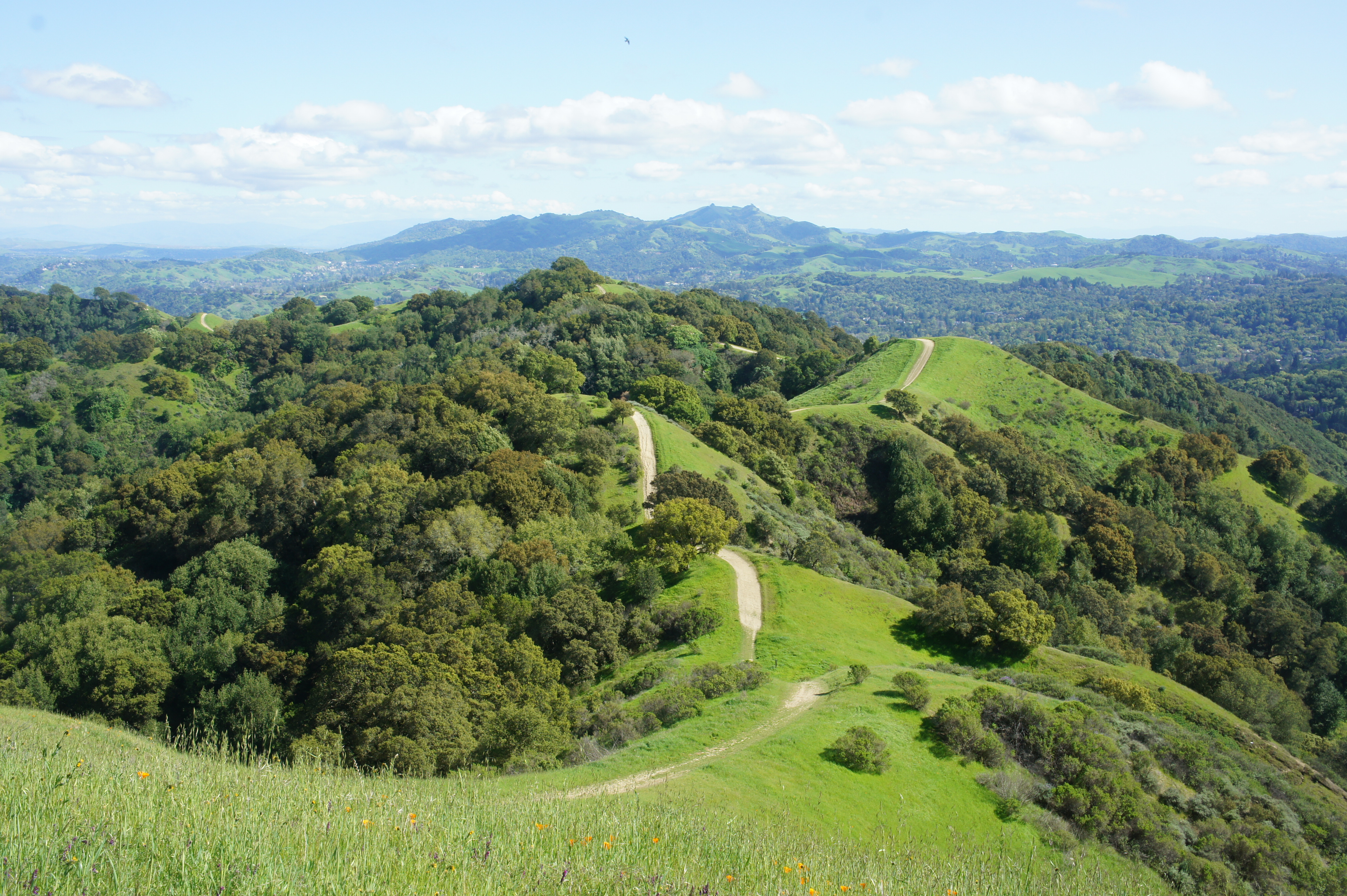
10. Seaborg – Briones Crest – Crescent Ridge Trail Loop (Moderate; 4.1 mi. stem-and-loop; Bear Creek Staging Area)
This moderate circuit offers relatively quick access to the Briones Crest, with views across the park’s woody eastern slopes to Mount Diablo and beyond. From Bear Creek, the Seaborg Trail strolls through Homestead Valley, ascends oak-studded hilltops, and breaks out onto open ridgelines with expansive vistas. The Crescent Ridge Trail casually—then steeply—drops back into the valley and returns to Bear Creek, capping off a 4-mile stem-and-loop.
See my post on July 12, 2025 for a full trail description.
9. Briones Peak and Table Top – Spengler Trail Loop via Blue Oak Trail (Strenuous; 6.0 mi. stem-and-loop; Reliez Valley Staging Area)
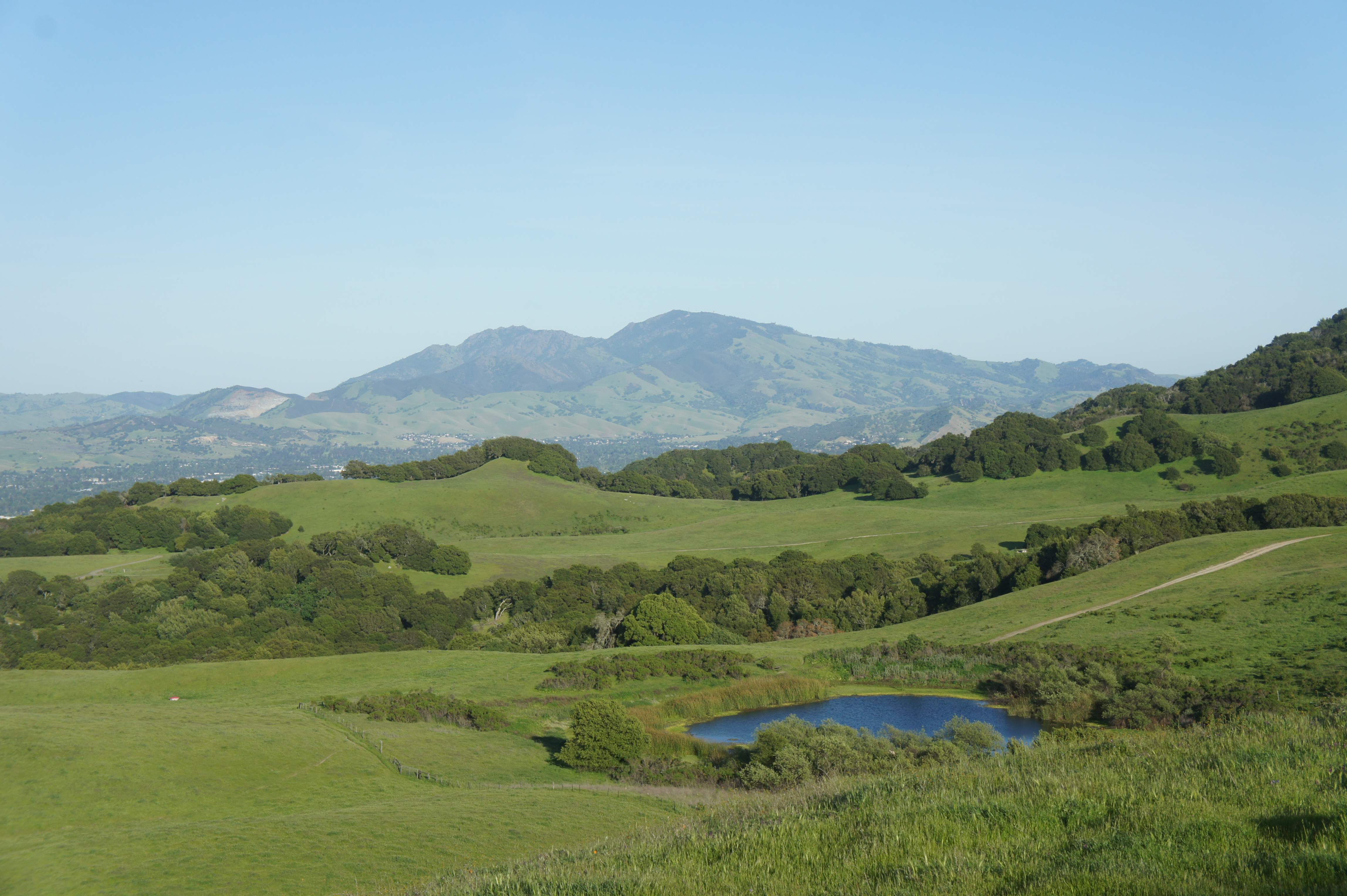
At 1,483 feet, Briones Peak is the highest point in the park and offers partial views across Ygnacio Valley. The nearby Table Top Trail boasts better vistas that extend, on a clear day, all the way to the Sierra Nevada in eastern California. After a steady climb on the pleasant Blue Oak Trail, follow the Blue Oak Shortcut and Spengler Trails to Briones Peak and Table Top, part of the broader Briones Crest. Complete the loop with a meandering walk on the Spengler Trail, which bobs and dips through woody terrain, returning to the Blue Oak Trail access route. This more strenuous hike covers more than 1,000 feet of elevation gain and loss.
See my post on July 14, 2025 for a full trail description.
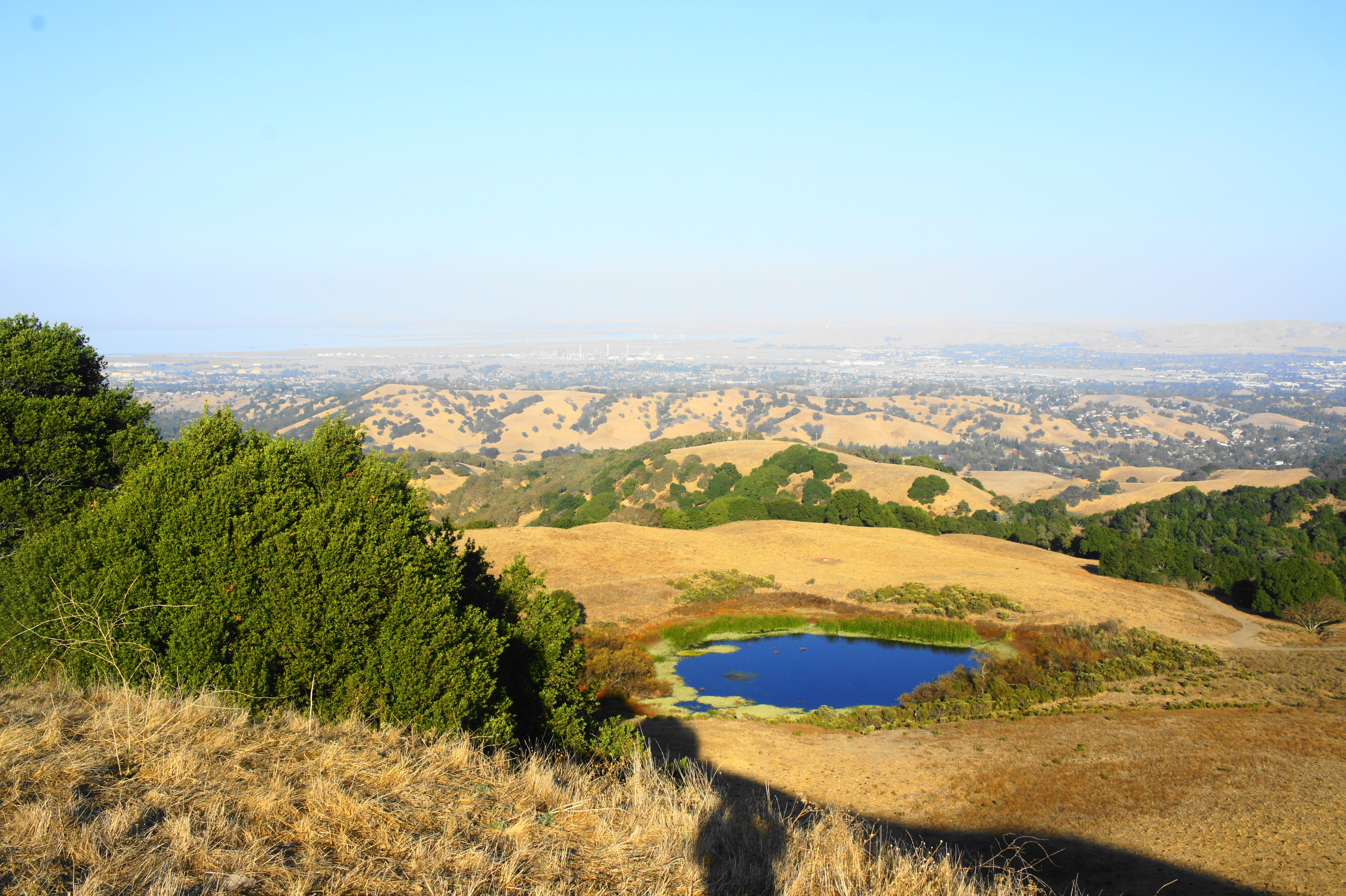
8. Mott Peak via Abrigo Valley & Old Briones Road Trail (Moderate; 4.3 mi. loop; Bear Creek Staging Area)
Though slightly lower than Briones Peak, Mott Peak has much better views in all directions and can be accessed from a number of trailheads in the park. This loop starts and ends at Bear Creek Staging Area, ascending Abrigo Valley and climbing to the Briones Crest and Mott Peak before dropping to the marshy Sindicich Lagoons and returning via Old Briones Road Trail. Most of the hike is out in the open, offering a sun-soaked jaunt through the heart of the Briones Hills.
See my post on July 12, 2025 for a full trail description.
7. Mott Peak via Abrigo Valley & Black Oak Trails (Moderate; 3.9 mi stem-and-loop; Bear Creek Staging Area)
A shorter and even sweeter version of the aforementioned hike, this 4-mile jaunt includes Mott Peak and the lovely Black Oak Trail. The latter drops down a scenic ridgeline then zig-zags through a pretty valley before connecting with Old Briones Road and Bear Creek again.
See my post on July 12, 2025 for a full trail description.

6. Russell Peak via Buckeye Ranch & Springhill Trails (Strenuous; 3.1 mi. stem-and-loop; Springhill Road Staging Area)
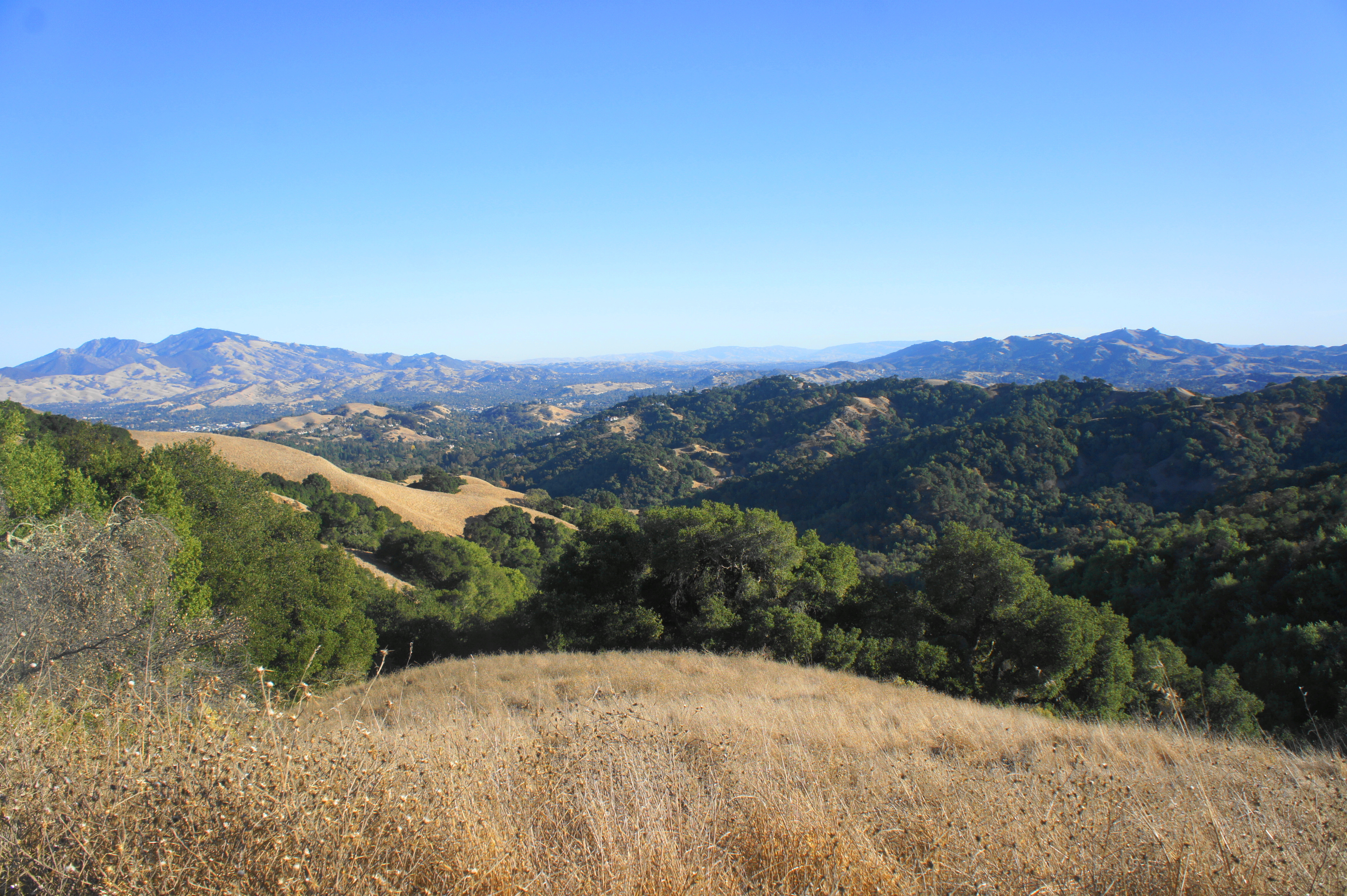
Lower than Briones and Mott Peaks, Russell Peak (1,357’) is the third named peak in the park and arguably the best of the bunch. This is largely because it sits at the nexus of the Briones Crest and Lafayette Ridge, a particularly picturesque uplifted wrinkle with an up-and-down trail and expansive views to Las Trampas and beyond. You’ll have to work for it though, climbing around 650 feet from Springhill Road and tackling a portion of Lafayette Ridge and the Springhill Trail to return to the start.
See my post on July 14, 2025 for a full trail description.
5. Russell Peak via Mariposa & Russell Peak Trails (Moderate; 2.7 mi. stem-and-loop; Panorama Drive)
Starting and ending at Panorama Drive in Lafayette, this alternative access loop to Russell Peak traverses fire trails with great views southward to Las Trampas and Mount Diablo. It also packs in the views of Lafayette Ridge noted above and has the added advantage of being a relatively gentle meander compared to other, more strenuous routes nearby.
See my post on July 20, 2025 for a full trail description.
4. Deer Creek – Pereira Trail Loop & Ivan Dickson Memorial (Moderate; 4.8 mi. stem-and-loop; Bear Creek Staging Area)
This westernmost hike in Briones extends out to a ridgetop overlooking Bear Creek Road and Briones Reservoir, with a stop for good measure at a memorial to a longtime patron of the park. Follow the Deer Creek Trail to its end on the Briones Crest then continue on the Pereira Trail, an out-and-back that approaches Briones’ western extremity. Then backtrack and bear south to Ivan Dickson Memorial and drop back into the Deer Creek drainage to find your way back to the start.
See my post on July 12, 2025 for a full trail description.

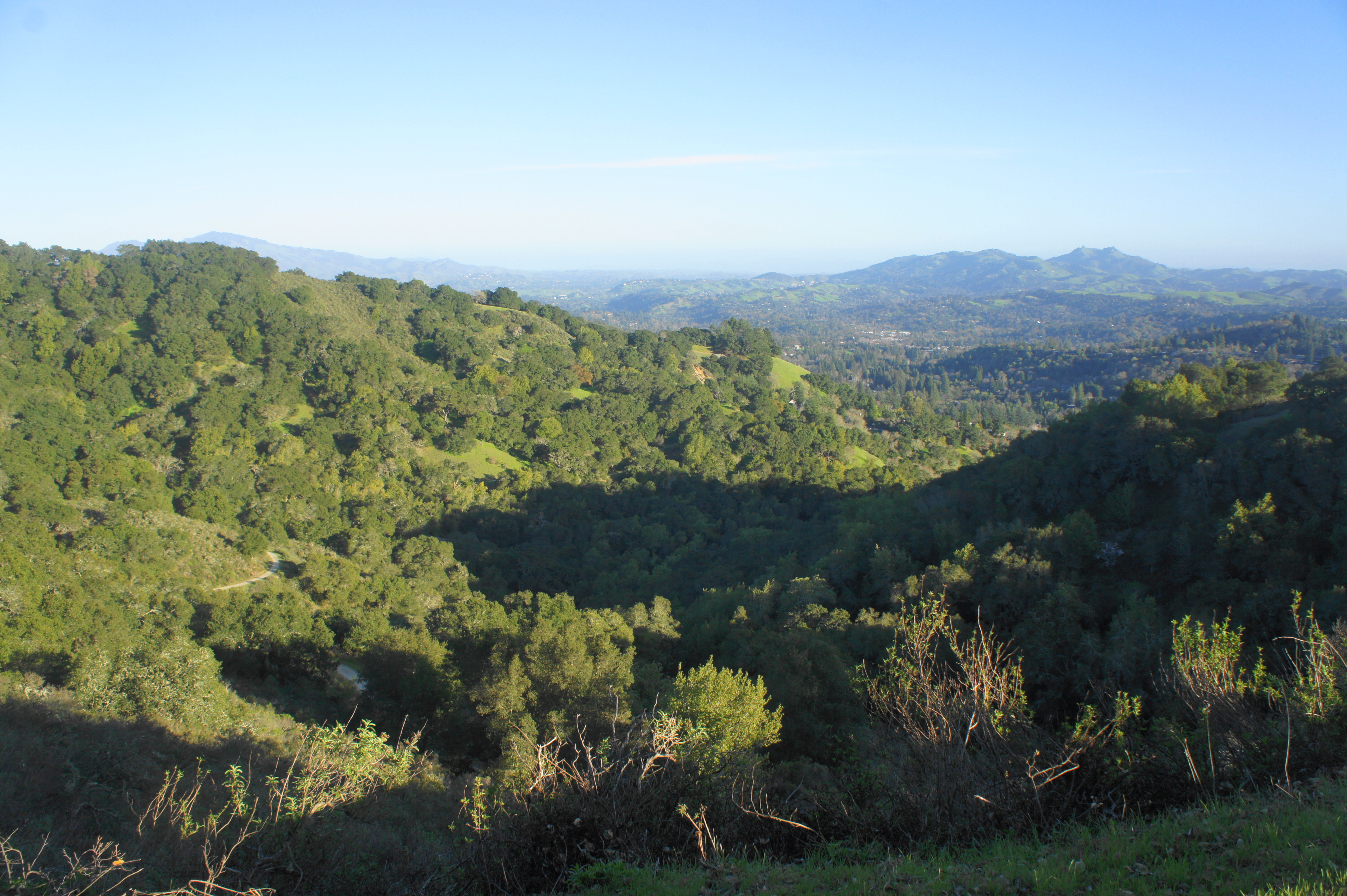
3. Sunrise – Briones Crest – Buckeye Ranch Trail Loop (Strenuous; 3.7 mi. stem-and-loop; Springhill Road Staging Area)
One of the three best hikes in the park, this short but challenging circuit ascends an open ridgeline to the Briones Crest and drops down into a woody canyon at Buckeye Ranch. The Sunrise Trail is a highlight but also a tough climb, gaining nearly 800 feet in elevation. It then leads into a scenic stretch of the Briones Crest, snaking southward to Lafayette Ridge. Then descend the Buckeye Ranch or Springhill Trails to cap off the roughly 4-mile hike.
See my post on July 14, 2025 for a full trail description.
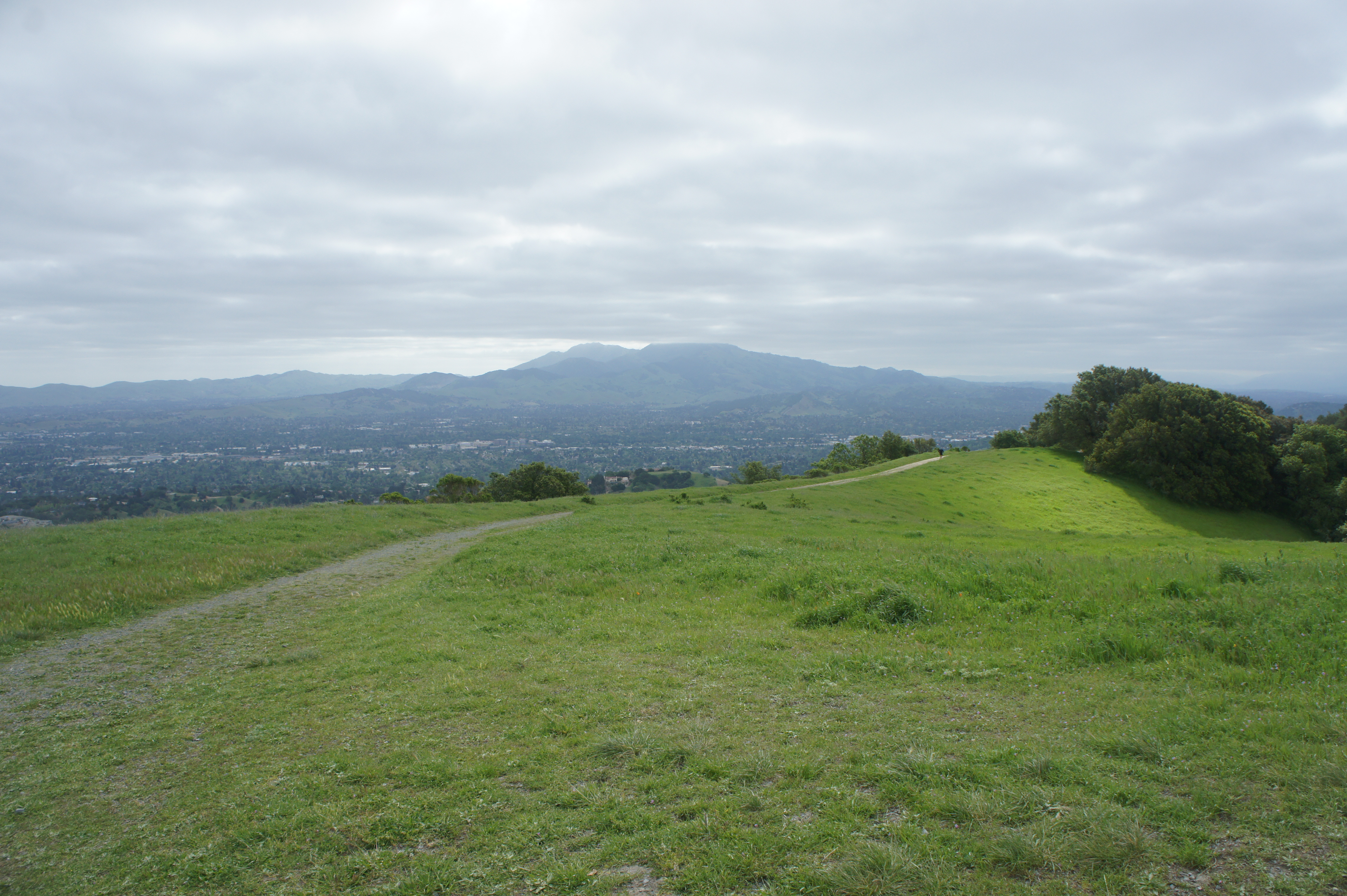
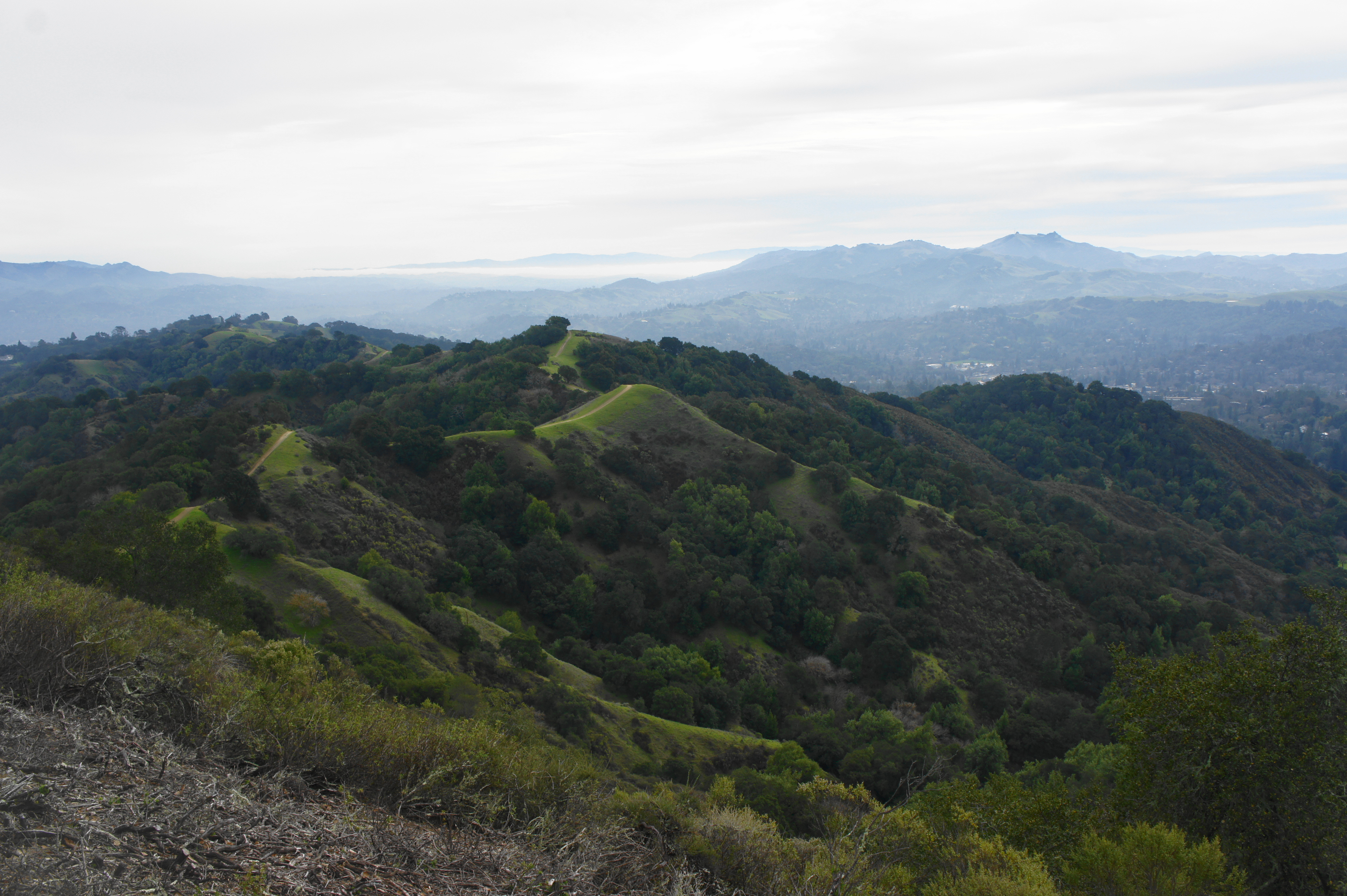
2. Lafayette Ridge Trail to Russell Peak (Strenuous; 7.2 mi. out-and-back; Lafayette Ridge Staging Area)
This iconic ridge traverse is one of the area’s most popular, extending 3.6 miles across largely treeless terrain with endless vistas of the Berkeley Hills, Las Trampas, Mount Diablo, and surrounding valleys. After a tough climb to start, the hike settles into a roller coaster of ups and downs, approaching the Briones Crest and bearing left to the Russell Peak summit. Return the way you came, enjoying the views from a different angle.
See my post on February 27, 2021 for a full trail description.
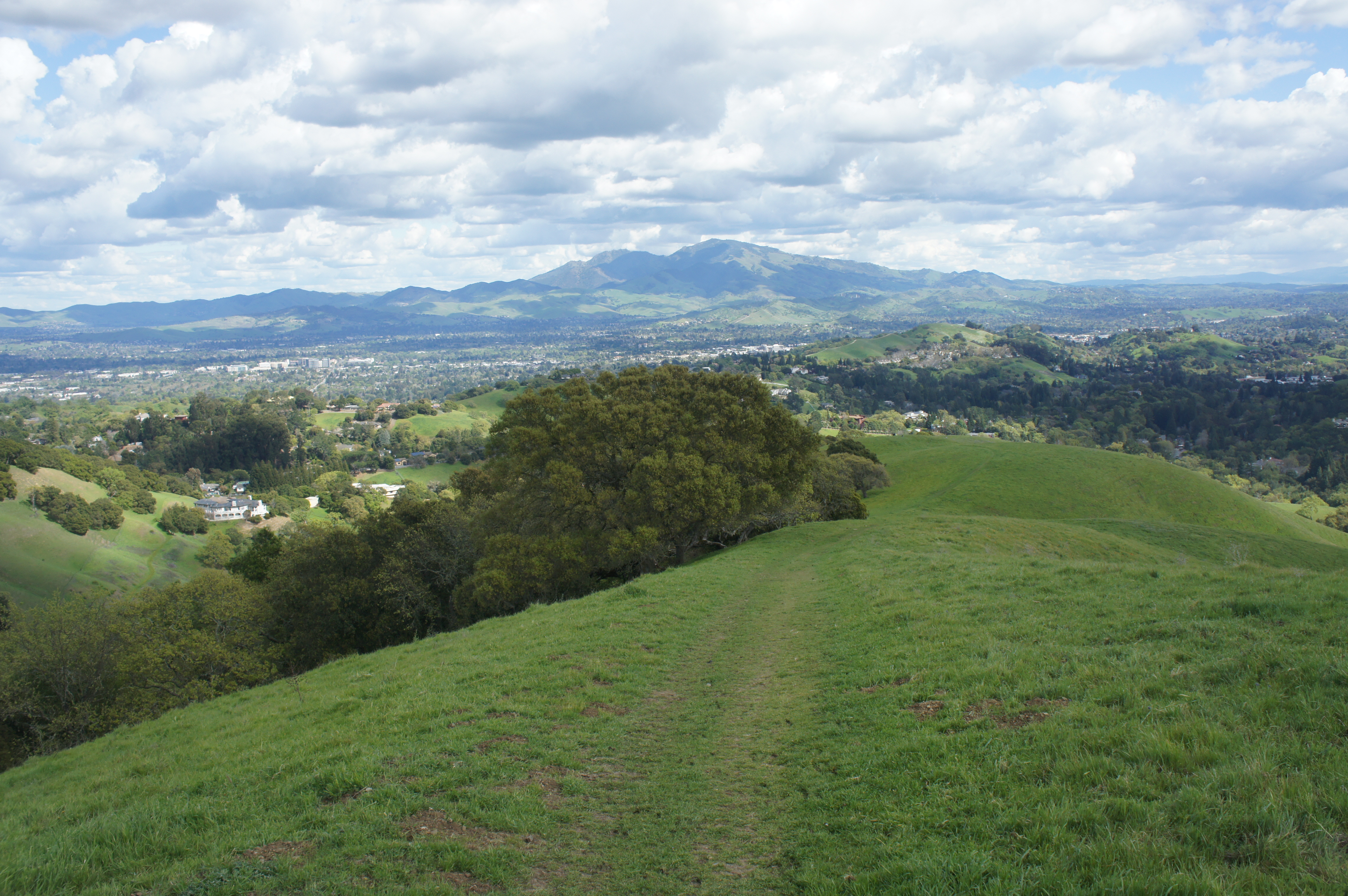
1. Briones Crest Trail Loop (Strenuous; 7.75 mi. loop; Bear Creek Staging Area)
The premier hike in the park, the Briones Crest Trail forms a near-circuit around the hilly tract, with open views much of the way. From Bear Creek, take the Seaborg Trail up to the crest and bear left, beginning a 6.5-mile stretch of nearly uninterrupted bliss as the path bears north to Briones Peak, west to Mott Peak and Sindicich Lagoons, and then south on a final ridgeline with a spectacular descent back to Bear Creek as a satisfying coda. If you have time for a half- to full-day hike in the park, this one is it.
See my post on July 12, 2025 for a full trail description.

Honorable Mention:
- Abrigo Valley – Briones Crest Long Loop (4.4 mi.)
- Abrigo Valley – Briones Crest Short Loop (3.4 mi.)
- Blue Oak Trail Loop (3.2 mi.)
- Deer Creek – Briones Crest Trail Loop (2.5 mi.)
- Lagoon Trail Loop (4.9 mi.)
