

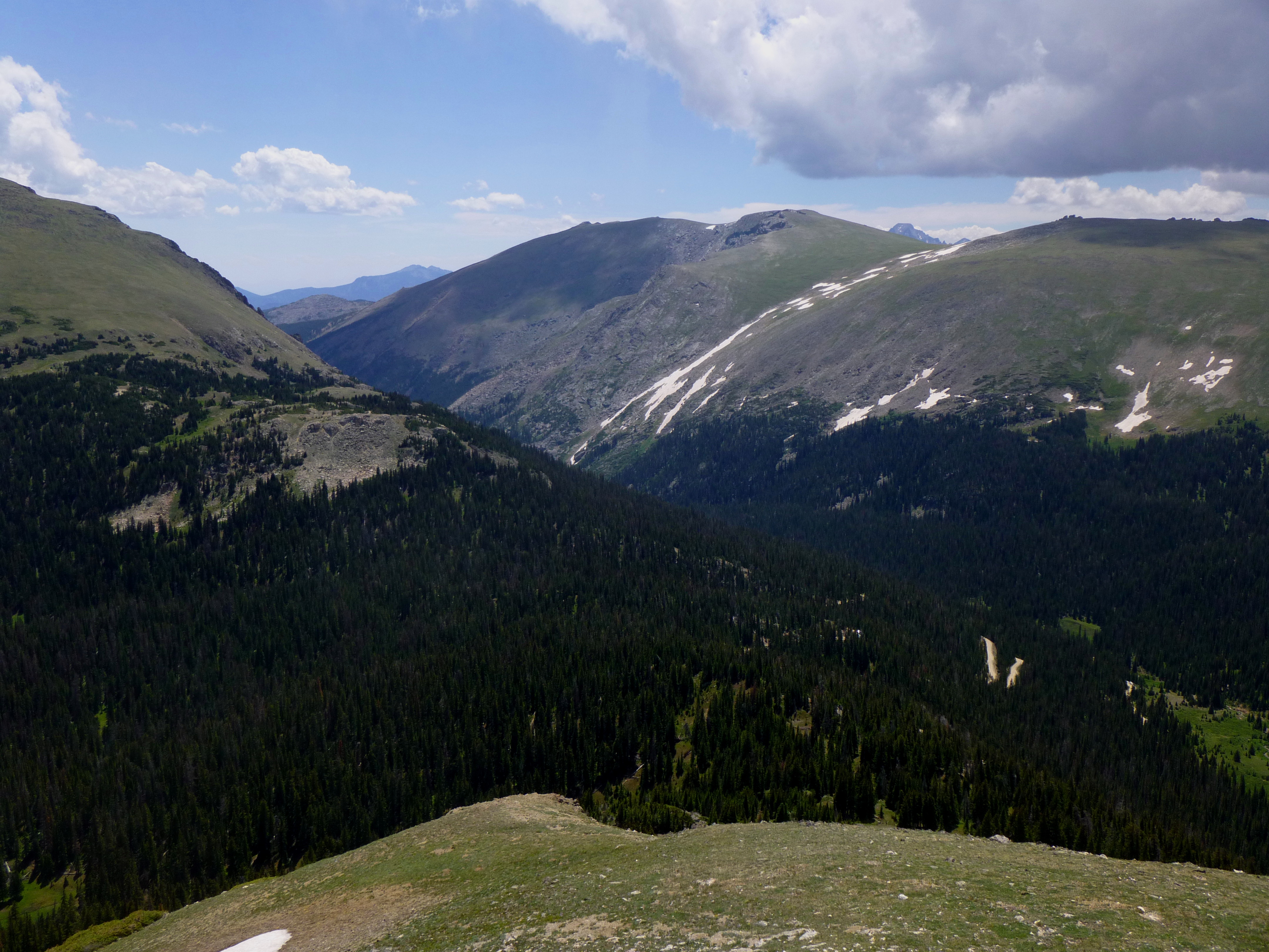
Despite being far less visited than its slightly higher cousin (Alpine Ridge Trail at Alpine VC, 12,005’), Marmot Point (11,909’) is no less spectacular. In fact, because the unpaved, one-way route up Old Fall River Road tends to weed out visitors, the relative solitude of Marmot Point makes this route perhaps a more attractive alternative. The short but steep ascent, in the open sun with no tree cover, endows tremendous 360 degree vistas—with Trail Ridge and Fall River Valley to the south, the Mummy Range to the east, and Cache la Poudre Valley, Iron Mountain, and the Never Summers to the north and west. If looking for a quick summit hike in the park, Marmot Point nicely fits the bill.

The hike
Though it is just 0.7 miles from Alpine Visitor Center, the only way to reach the Marmot Point trailhead by car is to drive 10 miles up the one-way Old Fall River Road (alternatively, however, one could park at Alpine VC and walk down the gravel road 0.7 miles to the trailhead). While the trailhead is not marked, the clear path heading up Marmot Point and the small collection of parked cars is a dead giveaway.

The trail begins on the right hand side of the road, near a small pond and a small outcropping of heavy, chalk white boulders (from which there are fine views by its own right).

500 feet above the timberline, the vegetation on Marmot Point is sparse, leaving hikers exposed to full sun on a clear day.
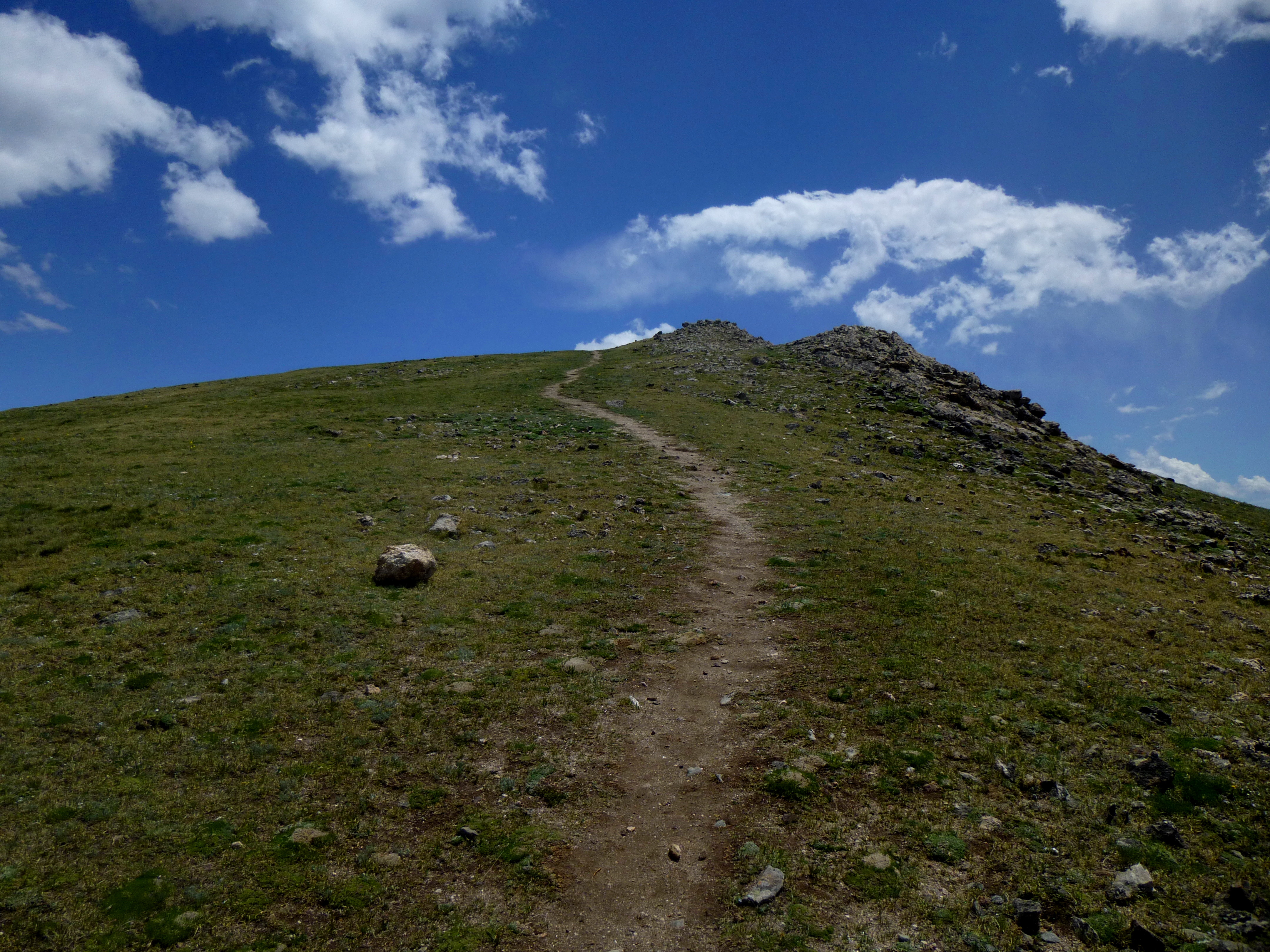
The steep slope climbs almost relentlessly for 0.4 miles – if you are looking for a gradual climb up neatly stacked switchbacks, this is not the trail for you.

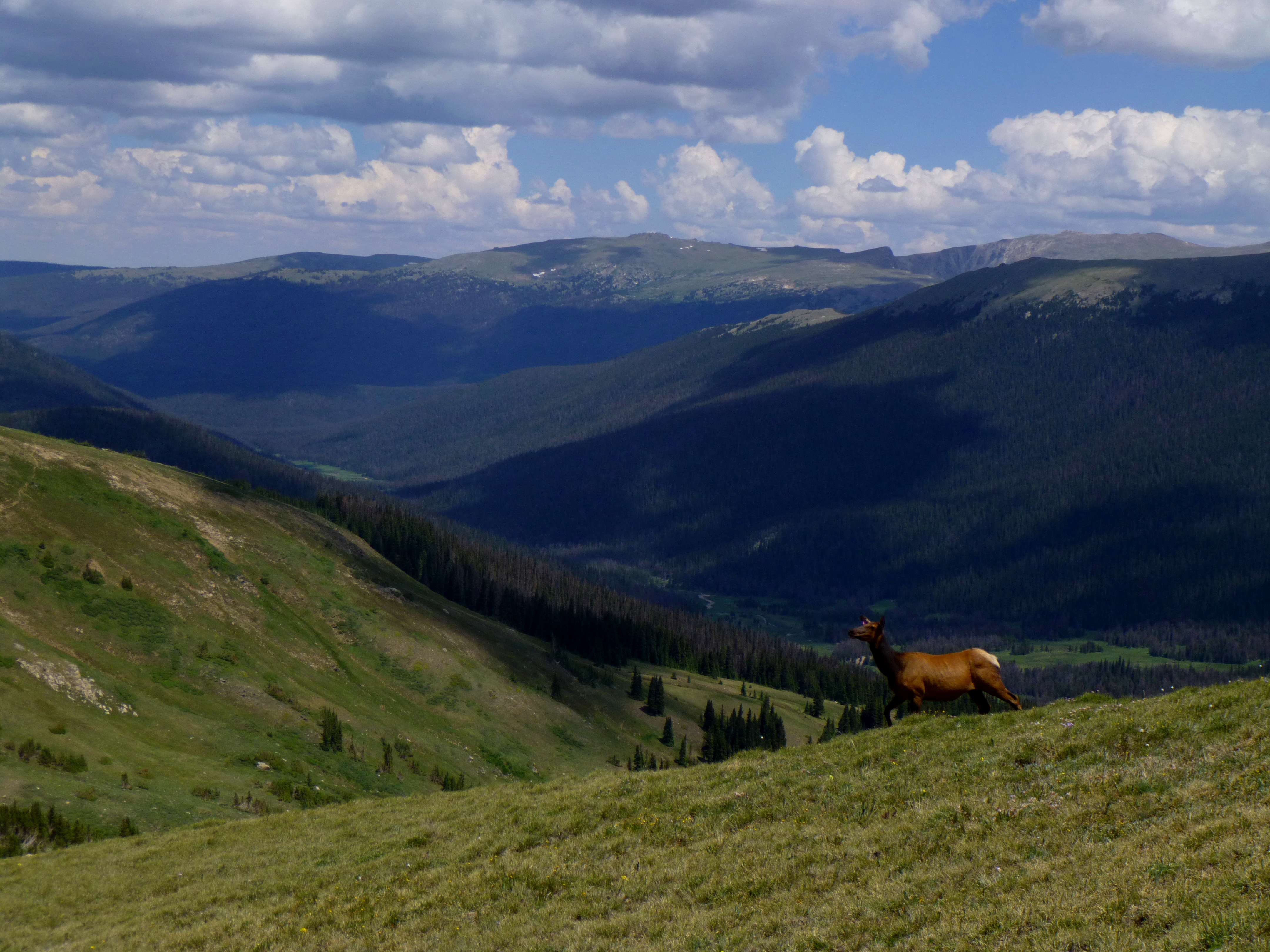
There are, of course, perks of being high up in the tundra. Late on a Monday morning in July, we were fortunate enough to spot a group of impressive elk…
…As well as a few marmots scurrying in and out of the rocks (hence the name, Marmot Point).

Like any trail of this nature, there are a couple deceptive, false summits, but for the most part, the average hiker should be able to reach the top within a half hour.

The panoramic views from the Marmot Point summit easily make the tough slog worthwhile!


After spending some time exploring at the top, return the same way you came. Allot at least 45 minutes to an hour for the round trip.

