
Note: This is the second in a series of five posts describing the John Muir Trail (JMT), a scintillating, multi-week hike through California’s Sierra Nevada that extends more than 200 miles from Yosemite National Park in the north to Mount Whitney and Sequoia National Park in the south. This post (and those that follow) assumes a northbound journey, beginning southeast of Mount Whitney at Horseshoe Meadow in Inyo National Forest, culminating at Happy Isles in Yosemite. The JMT is an arduous, multi-week backpacking trip that requires careful planning, preparation, and an official backcountry permit that can be quite difficult to obtain. Hikers typically complete the entire trail, including detours for food resupplies, in about 2-3 weeks. For more information on planning and preparing for the JMT, see my previous post titled “John Muir Trail Preparation & Logistics.” For summaries of the other three sections, see Section II (Onion Valley to Muir Trail Ranch), Section III (Muir Trail Ranch to Red’s Meadow), and Section IV (Red’s Meadow to Happy Isles).
The first of four sections along the northbound John Muir Trail, this roughly 65-mile stretch extends from Horseshoe Meadow to Onion Valley and traverses the highest terrain of the entire hike, including the summit of Mount Whitney (14,505’), the highest point in the contiguous United States. Those starting at Horseshoe Meadow and hiking at a roughly average pace (10-12 miles/day) should be able to complete this section in about six days (including a day hike to Mount Whitney). Careful planners will note that roughly the first two days are not in fact on the true John Muir Trail (JMT); rather, it is a 20-mile journey from Horseshoe Meadow to the JMT by way of Cottonwood Pass and the Pacific Crest Trail (PCT), through Sequoia National Park. (Note: This is due to the relative ease of getting a Cottonwood Pass permit, rather than one starting from Whitney Portal. See my previous post, “John Muir Trail – Preparation and Logistics.”) Only after reaching Crabtree Meadow, at the base of the Whitney complex, does one begin the proper JMT. From here, hikers can do an out-and-back to the summit of Mount Whitney as a day hike (without heavy packs!) and then continue northward the next day across stunning terrain to Forester Pass (13,110’), the highest pass of the entire JMT. Here hikers leave Sequoia and enter Kings Canyon National Park, following the Bubbs Creek drainage before ascending to Kearsarge Basin; a detour up and over Kearsarge Pass leads to Onion Valley, the first road connection since the start and a common waypoint for hikers who need to resupply for the onward journey.

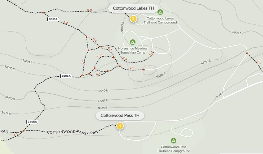
Horseshoe Meadow to Rock Creek via Cottonwood Pass (14 miles)
For many, due to permit constraints, the scintillating, multi-week journey on the John Muir Trail (JMT) begins not on the JMT at all, but along one of the many side trails that eventually connect with the main track. One popular destination for beginning the hike is Horseshoe Meadow, a high-altitude staging area at about 10,000 feet on the eastern flank of the Sierra Nevada—a 23-mile drive from Lone Pine, California. From Horseshoe Meadow, a network of paths offers access through Inyo National Forest to Sequoia National Park and the Golden Trout Wilderness. Two trailheads are of relevance for JMT hikers—Cottonwood Pass and Cottonwood Lakes—and are about a half-mile apart, with separate parking areas and backpacker campgrounds. A Cottonwood Pass or Cottonwood Lakes permit—which is good for the entire JMT journey—allows hikers to spend the night prior to your start date at the trailhead. (Note: There are 18 and 13 first-come, first-serve walk-in sites, at the cost of $6/night, at Cottonwood Pass and Cottonwood Lakes, respectively.) Although both the Cottonwood Pass and Cottonwood Lake routes both provide access to the Pacific Crest Trail (PCT), the hike as described here follows the former, offering slightly easier and shorter access to the PCT/JMT corridor.
Camping the night before your permit date helps with acclimating to the significant elevation change, with Lone Pine and Owens Valley several thousand feet below. (Note: We came from the Bay Area, meaning we were starting from near sea level.) Altitude sickness is one of the most common trip-enders, so doing all you can to acclimate to the 10,000+ foot elevation is highly recommended. (Note: This also suggests drinking lots of fluids—more than you think you need—on the trip’s opening days.)

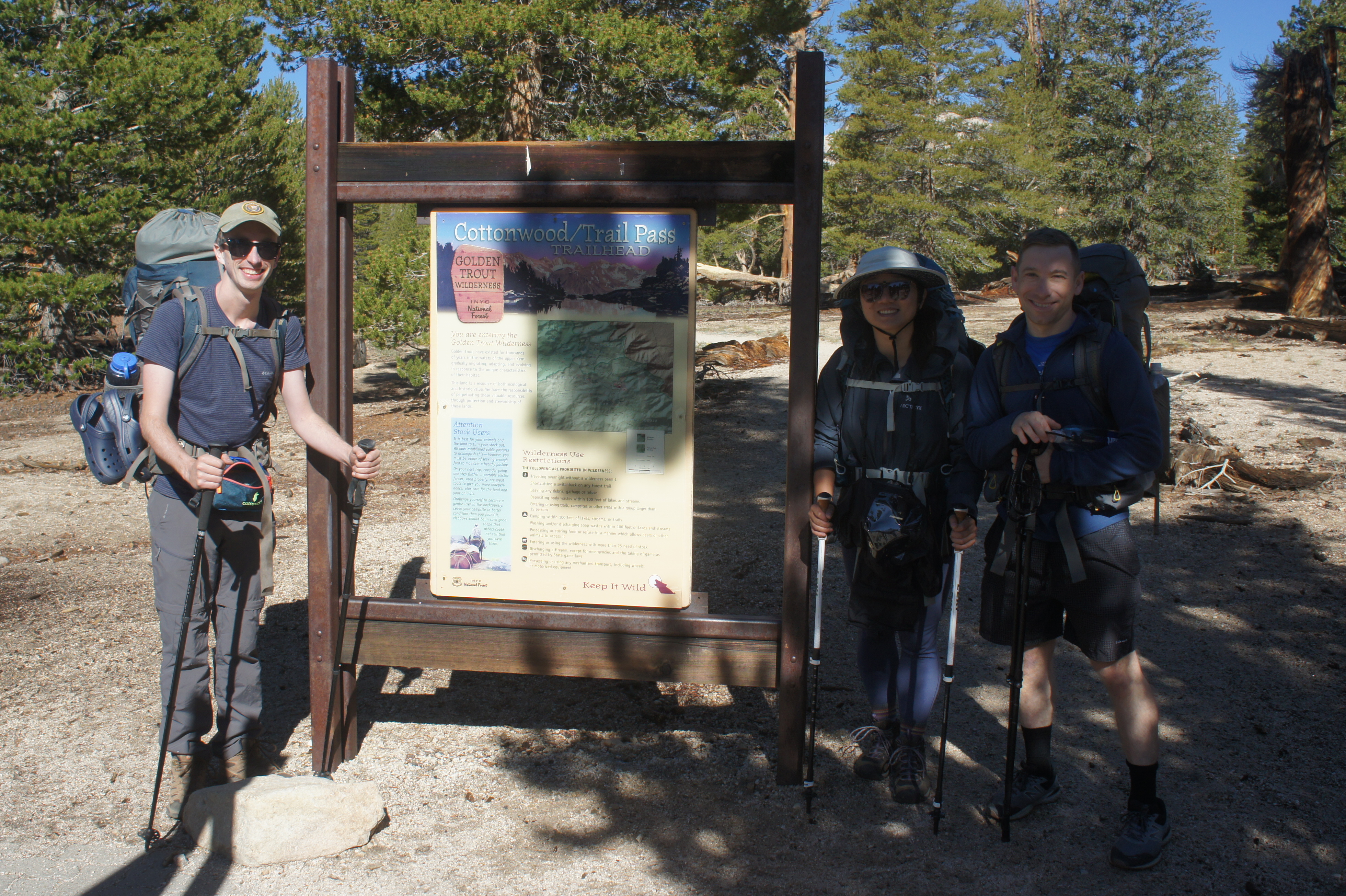
At the Cottonwood Pass Trailhead, situated at the far western end of the short loop drive at Horseshoe Meadow, a variety of signs and information boards welcome hikers to Inyo National Forest and the Golden Trout Wilderness, a 304,000-acre tract in the southern Sierras. The Golden Trout Wilderness, established in 1978, is often thought to mark the southern fringe of the High Sierras, the transition from glacier-carved peaks and valleys to open plateaus and eventually the scrubby foothills and Mojave Desert.
Heading west on the wide Cottonwood Pass Trail, the subalpine forest is dominated by lodgepole pines; hikers quickly reach a trail junction at about 1/10 mile. Staying right, follow the level moraine as the trail briefly skirts the sandy and open Horseshoe Meadow, fed by the modest Horseshoe Creek. Here hikers can begin to make out the bowl-like surroundings, with the smooth plateau skirted by high alpine peaks, including Trail Peak (11,605’) to the south.
After briefly flirting with the open meadow, the still-level trail heads back into the woods, which grow thicker as hikers continue westward. At about 1.3 miles, the easy trail crosses two minor streams in relatively quick succession and then begins the first major ascent, a roughly 1,100-foot climb to Cottonwood Pass. It begins with a relatively mild but steady uphill, still remaining among the conifers for now. At about the 2-mile mark, the pace of ascent picks up as hikers tackle around a dozen switchbacks.
As the trail briefly levels off, it skirts a brushy drainage on the left and then rises to a point with the hike’s first excellent views looking back toward Horseshoe Meadow. The broad length of the meadow gives way to a high front to the east, capped by unnamed peaks cresting 11,000 feet, concealing the major drop to the vast Owens Valley and Inyo Mountains beyond.

Soon enough, a second set of switchbacks ensues, this stretch remaining mostly in the trees with occasional vistas as the pass approaches. Rising to a layer of blocky granite, the trail crests the divide at Cottonwood Pass (11,132’), about 3.8 miles from the start.
In addition to continued views down the eastern slopes of the Sierras, hikers get their first peek west of the divide. Across the Kern River watershed (where hikers will spend the next several days), one can see as far as the Great Western Divide, a range of towering peaks that bisect Sequoia National Park. At Cottonwood Pass, hikers also connect for the first time with the Pacific Crest Trail (PCT), a 2,650-mile track that eventually doubles as the JMT some 16 miles to the north.

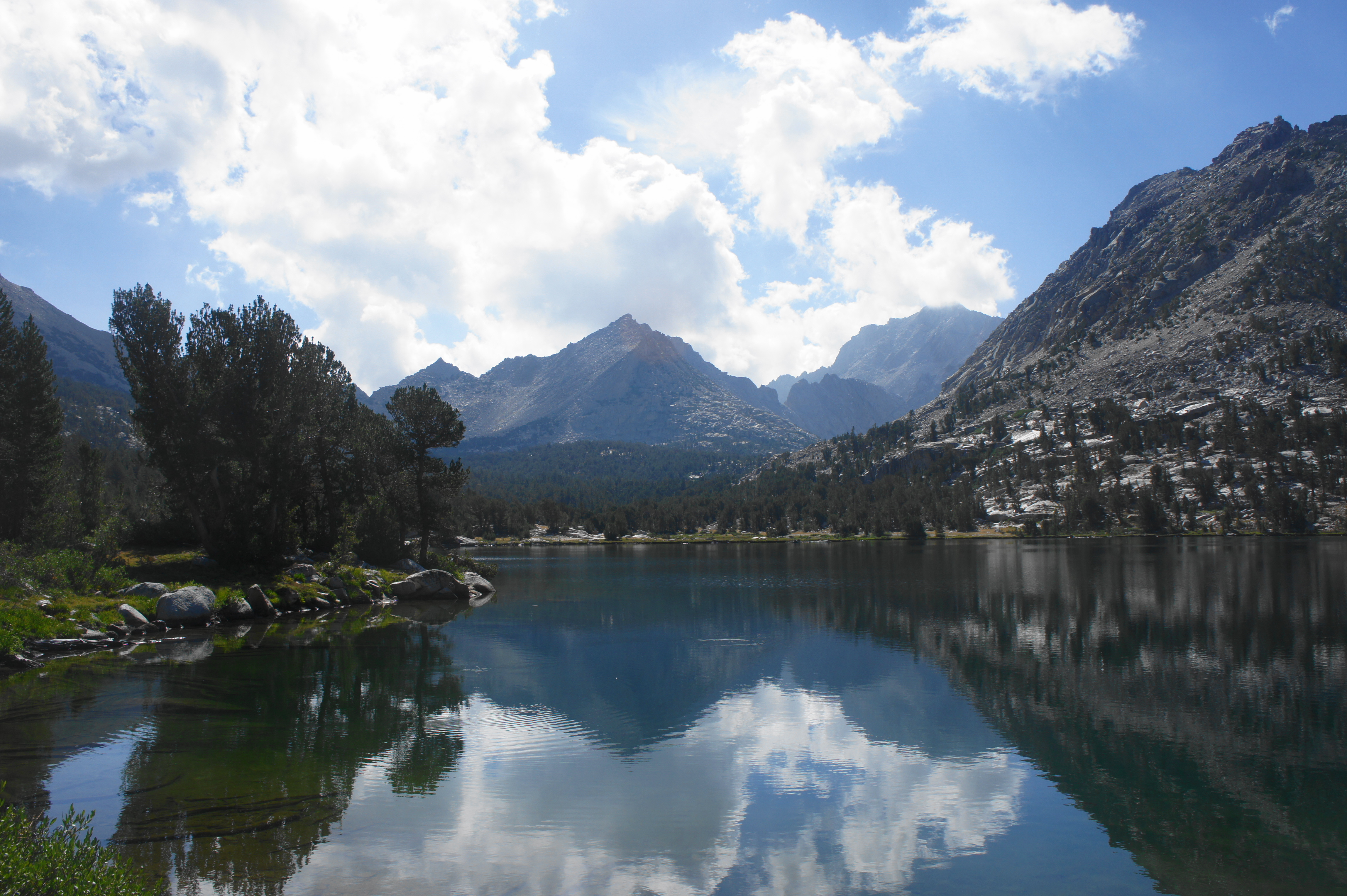
Though the most obvious trail leads straight in the direction of Big Whitney Meadow, this is not the PCT. Rather, hikers will want to turn right, following a reasonable grade as it hugs the south-facing slope of the main mountain divide. The mostly uphill track leads for 6/10 mile to a junction that is easy to miss: just before crossing a small drainage, a 0.2-mile spur trail leads right and climbs to Chicken Spring Lake, a worthy detour and good place to fill up on water for the onward journey.

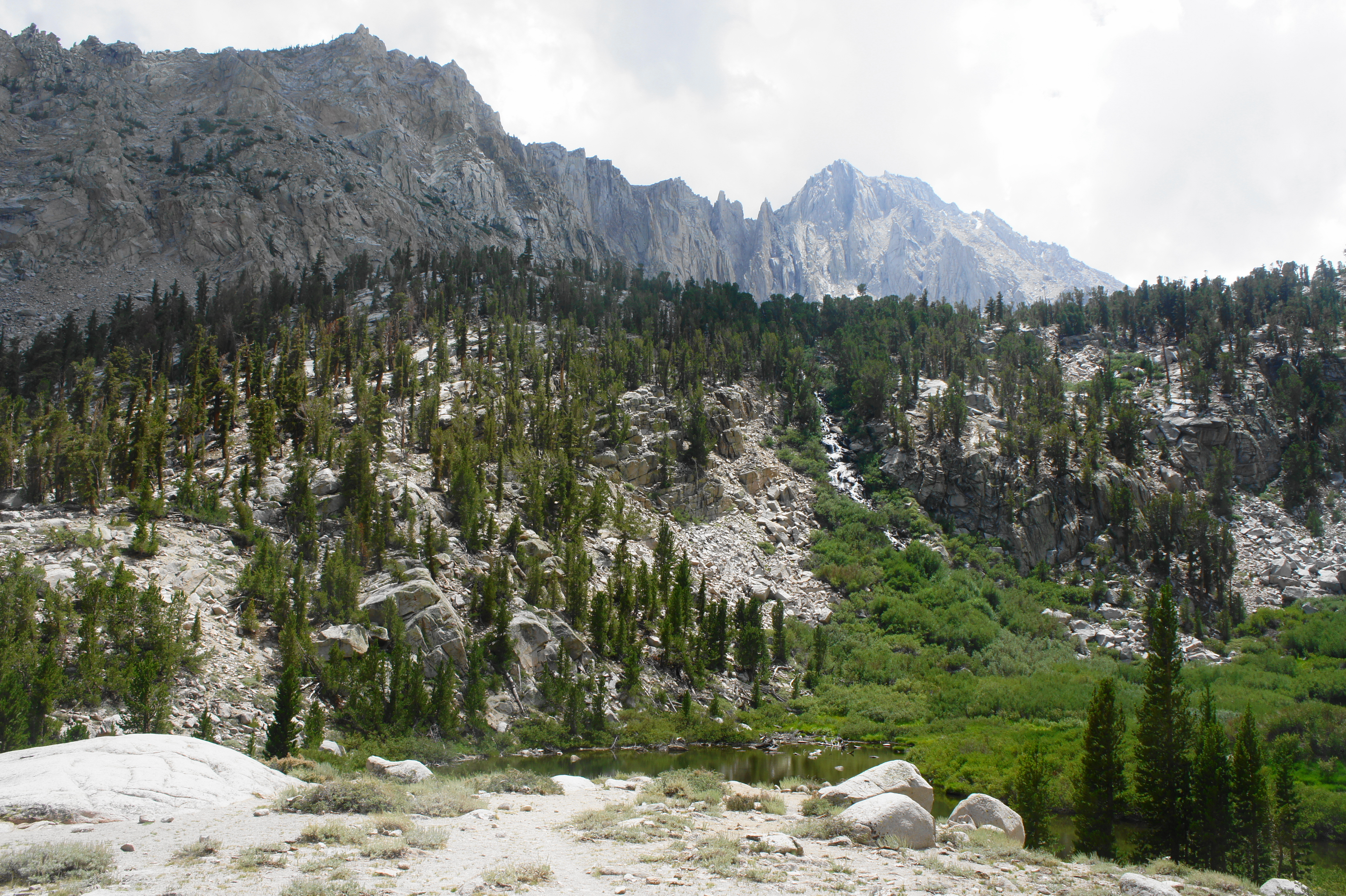
Chicken Spring Lake is perhaps the most popular destination in the Golden Trout Wilderness, with good reason, as the still waters abut a scenic granite pitch, a preview of what’s to come. Some JMT hikers will choose to camp here; although only 4.6 miles from the trailhead, the lake is already at 11,200 feet, so those concerned with altitude sickness may wish to set up here for the night. (Note: At a minimum, definitely fill up with water here, as, especially late in the season, there may be limited or no stream access for the next eight miles on the northbound PCT.)
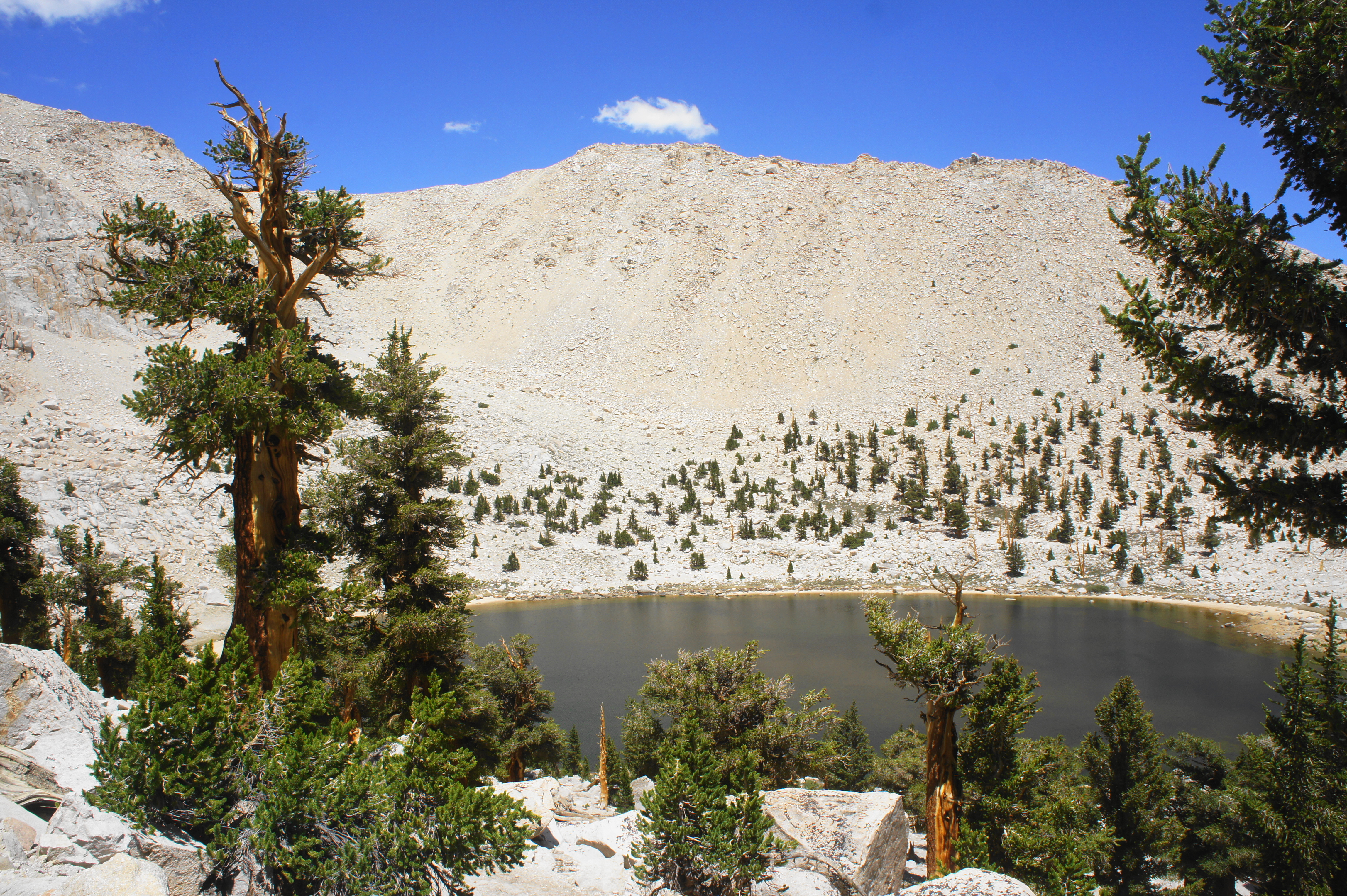
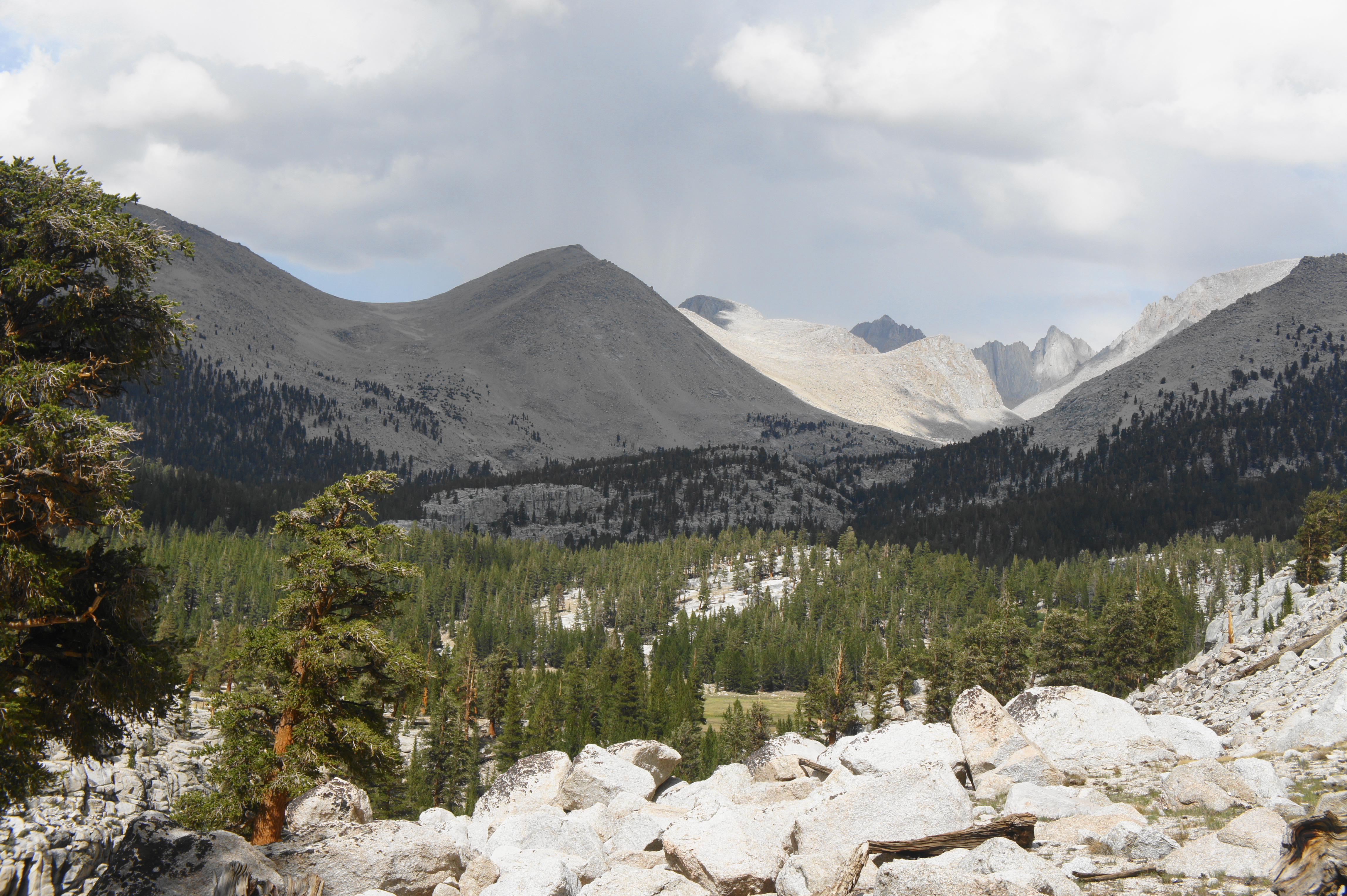
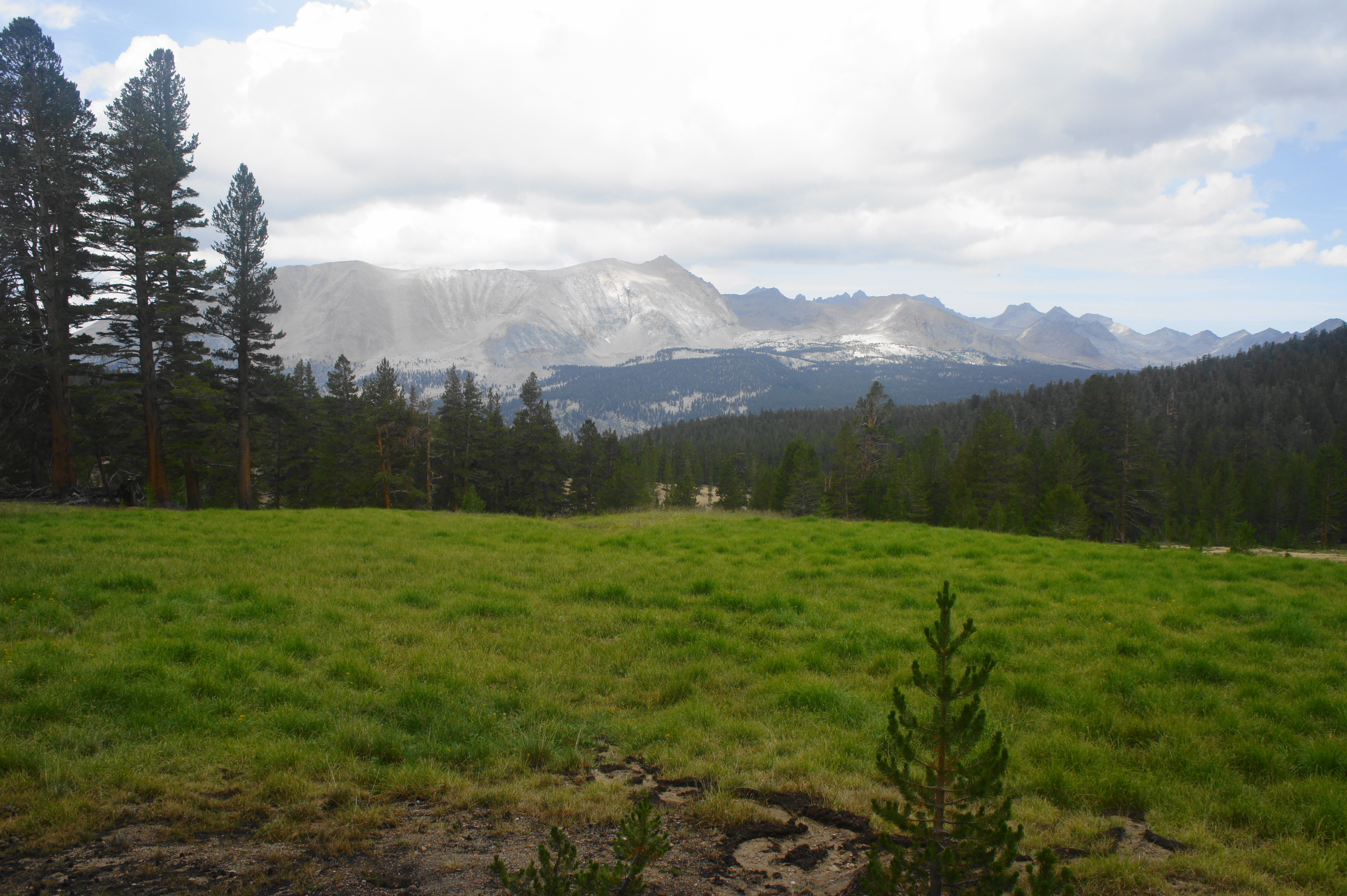
After visiting the lake, return to the PCT, cross the drainage (which may be dry), and begin a surprisingly difficult clamber, one of the steepest sections of the day. From here the rocky trail gains around 200 feet as it clears a ridgeline dotted with hearty foxtail pines and bird’s eye views of Chicken Spring Lake. On the other side of the ridge, hikers are greeted with an excellent look across the woody terrain of the Golden Trout Wilderness. The grassy patch to the southwest is Big Whitney Meadow, fed by Stokes Stringer Creek, which flows into Golden Trout Creek and eventually the South Fork of the Kern River. Beyond lies Johnson Peak (11,371’) and the Great Western Divide. Off to the south, hikers will eventually spot Olancha Peak (12,132’), a prominent summit that stands out as the highest peak in its immediate vicinity.

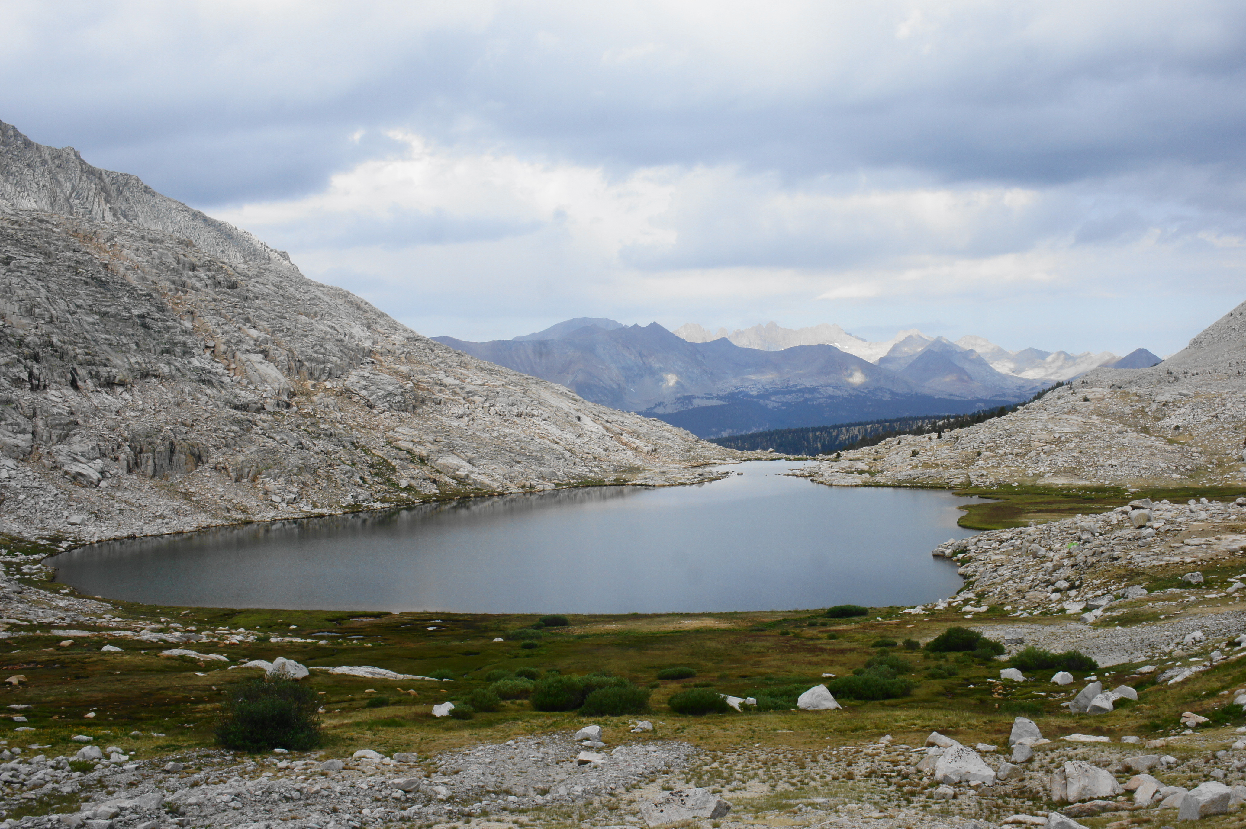
The High Sierras beckon, and Rock Creek—a popular goal for the first day of hiking—remains more than eight miles away. After a nice stretch of relative flat, the route ascends again as it skirts a talus slope with more great views of Big Whitney Meadow and beyond. After some more pleasant, level walking, the PCT rises again to clear a notch, where an unnamed but beautiful meadow lies beyond. The trail keeps its distance from the meadow, instead skirting a granite slope below Cirque Peak (12,900’). (Note: there is sometimes water here, in ponds above or below trail level, but don’t count on it.)

From here the ascent kicks into high gear again, rising steadily to clear another pointed ridgeline. The opposite side offers another new view—this time to the north, across the vast flats of the Siberian Plateau. One can begin to make out the steep valley carved by the Rock Creek drainage, still more than a five-mile’s walk from this point. (Note: The Mount Whitney area is visible in the distance.) Thereafter, the trail briefly descends before rising again to enter Sequoia National Park, where you will spend the next few days. By now, hikers are about 7.5 miles from the start.

Onward travel leads down to another trail junction at about 8.2 miles, where hikers must make a choice. The most common option is to continue straight on the PCT, following it for another 4.5-5 miles to the Rock Creek drainage. However, limited water availability between here and Rock Creek (as of July 2021, the area was completely dry) may push some to choose to bear right on the Siberian Pass Trail, taking an alternate route down to Rock Creek. The upside of this alternative is that it offers quicker access to water and nice campsites at the Soldier Lakes area; the downside is that the detour adds over a half-mile to the hike. A third option is to camp around here, on the Siberian Plateau: there are gads of nice campsites by the meadow, though the various forks of Siberian Pass Creek may be dry, depending on the time of year of travel, forcing one to dry camp.
This description continues to follow the PCT, which sets out across the Siberian Outpost en route to Rock Creek. The next four miles are a nice combination of flat and downhill terrain, although hikers who started at Horseshoe Meadow may be quite tired by this time of day, making the descent seem rather endless. Bearing west amid coniferous forest, hikers get occasional, somewhat obscured views of Joe Devel Peak (13,325’) and the spectacular Miter Basin area.
After about 2.5 miles of relatively level terrain, the PCT begins to descend in earnest into the drainage carved by Siberian Pass Creek. By now, hikers can see across the woody valley of Rock Creek to Mount Guyot (12,300’), the most prominent peak to the northwest. After about a mile of descent, hikers pass a small meadow bounded by thick granite slabs, then the trail zig-zags down switchbacks toward the main Rock Creek drainage. Crossing a marshy area at around 12.5 miles, there is some seasonal stream access and a campsite frequently used by trail crews. Thereafter, it is a relatively short walk to the next trail junction, situated about 12.8 miles from the start.
Here the Army Pass Trail (the route from Soldiers Lakes and Miter Basin) enters from the right, while the main PCT heads left, traversing a woody shelf above the Rock Creek drainage, with the main stream not yet visible. Just after crossing a tributary, about 300 yards from the junction, there are a couple decent campsites on the right, a welcome sight for those who hiked the full 13 miles to get here and don’t quite have the energy to keep going down to Rock Creek itself.
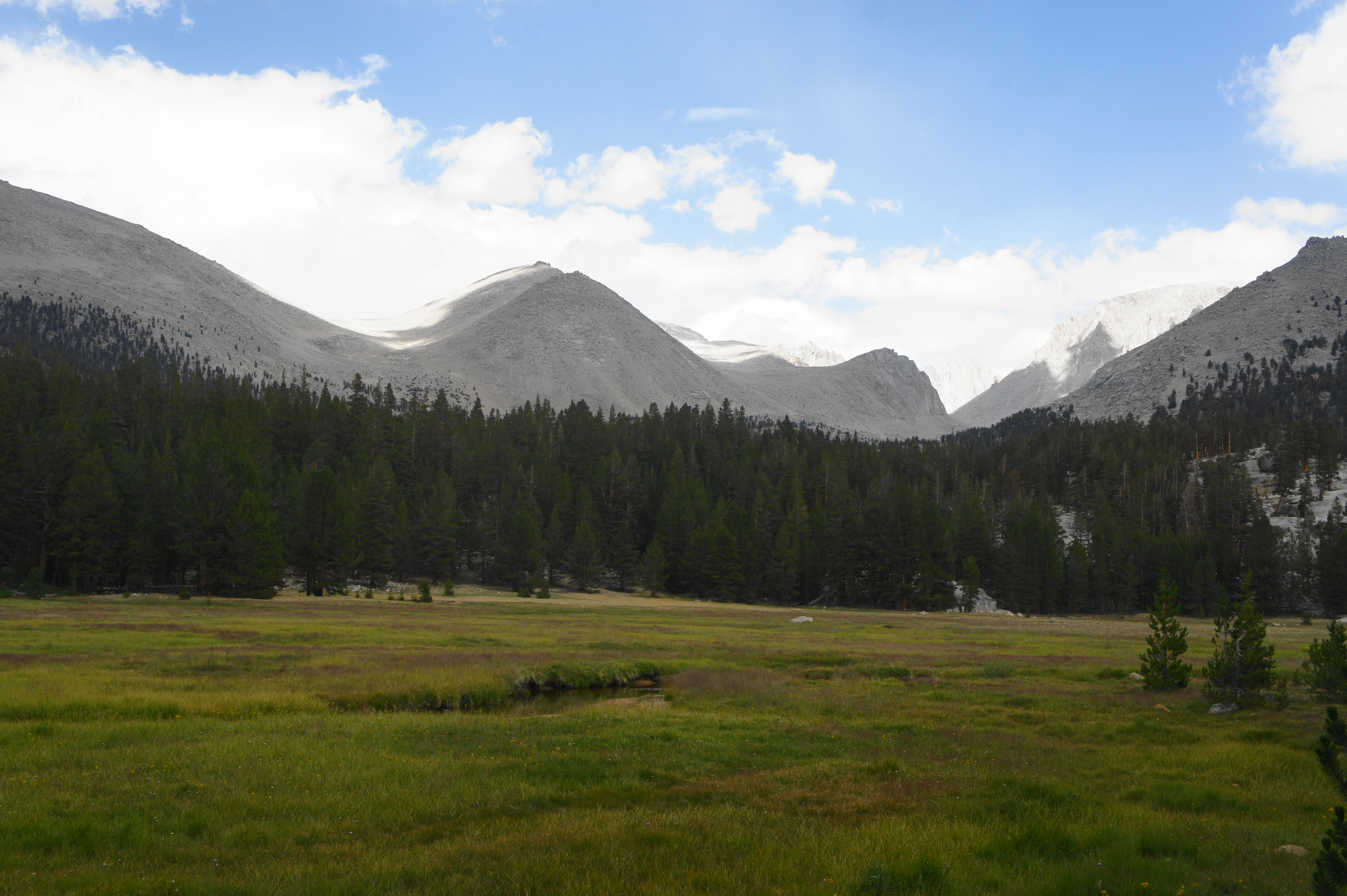
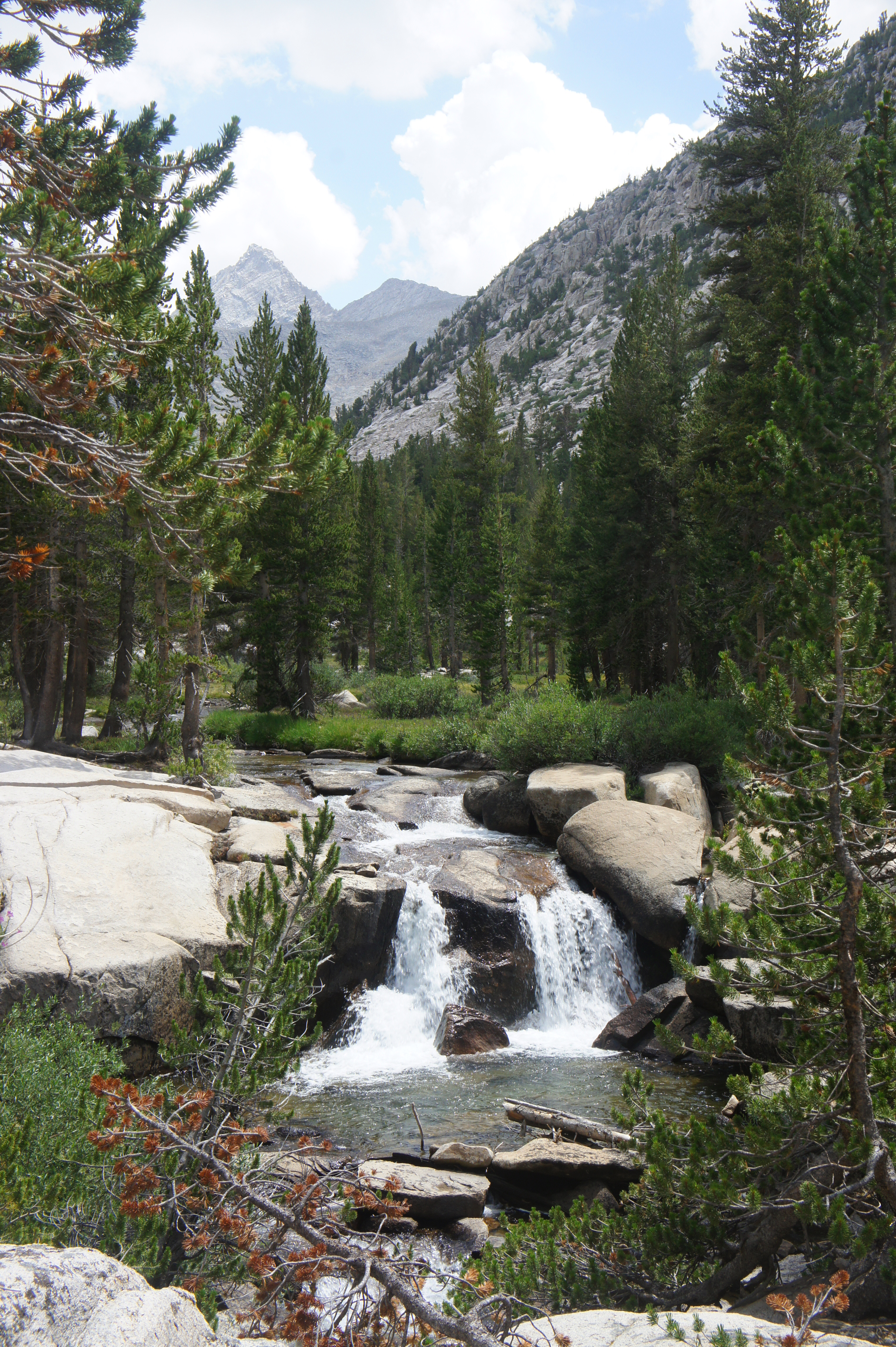
Continuing onward, it is another 1/3 mile until hikers cross a series of beautiful meadows, eventually coming to the banks of Rock Creek, a beautiful, babbling stream that hikers will follow for the next half-mile. There are several campsites around here, as well as a signed spur trail leading to the Rock Creek Ranger Station.

Finally, after nearly 14 miles of hiking from Horseshoe Meadow, the trail reaches the crossing of Rock Creek, where there is a bear locker and a multitude of campsites. This, or one of the campsites along the previous mile, is an ideal place to reach on Day 1 (or Day 2 if camped at Chicken Spring Lake the previous night) of the hike.
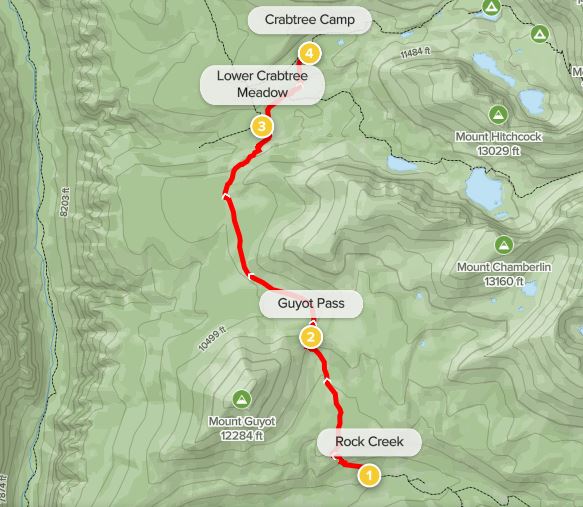
Trip Report: Three of us set out on July 27, 2021 from Horseshoe Meadow, carrying six days of food for Leg 1 of the journey. Despite a nasty thunderstorm the day before, we lucked out with sunny skies for much of the day, but the drought conditions made water availability challenging. We filled up at Chicken Spring Lake and saw no other water for the next eight miles, requiring each of us to carry about three liters each. It’s a good haul to Rock Creek on the first day, and we ended up camping at the tributary stream reached at around mile 13—not the greatest site but good enough for setting us up for the next section—up and over Guyot Pass to Crabtree Meadow—the following day.
Rock Creek to Crabtree (7 miles)
After rock-hopping across Rock Creek, the PCT wastes no time in beginning the ascent, more than 1,300 feet in elevation, to Guyot Pass (10,935’). After crossing a couple tributary streams, the path enters a set of aggressive switchbacks, quickly rising out of the Rock Creek drainage, with some limited views down-valley to the much-larger Kern Canyon. After more than 500 feet in elevation gain, the trail briefly levels off as the conifers grow sparser. From here the PCT descends to a point crossing Guyot Creek, often the last reliable stream before Crabtree.
After the creek, the upward incline remains relatively mild for about ¼ mile before picking up again, sans switchbacks, as the trail makes its way toward Guyot Pass. Rising amid a sparse conifer forest, travelers hike through the shadow of Mount Guyot (12,300’), a major peak separating the pass from the Kern River drainage.
After more than two miles and 1,300 feet in elevation gain, the PCT finally crests a final set of trail bends and clears Guyot Pass. The saddle itself offers partly obscured views back toward Rock Creek, as well as north toward the Crabtree and Mount Whitney areas.
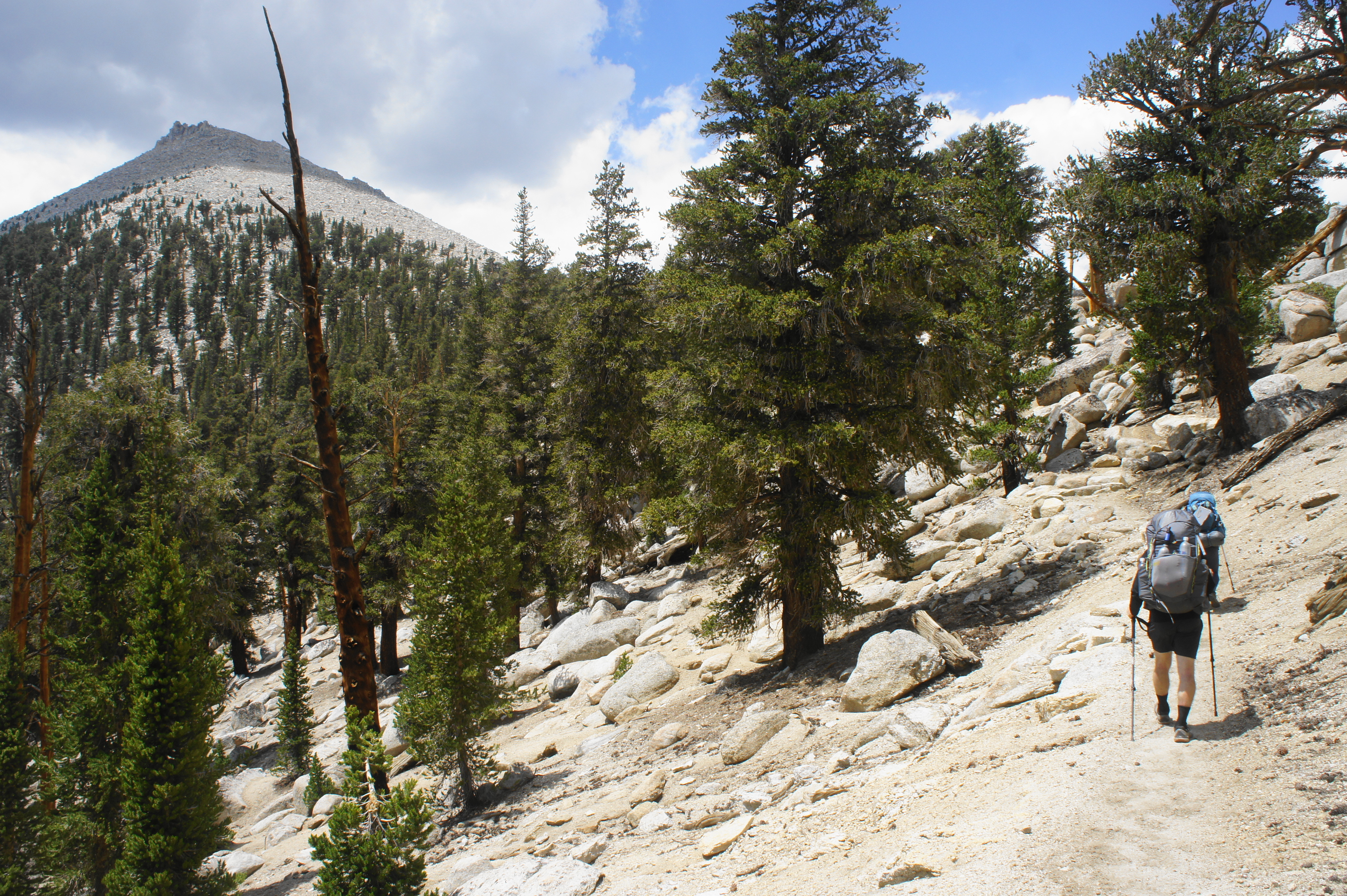
Beyond Guyot Pass, the PCT descends mildly to the fringes of Guyot Flat, a sandy expanse with limited (or no) water but expansive views west to Kern Canyon, the Kaweah Peaks, and the Great Western Divide. After a brief stretch of easy, level walking, the track climbs again amid a somewhat dense collection of pines. At about 4.4 miles from Rock Creek, the route traverses an open, sandy patch again; from here, the PCT ascends a surprisingly steep pitch, gaining around 200 feet in elevation to clear a woody ridgeline.

Once over the ridgetop, the eastward-trending trail offers its first views of the Mount Whitney complex: an intimidating collection of distant sawtooth peaks and spires, the highest terrain in the Sierra Nevada. The peak of Whitney is just out of view, but hikers can see many of its surrounding cousins, including Mount Young (13,177’), Mount Hale (13,491’), Mount Muir (14,012’), and Discovery Pinnacle (13,748’).
As the trail makes its way northeast, it drops into a granite notch lined with bulky boulders and reaches a wooden gate. After a short uphill, the trail briefly reenters the woods and then rounds a left-hand bend to the edge of Lower Crabtree Meadow, a beautiful and large patch of green fields, fed by meandering Whitney Creek.
As hikers approach Whitney Creek and the junction with a spur trail leading toward Mount Whitney, there is a bear locker and plenty of excellent camping spots along the edge of the meadow. At the fork, those skipping Mount Whitney can stay left, ascending the PCT in the direction of Wallace Creek and Forester Pass to the north. But most hikers seeking to do the entire John Muir Trail will want to bear east, setting one up for tackling Mount Whitney (and the official start of the northbound JMT) the following day.
The Whitney Creek Trail heading right offers the quickest access to Upper Crabtree Meadow and the Ranger Station, around which many hikers from Cottonwood Pass will make camp on night two or three. At first, the path is mild and extremely pleasant, flanking the meadow on the right, with views east and south toward Mount Hitchcock (13,184’) and Mount Chamberlin (13,169’).

Soon enough, however, the trail diverts away from the meadow and begins to climb again, following the Whitney Creek drainage through a thick forest of conifers. After climbing perhaps 100 to 150 feet, the narrow but well-trodden path crosses Whitney Creek, with an unmarked path heading right toward Crabtree Lakes. Stay left, now paralleling the stream on the right, steadily ascending in the shadow of Mount Young. After a short walk, hikers reach another trail fork, a three-way junction at the head of Upper Crabtree Meadow. Heading right (away from the creek) leads to the main camping area at Crabtree, a veritable “hiker village” chock full of campers at the edge of the meadow.
This main camping area at Crabtree, where there is a two-night limit, is nothing special, except for the presence of a bear locker and a rare luxury: a small pit toilet, with a single wall of corrugated metal for privacy, situated perhaps 150 yards from the stream and trail junction, at the edge of the meadow on the east side. Crabtree is particularly popular as a staging point for travelers to Mount Whitney (15 miles round-trip from here), and the Crabtree Ranger Station offers assistance in the case of emergency, as well as a sheltered deck if you need to dry some clothes or equipment during one of the area’s frequent rainstorms.
Trip Report: Beginning about a mile back on the PCT from the Rock Creek crossing, we covered the short trip to Crabtree on Day 2 of our journey. The climb out of the Rock Creek drainage to Guyot Pass was challenging, with steady gain but few switchbacks, but the rest of the day was relatively mild, with the sun finally coming out briefly as we reached Lower Crabtree Meadow. But, being late July, we were in the middle of a powerful monsoon season, and storm clouds threatened as we reached the main camping area at Crabtree in the mid-afternoon. A nasty thunderstorm had us scrambling for our tents, where we spent an hour and a half waiting out the rain and lightning. After moving our tents out of deep puddles, we got some better weather in the evening, enough to cook dinner and prepare for the next day—a 15-day hike to Mount Whitney—which would be our toughest day yet.
Crabtree to Mount Whitney and back (15 miles)
For hikers heading southbound on the John Muir Trail, the multi-week trek culminates at Mount Whitney (14,505’), the highest peak in the contiguous United States. For northbound JMT hikers, summitting the mountain comes very early in the trip; for most backpackers coming from Horseshoe Meadow, the arduous climb to Mount Whitney comes on Day 3 or 4. Fortunately, if one camps at Crabtree (or slightly farther up a Guitar Lake), hikers can tackle the summit as a reasonable, out-and-back day hike.

Due to the high propensity for afternoon thunderstorms, starting early in the morning from Crabtree is a must. (Note: Those seeking to watch the sunrise from the summit will want to start hiking no later than 1 or 2am.) From the main camping area—near the junction, bear locker, and Ranger Station—cross Whitney Creek and clamber up a woody hill with additional campsites to the right and left. After about 1/10 mile, take a right at the trail junction; at long last, hikers are finally on the John Muir Trail! The official start of the JMT (the summit of Mount Whitney) lies 7.4 miles—and a brutal 3,800 feet in elevation gain—from this point.
Heading east on the JMT, the high-traffic route follows a pine-studded terrace then traverses an open upland with views of the craggy Whitney complex ahead. About one mile from Crabtree, the trail skirts another pleasant meadow bisected by Whitney Creek and then rises rather sharply to a point overlooking the grassy carpet, bounded by the massif of Mount Hitchcock to the south.

Next, the trail rises to mount a granite shelf, overlooking a narrow gorge carved by Whitney Creek. The rushing waters soon give way to a quiet, marshy area and the serene Timberline Lake, where camping is prohibited but the morning reflection of the Whitney ridgeline is spectacular. This is a lovely spot and the last lake in the subalpine ecosystem before the JMT moves up beyond tree-line.


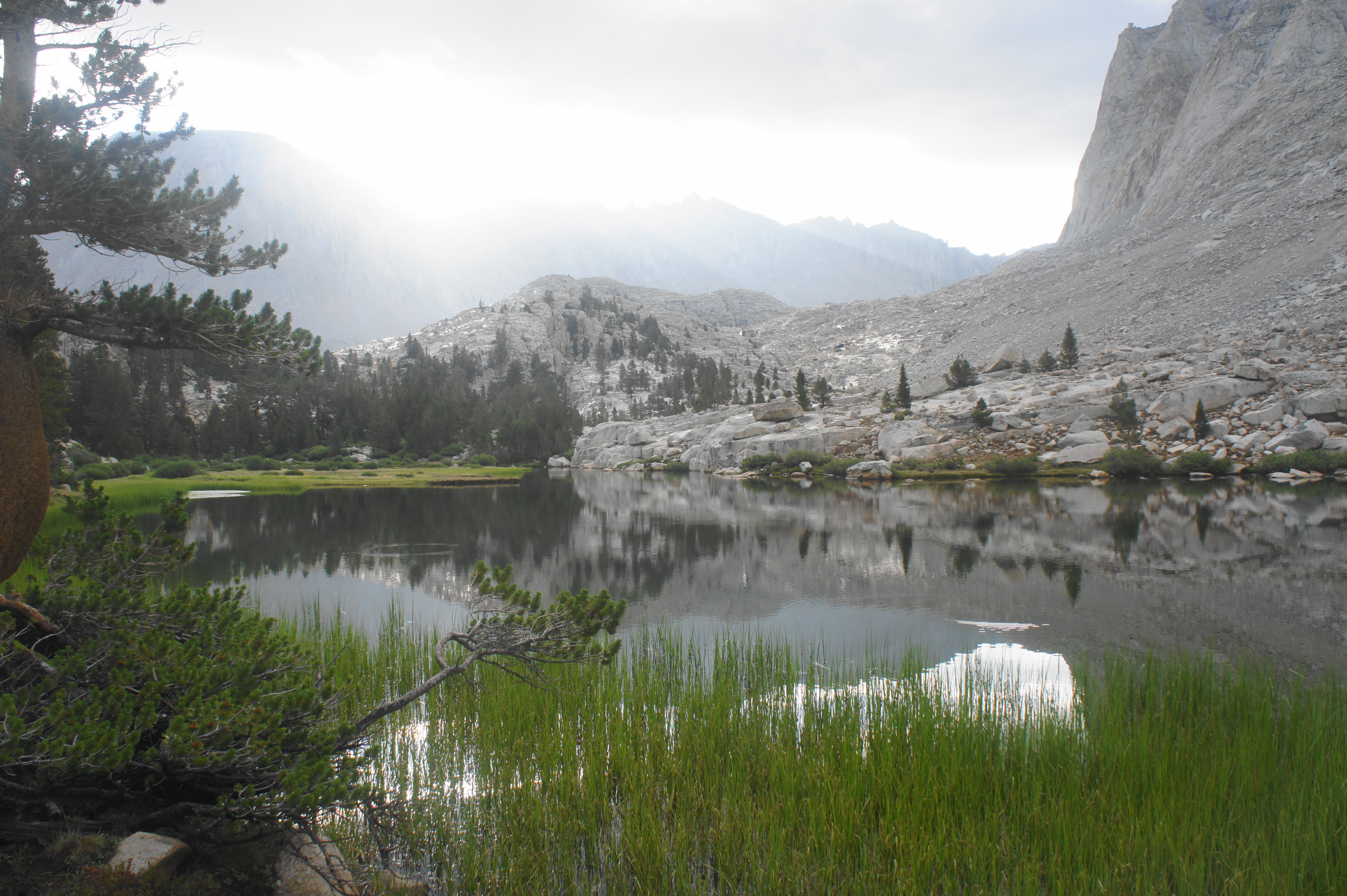
From Timberline Lake, the onward trail skirts the shoreline before rising to a densely wooded area with a nice campsite nestled up against a smooth granite wall on the right. After rising up above the timberline, the conifers are sparse and the granite boulders grow larger as the trail follows a wide depression between rocky slopes. The gently sloping path climbs to an open terrace that soon offers the first views of the entirely tree-less Guitar Lake, a very popular camping destination (especially for southbound JMT hikers heading to Whitney Portal). Coming in from the north, a nicely-flowing stream—which drains Arctic Lake, some 800 feet above—offers perhaps the last opportunity to fill up with water before the dry and desolate climb beyond.
Up to this point, with Guitar Lake on the right, the climb from Crabtree has covered 800 feet in elevation in just under three miles. In the next 4.5 miles, hikers will cover a crushing 3,000-foot gain between here and the summit of Mount Whitney.
The trail beyond Guitar Lake quickly passes a couple of small mountain tarns and then scrambles up a rocky bench, with the guitar-like shape of the lake coming into full view. The bowl-shaped depression in the granite ahead is entirely devoid of trees, with virtually all vegetation disappearing as the trail climbs to the base of a rugged and seemingly endless set of switchbacks leading up to Trail Crest and the turnoff for the summit.

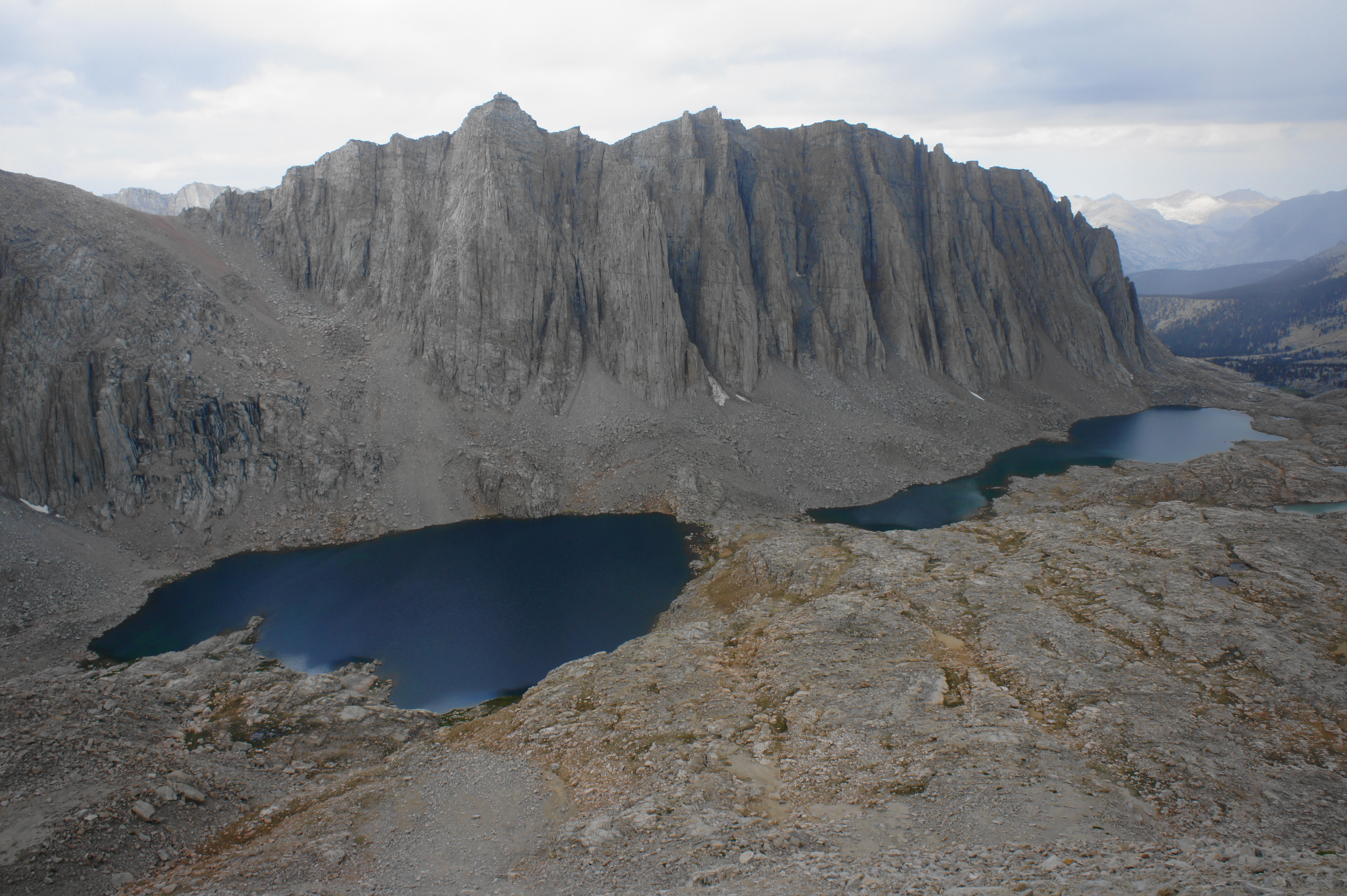
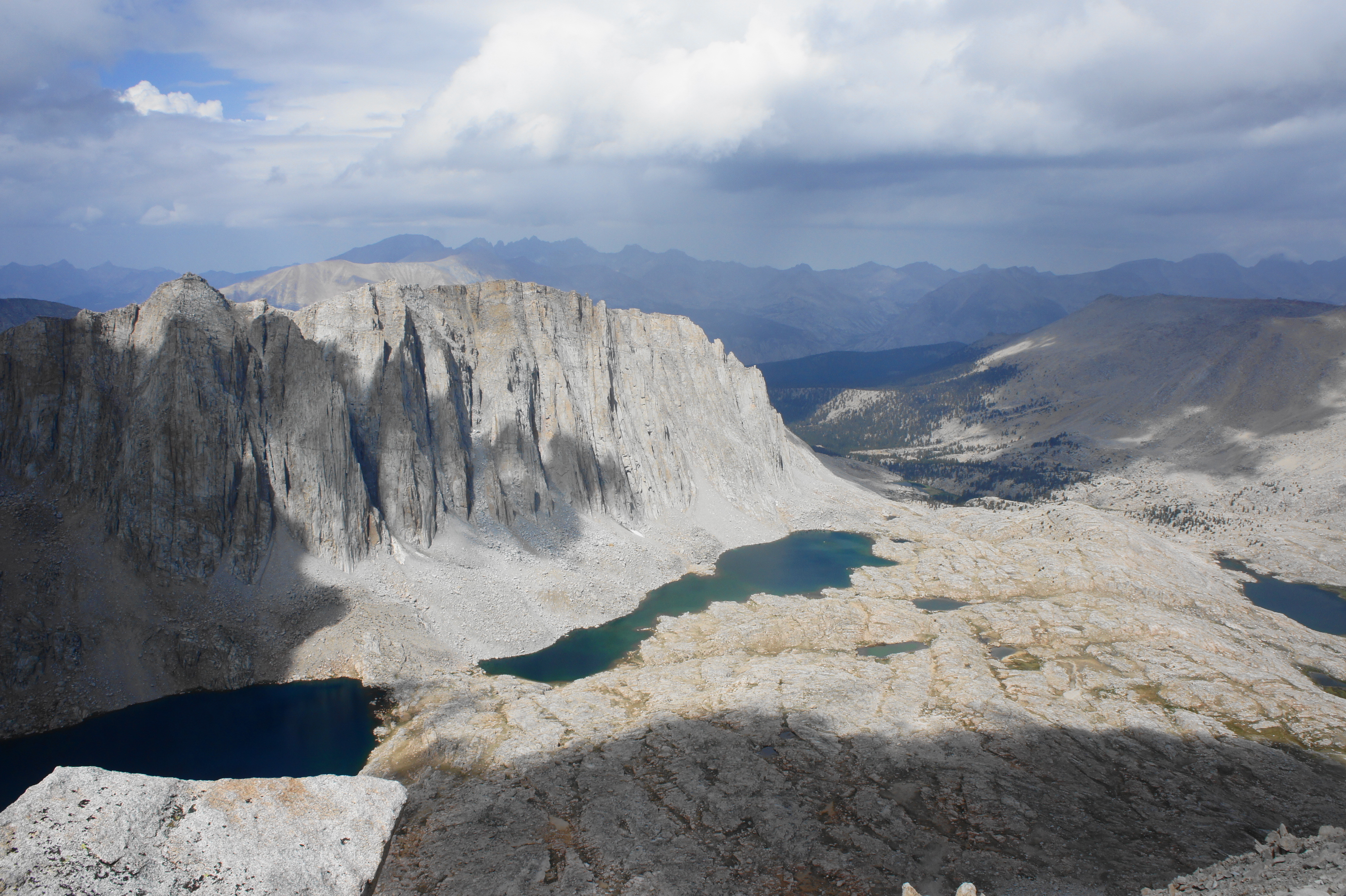
As hikers pass 12,000—then eventually 13,000—feet, the relentlessly ascending trail offers excellent views down to Hitchcock Lakes, two deep blue pools set at the base of jagged Mount Hitchcock. Beyond to the south, hikers eventually rise high enough to see over Mount Hitchcock to a clutch of peaks in the Miter Basin area—such as Mount Newcomb (13,410’), Mount Pickering (13,485’), and Mount Langley (14,042’). To the west, the Whitney Creek drainage gives way to Kern Canyon, with the Kaweah Peaks and Great Western Divide dominating the horizon.

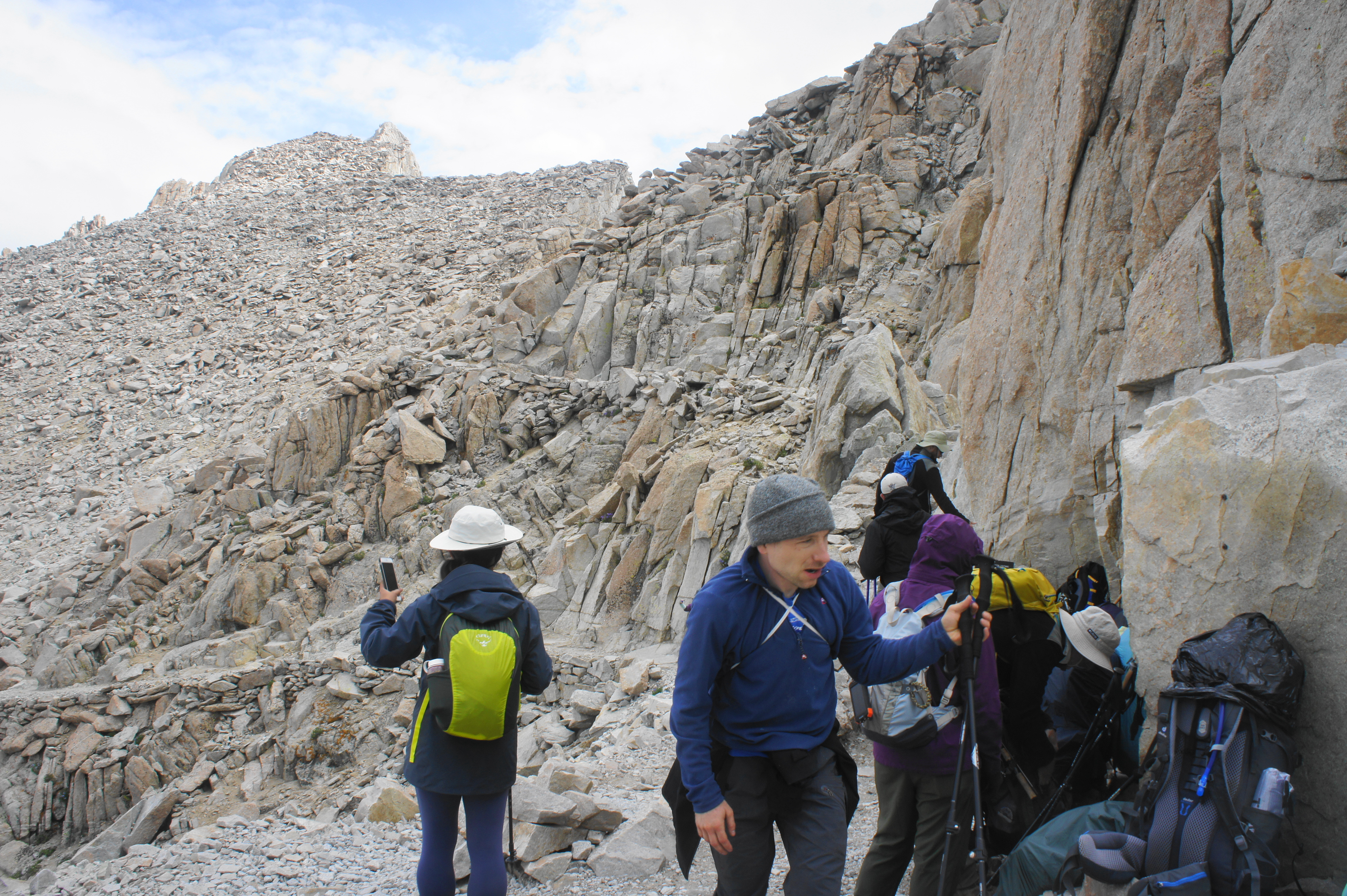
It is not until about 5.4 miles—at elevation 13,450’—that hikers reach the three-way junction just below Trail Crest. Here the JMT bears left for the final, two-mile stretch to the summit, while the onward path to Whitney Portal (the exit route for southbound JMT hikers) continues right. Because the journey to the summit from here is an out-and-back, this intersection is a popular staging point for multi-day hikers to leave their backpacks behind. (Note: Beware, however, of hungry marmots—who will have no qualms about chewing through your pack if left unattended!)

From this point onward, the crowds multiply, as throngs of day hikers and overnighters enter from Whitney Portal to the east, joining the hearty travelers from Crabtree for the final leg. The last two miles to Mount Whitney begin with a quick set of switchbacks, with continued views down to Hitchcock Lakes and Guitar Lake to the west.

After cresting a cleft between the main ridge and a jagged clutch of spires, the trail actually descends for a short while, reaching a set of window-like notches with precipitous drops down to the east. At many of these windows, hikers get a view down toward Owens Valley and Lone Pine, with a barren landscape resembling Mordor in between.
After passing a series of pinnacles and Mount Muir (14,012’), the trail settles into a steady, stony ascent toward the bulky western slope of Mount Whitney. In the final stretch, the JMT swings suddenly to the west, reaching a slope with new and spectacular vistas down to Wales Lake and the Wallace Lake drainage to the northwest.


From here, the trail routes back to the east, making its final ascent to the summit of Mount Whitney (14,505’), the highest peak in not just California but the entire contiguous United States. (Note: There are 11 peaks, all in Alaska, that are higher.) The summit also marks the end of the southbound JMT—and mile 0.0 for the northbound JMT, the (official) beginning of the journey! A metal plaque marks the true summit, while the modest Mount Whitney Summit Shelter offers sanctuary in case of a sudden lightning storm.


If the weather holds, the vistas from Mount Whitney are aplenty. To the east lies Owens Valley and the Inyo Mountains, with the various forks of Lone Pine Creek immediately below. The view south is even better, with clean views of Mount Langley, Mount Mallory (13,850’), and other high peaks, with Owens Lake (dry) and even the Death Valley area visible beyond. To the southwest lies Hitchcock Lakes and Crabtree, as well as much of the terrain covered in previous days, including the Guyot Pass area and Rock Creek drainage. The Kaweah Peaks and Great Western Divide continue to dominate the landscape to the west, while a northward view previews some of the terrain passed in future days on the JMT, including the Kings-Kern Divide, Mount Williamson (14,375’), and even the distant peaks of the Palisades (14,242’) in Kings Canyon National Park.


Having climbed 7.5 miles and 3,800 feet from Crabtree, it’s worth staying awhile at the summit, even as the gads of other visitors stream up and down the trail to the top. Once ready, however (a decision which may be accelerated by approaching storm clouds), return back down the way you came, returning to the junction after around two miles, then an additional 5.4 miles to Crabtree and the main camping area. The 15-mile round-trip journey will take much of the day for most travelers and, despite doing the trek without a heavy pack, is one of the hardest stretches of trail on the entire JMT.


Trip Report: Despite being a day hike with a lighter pack, the climb to and from Mount Whitney from Crabtree was the most challenging day of the entire JMT, made more difficult by looming thunderstorms and two bouts of hail. Leaving Crabtree at 6:45am, we definitely left too late in the morning, reaching the summit around 12:45pm, when the peak was shrouded with white clouds. The vistas briefly improved as we descended back toward Guitar Lake, but we were greeted again around 4pm with a nasty thunderstorm that left us soaked and scrambling for cover. After the storm, we returned to a water-logged camp at around 6pm—not exactly record time up and down Mount Whitney—but we were gratified to have conquered the summit and (officially) begun our hike on the JMT.
Crabtree to Tyndall Creek (9 miles)
Having crossed Mount Whitney off the list, it is time to head northbound on the JMT, traversing the high plateaus between Kern Canyon and the Sierra Crest, from Crabtree to Tyndall Creek. From the main camping area at Crabtree (near the Ranger Station), stay straight at the junction and rock-hop across Whitney Creek before rising steadily to the junction with the JMT at its mile marker 7.4. Here the northbound journey requires turning left, following a woody terrace for ¾ mile. About ½ mile from the start, a suddenly sharp ascent catches hikers by surprise, leading uphill until reaching a junction with Pacific Crest Trail (PCT) coming from the left.


Thereafter as the JMT bears north, it doubles as the PCT and climbs efficiently to clear a minor ridgeline before gradually descending again, toward a tributary of Whitney Creek. Here the tributary fans out into several forks, each crossed in turn. After the first, hikers climb to the edge of Sandy Meadow, a beautiful grassy veld with terrific views across Kern Canyon to the Red Spur (13,285) and Kaweah Peaks in central Sequoia National Park.
From here the JMT crosses three more drainages and then climbs mildly to a shady pass just shy of 11,000 feet, a bit of a teaser climb for the much longer ascent to come. As the trail crests the saddle and descends into the vast Wallace Creek watershed, sporadic views extend as far as Tawny Point (12,332’), Mount Tyndall (14,018’), and Junction Peak (13,888’) to the north.

After clearing a large boulder field, the descending path settles into a series of brief cuts and switchbacks, crossing a tributary of Wallace Creek, at about 3.8 miles from Crabtree. From here the trail edges largely eastward, then bends west, and drops to a popular camping area with a bear locker and a crossing of Wallace Creek. This is the widest stream traverse yet, requiring a good 30-40 yards of maneuvering amid the rocks and logs to cross.

The other side ushers in another climb that makes up the 600 feet in elevation lost, plus an additional 400 feet. After passing a junction with the High Sierra Trail, which leads down to Kern Canyon and its associated hot springs, the JMT leaves behind a field of popular campsites, rising steadily to the west. About 1/3 mile up from the junction, the trail rounds a right-hand bend, revealing a lookout to the left with outstanding vistas to Kern Canyon and the Kaweahs.

From here the views temporarily disappear as the path levels off and stays in a lodgepole pine forest until Wright Creek, another worthy spot to stop for water and a break. Beyond the creek, the ascent resumes, and the tree cover becomes sparser. After briefly paralleling the stream, the trail rises to clear several open patches, revealing views back to the southeast to Mount Whitney, a nifty alternative view of the state’s highest peak.
From here the trail ascends in fits and starts, clearing one ridgeline after another in a seemingly endless climb to Bighorn Plateau. After skirting several minor drainages and cresting several hilltops, the JMT finally breaks out above timberline at about 6.5 miles.

The next half-mile stretch is one of the most scenic of the entire JMT: the high altitude and barren landscape of Bighorn Plateau allows for sweeping vistas in nearly all directions, with the Great Western Divide unfolding to the north and west and Mount Whitney behind to the south. A shallow and serene pool gathers water off to the left; this is a popular spot for camping – but the exposed flat would not be great in the event of lightning.

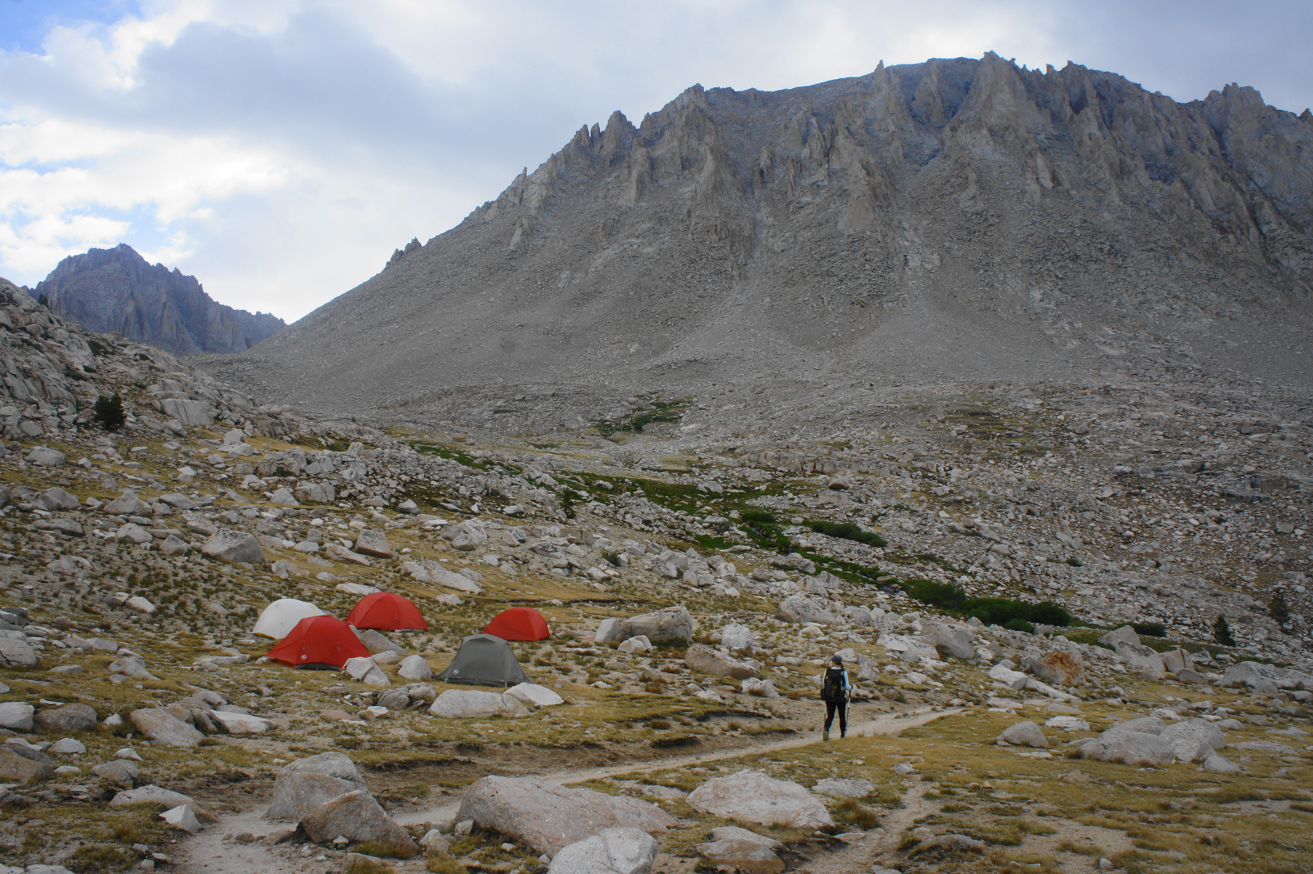
After traversing Bighorn Plateau, the JMT begins a steady descent into the Tyndall Creek watershed, beginning amid the foxtail pines before dropping back to the dry lodgepole forest. At a point a little over eight miles from Crabtree, the trail passes a camping area at the Tyndall Frog Ponds, a modest sight but less crowded than the area around Tyndall Creek below.

About 8.8 miles from Crabtree (JMT Mile 16.1), hikers reach a trail junction at the banks of Tyndall Creek. The route heading left leads to the often-unmanned Tyndall Creek Ranger Station, with Kern Canyon beyond. Bearing right, the JMT continues north, quickly approaching an open area, with the perennial drainage surrounded by low brush. Stay left at the junction with the Shepherd Pass Trail, then cross the creek, entering a very popular camping area. The best tent spots lie up the trail on the right after about 1/10 mile—past the bear locker on the left and near a set of lovely stairstep cascades, just below a restoration area where camping is prohibited. However, this is not typically a place for solitude.

Hikers do have a fine view from here looking north to the terrain to come: Caltech Peak (13,833’), Diamond Mesa, Junction Peak (13,888’), with Forester Pass in the middle, a little less than five miles’ walk from this point. The frame to the east is dominated by Mount Tyndall (14,018’).
Trip Report: We covered this nine-mile section on Day 4 of our hike, and we fared little better with the monsoon thunderstorms than our previous day. In fact, while we made it past Wallace Creek and partway up to Bighorn Plateau under merely overcast skies, the weather turned sour around 1pm, with a lightning storm that endured for well over an hour. Fortunately, the skies cleared partly for our journey over the epic plateau, and by the evening, we saw our first rays of sun since Day 1. Our campsite at Tyndall Creek was considerably better than our modest spot at Crabtree, but this area is still very popular with thru-hikers.
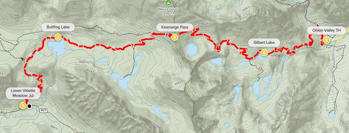
Tyndall Creek to Lower Vidette Meadow via Forester Pass (13 miles)
Tyndall Creek acts a staging ground for northbound JMT hikers preparing for the climb up and over Forester Pass (13,160’), the highest mountain pass encountered on the entire hike. From the main camping area along the west bank of the tumbling stream, the JMT continues northward, bounding around a lovely restoration area (no camping) and then skirts the edge of a lodgepole pine forest. It’s a short walk to the edge of a broad clearing and junction with the Lake South America Trail, which veers off to the left.


Ahead, hikers get an unvarnished view of the imposing Kings-Kern Divide, accentuated by the streaked walls of Diamond Mesa, with the craggy ridgeline beyond. At about 6/10 mile, the trail briefly cuts through another forested area, where there are a handful of additional campsites. Upon returning to an open, sedgy landscape devoid of trees, hikers get a distant view of Shepherd Pass (12,050’) and Mount Tyndall (14,018’) off to the east.

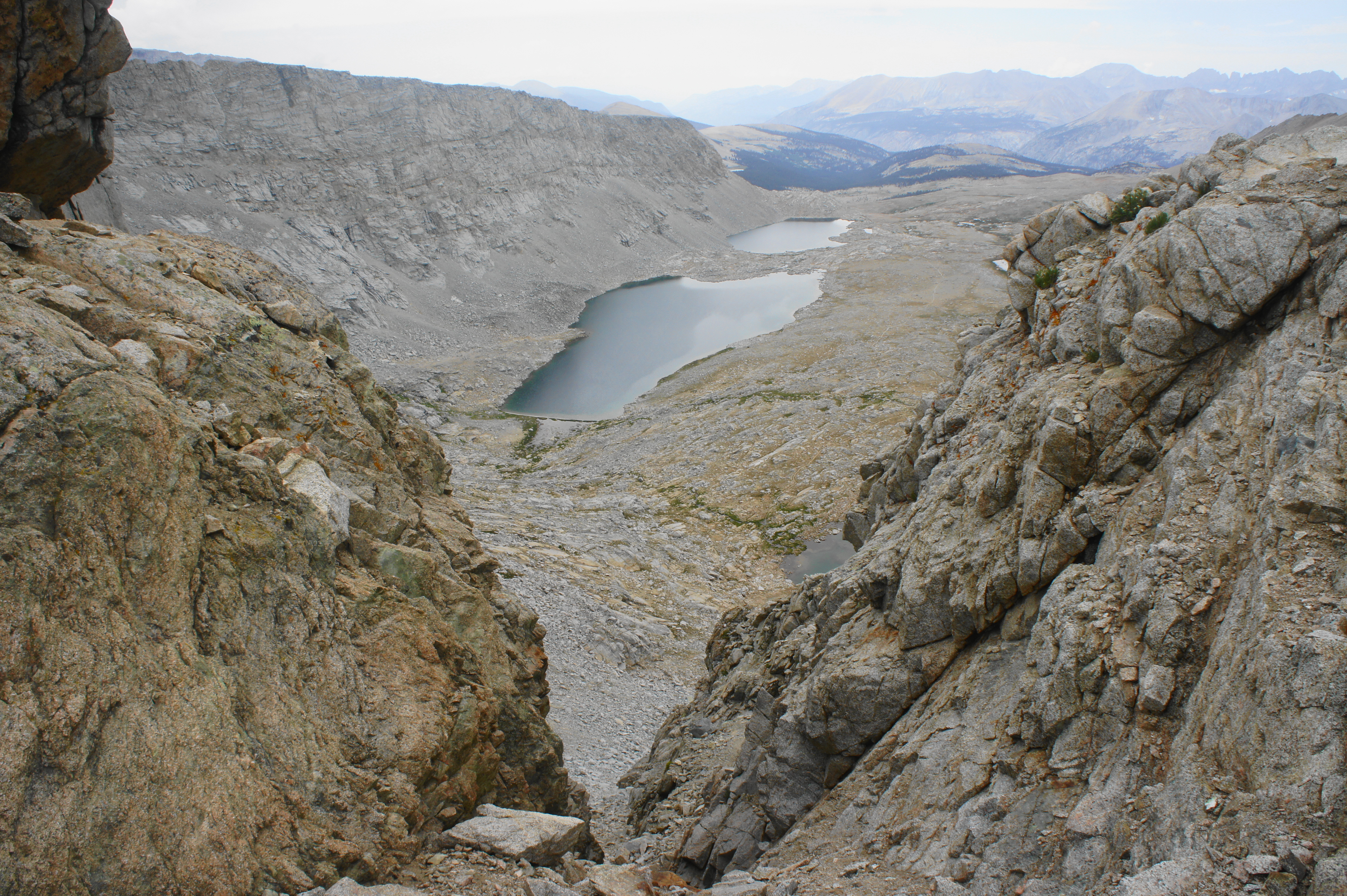
The narrow track steadily rises to a point overlooking an unnamed tarn at the base of Diamond Mesa and then clears a stony shelf, clearly entering a broad amphitheater surrounded by high, barren peaks. After crossing a minor stream, the JMT climbs to a pair of large glacial lakes on the right, keeping another flowing drainage off to the left. Finally, just short of four miles from the initial crossing of Tyndall Creek, hikers cross the same stream again near its source, the final opportunity to fill up with water before the pass.


Even though Forester Pass looms just ahead, it is still not obvious entirely where the trail goes from here, as the wall beyond appears sheer and impassable. Sure enough, however, the JMT begins to climb steeply to the right, clearing a talus slope and switchbacking to the base of a series of stony ledges. The trail work beyond is an impressive feat of construction, with the route over the pass completed in 1931 (prior to this point the JMT was routed east through Junction and Shepherd Passes). Here the switchbacking trail appears carved straight into the bulging granite, with a shelf just wide enough to offer passage for hikers.


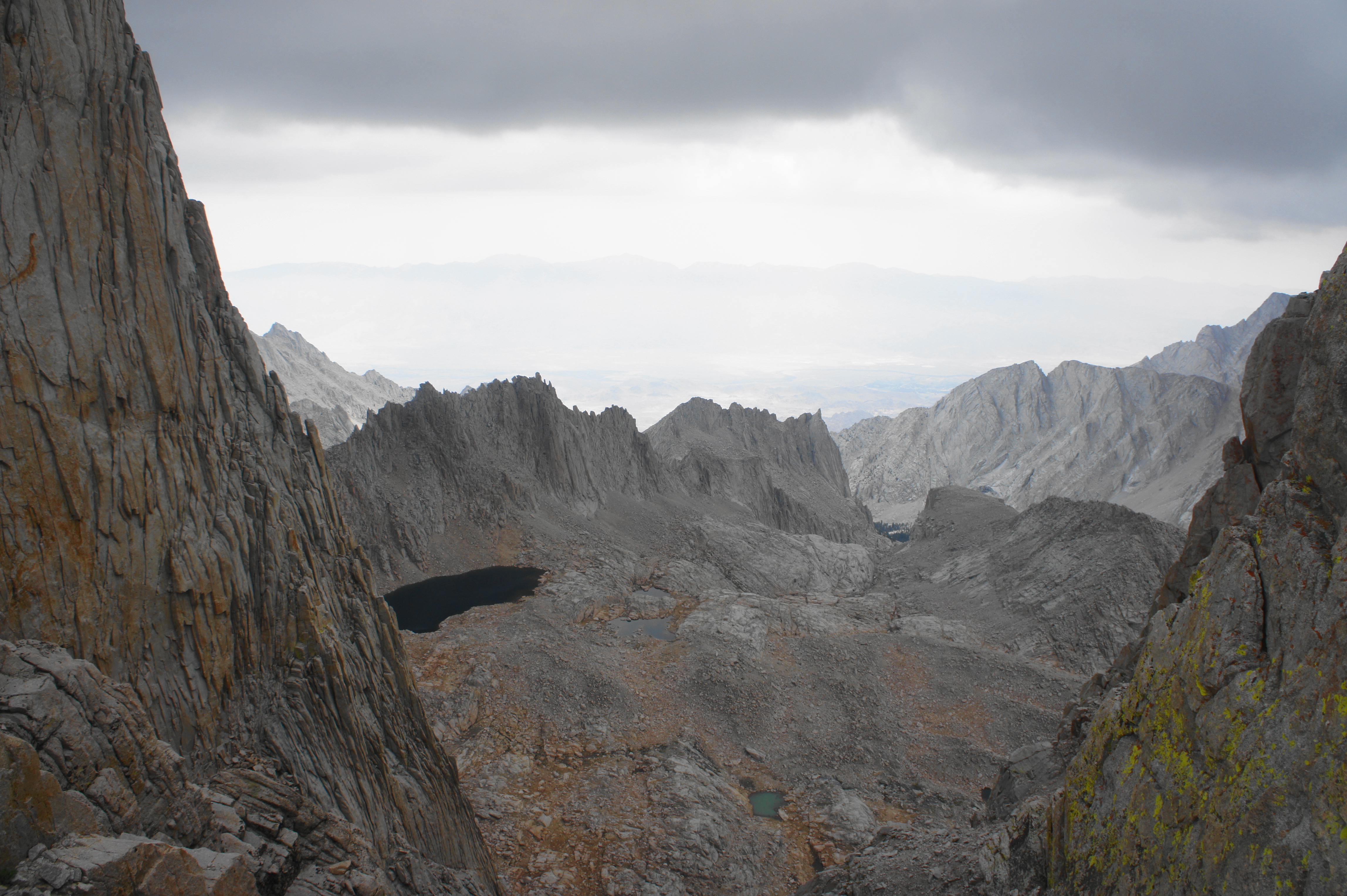
After more than 600 feet in gain from the final Tyndall Creek crossing, the trail reaches a narrow notch with window views back down to the two unnamed lakes, with the Tyndall Creek drainage, Kern Canyon, and the Kaweahs beyond. From here another short set of switchbacks leads to the crest of Forester Pass, the highest pass on the JMT. Here one is also likely to encounter a number of southbound JMTers, who had a much longer and arguably tougher climb to reach the pass from the other side.
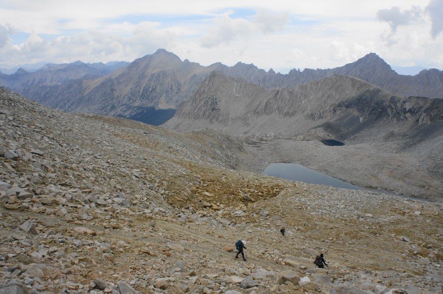
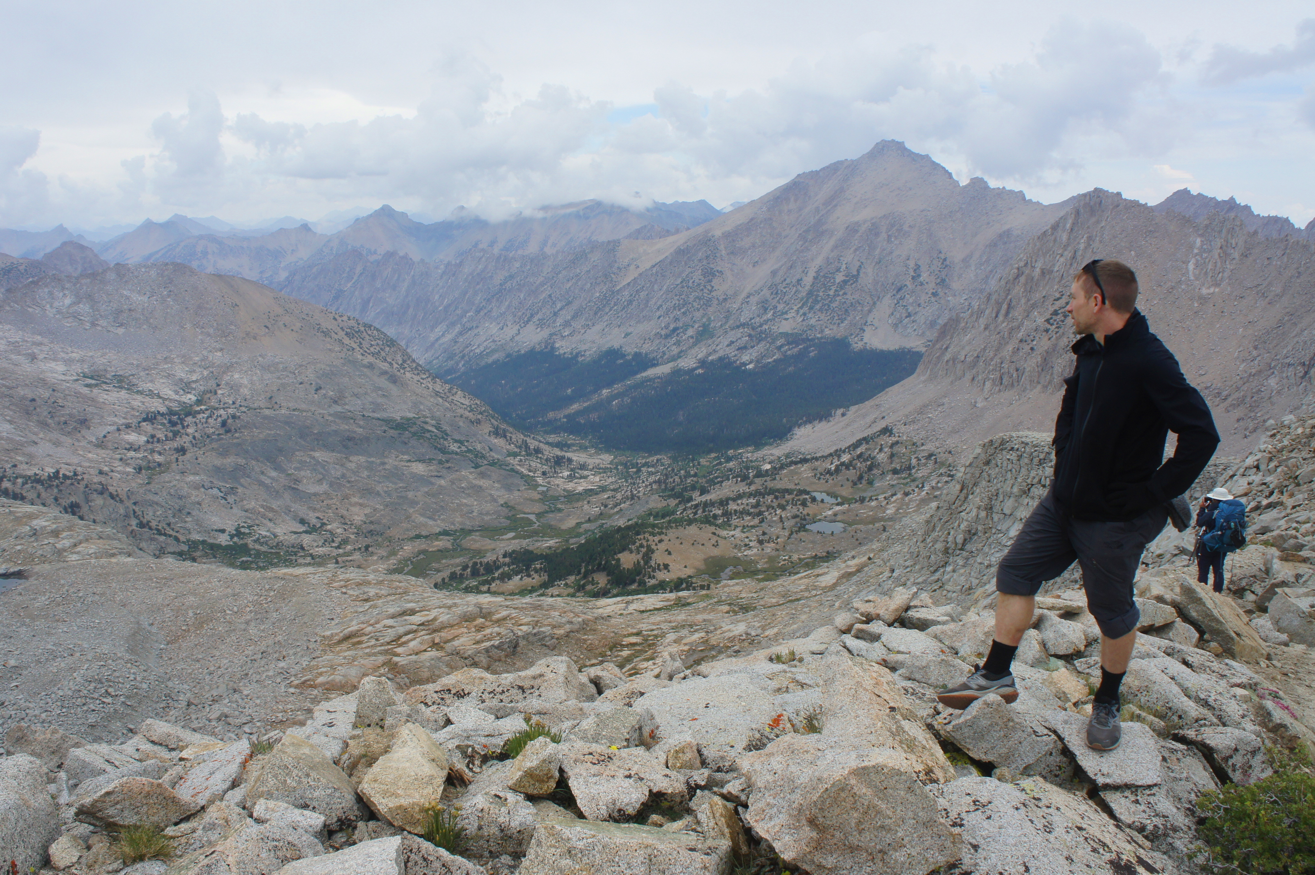
The views northward from the pass are simply spectacular, the first look into Kings Canyon National Park, where hikers will spend the next several days of the onward journey. Ahead to the north is a series of towering ridgelines, beginning with a jagged spine culminating in Center Peak (12,760’), followed beyond by the Sierra Crest, headlined by University Peak (13,632’), Mount Bradley (13,289’), and the Kearsarge Pinnacles. In the distance, hikers can preview some of the landscape of Leg 2 of the journey—including the area around Glen Pass and Pinchot Pass in Kings Canyon.

Descending from Forester Pass, the northbound JMT continues by zig-zagging down a talus slope then briefly levels off as it skirts a sharp grade dropping to an unnamed lake on the right. The aquamarine tarn is fed by snowmelt coming off Junction Peak (13,888’), an imposing summit situated at the intersection of the Kings-Kings Divide and Sierra Crest. Thereafter the trail skirts a high ridgeline with an even more precipitous drop off to the left, opening up excellent views down the canyon toward University Peak and the Kearsarge Pinnacles.

After flanking the high ridgeline for about a half-mile, the JMT doubles back and descends a sharp pitch heading back south toward the unnamed lake. The track skips across a small creek below the lake’s outlet and then continues northward across the increasingly verdant landscape. Off to the right is another small tarn and an unusual talus slope that is composed of charcoal-colored mafic plutonic rock, a relatively rare sight along the JMT.

From here the ever-winding trail courses through a batch of switchbacks, then drops to clear the same reliable stream again before plunging down a second set of squiggles, this time with expansive views down the granite-lined canyon. About 2.75 miles from Forester Pass, the trail briefly levels as it approaches some lovely streamside bends on the left, with the timberline encountered just beyond. As pines become increasingly abundant, the trail steadily descends northward, eventually passing some premier campsites on the left.

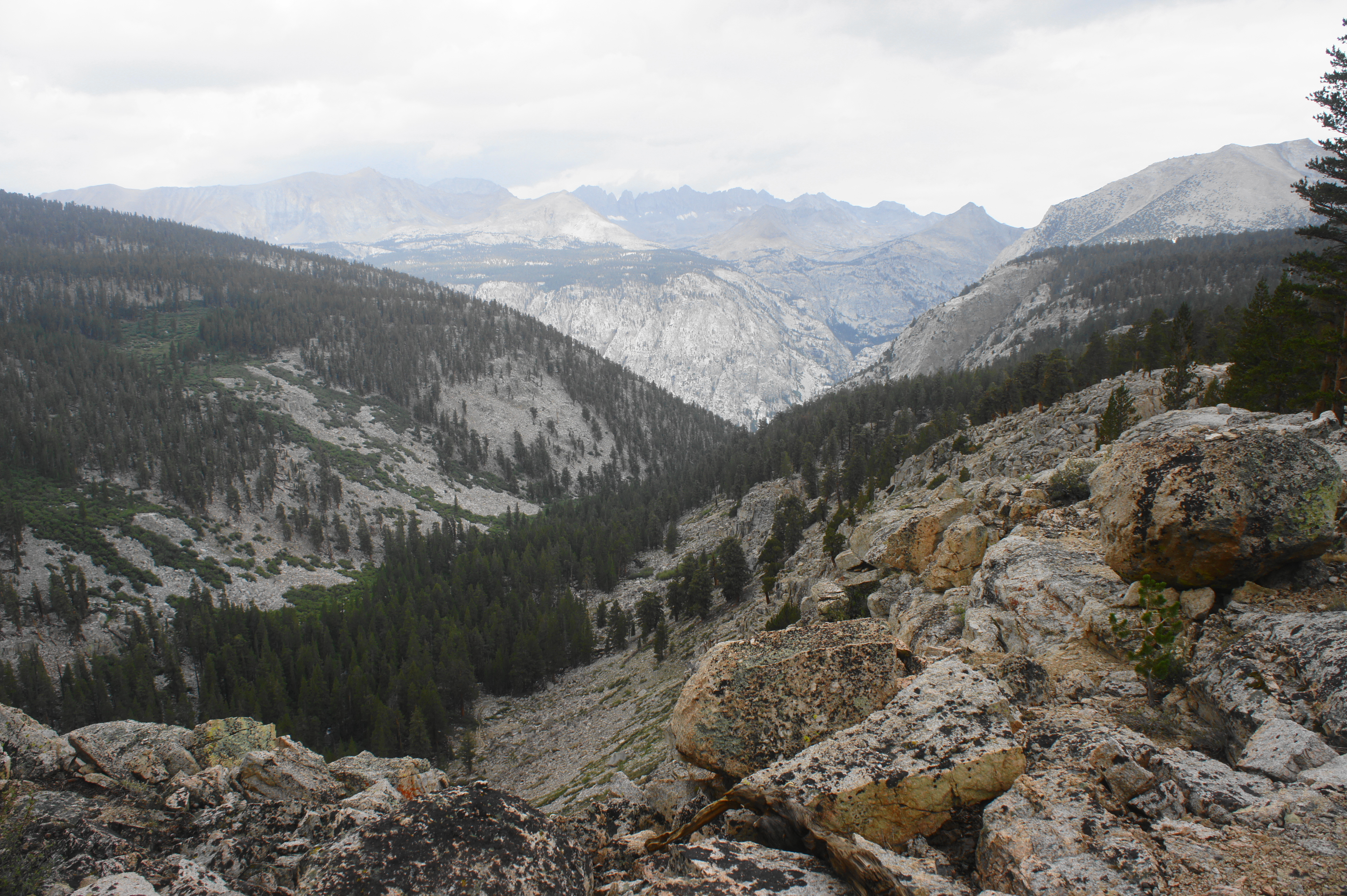
The trail remains atop a high, grassy shelf for much of the next mile before finally descending toward the Bubbs Creek drainage, plunging into a thick lodgepole pine forest and one of the most verdant landscapes yet encountered on the hike. The creek off to the left tumbles steadily, feeding a strong crop of vegetation. At a point about 4.75 miles from Forester Pass, hikers will gander across a steady tributary stream of Bubbs Creek, fed by the lakes of Center Basin off to the east.

Thereafter, the trail is modestly sloping, skipping across a mix of soil and slickrock, with increasingly prominent cascades off to the left. Occasionally the path traverses small meadows and stands of dead pines, but much of the next several miles is enclosed under the canopy of the tall trees. With Center Peak (12,760’) now firmly behind, hikers bear northwest through the main canyon, following a drainage that continues all the way to the Kings River in the heart of Kings Canyon. The trail never crosses Bubbs Creek but keeps it firmly within earshot for most of the way down to Vidette Meadow.
At one point, about seven miles from Forester Pass, the trail abruptly encounters a series of steep but shady switchbacks, which carry hikers down to a floodplain below 10,000 feet. Campsites around here are abundant and typically off to the left, with at least one sporting a bear locker. Hikers coming from Tyndall Creek will likely want to start looking for a place to set up for the night, having pushed around 13 miles on the day by this point. Vidette Meadow and Lower Vidette Meadow are somewhat easy to miss, largely obscured by the trees, as is the turnoff for the continuation of the JMT, which abruptly cuts right at a junction at JMT Mile 29.3. (Note: Continuing straight leads down a steep slope, following Bubbs Creek to Road’s End in the popular Cedar Grove area.) Camping for the night around the junction makes sense for those reaching this point on Day 5, with one final push up and over Kearsarge Pass the following morning.

Trip Report: We covered this section on Day 5, our first rain-free day since Day 1, although a thunderstorm to the north did briefly threaten as we set up camp near Lower Vidette Meadow at about 4pm. Forester Pass, though the highest pass on the JMT, was eminently reasonable from the north side, and the scenery beyond was arguably the best we had seen thus far on the trip. The lush forest of the Bubbs Creek drainage was a stark contrast with the past several days of high-elevation hiking that was often in the open exposure. Our bear canisters were nice and empty by this point, reducing our load as we entered the final day of Leg 1.
Lower Vidette Meadow to Onion Valley via Kearsarge Pass (8 miles)
Unless you have coughed up the cash to pay for a mule train to bring your food resupply to you, chances are you will have to divert off the JMT on the final day of Leg 1 to drop to Onion Valley and the town of Independence to retrieve a fresh week’s worth of food. The diversion is a minor annoyance in the sense that it adds two days and around 14 miles round trip of hiking to the overall journey. However, the scintillating lakes and towering peaks of the Kearsarge Pass area make the detour a more enjoyable experience. From Onion Valley, hikers can take a pre-arranged shuttle or hitch-hike down to the town of Independence for rest and resupply.
From the junction with the Bubbs Creek Trail, near Lower Vidette Meadow, the northbound JMT abruptly leaves the valley floor, beginning a nearly 1,000-foot climb in just over a mile. After about 6/10 mile and 500 feet in gain, the wooded trail briefly levels and hugs a perennial stream (fed by Bullfrog Lake above) with a couple of nice campsites. Above is an imposing talus slope and a sun-soaked wall of granite cliffs.

The onward path approaches the base of the wall before cutting left, twice crossing the stream and making way for a forested cut where the wall briefly fades away. Don’t forget to look back at the Bubbs Creek drainage to the south, where the silvery promontory East Vidette (12,356’) dominates the landscape. Beyond, to the southeast, hikers can see all the way up the drainage to Center Peak (12,760’), Mount Keith (13,977’), and Junction Peak (13,888’), with Forester Pass just hidden from view.
Rising through lodgepole forest, it is a short walk from the second creek crossing to a junction with the trail to Bullfrog Lake and Kearsarge Pass, your cue to exit the JMT to the right. After another hundred yards or so in the woods, the landscape begins to open up as hikers pass a grassy pond on the right, with imposing Mount Rixford (12,888’) beyond.
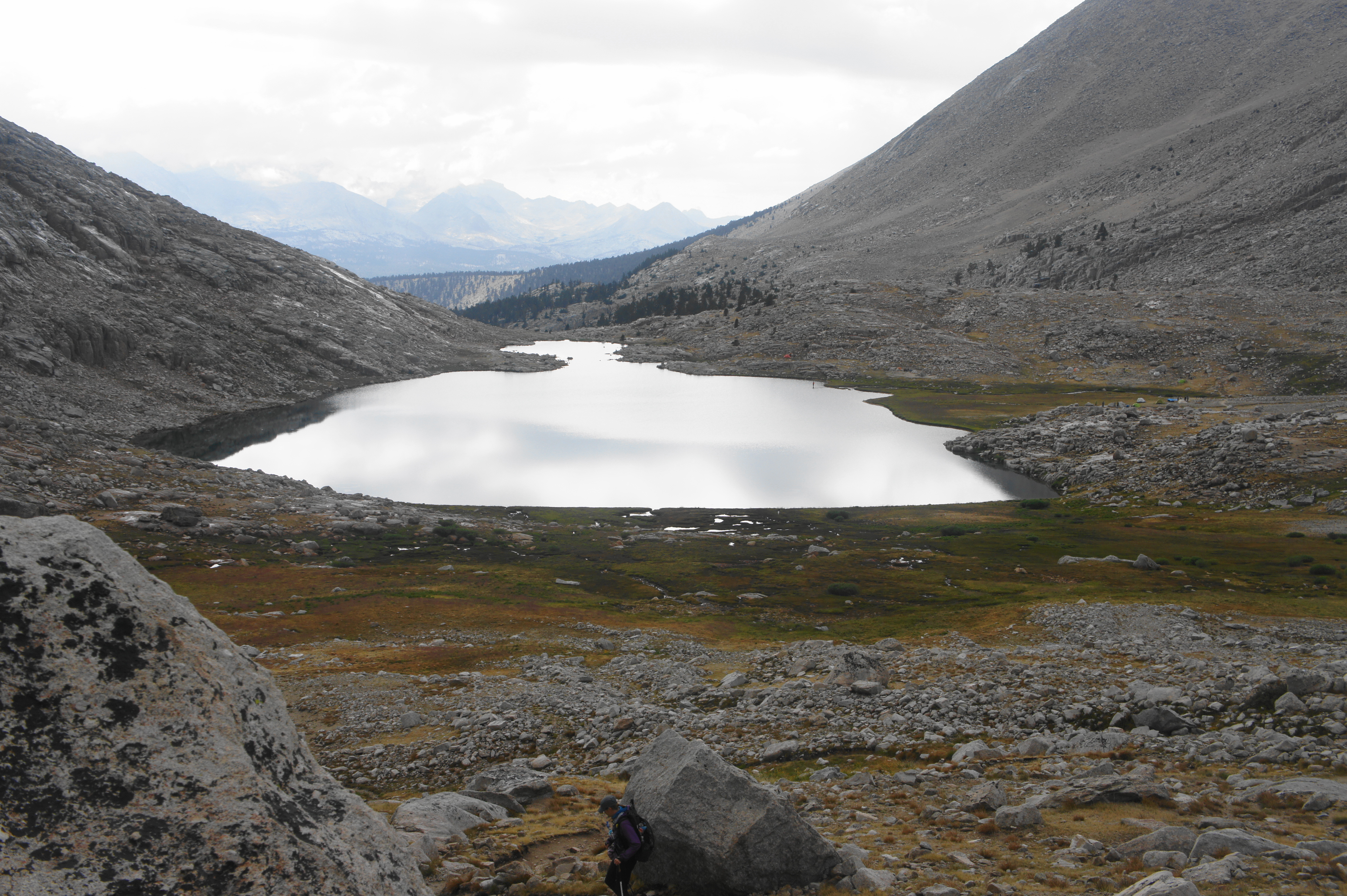
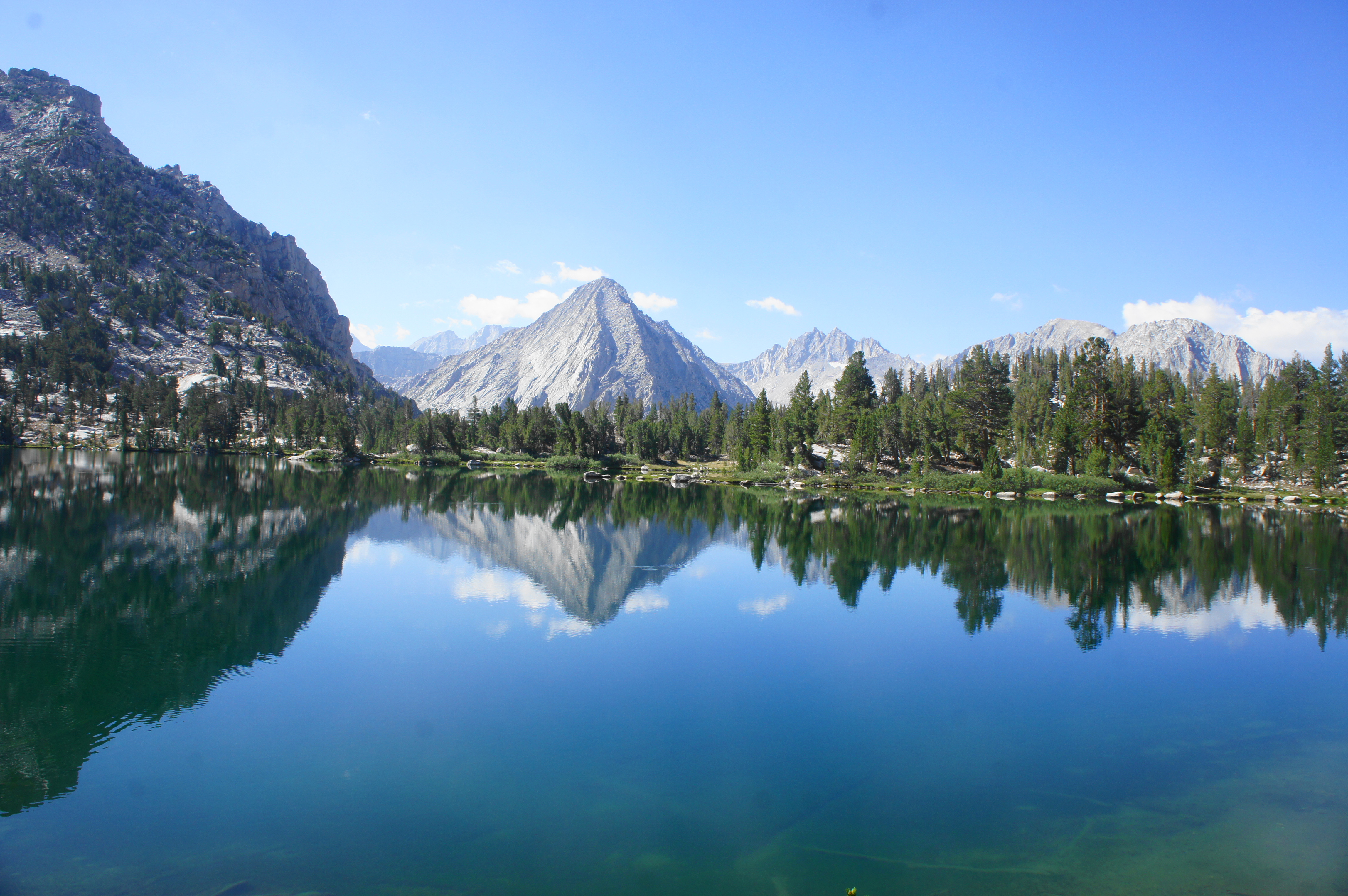
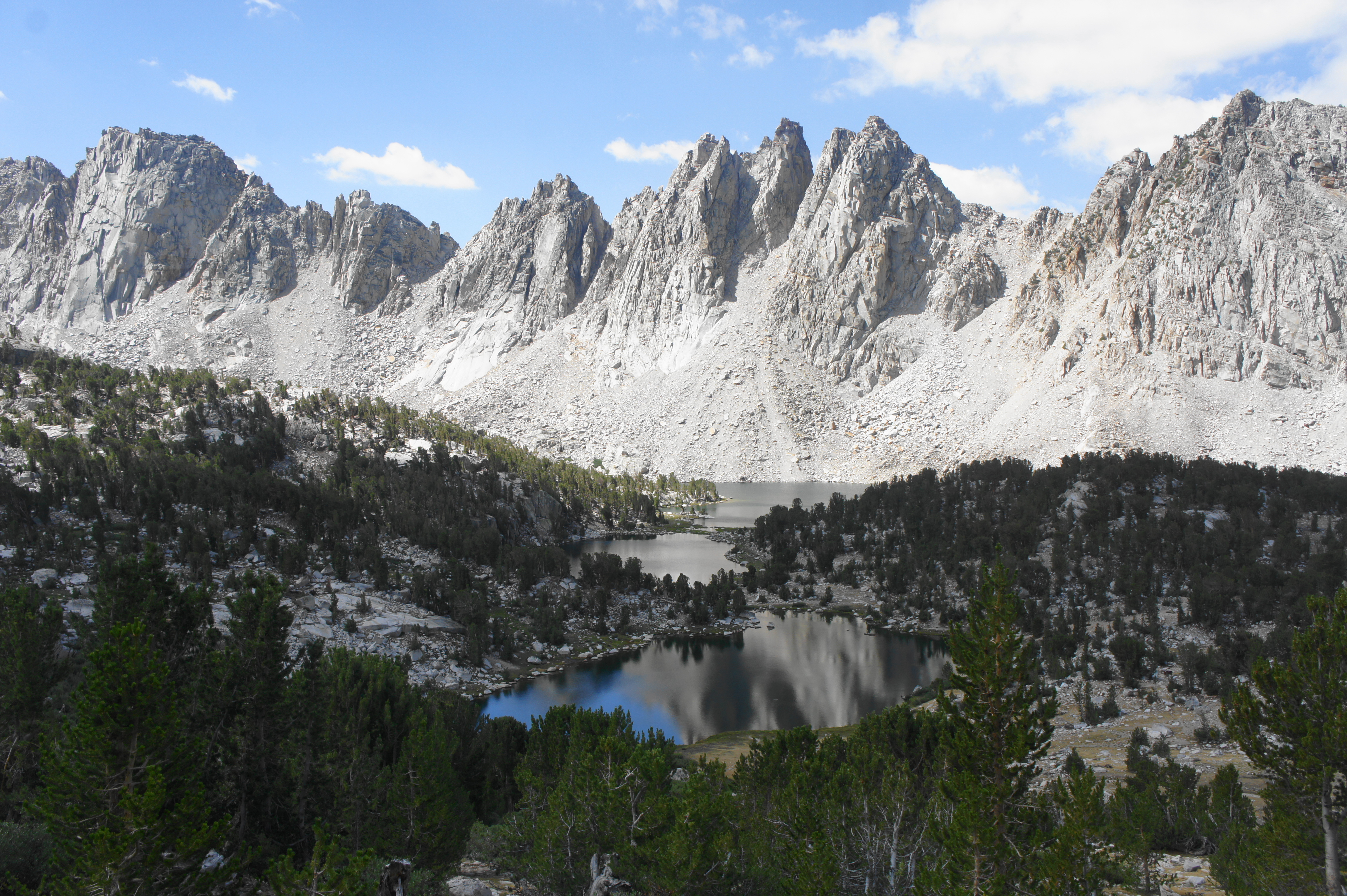
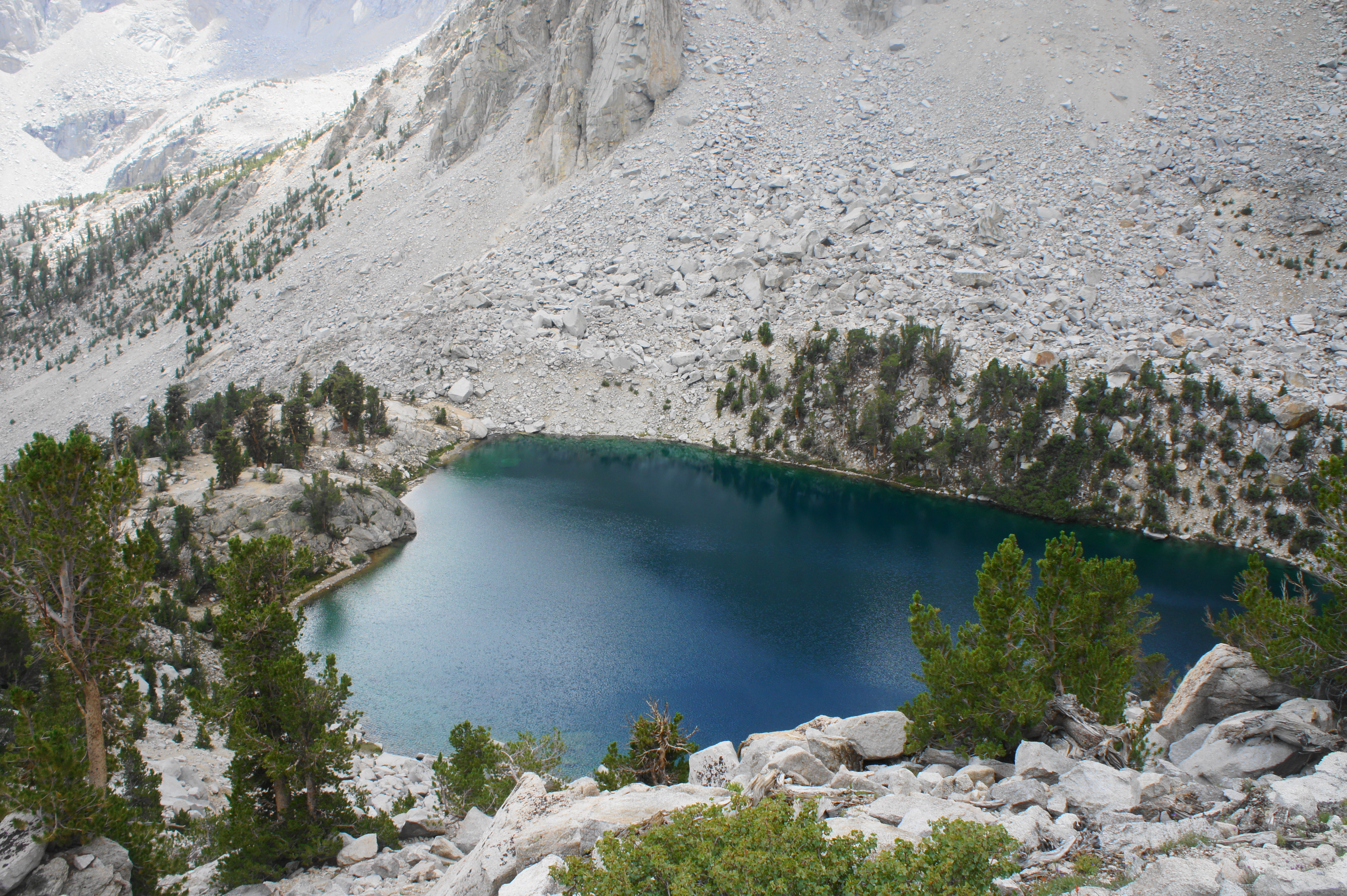
Although appearing at first that the trail might head for the divide just to the west of Rixford, the spur trail continues east, passing another tarn and then sharply climbing uphill to the shores of Bullfrog Lake, a spectacular destination where fishing is allowed but camping is prohibited. The lake is set in a basin bounded by the westernmost edge of the Kearsarge Pinnacles and views of University Peak (13,632’) and the Sierra Crest to the east. One can also see back south to East Vidette, West Vidette (12,241’), and Deerhorn Mountain (13,265’).

After staying well above the shores for about a half-mile, the trail eventually comes level with the lake, offering, if needed, sometimes the last reliable water source before Flower and Gilbert Lakes, which are over four miles away.

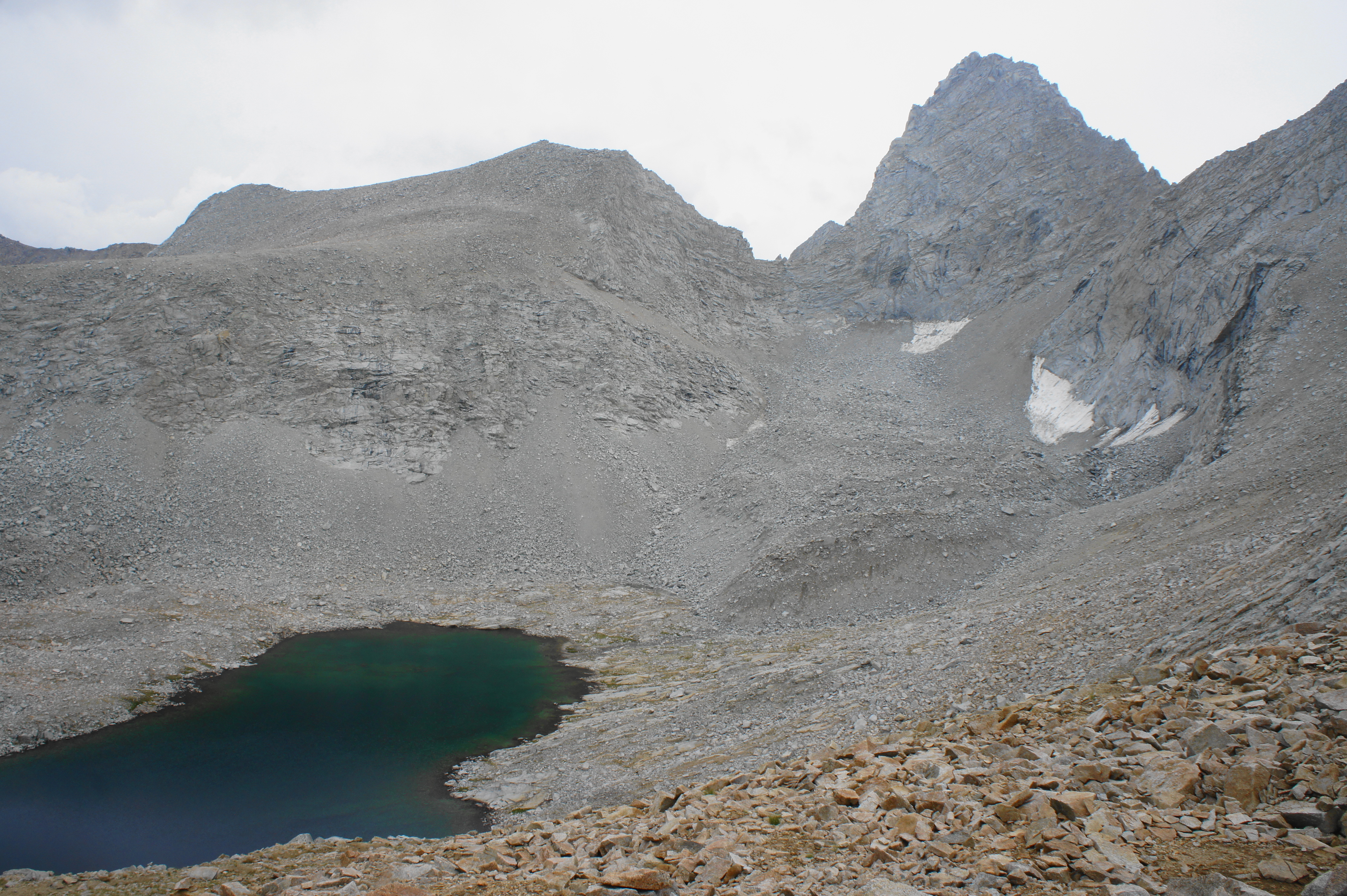
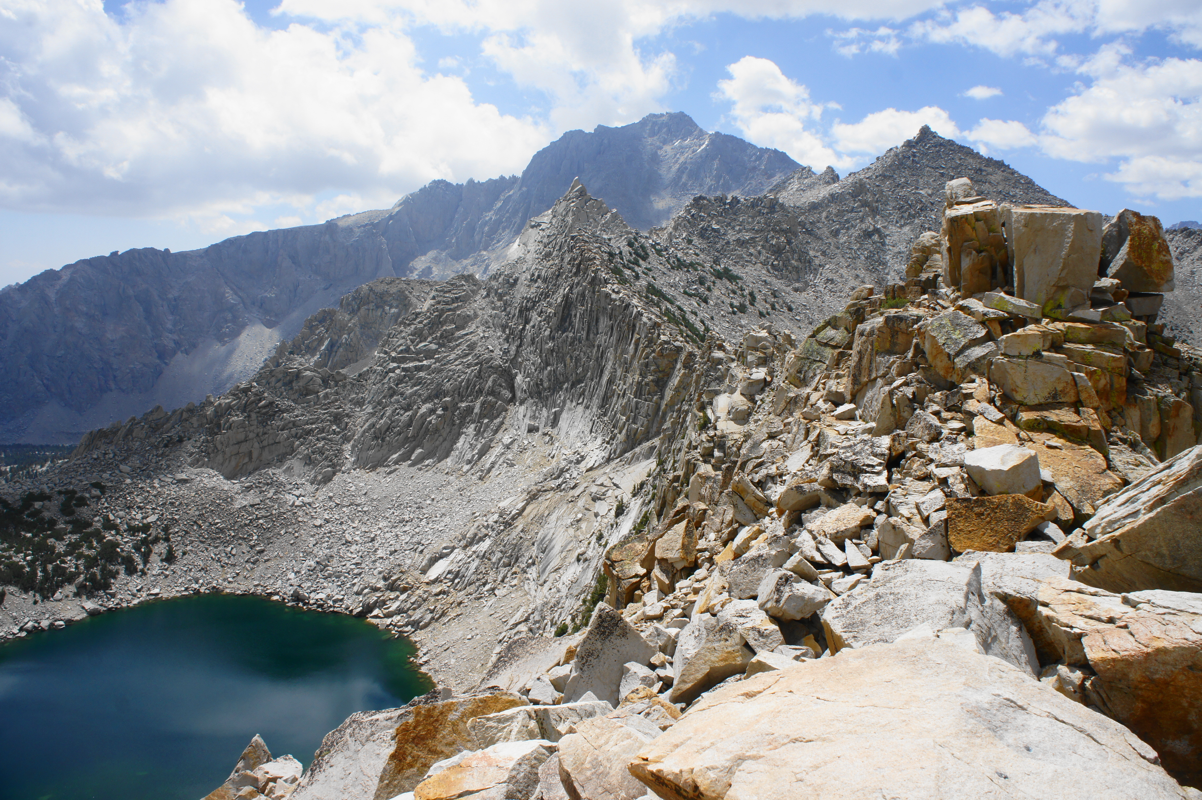
Beyond Bullfrog Lake, the trail continues eastward through patches of stunted pines. The terrain steadily rises as the distant notch of Kearsarge Pass gradually comes into view. After reaching 11,000 feet, the main track passes two unmarked but well-worn paths heading right; these paths descend to nearby Kearsarge Lakes, a popular destination for overnight trips from Onion Valley. The lower lakes are visible several hundred feet below, with the largest nestled up against the steep slopes of the Kearsarge Pinnacles.
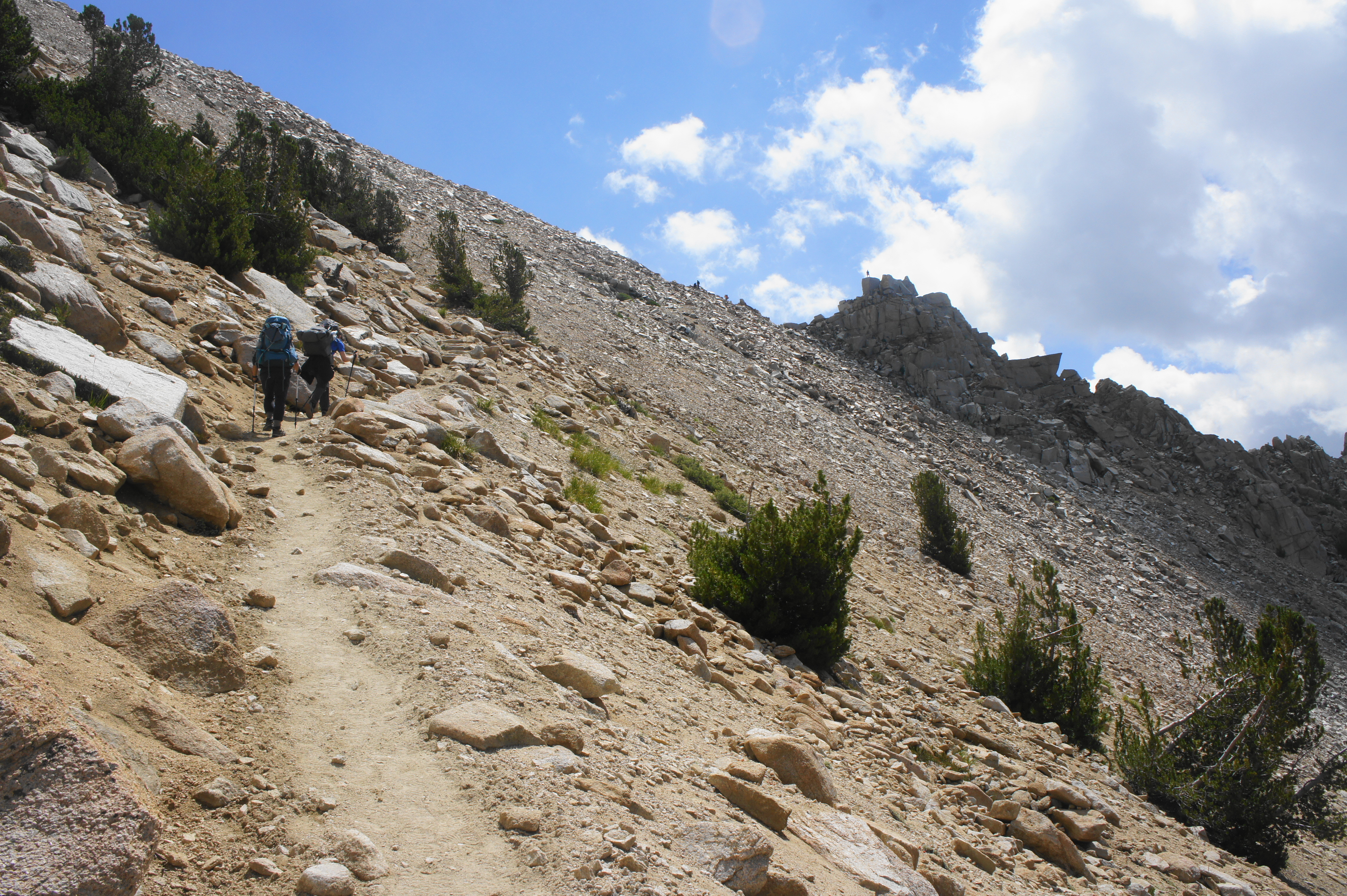

From here it is a sharp and demanding climb to a signed junction with another trail coming in from the west. (Note: This “upper route” offers passage to the northbound JMT and will be traversed on the first day of Leg 2.) By now the crowds of backpackers and hearty day hikers are likely to grow more evident, with more company ahead at Kearsarge Pass. The final ascent to the pass is brutal, sun-exposed, and rocky, with only a few switchbacks to ease the pain. At last, about 4.5 miles (and more than 2,000 feet in elevation gain) from Upper Vidette Meadow, hikers crest Kearsarge Pass (11,823’), a small, stony notch with extravagant vistas.


The landscape back to the west and south is terrific, with both Kearsarge Lakes and Bullfrog Lake in view. Beyond Kearsarge Pinnacles is a parade of barren peaks, from Junction Peak to the high crags of the Great Western Divide. The orange-tinted summit due west of Bullfrog Lake is Mount Bago (11,871’), with a bowl off to the right concealing Charlotte Lake and the headwaters of the Charlotte Creek drainage.

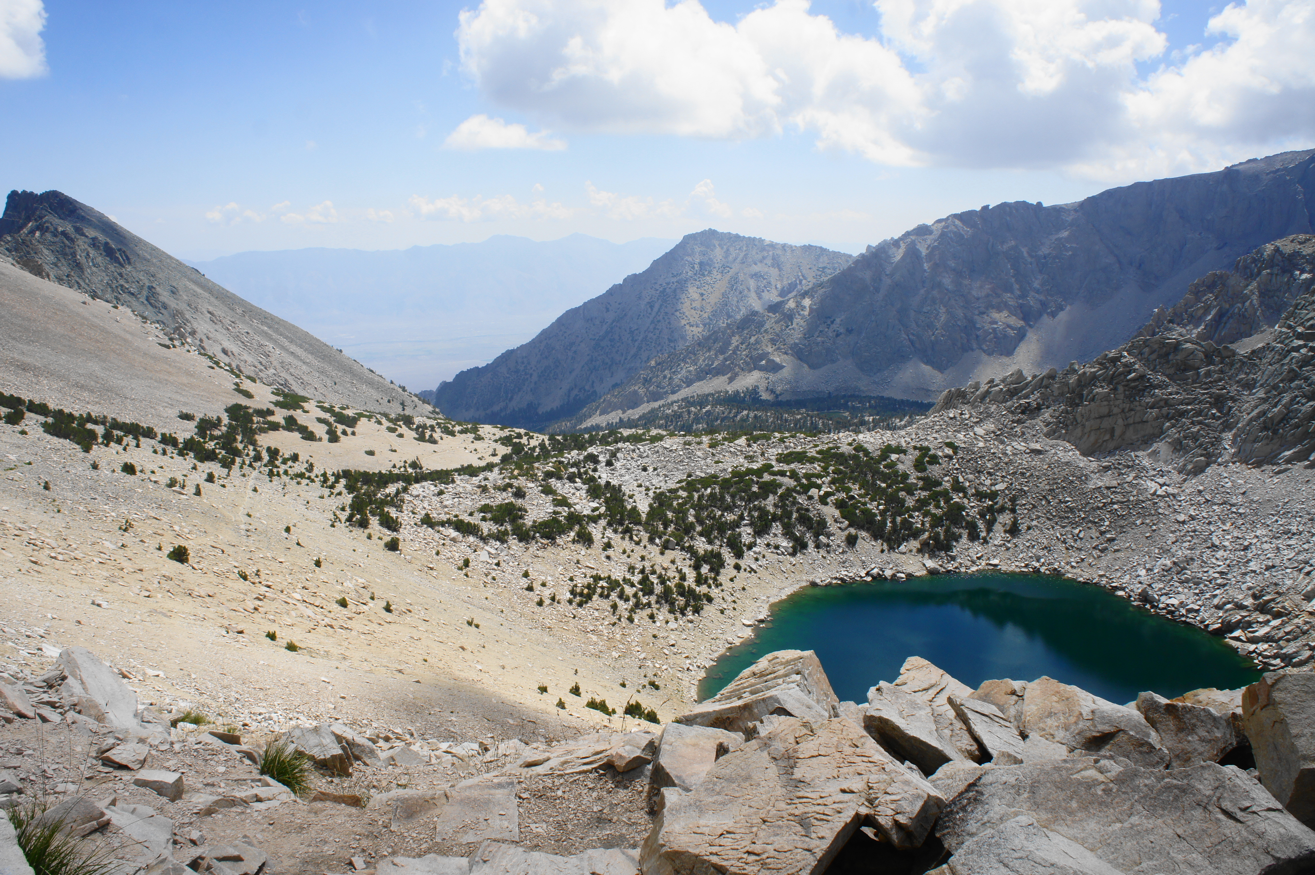
Having mounted the Sierra Crest for the first time since Mount Whitney, one can also see eastward down to Owens Valley. The turquoise pool directly below is Big Pothole Lake, the first in a series of watering holes peppered along the basin between here and Onion Valley. The impressive promontory to the south is University Peak, which overlooks both the Bubbs Creek area and Owens Valley.
Some hikers with generous friends will pick up their resupply at Kearsarge Pass and return the way they came to rejoin the JMT. But most who lack such a luxury will continue on, descending more than four miles and 2,600 feet in elevation, to the parking area and trailhead at Onion Valley.
The descent begins with an easy and pleasant walk down a long straightaway through blocky talus and open views of the unfolding valley. After two pairs of switchbacks, the subalpine shrubs become more ubiquitous and the trail begins to drop down a level, traversing several bends with occasional views of Heart Lake below. (Note: There is some decent cell service on Verizon in this section, although it disappears further down. No such luck with T-Mobile or AT&T.)
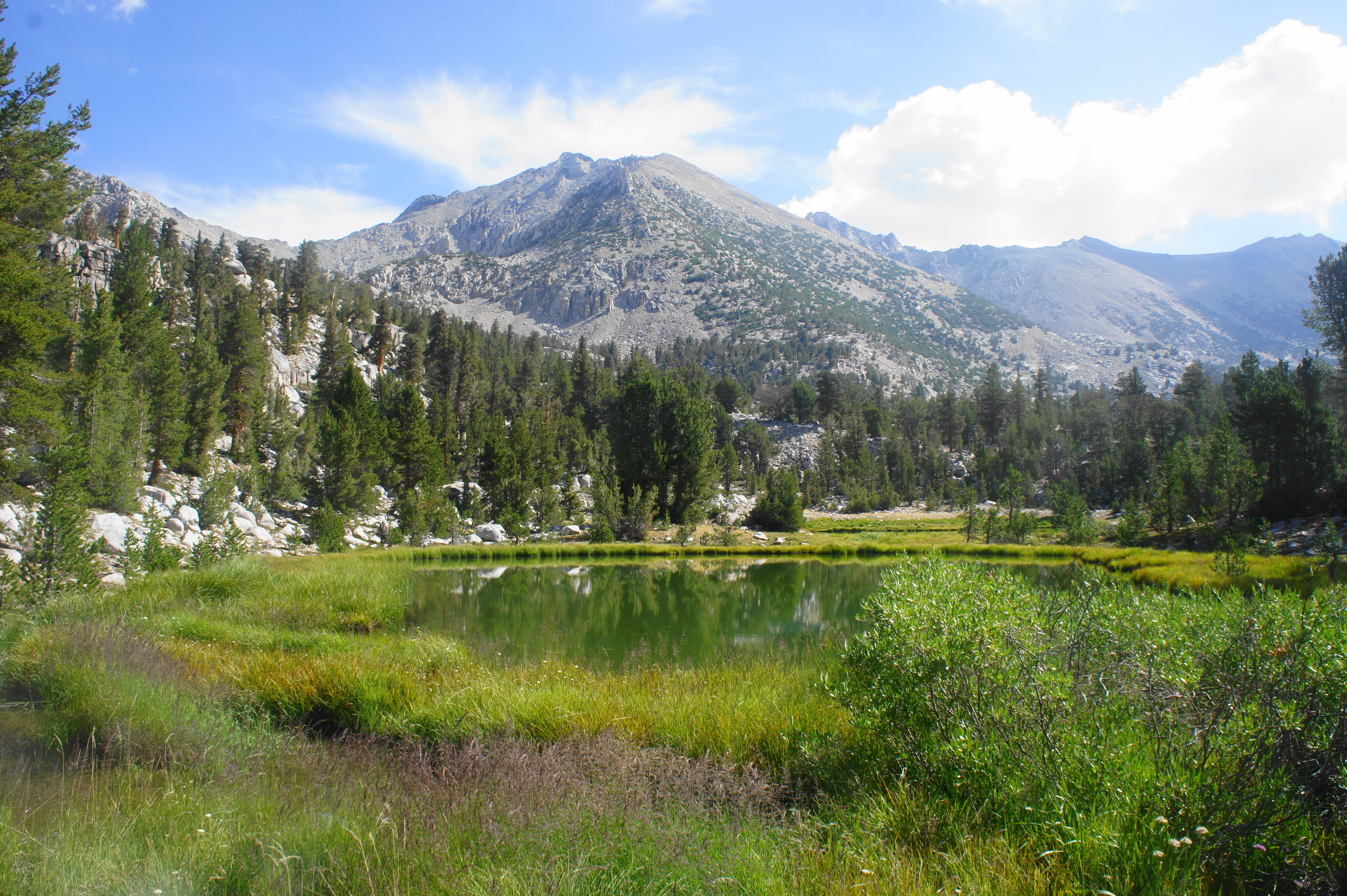
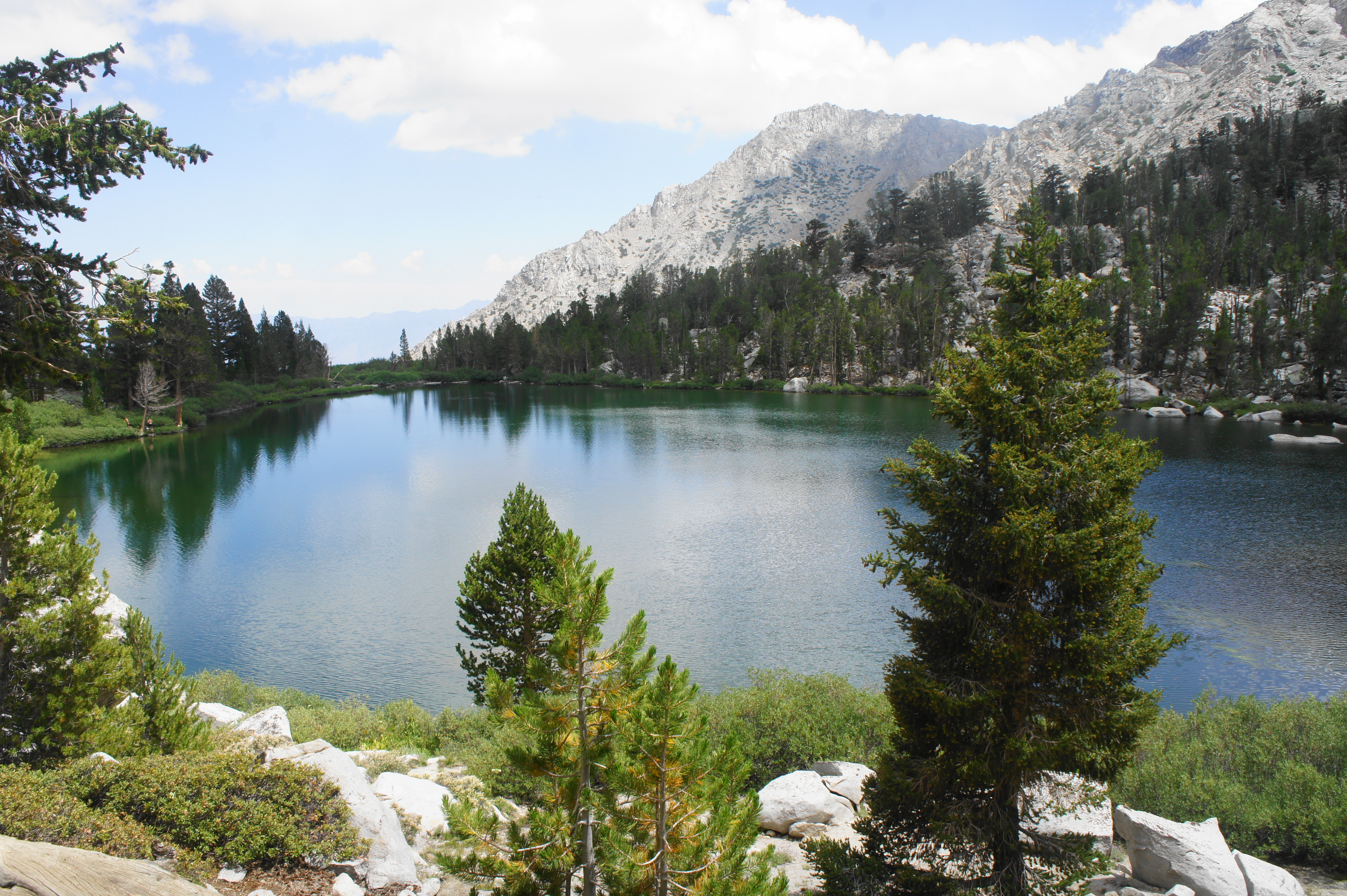
Instead of dropping to Heart Lake, the trail instead routes northward through another open section, followed by a short switchback section that culminates at a stream fed by Flower Lake, which boasts greenish-blue waters but requires some wandering along spur trails to reach. Camping around Flower Lake is popular, and the parade of day hikers become more noticeable at Gilbert Lake beyond.
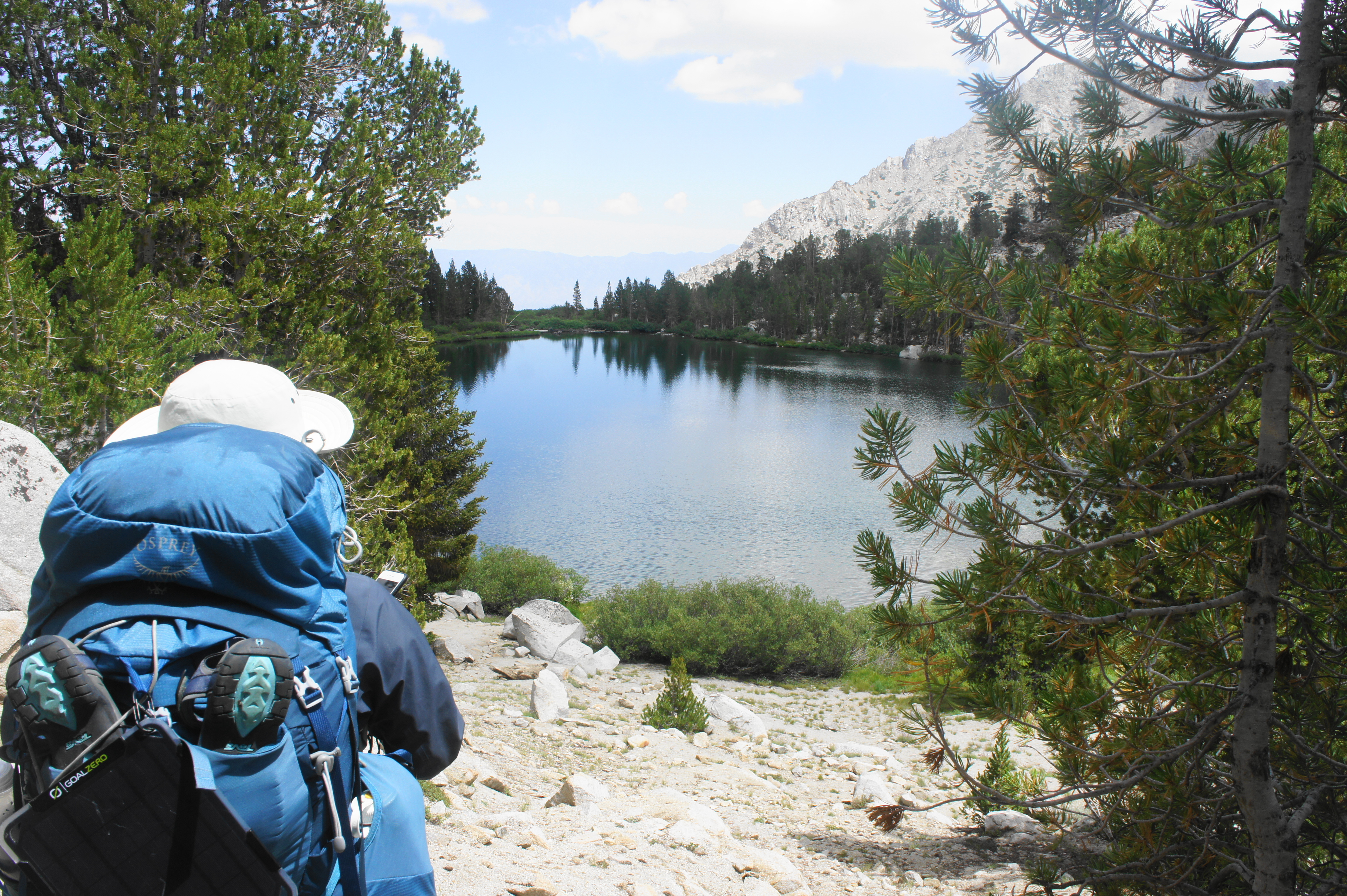
The latter is an exceptionally beautiful lake that almost resembles an “infinity pool,” with the edge of the waters seeming to culminate with a drop-off to the east. Wildflowers and odiferous shrubs are common along the lake’s shores, and a couple of massive boulders offer excellent spots to stop for lunch or a break.

Gilbert Lake still remains more than 1,200 feet above the road, and the final stretch can feel endless for hikers who have already been on the JMT for multiple days or weeks. Beyond the lake, the ecology noticeably begins to shift, with a barren rock slide giving way to brush and eventually desert scrub and manzanitas; the pine forest gradually fades away and the temperature noticeably climbs. Hikers finally do get a view of the winding, paved road that connects Onion Valley with the town of Independence, though it is still more than an hour away and disappears from view several more times.

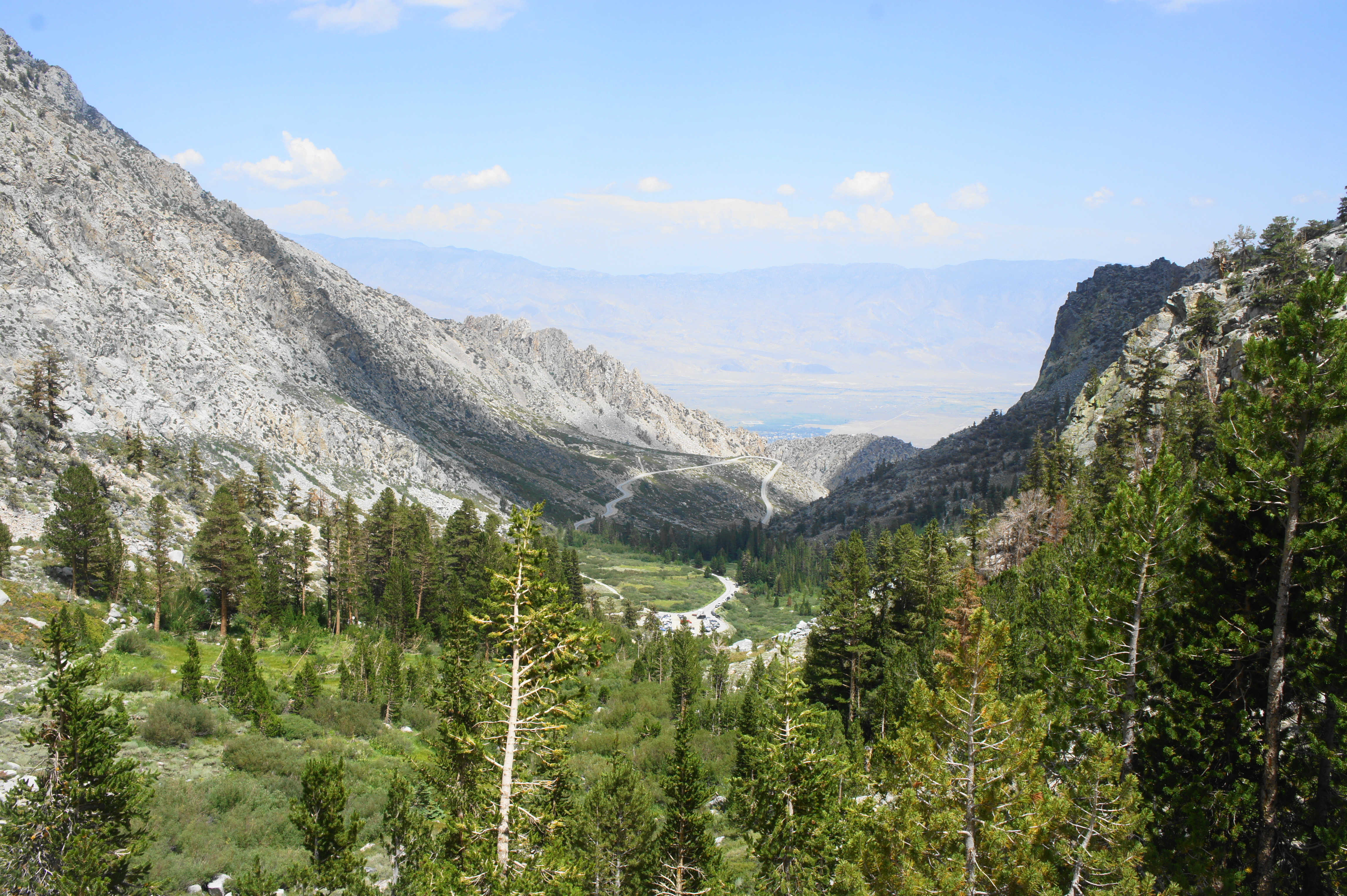
Another set of switchbacks drops to within striking distance of Little Pothole Lake, which is fed by Independence Creek and a tributary that cascades down a slope from the south. By now hikers can spot the parking lot, and the trail drops down three more sets of switchbacks before swinging north and reaching a marked junction with the trail leading up to Golden Trout Lake. Stay right, then right again at the next fork minutes later. After one last sun-exposed slope, the trail rounds a left-hand bend and drops to the Onion Valley Trailhead, situated at the start of the parking area and below the Onion Valley Campground. Some JMT hikers may spend the night at the campground or catch a ride into Independence for resupply.
Trip Report: We completed this relatively short section on Day 6, reaching Onion Valley at around 2:30pm, well ahead of our anticipated schedule. Here we arranged pickup with my girlfriend and drove into Independence and Lone Pine for a shower (!) and dinner before returning to spend the night at Onion Valley Campground, with a fresh 7-day resupply in hand. Although our original plan was to spend a full rest day at Onion Valley, our quicker-than-anticipated pace on Day 6 and the blaring heat and boredom of Onion Valley convinced us to continue on the following morning, retracing our steps back up and over Kearsarge Pass and on to Leg 2 (Onion Valley to Muir Trail Ranch). All told, our first six days and 65 miles had their trying moments (e.g., evading lightning, rain, and hail), but our feet and bodies still felt good as we entered the second and toughest leg of the journey…

Pingback: John Muir Trail Northbound Section 2 – Onion Valley to Muir Trail Ranch (Kings Canyon National Park, CA) | Live and Let Hike
Pingback: John Muir Trail Northbound Section 3 – Muir Trail Ranch to Red’s Meadow (John Muir Wilderness, CA) | Live and Let Hike
Pingback: John Muir Trail Northbound Section 4 – Red’s Meadow to Happy Isles (Ansel Adams Wilderness & Yosemite National Park, CA) | Live and Let Hike
Pingback: Top 10 Hikes in 2021 | Live and Let Hike
Pingback: John Muir Trail Preparation & Logistics | Live and Let Hike
Pingback: Thousand Island Lake Loop via High Trail & Shadow Creek Trail (Ansel Adams Wilderness, CA) | Live and Let Hike
Pingback: Mist Falls (Kings Canyon National Park, CA) – Live and Let Hike
Pingback: Little Baldy Trail (Sequoia National Park, CA) – Live and Let Hike