

Note: This is the fourth in a series of five posts describing the John Muir Trail (JMT), a scintillating, multi-week hike through California’s Sierra Nevada that extends more than 200 miles from Yosemite National Park in the north to Mount Whitney and Sequoia National Park in the south. This post (and those that follow) assumes a northbound journey, beginning southeast of Mount Whitney at Horseshoe Meadow in Inyo National Forest, culminating at Happy Isles in Yosemite. The JMT is an arduous, multi-week backpacking trip that requires careful planning, preparation, and an official backcountry permit that can be quite difficult to obtain. Hikers typically complete the entire trail, including detours for food resupplies, in about 2-3 weeks. For more information on planning and preparing for the JMT, see my previous post titled “John Muir Trail Preparation & Logistics.” For summaries of the other three sections, see Section I (Horseshoe Meadow to Onion Valley), Section II (Onion Valley to Muir Trail Ranch), and Section IV (Red’s Meadow to Happy Isles).
The third of four sections on the northbound John Muir Trail takes hikers from the deep-cut valley carved by the South Fork of the San Joaquin River to the modest luxuries of Red’s Meadow in the Mammoth Lakes area, the first time since its inception that the JMT comes within a half-mile of a publicly-accessible road. Relative to the two sections already covered, this 50-mile stretch is comparatively easier because it generally traverses lower elevations. However, there is still plenty of up and down, and the lower altitude brings more intense summer heat. After a stiff 3,000-foot climb from Muir Trail Ranch to Selden Pass, the JMT passes beautiful lakes and meadows and then sheds significant elevation to clear the Mono Creek drainage. Thereafter, the JMT rises again to 10,740 feet at Silver Pass, drops to Tully Hole, and ascends again to a lengthy ridgeline featuring several spectacular lakes. Finally, a lengthy descent brings hikers to Red’s Meadow, where creature comforts include a café, store, hot showers, laundry, and fresh resupply for the final leg ahead. (Note: For more on resupply, see my post here.)
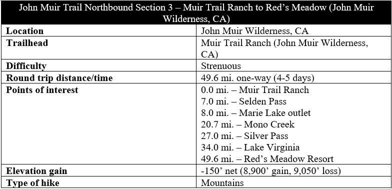
Muir Trail Ranch to Marie Lake via Selden Pass (8.0 miles)
The 80-mile Section 2 ended at Muir Trail Ranch (MTR), a common resupply point with few amenities save for some drinking water and a small store. Some hikers choose to pass through MTR in the middle of the day and move on, while others elect to camp across the South Fork of the San Joaquin River near the Blayney Hot Springs, a worthy detour.
In any case, the northbound route from MTR requires retracing your steps back up the short spur trail to a grassy shelf and a trail sign. Stay right as the trail climbs back into heavier woodlands and reaches a four-way junction. Trail purists—who seek to traverse every inch of the official JMT—can bear right to pick up the trail where they left off. But those okay with skipping a 1.7-mile portion of the JMT can continue straight on the Sallie Keyes Cutoff Trail. This challenging shortcut tackles around 600 feet in elevation gain in 6/10 mile, a brutal pitch but the most direct route toward Selden Pass and the northbound JMT.
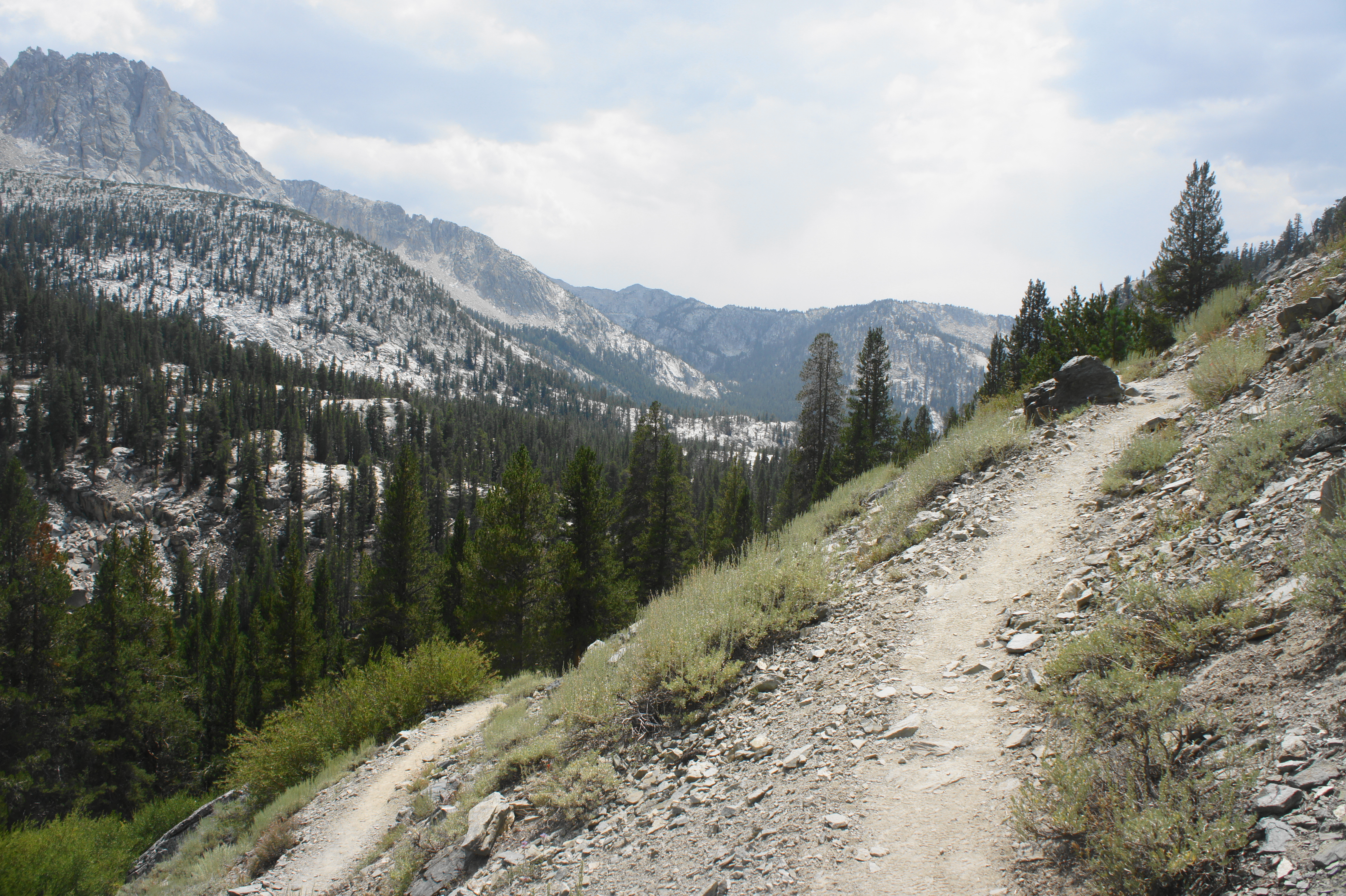
After intersecting with the John Muir Trail, the cutoff trail ends. Hikers should bear left on the JMT, heading in the direction of Selden Pass. After the fork, the incline briefly eases, ascending amid pines and junipers before entering a layer of manzanita shrubs, foxtail pines, and occasional aspens. After some initial uphill bends, the trail settles into a lengthy northwest ascent, with views back south across the San Joaquin drainage to the Le Conte Divide. Florence Lake, situated downstream to the west, is just out of view.

At the end of the northwesterly straightaway, the trail comes within striking distance of Senger Creek, with some small cascades visible in the woody drainage below. However, rather than descending to the creek, the JMT cuts eastward, the first of five switchbacks encountered in the next 20-30 minutes or so.
By the fifth switchback, the trail is back in the dense shade and the steady uphill grade eases. The path rises gently to a lovely crossing of Senger Creek—about three miles from MTR—where there are some decent campsites. Fill up with water here if necessary, as the streams between here and Sallie Keyes Lakes often run dry in the summer.
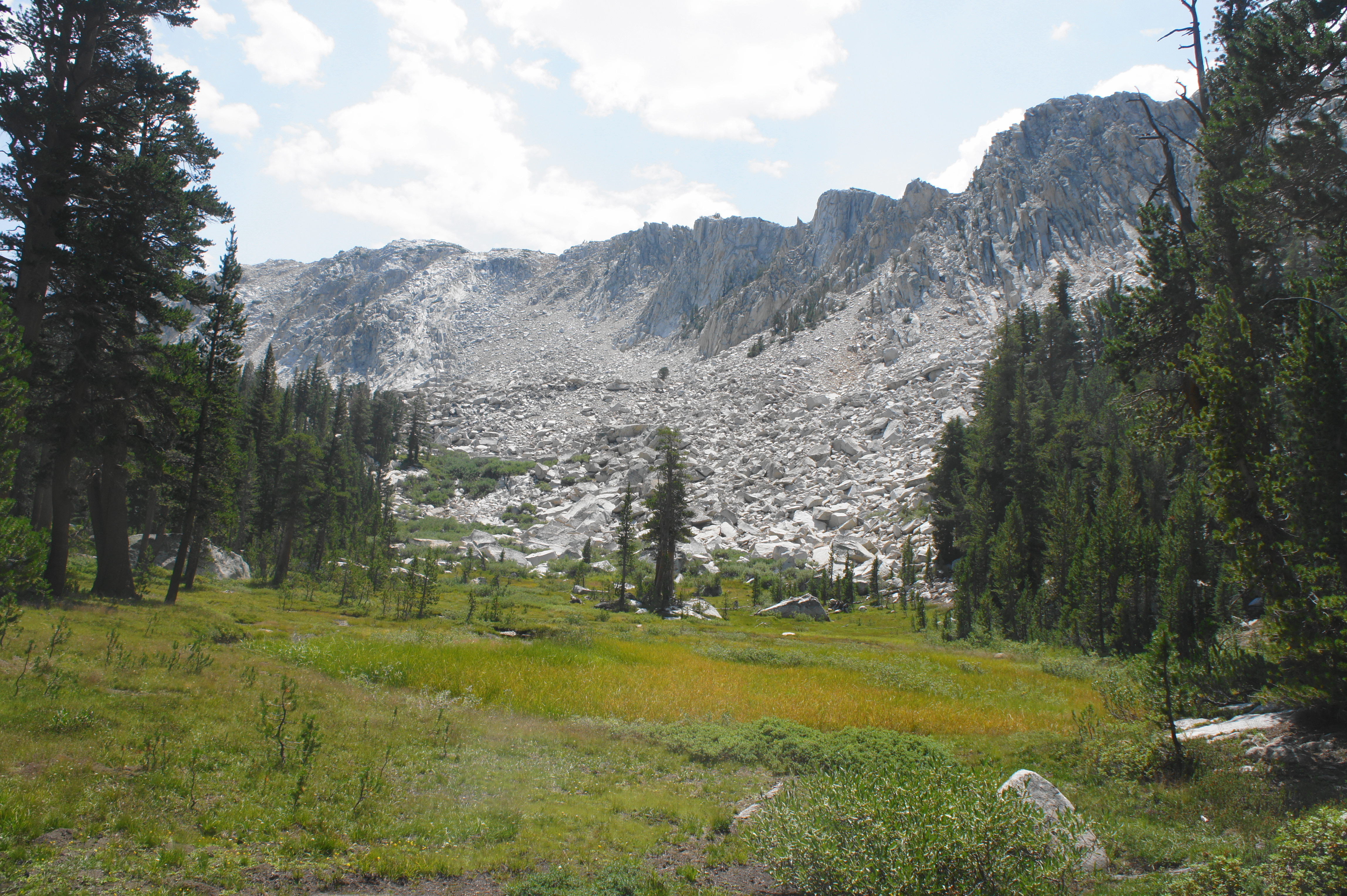
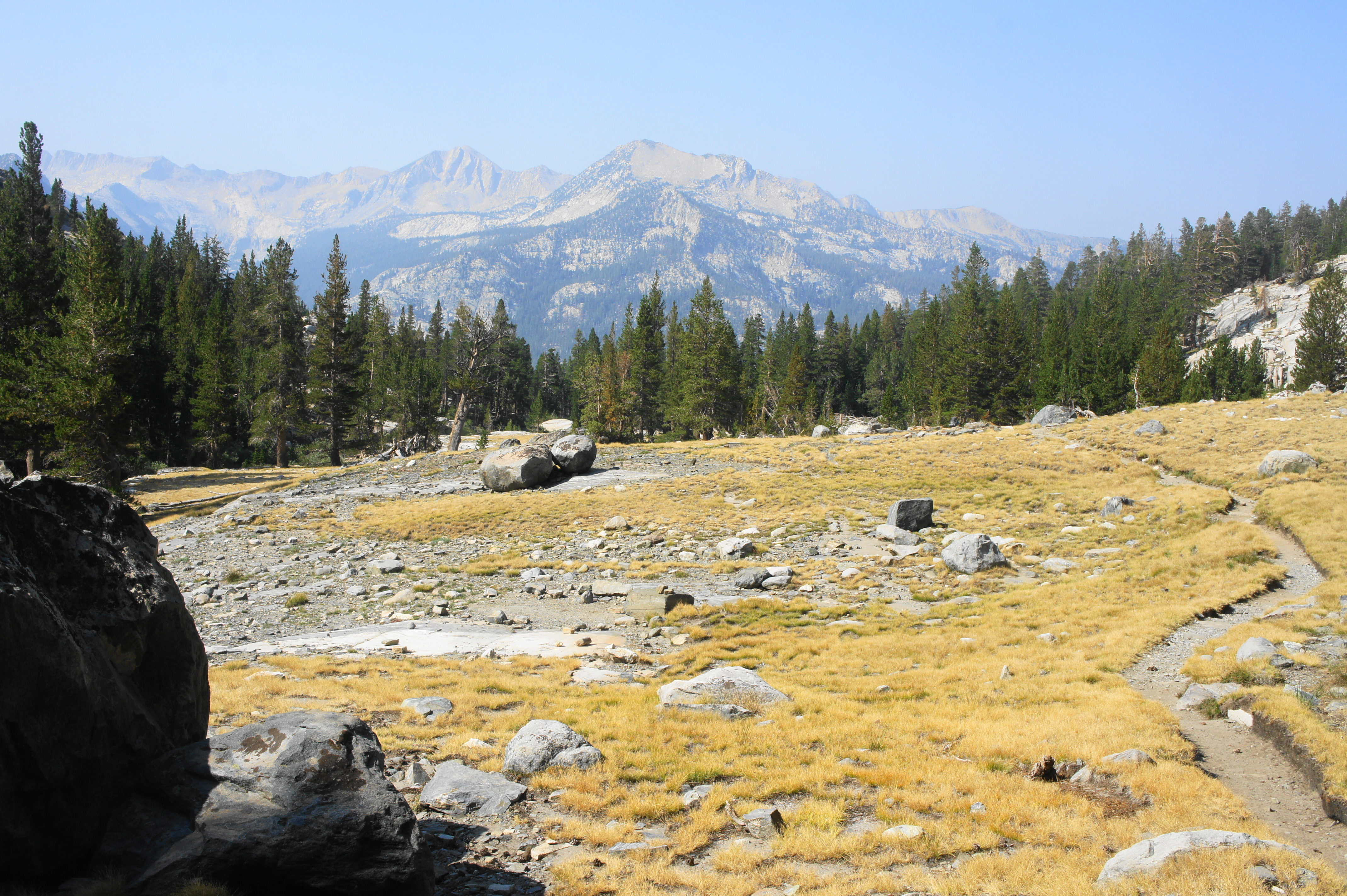
After Senger Creek, the JMT ascends another wooded pitch and edges westward into an area dotted with rocky knobs and outcrops but rather obscured vistas. After passing 10,000 feet, hikers will enter a dry meadow with some views to Mount Senger (12,286’) and Turret Peak (12,091’), two high points on the divide to the north.
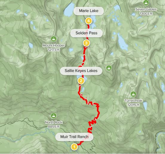
West of the meadow, the trail rises to clear a granite shelf and then descends, crossing a very minor stream before routing northward and climbing again. Travelling through spotty pine forest, the route comes level with the first of two of the Sallie Keyes Lakes on the right. This beautiful lake is a perfect lunch spot, with the still waters set below the gravelly western pitch of Mount Senger.

Cross Sallie Keyes Creek at the outlet of the lake, then follow the lakeshore and cross the stream again in about 3/10 mile. This small waterway connects the two Sallie Keyes Lakes, the second of which becomes visible off to the west.
From here the JMT begins to climb steadily toward Selden Pass. After skirting the edge of the western lake, the path routes northward, with views back south across the lakes and to the Le Conte Divide in the distance. The trail heads toward what looks like the main gap ahead, but this is indeed revealed to be a false pass, with plenty of additional climbing beyond.

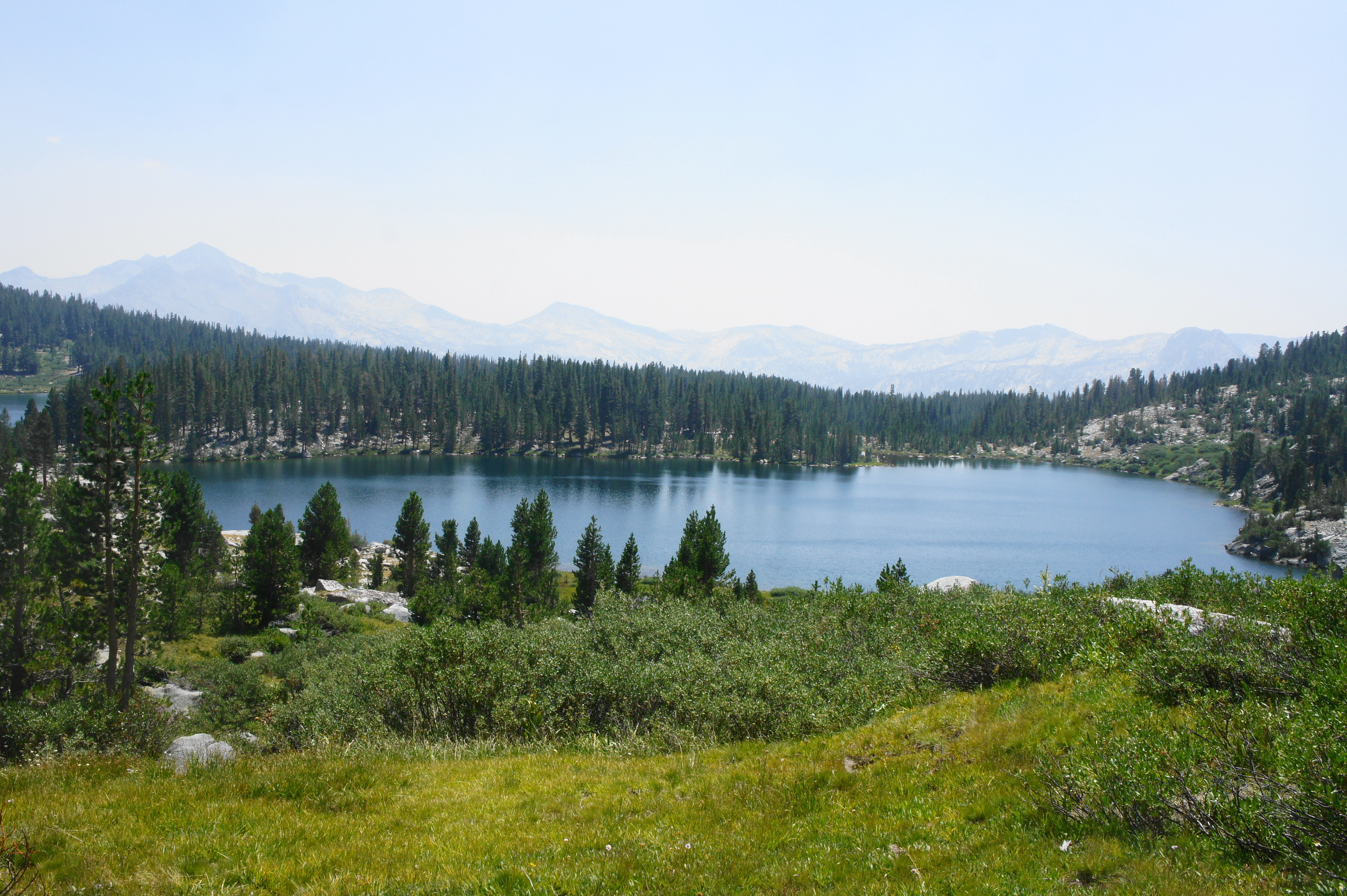
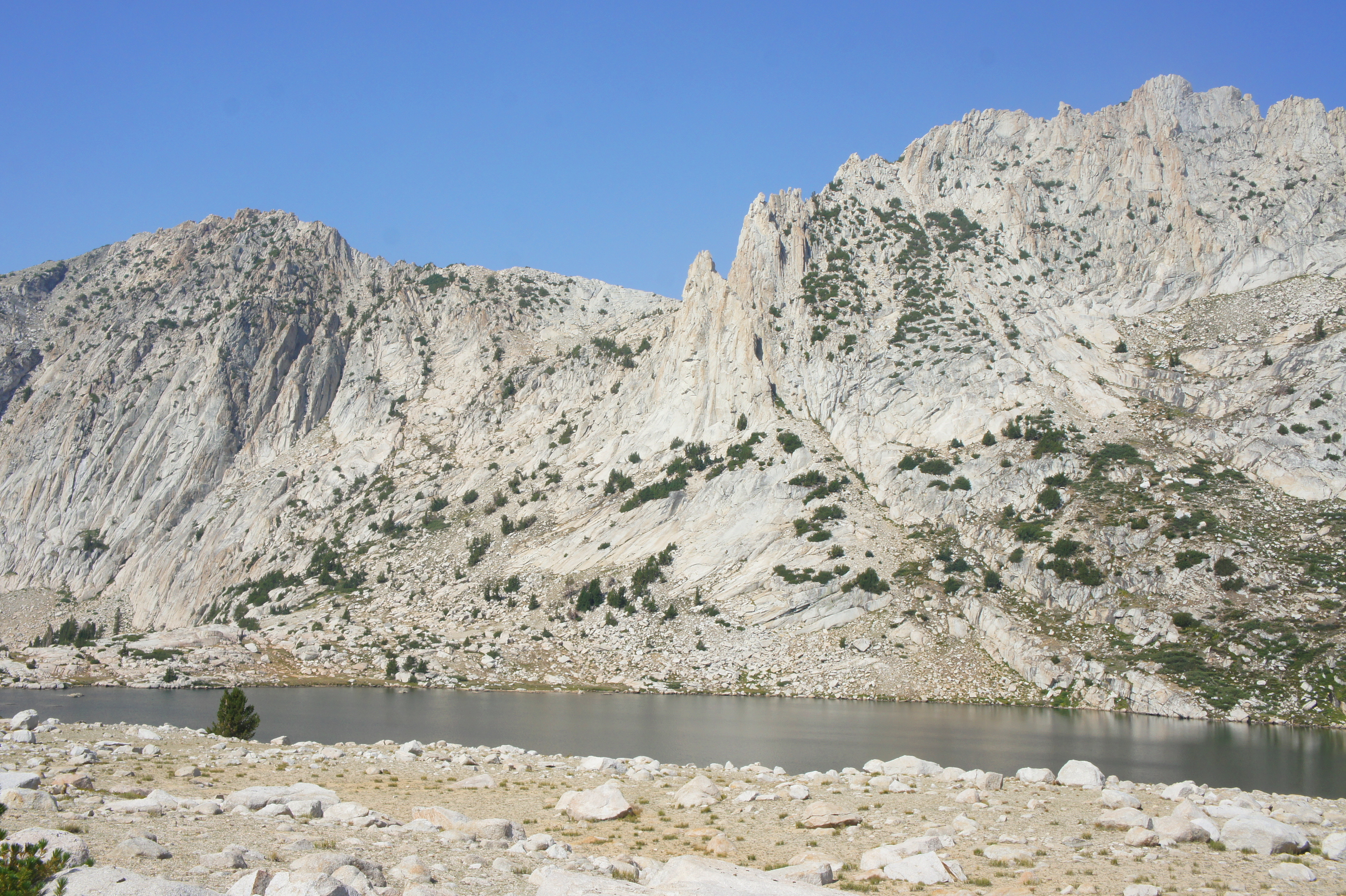
However, after crossing Sallie Keyes Creek twice more, hikers are rewarded with shoreline access to wonderful Heart Lake, so-named for its shape and beauty, situated in a granite bowl between Mount Senger and Mount Hooper (12,349’). There may be some small campsites here.


After skirting the eastern banks of Heart Lake, the trail rises again, roughly following the creek through a narrowing canyon. From here the JMT ascends a slope to the left of the stream, then crosses it again as the trail swings way to the east. After settling into a northward climb again, hikers mount the final switchbacks and reach the top of Selden Pass (10,900’), notable for being the first mountain pass since Guyot Pass (way back on Day 2) to be dotted with trees.
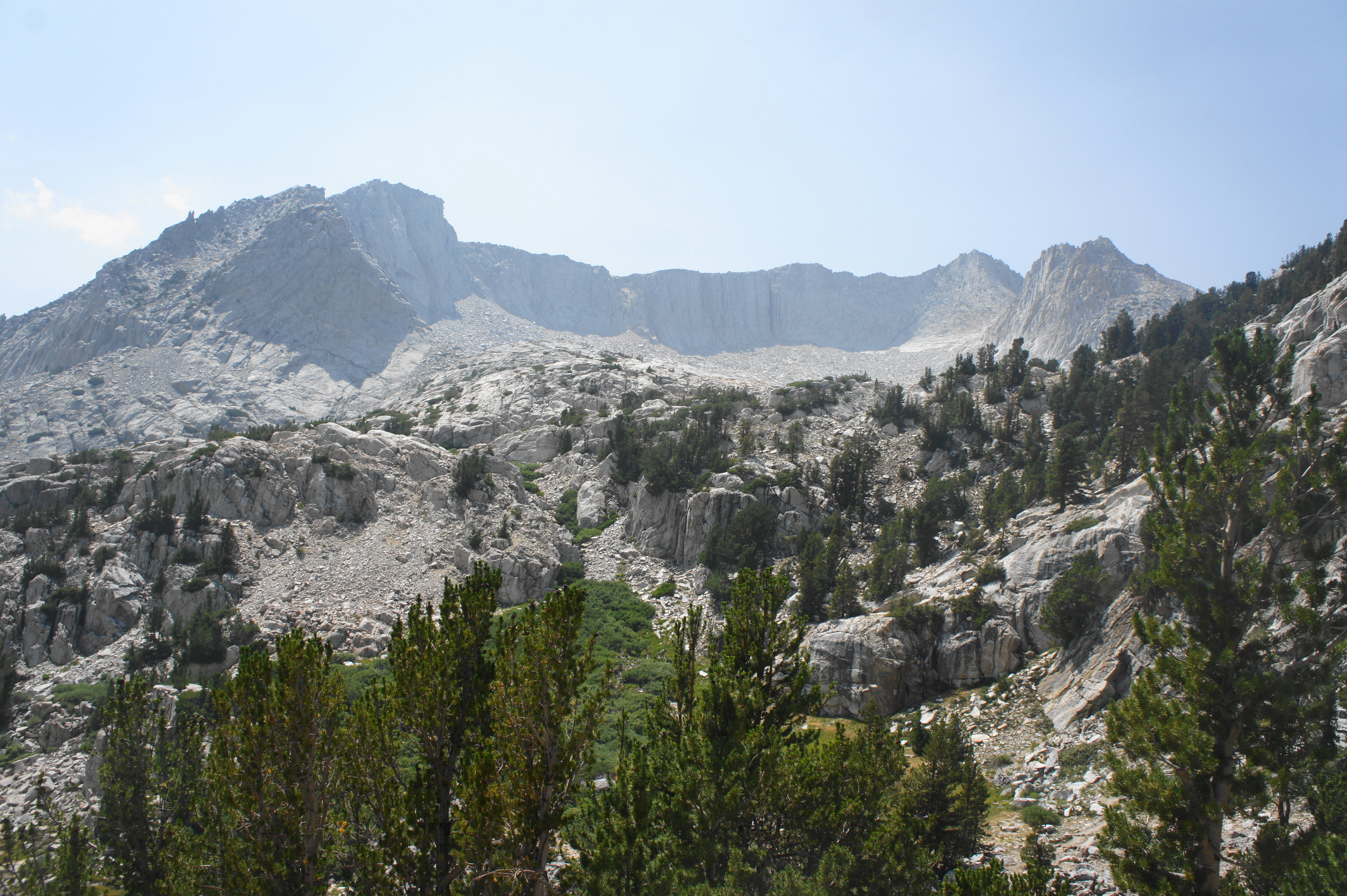

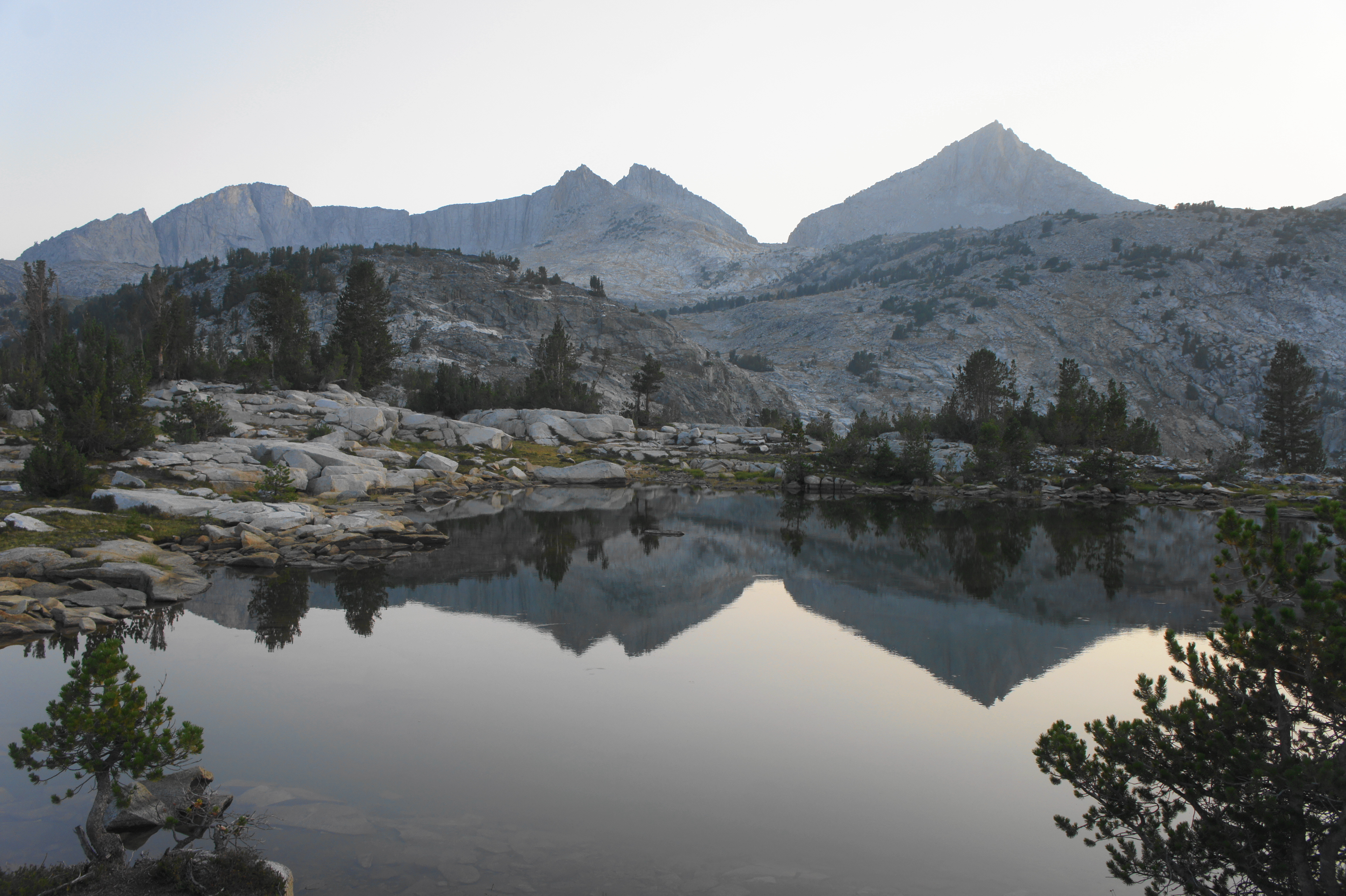
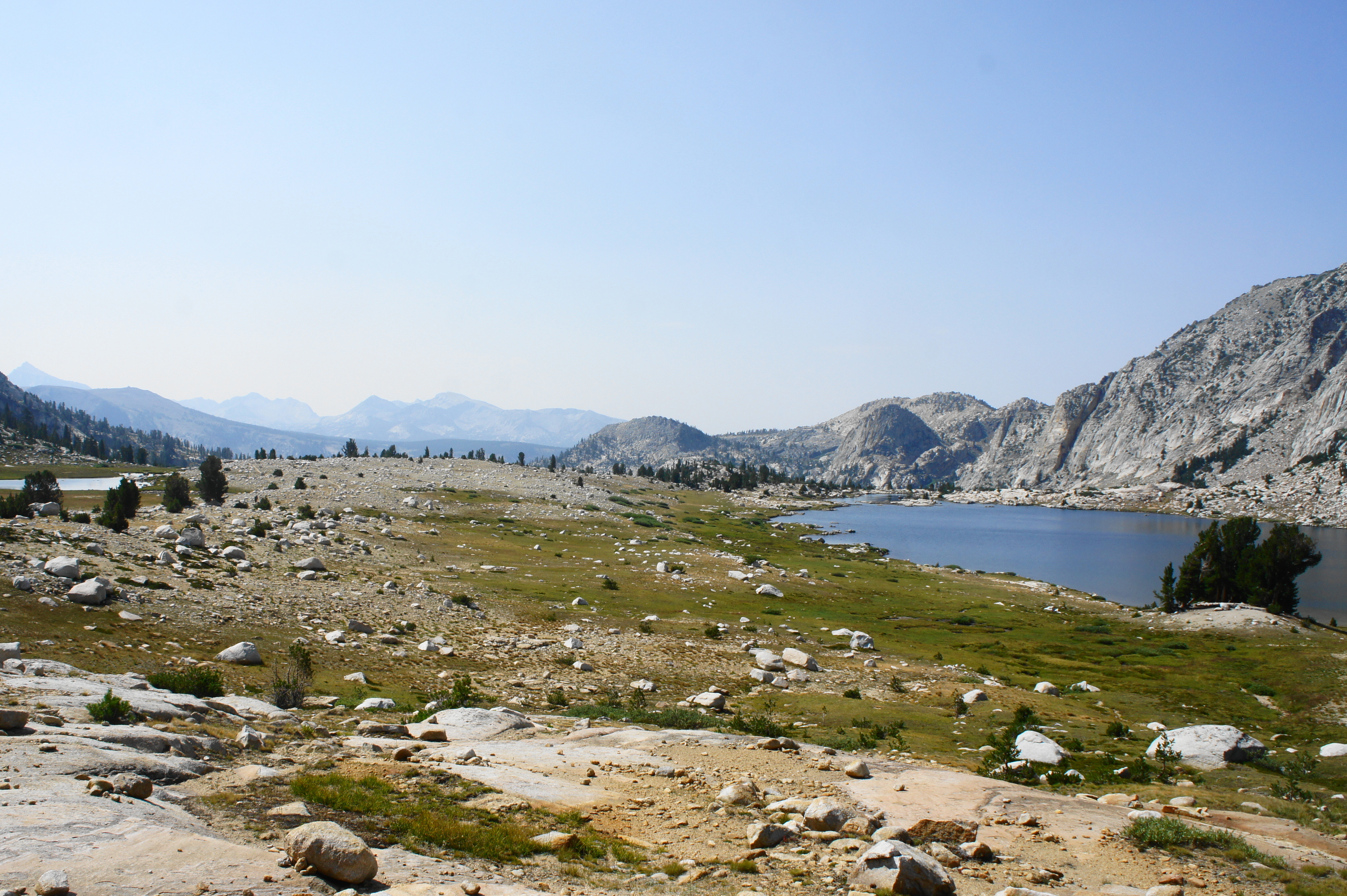
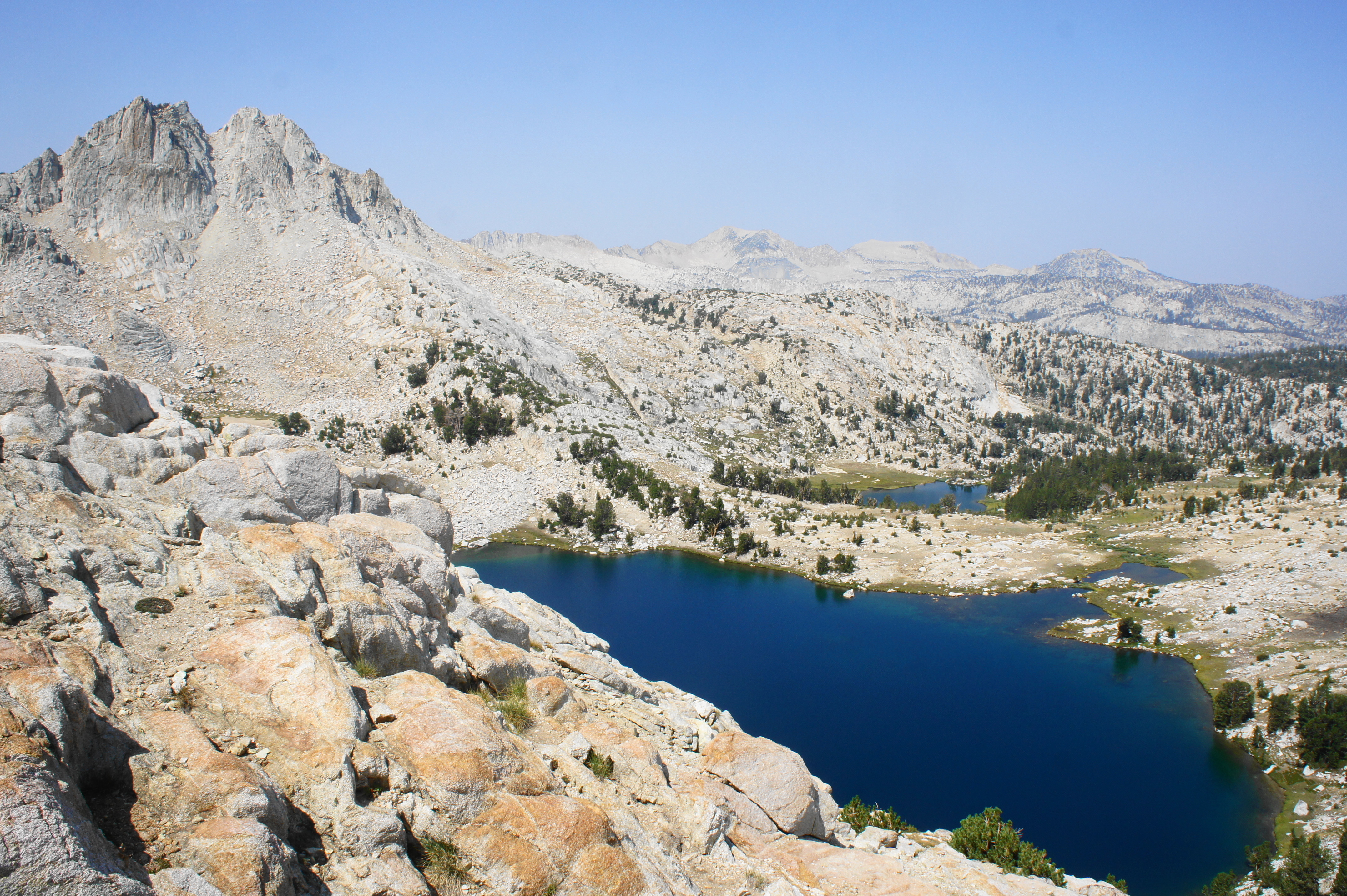
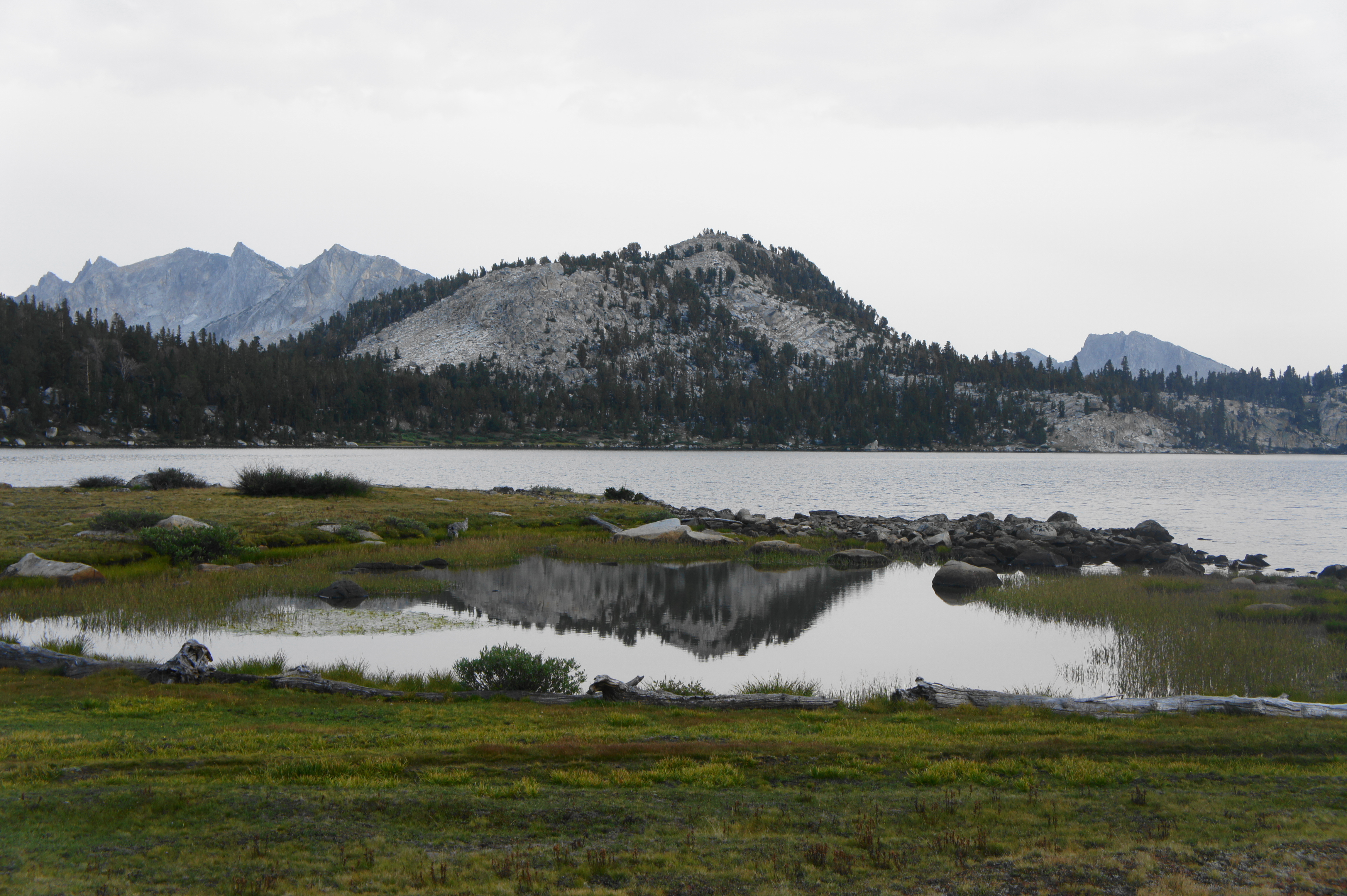
Despite the modest tree cover, the views from Selden Pass are magnificent. A glacial cirque off to the southwest reveals sheer cliffs that drop several hundred feet, with Mount Hooper in the distance beyond. And the most dramatic scene lies to the north, where the terrain gives way to a relatively large basin partially filled by Marie Lake. Here one can make out the intricate contours of the lake, with its various inlets and islands.

In the distance to the north, the dramatic peaks of the first line comprise the Mono Divide, headlined by mighty Mount Hilgard (13,361’) and Mount Gabb (13,741’). The next line of mountains beyond includes Recess Peak (12,836’) and Volcanic Knob (11,168’), which hikers will pass very soon. The jagged peak to the northeast is Seven Gables (13,075’), which conceals the Sierra Crest beyond.
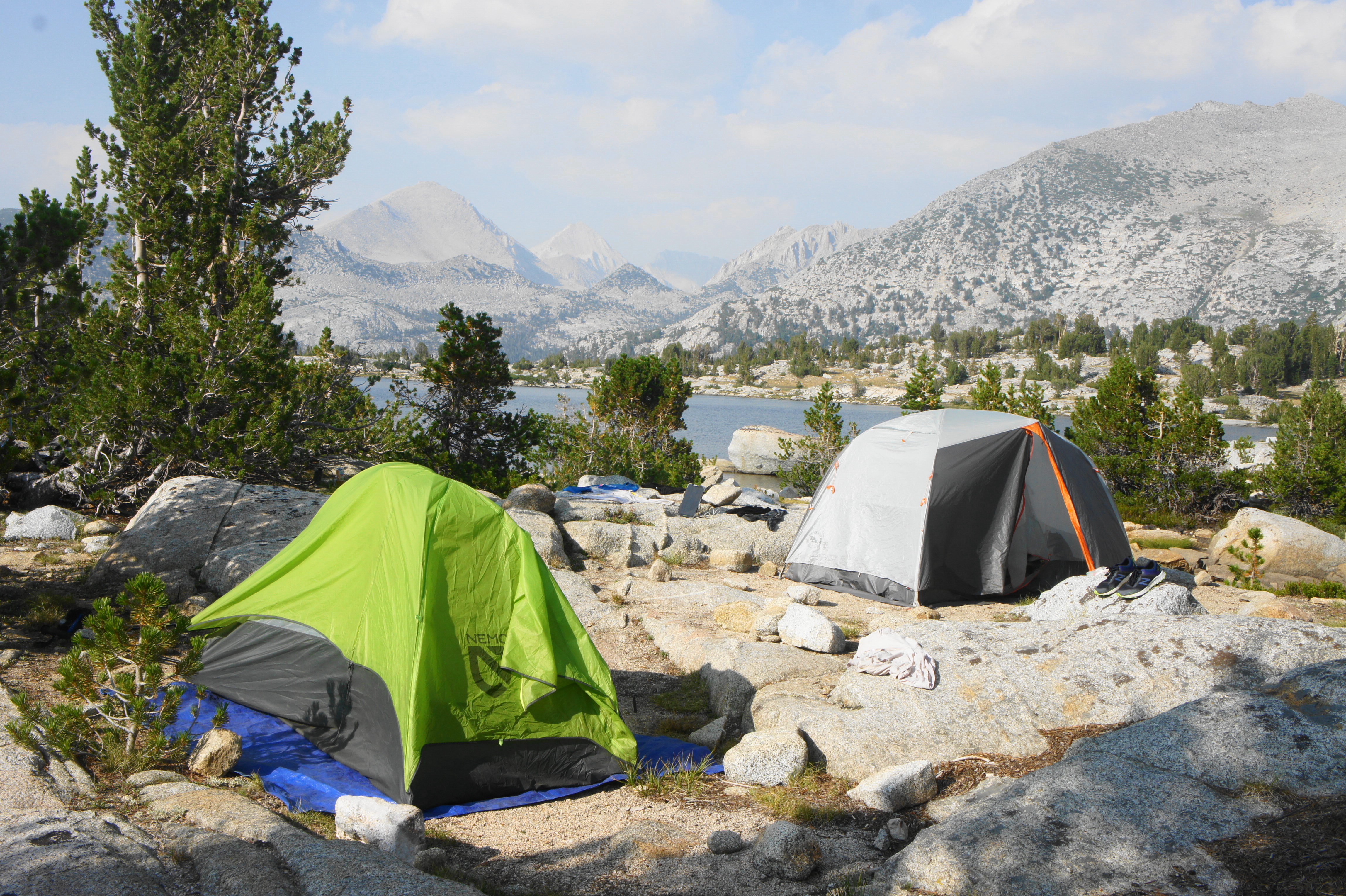

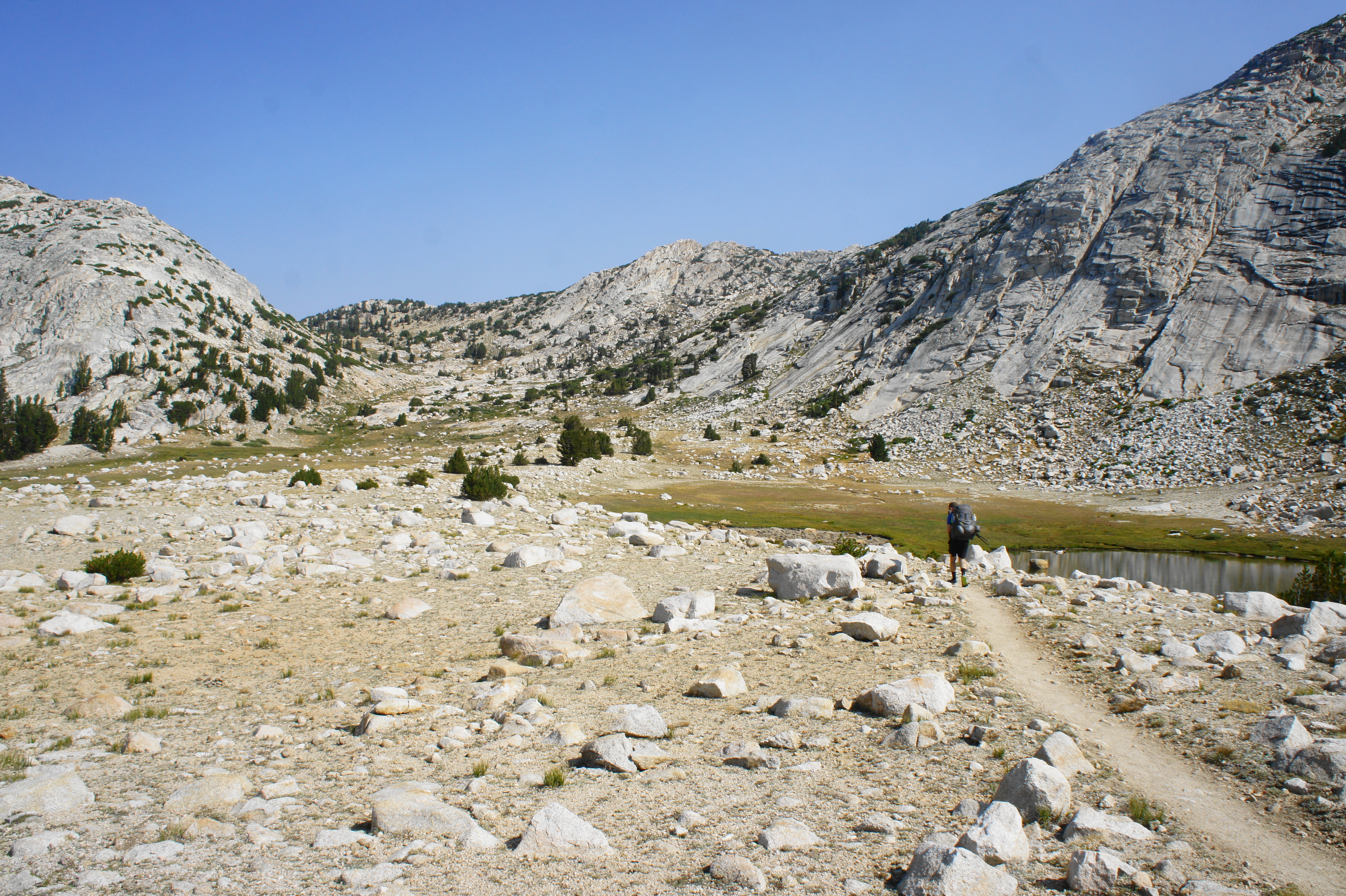
Having gained more than 3,200 feet since MTR, hikers have more than earned a breather atop the pass, although the allure of Marie Lake entices one to push further. After descending the requisite switchbacks, the JMT gradually descends to the western shores of Marie Lake, where campsites are bountiful and spectacular.


One particularly great option is to venture out onto a peninsula that nearly bisects the lake; just before the JMT drops westward and away from the lake, veer right off-trail and find a previous disturbed site on the peninsula. MTR to Marie Lake is a relatively short day, with hikers likely to arrive in the early- to mid-afternoon. But the prospect of watching the sunset over this terrific basin makes the early stop worthwhile. (Note: Hikers can continue on, however, easily reaching campsites at Rosemarie Meadow or along Bear Creek.)


Trip Report: This 8-mile day was our shortest since Day 7 (Onion Valley to Charlotte Lake). We had now gone 14 days without a rest day but had firmly established our “trail legs,” which made the 3,200-foot gain to Selden Pass relatively manageable. We arrived at Marie Lake in the mid-afternoon, with plenty of time to rest and explore the views from some of the abutting granite hilltops. Vistas were partly marred by smoke from the distant Dixie Fire. But the haze eased a bit just before sunset, allowing for stunning views in all directions.
Marie Lake to Mono Creek (12.7 miles)
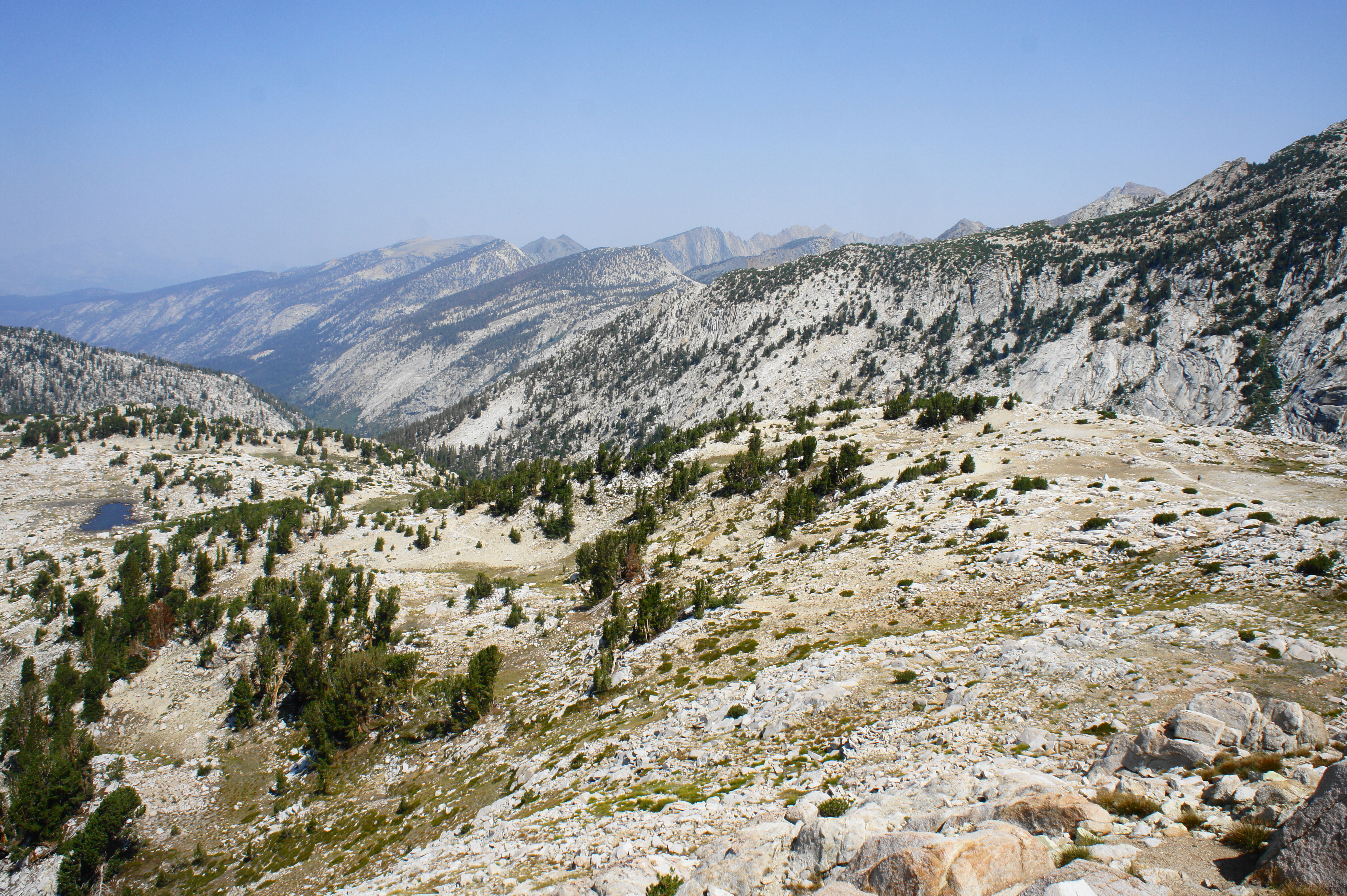
The onward route from Marie Lake descends to the Bear Creek drainage before mounting a hot and dry ridgetop below Volcanic Knob, leading to the larger Mono Creek drainage beyond. From the outlet of Marie Lake, the JMT veers westward, dropping down a level to a valley carved by the West Fork of Bear Creek. Marshall Lake, a modest and rarely-visited lake off to the west, is shielded from view by the thick tree cover. It is a steady and pleasant descent to the edge of Rosemarie Meadow, a somewhat popular camping area where the JMT intersects with the Rose Lake Trail. Continue right to stay on the JMT, then bear left at the junction with the Sandpiper Lake Trail, another short spur trail that leads to a set of lakes in a basin below Seven Gables.


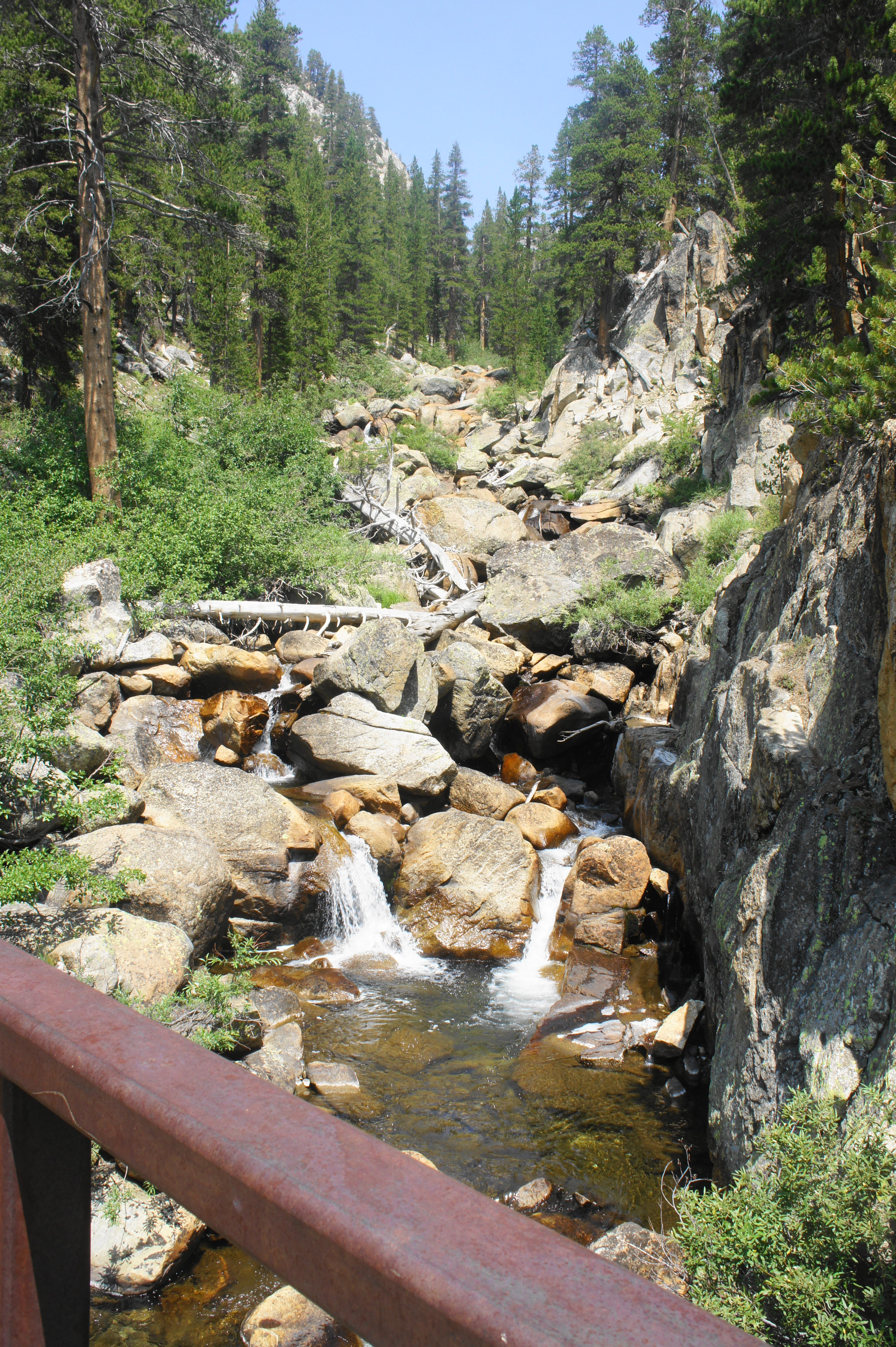
Cross the West Fork at a point approximately 1.7 miles from Marie Lake, then continue down a steady, wooded incline that eventually reaches the main Bear Creek drainage. Just after crossing Bear Creek (about 20 feet across), stay left at the junction with the Seven Gables Trail, another short offshoot. For the next three miles, the JMT/PCT roughly parallels the stream, passing occasional waterfalls and swimming holes. Follow Bear Creek to the junction with the Lake Italy Trail, then continue downstream for another two miles. At a point just under six miles from Marie Lake, the route splits again, with the Bear Creek Trail continuing to follow the cascading drainage west, while the JMT abruptly leaves the creek side and rises to the north. Bear right.
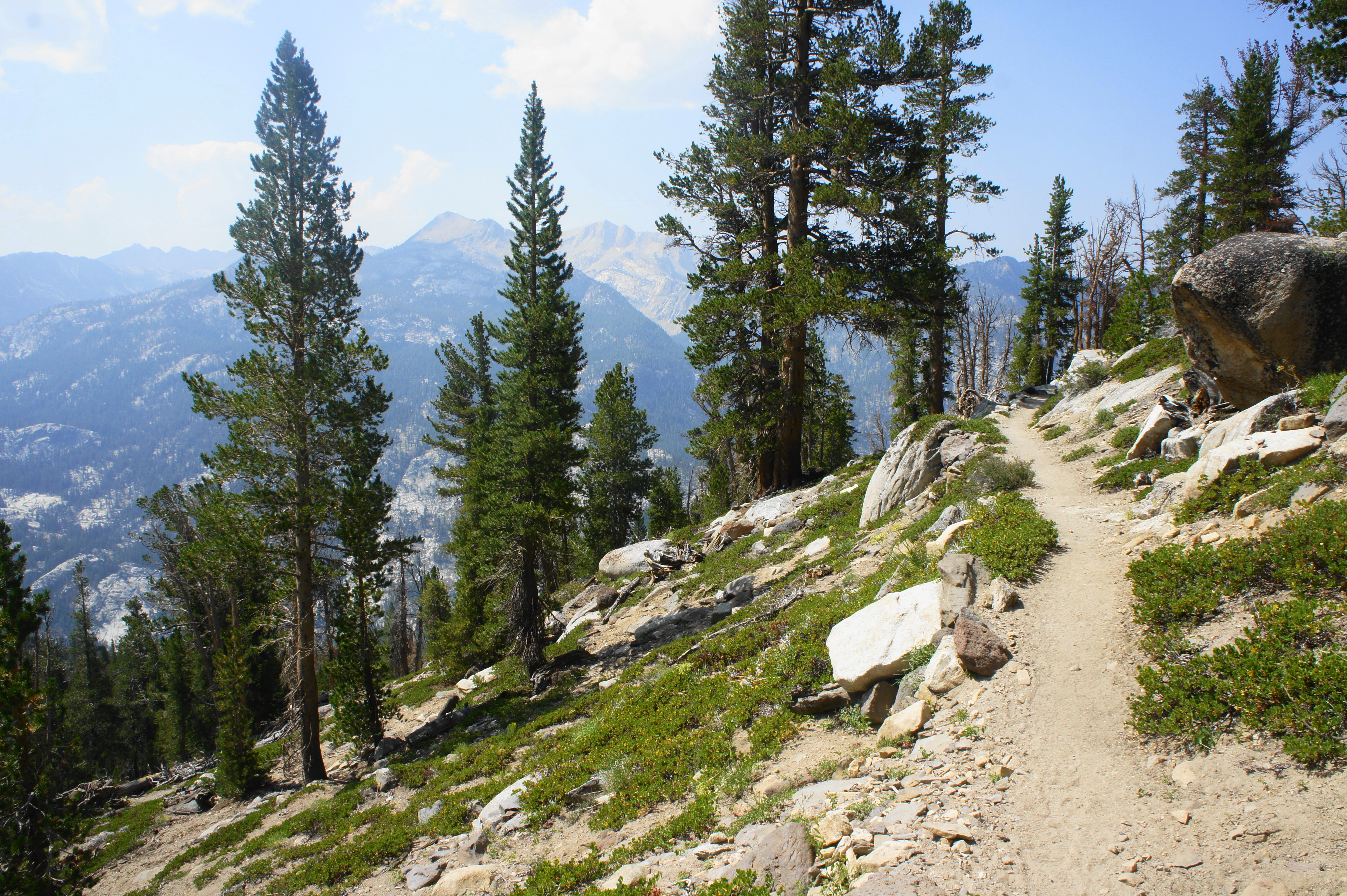
The subsequent climb to clear Bear Ridge is one of the least fun ascents of the entire hike, with toasty warm sun but relatively limited views. The climb begins modestly, passing a series of small tributary streams—the last reliable water sources for the next five or six miles. Thereafter, the JMT rises more steeply, ascending a set of switchbacks that are mostly wooded but occasionally allow peeks down into the Bear Creek valley. Here the trail passes below Recess Peak and Volcanic Knob, neither of which are visible through the thick forest. (Note: The latter, however, can be reached as part of a 3.5-mile, off-trail detour.)

After a particularly rigorous section with switchbacks and stairs, the trail levels off, crossing the ridgetop as it reaches the Bear Ridge Trail junction. (Note: Hikers can veer left here to detour to Vermilion Valley Resort (VVR) for rest and resupply.) Catch your breath at the junction before continuing on across a very mild flat, hugging a largely shaded and west-facing hillside.
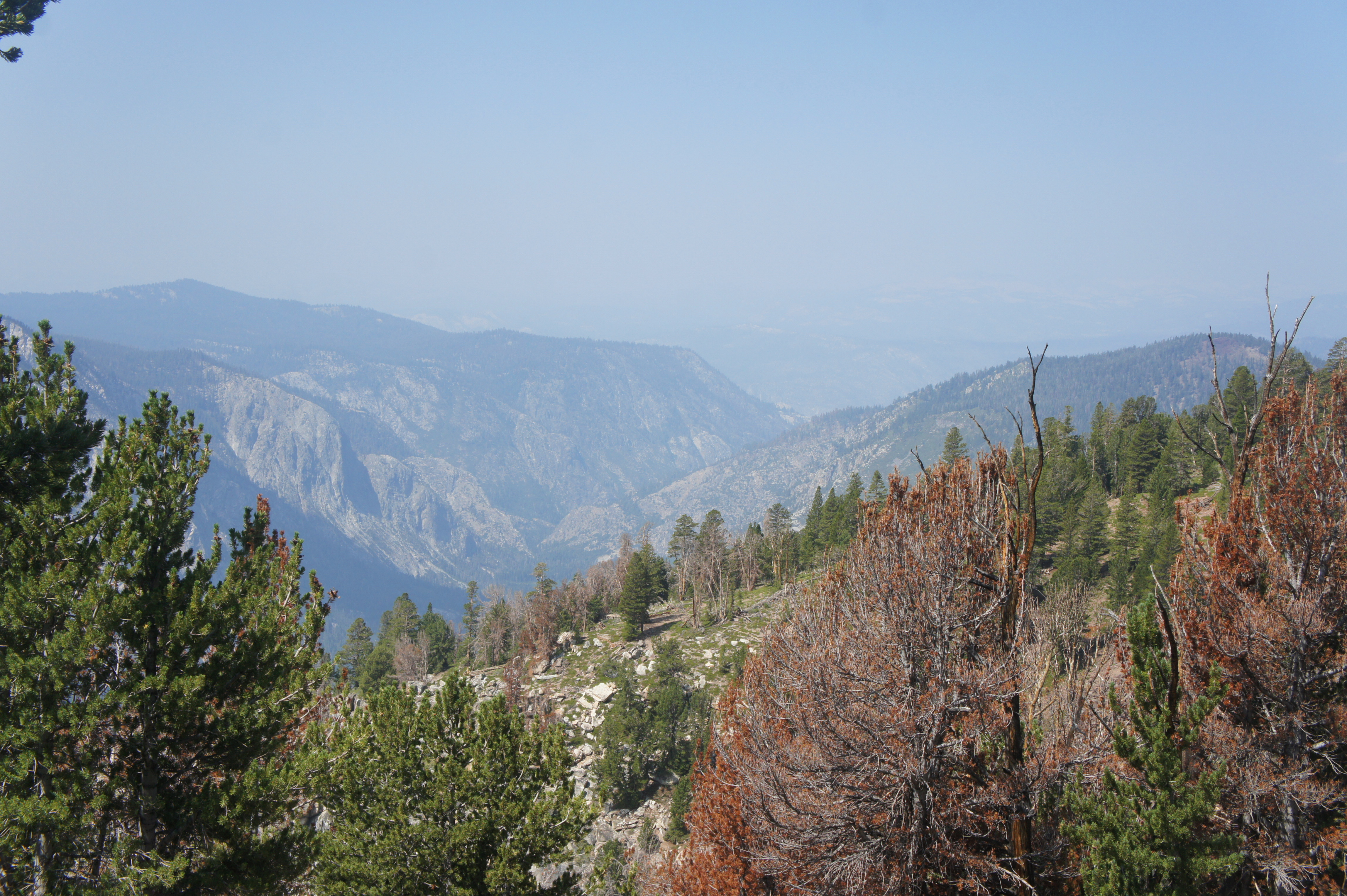
Following more than a mile of very pleasant and level walking, the northbound JMT begins the long and winding descent to the Mono Creek drainage, an immense and forested valley that is more than 2,500 feet deep in places. The trail descends through a changing ecosystem that shifts from a forest of white pines, red firs, and mountain hemlocks to a mix of white pines, lodgepole pines, and western junipers. Dense tree cover blocks expansive views of the valley below, but hikers can generally make out the contours of the large drainage that feeds into Lake Thomas Edison, with the obscured Vermilion Cliffs to the north.


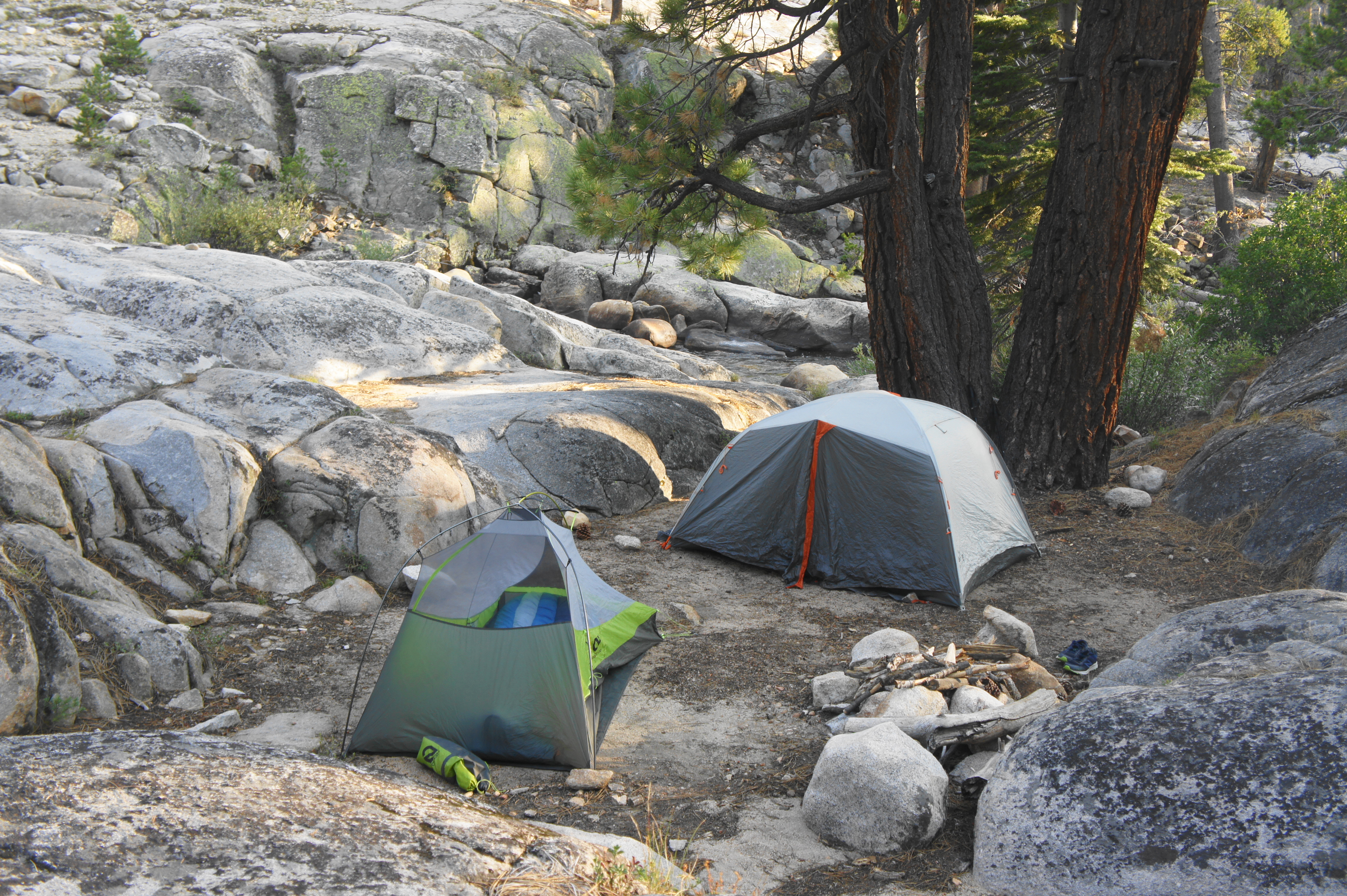
As quaking aspens enter the mix, the trail eventually descends to a point about 400 feet above the valley floor where a quick diversion off to the left leads to a rocky overlook. From here the trail cuts eastward and passes a set of small rivulets, the first accessible water in around five miles (at least in the dry season). After crossing a side stream that begins up near Volcanic Knob, the path briefly ascends and then drops to the main crossing of Mono Creek, where there is a sturdy wooden bridge that offers passage to the north bank. There are lots of shaded campsites around here, with easy access to the quick-flowing waters. (Note: Even better sites can be found about ¾ mile further, near the junction of the North Fork of Mono Creek and main Mono Creek waterway.) Less than a minute’s walk from the bridge, hikers will reach Mono Creek Junction, where the Mono Creek Trail (another access route to VVR) comes in from the left.

Although still short of the halfway mark in terms of distance, Mono Creek feels like the midway point in Section 3, with about 1 ½-2 days of hiking behind and around two full days ahead.
Trip Report: On Day 15 of our journey, we covered the 13-mile trek from Marie Lake to Mono Creek, camping at a spot about ¾ mile beyond the junction at the intersection of the North Fork and main fork of Mono Creek. The smoke lingered for much of the day, and the ascent of Bear Ridge was challenging in the midday heat. Unfortunately, my hiking partner suffered an ankle injury during the descent from Bear Ridge that ultimately waylaid us for a full day. We decided to take a full zero-day on Day 16 to let the injury heal a bit before pushing onward. During this unanticipated rest day, I managed to take a 9-mile day hike to nearby Mott Lake, a beautiful and rarely-visited destination. By Day 17, we were ready to continue on to Silver Pass and beyond. Even though we lost a day, we remained on schedule because of our decision to forgo a planned rest day at Onion Valley a week prior.
Mono Creek to Lake Virginia via Silver Pass (13.3 miles)
Mono Creek is a lovely drainage featuring lots of cascades and pools, and the JMT/PCT roughly follows it eastward from the Mono Creek Junction. After about ¾ mile of intermittent climbing, the trail levels off briefly and crosses the North Fork of Mono Creek, a side drainage that hikers will follow northward toward Silver Pass. Passing nice campsites on the left, the trail swings around to the east and north and begins a somewhat steep climb up granite slopes to the junction with the eastbound Mono Creek Trail, which services Mono Pass several miles up-canyon.

Stay left and follow the ever-climbing JMT, within sight of the North Fork as it alternates between calm stretches and spilling cascades. Leveling off briefly, the JMT edges a relatively open area called Pocket Meadow, which features some nice campsites and a gently-sloping waterslide. Farther on, pass the junction with the Mott Lake Trail—about three miles up from the bridge over Mono Creek.
After descending to cross the North Fork (no bridge), the trail begins a steep and earnest ascent, the most significant climb before Silver Pass. Gradually putting the leafy canyon behind, hikers will switchback up an east-facing slope, crossing Silver Pass Creek before finally leveling off at the top of a granite shelf about 600 feet above the North Fork.

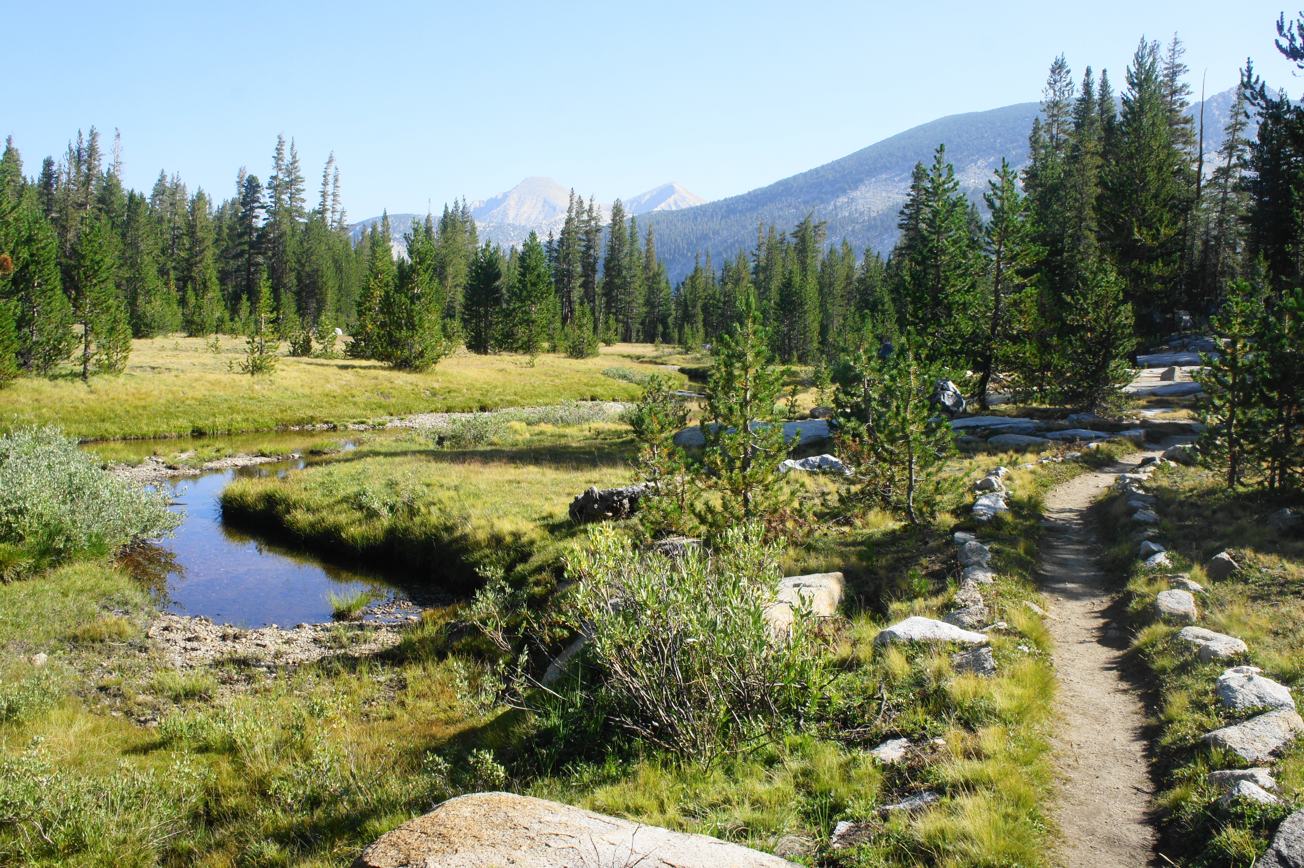
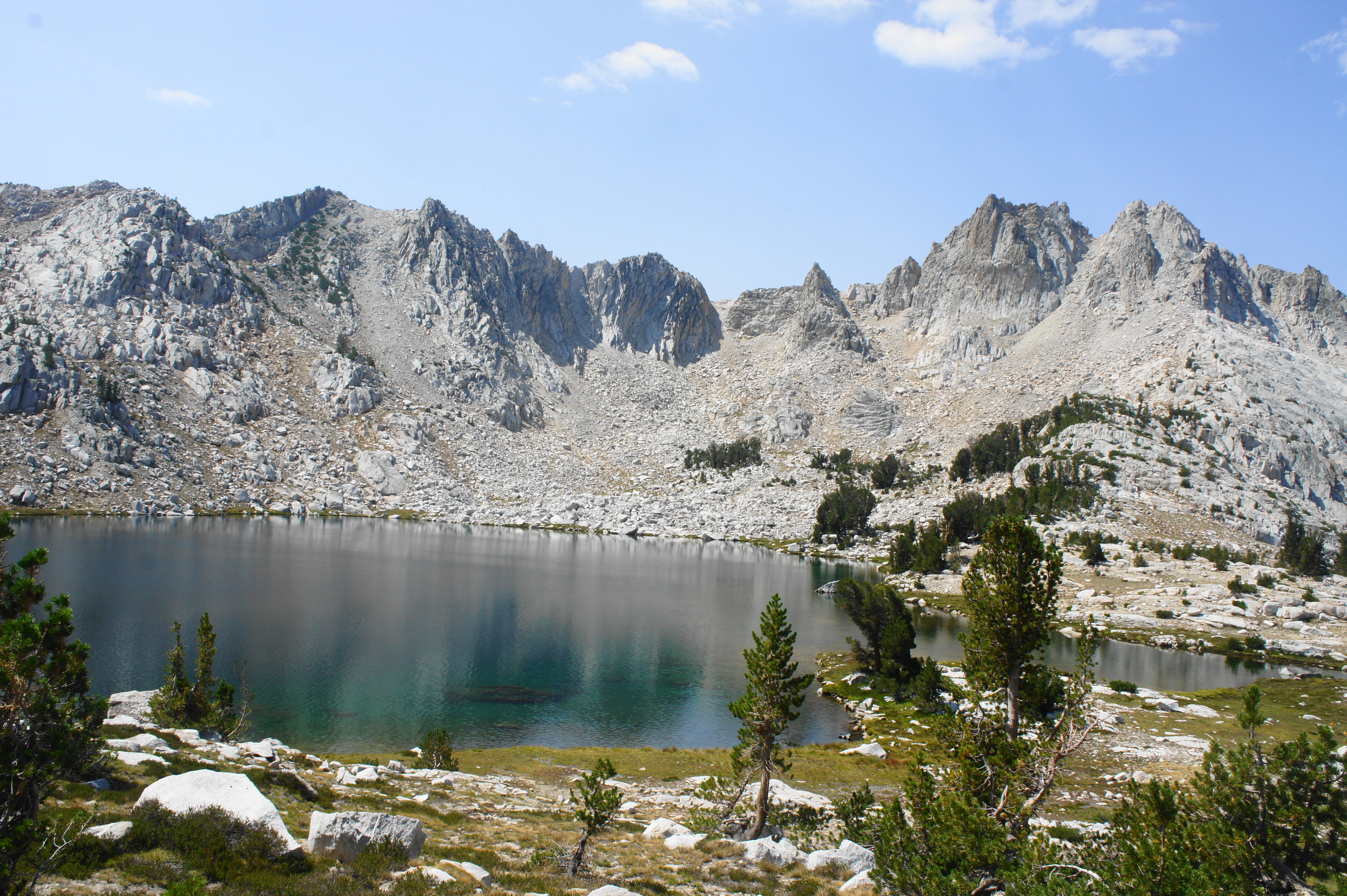
Now treading westward, the trail skirts a lovely meadow sparged by Silver Pass Creek. Follow the stream until the JMT crosses it again and then resumes its steady climb toward Silver Pass, rising through the woods below a rocky ridgeline. Eventually reaching an open area, the terrain descends modest slopes on both the left and right; hikers are following a thin upland toward the timberline. As the vegetation gradually falls away, great views can be had looking back south toward Volcanic Knob and the high peaks around Selden Pass beyond. Traversing sandy flats brings one to within striking distance of dramatic Silver Pass Lake off to the left; this surprisingly large water basin sits at the base of a wall of sheer cliffs and sawtooth pinnacles.
With Silver Pass now almost within view, the trail makes its final ascent to the high gap, passing an unnamed pool on the right and then skirting the creek toward its headwaters just below the pass. Curiously, the mild ascent needs no switchbacks to reach Silver Pass (10,740’) itself, but the trail then continues upward from here, ascending a set of switches to an even higher point that offers better views to the north.

From this vista, Silver Pass gives way to a basin of shimmering blue lakes, including Chief Lake and Papoose Lake off to the left and Warrior Lake to the right. Farther on, the bedrock drops significantly to Fish Valley, with the Mammoth Crest beyond. On clear days, one can spot the imposing peaks of the Ritter Range and even Donohue Peak (at the gateway to Yosemite National Park) in the distance.
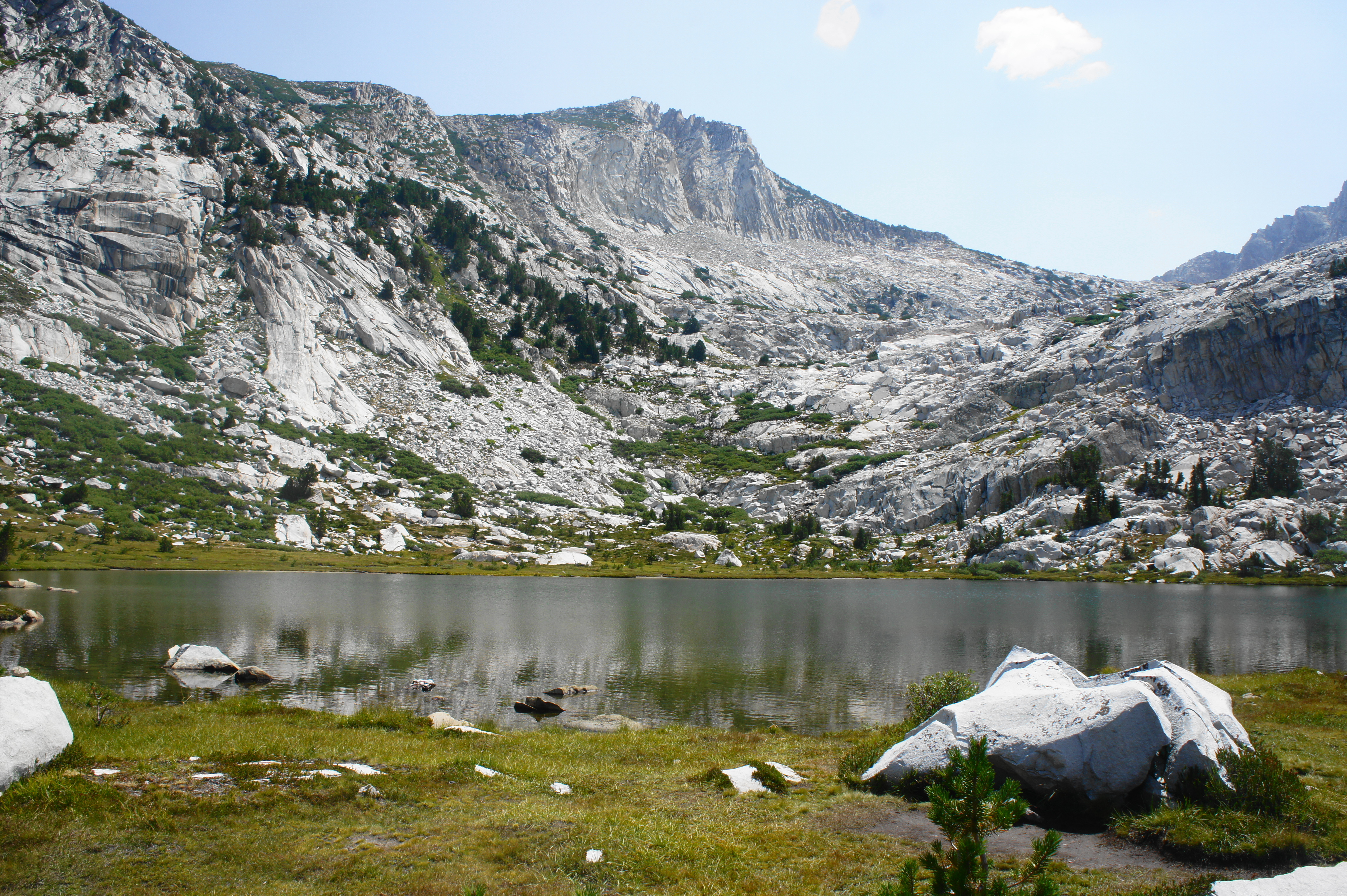
Beyond Silver Pass, the trail begins a seemingly never-ending descent from the Silver Divide to Cascade Valley and the Fish Creek drainage. The decline, which sheds nearly 2,000 feet in elevation, begins by skirting an exposed ridgeline overlooking Warrior Lake, with Mount Isaac Walton (12,099’) beyond. Rather than descending the east slope, however, the JMT cuts west, dropping to the shores of Chief Lake, set in a bowl below jagged peaks of the Silver Divide. There are a few campsites scattered here amid the granite slabs and patchy pines.


Bearing northwest from Chief Lake, the trail drops to a junction with the Goodale Pass Trail, a lengthy side route that offers passage back to Lake Thomas Edison and VVR. From here the JMT swings right again, descending to the outlet of Squaw Lake, a small but scenic lake lined by a green lawn of tufty grasses. Cross the stream, a tributary of Fish Creek, then follow the watercourse down-canyon as the trail returns to timberline. A lengthy descent brings one down to a pleasant meadow and bridged crossing, about a mile from the Squaw Lake outlet.
After crossing the tributary creek, the trail quickly crosses back again—this time with no bridge. The onward route descends steadily, first alongside the creek, then edges eastward into thicker lodgepole forest, away from the stream. Soon the trail reaches a minor clearing on a shelf above Cascade Valley, working northward toward Fish Creek and Tully Hole.
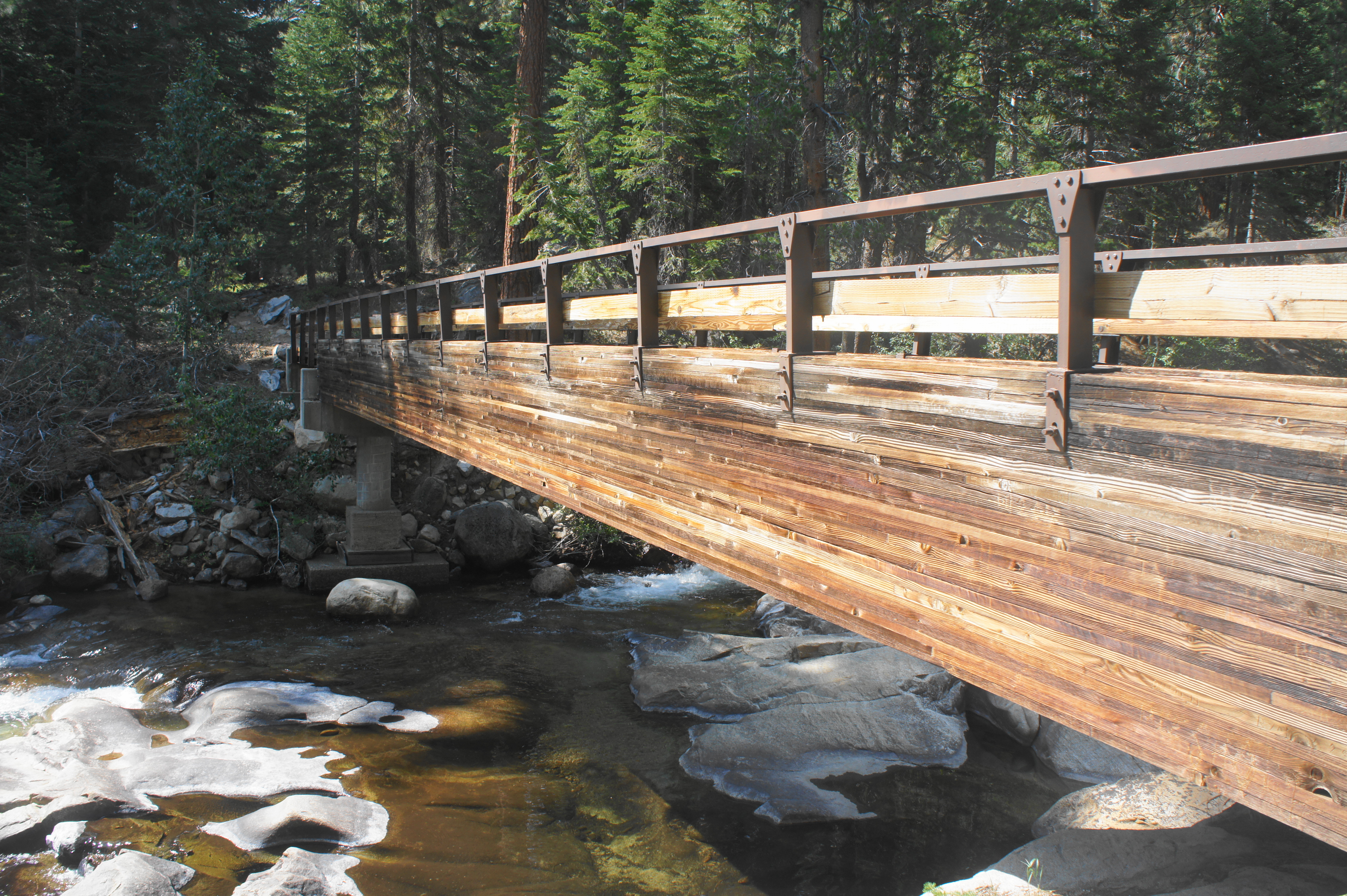
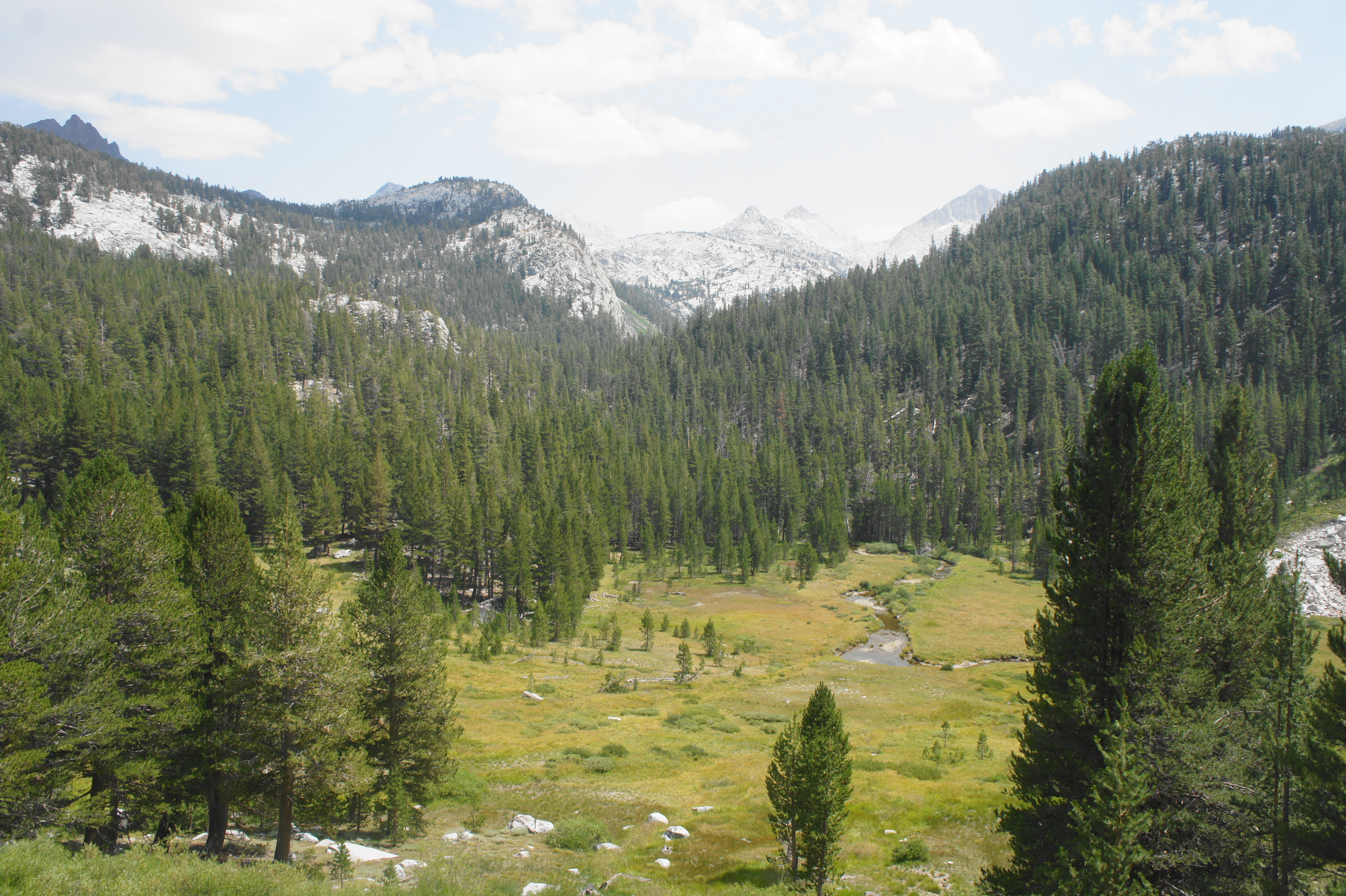
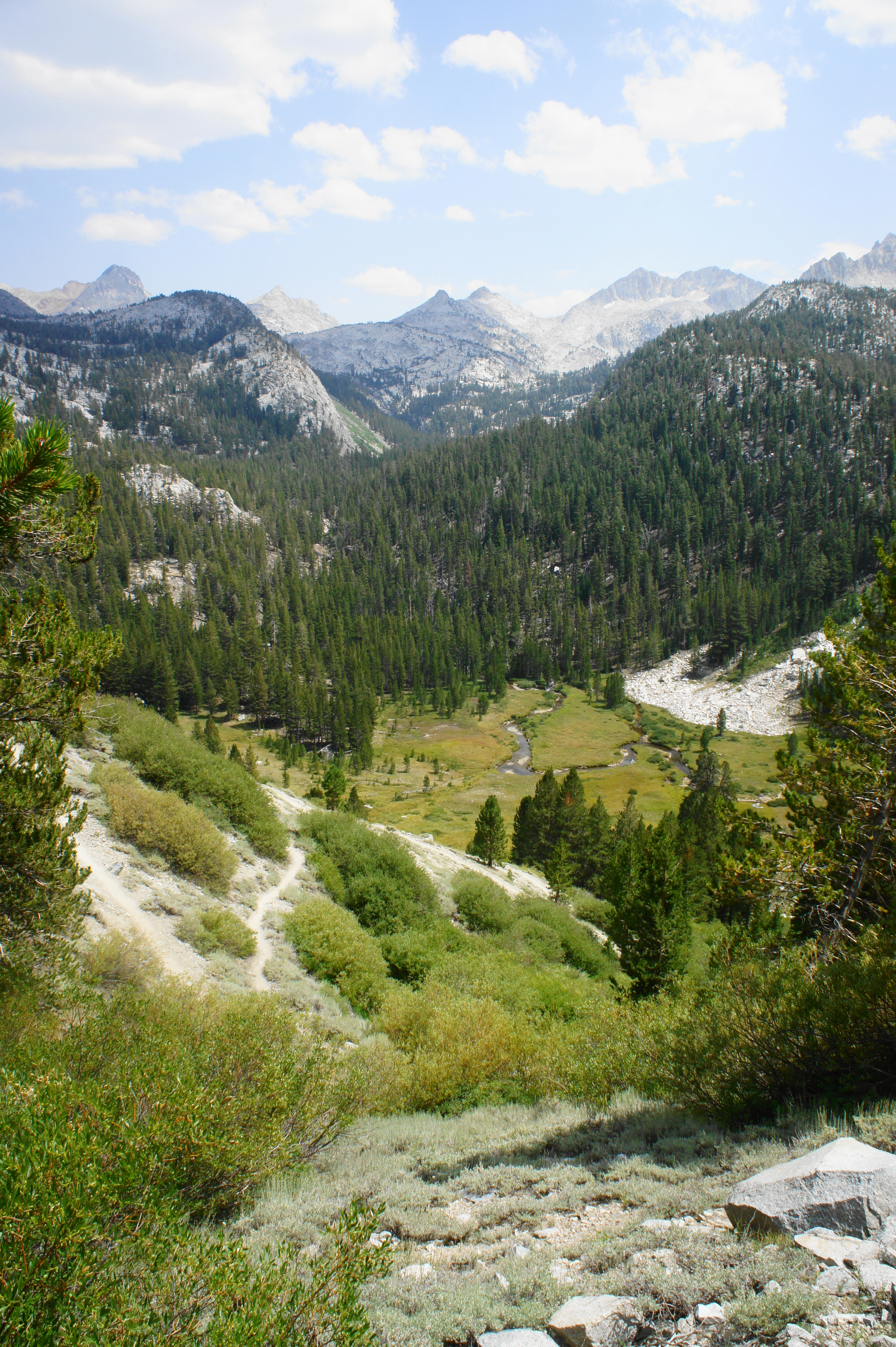
At the junction with the Fish Creek Trail, now a little less than four miles from Silver Pass, bear right, staying on the JMT. After a brief uphill, the trail drops to a steel bridge over Fish Creek, which is cascading here through a boulder-choked canyon. Following a steep switchback, the trail bears northeast along the creek, beginning the ascent to Tully Hole and Lake Virginia. The tumbling waters soon turn to calm meanders as hikers approach Tully Hole, a spacious meadow situated below McGee Pass and the Sierra Crest.
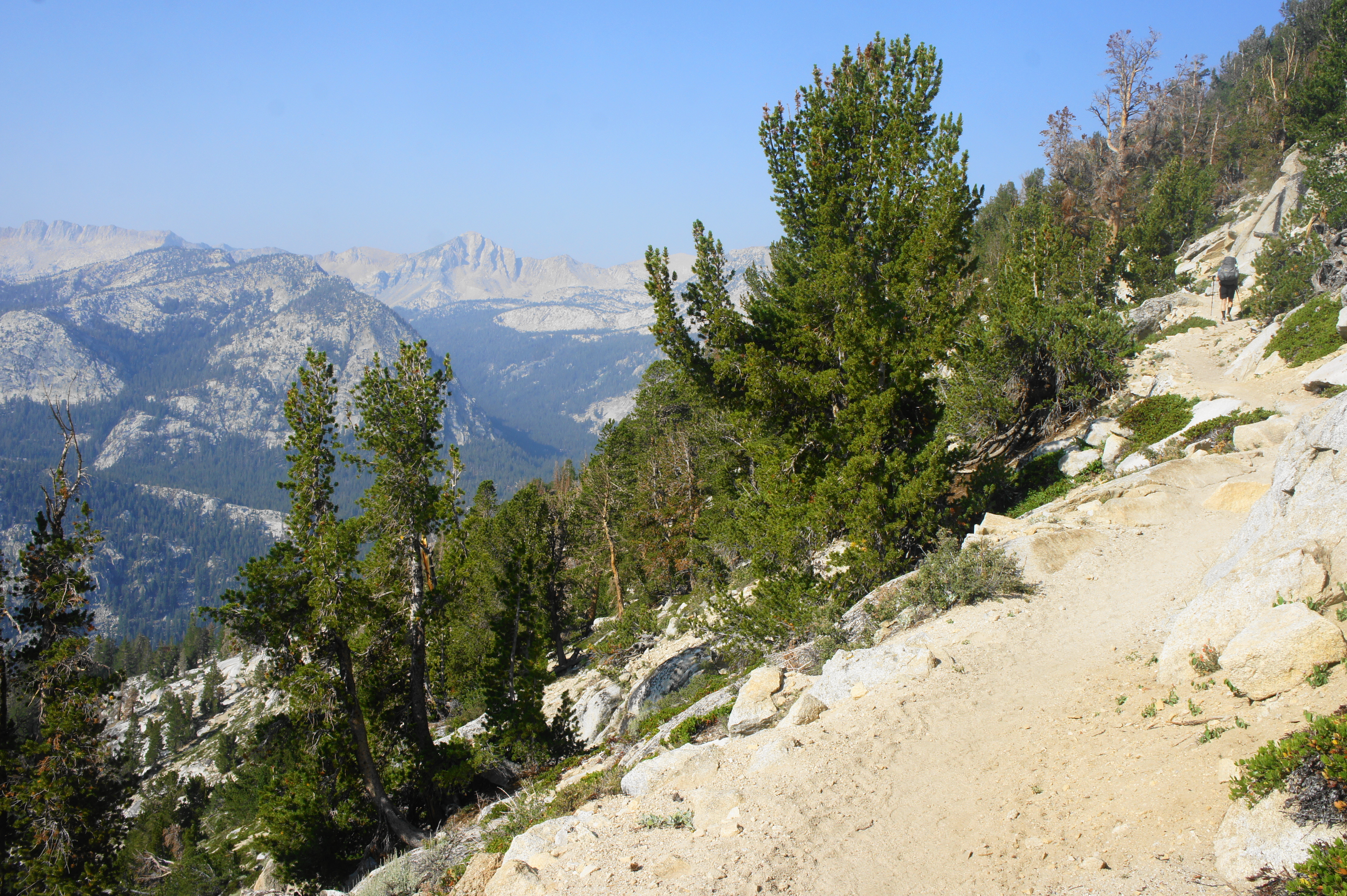
Turn left at the junction with the McGee Pass Trail, edging eastward to the base of a lengthy switchback section that constitutes the second major climb since Mono Creek. In the course of a little over a mile, the JMT ascends 17 switchbacks and gains more than 800 feet in elevation. The route offers extensive views eastward to the amphitheater of peaks beyond Tully Hole, including Red Slate Mountain (13,163’), Red and White Mountain (12,850’), and Mount Isaak Walton (12,099’). Here the Silver Divide meets the Sierra Crest, forming the upper reaches of the Fish Creek watershed.
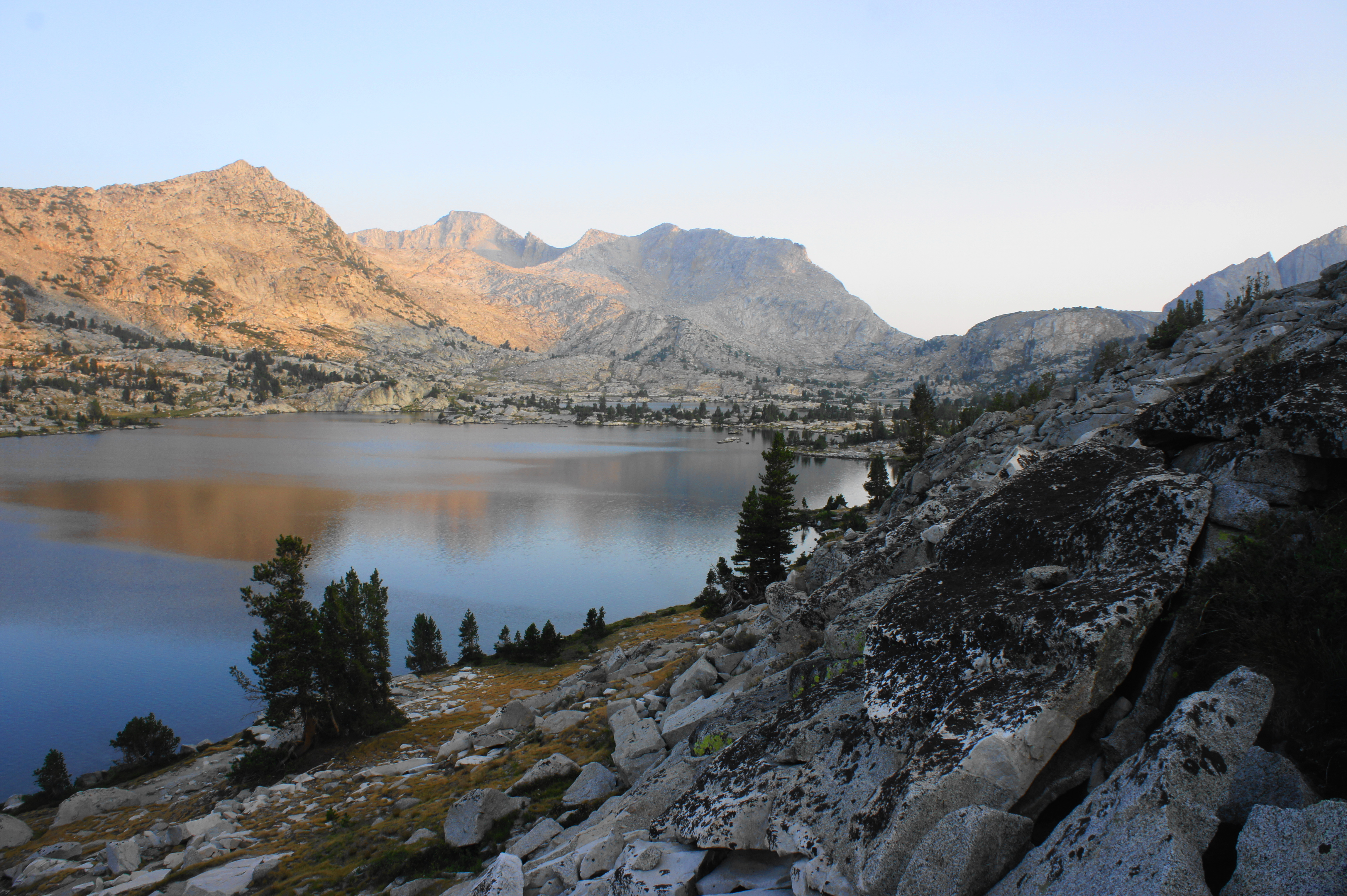
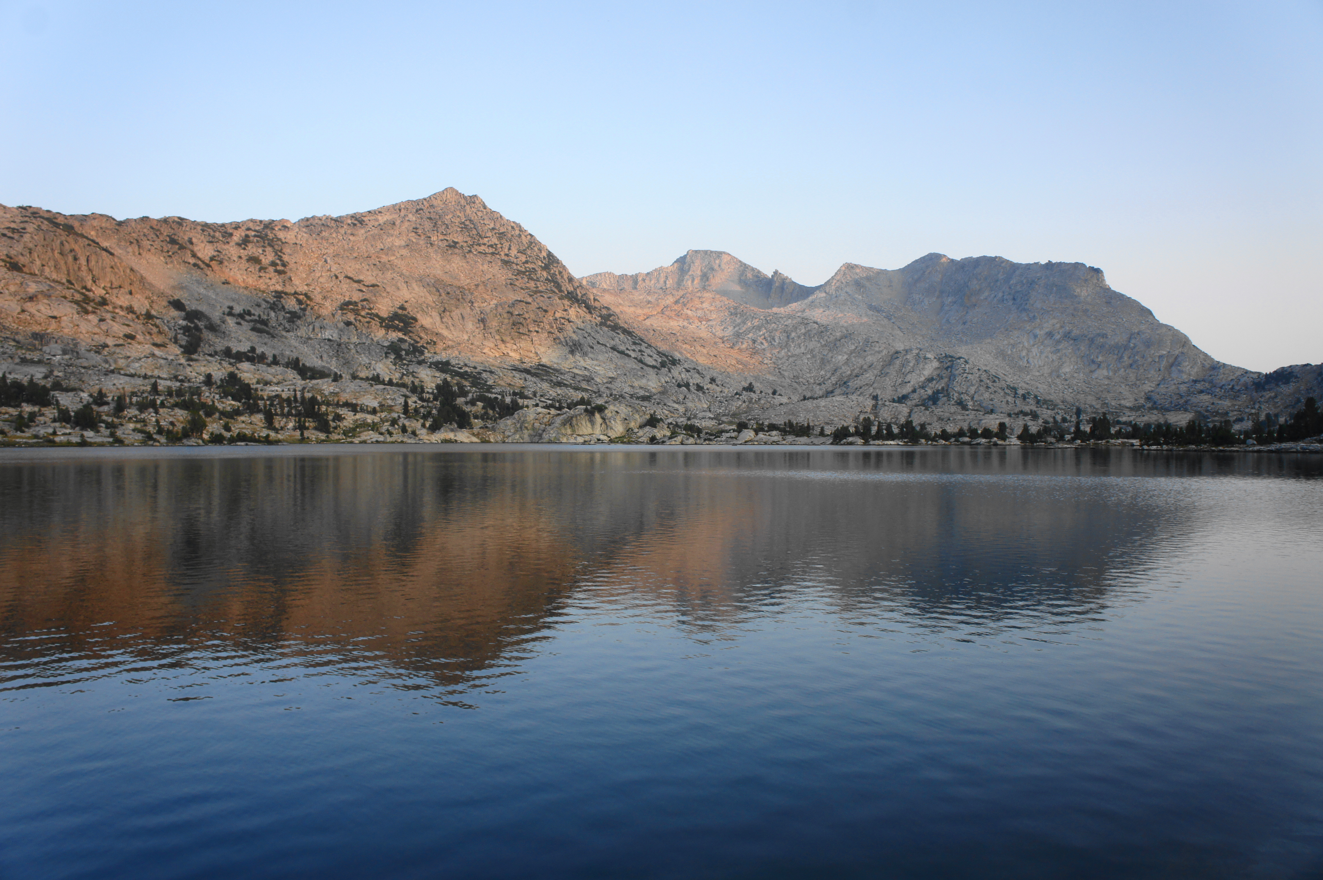
Counting switchbacks helps pass the time—while the first twelve come in quick succession, the thirteenth leads to a longer straightaway, as do the last two. A long uphill after the final bend finally leads up to the ridgeline, where the trail bends north and crests a wooded pass. Beyond lies Lake Virginia, the first in a series of large subalpine lakes tucked in the clutches below the Mammoth Crest. But first, hikers pass a smaller, unnamed pond visible down to the left; then the route edges northward and traverses a boulder slide to the shores of Lake Virginia, another memorable milestone on the JMT.

Lake Virginia is a very popular destination for backpacking, fishing, and swimming, and campsites can be found in abundance a short distance from the northern and western banks. Expect to have company on a summer day, although the crowds do little to blemish the terrific sunsets. Unnamed peaks along the Mammoth Crest dominate the landscape to the north and east, while a look south past the lake reveals a hidden drop to Fish Valley and the high crags of the Silver Divide on the horizon.
Trip Report: After the unexpected zero day at Mono Creek, we made good time on Day 17 despite facing the most elevation gain (4,100’) of any single day on the JMT. New encounters with fellow through-hikers made us some fast friends—and an unexpected reunion with a PCT hiker we met way back on Day 2 made for a fun surprise. Pushing all the way to Lake Virginia despite the temptation to camp at Tully Hole eased the burden of the next day, allowing us to reach Red’s Meadow a day earlier than we budgeted. By now we had travelled around 180 miles—almost 2/3 of the way through the entire journey from Cottonwood Pass.
Lake Virginia to Red’s Meadow (15.6 miles)
The distance from Lake Virginia to Red’s Meadow is a lengthy 15.6 miles, including several miles of relatively mundane terrain. However, the largely downhill tread and prospect of warm food, cold beer, and showers helps propel hikers on this final stretch to the first road-accessible destination within a half mile of the JMT since the start.


From Lake Virginia, the northbound JMT rises steadily for a short period and clears a rocky passage, with the Purple Creek drainage beyond. From the gap, the trail drifts northward and descends a string of wooded switchbacks, dropping to the outlet of Purple Lake, a beautiful destination in its own right that is set in a subalpine basin below the Mammoth Crest. (Note: There is no camping at the outlet of Purple Lake but there are some previously-disturbed sites past Purple Creek on the lake’s west side.)

Cross Purple Creek at the mouth of the lake, then stay right at the junction with the Cascade Valley Cutoff Trail. Minutes later, bear left at the next fork (with the Ram Lake Trail), continuing on the JMT as it enters a lengthy stretch where the route hugs the southern flank of a long string of mountains, with views of Fish Valley below.

This section begins with a steady ascent out of the Purple Creek drainage, with the uphill persisting for at least ¾ mile. Finally, the trail rounds a corner and heads northwest and soon settles into a relatively level tread, with steep drop-offs on the left. Across the valley hikers get excellent views of the Silver Divide, with its various canyons, each harboring at least one subalpine lake.

At a point just under four miles from Lake Virginia, the JMT curves northward and descends sharply amid craggy slopes to the Duck Pass Junction. The elevated terrain to the north conceals massive Duck Lake—at nearly 10,500 feet—above. (Note: The Duck Pass Trail offers an exit route to the Mammoth Lakes area and is a popular path for fishing enthusiasts on shorter day or overnight trips.)
From the junction, the JMT/PCT continues downhill (left) to a bridge over Duck Creek, which may in dry years be the only available water source for the next five miles. This 5-mile section begins by ascending briefly again, then rounding a right-hand bend. The bulky protrusion of Pumice Butte (9,533’) gradually draws nearer as the JMT/PCT contours around a series of minor drainages, remaining just above 10,000 feet for about three miles.
After finally dipping below 10,000 feet, the trail descends steadily through a dry lodgepole forest and then dips in and out of sandy flats before reaching the crossing of Deer Creek, a popular camping area. By now hikers have travelled nearly 10 miles from Lake Virginia.
After Deer Creek, the trail veers left and ascends briefly, with the terrain giving way to a sudden drop down to the left toward Fish Valley. The trail then levels and courses northward, crossing a tributary wash and approaching an unassuming gap between Pumice Butte and the Mammoth Crest, keeping a long and narrow meadow on the right.
After bearing west through the gap, hikers reach the Crater Creek watershed. Cross the creek, then pass Upper Crater Meadow on the right. The eerie terrain in this area is lined with pumice deposits, left by volcanic activity in the past three million years. The gray soil still yields wildflowers in abundance, however, and the streamside walk is pleasant enough as hikers push on toward Mammoth and Red’s Meadow.
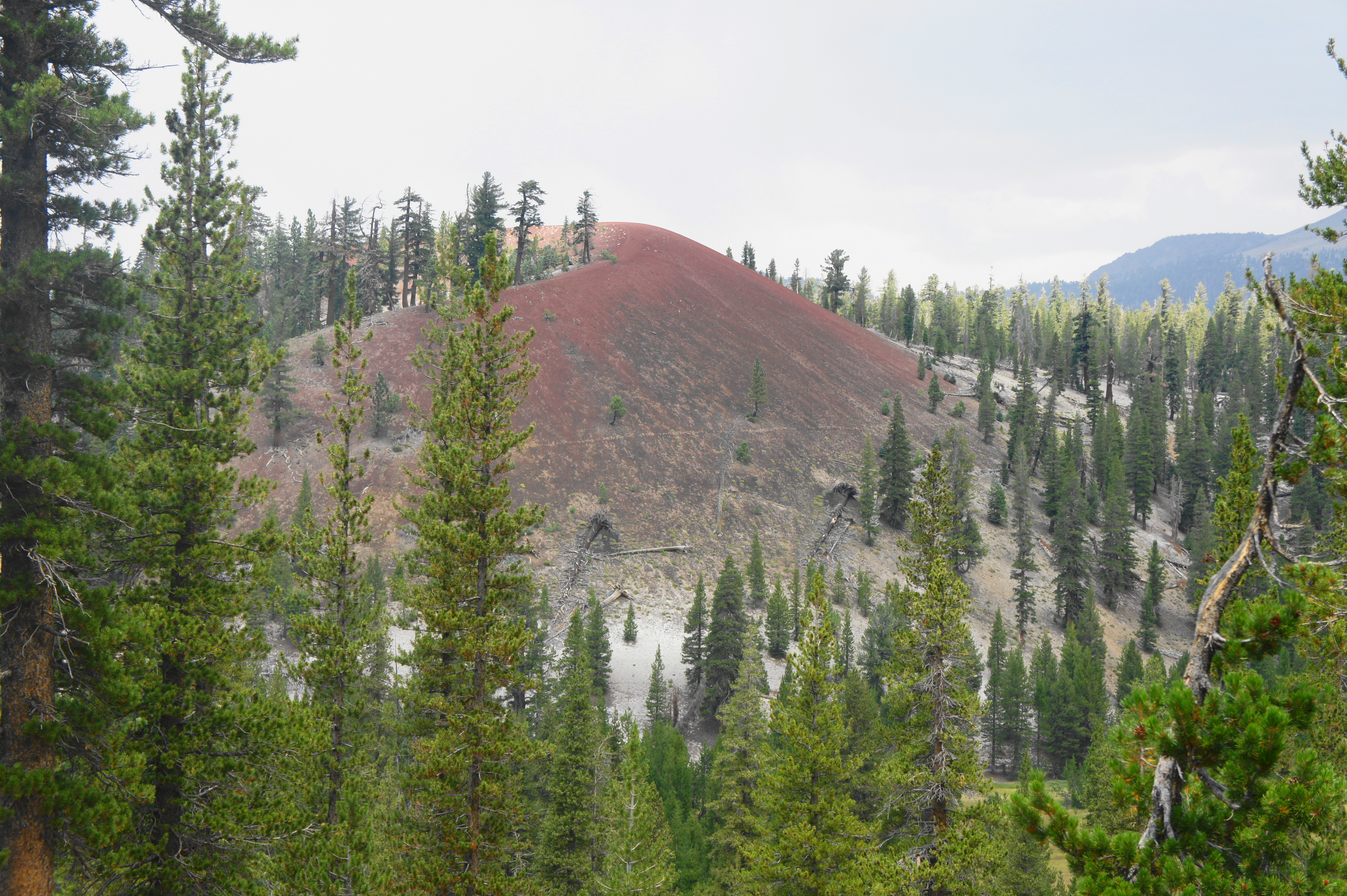
Cross the creek again, and then stay left at the junction with the Mammoth Pass Cutoff Trail. Cross Crater Creek a third time, then proceed up a short hill to the start of a downhill switchback section, with the first good views of the Red Cones, two scarlet-colored cinder cones that are a reminder of the area’s volcanic past. The JMT drops back to the banks of Crater Creek, crosses it, and then passes between the two cones, which stand like sentinels above a significant downhill slope that forms the eastern flank of a large valley. Here the JMT exits the John Muir Wilderness and enters the Ansel Adams Wilderness for the first time.
The steep slope beyond is donned with a dense thicket of pines and firs, with occasional openings revealing a stunning landscape beyond: the jagged peaks of the Ritter Range, which constitute the Sierra Crest in this section. After a long downhill heading north, the JMT cuts back south just before a flowing waterway.


Minutes later, the trail switches back north again, eventually entering a burn area caused by the Rainbow Fire in 1992. This marred landscape offers limited shelter from stormy weather, so hikers facing afternoon thunderstorms on the horizon should try to make quick work of this open section. The trail descends to cross Boundary Creek, which is often dry, then follows a charred upland in view of the Ritter Range. After crossing a final small stream, the JMT/PCT reaches a signed junction with a wider track heading east to Red’s Meadow Resort.
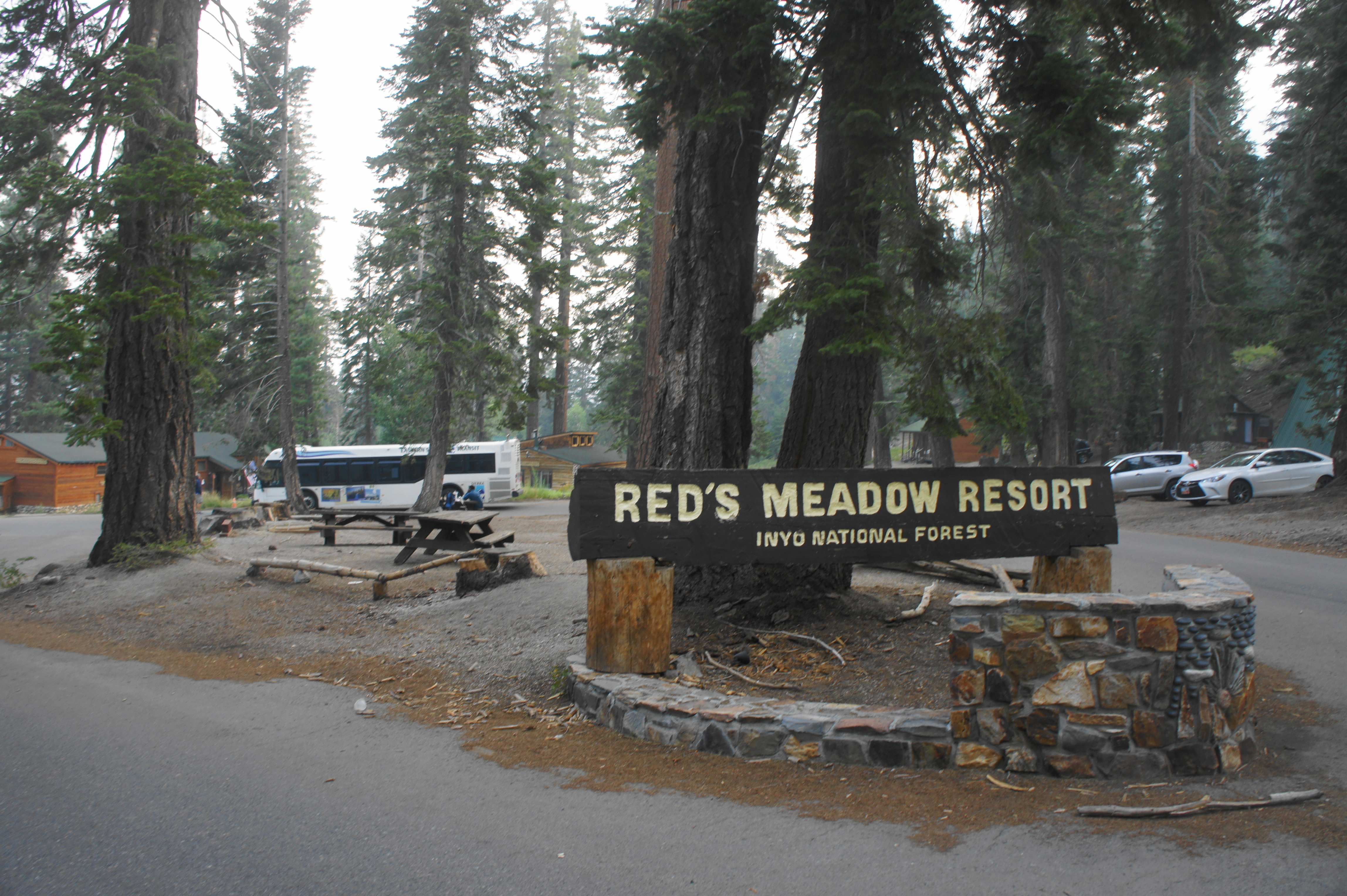
Hikers seeking rest and resupply should bear right at this fork, following the rutted path for a short distance to the official entrance to Red’s Meadow. Hot food, a general store, laundry, and showers await! There is also a generous hiker’s box of leftover resupply items at the resort, usually stored in the courtyard between the café and store. The Reds Meadow Campground, where most JMT hikers will reside for the night, is a quarter-mile walk from here. (Note: The backpackers’ campsite is #38, and the cost of the site—the first pay campground since Onion Valley—can be split among the various JMT hikers using it for the night.)
Trip Report: The 15.6-mile trek from Lake Virginia was the longest single-day slog of our entire hike, but we arrived in early afternoon, just beating out some threatening thunderstorms brewing over Mammoth Mountain. Red’s Meadow—with its hot showers, made-to-order meals, and nice collection of beer and ice cream—was a welcome sight after 18 days on the trail. We spent a whole rest day at Red’s Meadow the following day, during which we ventured briefly to nearby Devils Postpile National Monument and soaked in the hot springs above Reds Meadow Campground. There was some limited cell service at Red’s Meadow, which allowed me to call home to arrange our pick-up—five days later—in Yosemite.

Pingback: John Muir Trail Northbound Section 4 – Red’s Meadow to Happy Isles (Ansel Adams Wilderness & Yosemite National Park, CA) | Live and Let Hike
Pingback: Top 10 Hikes in 2021 | Live and Let Hike
Pingback: Mott Lake Trail (John Muir Wilderness, CA) | Live and Let Hike
Pingback: John Muir Trail Northbound Section 1 – Horseshoe Meadow to Onion Valley (Sequoia & Kings Canyon National Parks, CA) | Live and Let Hike
Pingback: John Muir Trail Northbound Section 2 – Onion Valley to Muir Trail Ranch (Kings Canyon National Park, CA) | Live and Let Hike
Pingback: John Muir Trail Preparation & Logistics | Live and Let Hike
Pingback: Five Lakes Trail (Granite Chief Wilderness, CA) | Live and Let Hike