
Note: This is the third in a series of five posts describing the John Muir Trail (JMT), a scintillating, multi-week hike through California’s Sierra Nevada that extends more than 200 miles from Yosemite National Park in the north to Mount Whitney and Sequoia National Park in the south. This post (and those that follow) assumes a northbound journey, beginning southeast of Mount Whitney at Horseshoe Meadow in Inyo National Forest, culminating at Happy Isles in Yosemite. The JMT is an arduous, multi-week backpacking trip that requires careful planning, preparation, and an official backcountry permit that can be quite difficult to obtain. Hikers typically complete the entire trail, including detours for food resupplies, in about 2-3 weeks. For more information on planning and preparing for the JMT, see my previous post titled “John Muir Trail Preparation & Logistics.” For summaries of the other three sections, see Section I (Horseshoe Meadow to Onion Valley), Section II (Onion Valley to Muir Trail Ranch), Section III (Muir Trail Ranch to Red’s Meadow), and Section IV (Red’s Meadow to Happy Isles).
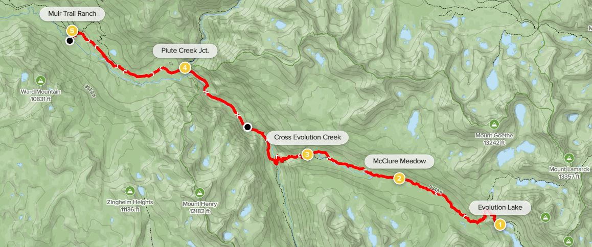
The second of four sections along the northbound John Muir Trail, this 80-mile stretch is arguably the hardest—and definitely the most remote—portion of the hike and is likely to take most hikers between 6-8 days to complete. (Note: We did it in seven, covering roughly 11 miles per day on average.) The stretch through Kings Canyon National Park is the land of many mountain passes, with travelers having to tackle one 12,000+ foot pass nearly every day. It is also a spectacular wonderland of lost alpine lakes, jagged pinnacles, and broad pine-studded valleys. A difficult stretch of 4-5 days brings one over Kearsarge, Glen, Pinchot, and Mather Passes, followed by a descent down the “Golden Staircase” to Le Conte Canyon. After climbing up and over Muir Pass, the JMT traverses nearly tree-less terrain to Evolution Lake, arguably the highlight of the entire trip, then follows lengthy Evolution Valley to the San Joaquin River and Muir Trail Ranch, where many hikers will get their next resupply. (Note: For more on resupply, see my post here.)

Onion Valley to Charlotte Lake via Kearsarge Pass (7.7 miles)
Assuming hikers exited the JMT for rest and resupply after Section I, onward travelers must retrace their steps from the previous leg for at least four miles, from Onion Valley to Kearsarge Pass. Having to carry a full bear canister with a week’s worth of food, the relentless ascent of more than 2,500 feet can be a rude awakening. Moreover, Onion Valley is also quite hot, so getting an early start is a must.

Start from the Onion Valley Trailhead, north of the Onion Valley Campground and at the end of the parking area, which tends to mostly full of day hikers. Beginning in scrubby lowlands, the bristly pines eventually become more ubiquitous, offering shade on a sunny day. First bending south, the Kearsarge Pass Trail cuts north and reaches an unmarked trail junction; stay left, then left again at the next (marked) fork, rising into the John Muir Wilderness.

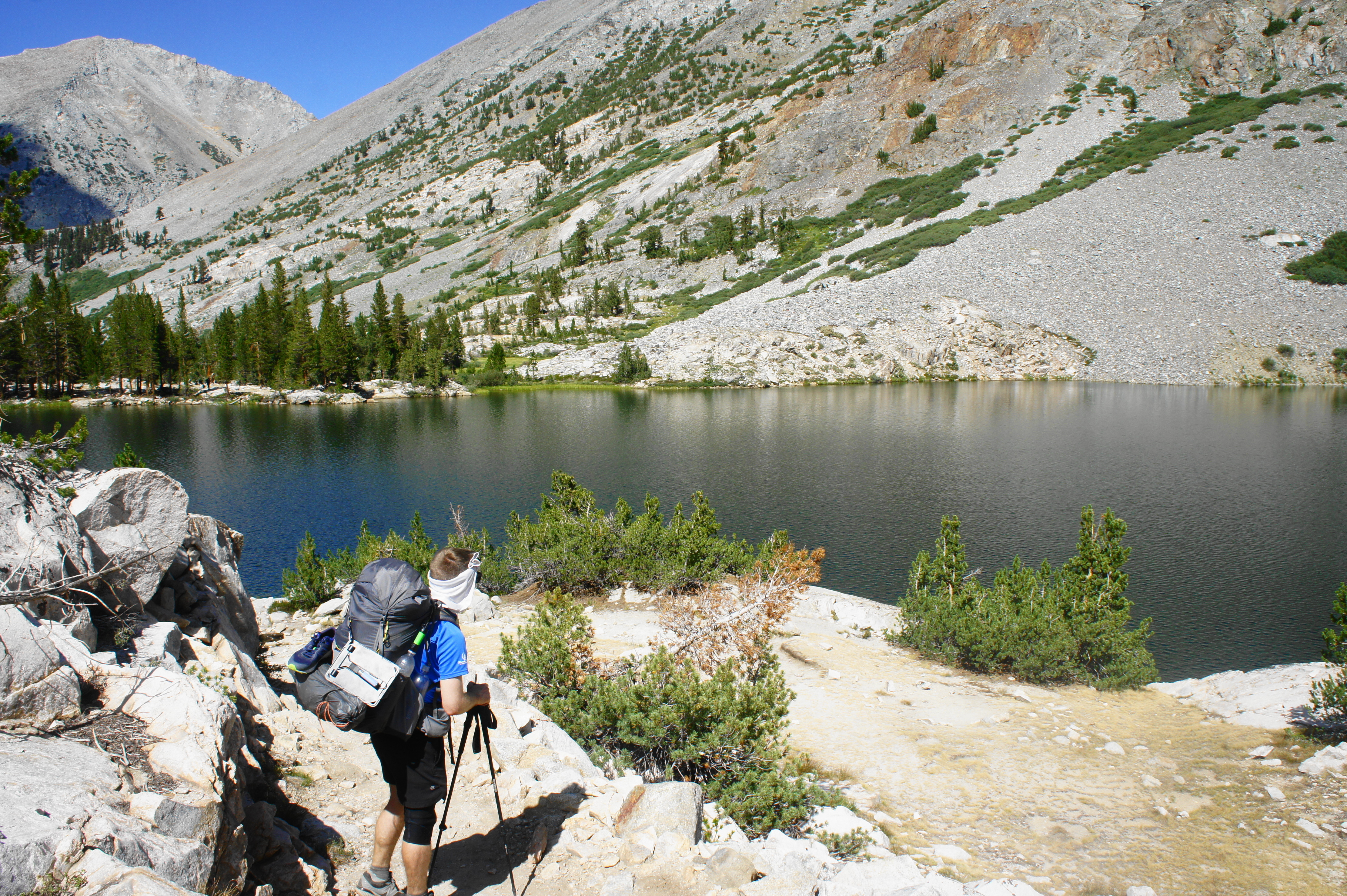
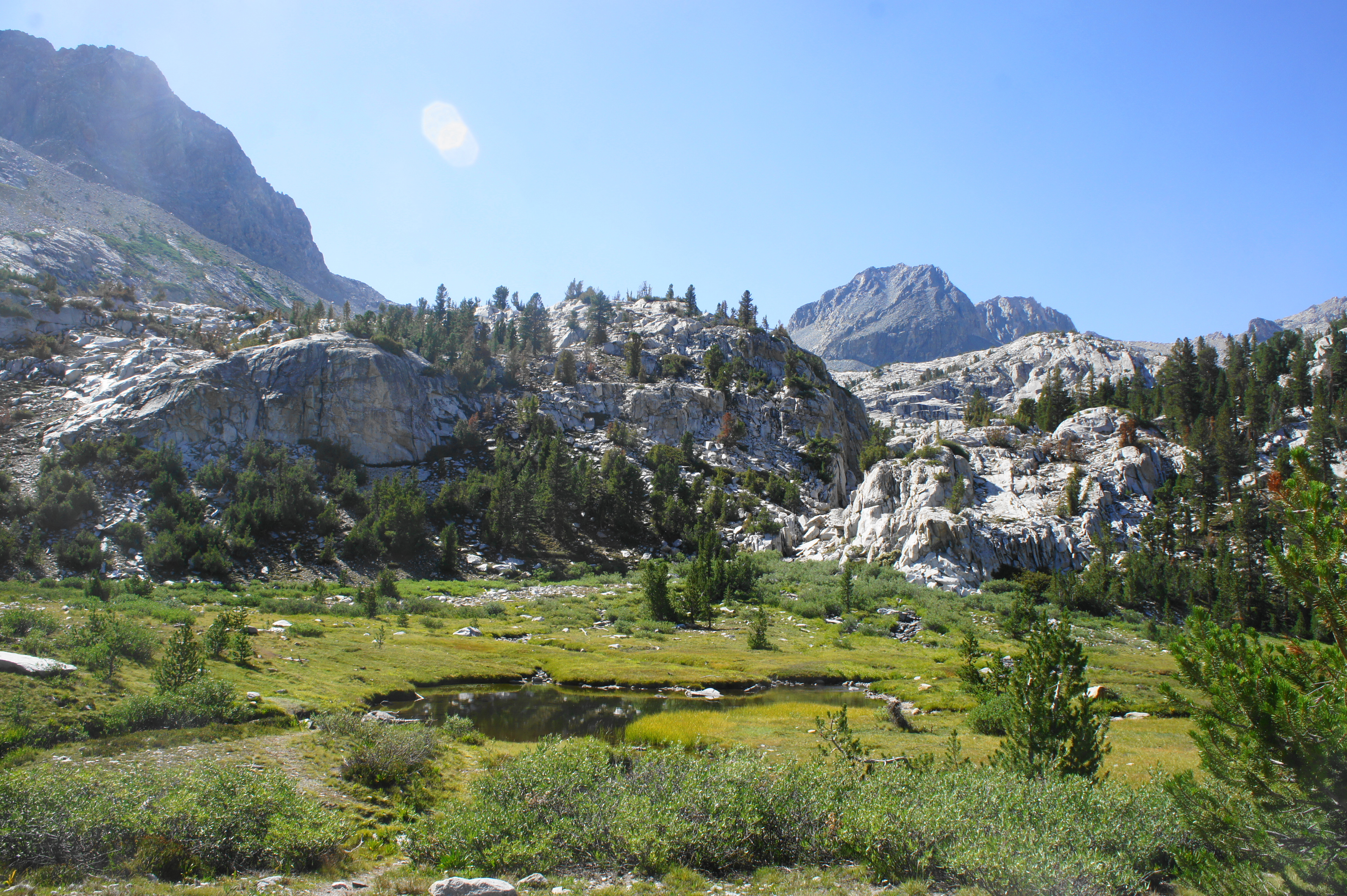
After about a mile and a half, hikers pass a bluff overlooking Little Pothole Lake, which is fed by cascades coursing down a pine-studded hillside. Keeping the main drainage of Independence Creek to the south, the trail switchbacks up to a tree-less rock slide and levels off as it approaches Gilbert Lake, set in a majestic basin bounded by the high peaks of the Sierra Crest.
After skirting the right flank of the lake, the trail ascends briefly to an unmarked junction where spur trails lead to Flower Lake, an artichoke-green body of water with a number of campsites. By now hikers have travelled more than two miles and gained around 1,300 feet.

The next section cuts in and out of tree cover, switchbacking to a point overlooking Onion Valley and Heart Lake, the latter a difficult-to-reach destination situated at the base of high cliffs. The dominant summit to the south is University Peak (13,632’), a mainstay of the final two days of Section I.

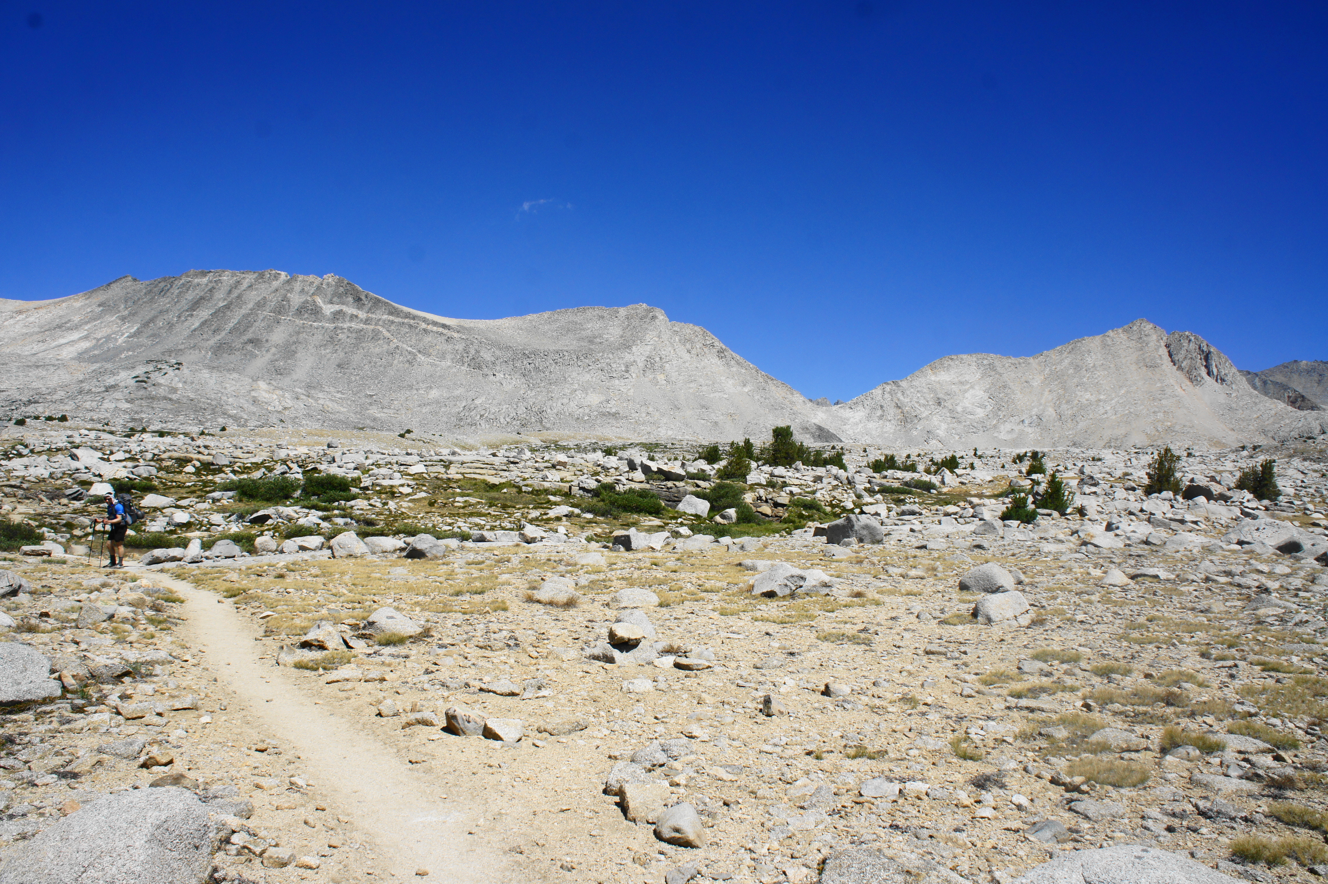
Once hikers have tackled the switchbacks above Heart Lake, the ascent to Kearsarge Pass reaches its final stage, an often sun-exposed trek through low shrubs and eventually alpine terrain. The trail follows a barren hillside on the right, rising to a shelf and then a pair of long switchbacks. Looking down to the left, one can see Big Pothole Lake, the last lake this side of the Sierra Crest.
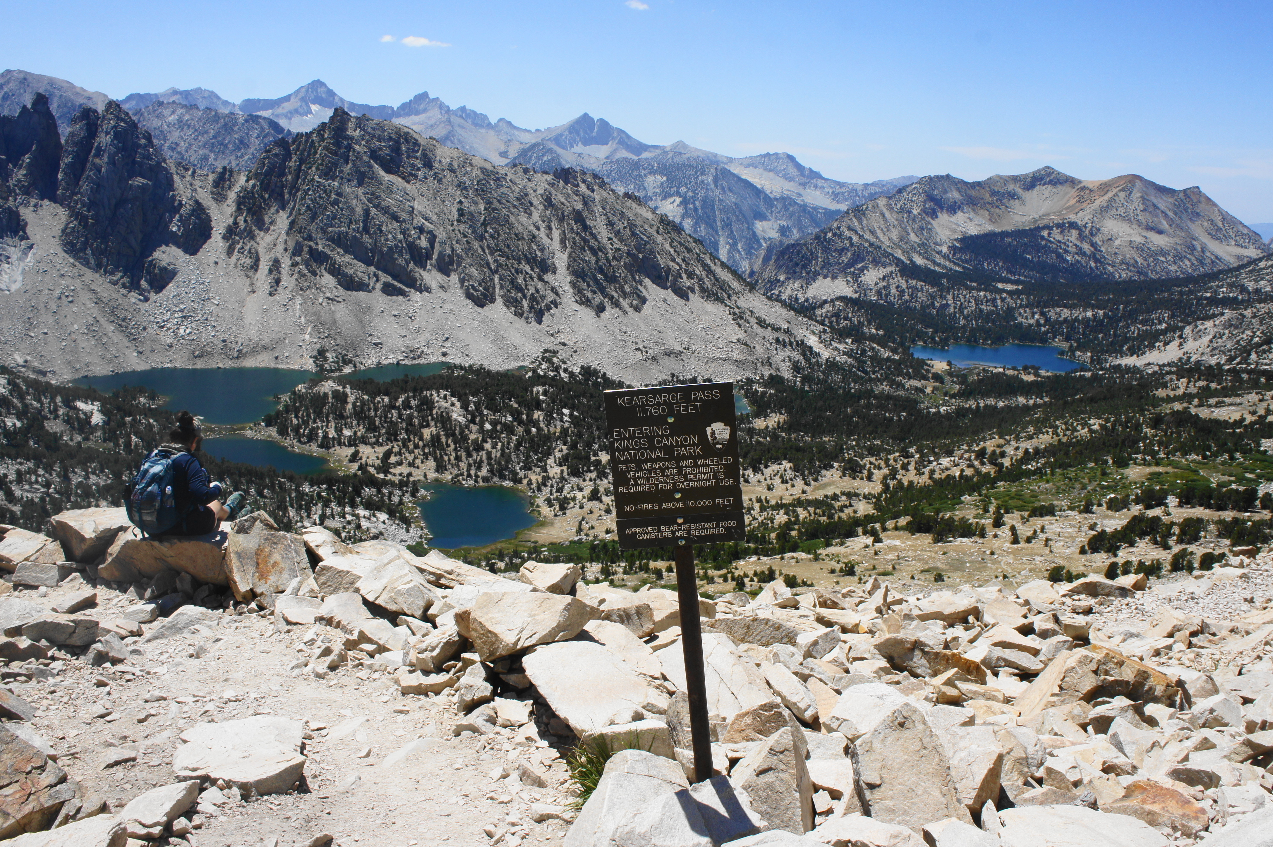
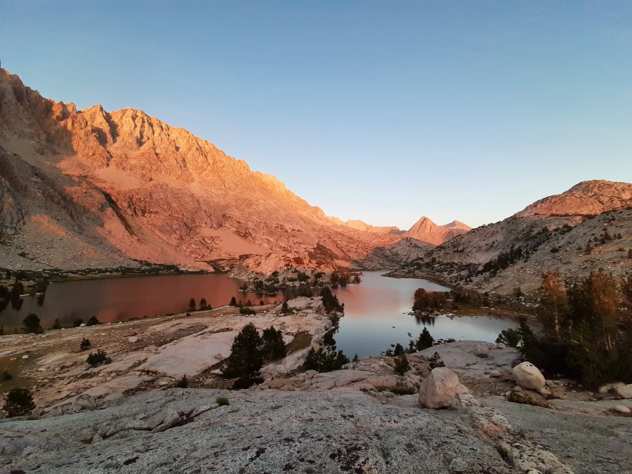
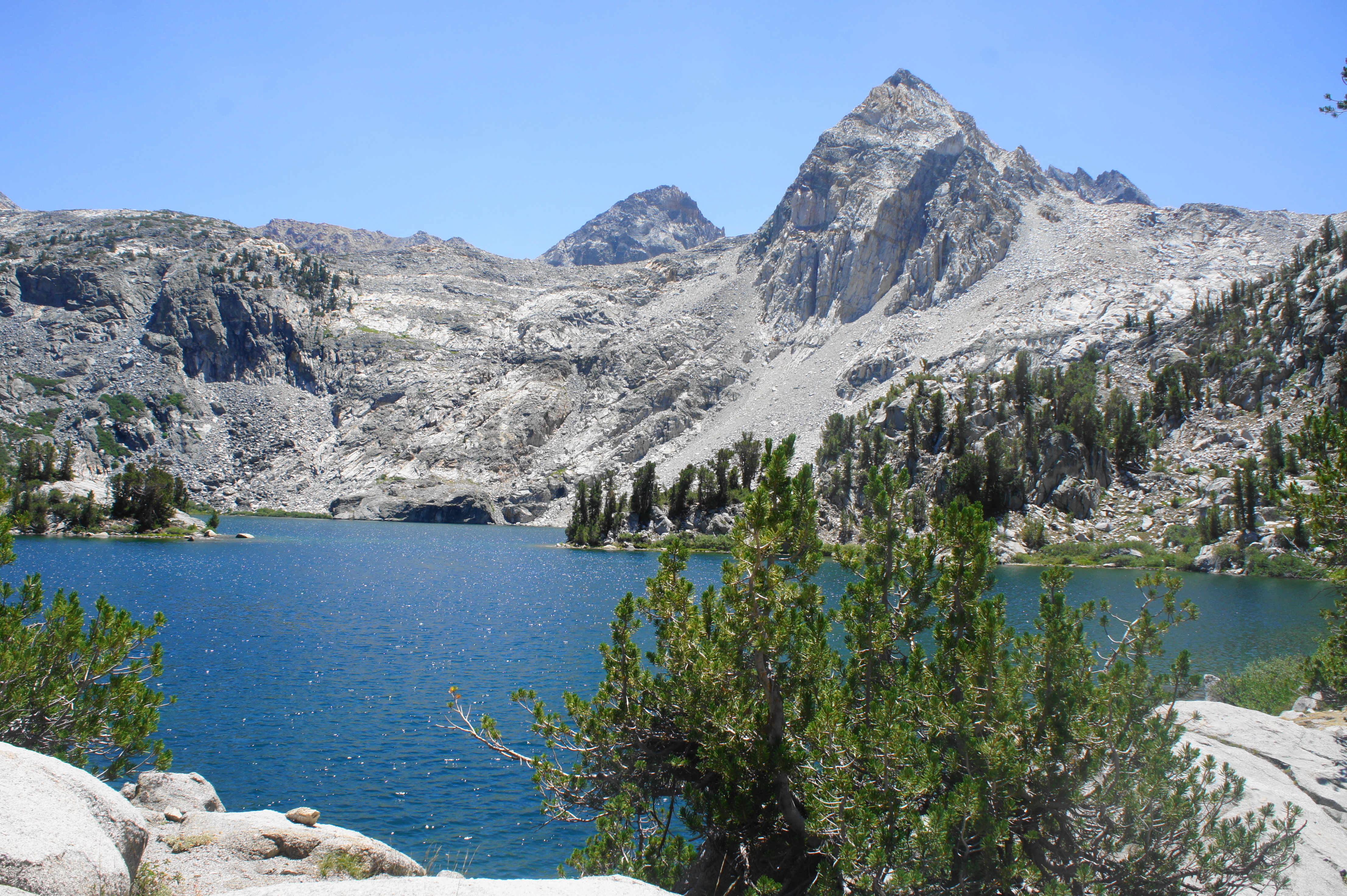
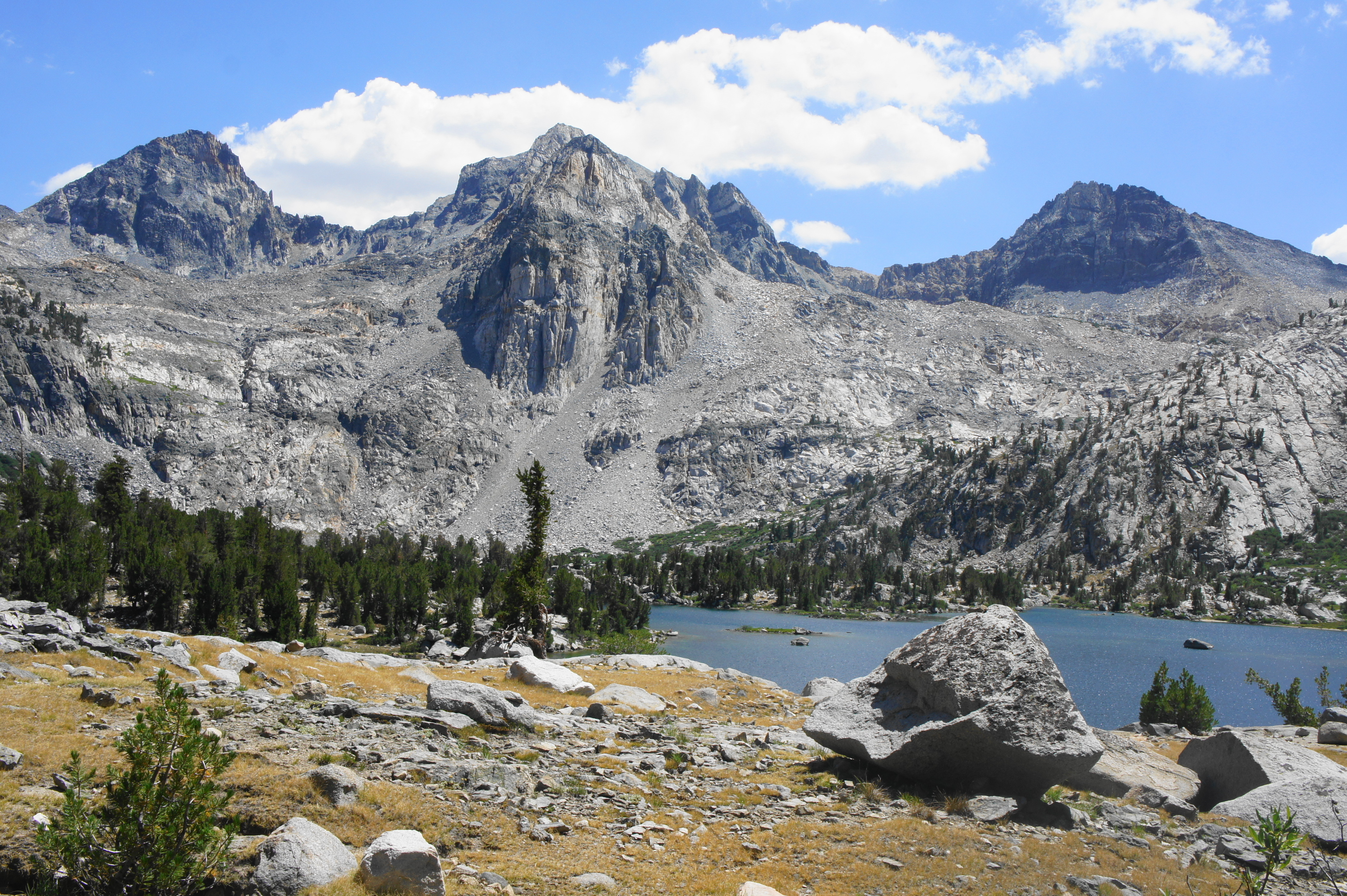
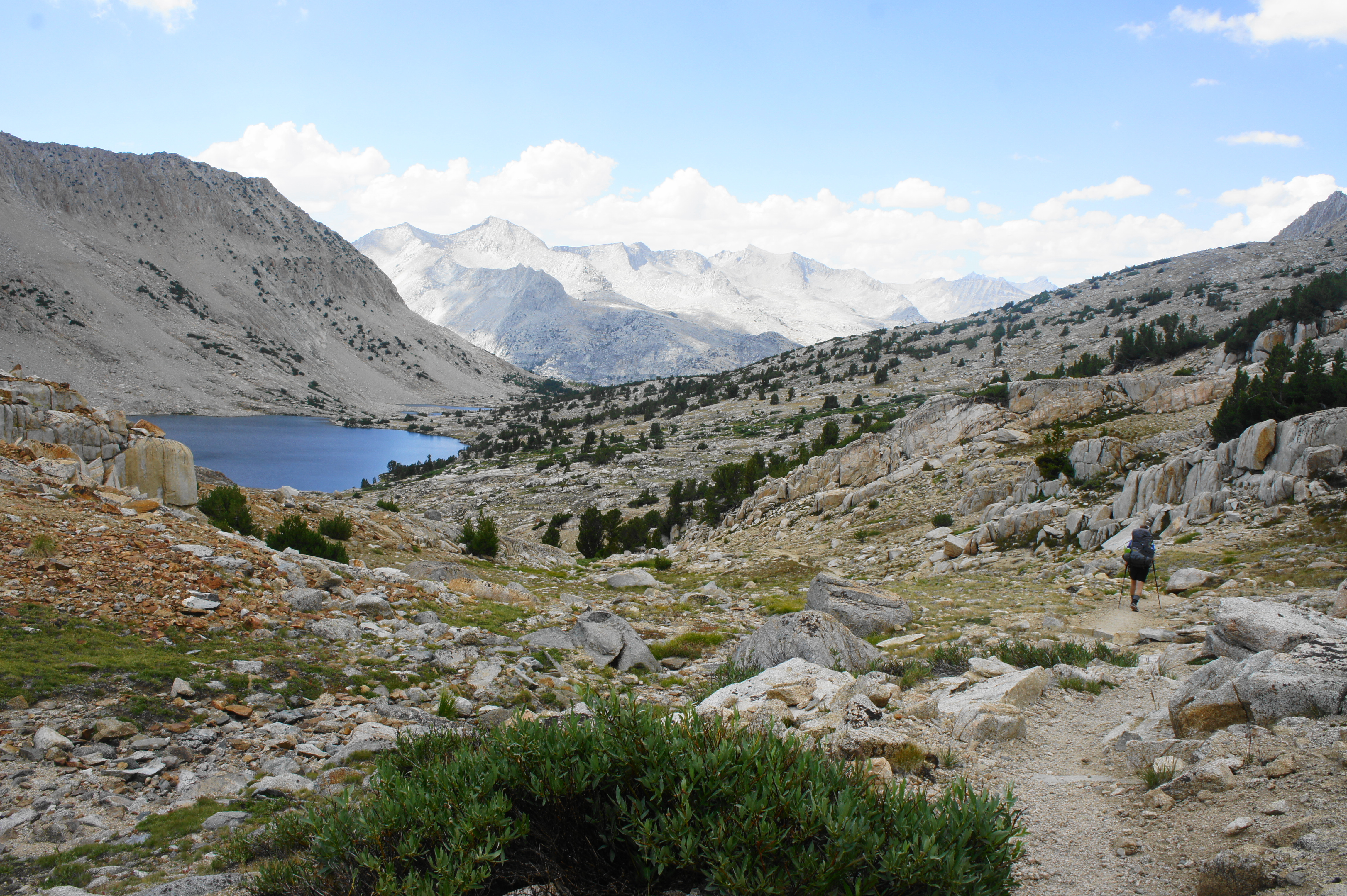
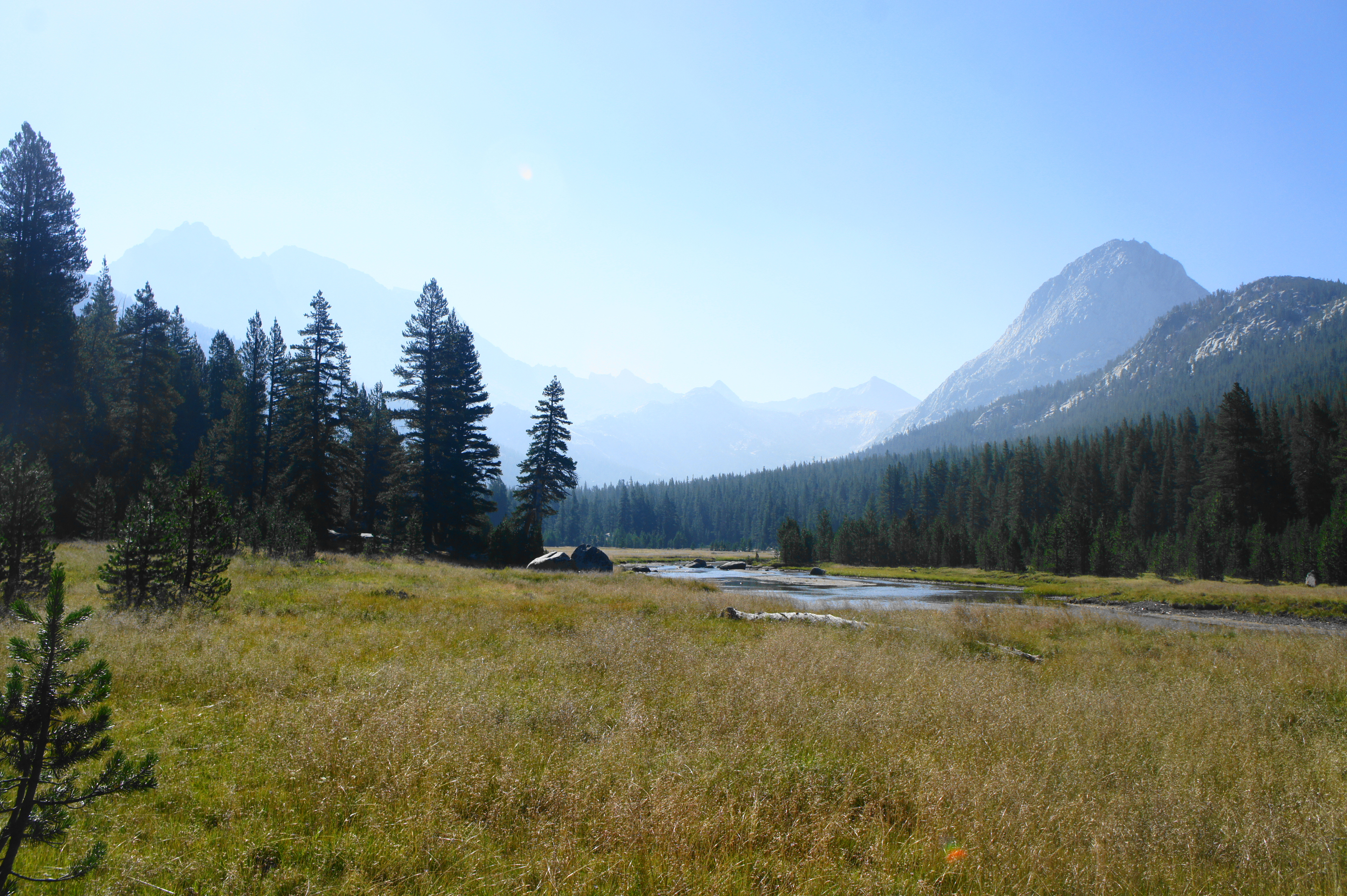
At last, around 4.2 miles from the trailhead, hikers crest Kearsarge Pass (11,760’), with views of the stunning landscape of Kings Canyon National Park beyond. In the basin below lie the shining blue waters of Kearsarge Lakes and Bullfrog Lake, with Kearsarge Pinnacles (12,035’) and Mount Bago (11,871’) beyond. (Note: The valley below Mount Bago conceals Charlotte Lake, a popular camping destination for the night.) The massive range to the south is the Kings-Kern Divide, which separates Sequoia and Kings Canyon National Parks.

From Kearsarge Pass, northbound JMT hikers will want to begin thinking about how far they want to go for the day and where to camp for the night. After descending the far side of the pass, hikers will soon come to a junction, with the Kearsarge Pass Trail continuing north while the Bullfrog Lake Trail heads south. Both intersect with the John Muir Trail further west, but taking the northern route makes more sense for a more direct connection. The downside, however, is that camping opportunities and accessible water are sparser along the northern route. (Note: For this reason, I recommend pushing on partway up Glen Pass to the north or diverting to lovely Charlotte Lake to camp. See map above.)
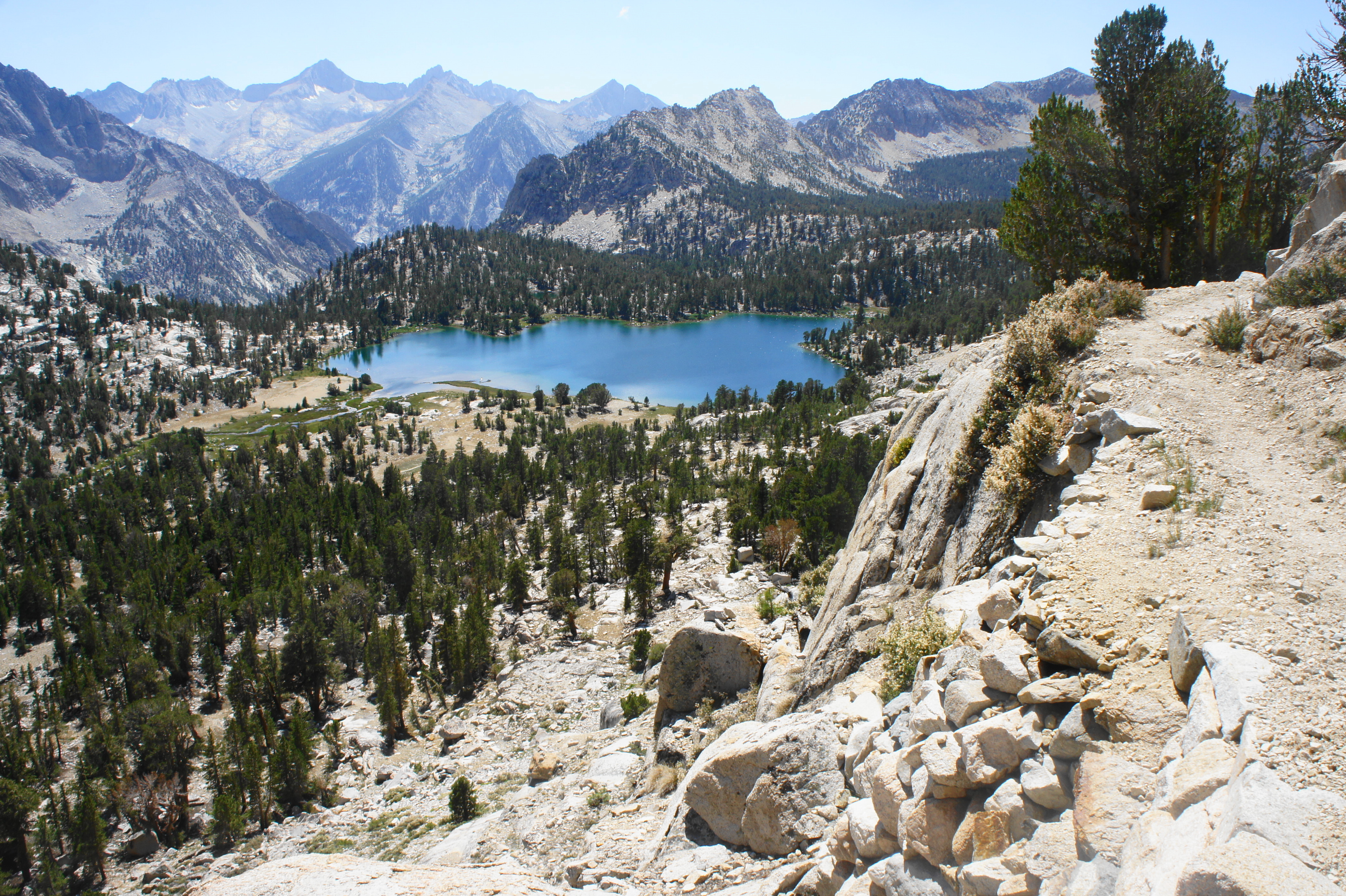
Continuing along the Kearsarge Pass Trail, the northern route skirts a series of high ledges that are not for the faint of heart (though not as crazy as these along the High Sierra Trail in Sequoia). After crossing a small but relatively reliable stream, hikers will encounter a few isolated campsites with great views but relatively distant access to water. After enjoying spectacular views of Bullfrog Lake from above, the trail dips to denser woods and climbs in and out of drier drainages. At nearly seven miles on the day, hikers will reach a signed trail junction. Those with enough energy to conquer part of Glen Pass or beyond can continue right, while those heading to camp at Charlotte Lake should bear left. Taking the latter path, the Kearsarge-Charlotte Lake Connector Trail is very short (roughly 2/10 mile) and ends at a four-way junction in a dusty gap between Kearsarge Basin and the Charlotte Creek drainage.


From the open saddle, known as Sandy Junction, continue straight on the Charlotte Lake Trail, which quickly drops back into the conifers and sheds 300 feet in elevation. The 6/10-mile detour to the edge of Charlotte Lake is a worthy diversion, especially given the excellent access to water (even swimming!) and a myriad of campsites. From the edge of the quiet bluish waters, stay on the trail for another ¼ mile or so to reach an area with a bear locker (nice if you packed too much food) and camping aplenty. Charlotte Lake is a great place to watch the sunset over the vast, deep waters, in the shadow of Mount Bago to the south.

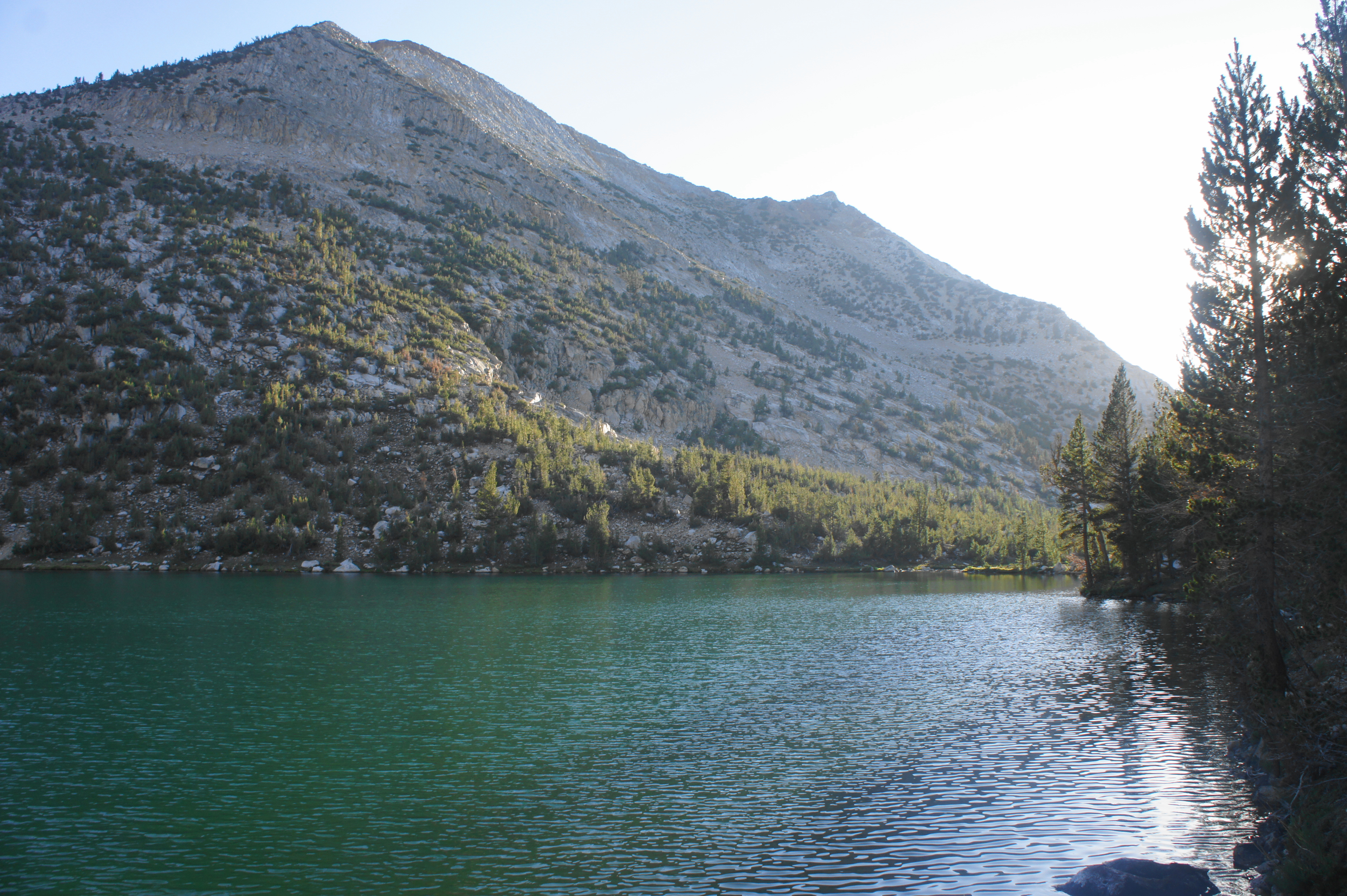
Trip Report: Having resupplied and spent the night at Onion Valley Campground on Day 6, we opted the next day to begin Leg II a day earlier than planned. Given the sharp ascent to Kearsarge Pass and newly-heavy packs, we covered a relatively modest 7.7 miles and camped at Charlotte Lake. We used the bear locker to store a few extra items that would not quite fit in our bear canisters. Our campsite, situated atop a rocky face overlooking the lake, was our best yet, and with nice, sunny weather finally upon us, we were in high spirits as we embarked on Leg II of our journey.
Charlotte Lake to Woods Creek Junction via Glen Pass (12.0 miles)
From the campsites at Charlotte Lake, retrace your steps along the lakeshore, then climb 300 feet in a little over a half-mile to return to Sandy Junction. Turn left on the John Muir Trail (JMT)—the only trail you will have to worry about following for the next 60+ miles. The subsequent stretch between here and Rae Lakes is exceptionally scenic but requires mounting Glen Pass (11,970’), one of the most challenging ascents on the northbound JMT.

The climb begins in a sparse lodgepole forest but soon turns to foxtail pines as the trail steadily ascends a west-facing slope, with excellent views emerging of Charlotte Lake, Mount Bago, and the Charlotte Creek drainage. Soon enough, a smooth-faced granite knob appears in the distance—this is Charlotte Dome (10,673’), a reasonably popular climbing destination.


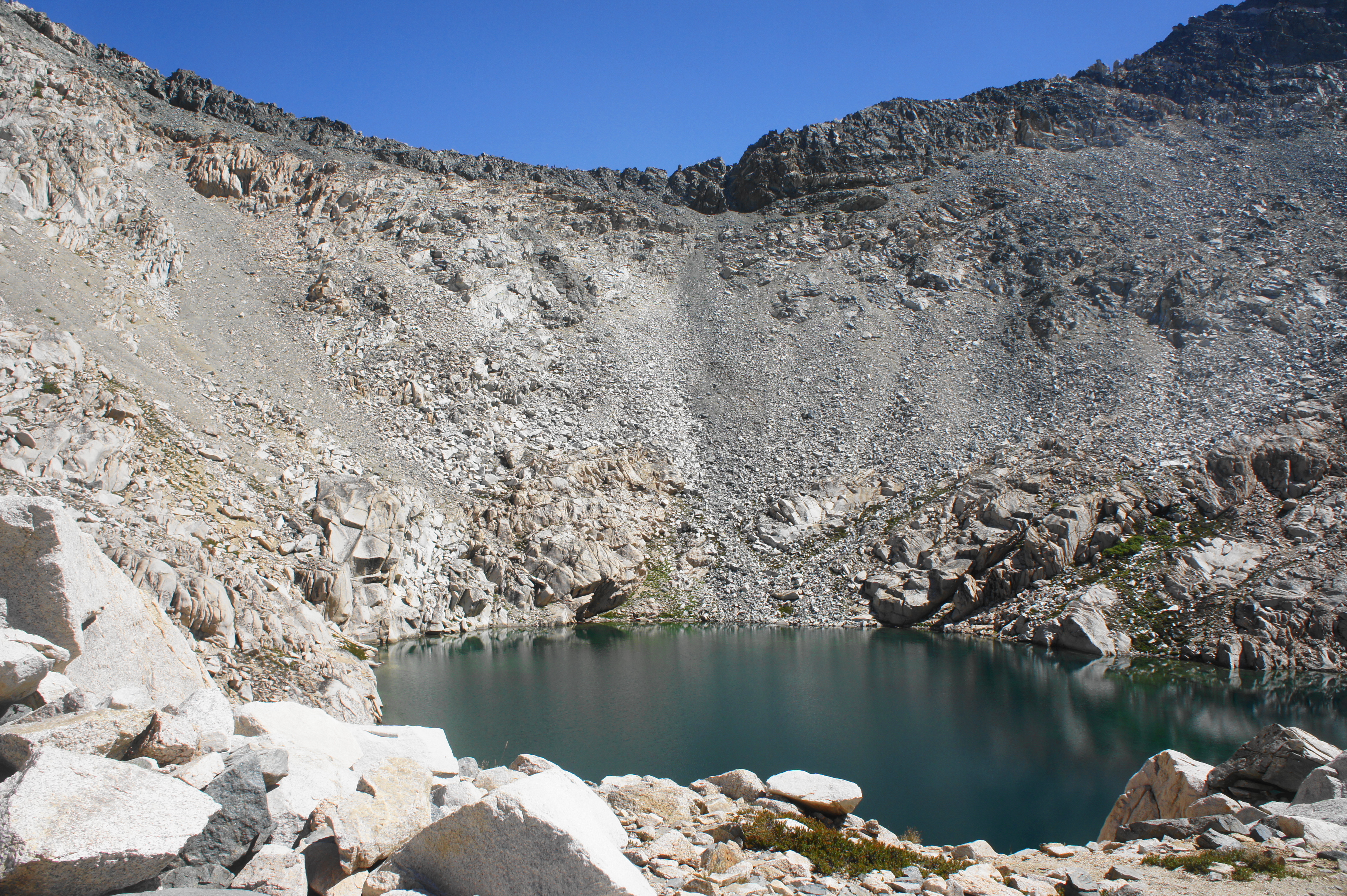
Drawing closer to the edge of treeline, the JMT ascends a challenging rocky traverse with deep steps, then briefly draws downhill before rising again and rounding a corner that offers the first views east toward Glen Pass. Hikers soon reach a small tarn at the base of a granite slope on the right; this water, while stagnant, is fresh and a good place to fill up.

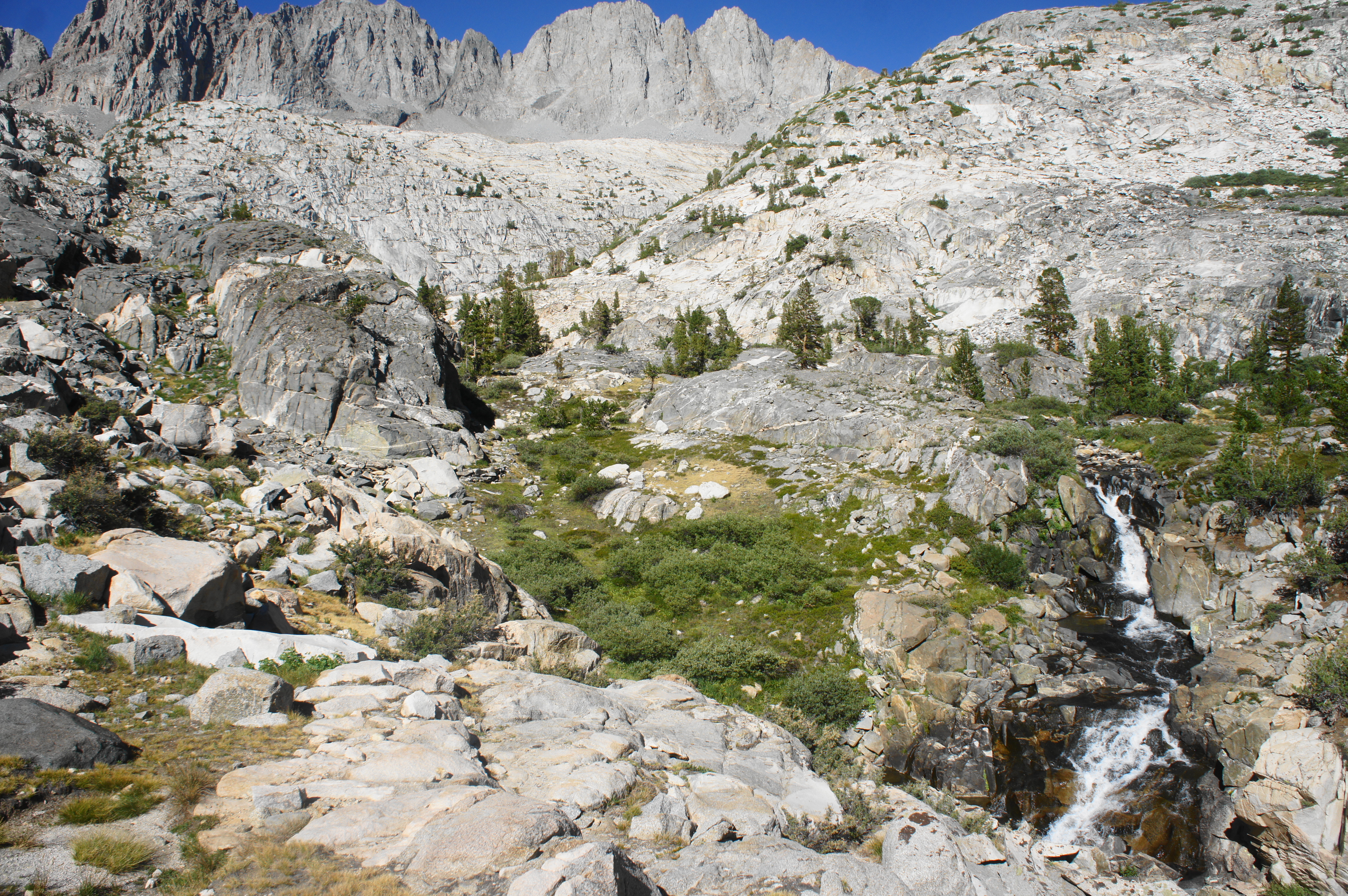
In around 300 yards, the pines dissipate, giving way to an amphitheater of rubble. The cirque appears to bottom out in what looks like a large crater down to the right that is sometimes filled by a pothole lake. (Note: Elizabeth Wenk’s book on the JMT describes this as “quite possibly the only lake along the JMT that lacks any acceptable campsite” (p. 179)).
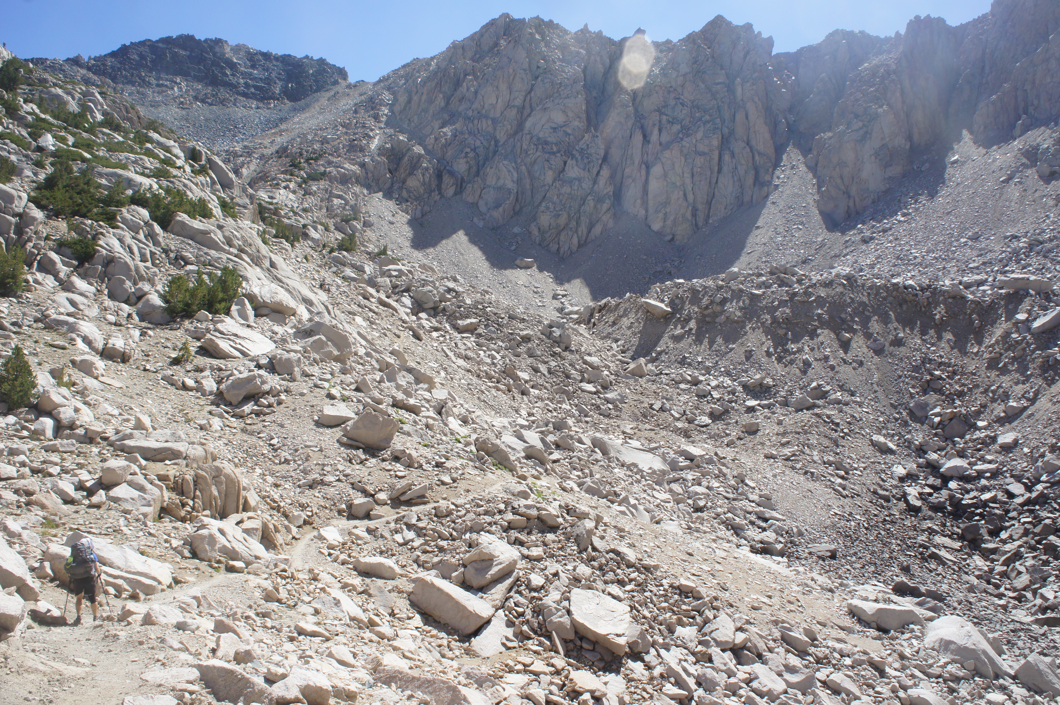
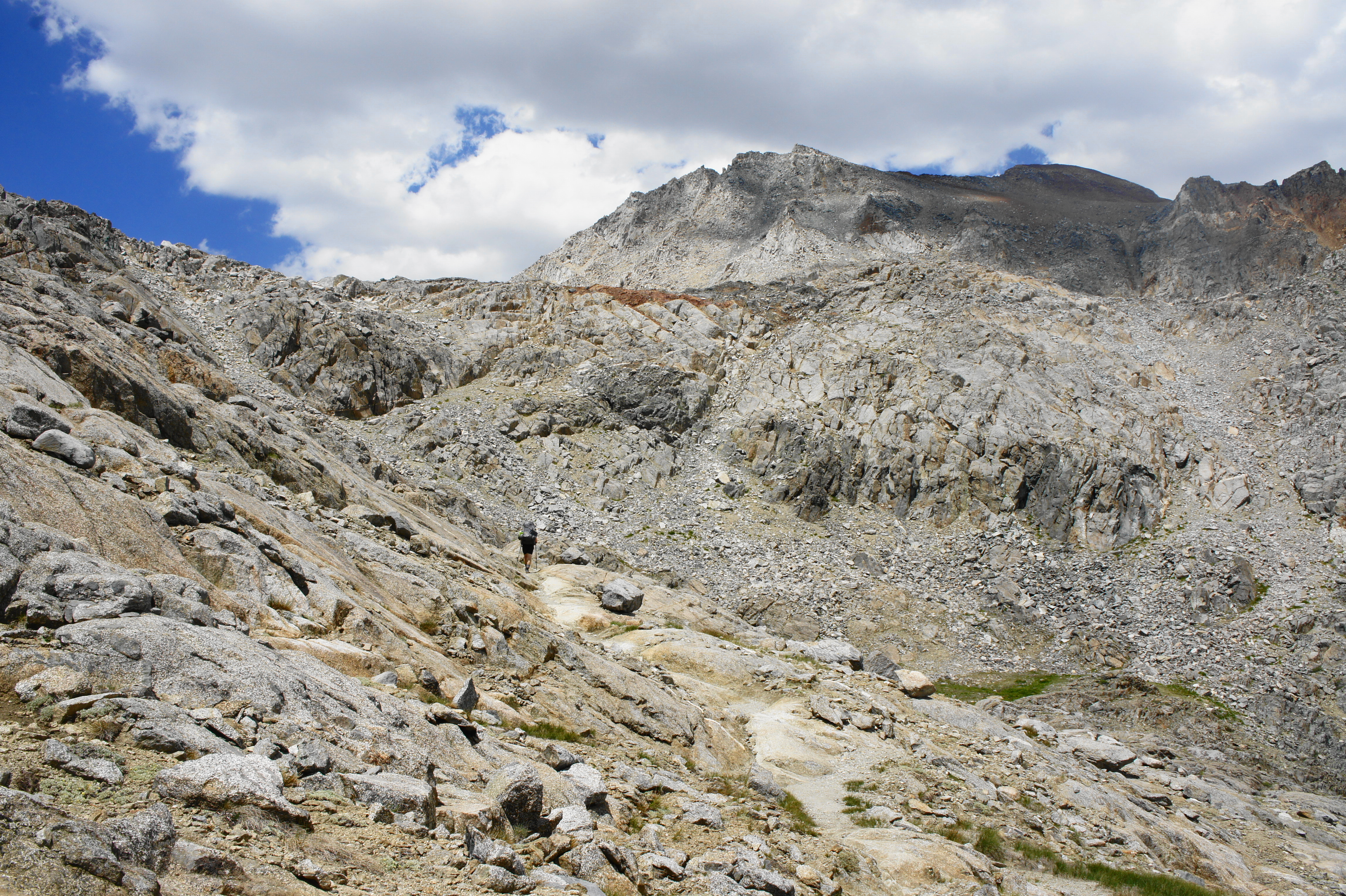
From here to the pass, the ascent is simply a brutal slog, one of the meanest yet experienced on the northbound JMT. After cresting a lip with a brief flat, the trail skirts a second, larger lake and then mounts a series of switchbacks through the talus to the exposed rim of Glen Pass (11,970’).
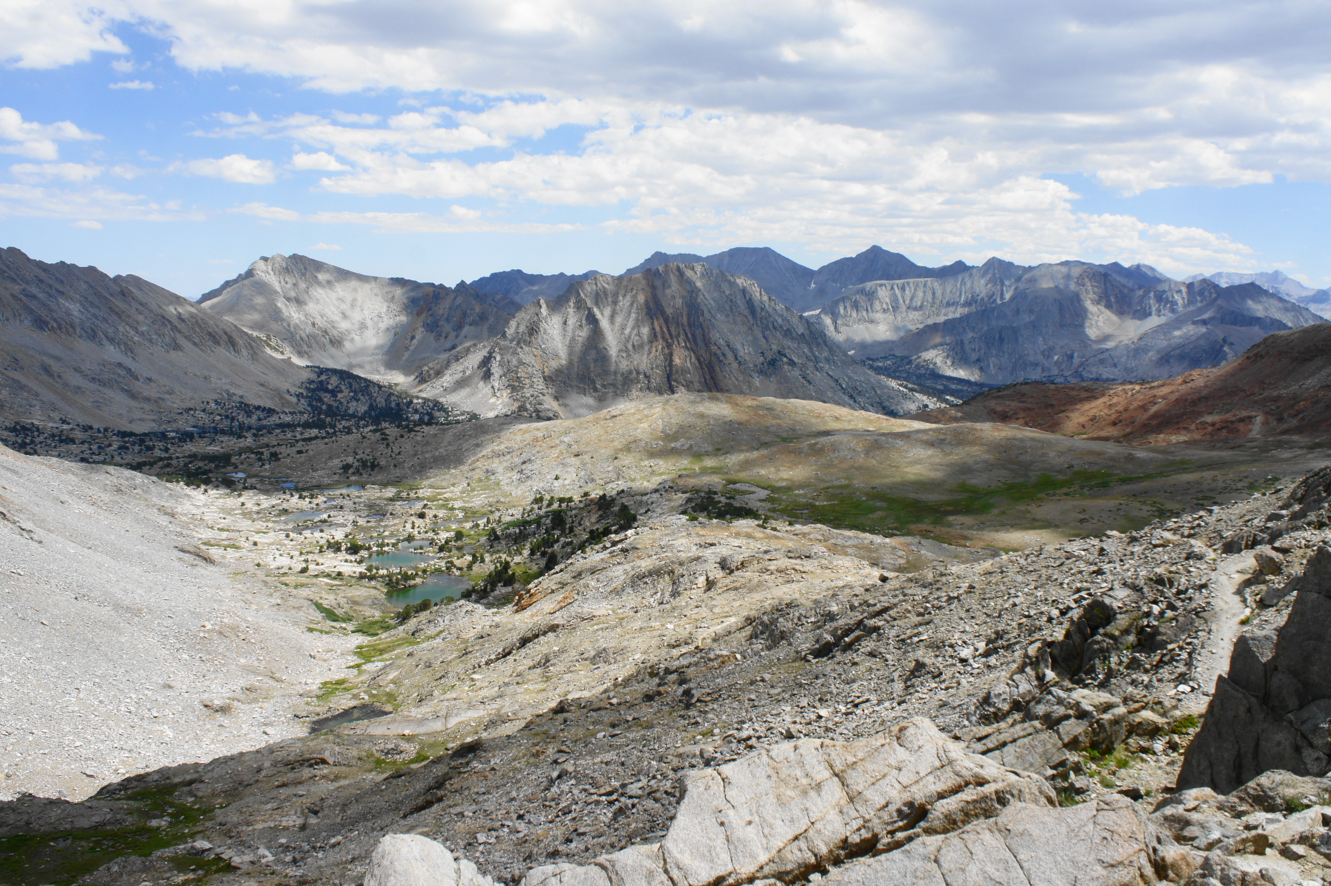
While the views south from the pass are limited due to the high walls of the bowl-shaped cirque, the northward vistas are much broader, spanning a chalky basin with dozens of unnamed lakes, followed in the background by majestic Rae Lakes and several high peaks of the Sierra Crest (from right to left): Dragon Peak (12,995’), Black Mountain (13,291’), Diamond Peak (13,126’), Acrodectes Peak (13,179’), and Colosseum Mountain (12,473’), with more beyond. Much of the terrain that will be covered in the next two days is within view, extending all the way to Pinchot Pass (12,130’), more than 16 miles away by foot, and even North Palisade (14,242’), a distant fourteener and highest point in Kings Canyon National Park.


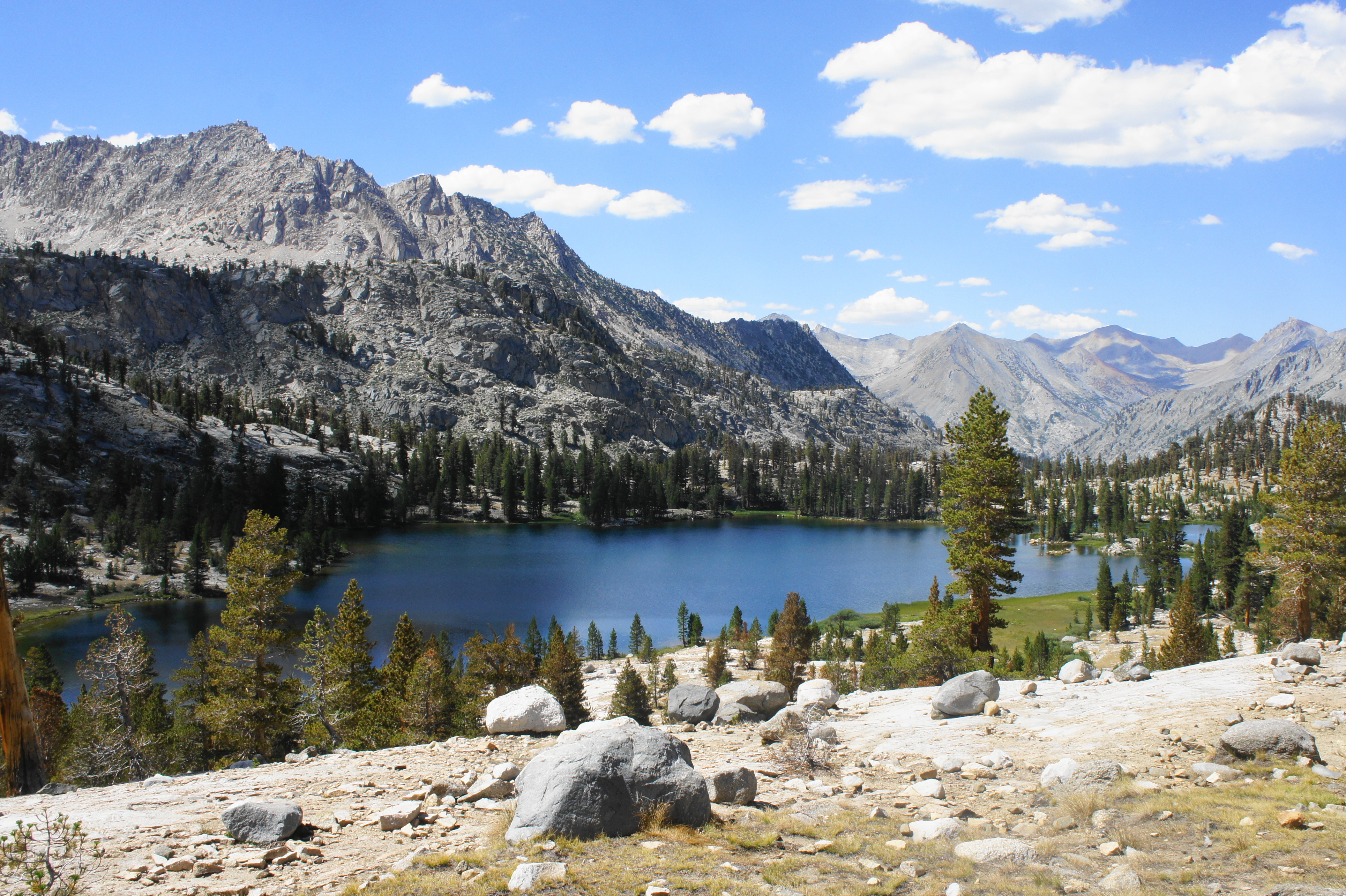
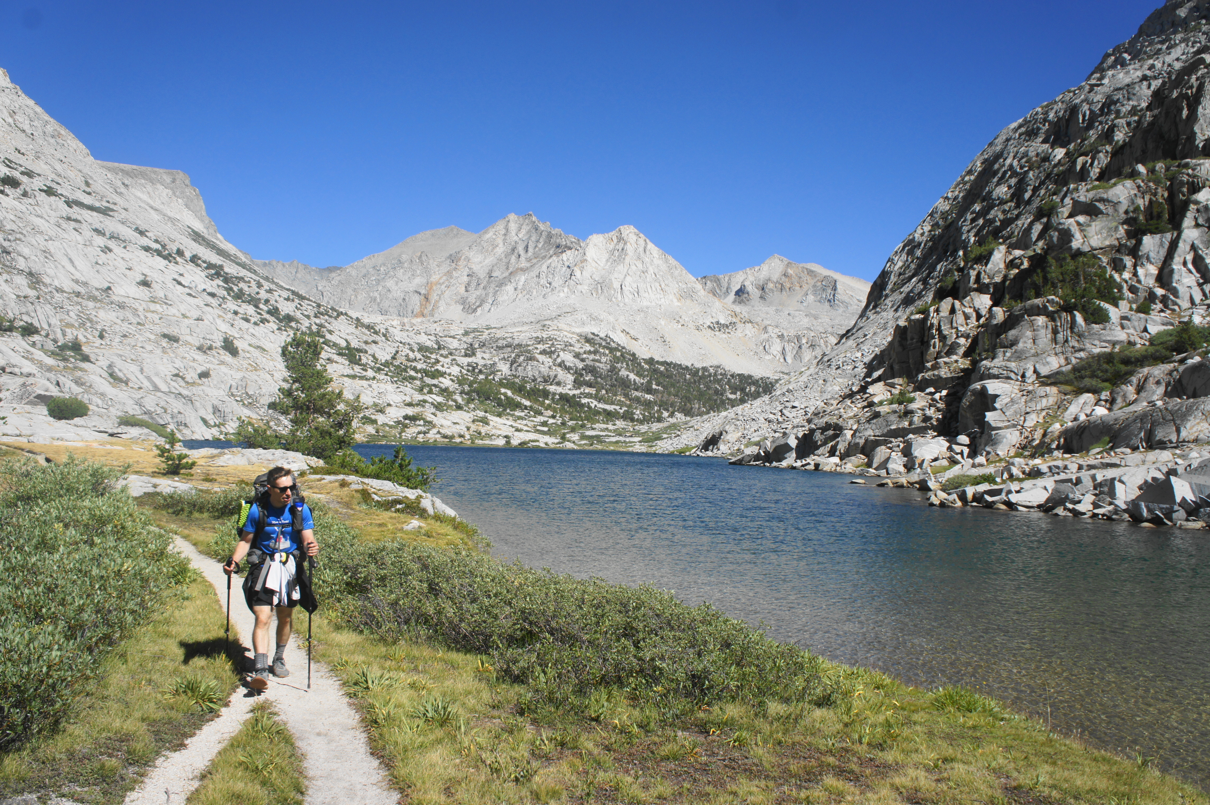
It is hard to believe that there is verdant life down in the valley given the views of the barren landscape from Glen Pass, but the descent down into the Woods Creek watershed eventually brings hikers back to the lush forest. After an initial descent down sharp, crumbly switchbacks, the trail briefly ascends a slickrock knob and follows a narrow notch before reaching a partly vegetated area at the base of another set of switches. After following—and crossing—a small stream, the trail drops into a larger drainage marking another steady descent toward the three beautiful Rae Lakes—one of the iconic sights of the JMT.

After skirting some high ledges above Upper Rae Lake, the JMT finally reaches a junction at the lake level, around two miles from—and 1,400 feet below—Glen Pass. Here a spur path leads left toward the Sixty Lakes Basin; stay right, threading a narrow strip of land between Upper and Middle Rae Lakes. Looking off to the south, the prominent pinnacle across Upper Rae Lake is called the Painted Lady (12,126’), a superbly scenic and photogenic peak composed partly of pinkish mafic plutonic dikes.


The crystal blue waters continue to tempt hikers as the JMT leads to a creek crossing and then continues to follow the shores of the upper lake eastward and north. A little less than a half-mile from the junction, the trail leaves Upper Rae Lake behind but keeps Middle Rae Lake in view to the west, even as the JMT rises to a shelf pockmarked with stands of whitebark pines. A signed spur leads left to a camping area with a bear locker. The imposing Fin Dome (11,693’) comes into view partway down the valley, and the JMT passes the Rae Lakes Ranger Station on the right, nearly three miles from Glen Pass.
Staying high and mostly away from the lakeshore, the JMT gradually descends and clears Lower Rae Lake off to the left, arriving eventually at a shelf overlooking the next body of water—Arrowhead Lake—in the valley below. This impressive lake nonetheless appears modest compared to the majestic Rae Lakes to the south. There is some decent camping as the trail comes to the north side of the lake, with a sedgy marsh beyond.

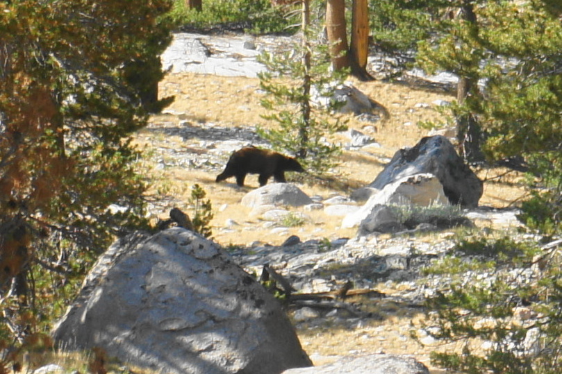
After crossing a marshy basin with multiple stream crossings, the JMT briefly rises again and continues to a spot overlooking Dollar Lake before descending again to the lakeshore. (Note: As of 2021, there was no camping allowed at Dollar Lake.) As the trail enters thicker woodlands, hikers pass a signed junction with the Baxter Pass Trail—this little-used, unmaintained track leads up to Baxter Lakes and the Sierra Crest before descending sharply into Owens Valley. Stay left at the junction, continuing on the northbound JMT.
After Dollar Lake, the onward trail drops down a sun-exposed section with the cascading waters of the South Fork of Woods Creek off to the right. The imposing peaks to the east briefly conceal the Baxter Creek drainage and passage up to Baxter Pass before eventually the terrain opens up again, with the creek visible coming down from the Sierra Crest.

The mixed scrub eventually turns to denser woods as the JMT drops to clear a tributary stream fed by the Sixty Lakes Basin. Upon crossing, hikers must pass through a sad wire gate, after which the trail briefly rises again before settling into a gradual decline. The stairstep terrain of flats and drops offers magnificent views down-canyon toward Window Peak (12,086’), Pyramid Peak (12,777’), and Crater Mountain (12,871’).


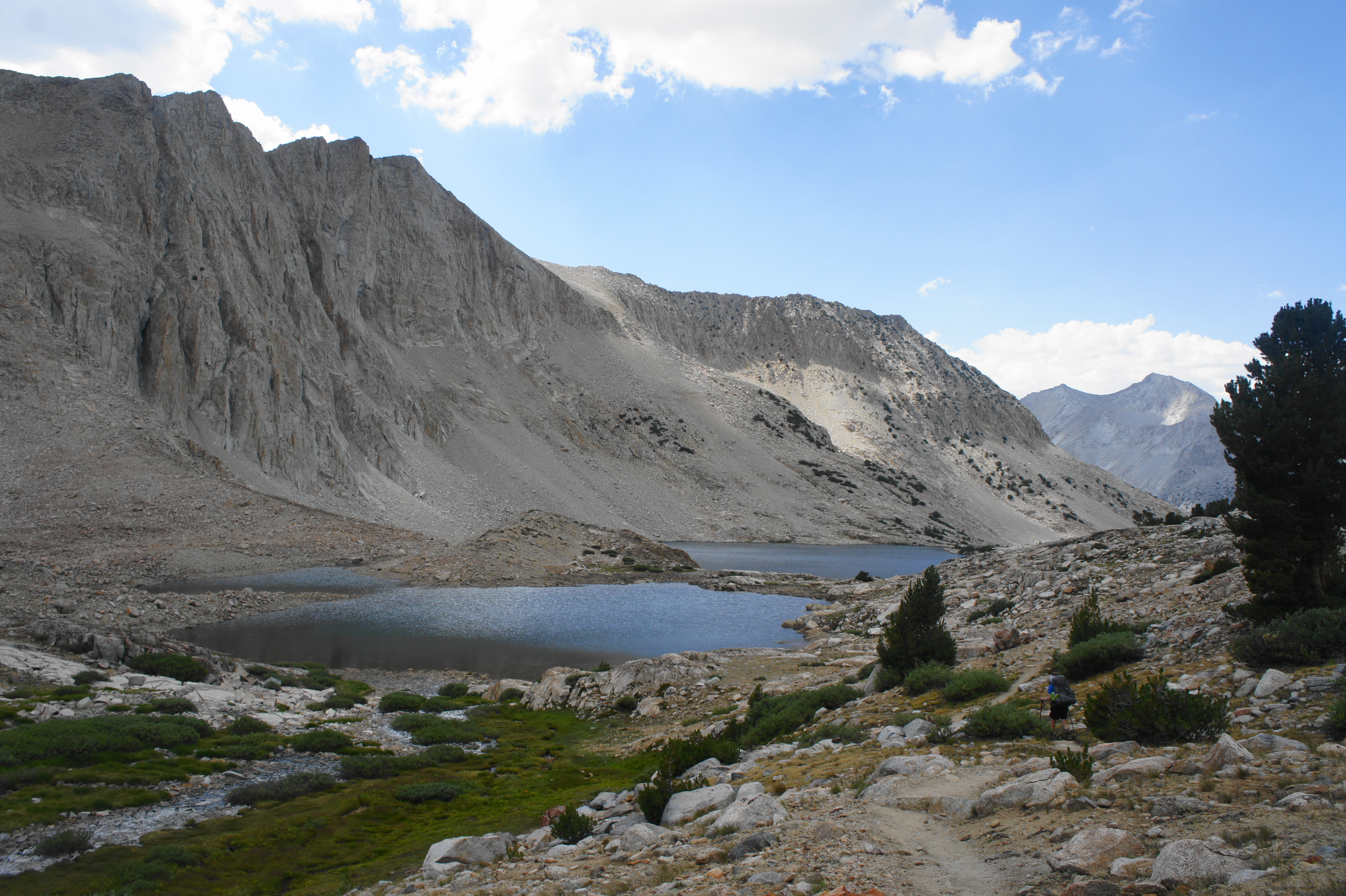
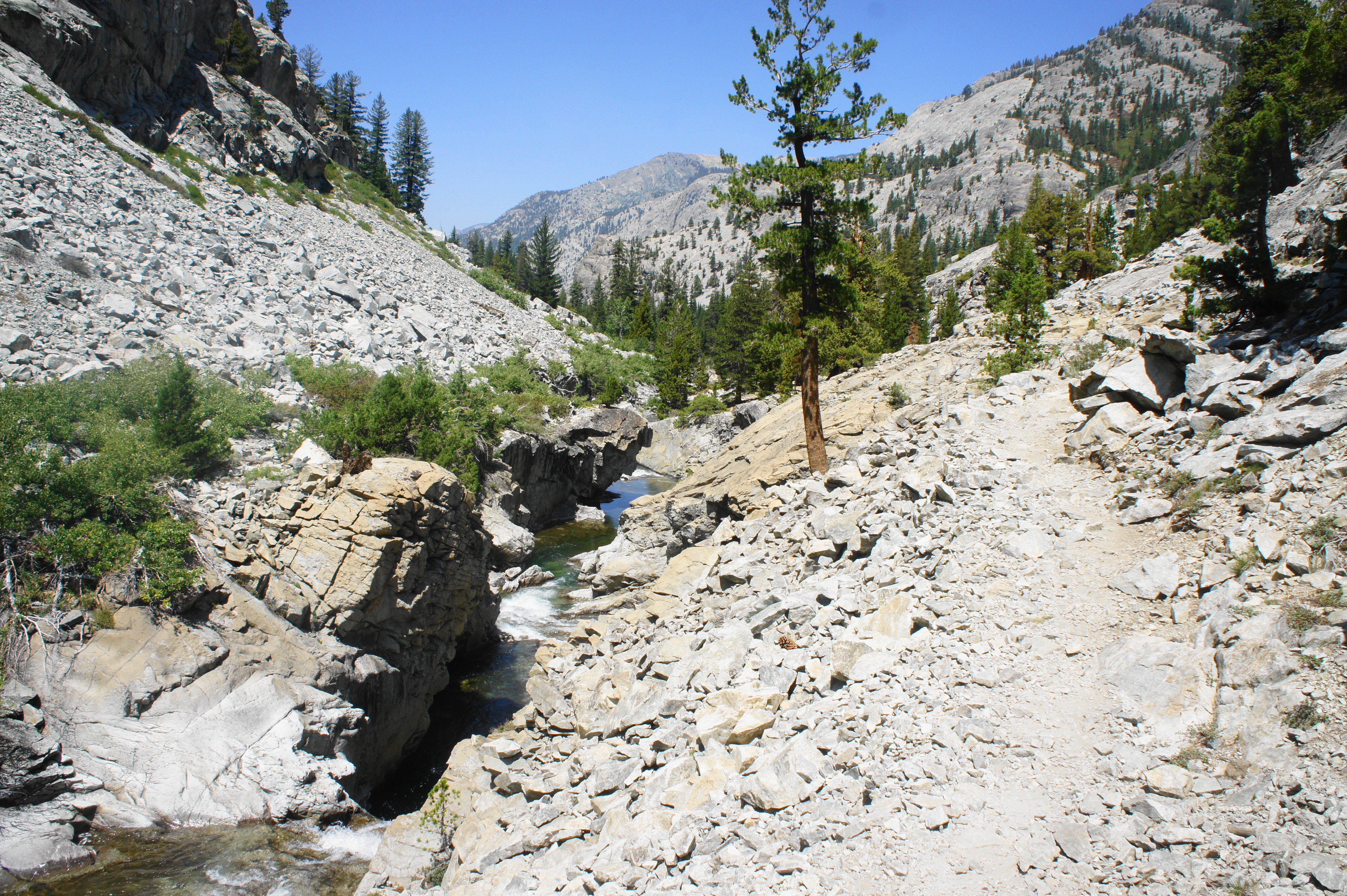
The onward trail descends in and out of thick tree cover, with lots of aspens and even some ferns coming into view. Cross a few minor streams as the brush grows thick, high enough to obscure one’s views for awhile, with occasional campsites available under clutches of pines. Just when hikers think they have reached the end of the descent, the trail cuts west from the confluence of the two main forks of Woods Creek, taking another ½ mile to descend to the famously wobbly Woods Creek suspension bridge, also known as the “Golden Gate of the Sierra.”

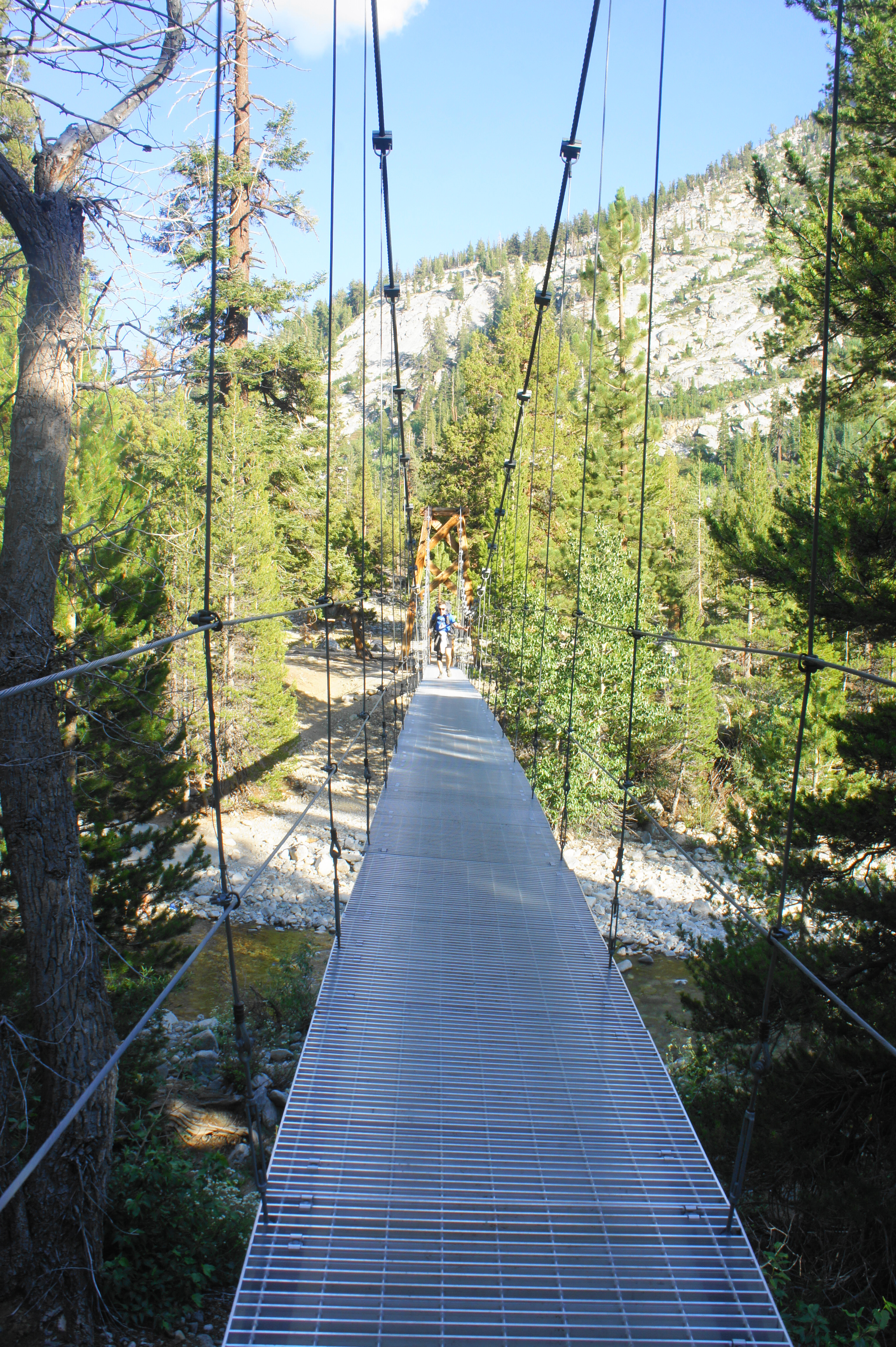
If arriving here from Charlotte Lake, it’s likely that many will want to look for a place to camp for the night around here. (Note: The footbridge is about 12 miles from Charlotte Lake, and nine from Glen Pass.) The most obvious is a large, well-used camping area off to the right, just before the bridge, with a bear box and lots of places for tents. (Note: Better spots are to be had a little further, however—especially as the onward JMT rises to pass a scenic waterslide along Woods Creek, about ½ mile from the crossing.)

Crossing the suspension bridge is itself an experience—a sign asks that hikers cross it one at a time, as the swaying of the cables can be unnerving. Once across, it is a short walk to the junction with the Woods Creek Trail (also known as Paradise Valley Junction), the unofficial end of this scenic section, often completed on day two of the second leg from Onion Valley.
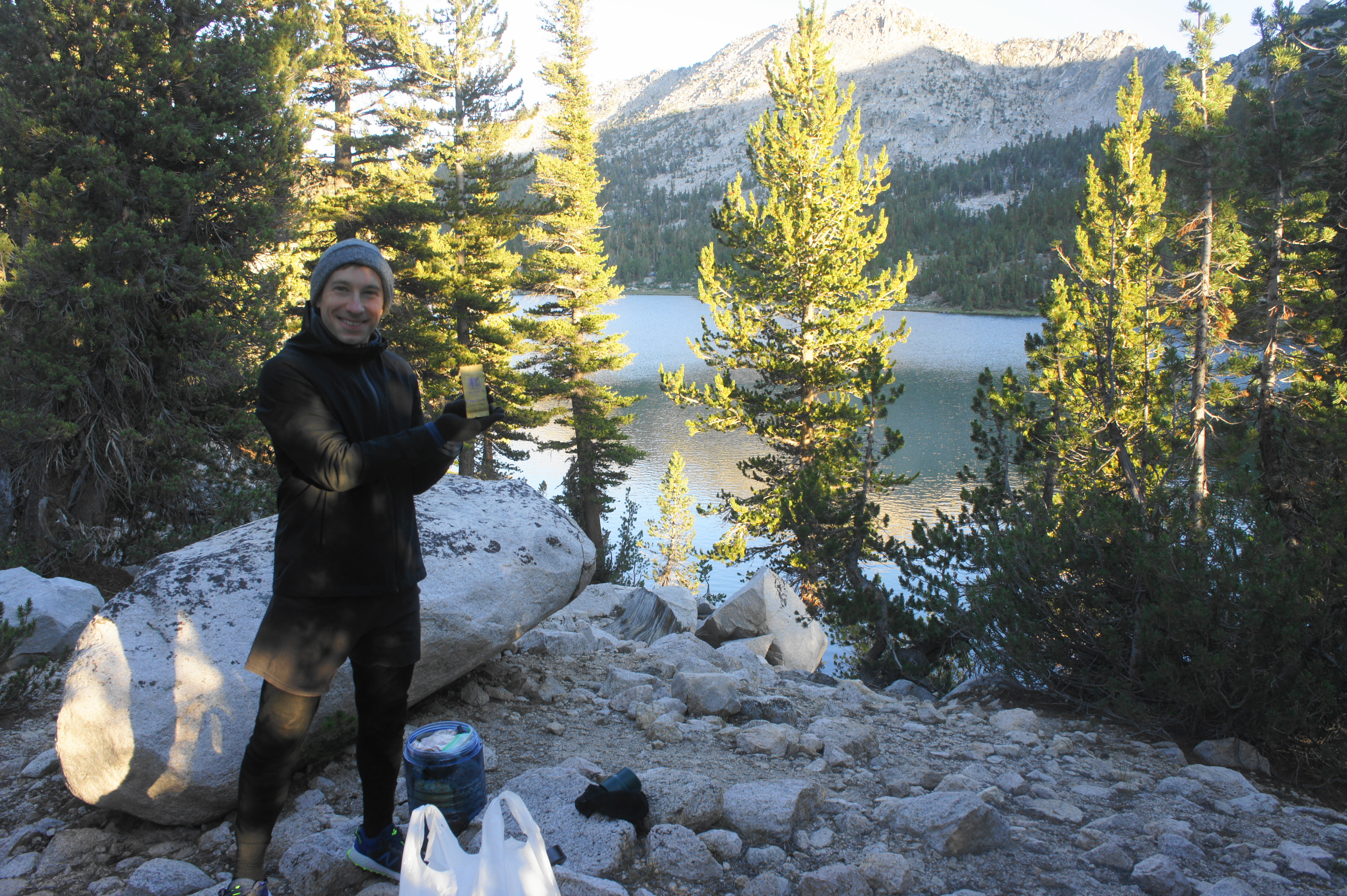
Trip Report: We traversed this section on Day 8 of our journey and Day 2 of the second leg, reaching the Woods Creek Junction in late afternoon. Seeing three black bears in the section below Dollar Lake was a highlight, as were the relatively clear skies—a welcome sight after a rainy first leg from Cottonwood Pass to Onion Valley. We camped at an excellent spot about ½ mile past the Woods Creek Junction; from our perch at the edge of a lengthy water slide, we enjoyed excellent views down to the valley, as well as a lovely set of pools at the head of the waterfall. One of our best spots yet, and worth the extra push at the end of the day.
Woods Creek Junction to Bench Lake Junction via Pinchot Pass (10.5 miles)
Although the popular JMT route rarely affords absolute solitude, the section north of Woods Creek Junction is one of the least-travelled portions of the hike. While Glen Pass and Rae Lakes are heavily-trafficked by backpackers on the shorter and more popular Rae Lakes Loop, the terrain between Woods Creek and Le Conte Canyon is traversed largely by JMT through-hikers.
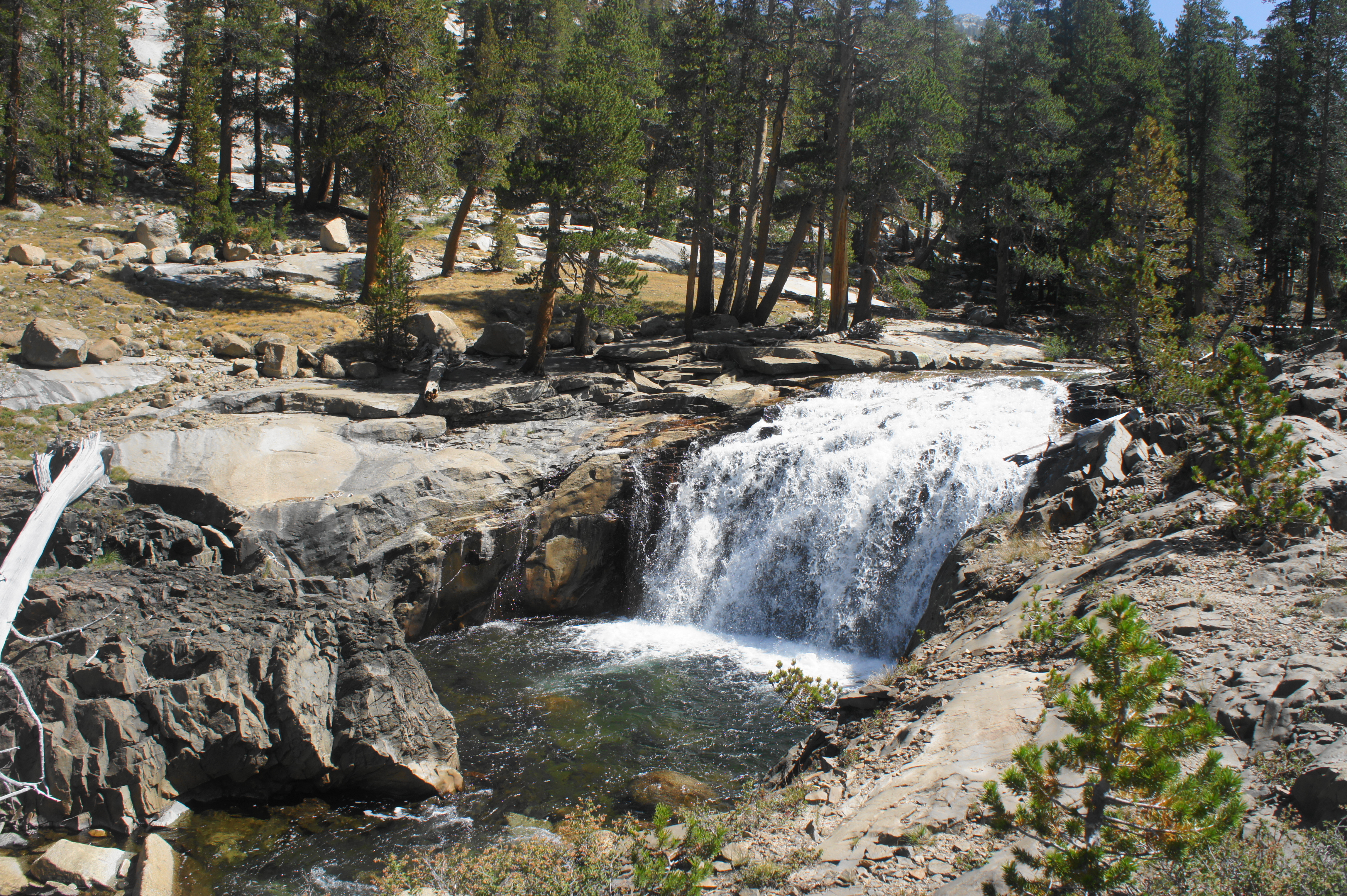
After shedding more than 3,400 feet since Glen Pass, the subsequent section wastes little time in regaining that elevation. Past the junction, the stairstep trail climbs steadily through pockets of lodgepole pines and ubiquitous manzanitas, reaching the Woods Creek Waterslide after about a half-mile. This terrifically scenic cascade tumbles down a sheet of granite bedrock, with southward views of King Spur (12,212’) and Diamond Peak (13,126’). This scenic corner of Kings Canyon is one of the most memorable points of the hike. (Note: Better yet, there are a couple of small campsites near the waterslide, set back on a partly shaded bluff overlooking Paradise Valley. This is an ideal spot to watch the sun set over the Sierras and is much better than the crowded spots down by the footbridge.)

Above the waterslide, the trail enters a denser thicket of brush, fed by a set of minor tributaries coming off the mountains to the west. Steep stone steps abound as the onward JMT follows a shelf dozens of feet above the northern fork of Woods Creek. At a point about 1.3 miles from the Woods Creek Junction (and 600 feet in elevation), the trail crosses the White Fork of Woods Creek, a well-flowing tributary that offers the easiest water access for the next two miles. (Note: Even as Woods Creek proper is visible just off the trail, it usually requires descending a steep—sometimes sheer—cliff to reach.)

Beyond, the trail continues to climb, paralleling the stream, and then ascends a sun-exposed rocky section with views of a waterfall up ahead. After a short set of switchbacks, the trail clears the top of the falls, and Woods Creek calms again as the trail follows a grassy plain with a couple of campsites. About 2.5 miles from the junction, the trail enters a dense wooded section, which partly eases the relentless uphill – while still climbing, at least hikers are out of the blaring sun.

Having cleared a particularly steep section, the path rises to cross a stream, where one can easily filter water again, and then shortly approaches the junction with the Sawmill Pass Trail. (Note: Like the Baxter Pass Trail, the Sawmill Pass route rises sharply from Owens Valley and does not exactly have rave reviews…) By now hikers have walked around 3.6 miles—and gained more than 1,800 feet—since Woods Creek Junction and the suspension bridge. This also marks roughly the halfway point to Pinchot Pass, arguably the toughest mountain pass of the entire journey.

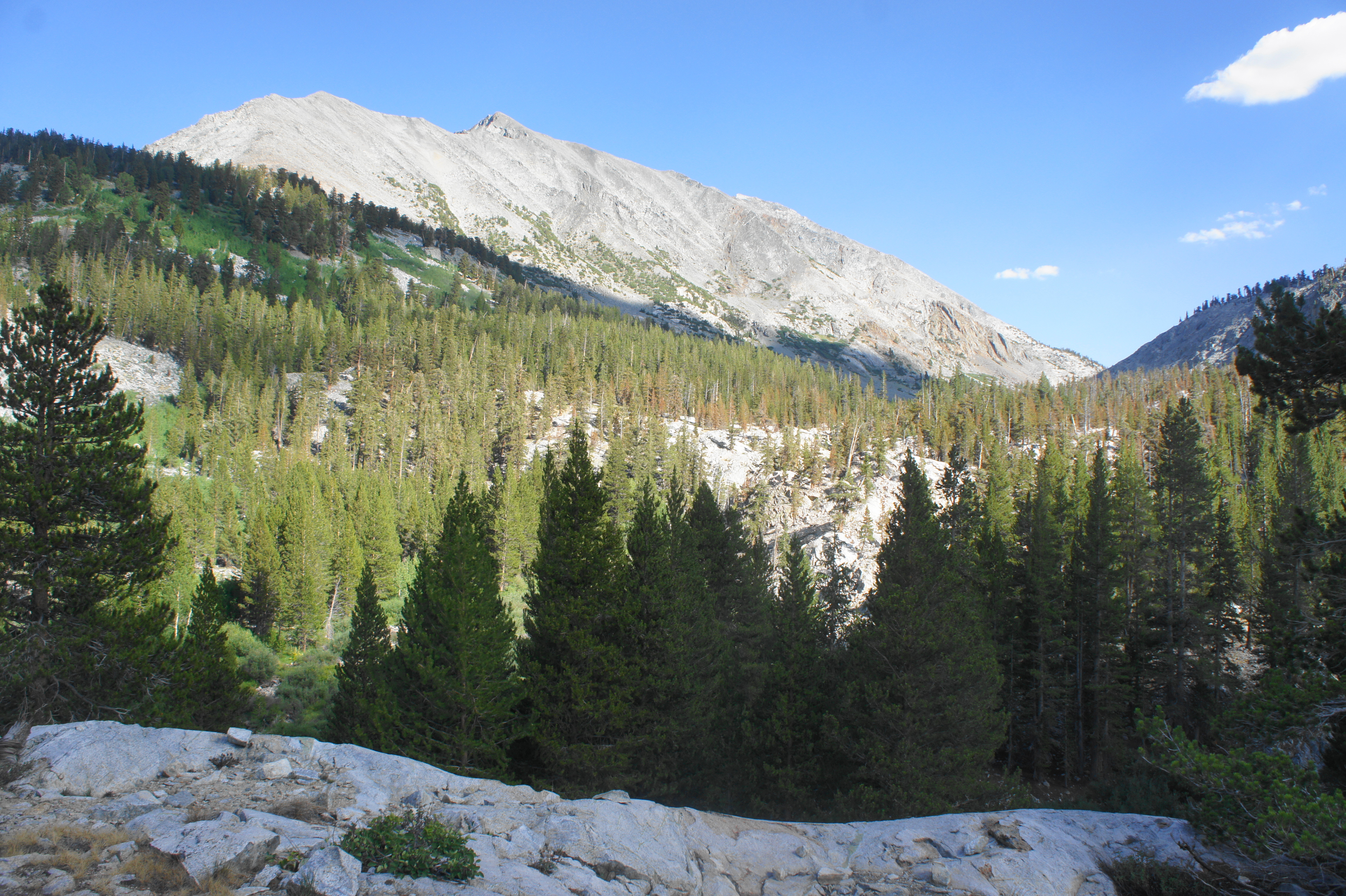
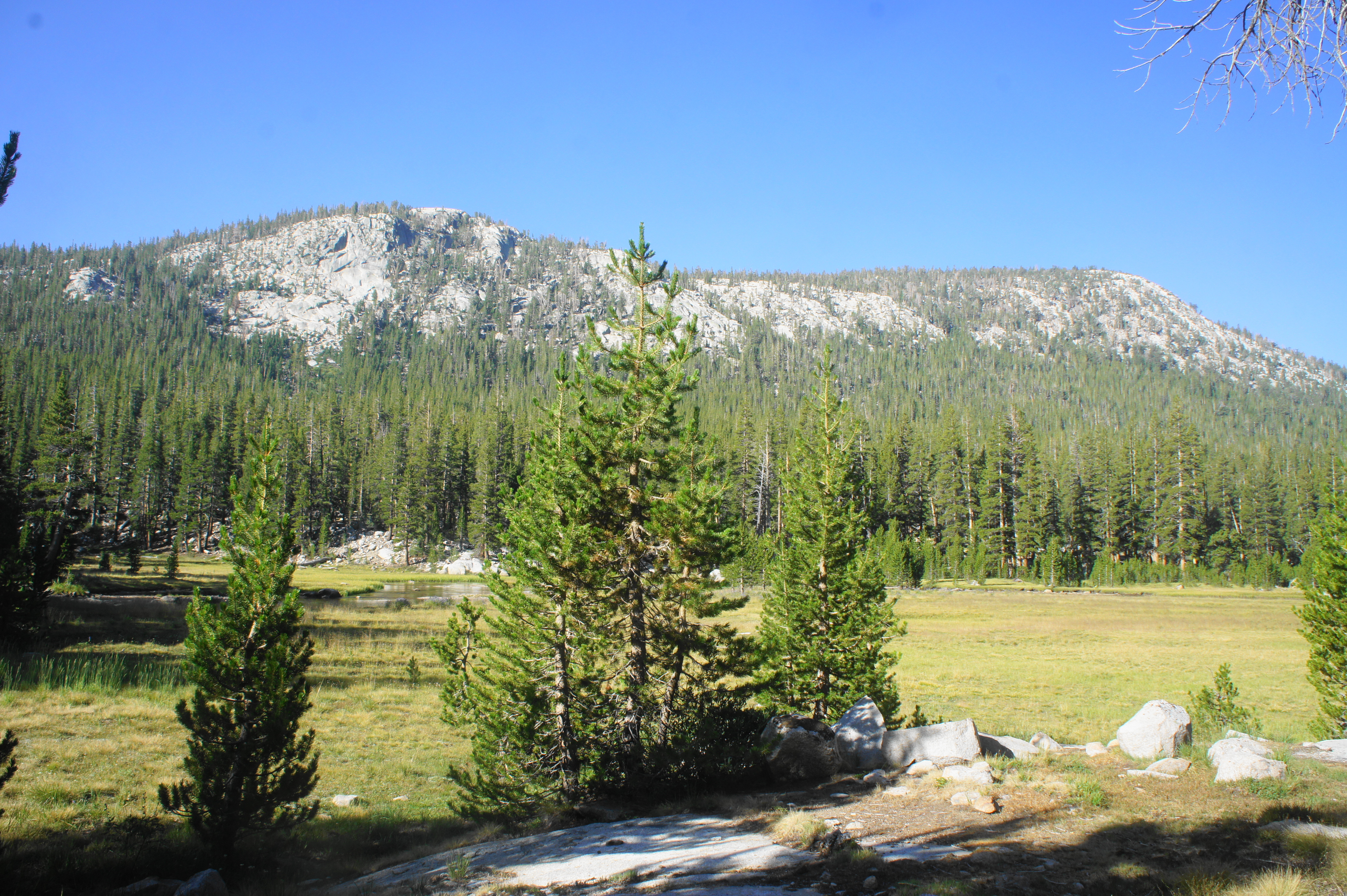
Part of the reason Pinchot Pass is so gnarly is that the terrain around it is largely dry and sun-exposed, at points appearing almost like a Martian landscape of ruddy and orange-hued talus. The amphitheater of mountains becomes clearer as hikers ascend past the Sawmill Pass Junction to a partly tree-lined ridge between Twin Lakes on the right and a smaller lake on the left. The craggy peak to the west is Crater Mountain (12,871’), which some JMT hikers summit as a half-day hike.
Beyond the lakes, as the vegetation grows thinner and the winds stronger, it appears that the trail is heading straight, toward a tree-less gap east of Mount Wynne (13,180’) and along the Sierra Crest. However, after passing above more unnamed lakes off to the right, the JMT actually bends west, cresting a ridgeline around 5.75 miles from the Woods Creek bridge. Here one can finally see Pinchot Pass (12,130’)—the grey saddle to the west of Mount Wynne—ahead.


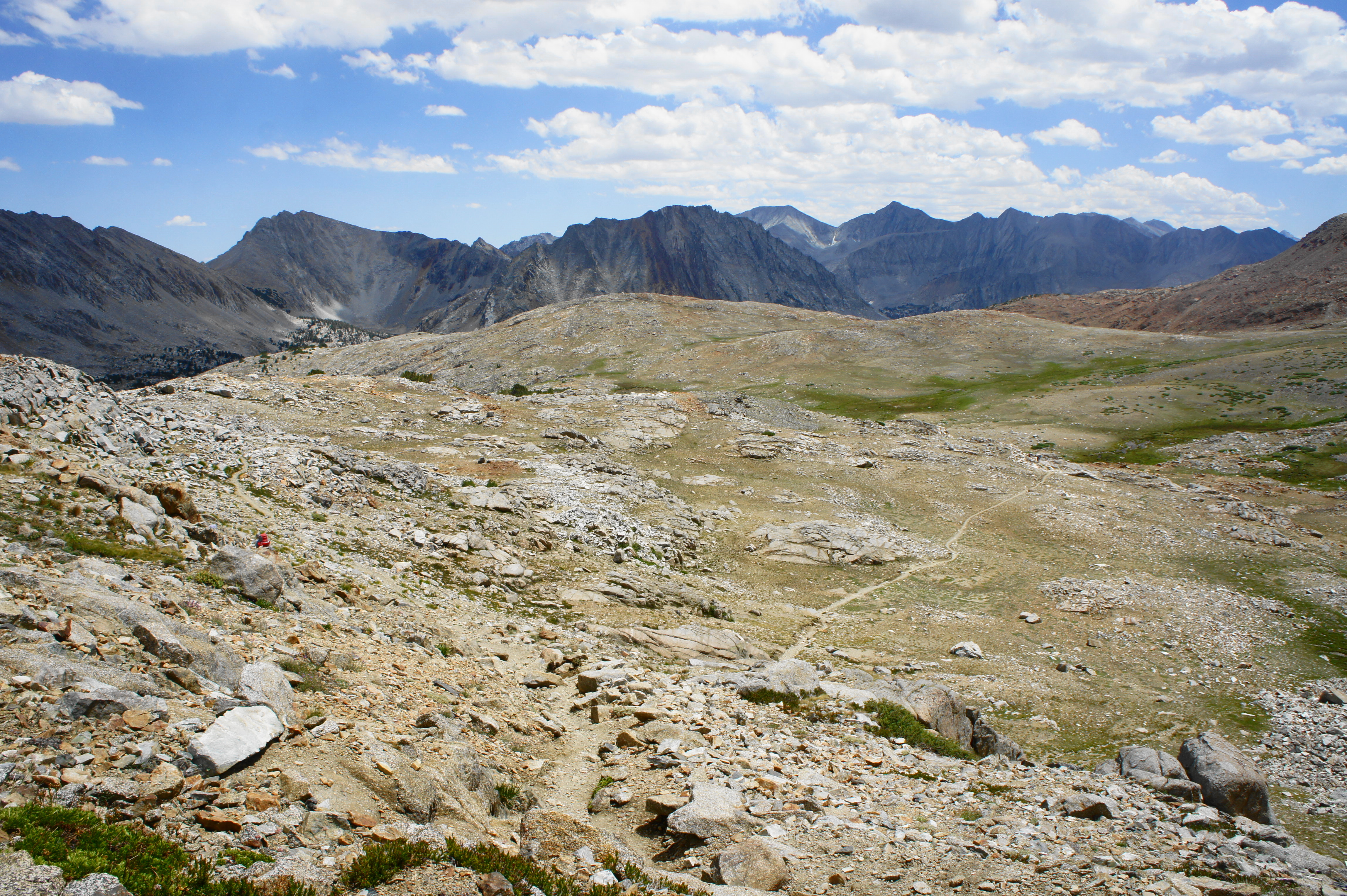
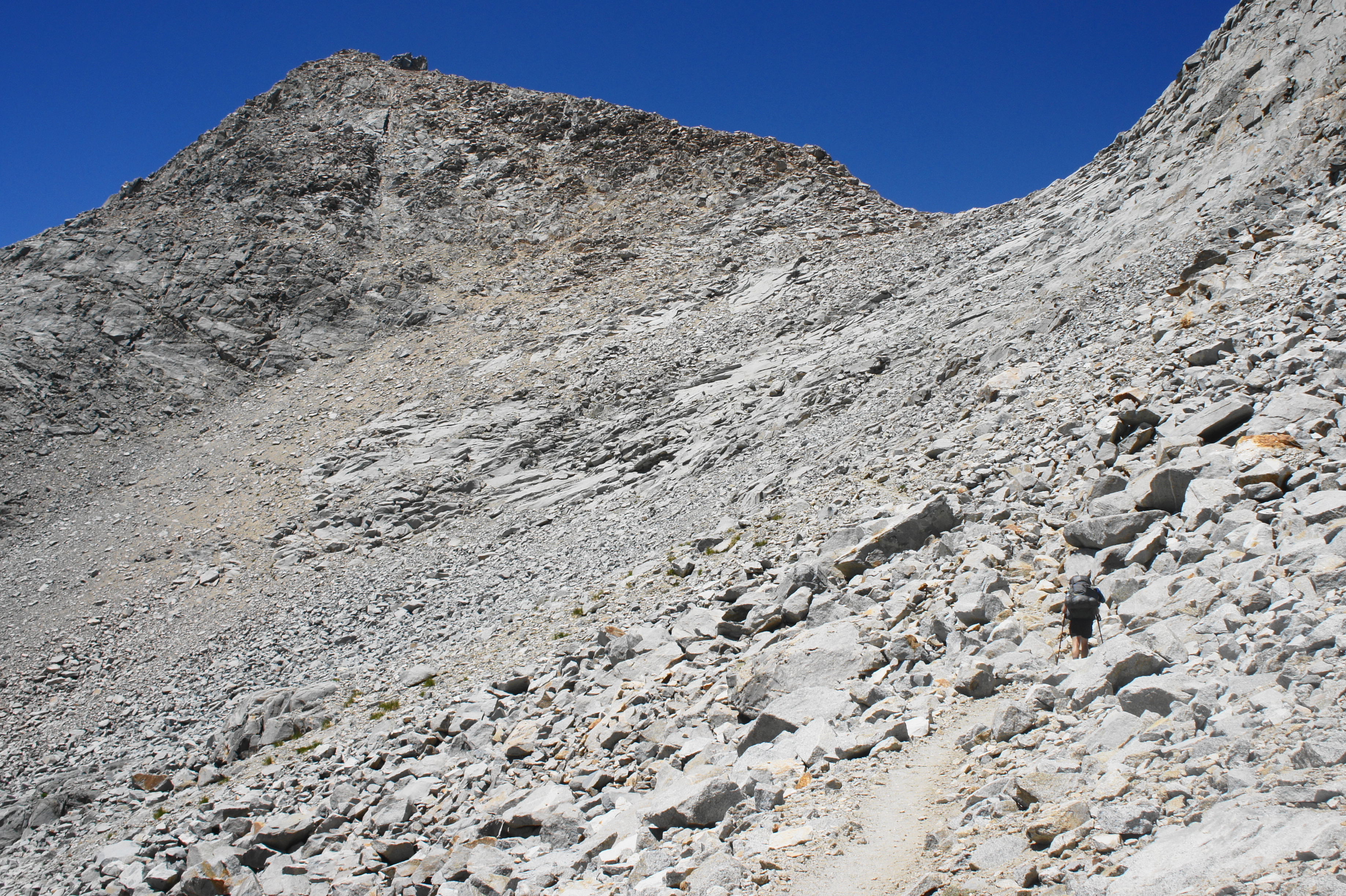
The final approach to Pinchot Pass involves crossing open terrain, following a blocky spine and keeping a sedgy meadow with additional ponds down to the right. The JMT dips briefly and crosses a stream and pool between two ridges, after which the brutal finale greets hikers with a slap in the face.

The path ascends 500 feet in about 6/10 mile and can be thought of in three parts. First, an initial, switchbacking climb gains height quickly, offering views across the vast plateau and beyond to the Sierra Crest. After clearing a rocky protrusion, the trail then cuts left, bending and cutting into a second set of switches. This is followed by a deceptive straightaway that belies the final set of switchbacks and a steady northward clamber, which finally crests the pass at a point 7.4 miles—and seemingly a world away—from Woods Creek Junction.
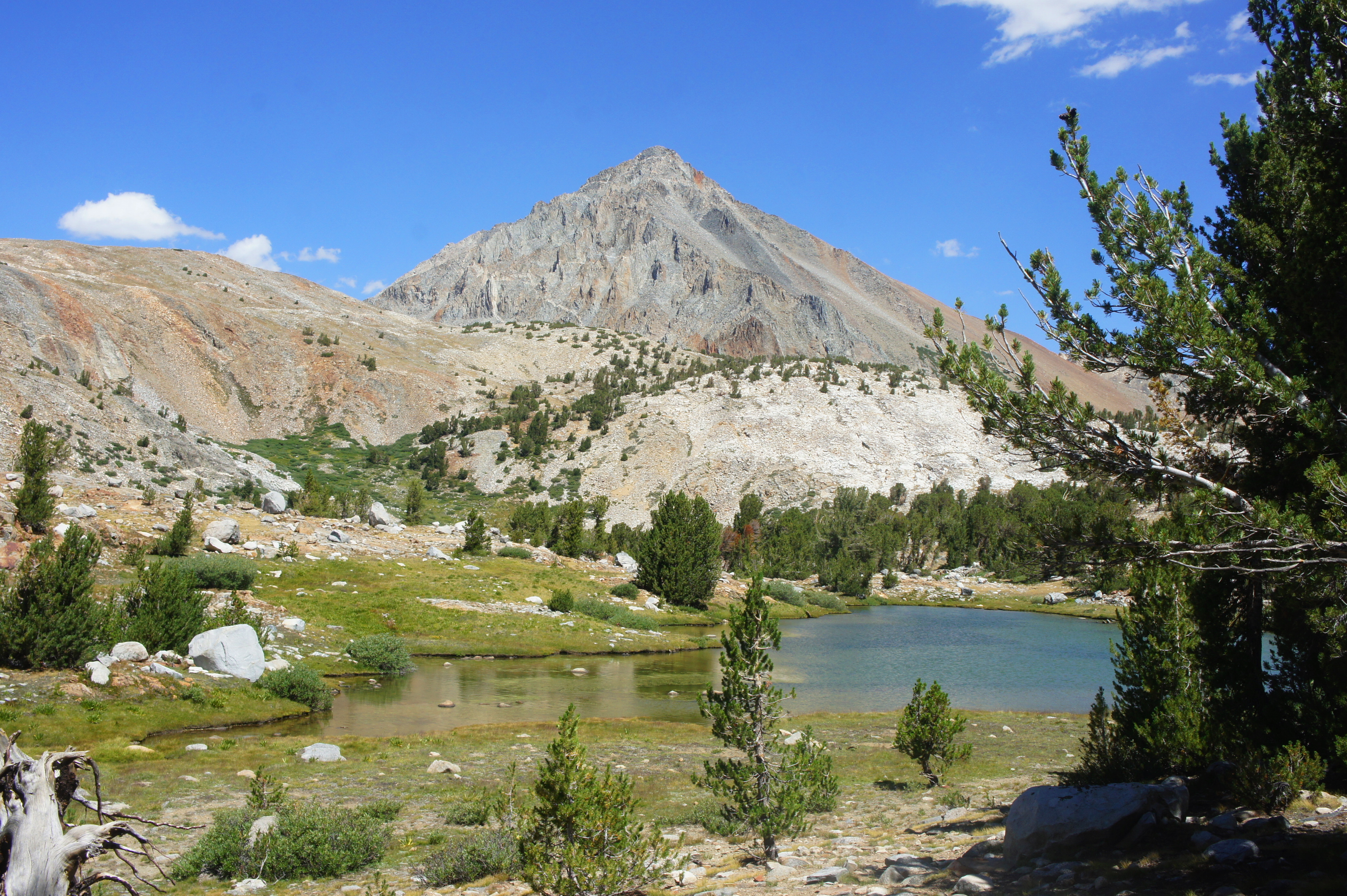
As with other passes, the views from Pinchot Pass—named for the founder of the U.S. Forest Service—are magnificent in both directions. Looking back south and east, a parade of small pools leads to a drop-off to the broader Woods Creek valley, with Mount Perkins (12,562’), Colosseum Mountain (12,473’), and Mount Cedric Wright (12,336’) just beyond. In the distance is the Sierra Crest, which hikers have been following for several days.

To the north and west, the terrain is similar—with dramatic lakes and endless mountains—but the pools to the west are much larger. Lake Marjorie, just two miles from this point, is visible down below, with the Cirque Crest, Mount Ruskin (12,921’), and Vennacher Needle (12,996’) beyond. One cannot quite see Mather Pass, the next in the chain of passes to the north, but the lofty peaks visible beyond the pass are among the highest in the Sierras—including North Palisade (14,242’), Polemonium Peak (13,962’), and Mount Sill (14,153’).

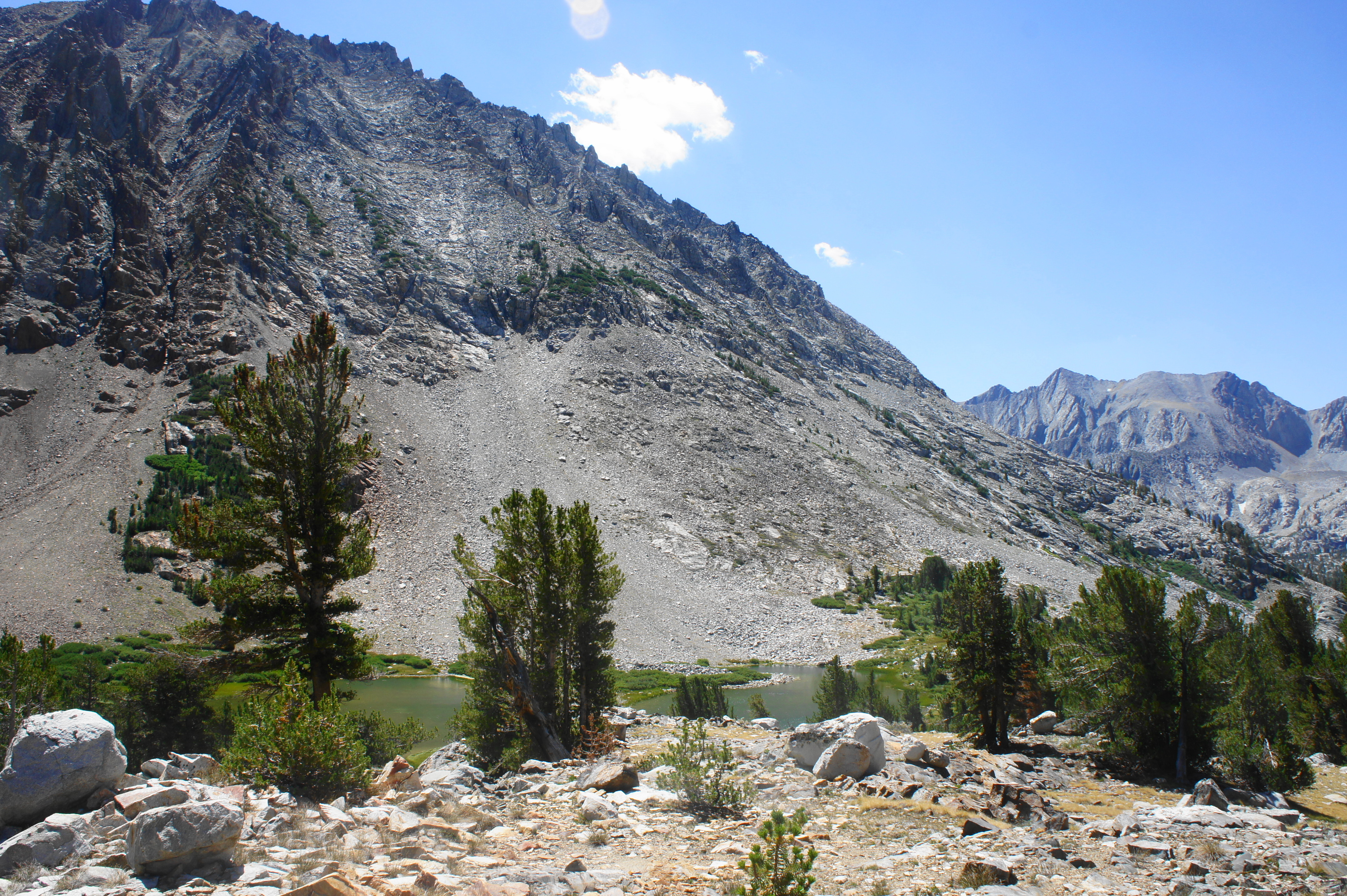
Rejuvenated by the views and (temporary) end to the uphill, hikers can make good time descending off the pass and down toward the main watershed of the South Fork of the Kings River. After the requisite stable of switchbacks, the trail descends through a stony notch, adjacent to an unnamed turquoise pool at the base of a stunning, reddish talus slope. The path then stays along a bench to the east of Lake Marjorie, resisting coming close to the lakeshore until the lake’s northern terminus. Around here are a large number of campsites, although many are hidden and somewhat distant from the trail itself. This is still exposed terrain, with little vegetation and high propensity for winds and bad weather.

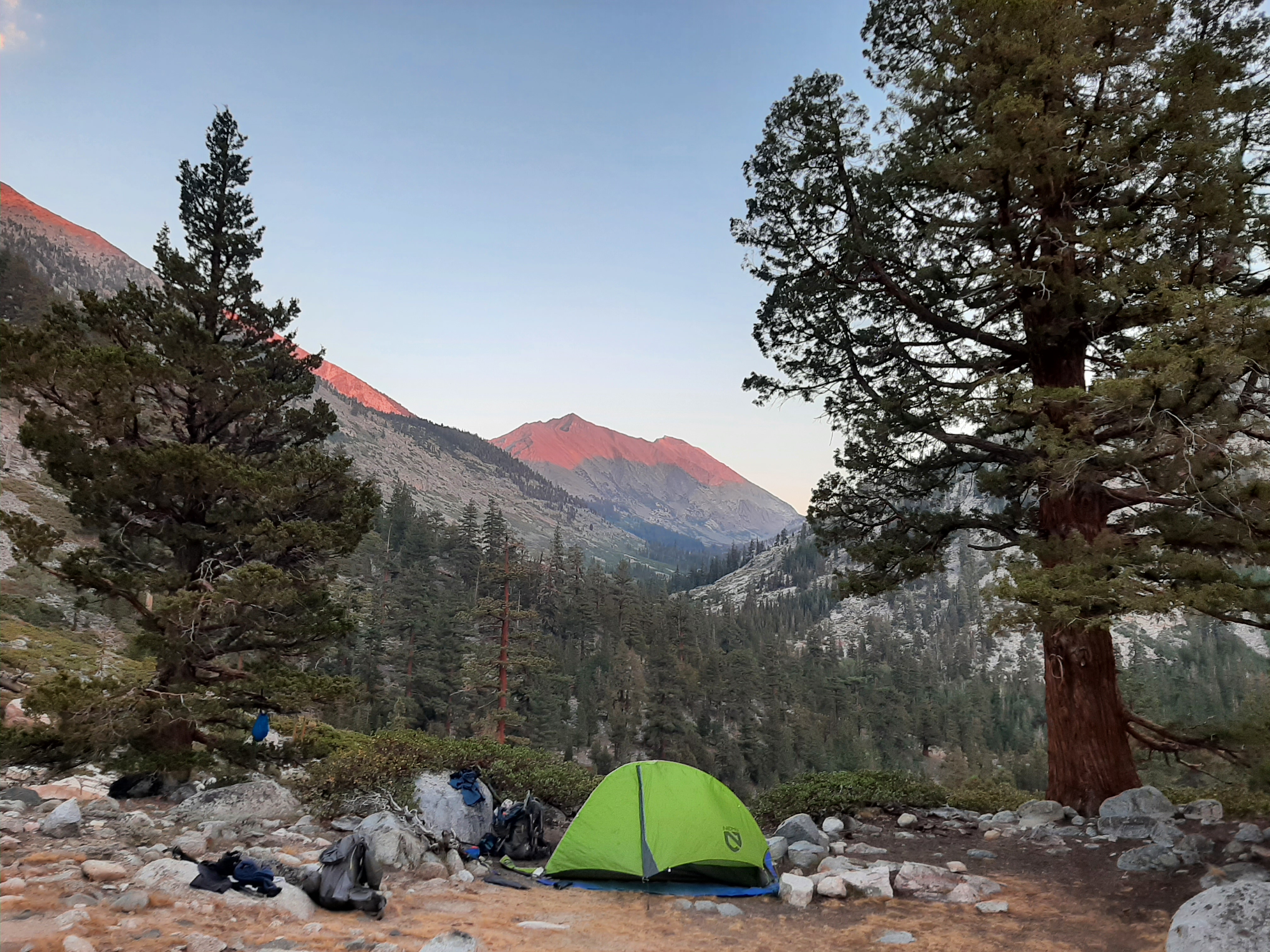
Heading further down, the JMT drops to a marshier area with another lovely lake on the left. More campsites are available, and camping here has the advantage of avoiding the crowds of Lake Marjorie. Better still, the trail drops to a flat with a number of additional campsites with more shade and a fourth lake on the left. (Note: Yours truly camped here.) This is an excellent spot and has good views cross the South Fork drainage to Upper Basin and Mather Pass, now visible in the distance.


Further on, a fifth lake, even more surrounded by pines, emerges in a bowl down to the right. After skipping across a small stream, the trail drops to a junction with the Bench Lake Trail; minutes later, after another water crossing, the trail reaches a junction with a short spur to the Bench Lake Ranger Station and, quickly thereafter, the Taboose Pass Trail junction.
Trip Report: Day 9 of our adventure was one of the most challenging, given the 3,300-foot climb from our campsite at the Woods Creek Waterslide to Pinchot Pass. After reaching the pass in the early afternoon, we quickly scampered down the north slope, passing on campsites near Marjorie Lake in favor of a lovely spot just off the trail near lake #4 described above. From here we enjoyed a spectacular sunset over the South Fork drainage, with majestic views of Mather Pass and North Palisade—terrain we would cover the next day. We could have possibly pushed further, but we had heard stories of a very aggressive black bear prowling in the South Fork of Kings River drainage and thus opted for a higher-elevation camp. At just above 11,000 feet, this was the highest campsite of our entire hike. But temperatures were still relatively mild, and small rain clouds—while coming close to threatening—held off the entire day.
Bench Lake Jct. to Deer Meadow via Mather Pass and Golden Staircase (14.5 miles)
From the Bench Lake and Taboose Pass Trail junctions, the northbound JMT begins a sharp, switchbacking descent through lodgepole pine forest, skirting the main stream fed by Lake Marjorie to the south. After an initial set of bends and turns, the trail cuts northeast and enters a second set of switches, dropping to cross a tributary stream, then comes level with the main drainage—the South Fork of Kings River.

Crossing this river can be a challenge at high water: it is deep and flowing at a good clip. But much of the year, one can rock-hop across the stream like most others. Around here, a faint path is all that remains of what some call the “old JMT”—a section of trail that climbs up an over nearby Cartridge Pass, used by travelers when the present route over Mather Pass and up the so-called “Golden Staircase” was still being constructed.

Today’s JMT stays right after crossing the South Fork, gradually ascending en route to Mather Pass. As far as ascents go, the amble up to this pass is considerably more enjoyable than most, rising 2,000 feet over the course of 5.5 miles, with plenty of scenery along the way. The route ascends mildly, eventually rising out of the thick woods into a section of patchy meadows, with the tumbling creek off to the right.
Crossing several tributary streams, the path ascends to an area of even spottier woods, with vast talus slopes and sporadic brush. This is Upper Basin, an exceptionally scenic alpine flat, bounded on three sides by towering peaks. Looking back to the southeast, one can spot the ruddy-colored peak of Cardinal Mountain (13,397’), and the imposing 14-er to the east is Split Mountain (14,058’), a reasonably popular day hike from here. Off to the left is a saddle known as Amphitheater Pass, situated off trail but probably a reasonable scramble for those who are curious. Ahead, one can see the low cut of Mather Pass—to which the JMT is taking you—with the tippy tip of Middle Palisade (14,040’) visible just beyond it.
Continue to climb up through scrub and open sun, passing several small pools on left and right. Finally, about 4.5 miles from the South Fork, hikers reach the base of the final pitch up to Mather Pass. While the climb to this point was leisurely, this concluding section is not: the ascent begins by swinging way over to the right, then curves left and follows a steady proclivity westward toward the pass. After the straightaway, the route suddenly steepens and ascends a group of switchbacks, cutting back right to the high saddle.

At last, the exposed trail mounts Mather Pass, although the views north from the cut remain limited. Travel some 30 seconds further to get the first look down into Palisade Canyon, where hikers will spend the next several miles. The basin in the canyon’s upper reaches feels narrower and tighter than others, with small lakes feeding into the larger Palisade Lakes below and the craggy ridge of Palisade Crest (13,553’), Norman Clyde Peak (13,851’), Middle Palisade (14,040’), and Disappointment Peak (13,917’) constituting the northern flank.


A perch just beyond the pass itself offers the best place to look out over the canyon, after which the trail again sheds the elevation that it had gained. The inevitable switchbacks down into Palisade Canyon eventually give way to a relative flat, with the trail staying high on the shelf to the right of Palisade Lakes. Scree turns to scrub and eventually modest meadows, and tributary streams become more frequently seen. There are several campsites as one comes closer to Upper Palisade Lake, but they remain more than 100 feet above the shores, making lake access perhaps more difficult than necessary.


Further on, the trail gradually curves westward, still remaining high above the two lakes. There are even some uphill pitches here, with regular sets of neatly-carved stone stairs. Finally, after walking nearly the length of Lower Palisade Lake, the JMT cuts back sharply and descends a stony staircase, reaching the outlet of the lake, around which where there is lots of camping. Some may call it quits here for the day, not a bad choice given the excellent views and the rigorous downhill section beyond.

But onward travelers hoping to put in a very full day can push onward, dropping below Lower Palisade Lake and into the craggy canyonlands of the Palisade Creek drainage. Here the stream has carved shallow cuts in the rock, producing narrow pitches and beautiful—but hardly accessible—waterfalls.
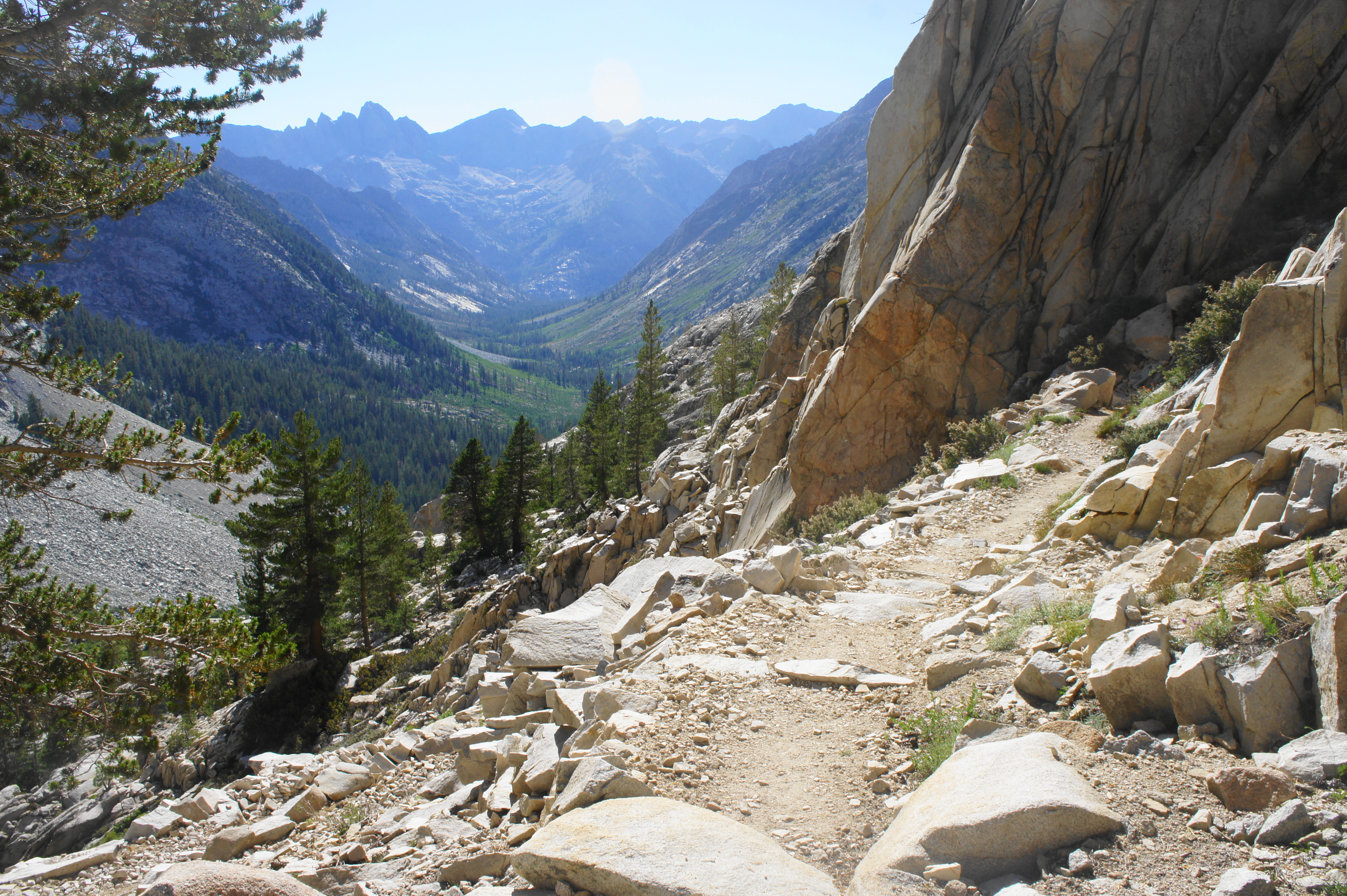
Then, at a point more than 11 miles from Bench Lake Junction, the JMT reaches a high bluff overlooking the remainder of Palisade Canyon below. This is one of the most picturesque overlooks on the hike, with the canyon dropping more than 1,500 feet to the forest and Deer Meadow below, with Le Conte Canyon and Devils Crags (12,262’) and the peaks of the Black Divide in the distance.
This spot also roughly marks the start of what has become to known as the “Golden Staircase,” a rugged and intricately-cut collection of switchbacks, the final section of the JMT to be completed in 1938. The staircase begins by making its way toward a narrow side canyon, where the well-trodden trail descends a series of rocky wiggles, followed by a mellow forested area. Palisade Creek, which comes in and out of view, forms large cascades as it plunges down the steep pitch. Next, the route bears westward and descends another notch. Following a long zig-zag, the trail approaches creekside, where there are a couple of small campsites with amazing views but windy exposure.

Thereafter, the trail continues to descend, cutting through a surprisingly brushy and lush—even muddy—section, adjacent to a modest waterfall. From here it is a short walk down to the treeline, where hikers are suddenly plunged into a forest of densely-packed lodgepole pines.

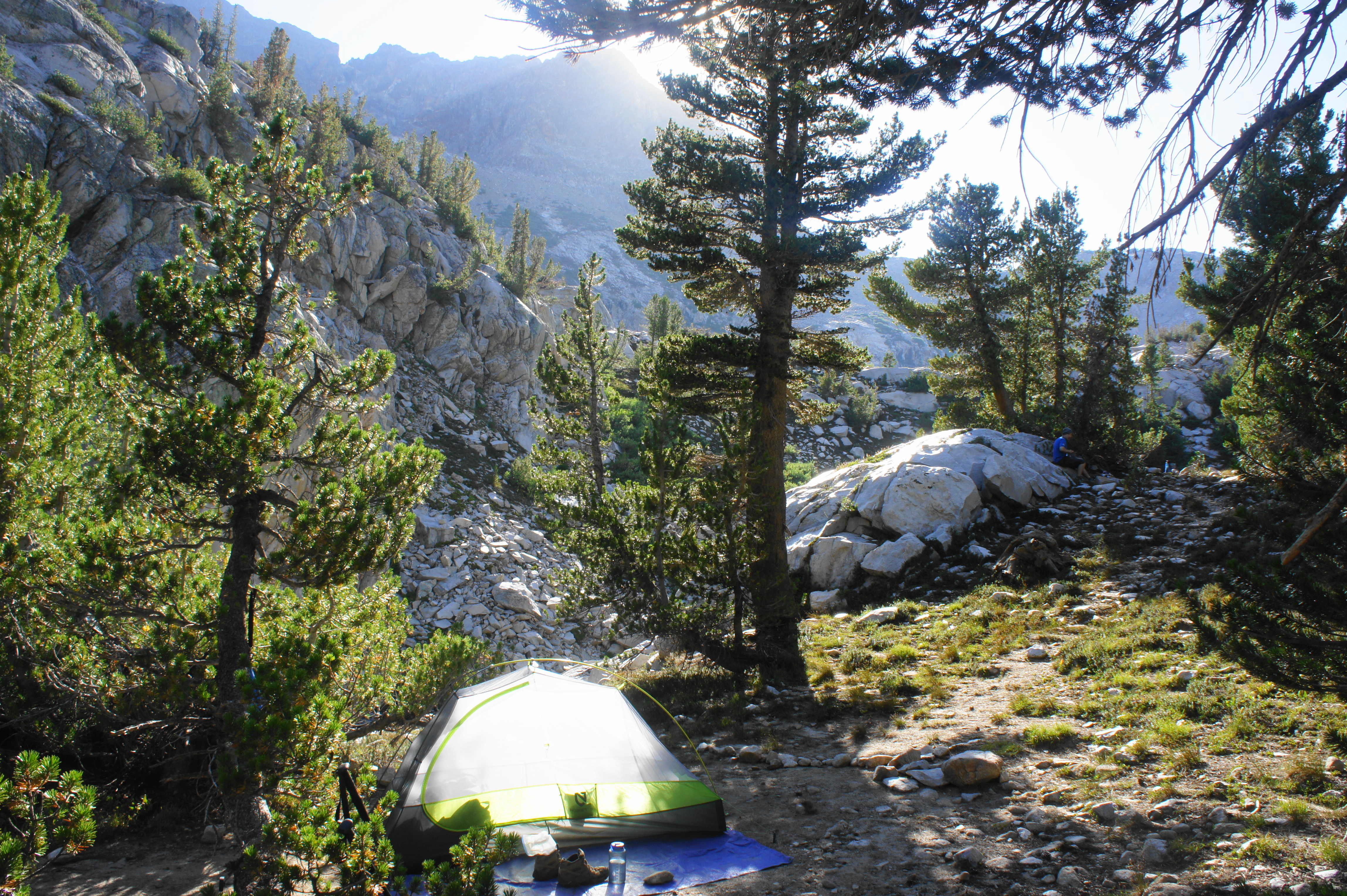
Although the meadow part of Deer Meadow is not easily found, there are camping spots aplenty around the start of the wooded section, with easy access to Palisade Creek. There is a temptation to push further, but the available campsites soon thin out, with the only obvious previously-disturbed sites too close to the water to be “legal.” The route crosses Glacier Creek and its various rivulets and then actually climbs—gaining around 50 feet—before dropping to an area with lots of dead trees from a fire that is around a decade old.

Continue around a mile past Glacier Creek to reach a couple of decent campsites just off the trail, with easy access to Palisade Creek. It is about 14.5 miles from Bench Lake Junction to this point, making for a long day. Hearty hikers can push farther across relatively easy terrain, or weary walkers can camp up to a few miles back at Palisade Lakes or the base of the Golden Staircase.
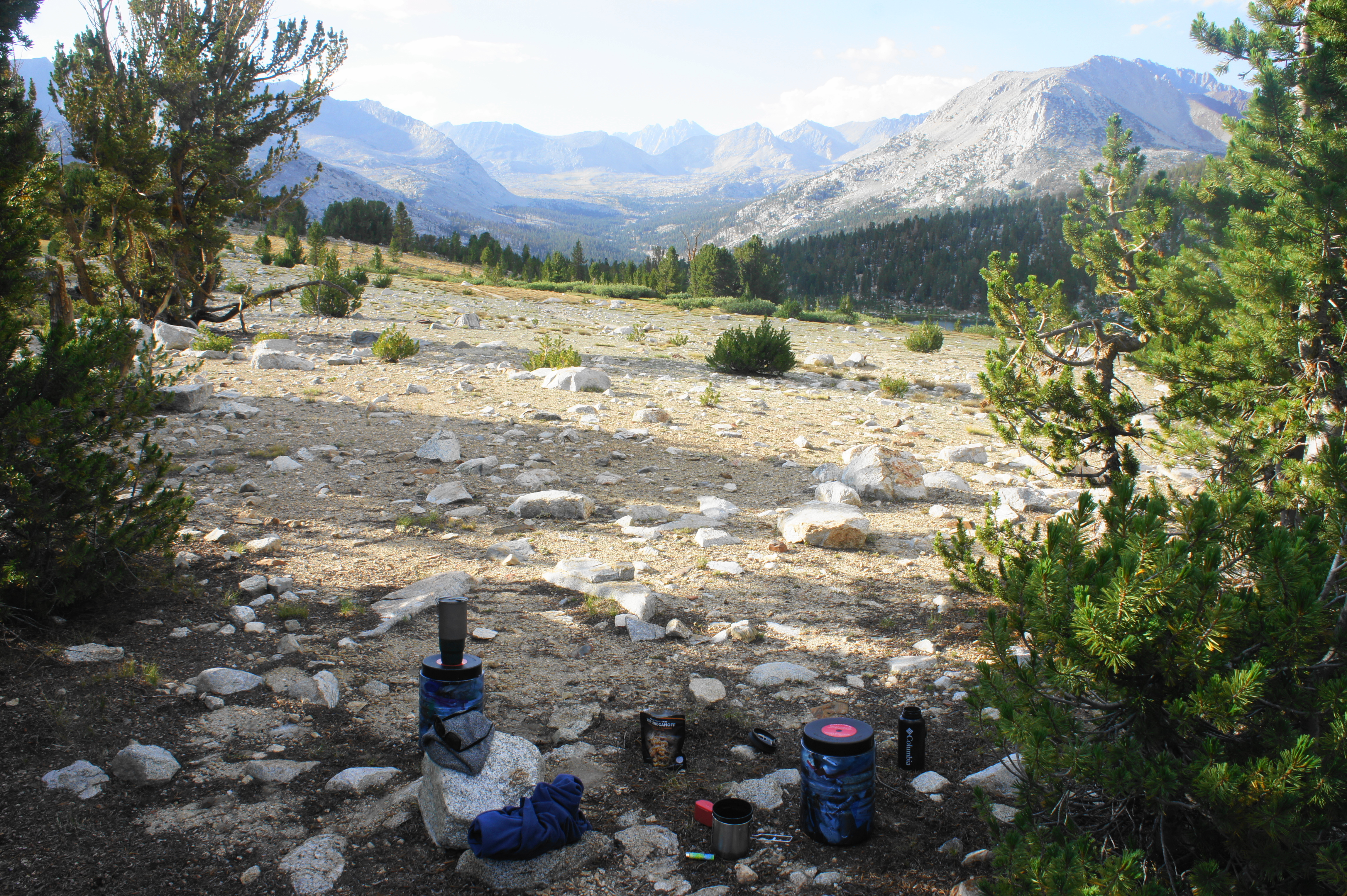
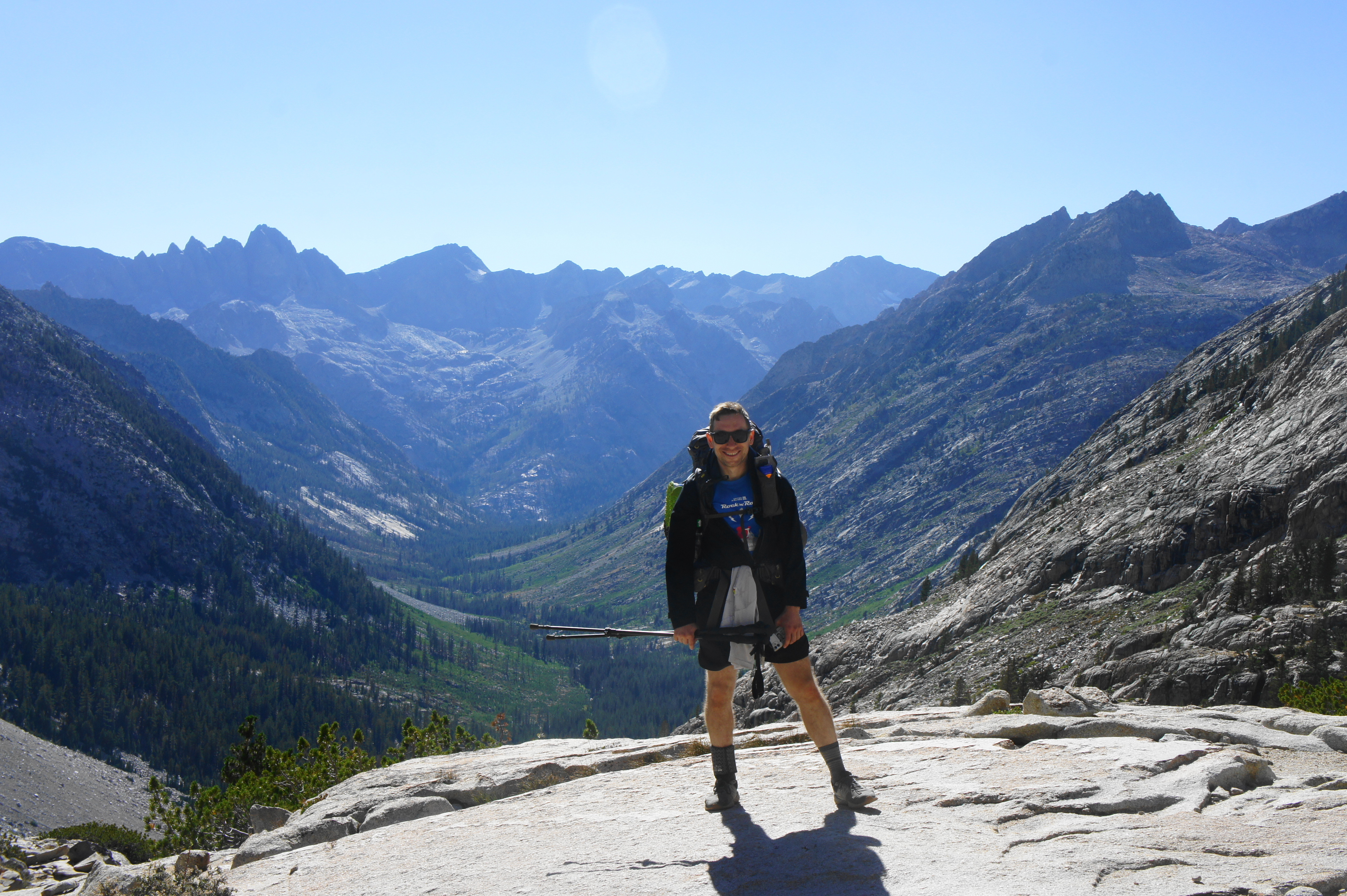
Trip Report: From our campsite about a half-mile above the Bench Lake Junction, we travelled farther than expected on Day 10. Originally planning to camp near the outlet of Lower Palisade Lake, we arrived early in the afternoon after a leisurely walk up and over Mather Pass. Unsatisfied with the remaining campsites (the best spots were taken) and with some extra energy to spare, we pushed on, completing the entire length of the Golden Staircase. We struggled to find an open campsite at Deer Meadow, so we kept going for about 1.5 miles to the aforementioned campsite beyond Glacier Creek. The site itself was nothing to write home about, but it was one of the lowest elevation sites we had used yet and offered easy access to water. After six straight days of tackling a mountain pass, we were looking forward to our next day, the first pass-free day since Day 4. We also reached a milestone today, completing our first 100 miles of the more than 250-mile journey.
Deer Meadow to Starr Camp via Le Conte Canyon (10.5 miles)
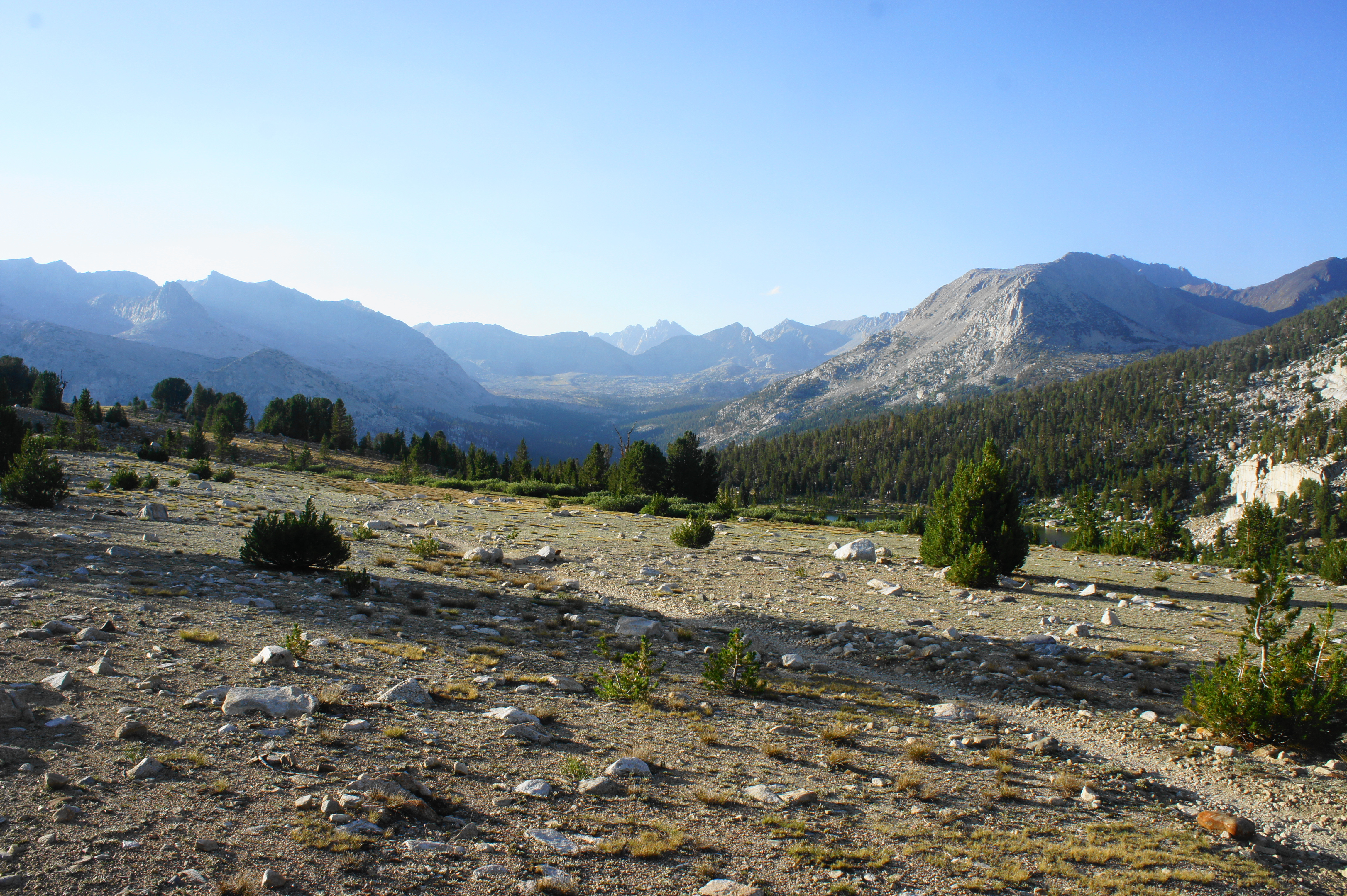
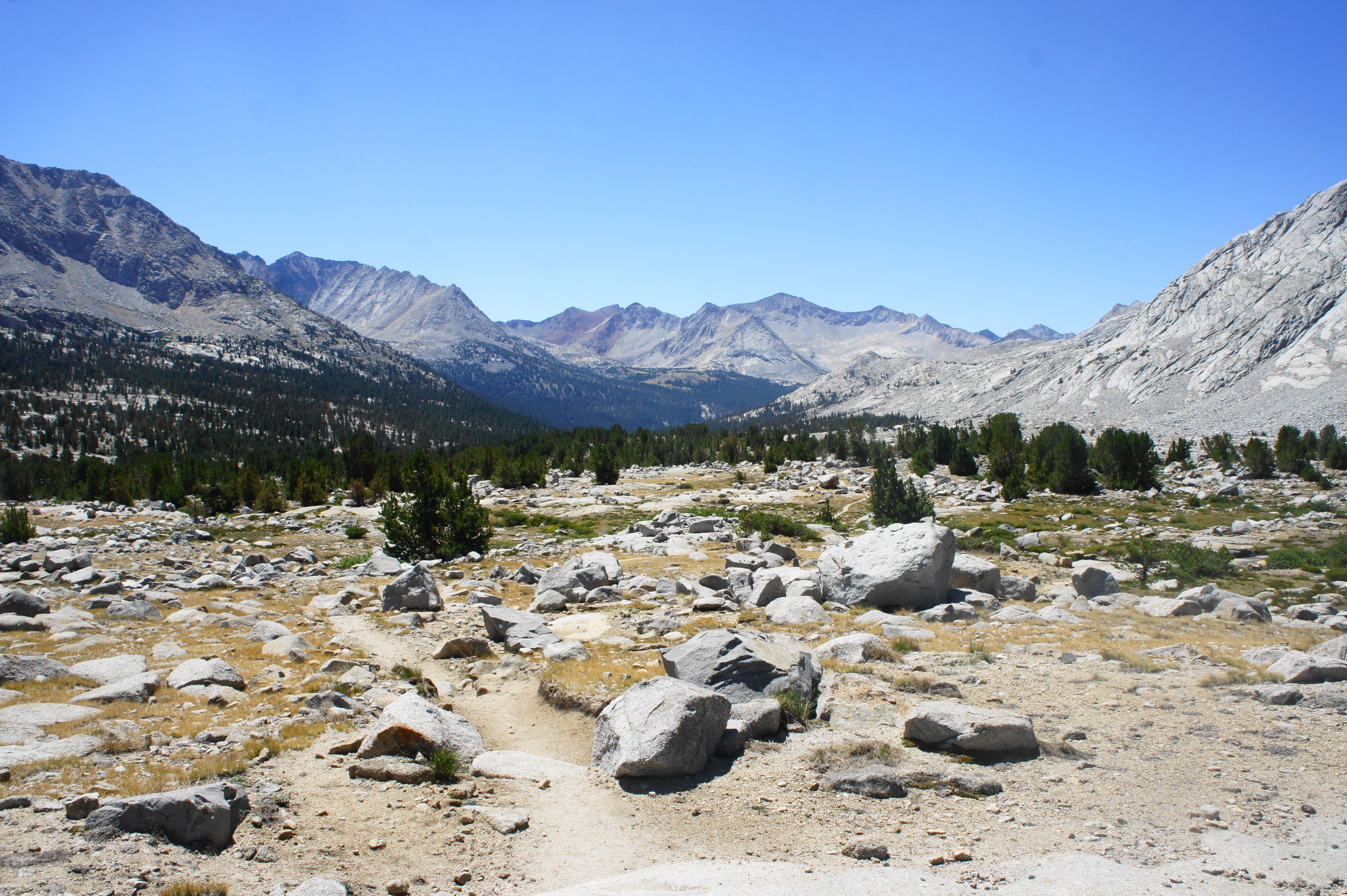
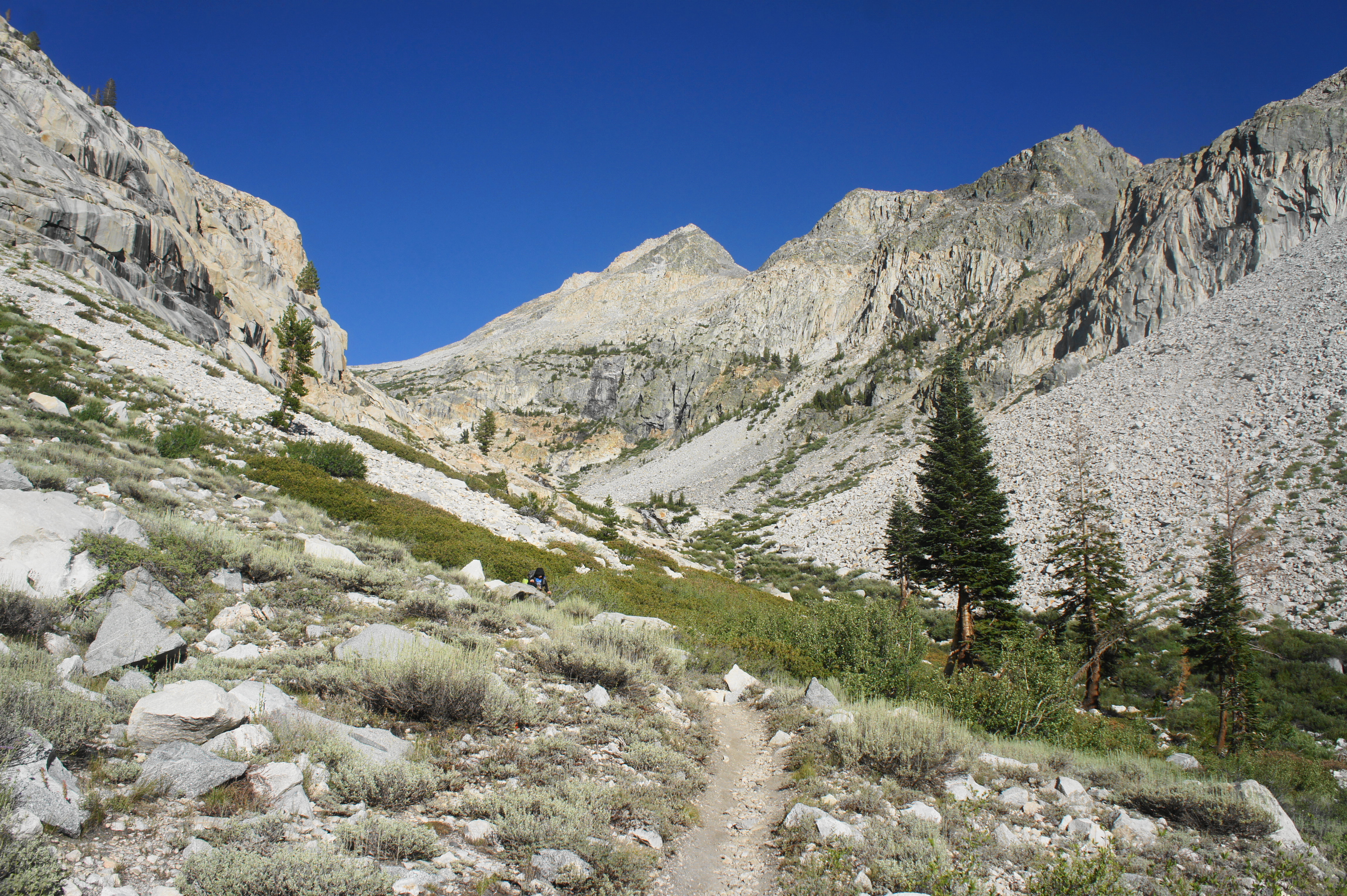
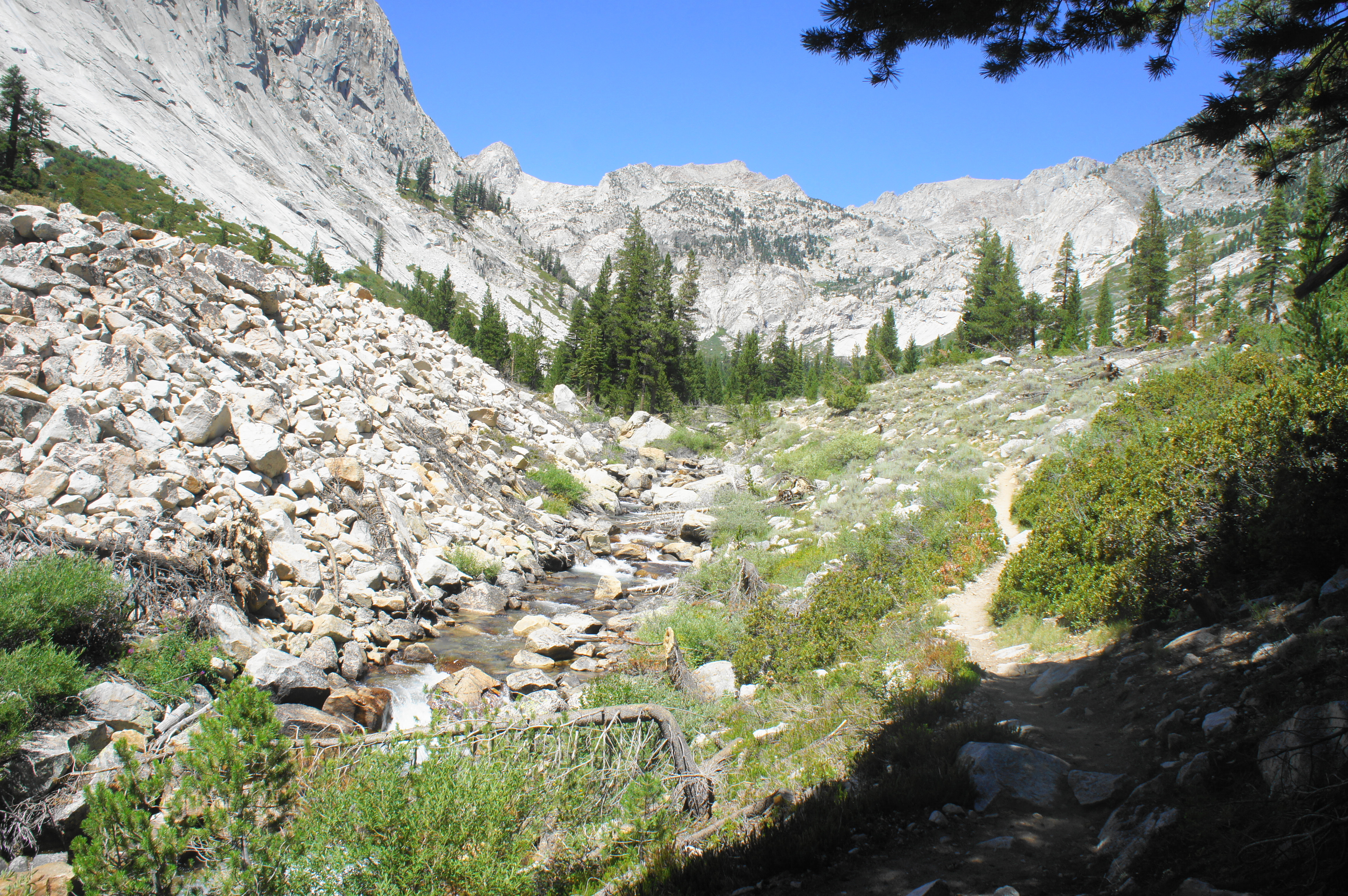
The subsequent section between Deer Meadow and Muir Pass begins as a very mild and pleasant walk through deep, forested canyons, followed by the inevitable uphill back to the timberline and beyond. The westward path from Deer Meadow gradually descends into ever-thicker woodlands, staying consistently to the right of Palisade Creek—but never crossing it. Occasional open patches offer distant views of the Black Divide and other ragged peaks of central Kings Canyon, while aspens—and pine trees with huge cones—increasingly dot the landscape.
After three to four miles from the various Deer Meadow campsites, the trail suddenly drops quickly down to a junction, where a path heads left down the Middle Fork of Kings River drainage toward Cedar Grove and the main visitation area of Kings Canyon National Park. The Middle Fork comes into view just ahead, near the confluence with smaller Palisade Creek, which hikers had been following for several miles to this point. At just over 8,000 feet, this is the lowest elevation of the entire JMT hike (from Cottonwood Pass) thus far.


Taking a right on the JMT/PCT, the northward route formally enters Le Conte Canyon, a lengthy valley that is fed by the Middle Fork and bounded by the Black Divide on the west and Sierra Crest to the east. After the junction, the trail climbs steeply, passing lovely forested cascades and a couple of swimming holes on the left. Then the path levels off for a mile or so, and the rumbling waters of the Middle Fork turn suddenly still and quiet as the trail passes Grouse Meadows on the left. These marshy meadows are a lovely spot to stop for a break (or set up camp), with excellent views of the chalky white peaks to the west and north. There are also patches of blueberry bushes that reach their peak in around late August.


After Grouse Meadows, the trail returns to thick lodgepole forest, with a few spots where one can sneak a peek of a waterfall coming down from a stone gap to the west. This is Ladder Creek, fed by Ladder Lake and the snowmelt from the Black Divide.


Ahead the tree cover weakens and the vegetation transitions to manzanita and a wider array of conifers. The trail steepens again, climbing alongside small waterfalls on the Middle Fork. After crossing a footbridge over Dusy Branch, the JMT reaches another junction, this one with the Bishop Pass Trail. Here hikers enter from the South Lake area, a popular starting point for the North Lake – South Lake Loop, a shorter, week-long journey that covers some of the best terrain in northern Kings Canyon National Park.
After passing the junction and the Le Conte Ranger Station, the onward trail climbs mildly to Little Pete Meadow, which is not so little at all. Beyond the meadow is the hardest climb since Mather Pass—a relentless, sun-exposed ascent clears around 300 feet to crest a rocky shelf. The views looking back down Le Conte Canyon are spectacular, with hikers in awe at the amount of ground they have covered thus far.

From here the trail levels off again and rounds a dogleg left to skirt Big Pete Meadow, which boasts some lovely streamside campsites. After crossing two modest tributaries in quick succession, the JMT begins a gnarly, exposed climb with lots of loose gravel. From here until Muir Pass, hikers will gain more than 2,700 feet in elevation.
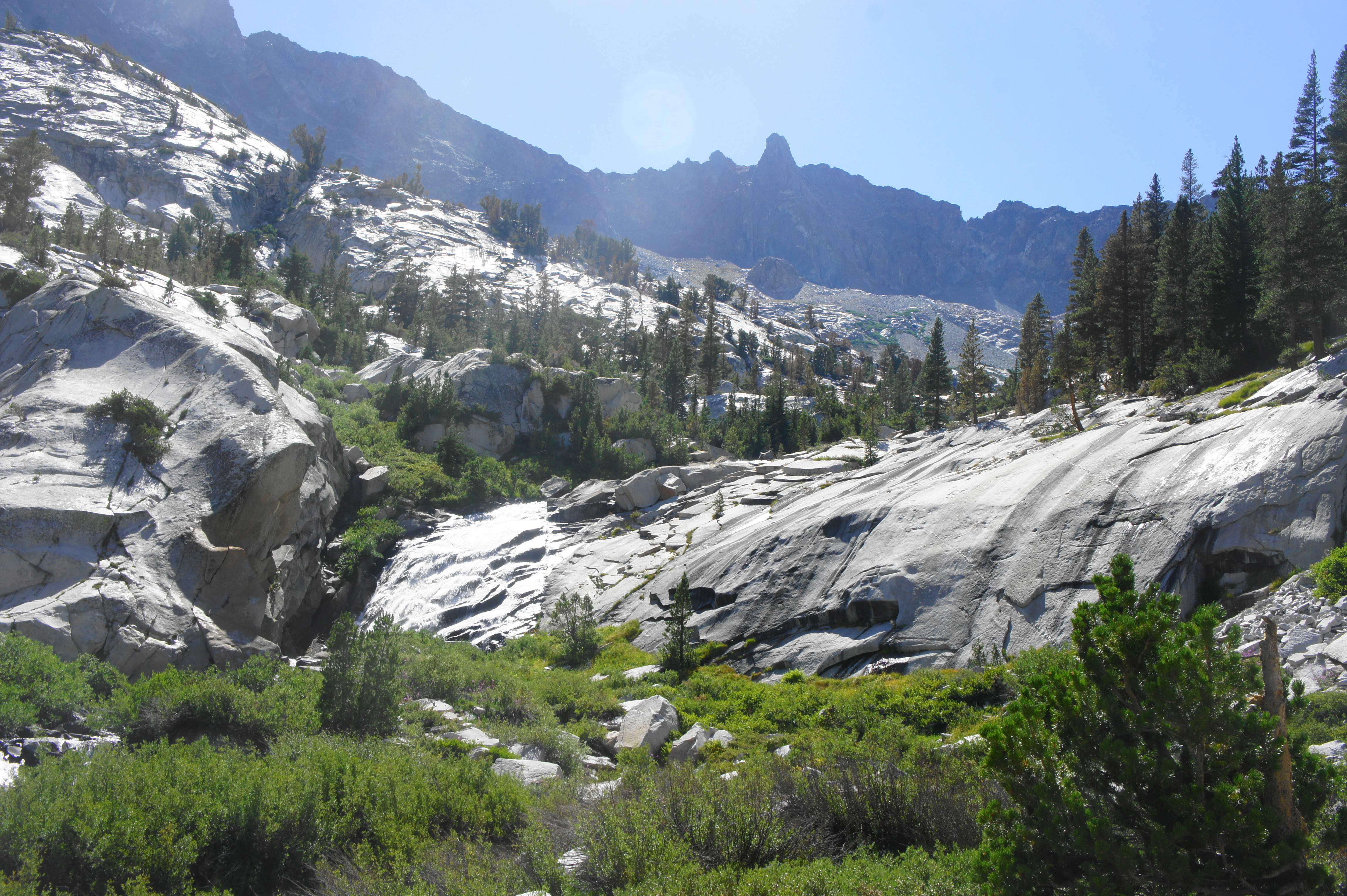
Following the Middle Fork as it narrows but drops over tumbling cascades, the trail skirts a talus slope, approaching a stunning waterfall—one of the largest seen yet on the hike—on the left. After switchbacking up a granite notch, there is a second set of falls, after which the terrain suddenly levels off and reaches a meadow and marshy area informally known as Starr Camp. (Note: This site is unsigned and not marked on maps but is somewhat obvious when hikers reach it.) Here there are plenty of camping opportunities, most off to the left, across Palisade Creek to an unnamed, hidden pond. (Note: Even better campsites lie about ¼ mile further at a flat area tucked on a shelf above a narrow canyon, with another waterfall just beyond to the north.)


The distance from the Deer Meadow campsites to here is roughly 10.5-12 miles, depending how far one pushed on the previous day. Ambitious hikers can continue onward toward Muir Pass, although there is a relative dearth of sheltered campsites between here and the other side of the pass.

Trip Report: On our first day without a mountain pass since Day 4, we covered about 10.5 miles on Day 11 and camped at a spot about ¼ mile past Starr Camp, with great access to the stream and views of tumbling waterfalls. This was a veritable paradise, although it did get a tad cold at 10,500 feet. We had now gone 11 days with no rest days, but our packs were getting lighter, and the prospect of seeing spectacular Evolution Lake and getting our resupply in the next two days kept us motivated. We were also nearing the halfway mark of the hike (we would reach it on the next day).
Starr Camp to Evolution Lake via Muir Pass (10.1 miles)
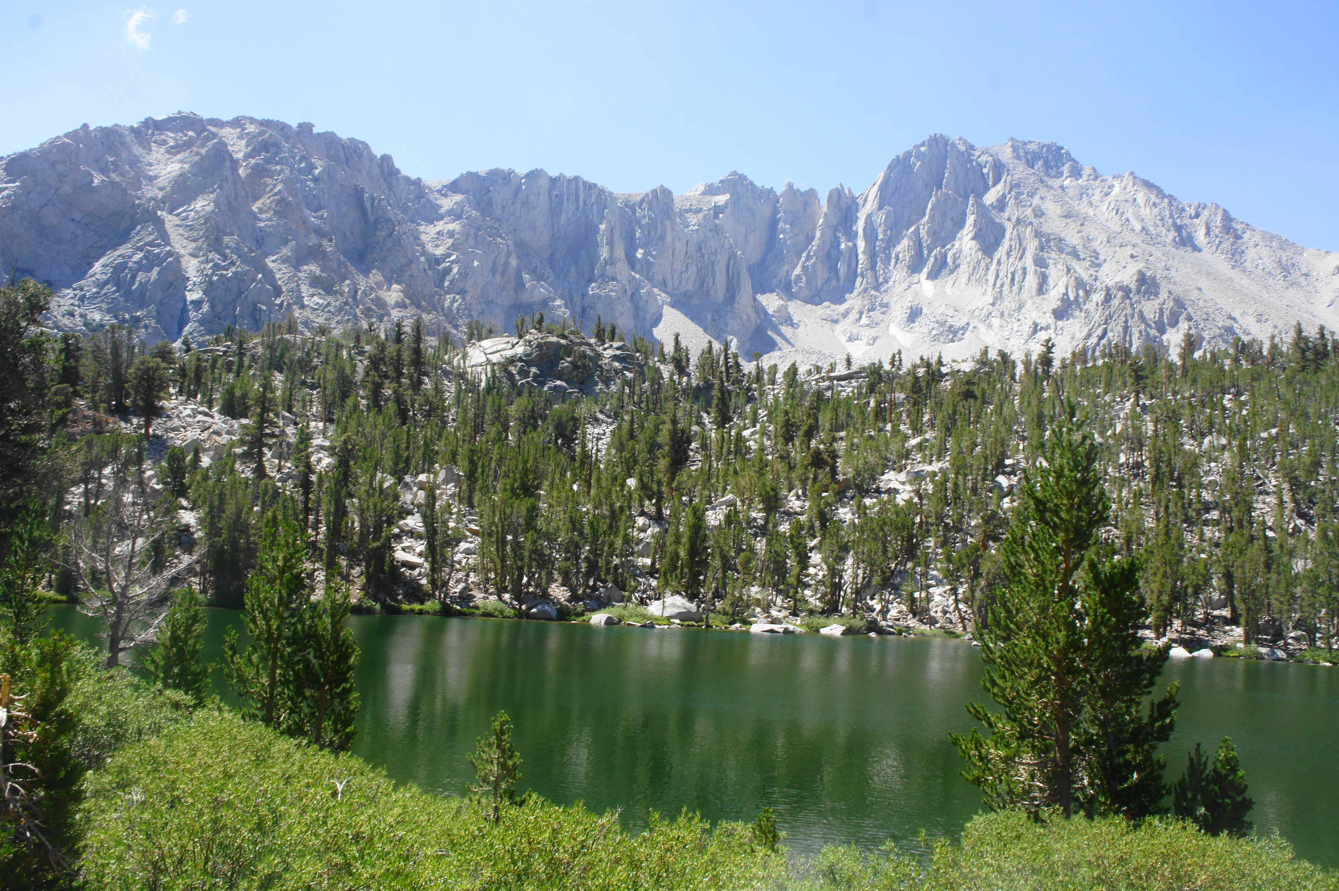
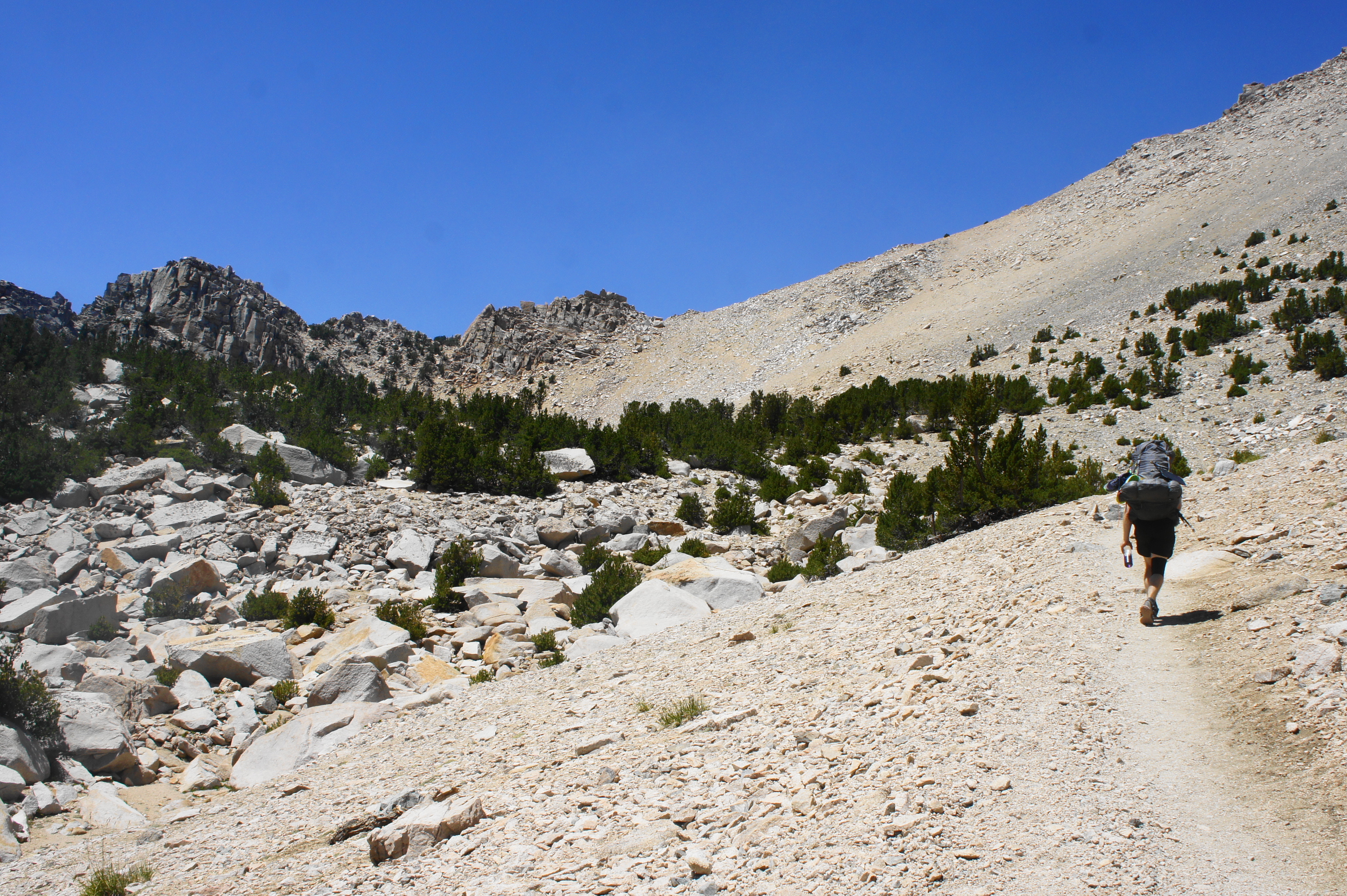
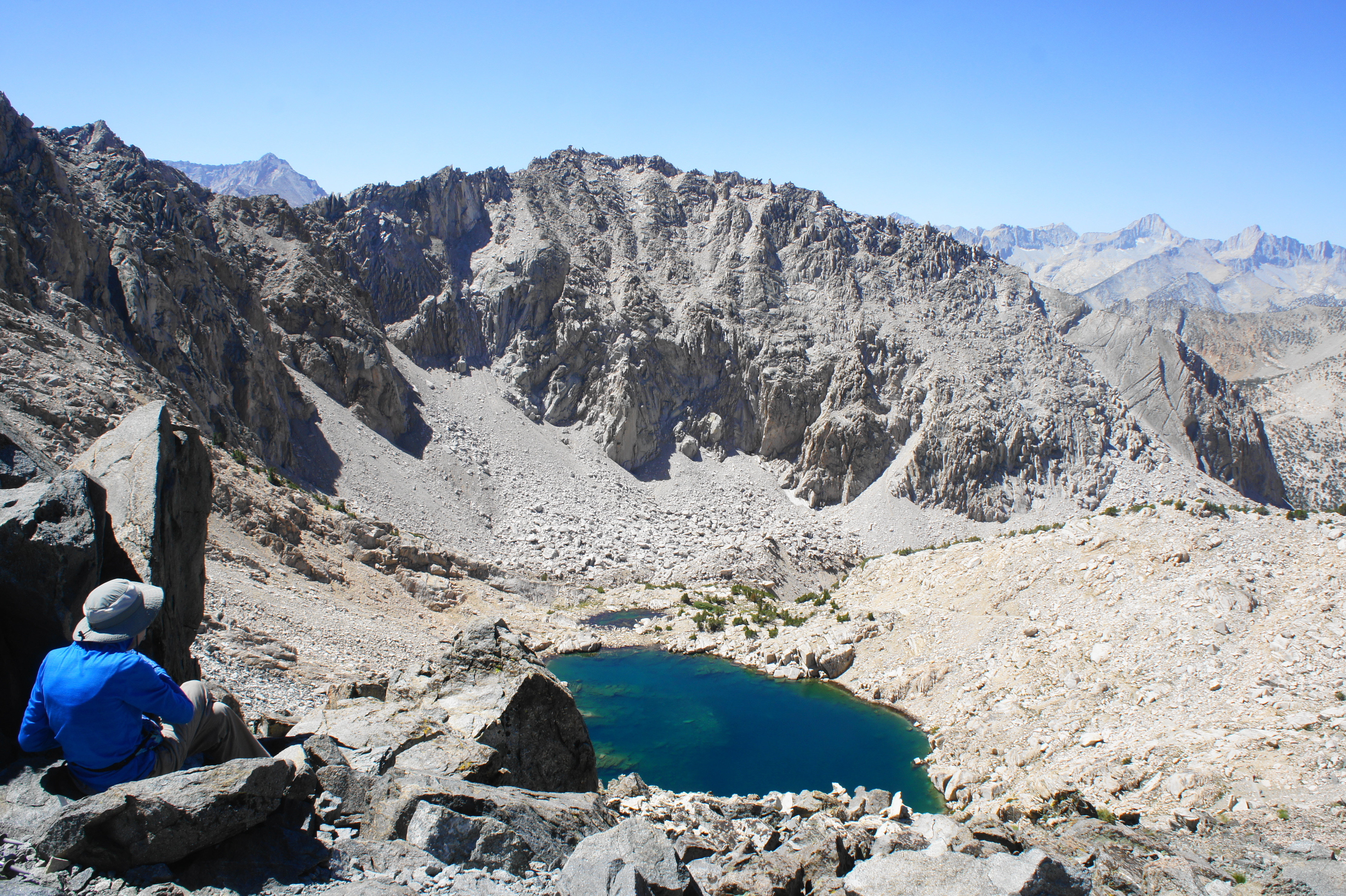
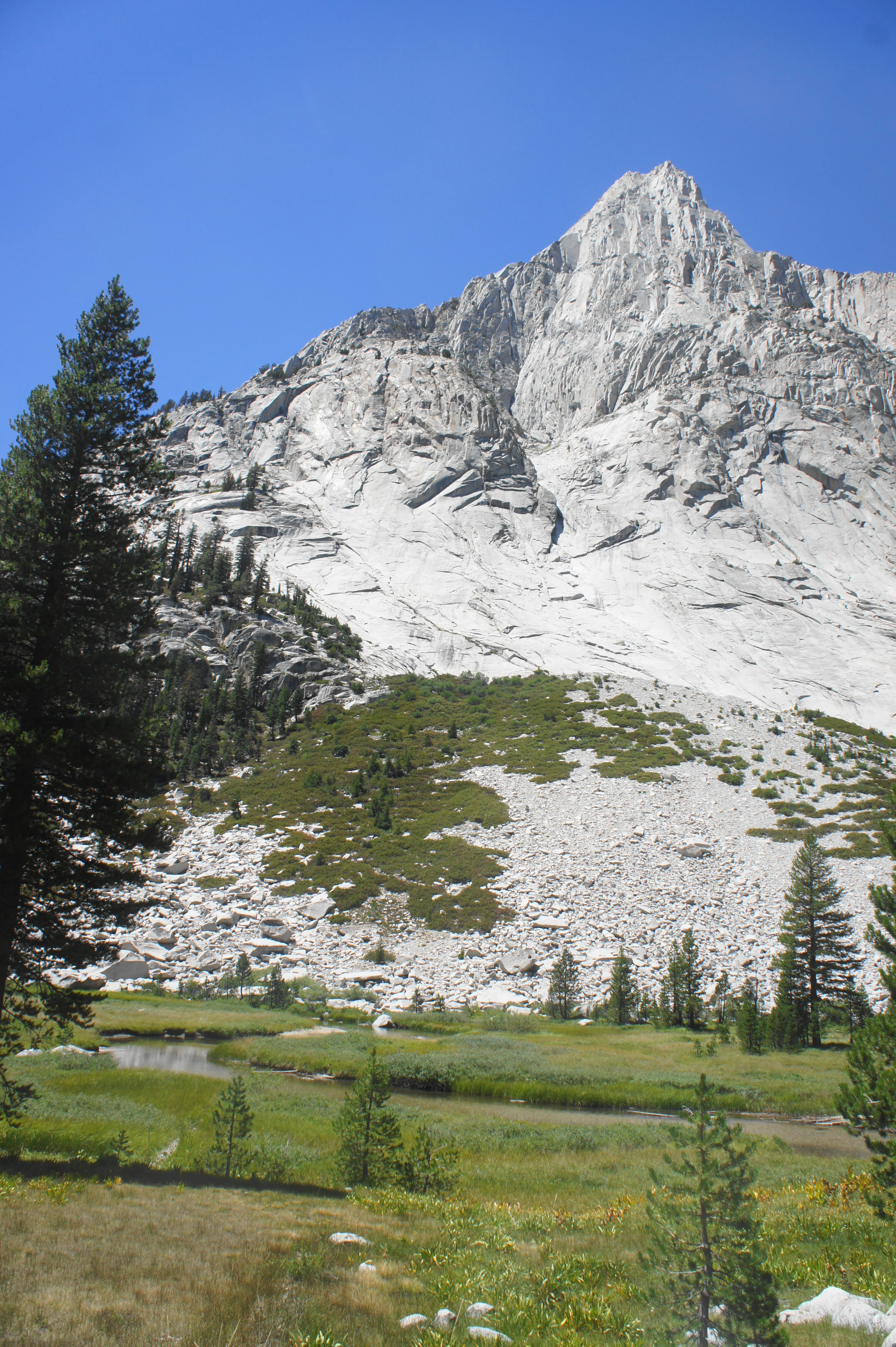
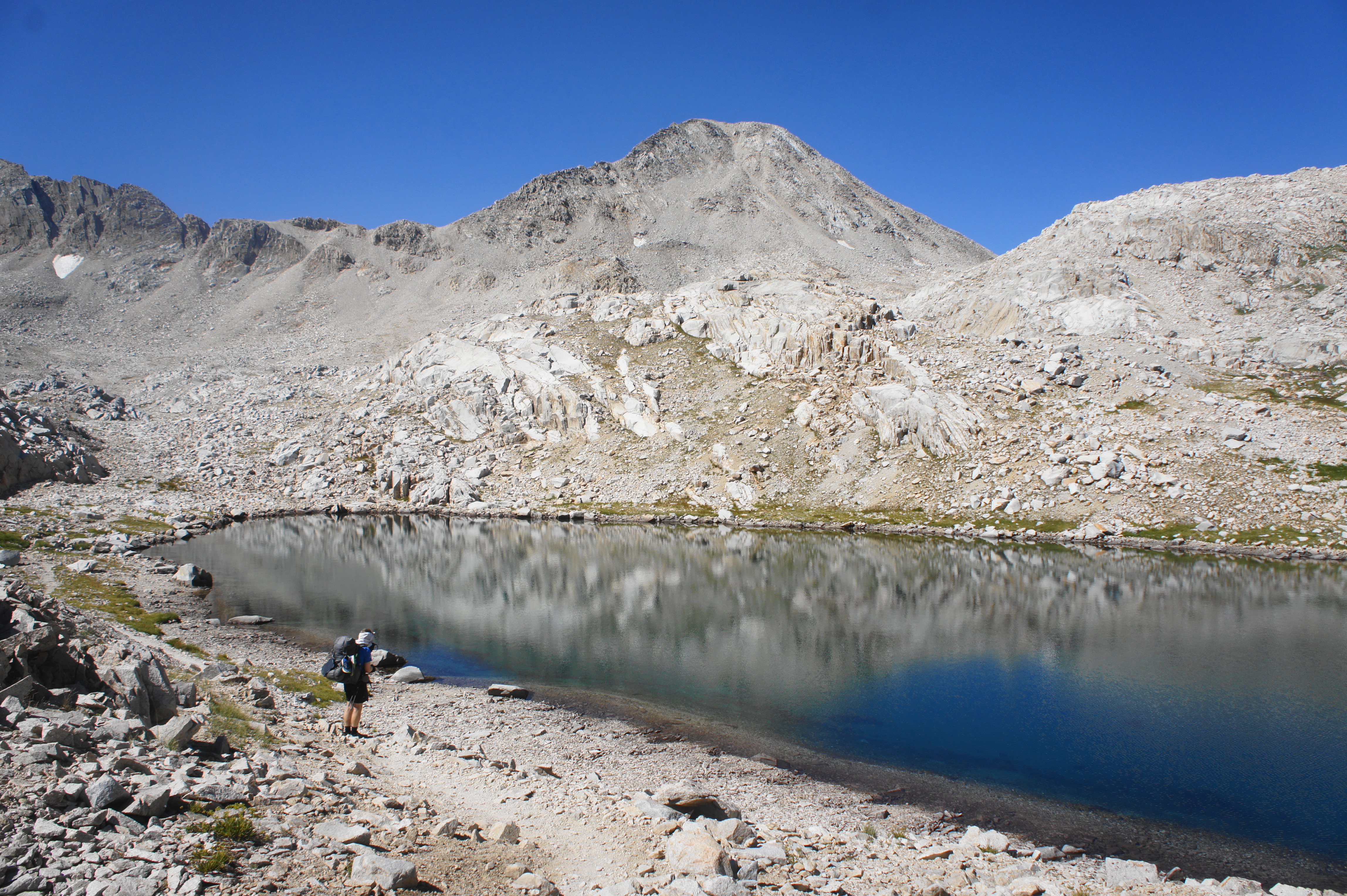
In the subsequent section, JMT hikers will emerge above tree line and tackle a desolate landscape of granite crags and boulder fields en route to Muir Pass. The climb from Starr Camp begins in the trees, passing clutches of pines and rising to an upper shelf with another scrubby meadow and waterfall. Upon climbing to clear the falls, the trail reaches another tier, this one with an unnamed lake on the right. (Note: There is no camping allowed at this lake.) The still waters reflect the towering peaks of Mount Warlow (13,286’) and Mount Fiske (13,503’) of the Goddard Divide, with the foreground lined with low grass and stunted shrubs.

Beyond this point, the vegetation largely disappears, and the trail switchbacks up a granite slope and crosses a side stream. Soon enough the JMT comes back to the northern banks of the Middle Fork of Kings River, now little more than a small creek. The trail follows a shallow canyon and cuts through a notch at the outlet of another unnamed lake, this one surrounded by bleak, dark metamorphic rocks.


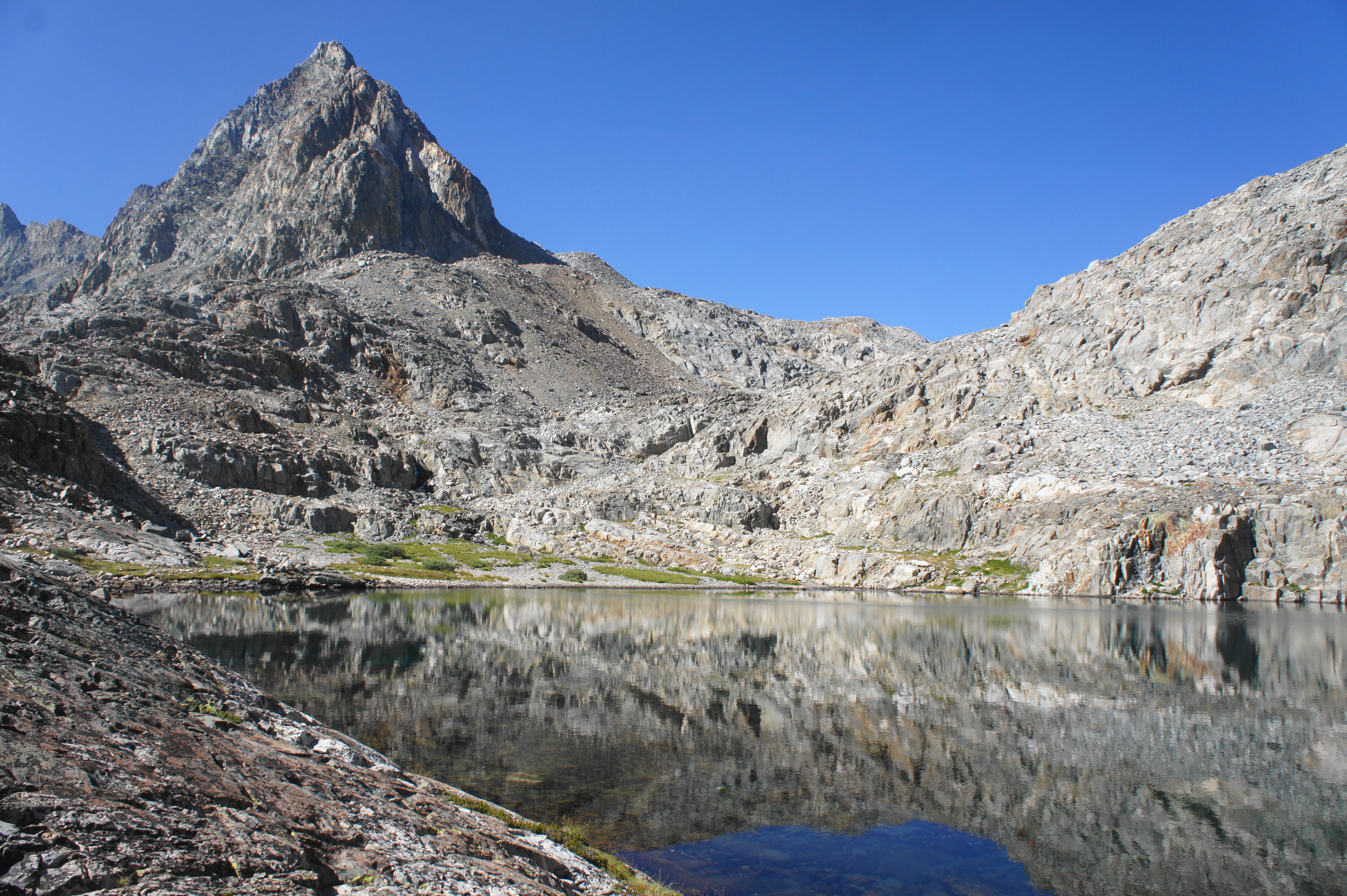
From the far side of the lake, the trail follows the river to its headwaters at Helen Lake, a surprisingly large and majestic lake set in a glacial cirque below the Goddard Divide. (Note: The lake was named after one of John Muir’s daughters; nearby Wanda Lake was named after his other daughter.) There is nary a tree or shrub in view at Helen Lake, and camping here in the windswept cold would not be ideal.

From the outlet of the lake, the trail cuts southwest above the shores, approaching the final approach to Muir Pass, which is notably milder than the brutal final pitches at Pinchot or Glen. After reaching nearly 12,000 feet, the John Muir Trail crests its namesake Muir Pass, which boasts a semi-famous stone hut, constructed in 1930.
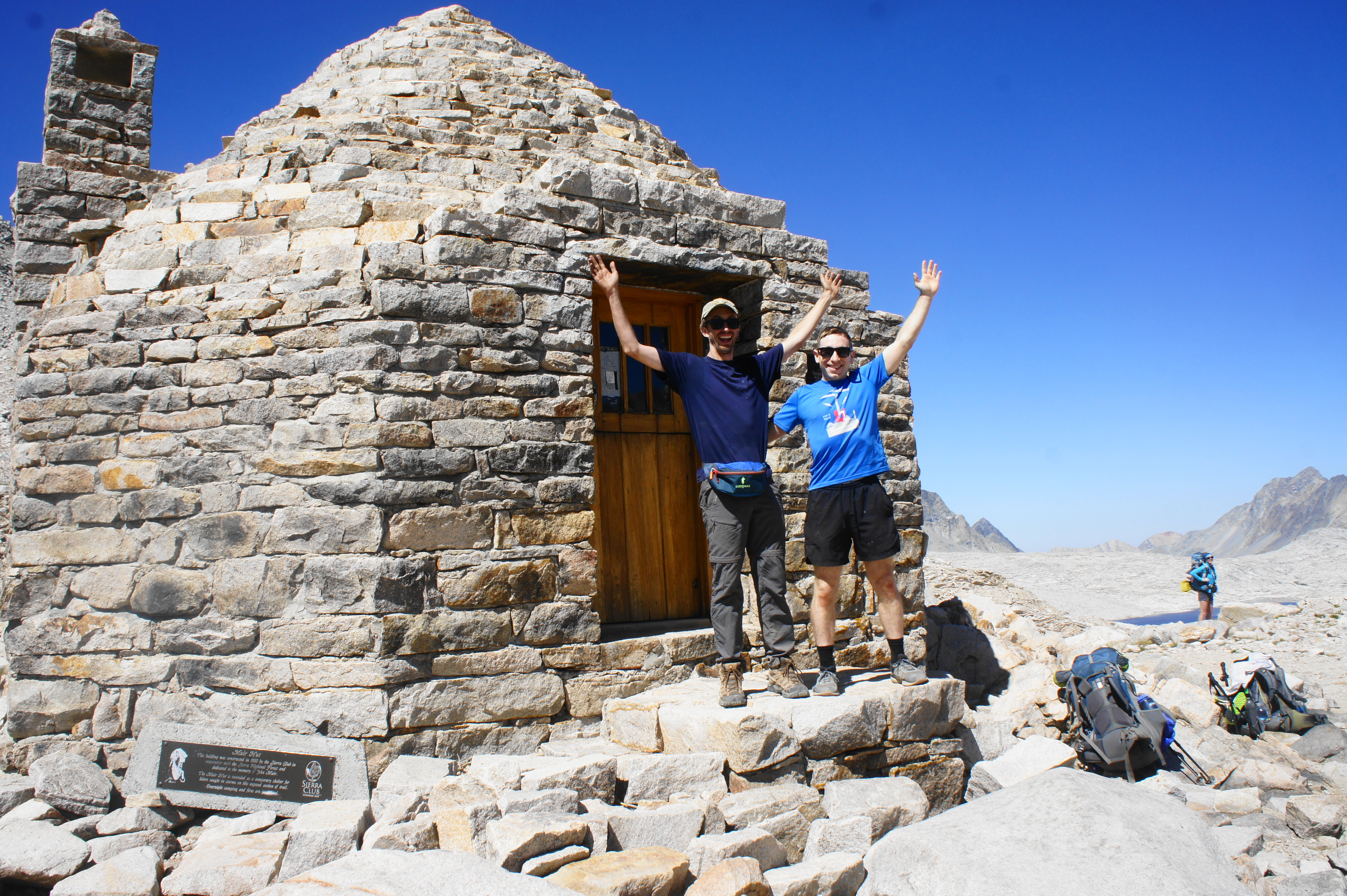
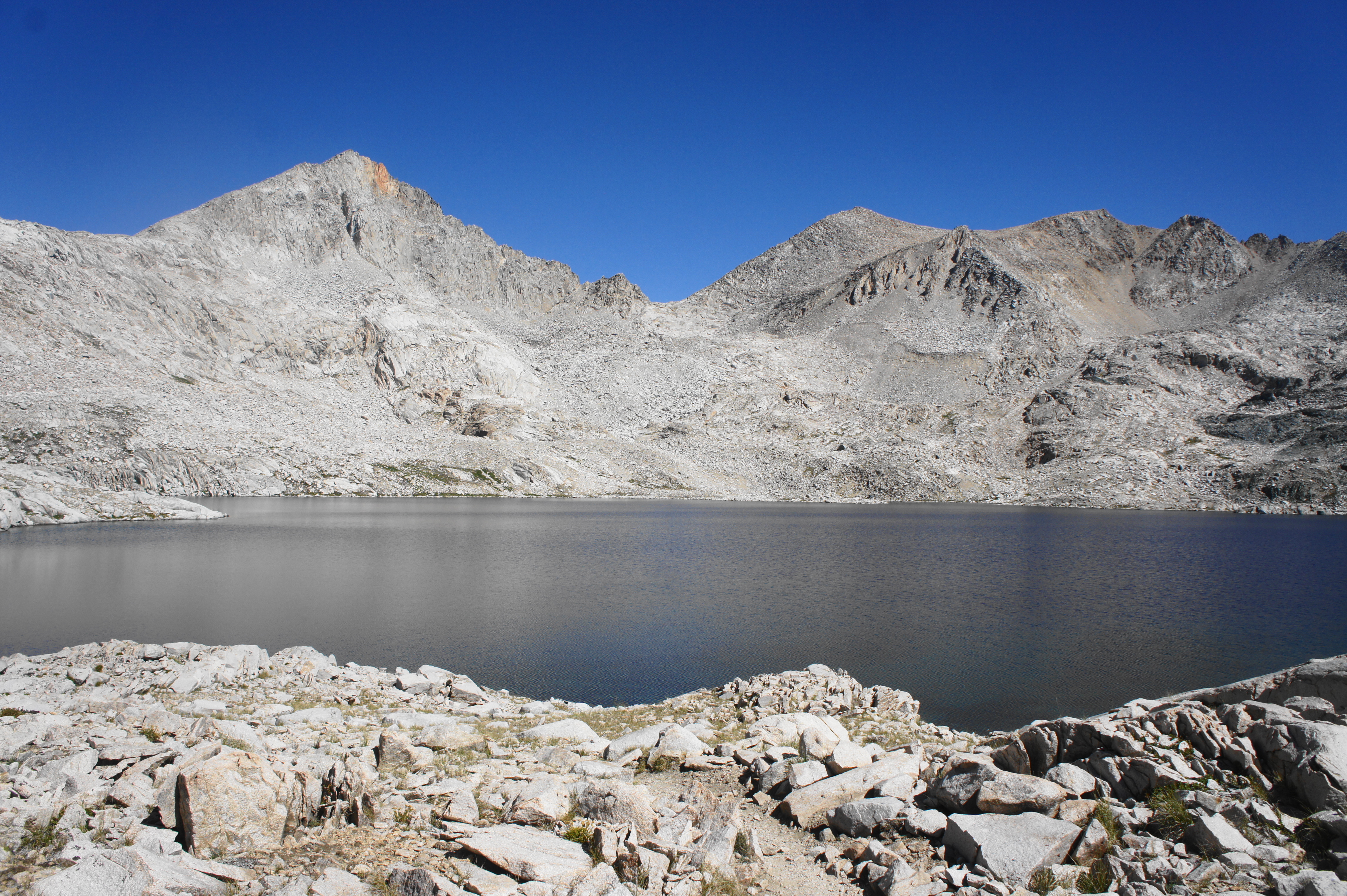
At 11,980 feet, Muir Pass is the highest point remaining on the northbound JMT – while there will still be ups and downs, hikers will not reach another 11,000-foot pass until Donohue Pass (11,060’) in Yosemite. One can get a sneak peek at the coming landscape by peering westward across the mostly barren landscape, filled by two glimmering lakes—Wanda Lake and Lake McDermand—in the basin below. However, the onward passage into Evolution Valley is hidden from view for now.
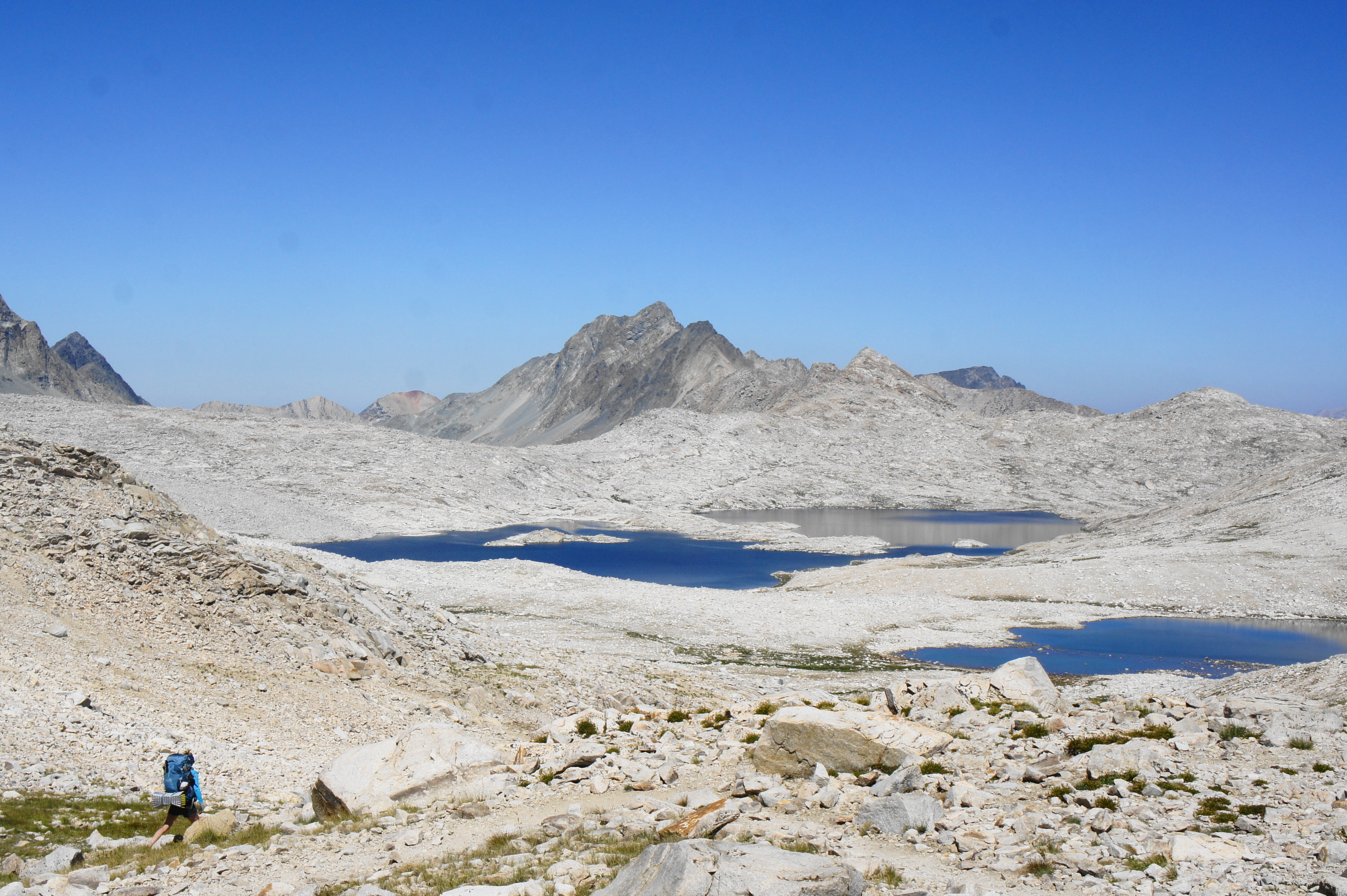
Descending into Evolution Basin from Muir Pass, the sun-exposed trail descends a series of rocky but relatively mild switchbacks and then skirts Lake McDermand on the left. After a short uphill, the JMT descends to the much larger Wanda Lake, which—despite having no tree cover—has a handful of campsites that are frequently used by southbound JMT hikers. For a lengthy period, the trail abuts the shoreline, allowing travelers to peer down into the crystal-clear but chilly waters.


After following the length of Wanda Lake, the trail crosses the beginnings of Evolution Creek and follows it northward as the terrain drops a level, reaching another unnamed lake between Wanda and Sapphire Lakes. Some modest vegetation begins to appear as the path drops steadily to Sapphire Lake, another exceptionally pretty destination, in the shadow of imposing Mount Huxley (13,086’). There are a few campsites in the sandy section near the lake’s shores, but shade remains at a premium.

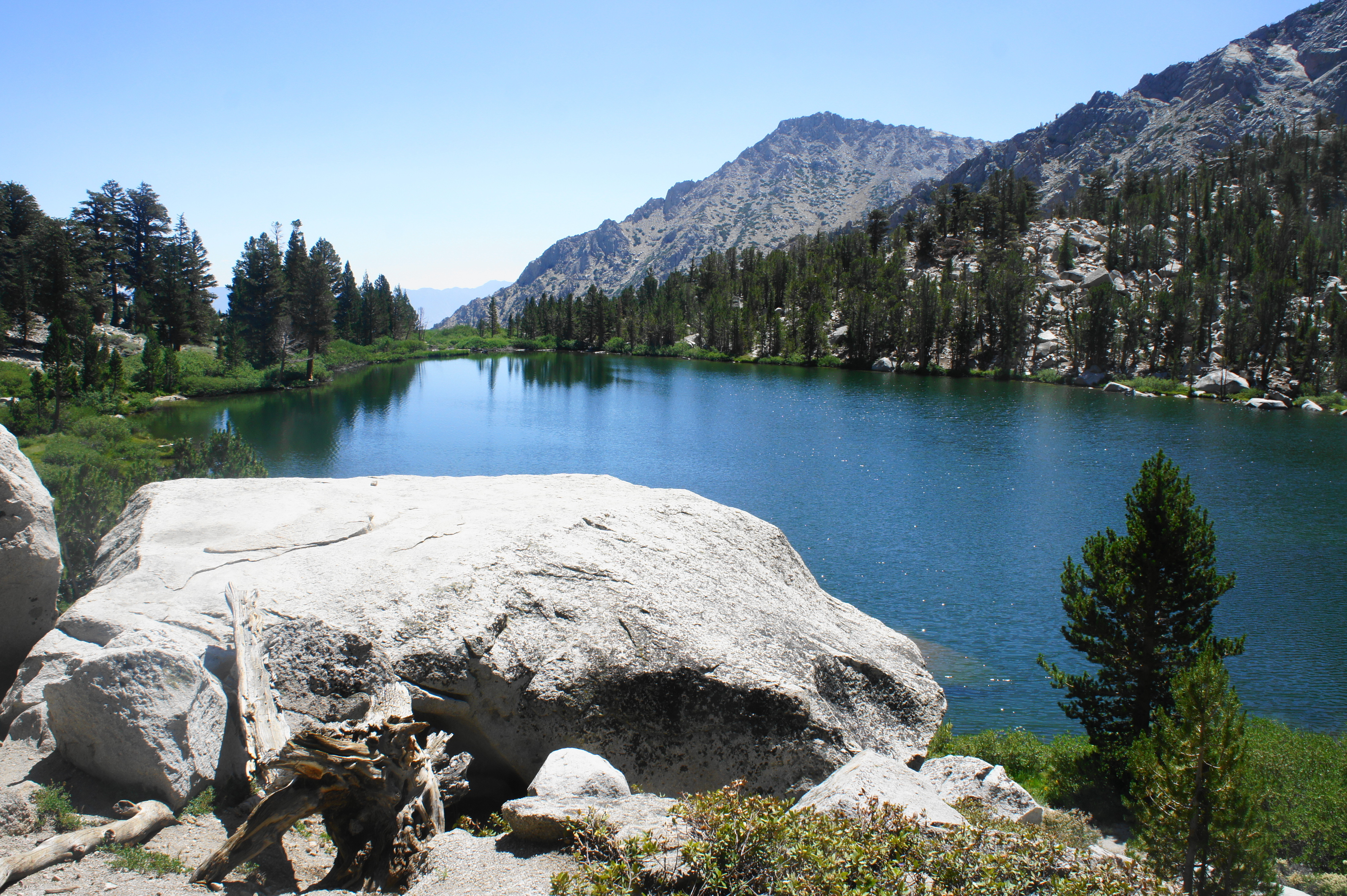
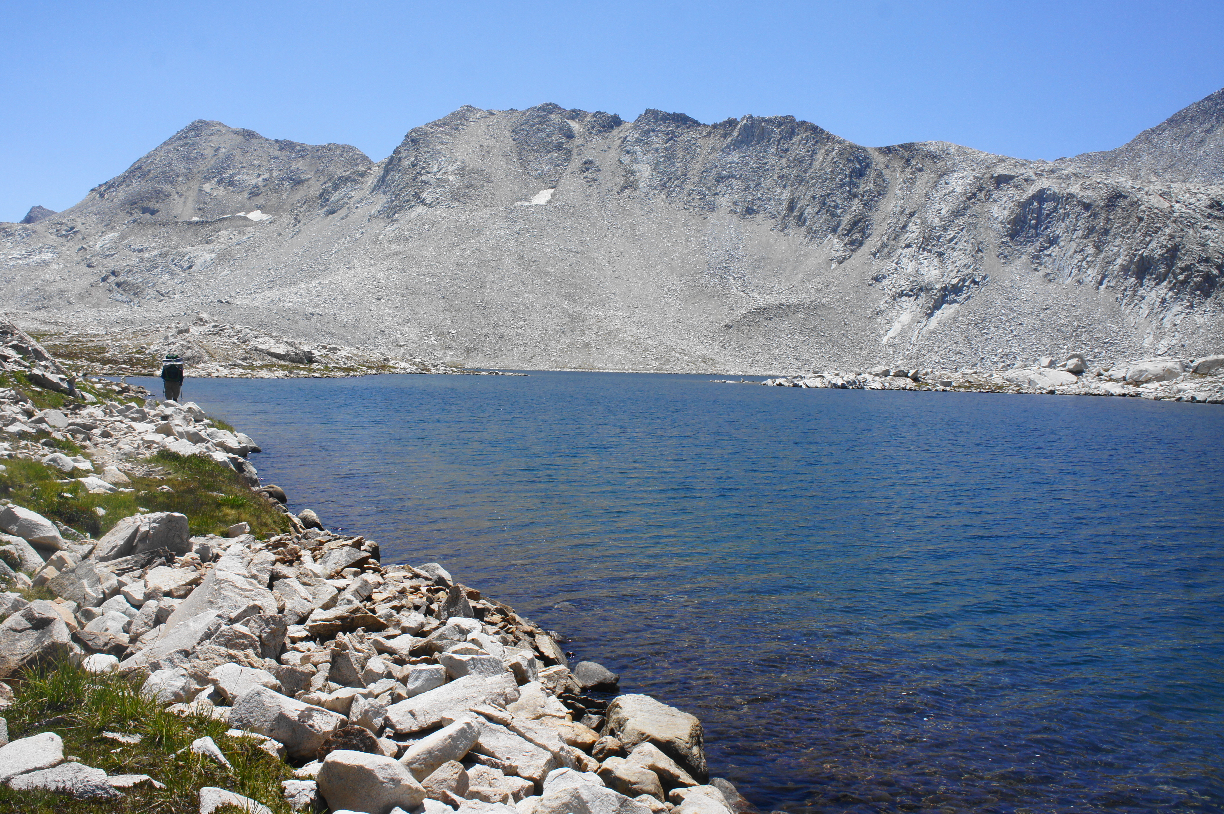
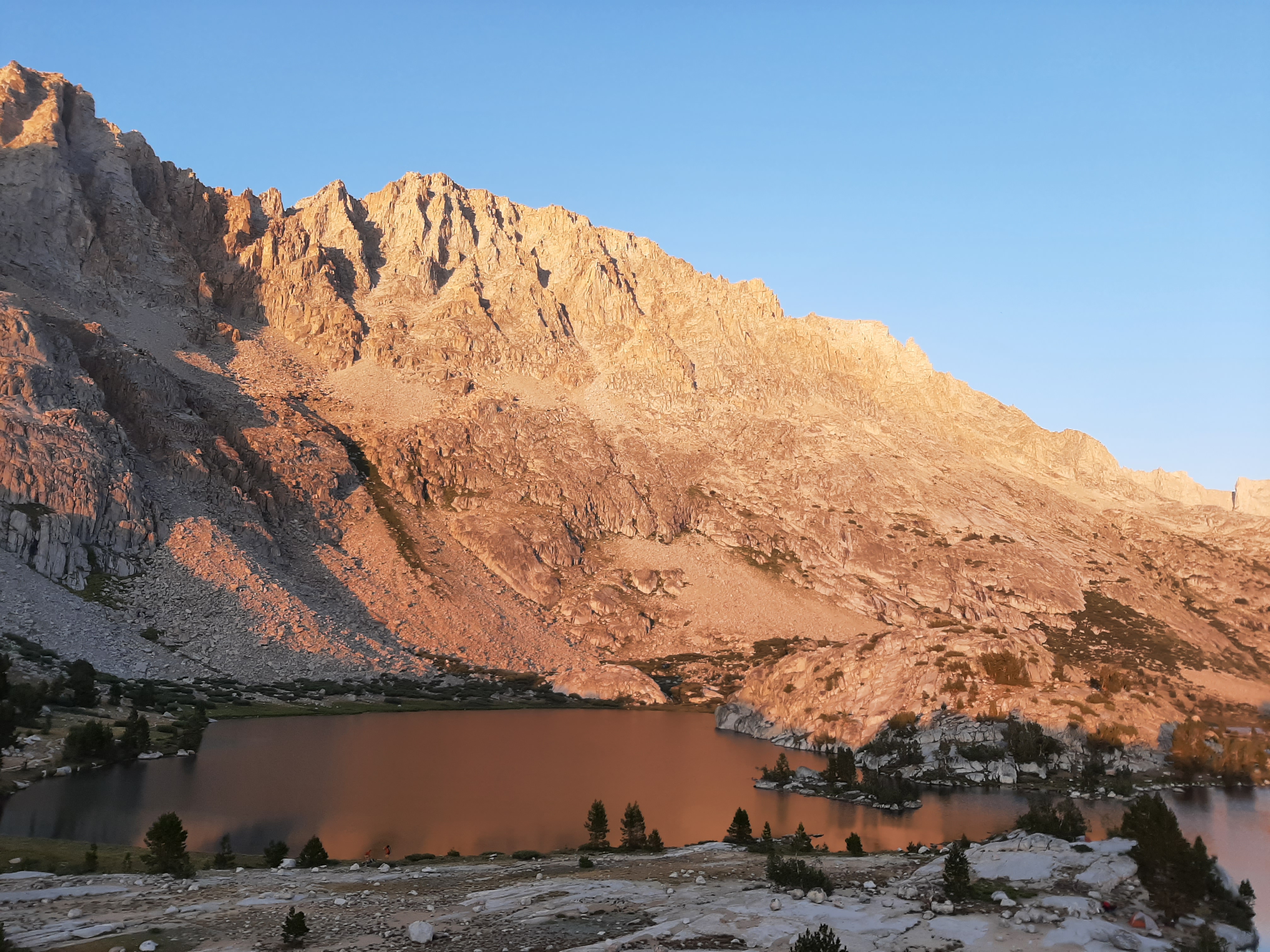
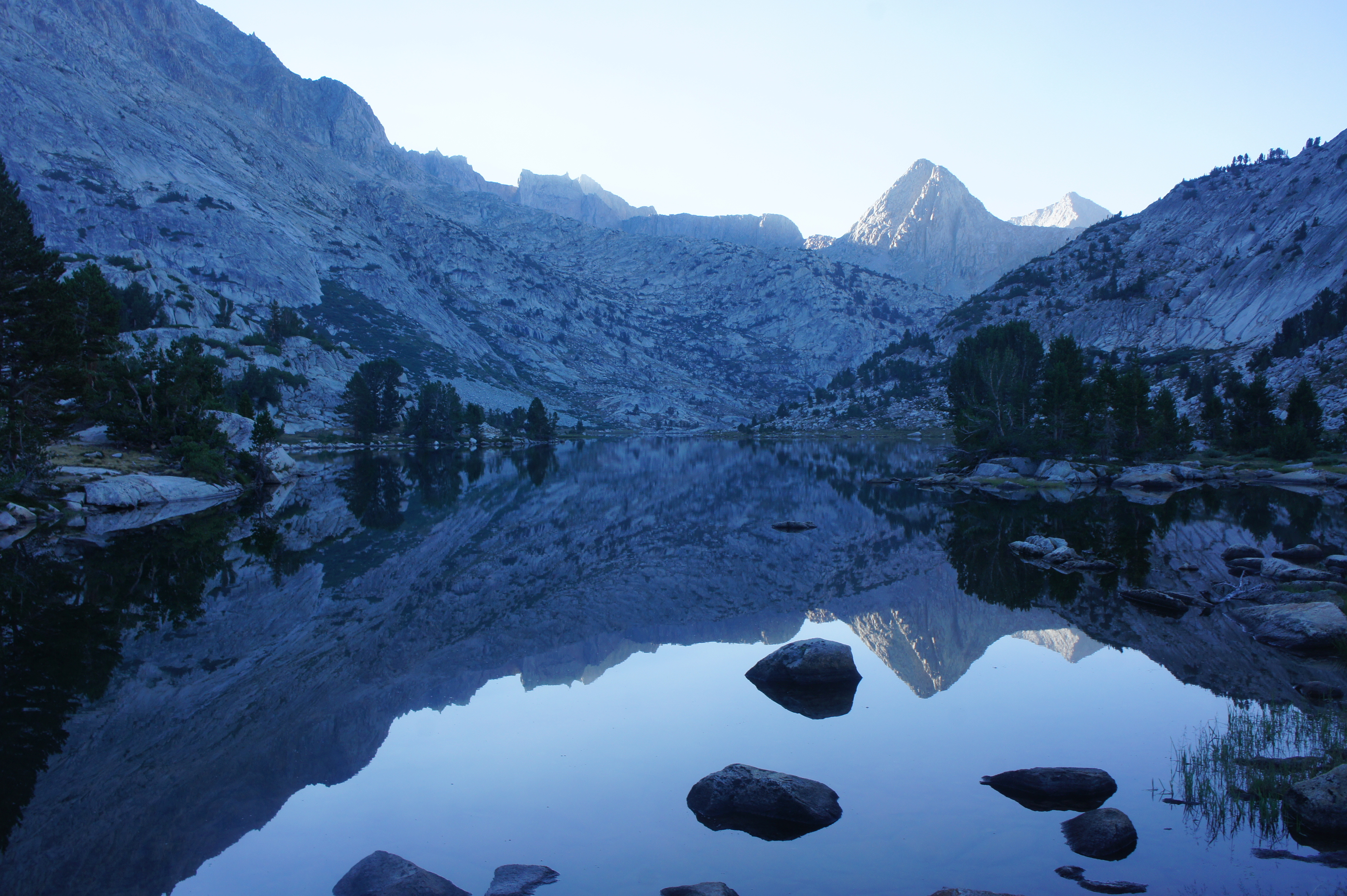
Hikers in search of camping are better-suited pushing onward to Evolution Lake, the final of the three named lakes in the Evolution Basin and easily the most spectacular. Bounded by steep cliffs to the east and west, the lake extends length-wise, filling pretty inlets and producing small islands studded with granite and occasional conifers.

While the trail follows Evolution Lake for 1.5 miles, it largely keeps its distance so as to protect the fragile lakeshore, and the majority of the campsites are located at the northern end near the outlet. Here the lake suddenly gives way to a stream that tumbles more than 800 feet to spectacular Evolution Valley below.


To reach the top of these cascades, detour left just as the trail turns away from the far western end of the lake, following a well-worn trail to Evolution Creek and the lip of a granite slide where the terrain appears to fall off a sudden cliff. There are some premier campsites in this area, and the granite knob off to the right is an exceptional spot to watch the sunset. Even if one arrives relatively early in the afternoon to Evolution Lake, it is worth staying the night so as to take in one of the JMT’s most beautiful settings.


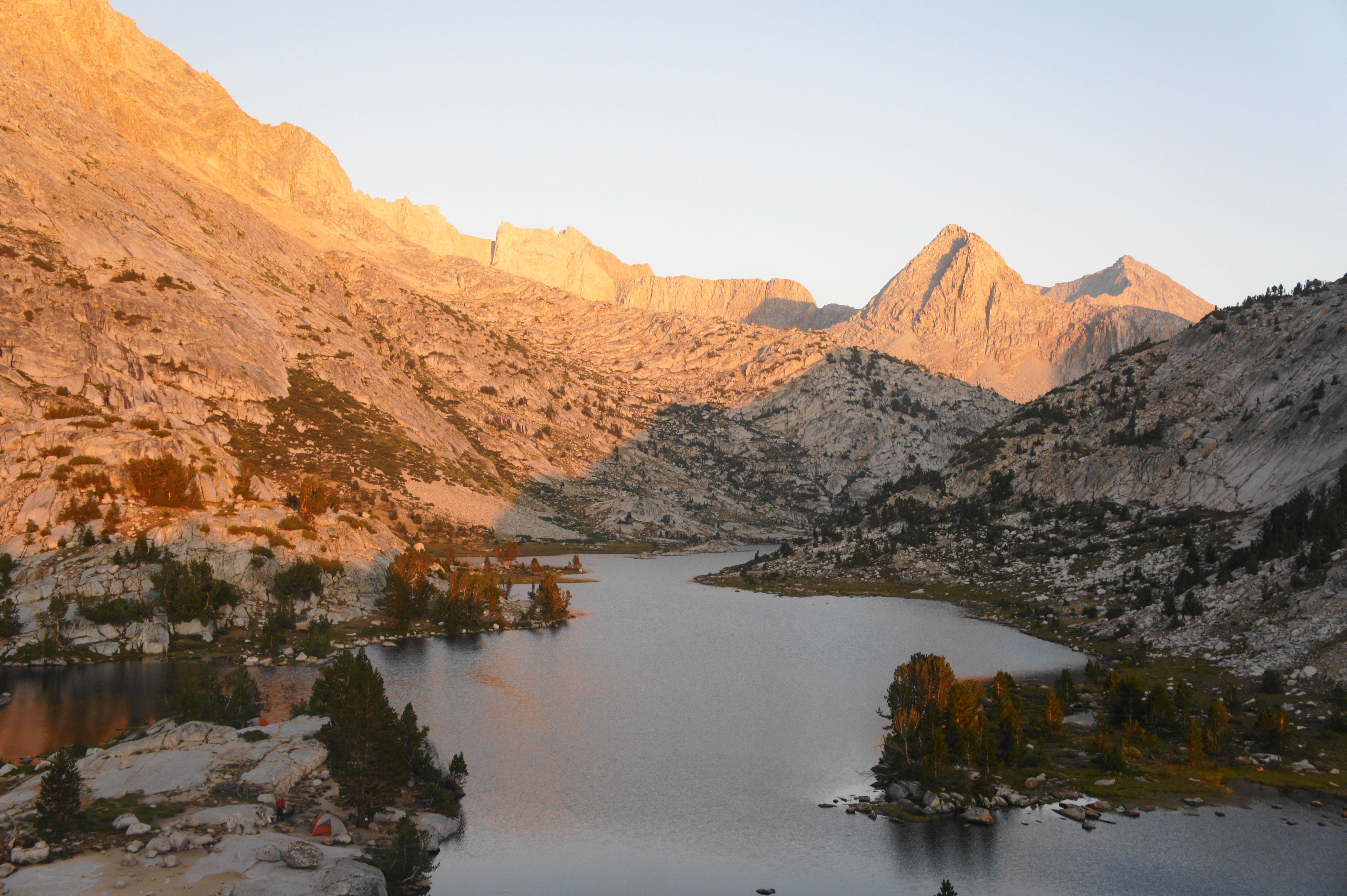
Trip Report: Covering just ten miles with relatively modest elevation gain, this was one of the easiest days thus far, but, knowing that Evolution Lake would be a highlight of the trip, we elected to camp there instead of pushing farther on. As we set up camp, we witnessed the arrival of a search -and-rescue helicopter—guided in by the McClure Meadow ranger—to fly out a camper who had broken his ankle climbing a nearby stony knob. As the sun set, I set up atop the granite bluff at the western end of the lake and watched as the skies filled with orange, red, and purple hues. The sun set almost perfectly in the aperture cut by Evolution Valley to the west, capping off another terrific day on the trail.


Evolution Lake to Muir Trail Ranch (14.9 miles)
From the west end of Evolution Lake, the earth gives way and drops abruptly, with the remainder of Evolution Valley more than 800 feet below. One can spot McClure and Colby Meadows in the distance, followed by a slight southward curve in the valley that reveals granite-lined slopes and conceals the distant junction of Evolution Creek and the South Fork of San Joaquin River. Hikers will cover all of this terrain between Evolution Lake and Muir Trail Ranch.
From the outlet of Evolution Lake, the JMT leaves the lakeshore, following the left flank of a secondary drainage and then courses toward the thick lodgepole forest and a lengthy downhill switchback section. At the top of the switchbacks is an unmarked spur leading up Darwin Bench and Lamarck Col to the north. The main track, however, drops steadily and winds back and forth down woody switches to the valley floor below.
The switchbacks last more than a half-mile, after which the terrain levels and the trail courses west, following two partly-obscured waterfalls on the right. Both drain from Darwin Bench and fill a waterway that hikers must cross minutes later. This long, three-part crossing could be challenging at high water, but rocks and logs offer passage for much of the summer season.

From here the terrain becomes considerably easier and the trail settles into a mild and gradual descent for much of the length of Evolution Valley. Staying mostly in the trees, the JMT/PCT passes Colby Meadow on the left, then McClure Meadow about a mile later. The latter is a popular camping spot because of its fantastic views looking back east toward the High Sierra. The towering knob off to the right is called The Hermit (12,360’); one can also see beyond to Mount Mendel (13,691’), Mount Darwin (13,830’), and other distant mountains. There is also a ranger station at McClure Meadow, and easy access to water at the shores of Evolution Creek.

The onward path loosely follows the creek as it eventually leaves the meadow behind. About ¼ mile from the ranger station, the trail suddenly switchbacks down but then quickly settles back into its casual descent as the creek cascades down a slope on the left. The trail later passes through a gate and then skirts a bend in the stream to the left, followed by a mild descent in and out of pretty clearings.
The trail eventually comes level with Evolution Meadow, but it is not easily seen through the thick pines. After edging northward, the trail swings back around to the south to reach the crossing of Evolution Creek, situated about 6.5 miles from the outlet of Evolution Lake. (Note: Water levels remain reasonably high here year-round; in fact, on our July-August trip—during a drought year—this was the only time where we legitimately had to take off our shoes to cross. The creek was only ankle-deep and not particularly fast-flowing, however. At higher levels, it is safer to use an alternative crossing—marked on the Guthook app—about a half-mile upstream.)


From the south side of the creek, the trail settles back into a westward tread, and the stream turns from calm ripples to raging cascades and waterfalls. Pass a pair of 10- to 20-foot cascades on the right as the trail cuts in and out of talus clearings. The sharper terrain reveals a steady drop to the main canyon of the South Fork of the San Joaquin, with Goddard Canyon coming in from the left. As the trail settles into a set of steep switchbacks, the crumbly trail is dotted with darker-hued metavolcanic rock that is around 160 to 130 million years old.

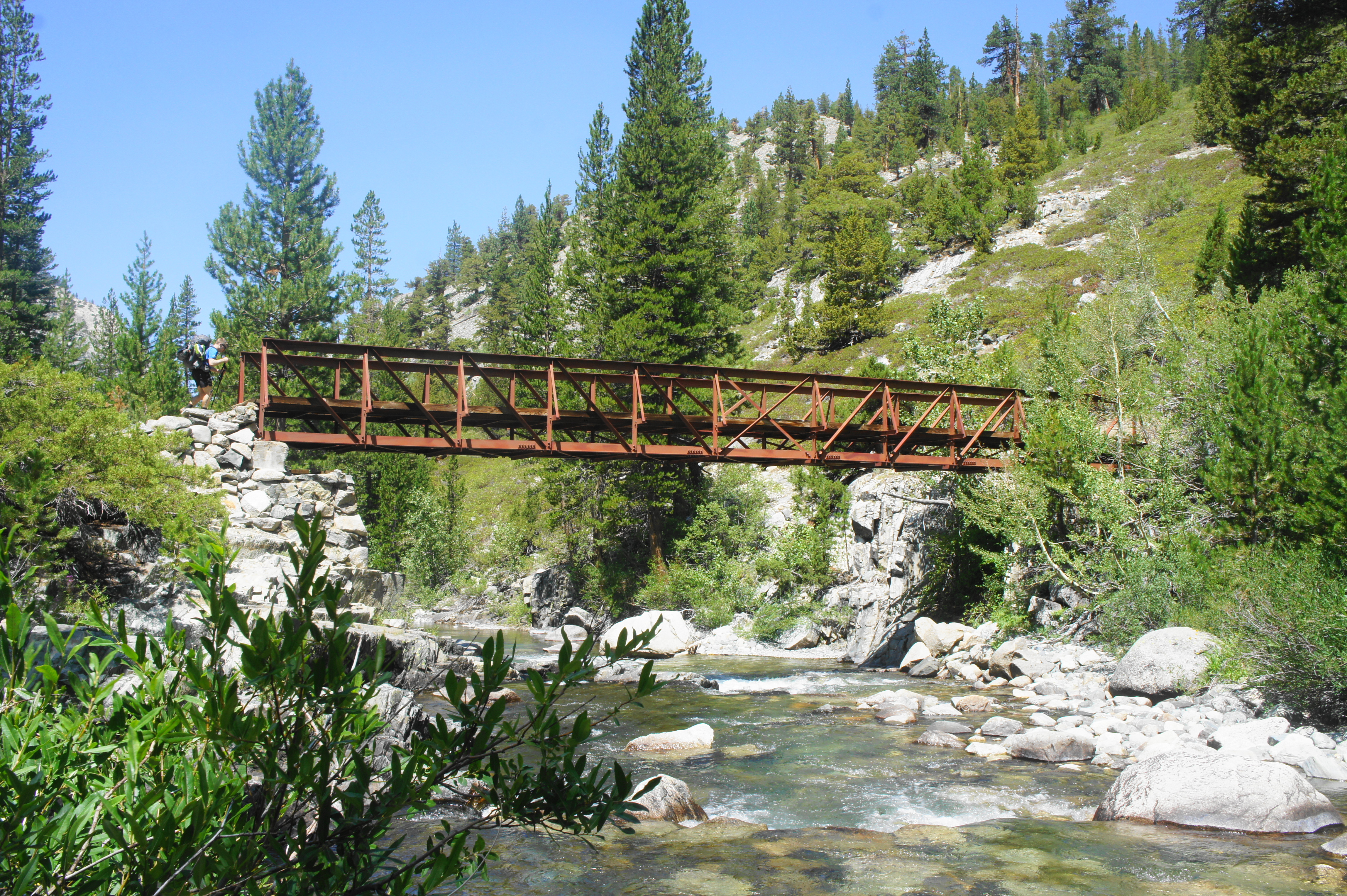
The temperature notably rises as hikers descend into the warm and dusty canyon, cutting north and south down the switchbacks before coming out at a bridge over the South Fork of the San Joaquin River, the main drainage in the area. Right after the crossing is a junction; JMT hikers should continue right.

Now heading north, the trail follows a dry—and then wet—tributary wash before reaching the banks of the San Joaquin again, this time downstream from the confluence with Evolution Creek. Cross another high bridge over the river, entering a section that interchanges shady woods and exposed rock slides. The canyon narrows considerably as hikers hug the north banks of the San Joaquin, at some point passing the modest Aspen Meadow, where its namesake trees can be spotted, though not necessarily in great abundance.

At one point, the onward path climbs briefly to clear a narrow cleft, overlooking the rushing waters below, then descends and cuts through manzanitas to a bridge over Piute Creek, a majority tributary of the San Joaquin. A junction lies just beyond, and—for the first time in several days—hikers depart Kings Canyon National Park. (Note: Hikers on the North Lake-South Lake Loop will use the Piute Canyon Trail heading east toward Piute Pass.)

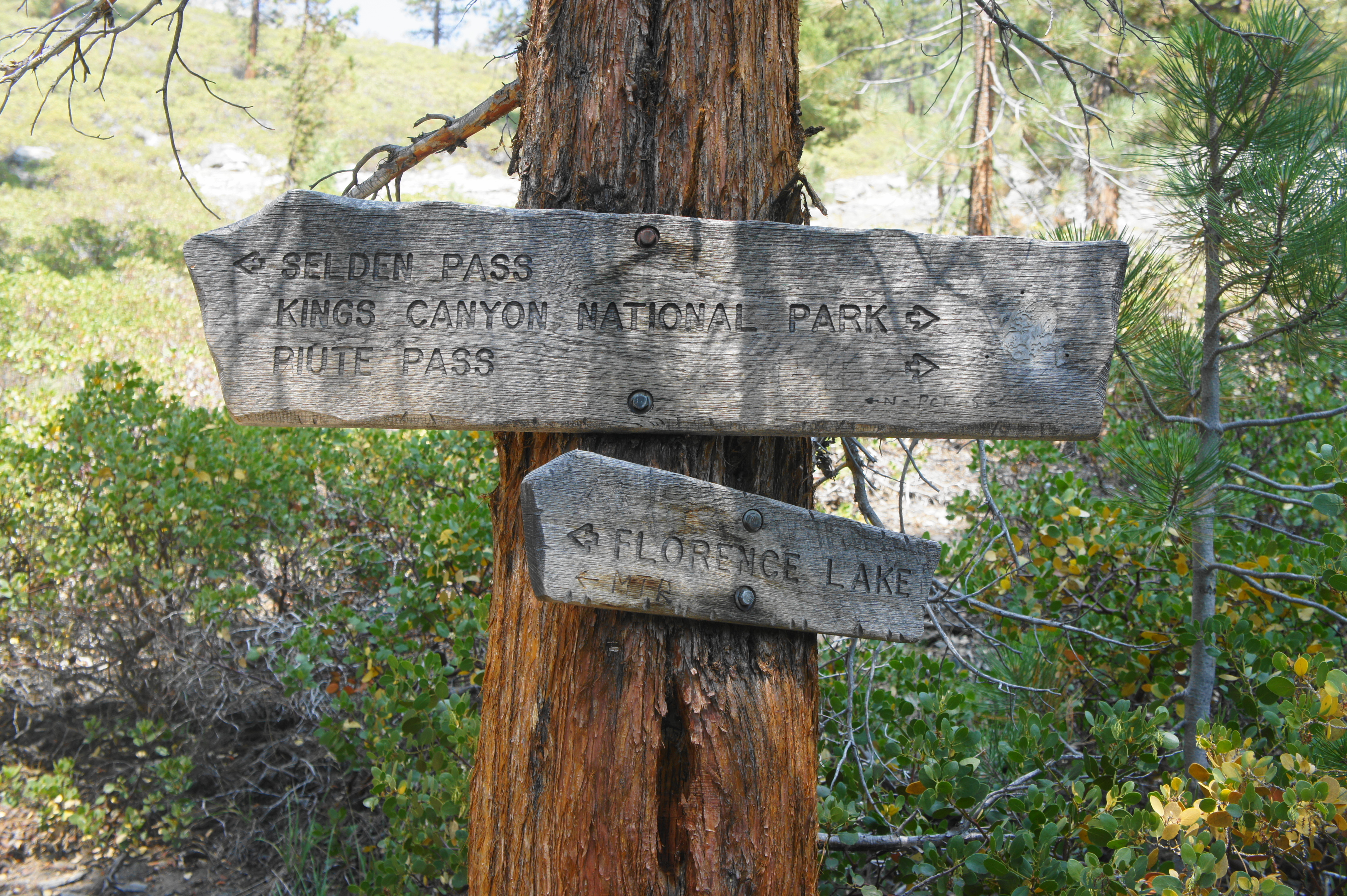
By this point, hikers have covered more than 11.5 miles from Evolution Lake, but Muir Trail Ranch—the popular resupply spot—lies still further. Entering the John Muir Wilderness and Sierra National Forest, leave Piute Creek and its associated campsites behind, traversing a sandy bench well above the San Joaquin. (Note: There is no easy access to water for the next two miles.) After edging in and out of the sparse tree cover, the trail rises mildly at a point about one mile from the Piute Creek Junction and then descends gently to another fork. This junction marks the turnoff point for Muir Trail Ranch (MTR); hikers without need for resupply can continue right, but those heading for MTR should bear left, following the sign for Florence Lake.

The spur trail descends to an area with pebble-lined banks and several campsites along the San Joaquin. Then the trail enters an unwelcome uphill section that leads away from the river, rounds a dry tributary, and then descends again. As partly-obscured Shooting Star Meadow is passed on the left, the spur trail reaches a four-way junction, with the Sallie Keyes Cutoff Trail heading off to the right and the descent to MTR and Blayney Hot Springs to the left.
Heading left, the trail traverses open terrain to another trail sign. Stay left and descend sharply into a highly-vegetated area, which opens up soon enough to Muir Trail Ranch, where hikers can retrieve their resupply buckets.
All of Muir Trail Ranch is off-limits to backpackers, save for a small, fenced-in section where there is a small store and several tables available for packing and organizing resupply buckets. There is also a sink with potable drinking water, and—except during Covid-19—a generous hiker’s box full of supplies and food leftover by past hikers. Visiting MTR offers a chance to meet fellow JMT hikers, swap snacks, and share stories.
After picking up the resupply, hikers can continue back to the JMT, or settle in for the night. Camping is not allowed right at MTR, but there is a path leading south from the ranch toward the South Fork of the San Joaquin River, which leads to some suitable campsites. The sign marking existing trails and no-camping zones is confusing, but generally one can head past the sign and find campsites on the left, set back from the water. A better but more adventurous option involves following the path to the San Joaquin, then fording the river just upstream from a black rope strung across the length of the water. From here, follow a path leading straight away from the river and toward an open, soggy field. Here lies Blayney Hot Springs, clutch of pleasantly-warm pools, some easily accessible and relatively mud-free.
While one cannot camp right at the hot springs, there are a few small spots hidden amid the rock outcrops between the field and the river. (Note: These are not the world’s greatest but serviceable and worth it for their proximity to the hot springs.) Soaking at the hot springs offers a nice respite after a long journey from Onion Valley to this point, more than halfway now to the end of the JMT.
Trip Report: Now nearly 150 miles into our 250-mile journey, we reached Muir Trail Ranch around 3pm after covering 15 miles of downhill hiking from Evolution Lake. It was noticeably warmer down in the valley and in the sunny patches of the San Joaquin watershed—and smoke from the distant Dixie Fire in northern California had started to settle in the valley, partly obscuring our views but not severe enough to have lingering effects on our health and endurance. We found the service at MTR to be good and efficient, and the store had a surprising number of supplies, including some extra sunscreen, electrolytes, and even some hats and shirts. After loading our next set of food into our bear canisters, we trudged across the San Joaquin and, after some confusion, eventually found the campsites and Blayney Hot Springs. The hot springs were blissful as the sun started to set, well worth the slight detour from MTR. The next day we would begin Leg III of our journey.

Pingback: John Muir Trail Northbound Section 3 – Muir Trail Ranch to Red’s Meadow (John Muir Wilderness, CA) | Live and Let Hike
Pingback: John Muir Trail Northbound Section 4 – Red’s Meadow to Happy Isles (Ansel Adams Wilderness & Yosemite National Park, CA) | Live and Let Hike
Pingback: Top 10 Hikes in 2021 | Live and Let Hike
Pingback: John Muir Trail Northbound Section 1 – Horseshoe Meadow to Onion Valley (Sequoia & Kings Canyon National Parks, CA) | Live and Let Hike
Pingback: John Muir Trail Preparation & Logistics | Live and Let Hike
Pingback: Five Lakes Trail (Granite Chief Wilderness, CA) | Live and Let Hike
Pingback: Mist Falls (Kings Canyon National Park, CA) – Live and Let Hike