
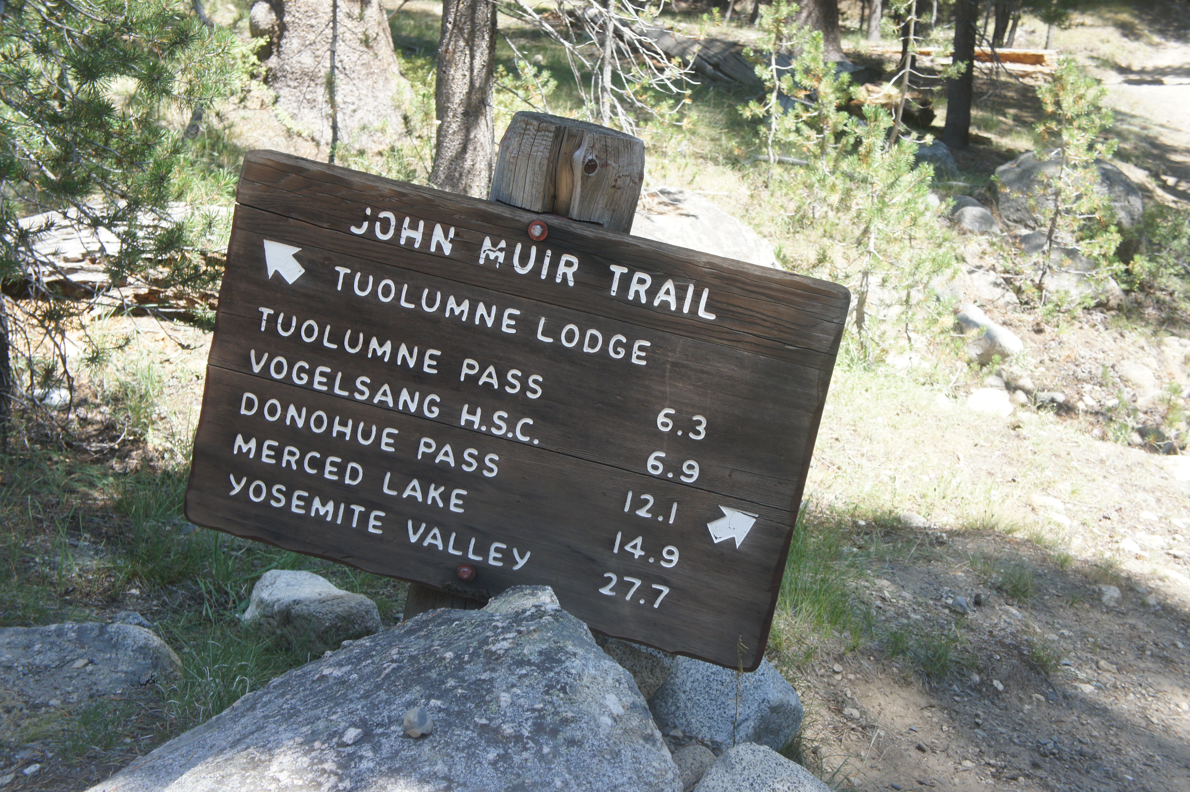
Note: This is the fifth in a series of five posts describing the John Muir Trail (JMT), a scintillating, multi-week hike through California’s Sierra Nevada that extends more than 200 miles from Yosemite National Park in the north to Mount Whitney and Sequoia National Park in the south. This post (and those preceding it) assumes a northbound journey, beginning southeast of Mount Whitney at Horseshoe Meadow in Inyo National Forest and culminating at Happy Isles in Yosemite. The JMT is an arduous, multi-week backpacking trip that requires careful planning, preparation, and an official backcountry permit that can be quite difficult to obtain. Hikers typically complete the entire trail, including detours for food resupplies, in about 2-3 weeks. For more information on planning and preparing for the JMT, see my previous post titled “John Muir Trail Preparation & Logistics.” For summaries of the other three sections, see Section I (Horseshoe Meadow to Onion Valley), Section II (Onion Valley to Muir Trail Ranch), and Section III (Muir Trail Ranch to Red’s Meadow).
In the fourth and final section of the northbound John Muir Trail, hikers leave the creature comforts of Red’s Meadow Resort for one last jaunt in the wilderness, climbing past scintillating lakes and over mountain passes into Yosemite National Park. From here, the JMT follows lengthy Lyell Canyon to bustling Tuolumne Meadows, then, two days later, ends triumphantly at Happy Isles in Yosemite Valley, at the base of iconic Half Dome. This section rises to over 11,000 feet at Donohue Pass but ends at a modest 4,040 feet in Yosemite Valley, where through-hikers can celebrate completing the entire, multi-week journey on the John Muir Trail.

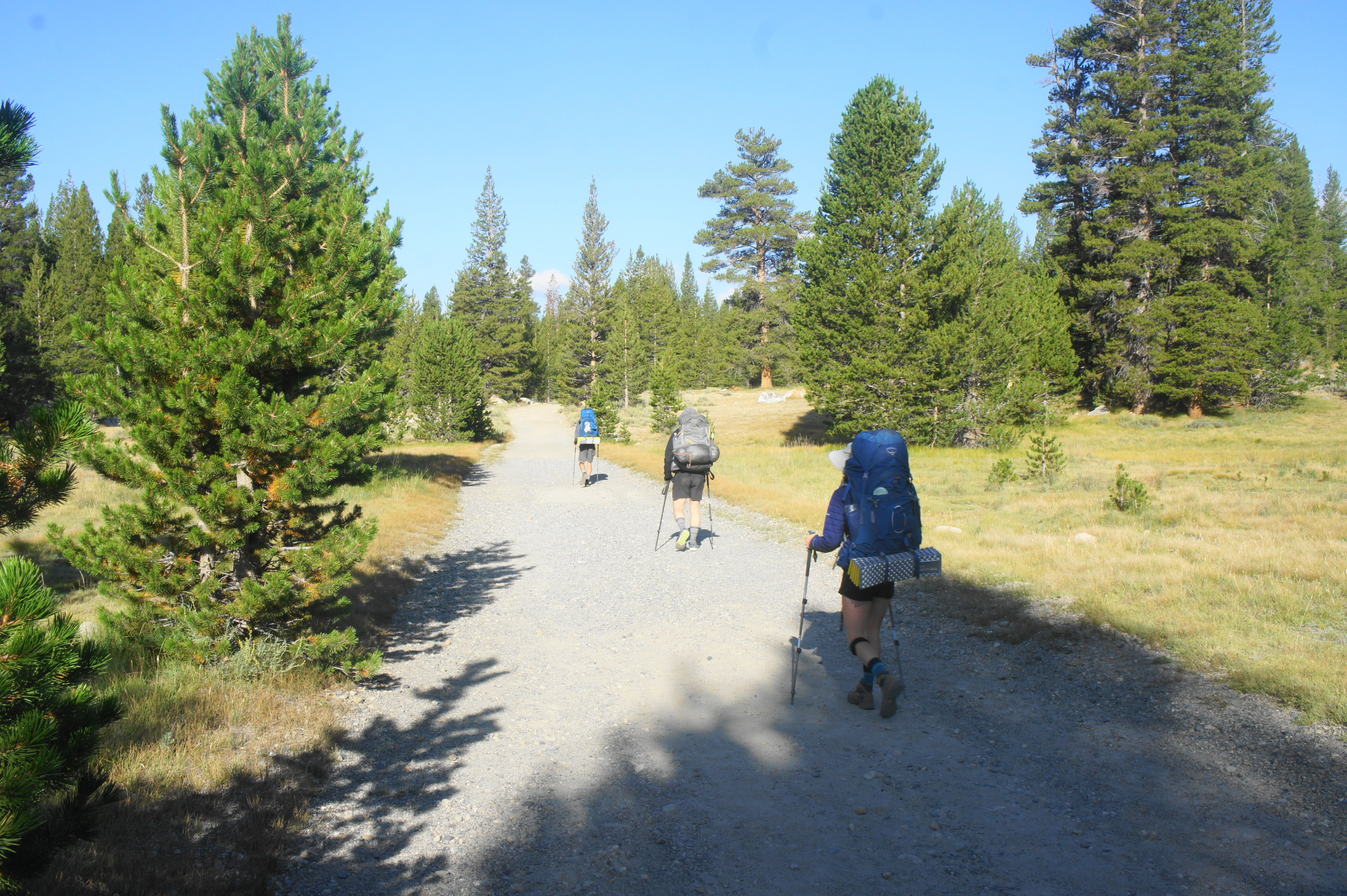
Red’s Meadow to Garnet Lake (14.4 miles)
It’s hard to say goodbye to Red’s Meadow Resort, where northbound JMT hikers were spoiled with hot food, cold beer, showers, laundry, and other amenities. One final leg remains, however, and fortunately it is no less scenic than the previous three sections.

Hikers have a few options to access the John Muir Trail/Pacific Crest Trail (JMT/PCT) from Red’s Meadow Resort, but the one that makes most sense is to begin where Section 3 left off: at the junction ¼ mile south of the main entrance to the resort, where the northbound JMT bears right and wraps around the resort to the west side. The trail quickly descends to a second junction, and then a third—stay straight at both. Traversing modest woodlands, the JMT drops for about 4/10 mile to another junction; stay straight, climbing a brief rocky scramble and entering Devils Postpile National Monument. From here the trail quickly approaches a sturdy bridge over the Middle Fork of the San Joaquin River, the main drainage in the area.
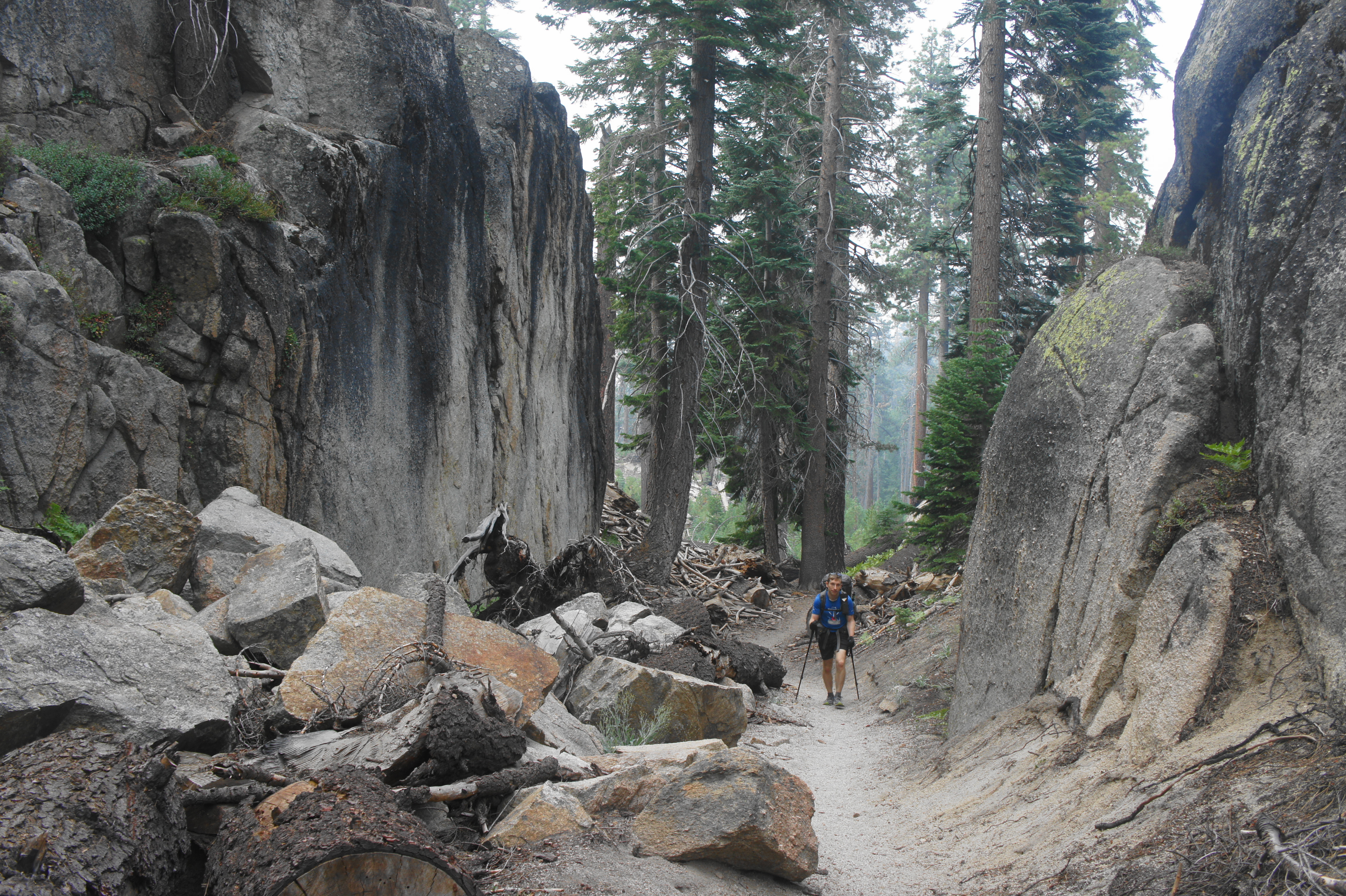
Cross the footbridge and then enter an area known as The Buttresses, a collection of stony fins and outcrops bisected by narrow passages, including one that steers the JMT northward through the labyrinth. Eventually the trail rises steadily atop a cliff-hewn bench, with bird’s eye views down to the San Joaquin drainage and Red’s Meadow area. Mammoth Mountain (11,053’), which harbors the famous ski area, dominates the skyline to the east.
A steady ascent brings travelers to another junction at about the two-mile mark. Here the Summit Meadow Trail leads westward into the Ritter Range, while an access trail to Devils Postpile bears east. Continue straight, quickly passing several outcrops with distant views of the basaltic columns of Devils Postpile, which were formed by cooling lava less than 100,000 years ago.


Perched high above the valley below, the JMT continues northward at a modest incline and reaches another four-way junction at about 2.5 miles. Here, for the first time since Crabtree Meadow, way back in Section 1, the John Muir Trail and Pacific Crest Trail split, with the latter bearing slightly east toward Agnew Meadows while the former continues to follow a high shelf below the Ritter Range. (Note: The JMT and PCT will rejoin several miles later, at Thousand Island Lake.)
In the next section, the ascent kicks into high gear, gaining around 400 feet in ¾ mile. After staying right at a junction with the Superior Lake Trail, the JMT comes alongside Minaret Creek and crosses a log bridge, with wild blueberry bushes greeting hikers on the north side of the creek. A maze of trails leads in different directions here; follow the most obvious, which heads right initially and then ascends a slope before leveling off. Relatively flat terrain takes hikers to a short spur leading west to Johnston Lake, a marshy pond set in a pretty meadow surrounded by thick conifers.

Beyond the lake lies another junction. Bear right, beginning a steady and arduous climb with one long switchback. It is 2.5 miles—with over 1,100 feet of elevation gain—from Johnston Lake to the first of the Trinity Lakes, a collection of small and swampy pools with some lakeside camping options. (Note: An unmarked trail near here leads westward to Emily Lake, but the junction is not obvious.)

Soon enough, hikers pass another clutch of ponds that constitute the Upper Trinity Lakes, where there are again some sandy campsites. Thereafter the JMT mounts a 250-foot climb to a notch above Gladys Lake, which comes into view through the trees below. It is a quick jaunt down the shoreline, which is surprisingly mucky and a favorite for aquatic bugs but has distant views of San Joaquin Mountain (11,600’) and Two Teats (11,397’) across the broad valley.
A brief ascent again leads to a new drainage, this one filled in part by beautiful Rosalie Lake. Descend a couple of switchbacks to reach the shoreline and cross the lake’s outlet, around which there are several nice campsites. This lake is the most dramatic since Purple Lake in Section 3, highlighted by a sheer cliff some 300- to 400-feet tall along the western shore.


The onward JMT follows close to the lake as it edges westward, rising again to yet another low, forested gap. The next drainage, carved by Shadow Creek, is even deeper and more dramatic. In the next mile, JMT hikers will lose more than 750 feet. Descending a set of 21 switchbacks, Shadow Lake comes into view after the eighth. After the switchbacks, the trail leads to a nice rock outcrop perched a couple dozen feet above Shadow Lake, where camping opportunities are very limited.

After skirting the southern shores, the trail suddenly climbs steeply, turning away from the lake. But the route soon drops again to a bridge over Shadow Creek, a good place to stop to fill up with water. Just past the bridge is another route junction; stay left on the JMT.
Begin a steady ascent, loosely following rumbling Shadow Creek on the left. About 2/4 mile upstream, stay right at a three-way junction, leaving the main drainage in favor of a tributary ravine. Alternating between dense forest and open granite slickrock, the northbound trail begins a challenging ascent that feels like a mountain pass—even as it is not officially listed as such.
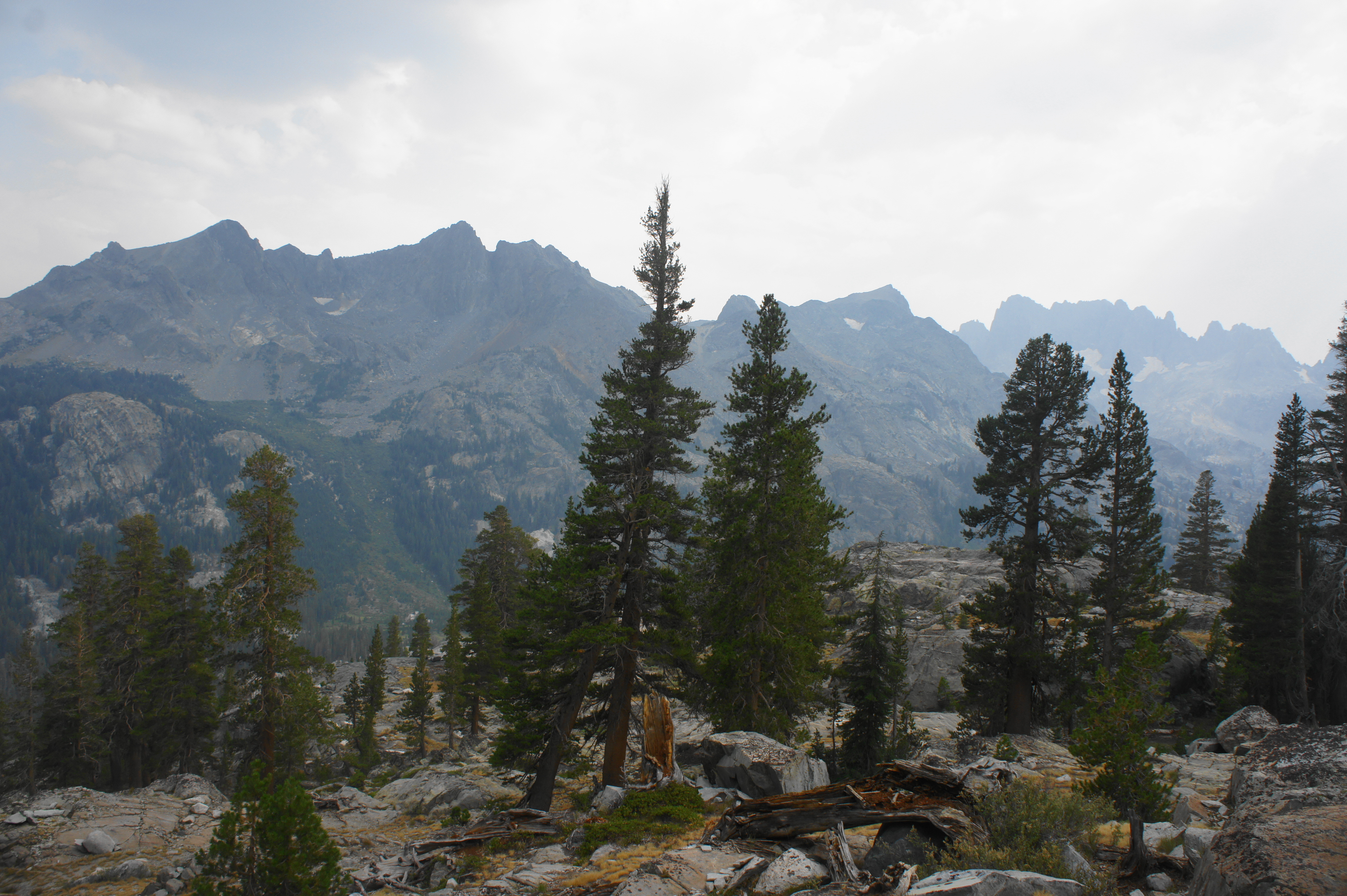
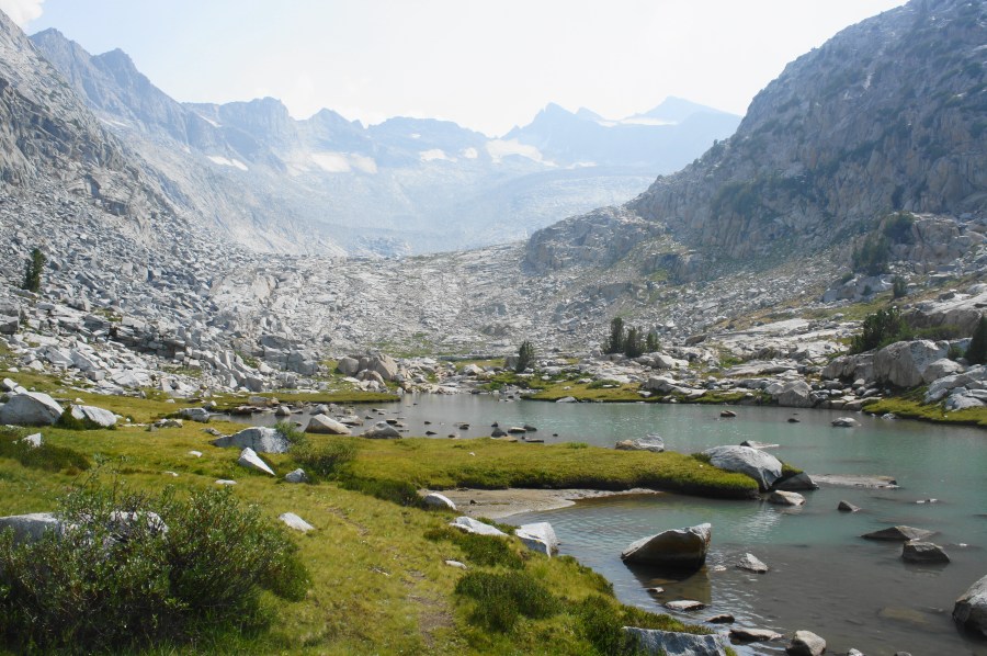
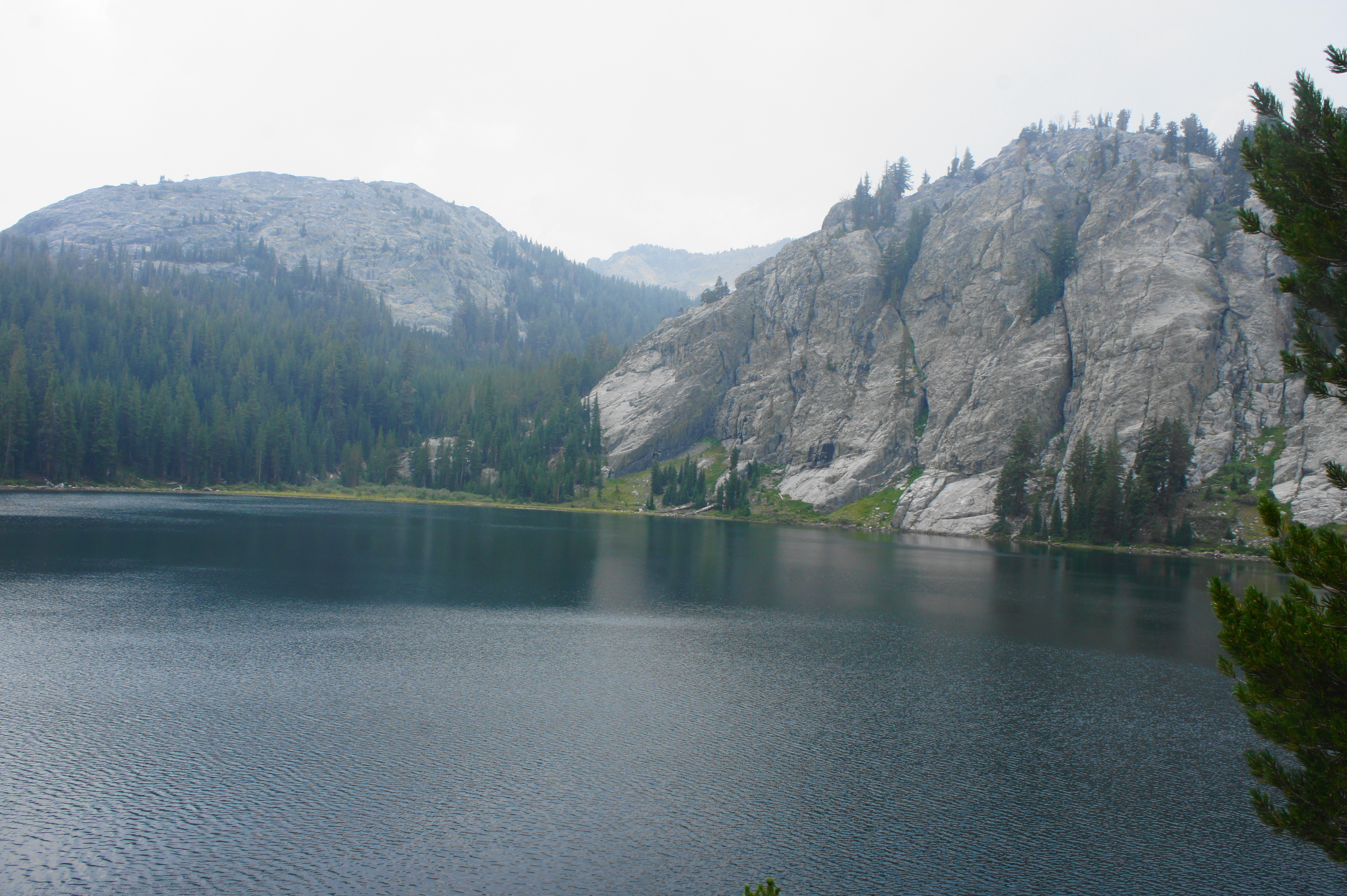
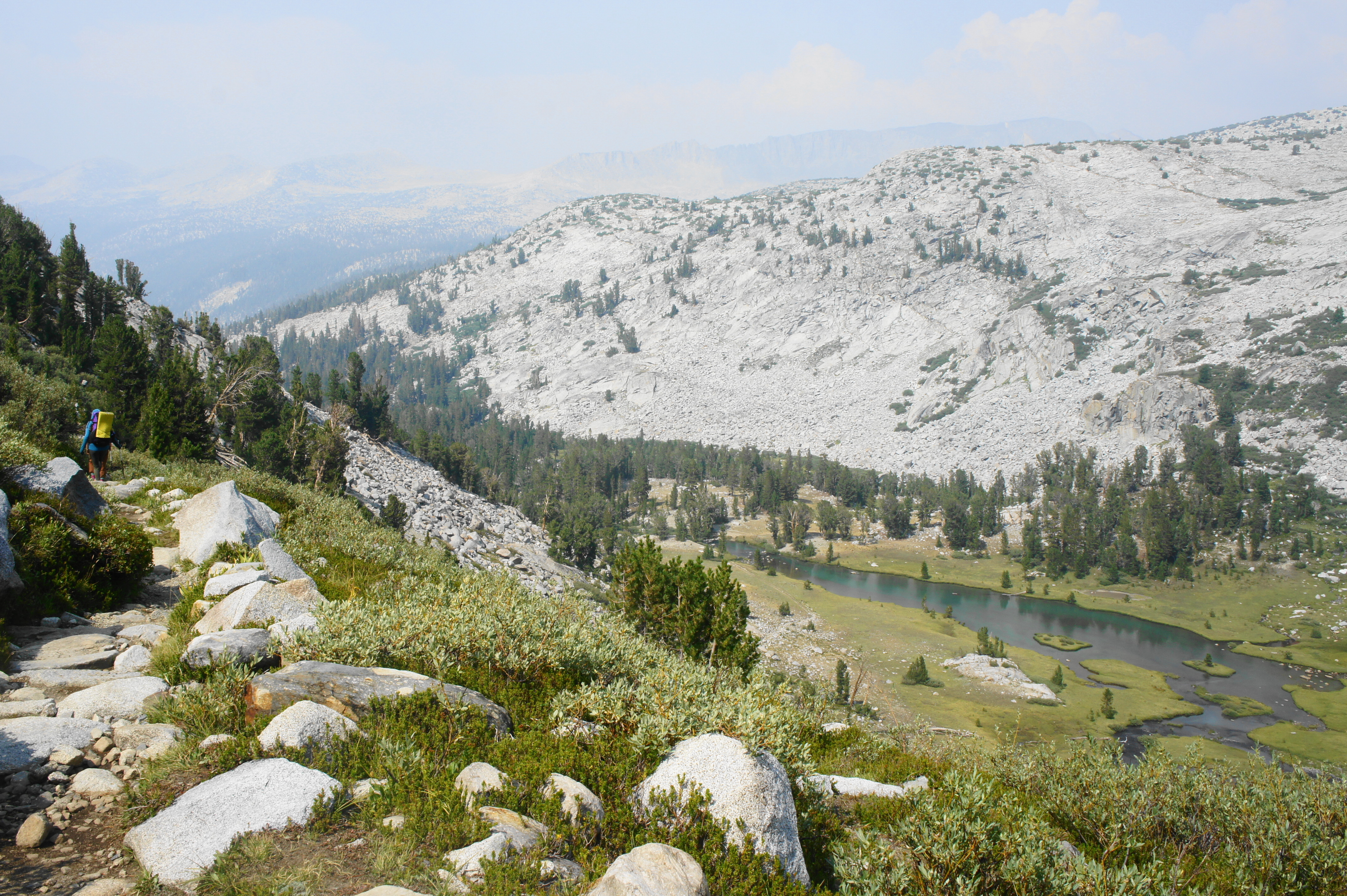
The trail rises 1,100 feet over the course of two miles, first by traversing granite slabs then roughly following a small stream up to a graveyard of black and reddish metavolcanic rock, a sharp contrast from the smooth granite of past terrain. A look back reveals a collection of craggy peaks, including Volcanic Ridge and the Minarets. Finally, at a point about 13 miles from Red’s Meadow Resort, the JMT crests the ridgeline, affording the first views of Garnet Lake, the largest lake yet encountered on the hike.
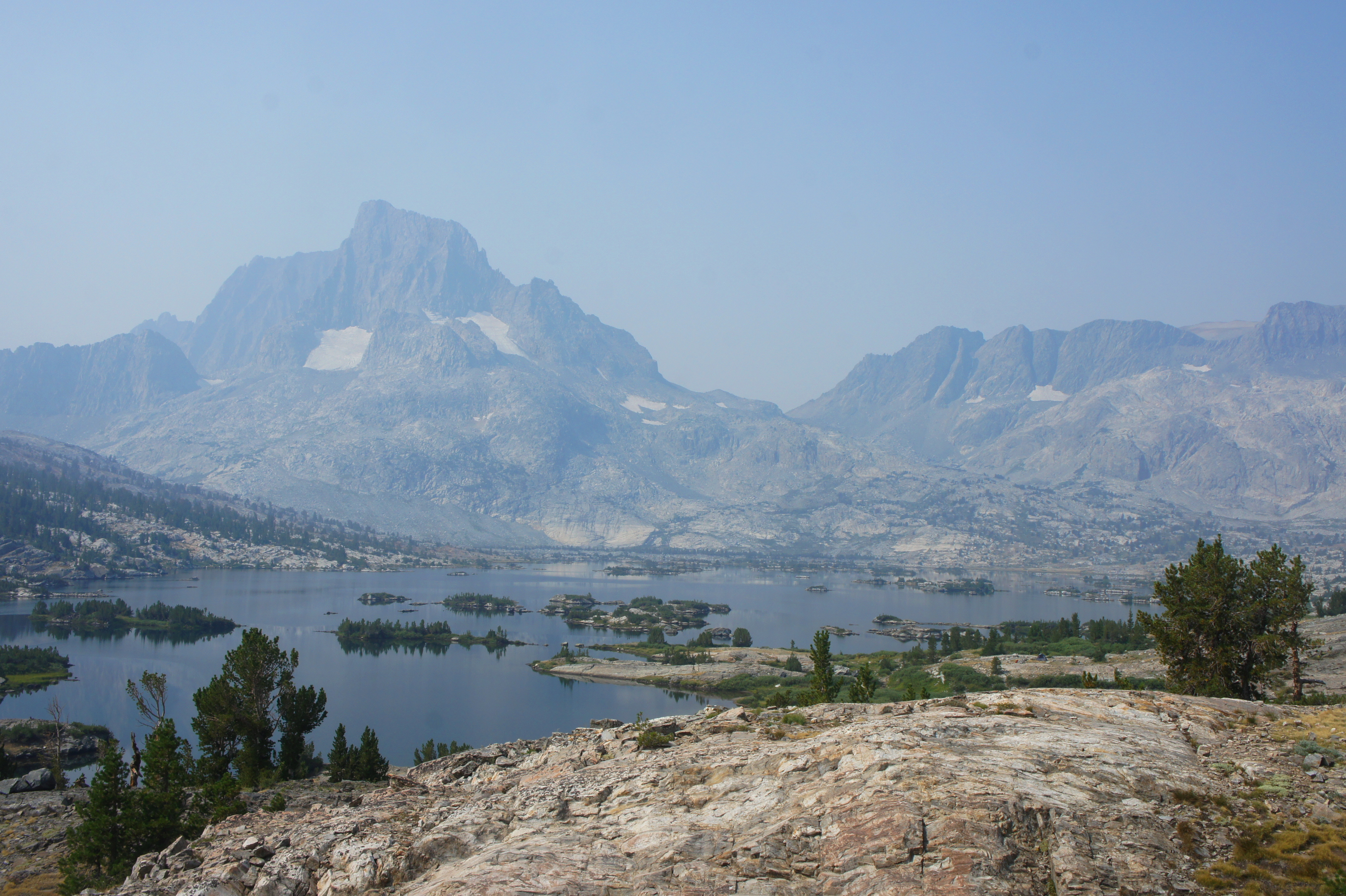
Garnet Lake is astonishingly beautiful, dotted with small islands and peninsulas and set in a long basin more than 3,000 feet below towering Mount Ritter (13,140’) and Banner Peak (12,945’), the highest summits in the Ritter Range. Descending several switchbacks leads to a smattering of off-trail campsites near the southern shores of the lake, but the best lie further on, after crossing the outlet of Garnet Lake.

Stay left at the junction with the unmaintained Garnet River Cutoff Trail, cross the footbridge, and proceed for more than ¼ mile to a point where the trail edges around a protruding granite outcrop. (Note: Camping is prohibited within ¼ mile of the lake’s outlet.)

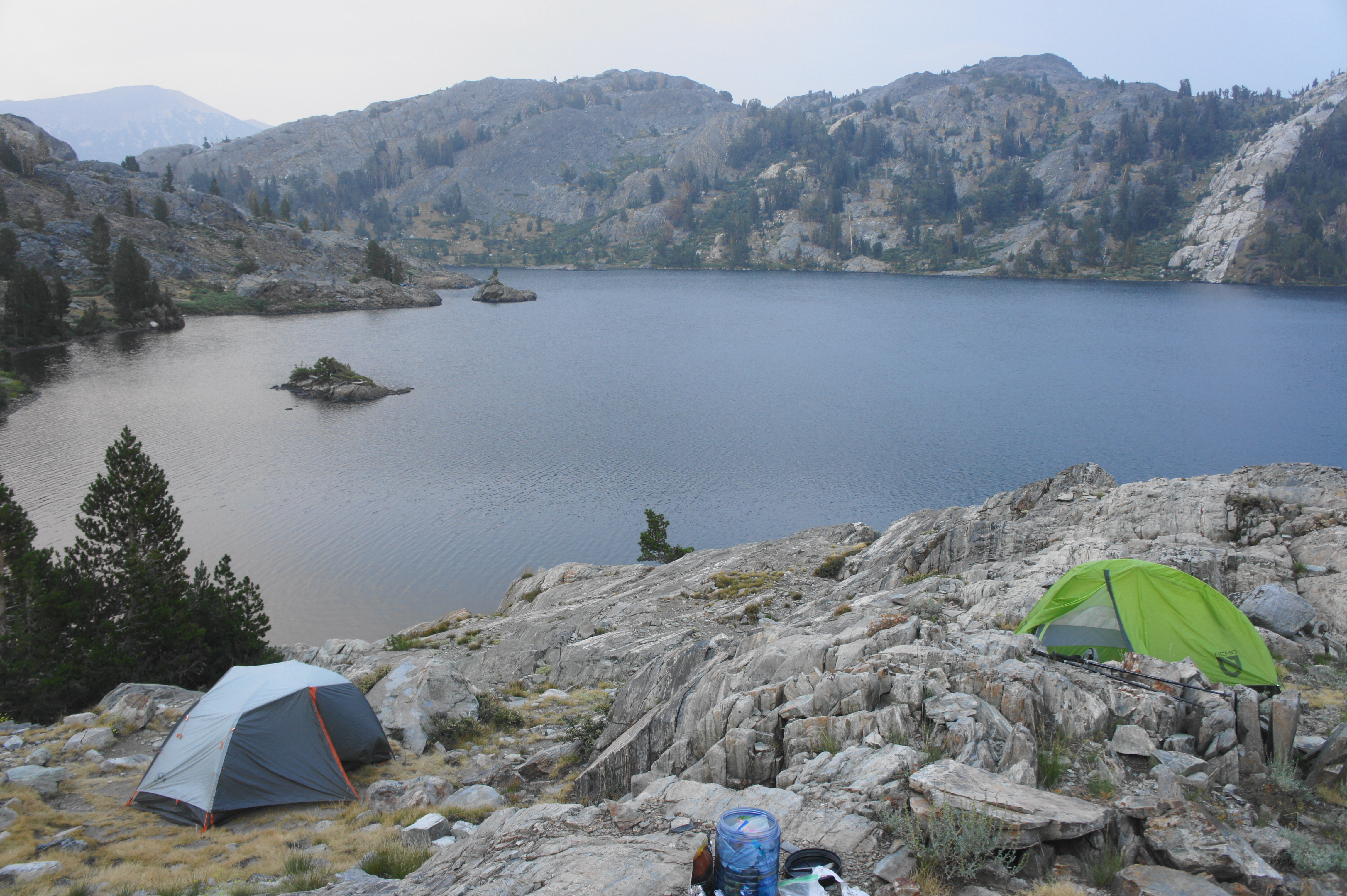

Here a spur trail leads left to a popular set of campsites; continuing down this narrow and very rocky path leads to even better sites, although all are relatively exposed to the wind. Many hikers will choose to set up camp here at Garnet Lake, more than 13 miles from Red’s Meadow—although hearty hikers can continue farther to Ruby, Emerald, or Thousand Island Lakes.
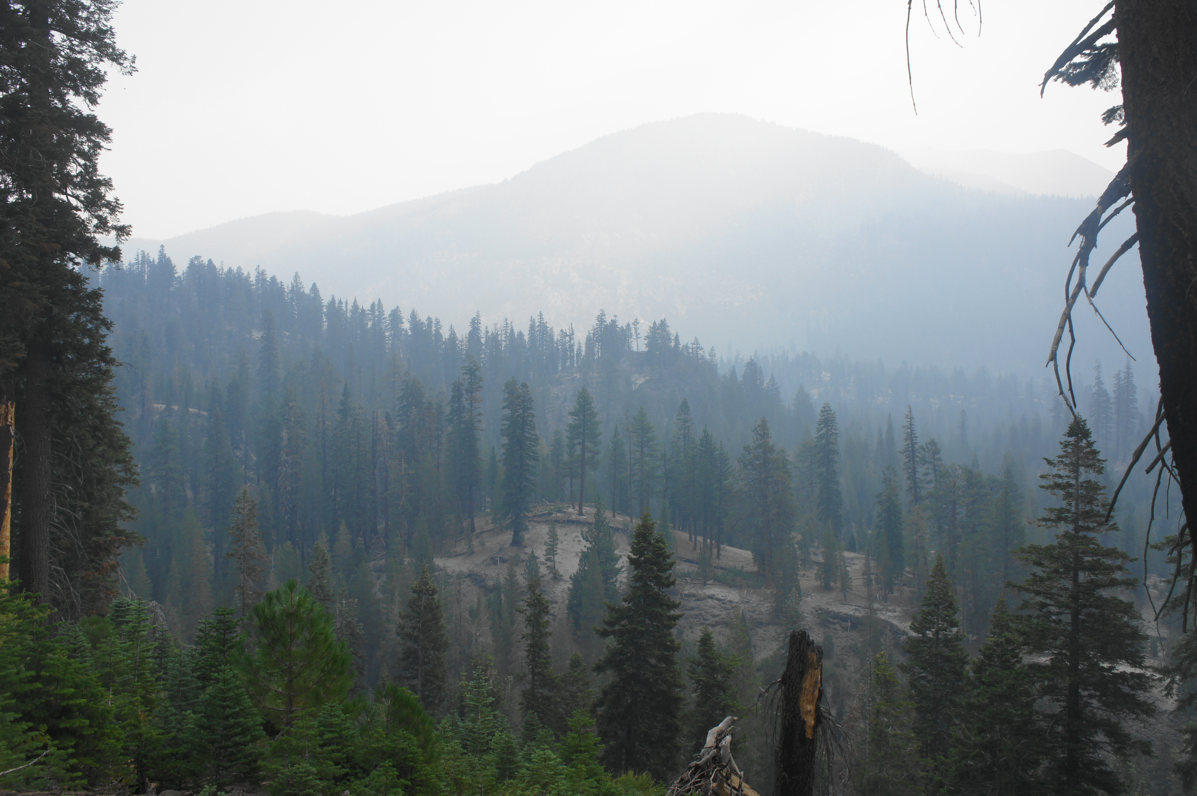
Trip Report: The first day of Section 4 began with thick smoke from the Dixie Fire, but the haze gradually cleared as the day wore on. Lacking great options for camping near Shadow Creek, we pushed on to Garnet Lake and were glad to do so, as the sunset and sunrise over the majestic lake were simply spectacular. We just avoided some thunder clouds off to the north and west and set up camp in some light rain at a spot about ¼ mile down the spur trail along the northern shore of Garnet Lake. This area is extremely rocky and somewhat difficult to negotiate but offered solitude in an otherwise popular area for overnight camping. The next day we would push on to Thousand Island Lake and beyond.
Garnet Lake to Upper Lyell Canyon via Island Pass and Donohue Pass (10.7 miles)
The next section takes hikers north and west through Ansel Adams Wilderness and into Yosemite National Park. It’s hard to say goodbye to the stunning landscape of Garnet Lake, although the JMT passes several more picturesque lakes in the coming miles.

From the north shore of Garnet Lake, the JMT eventually climbs up and away from the lakeshore, but the overhead views of the lake linger for another ¼ mile or so. After gaining around 200 feet, the trail reaches a marked junction, with a route heading left toward a set of campsites on a rocky peninsula to the west.

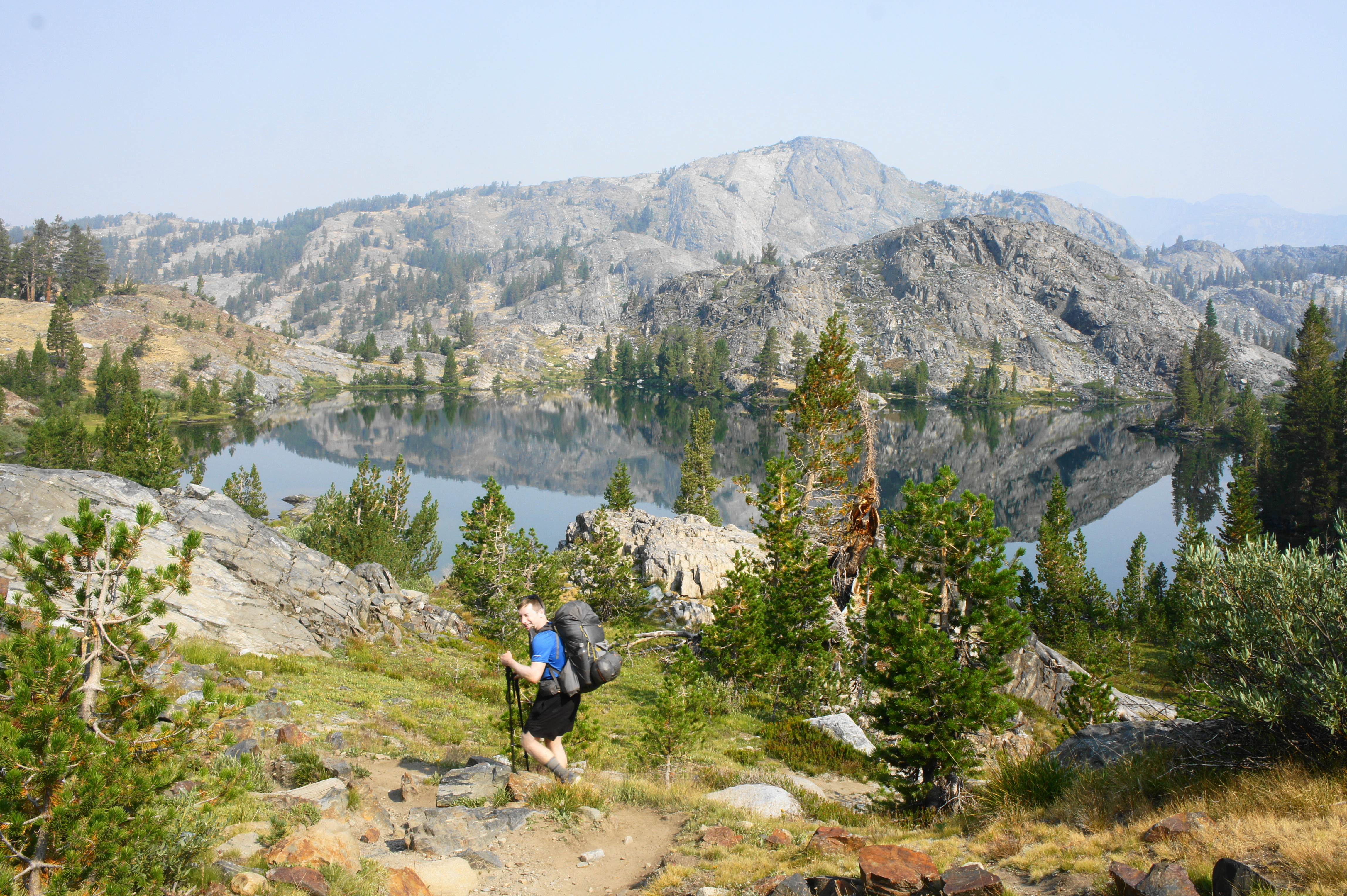
Beyond, the JMT rises again to clear a scraggy gap and then descends to Ruby Lake, so-named for the scarlet-colored scree slope that flanks the lake’s western shores. This is another moderately popular camping area, with several sites past the outlet of the lake on the left.

Camping is more limited at the similarly-sized Emerald Lake, reached by way of a short up and down, about 2/10 mile from Ruby Lake. Views across this lake are considerably more expansive, with another high granodiorite ridge visible to the north, as well as a distant look toward Agnew Pass to the northeast.
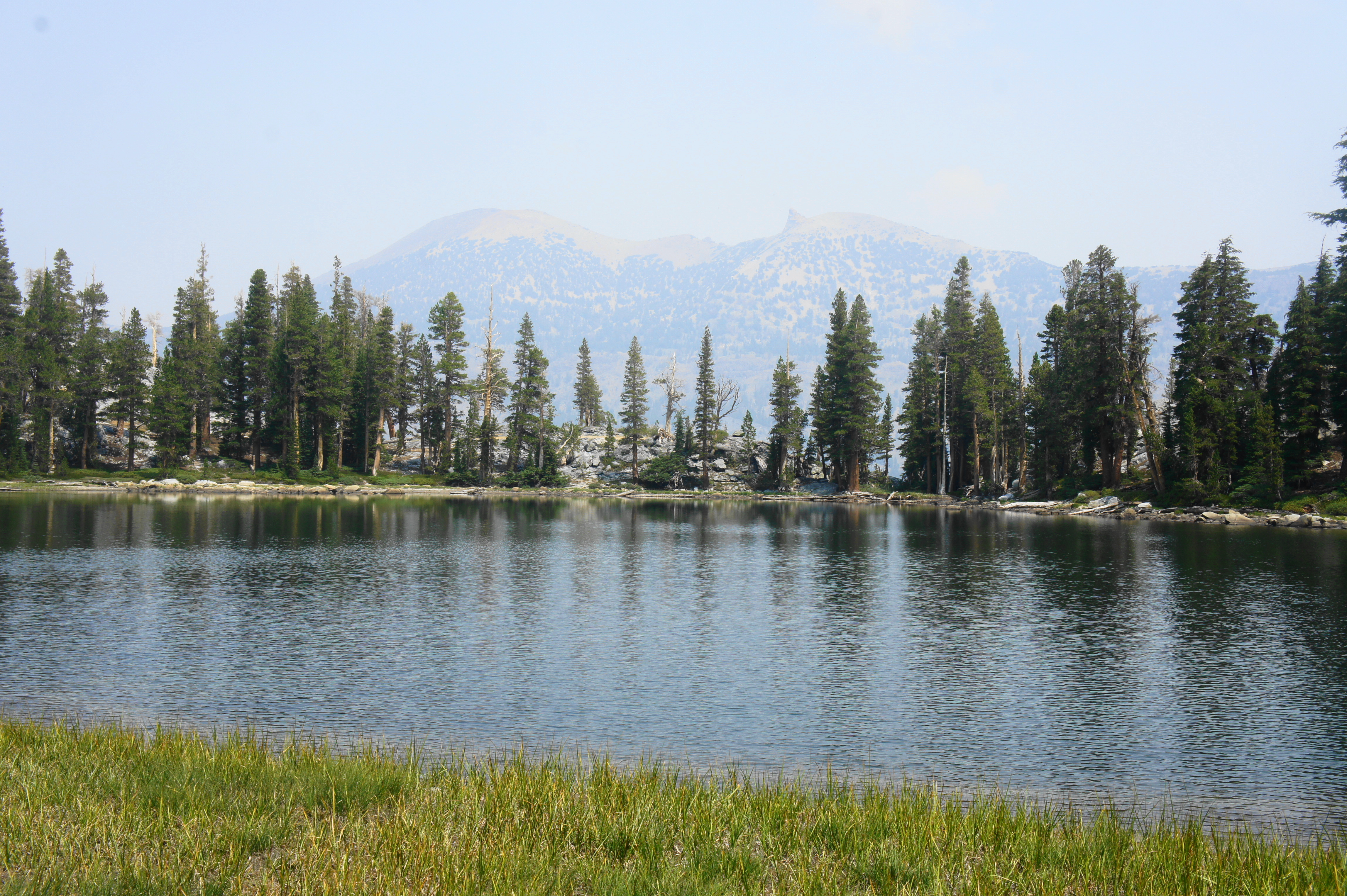
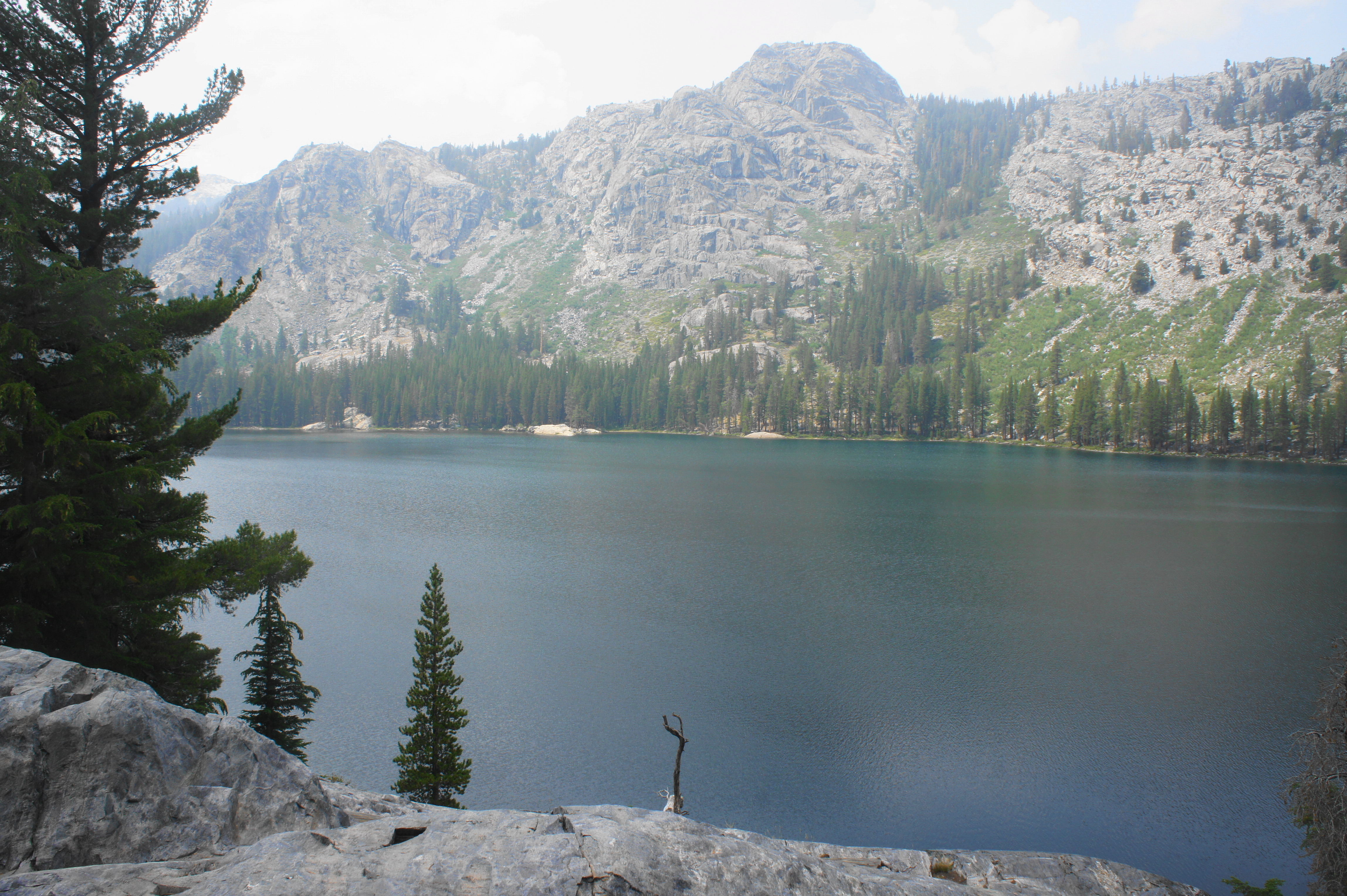
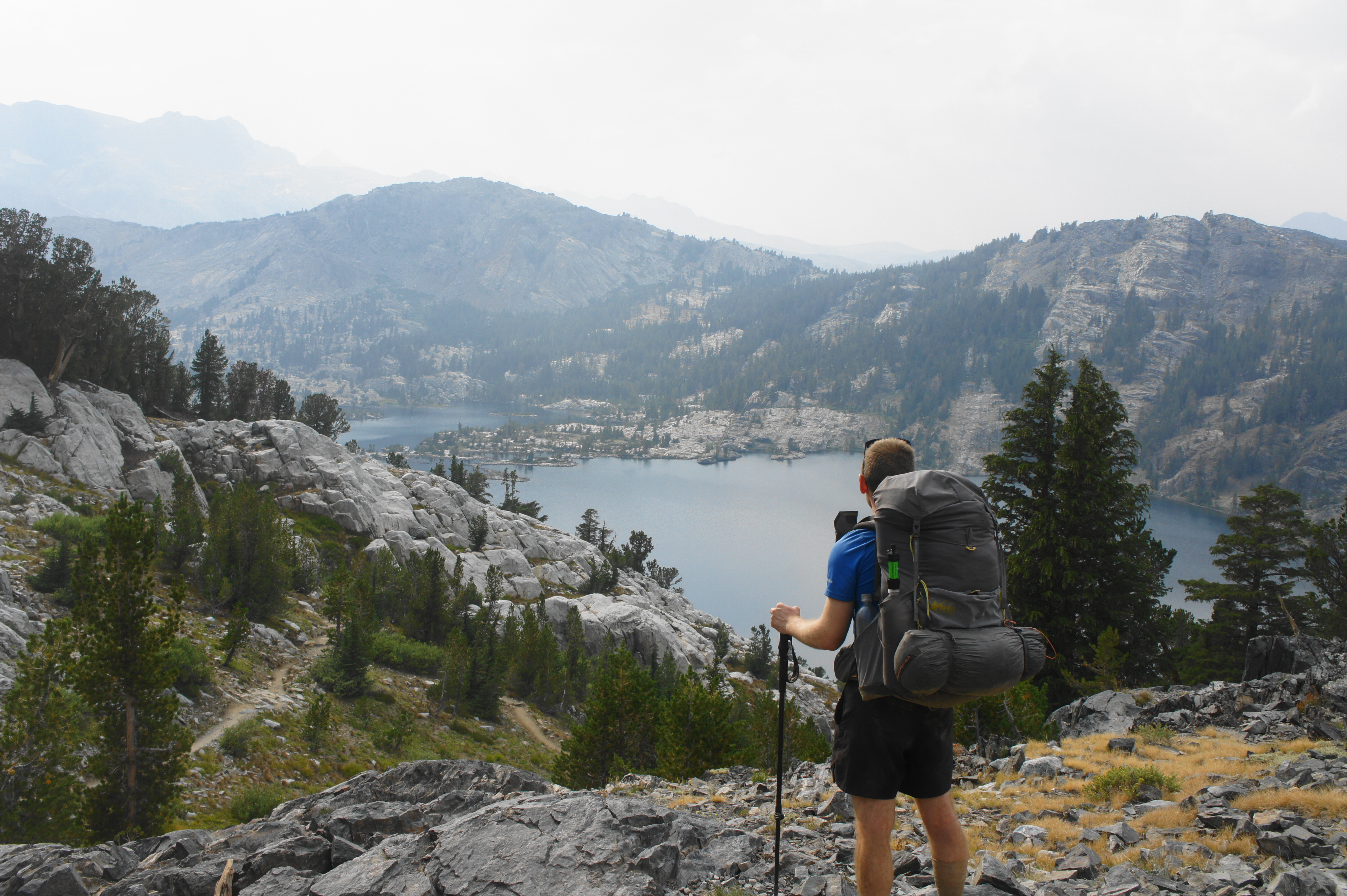
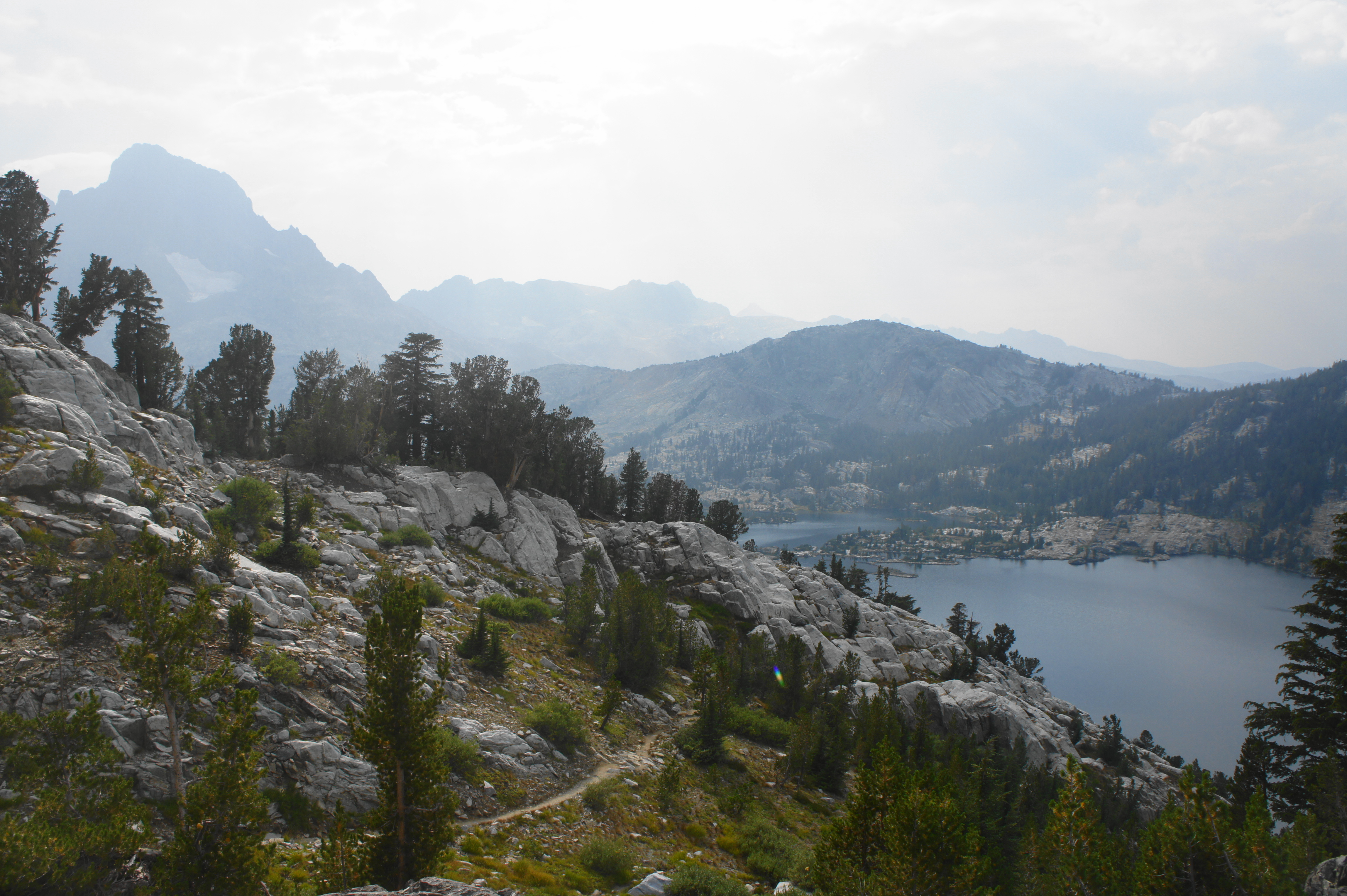
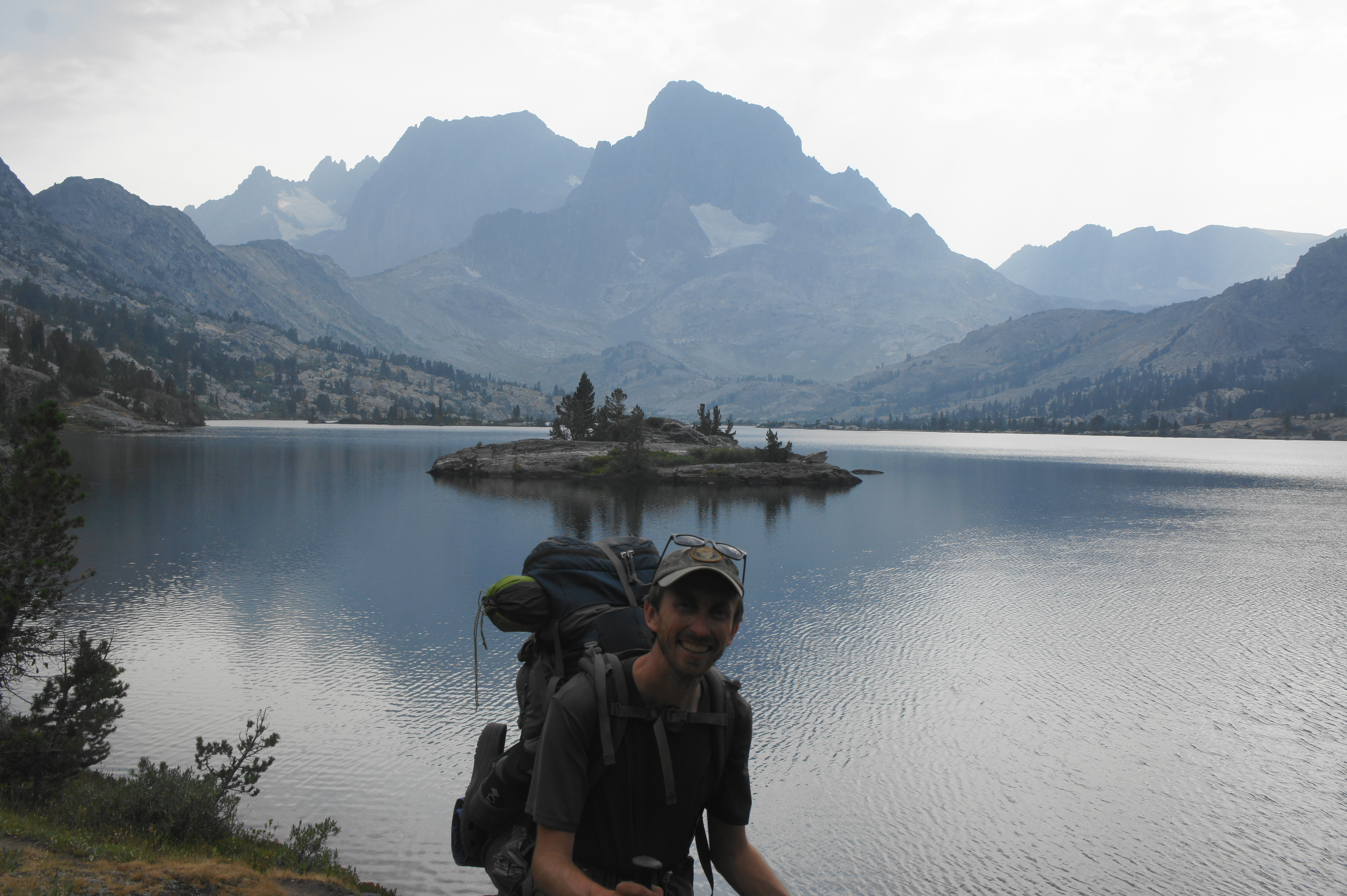
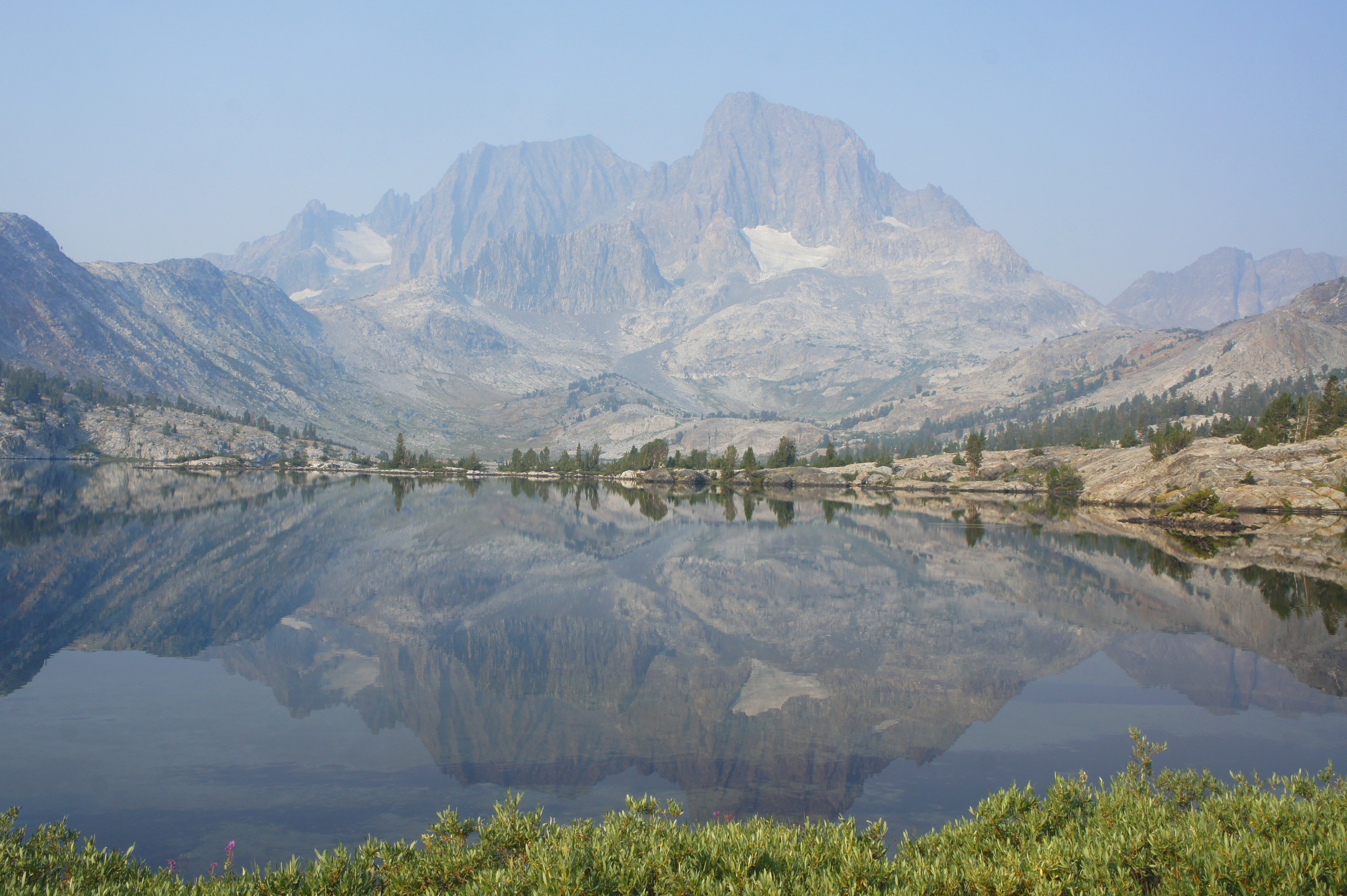
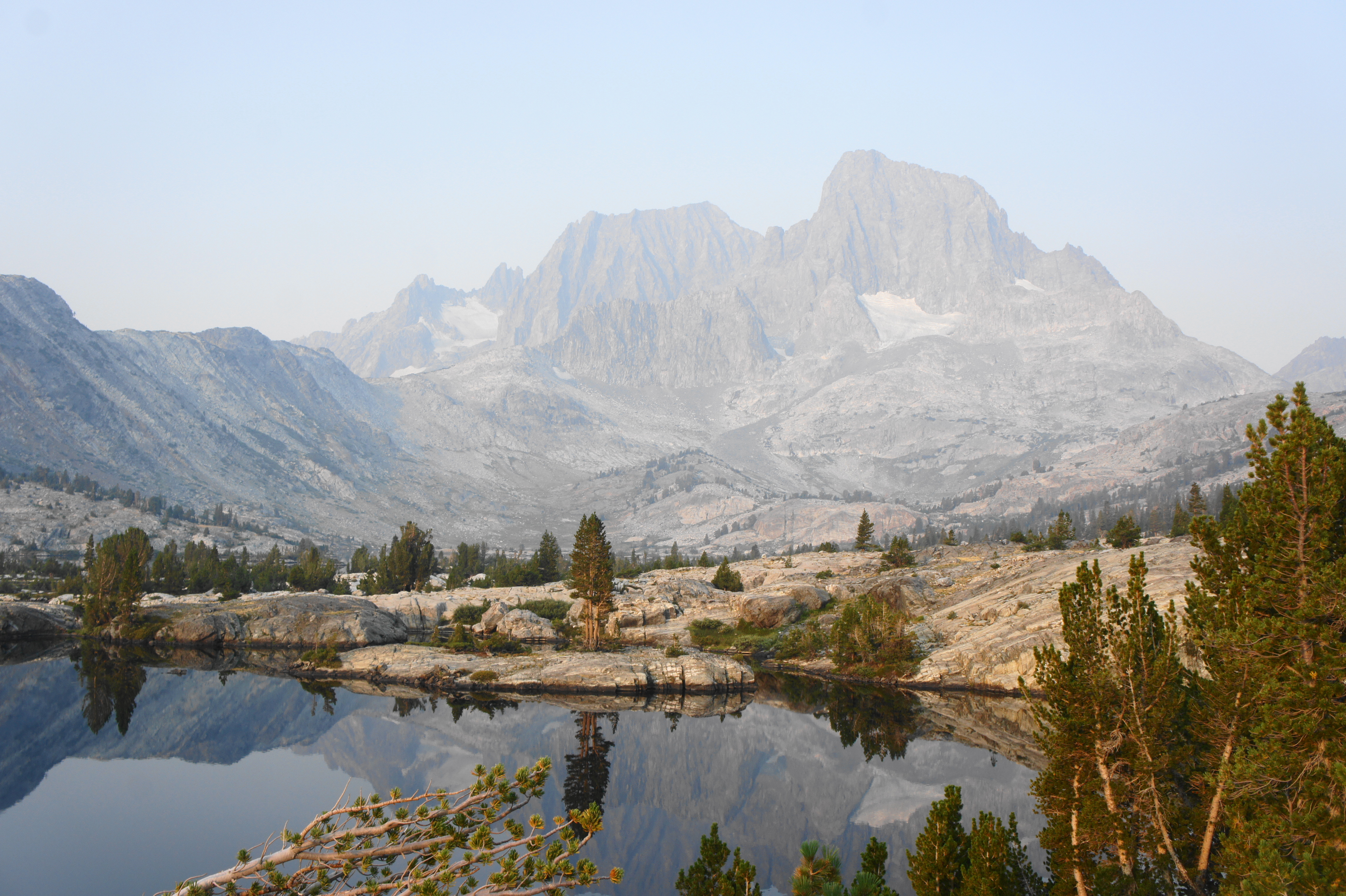
It is a short and easy descent from Emerald Lake to the dazzling Thousand Island Lake, dotted with dozens (though seemingly way less than a thousand) little islets. Like at Garnet Lake, Banner Peak dominates the landscape to the west. This spacious lake, the largest encountered along the entire JMT, is very popular for overnight camping, and there are many sites along the Thousand Island Lake Trail, reached just soon after crossing the lake’s marshy outlet.


At the four-way junction, stay straight as the Pacific Crest Trail merges again with the JMT as it comes in from the right. The onward JMT/PCT begins a mild but persistent climb to scenic heights overlooking Thousand Island Lake, then through a grassy gap with two unnamed ponds. Without even an obvious marker or trail sign, hikers easily crest Island Pass (10,200’), certainly the least challenging of the JMT’s many mountain passes.
The descent from the north side of Island Pass is slightly steeper but still relatively mild, dropping through mixed coniferous forest into a broad valley serviced by Rush Creek and its many tributaries. Stay right at the junction with the Davis Lake Trail, then descend to clear two streams in quick succession. After following the weaving creek on the right, stay left at the junction with the Rush Creek Trail, which descends the valley to Waugh Lake and Gem Lake—situated in large basins that are not visible from the JMT.
Immediately after the junction, cross the stream again, then proceed up a rocky staircase, initiating a steady climb to Donohue Pass and Yosemite. The uphill path flirts with the main drainage of Rush Creek on the right but does not cross it for nearly a mile. Ascend a set of switchbacks as the tree cover gradually thins, coming to the junction with the Marie Lakes Trail, a popular camping area and rest point about 6.5 miles from Garnet Lake.

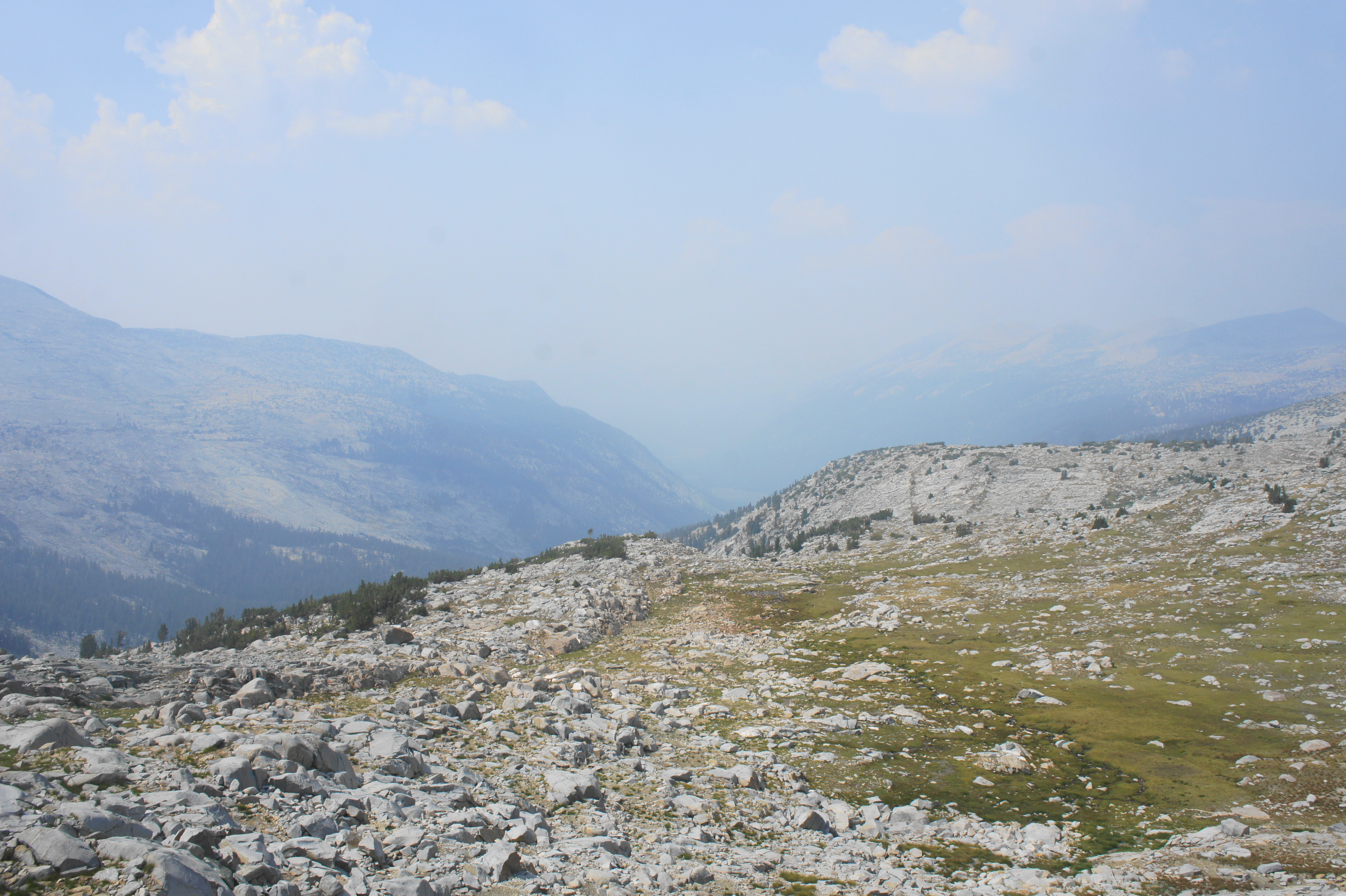
Cross over Rush Creek, then ascend through a landscape of rocky ledges and tufty meadows, keeping a small tributary creek off to the right. After passing modest ponds on left and right, the path rises a level and twice crosses the thinning stream. Edging westward toward Donohue Pass, Donohue Peak (12,023’) and the chalky peaks of the Koip Crest dominate the landscape to the north. After passing the stream for a final time—the last water crossing this side of the Sierra Crest—the JMT embarks on a challenging and sun-exposed climb to the pass.
After edging largely southwest for about ¾ mile, hikers are tricked into thinking they are almost at the pass. But after rounding a bend along the boulder-strewn slope, it is revealed that there is more to clamber ahead. From here hikers must gain another 100 to 150 feet in elevation. As the contours of the Cathedral Range come into view to the west and south, the JMT finally crests Donohue Pass (11,060’), the penultimate mountain pass of the multi-week journey.

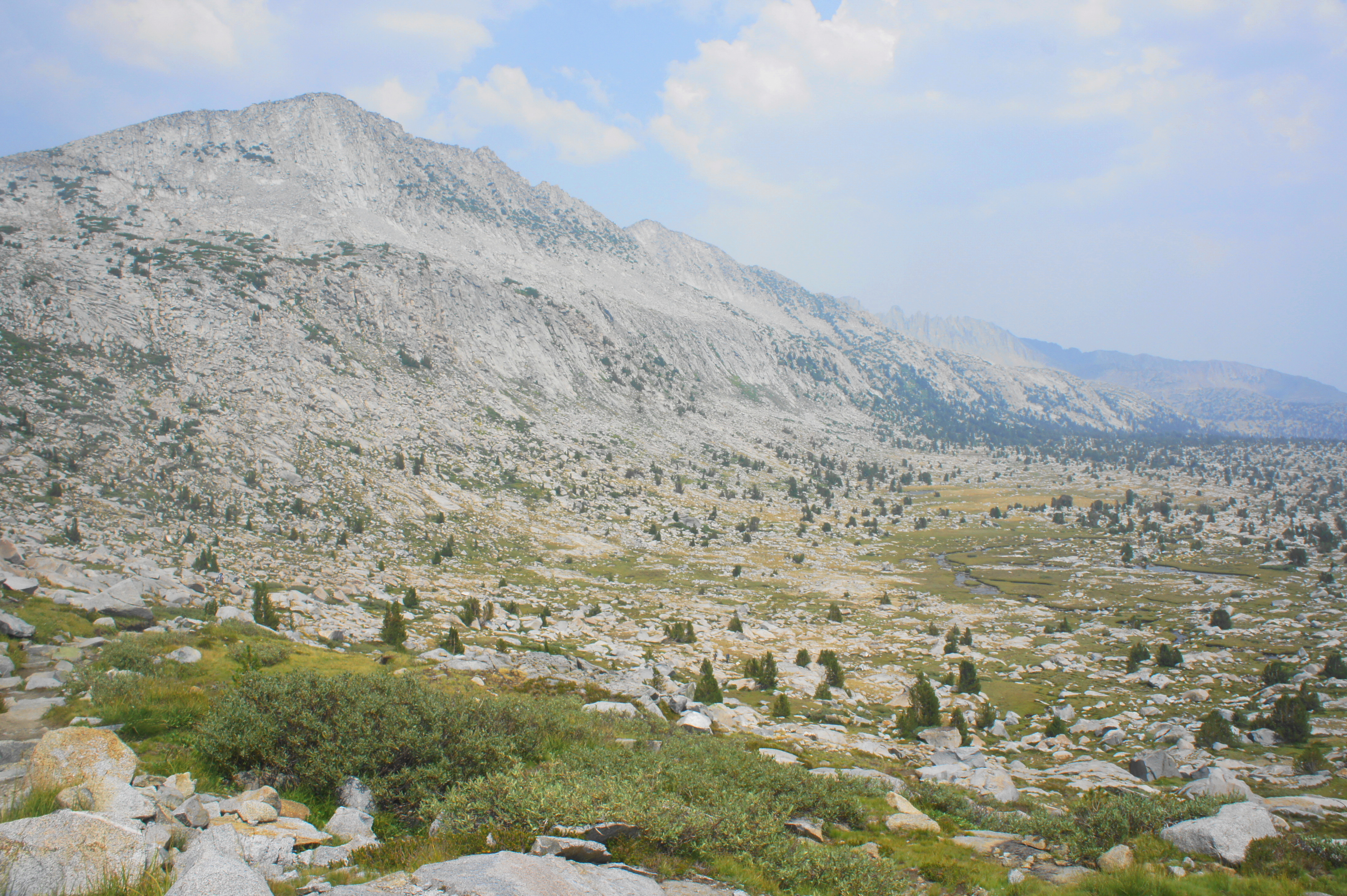
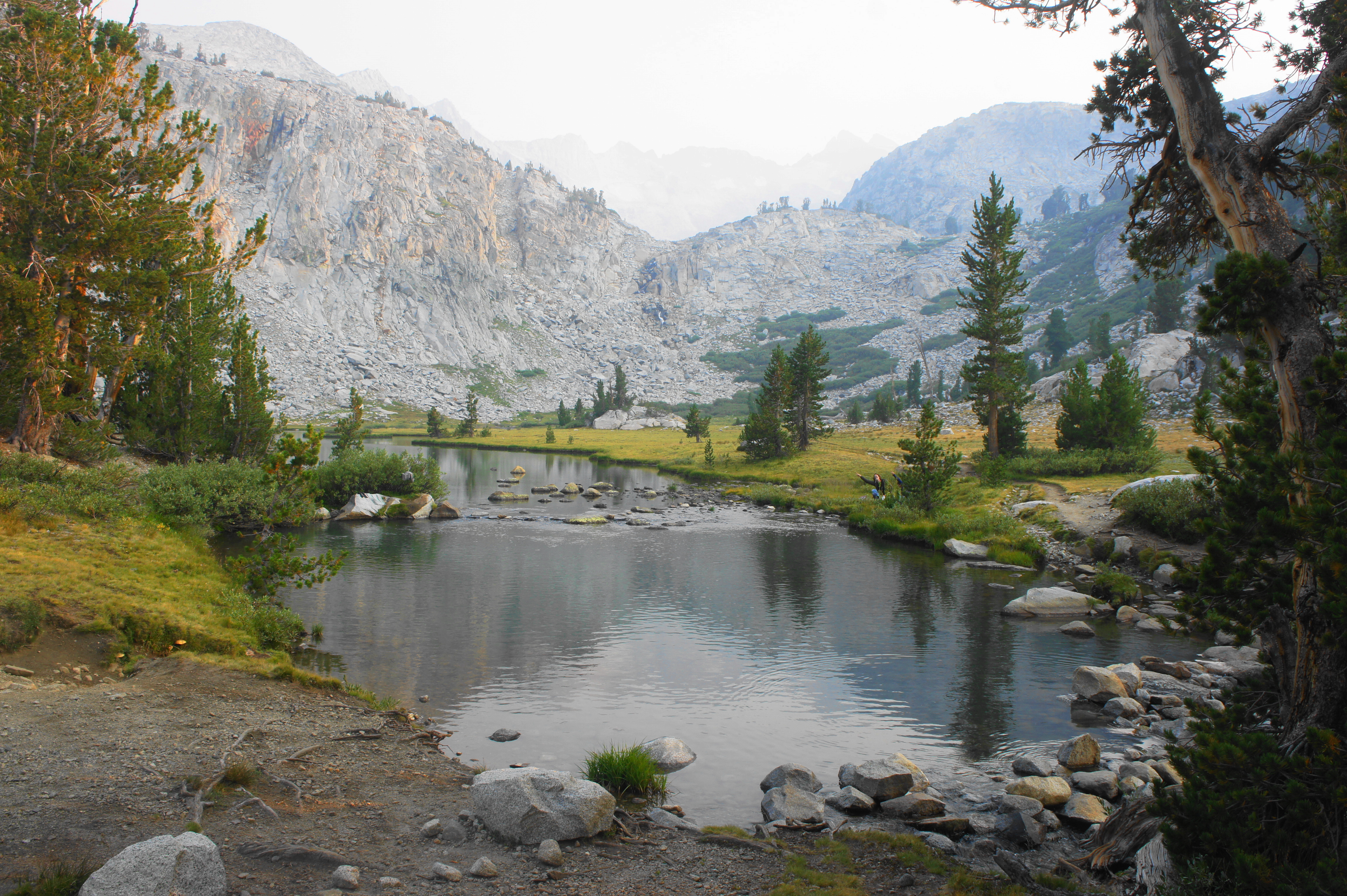
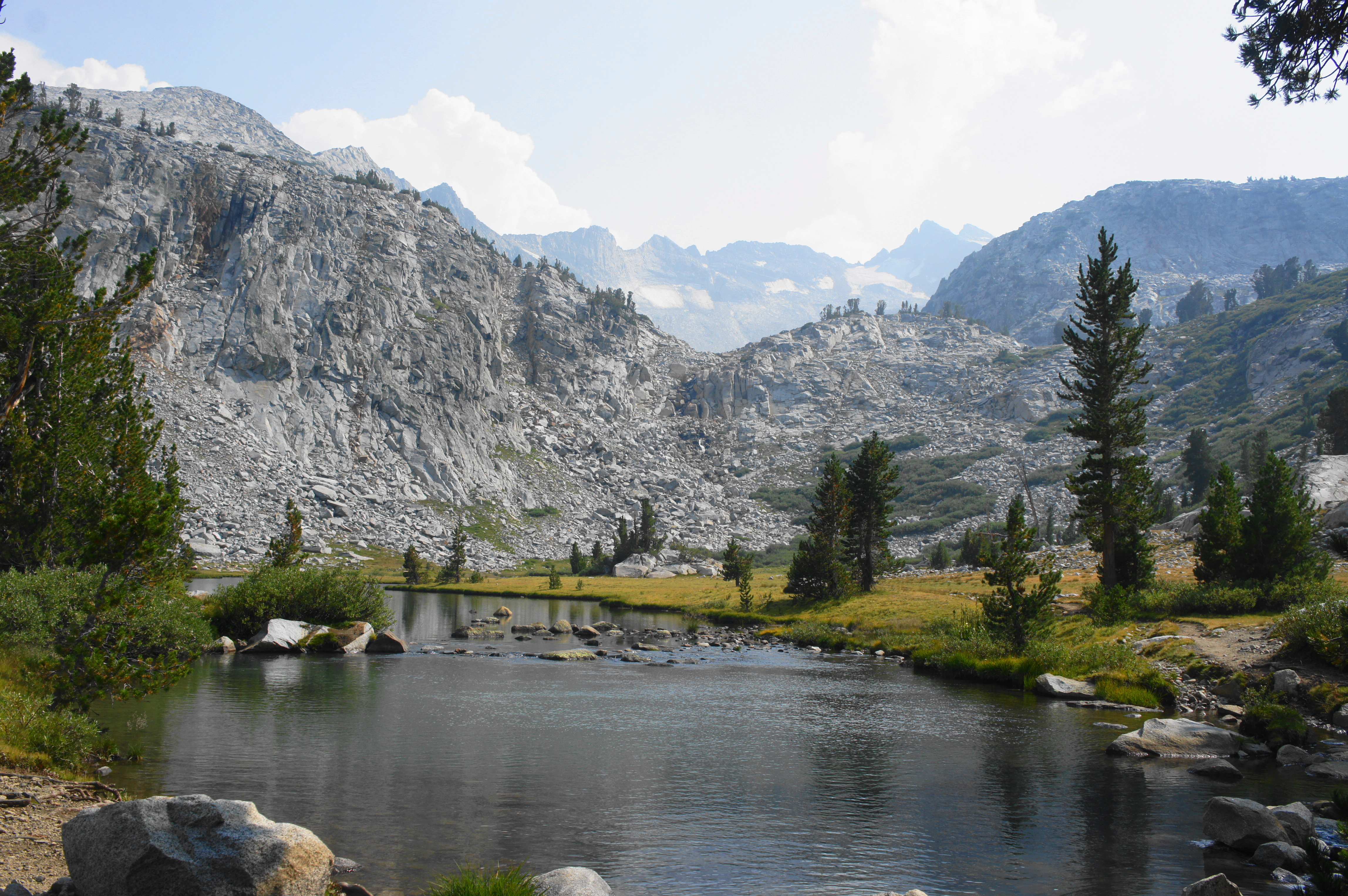
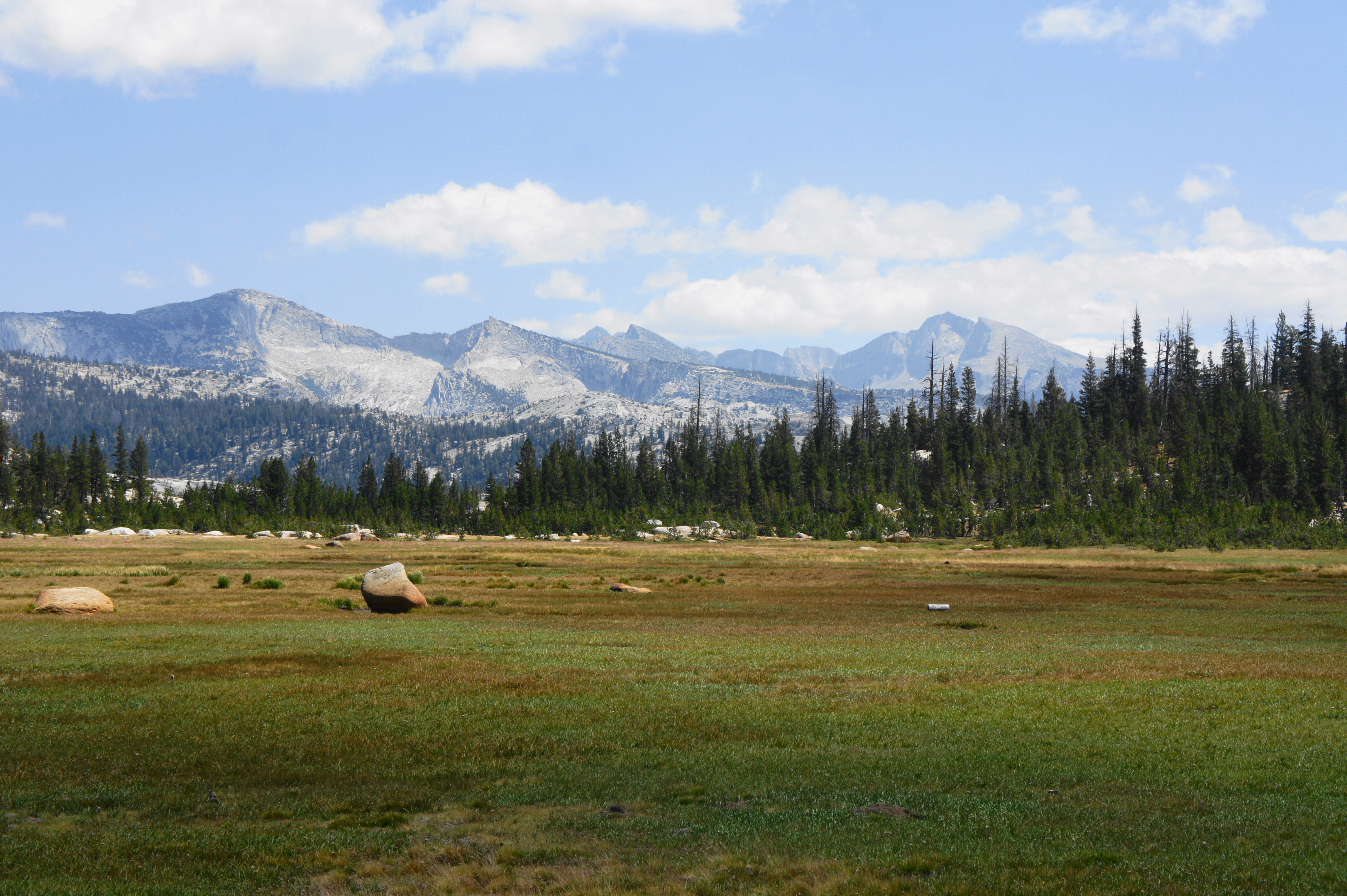
Looking back from the pass, the landscape spans from Donohue Peak to the northeast to Banner Peak and Mount Ritter to the southeast. Ahead, there is a small pond fed by snowmelt and then a steep declivity leading down to Lyell Canyon, an expansive valley where hikers will spend the next dozen-plus miles. Here at Donohue Pass, JMT through-hikers finally leave the Ansel Adams Wilderness in Inyo National Forest and enter Yosemite National Park, one of the most famous parks in the world.
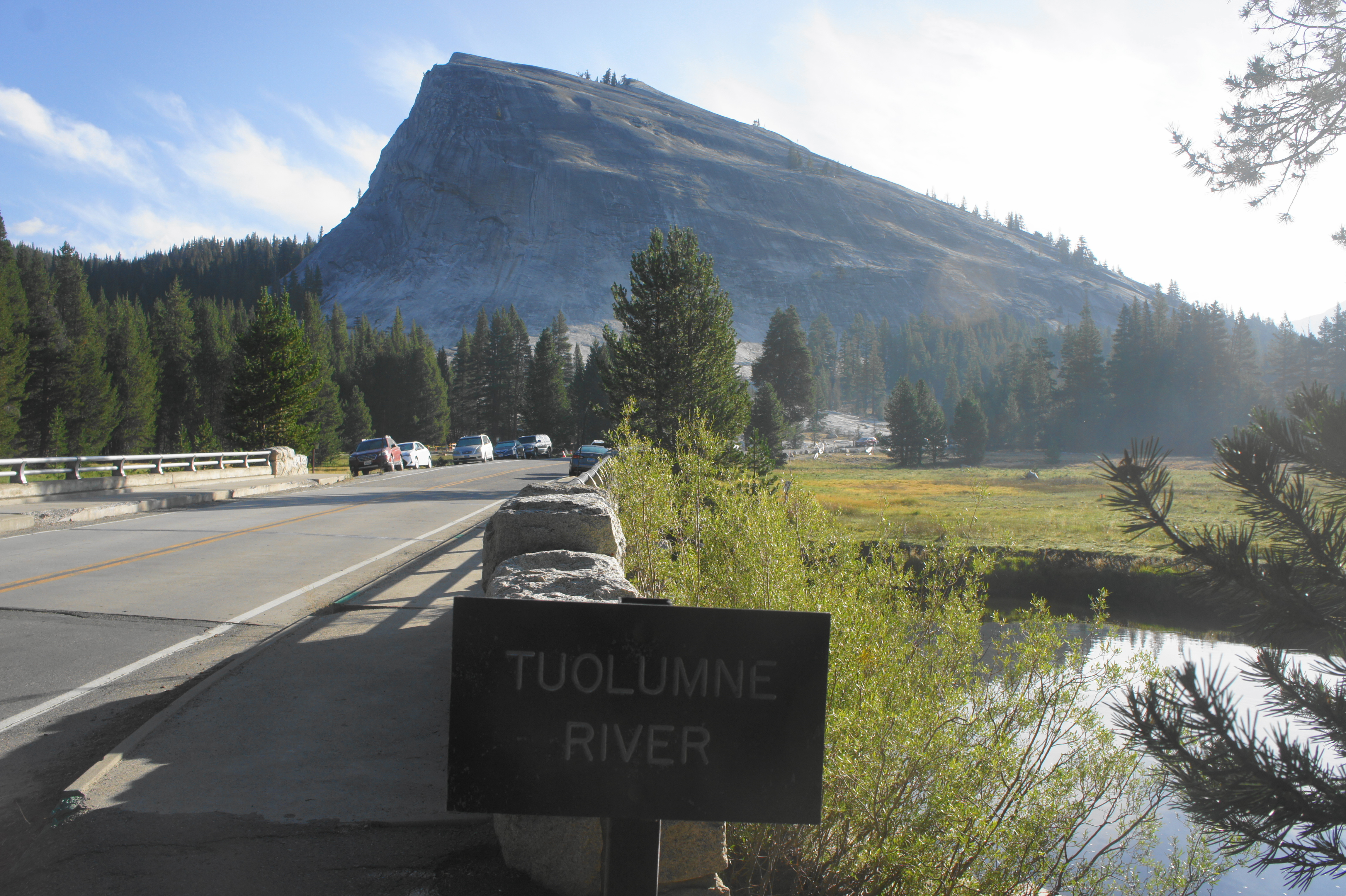
Still several days from bustling Yosemite Valley, the upper reaches of Lyell Canyon are quiet and peaceful, bounded by the Cathedral Range on one side and the Koip and Kuna Crests on the other. Tuolumne Meadows, the next notable stop and only place where the JMT crosses a public road, remains just out of view, tucked around a corner to the northwest.
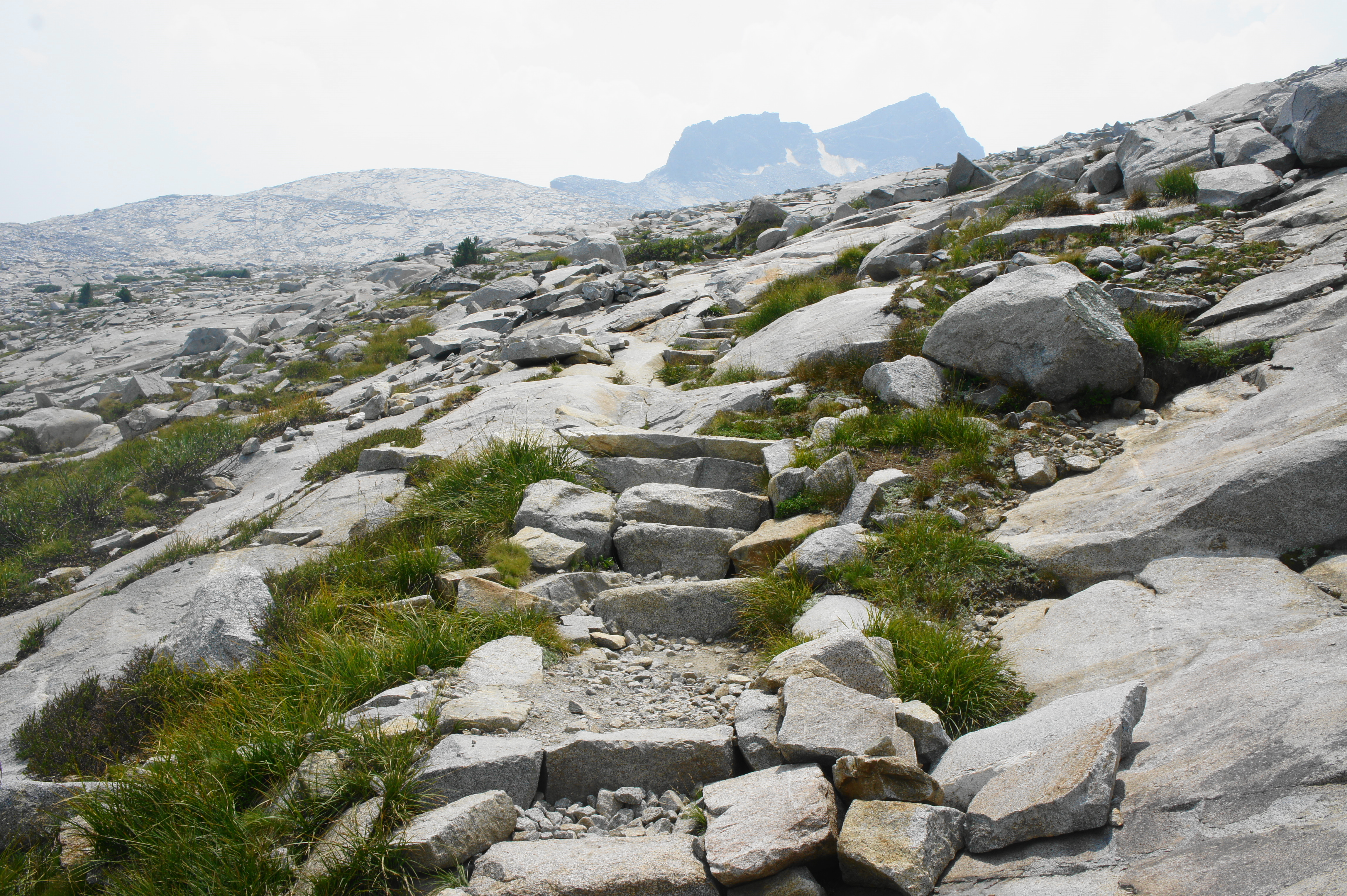
From Donohue Pass, the JMT is noticeably well-maintained, with meticulously-placed rock steps, the handiwork of Yosemite trail crews. The trail drops down an open slope to a brief ridgeline and then edges westward to an open meadow and the first crossing of the Lyell Fork, the primary drainage of the long valley. Here the glacier-fed waters are a spectacular aquamarine color, set below Mount Lyell (13,114’), the highest point in Yosemite National Park.

After crossing the waterway, the JMT ascends an unwelcome uphill to a granite knob between streams before descending again to a beautiful tributary. Rock-hop across this creek and proceed down a dramatic descent with at least three more stream crossings and an idyllic meadow and unnamed lake below.
Edging down the east-facing slope, the JMT crosses the Lyell Fork again at a spot just below the outlet of the unnamed lake. Ideal camping abounds in this area, known as Upper Lyell Base Camp, with dramatic views back toward Lyell Glacier. Expect to meet a lot of southbound JMTers here, very early (2-3 days) into their multi-week journey.

Trip Report: Initially planning to camp below Donohue Pass on the south side, a better-than-expected distance covered on the previous day allowed us to tackle the pass on Day 21 of our northbound journey. We found Donohue Pass to be quite challenging, one of the top four most difficult mountain passes on the JMT, and the smoke from distant wildfires was intense, heavily obscuring views down Lyell Canyon. However, we managed to snag a premier campsite at Upper Lyell Base Camp, with easy access to the unnamed lake in the upper canyon, making for a lovely evening in one of our last wilderness camps of the hike. By now we had traversed nearly 25 miles since Red’s Meadow and more than 200 miles from Cottonwood Pass—the start of our journey three weeks earlier.
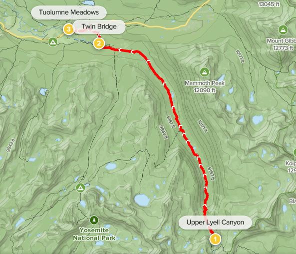
Upper Lyell Canyon to Tuolumne Meadows (11.6 miles)
The descent from Upper Lyell Canyon to Tuolumne Meadows is a relatively easy and pleasant downhill, but the 11.6-mile trek to the turnoff for Tuolumne Meadows Campground feels long and even monotonous at times. Even though Red’s Meadow Resort lies only 2-3 days back, the prospect of reaching Tuolumne Meadows—with its lodges, store, and café—provides additional motivation to knock out the remainder of Lyell Canyon in around a half-day of hiking.
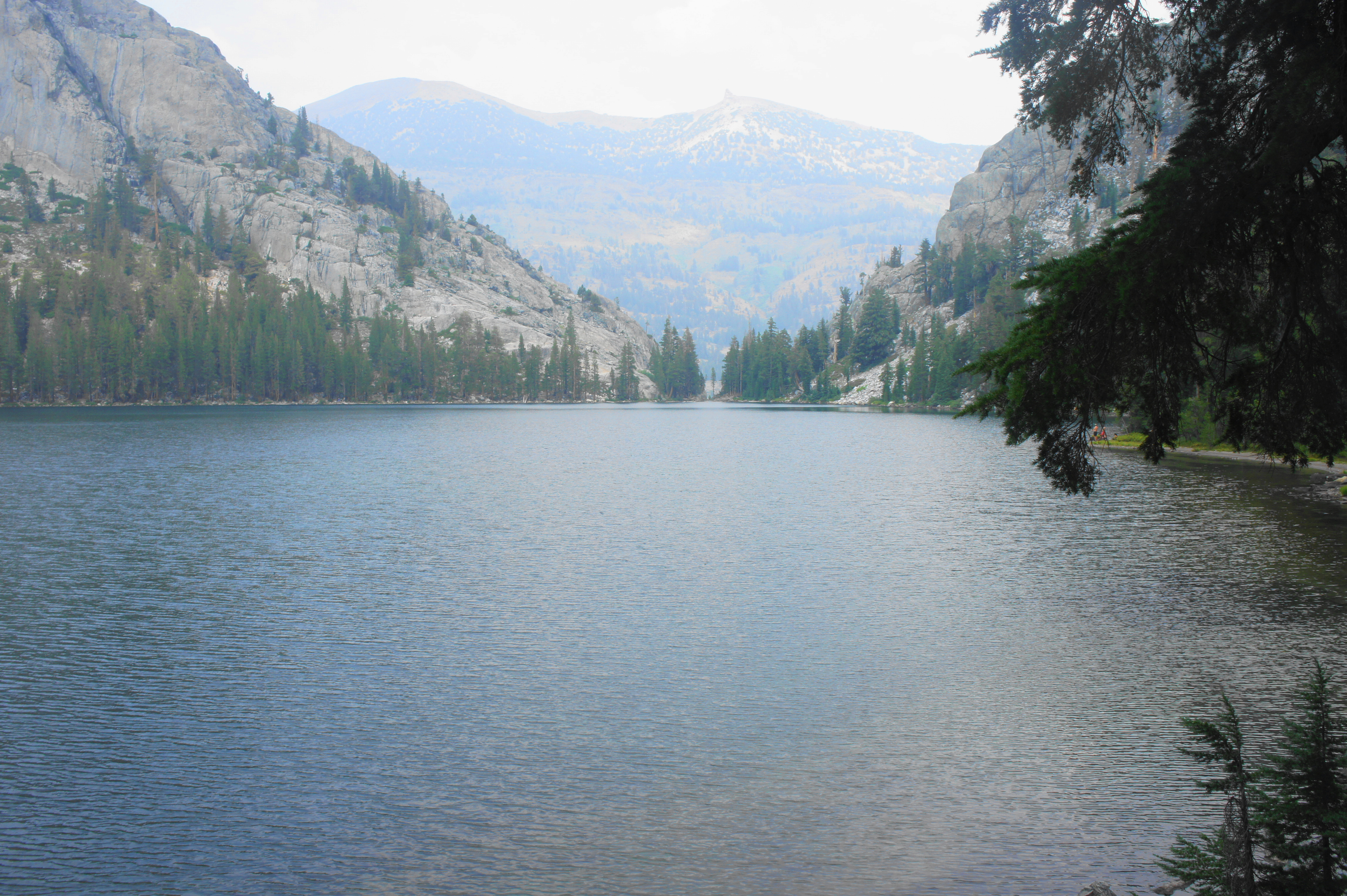
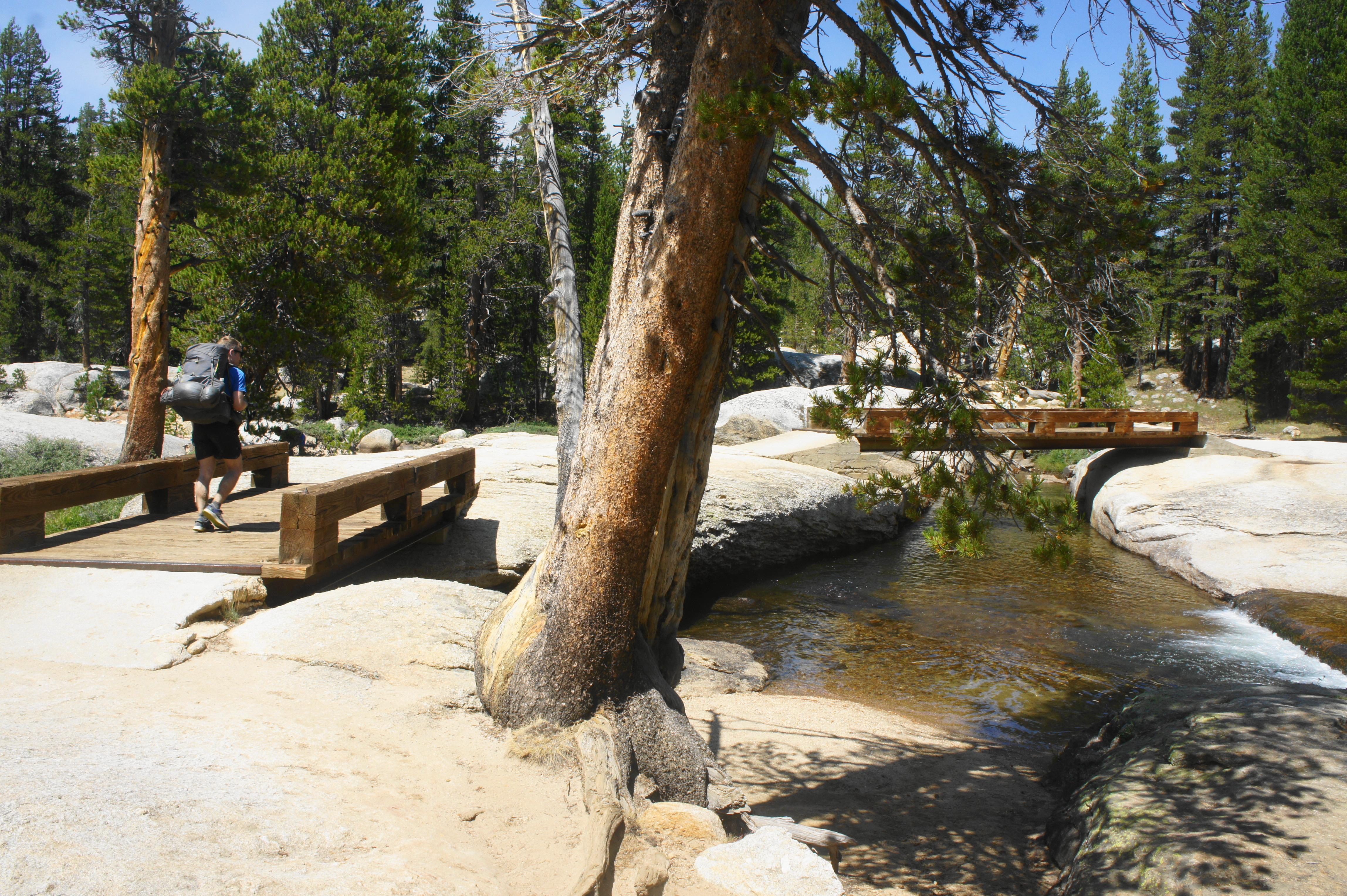
From the stream crossing at Upper Lyell Base Camp, the northbound JMT courses downhill, gradually entering some of the thickest tree cover since before Garnet Lake. After a set of wooded switchbacks, the trail crosses a minor tributary stream and then traverses a footbridge over the Lyell Fork again. Thereafter, the JMT edges slightly westward and begins descending a series of bends that drops 750 feet in ¾ mile to the first of a spate of beautiful meadows, where the Lyell Fork meanders calmly through Lower Lyell Canyon. Up to the east are the bald peaks of the Kuna Crest, headlined by Kuna Peak (13,002’), on the border of Yosemite and Inyo National Forest.

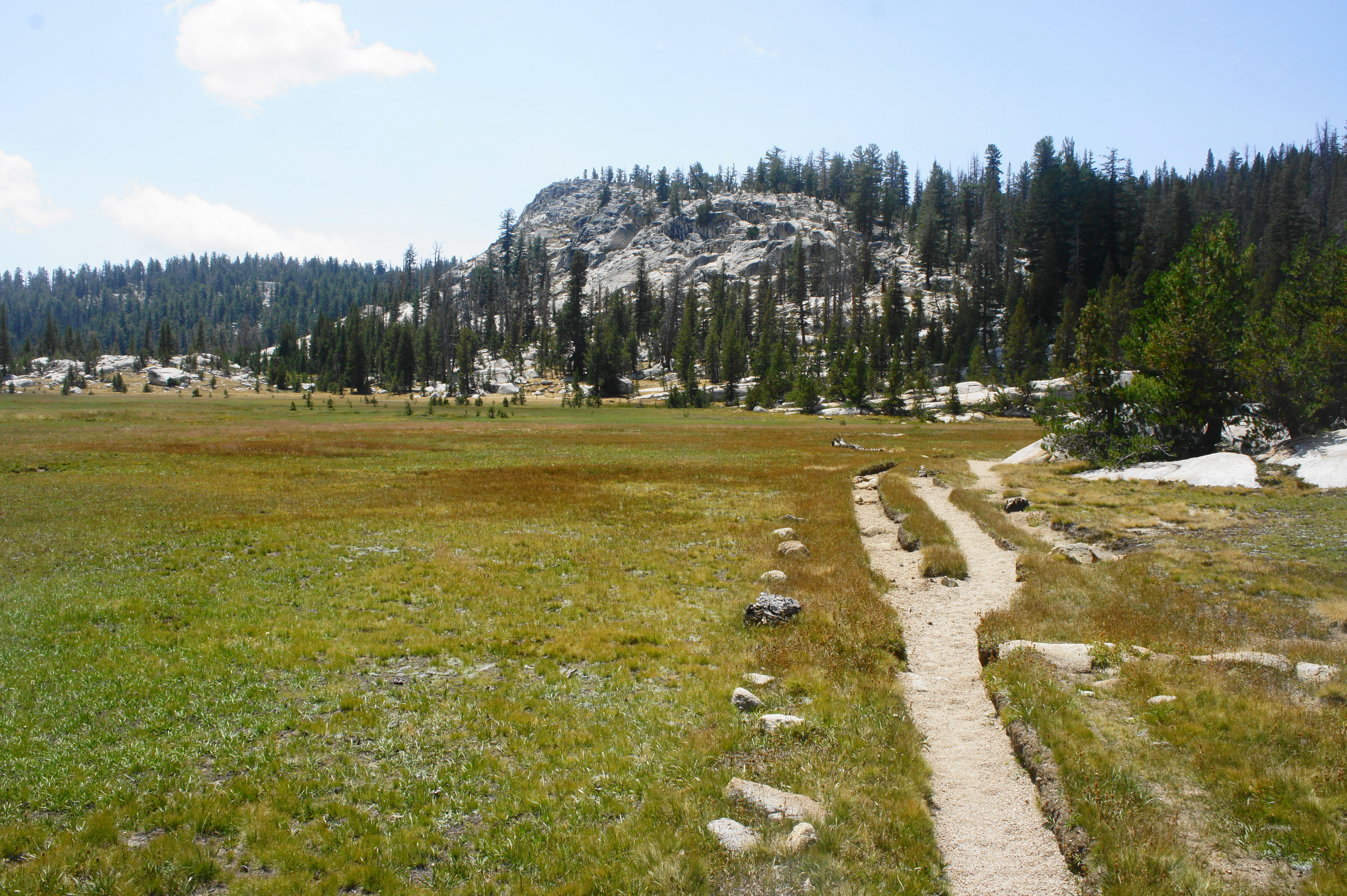
Once at the meadow level, the JMT is very mild—nearly level—for the next 9-10 miles. In fact, the route sheds only 400 feet between the base of the switchbacks and Tuolumne Meadows. As the canyon courses northwest, the waters of the Lyell Fork grow fuller and even more beautiful, with plenty of nice meanders that offer nice spots to stop for lunch or a snack. The gentle trail follows the western edge of an open meadow for nearly a mile, skirting in and out of the trees, then follows another meadow for another ¾ mile.

After staying right at a junction with the trail to Ireland Lake and Vogelsang, the Lyell Fork briefly picks up force and tumbles down a short set of cascades, after which it mellows again and enters yet another long and beautiful meadow, this one extending for around 2 ½ miles. The trail remains mostly in the woods, however, and traverses some slickrock in places as it edges closer to Tuolumne Meadows and the culmination of Lyell Canyon. At one point the JMT enters a no-camping zone that continues all the way to Tuolumne Meadows (where there is an official backpackers’ campground). The remaining open spaces gradually become enveloped by bushy conifers, and much of the terrain as the JMT bends westward is devoid of views.


After briefly crossing an open pasture with a few slabs of granite, the trail returns to the woods, crosses a bridge over Rafferty Creek, and intersects with the Rafferty Creek Trail, which heads south toward Vogelsang. Staying right, the JMT continues westward, then approaches another junction. Hikers desperate to set up camp can bear left here, following the shortcut path to Tuolumne Meadows Campground.

However, the official JMT continues right, with the wide and now relatively well-trafficked route crossing the Lyell Fork at a pretty spot called Twin Bridge, where the riverbed itself is revealed to be a long granite slab. Here families of day hikers play in the gently-flowing stream. After the slickrock area, the trail travels north amid the conifers to a brief uphill. After a bridge over the Dana Fork, hikers reach a junction with a spur trail leading right to the Tuolumne Meadows Lodge. Stay left, passing a parking lot for the Rafferty Creek/Lyell Canyon Trailhead off to the right. (Note: Many southbound JMTers will begin their journey here.)
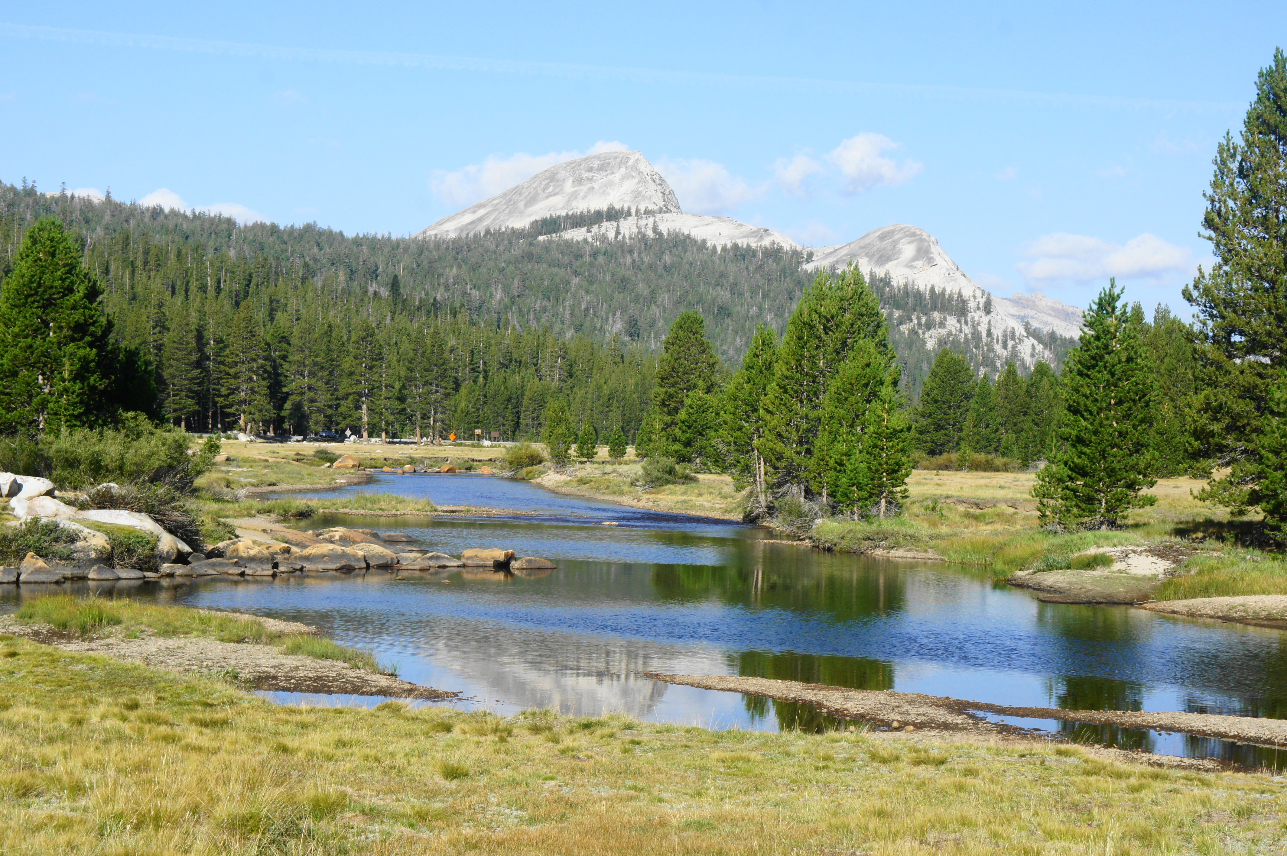
As the curious sound of traffic noise (an unfamiliar sound after multiple weeks on the trail) becomes more frequent, the westbound JMT comes within sight of Tuolumne Meadows Lodge Road and parallels it on the left. Across the street is a small ranger station and wilderness permit office. After skirting another parking lot, the JMT/PCT cuts left, distancing itself from the road, and traverses an open meadow with distant views of the Cathedral Range, including Johnson Peak (11,070’), Unicorn Peak (10,823’), and Cathedral Peak (10,911’).

Finally, the trail leads straight to a busy road intersection. Across Tioga Road to the north is a small parking lot and trailhead, tucked below the imposing Lembert Dome (9,450’), one of the most popular destinations for day hikers in the Tuolumne Meadows area. While the JMT/PCT continues straight, following a newly-paved road leading northwest, hikers seeking to spend the night at the Tuolumne Meadows Campground should bear left, following the sidewalk over the Lyell Fork. Just before the general store and Tuolumne Meadows Grill lies the entrance to the campground. The backpackers’ campground is tucked away deep in the back of the campground atop a mean hill and costs $6 per person. But the walk-in camp is within walking distance of the store and grill and is a fun place to connect with fellow backpackers.
Trip Report: This was a relatively relaxing day of almost exclusively flat or downhill hiking, and we reached Tuolumne Meadows Campground in the early afternoon. The sight of scores of day hikers and RV campers came as a bit of a shock after three weeks in the wilderness (the visitation numbers at Tuolumne Meadows significant dwarf those of Red’s Meadow)—but we were more than happy to pay the $6/person at the backpackers’ camp for quick access to the store. While the grill was closed due to Covid-19, the store offered a surprising number of snacks, including salads and sandwiches, as well as a fine selection of cold beer. We spent much of the evening chatting with fellow JMTers, many of which were SoBos and just beginning their long trip. We had only two more days left to reach Yosemite Valley.
Tuolumne Meadows to Sunrise High Sierra Camp via Cathedral Pass (9.6 miles)
Just one final leg remains until the completion of the JMT: a 23-mile section linking Tuolumne Meadows with Happy Isles in Yosemite Valley, usually finished in two days. Starting from the road junction at Lembert Dome—a short walk north from the Tuolumne Meadows Campground—the JMT/PCT bears northwest, doubling as a secondary road that services the Glen Aulin Trailhead, Soda Springs, and the Parsons Lodge. The trail quickly enters the official Tuolumne Meadows, a series of grassy lawns with open views of the surrounding peaks, including Unicorn Peak and Cathedral Peak in the Cathedral Range, as well as Lembert Dome and Pothole Dome (8,760’).


After the turnout (right) to the Glen Aulin Trailhead, pass through a gate that bars vehicle traffic and continue along the wide, unpaved road amid stands of lodgepole pines, bearing westward and reaching the northernmost point along the JMT. From here the route bends south, passing Parsons Lodge and McCauley Cabin on the right and officially parts with the Pacific Crest Trail, which continues northward. Then the JMT crosses a bridge over the Tuolumne River, the main drainage in the northern part of Yosemite National Park.
Cutting across the beautiful meadow, the JMT traverses the often-dry Unicorn Creek, then heads southwest on a flat straightaway, returning to Tioga Road. Cross the busy road—be careful of passing traffic—then continue as the trail reenters the thick forest. Bear uphill to two junctions. Stay left at the first, then right at the second, returning to the edge of the Yosemite Wilderness and following it westward, through a dense conifer forest with several rock shelves.

Soon after gaining around 100-150 feet in elevation, the JMT sheds it all, descending to a bridge over Budd Creek, a tributary of the Tuolumne River. Just past the creek, stay left at the junction, finally settling into a steady southward trajectory in the direction of Cathedral Pass and Yosemite Valley.
The northbound JMT (which, ironically, heads south) climbs steadily for the next ¾ mile before the incline eases a bit as granite knobs come into view on the left. After a good distance of mild walking, the trail enters a very steep, half-mile section that gains more than 300 feet before leveling off again.
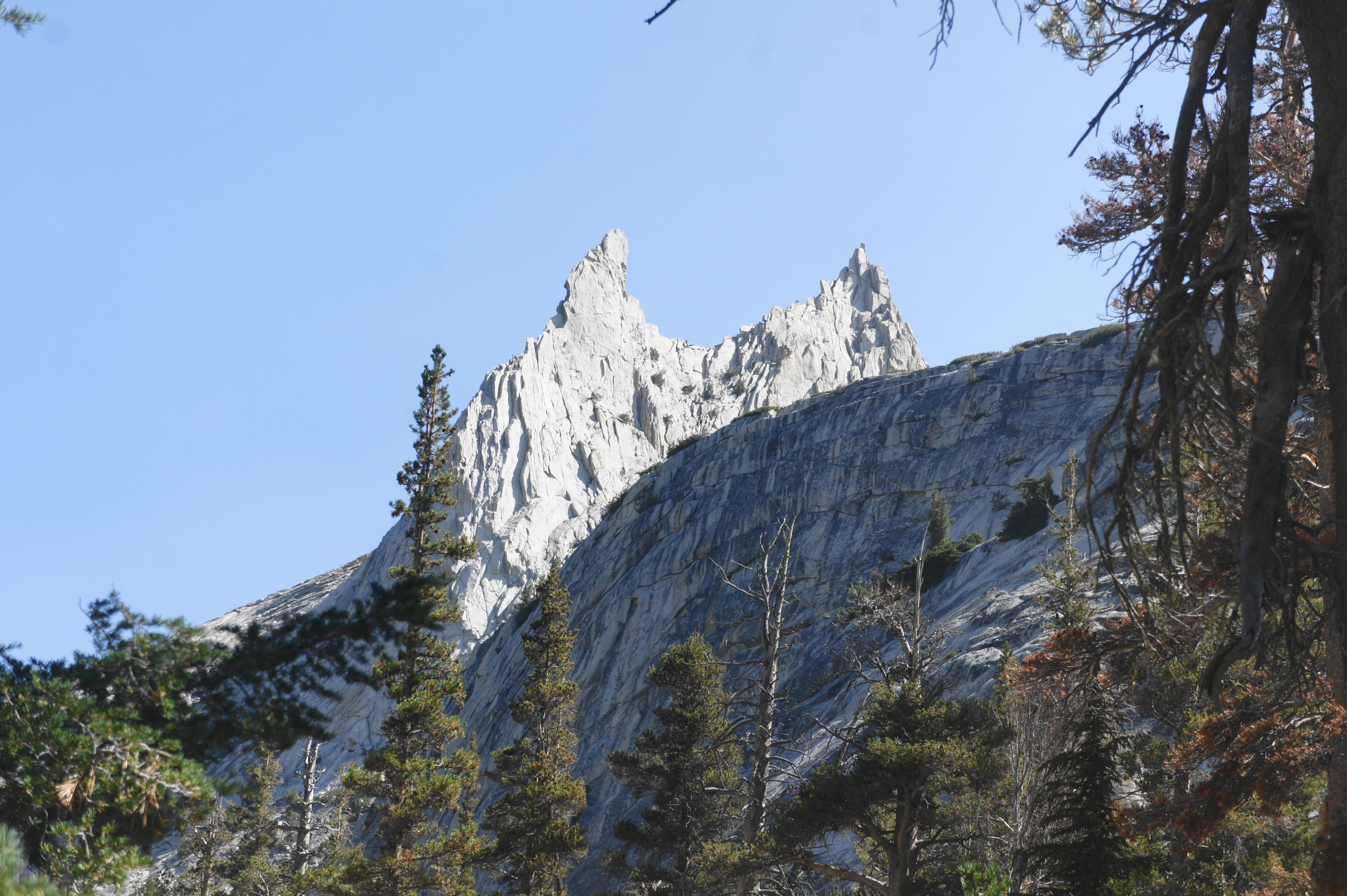
After a brief downhill, turn up again to a junction for the spur trail to Lower Cathedral Lake, the first of the two Cathedral Lakes. The lower lake is not visible from the main JMT, but Upper Cathedral Lake comes into view on the right about a half-mile farther on. The shore is worthy detour and offers an opportunity to fill up with water; in dry years, this may be the last reliable water source for several miles (until Sunrise Creek). Upper Cathedral Lake is set in a grassy bowl below iconic Cathedral Peak (10,911’), which has an uncanny resemblance to the top of Sauron’s tower in the Lord of the Rings.

Moving on from Upper Cathedral Lake, the trail rises mildly, detours around Cathedral Meadow (a sensitive preservation area), and climbs to Cathedral Pass (9,700’), the last mountain pass on the northbound JMT—and one of the easiest. Here the wide trail traverses a broad meadow wedged between Tresidder Peak on the west and Echo Peaks (10,960’) to the east. The pass also marks a change in watershed: streams flowing north from here empty into the Tuolumne River, while those bearing south end up in the Merced River, which flows through Yosemite Valley.


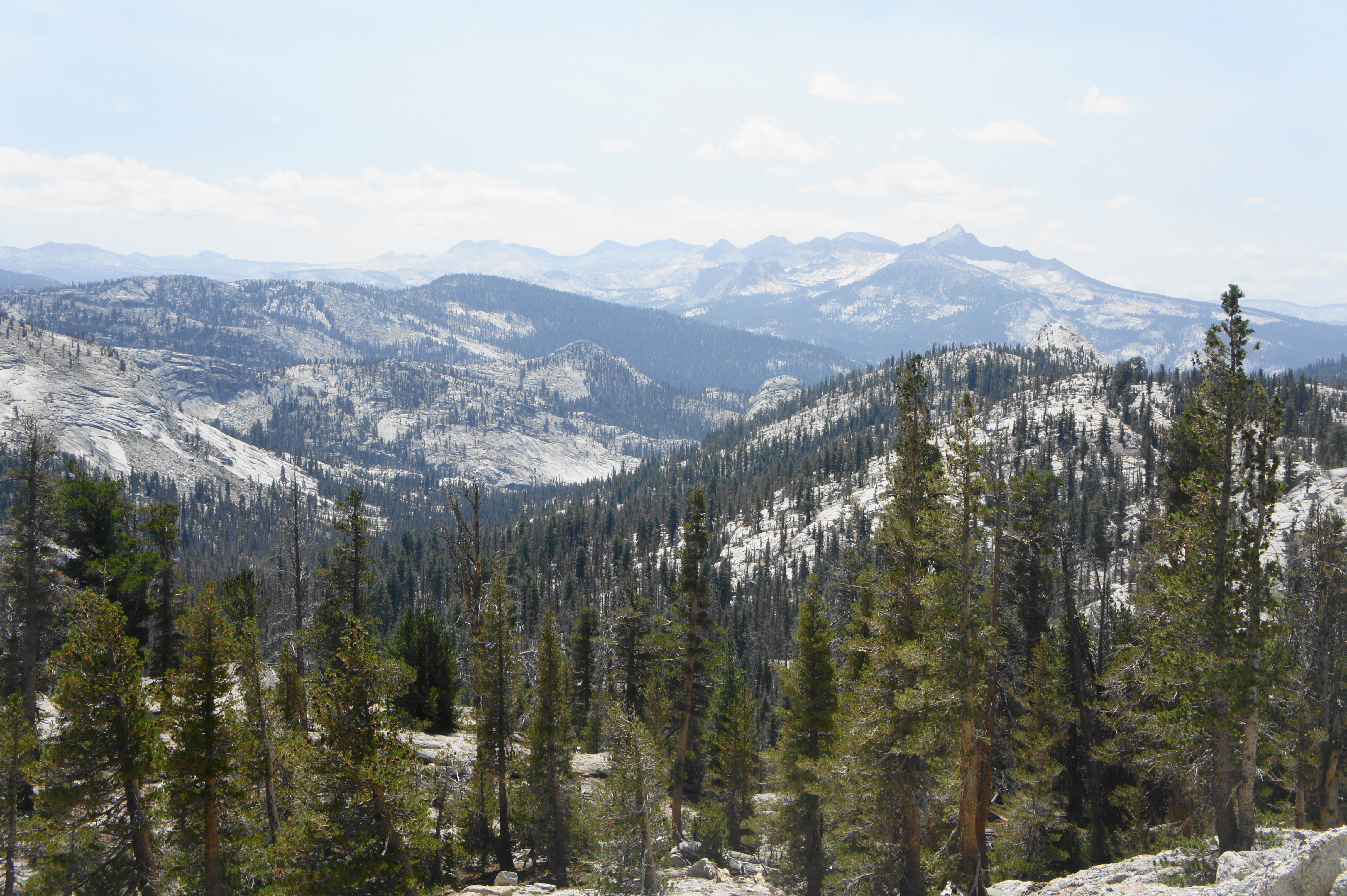
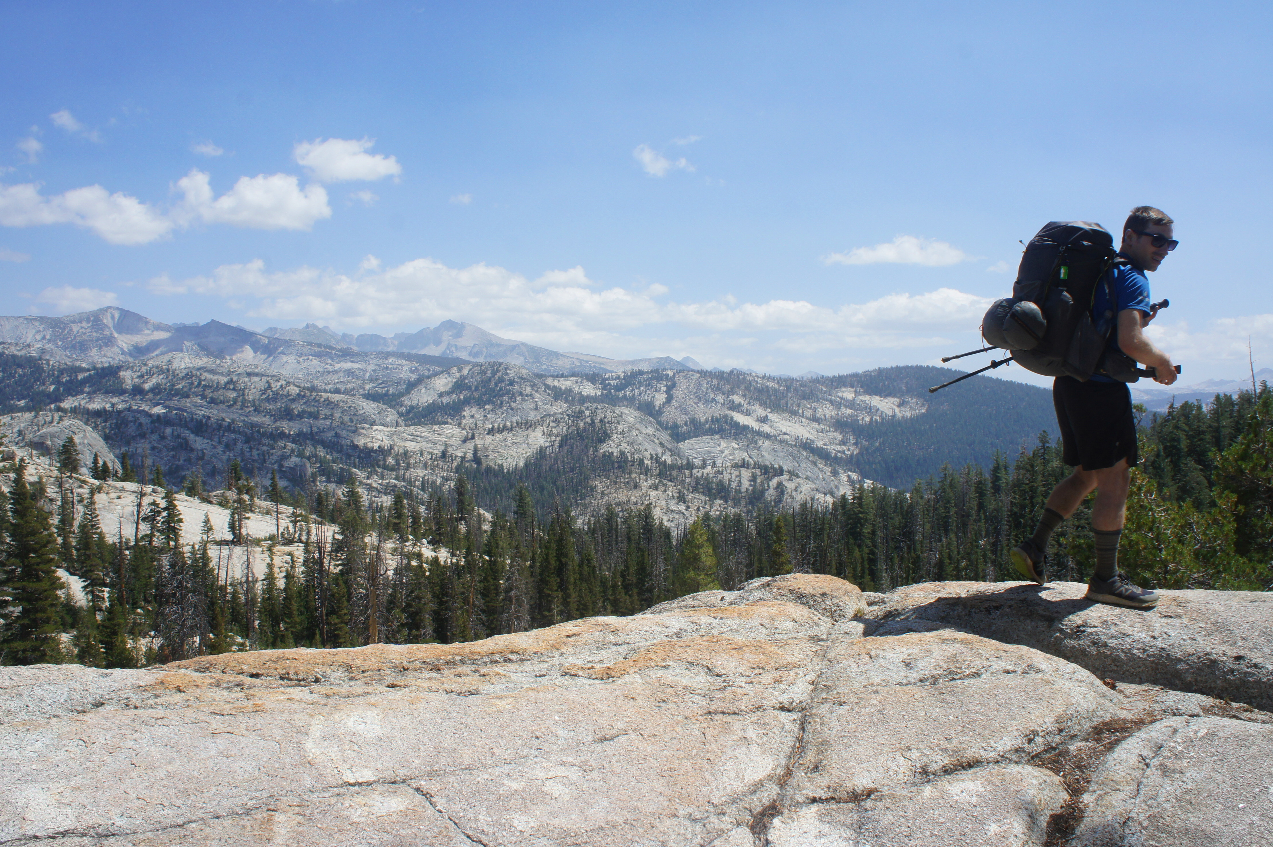
Surprisingly, the onward JMT continues to climb after leaving Cathedral Pass, edging partway up the eastern slope of Tresidder Peak and cresting a divide below Columbia Finger, a prominent landmark in the area. The view south from the divide is stunning, with much of central Yosemite unfolding below and a distant view of the rarely-visited Clark Range in the southern reaches of the park.
Edging westward, away from the main Cathedral Fork drainage below, the trail descends steadily to Long Meadow, notable for its stubby pines. After crossing a (sometimes dry) tributary stream, the JMT comes to a trail junction. Stay right, following the southbound path as it hugs another scenic meadow, this one with good vistas of the granite slopes to the east.
The meadow is actually a dogleg right, with the trail following it around the bend and approaching an area serviced by a side stream known as the Sunrise High Sierra Camp. This site has nine cabins, but they are reserved for registered guests. (Note: In 2021, the Sunrise camp was closed the entire year.) When the camp is open, there is also a water spigot available—but don’t count on it in case the camp is closed. If there is water, this area makes for a nice area to set up tents for one last night on the JMT.
Trip Report: We covered this section in good time on Day 23, filling up several liters of water at Upper Cathedral Lake because of a tip that the next several miles were completely dry. This was not entirely true—there were some pools in the tributary creek at Long Meadow—but the water was indeed turned off at Sunrise Camp (which was closed all of 2021), so we pushed on to find a campsite farther on at Sunrise Creek. The weather was warm and sunny all day, with no real threats of storm clouds, and the skies were relatively clear of smoke after a week of thick haze.
Sunrise High Sierra Camp to Happy Isles (13.2 miles)
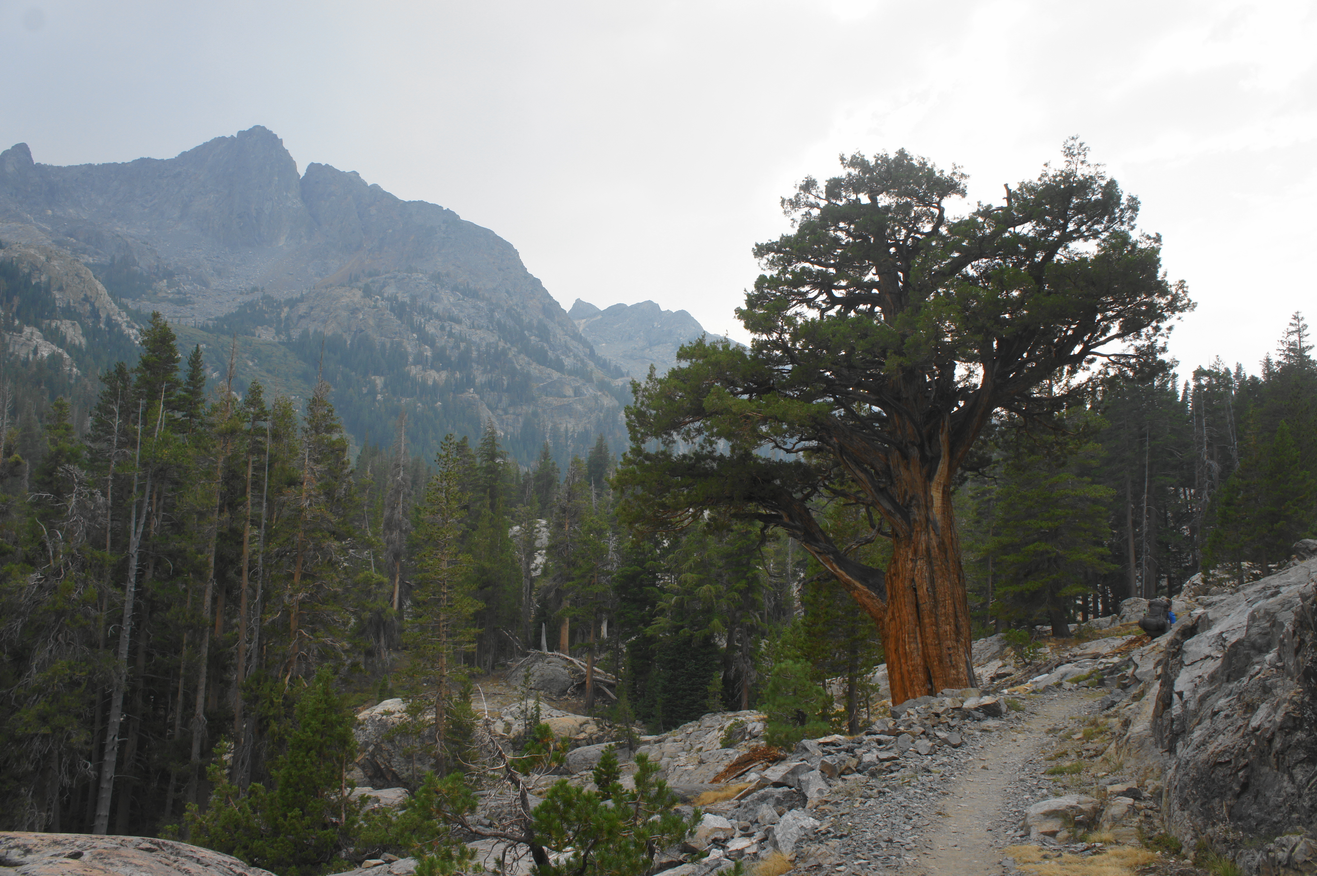
The final 13-mile stretch from Sunrise Camp to Happy Isles sheds more than 5,000 feet in elevation. From the High Sierra Camp, the JMT passes a junction with the Sunrise Lakes Trail (stay left) and then drops through a stony notch to the base of a three-part climb. The first pitch, a steep incline, leads up to a scenic outcrop with outstanding views across Yosemite to the distant Clark Range. Then, a longer uphill weaves in and out of woody hollows and ascends a hillside with sparser pines. Finally, after a brief period where the JMT levels off, it rises a third time to crest a ridgeline below Sunrise Mountain. There are a handful of campsites—but no water—atop the ridge.

From the ridgetop, the JMT begins a steep and steady descent, with switchbacks taking hikers down past the trickling headwaters of Sunrise Creek, which travelers will roughly follow for the next several miles. The tumbling stream gains strength as the vegetation grows lusher and the trail incline eases a bit, and hikers will cross Sunrise Creek at a point about 2.8 miles from Sunrise Camp. There is a decent campsite on the left bank, as well as another a couple minutes later along the right bank. (Note: We camped here on our final night.)
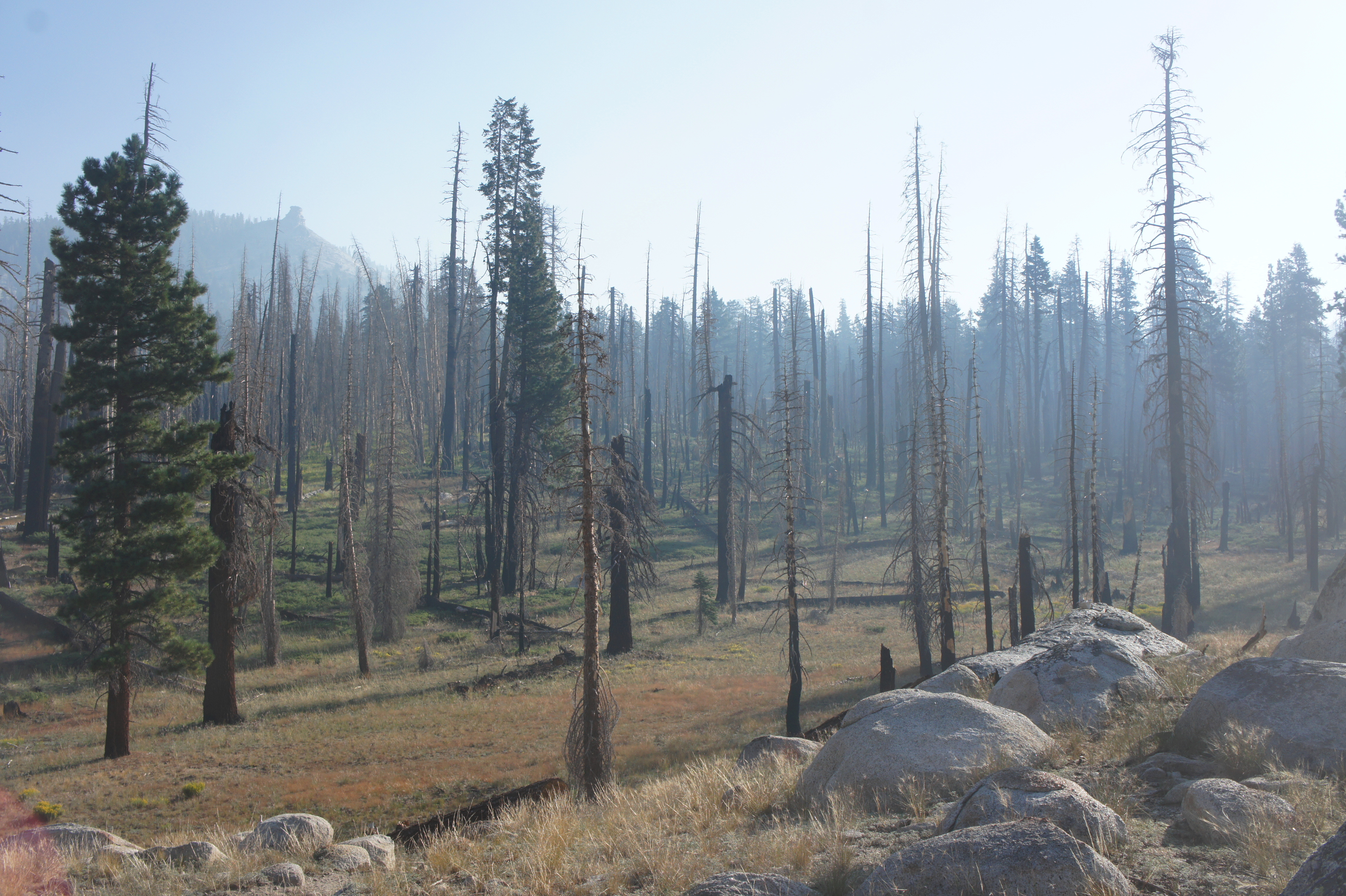
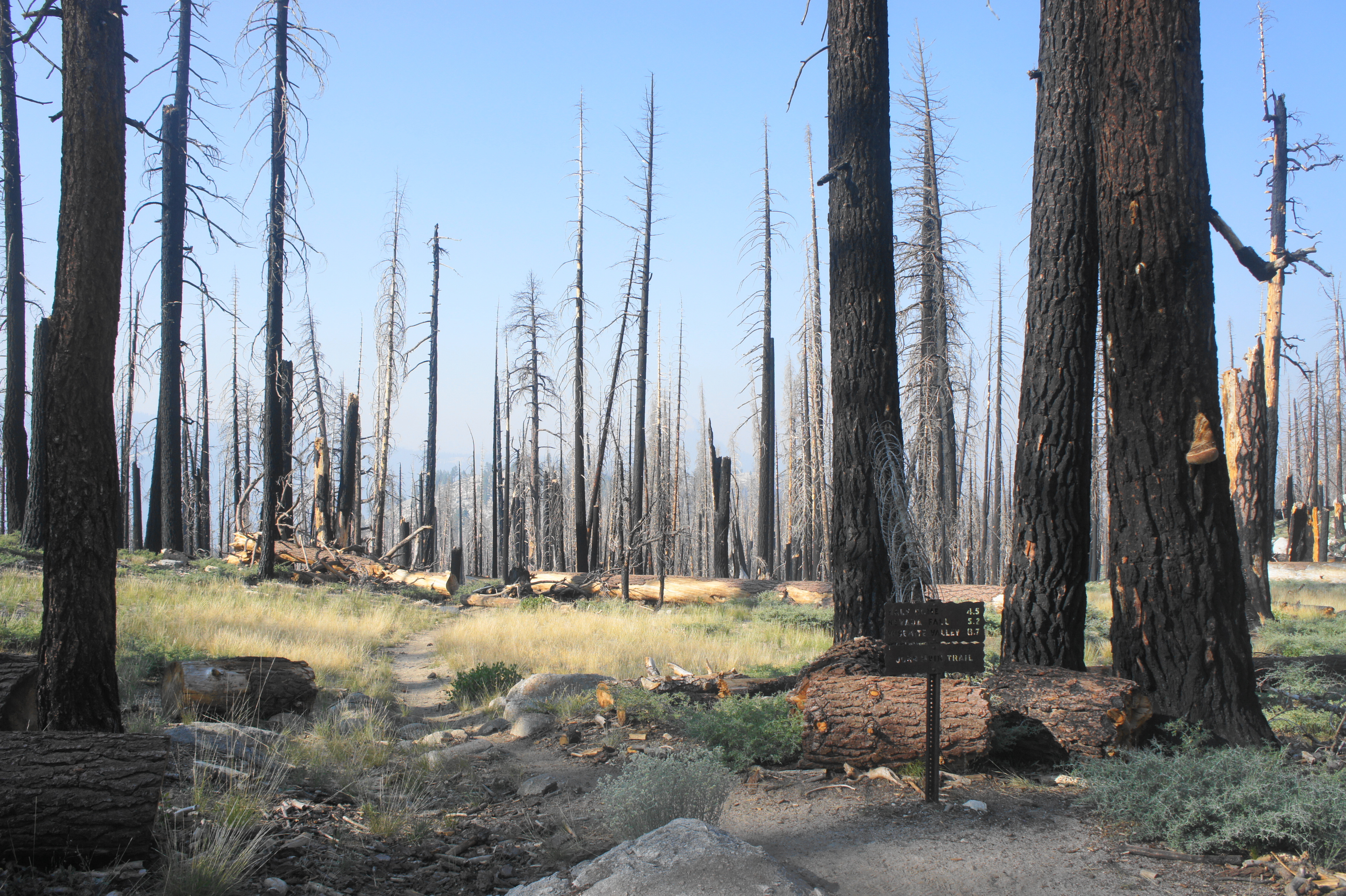
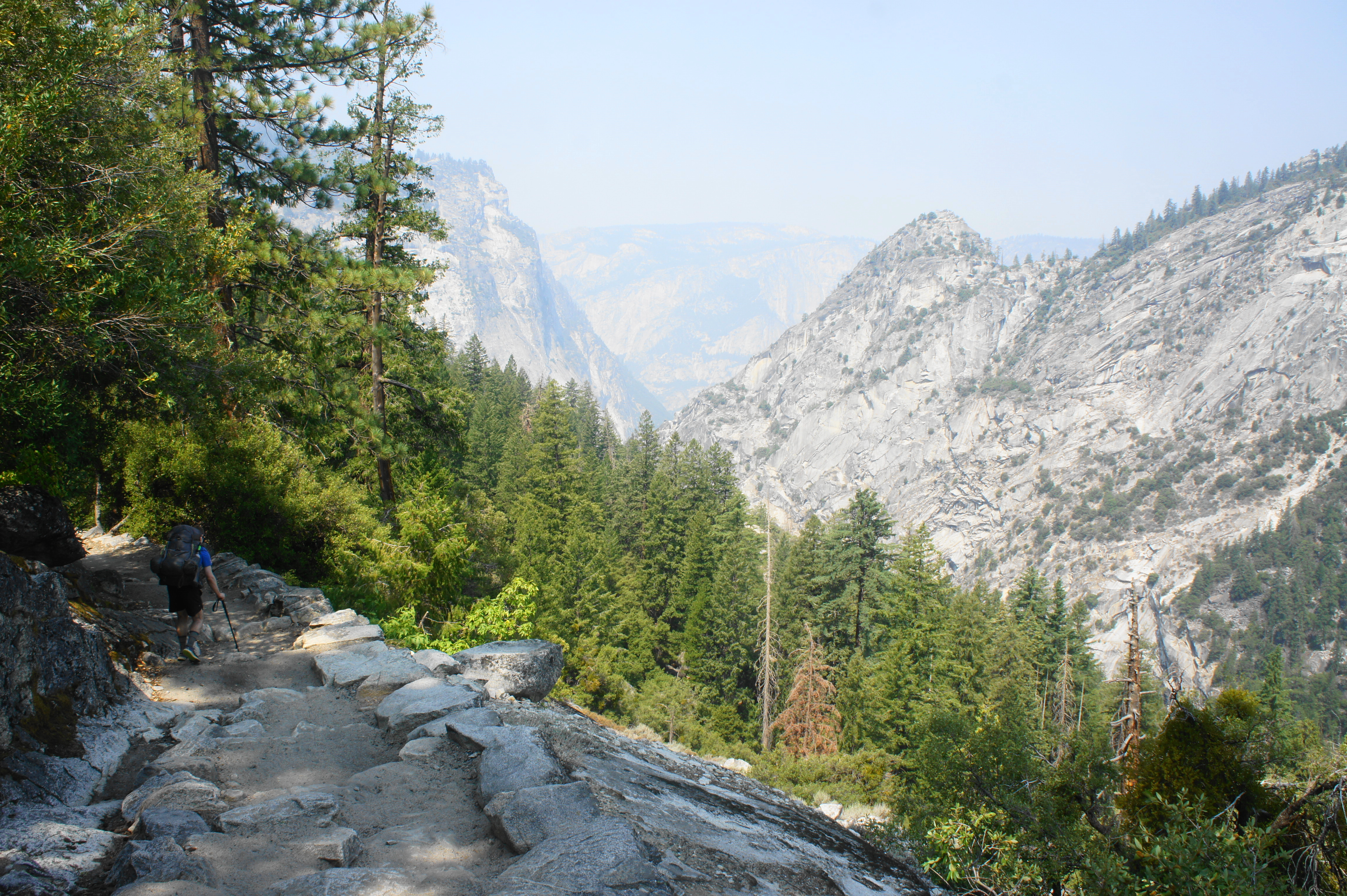
After crossing a tributary stream, the JMT eventually bends westward and then enters a forbidding burn area, caused by the 2014 Meadow Fire. Hikers will follow the charred trees for the next 1.5 miles or so. Off to the left, a high ridgeline drops precipitously to Little Yosemite Valley, a beautiful meadow-dotted landscape below Moraine Dome (8,005’) and Bunnell Point (8,193’).

At a point around 4.5 miles from Sunrise Camp, the JMT intersects with the Forsyth Trail (stay left) and bends left, away from the Sunrise Creek drainage. By now the grassy terrain gives to thick underbrush, which eventually turns to scratchy thistles. (Note: Definitely wear pants through this section.) Bear right at the next junction, cross a tributary stream, and drop to a notch that passes below Moraine Dome on the left, coming parallel to Sunrise Creek again.

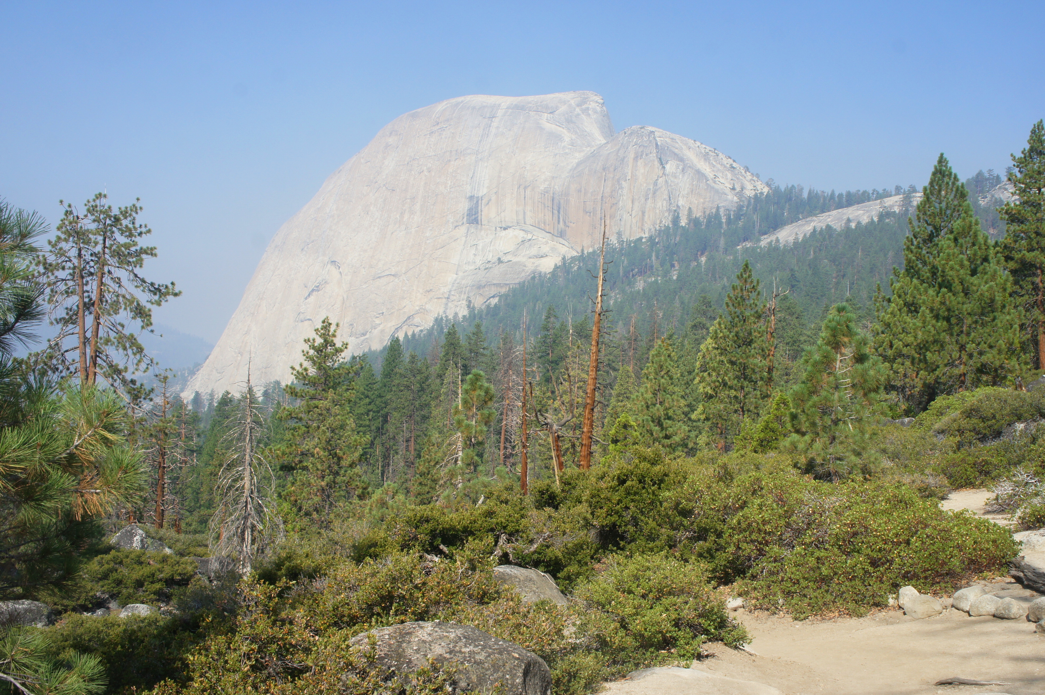
Gradually the (unburned) forest returns, and the prickly brush dissipates. After crossing the creek again, the JMT descends more steeply through a white fir forest, rounding a stream-fed gully and reaching a junction with the trail to Clouds Rest, a popular day hike and JMT detour. Stay left, edging away from the Sunrise Creek drainage and bearing westward, emerging out of the trees briefly for the hike’s first unobstructed views of Half Dome (8,836’), perhaps the most famous feature in all of Yosemite National Park.
The trail soon descends to the Half Dome Trail Junction, where JMT hikers holding an additional day use permit to climb Half Dome can proceed right for the arduous climb to the summit. All others should bear left, embarking on a wooded switchback section where hikers are likely to encounter scores of Half Dome day hikers. Follow this downhill tread for more than a mile to the Little Yosemite Valley area, where there is a ranger station, restroom, and campground. Bear right at a set of junctions, and head west across the sandy flat, eventually coming within striking distance of the Merced River.
After a mild uphill rocky section, the trail continues downhill, keeping the river on the left. Passing under Liberty Cap (7,076’) on the right, the JMT looks out over a significant drop to Yosemite Valley below, with Grizzly Peak (6,222’) and Glacier Point (7,214’) visible to the west. To remain on the official JMT, stay left at the junction with the Mist Trail, where there is a small pit toilet. (Note: Alternatively, proceed down the Mist Trail, a shorter but steeper alternative that passes under Nevada and Vernal Falls en route to Happy Isles.)
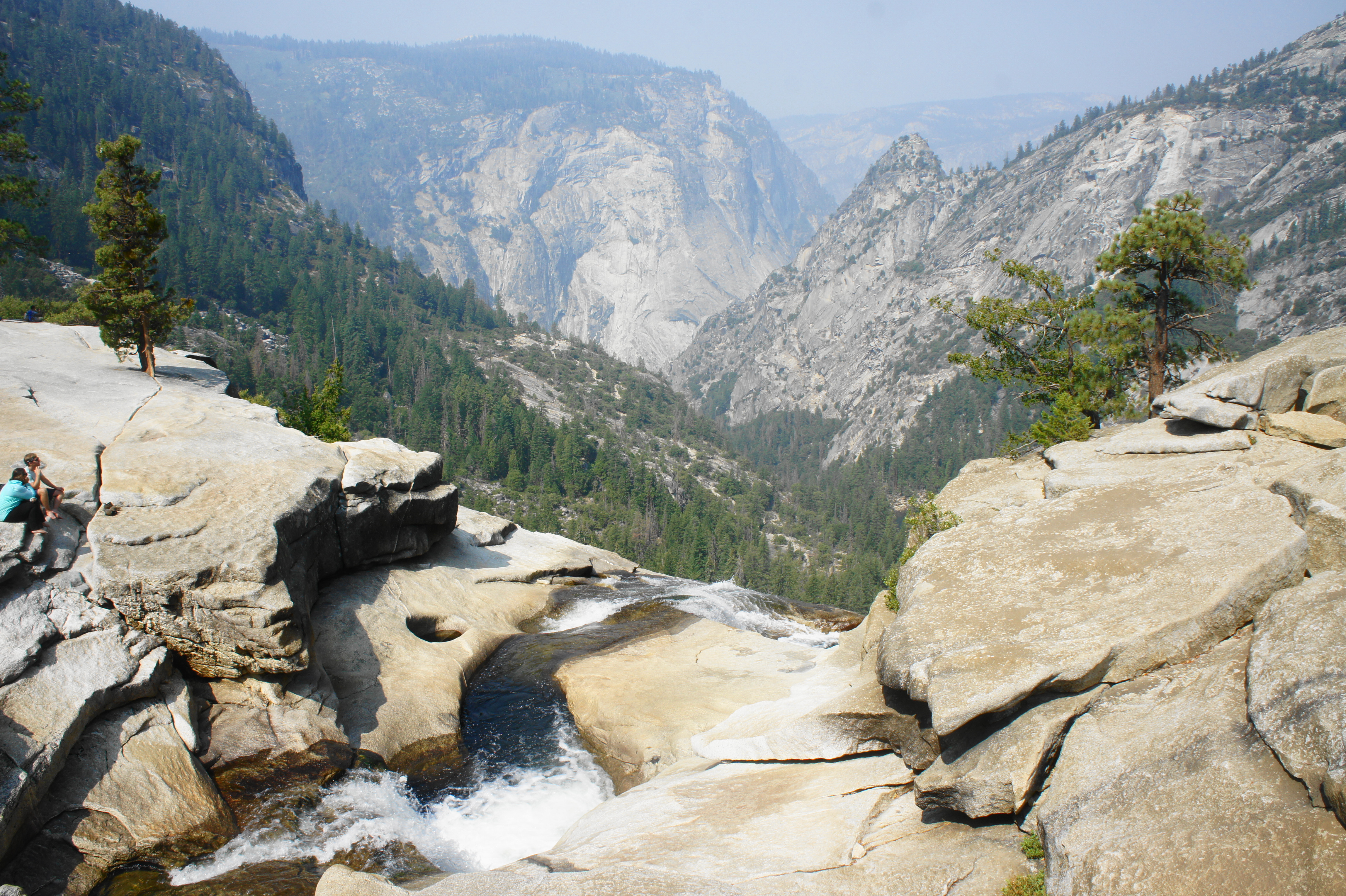
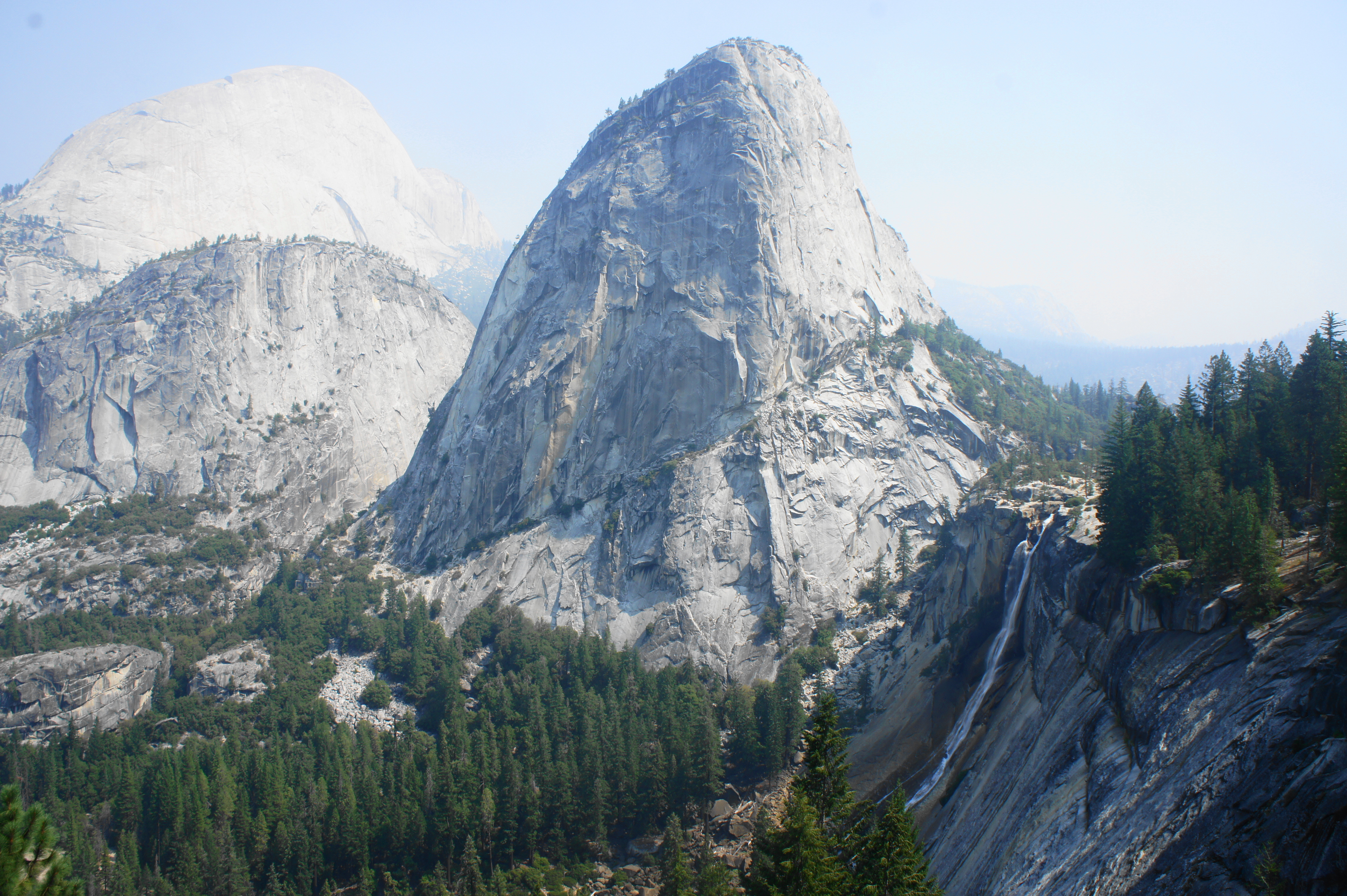
It is a short walk from here to the bridge over the Merced River and above Nevada Falls, a spectacular chute that tumbles nearly 600 feet. The best views of the falls lie beyond, as the trail winds south and west; look back to see the falls, with towering Liberty Cap and Half Dome beyond. The carefully-crafted trail here has several long stretches of stony walls to protect visitors from unwelcome slips.
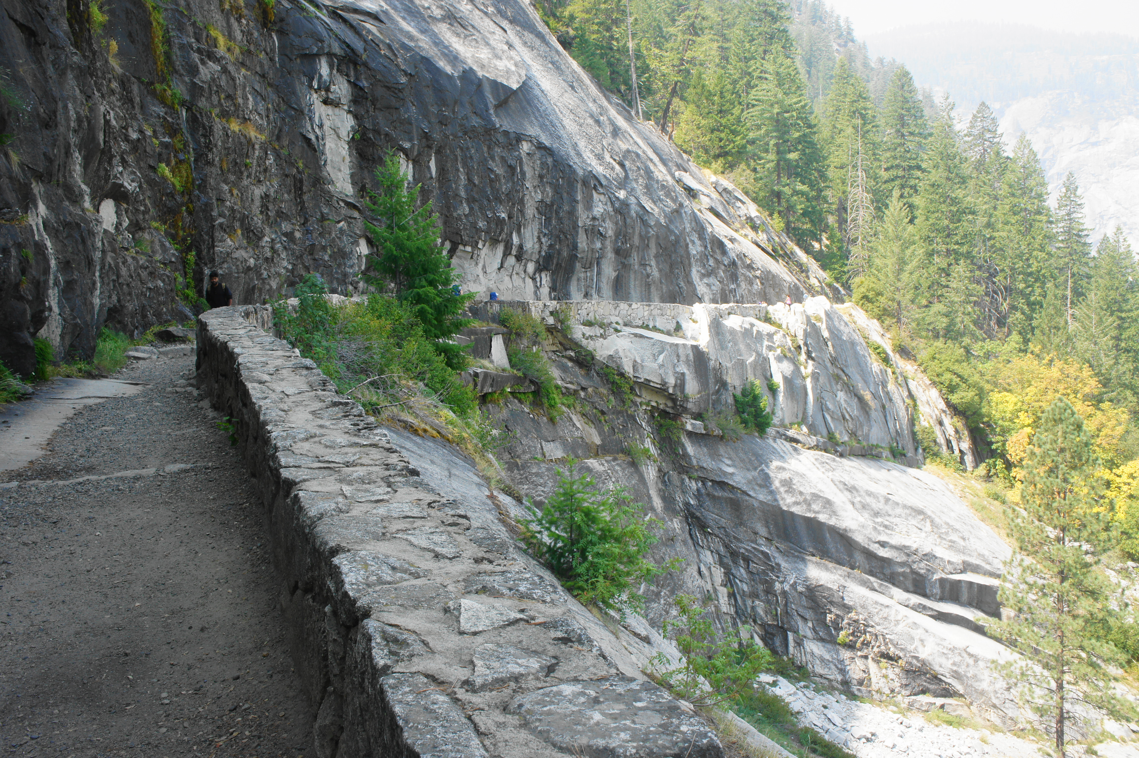
As the trail edges away from Nevada Falls, tree cover becomes thicker and passes a junction with the Panorama Trail, a steep, stair-stepping path leading up to Glacier Point. After a mile-long section with a couple pairs of switchbacks, the JMT descends to the Clark Point Junction, where another spur trail leads down to connect with the Mist Trail and Vernal Falls. Stay left, first staying high with open views before dropping back into the dense woods. The trail edges southwest to a switchback area that winds and bends down toward Yosemite Valley, losing 800 feet before reaching a trail junction. Stay right at the fork with a lesser-used stock trail, then left at the lower junction with the Mist Trail, where JMT hikers meet the masses of day hikers who are heading up to Vernal and Nevada Falls.
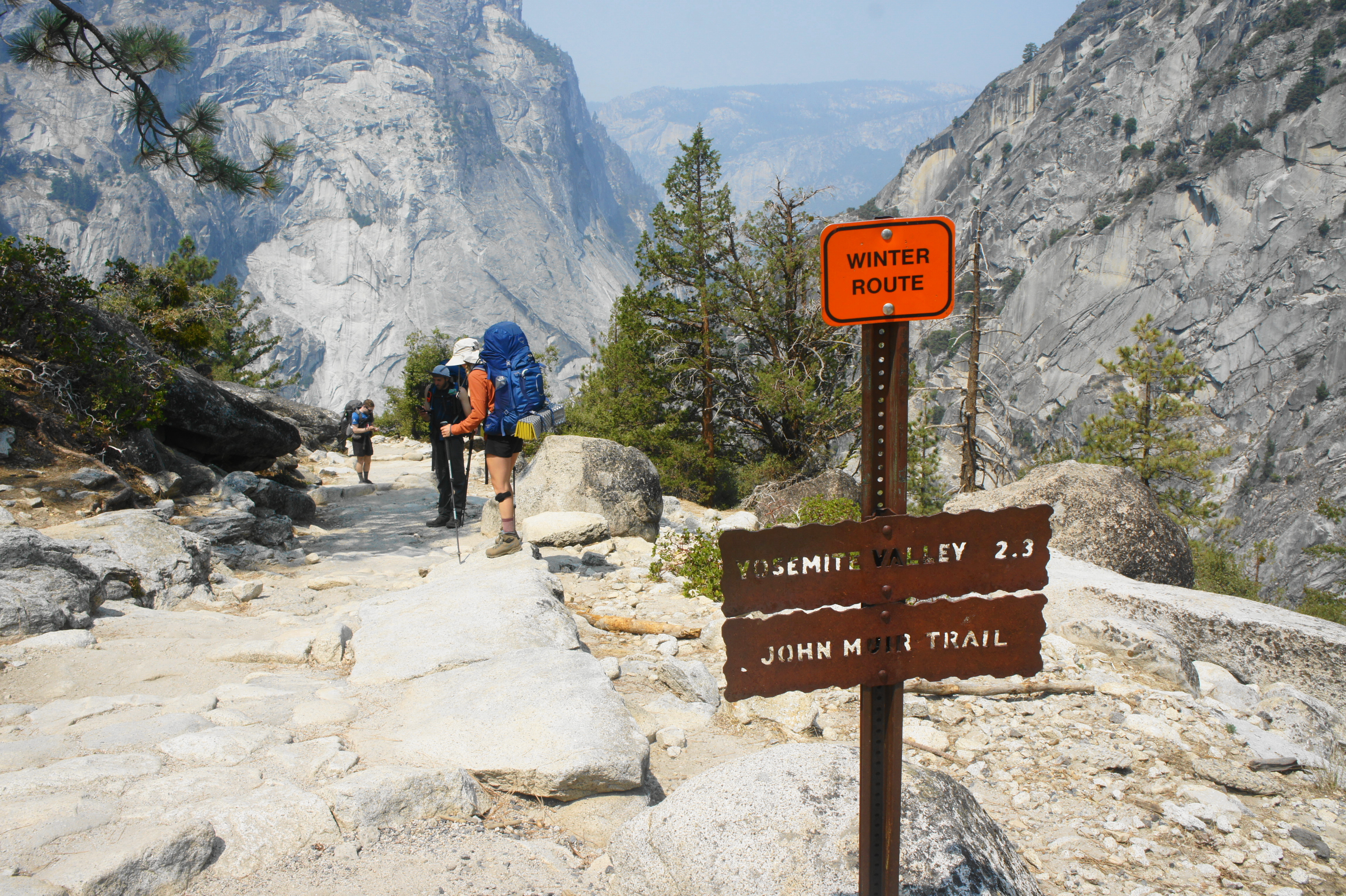
Keeping the Merced River on the right for a short period, the route drops to a restroom area and crosses the Merced River Bridge. Now on the north side of the rushing stream, the trail is asphalted—a hiker’s superhighway with visitors by the bunches crowding the path. Make your way briefly uphill, then down, as the trail hugs a cliffside well above the Merced River. As the path bends north, the incline eases and, at long last, reaches a large trail sign marked “High Sierra Loop Trail,” which serves as the unofficial end of the northbound JMT. Mount Whitney is a distant 211 miles—and several weeks of hiking—away. It’s a short walk from here to the Happy Isles Loop Road, where the JMT ends at last. (Note: It’s a short walk—or shuttle ride—from here to the Curry Village area, where JMT hikers can enjoy a well-earned pizza and beer.)

Trip Report: We did it! After camping just past the first crossing of Sunrise Creek, we fought through thick smoke, some of the worst of entire hike. After passing dozens of day hikers heading for Half Dome, we dropped to Little Yosemite and reached the top of Nevada Falls by late morning then proceeded down the switchbacks and through the massive crowds to Happy Isles. From here we walked to Curry Village, where we ate lunch and met up with my girlfriend, who graciously agreed to pick us up and drive us back to the Bay Area. All in all, including the various spurs and detours, we covered 254 miles in 24 days (including two rest days). Fortunately, we managed to finish just a few weeks before much of the area was closed to backpackers due to the KNP Complex Fire. Along the way we saw stunning alpine terrain, made some good friends, and scratched a long-time itch to try our hand at long-distance through-hiking—perhaps the first of many to come!

What a lovely post full of details and nice photos!
Thanks for sharing and best wishes for 2022.
Pingback: Top 10 Hikes in 2021 | Live and Let Hike
Pingback: John Muir Trail Northbound Section 1 – Horseshoe Meadow to Onion Valley (Sequoia & Kings Canyon National Parks, CA) | Live and Let Hike
Pingback: John Muir Trail Northbound Section 2 – Onion Valley to Muir Trail Ranch (Kings Canyon National Park, CA) | Live and Let Hike
Pingback: John Muir Trail Northbound Section 3 – Muir Trail Ranch to Red’s Meadow (John Muir Wilderness, CA) | Live and Let Hike
Pingback: John Muir Trail Preparation & Logistics | Live and Let Hike
Pingback: Top 10 Hikes in 2022 | Live and Let Hike
Pingback: Five Lakes Trail (Granite Chief Wilderness, CA) | Live and Let Hike
Pingback: Thousand Island Lake Loop via High Trail & Shadow Creek Trail (Ansel Adams Wilderness, CA) | Live and Let Hike