

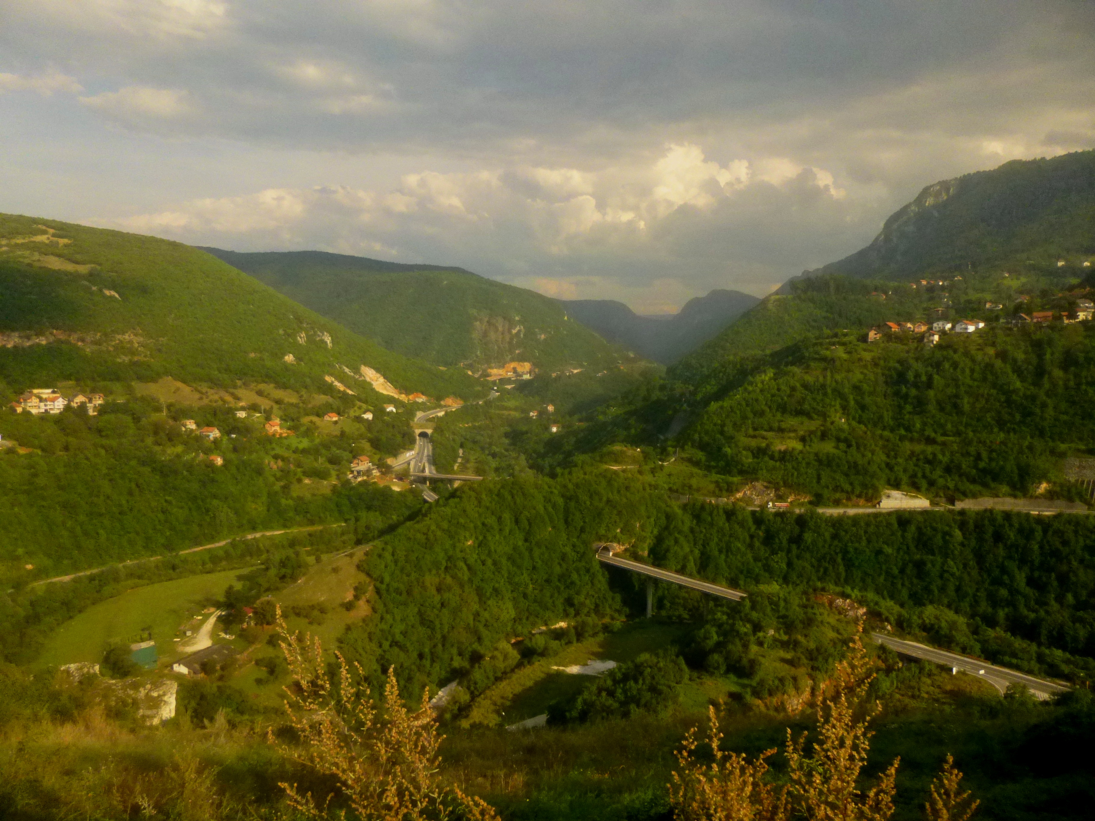
In Europe’s great cities—from Paris to London to Rome—public parks, though grand and well-manicured, are a dime a dozen. But rushing waters, bounded by colossal canyon walls, indeed a fisher’s or rock climber’s paradise—just a 20-minute walk from the city center? Now that is a rare sight…and a feature that makes Sarajevo—the political and economic hub of mountainous Bosnia & Herzegovina—unique among Europe’s great cities. With its start less than a 10-minute walk from Sarajevo’s Old Town (no vehicle required!), the city’s oldest walking path—known to locals as “Dariva”—abruptly transports visitors into rugged and colorful Miljacka Canyon, a peaceful contrast from the bustling city center. The wide path, asphalted and replete with public benches, follows the Miljacka River for nearly two miles to 16th-century Kozija cuprija, or Goat’s Bridge. Complete solitude remains elusive—the main thruway out of town towers above, and the trail is crowded with locals in the evenings—yet a stroll along Dariva offers a flavor of nature in Sarajevo’s backyard.

The hike
Dariva begins just 0.3 miles east of Sebilj Square in Bascarsija, or roughly a half-mile (follow the north bank of the Miljacka) from Sarajevo’s celebrated Latin Bridge. From the banks of the Miljacka, walk east along Bentbasa road, keeping the river on the right, passing both the dam and the footbridge just before the Miljacka bends sharply southward. Resist the temptation to cross the footbridge in pursuit of a visibly steep, winding path on the southern bank—this is not Dariva.

Instead, continue 100 meters on the sidewalk (a rare occurrence in Sarajevo), then finally turn right at the next significant street—this road, lined with trees on one side and a sports complex on the other—marks the beginning of Dariva. Beyond the sports complex and swimming pool, find a rough sketch of the route ahead on the right:

Here the road ends, and the official path—walkers and bikers only—begins.
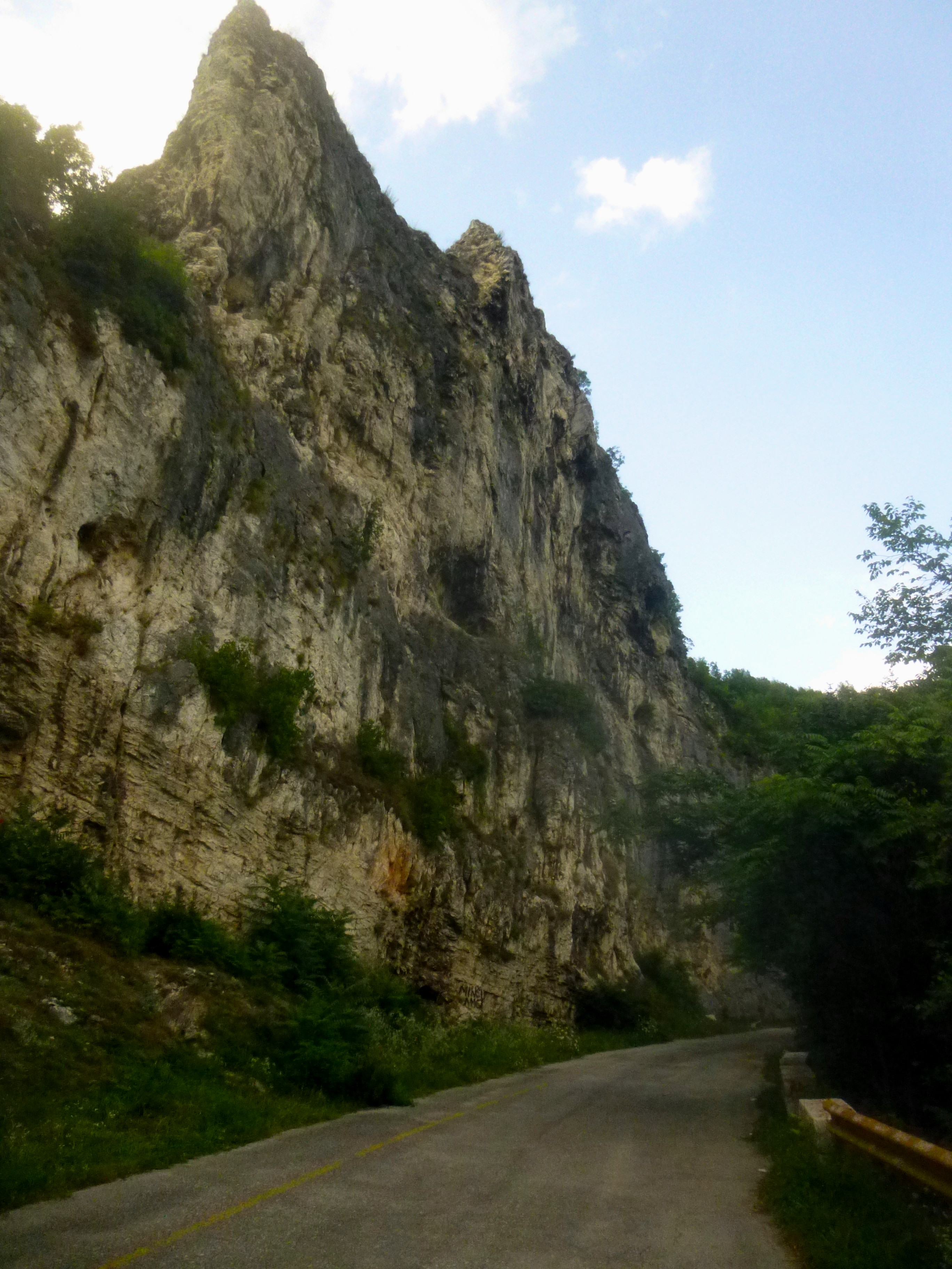
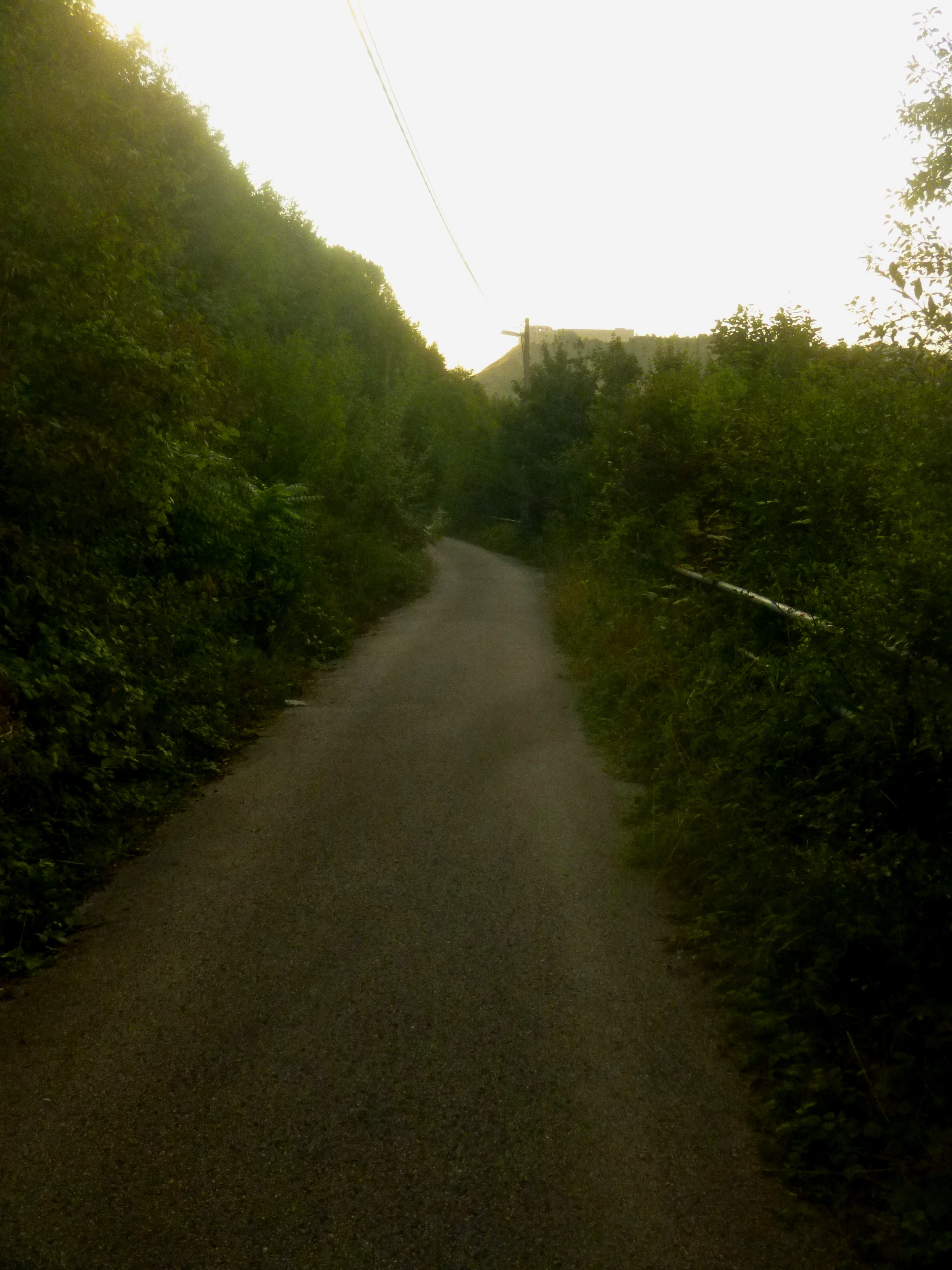
The route is smoothly paved and quite spacious—at least 6-7 feet wide in many places. Stone benches are ubiquitous and bikers prevalent. At about ¼ mile, Dariva passes through a short tunnel, mirroring the wider and busier highway tunnel above. An impressive wall of rock appears to the left, the centerpiece being a limestone crag that juts out like a giant thumb. Atop the wall, some 300 feet high, lie the festering ruins of Bijela tabija, or White Fortress. The ruins are best viewed after rounding the bend, where the route crosses under a bridge just before opening up into broader, flatter terrain. Here the names and titles of notable Sarajevans—politicians, imams, and the like (perhaps they are graves?)—are carved into the wavy stone wall on the left edge of the path. Eventually the inscriptions end, yet the smooth white placeholders continue, reserved for future additions.

Source: Google Maps 2014
At the far end of the bend lies Duga stijena, or Long Rock, the heart of the Dariva rock climbing area. It is not uncommon here to spot local adventurers scaling the black-and-yellow walls.
After again crossing under the highway, the path again enters a narrow section of Miljacka Canyon. The Miljacka itself, so still as it weaves through Sarajevo, here is defined by small rapids, producing a sound that gently echoes through the trees.
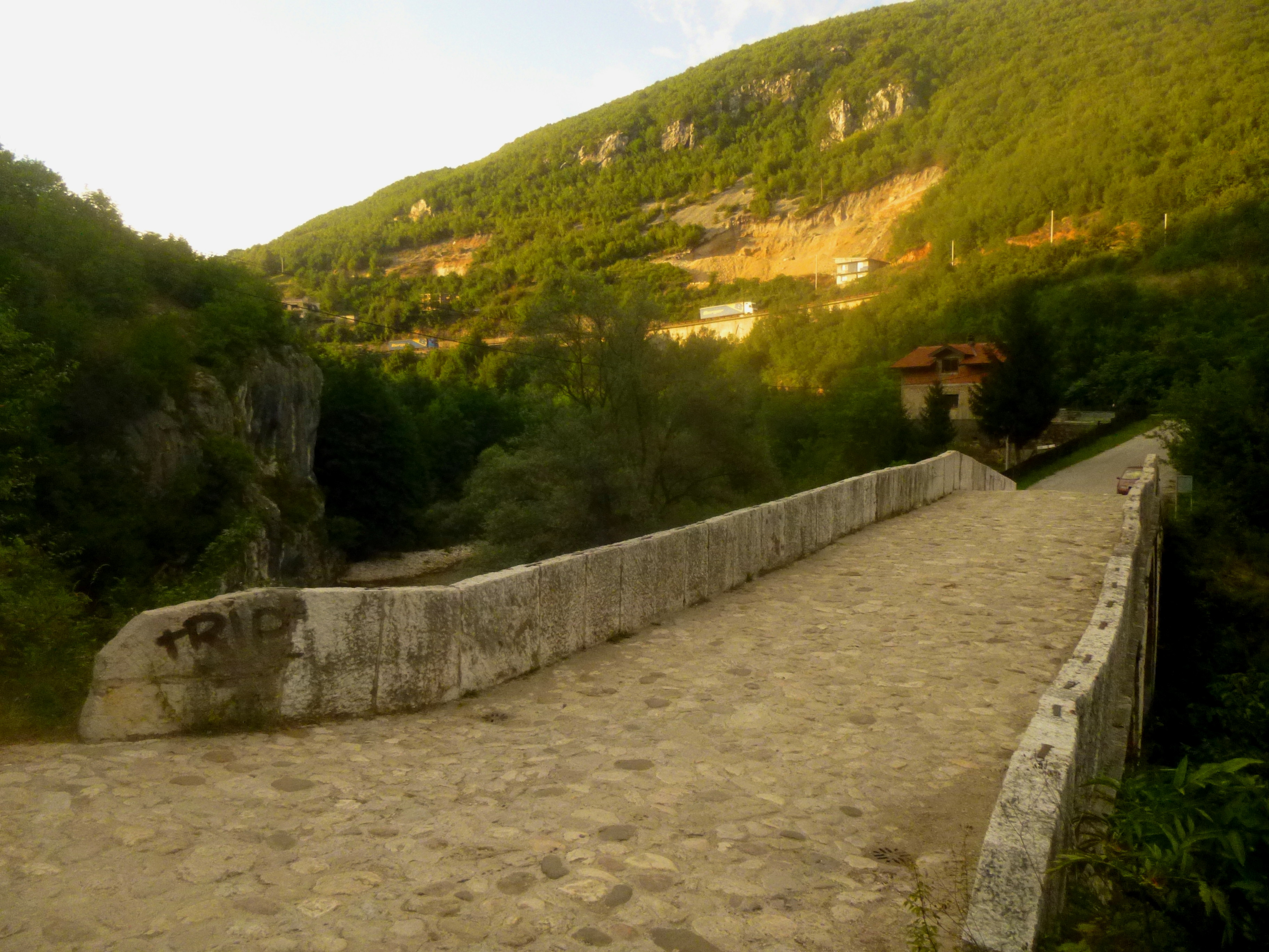
The remainder of the trail follows the northern bank of Miljacka from a distance, before finally crossing the river at Kozija cuprija, modest in size yet an impressive architectural achievement considering its age: historians date the construction of Goat’s Bridge to before 1550. After crossing the stone arc to the southern bank, it is possible to access the Miljacka from a primitive footpath that descends down to the left, affording decent views of the bridge (though it is more difficult at high water).
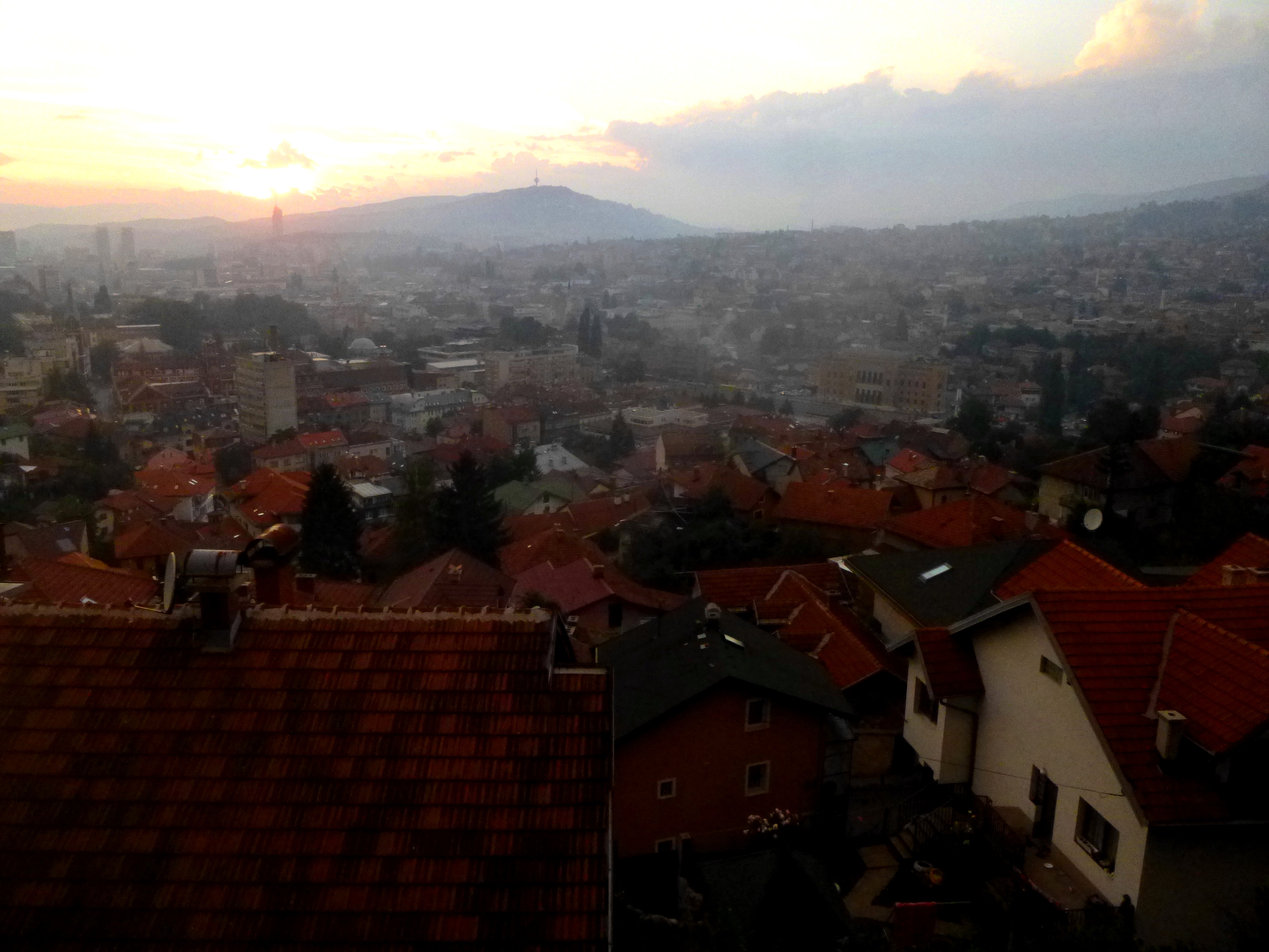
Having reached the end of the stroll at Goat’s Bridge, most visitors are then likely to double back, retracing the roughly two miles back to Sarajevo. But consider, for extra credit, returning via the southern flank of Miljacka Canyon. This option, however, is not for the fainthearted – the zigzagging route back toward Sarajevo is steep and bewildering—my journey took me some 500 feet uphill (dwarfing even Bijela tabija across the canyon) before I was able to find a good path leading down toward the city.
(However, my wanderlust paid off with beautiful views of the Sarajevo sunset, as well as a fantastic look at everyday life in Bosnia far from the tourist circuit—from farms and goat herds to soccer matches in the street.)

Before considering this endeavor, it is perhaps wise to either come equipped with water and a good map, or at least a decent mental compass or an affinity for wandering—lovingly lost in a beautiful and historic city.

Pingback: Plains of Abraham Loop (Quebec, QC) | Live and Let Hike
Reading this brought back such a wave of nostalgia for me — I remember hearing about Dariva when I was younger, but at that time it was just a name in a faraway city. Now, reading your description, I can actually feel what it must be like to walk that path — the sound of the rushing Miljacka, the canyon walls towering like guardians, the history etched into every bend of the trail.
It reminds me so much of my own journeys here in Nepal — trekking through the Himalayan foothills in places like Ghorepani and Manaslu, or wandering the quiet trails near Everest and Annapurna. That same mix of rugged nature and living history, of a trail that feels like it’s both taking you somewhere new and bringing you closer to the heart of a place.
Your storytelling made me feel like I was right there, wandering Dariva at sunset, just as I’ve stood on a ridge in the Himalayas, watching the day soften into evening. Truly beautiful writing — it makes me want to see Sarajevo with my own eyes.
https://www.himalayaheart.com/trip/everest-base-camp-trek