
Prince William Forest Park—situated about 30 miles south of Washington, DC—preserves a 17,000-acre slice of what was once a vast sea of oaks, hickories, and chestnuts spanning much of modern-day Virginia. Surprisingly, many DC residents are oblivious to its existence, but those who have been to Prince William Forest Park know it for its serenity, natural beauty, and historical potpourri: this was the stomping grounds for American Indians, Rochambeau, and America’s first spy agency, among others. The 8-mile circuit described below offers a fine introduction to the park, a survey of two stream valleys following the North and South Forks of Quantico Creek and the highlands between them.

The hike
Prince William Forest Park in Dumfries, Virginia is easily accessible from I-95 southbound from Washington, DC. Immediately upon entering the park, the hustle and bustle of the highway and city seems a world away, as the entry road is swallowed by thick and alluring woods. Take the first right after the park entrance to visit the Visitor Center, check out the exhibits, and obtain maps and other information. (Note: in winter and early spring, pay the $7 entrance fee here.) Pine Grove Picnic Area is situated just northwest of the Visitor Center at the end of a long parking lot—and is the starting point for this hike.
Parking at parking area “A” or “E” along the Scenic Drive shaves off about a mile from the circuit hike. However, these lots are small and often full—and if you are stopping at the Visitor Center anyway, it makes sense to simply begin at Pine Grove.
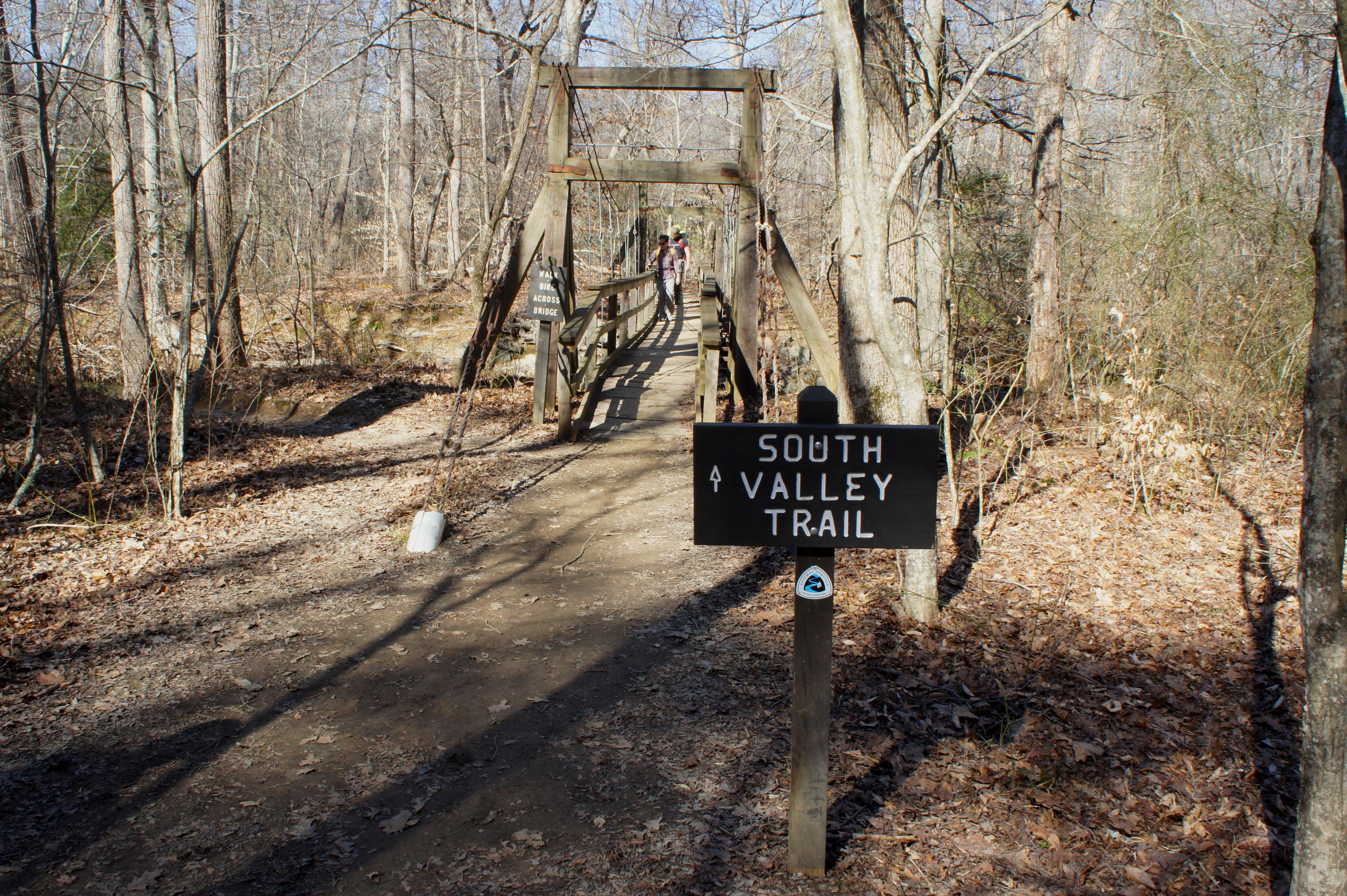
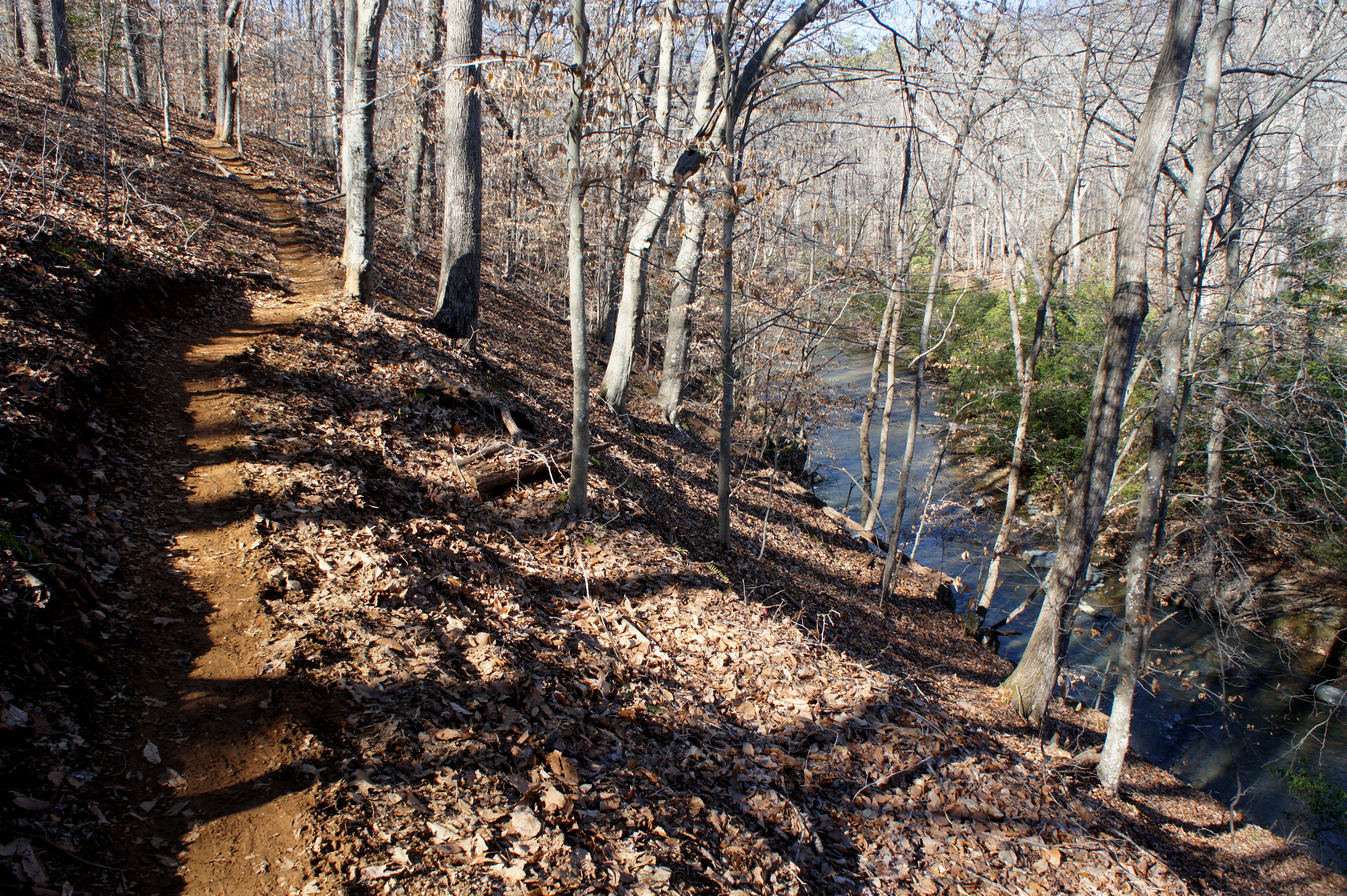
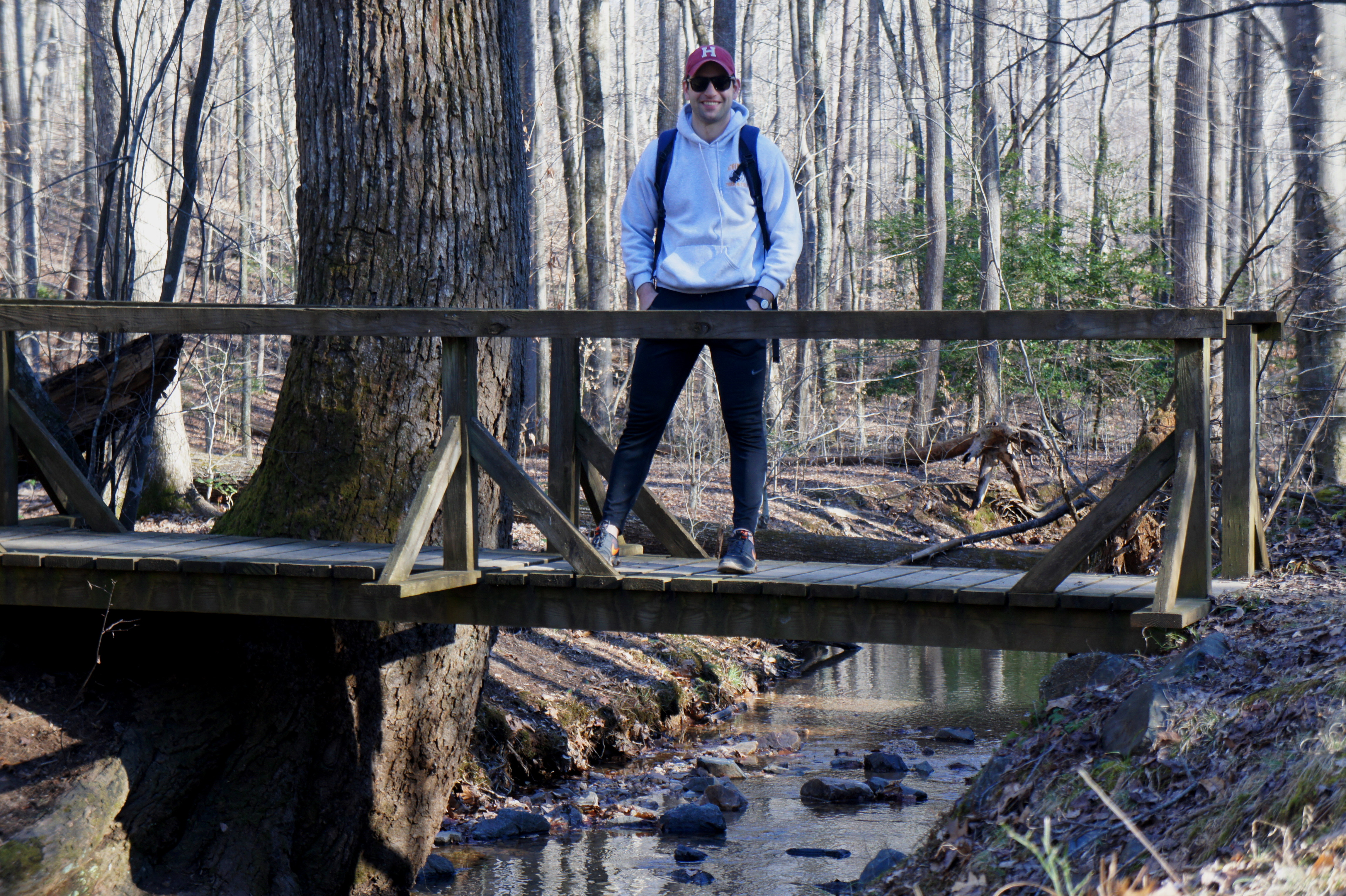
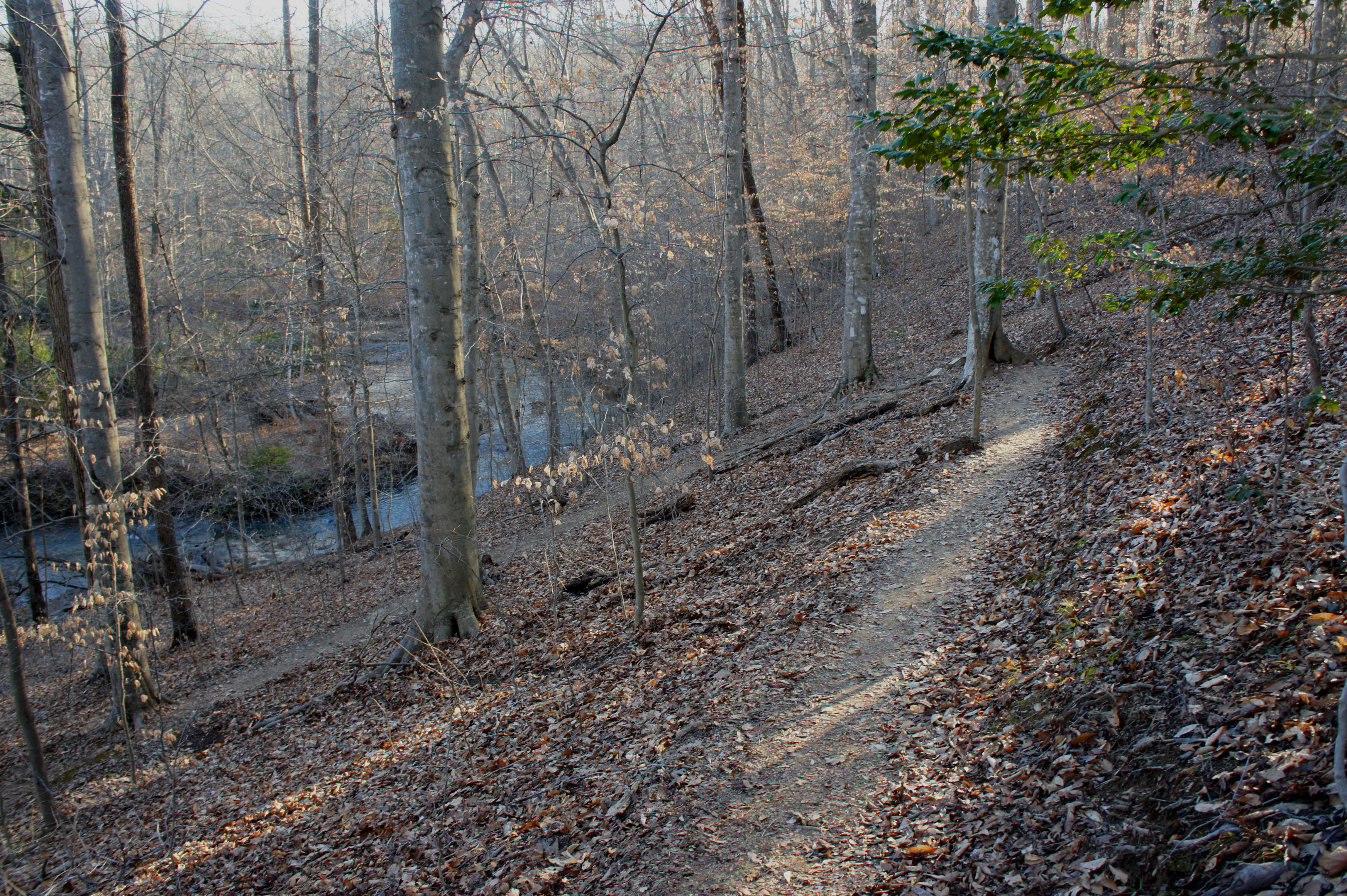
Start at the end of the parking lot, where the road gives way to a small meadow fronted by a low wooden fence and picnic table. Stay straight and cross the grassy field to the back right corner, where the Laurel Loop Trail drops into the woods. Follow the yellow and baby blue blazes—marking the Laurel Loop and Potomac Heritage Trail, respectively—as the route drops 150 feet to the South Fork of Quantico Creek. Stay straight at the four-way junction at 4/10 mile, and then follow the dusty path to a cable bridge over the South Fork. Turn right on the white-blazed South Valley Trail, the longest in the park and arguably the best.
South Valley Trail to Pyrite Mine Road
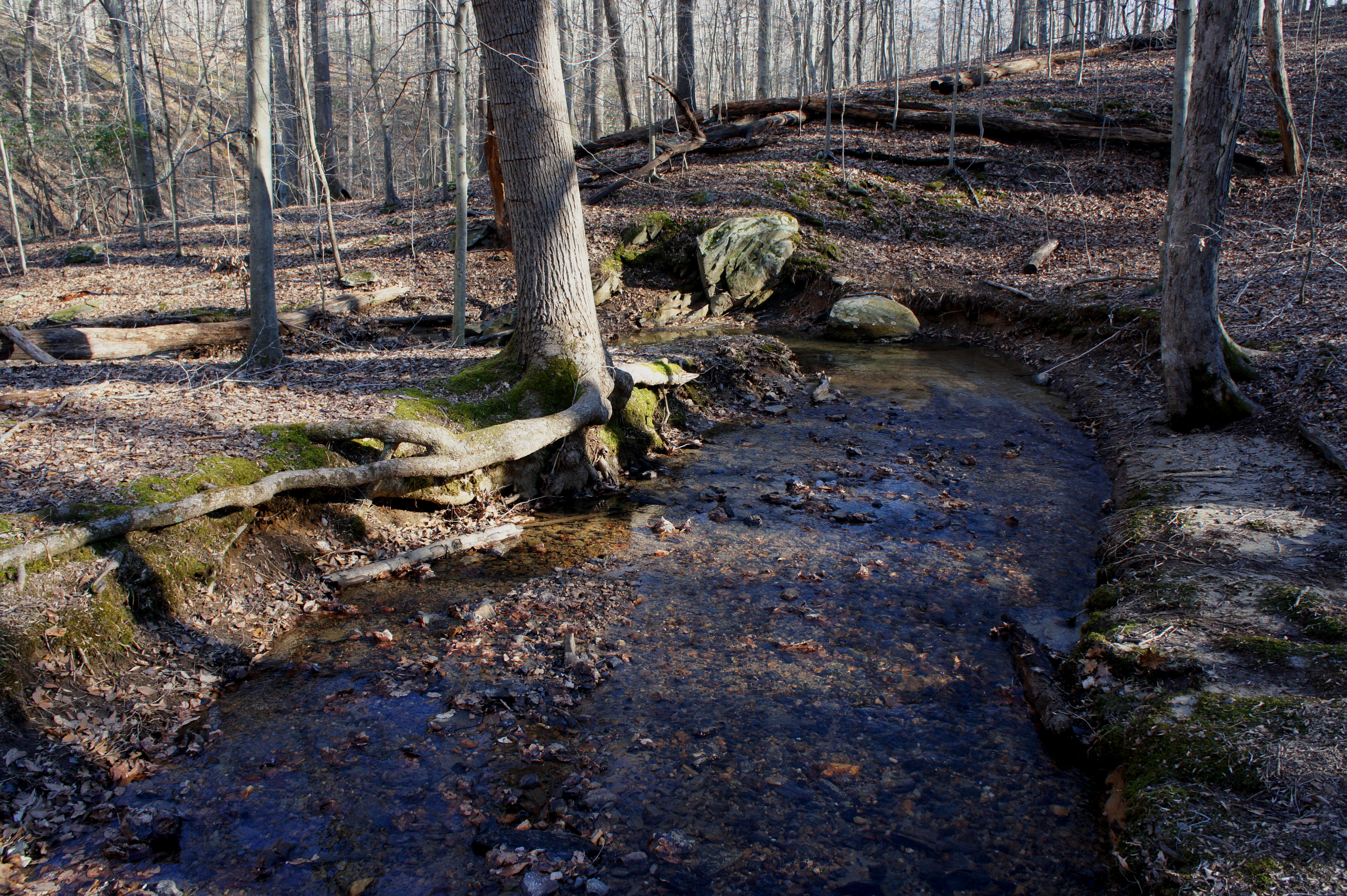
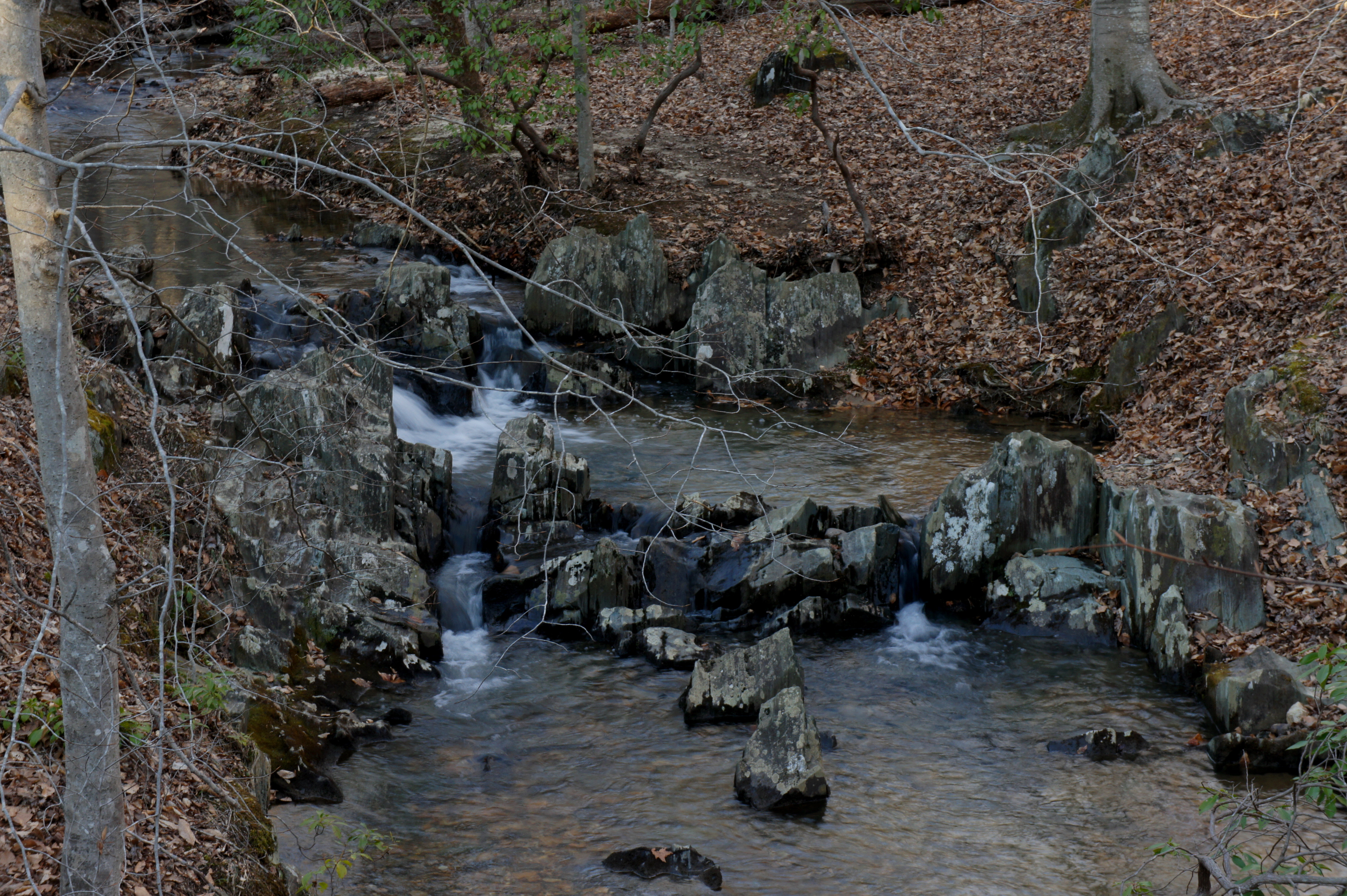
From here, follow the South Valley Trail northward as it traces the South Fork of the Quantico downstream. Slicing through the opposite bank, a noisy tributary drops into the creek. Around 8/10 mile from the trailhead, look for a set of minor cascades on the right as the creek rounds a left-hand bend.
Shortly after, the path narrows and ascends the side of a ridge to a point about 20-30 feet above the creek bed. Within a couple hundred yards, the trail drops back to creek level and passes the remains of an old concrete structure and wooden tower. Just downstream is the confluence of the South Fork and North Fork of Quantico Creek; Pyrite Mine Road enters from the left, and the North Valley Trail begins on the other side of the bridge to the right.
North Valley Trail to Quantico Cascades
Skirting the eastern boundary of the park, the North Valley Trail bends northwest and eventually spans a wooden boardwalk, which cuts through a group of Virginia pines. Take a brief detour on the left to see the Pyrite Mine Overlook, offering views of the old Cabin Branch mining site where “fool’s gold” was extracted from 1889 to 1920. After the mine closed, the owners left piles of pyrite tailings, bleaching into Quantico Creek and raising the acidity level to an ultra-acidic 2.8 pH. The National Park Service reclaimed the site in the 1990s, and the hillside now supports a dense stand of Virginia pines.
Following a second short boardwalk, the footpath again crosses the North Fork of Quantico Creek. Bear right at the fork, continuing on the North Valley Trail. Around 1.75 miles from the start, hikers pass on the left the concrete remains of a building associated with the pyrite mine. The trail then enters a wooded floodplain, with a high density of birch trees lining the creek’s opposite bank, and clears a trickling tributary.
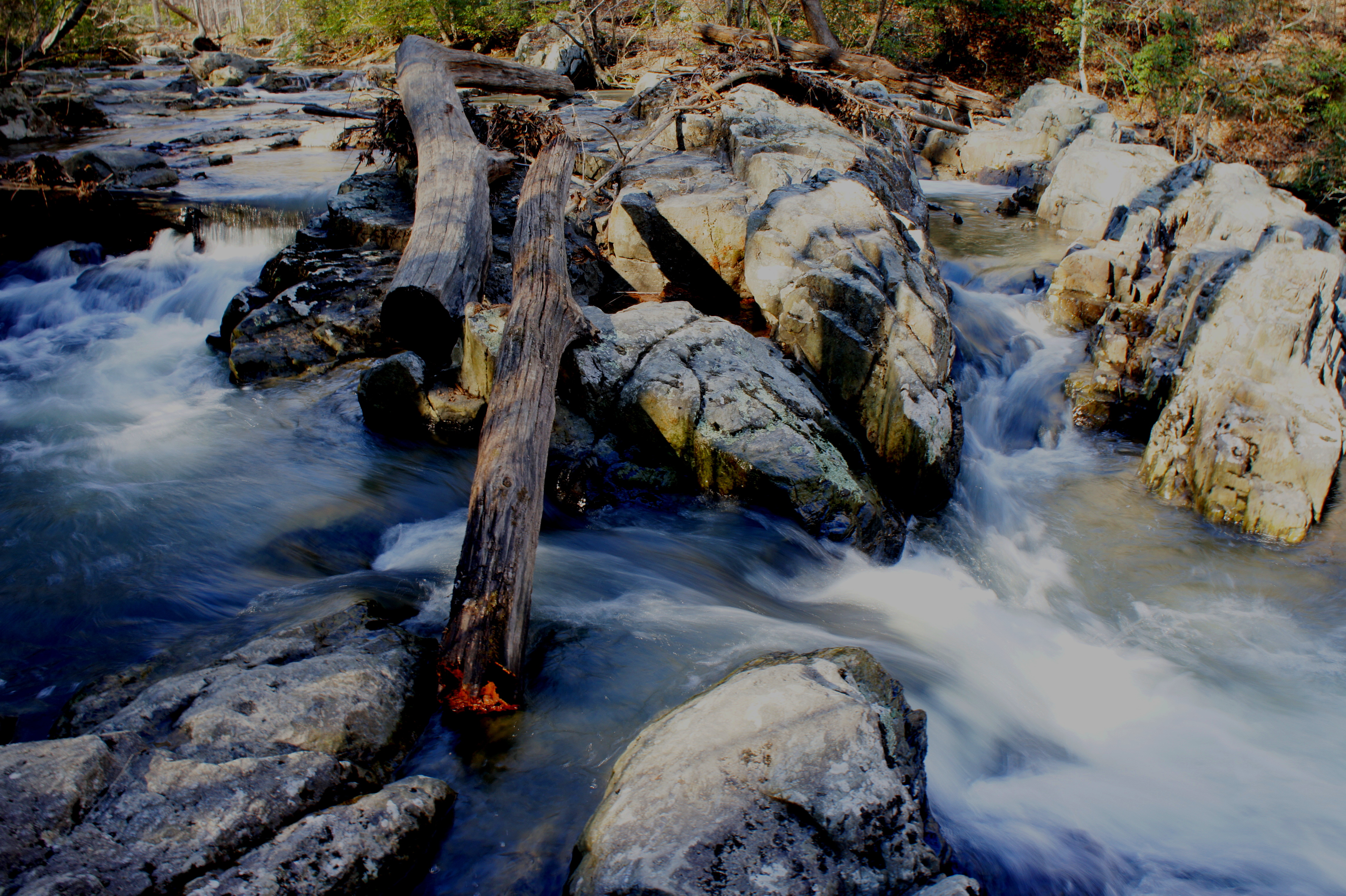
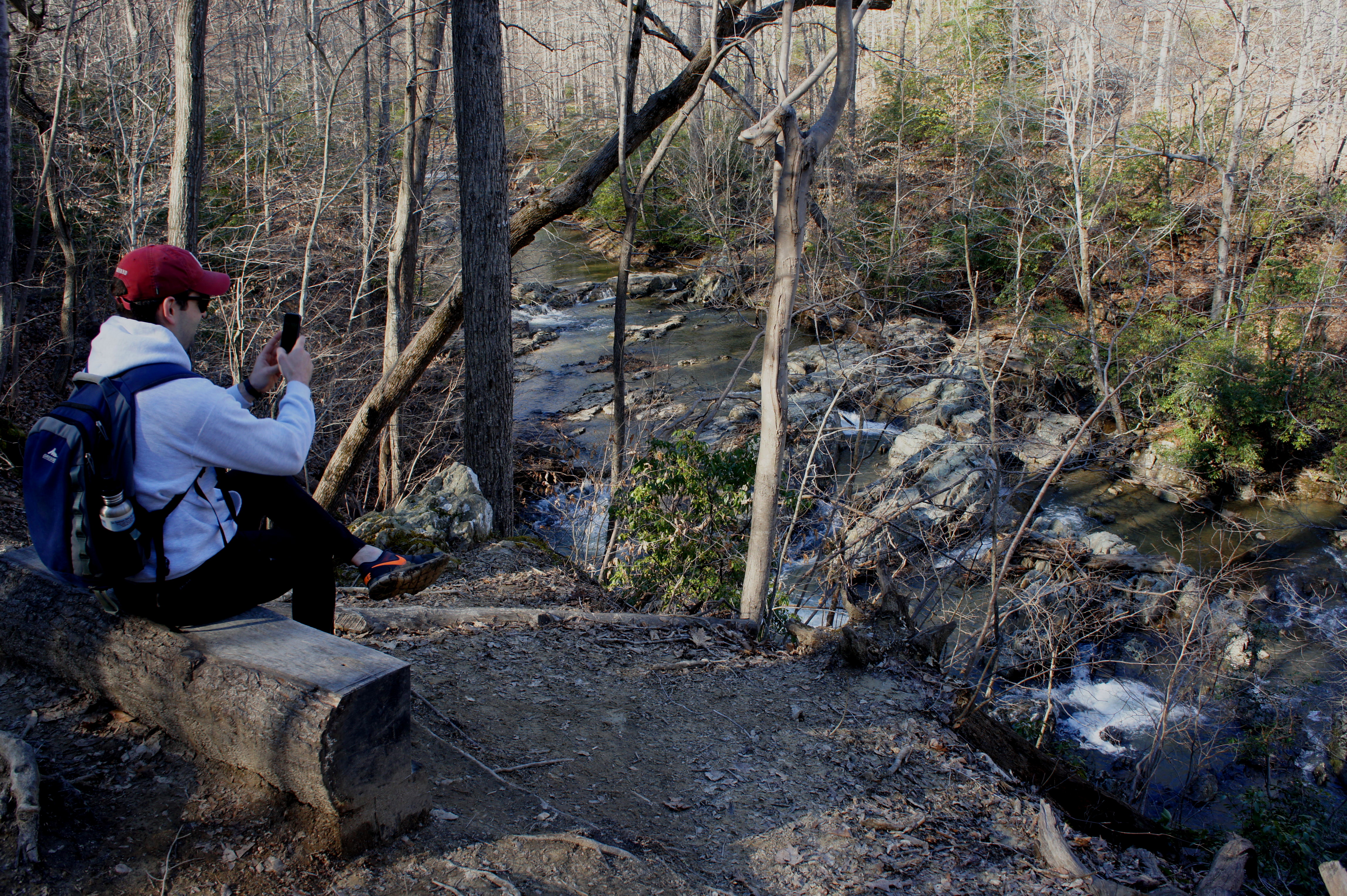
Around 2.5 miles from the start, the North Valley Trail climbs halfway up a hillside overlooking the best cascades yet—a jigsaw of rocks and waterways that is accessible by way of a steep social trail.
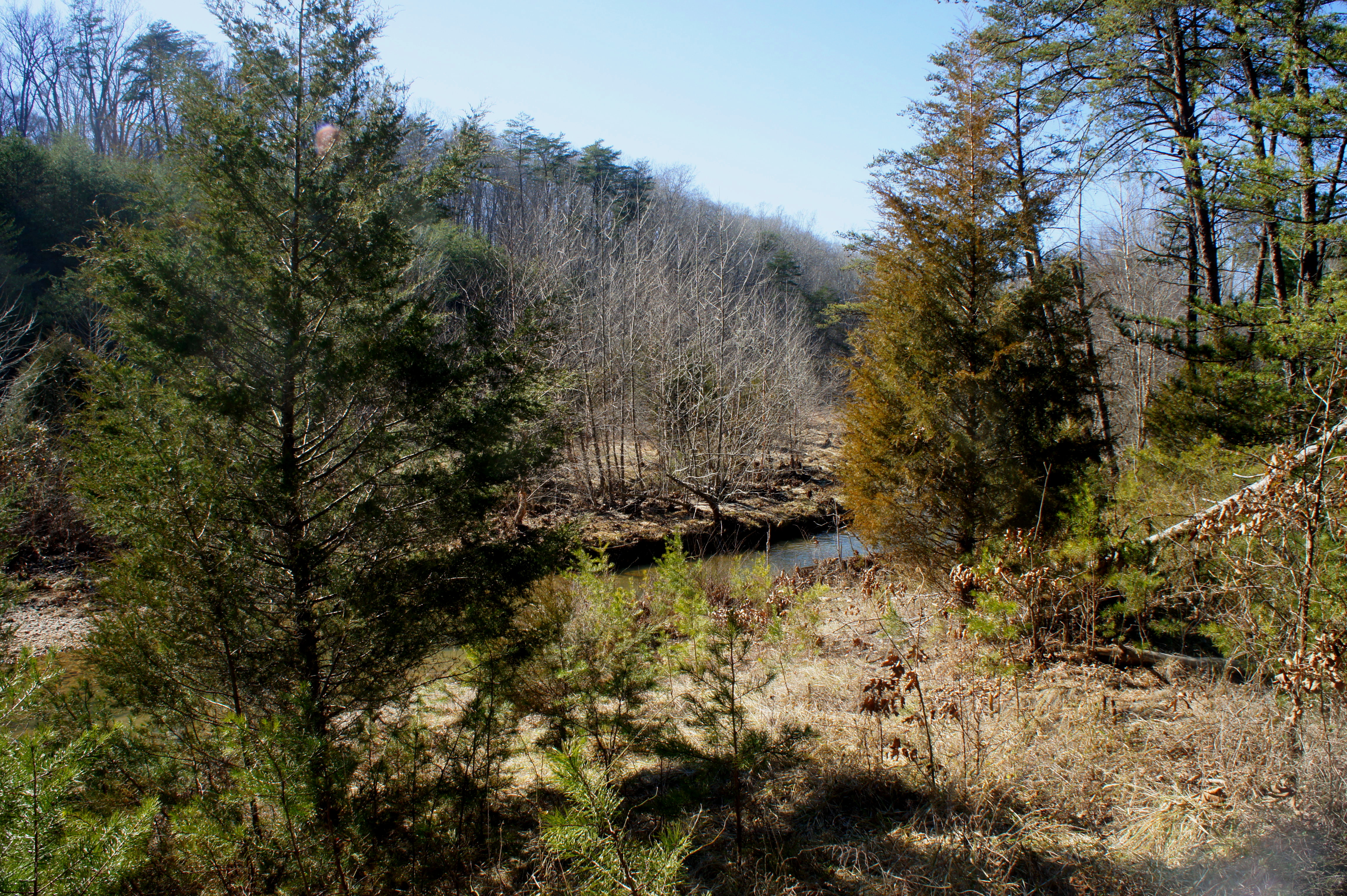
Surprisingly, just a couple hundred yards upstream, the creek is still and quiet. A wayside explains that you have just entered Virginia’s “coastal plain,” or Tidewater region. Quantico Cascades ahead sits astride the lengthy Atlantic Seaboard Fall Line, the geological break between the upland region of metamorphic bedrock (known as the Piedmont) and the softer sedimentary layers of the Tidewater.
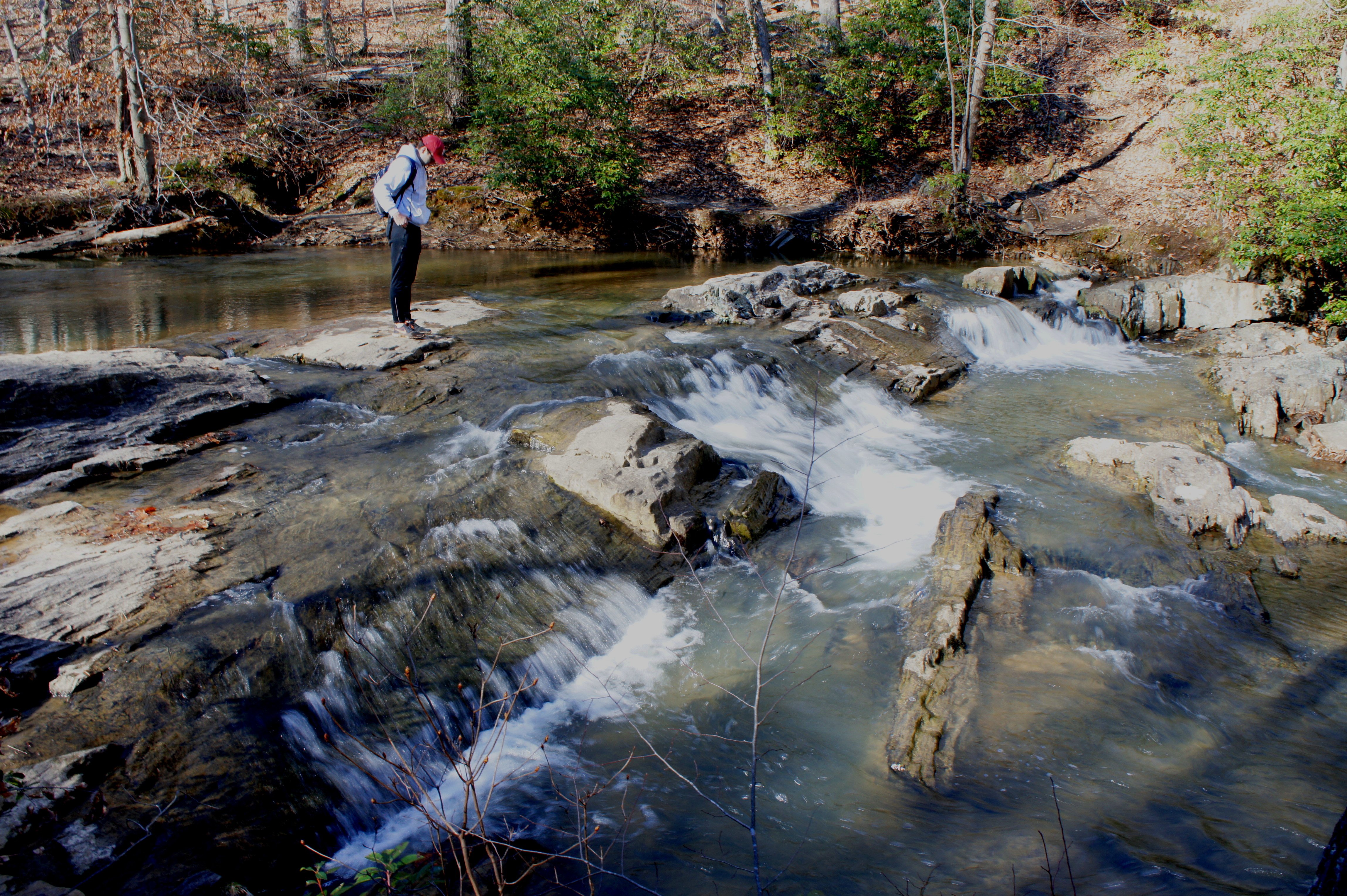
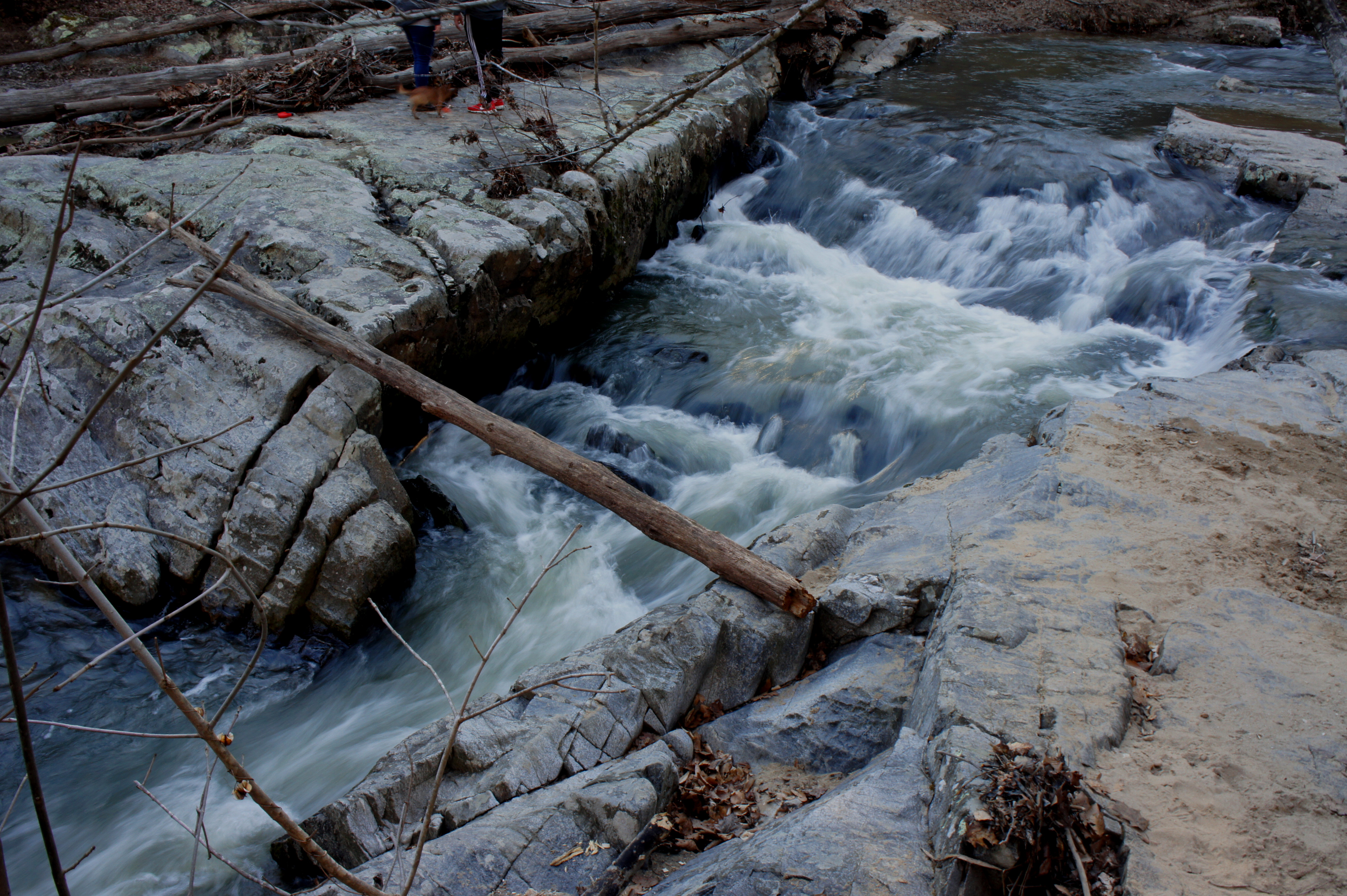
To see Quantico Cascades, cross over a short wooden bridge, then bear right at the trail junction, leaving the North Valley Trail behind. Follow the creekside path for about 200 yards to the cascades. This is a popular destination and a fine spot to stop for a snack.
Quantico Cascades to South Valley Trail via Mary Bird Branch Trail
Backtrack 10-20 yards from the cascades and follow the yellow-blazed trail leading up the hillside. This is the start of a modest climb from Quantico Creek to Scenic Drive, covering 170 feet in elevation gain in ¾ mile. Leaving the stream valley behind, the Quantico Cascades Trail (alternatively, Quantico Falls Trail) ascends a ridgeline to a four-way junction, where it again meets the North Valley Trail. Stay straight, climbing gradually to Lake One Road; bear left for 1/10 mile, then turn right again on the Quantico Cascades path, which weaves through the woods to Scenic Drive and parking area “E.”
Cross Scenic Drive to continue the loop, striking out on a new path: the Mary Bird Branch Trail. Named for an appealing tributary of Quantico Creek, this red-blazed trail cuts westward across level terrain before descending to the Mary Bird Branch drainage and crossing the creek. For its finale, the trail climbs 50 feet up a hillside to the unpaved Old Black Top Road.
Turn right on Old Black Top Road and follow it 125 yards northwest to the start of the High Meadows Trail, marked with orange blazes. The Little Run drainage that the trail crosses is even more pleasant than Mary Bird Branch; the trail drops through a notch between two hills and crosses Little Run. Bear straight on the Little Run Loop Trail (yellow blazes) and continue westward until the route meets Taylor Farm Road. Turn left on this road, following it downhill for 4/10 mile to the South Valley Trail.
South Valley Trail to Visitor Center
After 2.5 miles in the highlands away from Quantico Creek, hikers will return creekside after bearing left at the junction. Some of the best scenery lies ahead as the South Valley Trail skirts the left bank of the South Fork. Five miles from the start, the footpath passes under Scenic Drive.
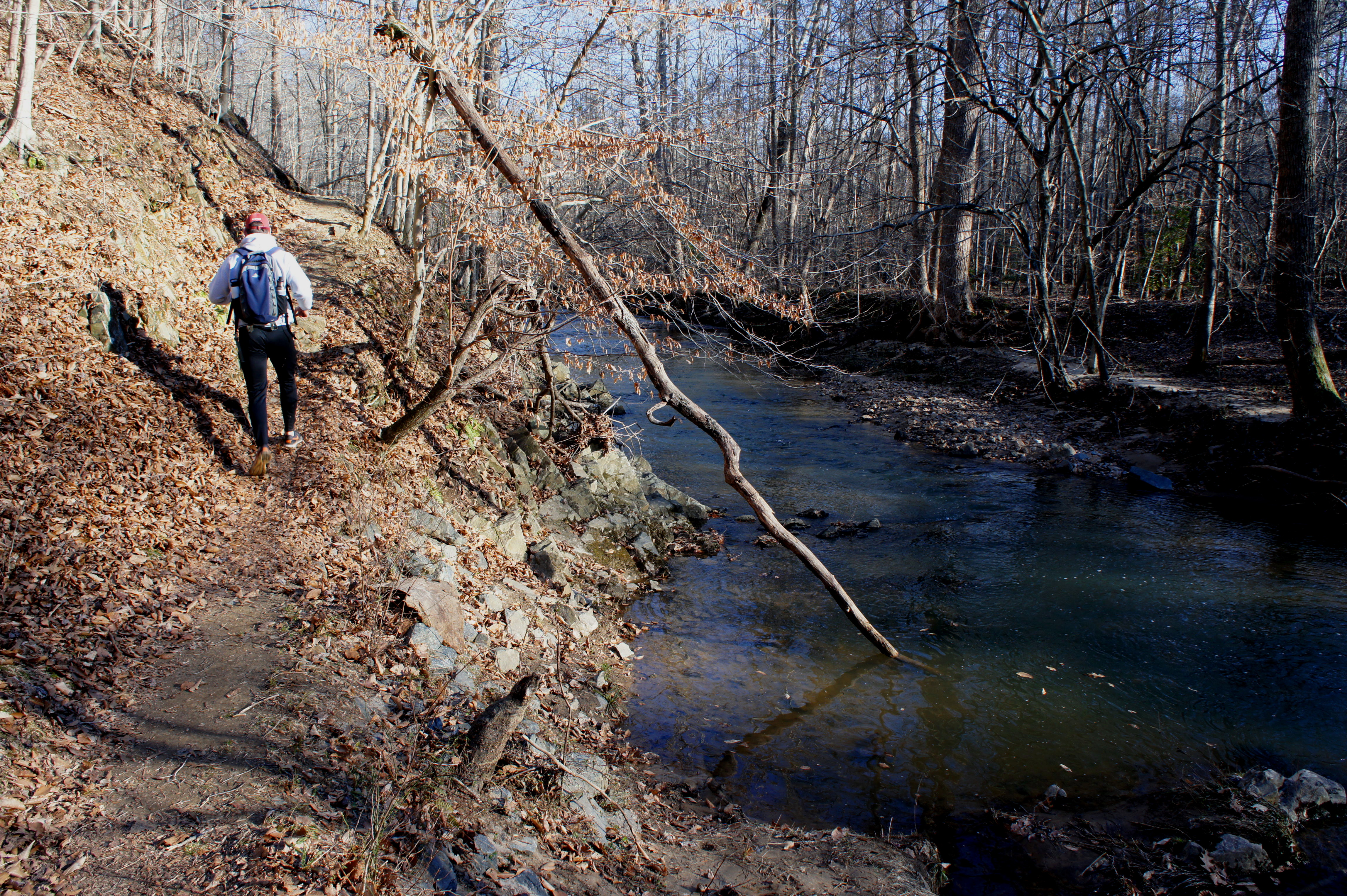
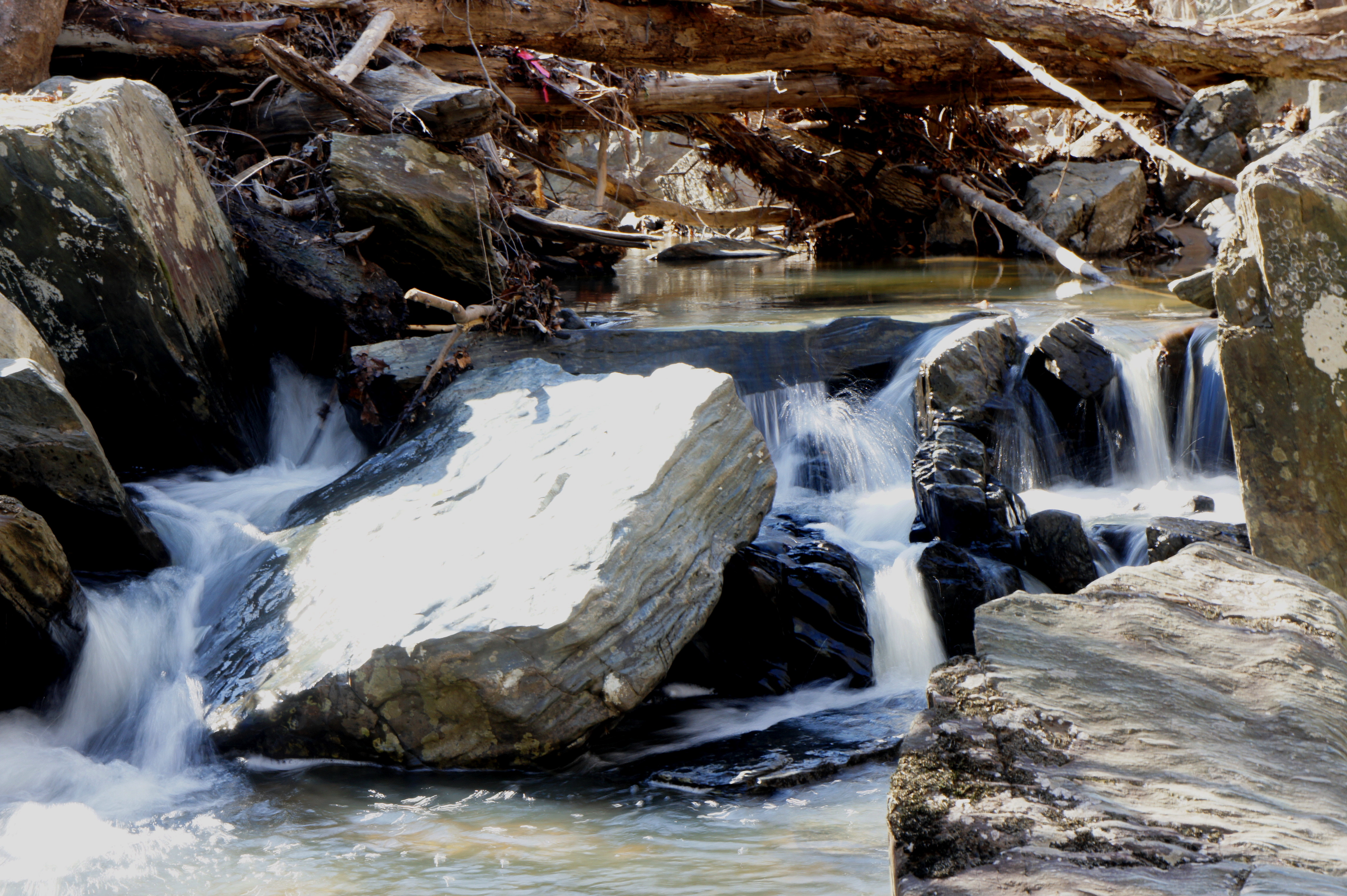
A few minutes beyond the underpass, hikers will come across the first of three cascades—this one comprising a scenic chute flanked by hunks of exposed gray bedrock. The second and third cascades are harder to access but pretty nonetheless.

After following the inner bank of a sharp creek bend, the South Valley Trail climbs partway up a wooded ridge, offering obscured bird’s eye views of the creek. After returning to the floodplain, two tributaries, a handful of minor cascades and three spur trails on the left highlight the remaining section before crossing Scenic Drive a final time.
At 6.5 miles, the trail splits, with the Turkey Run Ridge Trail bearing off to the left. Stay right, entering an area of déjà vu, where the trail mimics the sharp left-hand bend and sudden uphill of the previous mile. This time the trail stays high above the South Fork for a longer period but eventually drops back to creek level as it crosses the Mary Bird Branch at its mouth. (Note: As of February 2016, the wooden bridge crossing Mary Bird Branch had been dislodged, requiring hikers to either find a creative detour or climb the 4-foot high bank of Mary Bird Branch head-on.)
The final stretch features a view of a pretty but inaccessible waterfall (probably the tallest in the park) across the creek at 7.2 miles, just before a brief merger with North Orenda Road. Bear right, following the road back to the original cable bridge crossed hours ago. From here, it’s a ½-mile uphill slog on the Laurel Loop Trail back to Pine Grove Picnic Area.

The North Valley-South Valley circuit can feel like an entire day’s endeavor, but it’s reasonable to complete the entire stem-and-loop in 3-5 hours.

The dislodged footbridge on South Valley Tr between Turkey Run Ridge Tr and Orenda Rd is back in place.
Pingback: Birch Bluff Trail Loop (Prince William Forest Park, VA) | Live and Let Hike
Pingback: Top 10 Hikes of 2016 | Live and Let Hike