

Dropping more than 200 feet over the course of a mile, the Zachary Taylor Trail follows Donaldson Run from its source to the Military Road in Arlington, Virginia. The wooden path is partly paved, and a southern spur route offers a loop option through an Arlington neighborhood. Highlights include lush greenery and a handful of very small but pretty cascades.

The hike
Situated upstream from the well-travelled Donaldson Run Trail, the Zachary Taylor Trail runs roughly west to east from 26th Street N. to N Military Road. Parking is easier along 26th Street N., where the walk begins across the street from Marymount University’s Reinsch Library. The paved trail cuts southeast past a wooden kiosk, grassy field, bike rack, water fountain, and a series of benches. As the trail bears left into the woods, it begins to drop steeply and rounds a sharp switchback, entering the Donaldson Run stream valley. It takes a couple minutes, past a field and overgrown former basketball court, until water is spotted on the right—the source of Donaldson Run.

The nascent creek fuels the growth of a dense bamboo stand on the right at around ¼ mile; the trail then passes below a series of houses and a stone wall on the left. At 4/10 mile, the footpath crosses N Vernon Street, then traverse N Vermont Street. At the end of N Upton Street, the trail reenters the woods with the creek on the left and the paved route gives way to gravel. At 7/10 mile, the Zachary Taylor Trail crosses a wooden bridge.

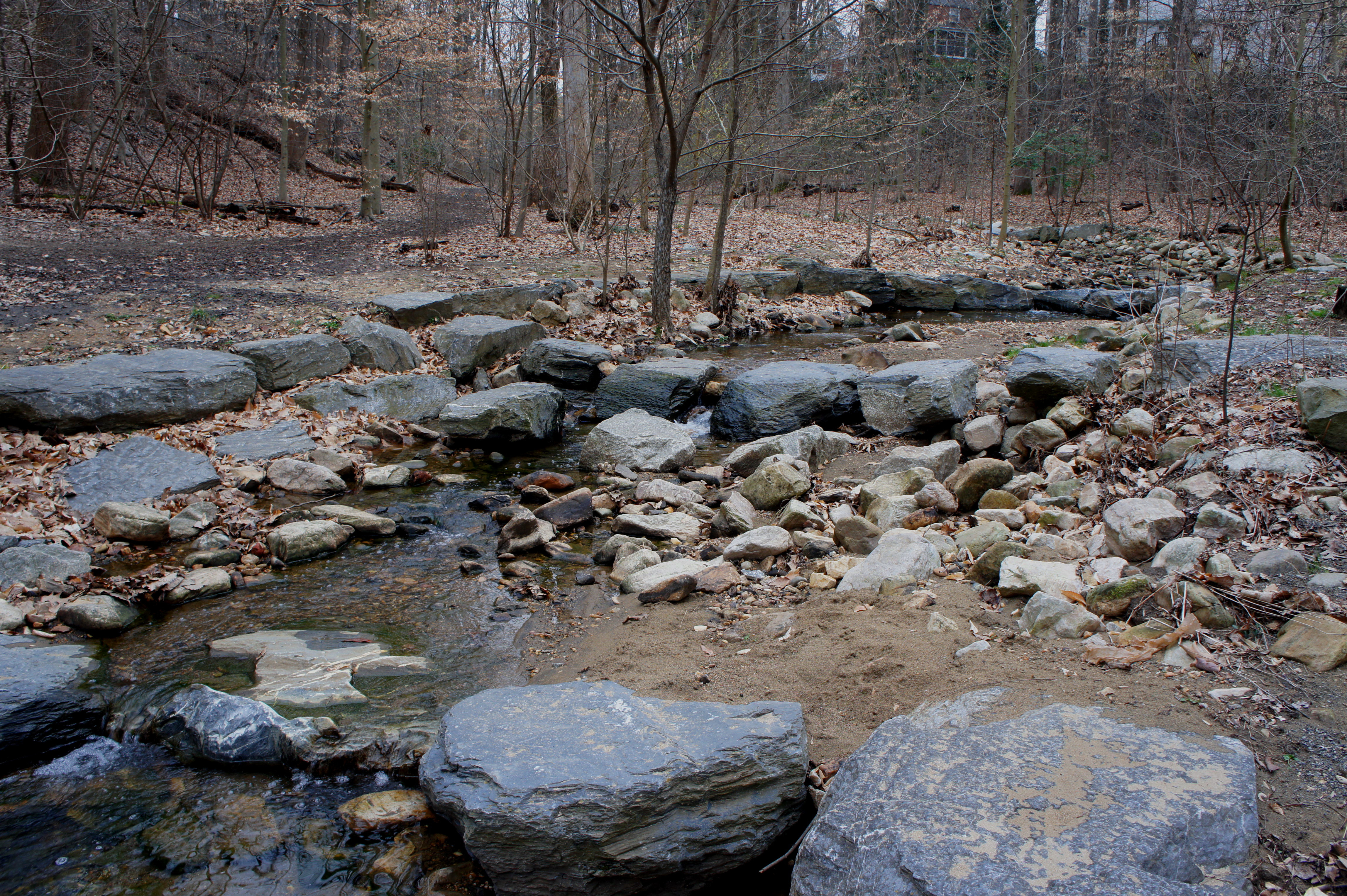
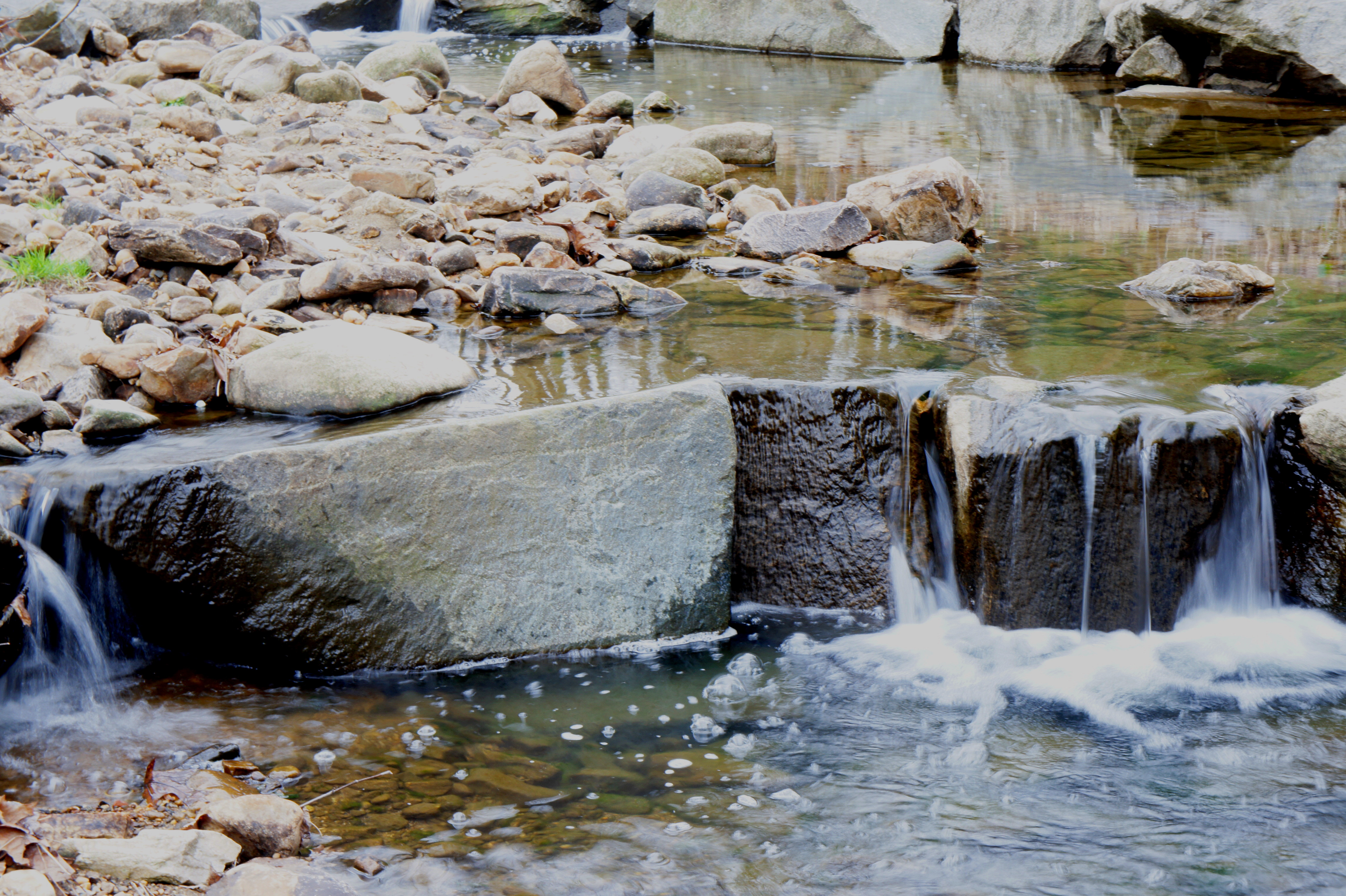
A couple minutes later, the highlight of the hike is a charming creekside venue where a pair of benches offers a nice view of a couple small cascades. The trail continues to follow Donaldson Run downstream before crossing a second bridge. Take a left at the trail fork and walk the remaining 100 yards to N Military Road. Look for another set of small pools and cascades on the left.
It’s possible to cross N Military Road and follow 30th Street N. to connect with the Donaldson Run Trail and Potomac Overlook Regional Park. Saving that hike for another day, however, turn around at the end of the Zachary Taylor Trail and return to the bridge. Instead of crossing the creek, bear left at the trail junction to embark on new ground. Here a narrow path skirts the east bank of Donaldson Run, returning to the picturesque creekside bend with the benches, then bears south along a tributary. At 1.3 miles, the trail terminates at the end of a cul-de-sec: N Utah Street.

Here begins the less-than-exciting section, where walkers must follow roads and sidewalks for 4/10 mile. Bear right on N Vacation Lane, then again on N Vermont Street, which crests a steep hill before dropping back to meet the paved Zachary Taylor Trail on the left.
From here, retrace your steps along the trail back westward to 26th Street N. Allot around an hour for the round-trip stem-and-loop.
