

Bearing westward from Rosslyn in Arlington, Virginia, Donaldson Run is the third notable tributary feeding into the Potomac River. Like its neighbors—Spout Run, Windy Run, and Pimmit Run—Donaldson Run cuts through rocky bluffs, with the last half-mile punctuated by minor but pretty cascades. The Donaldson Run Trail links the lengthy Potomac Heritage Trail, on the banks of the Potomac, with Potomac Overlook Regional Park and features thick forest, several creek crossings, and small waterfalls. Starting at Marcey Road Park (just outside Potomac Overlook Park), one can combine the Donaldson Run Trail with some neighboring routes to form a nearly two-mile stem-and-loop.

The hike
To reach Marcey Road Park, follow the signs to Potomac Overlook Regional Park off Military Road in northern Arlington. Turn onto Marcey Road and follow it for 1/3 mile, parking in the small lot on the left. (Note: Additional parking is located just up the road on the right at the Potomac Overlook Park entrance.) Marcey Road Park features one basketball and three tennis courts.
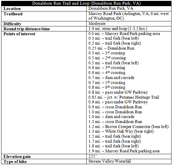
Start the hike by walking around the basketball court and down a minor, grassy slope to the edge of the woods, where the trail officially begins. The well-worn path splits almost immediately—bear left for the quickest access to Donaldson Run. (Note: White Run Way, which comes in from the right, serves as part of the return route.) The route follows a relatively straight, downhill bearing toward Donaldson Run, quickly losing more than 60 feet in around 2/10 mile. (Note: Stay straight at the two subtle trail forks; drop over the lip of a steep descent at the bench as the more obvious trail weaves left.) Around ¼ mile from the start, the Donaldson Run Trail curves sharply right and down a set of wooden steps to the banks of the creek.
Donaldson Run takes its name from Robert H. Donaldson, who worked the land encompassing the stream during the Civil War and sold his produce in Georgetown, an often difficult trip due to inclement weather and rugged terrain.
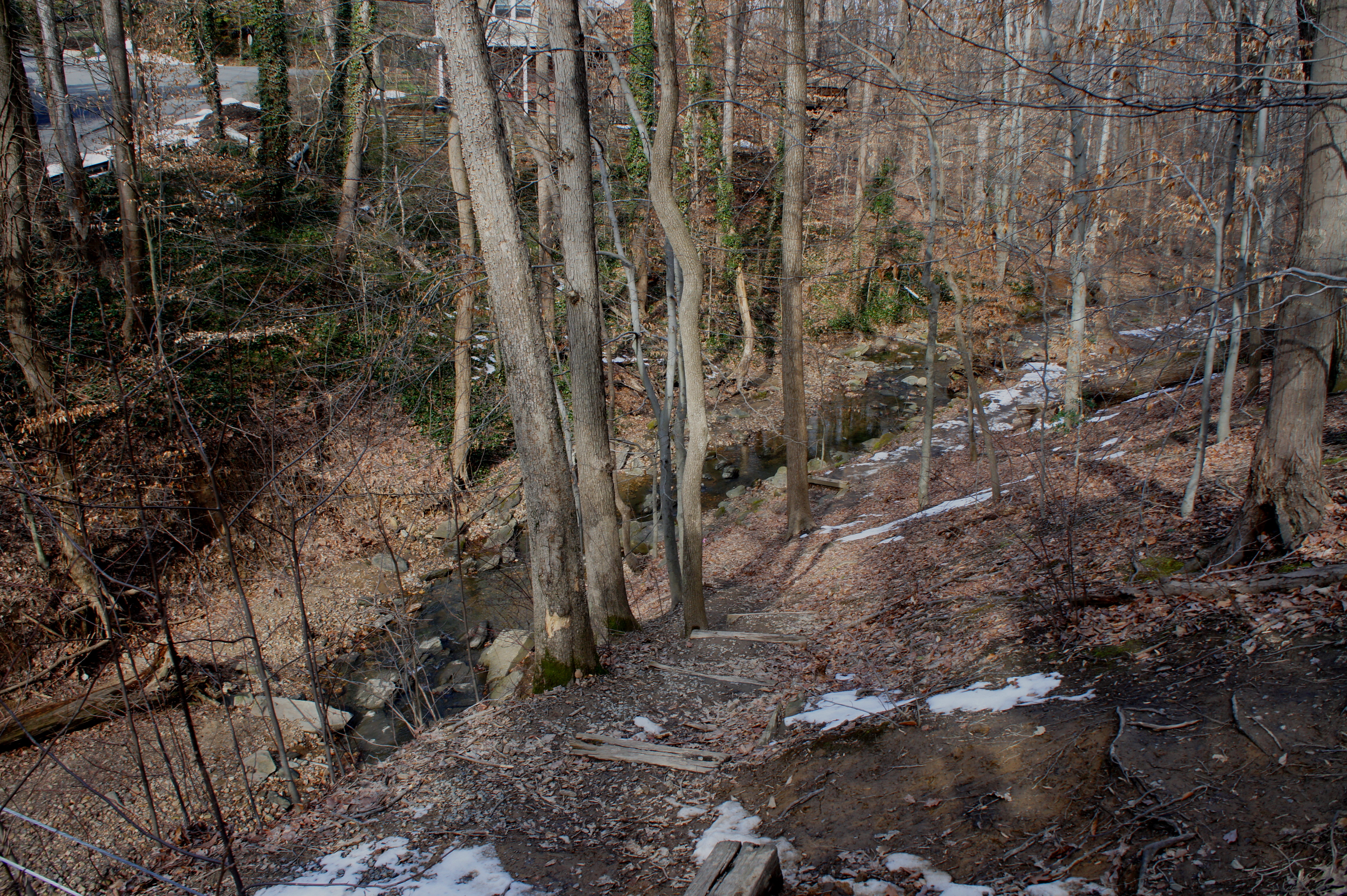
Bearing right (downstream), the Donaldson Run Trail follows the creek’s right bank for 200 yards as it snakes through a minor S-curve. The first of six unique trail crossings is fair-weather only but relatively straightforward. The second traverse—another 200 yards downstream—is longer and requires careful footing to avoid wet boots. Around a half-mile from Marcey Road Park, a pair of wooden signs direct hikers at a trail fork; stay straight. (Note: Return to this junction on the return trip to start the loop option.)

The junction is immediately followed by another creek crossing, the hike’s third. A laughably short staircase assists with the not-so-treacherous climb out of the streambed on the other side. Now following the left bank, the trail crosses a minor tributary entering from the west, then traverses Donaldson Run for a fourth time.
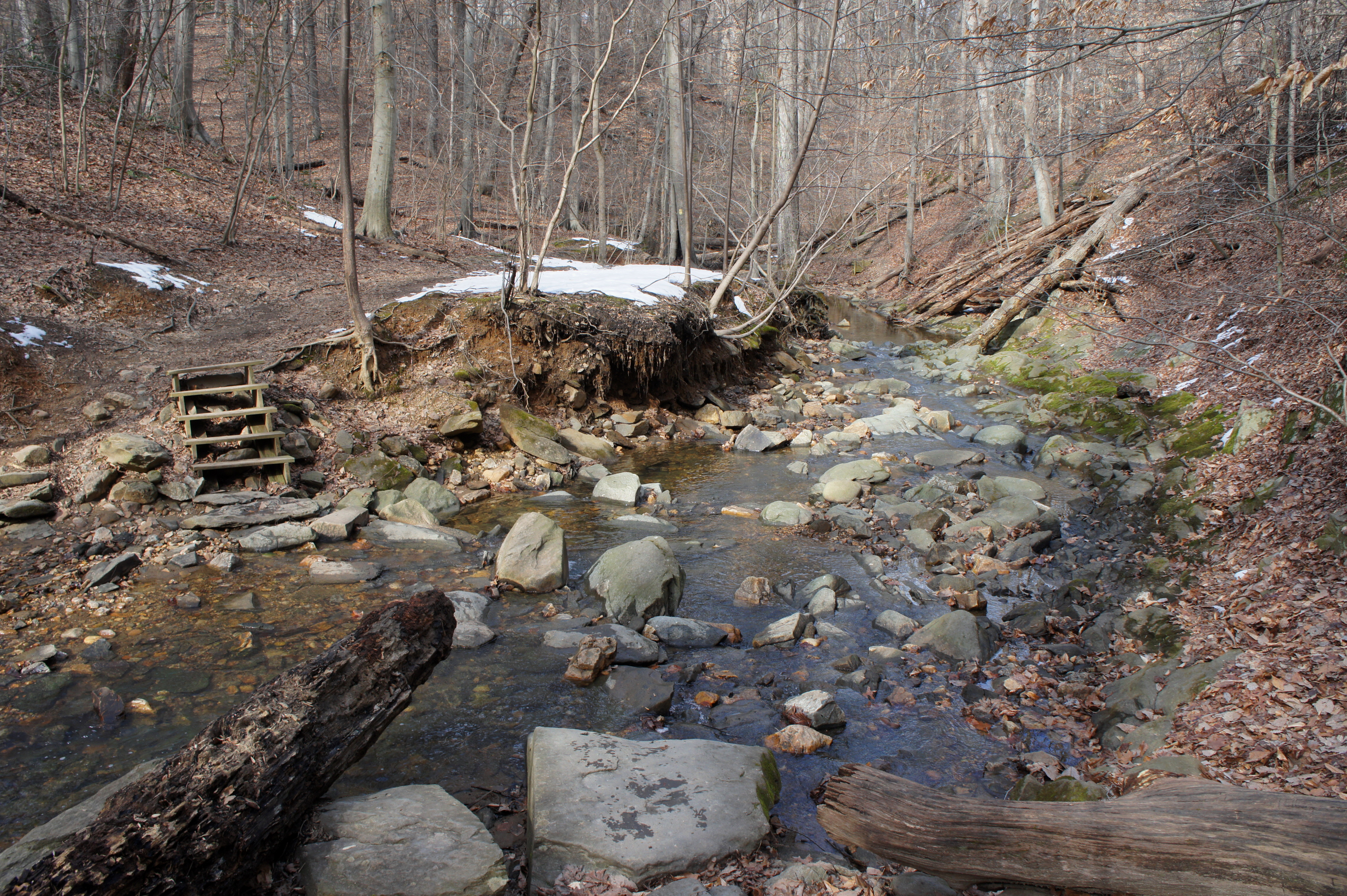
All of a sudden, hikers come across an unexpected eyesore—the remains of a graffiti-laden concrete dam. Fortunately, the serenity of Donaldson Run is salvaged by a small but beautiful cascade and pool at the foot of the dam.
Onwards, it’s only a few minutes until the trail crosses Donaldson Run a fifth time then passes over another minor tributary before switching back to the right bank for the sixth crossing. This traverse, while still reasonable, is perhaps the most treacherous, as it comes just before Donaldson Run plunges down a set of cascades—be careful with small children or on wet, slippery days. (Note: Look also for a rustic stone wall—presumably remains of Donaldson’s farm—just before the crossing.)

With a high bridge (bearing the George Washington Memorial Parkway) looming ahead, Donaldson Run drops at a quicker rate, forming small waterfalls. Unfortunately, these cascades are difficult to reach, as the trail now bears sharply upward to a point high above the creekbed. After passing under GW Parkway, the Potomac River comes into view, and the route begins its final descent. Stony steps and railings assist with the sharp downhill. Finally, approximately 0.85 miles from the start, the Donaldson Run route terminates, merging with the aqua-blazed Potomac Heritage Trail. The mouth of Donaldson Run is visible just ahead.
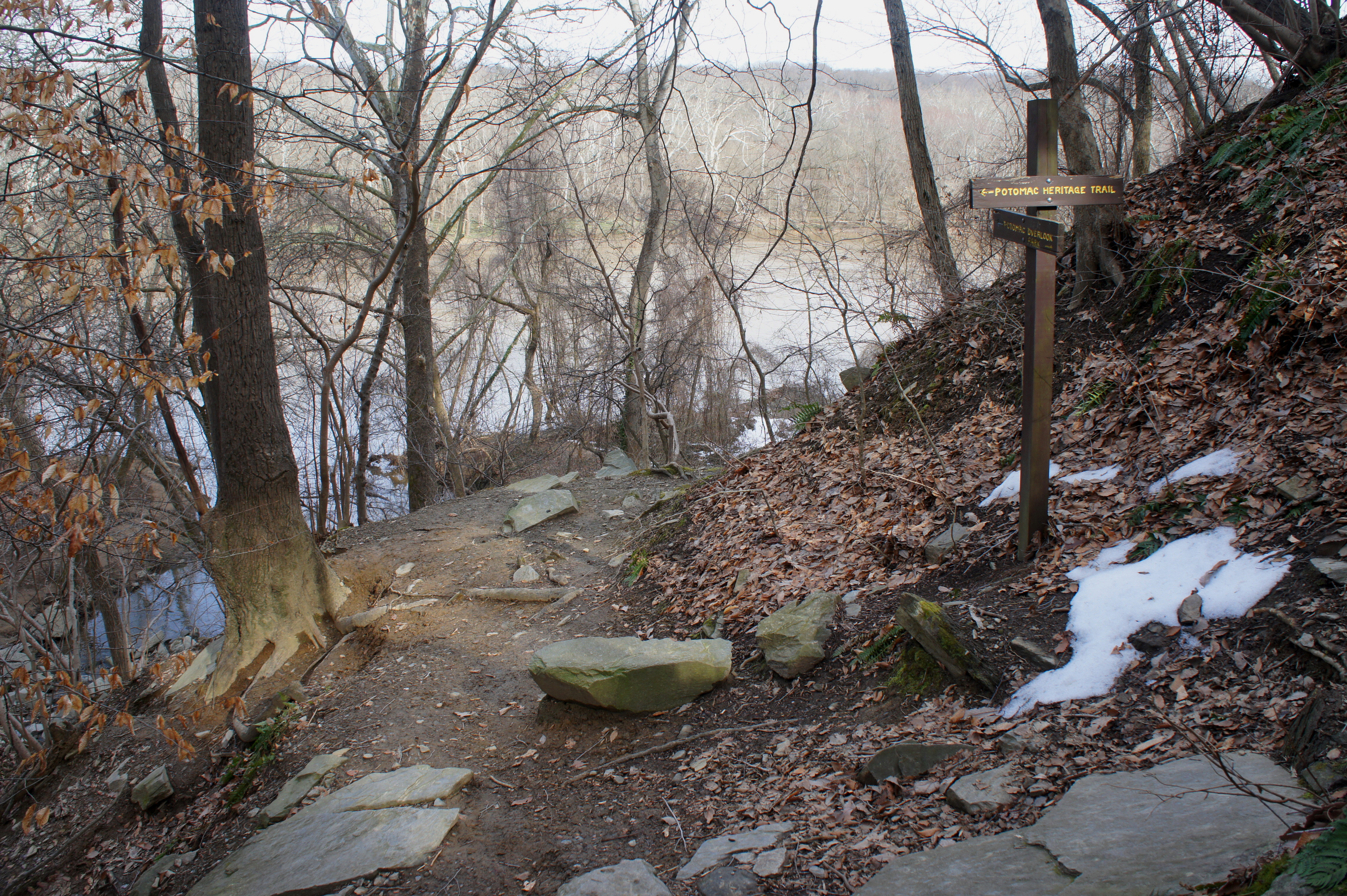
From here, continue left or right on the Potomac Heritage Trail, or return the way you came. Instead of retracing the entire 0.85 miles, it’s possible to vary the scenery a bit by looping back to the start by way of the Brown Creeper Connector junction, situated just past the third crossing (the fourth on the way back). (Note: This is around 1/3 mile from the end of the Donaldson Run Trail.)

The Brown Creeper Connector Trail ascends sharply, up through a woody ravine, to the northern reaches of Potomac Overlook Regional Park. Take a hard right at the signed junction with the “White Trail,” or White Oak Way. (Note: If you crest the hill and enter the “Circle of Life” Gardens, you have gone too far.) White Oak Way—despite its name, notable more for its towering tulip poplar trees—snakes along the brim of a hillside overlooking the Donaldson Run drainage for around ½ mile, ending back at the very first trail junction. Bear left, emerging out of the woods and back at Marcey Road Park.
Allot at least an hour for this round-trip, with the loop option, of 1.9 miles.

Pingback: Gulf Branch Trail (Arlington, VA) | Live and Let Hike
So glad I found this blog! I’m very very new to hiking and I’m currently trying to build my stamina and lose weight for longer hikes. Your blog has been the best resource I’ve found for this area. I went on this trail yesterday per your recommendation! I’m going to continue following your blog to explore other trails in the DC area. Thank you!
Pingback: Zachary Taylor Trail (Zachary Taylor Park, VA) | Live and Let Hike