– Revolutionary War Series –
Morristown National Historic Park’s Jockey Hollow—once a sprawling winter camp for George Washington’s Continental Army in 1777 and 1779—is now a popular hiking destination for local New Jersey residents. Shielded from British forces by the Watchung Mountains, Jockey Hollow was a strategic location where Washington could train and prepare his nascent force before a summer of fighting; the brutal cold and poor living conditions, however, would test the soldiers’ mettle. The Yellow Trail—situated beyond the Jockey Hollow Visitor Center—covers part of the terrain occupied by Washington’s forces, including reconstructed examples of soldiers’ quarters and an open field where guards would assemble each day for inspection. The woodsy hike, a combination of the Soldier Hut and Grand Parade Trails, forms a 2.25-mile circuit that takes a little over an hour to complete.


The hike
The Yellow Trail (one of eight named trails in Jockey Hollow) can be accessed from several points in the park. However, it is perhaps best coupled with a visit to the Jockey Hollow Visitor Center. From the Visitor Center, you can reach the start of the trail by following the paved path to Wick Farm (behind the center) or driving and parking at the Wick Farm parking area (roughly 2/10 mile up one-way Cemetery Road on the right). The small parking lot is adjacent to a dark red farm house built by Henry Wick around 1750, well before the farm first played host to Washington’s rebels in 1777.
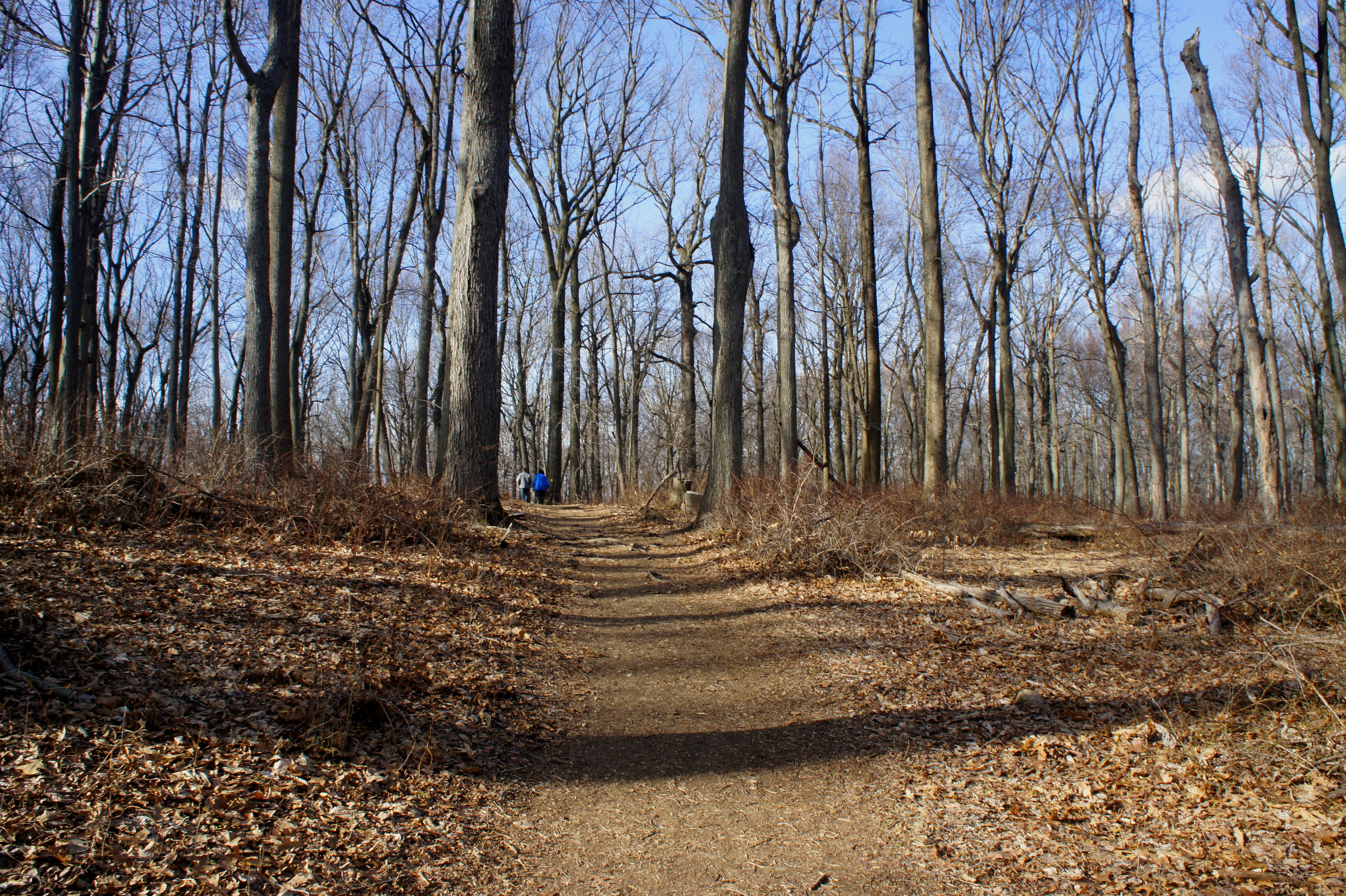
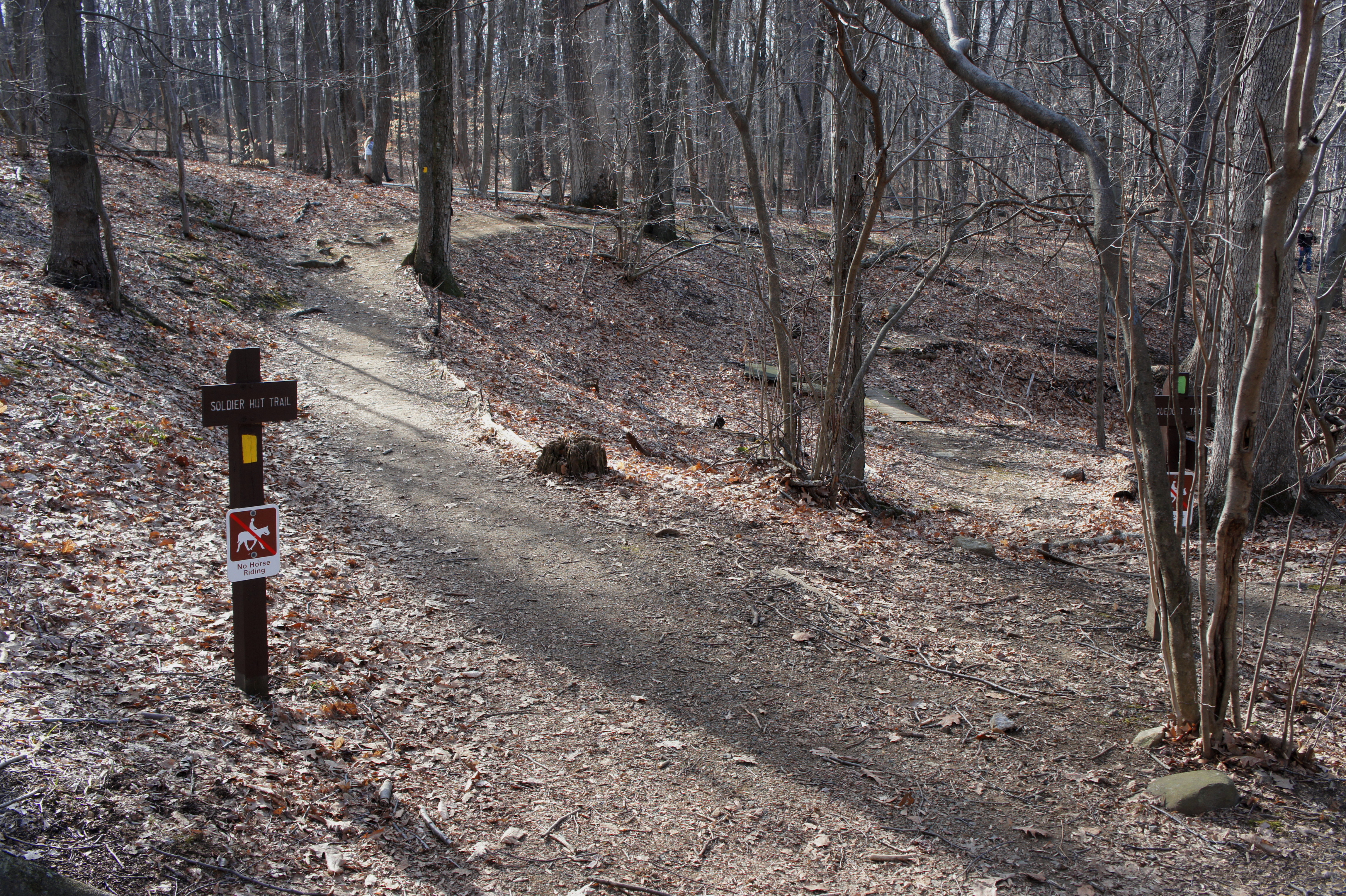
The Yellow Trail loop begins just up Cemetery Road at signpost #49 (on the right). The Soldier Hut Trail immediately dives into the woods and brush, gradually climbing to crest a low hill at 2/10 mile. By now, the trail is wide and partly graveled and descends briefly to a 5-way junction. Stay straight on the yellow-blazed path as the Green/Aqueduct Loop Trail bears off to the right. From here the Yellow Trail parallels both the road (on the left) and the Green Trail (down in the minor ravine to the right).
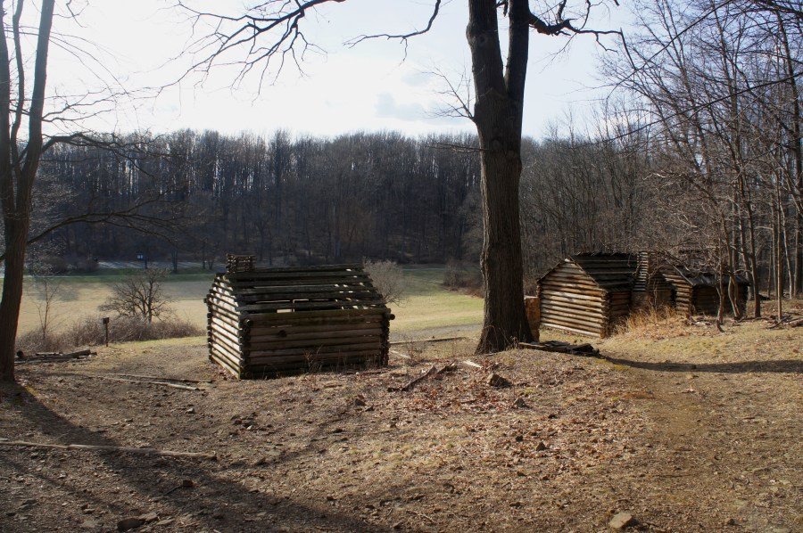
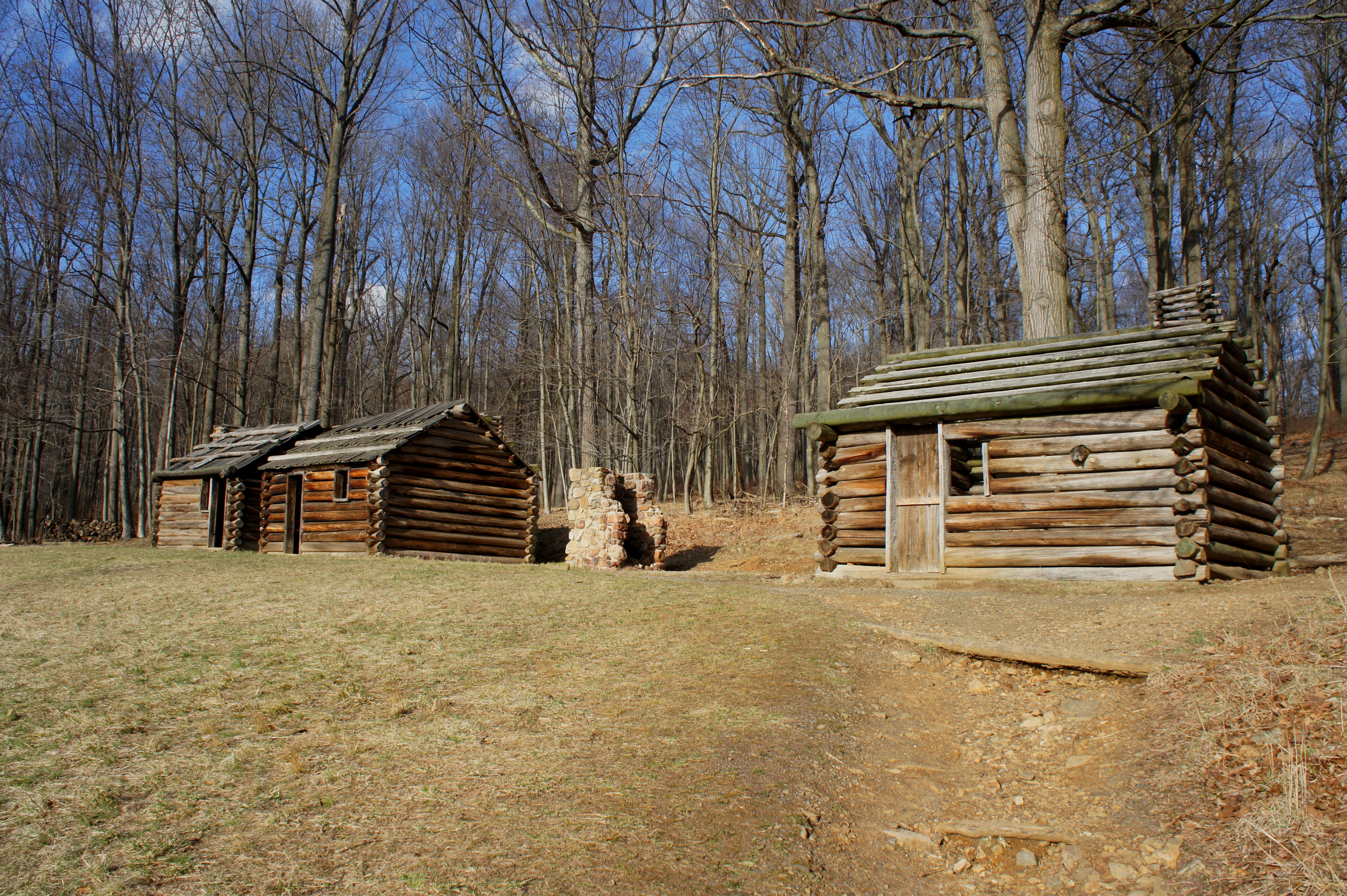
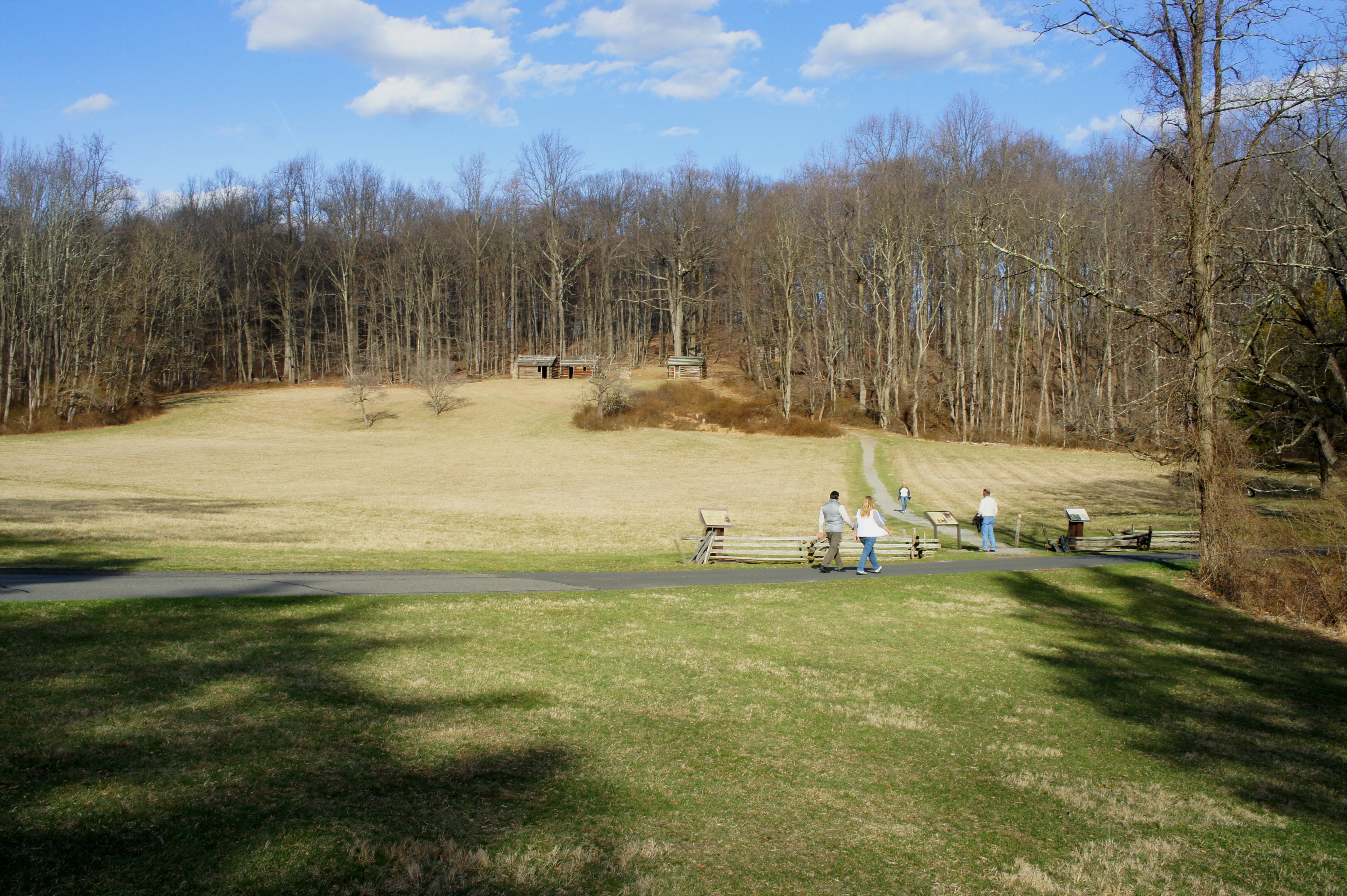
Now bearing east, the Soldier Hut Trail emerges onto a grassy field dotted with several cedar trees at 0.9 mile. Crossing the Grand Parade Road here, the reproduced Soldier Huts are visible up the hill beyond. It’s a steep but short climb to the four huts, very modest wooden shelters against the brutal cold and snow. The three in the front were built for enlisted soldiers, while the larger (two-room) hut in the back reproduces an officer’s residence.


From the officer’s hut, the trail bears right and climbs to a low ridge line. Remains of war-era hearths dot the landscape, highlighted by an interpretive panel on the left. Steps beyond, bear right at signpost #41, then continue east as the trail levels off. Stay right at the next trail fork (signpost #42).
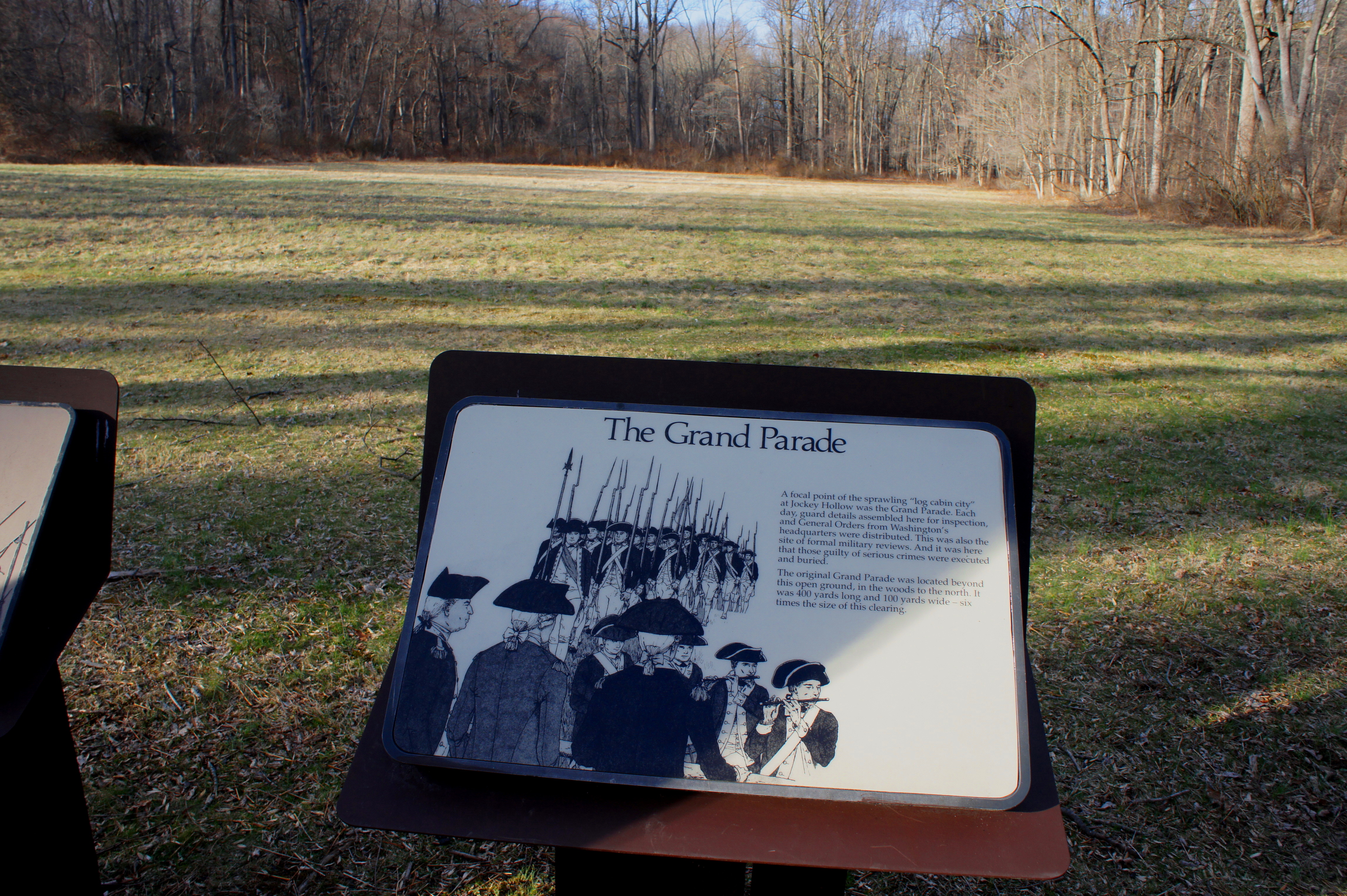
By now you are on the Grand Parade Trail, which drops sharply at roughly the 1.25-mile mark, with the sight of an open field down to your left. At 1.3 miles, the trail approaches Grand Parade Road but does not yet cross it. Stay to the left, skirting the Grand Parade, a broad field where guards reported every day for inspections and to receive orders. (Note: The original field was situated in the woods to the north and was roughly 400 yards long and 100 yards wide.)
From the interpretive panels at Grand Parade, cross the road and continue southwest along a level straightaway. The trail emerges at the so-called “Trail Center” at 1.6 miles, a parking area that serves as an access point to the Yellow, Orange, Green, Red, and Blue Trails. Cross to the other side of the parking area, where the trail continues.
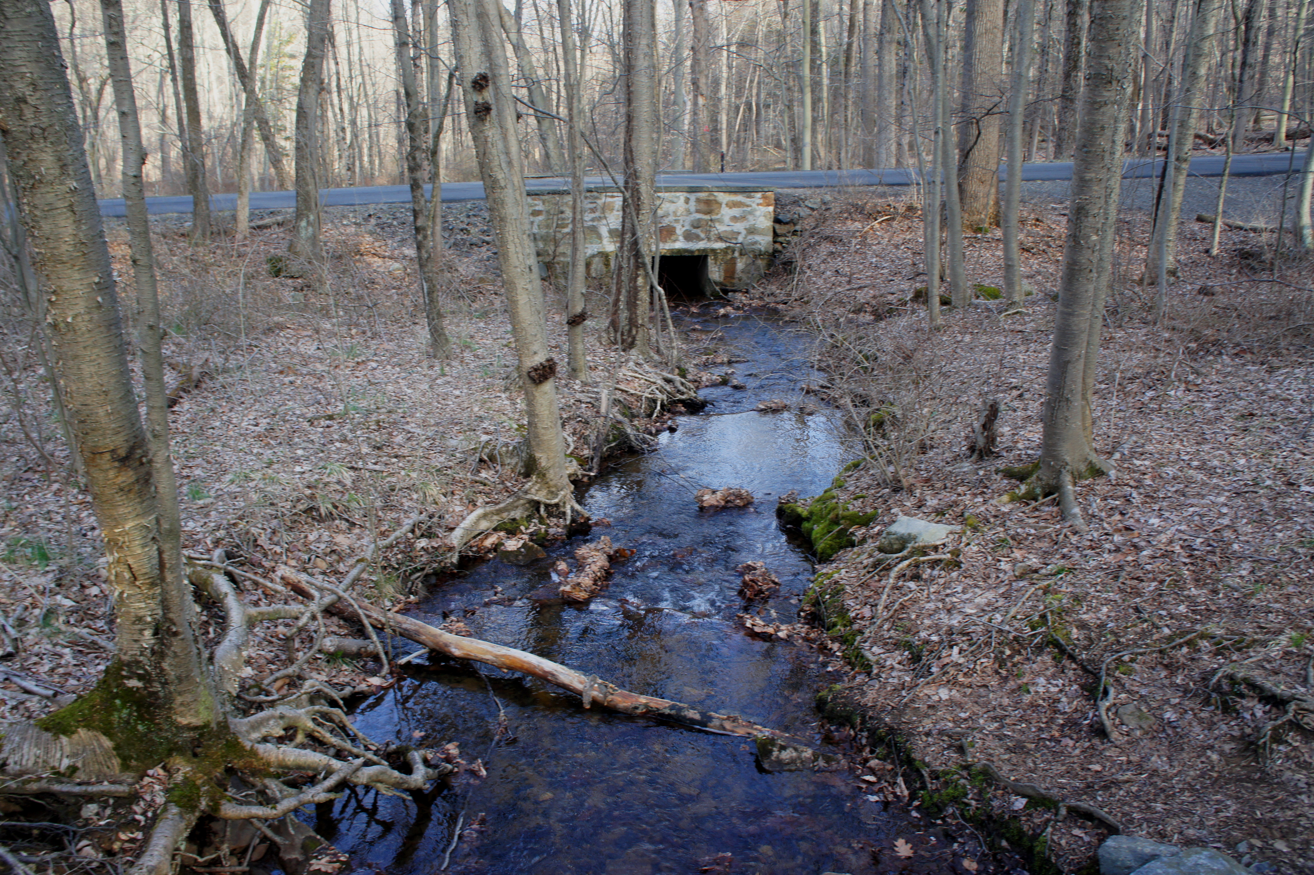
Briefly sharing the path with the Aqueduct Trail, the two paths diverge after crossing Primrose Brook. The Yellow Trail follows a minor tributary then climbs sharply uphill, the final push before returning to Wick Farm. The grade eases at the 2-mile mark; bear right at signpost #47. From here the trail passes behind an old apple orchard.
Stay straight at the next trail fork (with the Orange Trail, at roughly 2.15 miles), followed quickly by an abrupt return to the start—the Wick farmhouse and parking area. (Note: If parked at the visitor center, follow the paved path for another 1/10 mile.) Allot roughly 1-1.5 hours for this easy-to-moderate hike.

Pingback: Morristown National Historical Park, NJ | Live and Let Hike