Situated just off Interstate 5 in northern California, Castle Crags State Park covers a scenic pocket of the Trinity Divide—a small but alluring mountain range that separates the Sacramento River and Trinity River watersheds. The star feature is a large outcrop of granite formations, technically situated outside the park, but visible from many of the park’s 12 hiking trails. The most easily accessible viewpoint is Vista Point, situated at the end of a short, wheelchair-accessible trail. The overlook offers views of three distinct landmarks: the pasty Castle Crags, the distant Gray Rocks, and the snowy behemoth of Mount Shasta.

The hike
The Vista Point parking area is located at the end of the Vista Point Road, deep in the heart of Castle Crags State Park. (Note: The road passes the trailhead for the Root Creek Trail on the left.) From the parking lot, follow the wide and well-marked path as it bears southeast at a slight uphill. Down to the left, the steep slopes of Kettlebelly Ridge are covered with thick conifers—pines, firs, and hemlocks. At around 70 yards, the woods briefly give way to sun as the path passes under power lines.

About 300 yards from the start, the trail curls to the right and approaches a trail junction; bear right at the fork. (Note: Here an extension of the Vista Point Trail continues left, away from the overlook.) Having rounded a corner and gained a few dozen feet in elevation, the trail doubles back to the northwest, making the final push to the overlook.
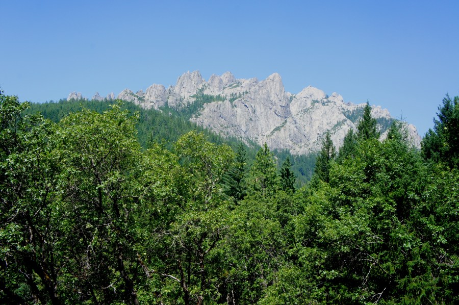
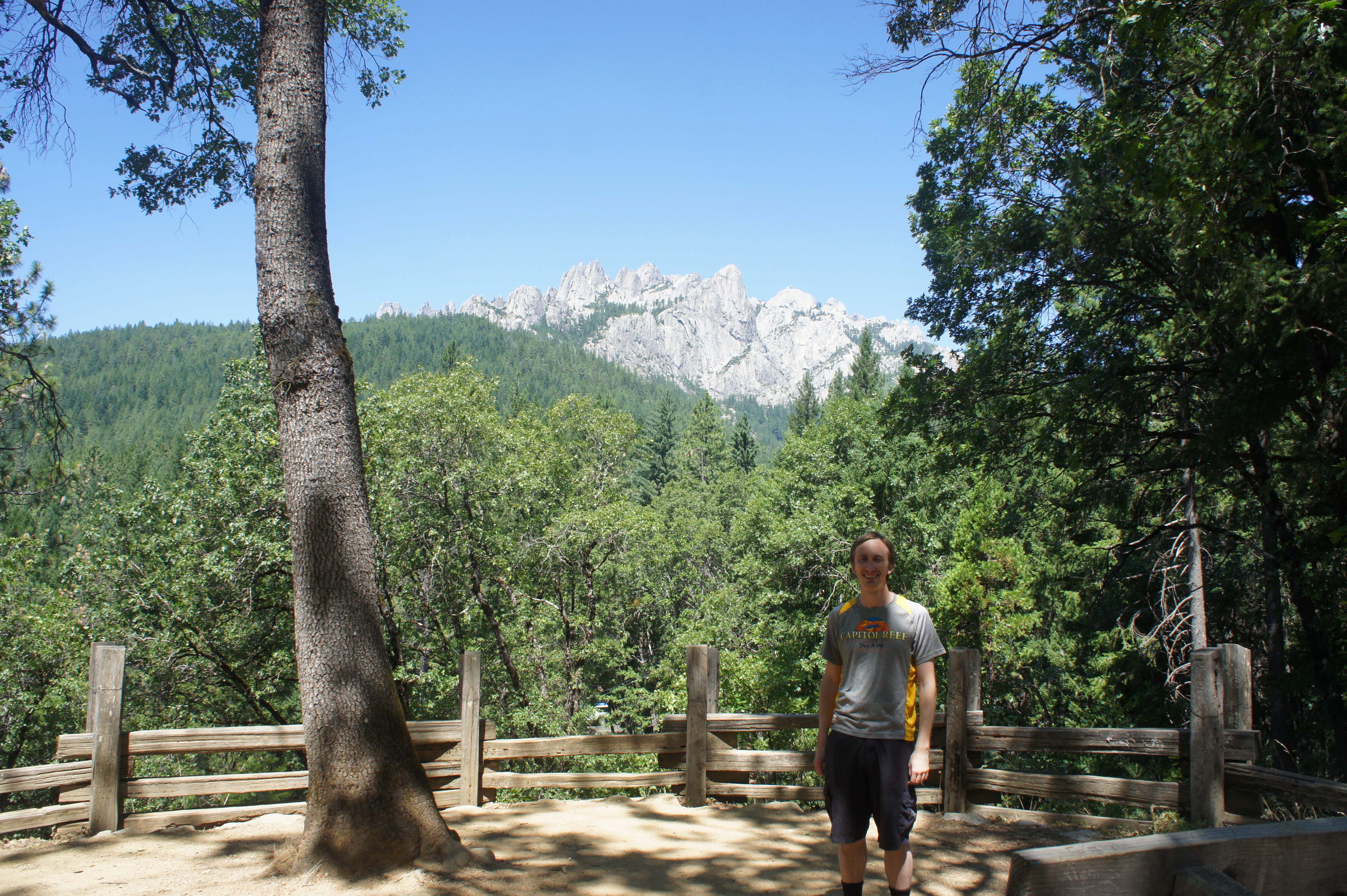
At ¼ mile, the trail ends at splendid Vista Point. Straight ahead is Castle Crags (7,200’), the centerpiece of the park bearing its name. (Note: Though, ironically, they are situated just outside the park.) These granite formations owe their existence to subterranean lava flows that cooled roughly 170 million years ago; with time, the softer layers around the granite eroded, leaving this spectacular protrusion of chalky spires and domes.

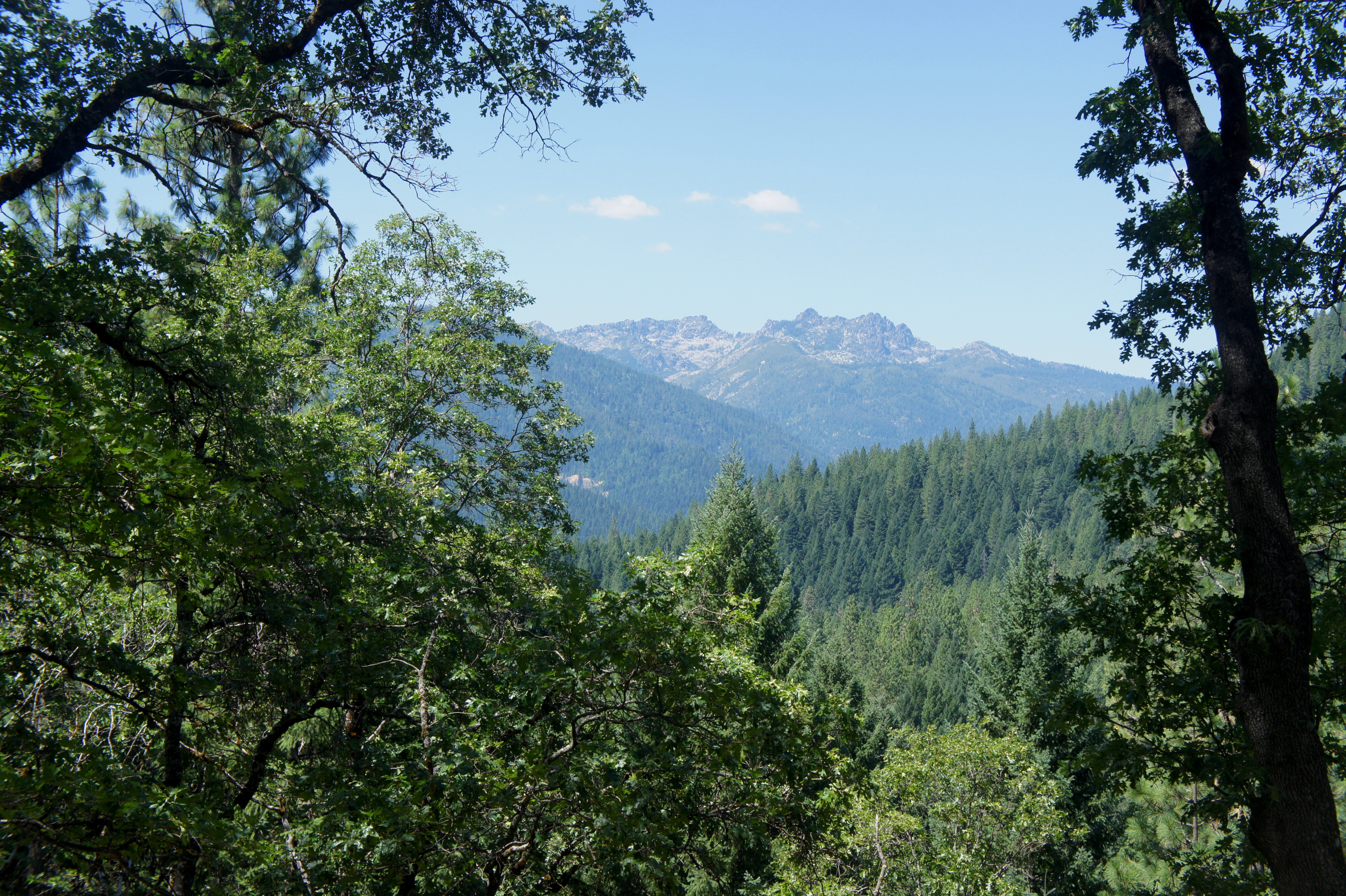
To the left of Castle Crags are the Gray Rocks (7,286’); considerably more distant, these older, metamorphic formations are nonetheless visible on clear days to the west. The roughly 400 million year old rocks form some of the highest reaches of the Trinity Divide.
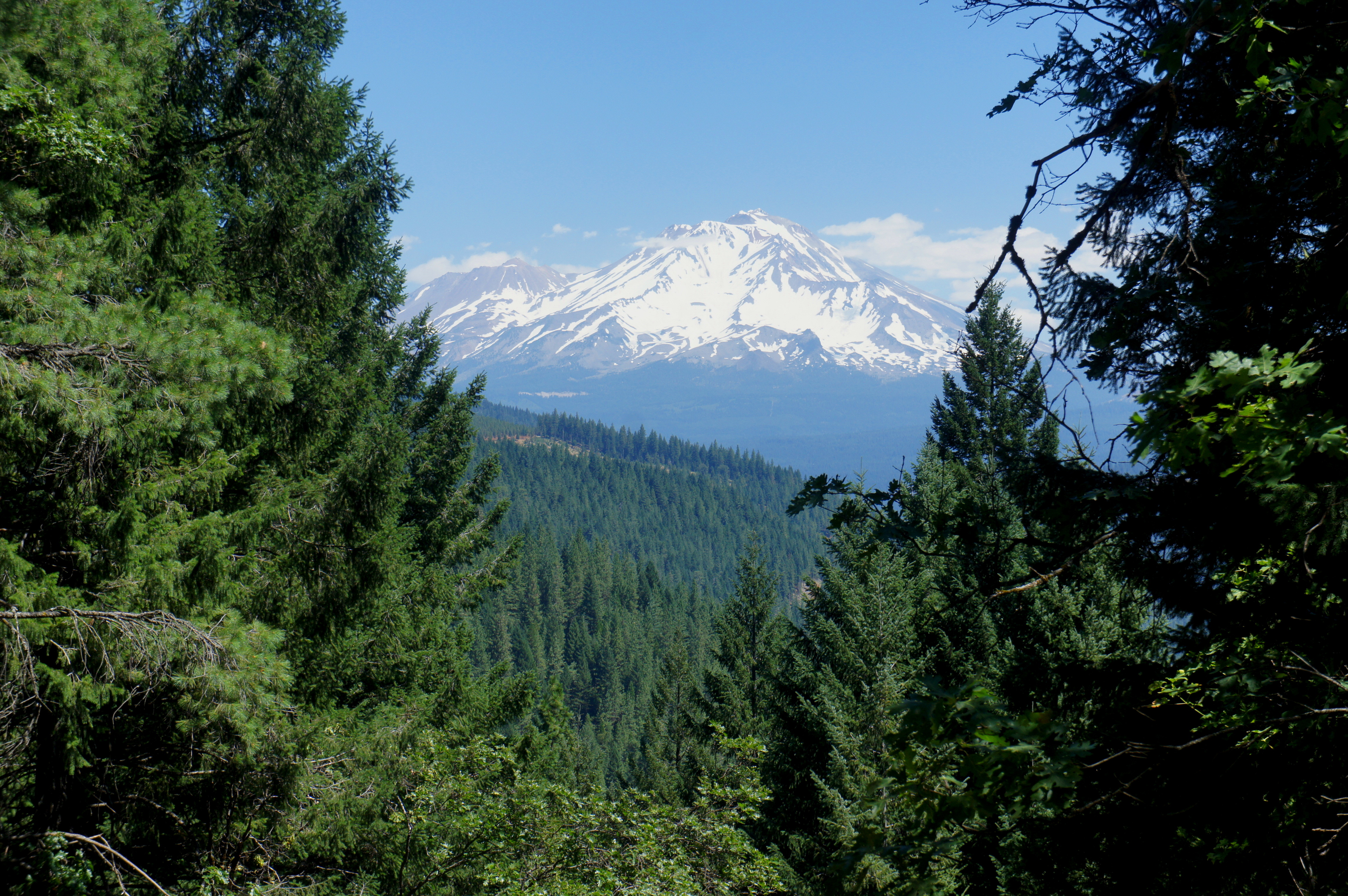
Finally, arguably as alluring as the Crags themselves, the window to the north offers a framed view of Mount Shasta (14,180’), the fifth-highest peak in California and second-highest volcano in the contiguous U.S. (Note: It lasted exploded in 1786.) Capped with snow much of the year, Mount Shasta is highly photogenic, the undisputed master of the mountains in this area.
Benches and picnic tables at the vista offer a place to sit down and admire the views, while interpretive signs offer a brief explanation of the geology of the area. Once you have had your fill, return the way you came; allot around 20-30 minutes for the out-and-back.
Extra credit
Stretch your legs on the longer Root Creek Trail, situated just 75 yards down the Vista Point Road. This easy walk ends at a babbling stream, with a more strenuous path continuing beyond to majestic Root Creek Falls.

Pingback: Root Creek Trail & Root Creek Falls (Castle Crags State Park, CA) | Live and Let Hike