
Maryland Section 2 is almost certainly the least interesting of Maryland’s seven Appalachian Trail (AT) sections. (Note: As delineated by the Potomac Appalachian Trail Club’s Appalachian Trail Guide to Maryland and Northern Virginia.) It does offer variety, however, as it weaves through dense deciduous forest and open fields in a quiet and peaceful section of Maryland. There is also a lot of human history, with remnants of rock walls scattered alongside the AT. The route picks up where Appalachian Trail Maryland Section 1 leaves off, climbing from Raven Rock Hollow to Buzzard Knob and Warner Gap Hollow and finishing four miles later at Wolfsville Road. Through-hikers will find rest at the modest Ensign Cowall Shelter in this section.

The hike
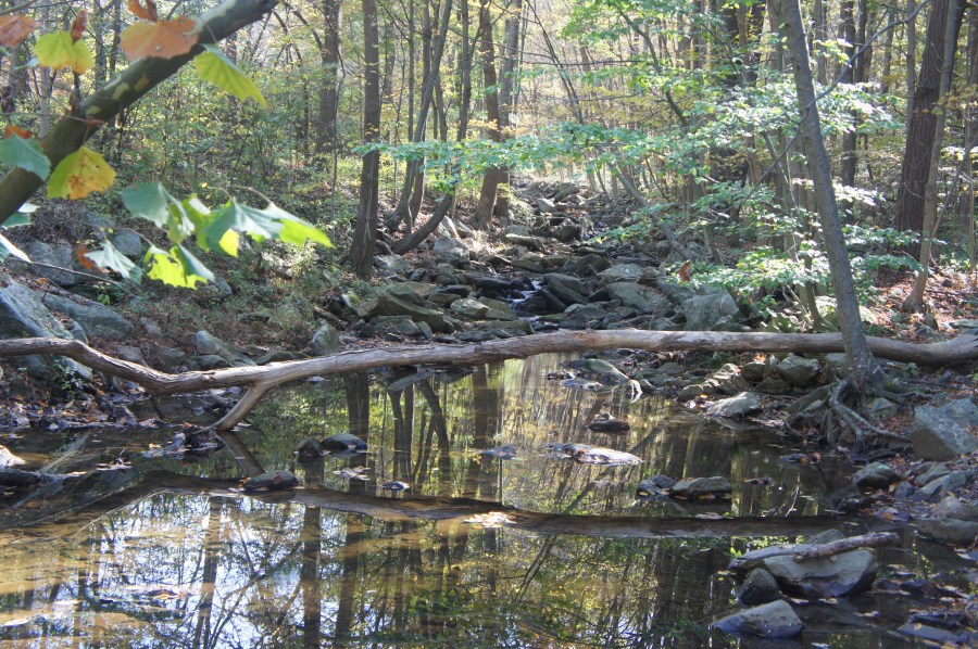
Day hikers can park alongside the shoulder on Raven Rock Road at the crossing of the Appalachian Trail (AT). Raven Rock Hollow marks a clear departure from much of the Maryland AT, as lengthy South Mountain breaks down into smaller, shorter peaks. Opposite Raven Rock to the north, the southbound AT hugs the road for the first 1/10 mile, with Little Antietam Creek rippling over rocks down to the right.
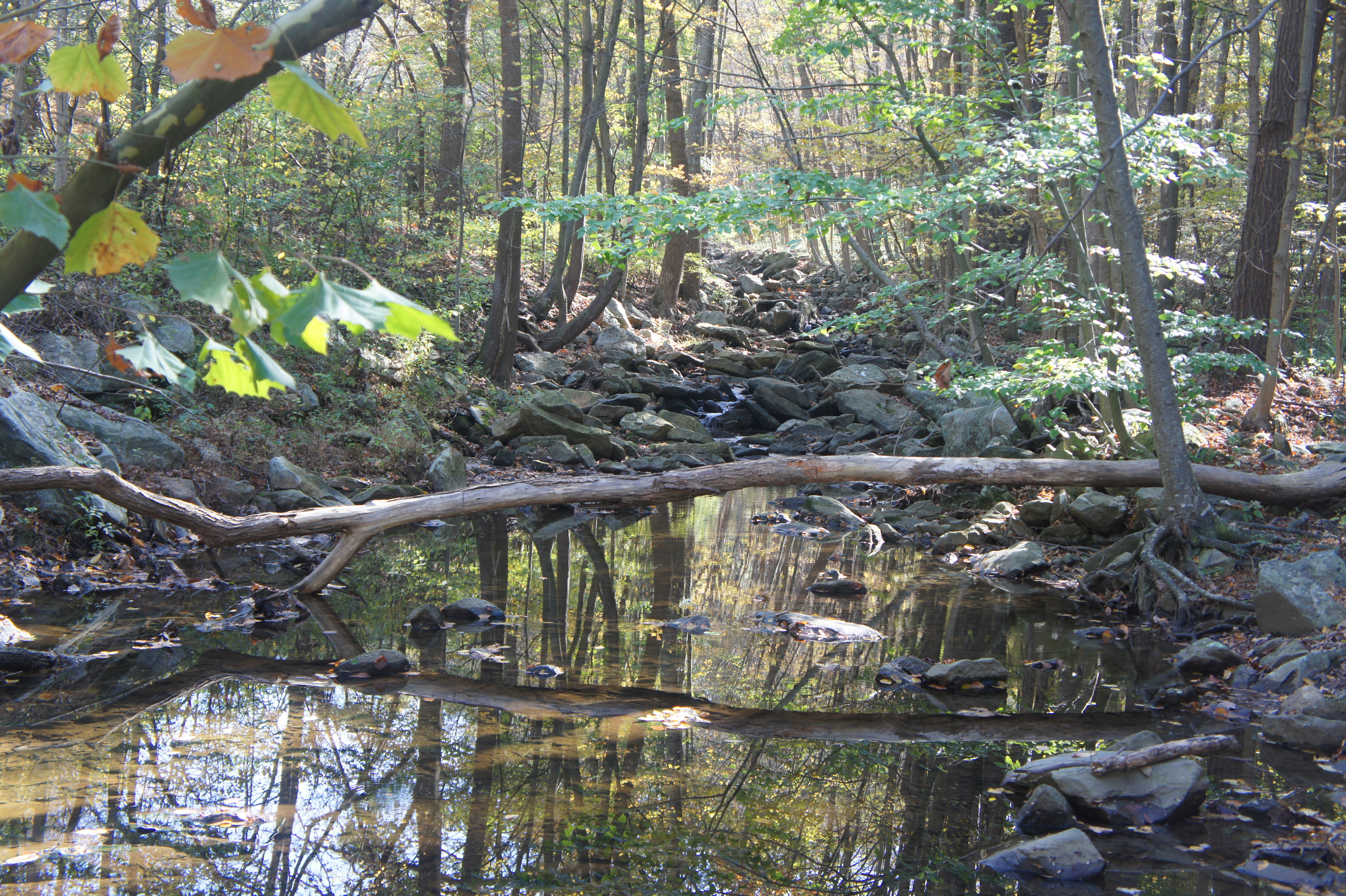
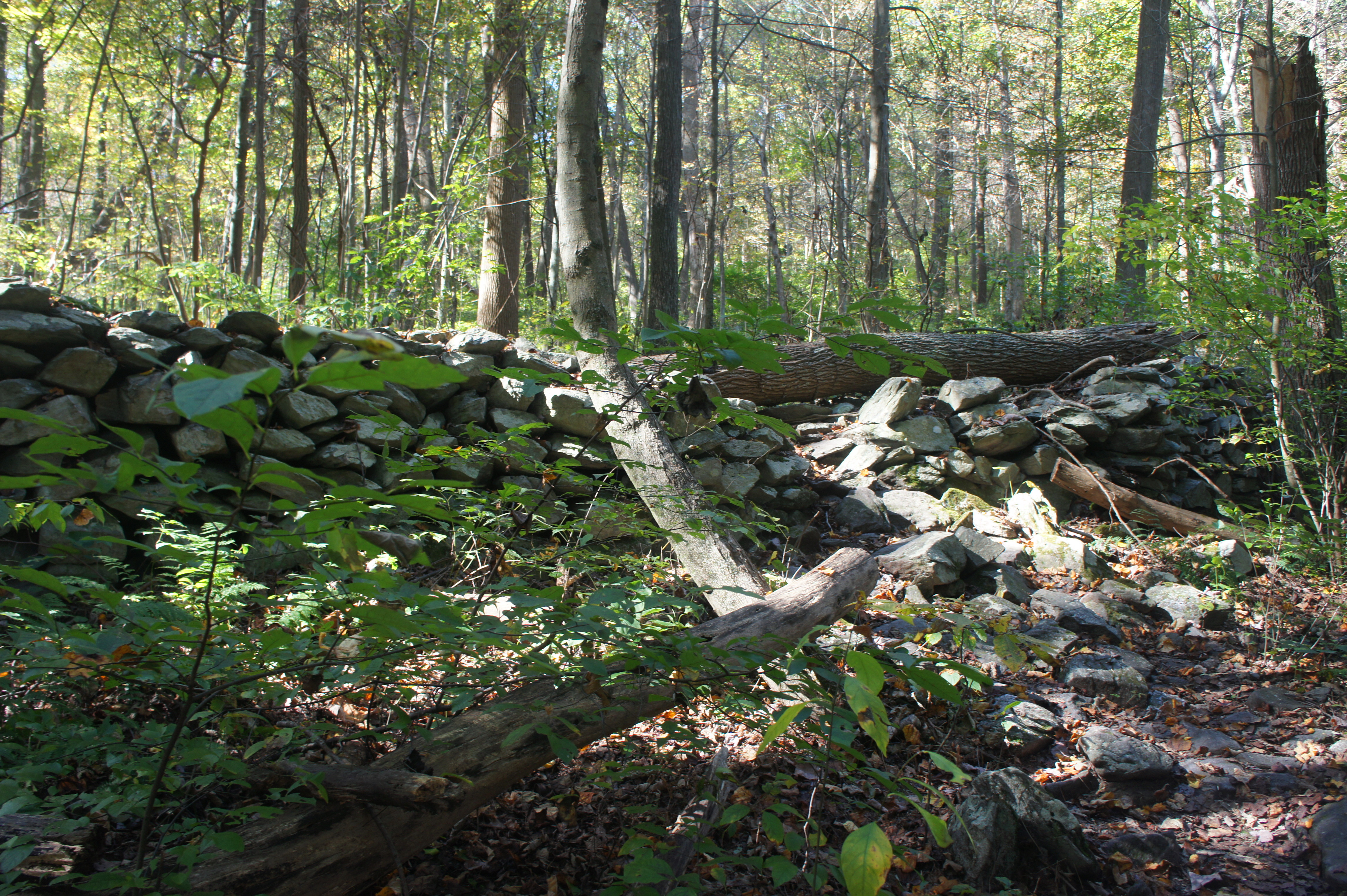
After crossing the stream, the trail leaves the road behind and bears south toward Buzzard Knob (1,560’). While the path does not reach the top of Buzzard Knob, it does climb to a high pass to the east of the summit. After gradually climbing out of Raven Rock Hollow, the ascent begins in earnest at around 2/10 mile. Minutes later, the path surmounts a partly collapsed rock wall, a reminder that this area used to be inhabited by farmers and livestock owners. The climb eases thereafter as the AT crests a woody ridgeline, reaching a local high point at about the ½-mile mark.
Reaching the pass ushers in a sharp descent of around 200 feet to Warner Gap Hollow. The AT spits out onto unpaved Warner Hollow Road at 8/10 mile; bear left on the road for about 30 yards, then follow the white blazes as they leave the gravel drive and continue south. The path quickly crosses another flowing stream and returns to climbing.
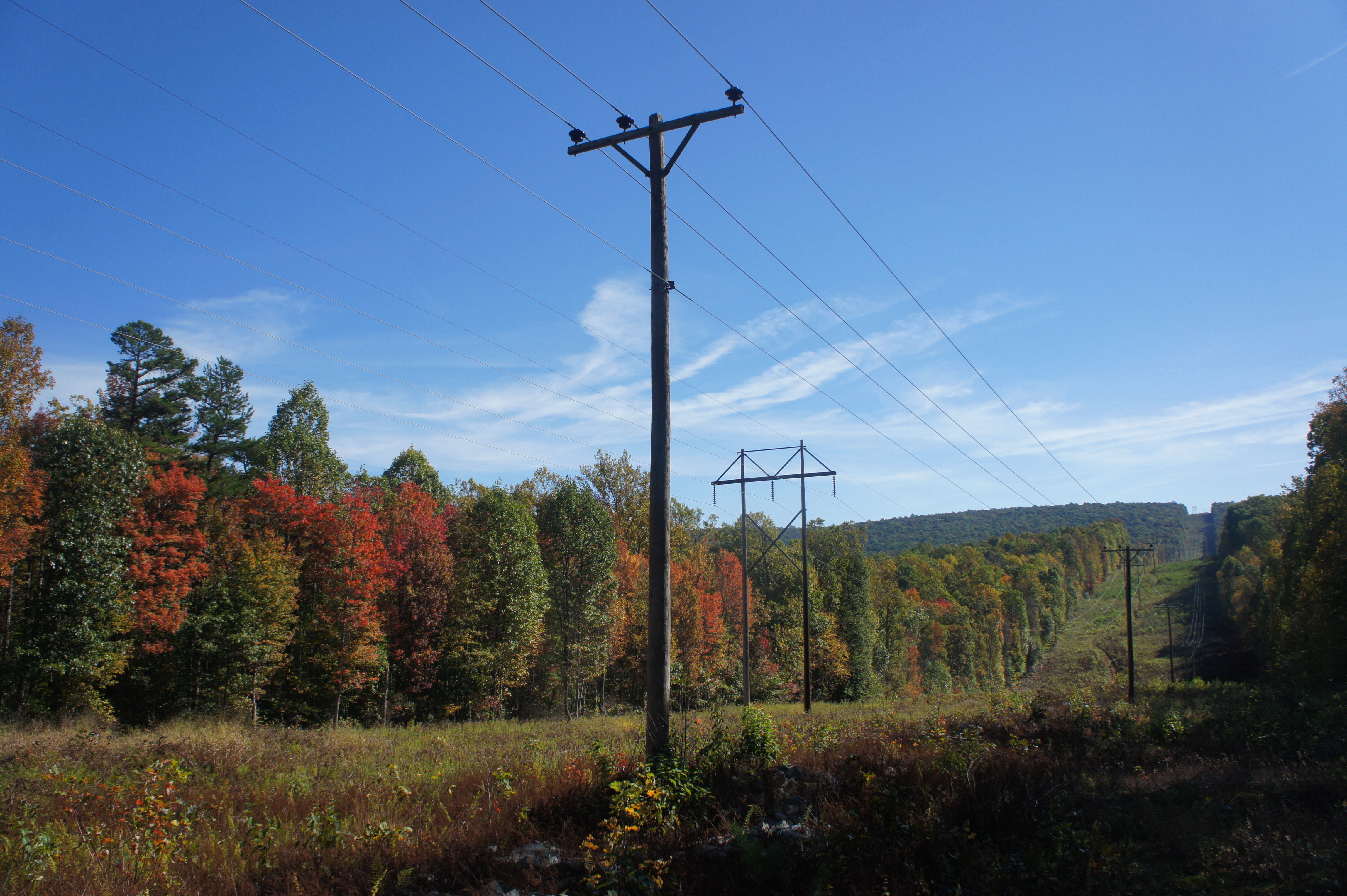
The second ascent is considerably longer than the first, gaining 500 feet in elevation and stretching for about ½ mile before levelling off. The lower reaches of the hillside are dotted with more remnants of old rock walls. At 1.2 miles, the trail passes under power lines, which cut abruptly across the mountain slopes in a straight line bearing southeast.
Beyond the tree cut, the trail weaves in and out of a series of woody ravines, then climbs to the base of a shady slope littered with mammoth boulders. The incline picks up as it clears the cluster of quartzite deposits and skirts the edge of a 10-15 foot wall speckled with green moss. The trail crosses a minor stream at 2.1 miles, then reaches another local high point at about 2.3 miles.
With the sound of zooming vehicles ahead, the trail suddenly bursts out of the woods and traverses a brushy field at 2.45 miles. The field ends at Foxville Road, a relatively busy thoroughfare in Maryland’s high country.

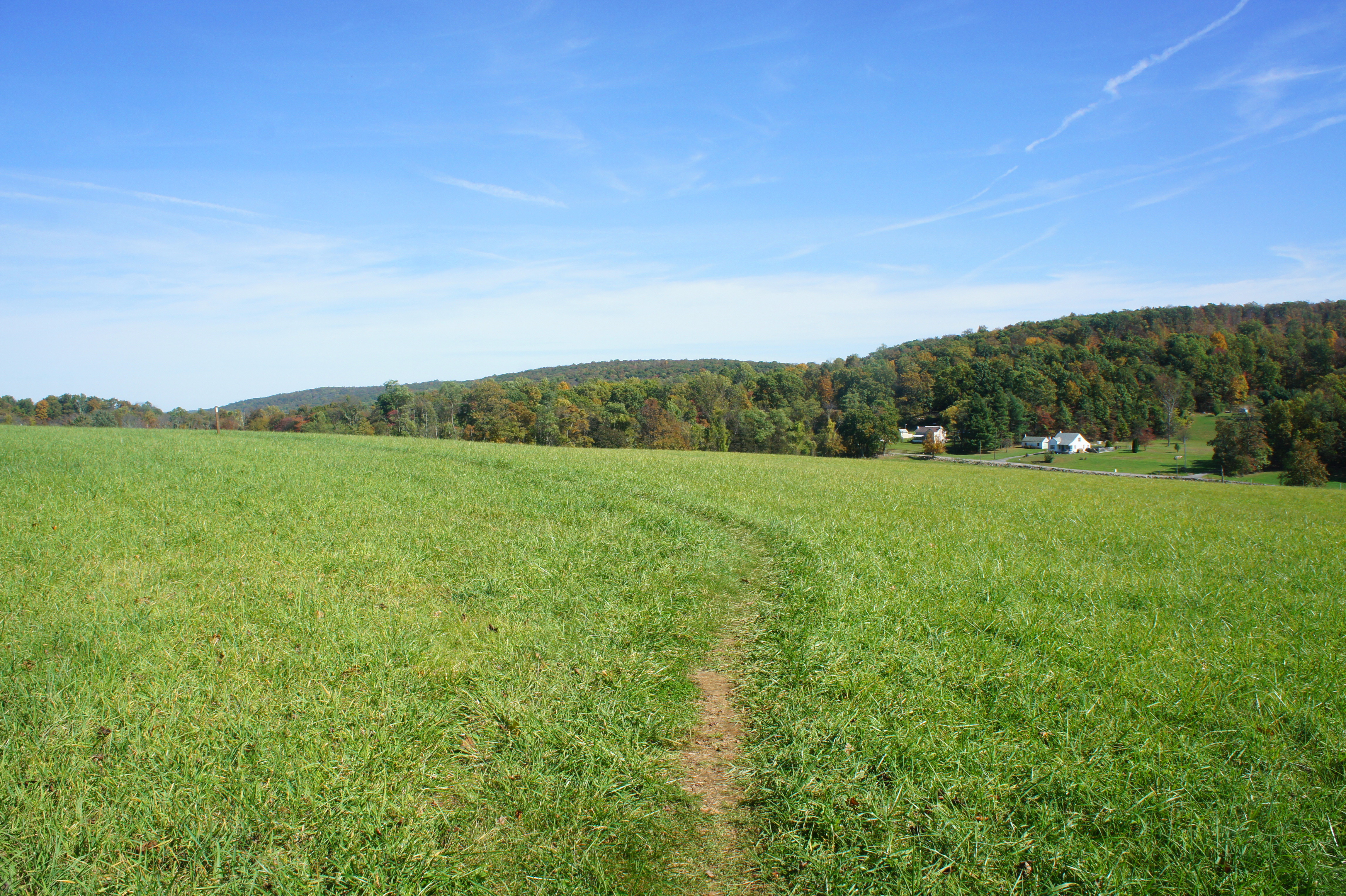
Cross the road and continue on the white-blazed AT as it enters a dense thicket. The trail approaches a second, much larger field awaits at 2.75 miles and begins a ¼-mile jaunt across this scenic, grassy hillside. A thin tree line marks the boundary between Washington and Frederick Counties. Off to the left is a row of farmsteads along the Pleasant Valley Road.

At the 3-mile mark, the AT reenters the deciduous forest and meanders gradually uphill to the section’s high point (1,713’) at about 3.4 miles. (Note: Here the trail technically enters the jurisdiction of South Mountain State Park for the first time.) Skirting a handful of rocky outcrops, the AT drops to cross a second clearing with power lines at 3.6 miles. The downward slope steepens beyond and passes the Ensign Cowall Memorial Shelter on the right. Stop here for a snack—or, for onward backpackers, a night’s rest. (Note: There is reportedly a spring nearby, though I was unable to locate it; in any case, it’s probably better to filter water back at one of the creeks you have already passed.)

From here the AT continues down the final stretch. Bear right at the trail fork at 3.9 miles, following the white-blazes as the path bears north. Four miles from the start, blue blazes direct hikers to the left to the local AT parking area; the white-blazed AT ends shortly thereafter, with little fanfare, at Wolfsville Road. This is the end of Section 2, with a much longer, rockier, and steeper Section 3 beyond.
Traversing the 4-mile route to this point should take 2-3 hours one-way. For those lucky enough to have a car parked at Wolfsville Road, your journey ends here. All other day hikers will have to turn back, retracing your steps back to Raven Rock Hollow.

Pingback: Appalachian Trail – Maryland Section 3: Wolfsville Road to US 40, including Black Rock & Annapolis Rocks (South Mountain State Park, MD) | Live and Let Hike
Pingback: Appalachian Trail – Virginia/West Virginia Section 1: Harpers Ferry to Keys Gap (Harpers Ferry National Historical Park, WV/VA) – Live and Let Hike