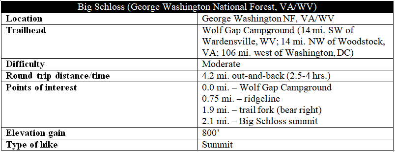
At 2,964 feet, Big Schloss is not the highest peak on Great North Mountain—which stretches for 50 miles along the Virginia-West Virginia border—but it is arguably the grandest. Named for the German word for palace or castle, Big Schloss offers panoramic views of some of the most beautiful terrain in the mid-Atlantic: rugged hillsides, majestic valleys, and endless mountains on the horizon. The downside of these renowned vistas, of course, is considerable foot traffic; the moderate, 2.1-mile hike to the peak can be crowded on weekends. This castle in the sky is extensive, however, offering a place for everyone to sit and soak in the tremendous scenery at the summit.
The hike
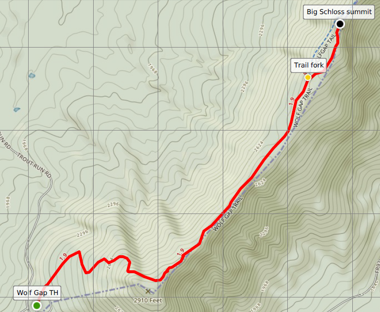
The hike to Big Schloss begins at the Wolf Gap Campground, situated right on the state boundary in George Washington National Forest. (Note: The campground is a 14-mile drive from either Wardensville, West Virginia to the northeast or Woodstock, Virginia to the southeast.) Park at the turnoff for Wolf Gap, then walk clockwise around the paved campground loop drive to reach the trail’s start (or simply follow the crowds).
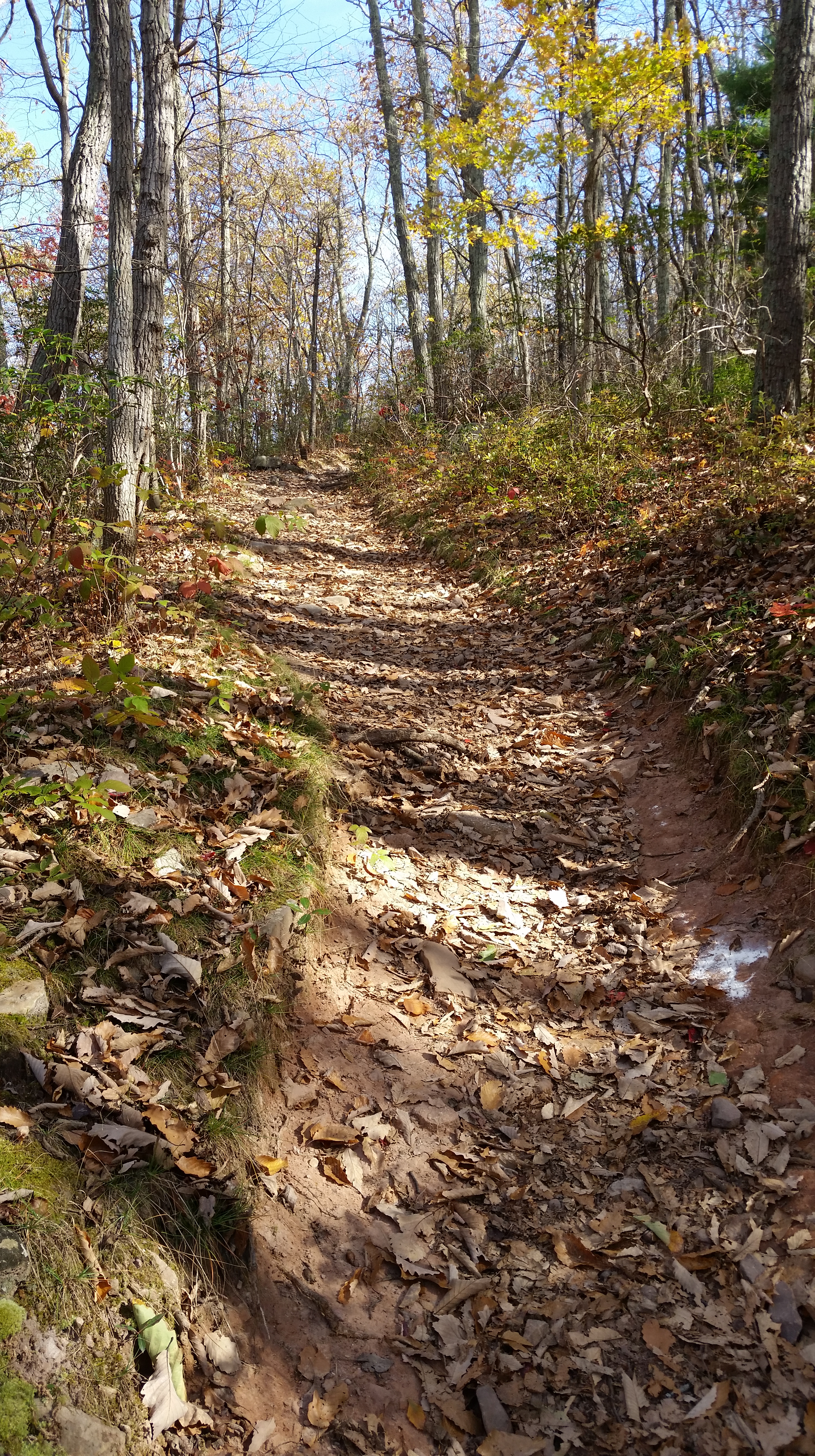
For now on the West Virginia side of the border, the route to the summit begins by following the Mill Mountain Trail for 1.9 miles. The path bears northeast from Wolf Gap, climbing gradually but steadily through a forest of maples, oaks, and beech trees. After rounding a right-hand bend at ¼ mile, the incline steepens as the trail climbs the western slopes of Mill Mountain.
Mill Mountain constitutes a small section of Great North Mountain, a larger area that is better understood as a mountain range than a single peak. Great North Mountain, in turn, is part of the Ridge-and-Valley Appalachians, characterized by their long mountain belts, separated by green, parallel valleys. They owe their formation to a mountain-building period around 300 million years ago.
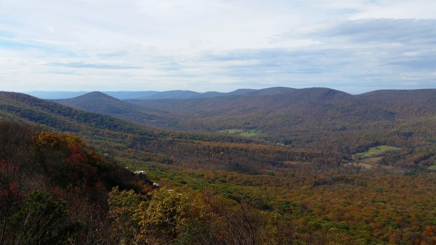
The Mill Mountain Trail passes batches of mountain laurel and switchbacks up the hillside, with some limited views back to Wolf Gap and the slopes of Tibbet Knob (2,930’). A hefty rock cluster appears on the right at 6/10 mile, while the trail cuts left and levels off slightly. Pushing eastward, the trail crests the ridgeline at the ¾-mile mark. Cutting left, the trail follows a relatively thin spine with views in both directions—west and north into West Virginia and east and south into Virginia. The best views are to the right, overlooking the Stony Creek watershed in the direction of Little Schloss (2,624’) and the Shenandoah Valley.

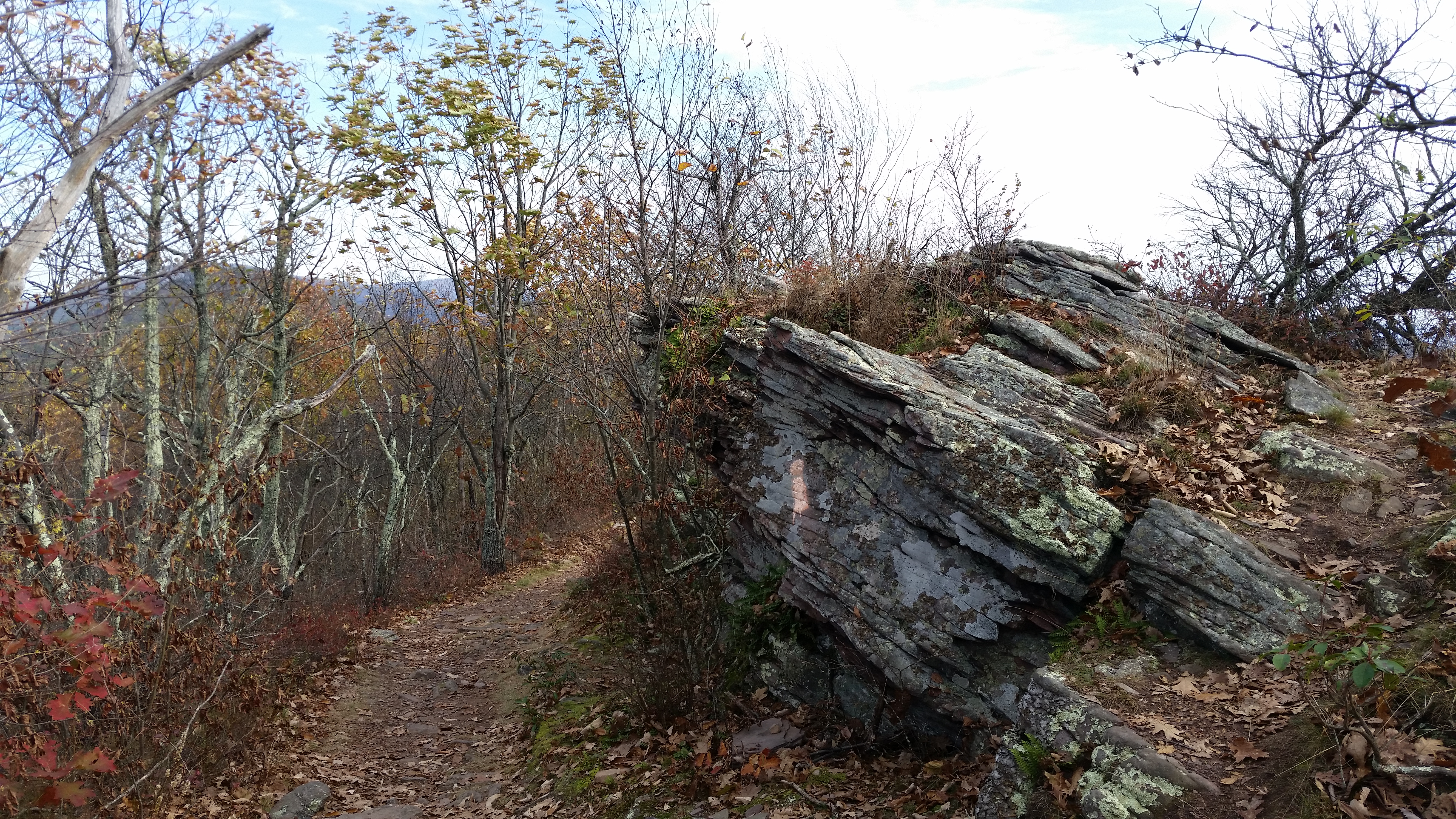
Heading northeast along the ridgeline, the trail descends gradually with intermittent views to the east. Clumps of Tuscarora sandstone dot the mountaintop; this hard layer of rock resists erosion and caps many of the mountains in this area.
The mountaintop widens at around 1.3 miles as the trail continues through hardwood forest. An uphill section begins at 1.5 miles and gains roughly 80 feet over the next 1/3 mile. Take a right at the trail junction at 1.8 miles, leaving the Mill Mountain Trail for the short Big Schloss Trail.
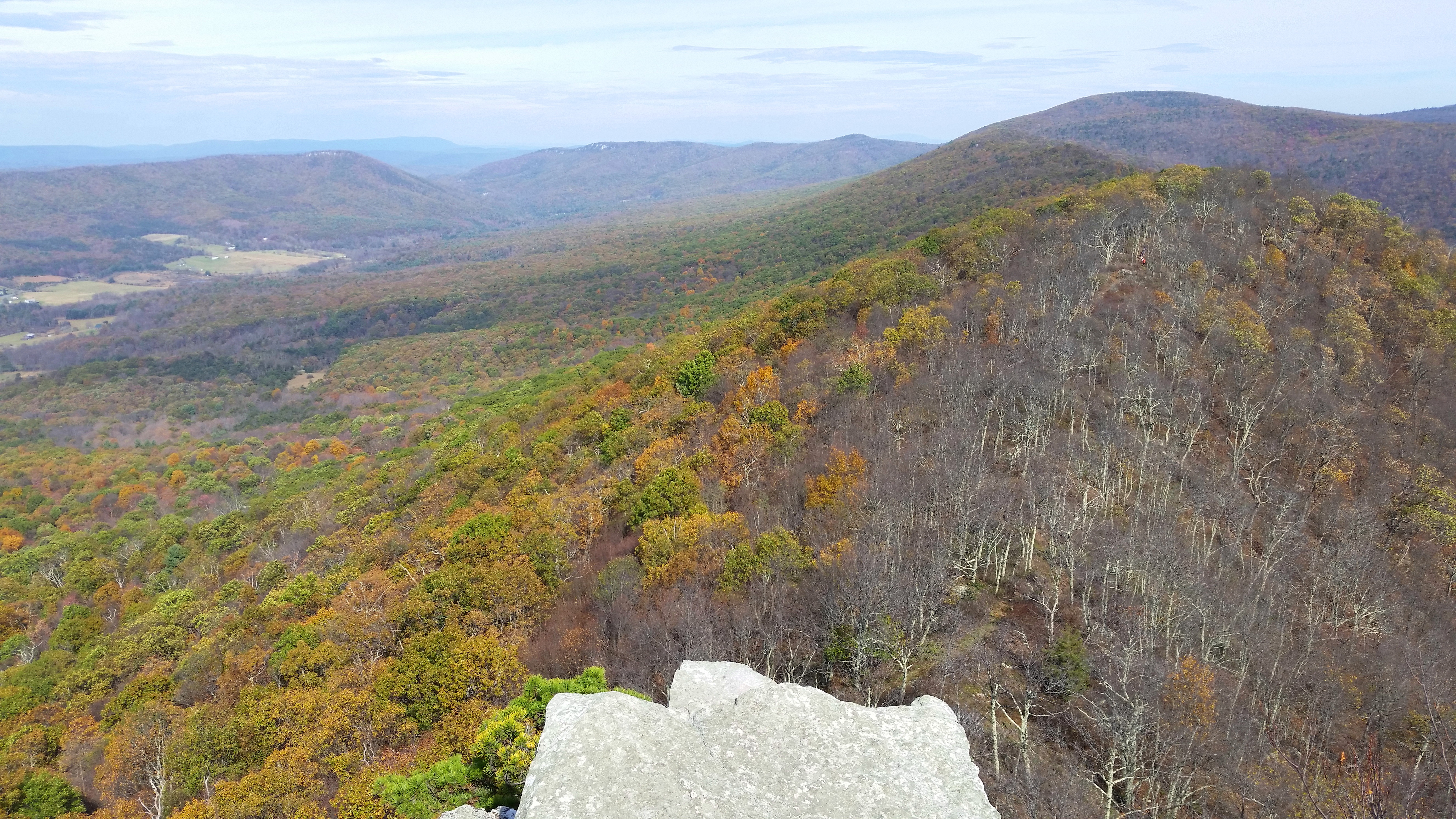
This final spur to the summit begins with an initial ascent, then levels off as rocky ledges offer the hike’s first unobstructed views of Trout Run Valley to the north and west. Except for a handful of farmsteads, this valley appears virtually untouched by man. Long Mountain (3,128’) forms the opposite flank, while Tibbet Knob rises to the southwest.

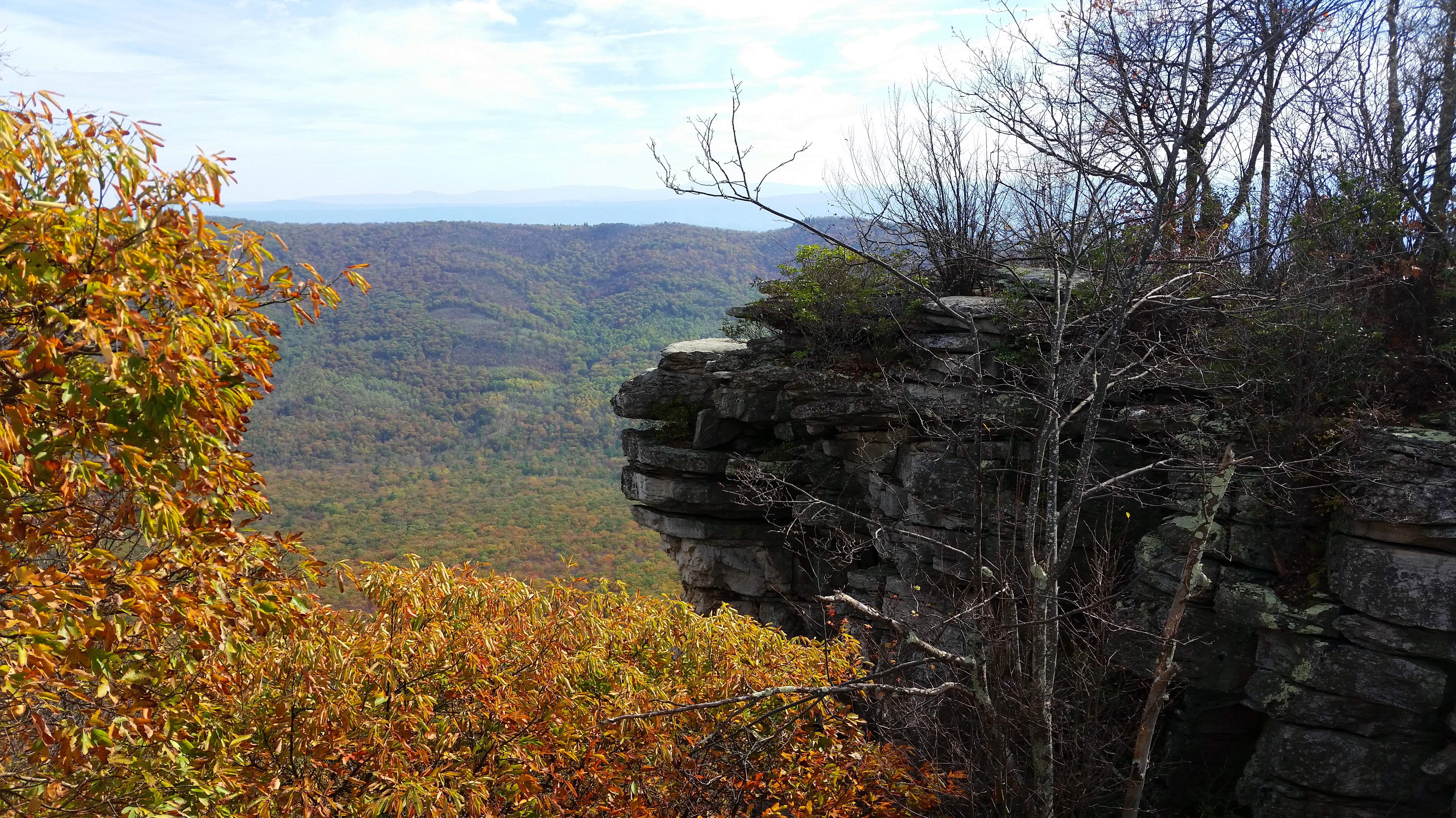
Just beyond, the trail approaches the summit, accessed by way of a wooden bridge that traverses a cleavage in the sandstone. Now in the “keep” of the castle, it is a short climb to the high point, where a 270-degree panorama unfolds. (Note: By now you are firmly within the Virginia state boundary.)


The rest of Trout Run Valley is visible to the left, bounded by Long Mountain and Halfmoon Mountain (2,717’) to the north. Mill Mountain continues to the northeast, extending beyond Big Schloss to the highest point in the Great North Mountain range at 3,293 feet.
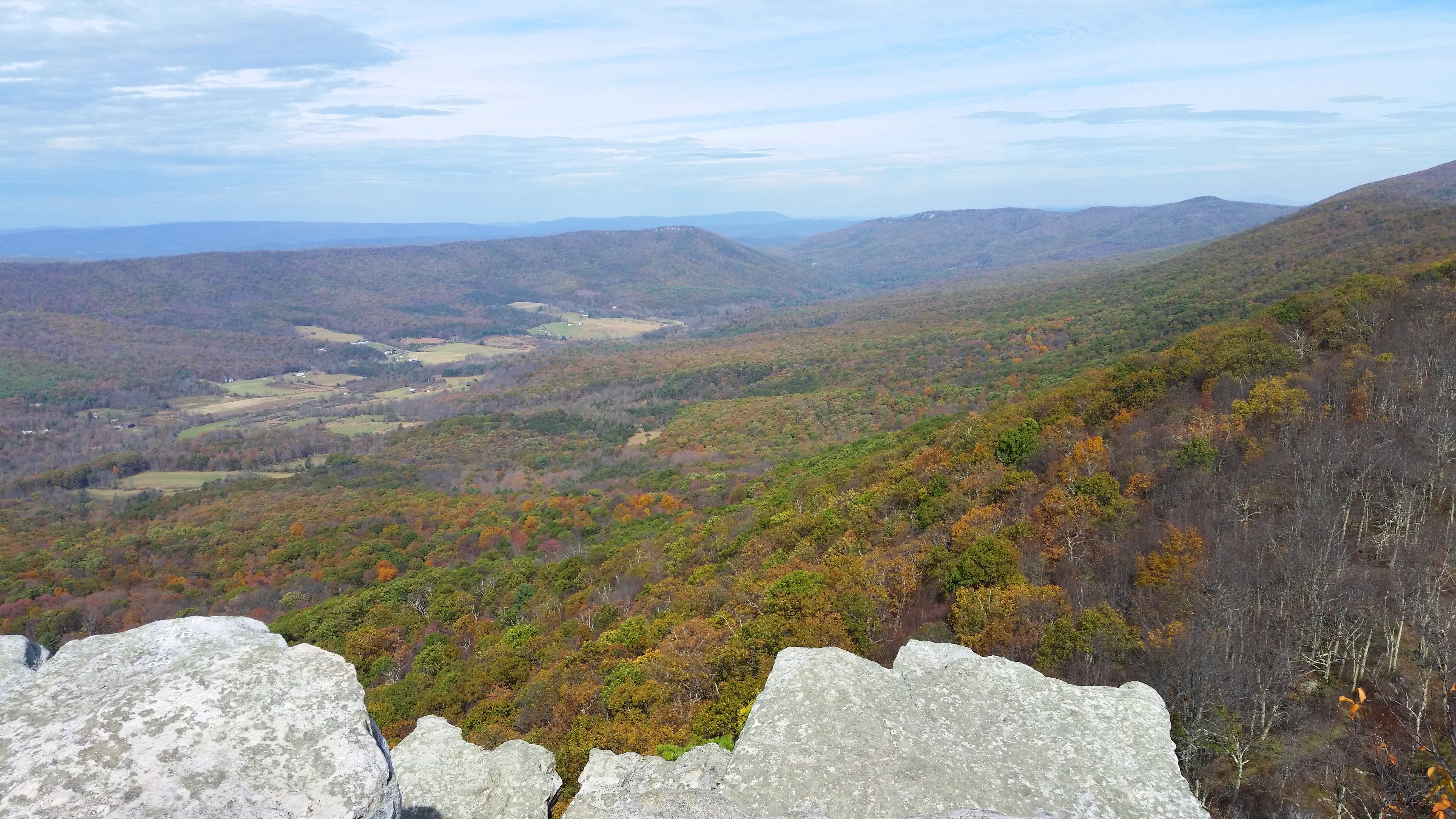

The long ridge to the east is Little Sluice Mountain (3,120’), ending abruptly at Little Schloss. Looking down toward the Shenandoah Valley, the mountains cast shadows over a patchwork of farms. East of the valley is Massanutten Mountain, itself outdone by the taller Blue Ridge Mountains of Shenandoah National Park beyond.

It should take around 1 ½-2 hours to reach the summit, warranting some rest time to eat and admire the beautiful surroundings. Once ready, head back the way you came to complete the 4.2-mile round-trip. The entire hike should take between 2.5-4 hours, depending on pace and the number of breaks.

Pingback: Tibbet Knob (George Washington National Forest, VA/WV) | Live and Let Hike
Pingback: Top 10 Hikes in 2017 | Live and Let Hike
Pingback: Tuscarora Trail to Eagle Rock (George Washington National Forest, VA/WV) | Live and Let Hike