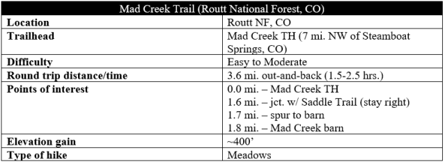
The Mad Creek Trail is a popular hike in northern Colorado, just a 10- to 15-minute drive north from Steamboat Springs. The trail remains largely in the foothills of the Park Range but offers access to the higher Mount Zirkel Wilderness in the heart of Routt National Forest. The highlight is a rehabilitated barn dating to the early 1900s, situated in a beautiful meadow and glacial U-shaped valley. With relatively mild elevation gain, this is an ideal family-friendly hike in the Steamboat Springs area.

The hike
The Mad Creek Trailhead is marked by a roadside sign off Route 129, roughly 5.5 miles north of the intersection with US Route 40 in Steamboat Springs. The large parking lot is likely to be busy on nice, summer days, with the majority of visitors simply there to explore the creek just steps from the trailhead.
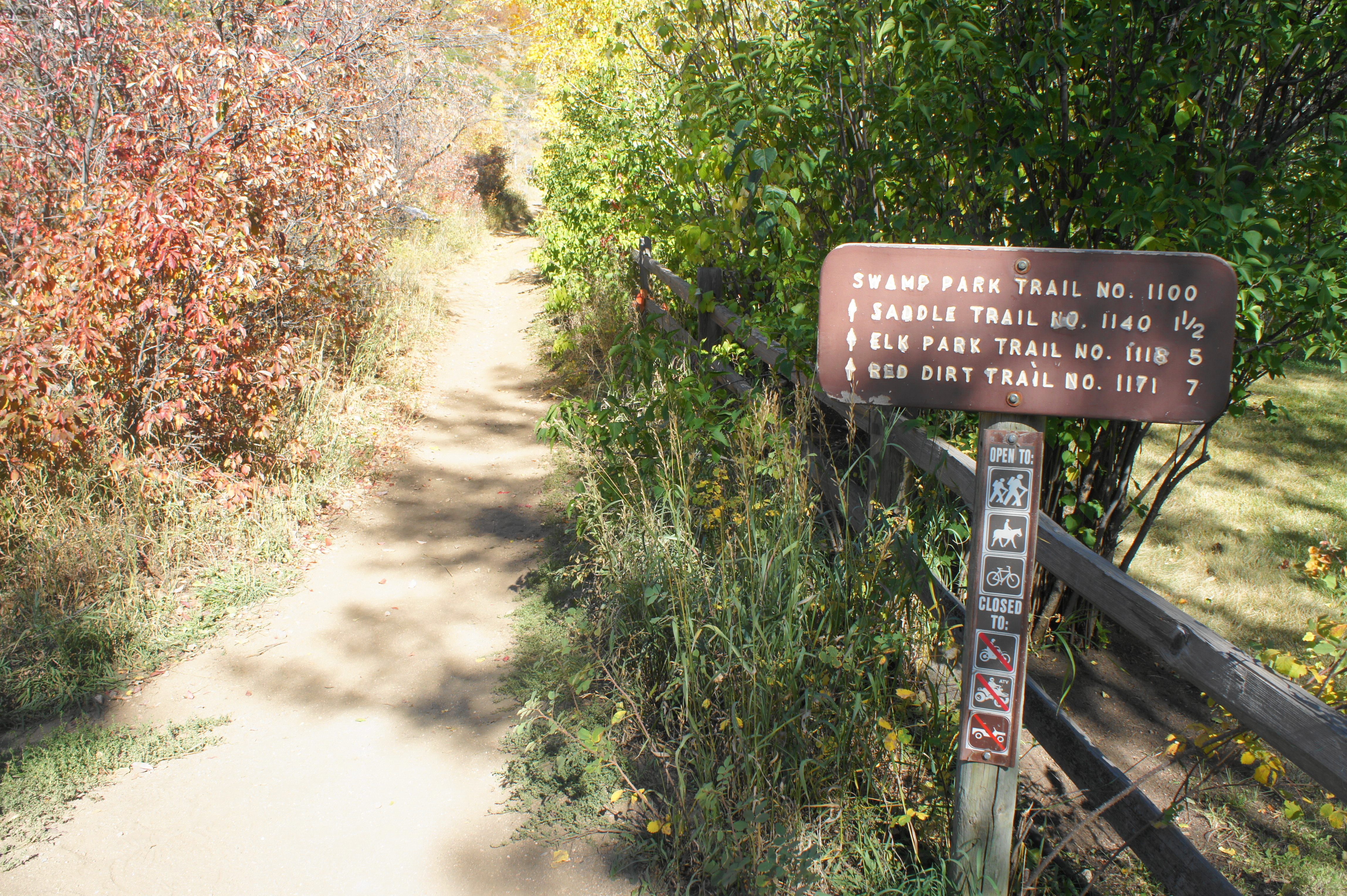
Hikers should head off north from the parking area on the wide and dusty trail, which quickly crosses a paved road that leads to private property. Once across the road, the so-called Mad Creek Trail actually follows the longer Swamp Park Trail (No. 1100) for most of its entirety. (Note: This description stops at the Mad Creek Barn, about 1.8 miles from the start, but the Swamp Park Trail continues for miles northeast into the Mount Zirkel Wilderness.)
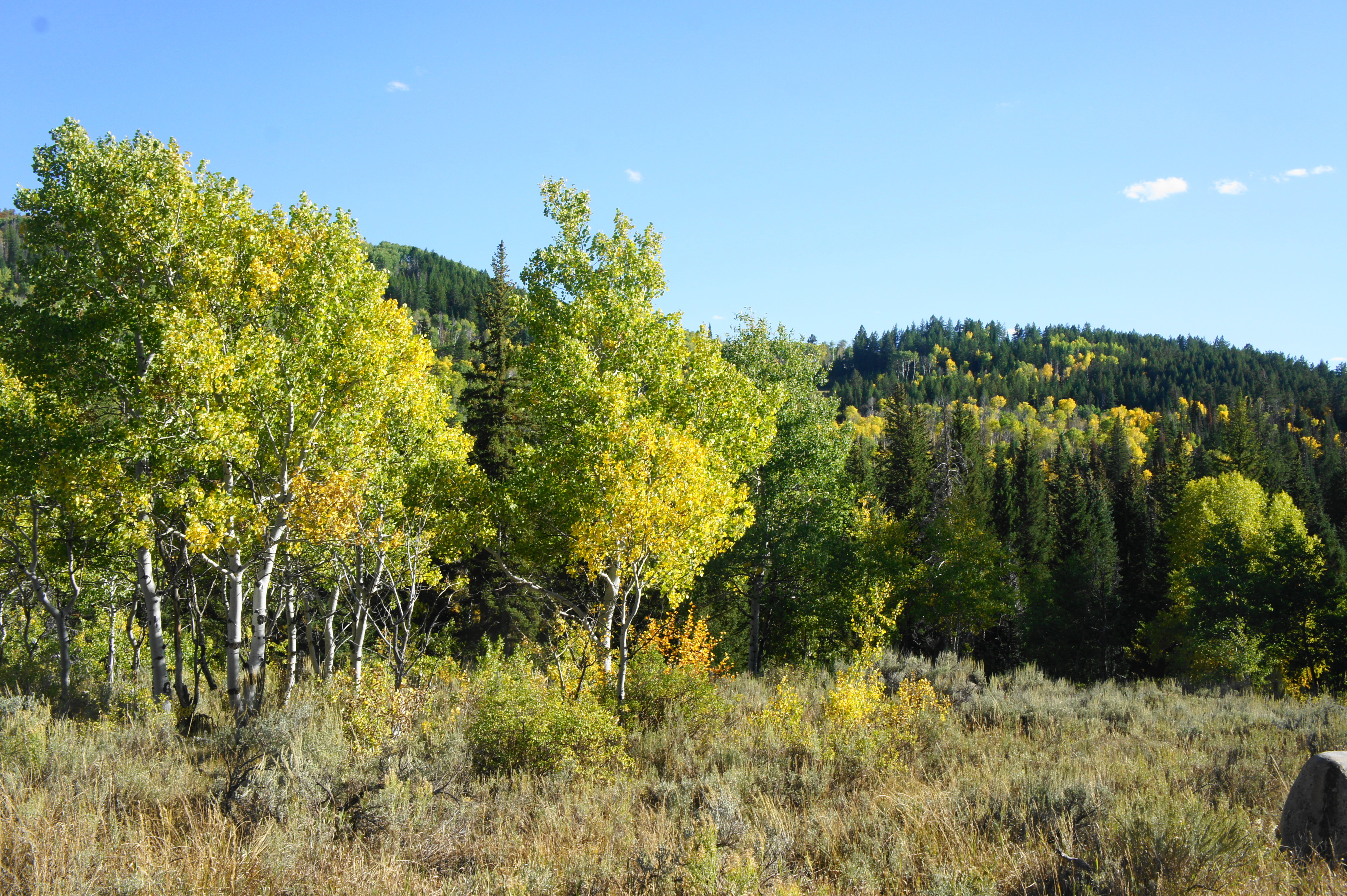
The Mad Creek Trail immediately begins to climb. In contrast with the opposite side of the Mad Creek Valley, this flank is sunny and exposed, with the hillside littered with low-lying scrub oak. The trail keeps its distance from Mad Creek, but, at about 2/10 mile, hikers can look back at the creek and a bridge back near the trailhead that leads over the stream. Within about a quarter-mile from the start, the route rounds a left-hand bend, exposing the deep canyon ahead. Pines become more common as the trail passes under a string of power lines, and a mix of igneous and metamorphic boulders dot the hillside.

In the shadow of a large granite outcrop, there is a good view of the canyon, with its rushing cascades below, at about 4/10 mile. Continuing to hug the canyon’s left flank, hikers will pass a high rock sentinel—likely a volcanic porphyry dike—at the ½-mile mark, followed by a short and mild ascent.

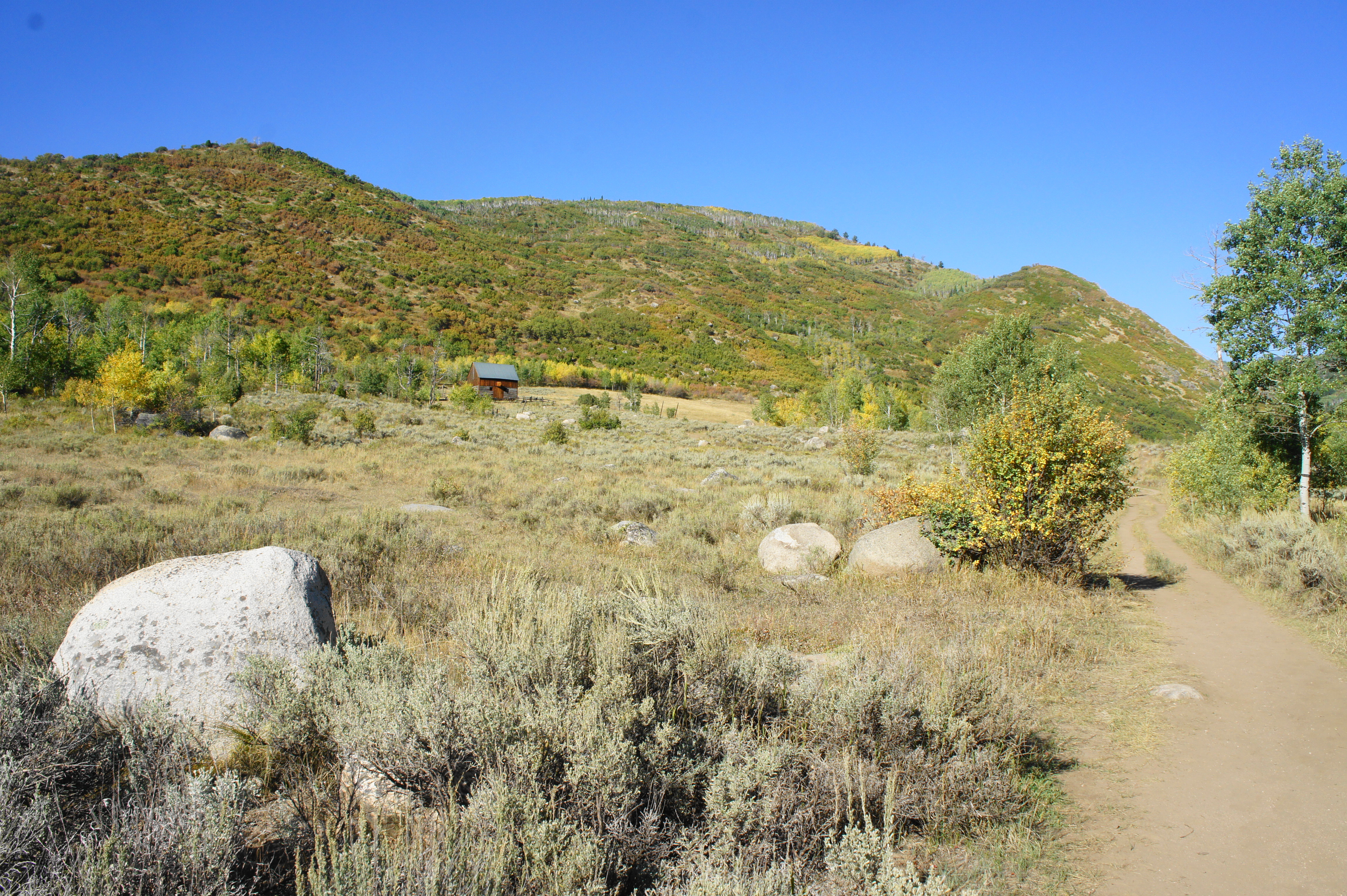
The trail levels out as it cuts through another sunny section with ubiquitous scrub oak. After one mile, a broad mountain appears up the canyon, and one can spot the meadow where the barn is situated. The canyon begins to give way to open pastures, and the sounds of Mad Creek grow stronger as the trail gradually returns to the vicinity of its banks.

Entering an aspen grove, a fence appears on the left, and hikers reach an easy-to-miss trail junction at roughly 1.6 miles. This is the start of the Saddle Trail (#1140), a short connector trail that, if taken to its end, leads to the Red Dirt Trail and beyond. (Note: Ambitious hikers can turn left here, following the Saddle and Red Dirt Trails back to Route 129 for a 10-mile loop.)

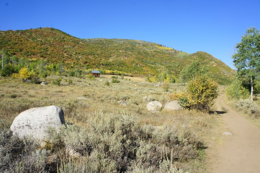
Just beyond, a couple of spur trails provide the hike’s best access to Mad Creek, and the trees vanish into a broad meadow. The Mad Creek Barn is visible ahead. To reach the barn, continue for another 1/10 mile, then bear left at the fork, following what was once an old road to the site.
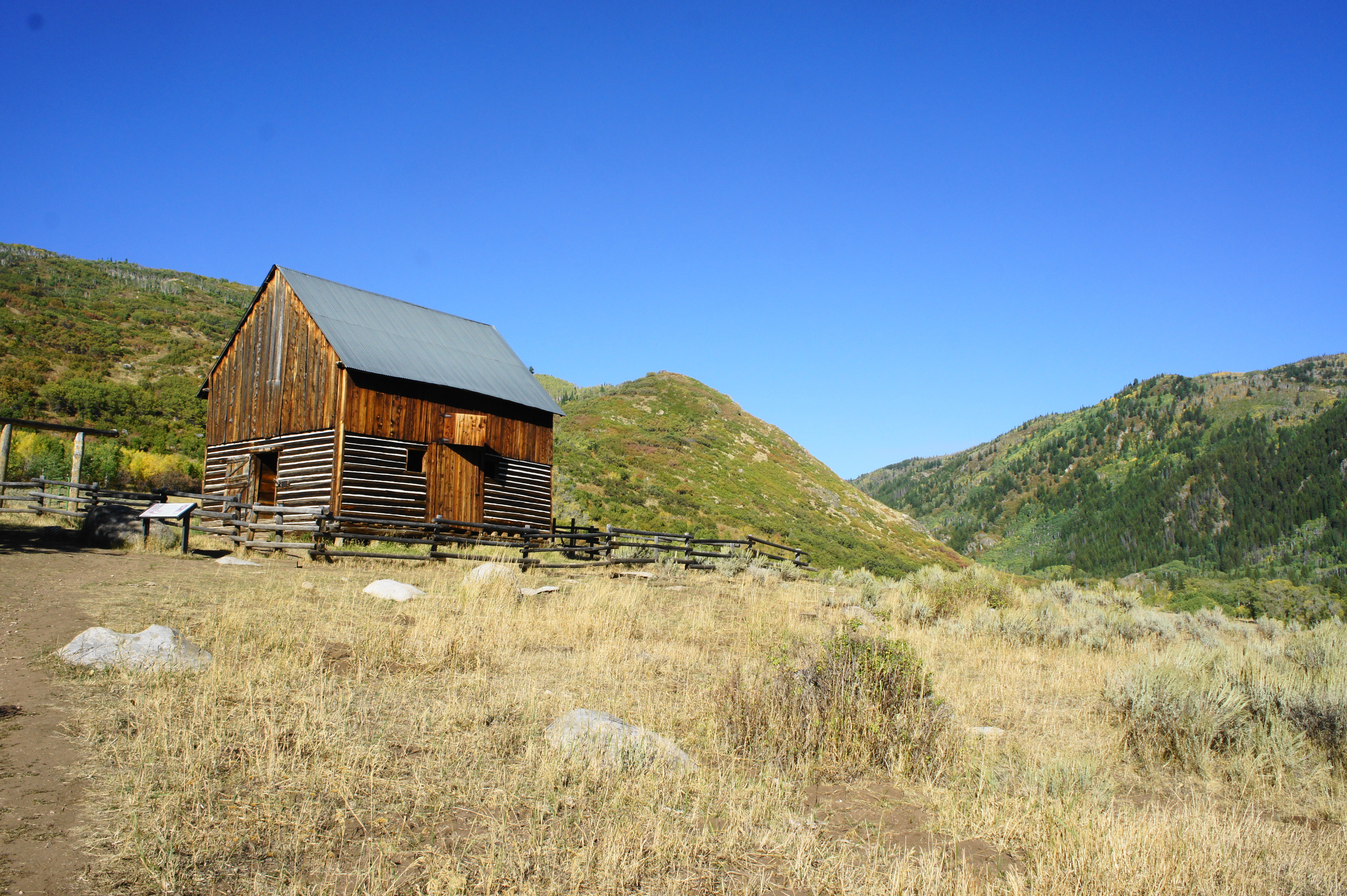
The pioneer-style Mad Creek Barn was built in 1906 by rancher James Ratcliff, who eventually became the first Forest Supervisor for Routt National Forest. The barn fell into disrepair but was restored in 2001 and is now open for exploration. Horse stalls take up much of the room on the first story; for the adventurous, there is a wooden ladder leading to the second floor.
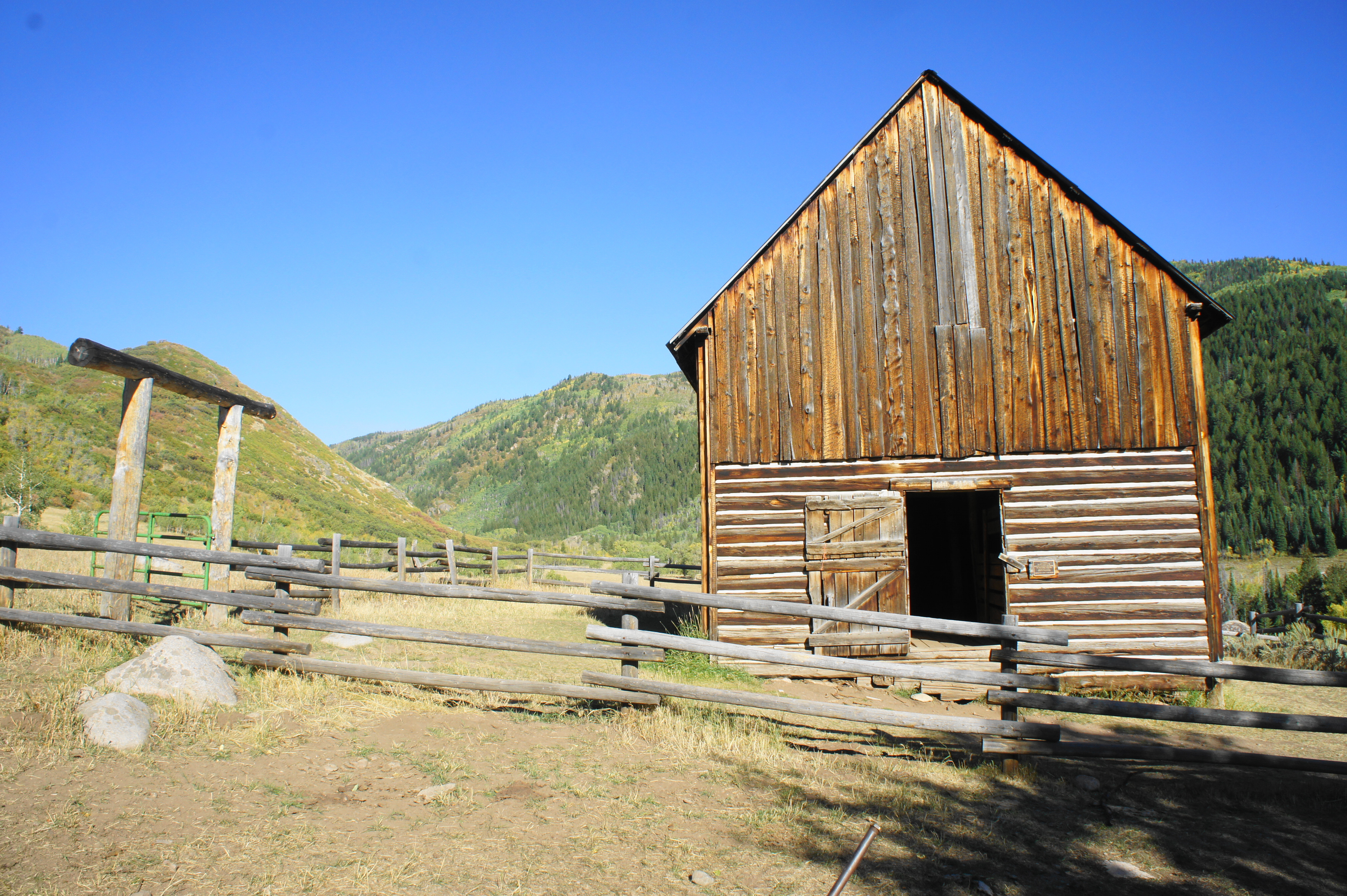

Outside, it is easy to admire the daily view Ratcliff once enjoyed while living here: the U-shaped glacial valley weaves northeast through higher, pine-studded mountains, while the view back south is highlighted by aspen groves and the Mad Creek Canyon. Wildflowers bloom part of the year, and the sounds of flowing Mad Creek are ever-present.
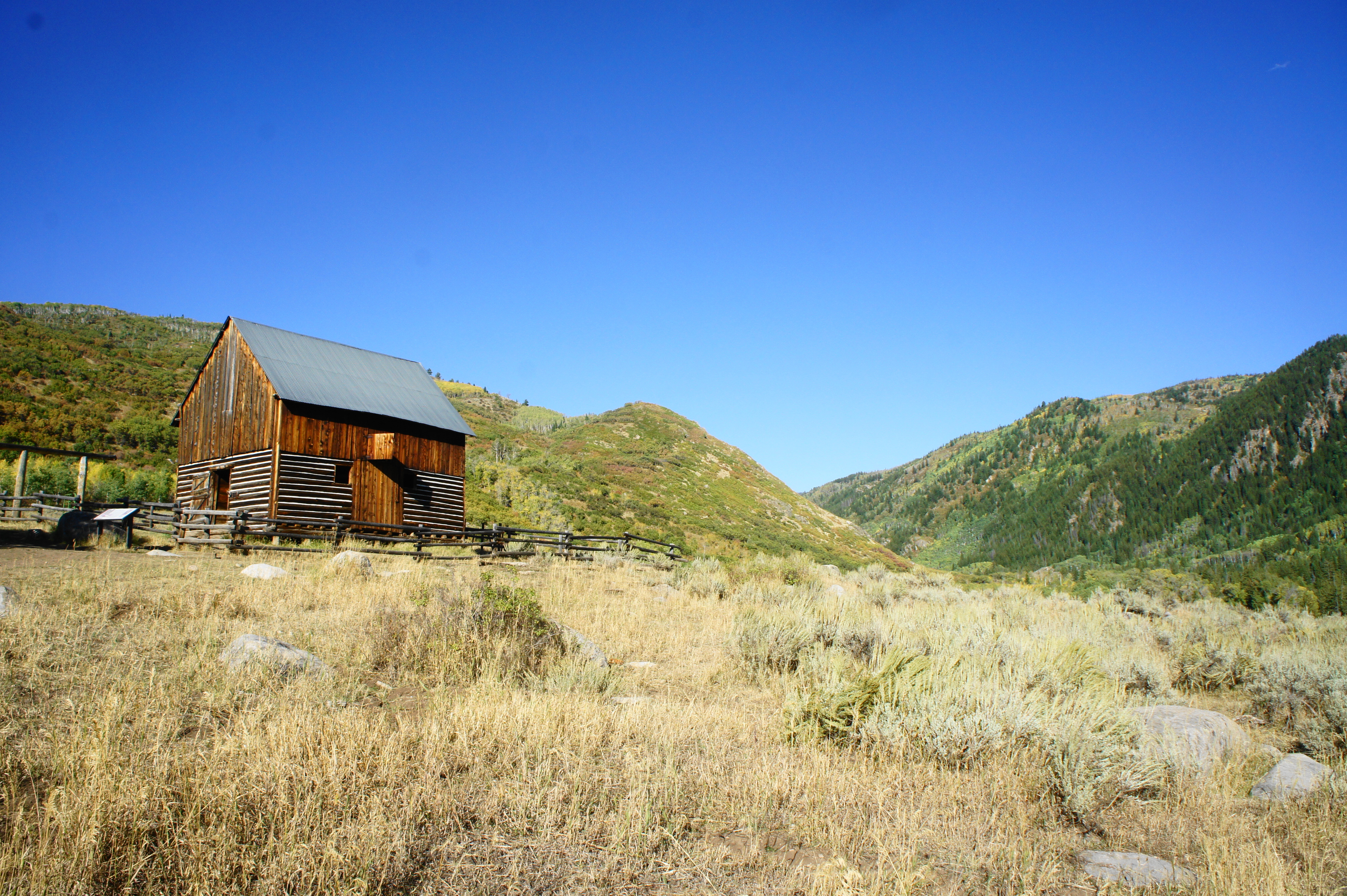
This is the turnaround point for this hike—although ambitious backpackers are welcome to venture further up the Swamp Park Trail into higher terrain. Visitors to the barn should plan for around 1.5-2.5 hours of round-trip hiking.