While many visitors to Steamboat Springs, Colorado flock to Fish Creek Falls Recreation Area to the see the state’s second-highest waterfall, there are in fact two significant waterfalls in the vicinity: the famous 284-foot Fish Creek Falls and the lesser-visited Upper Fish Creek Falls. While significantly shorter in height, Upper Fish Creek Falls is charmingly nestled in a rocky cleft along the heights of a hanging valley, making the roughly 2-mile trek to the falls as interesting as the destination. Upper Fish Creek Falls is situated along the much-longer Fish Creek National Recreation Trail, which extends from the main parking area at Fish Creek Falls to Long Lake high up in the Park Range. (Note: See my post from December 17, 2018 for a description of the shorter Fish Creek Falls Loop.)


The hike
The Fish Creek Falls Recreation Area in Routt National Forest is a top destination in the Steamboat Springs area, and the parking lots are sure to fill up quickly on a nice day or weekend. Arrive early to get a spot and, if forced to park in the lower lot, hike the extra 2/10 mile on a paved track to reach the official trailhead for Fish Creek Falls.
A couple of trails begin at the upper parking area, including the paved and wheelchair-accessible Overlook Trail and the Fish Creek National Recreation Trail (NRT), a dirt track that offers access to both the lower and upper falls. Lower Fish Creek Falls—a titanic cascade at 284 feet—is visible from a small wooden bridge at 2/10 mile. (Note: Stay right at the two junctions with trails heading to the picnic area.)

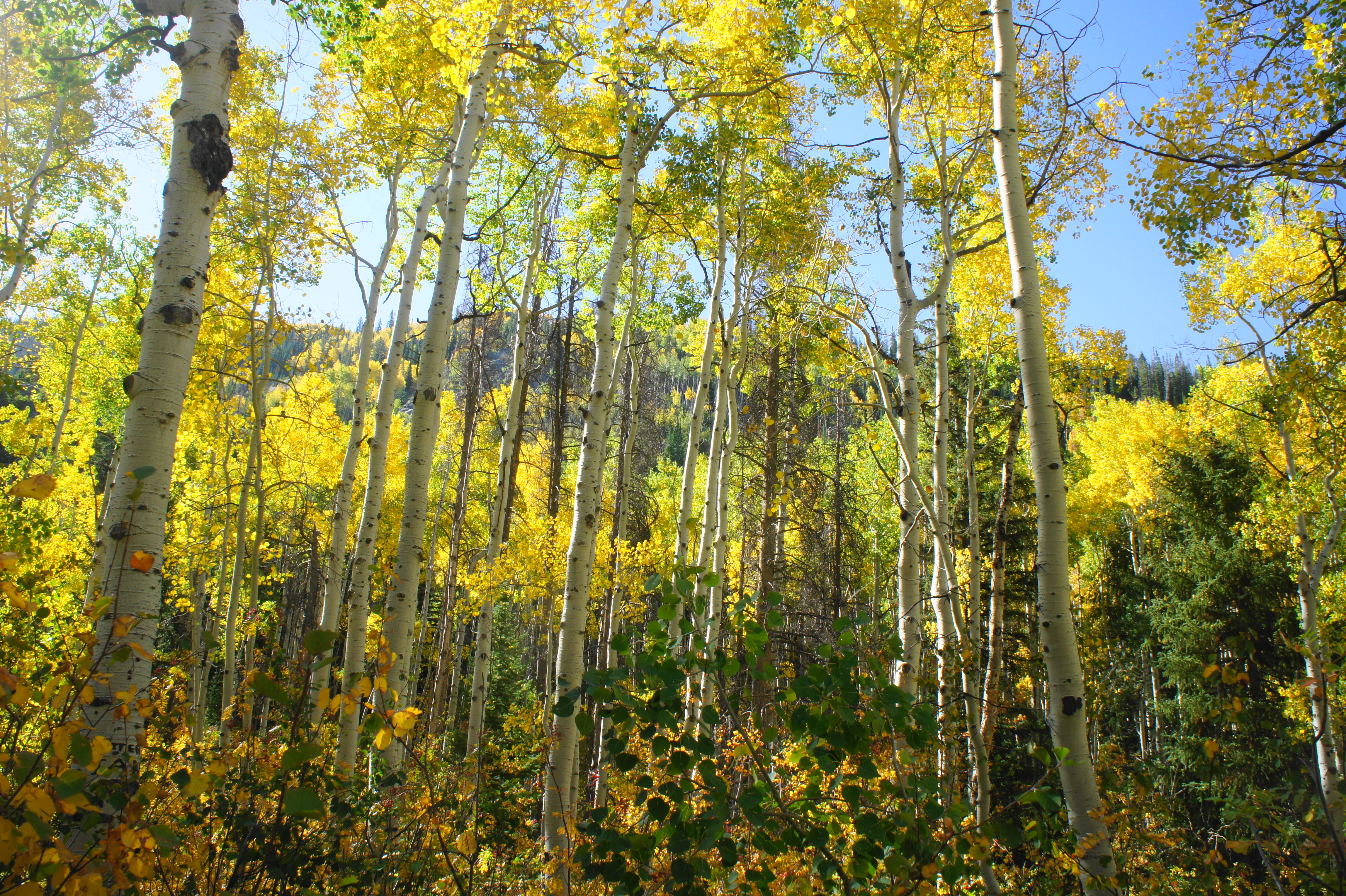
Lower Fish Creek Falls is situated at the terminus of a glaciated hanging valley—a valley above a valley—that will serve as the primary highway for the hike to Upper Fish Creek Falls. To reach the valley, however, requires a steep initial climb, an ascent that begins right away after crossing the bridge. Immediately the Fish Creek NRT gains about 200 feet of elevation within a quarter-mile as it switchbacks out of the lower canyon. Dark metamorphic rocks predominate, while the soil is topped with a variety of pines and—increasingly as you climb—beautiful aspens.

At ½ mile, the switchbacks pause and give way to a straight ascent as the trail bears eastward. Entering the hanging valley, the terrain remains lush with vegetation that largely conceals any views—although an occasional window provides a look back west and north to aspen-covered hills. The switchbacks return around 8/10 mile but then end again within 300 yards. The relentless slope gradually eases thereafter, leading to a pleasant flat section through aspen groves.
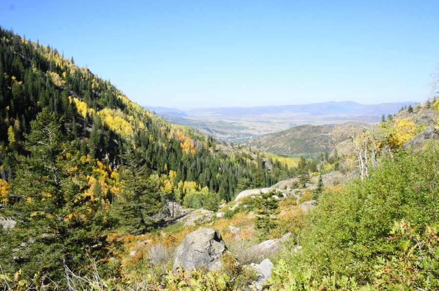
Finally, around 1.25 miles, the trail climbs out of the forest and into a barren, rocky area that affords views of the valley ahead. The rest of the hike to the falls cuts through similar terrain. From here the route flattens out again and even gradually descends in spots as it approaches Fish Creek. Amid relatively dense woods, the trail crosses a wooden bridge over the creek, which is cascading at a decent clip. A large rock slide covers the slope on the right.

Past the bridge, the trail climbs amid scrub oak with views of the hanging valley and down to Steamboat to the west. A particularly scenic section traverses a wide rock ledge at 1.8 miles, hugging a high gray wall as the trail bends to the left. The valley below forms a wide U shape, with the larger flats around Steamboat visible in the distance.

Beyond the ledge section, a shooting cascade appears on the right, and the trail briefly splits. Heading in either direction largely leads to the same place, although the maze of trails can be confusing. At about 1.9 miles, the trail diverges again, with a left turn heading to an overlook.

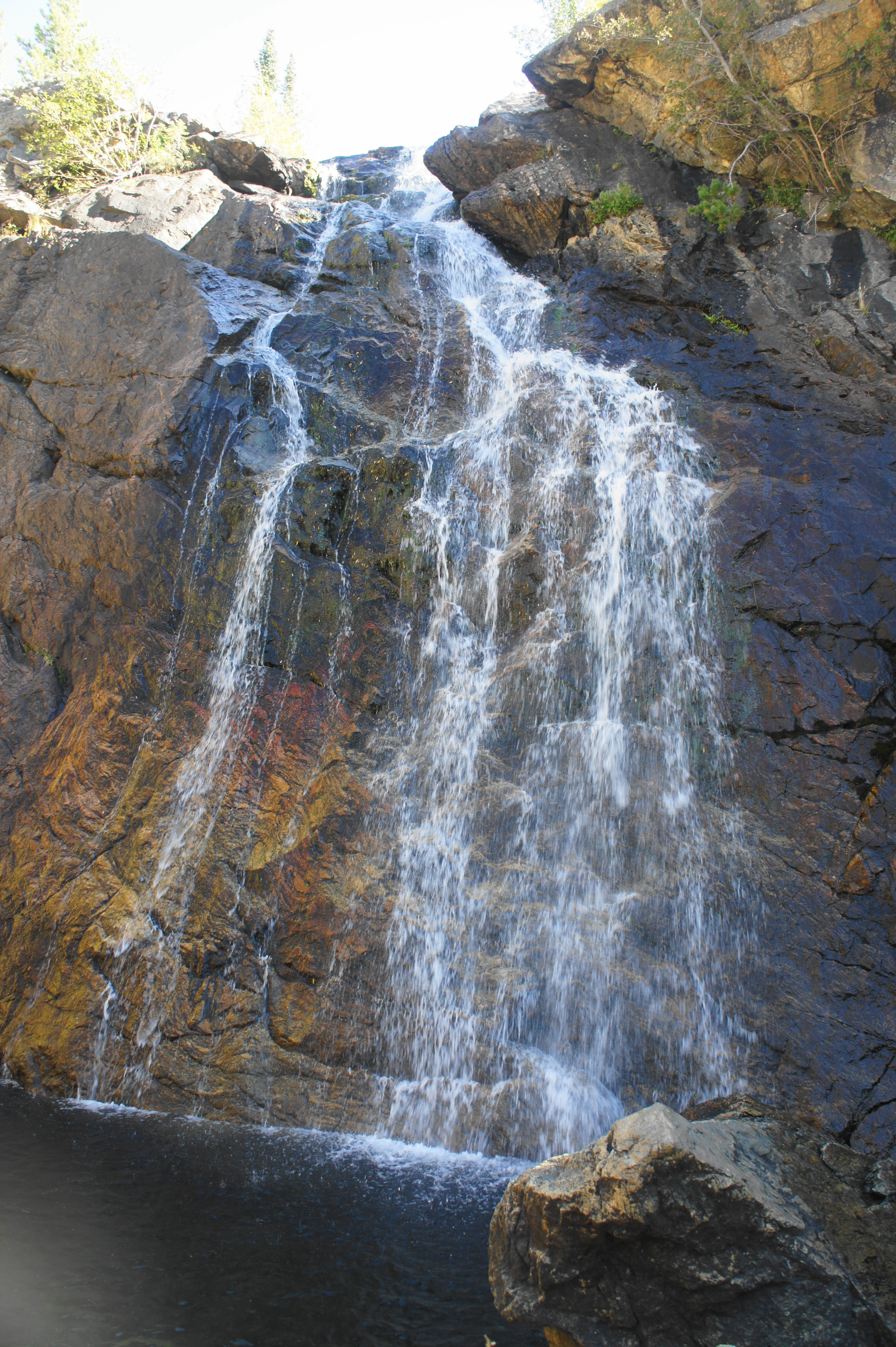
Continue right, climbing out of an area of dense scrub. After cresting a ridge, the trail drops, and the sounds of Upper Fish Creek Falls roar louder. The falls are not located on Fish Creek proper, but rather a minor tributary that nonetheless carries water year-round.
At 2.1 miles, the hike ends at the waterfall, and there are plenty of fine places to stop and sit for a snack or lunch. The often-shaded cascade drops 20-30 feet into a small pool, with the volume of water depending largely on the season: obviously spring and early summer are the best time to catch the snowmelt as it thunders over the falls.


The Fish Creek NRT continues for another four miles to Long Lake and connects with the Continental Divide Trail at an elevation above 10,500 feet. However, most day hikers will want to turn around at the upper falls, returning the way you came. With time set aside for lunch and photography stops, it’s best to allot at least 2 ½ hours for the round-trip hike from Fish Creek Falls Recreation Area.

Pingback: Fish Creek Falls Loop (Routt National Forest, CO) | Live and Let Hike
Pingback: Top 10 Hikes in 2018 | Live and Let Hike
Thanks for the awesome description of Fish Creek Falls! I just wanted to note the $5 cash or check parking fee required at the trailhead. An Annual Day-Use Pass for Medicine Bow-Routt National Forests or an America The Beautiful pass are also accepted. Visitors can also purchase a $5 day use pass in advance here- https://www.recreation.gov/sitepass/74376