
Driving west toward Steamboat Springs on US Route 40 in northern Colorado, one of the most noticeable mountains is Rabbit Ears Peak (10,654’). Although its namesake “ears” have partly deteriorated, the multi-pronged peak remains an iconic fixture of the Steamboat area. A moderately difficult climb of around 1,050 feet—stretched out across 2.6 miles—offers hikers access to the summit and unlocks panoramic views of the Park Range and beyond.

The hike
The route to Rabbit Ears Peak begins near Dumont Lake, just west of Rabbit Ears Pass (9,573’) on US Route 40. Bear north on the well-maintained, gravel pitch toward Dumont Lake, but instead of bearing left to the lake and picnic area, continue straight, then take the second left. Many hikers park here, but it is possible to continue another ¼ mile up another gravel road to the start. Bear right at the first fork (there is, amusingly, a rabbit-shaped sign marking the way to Rabbit Ears), then immediately park on the left or right. (Note: The road continues beyond but quickly becomes a 4-wheel-drive track.)
From this parking area, the hike begins by continuing northeast up Forest Road 291 (a.k.a. Grizzly Creek Road). The dirt track climbs gradually and quickly offers views east across a grassy meadow, followed by the first look at Rabbit Ears Peak at about the ¼-mile mark. The destination remains in sight for much of the hike, although it always seems to take longer to reach than it initially appears…
At around 0.35 miles, the trail dips to cross a dry wash, and the road gets significantly rougher. (Note: It is feasible to drive a standard, 2-wheel-drive car to this point, but it is virtually impossible thereafter.) Just beyond, the trail enters a long, open meadow with continued views of Rabbit Ears. As the vegetation gives way, the route is in full sun for a lengthy stretch, interrupted only briefly by a minor cut through a line of pines at ¾ mile.

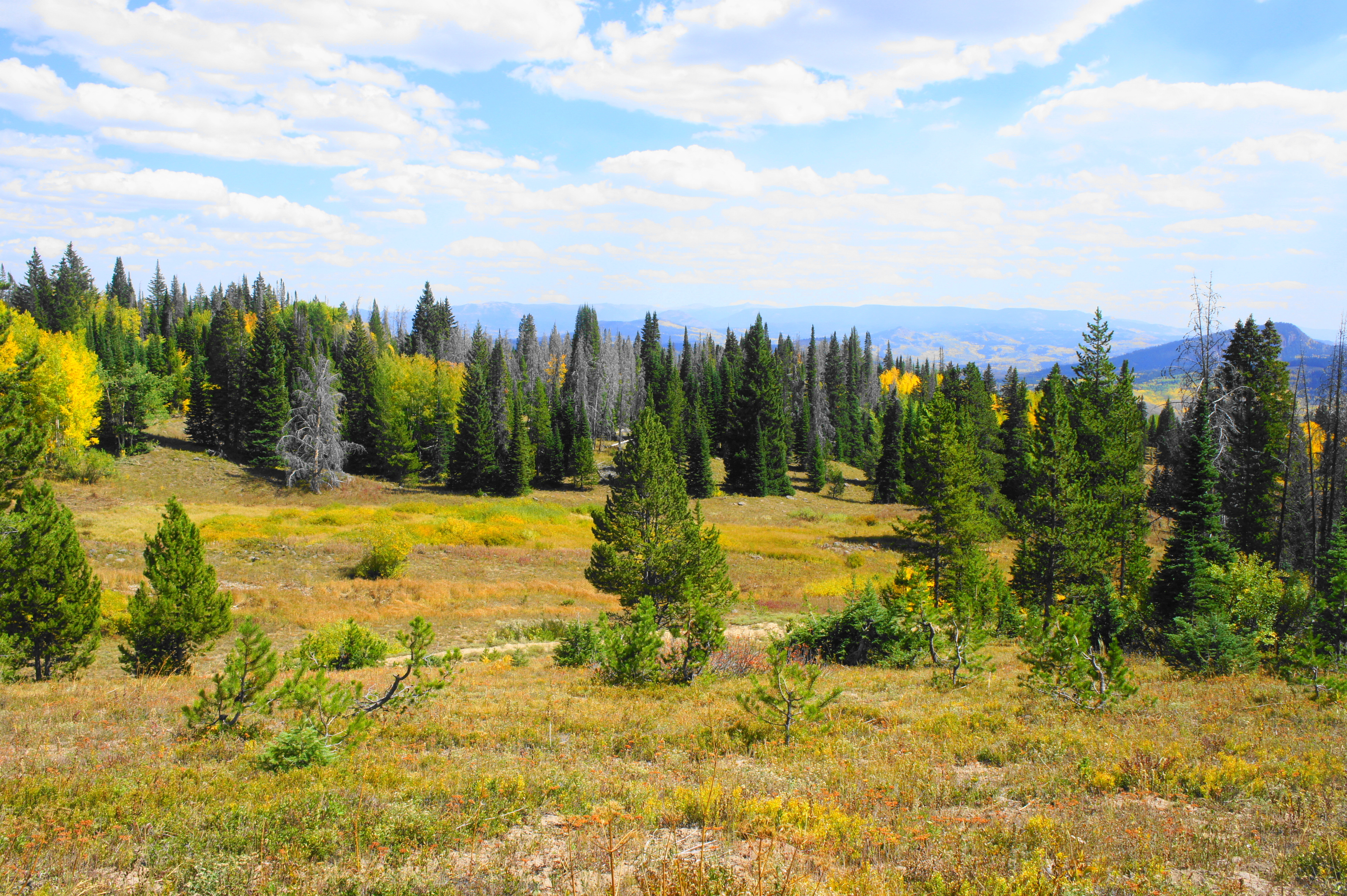
The second meadow is even larger, and the track continues to mildly gain elevation. By now you can make out the broader ridgeline to the north that connects Rabbit Ears Peak with the Park Range and Continental Divide. At about 1.2 miles, the trail crosses a minor stream—a tributary of Grizzly Creek—and there are sometimes trucks and jeeps parked near the water’s edge. (Note: It is possible to continue driving past here, although the creek crossing is likely to be difficult for all but ATVs.)
Beyond the creek, the long meadow continues. A short steep section leads into a brief respite of shade before returning to the open terrain. At the end of this meadow, there is a steep climb through a stand of pines. Following another sunny section, the summit of Rabbit Ears briefly disappears from view and the path cuts sharply right. Now well immersed among the trees, the path bobs up and down, then flattens considerably.
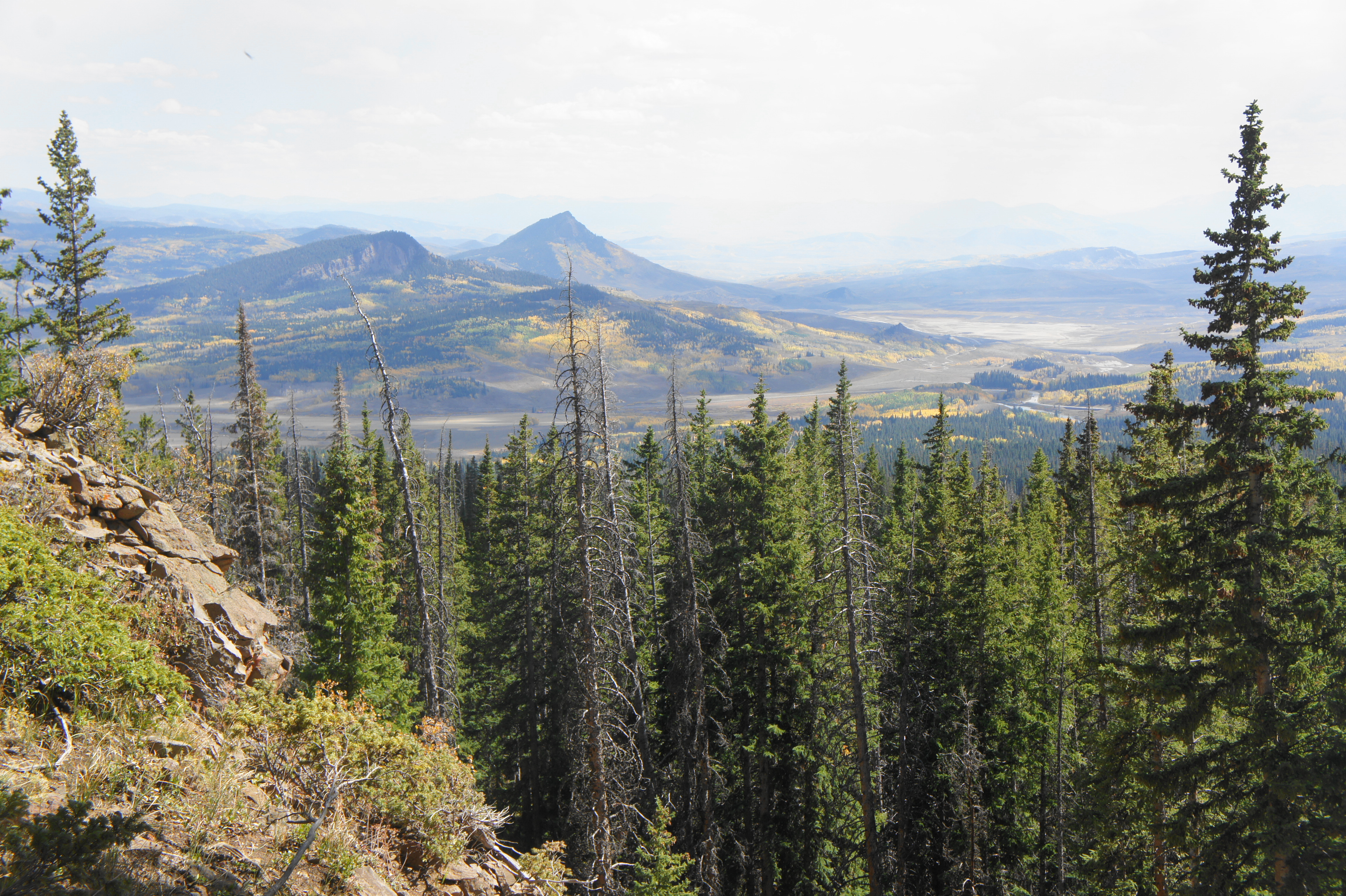
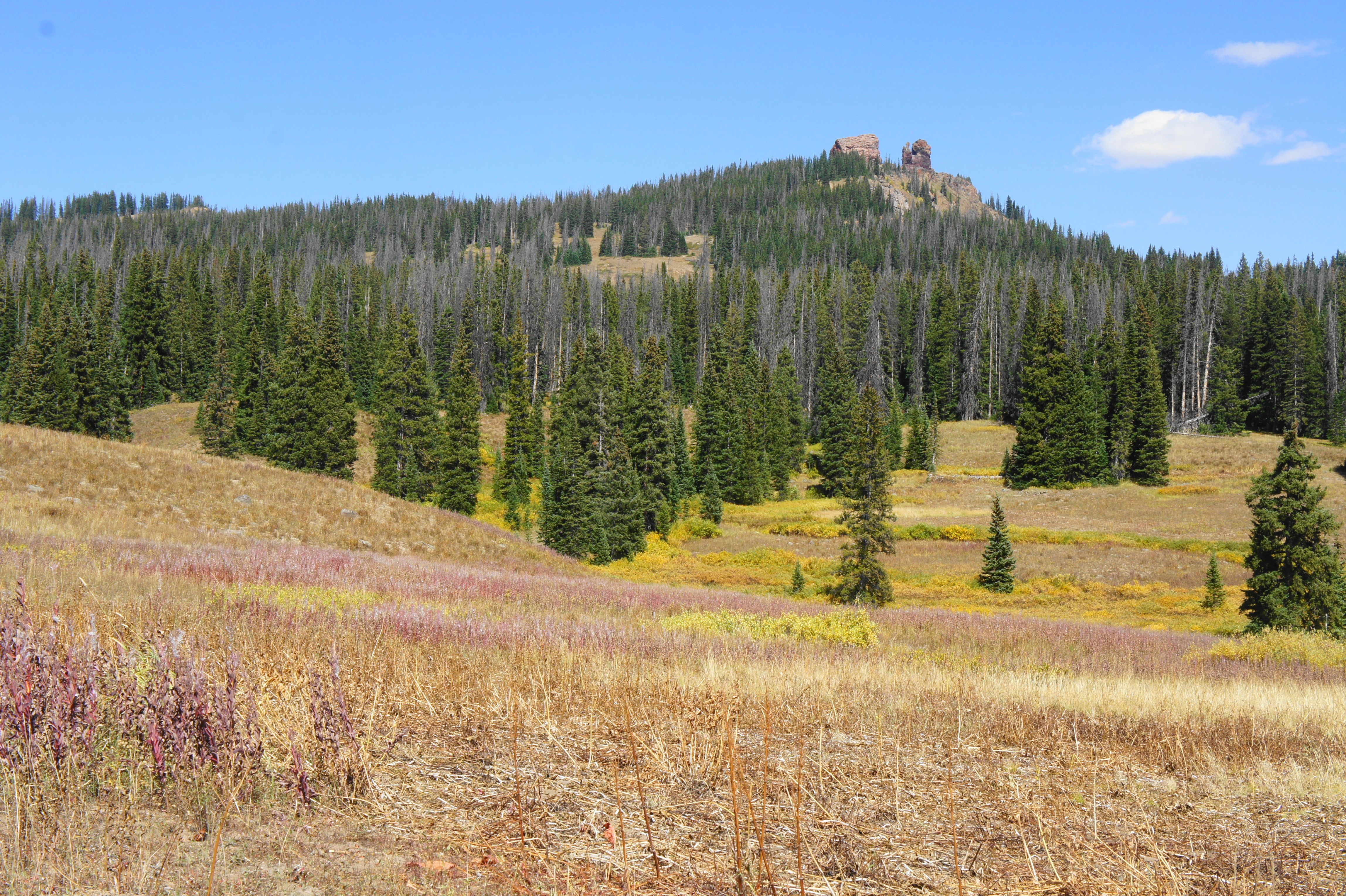
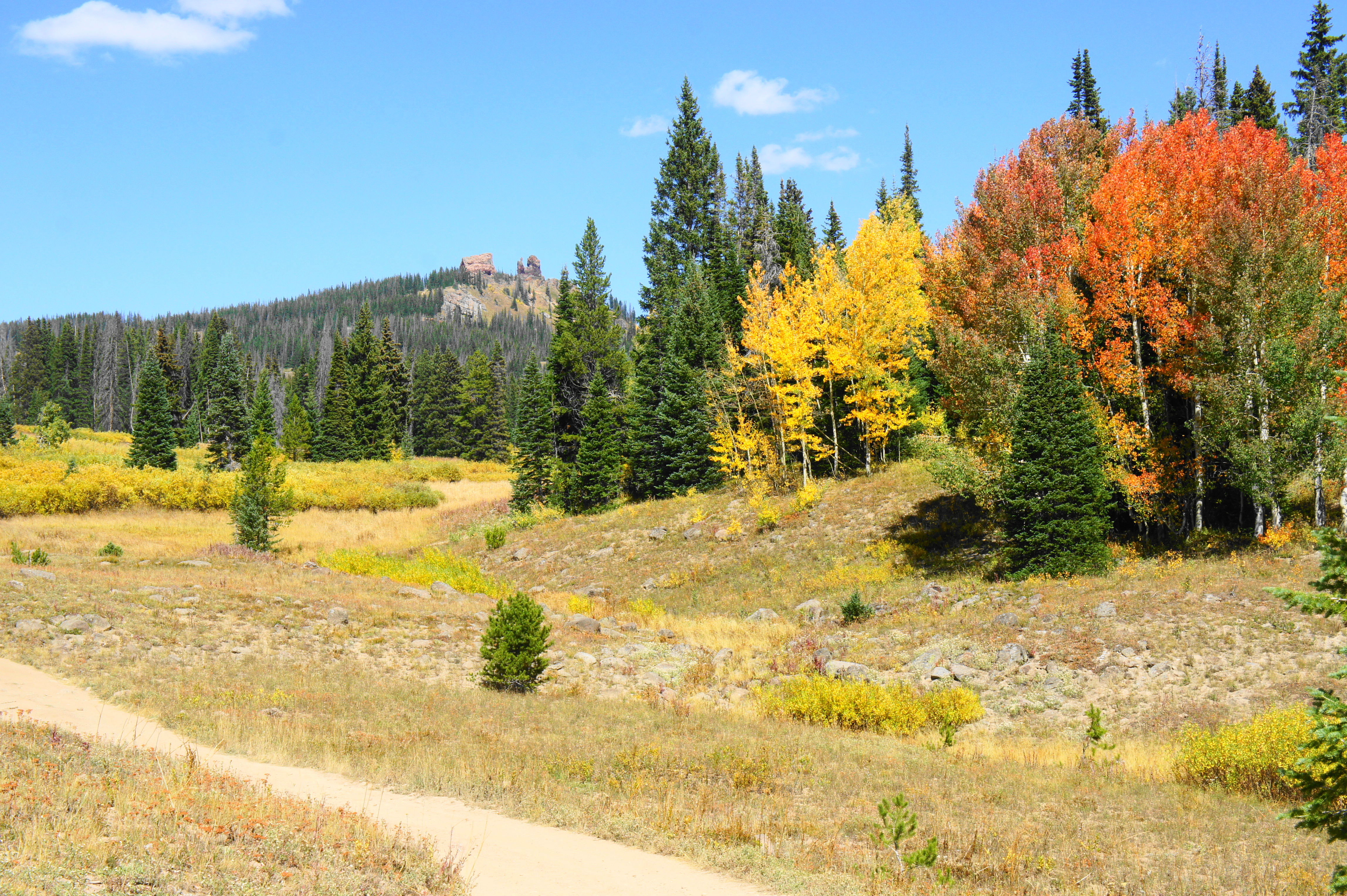
At 2.1 miles, the trail bends east and climbs sharply. With the summit again briefly in view, the route takes a right and leads to a fantastic vista. The most striking feature of the multihued valley below is Whiteley Peak (10,115’), a pointy pyramid that stands alone. In front of Whiteley is Bear Mountain (9,845’), another peak in the Rabbit Ears Range. To the left is a collection of volcanic crags, remains of material launched from a nearby volcano between 23-33 million years ago—often confused for intrusive rocks that were part of the volcano itself. The basalt outcrops continue on your right as you approach the summit. (Note: Even ATVs riders must disembark at this viewpoint, as the terrain beyond is the steepest of the hike.)
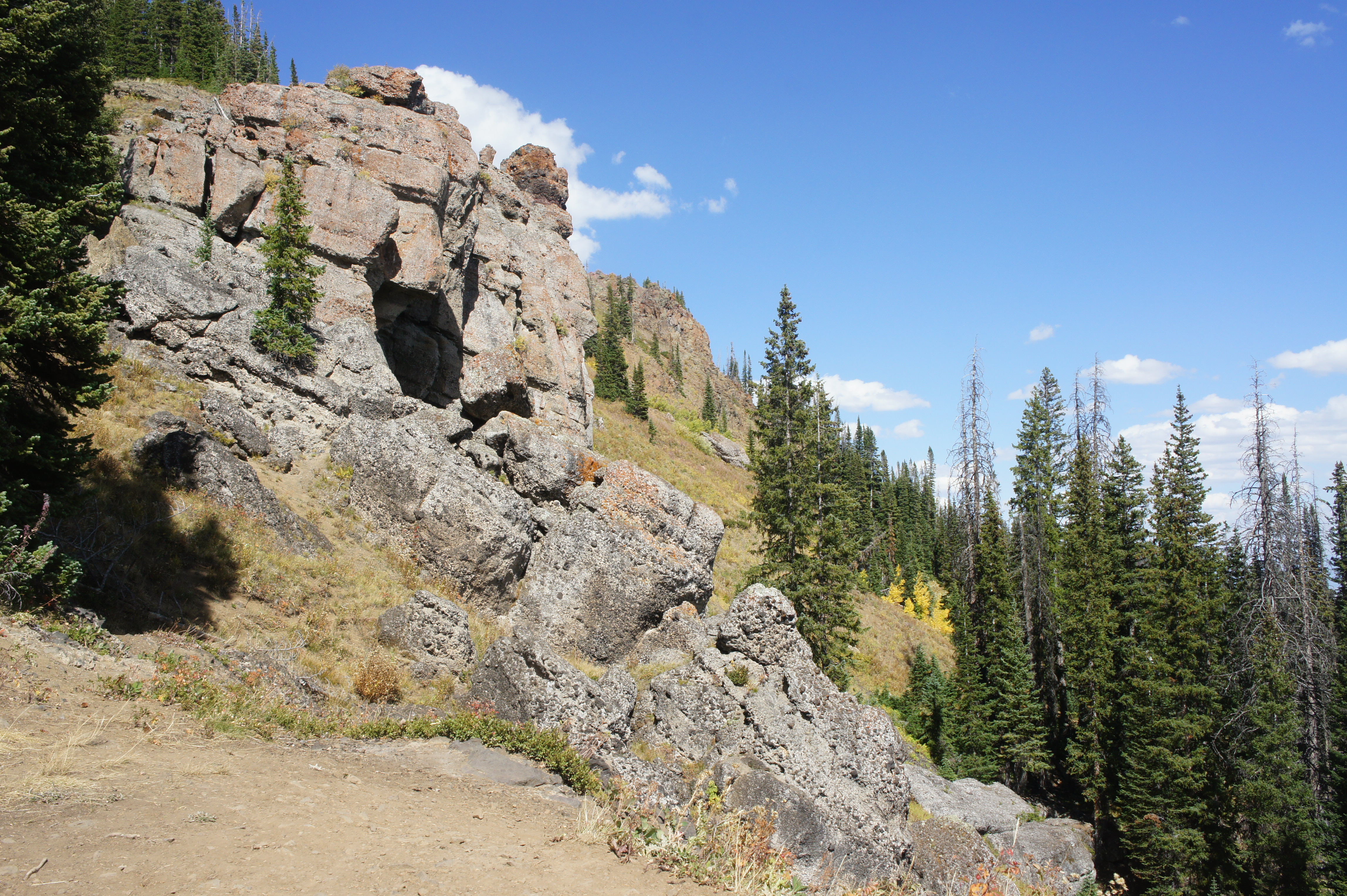
Beyond the viewpoint, the trail enters an atrociously steep ascent, complete with zero switchbacks to ease the climb. The destination is within reach, however, providing the extra motivation needed to push onward. At 2.5 miles, the road levels out and approaches the base of a red and gray speckled outcrop—often referred to as the “Rabbit’s Back.” The actual “ears” lay hidden beyond, but this outcrop is worth exploring (and, while potentially hazardous, possible to climb without ropes).

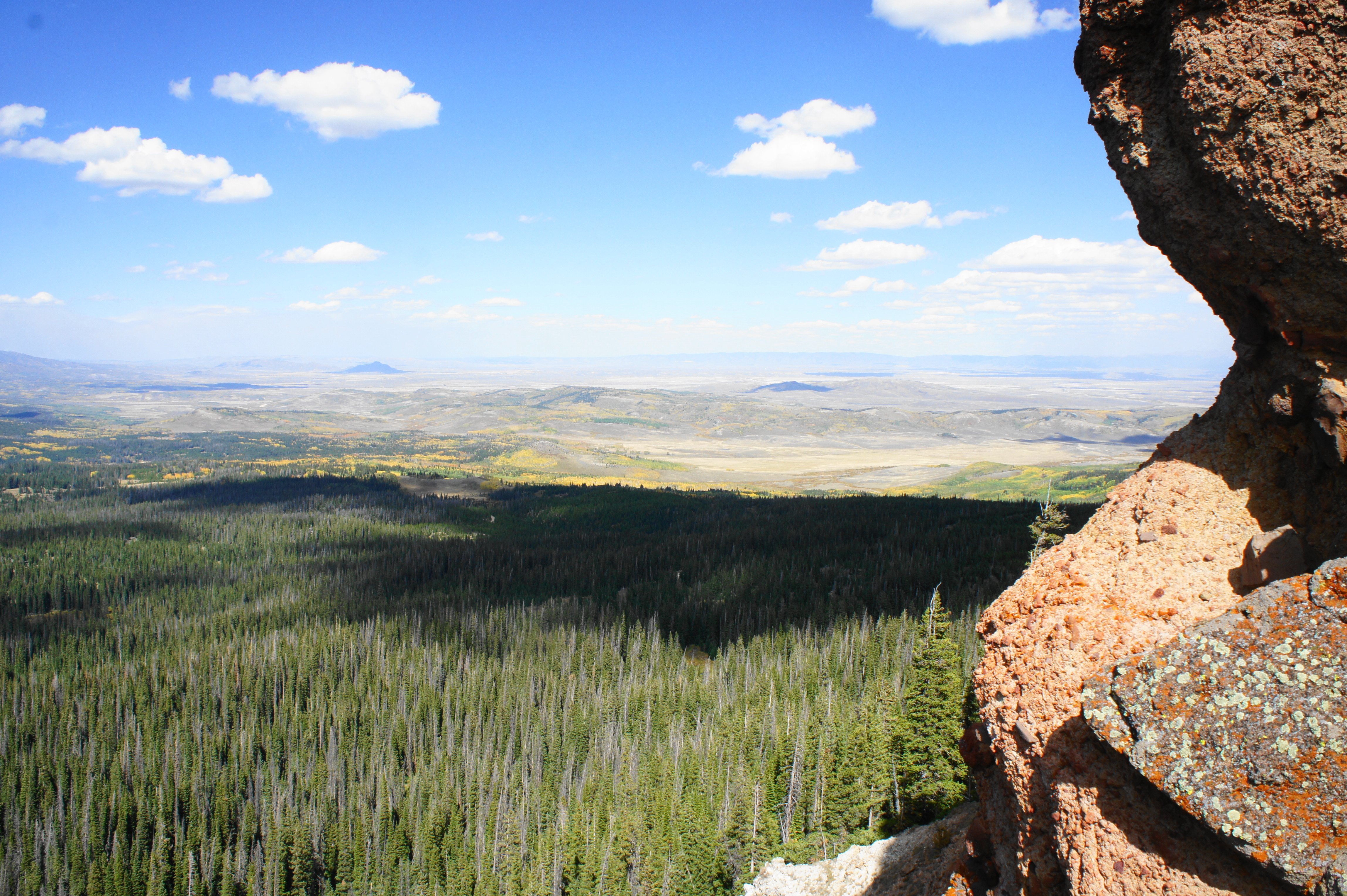
To the north, an excellent view unfolds of the Park Range: the hulking mass in the foreground is Elmo Point (10,692’), followed by a set of even higher ridgelines that extend into the Mount Zirkel Wilderness. The low-lying valley to the northeast, which appears dry and desolate, is the North Park Basin, where Walden, Colorado is located.

Stay to the south side of the Rabbit’s Back to reach the Rabbit Ears. After an initial climb that requires some minor scrambling, a well-worn hiker’s trail provides a level path to the base of the Ears. The two thumbs tower well over 50 feet. (Note: The west (and closest) tower lost a chunk of its mass in recent years, leaving a slender version that nonetheless remains prominent.) From the saddle between the Ears and Rabbit’s Back, vistas open up to the north and south—although the often-fierce wind can prevent many visitors from wanting to stay too long.


This marks the end of the 2.6-mile walk—return the way you came for a 5.2-mile out-and-back that takes between 2.5 and four hours, depending on pace.

Pingback: Top 10 Hikes in 2018 | Live and Let Hike
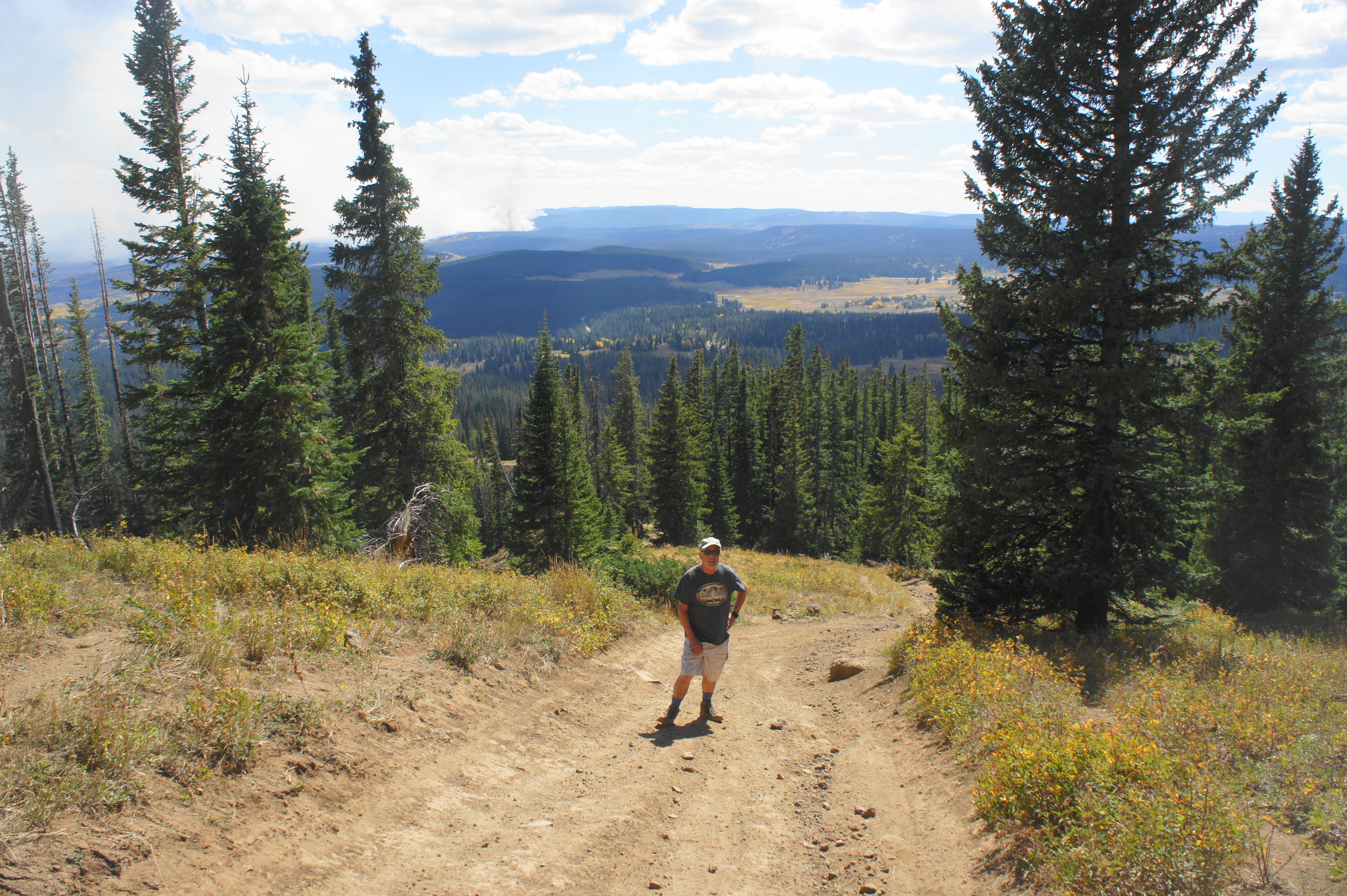
Did this drive today in a stock 2020 Wrangler Willy’s 4-door. It took a little bobbing and weaving, but could drive all up to the point where the article says “even ATVs riders must disembark… Crossing the grizzly creek tributary was the toughest part but did not bottom or spin, just had to think and maneuver a bit- might be much tougher in the spring or early summer. I am far from expert off road driver as this is the second drive I have done in 30 years- though used to do a fair bit back then.
Nice. Certainly makes the hike easier if you’re able to tackle most of it in a jeep!