
Although lacking the allure of the nearby Tracks in the Sand Trail, the Soundside Nature Trail in North Carolina’s Jockey’s Ridge State Park offers a pleasant and easy stroll through diverse terrain. The dunes of Jockey’s Ridge—the highest on the East Coast—are visible from the path, but the circuit hike largely keeps its distance from them in favor of maritime thicket. Spur trails offer access to the shores of windy Roanoke Sound.

The hike
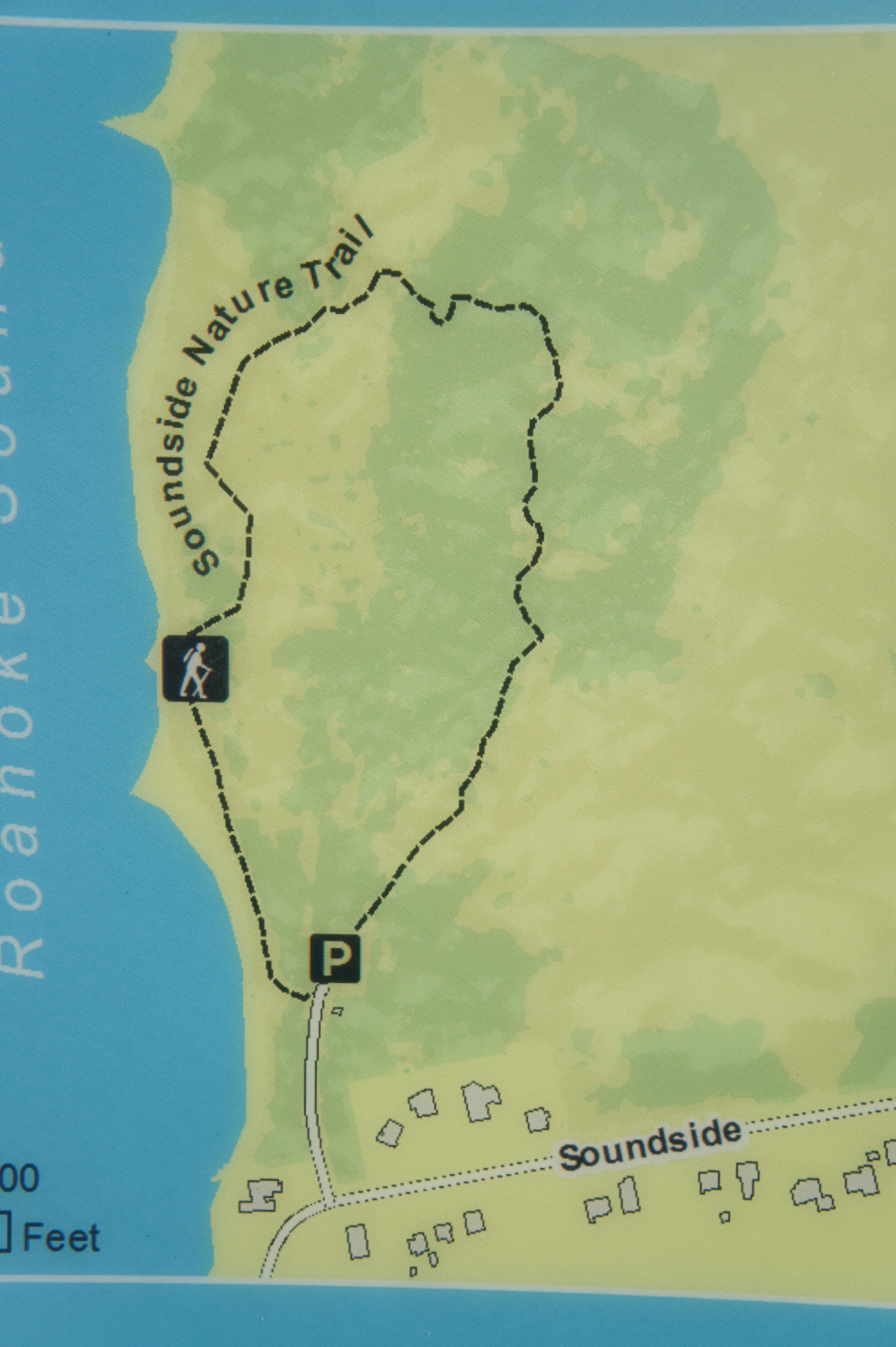
Unlike other routes in the park, reaching the trailhead for the Soundside Nature Trail requires leaving the park and driving around to the southern end of Jockey’s Ridge. From Croatan Highway in Nags Head, bear west on Soundside Road, a semi-residential drive. Just as the road begins to bend southward, take a right into the signed parking area.
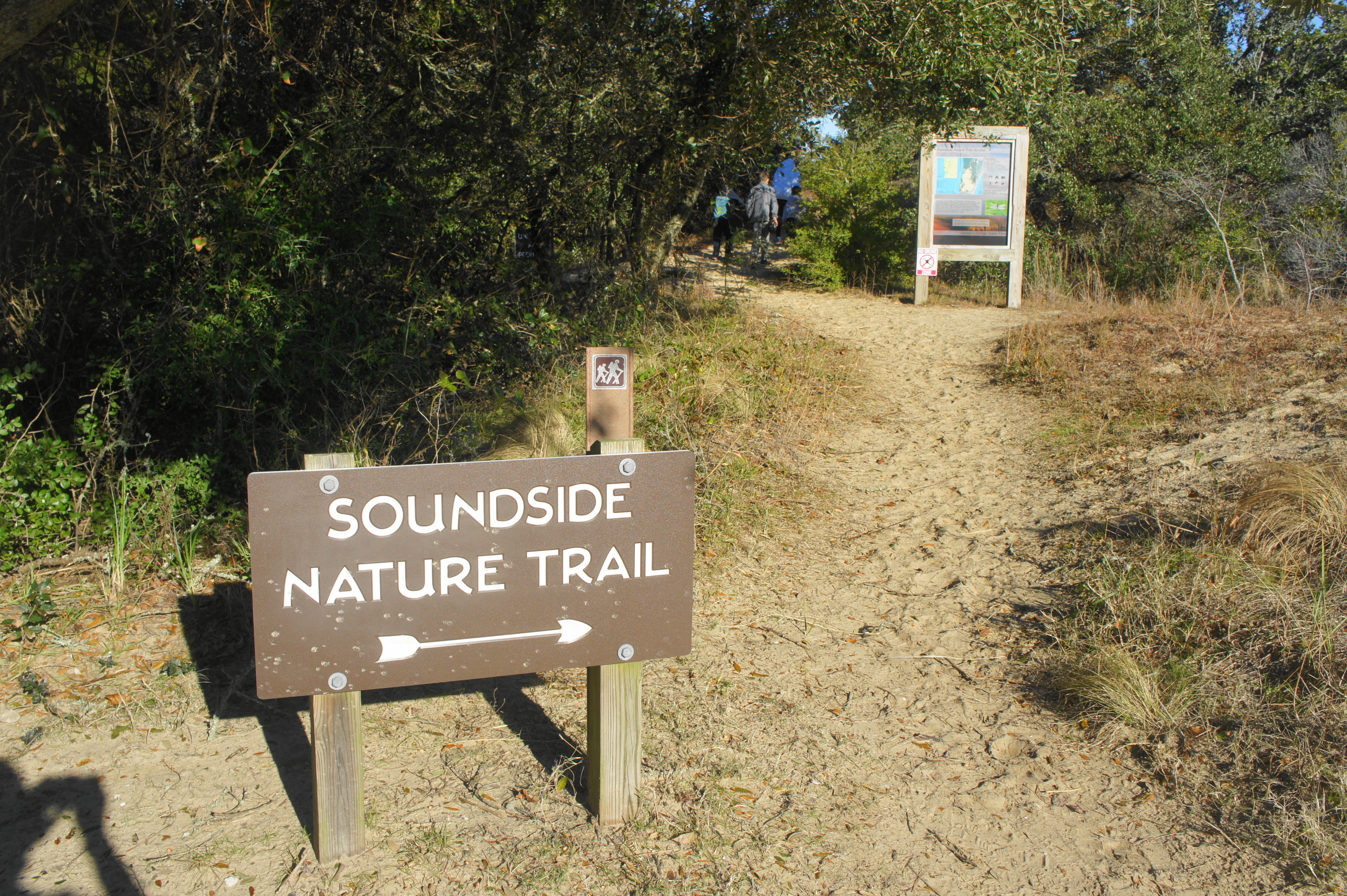
It’s hard to miss the trail’s start, which is marked with a large sign complete with a small map. Just steps from the beginning, however, the trail reaches its first junction—a winding bend offers access to the left or right. Stay right—following the plastic stakes with directional arrows—to traverse the circuit in a counterclockwise direction. This part of the hike is relatively open, with brush giving way to thick clumps of sand.
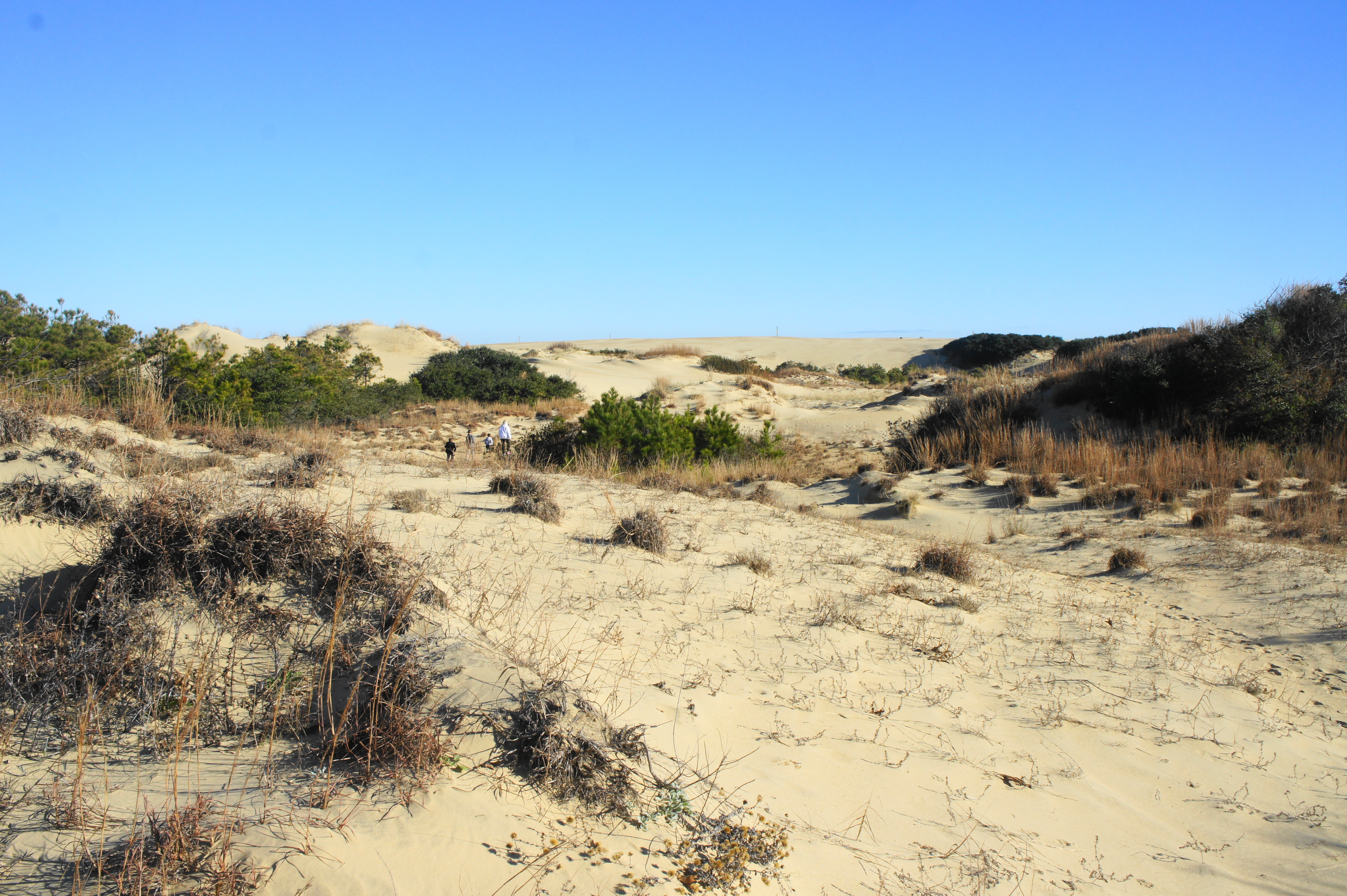
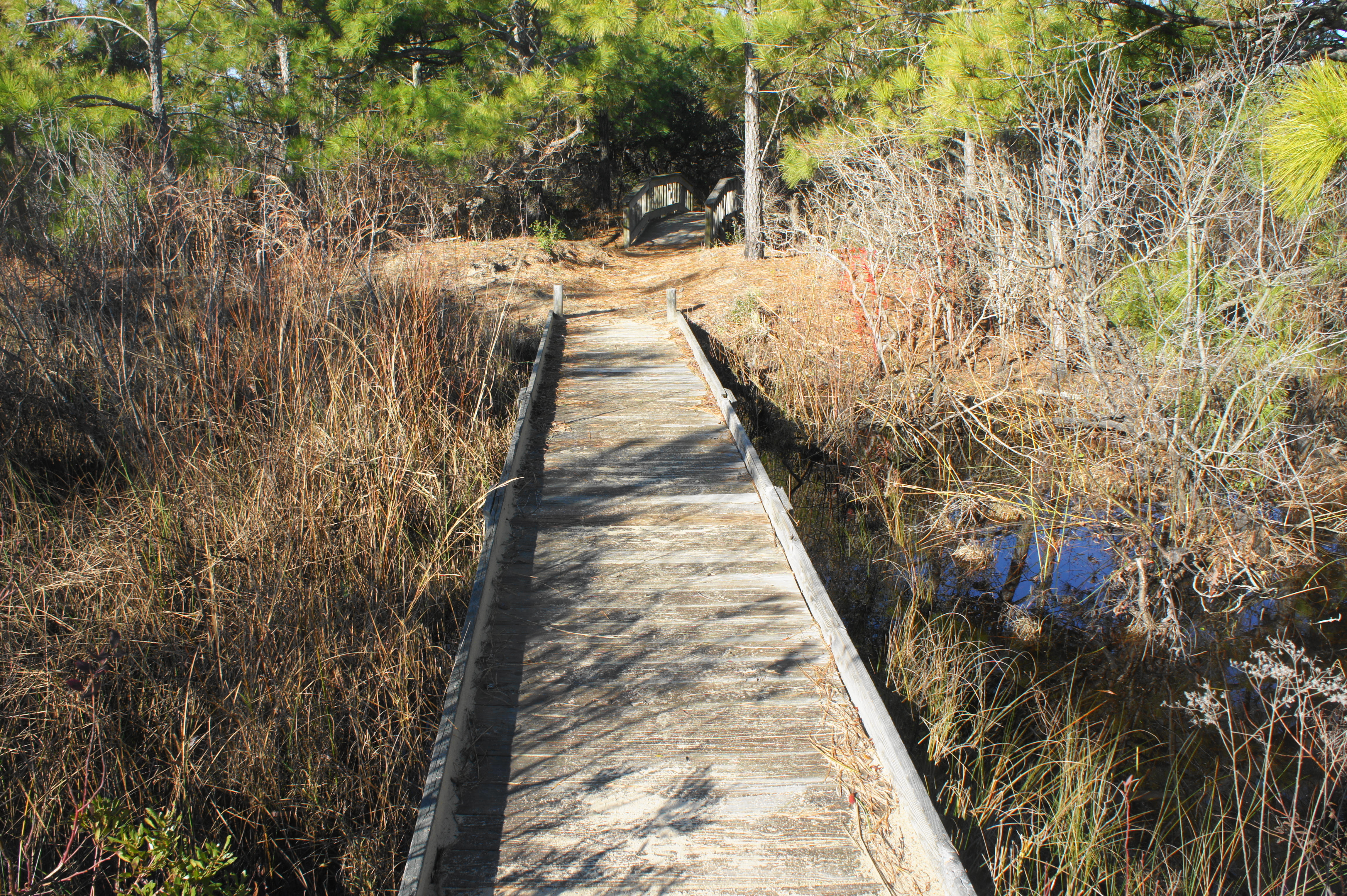
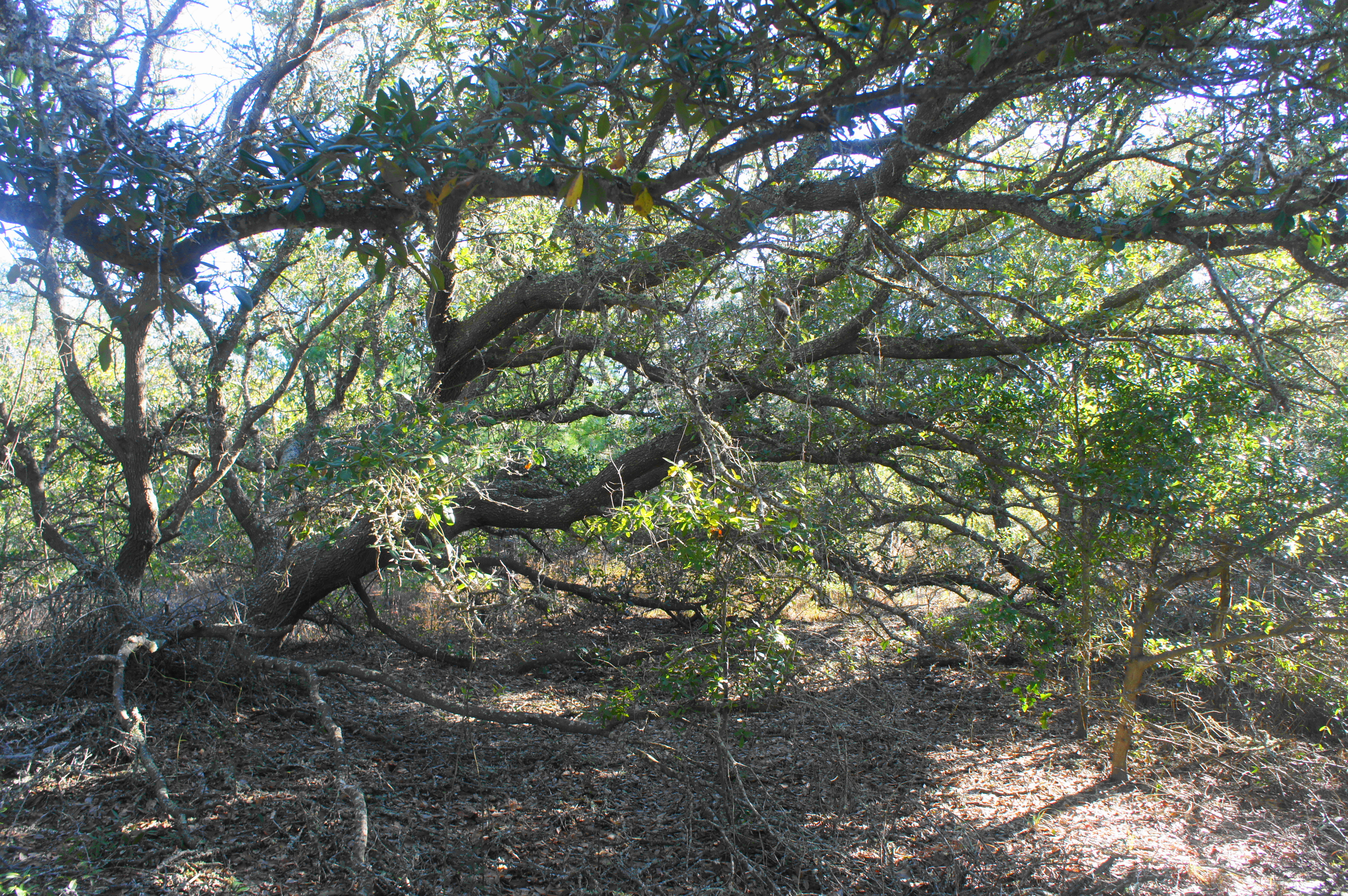
At around 150 yards, the route splits again. Meandering off to the right offers access to the high dunes in the distance, while the trail bears left and narrows to a single-track. On the left is a small marsh, overgrown with tall grasses. About 250 yards from the start, the path bears left and traverses a pair of wooden bridges. The terrain beyond is dominated by loblolly pines, as well as red bay, wax myrtle, live oak, and the occasional juniper.
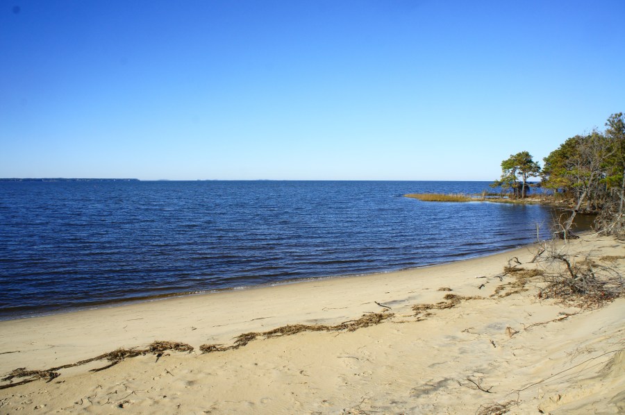
After 3/10 miles, the trail approaches a boardwalk and tall set of stairs, climbing to surmount a minor ridgeline. From there it is down again, dropping to an open area that resembles a sand superhighway. Bear left (following the arrows), then explore the spur trail heading off to the right: this path provides access to the shores of Roanoke Sound. This namesake body of water separates the Outer Banks from Roanoke Island and feeds into the larger Albemarle Sound.

Returning to the main trail, bear right and follow the path as it reenters the brush, following an old jeep track. A four-way junction at ½ mile offers access again to the shores of Roanoke Sound. The final stretch of trail traverses grass-laced terrain amid relatively high trees and shrubs. With the parking area back in sight, the track bears left, but a clearing provides access straight back to your car.
This short jaunt—good for kids and dog walkers—lasts 20-30 minutes and clocks in at a modest 6/10 mile.
