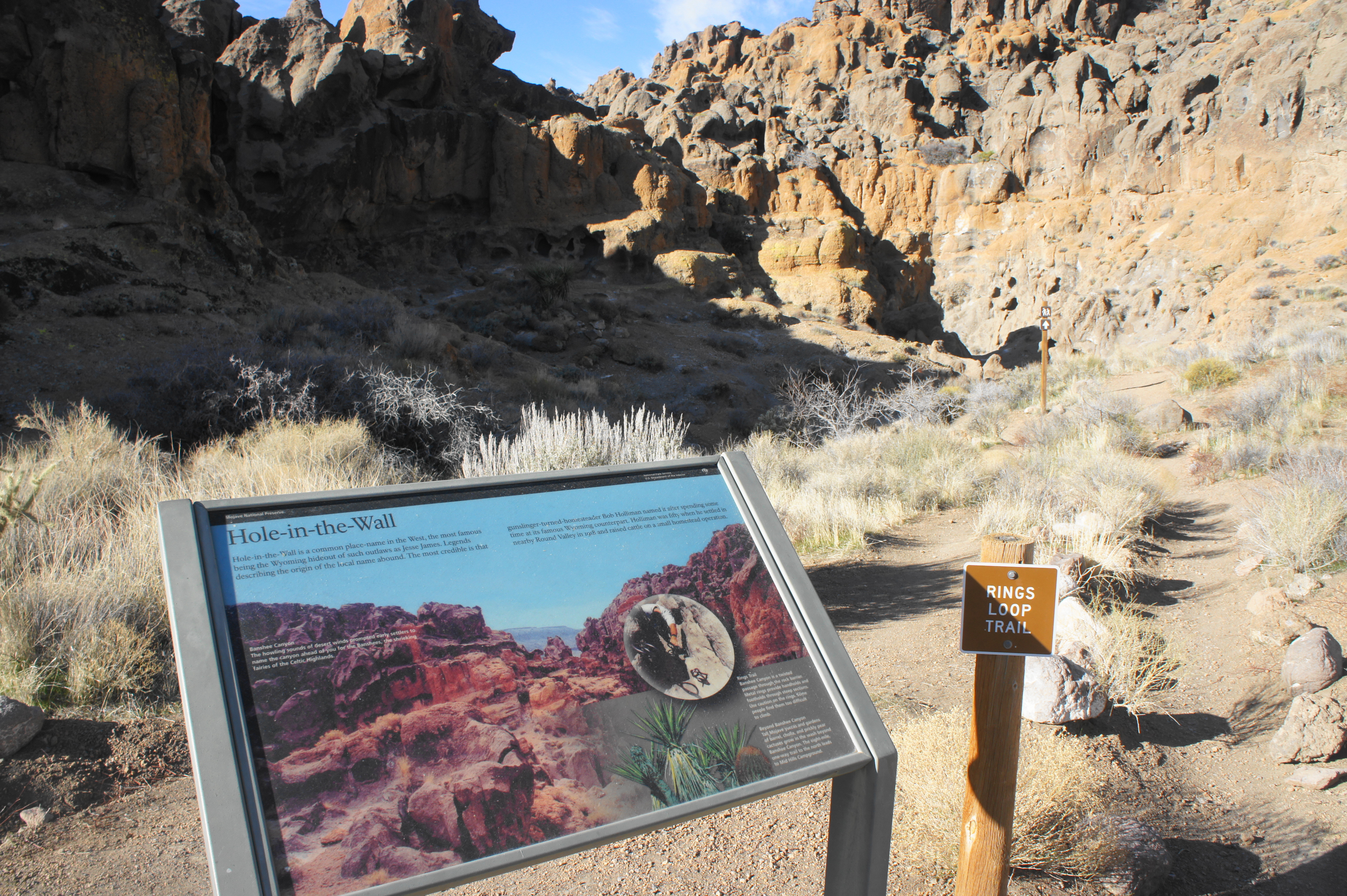
The Rings Loop Trail at Mojave National Preserve’s Hole-in-the-Wall area meanders through Banshee Canyon, a wild, narrow notch named by early settlers for its howling desert winds. Though only 1.4 miles, this brief circuit packs a punch, passing through desert scrub to a set of ancient petroglyphs before ascending a pair of ring ladders, bolted into the rock, to exit Banshee Canyon. Dotted with hundreds of tafoni, the weathered canyon walls are a spectacular sight, making this hike one of the best in the area. (Note: It does take a bit of physical strength to ascend the ring loops; those not up for it can turn back at the first ladder, making this an out-and-back.)


The hike
The Hole-in-the-Wall area is situated in the heart of southern California’s Mojave National Preserve and, sporting a visitor center and campground, is one of the most popular destinations in the park. Park at the Hole-in-the-Wall Information Center, a modest building in the shadow of a high butte, roughly 20 miles north of the Needles Freeway (I-40). (Note: Hole-in-the-Wall is around 40 miles from Kelso Dunes, the other major destination in Mojave.)
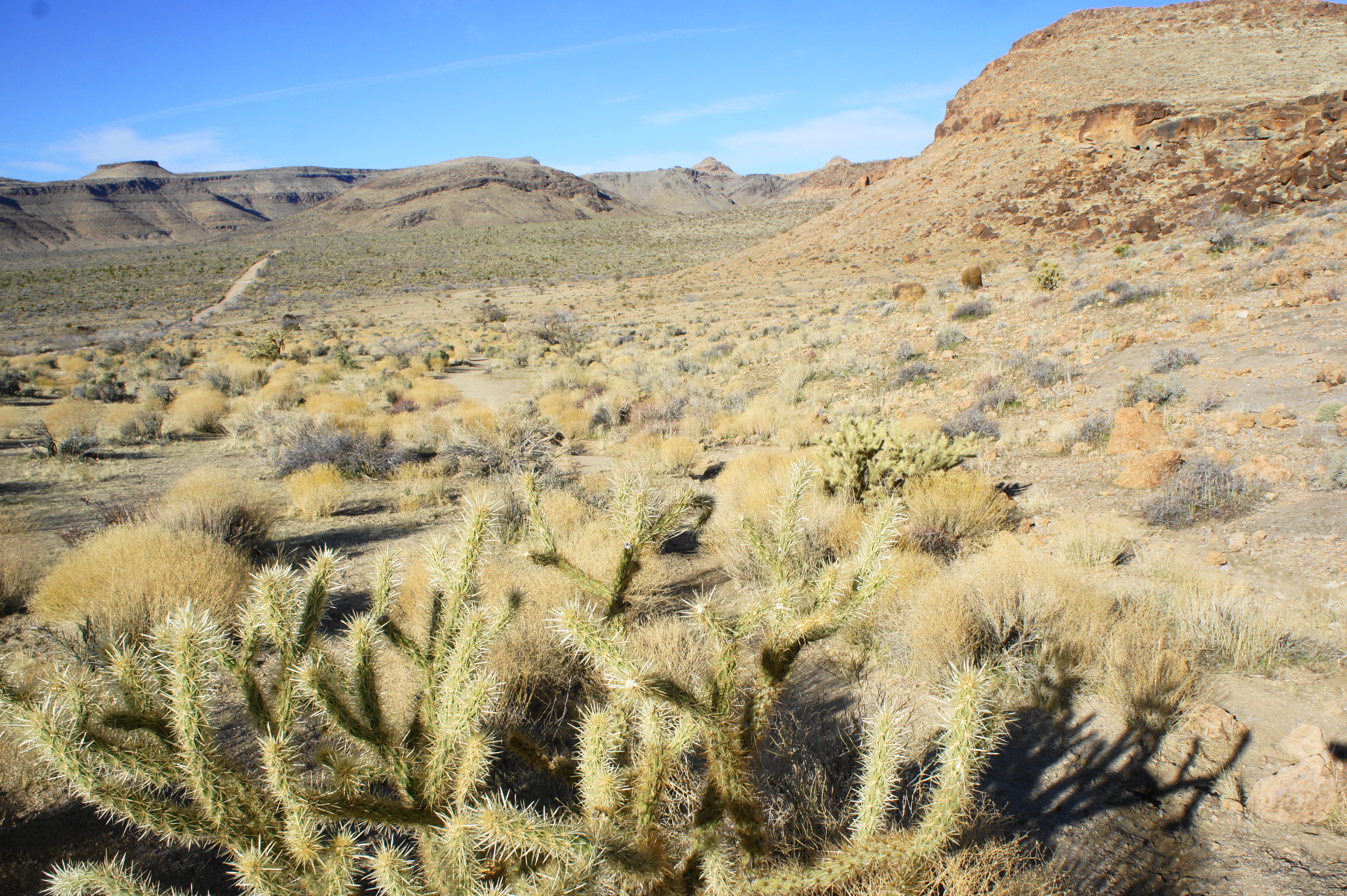
Begin by walking east to the end of the parking lot, where the Rings Loop Trail takes off into the desert. (Note: One can also start at the official Rings Loop Trailhead farther up the road, but its best to start at the Info Center, leaving the best part (Banshee Canyon) for last.) With a steep proclivity on your right, the wide path quickly drops into a sandy wash. After 150 yards, the path leaves the wash on the right and cuts through a break in a barbed wire fence. Across the flat desert to the east is Woods Mountain, a hulking mass that rises to more than 5,000 feet, while the stairstep mountain to the northwest is Barber Peak, which climbs still higher to 5,505 feet.
As the trail hugs the scrubby hillside on the right, it curves southward, and then west, to reveal another wide basin, the mouth of Wild Horse Canyon. The Wild Horse Canyon Road provides access to a handful of private residences in this remote and desolate environment.

At about 1/3 mile, an interpretive wayside invites hikers to pause and scour the jumble of chestnut-colored boulders on the right for ancient petroglyphs. The rock art is not necessarily easy to find: it took yours truly at least 10 minutes to spot the tiny bighorn sheep etched on an outward-facing stone that is highlighted in the wayside’s photo. There are also scrawlings that resemble snakes in a couple of places, but overall the petroglyphs are not particularly special.


Moving on, the trail continues westward, highlighted by buckhorn cholla, an attractive species of cacti that sticks out amid the otherwise scrubby brush. Ahead is the orange-hued thumb of Horse Mesa, which towers over the desert floor.
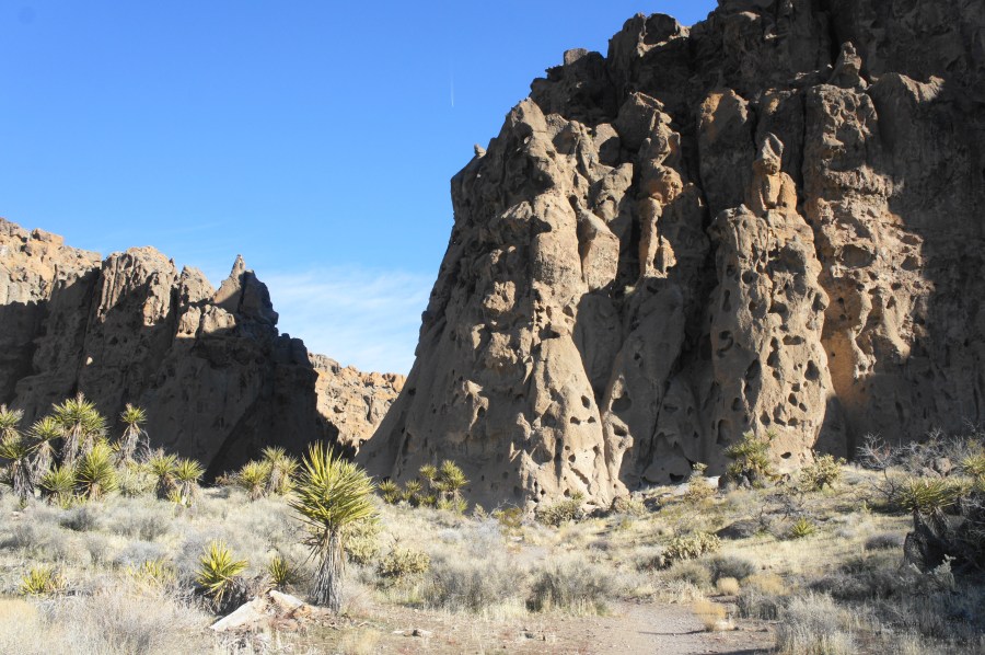
At 2/3 mile, the trail cuts through another fence then briefly follows a sandy wash. At 8/10 mile, leave the dry bed and trace the narrow path as it comes to the base of a honeycombed wall. Just beyond, the Barber Peak Trail bears off to the left; stay right on the Rings Loop Trail, entering Banshee Canyon.

The landscape ahead is terrifically weird: weathered openings in the rock (called tafoni) give the canyon walls an appearance of swiss cheese, while the uneven heights of the rock transform the walls into ghost-like figures. It’s easy to let the imagination run wild as the trail edges deeper into the canyon.

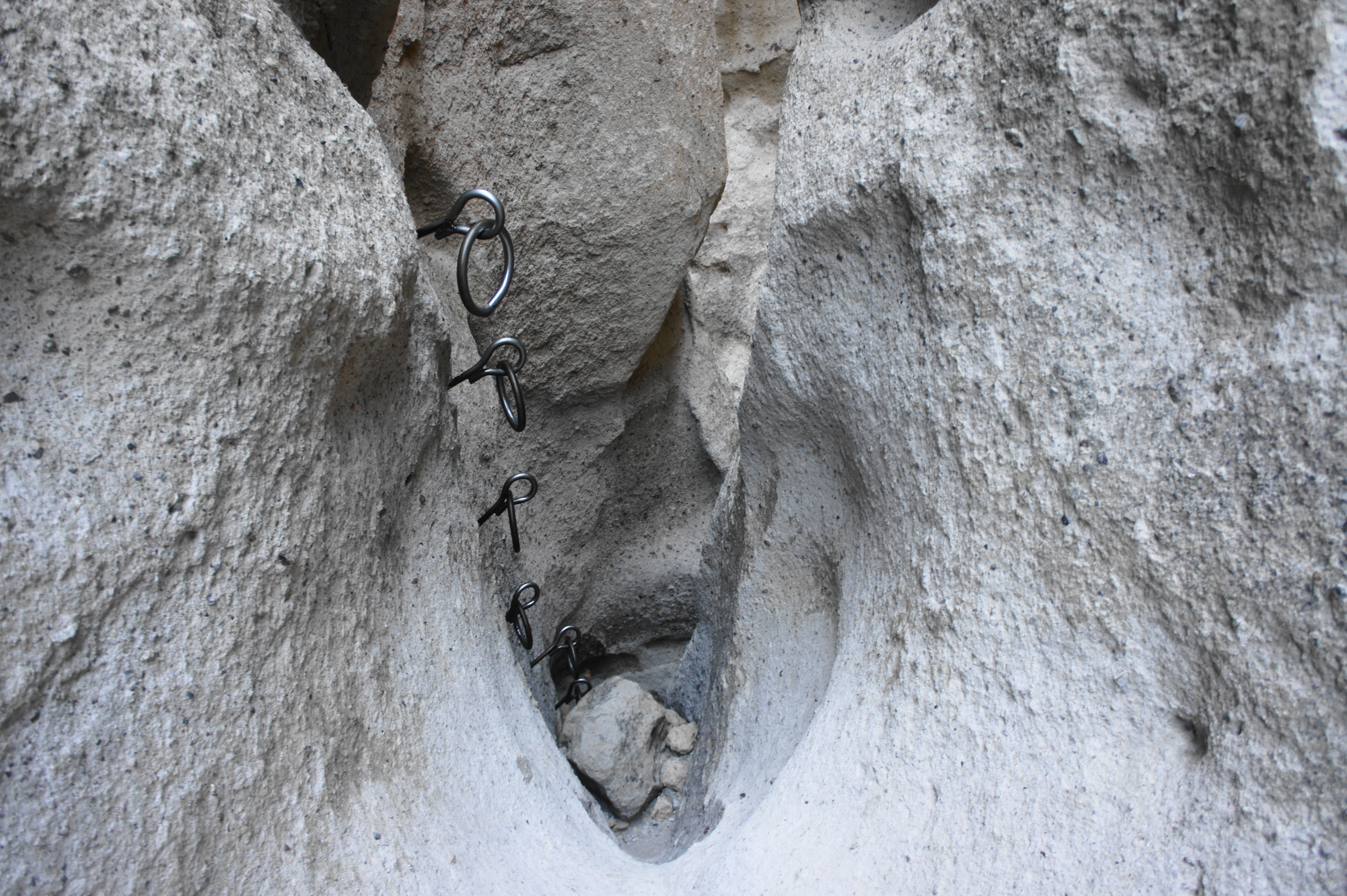
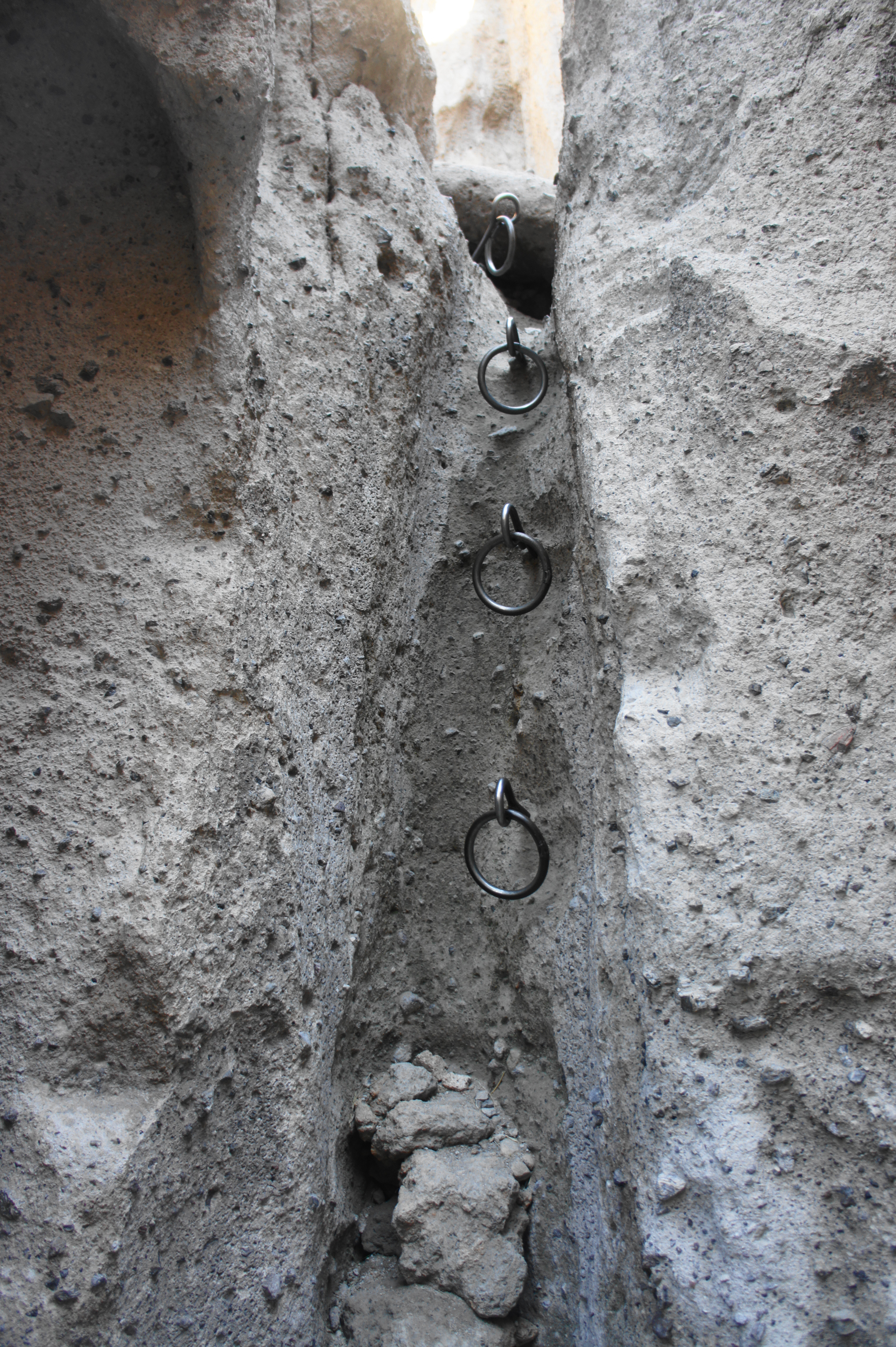
After the fork, the route climbs a chalky white surface and then approaches a fork in the canyon: the wash to the right ends at an impassable pouroff, while the trail continues left. Traverse a boulder jumble as the walls tighten, reaching the first of the two ring climbs at just over the one-mile mark.


A half dozen rings, bolted into the right wall, assist with the ascent through the crevice: hikers may not need to use all of the iron rings, but the last three are particularly helpful to get up and over the smooth dryfall.
From here, the route rounds a corner and then leads to the second set of rings: this time there are only four, but they are likely to be essential for most climbers.
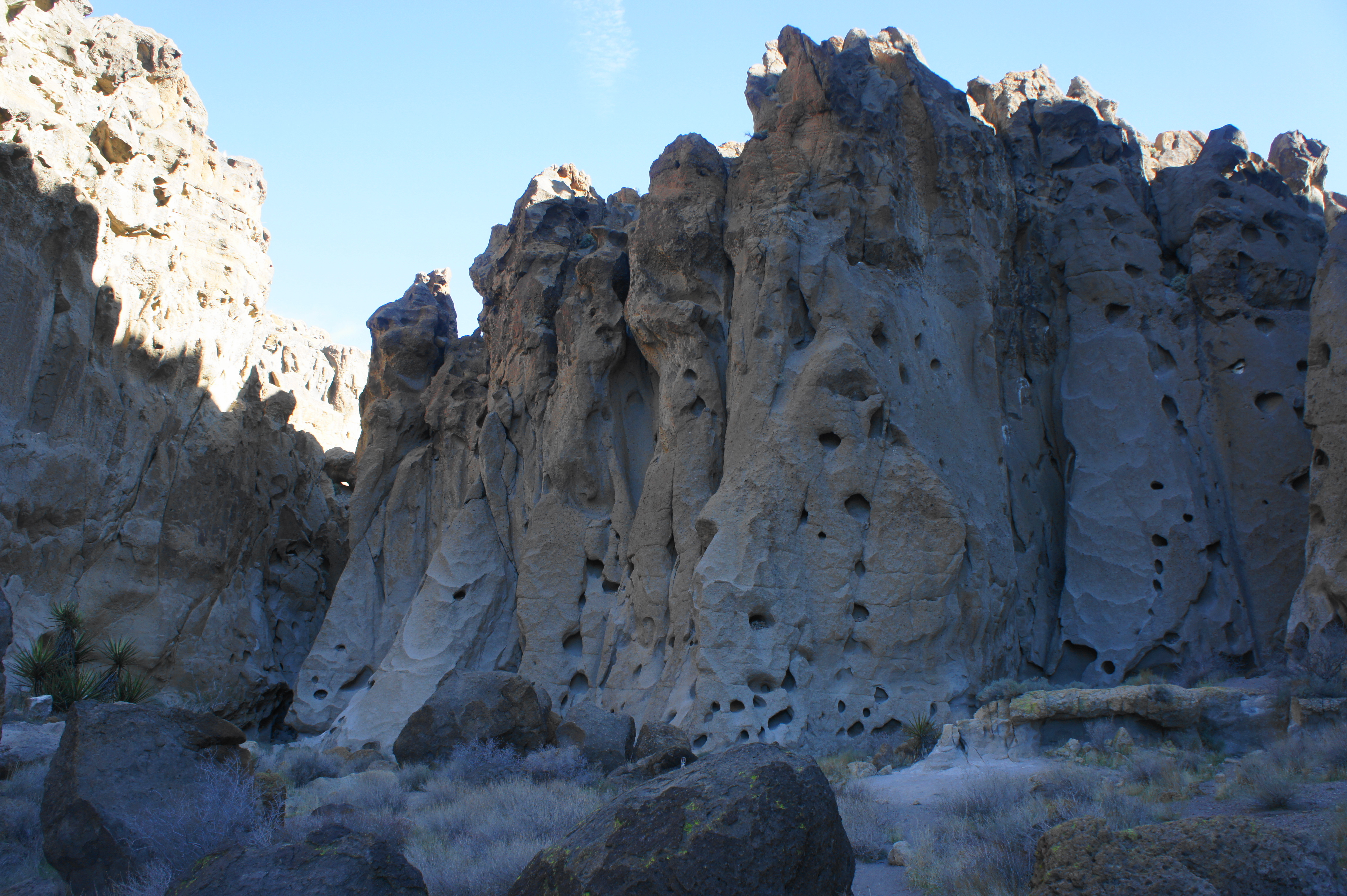
After ascending, follow the narrow, winding wash as it emerges back into the sunlight. A final climb leads to a shelf with a nice view back at the short but scenic canyon. Steps later, the trail ends at the Rings Loop parking area. (Note: There is also a short spur trail that leads to an overlook of another part of the canyon off to the right.) Interpretive signs at the trailhead provide a brief geological and human history of the area.


Having exited at a different point, a ¼ mile walk along the paved road is required to return to the Hole-in-the-Wall Information Center. All in all, the hike clocks in at 1.4 miles, which can be done in under an hour.
Extra credit
Extend your time at the Hole-in-the-Rock area by trying one of the area’s three other hikes, including the short Nature Trail, which leads to the campground.

Pingback: Hole-in-the-Wall Nature Trail (Mojave National Preserve, CA) | Live and Let Hike
Pingback: Top 10 Hikes in 2020 | Live and Let Hike