Mojave National Preserve in southern California boasts a wide array of desert ecosystems, from pinyon-juniper woodlands, to Joshua tree forests, to cactus-yucca scrub, but there is perhaps none more iconic than the massive desert dunes scattered across the 1.6-million acre park. The primary show-stopper is Kelso Dunes, the largest dune field in the Mojave Desert and a relatively popular destination in an otherwise remote preserve. A trip at sunset reveals stunning colors on the wispy dunes, and hearty hikers can climb more than 500 feet in elevation to summit the highest of the bunch, offering panoramic views of the quiet desert and surrounding mountains.


Map of Kelso Dunes Trail, Mojave National Preserve, created using alltrails.com (Check out the interactive map and MapMyHike track)
The hike
Kelso Dunes is located in a broad desert basin in the southwest portion of Mojave National Preserve, roughly a 100-mile drive from either Barstow, California or Las Vegas, Nevada. While still remote, Kelso Dunes is a major draw of visitors to the park, and the Kelso Dunes Trailhead is located just 12 miles southwest of the Kelso Depot Visitor Center. From the visitor center, drive south on Kelbaker Road for eight miles, then bear right on the unpaved Kelso Dunes Road (passable to 2WD but often heavily washboarded) and follow it for roughly three miles to the trailhead. There is a pit toilet and several parking spots at the trailhead. (Note: The road continues on from here, providing access to some decent dispersed camping spots.)
The destination—the highest of the dunes, at 3,113 feet above sea level—is easily seen from the Kelso Dunes Trailhead. Although the trailhead serves as a common entry point, there is no official “trail” to the top. After an initial sandy track, the route quickly goes haywire amid a series of crisscrossing potential paths. There is, however, a recommended route—which minimizes time spent on steep inclines—described below.

The route begins on a well-worn, sandy track through a sea of creosote bush, seemingly the predominant plant at this altitude in the park. (Note: At about 2,600 feet, it’s generally too low for Joshua trees.) After a few minutes, the creosote and sagebrush give way to clumps of bunchgrass, seemingly the only living plant in the thick dunes.

At about ¼ mile, the “choose your own adventure” begins as footprints diverge in several directions. It is generally easier to stay to the right, below the escarpment that emerges on the left. The various paths, however, effectively converge as they head toward a high saddle to the right of the highest dune visible ahead. The initially level landscape begins to gain texture and height as the hike proceeds. At about 8/10 mile, the “main” route crests a hillside, then another, and continues to stairstep up the dunes ahead of the saddle approach.

At about 1.2 miles, the now steadily-climbing route splits into two ridges; take either approach, skirting a series of interlocking bowls that form a set of figure-eights. (Note: In general, stay high on the ridges to avoid steep descents and ascents out of the bowls; if you’re still descending to clear sandy basins at this point, you’re doing it wrong.)

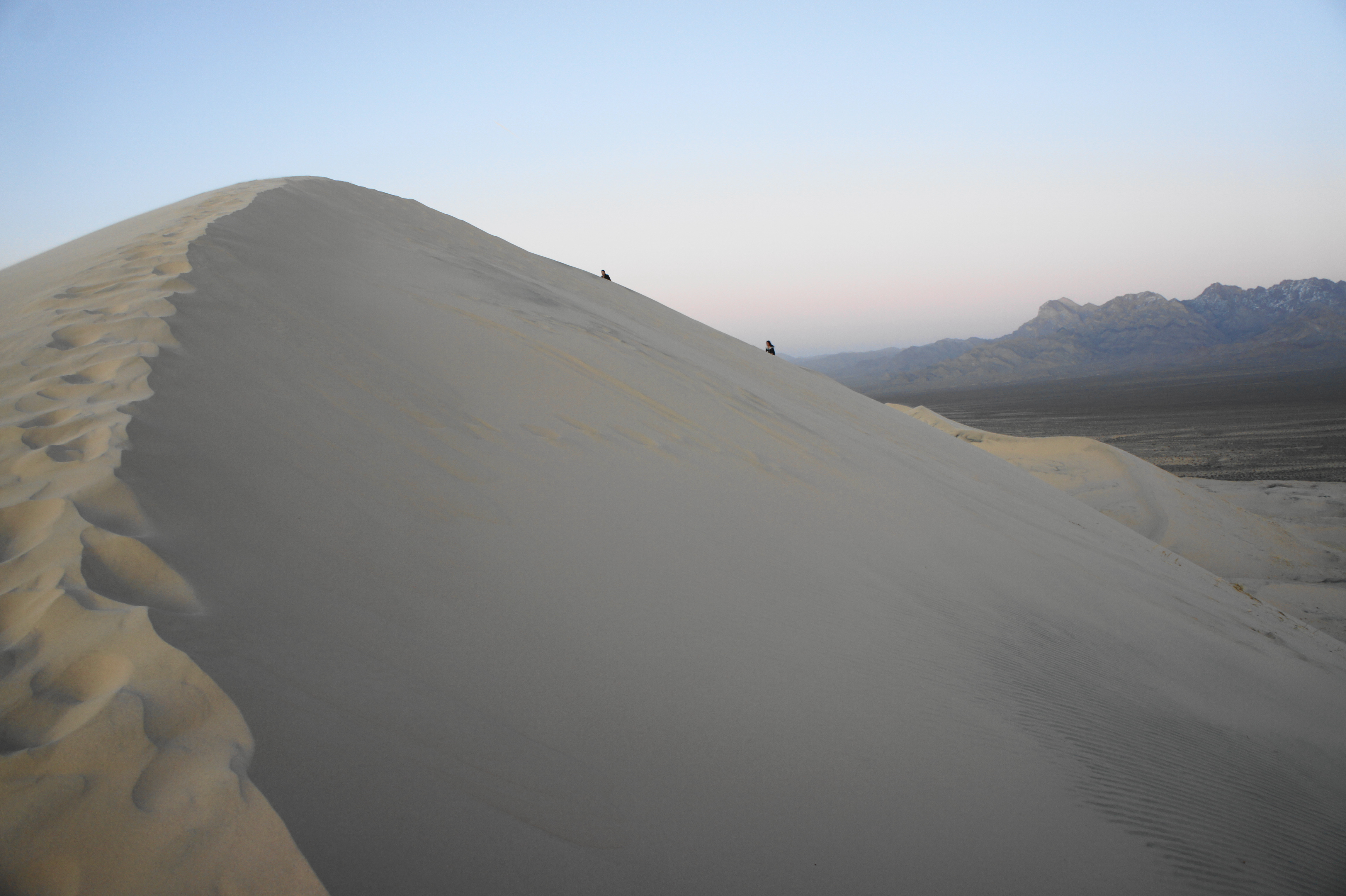
At 1.3 miles, there is no avoiding the monstrously steep ascent to the saddle, which is best taken by switchbacking to the best degree possible in order to avoid a crushing incline. It is at this point that first-time dune hikers will be yearning for flat land—ascending aeolian sand is considerably more difficult than “normal” terrain.


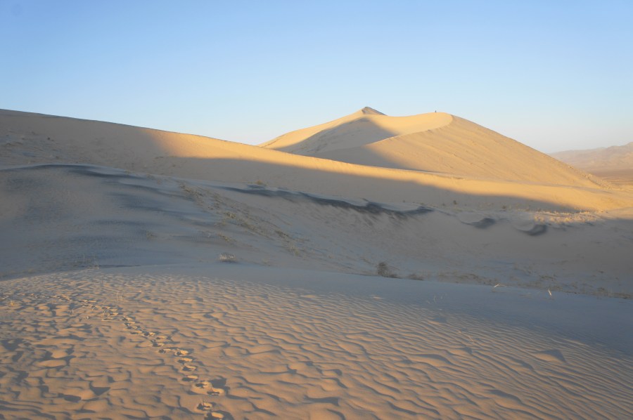
Finally, at about 1.5 miles, the route crests the saddle, revealing views of the broader dune field to the north. Views at sunset can be simply spectacular, as the evening light flashes color on an otherwise greyish-white landscape.


Heading left from the saddle, the ensuing route first ascend a false summit, then it’s a final, short but steep push to the actual summit of the highest dune, the capstone of the hike. While hopes of spending an extended period of time at the top are likely to be dashed by frequent winds, the views from atop the peak are simply stunning.


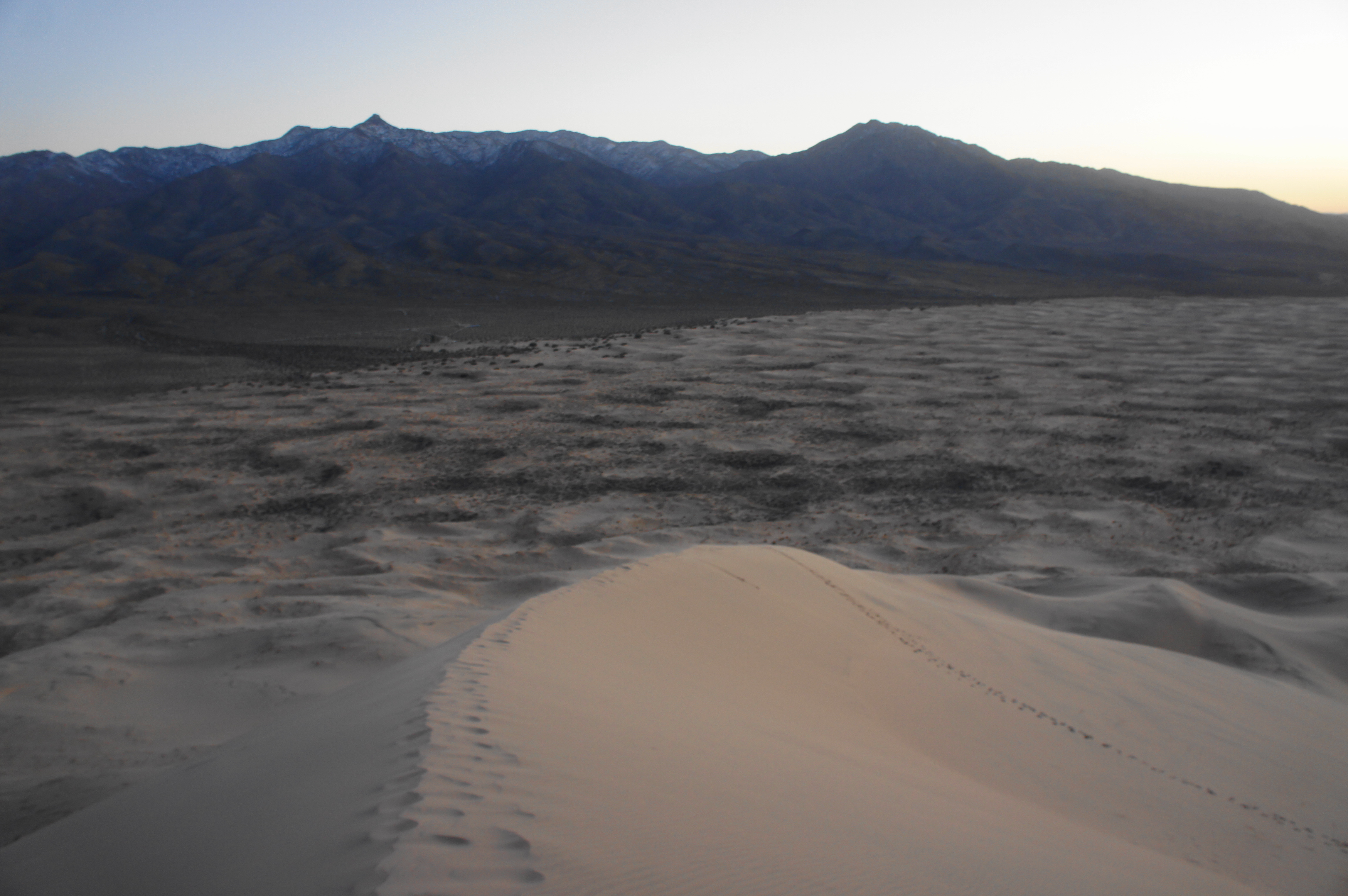
To the north, the dunes of Devil’s Playground extend off into the distance, with the Kelso Mountains and Soda Mountains beyond. To the east, the desert basin comes to an abrupt end as the Providence Mountains rise to nearly 7,000 feet. To the south are the craggy Granite Mountains and Old Dad Mountains. The dunes themselves were a product of these mountain boundaries, which blocked passage of the prevailing winds that carried the sands that now make up Kelso Dunes all the way from the Mojave River, dozens of miles to the west.
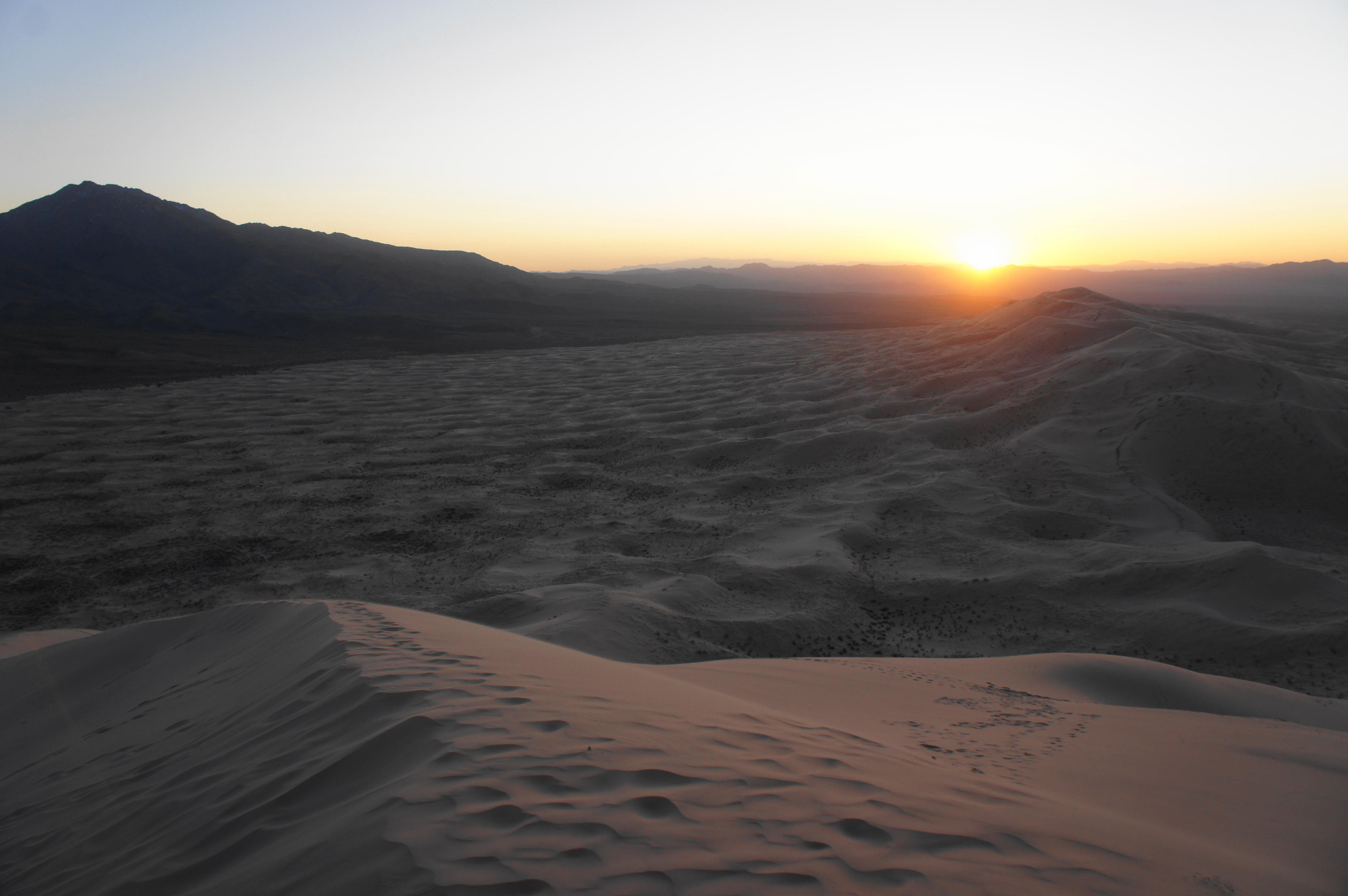

Finally, to the west, the setting sun. That way to Los Angeles and the Bay Area, bustling metropolises that feel like a world away.
Once you’ve had enough—or the winds force you to descend—make your way back the way you came, or, for the adventurous, try traversing the steep-sloping ridge that bears southwest from the summit. Below your feet, the sounds of shifting sands create small “booming” sounds, the effect of the hot surface crashing over the colder sands below. This way is definitely a steeper descent than the original route—and some route-finding is required—but is generally good fun as hikers skate down the shifting sands. Be sure to eventually edge leftward, however, as the trailhead lies slightly to the east.

It’s possible to spend at least a half-day on the dunes, but allot at least 2-3 hours for the round-trip hike to the summit and back. If doing a sunset hike, bring a headlamp or, with a full moon or starlight sky, let your night-vision kick in to experience the beautiful desert after the sun sets. Consider pairing the hike with a visit to the nearby Teutonia Peak Trail or various hikes in the Hole-in-the-Wall area.


Pingback: Rings Loop Trail (Mojave National Preserve, CA) | Live and Let Hike
Pingback: Top 10 Hikes in 2020 | Live and Let Hike