
Devil’s Kitchen, the second-largest hydrothermal area in California’s Lassen Volcanic National Park, is a quieter—but no less smelly—alternative to the popular Bumpass Hell. The area owes its relative solitude to its location in remote Warner Valley: despite being a few miles from the main highway through the park, the trailhead is a full 1 ½ hour drive from the Kohm Yah-mah-nee Visitor Center. Yet the hike itself is reasonably short and easy, with a modest 450-foot elevation gain the course of over two miles. The acidic fumaroles at Devil’s Kitchen may smell like rotten eggs, but they are an awesome peek into the volcanic underbelly of Lassen Peak, one of only two volcanoes in the contiguous US to blow its top since 1900. The route to Devil’s Kitchen follows part of the Pacific Crest Trail and traverses splendid meadows and thick coniferous forest before reaching the hydrothermal site. (Note: Visitors can add a detour to nearby Drake Lake for a roughly 7-mile stem-and-loop, or trek over to Boiling Springs Lake and Terminal Geyser on the south side of the valley.)

The hike
To reach the Warner Valley Trailhead, head west on Feather River Drive in the town of Chester, California, then stay left on Warner Valley Road and follow it for 15.5 miles. The last three miles are dirt/gravel but usually passable to 2WD vehicles. Pull into the trailhead on the left—or, if you’re staying at the Warner Valley Campground or Drakesbad Guest Ranch, continue down the road.
From the trailhead, look for the sign marking the route to Boiling Springs Lake. This is the main gateway for a series of trails in Warner Valley. After 150 yards, the route joins with the Pacific Crest Trail (PCT), which comes in from the right. Now on the PCT, the trail descends gradually to a broad meadow chock-full of corn lilies. After a brief boardwalk section, the path bears left and works its way to the banks of Hot Springs Creek, a perennial waterway that is fed in part by Devil’s Kitchen up-stream.
At 4/10 mile, the trail crosses a sturdy bridge over the stream and begins a mild climb. Now bearing westward, the PCT skirts an open hillside at 6/10 mile with views down the valley to Drakesbad Guest Ranch. Notice the tributary stream just off to the right: while at first glance it appears normal, a closer look reveals a tin-colored sheen and rising steam. This is no ordinary creek—the water is fed by an underground hot spring, one of several in the area.

Moving on from this initial geothermal feature, the trail drops to a junction at the base of a giant incense cedar tree. Bear right here, following the sign for Drakesbad and Devil’s Kitchen, leaving the PCT. (Note: The routes to Drake Lake and Boiling Springs Lake/Terminal Geyser continue left.) From here the path sheds the initial elevation that it gained, dropping amid a small boulder field to a subsequent fork at 8/10 mile. A spur trail leads left to the remains of Dream Lake (now a boggy meadow), which—after a dam breach in 2011—is today a relatively underwhelming sight. (Note: Head up the short trail to Dream Lake Meadow if you wish, but then return to the junction.) At the junction, head north across a bridge over Hot Springs Creek. Within seconds, the trail reaches a T-junction again. This time bear left.
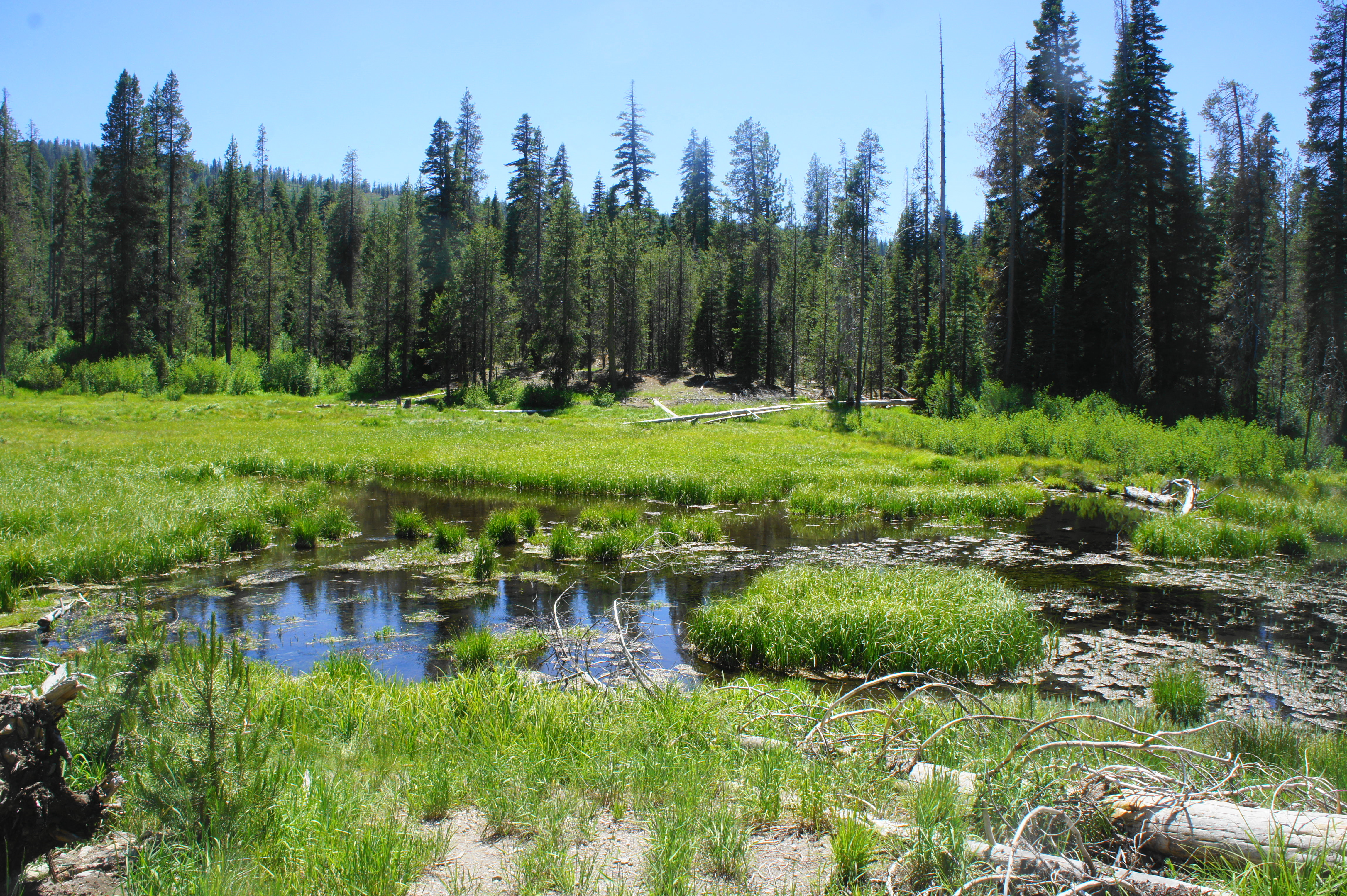
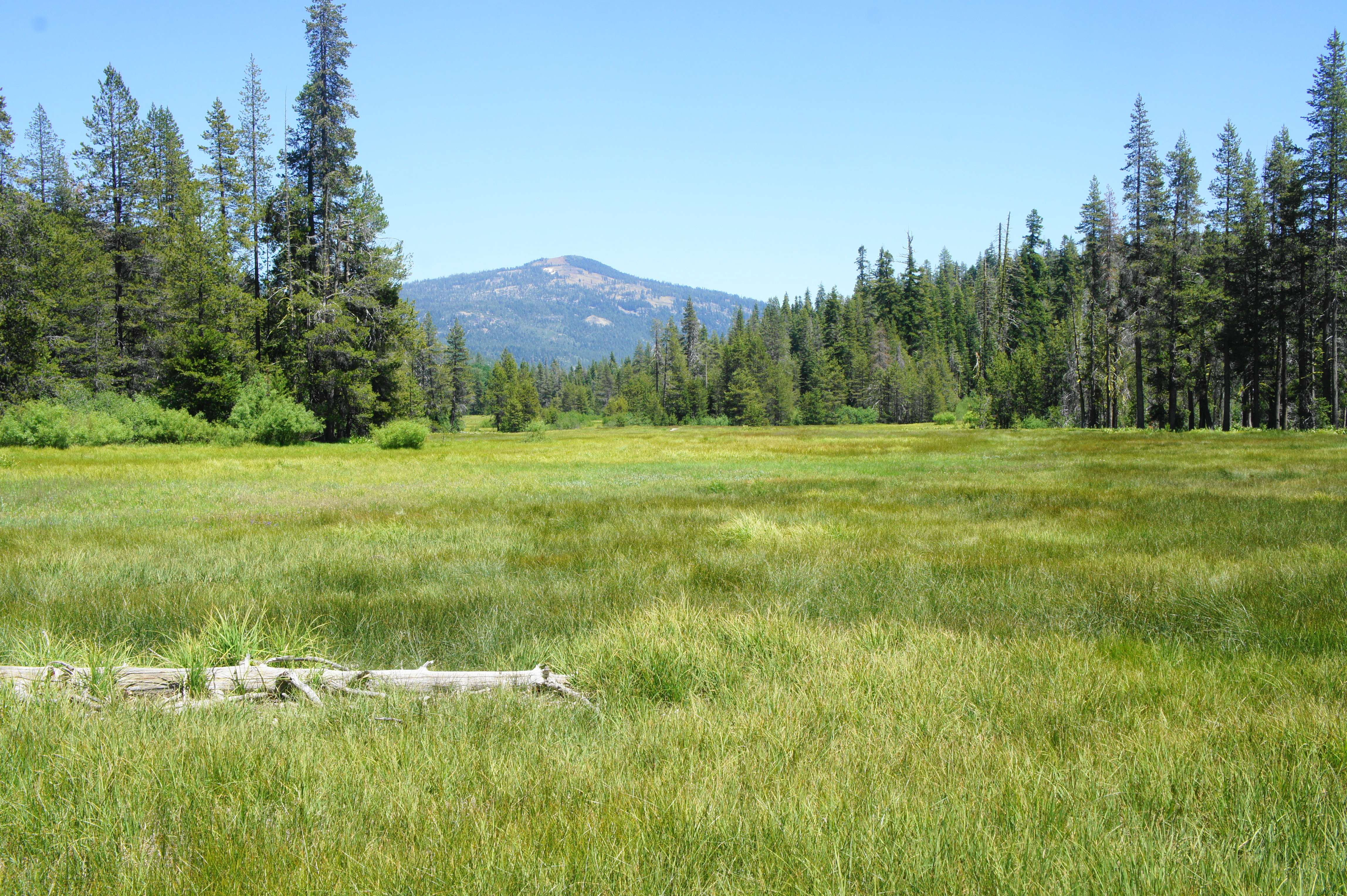
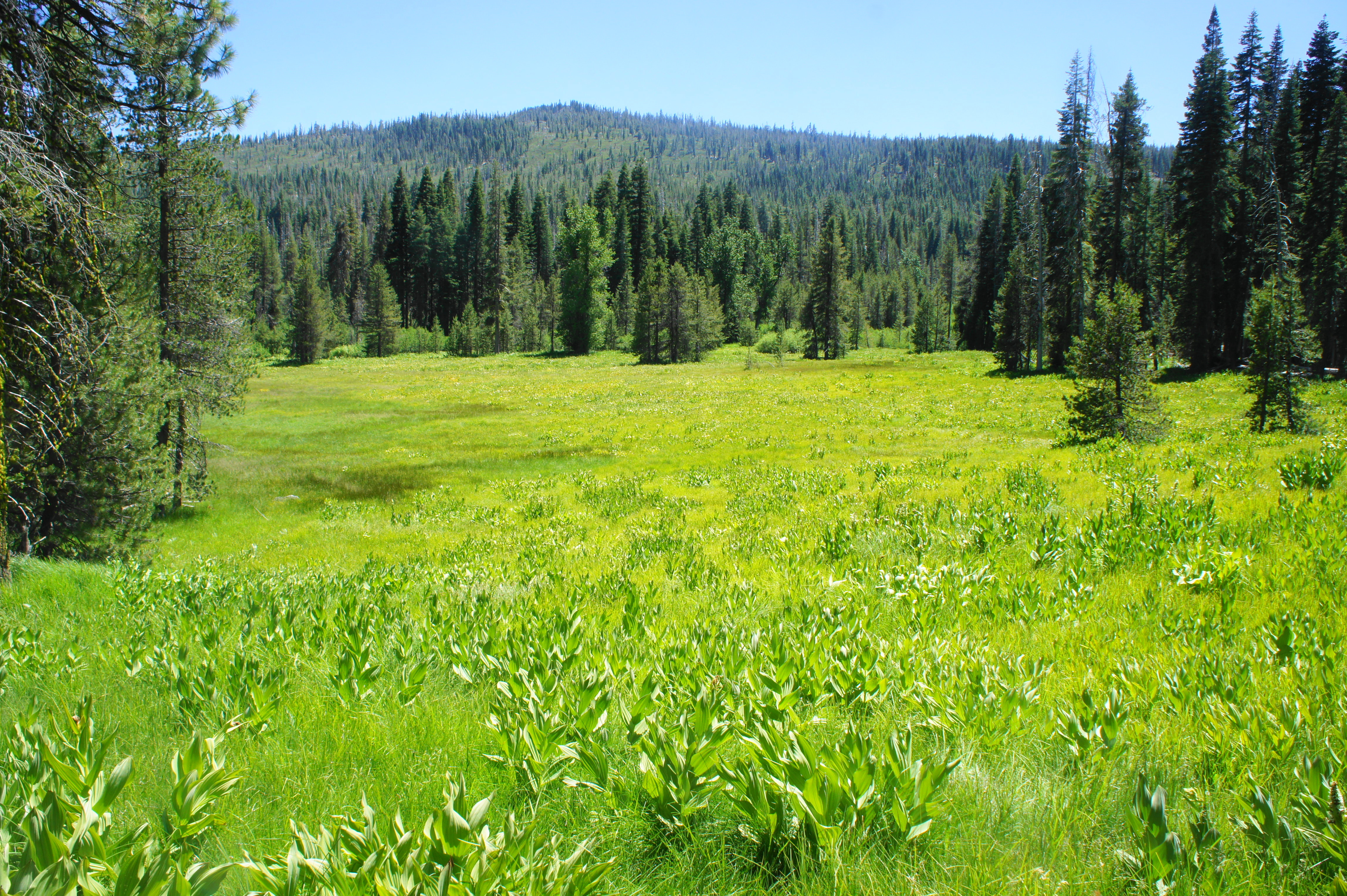
The next section is a highlight of the hike: after briefly skirting the stream, the trail crosses a minor tributary at about the one-mile mark. Beyond is an expansive meadow with fantastic views. Ahead one can see the western reaches of Warner Valley, with Sifford Mountain (7,409’) and an unnamed mountain (7,139’) on the left. Looking back eastward, hikers can spot Drakesbad and Mount Harkness (8,046’), the highest point in the park’s southeast. The meadow itself is often teeming with wildflowers, and tall grasses rustle gracefully in the wind.

Traversing the meadow toward Devil’s Kitchen 
Looking back down Warner Valley toward Mount Harkness
Part boardwalk, part dirt, the trail cuts through the middle of the meadow, briefly traverses a wooded section, then soaks up the sun one more time before a long stretch in the woods. At 1.3 miles, the Devil’s Kitchen Trail enters a dense forest of pines, firs, and cedars.
The onward path traverses mildly uphill for 2/10 mile to another trail junction, as the Drake Lake route comes in from the left. (Note: This route has an unavoidable creek crossing, so be prepared to get your feet wet if you go that way. There are no obstacles on the main route (right) to Devil’s Kitchen, however.) Staying right at the fork, the Devil’s Kitchen Trail gradually begins to climb at a steadier incline. At about the 2-mile mark, the trail overtakes a ridgeline then descends to a grassy gulch. After crossing a minor stream, the path ascends more steeply, cresting a higher ridge at 2.3 miles. For horse-riders, there is a hitchrail on the right. Only human traffic is allowed beyond this point.

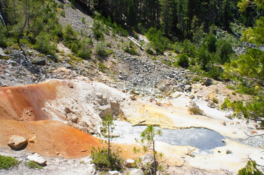
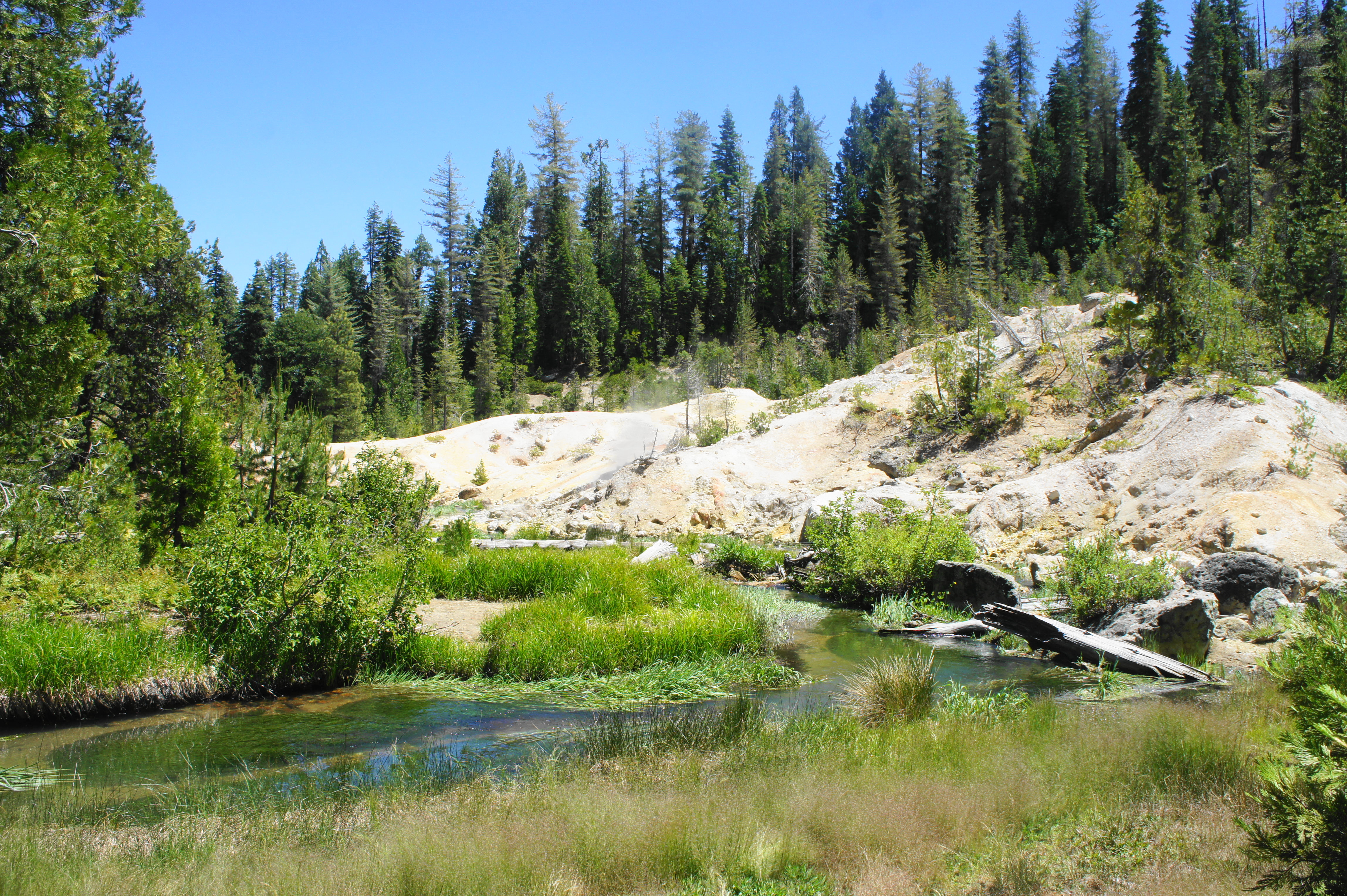
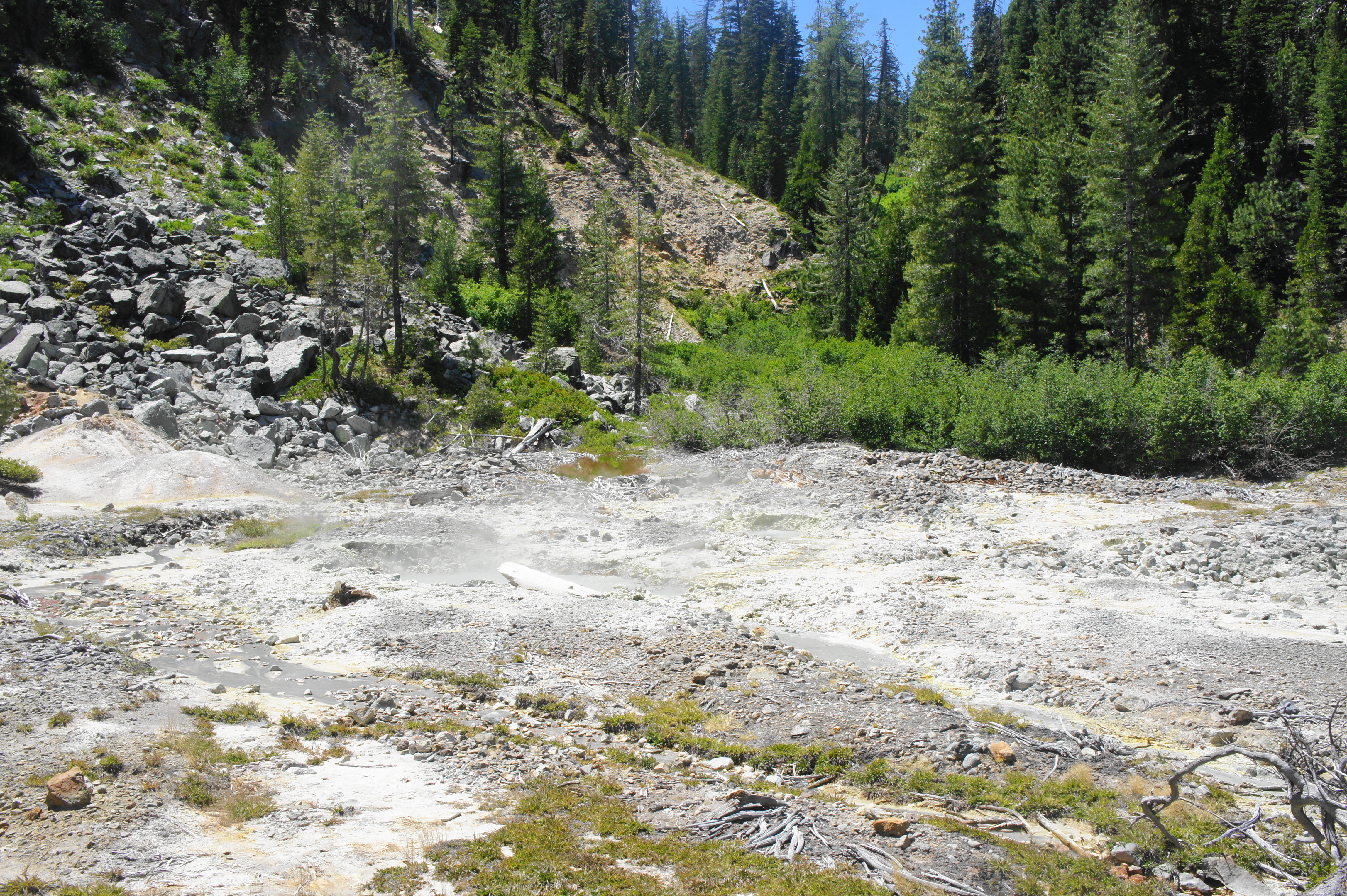
The warning signs begin right away: you are entering an active geothermal area. Don’t even think about going off trail unless you want some serious burns—or worse. (Note: The soil around geothermal areas is notoriously unstable.) The path drops sharply down a set of bends, emerging out into the sun again, and crosses another bridge over Hot Springs Creek. Steam rising from the chalky hillside off to the left gives off a not-so-subtle, sulfuric scent.
What produces this peculiar occurrence? Rain and snowmelt in the Lassen area seeps deep into the ground, feeding into a boiling reservoir of hot water before returning through fractures in the earth back to the surface as condensed steam. This steam in turn heats water near the surface level, generating mud pots and steam vents. The steam bears hydrochloric acid and sulfur, producing the acidic—and smelly—nature of the fumaroles.
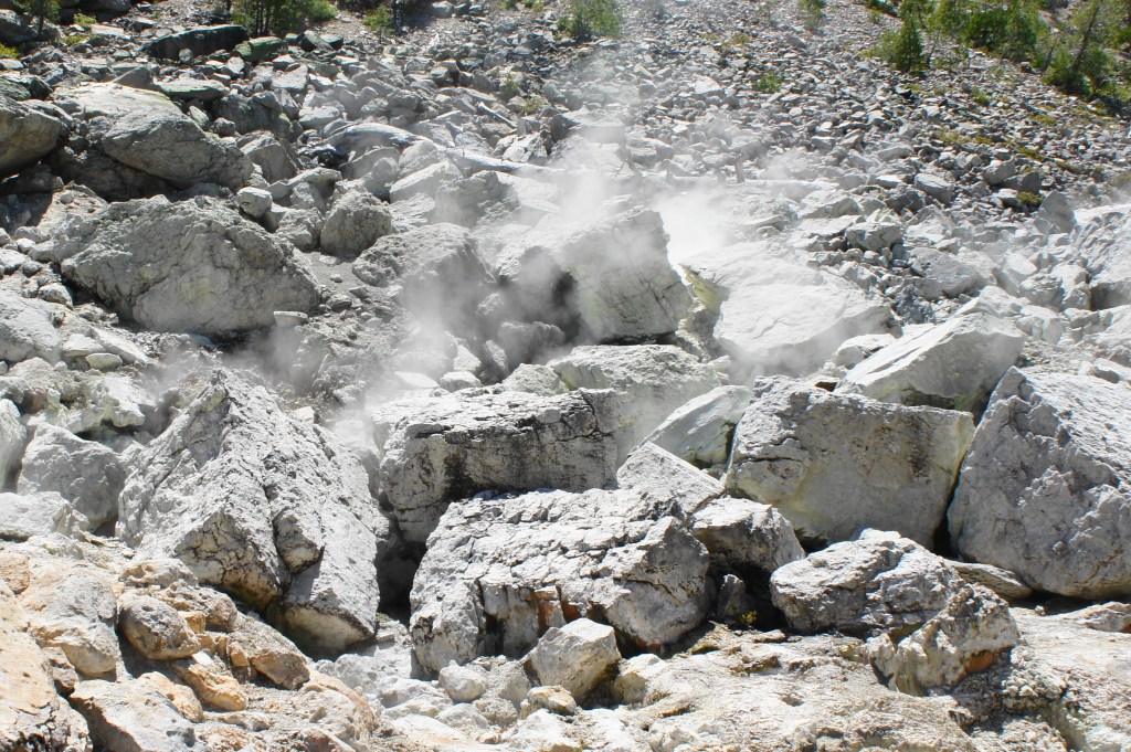
Steam rising at Devil’s Kitchen 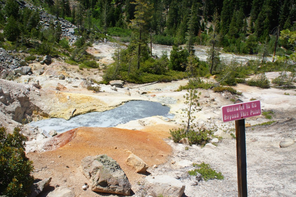
Boiling pool at Devil’s Kitchen
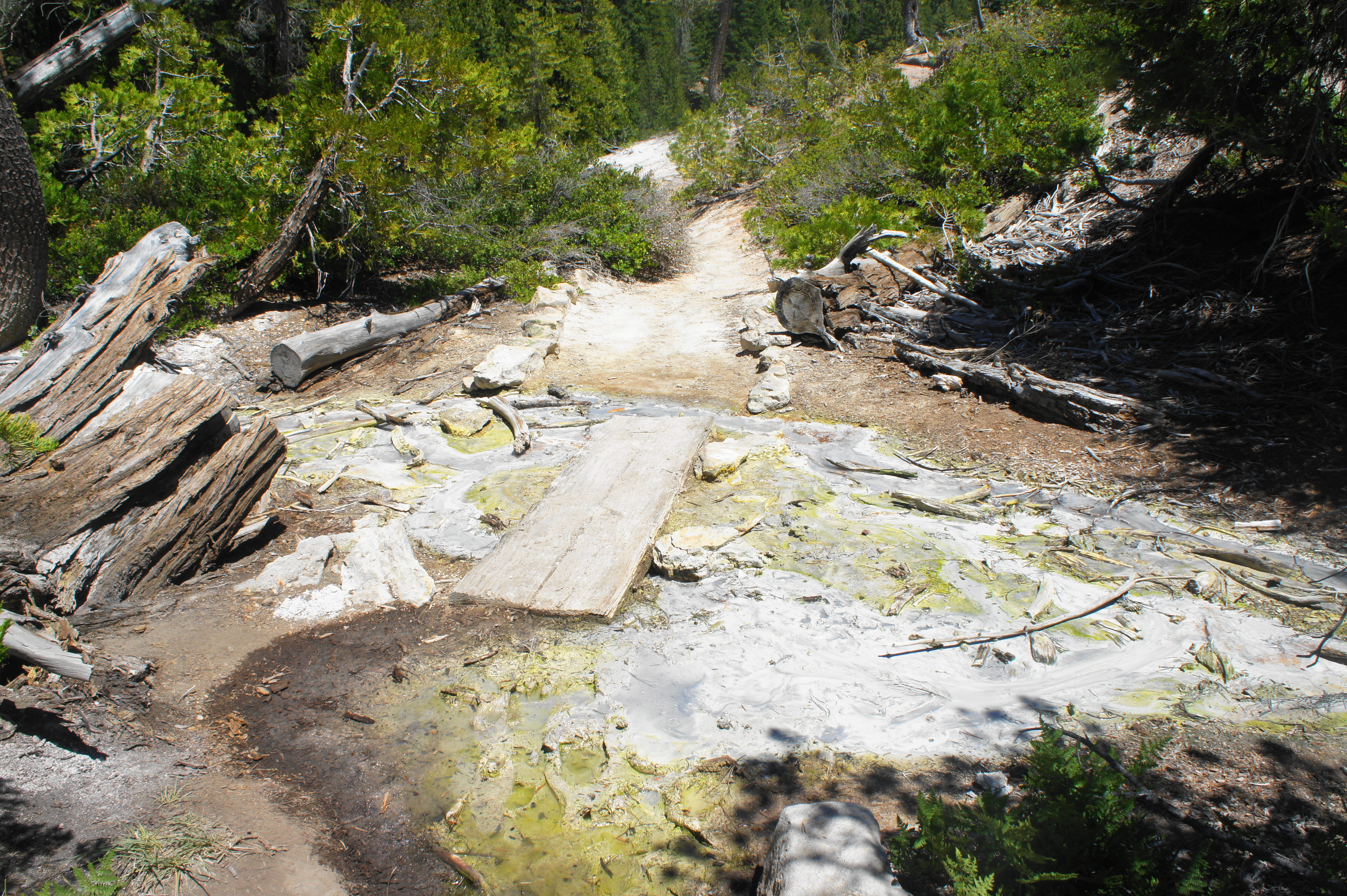
After crossing the stream, the well-worn route climbs a chalky-white knoll and then splits. This is the start (and end) of a short loop section around Devil’s Kitchen. Heading left first, the narrow path traverses a wooden bridge over a milky froth – stream water combined with the acidic output of the fumaroles – then climbs to a crest with steaming springs on the left and gurgling vents on the right.

The distinct smell of rotten eggs combines with the overbearing heat of the steam to make the descent from the crest one of the more unpleasant—but wild—stretches of the hike. Beyond, the geothermal area opens up into a largely flat wonderland of boiling pools, milky stream, and odorous fumes. In the distance to the east, one can hear (but cannot see) the thundering cascades of Devil’s Kitchen Falls—tempting but thoroughly off-limits due to its location well off trail.

As the route bears northward, skirting the hellish basin on the left, there is a brief spur to a viewpoint at about 2.6 miles. The spur ends abruptly at a fenced cul-de-sac; turn around here and head back to the main route. Bearing left, follow the trail as it flanks juniper bushes interspersed with mud pots, then carefully cross a tiny wooden plank over a milky stream. (Note: Clearly the water must not be too warm here or the park service would not allow one to get so close. In any case, don’t push your luck.) From here the path returns to the initial start of the loop.
Having completed the circuit, head back the way you came, toward Drakesbad and Warner Valley Trailhead. After the initial ascent back to the horse hitchrail, the rest of the way is larger downhill; stop in the meadow area for a snack/picnic, then make your way back to the trailhead to complete this entertaining half-day hike. All told, the out-and-back (plus the short loop at Devil’s Kitchen) clocks in at about five miles.
Extra credit
With the second half of your day, take the 3-mile round-trip hike to Boiling Springs Lake or extend it with a trip to nearby Terminal Geyser (6 miles round trip), the two other hydrothermal sites in the Warner Valley area of Lassen Volcanic National Park.

Pingback: Drake Lake Trail (Lassen Volcanic National Park, CA) | Live and Let Hike