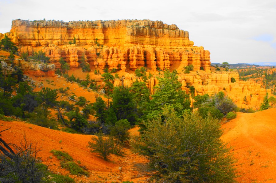
Receiving roughly 2.5 million visitors per year, Bryce Canyon National Park is the second-most popular national park in Utah. And yet, while Bryce’s wild landscape of colorful hoodoos is absolutely majestic, it is not the only place in the state to walk among towering, pinkish-orange rock pinnacles of the Eocene-era Claron Formation. One such alternative is beautiful Red Canyon, situated along Highway 12 between Bryce Canyon and Panguitch, Utah, a mere 10-15 miles from the national park but a world away in terms of crowds. Most pass through this “mini-Bryce” without bothering to stop for more than a picture; but those who stay are rewarded with terrific hiking opportunities among the multi-hued hillsides, lofty hoodoos, and twisted canyons.
One great option for a 2-3 hour, moderately strenuous hike is the Buckhorn-Golden Wall Trail circuit, one of the few short loop options in the Red Canyon area of Dixie National Forest. Starting and ending at Highway 12, hikers climb to soaring heights with panoramic views before descending and ascending a series of ridges with colorful knobs that arguably rival those in neighboring Bryce in terms of beauty. This roller-coaster of a hike is particularly inviting for overnighters at Red Canyon Campground, as the Buckhorn Trail leaves right from the campground. (Note: While I describe below a minimalist, 4.0-mile loop that links the Buckhorn, Golden Wall, and Red Canyon Bicycle Trails, it is possible to extend the hike by adding side trips to Buckhorn Point and Castle Bridge.)


The hike
From Panguitch or Bryce Canyon, make your way along Highway 12 to the Red Canyon area, stopping at the Red Canyon Visitor Center for a map and information on the area. While possible to start the loop from the visitor center by crossing the road to the south, yours truly tackled the Buckhorn – Golden Wall Trail Loop from Red Canyon Campground. The Buckhorn Trail begins just to the left of campsite #26 – there is a prominent wooden sign. (Note: There is an unmarked trail between sites 24 and 26 which leads up to an old CCC amphitheater – while an interesting sight, this is NOT the Buckhorn Trail.)

From the start, the Buckhorn Trail wastes little time in ascending, rounding seven switchbacks before settling into a southward ridge after 4/10 mile. Views improve with each bend, as the trail rises above reddish slopes with a smattering of ponderosa pines, with Highway 12 and the hoodoos of Red Canyon visible to the north.

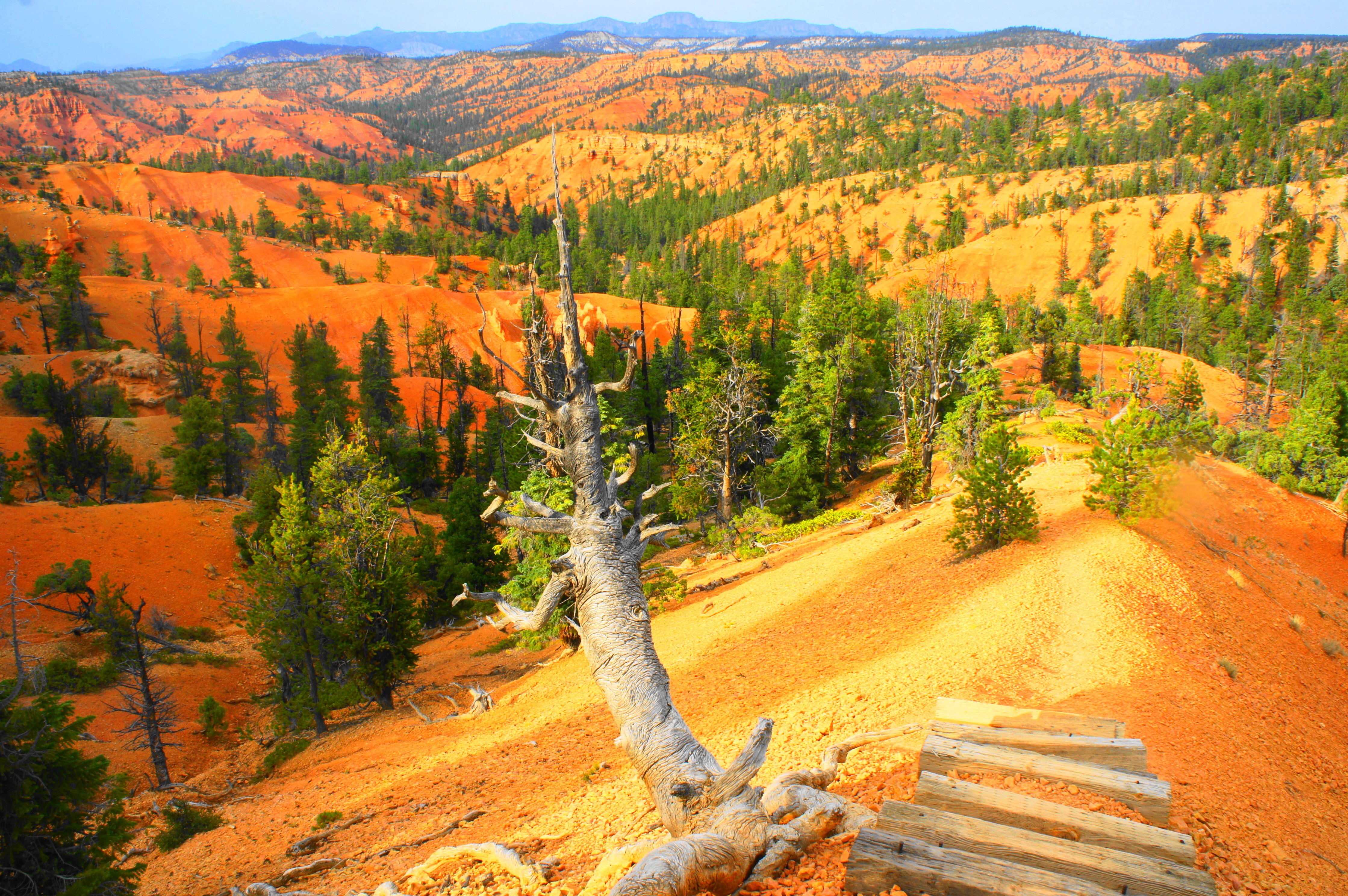
Once atop the ridge, the upward slog eases as hikers make their way southward along a breezy ridgeline. Eastward views extend across a wide drainage, while the distant cliffs of Hancock Peak (9,964’) and Flat Top (9,367’) fill the horizon to the northeast.
After a brief respite, the incline steepens again and climbs to clear a high saddle at 2/3 mile. Beyond, to the south, is a wonderland of golden cliffs and knobs and weathered slopes. The tree-studded mass beyond is Thunder Mountain (itself hosting a longer mountain bike trail). Just after cresting the ridge, the trail bears right and then forks: a short spur heads right up to Buckhorn Point, a fine vista, while the Golden Wall Trail veers down to the left, dropping below the ridge.

Bear left on the Golden Wall Trail (or take the short but uphill spur to Buckhorn Point before returning to this point), which immediately sheds at least 150 feet of the elevation gain that it took to get to this point. That’s the thing about this loop: just as you think you have done all the climbing, the trail drops again and climbs another ridge—a maddening but also perhaps endearing quality of the Golden Wall Trail section.
The first descent settles into a relatively level trek as the trail weaves around a series of minor ravines, each sprinkled with hearty pine trees. At about 9/10 miles, hikers get a nice view of the striated, pantone-colored monolith towering above. Soon enough, the trail enters another set of steep switchbacks, followed by a staircase of 26 wooden blocks, culminating in excellent views across the ruddy landscape at the base of the bulky monolith.

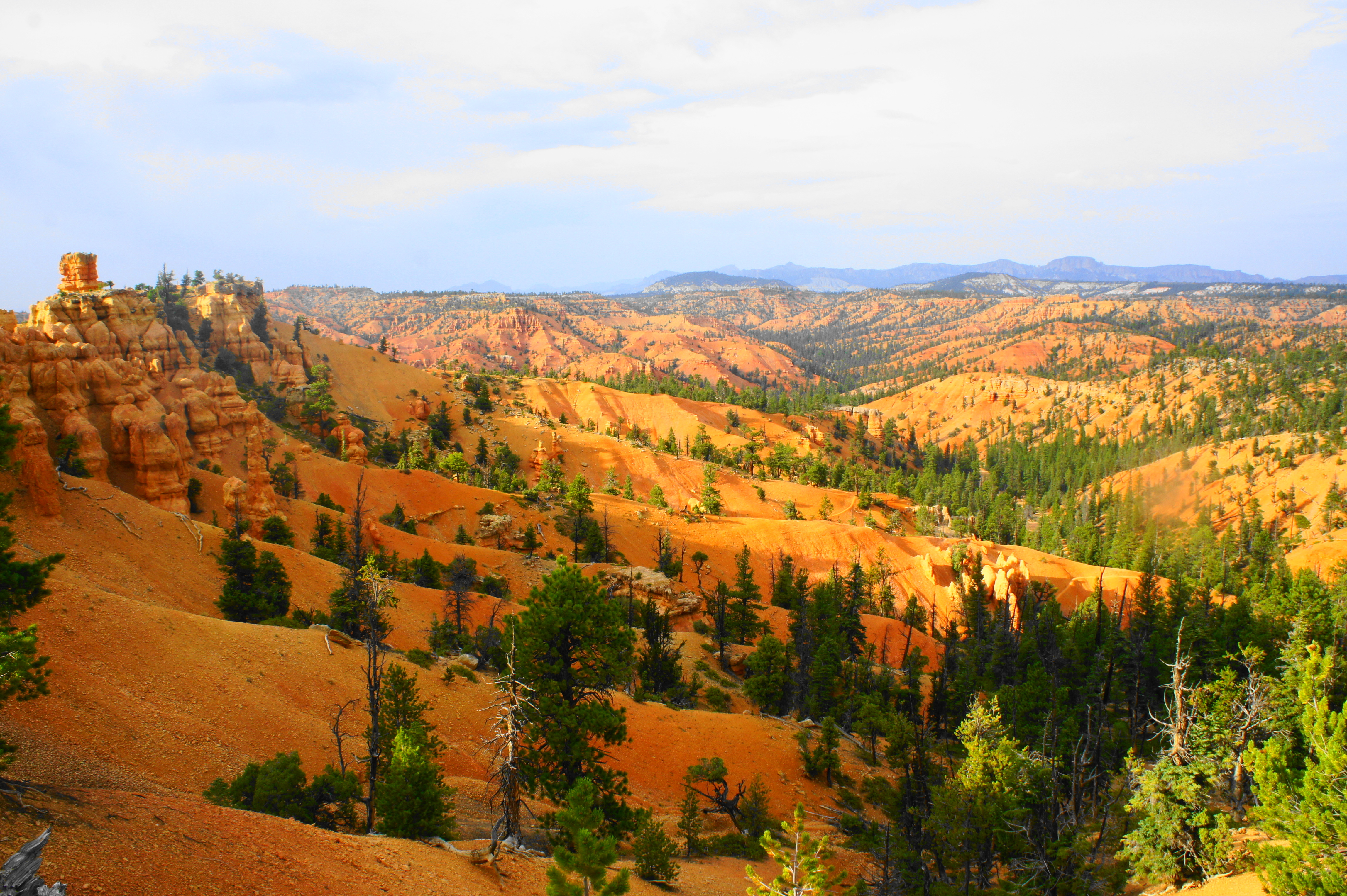
View south toward Thunder Mountain 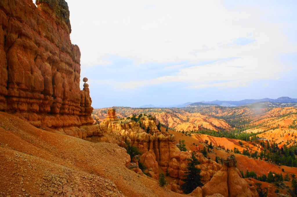
At the top of the staircase
Passing the stony temple on the right, a new drainage comes into view, this one boasting bulging, carrot-tinged fins and a pine-studded valley to the north. Red Canyon and Black Mountain (7,889’) return to view in the background, with Panguitch Valley off to the left.

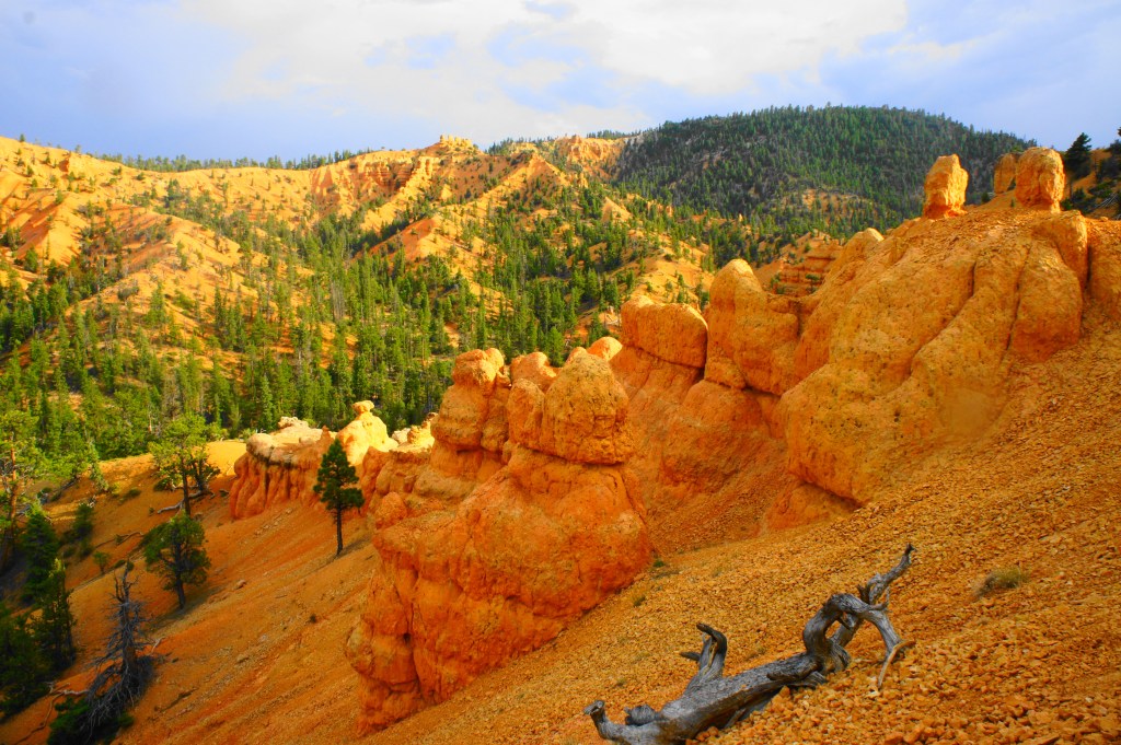
So now the trail descends back toward Highway 12, right? Wrong. Instead of dropping to the north, the trail hugs the ridge for a brief moment before descending again down the south slope, ending up in a wide, sandy wash at 1.6 miles. Briefly follow the drainage upstream before taking the unmarked-but-evident trail continuation. From here, the narrow path ascends sharply again, wrapping around to the west of the trail’s namesake: the Golden Wall, a spectacular, towering spectacle dotted with clear layers of brown, gold, and orange.

Having climbed around 200 feet from the wash, the trail at last crests another ridge, marking the end of the last ascent of the loop hike. From here, atop a shelf of grey ledges, hikers peer into yet another side drainage, this one bearing northwest toward the main Red Canyon.

Golden Wall 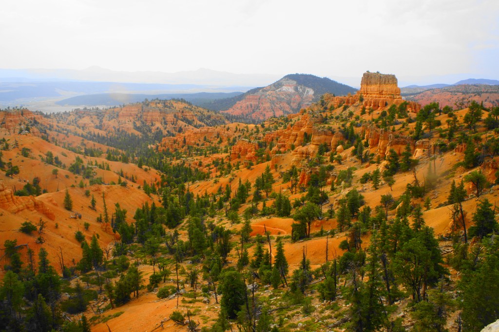
View from the final crest; the Golden Wall Trail drops into this canyon
From this point, roughly the 2-mile mark, follow the winding path as it drops into the canyon and crosses the dry streambed at 2.4 miles. Minutes later, the trail crosses back to the right side of the wash, and then reaches a trail junction—the steep and meandering Castle Bridge Trail bears off to the right, offering a longer (and more scenic) way back to the trailhead. Those short on time (as I was, trying to escape a looming thunderstorm), however, should continue straight on the Golden Wall Trail, which follows the widening wash and drops into it again at 2.7 miles. From here, follow the streambed for ¼ mile, after which the trail returns to the right bank and the Castle Bridge Trail rejoins from the right. From here, it is a half-mile of relatively level walking through pinyon-juniper forest to the main, much larger drainage cutting east-west through Red Canyon. Cross the wide wash, then climb to reach the paved Red Canyon Bicycle Trail at 3.4 miles. Bear right, following the bicycle trail (which parallels Highway 12 on the left) for a little over a half-mile to return to the entrance to Red Canyon Campground.

Hoodoos from the Golden Wall Trail 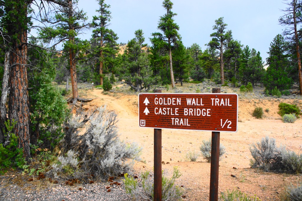
End of the Golden Wall Trail as it reaches the bicycle trail and Highway 12
All told, the loop as described involves around four miles of walking, although extensions (to Buckhorn Point and Castle Bridge) can add another mile. This is no easy walk in the park, however, considering the significant up-and-down, so plan to budget at least 2-3 hours for the scenic walk through the hoodoo wonderland.

We spent ten days in this area at the end of July. We stayed at Ruby’s Inn and RV Park. We knew we could hike Red Canyon without any people and socially distance with the virus. We did this loop last year. Great hike.
This is incredible and your photos are beautiful! ! Thank you for sharing. I’m so jealous, I’ve always wanted to go!
Pingback: Top 10 Hikes in 2020 | Live and Let Hike