
Piestewa Peak (2,608’) is the second-highest summit in the Phoenix Mountains, a smattering of cactus-covered peaks in the heart of Arizona’s largest metropolis. Situated inside the Phoenix city limits, Piestewa Peak is extremely popular, but the panoramic views across nearly the entire metropolitan area make the crowded climb worthwhile. Along the way, the wide, impeccably-manicured trail passes hundreds of southern Arizona’s iconic saguaro cacti and mounts several jagged rock outcrops. The route to the summit climbs relentlessly, gaining 1,168 feet in elevation, but is relatively short at 1.1 miles. The peak is named for Lori Piestewa, who was the first female Native American soldier in the U.S. military ever killed in combat and the first woman in the U.S. armed forces to die in the Iraq War in 2003.


The hike
Phoenix Mountains Preserve comprises several non-contiguous units arrayed across north-central Phoenix, but the hike to Piestewa Peak is in the main, largest unit at Phoenix Mountains Park and Recreation Area. From East Glendale Ave/East Lincoln Drive, turn on to East Squaw Peak Drive and follow it past the entrance gate. Park in the first major parking area on the left. (Note: If full, there are plenty of other parking areas along the road with connector trails leading to the start.) Look for the trail sign at the southwest end of the parking lot; this is the start of the 1.1-mile Summit Trail, which hikers will follow all the way to Piestewa Peak.

With the peak towering high above to the north, the Summit Trail (also doubling as Trail #302—Freedom Trail for now) begins climbing, heading northward first before reaching a first trail junction. The route continues up to the left, climbing westward to an initial set of switchbacks. The neatly-crafted path leads up to a bench with views of Phoenix at 2/10 mile, then settles into a northerly tread, continually climbing stony steps.

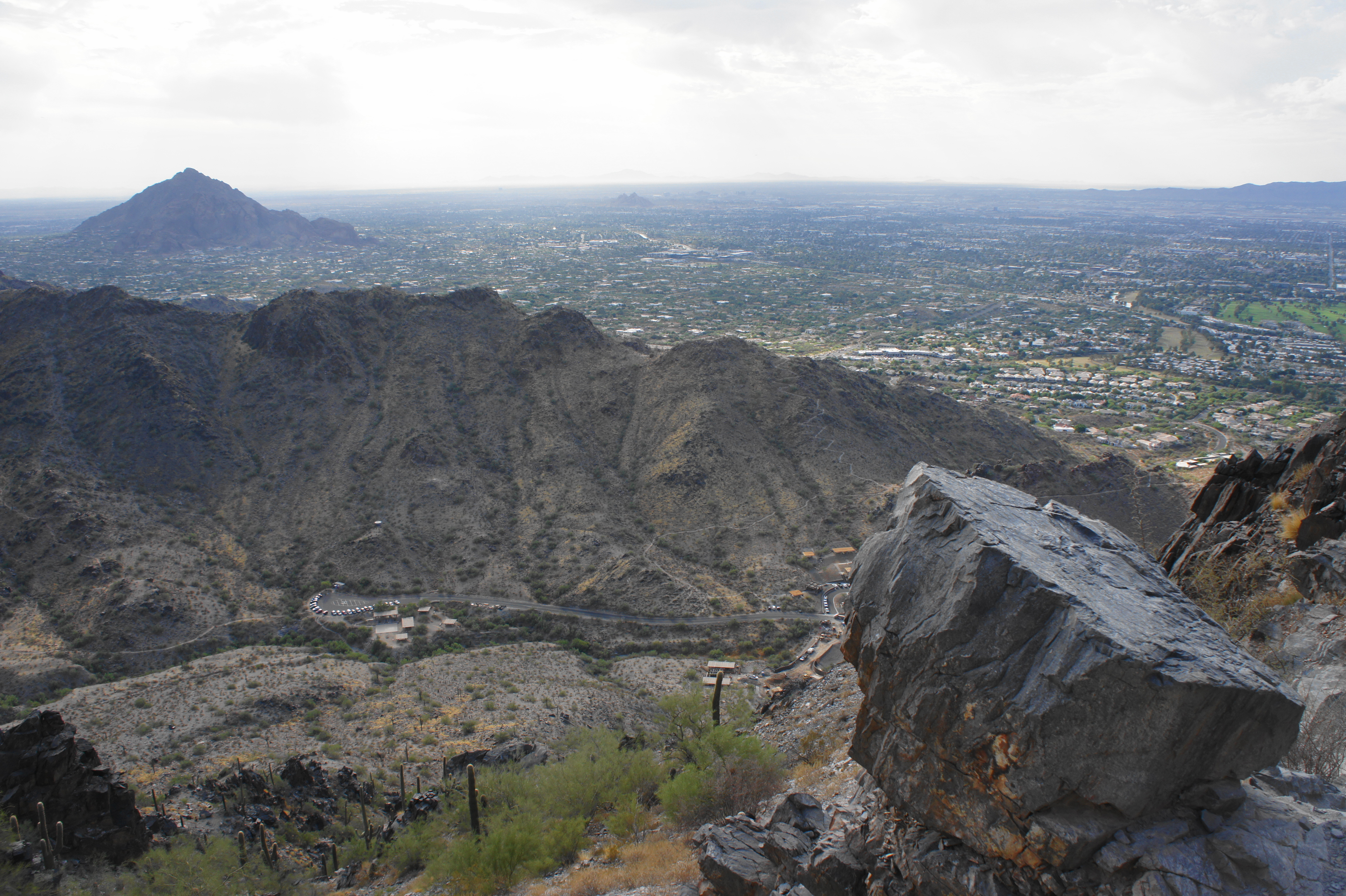
As the trail reaches a low saddle, the slope down to the right is dotted with saguaro cacti of various shapes and sizes, and hikers also get their first views down into the drainage to the west. By now, the skyscrapers of downtown Phoenix are in full view, with the city bounded by South Mountain and the Estrella Mountains to the south.

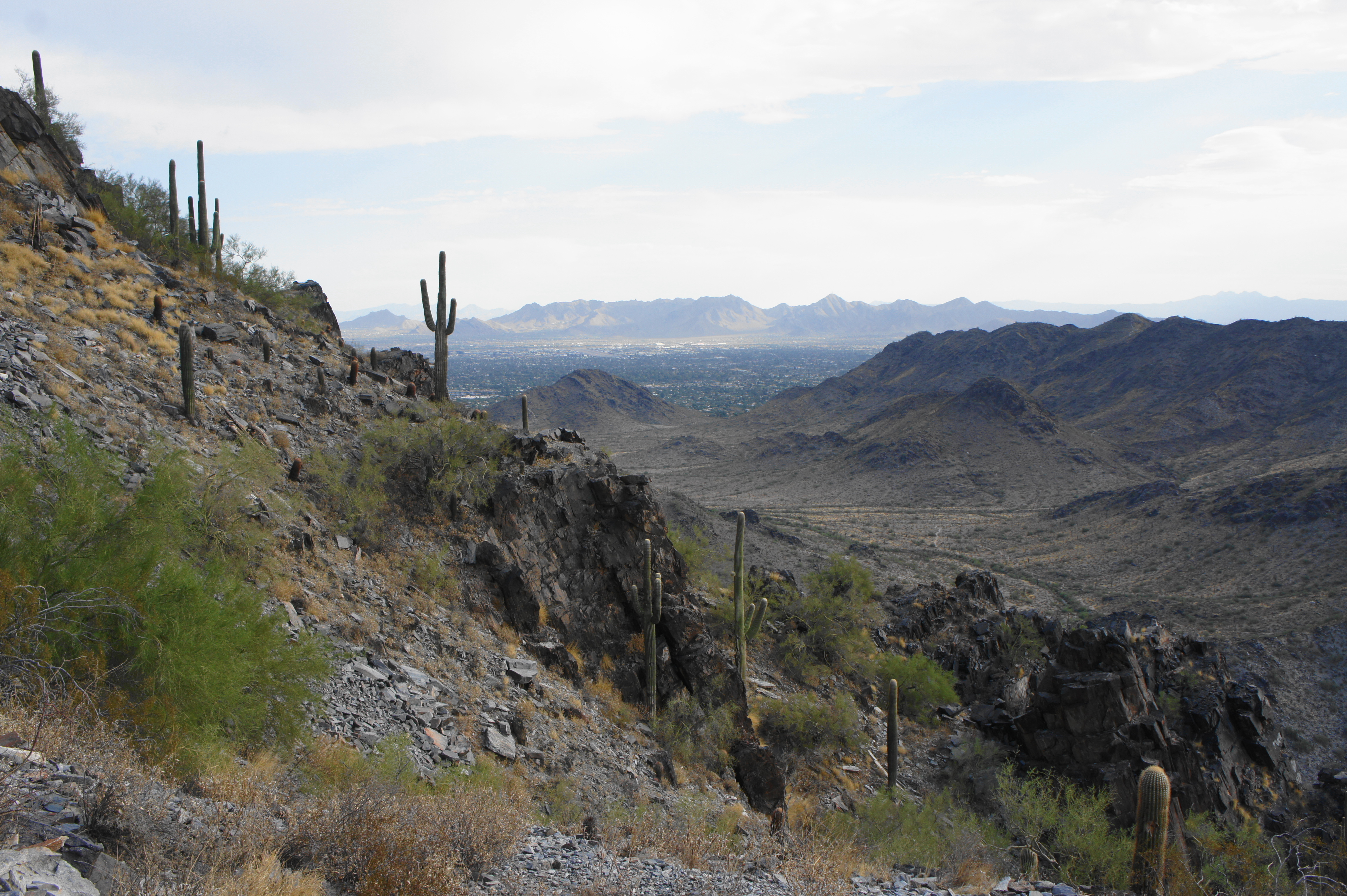
From here the Summit Trail ascends the steeply sloping ridgeline, switchbacking up to a second bench and then two more at a trail junction at 0.55 miles. Here the Freedom Trail drops sharply off to the left, while the Summit Trail continues right and resumes the steady climb. Hikers can now see even further off to the west, where the heavily-populated plains stretch all the way to the White Tank Mountains.
Beyond the junction, the trail enters a brief steep stretch, but, after swinging around to the west side (nice and shady in the morning), the incline suddenly disappears, providing a mild respite from the steady ascent. This is a nice area to examine the jagged, angular rock—composed of a very old metamorphic layer that is primarily schist. As for the flora, in addition to the saguaros, one can spot ubiquitous creosote, mesquites, and ocotillos, as well as barrel, hedgehog, and prickly pear cacti.

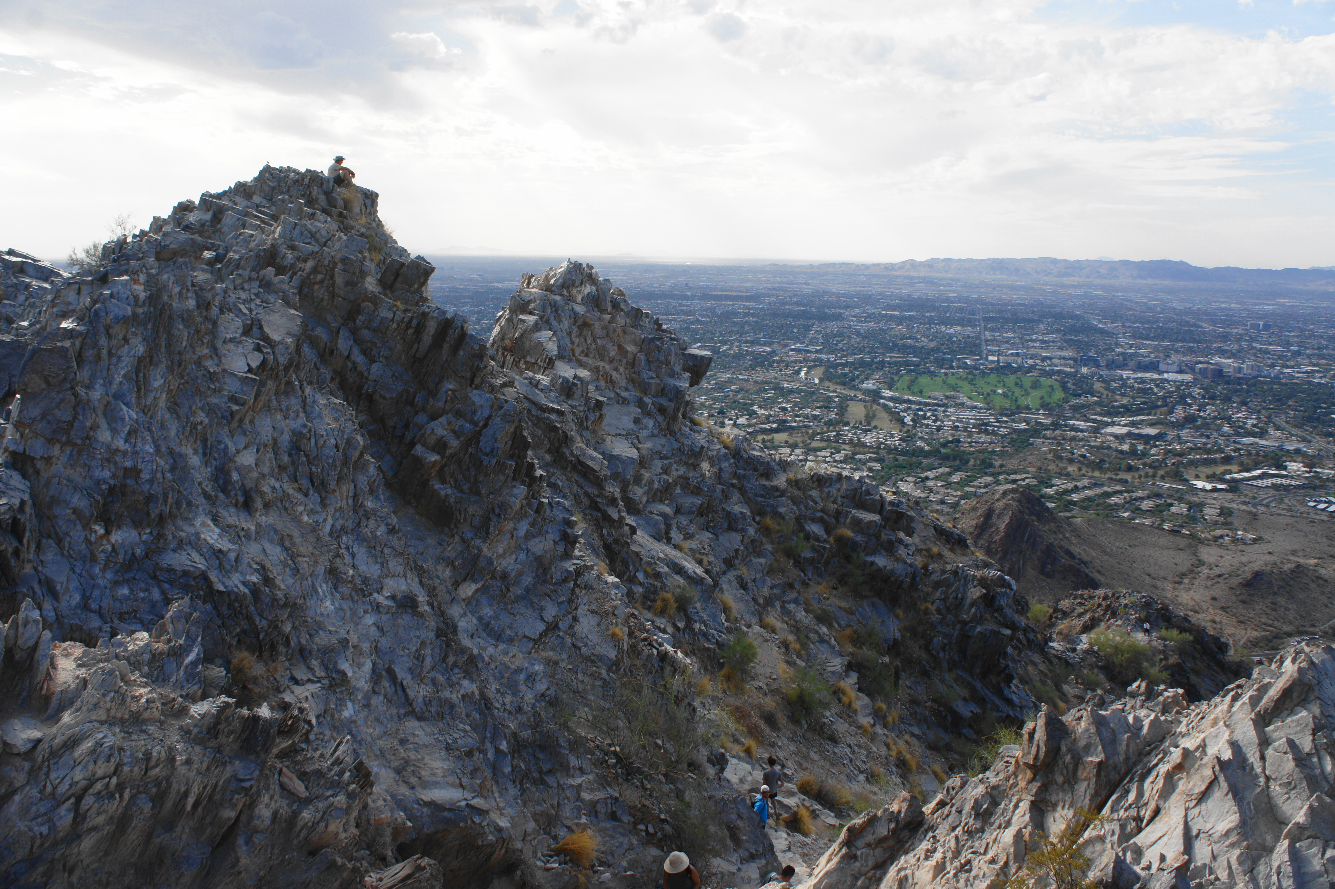
After treading along the west flank of the ridgeline, the trail returns to switchbacks with open views to the west, south, and east. By now, one can easily make out Camelback Mountain (2,706’), the highest peak in the Phoenix Mountains. Tall saguaro thrive up and down the spine of Piestewa Peak as hikers climb higher. At about the one-mile mark, visitors reach the steepest section; from here it is a sharp ascent up large stony stairsteps to a narrow notch. After wedging through the cleft, hikers are greeted with a choice: left or right to the various pinnacles of Piestewa Peak.
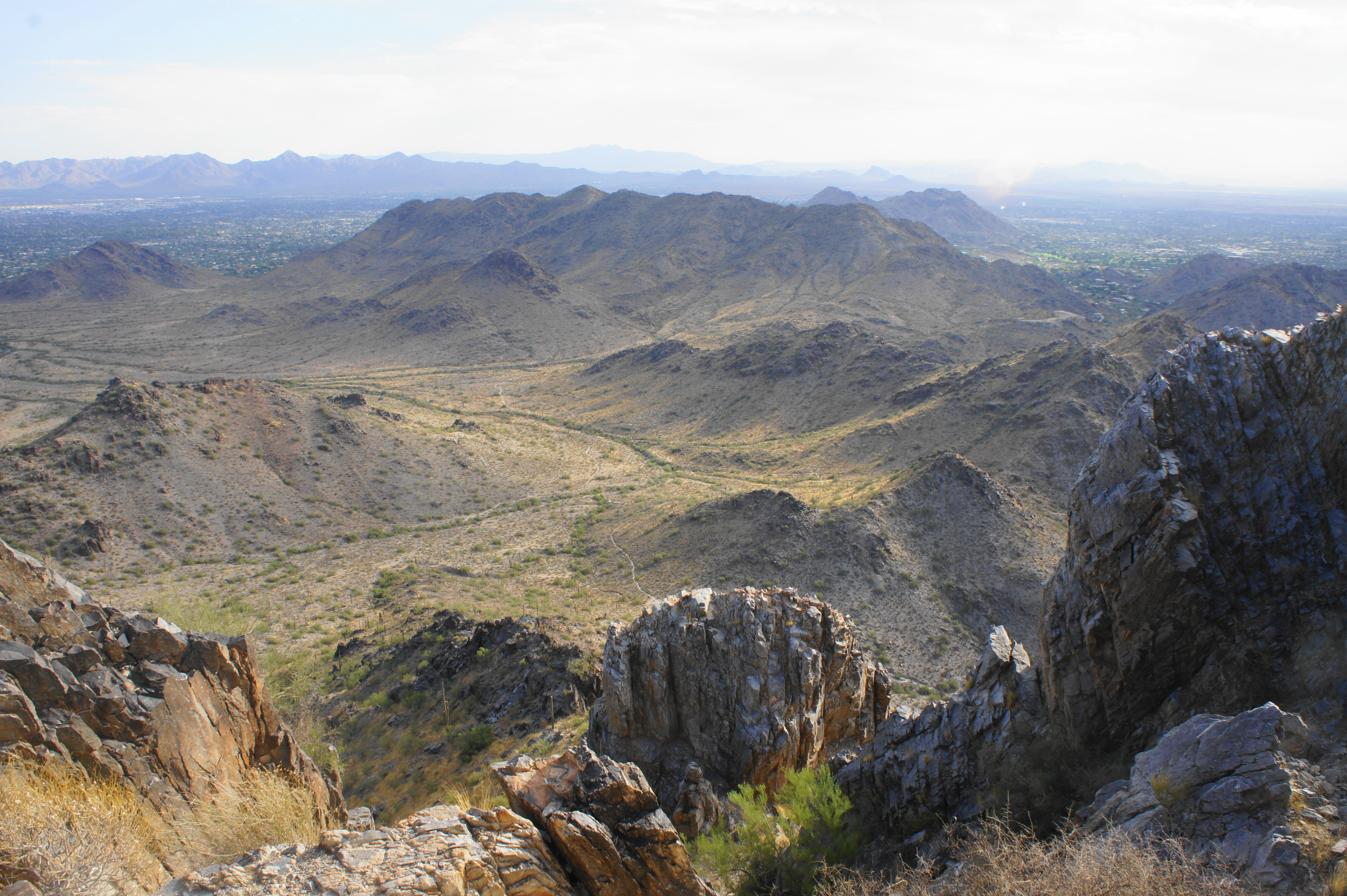
The panoramic views from Piestewa are simply excellent, as nearly the entirety of the Phoenix metropolitan area unfolds below in all directions. In addition to the usual southward and westward views, the frame looking north opens up for the first time on the hike: beyond the Phoenix Mountains lies Scottsdale, the Cave Creek area, and the McDowell and New River Mountains. On the horizon to the southeast, the Phoenix Valley stretches in the direction of Tucson, with the suburbs of Chandler, Gilbert, and Mesa in the foreground. Due east, one can see toward Tortilla Flat and the Superstition Mountains.
There are likely to be many other hikers at the peak on a busy morning, but the various summits offer a place for everyone to sit and take in the vistas. The toughest choice is deciding which way to face.

When ready, return the way you came—this is a one-way hike. The downhill is, of course, easier than the steady climb, but watch your step as you descend the steps with deep troughs. All told, the out-and-back clocks in at about 2.2 miles, a roughly 2- to 3-hour journey.

Pingback: Phoenix has parks for everyone, so don't miss out on the fun! - Lost In Phoenix