
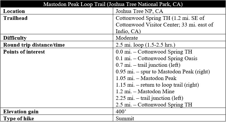
Mastodon Peak is a rocky knob in the Cottonwood Mountains of southern Joshua Tree National Park, situated in the Colorado Desert of southern California. From the modest summit, hikers gain 360-panoramic views, with the Eagle Mountains unfolding to the east, Cottonwood Mountains to the west, and Salton Sea to the south—miles of classic southwestern desert, replete with the iconic Mohave yucca, ocotillo, red barrel cactus, and other desert plants. The moderately-difficult Mastodon Peak Loop Trail forms a 2.5-mile circuit, passing through the wild oasis of Cottonwood Spring before climbing to the summit, then descending to a maze of sandy drainages, surrounded by Joshua Tree’s iconic chunky boulders. This is worthy stop for travelers driving on Interstate 10 between Los Angeles and Phoenix and, located near the southern boundary of the park, is considerably less-crowded than the desert Disneyland that is Joshua Tree’s Park Boulevard area.
The hike
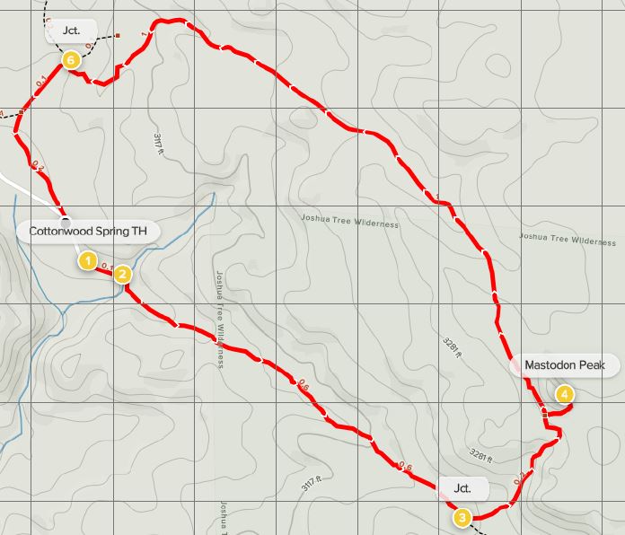
Cottonwood Spring, which serves as the trailhead for this hike, is located in the Colorado Desert, one of the two deserts that meet in California’s Joshua Tree National Park. While the namesake Joshua trees are absent in the Colorado Desert, beautiful desert oases are more abundant, and the Cottonwood Spring Oasis is one of the most easily-accessible. From Interstate 10, take Exit 168 and follow Cottonwood Springs Road northward for nearly seven miles, passing through Cottonwood Canyon. Bear right at Cottonwood Visitor Center, then follow Cottonwood Oasis Road to its end, parking at the trailhead at Cottonwood Spring. From here, a clearly marked trail heads eastward toward Mastodon Peak and Lost Palms Oasis. Take this route as it descends quickly into Cottonwood Spring Oasis.
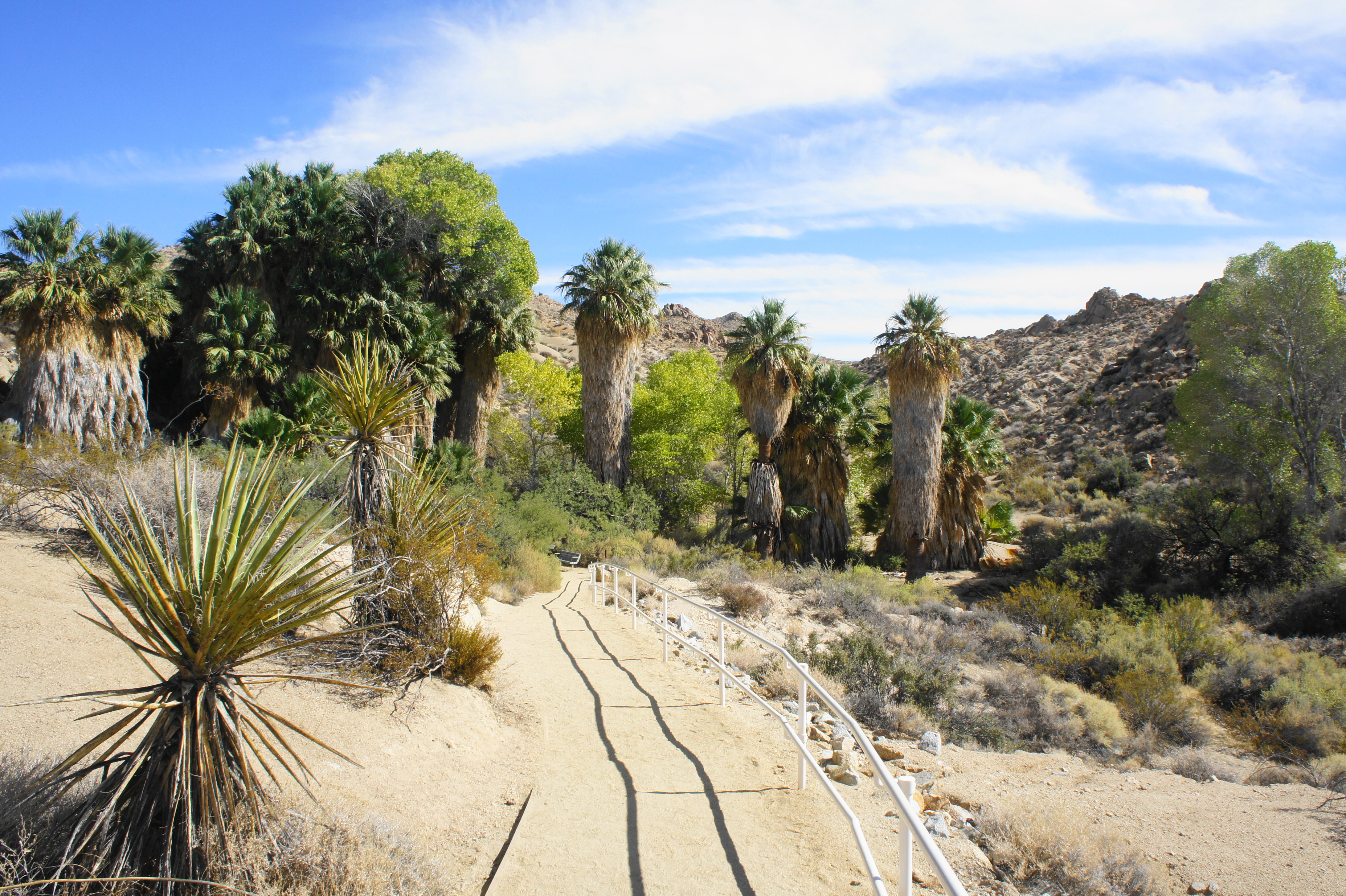
Nestled in an otherwise dry drainage in the Cottonwood Mountains, Cottonwood Spring Oasis is a lush paradise dotted with California Washingtonia (a.k.a. “fan palms”) towering dozens of feet high. Interspersed among the palms are namesake cottonwood trees, also fed by Cottonwood Spring, a rare source of water in the arid Colorado Desert. Cottonwood leaves turn a beautiful golden yellow in fall. The spring itself came to life via earthquake activity, which allowed water to seep out from the earth’s surface, creating the shady oasis seen today.
Beyond Cottonwood Spring Oasis, continue southeast on the Lost Palms Oasis Trail, which doubles as part of the Mastodon Peak Loop. The wide, easy-to-follow trail climbs gradually out of the sandy ravine, ascending a set of stairs at about 2/10 mile. (Note: A brief spur on the right leads to an example of bedrock mortars developed by the native Cahuilla people who used to dwell here.)
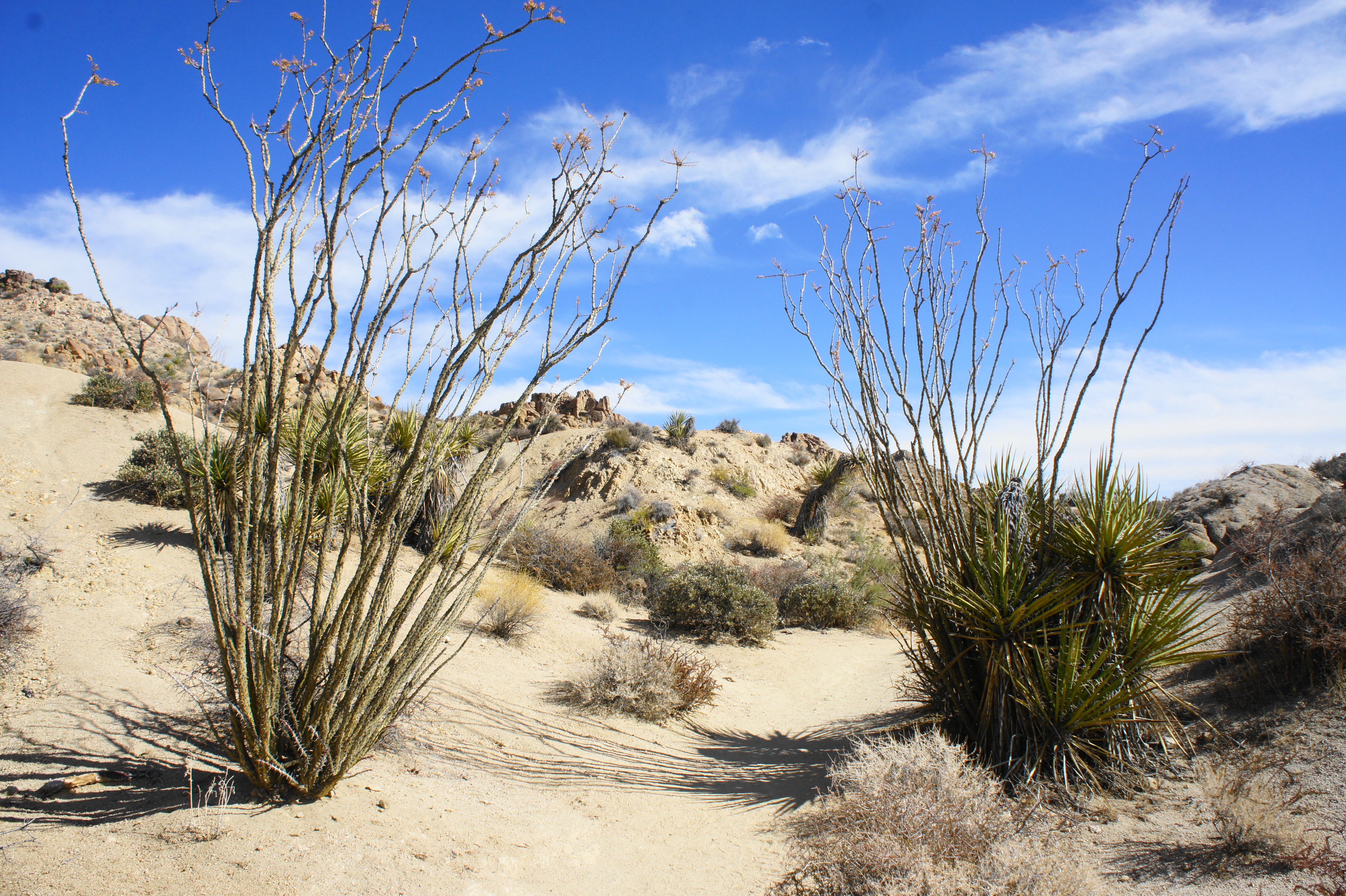
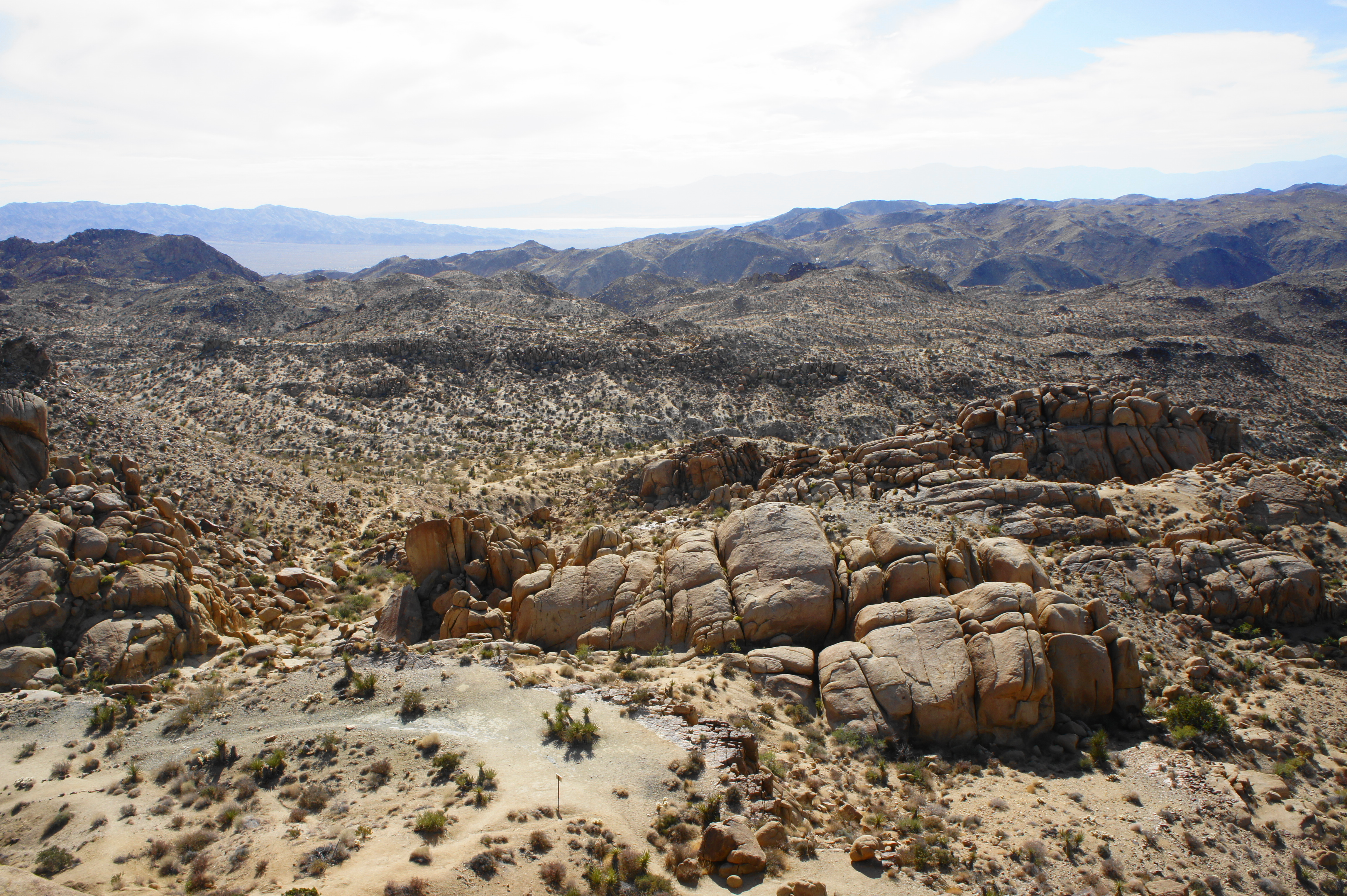
Slight variants on sagebrush, saltbush, and creosote predominate in the Colorado Desert, but more prominent plants—including Mohave yucca, California barrel cactus, buckhorn and pencil cholla, and ocotillo—become increasingly visible as the trail proceeds. After passing through a pair of ocotillos, the trail descends a set of stairs to clear another wash before ascending again to a basin with lots of spiky yucca plants. By now, hikers also start to get more open views of the surrounding Cottonwood Mountains.
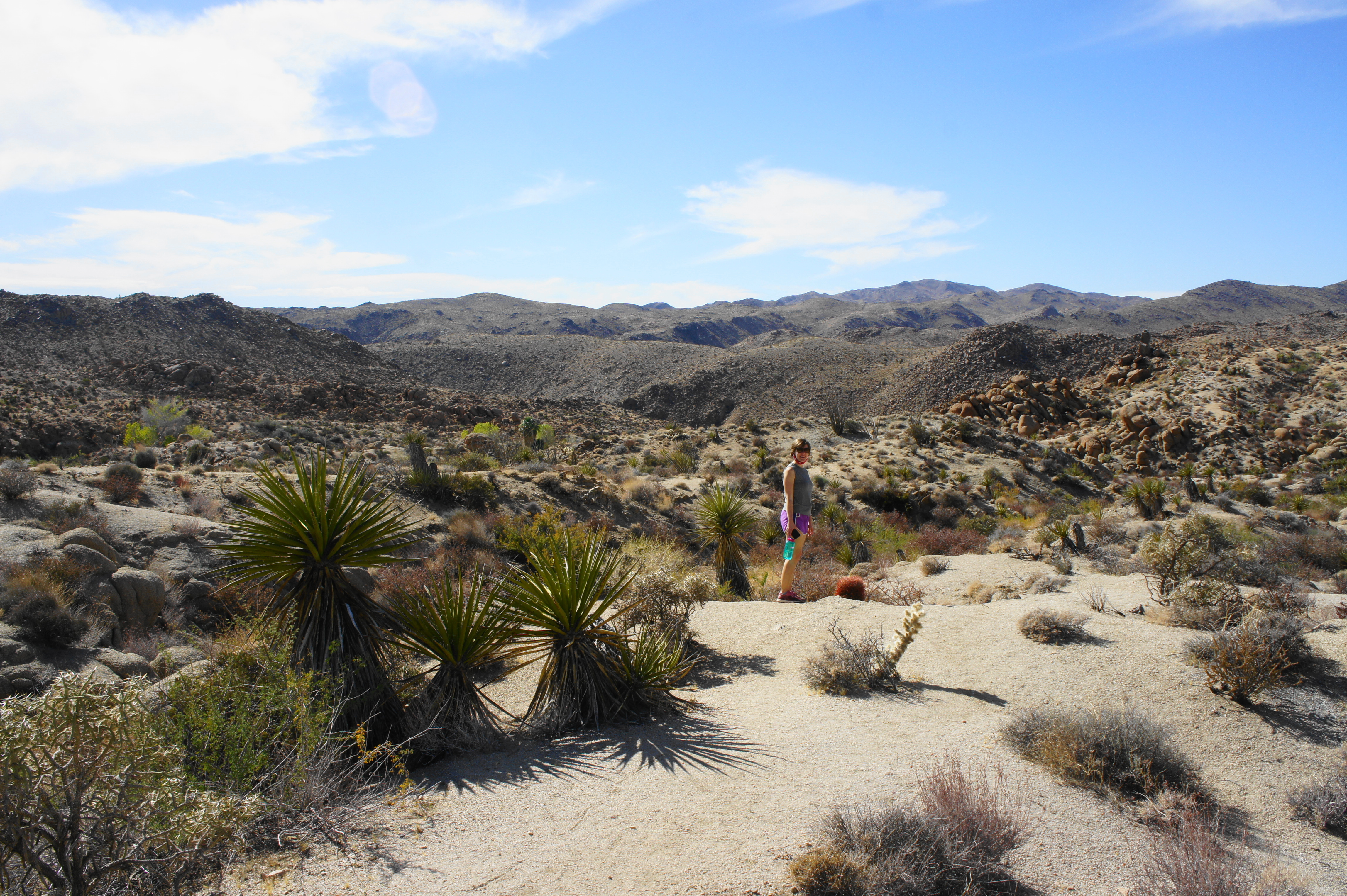
The trail continues to climb to a junction at 7/10 mile, where the Mastodon Peak Trail bears off to the left. Take this turn and ascend through a rock garden and stony notch, with the summit of Mastodon Peak (3,285’)—one high outcrop among many—visible ahead. The rock formations of the area are the result of faulting and weathering, while the orangish hue is a product of chemical changes that have occurred when the mineral components of the metamorphic rock combine with water.
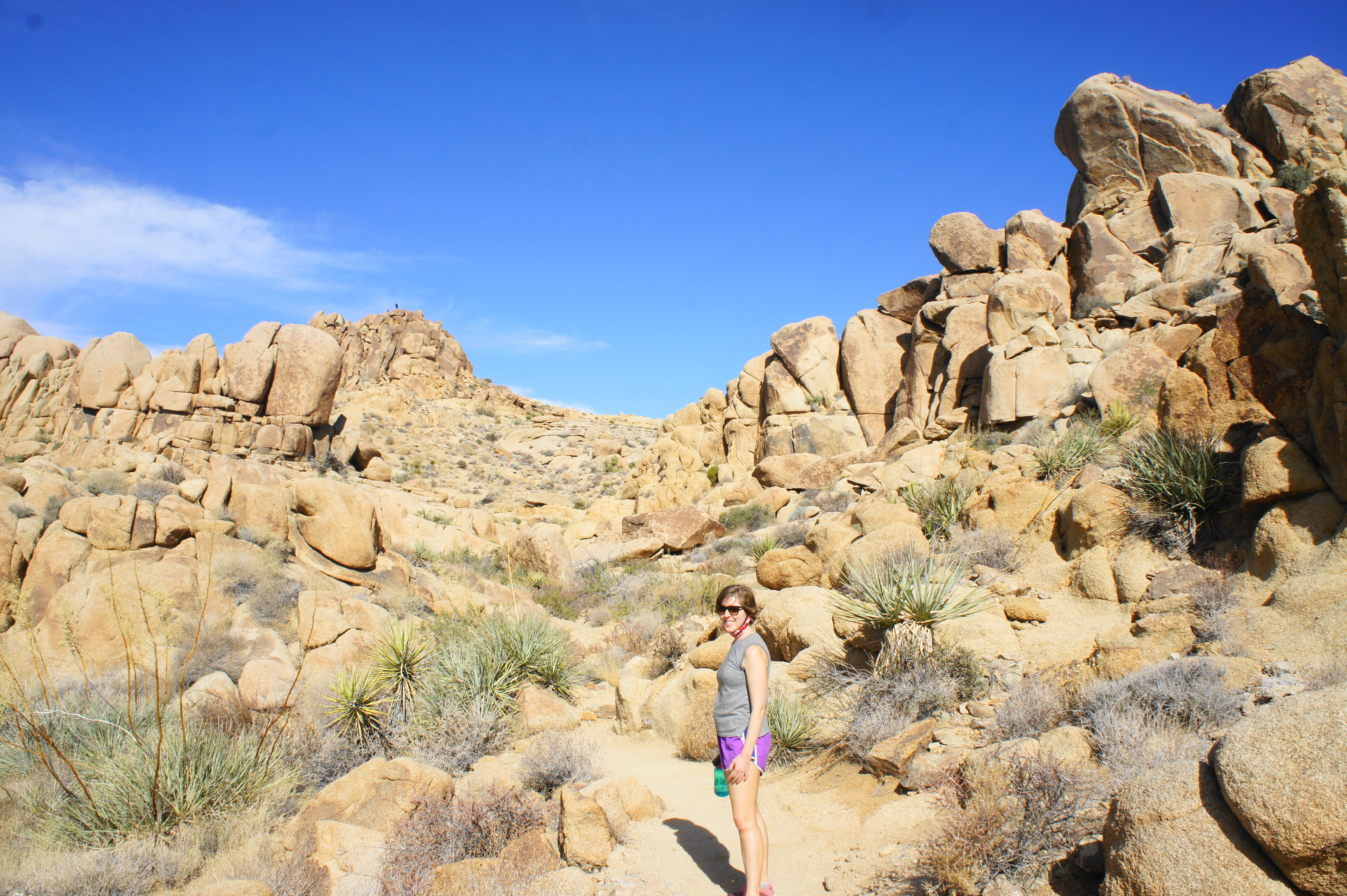
There are a couple points in this section where the trail is harder to follow: keep your eyes peeled for trail cairns and rock dividers that keep hikers on the right track. After ascending a set of crumbly slopes, a spur trail leads off to the right: this unmaintained track leads to the summit of Mastodon Peak.
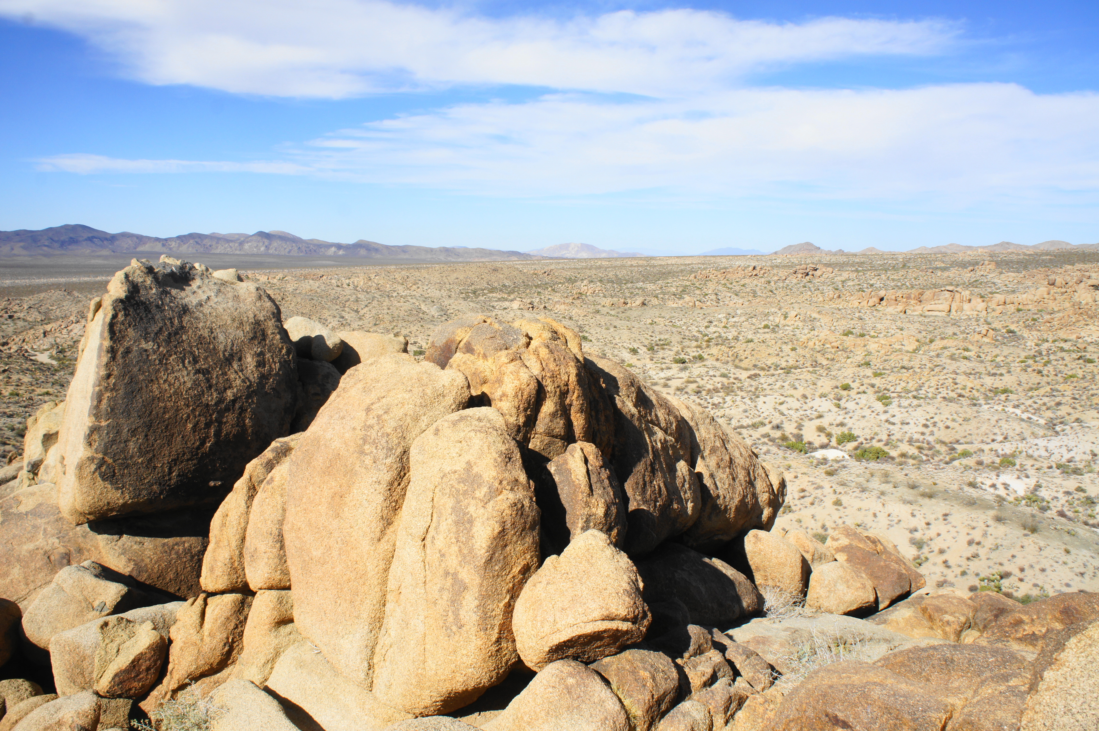
The final ascent requires some modest rock scrambling along the backside of the peak but is not particularly strenuous. Those reaching the summit are rewarded with wide-reaching vistas: north and west across Pinto Basin to the Hexie Mountains, east to the high Eagle Mountains, south across the Cottonwoods toward Coachella Valley and the Salton Sea, and west to Cottonwood Basin, with the Mojave Desert beyond. A mere mile from the trailhead, this summit panorama packs quite the punch for relatively little effort.
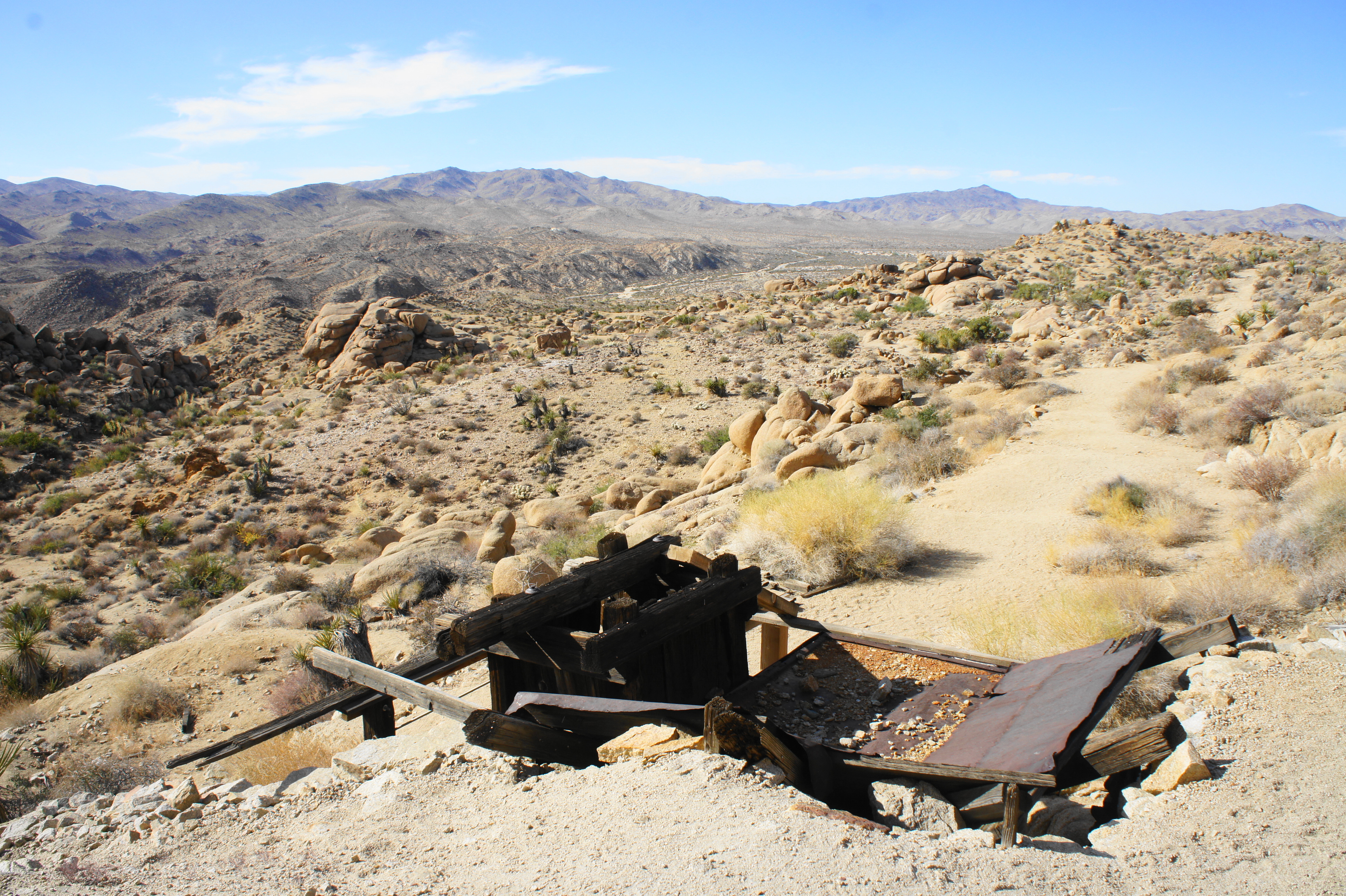
Retrace your steps back down the spur trail to the main track, this time turning right to continue on with the loop. (Note: Follow signs for the campground.) After hugging the mountain on the right, the Mastodon Peak Loop Trail descends to the long-abandoned Mastodon Mine, a gold mine which—like nearly all mines in the area—provided brief but ephemeral hopes of profit.
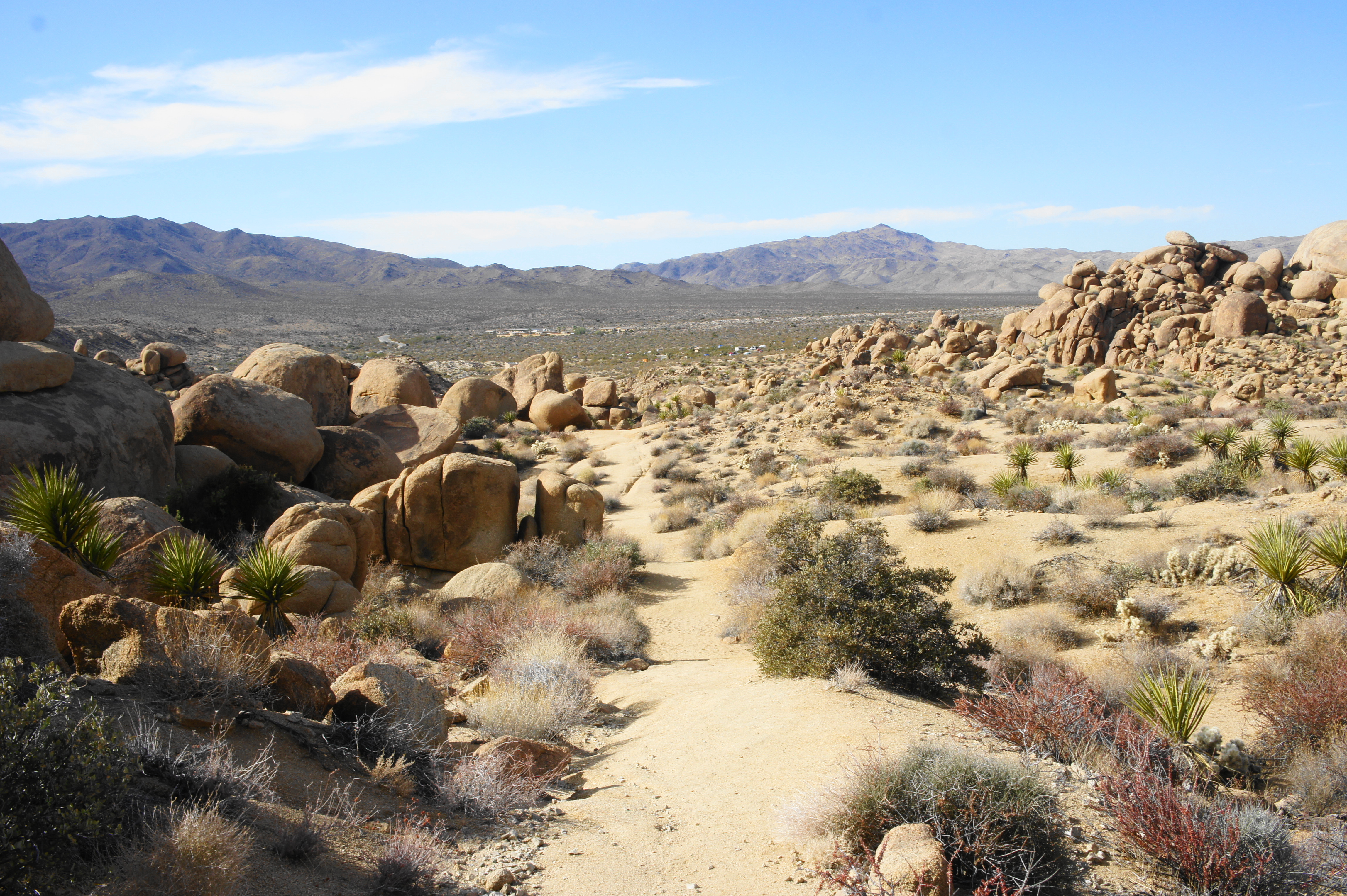
From the mine, the trail drops to a sandy wash at 1.45 miles. Follow the arroyo for around ¼ mile, then leave the wash on the right, descending again—amid gargantuan boulder—to a larger wash at 1.9 miles.
The trail leaves this drainage again on the right at 2.05 miles, after which the trail follows a narrow track into a side ravine with more palms, cottonwoods, and—curiously—non-native eucalyptus trees. Emptying into yet another wash, follow the sandy basin to a trail fork. Stay left, following the wash into a wider drainage with lots of creosote bush. Just before reaching Cottonwood Oasis Road, look for a marked path heading off to the left, which leads back to the road just short of the parking area. This is the end of the 2.5-mile hike.
The Mastodon Peak Loop Trail is a moderately-difficult trek that should take between 1 ½ and 2 ½ hours. Of course, it’s best to avoid summer—but if you are in the area during the brutal hot months, plan to hike early in the morning.

Thank you for sharing this post. Joshua Tree Park seems to be a favorite park of many, and I am going to look into it some more.