
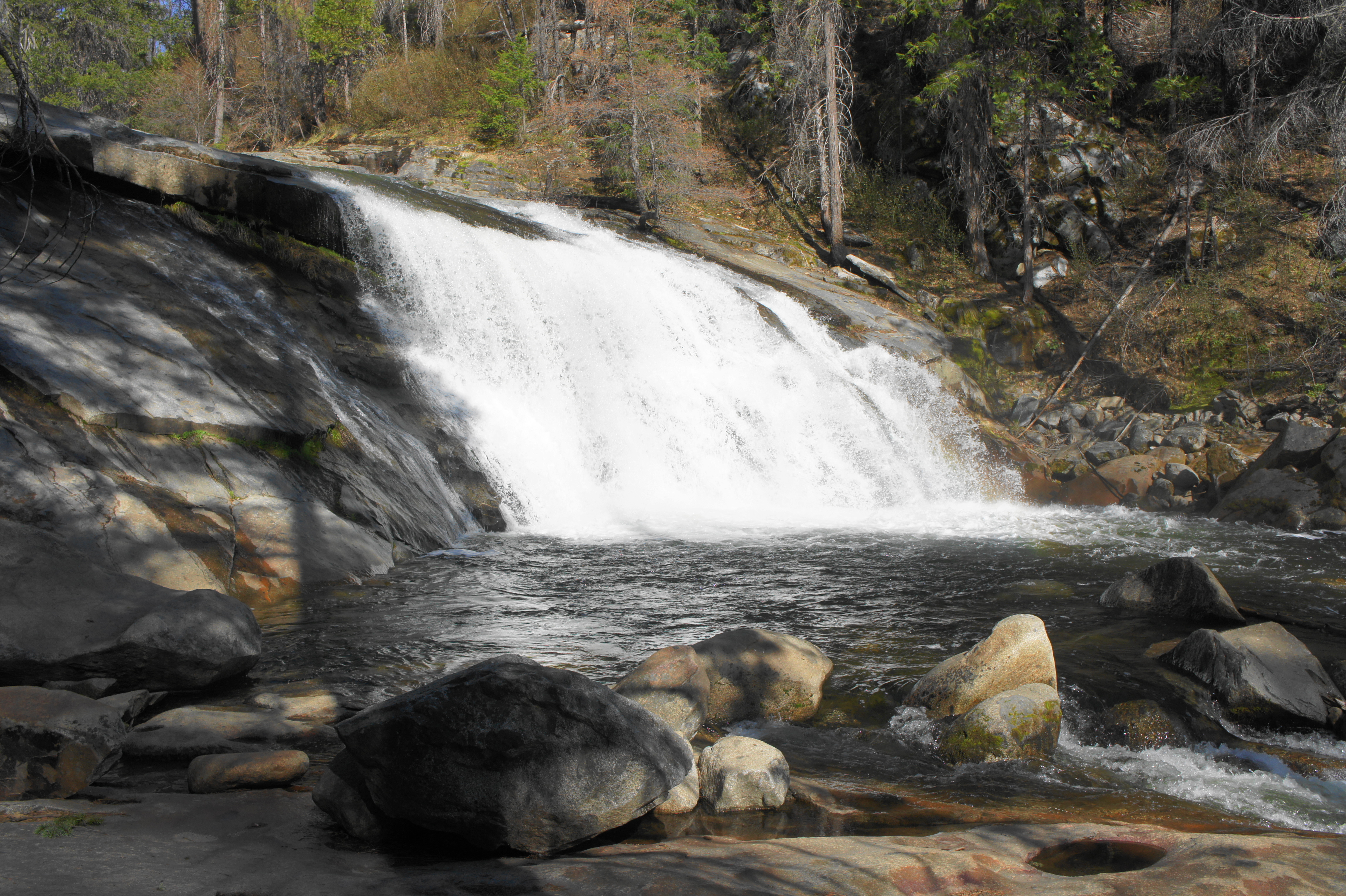
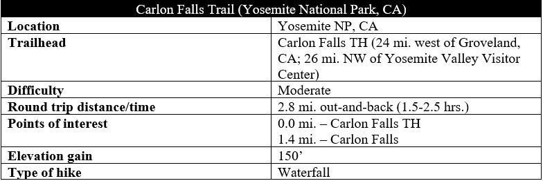
Starting just outside Yosemite National Park, the Carlon Falls Trail is off the usual tourist track but features a lovely, 30-foot waterfall along the South Fork of the Tuolumne River. Mostly level as it hugs the north banks of the river, the trail climbs abruptly near the end, culminating at the multi-tiered falls, punctuated by small pools that could serve as summer swimming holes. Unlike many other waterfalls in Yosemite, Carlon rushes year-round, making this is a nice destination in the fall when streams elsewhere in the park have dried to a trickle. The very pretty, 3-mile hike is worth a stop for those en route to and from Yosemite Valley along the Big Oak Flat Road.
The hike
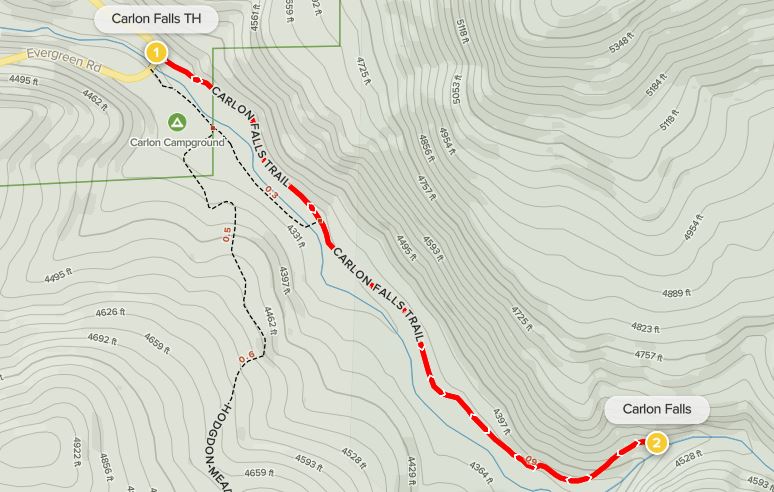
Reaching the trailhead in California’s Stanislaus National Forest requires turning off Big Oak Flat Road onto the north-bound Evergreen Road (a.k.a. Route 12), just over a mile north of the Big Oak Flat Entrance Station in Yosemite National Park. Evergreen Road snakes roughly eastward for a mile, then crosses a bridge over the South Fork of the Tuolumne River, where there are three separate parking areas, which can be somewhat confusing. Eschewing the turnoffs for the Upper and Lower Carlon Day Use Areas along the south bank, proceed across the bridge and park in the small lot on the right – it is marked “Carlon Falls.” (Note: If full, park in one of the day use areas.)
From here, a narrow trail plunges immediately into the thick conifer forest. With the river on the right, the Carlon Falls Trail (a.k.a. South Fork Tuolumne River Trail on some maps) enters Yosemite National Park and the Yosemite Wilderness after 1/10 mile. As the trail roughly parallels the South Fork on the right, the river proceeds through sections of relative stillness and steady flow. The undergrowth is dotted in places with green horsetail reeds, a bamboo look-alike found in riparian zones across North America.
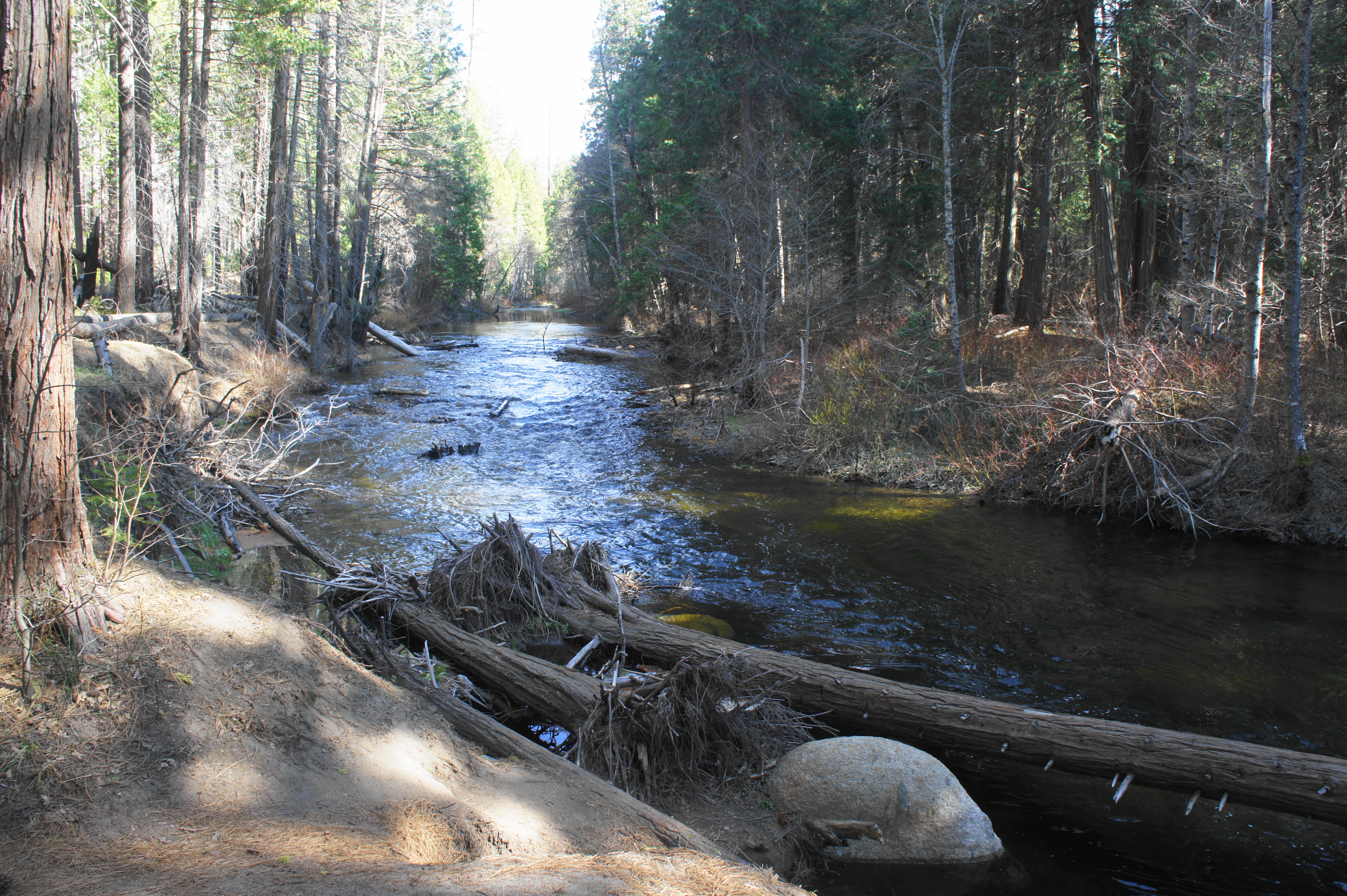
After stepping over a short, shin-high wall (remnants of an old structure?) at 2/10 mile, the trail turns abruptly rockier and more rugged for a brief stretch before settling back into a pleasant track blanketed with pine needles. As the trail follows the floodplain, occasional deep pools can be seen along the river.
After more than a mile of pleasant walking across relatively level terrain, the trail cuts left and ascends to clear a high point at a bend in the river. As the river narrows and the still waters turn to rapids and cascades, the trail becomes suddenly steep, climbing a very rocky slope to clear some high bluffs. Then the narrow path lurches downward to clear a ravine, followed by an unmarked fork. While the most obvious path continues right to the banks of the stream, the onward route to the falls actually bears left, ascending sharply up another rock outcrop. This section requires a short scramble that may require the use of hands to propel oneself. (Note: It is far from the technical, however.)
About 1/10 mile later, hikers embark on a “choose your own adventure,” as paths head off in two directions again. Heading right leads down to the river, where onward progress requires some scrambling over boulders and cutting through scrub. Staying left is easier but climbs again. Head left to mount a spot where one can begin to make out Carlon Falls.
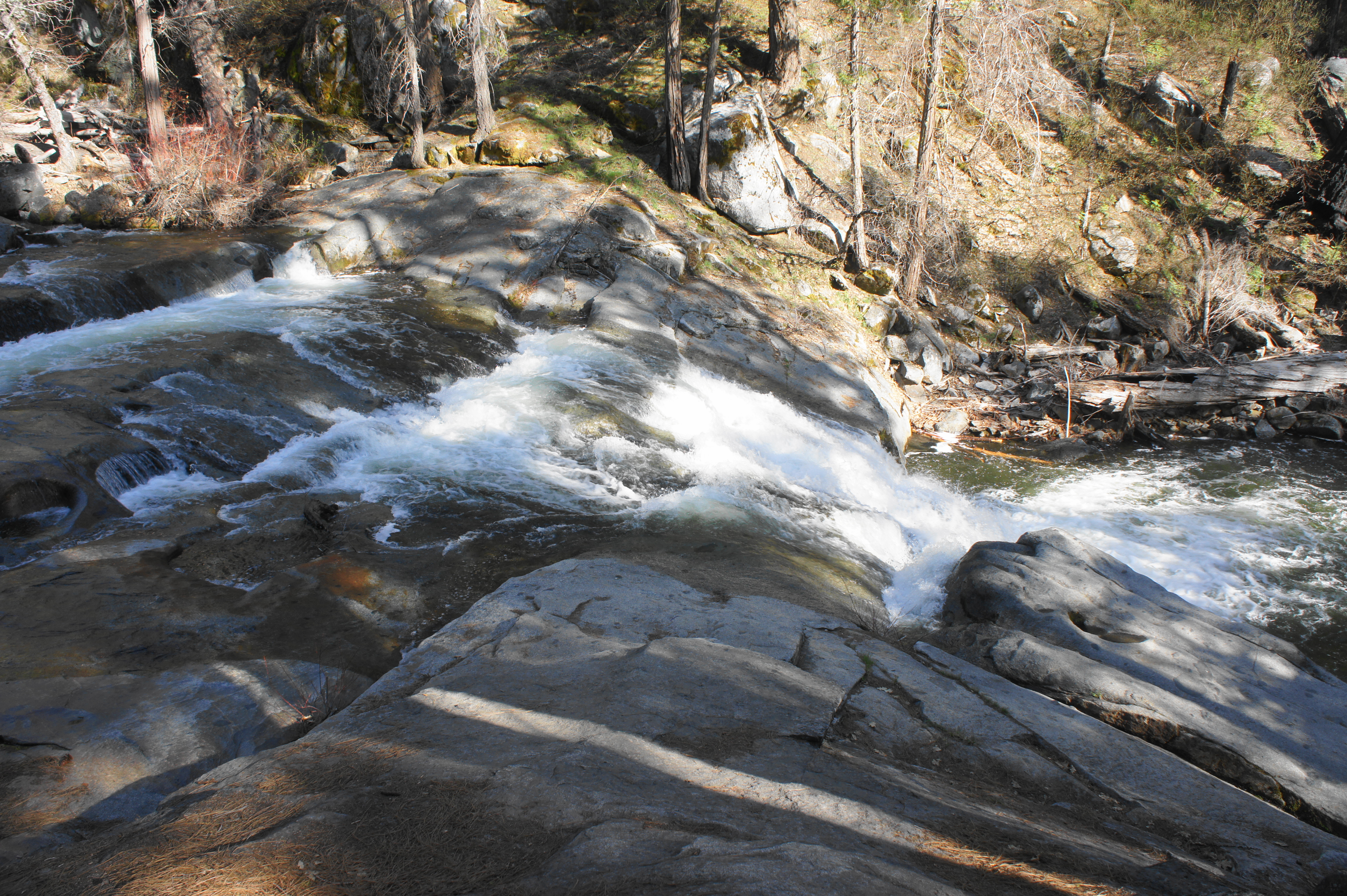
By now it is obvious that the cascades drop in several installments, but the primary waterfall is a 30-foot drop straight ahead. Descend where possible and weave amid the boulders and granite slickrock to a spot where hikers can access the pool just below the falls. The rushing waters fan out across a span that can be as much as 50 to 60 feet wide.

After enjoying the falls, return the way you came. The moderately-difficult hike should take between 1-3 hours to complete, depending on pace and how much time one spends at the falls.

I believe the ruined structure mentioned is the remains of the Carl Inn swimming pool.
Pingback: Top 10 Hikes in 2021 | Live and Let Hike
Pingback: Chilnualna Falls Trail (Yosemite National Park, CA) | Live and Let Hike