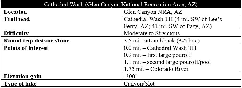
Appearing modest from the trailhead, Cathedral Wash quickly deepens into a spectacular canyon that cuts through the Kaibab Limestone and Toroweap Formation in northern Arizona’s Glen Canyon area, ending at the Colorado River and a narrow sliver of Grand Canyon National Park. Don’t be fooled by the hike’s short distance: this is a trail-less adventure, requiring route-finding and mild scrambling to overcome several obstacles, including nasty pouroffs, muddy pools, and exposed ledges. That said, this is not a technical slot canyon, and—given that it is somewhat well-advertised by Glen Canyon National Recreation Area—it is a relatively popular hike for hikers of all ages, a fun half-day adventure in the area around Lee’s Ferry. (Note: As with all slot canyons, conditions vary widely; on some days, muddy pools are hard to avoid, while on other days—like during my visit in May 2021—avoiding wet feet is relatively straightforward. Due to flash flood danger, don’t enter when there is rain in the forecast!)
The hike
The entry to Cathedral Wash lies just within the pay area for Lee’s Ferry, just north of the “town” of Marble Canyon on the west flank of the Colorado, near the Navajo Bridge Interpretive Center. While the Colorado River itself remains within the jurisdiction of Grand Canyon National Park, the bulk of the hike lies within Glen Canyon National Recreation Area, a massive tract best known for nearby Lake Powell, a dammed reservoir located upstream.
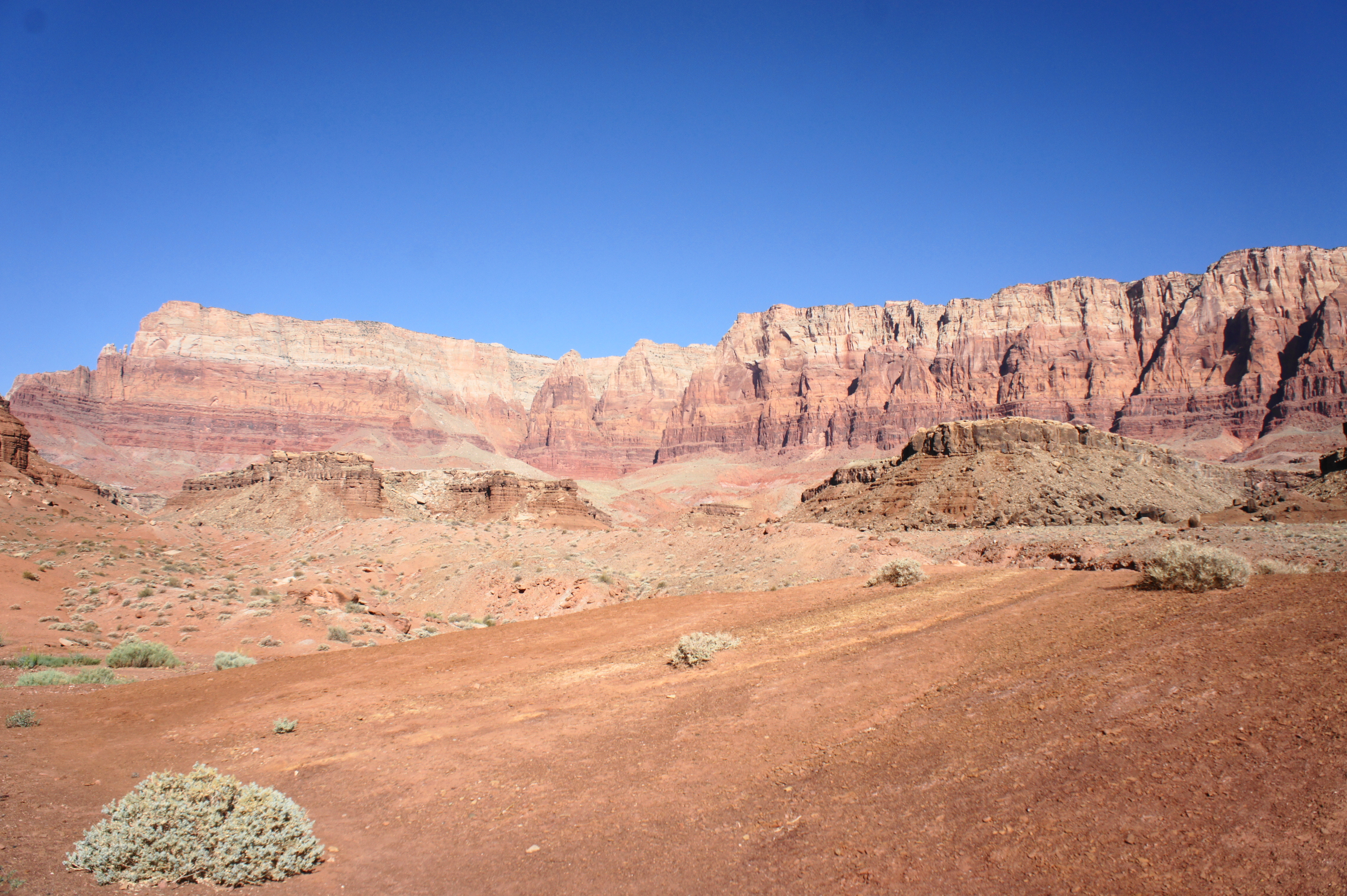
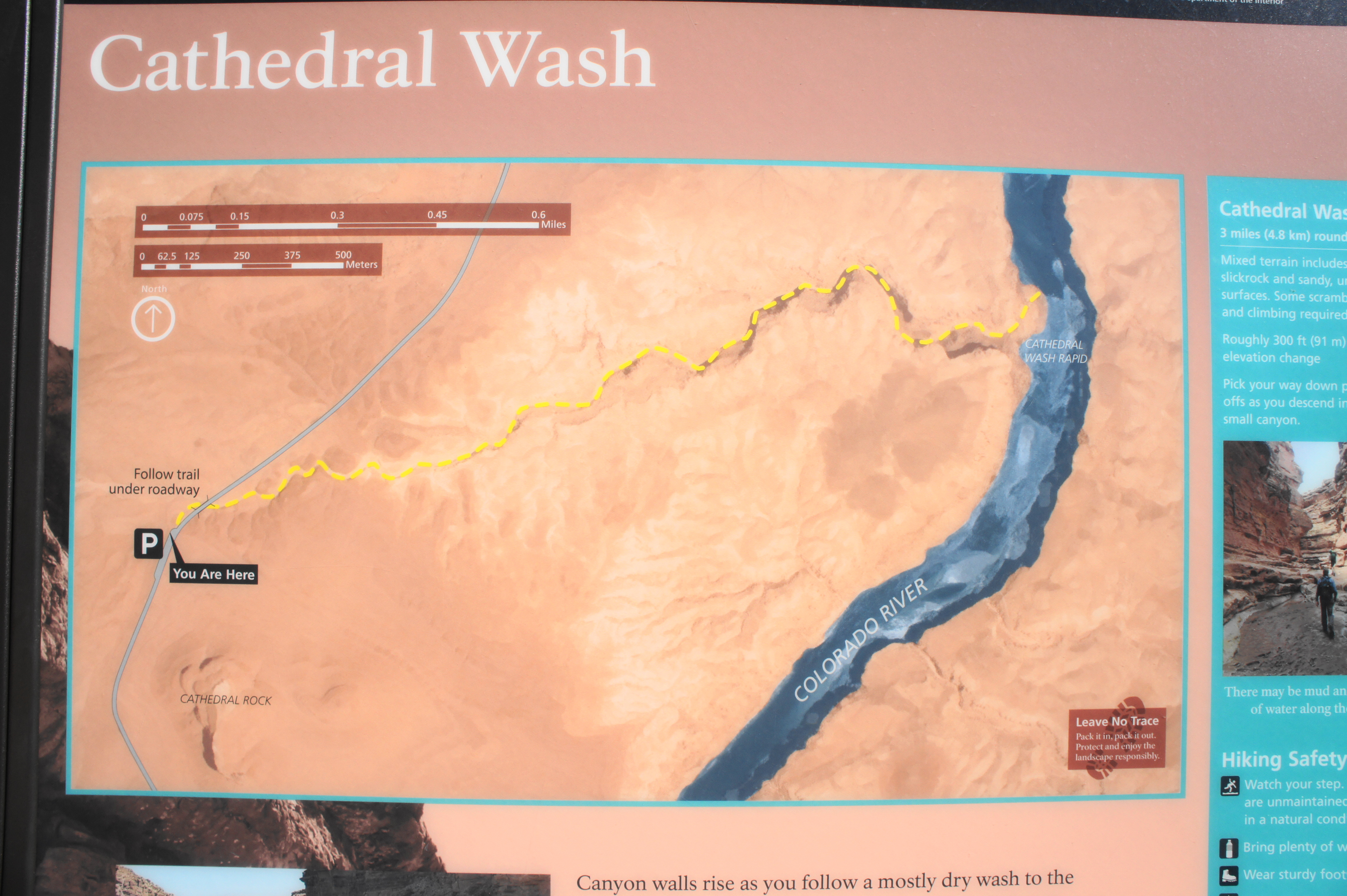
As visitors bear north on the road toward Lee’s Ferry, the drive takes one across a broad and crumbly shelf, with the multihued Vermilion Cliffs towering above to the west and the deep incision of Marble Canyon off to the east, obscured from view. The trailhead for Cathedral Wash lies 1.4 miles down Lee’s Ferry Road, with a long, paved pull-off on the left. From here, a wayside sign details the geology of the Vermilion Cliffs, and a second sign, indicating the start of the Cathedral Wash hike, guides the way into the wash. (Note: Technically one can continue up the wash, toward the Vermilion Cliffs, into Upper Cathedral Wash, but it is Lower Cathedral Wash—east from the trailhead—that packs the more spectacular views.)
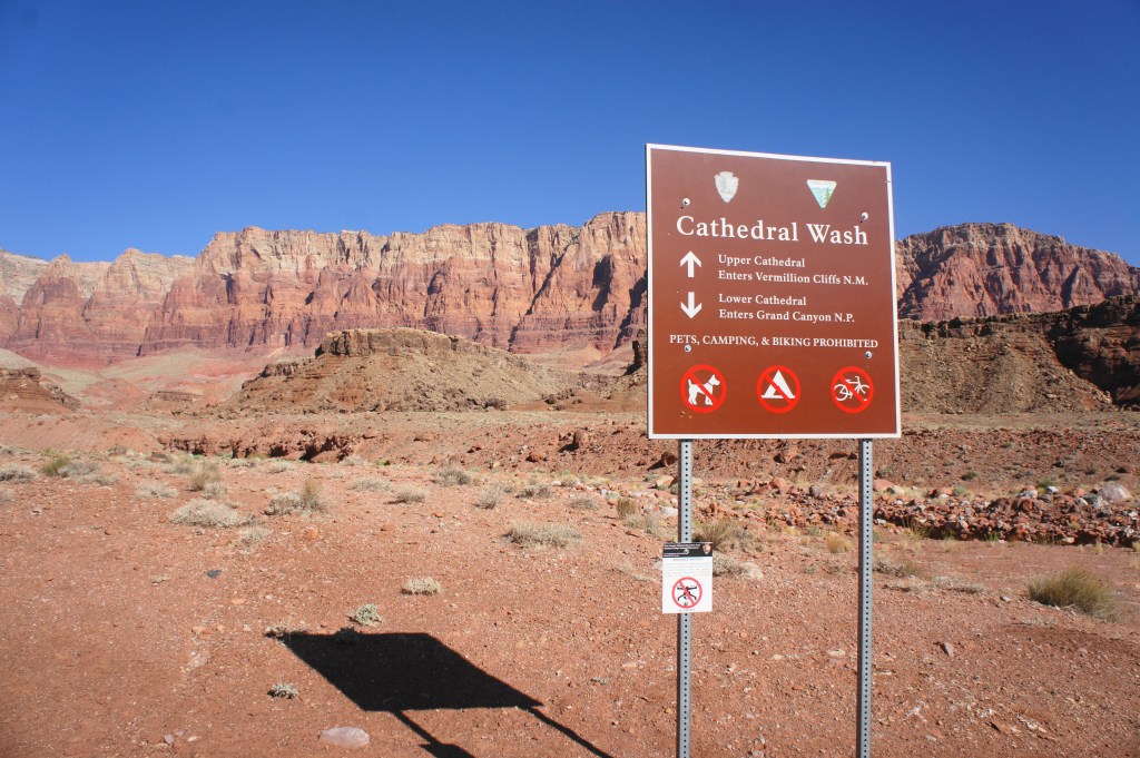
Cathedral Wash Trailhead 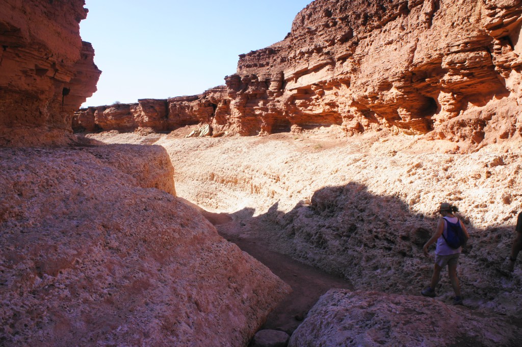
Starting down Cathedral Wash
From the trail sign, follow the sidewalk east-northeast to its end, after which the path turns to dirt and drops down into Cathedral Wash. Bear right and pass through a culvert under Lee’s Ferry Road, carefully following deep concrete steps on the other side to drop back to the natural wash, now on the east side of the road.
While the Vermilion Cliffs are primarily composed of “newer,” Jurassic-period rocks, the hike begins in the reddish Moenkopi Formation, a rock layer dating to the Triassic period (240-250 million years ago). This crumbly layer is ubiquitous across the Colorado Plateau, especially in nearby Utah, forming the base of tall geologic formations in places such as Zion and Capitol Reef National Park.
The Moenkopi sits atop the harder and even older Kaibab Limestone layer, which quickly comes into view as hikers make their way down into Cathedral Wash. After about ¼ mile of easy walking through the gradually-deepening canyon, the bedrock turns to a ghostly, speckled, cream-colored layer, marking the transition into the Kaibab Limestone. It is relatively unusual to find narrows and slot canyons in this layer (and the subsequent Toroweap Formation), but the gradual weathering of Cathedral Wash has revealed a weakness in the rock, allowing seasonal floods to cut ever deeper into the stony shelf en route to the Colorado River below.
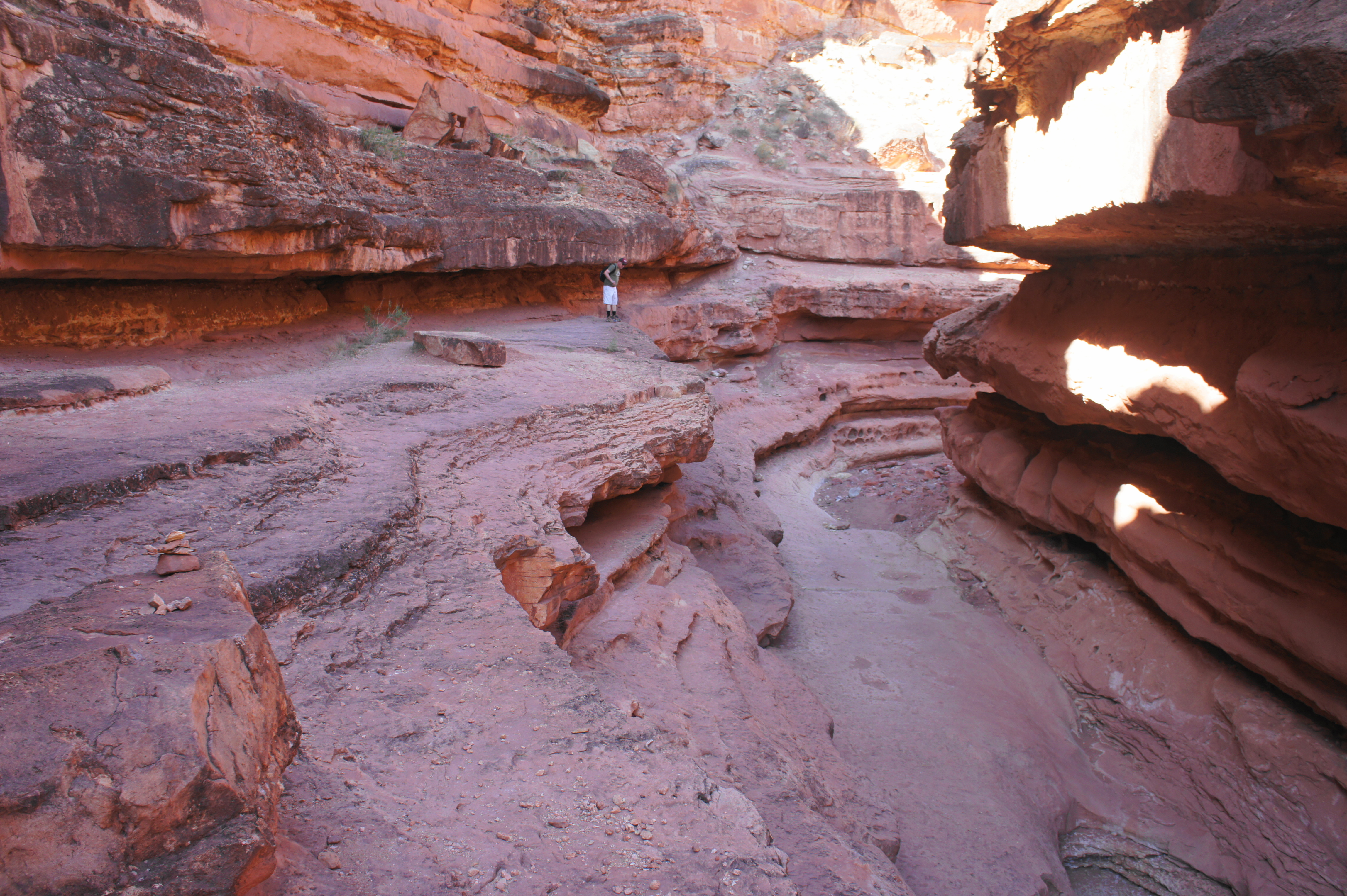
Over the course of the next quarter-mile, the route drops down three minor pouroffs that are very short and easy to negotiate, after which the canyon briefly opens up, revealing ever-higher walls on both sides. Soon enough, the gorge narrows again, and hikers must bypass a boulder choke and drop by following the flat shelves on either the right or left.

Descending Cathedral Wash 
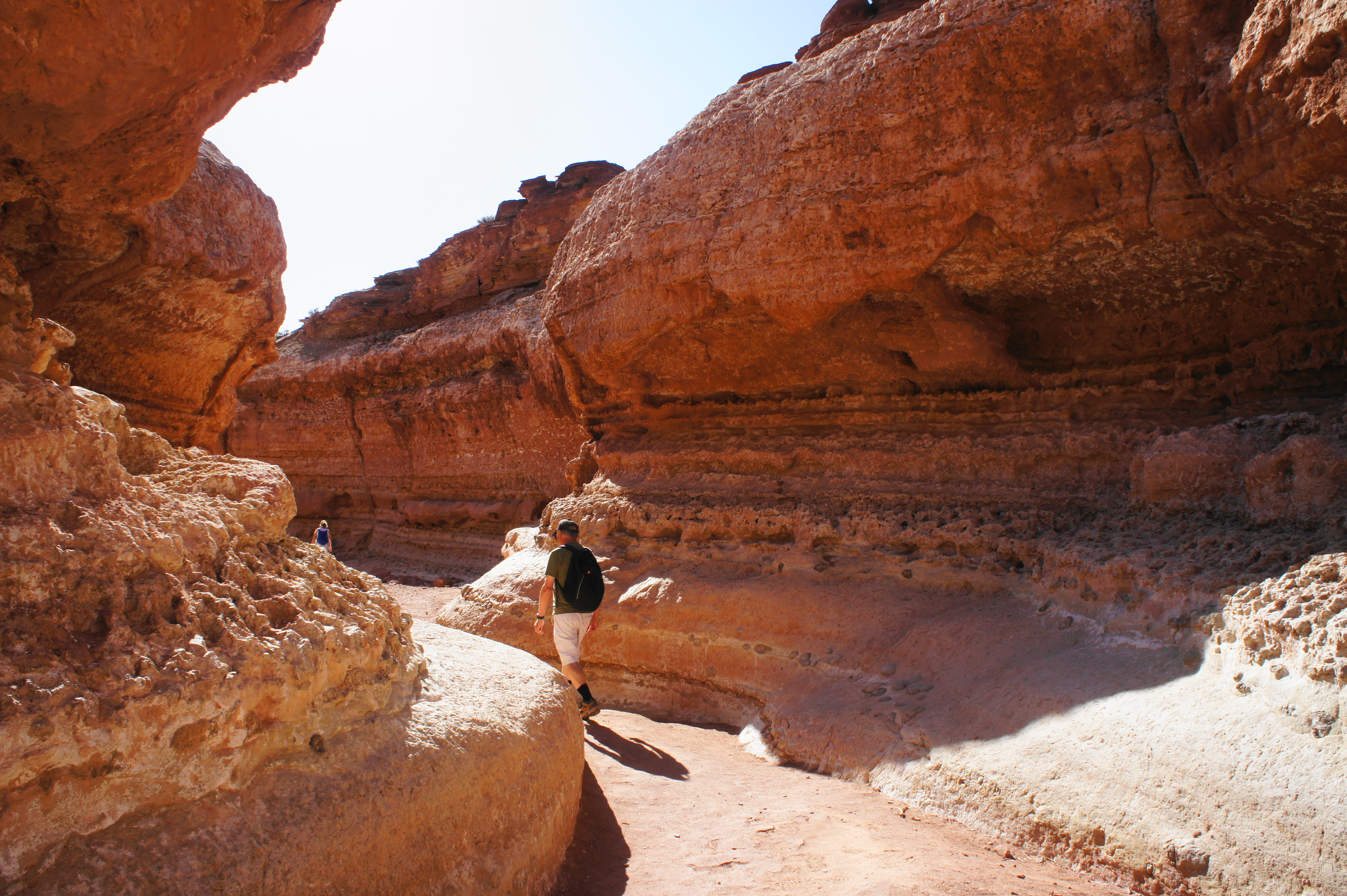
Tafoni (or solution pockets) along the trail
After dropping back to the wash level, hikers encounter another minor obstacle minutes later: a set of three potholes, often filled with water. If dry, one can easy head right down the throat of the canyon, but most will want to again follow ledges on either side to bypass the puddles.

Descending back to the wash level 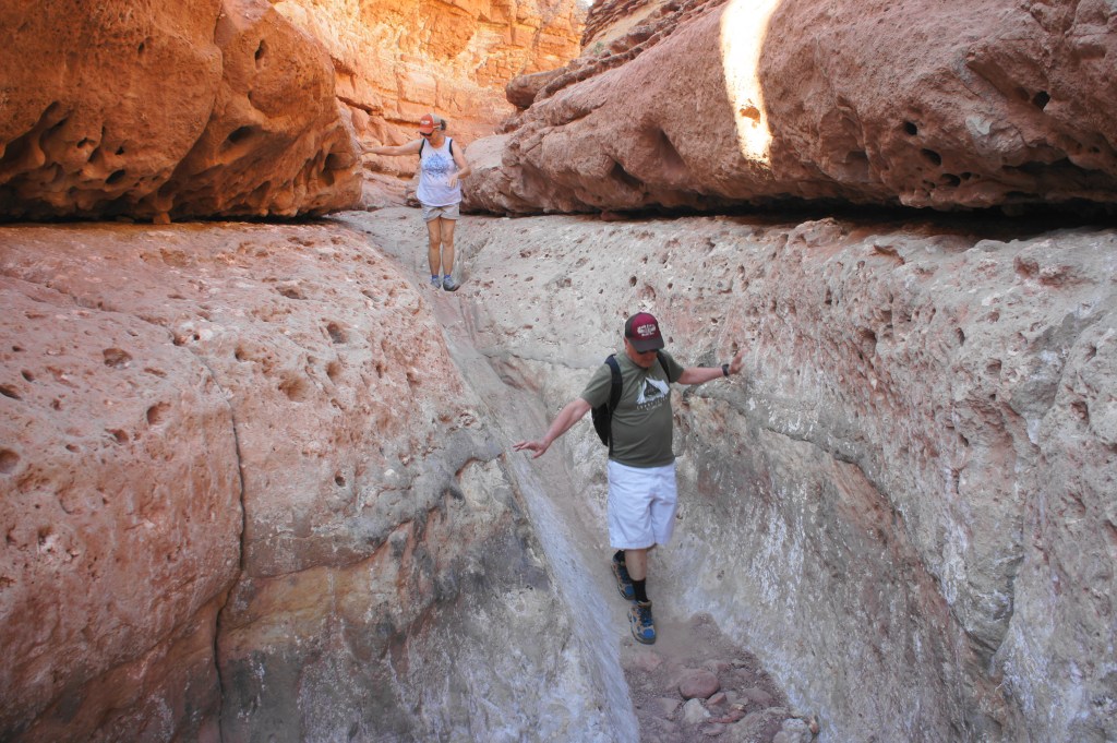
Straight down the gut of a minor pouroff
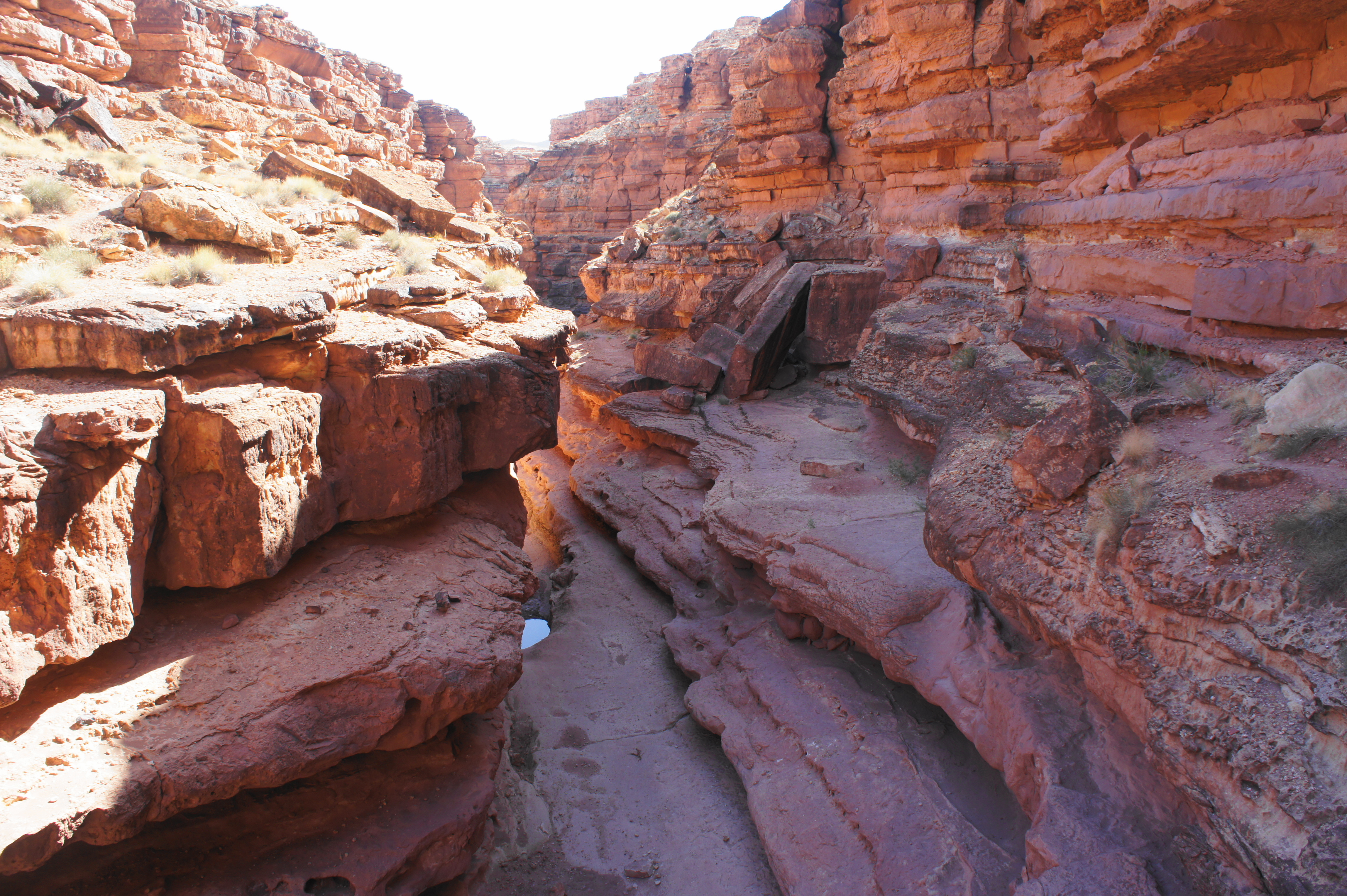
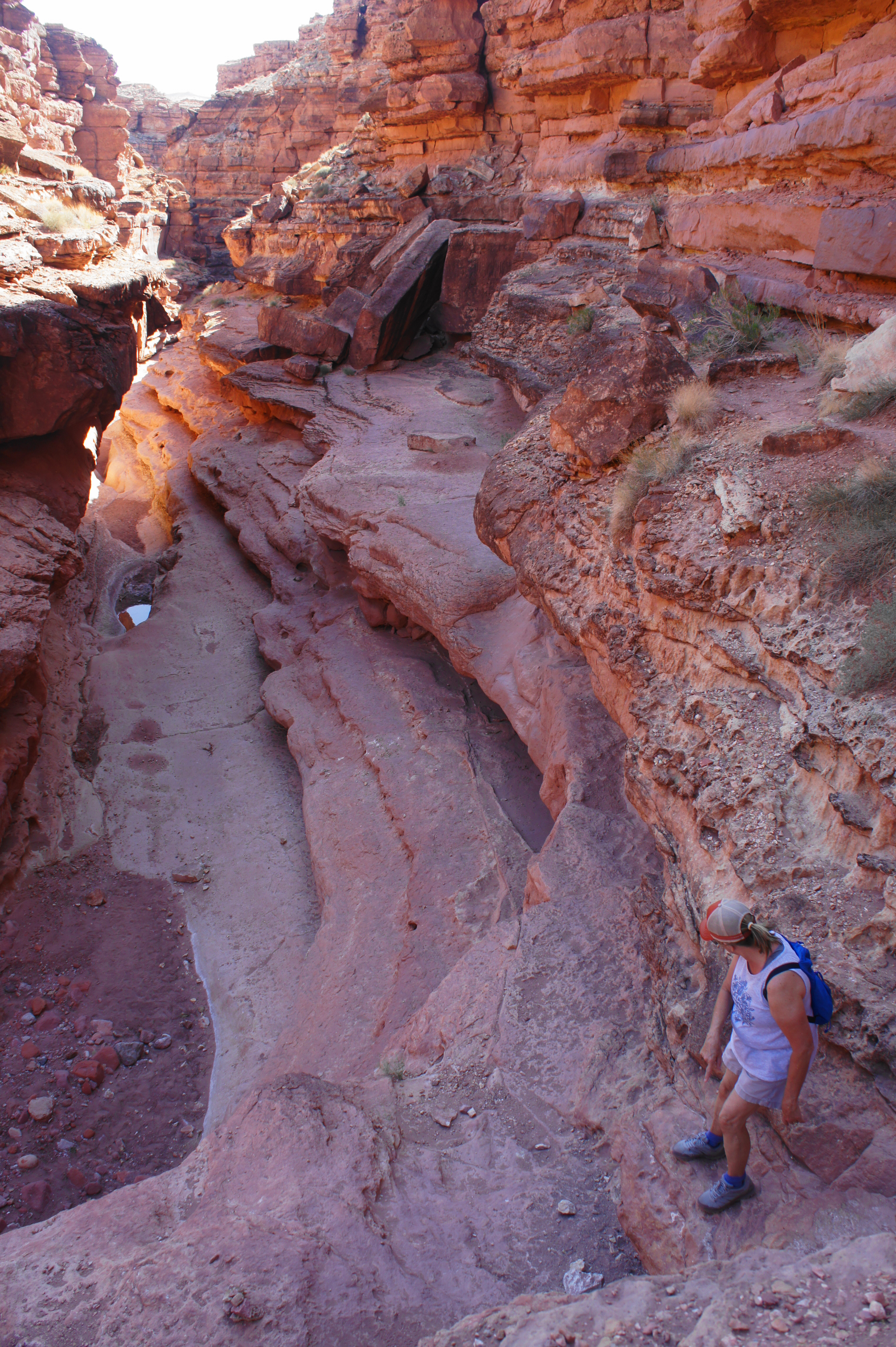
After this point, the canyon widens again, revealing chimneys of stacked limestone and Moenkopi high above. At 8/10 mile, a side drainage comes in from the left, although a tall dryfall makes access quite difficult.


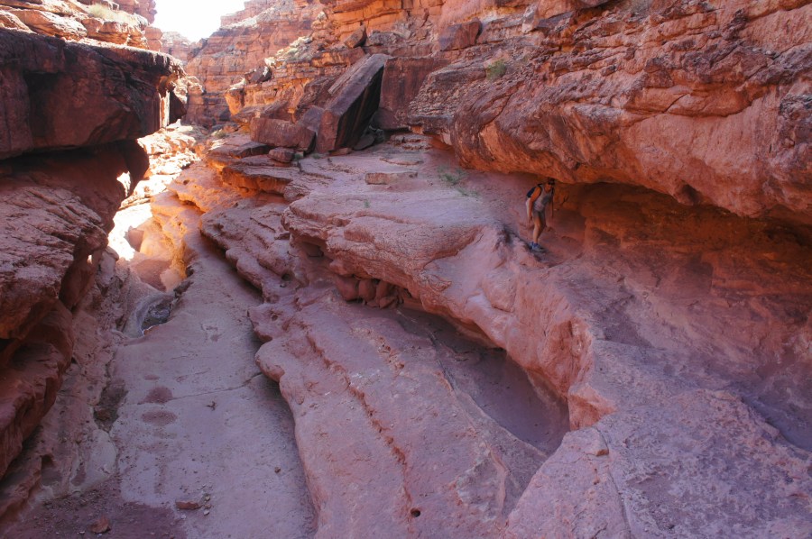
Open area along Cathedral Wash
By now, hikers are around halfway to the Colorado, but the fun is only beginning, as the route in the latter half of the hike is considerably more challenging and slow-going. At 9/10 mile, hikers suddenly stumble upon a tall pouroff of 30 to 40 feet, impossible to handle head on without a rope or serious down-climbing experience. Fortunately, a shelf system off to the right offers safe passage, although the route requires some careful footing and use of handholds to descend. Rock cairns guide the way right, leading to a chute where it is possible to descend safely to the next level down. This is perhaps the most difficult scramble of the hike but should be passable to most hikers with some patience and perhaps some help from your fellow hiking companions.
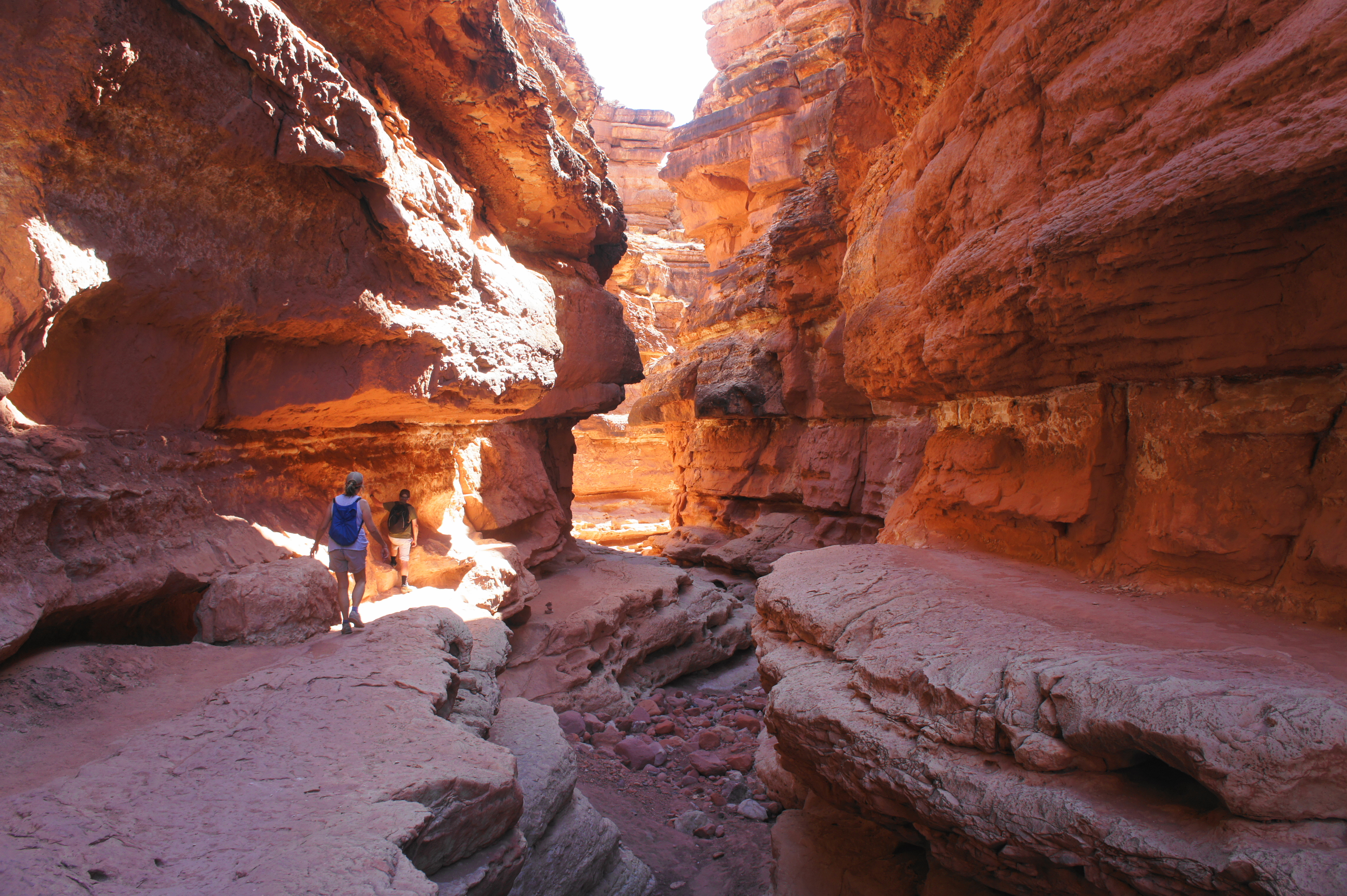
Once down a level, hikers should resist continuing straight down to the wash. Rather, follow the ledge as it approaches an overhang, then duck your head and follow the passage until it reemerges back into the open. Continue until reaching a small clutch of boulders, and again resist the temptation to descend to wash level, instead paralleling the right-hand wall. Here a straightforward, sandy path gently courses down to the next level.

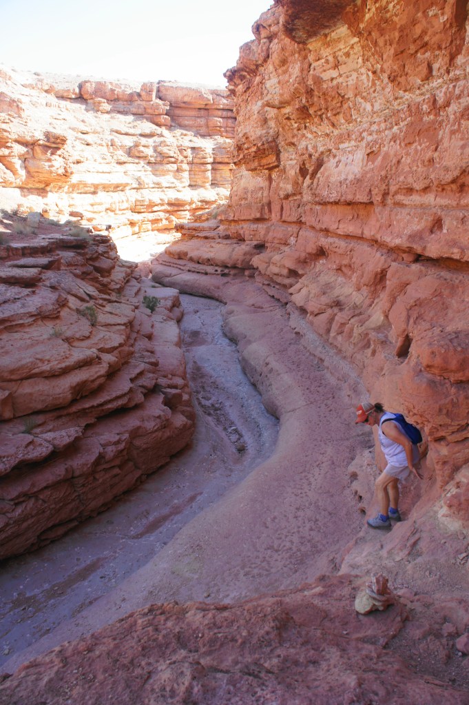
Keep skirting the right flank as you encounter a second nasty pouroff at 1.1 miles, this one guarded by a massive chockstone with a relatively deep, year-round pool below. Again the shelf system on the right is your friend, with natural stairsteps leading down easily to the wash, having put the pool behind you. Much of this is likely to be cairned, but continue to use careful footing and make good decisions – if following the path of least resistance, nothing resembling exposed “climbing” should be required.
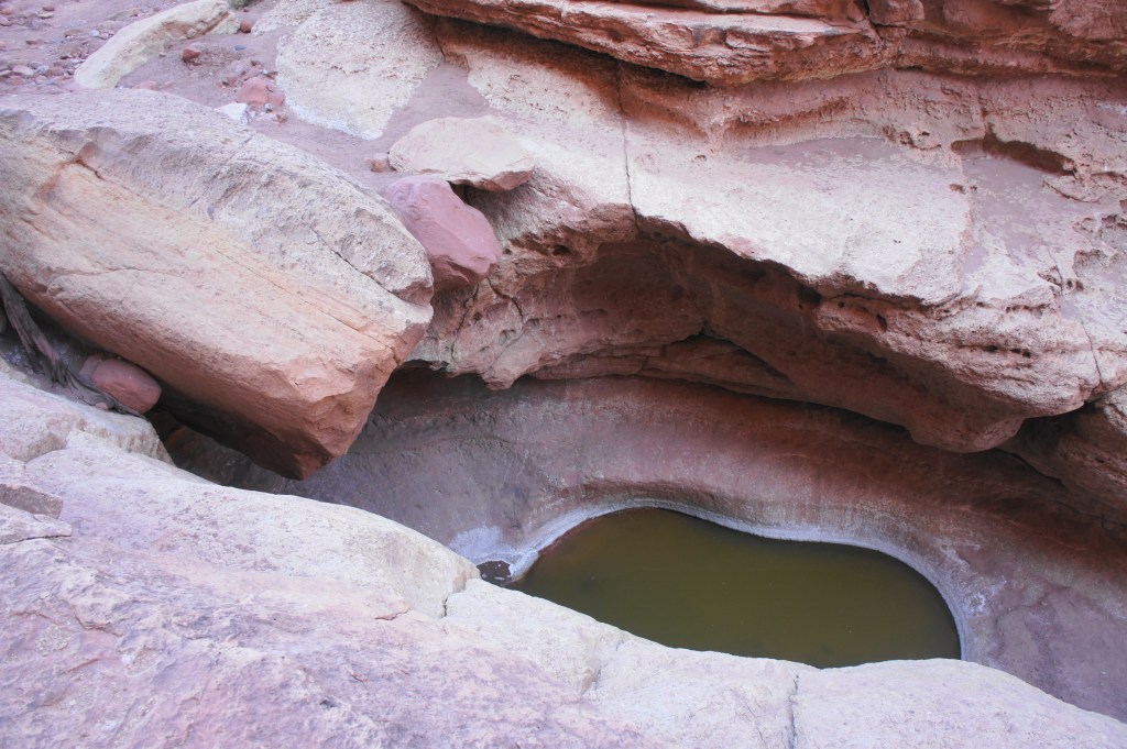
Nasty pool and chockstone 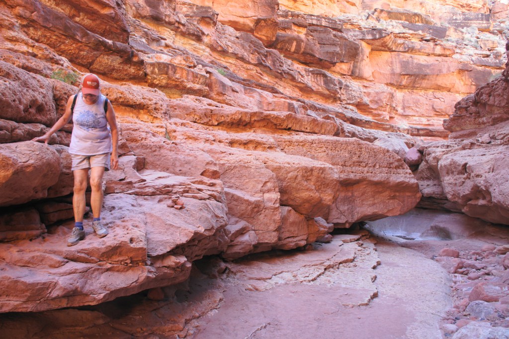
Easy descent to clear the pool
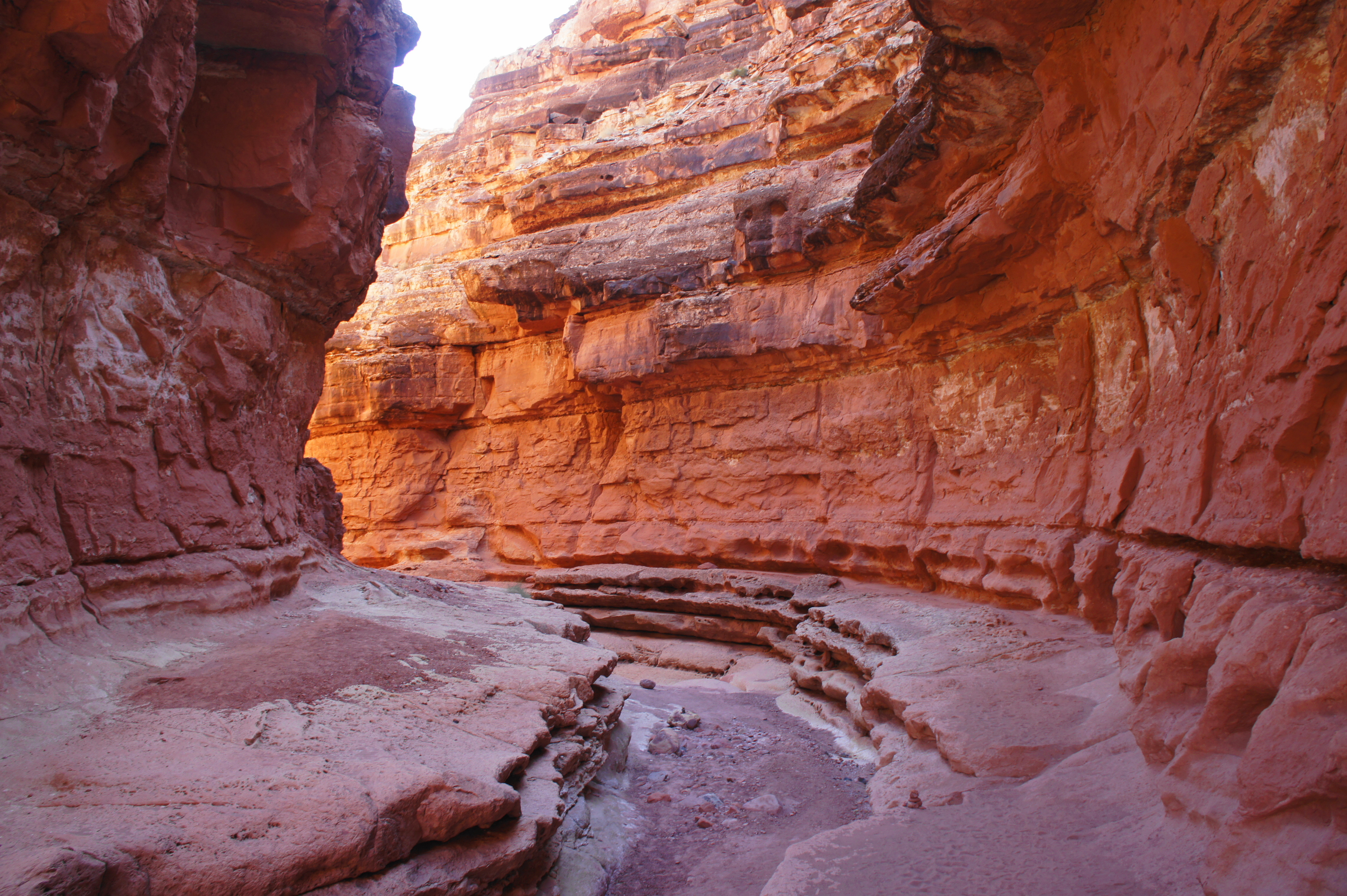
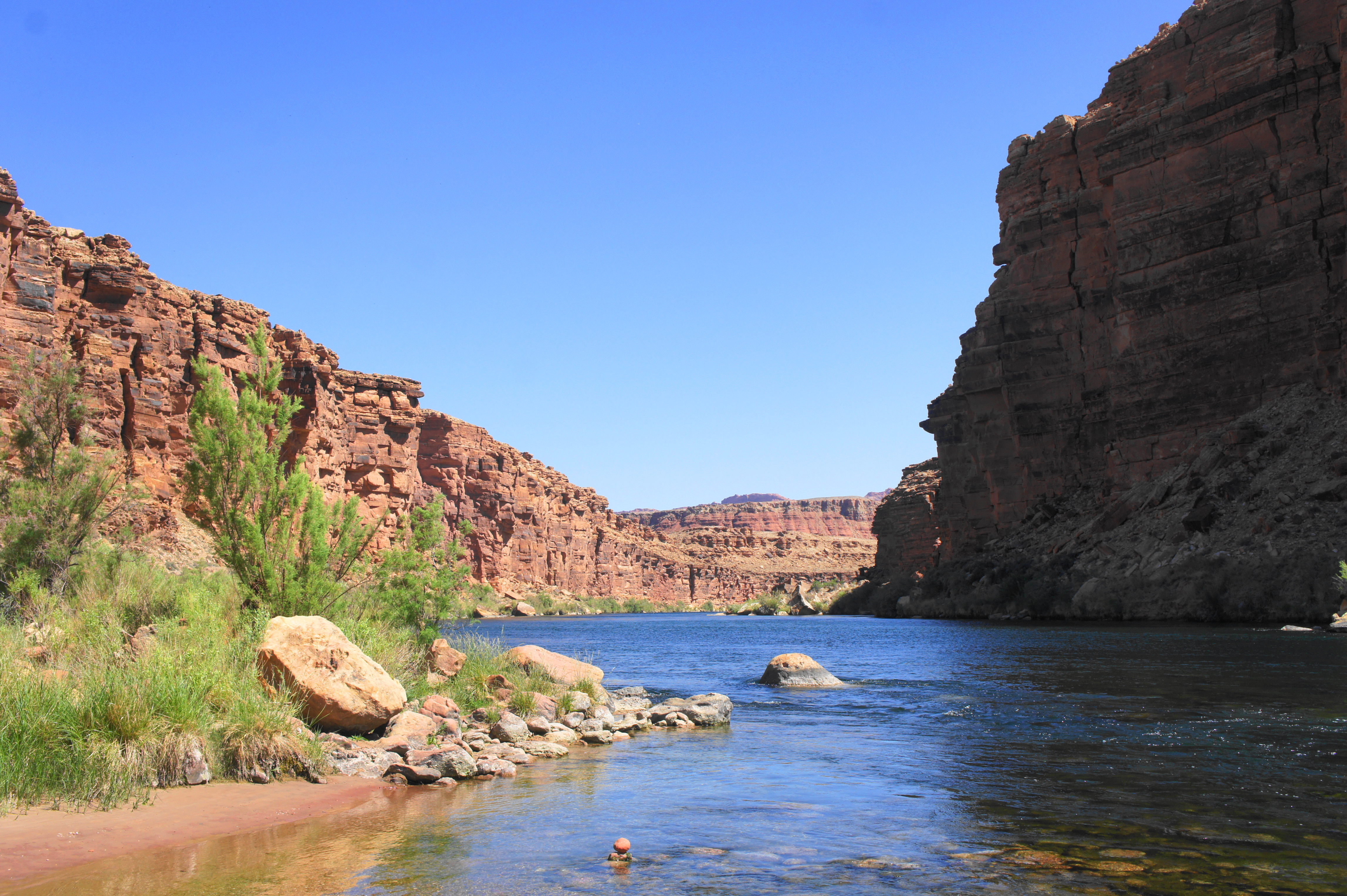
The walking thereafter is generally easier than this latest stretch, now behind you, and by now the canyon walls rise more than 100 feet. The sun and shadows reveal wild colors: beautiful reds, oranges, and even purples make for a picturesque setting.
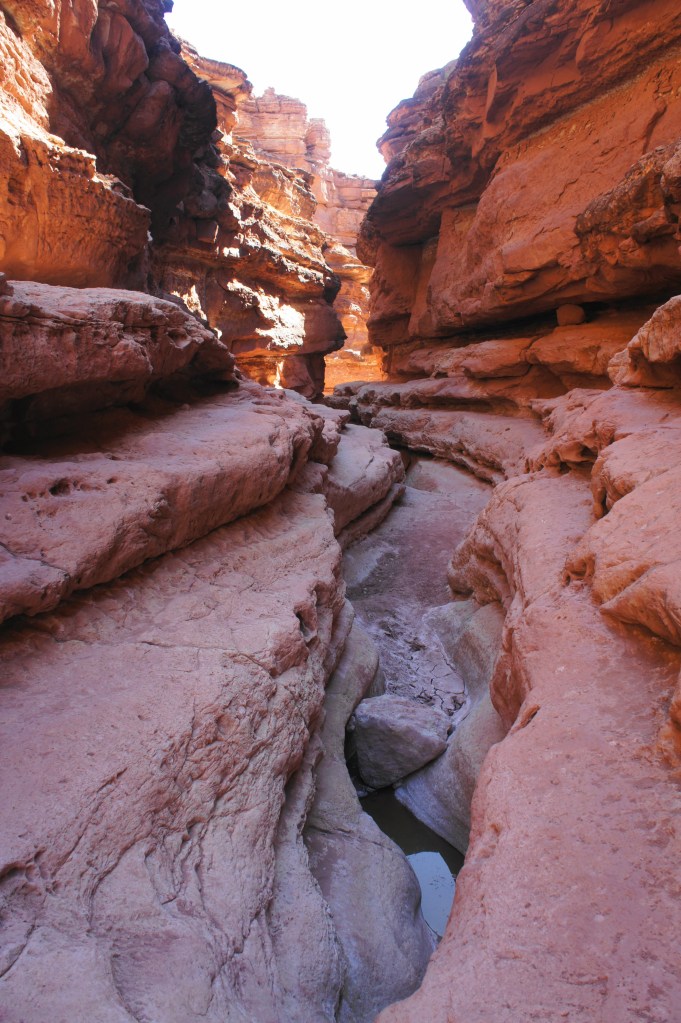
Beautiful narrows 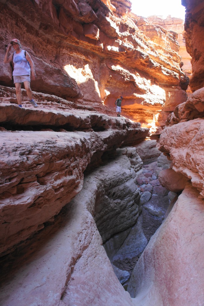
Above the narrows
After an ever-so-brief time in the wash bed, hikers will want to divert again—left this time—to avoid a muddy splash as the floor drops down a narrow chute. Bypass two drop-offs, staying left for around for around 150 yards, after which it is safe to descend to the wash bed. After following cairns to the right flank, the route drops back to wash level again and continues up and across a reasonable bypass on the left, avoiding a set of shallow pools.
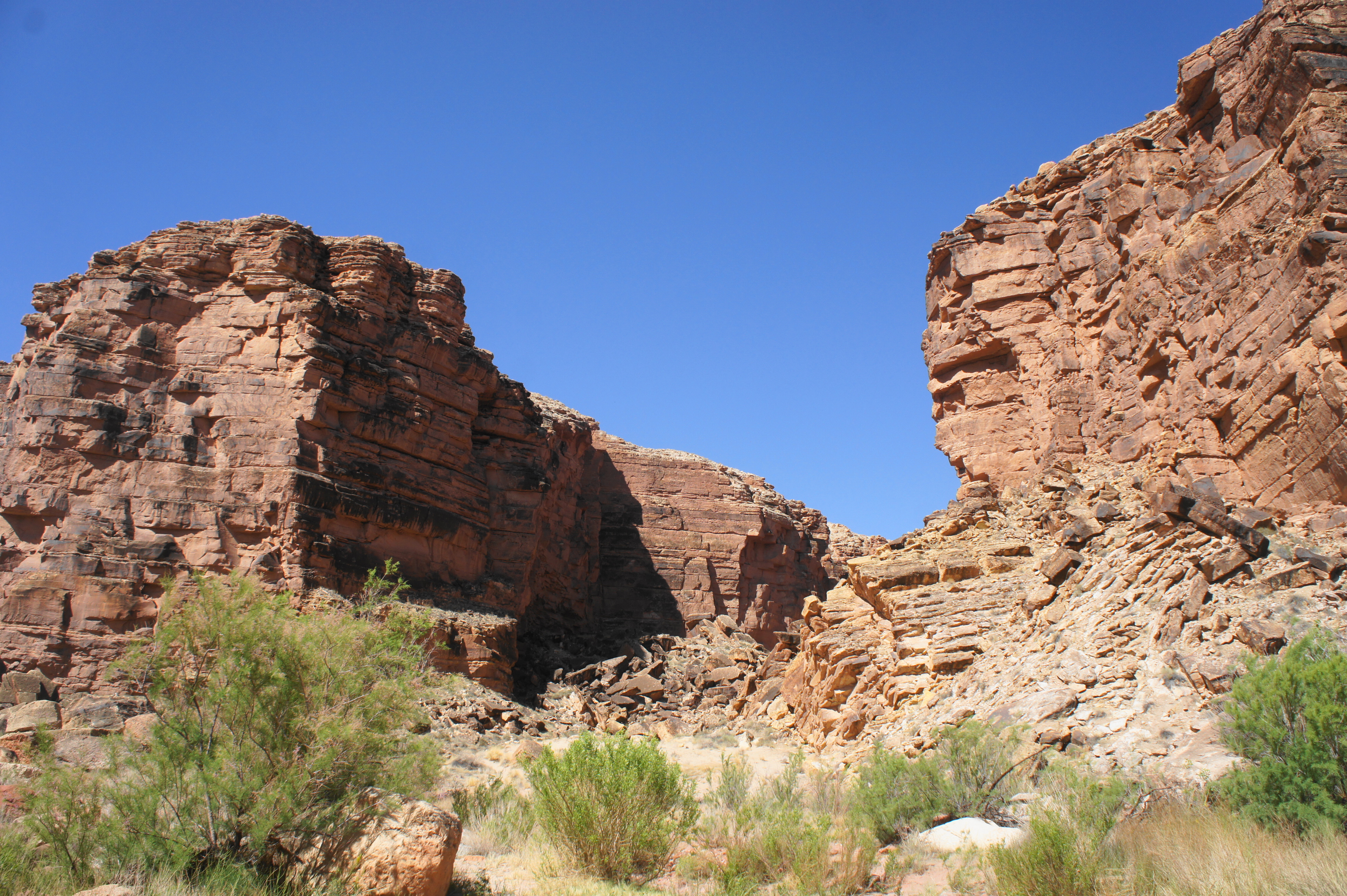
By 1.3 miles, the canyon has opened up considerably, marking the final stretch to the Colorado. With the roaring river within earshot, the path is easy work until a final boulder choke at about 1.5 miles, which requires either a controlled jump or rocky bypass on the left in order to clear. By now the walls on either side are as high as 300 feet above the canyon floor.
At last, around 1.7 miles from the start, hikers emerge from the lush riparian vegetation and set their sights on the majestic Colorado River. As it snakes through Marble Canyon, the natural sculptor passes over a set of rumbling rapids; it is not uncommon to spot river rafters, having started at Lee’s Ferry earlier in the day, making their way through this early warm-up riffle (called Cathedral Wash Rapid), a teaser of what’s to come downstream.
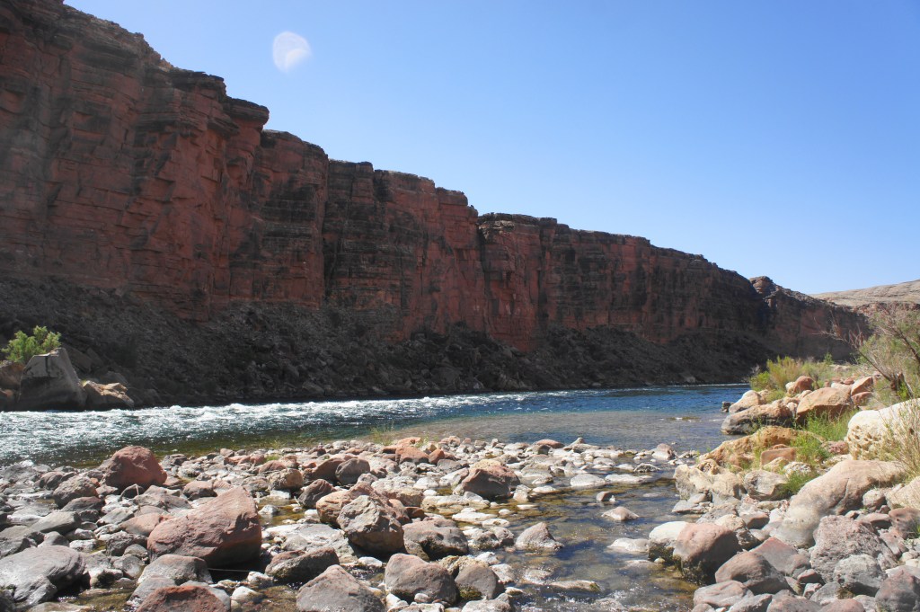
Cathedral Wash Rapid and downstream 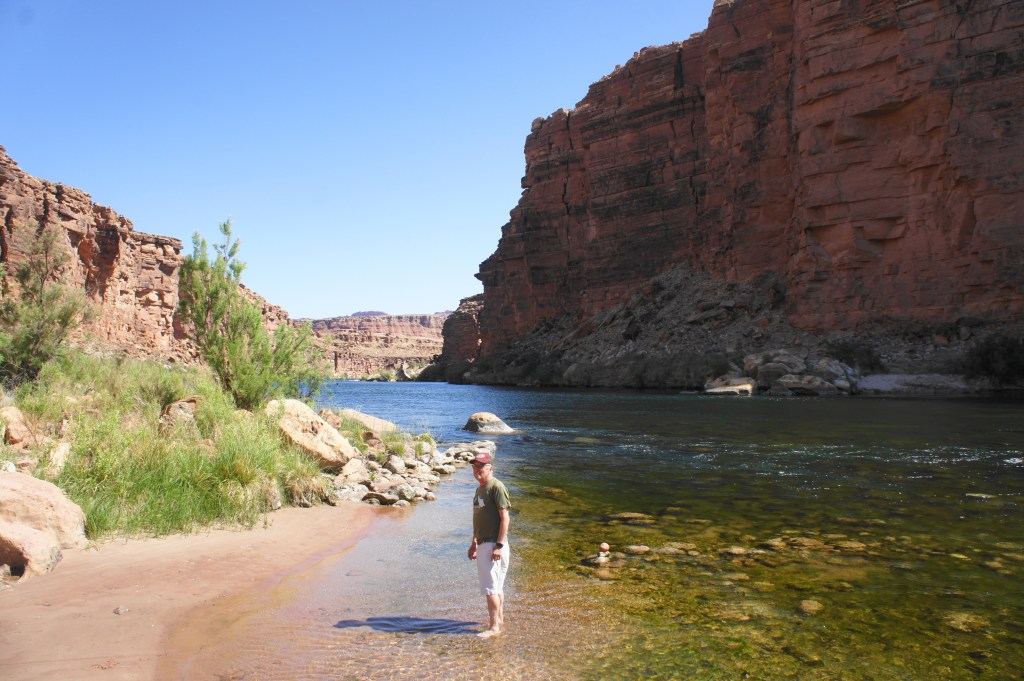
Looking upstream at the Colorado River
Off to the north, the canyon bends right, and the high Navajo sandstone of Johnson Point (3,792’) is visible above the gorge. To the south, beyond the rapids, the river also rounds a right-hand bend en route to Navajo Bridge and the rest of the Grand Canyon.
After stopping for a snack and dipping your feet in the chilly waters, return the way you came. With the sun shifting position and the canyon views different on the way up, there is plenty to enjoy despite retracing previously-trodden ground. The return journey will also test your memory, having to complete the route-finding and scrambling in reverse. Once you have cleared the initial 30- to 40-foot pouroff, it is smooth sailing for a little less than a mile back to the car.
Travel times will vary wildly depending on condition and comfort with the scrambling required, but it is wise perhaps to devote an entire morning to handling this spectacularly scenic slot.

Looks like you’re having a spectacular time. Great photos.
On Tue, Jun 22, 2021, 11:03 AM Live and Let Hike wrote:
> Andrew Wojtanik posted: ” Cathedral Wash, Glen Canyon National Recreation > Area, May 2021 Appearing modest from the trailhead, Cathedral Wash quickly > deepens into a spectacular canyon that cuts through the Kaibab Limestone > and Toroweap Formation in northern Arizona’s Glen Canyo” >
great coverage. I turned around at the last ‘tall drywall’. Was afraid i might fall and get stranded
Pingback: Horseshoe Bend Trail (Glen Canyon National Recreation Area, AZ) | Live and Let Hike
Pingback: Top 10 Hikes in 2021 | Live and Let Hike