
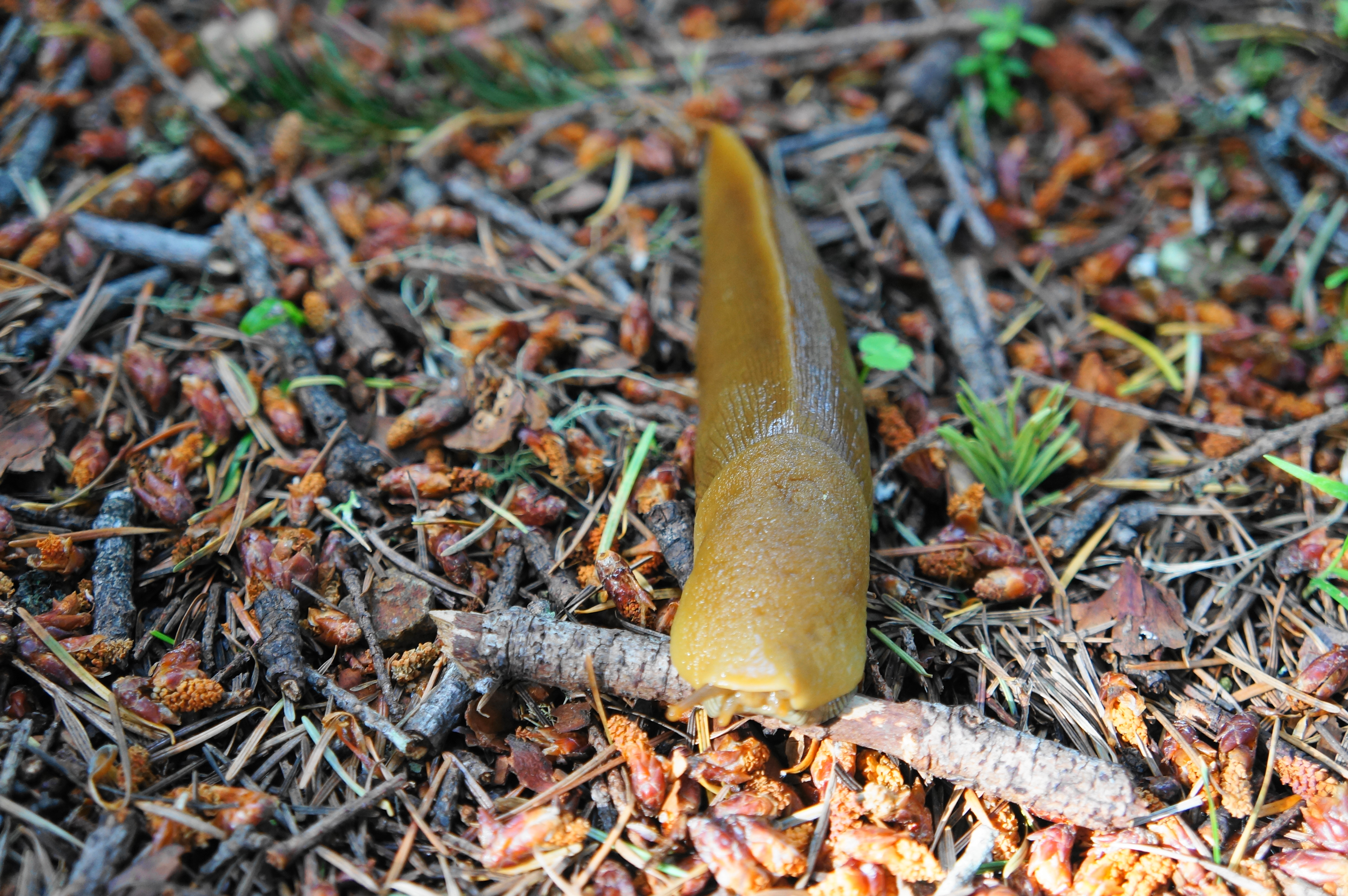
Traversing one of the few stretches of the California coast without a paved road, the Lost Coast Trail has become an enormously popular backpacking destination known for its striking cliffs, black sand beaches, redwood groves, and frequent wildlife sightings (seals, Roosevelt elk, black bears, ospreys, and many others). Curiously enough though, the vast majority of visitors keep to the northern half of the 53-mile trail, traversing a 25-mile section that connects Mattole and Black Sands Beach via the King Range National Conservation Area. Wilderness permits for this section are highly competitive and difficult to obtain, with group sizes capped at three people. However, the southern half of the trail, situated largely in Sinkyone Wilderness State Park, is a very different story: the up-and-down path—overgrown and very strenuous but strikingly beautiful—is deserted much of the year. Weekday visitors are likely to have beaches and clifftops all to themselves, and there is little red tape beyond a small parking fee.
The 27-mile southern section can be subdivided into four parts, including, from north to south: (1) a roughly 8.5-mile jaunt from Hidden Valley/Shelter Cove to Needle Rock Visitor Center; (2) an approximately 7.5-mile trek from Needle Rock to Wheeler Camp; (3) a 3.5-mile stretch between Wheeler and the beach at Little Jackass Creek; and (4) a final connection between Little Jackass and Usal Beach (7.5 miles). This post covers section 2, describing a one-way hike that culminates at the spectacular beach camp at Wheeler, a former logging community that has long since returned to its natural state. (Note: The subsequent section connecting Wheeler with Little Jackass is described in a second post.) Hikers may cover this section as part of a longer through-hike (from Mattole or Shelter Cove to Usal) or as an out-and-back that would make for a very long day hike but a reasonable 2- or 3-day backpack. Expect very rugged conditions, with a very overgrown trail and extensive elevation gain and loss. This is not a beginner’s hike—but highly rewarding for those willing and able to brave the Sinkyone Wilderness.

Sinkyone Wilderness: A Brief Introduction
Sinkyone Wilderness State Park has the perhaps unique distinction of being a California state park with declining visitation (with the possible exception of Usal Beach, described as a “basically lawless” party zone with a “long history of misbehavior”). The number of annual visitors to the Needle Rock Visitor Center and the nearby Bear Harbor area are a mere fraction of its total a mere decade ago. This is in large part due to the very limited facilities and deteriorating condition of the roads and trails.
For example, although most maps (including Google) continue to suggest a drivable route between Needle Rock and Bear Harbor, this 2.7-mile stretch has been closed to vehicles for more than eight years. Now it is a hiking route—and the best-maintained trail in the park at that. The rest of the Lost Coast Trail, from Bear Harbor to Usal Beach, is one step above a bushwhack: there is indeed a trail, but it is faint, heavily overgrown, and full of obstacles, including fallen trees and dense patches of thistle.
What was once a busy logging area in the mid-20th century has been reclaimed by the diverse flora and fauna that has long populated the Lost Coast. Even the reach of state park personnel is limited: aside from occasional patrols and a part-time volunteer at Needle Rock, there is little permanent presence of park officials. On a Tuesday in late May 2022, when we were leaving Needle Rock along the rough Briceland Road, we had to remove a thin tree some 40 feet long that had fallen across the one and only path out of the area. Neither the volunteer at Needle Rock nor the maintenance ranger we ran across later knew about the obstacle, suggesting we were the only ones to traverse the road that day.
The state of Sinkyone, of course, is welcome for those seeking a true wilderness experience, far from signs of civilization. The ranger we met outside the park told us that he been calling for trail maintenance to be done, to no avail, for more than six years—but then he quickly reconsidered and smiled: perhaps it’s better that way—to keep the Lost Coast “lost” after all.
The hike
Getting to and from Sinkyone’s Needle Rock Visitor Center, where this 7.6-mile section of the Lost Coast Trail begins, is half the battle. After a long and winding drive on Briceland Road, the road turns to dirt at a spot called Four Corners. From here it is only 3.3 miles to Needle Rock, but it is a slow slog: potholes and jagged rocks abound, with the track turning into a muddy, impassable mess after heavy rainstorms. Four-wheel drive is not necessarily required, but high clearance is a must; while possible to traverse, I would not recommend taking your average sedan down to the road (we handled it in a Subaru with 8’’ clearance).
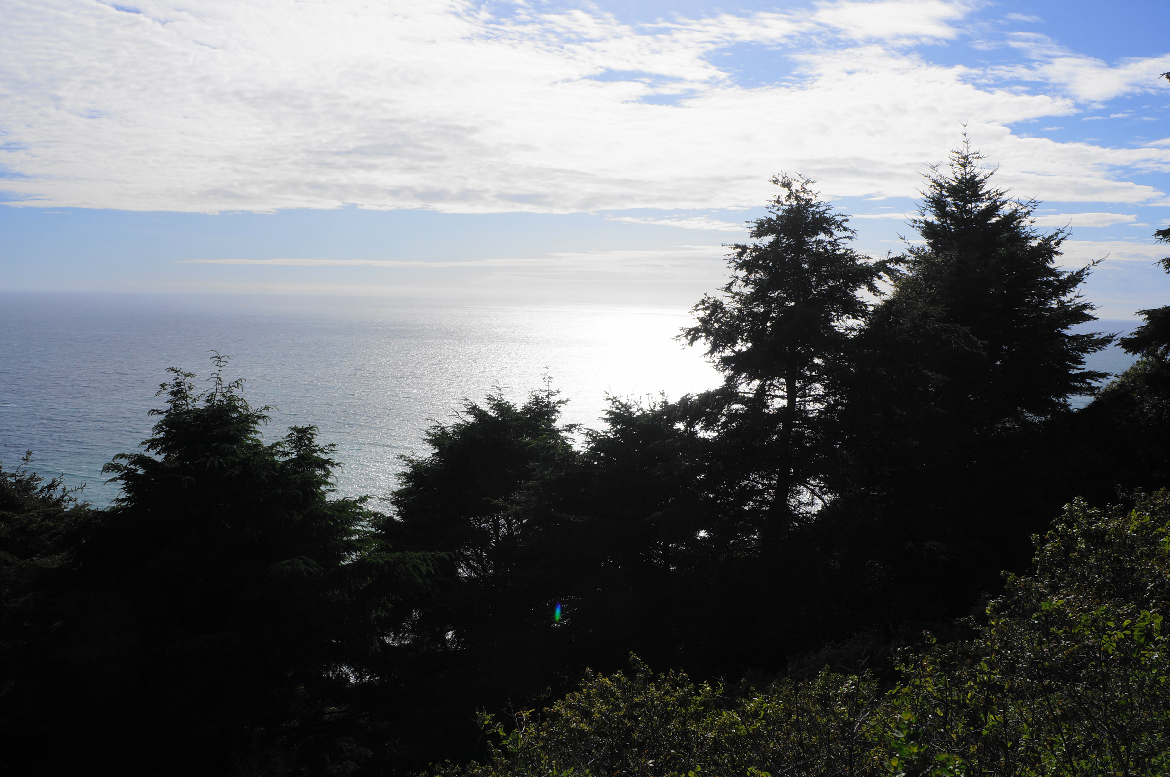
The drive down to Needle Rock is beautiful, weaving in and out of fern- and fir-studded ravines, with occasional views down to the coast and open blue ocean. The final stretch cuts through an open brushy area, passing a barn on the right and ending at a small parking area across from the Needle Rock Visitor Center. This information station is staffed part of the year, and hikers are asked to pay a small fee for backpacking: $5 per person per night (be sure to bring cash!).
The visitor center and parking area are situated on a grassy shelf a little less than 200 feet above the coastline, with excellent views north toward the King Range and Shelter Cove. Needle Rock was once home to a small dairy farm, as well as a store, hotel, and even a school. There was also a logging railroad running from Bear Harbor to nearby Piercy, California—until it was irreparably damaged in the 1906 earthquake. After plans in the 1960s of establishing a monastic community here fell through, the Needle Rock area was incorporated into Sinkyone Wilderness State Park, which was established in 1977. A major push by environmentalists saved the remaining redwoods in the area from being logged in the 1980s, with activists raising funds to purchase 3,000 acres of land from the Georgia-Pacific Lumber Company. This territory was then gifted to the park.
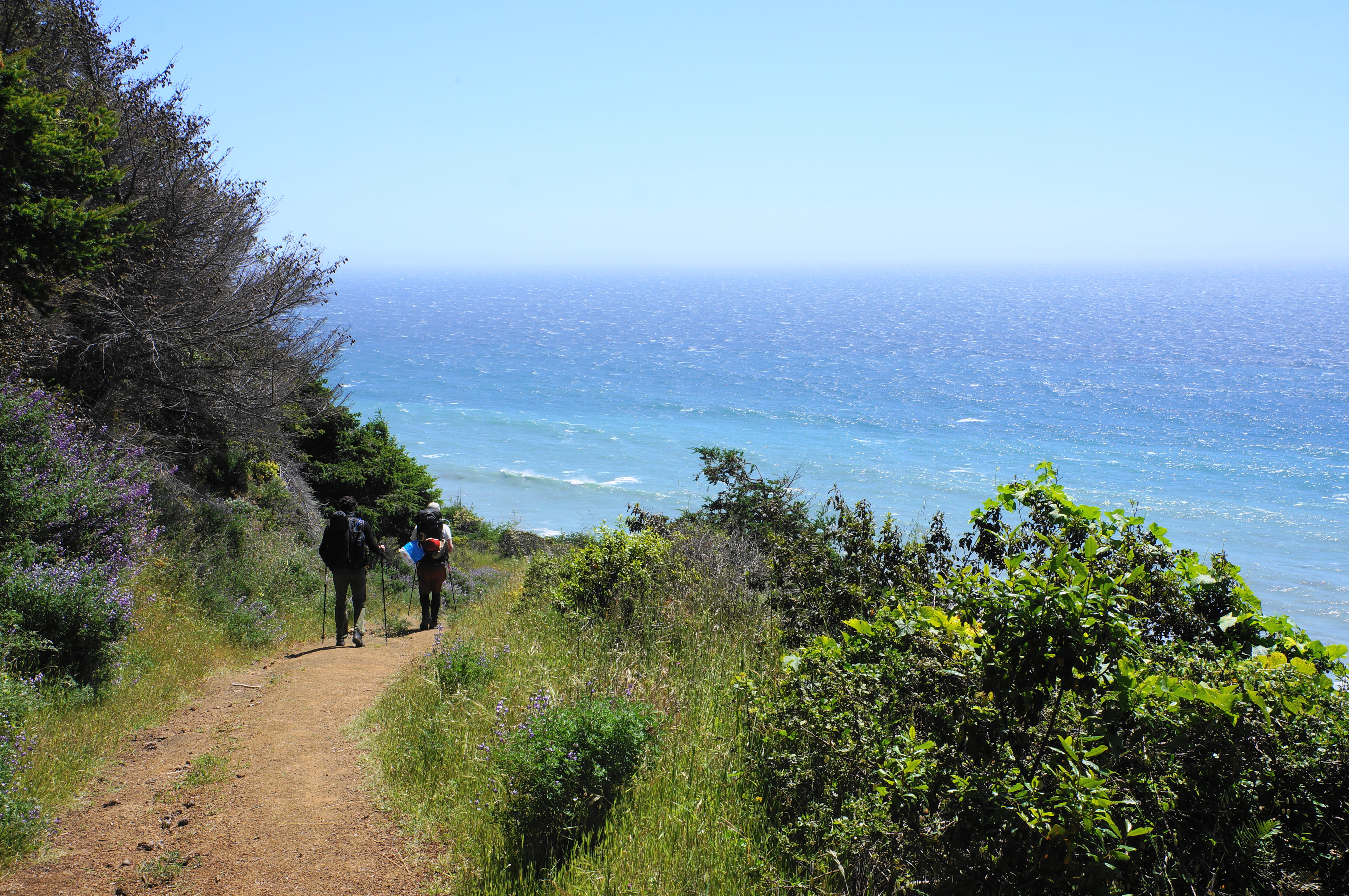
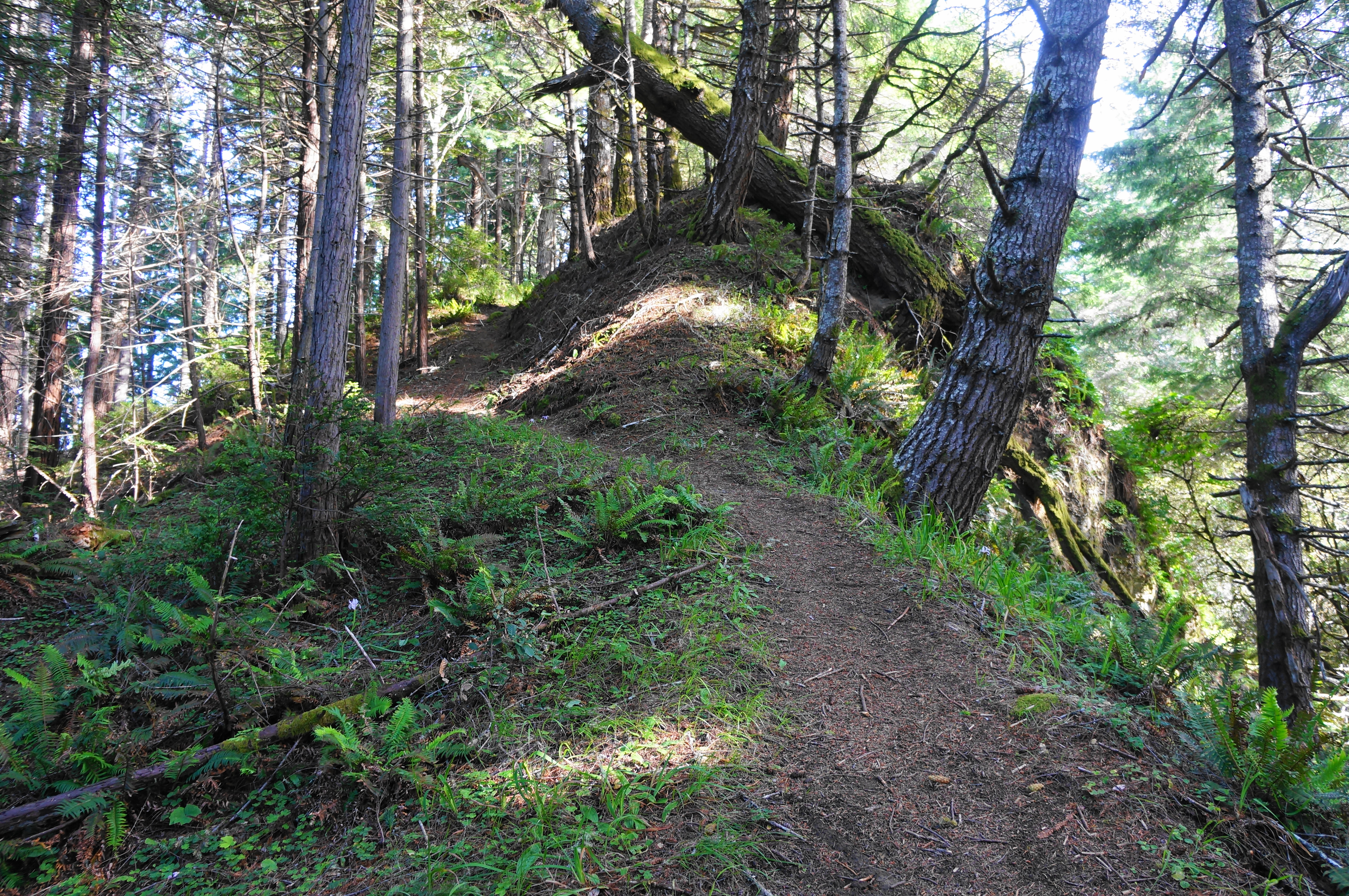
Today, there is a modest visitor center, several campsites, and a beach at Needle Rock. Briceland Road is closed past Needle Rock—and has been for years; this marks the start of the Lost Coast Trail section heading south. The stretch between Needle Rock and Bear Harbor is considerably better-established than subsequent sections, with the trail following the old double-track road along coastal bluffs.
After an initial open section with coastal views, the Lost Coast Trail quickly rises into a forest dotted with spruce and firs. In spring, wildflowers abound, including California poppies, lupine, Indian paintbrush, wild morning glory, penstemon, monkeyflower, buttercup, and Douglas iris. (Note: red columbines become visible later in the hike.) After rounding a couple shady ravines, the trail comes to a highly eroded cut at 4/10 mile, where part of the soil beneath the road has vanished into the ocean below. The bluffs along the Lost Coast are very fragile and sensitive to erosion—the result originally of seismic activity along the San Andreas Fault, situated just offshore around here.
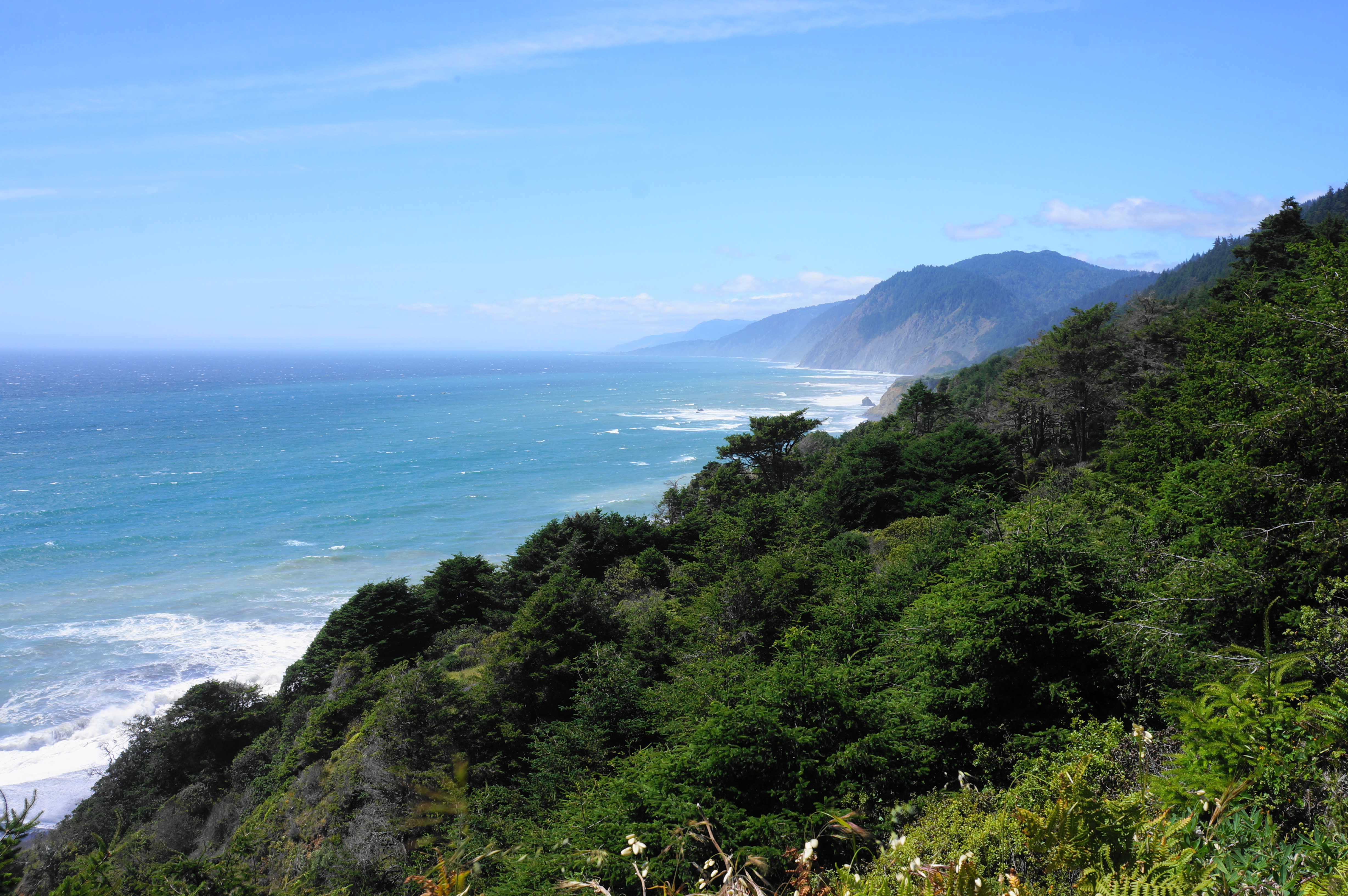
Continue on to another ravine, this one with a flowing tributary (at least in winter and spring) that is easily crossed. Proceed up a steep incline, rising higher into the forest, then descend a scenic downhill with coastal vistas to Chamisal Mountain, Shelter Cove, and the King Range to the north. The trail heads toward a pair of two coastal humps and then bears left along a quiet drainage out of sight of the ocean. The drainage reveals itself to be Flat Rock Creek, a waypoint marked with a small worn-down sign. This is the most reliable water source before Bear Harbor, about 1.3 miles away.
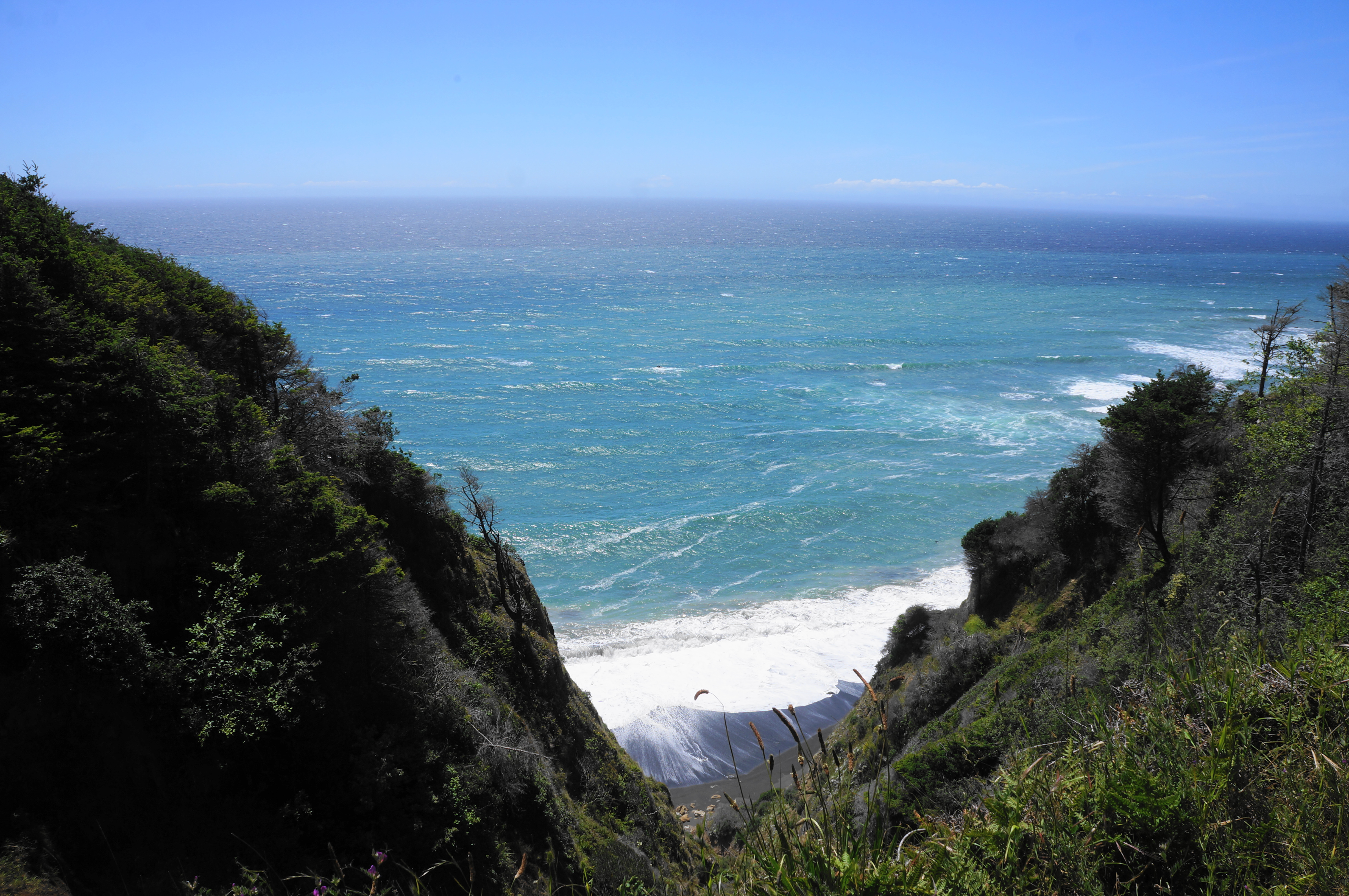
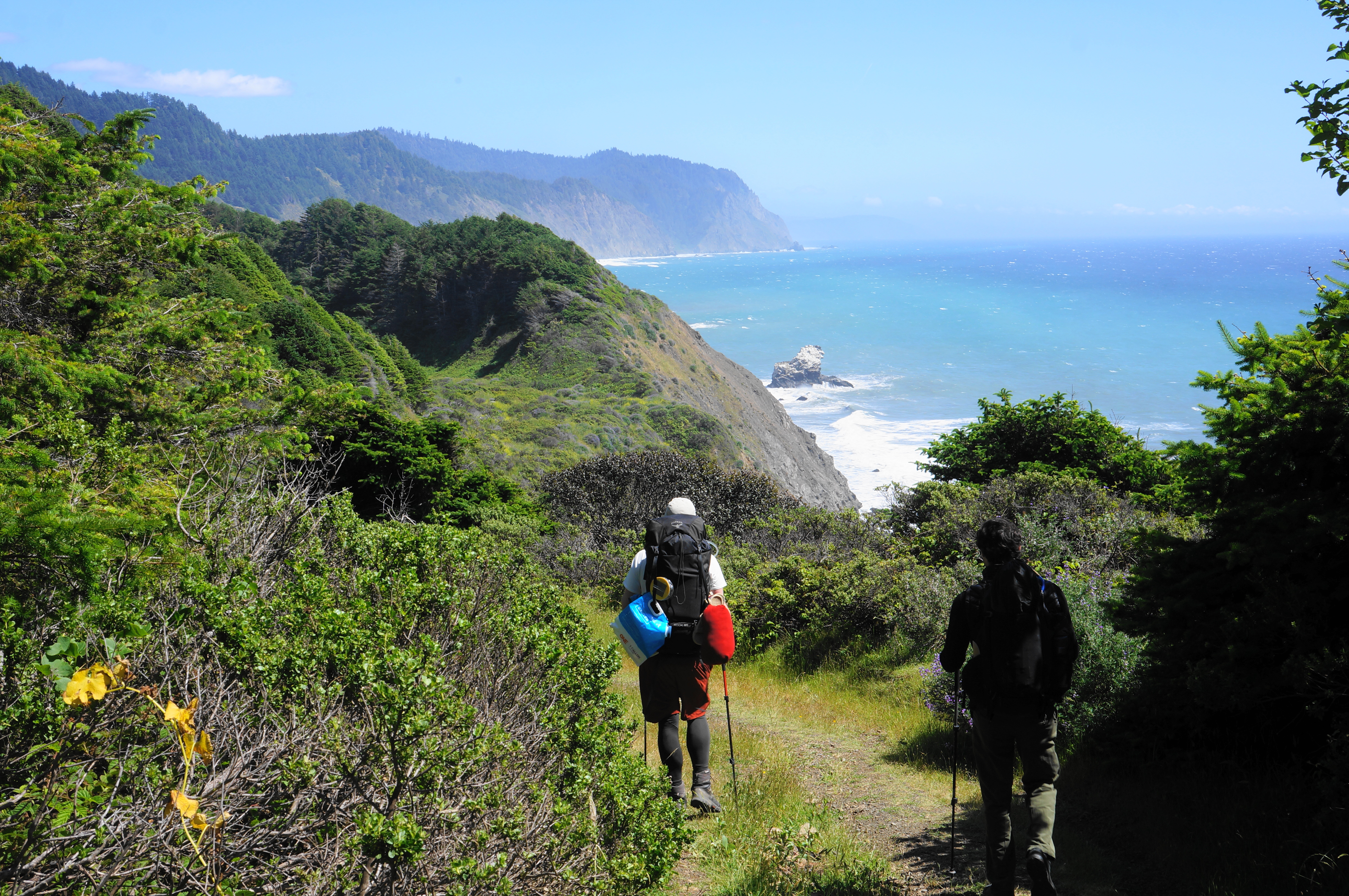
After crossing the modest stream, the trail crosses a meadow of coastal scrub and then ascends somewhat sharply to clear a point on the right that is marked on maps as High Tip. Soon the path descends again, with views along the coast to a sea stack called Morgan Rock. The V-shaped cut in the distance is Wheeler Beach—the destination for this leg that is nonetheless still a little less than six miles away.
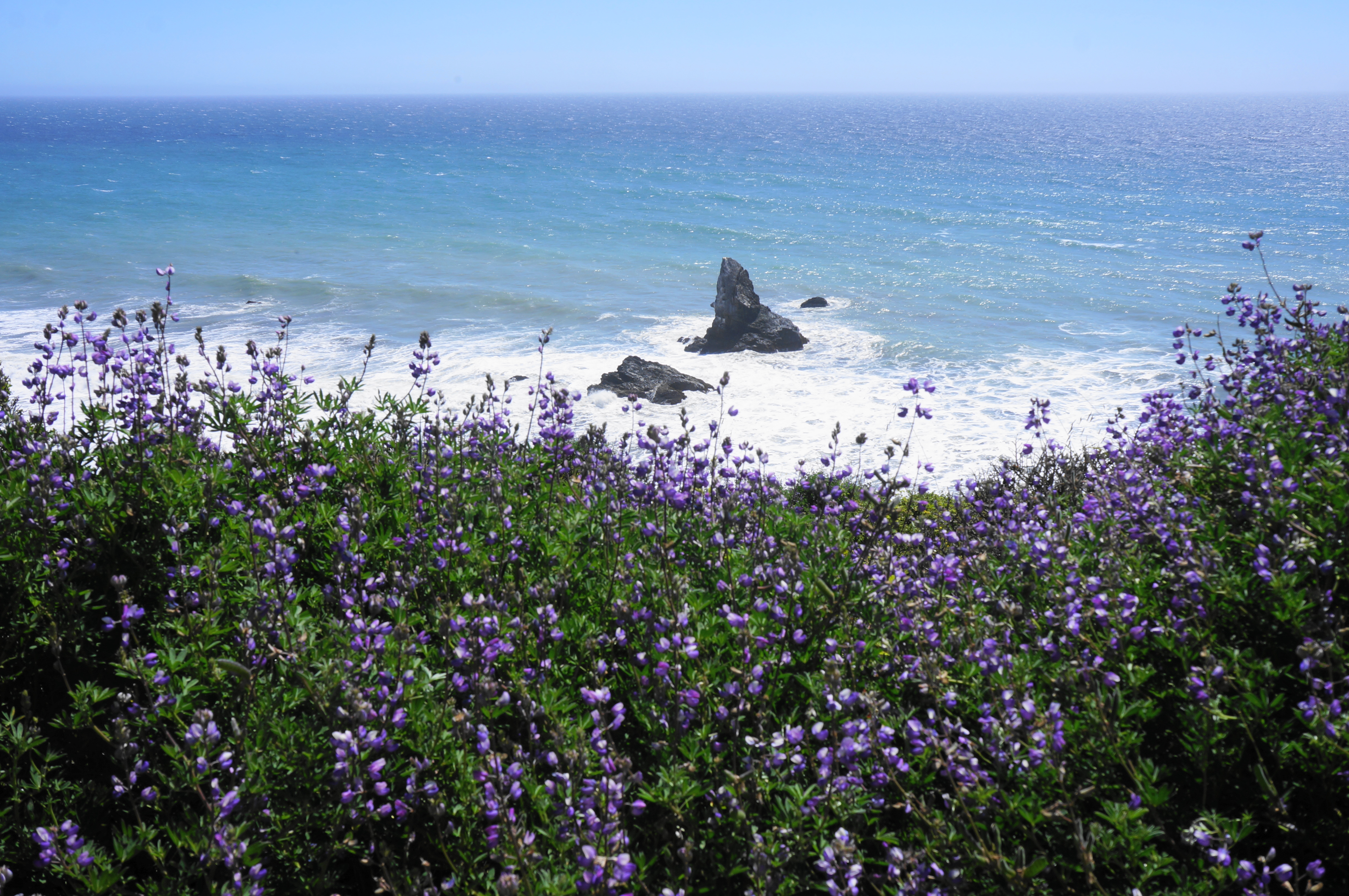
Dropping down another scenic slope brings hikers parallel to another outcrop, just out to sea, called North Rock. Look back to the north for a view of a pair of natural arches, carved by the relentless waves crashing against the eroding cliffs. Drop again to clear an alder-lined ravine, then follow a long meadow, protected from the ocean by a line of fir-topped hillsides.

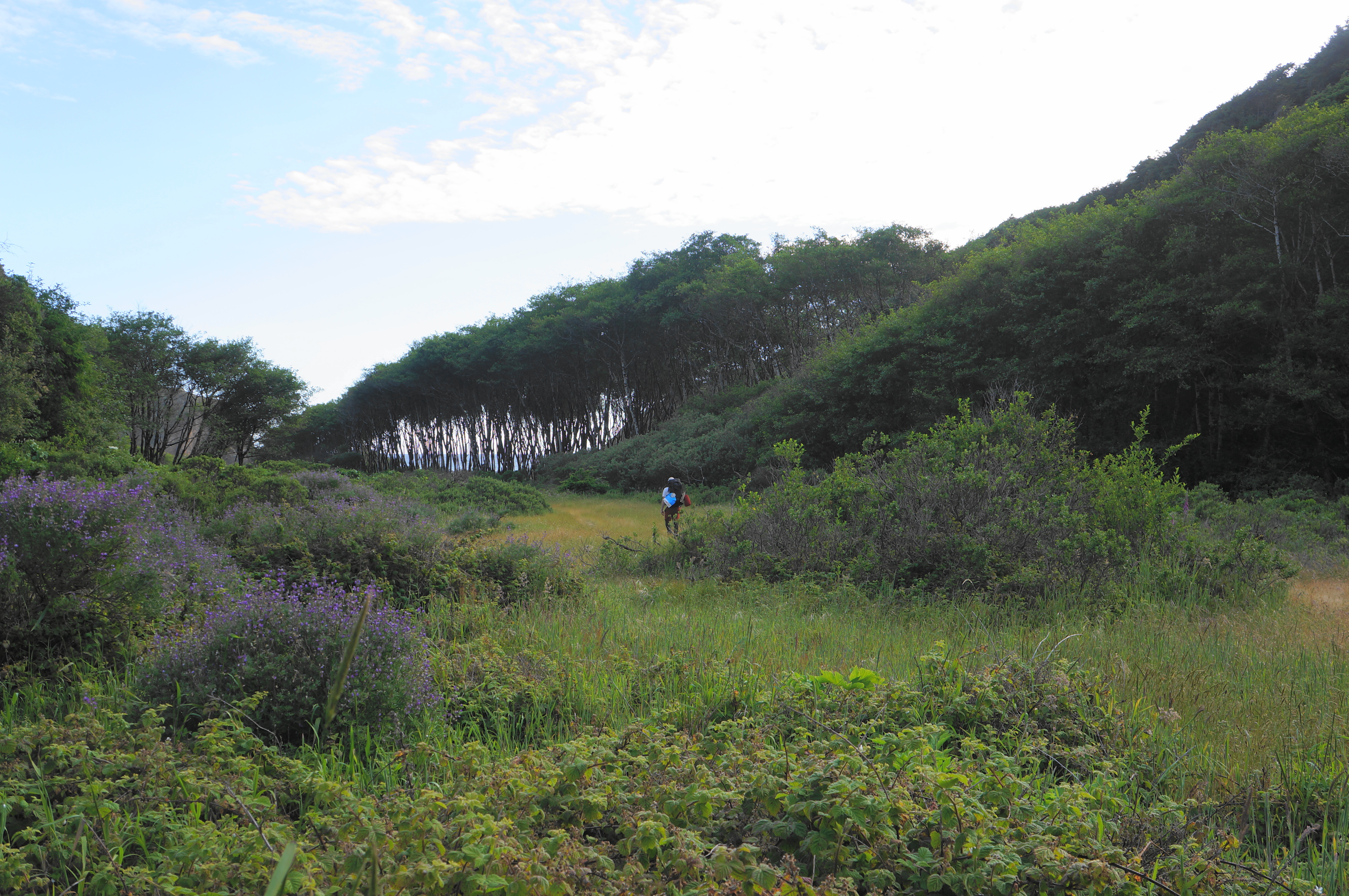
At 2.4 miles, the trail comes upon a surprising sight: a pair of pit toilets on the left. The now-overgrown field on which you stand was not so long ago a dirt parking area, the terminus of Briceland Road. Orchard Creek Camp is also here—named for the drainage running through the area. However, camping here is far less scenic than Bear Harbor just ¼ mile farther.
Pushing on, the wide track suddenly ends, replaced by a narrow single-track that pushes through dense brush, a teaser of what is to come. After crossing Orchard Creek, continue southeast along the broader Railroad Creek, entering a eucalyptus grove—a clear sign of former human development. These non-native trees were planted en masse across much of the state after the mid-19th century. The trail along here roughly follows the railbed that was once used to haul lumber, culminating at Bear Harbor just beyond. There are few traces of it left—but there are a few concrete slabs that serve as a reminder of the once-bustling logging enterprise.

It is a short walk from the eucalyptus to Bear Harbor Camp, a multi-site campground with picnic tables and fire pits. This camp often fills up on holiday weekends, such as Memorial Day and 4th of July, but is relatively sparsely used the rest of the year. At 2.7 miles, a spur trail leads right, over a bridge, to the small beach at Bear Harbor. Here there was once a wharf that was used for loading lumber onto offshore schooners.

Some hikers, especially if arriving late in the day, may opt to overnight here at one of the sites at Bear Harbor. Several pretty camping spots are within striking distance of Railroad Creek and the beach, with spring wildflowers producing striking colors all around.
Those pushing on to Wheeler, however, are less than halfway, with the most challenging terrain to come. The sign at the junction to Bear Harbor beach is partly correct: it is indeed about 4.5 miles from here to Wheeler, but the sign indicates 4.5 miles to “Little Jackass Creek,” which is in fact the next destination beyond Wheeler (about 8 miles from here). So the distance is right but the destination incorrect…

Immediately after the junction, hikers will notice a significant deterioration in the quality of the trail. The path is quickly overtaken by dense brush, including blackberry bushes and assorted greenery but also thistle and some poison oak: wearing pants (and perhaps long sleeves) is a must. The subsequent ¾ mile is one of the roughest stretches of the hike, beginning with the thicket, then, especially after crossing a modest stream, rising a slope with several downed trees. Avoiding the obstacles requires some backpacker jujitsu: clambering over or ducking under fallen trunks in several places.


The trail beyond the stream is free of thistle but very steep and full of tree obstacles. Take your time, rising amid the firs and ferns, gaining about 250 feet in elevation—with five switchbacks—before levelling off briefly. The ascent resumes shortly thereafter but is milder and relatively free of fallen branches, and there are some obscured views down to the coast below.
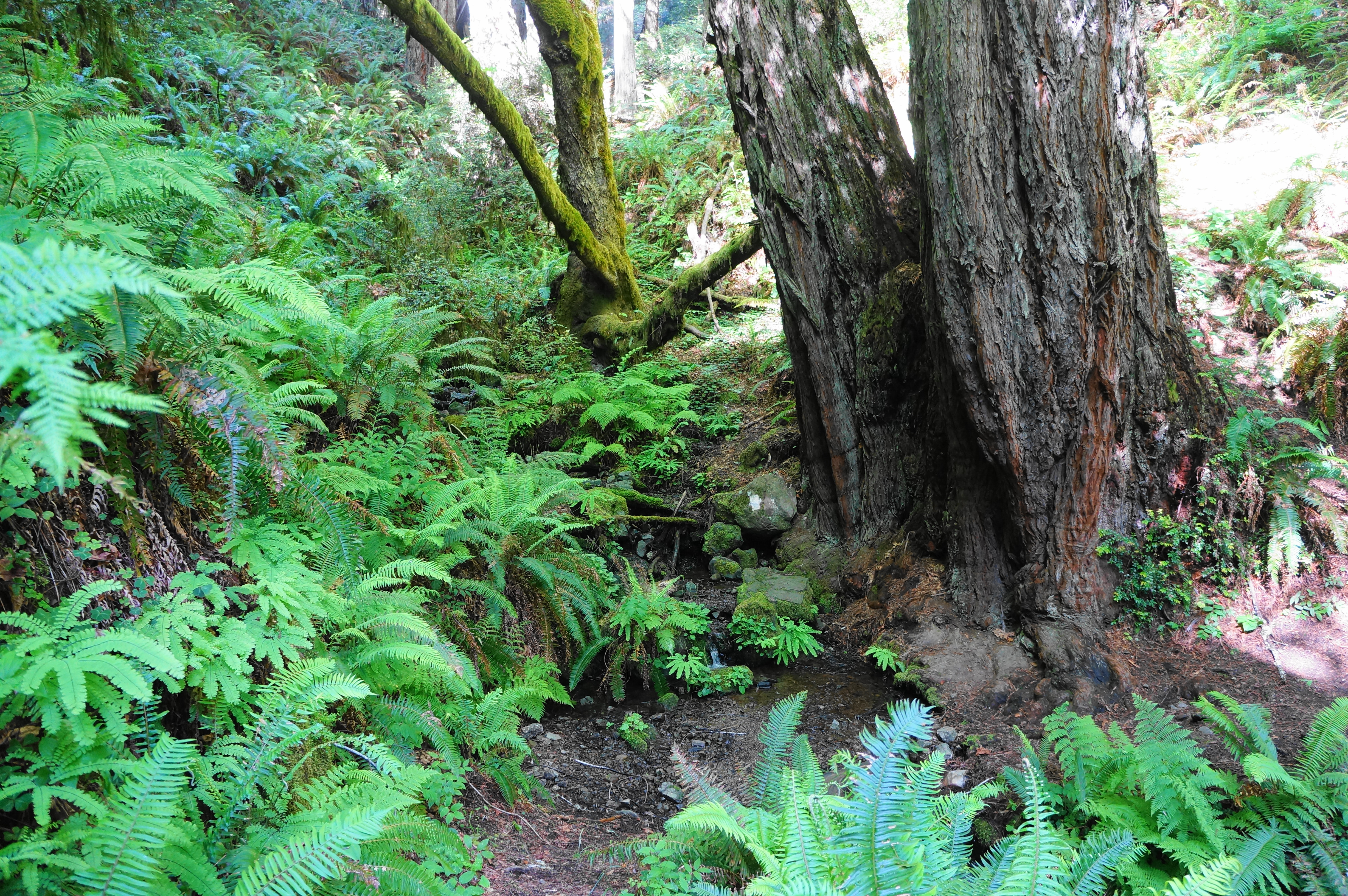
Continue along the west-facing hillside until it begins to drop eastward, clearing a beautiful gully known as Duffy’s Gulch. The decline brings one past the first old-growth redwoods of the hike: mammoth titans that were somehow spared during the logging spree of the late 19th and early 20th centuries. The sporadic stands in this drainage take on the name J. Smeaton Chase Grove, named for a famous nature writer and traveler who explored much of California around the turn of the century. The scenery at the point where the Lost Coast Trail crosses the creek is simply sublime: moss-laden oaks mix with ruddy redwoods and a carpet of ferns, punctuated by the gently tumbling stream. This is one of the prettiest spots on the entire hike.
After the creek, the climb resumes, steadily treading upward toward the coastal bluffs. At 4.9 miles, the path crests a ridge, with a short spur heading right for seaside views. After a brief open and brushy section, the trail returns to the woods and climbs again, with the understory growing thicker. Pass a redwood patch at about 5.5 miles, then ascend very sharply up to a thin highline. The trail soon passes the highest point on the Needle Rock-Wheeler section, roughly 900 feet above sea level.
As the Lost Coast Trail begins another descent, it passes two depressions on the left that are filled with immature redwoods. Soon after, there is another surprising uphill, this one cresting at about 750 feet, following at last by the long, final descent to Wheeler Camp and the beach. As a small drainage feeds into a larger one, hikers pass through School Marm Grove, another impressive clutch of redwoods.


The lengthy downhill ends at about 7.1 miles, where there is a trail sign, another pit toilet, and an open field. This is the start of Wheeler Camp, a camping area with several sites spread out over the course of about 2/3 mile. Those seeking to camp among the redwoods can find a lovely streamside site off to the left, sitting along the banks of the North Fork of Jackass Creek.

Within 1/10 mile, the trail crosses the North Fork (an easy rock-hop) then continues through more brush to another campsite at 7.4 miles. This one has a pit toilet off to the left (the closest to the beach). Cross a second stream—the main branch of Jackass Creek—soon thereafter, then come to an open scrubland with several more sites on the right. It is hard to believe, but this seemingly pristine area was once home to a bustling logging community. The dense tree cover has since recovered, returning the drainage to its near-natural state.
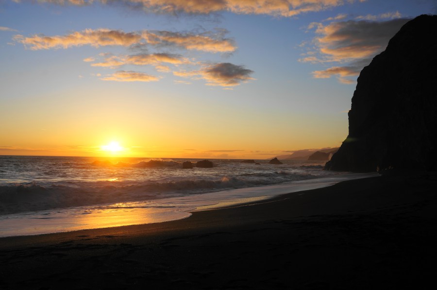
The best campsites (unless you don’t like a little wind) are situated at the end of the drainage where Jackass Creek passes through an alder grove and snakes around Wheeler Beach, culminating at the Pacific Ocean. The black sand beach is a fronted by tall cliffs on either side and is a wonderful place to watch the sunset. Campsites can be found along the scrubby upland just above creek level (on both sides of the stream). Here one can watch the sun set over the crashing waves, enjoy a fire (permitted in designated fire pits only), and, if heading farther south the next day, rest for the onward journey to Little Jackass Creek and beyond.


All told, this strenuous hike takes at least 4-6 hours one way, with hiking pace declining significantly after Bear Harbor due to the extensive up and down and many obstacles. Travelers often take a rest day here at Wheeler Camp (or a day hike up to Little Jackass Creek or Sally Bell Grove) or head back to Needle Rock the following morning. Southbound Lost Coast Trail hikers have another 1-2 days ahead of them to reach Usal Beach.


Pingback: Lost Coast Trail – Wheeler Camp to Little Jackass (Sinkyone Wilderness State Park, CA) | Live and Let Hike
Pingback: Top 10 Hikes in 2022 | Live and Let Hike
That was a great read. I want to do it.