
Note: This is the second of four posts covering hikes in northern Illinois’ Starved Rock State Park, which boasts 18 sandstone canyons, dozens of waterfalls, and an impressive network of trails along the southern shores of the Illinois River. This post covers a 4.4-mile stem-and-loop hike from the Starved Rock Visitor Center to LaSalle Canyon via French and Wildcat Canyons, with a return journey along the Illinois River to Eagle Cliff and Lover’s Leap Overlooks.
Those accustomed to hiking in the majestic mountains and stunning canyons of the American West may not be so keen on a trip to the seemingly flat, featureless Midwest. Yet amid the endless plains of the U.S. heartland, there are some rare surprises—occasional concentrations of natural beauty that might just rival the Rocky Mountains, the Colorado Plateau, or the Sierra Nevada. Starved Rock State Park in northern Illinois is one of those surprises—a riverside complex of towering bluffs, narrow canyons, tall waterfalls, and cool alcoves that is a local favorite for Chicagoland residents but virtually unknown to the rest of the country. Here, in a park merely two hours from the Windy City, a network of terrific hiking trails crisscrosses the southern flank of the Illinois River, diving in and out of 18 glacier-carved canyons, each featuring high sandstone walls and, after recent rains or snowmelt, surprisingly impressive waterfalls. The trail network, which stretches from Saint Louis Canyon to the west to Illinois Canyon to the east, can be broken down into four sections:
- A) A roughly 1.5-mile section connecting St. Louis Canyon with the Visitor Center area at Starved Rock;
- B) An approximately 4.5-mile loop that covers terrain immediately east of the Visitor Center, including French Canyon, Wildcat Canyon, LaSalle Canyon, and several overlooks along the Illinois River;
- C) An admittedly less scenic, 2-mile one-way stretch that connects sections B and D, by way of Owl and Hennepin Canyons;
- and D) a set of three canyons—Ottawa, Kaskaskia, and Illinois—that can be combined in a roughly 3-mile hike.
In a flurry of activity on a Saturday in June, yours truly combined all four sections (much to the surprise of the rangers at the Visitor Center!) as an out-and-back hike that traversed more than 14 miles. But most visitors will want to bite off only one or two in a day. In this post, I describe section B, a stem-and-loop hike that traverses the heart of the park, beginning and ending at the Visitor Center. After dipping into French Canyon, the route follows the Campanula Trail to the Bluff Trail, skirting Wildcat, Basswood, and Lonetree Canyons before dropping to the Illinois River and completing an out-and-back to LaSalle Canyon. From LaSalle, the return route hugs the banks of the river and rises to Eagle Cliff and Lover’s Leap Overlooks before dropping back to the Visitor Center. French, Wildcat, and LaSalle Canyons feature seasonal waterfalls.


The hike
Most hikes begin and end at the Starved Rock Visitor Center, situated on the banks of the Illinois River in the western half of Starved Rock State Park, where there is a large parking lot, river access, and many picnic tables. This area is bustling on weekends and even some weekdays, with hikers, picnickers, paddlers, and anglers converging on one of Illinois’ most popular state parks. The Visitor Center, a short walk from the parking lot, has exhibits on the natural and human history of the area and information on recreational activities in the park.
(Note: The hike described below is roughly the route pitched in the hiking pamphlets at the Visitor Center as the 4-mile, 2.5-hour option. As of June 2022, there were several trail closures—including a washed-out section of the Bluff Trail above French Canyon—so this route avoids these spots.)
Heading east from the Visitor Center, the wide and paved track reaches a four-way junction at 1/10 mile. Stay straight at the fork, running through the thick deciduous forest to a hard-right turn with additional information boards and the last trash can eastward from the Visitor Center. Continue south, passing the exit left (this will be used on the return), and heading toward French Canyon, the first of more than a half-dozen sandstone draws encountered on the hike.
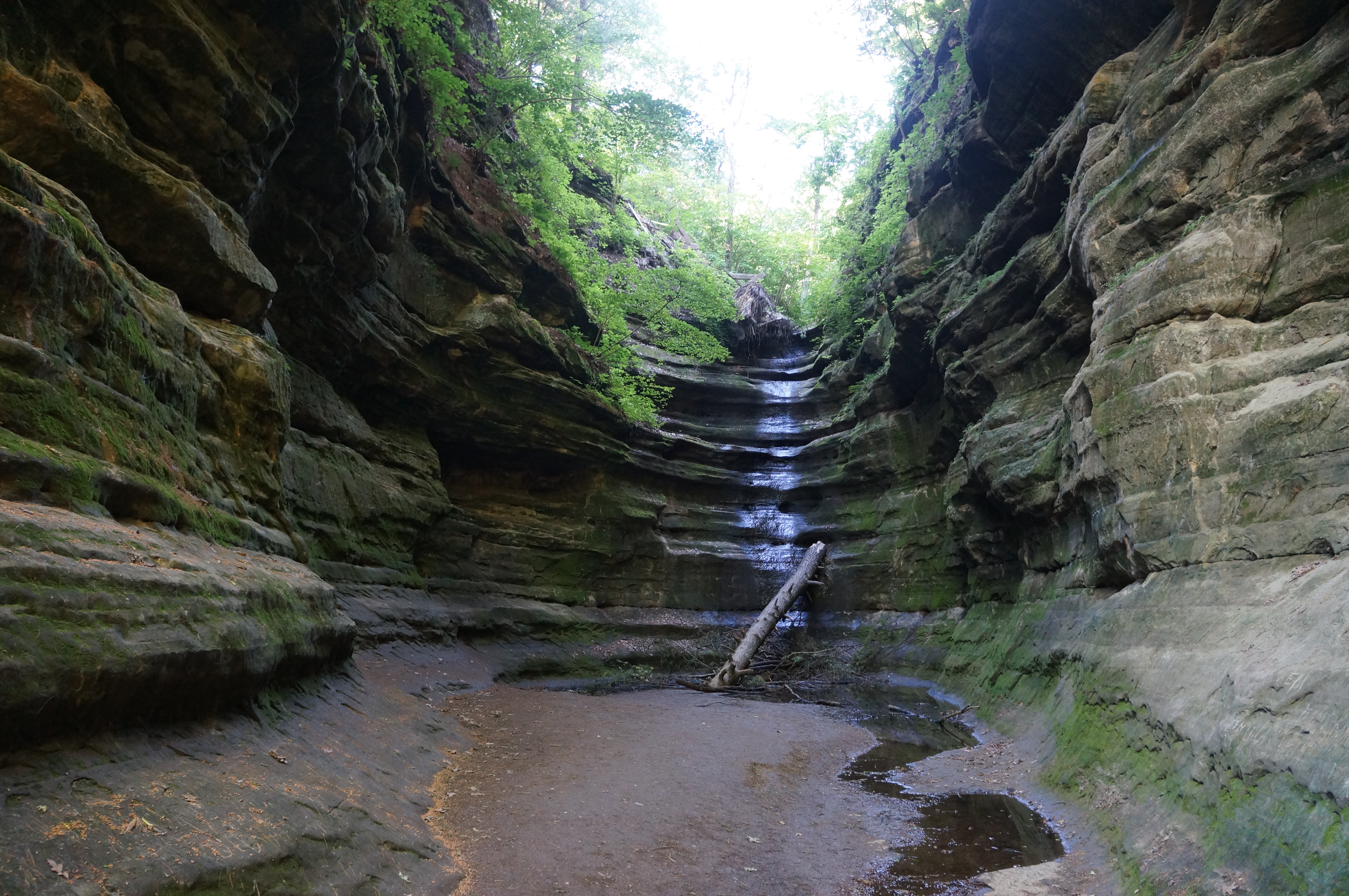
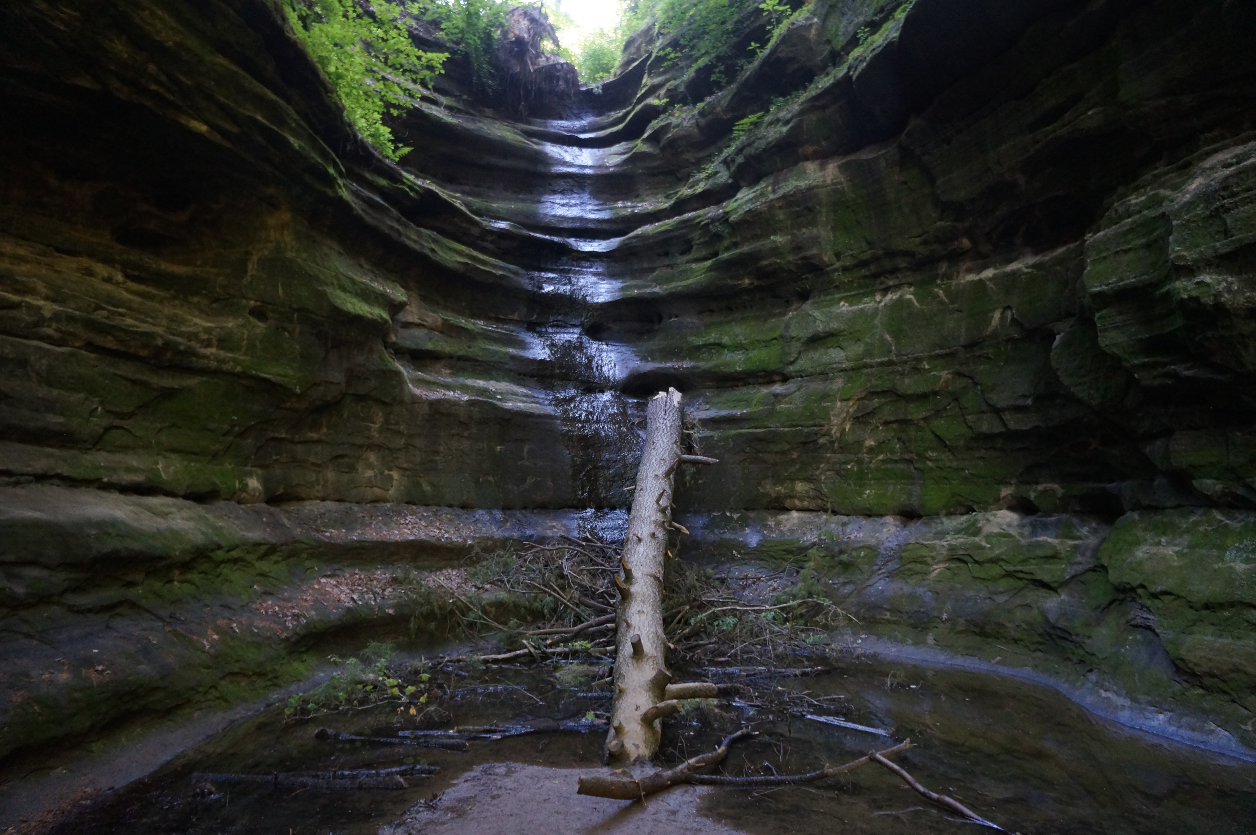
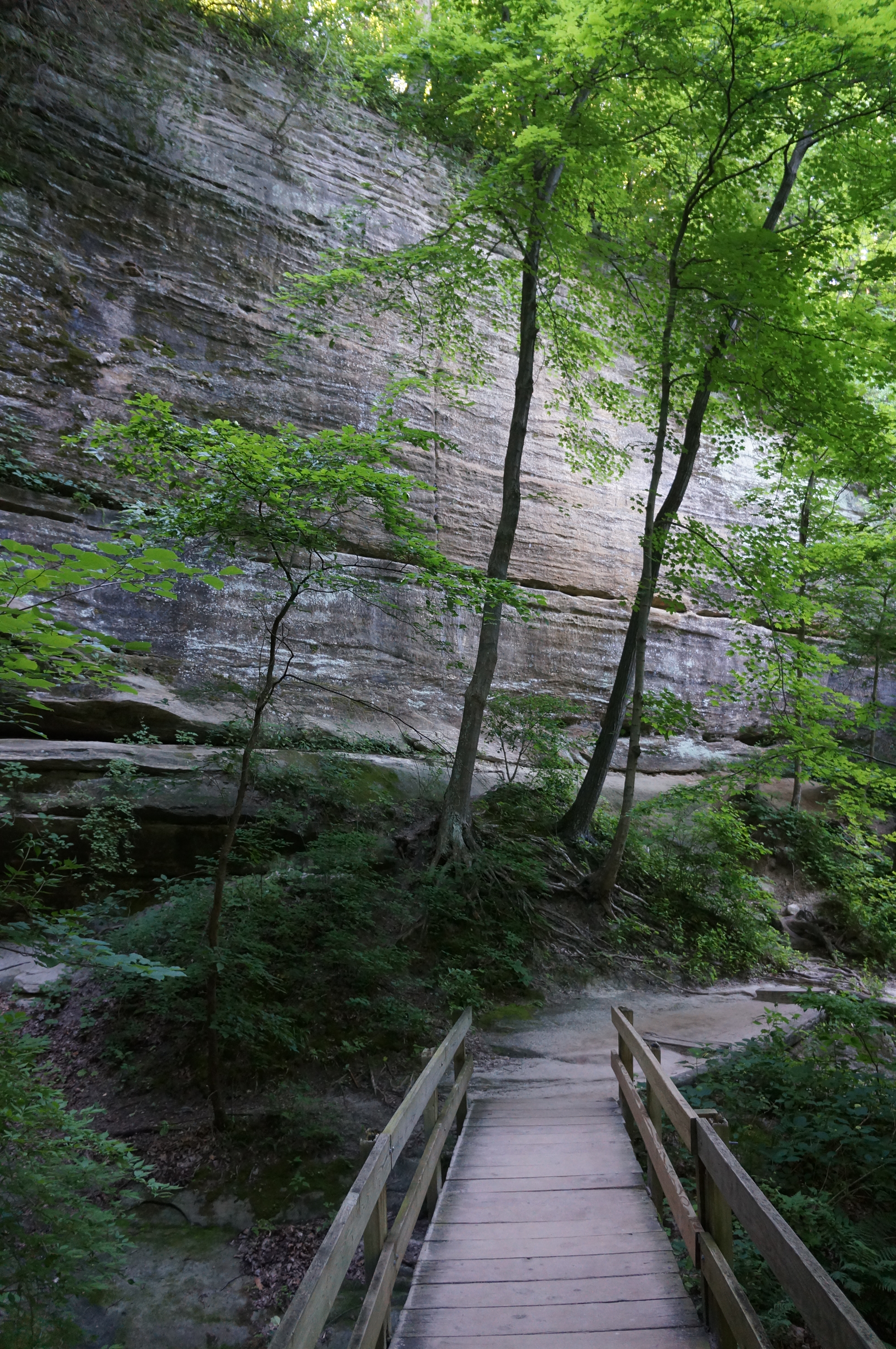
Climb up the hike’s first set of steps—get used to this!—then bear left at the next fork, following a spur trail that drops down to French Canyon. The spur trail and guardrail end at a punchbowl at the entry to a narrow section of the sinuous canyon, with minor, off-trail scrambling required for onward passage. Here the canyon floor narrows to a point where one can touch the sloping angles on both sides, scurrying up an oft-flowing streambed.


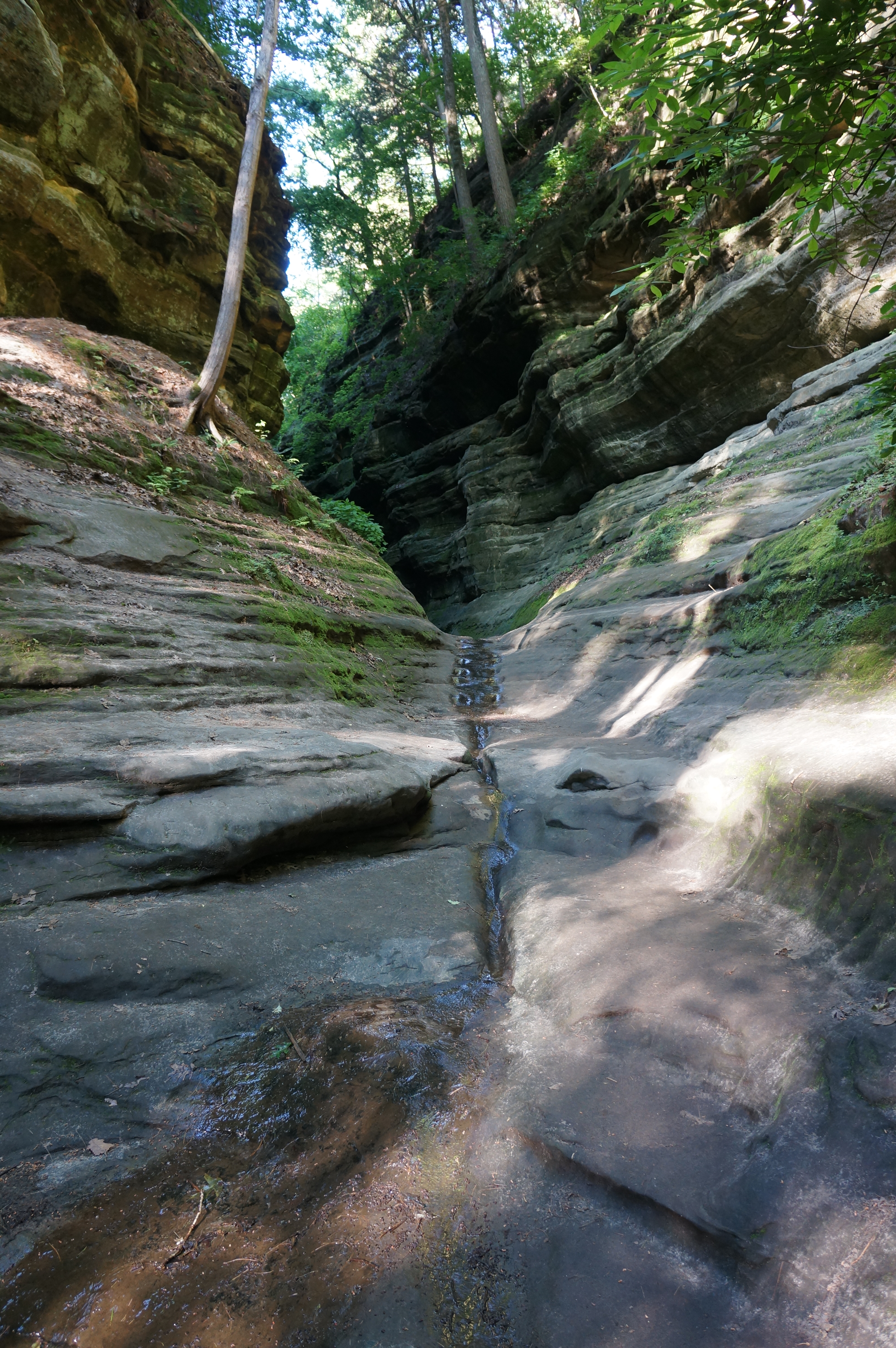
Beyond is a beautiful amphitheater, ending in a high dryfall with a seasonal waterfall. This spot is one of the most photogenic—and popular—in the park: looking back, the light creeps partway into the dark canyon, with high, striated walls on both sides.

After exploring this worthy spur trail, retrace your steps back to the main track, rising a series of wooden staircases to a shelf above French Canyon and just below the cabins at Starved Rock Lodge. Parallel French Canyon below on the left as the route edges southward; across the canyon, one can see the extensive storm damage to the Bluff Trail. (Note: Hopefully this is resolved soon!)
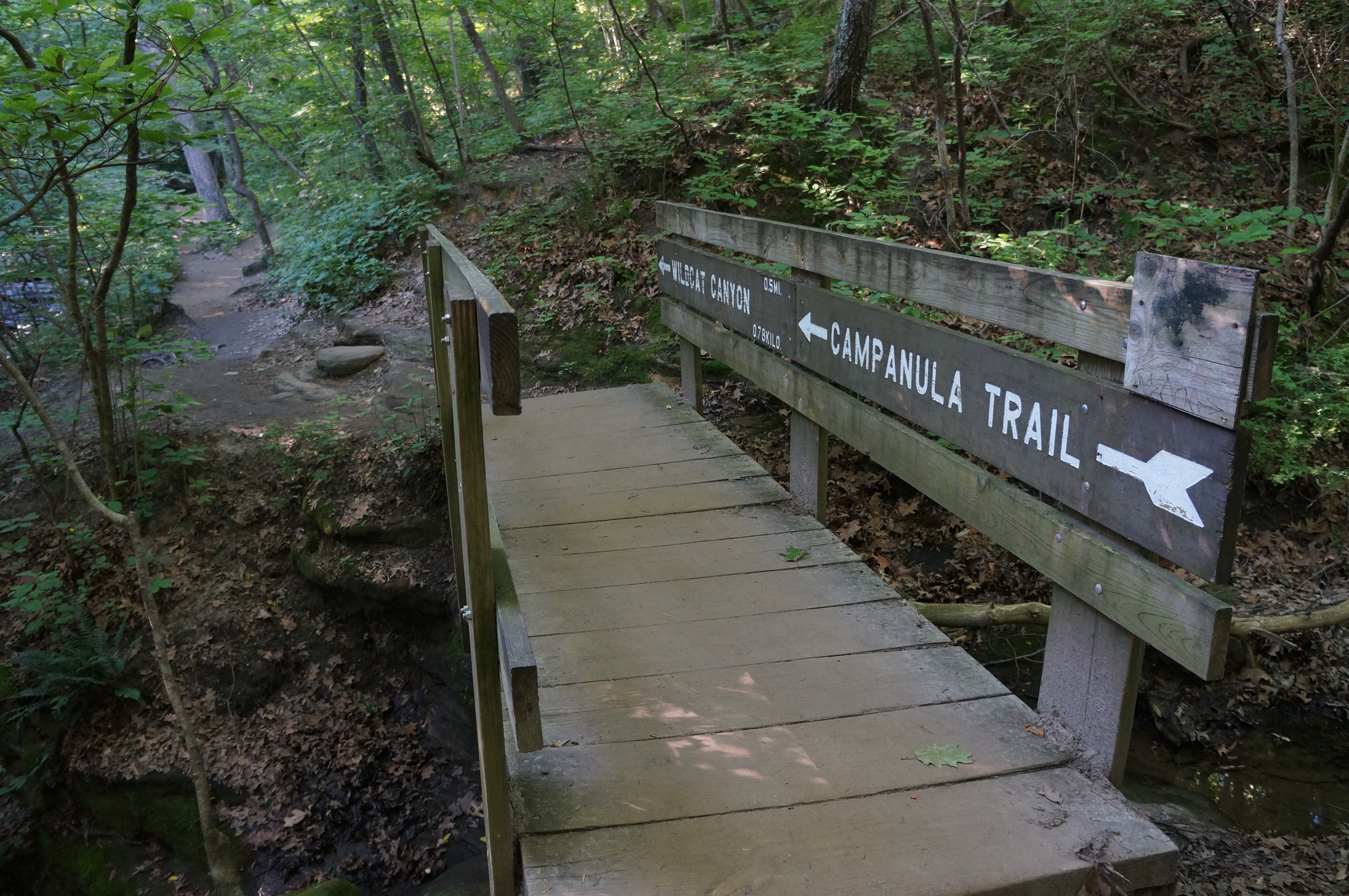
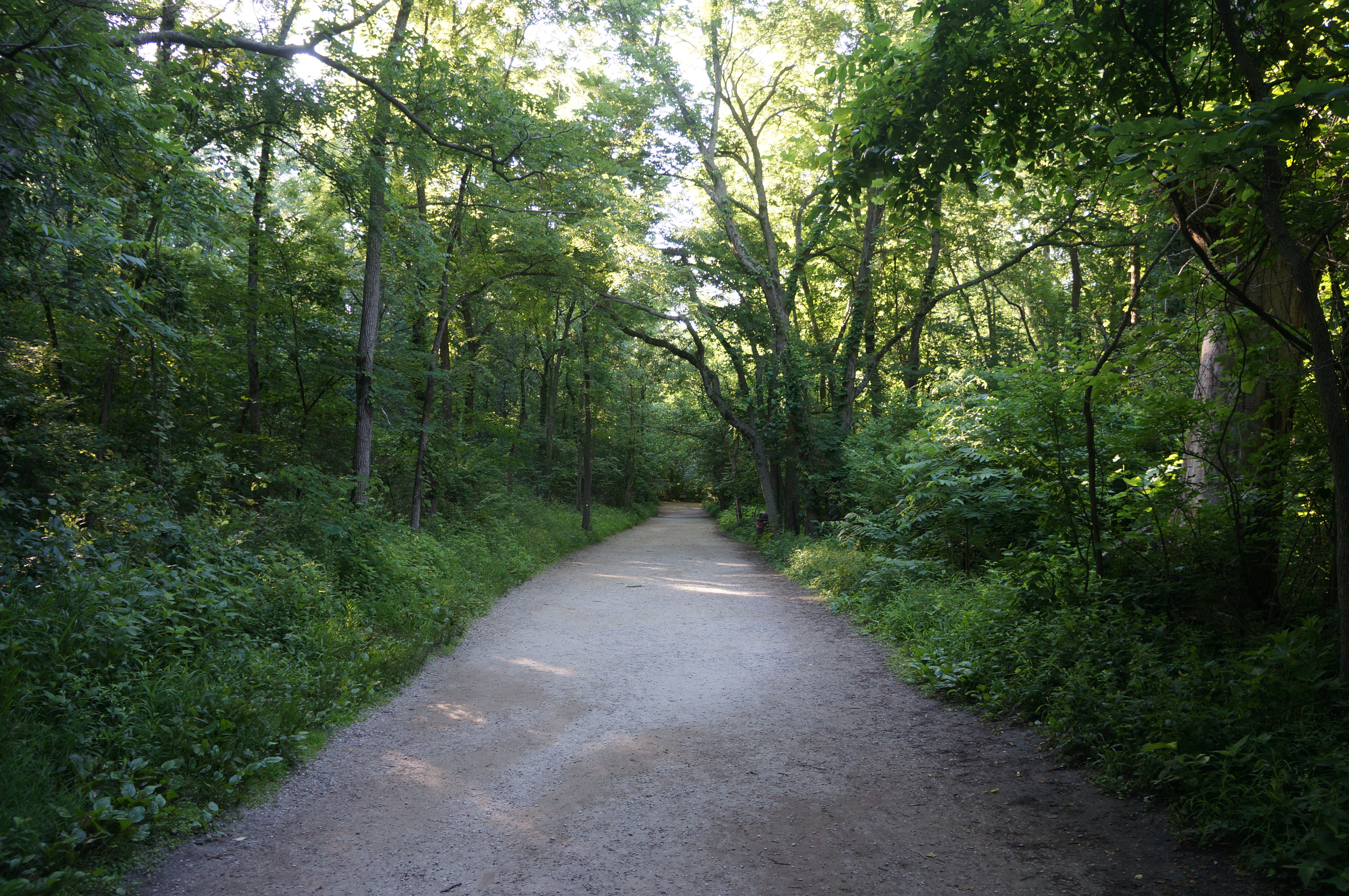
At ½ mile, reach another junction, with a bridge leading left, away from the lodge. Take this route, passing another fork a minute later (the closed Bluff Trail heads left), then traverse the drainage of French Canyon, much milder above the dryfall. Climb the staircase leading up and out of the gully, then settle in for a mild and pleasant boardwalk on the Campanula Trail. This quiet path weaves gracefully through the dense forest, offering passage eastward.

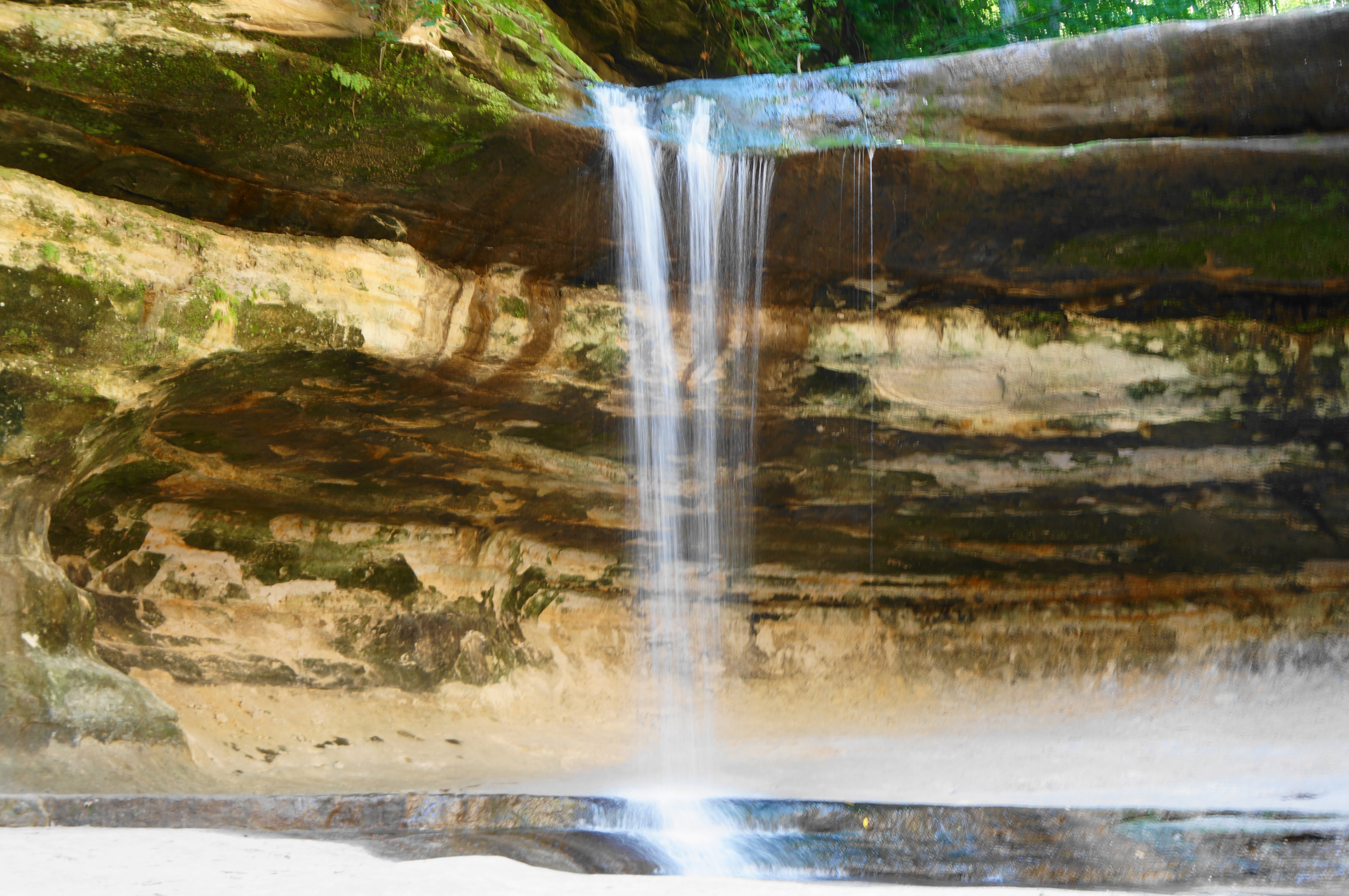
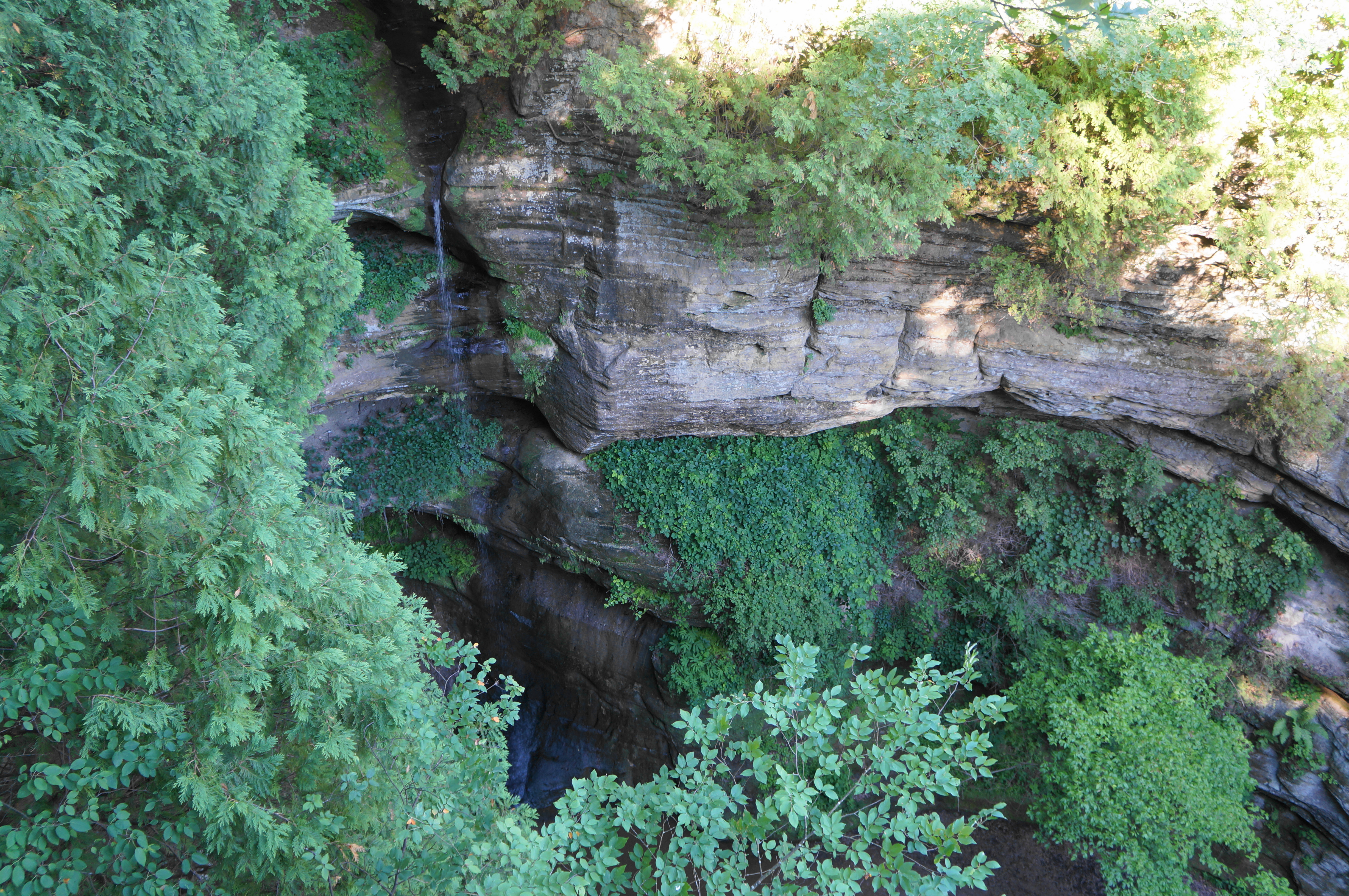
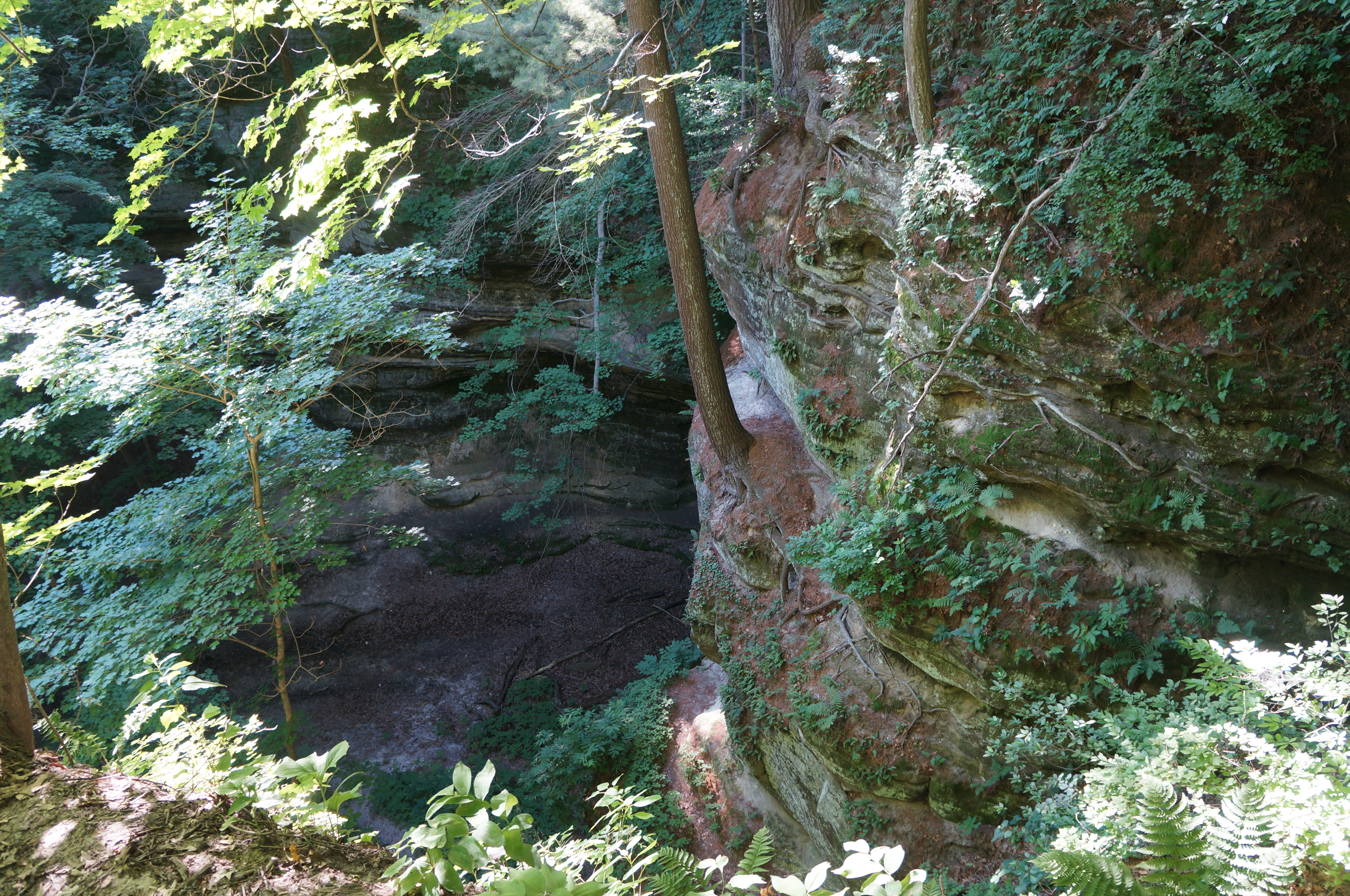
At the one-mile mark, the trail approaches the lip of Wildcat Canyon, a short but dramatic gorge, punctuated by a short waterfall, followed immediately by a much taller, 80-foot cataract. Views of the main falls from this vantage point are not great; but one can peer down into Wildcat Canyon by veering left on a connector trail heading left along the west flank—or by continuing straight and taking a spur trail out to a viewpoint on the east side of the canyon. Wildcat Canyon Falls is a slender, single drop and tends to last longer into the summer season than some others (such as French Canyon Falls).

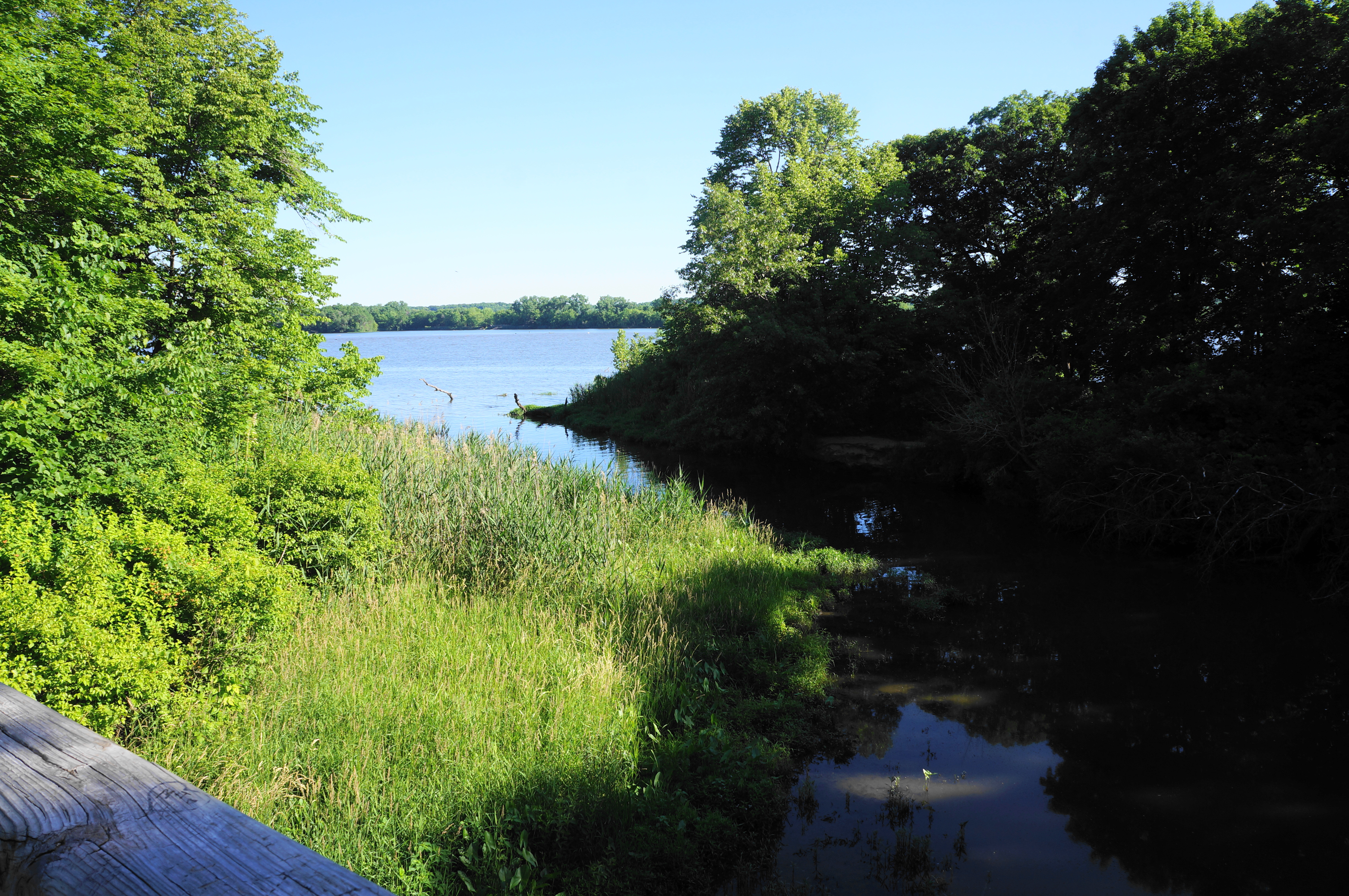
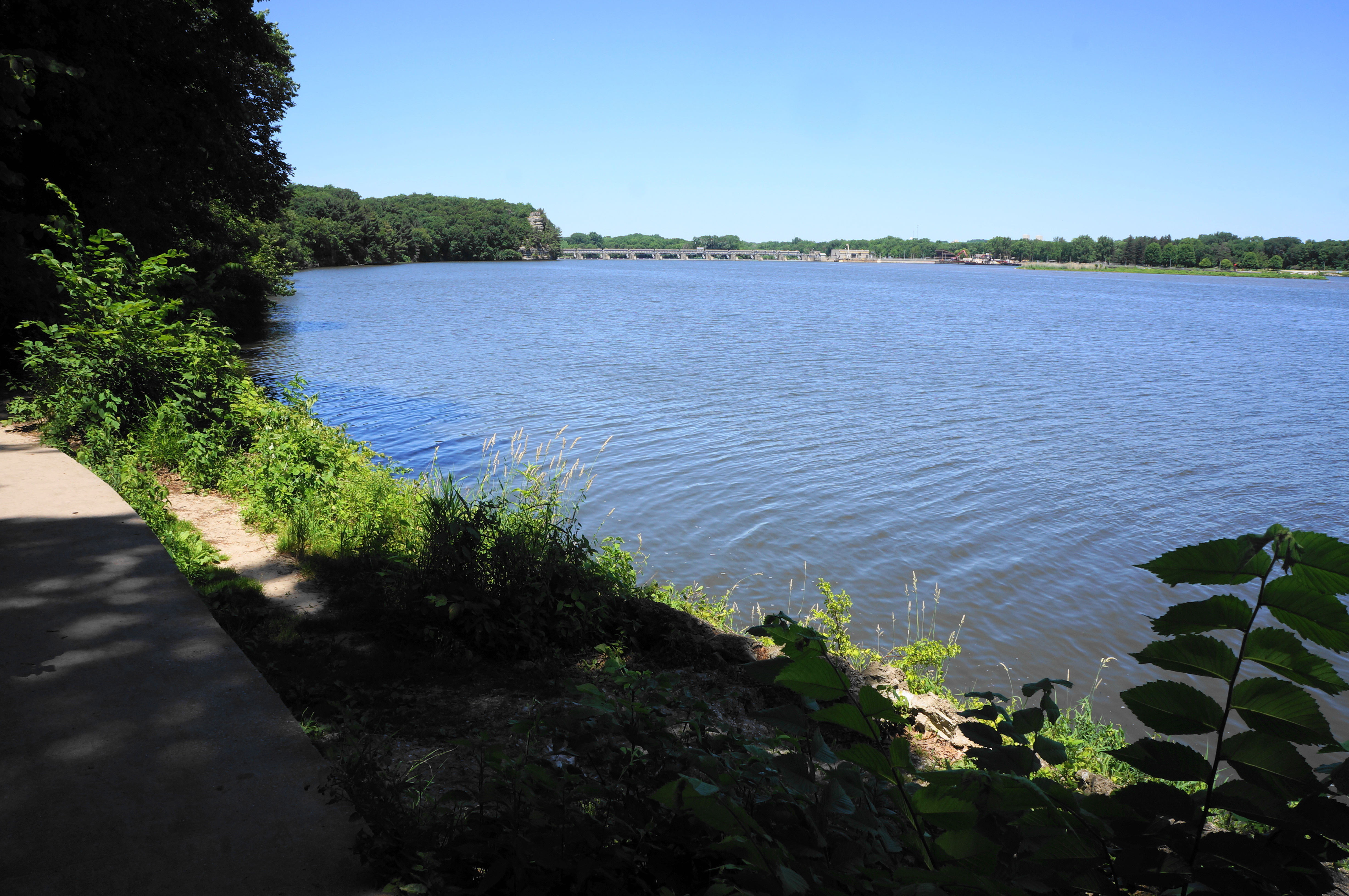
From the eastern viewpoint, continue on the Bluff Trail, heading east, following the signs for Sandstone Point. (Note: Crowds are likely to dissipate slightly after this point, with many opting to descend a connector trail to the river.) At about 1.3 miles, the up-and-down route skirts the drop into Basswood Canyon, which is unfortunately not easily viewed in its entirety. Then the trail angles around a couple of smaller drainages, followed by a short spur out to Sandstone Point Overlook, a fine viewpoint with the first clear views across the Illinois River on the hike. Downstream, one can see the Starved Rock Dam, which was constructed in 1933 and is actively managed by the U.S. Army Corps of Engineers.

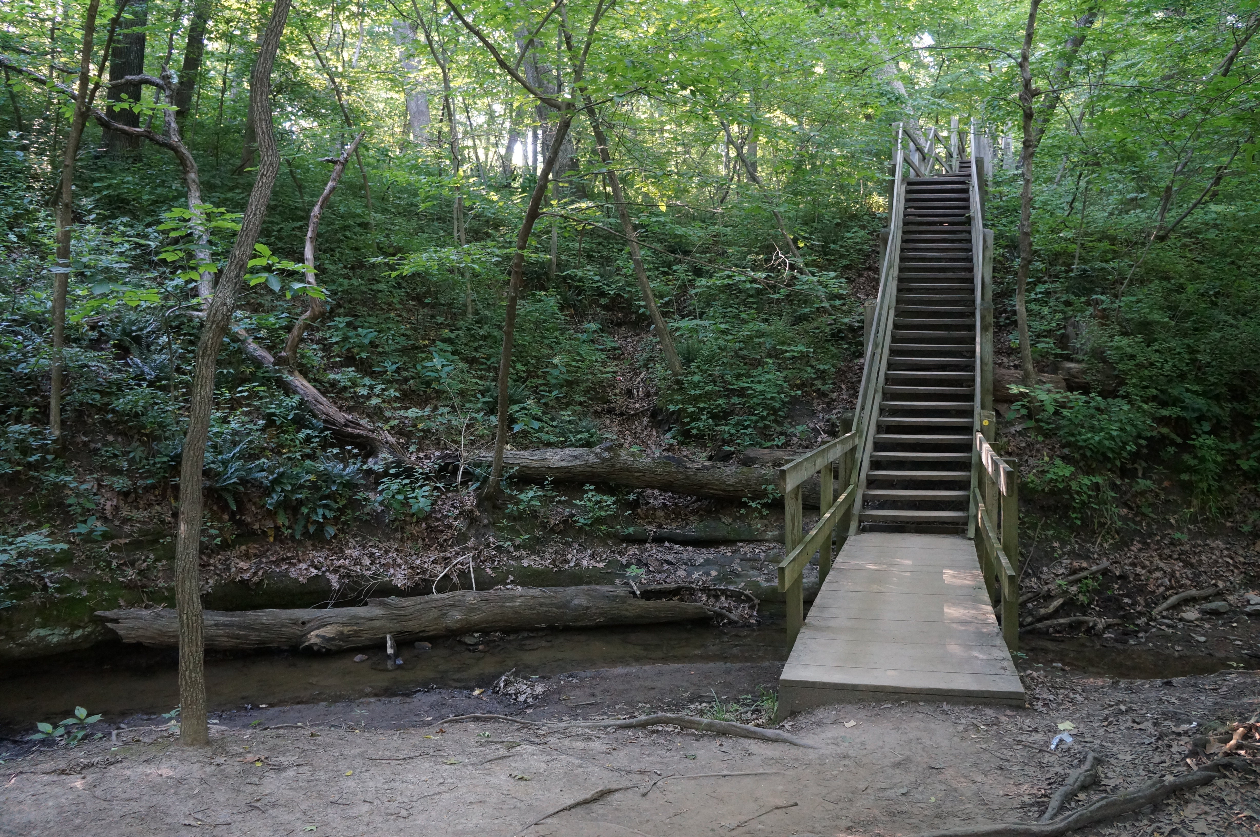
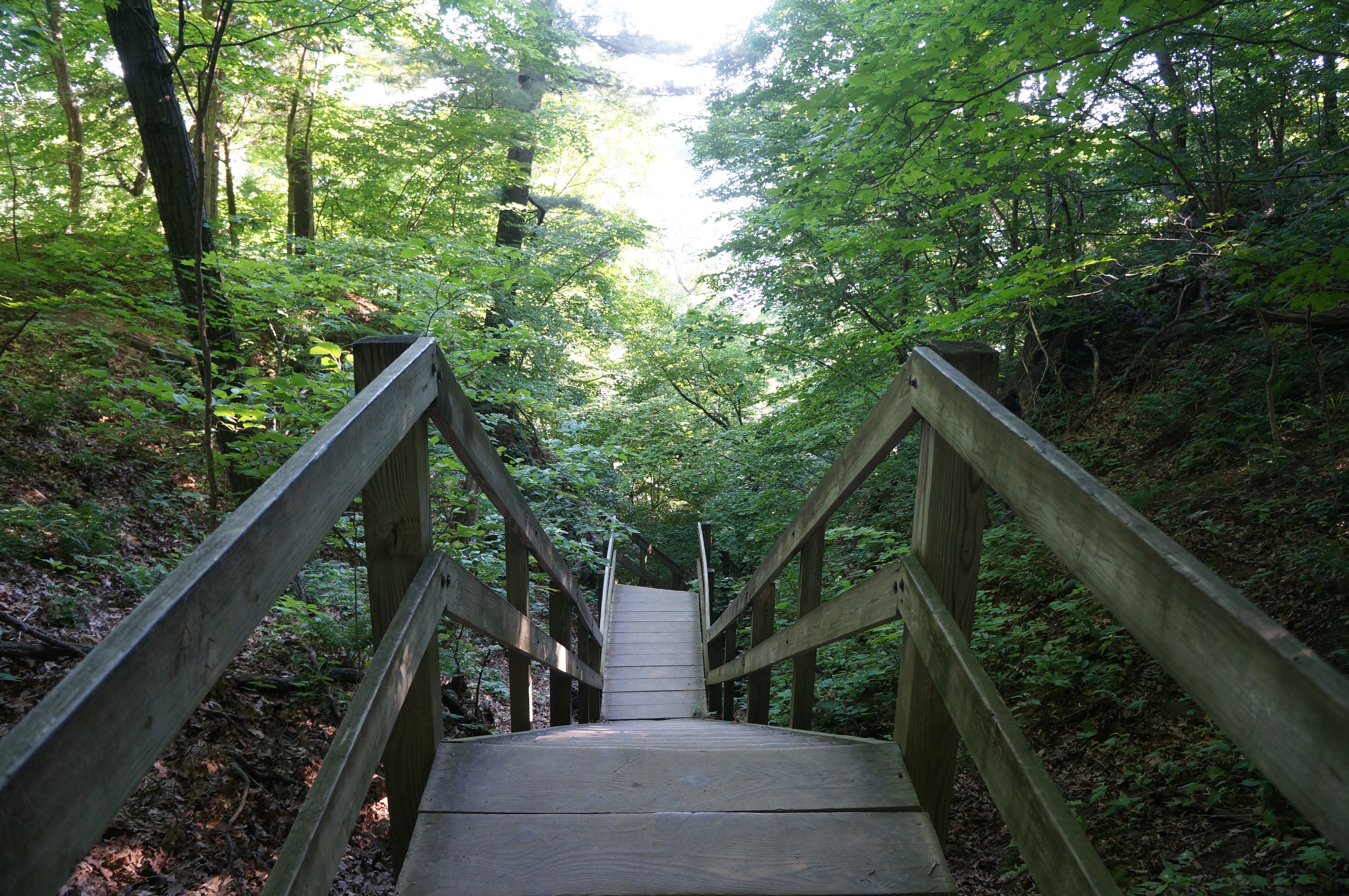
From the overlook, work your way back to the main trail and turn left, edging the side of the bluff and around the many fingers of Lonetree Canyon, another precipitous gorge with high, multi-hued walls. The trail does not drop into the canyon but rather skirts around it, reaching the top of a lengthy staircase. The stairs descend through a narrow break in the sandstone cliffs, dropping steadily and shedding nearly 100 feet in elevation. The downhill ends at a trail junction just steps from the banks of the Illinois River.
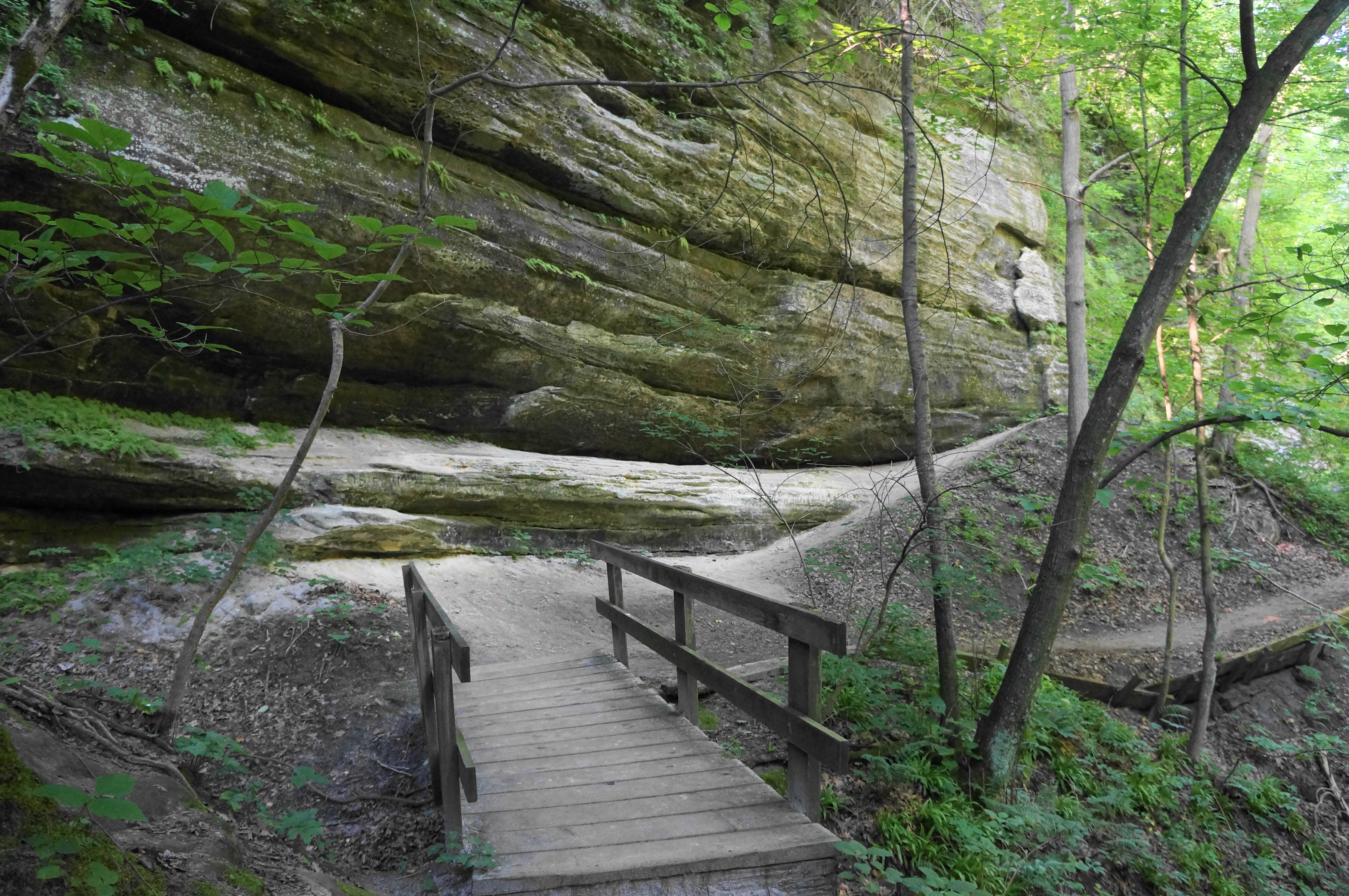
Hikers can bear left here to return toward the Visitor Center via the River Trail—but it’s worth taking the extra 1.2-mile out-and-back to LaSalle Canyon, a highlight of the hike. Heading right at the fork, the dirt path parallels the wide and voluminous river on the left and passes additional sandstone cliffs on the right. At 1.9 miles, a spur trail (closed as of June 2022) heads left toward Tonty Canyon, an adjoining drainage to LaSalle, and then crosses a stone and wood bridge over a minor wetland and inlet of the Illinois, fed by the stream that services the two canyons.

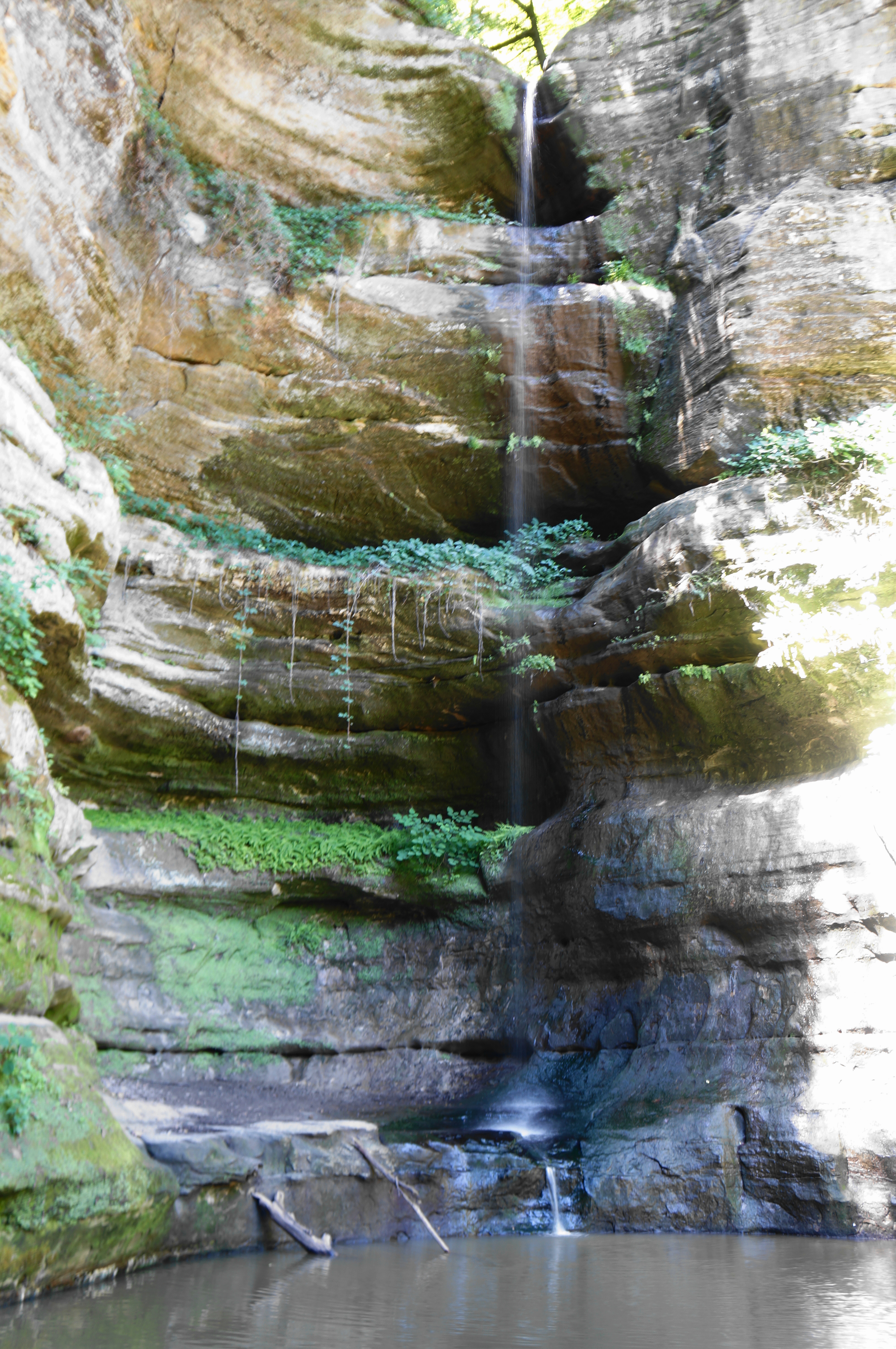
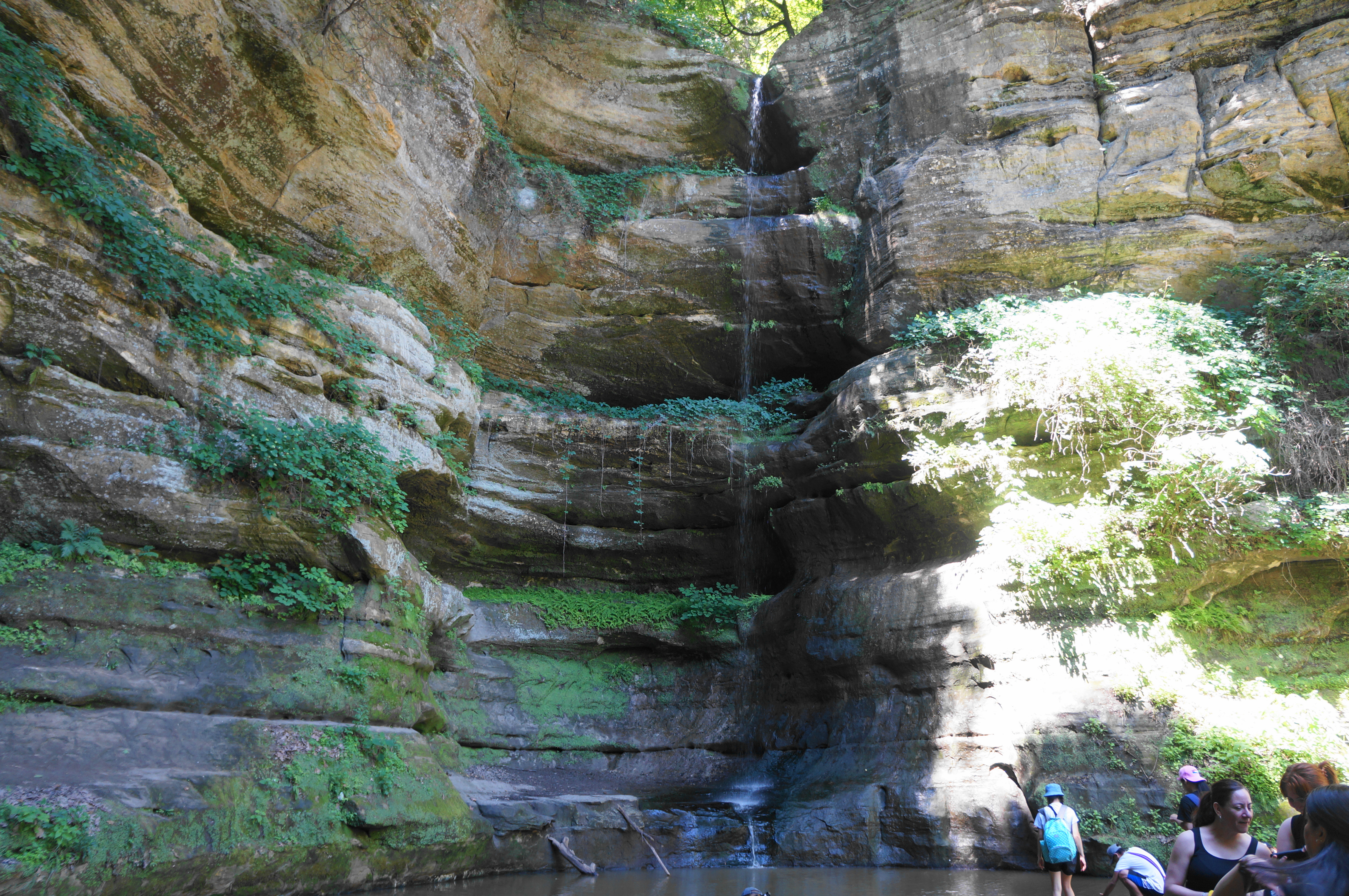
At the east end of the bridge, look for a trail heading right. This is the spur to LaSalle Canyon. The canyon narrows quickly as hikers head southward, passing the confluence at the base of Tonty and LaSalle, with sheer vertical walls on the left. Traversing a series of short bridges, the trail bends left, then right as it drives deeper into LaSalle Canyon.
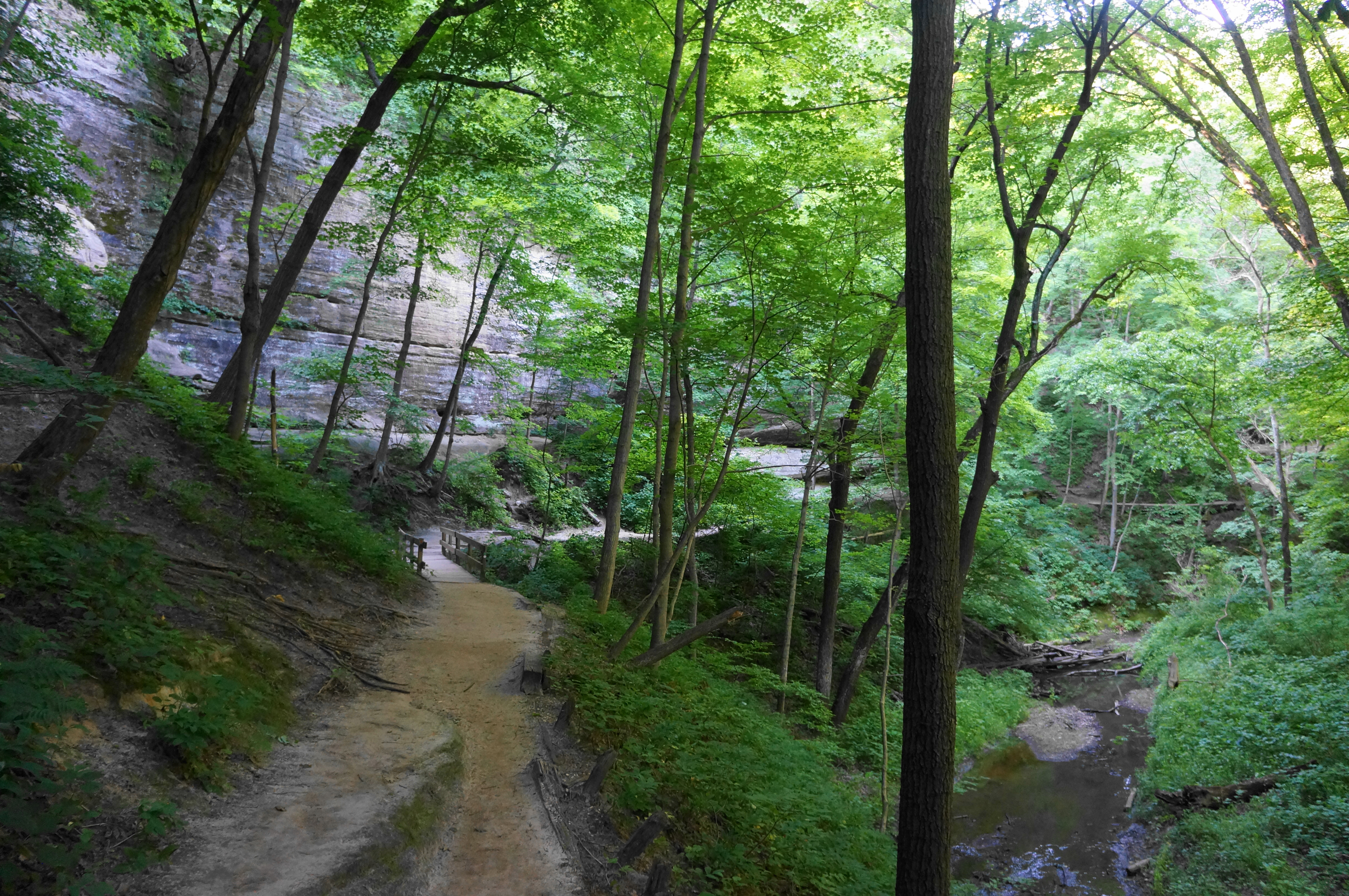
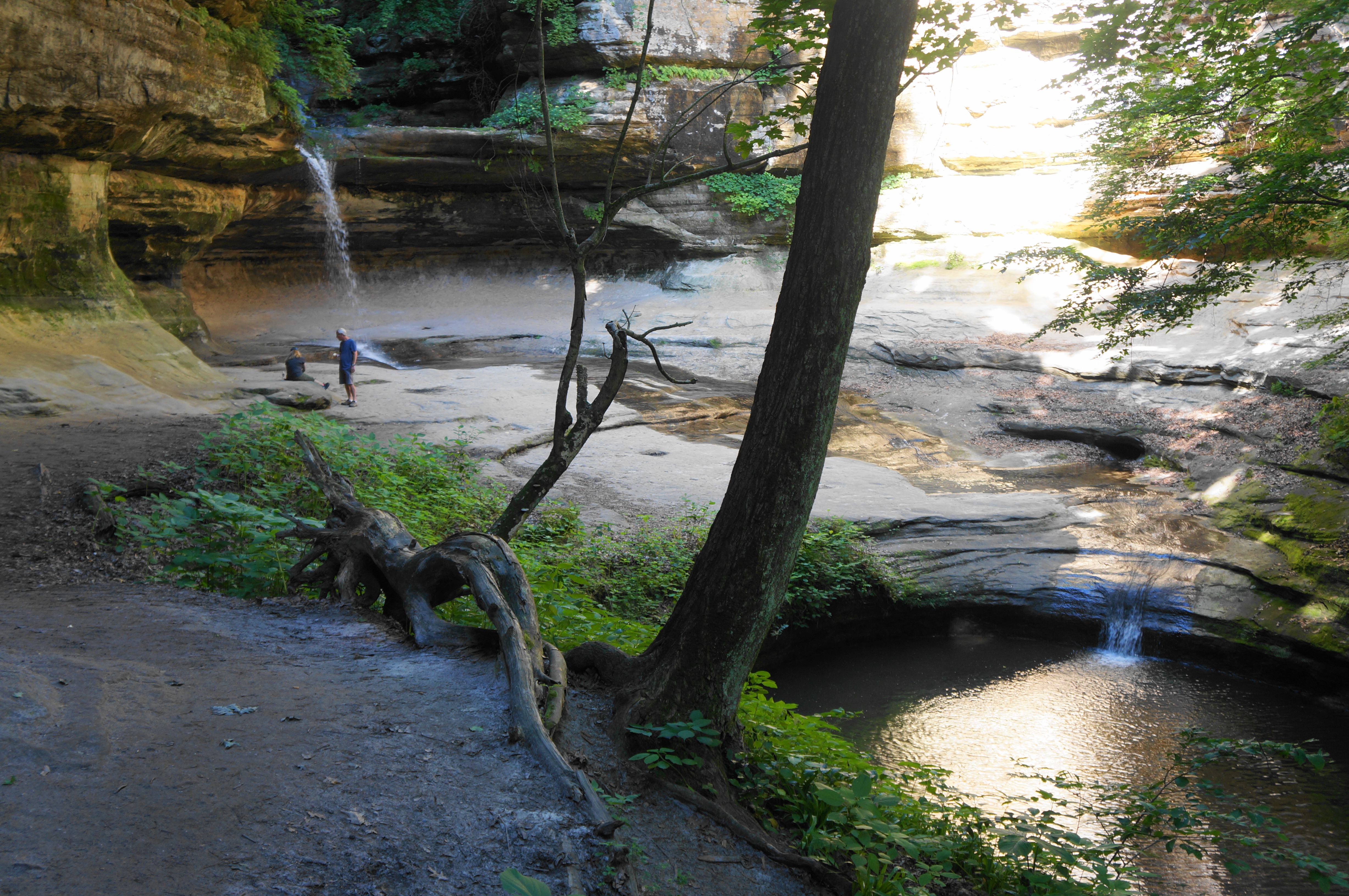
Although the route continues (linking with Tonty Canyon), a natural turn-around point is the bowl-shaped amphitheater at LaSalle Canyon Falls, a nearly perennial flow that drops around 25 feet. Like other falls in the park, visitors can go behind the waterfall for an awesome rear view. This peaceful area is one of the gems of Starved Rock—especially in the early morning when visitors are few and far between.


When ready, return the way you came, exiting LaSalle Canyon and bearing left, crossing back over the bridge and marshland. Continue westward as the River Trail returns to the base of Lonetree Canyon. This time stay straight (not left, up the long staircase) to continue the loop portion of the hike. Pass Lonetree on the left, then below Basswood Canyon, all the way staying within a stone’s throw of the Illinois River. The route is paved for part of this section, although it ends just before the turn toward Wildcat Canyon.
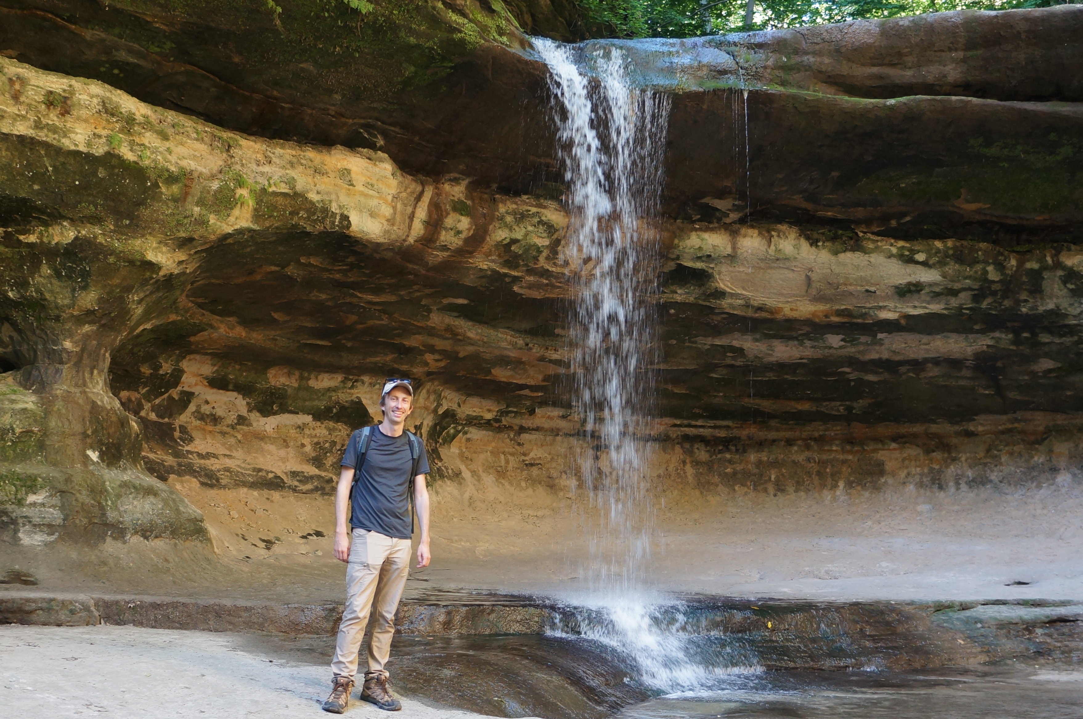
Bear left at the junction at 3.2 miles, following a spur trail toward Wildcat Canyon Falls. Climb a set of stairs, then bear left and descend to a basin and pool at the foot of the 80-foot waterfall—viewed from above earlier in the hike but considerably more photogenic from this angle. This is also a very popular destination, given its proximity to the Visitor Center.
After admiring the falls, return to the River Trail and bear left, crossing a bridge over the falls-fed creek. Minutes later, there is a junction with a spur leading to Beehive Overlook, although this was also closed as of June 2022. So stay left and mount a minor highland before dipping to clear a streambed at the base of Pontiac Canyon, another off-trail drainage.
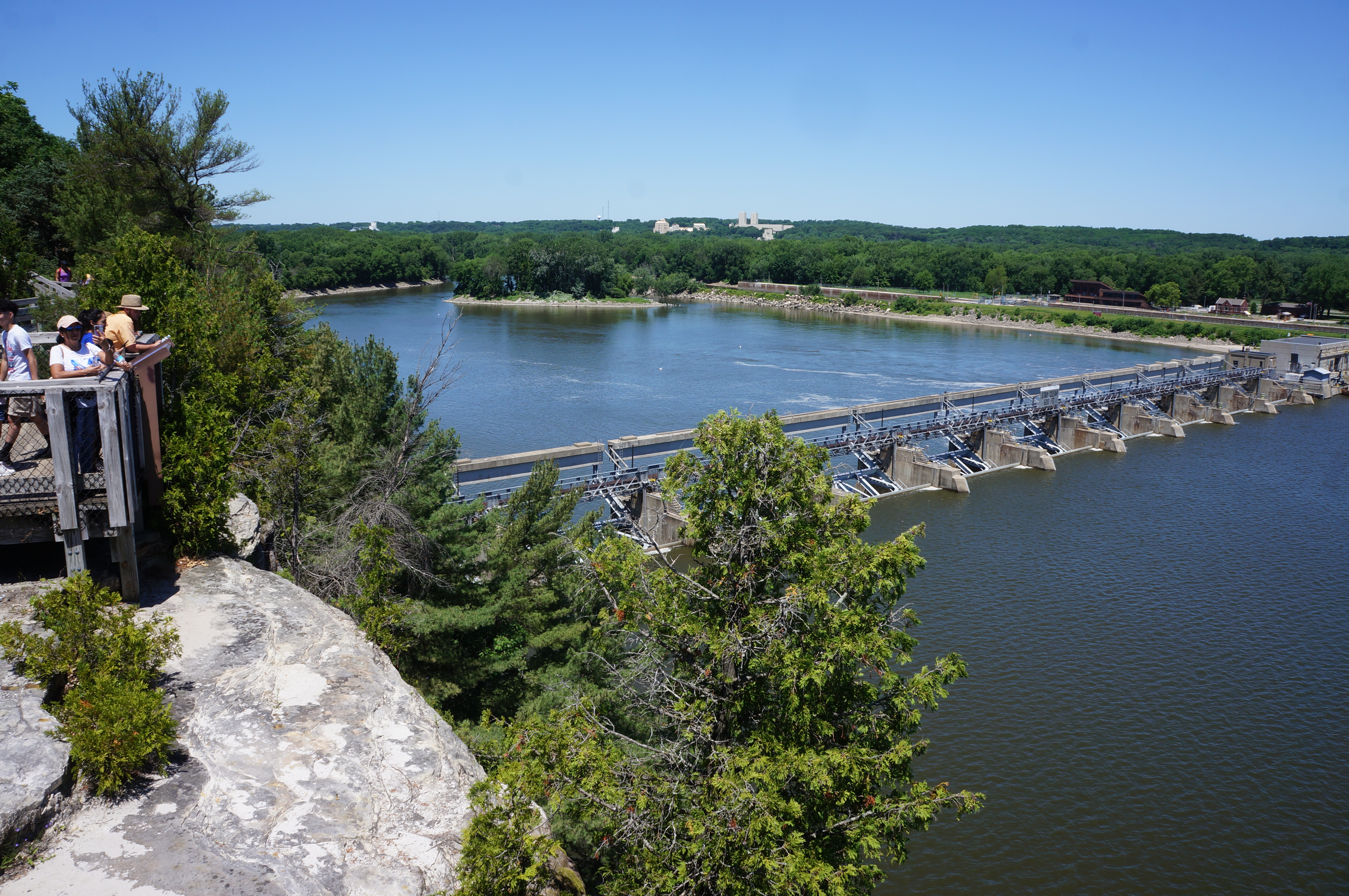
The next section is paved again and comes to a junction at 3.6 miles. Bear right here, rising up a wooden staircase, then bear right again at the next fork, leading out to Eagle Cliff Overlook, probably the park’s best viewpoint of the Illinois River. From the wooden platform, hikers can peer out westward across Starved Rock Dam and east, upstream, in the direction of the town of Ottawa.

Continuing westward, stay right at the fork, passing another overlook to the dam on the right, then begin rounding a corner amid patches of pines, reaching a short spur to Lover’s Leap Overlook. This more obscured viewpoint nonetheless has the hike’s first views of the park’s namesake—Starved Rock. The rock—and park—derives its name from an event in the late 1700s in which a band of Potawatomi Indians laid siege to a group of rival Illinois, who holed up atop the bluff until forced into starvation.

Leaving Lover’s Leap, head south on the continuing trail, eventually coming to a junction at about four miles. Stay straight/right, skirting a wide section of French Canyon on the right, coming to another, highly-trafficked fork. Bear right here, dropping down a long staircase section into French Canyon. Cross a wide bridge over the creek that feeds the canyon and come to one of the initial junctions encountered very early in the hike.
From here, it is a short walk on the wide path back to the parking area. Bear right, round a 90-degree left-hand turn, then stay straight at the final four-way junction to return to the backside of the Visitor Center. The total hike clocks in at around 4.4 miles, a hike that will likely take most around 2.5-3.5 hours to complete. This hike—Section B of the four sections—can be nicely combined with one of the other sections for a nice day-long outing.
Note: Also be sure to check out the other sections, including A) St. Louis Canyon and Aurora Canyon (2.8 miles); C) LaSalle Canyon to Council Overhang via Owl & Hennepin Canyons (2.1 miles); and D) Ottawa, Kaskaskia, & Illinois Canyons (2.8 miles).

Pingback: LaSalle Canyon to Council Overhang via Owl & Hennepin Canyons (Starved Rock State Park, IL) | Live and Let Hike
Pingback: Ottawa, Kaskaskia, & Illinois Canyons (Starved Rock State Park, IL) | Live and Let Hike
Pingback: St. Louis Canyon and Aurora Canyon (Starved Rock State Park, IL) | Live and Let Hike
Pingback: Top 10 Hikes in 2022 | Live and Let Hike