Note: This is the fourth of four posts covering hikes in northern Illinois’ Starved Rock State Park, which boasts 18 sandstone canyons, dozens of waterfalls, and an impressive network of trails along the southern shores of the Illinois River. This post covers a 2.8-mile hike that explores three canyons—Ottawa, Kaskaskia, and Illinois—as out-and-back jaunts, as well as the impressive alcove known as Council Overhang.
Those accustomed to hiking in the majestic mountains and stunning canyons of the American West may not be so keen on a trip to the seemingly flat, featureless Midwest. Yet amid the endless plains of the U.S. heartland, there are some rare surprises—occasional concentrations of natural beauty that might just rival the Rocky Mountains, the Colorado Plateau, or the Sierra Nevada. Starved Rock State Park in northern Illinois is one of those surprises—a riverside complex of towering bluffs, narrow canyons, tall waterfalls, and cool alcoves that is a local favorite for Chicagoland residents but virtually unknown to the rest of the country. Here, in a park merely two hours from the Windy City, a network of terrific hiking trails crisscrosses the southern flank of the Illinois River, diving in and out of 18 glacier-carved canyons, each featuring high sandstone walls and, after recent rains or snowmelt, surprisingly impressive waterfalls. The trail network, which stretches from Saint Louis Canyon to the west to Illinois Canyon to the east, can be broken down into four sections:
- A) A roughly 1.5-mile section connecting St. Louis Canyon with the Visitor Center area at Starved Rock;
- B) An approximately 4.5-mile loop that covers terrain immediately east of the Visitor Center, including French Canyon, Wildcat Canyon, LaSalle Canyon, and several overlooks along the Illinois River;
- C) An admittedly less scenic, 2-mile one-way stretch that connects sections B and D, by way of Owl and Hennepin Canyons;
- and D) a set of three canyons—Ottawa, Kaskaskia, and Illinois—that can be combined in a roughly 3-mile hike.
In a flurry of activity on a Saturday in June, yours truly combined all four sections (much to the surprise of the rangers at the Visitor Center!) as an out-and-back hike that traversed more than 14 miles. But most visitors will want to bite off only one or two in a day. In this post, I describe section D, a 2.8-mile out-and-back hike that combines Ottawa, Kaskaskia, and Illinois Canyons, each featuring high sandstone walls, gleaming pools, and refreshing waterfalls. Along the way, hikers can also visit Council Overhang, a recess in the sandstone that forms a broad amphitheater of stone. These gems are situated in the eastern reaches of Starved Rock State Park, with more limited crowds and seasonal falls that typically last longer into the summer.

The hike
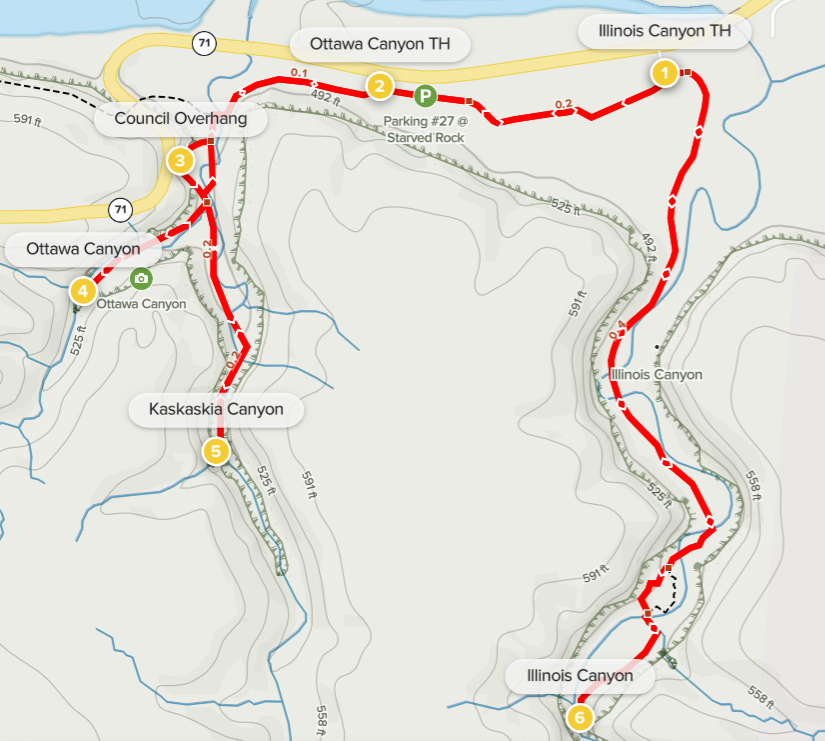
In contrast with most other hikes in the park, Ottawa, Kaskaskia, and Illinois Canyons are situated well away from the crowded Starved Rock Visitor Center area. Instead, most will begin this section from one of two modest parking lots off Route 71 in the eastern half of the park—Ottawa Canyon Trailhead or Illinois Canyon Trailhead. (Note: The below hike begins and ends at the latter—although the Ottawa Canyon Trailhead is larger and thus probably a better bet on busy weekends.)
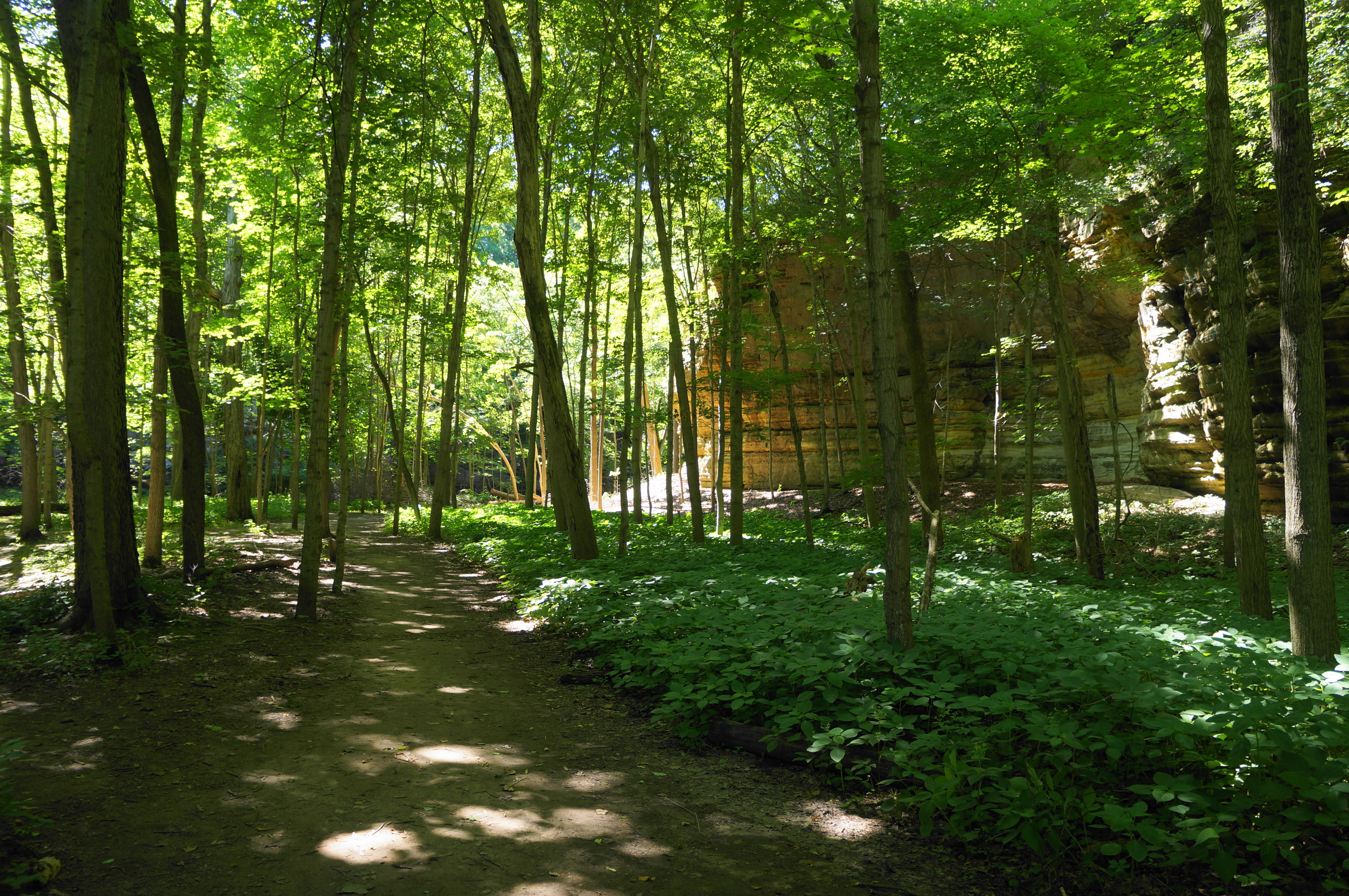
The towering sandstone walls and lovely freefalling cascades are not at all immediately obvious as the hike begins at the Illinois Canyon Trailhead. Heading west from the trailhead, the Bluff Trail heads into dense woods, not quite leaving earshot of the road off to the right. The Illinois River is hidden away, across the road, but the route follows a broad and flat floodplain, routing toward Ottawa and Kaskaskia Canyons. At Ottawa Canyon Trailhead, cross the long parking area and continue on the path westward.
The main track begins to curve southward at around 1/3 mile, then—as is common in the park—seems to split into a flurry of alternatives, some immediately crossing the stream fed by the two canyons, while others snake along its eastern bank. The most-used track heads across the creek and then reaches an unmarked but well-trodden junction. Here the Bluff Trail covering Section C—LaSalle Canyon to Council Overhang—comes in from the west.

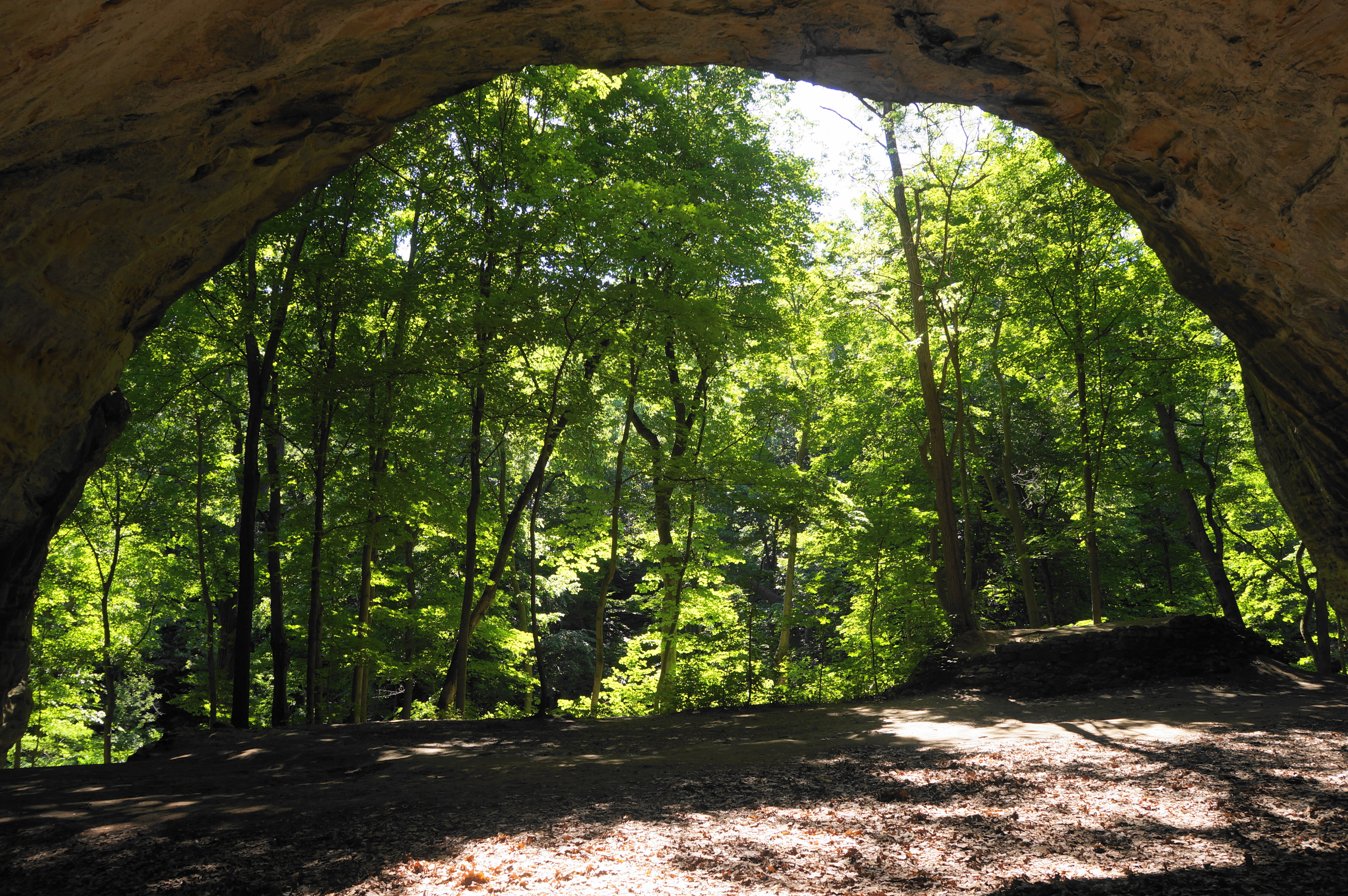
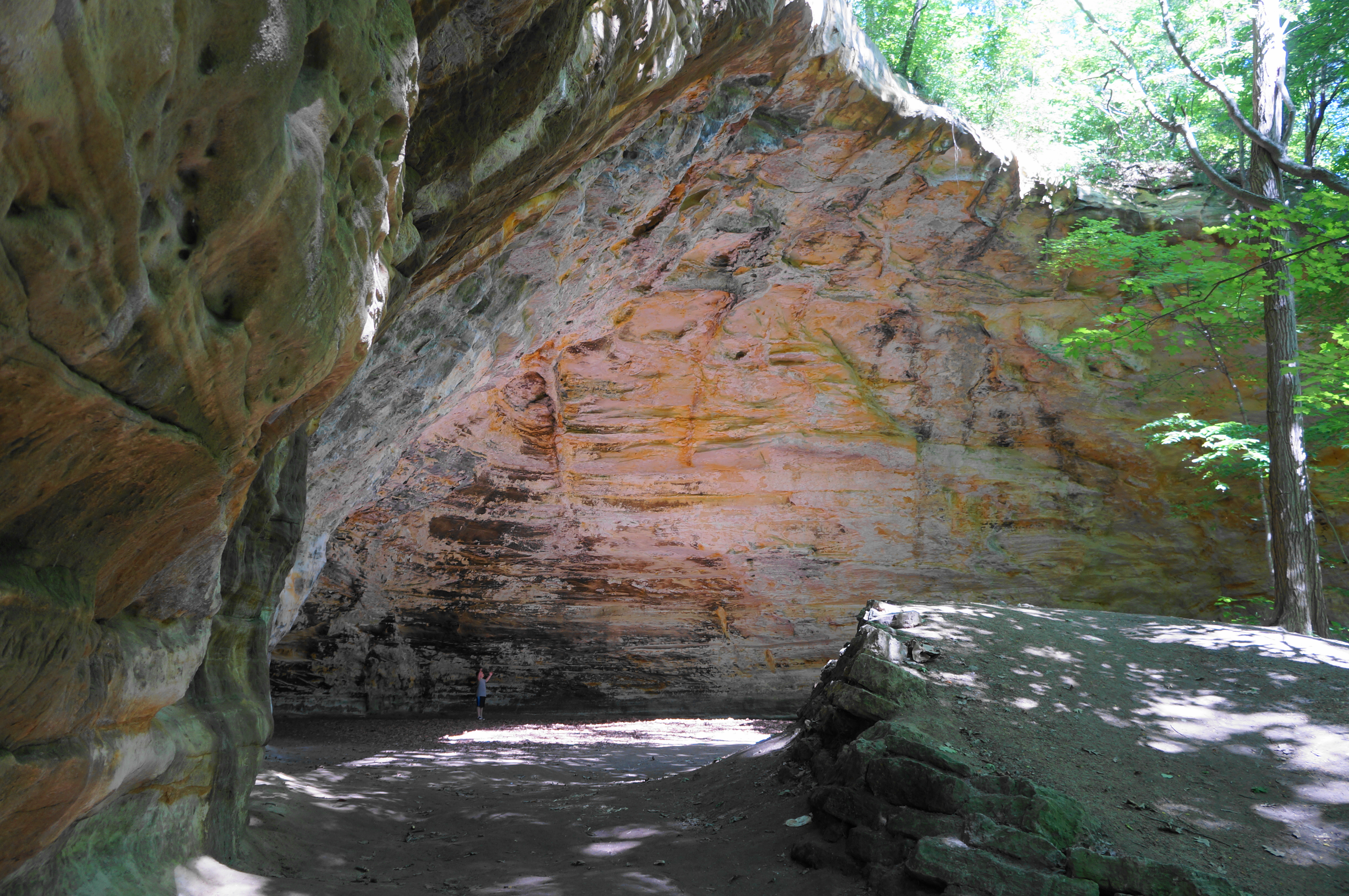
Bear left instead, quickly coming to a new junction, with an obvious path leading right and up to a stunning feature of the landscape: an eroded alcove known as Council Overhang, thought to have been used as a meeting place for native tribes living in the area. At 40 feet high and some 30 feet deep, the broad incision is an impressive sight to behold—especially for Illinois—and is captured best on camera with a fisheye lens.
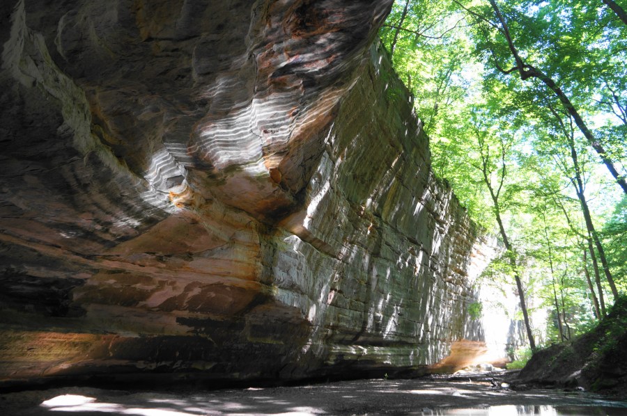
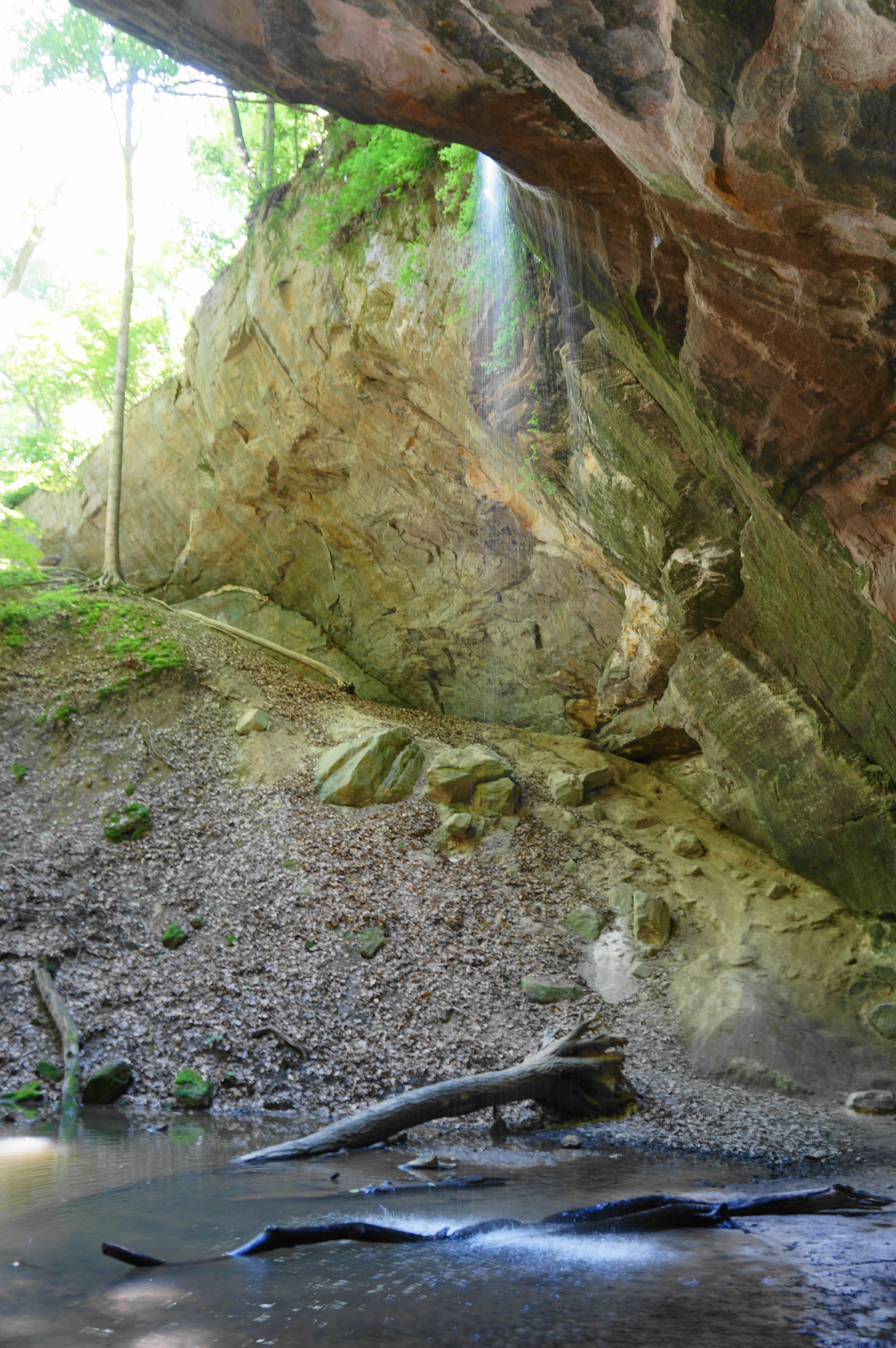
Leave the echoing alcove by continuing around the bowl and then bearing south, reconnecting with the main access route to Ottawa and Kaskaskia Canyons. Bear right at the next fork, heading up Ottawa Canyon first. This beautiful, stream-fed drainage features ruffled sandstone walls, reaching upwards of 50 feet tall, and—after some muddy traverses of the slow-flowing creek—culminates at a 45-foot waterfall.
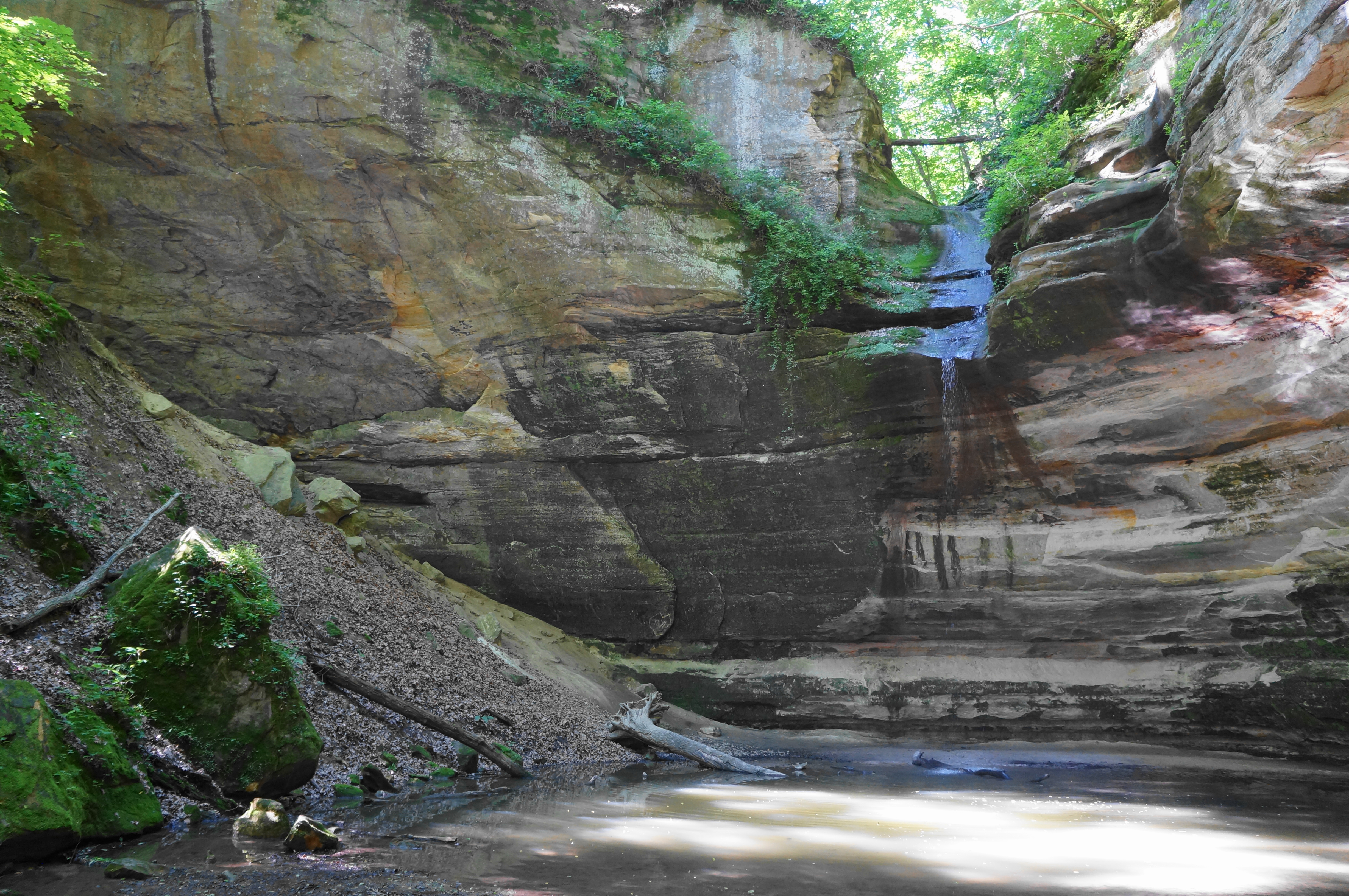
Ottawa Canyon Falls is notable for its freefalling drop, which allows hikers to edge around the grotto to its back side, a terrific, up-close—and sometimes wet!—view of one of the park’s most interesting cataracts. The rippling pool below, when illuminated by sunlight, often causes a projection on the walls above that appears like bright, moving waves.


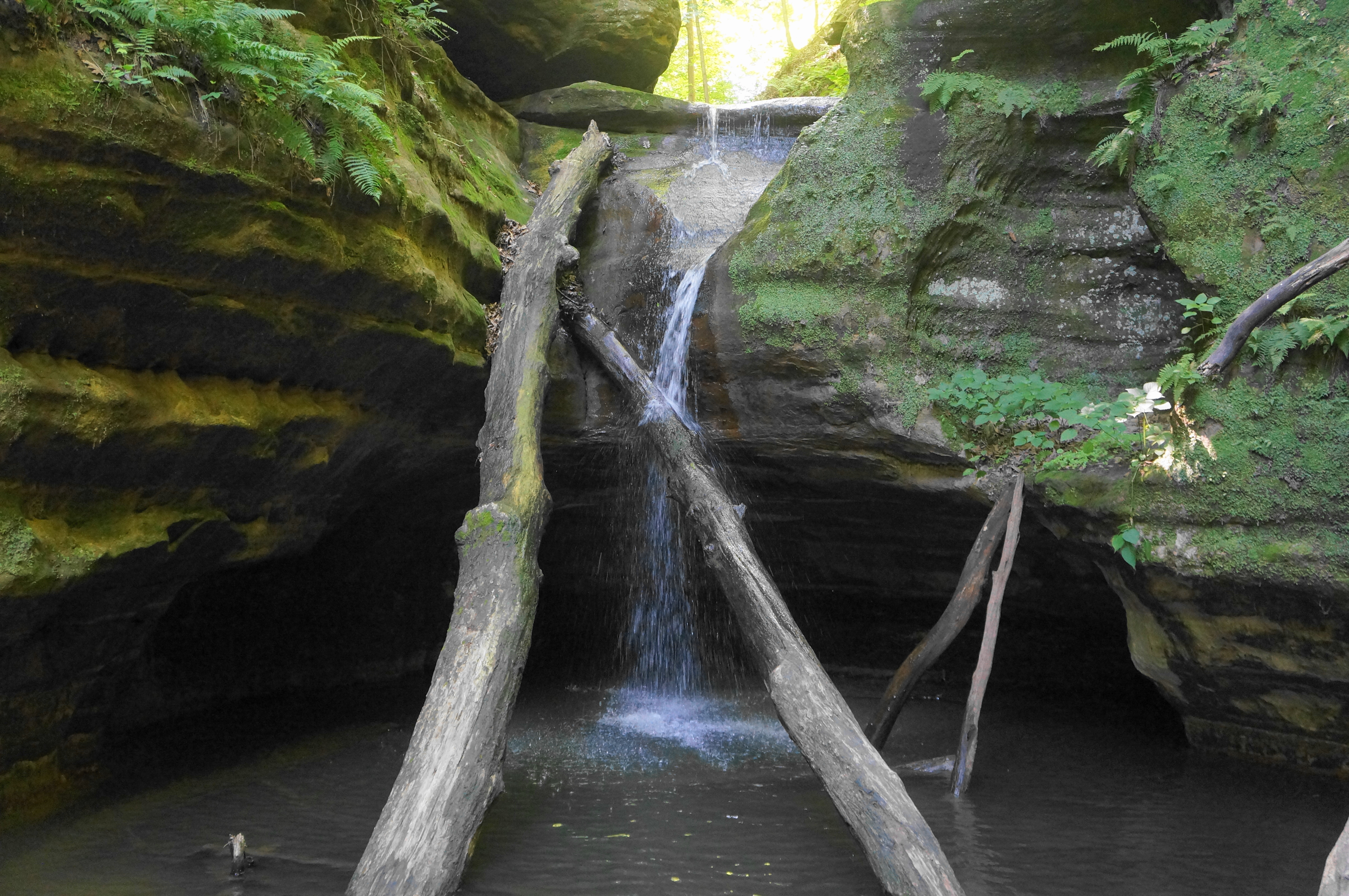
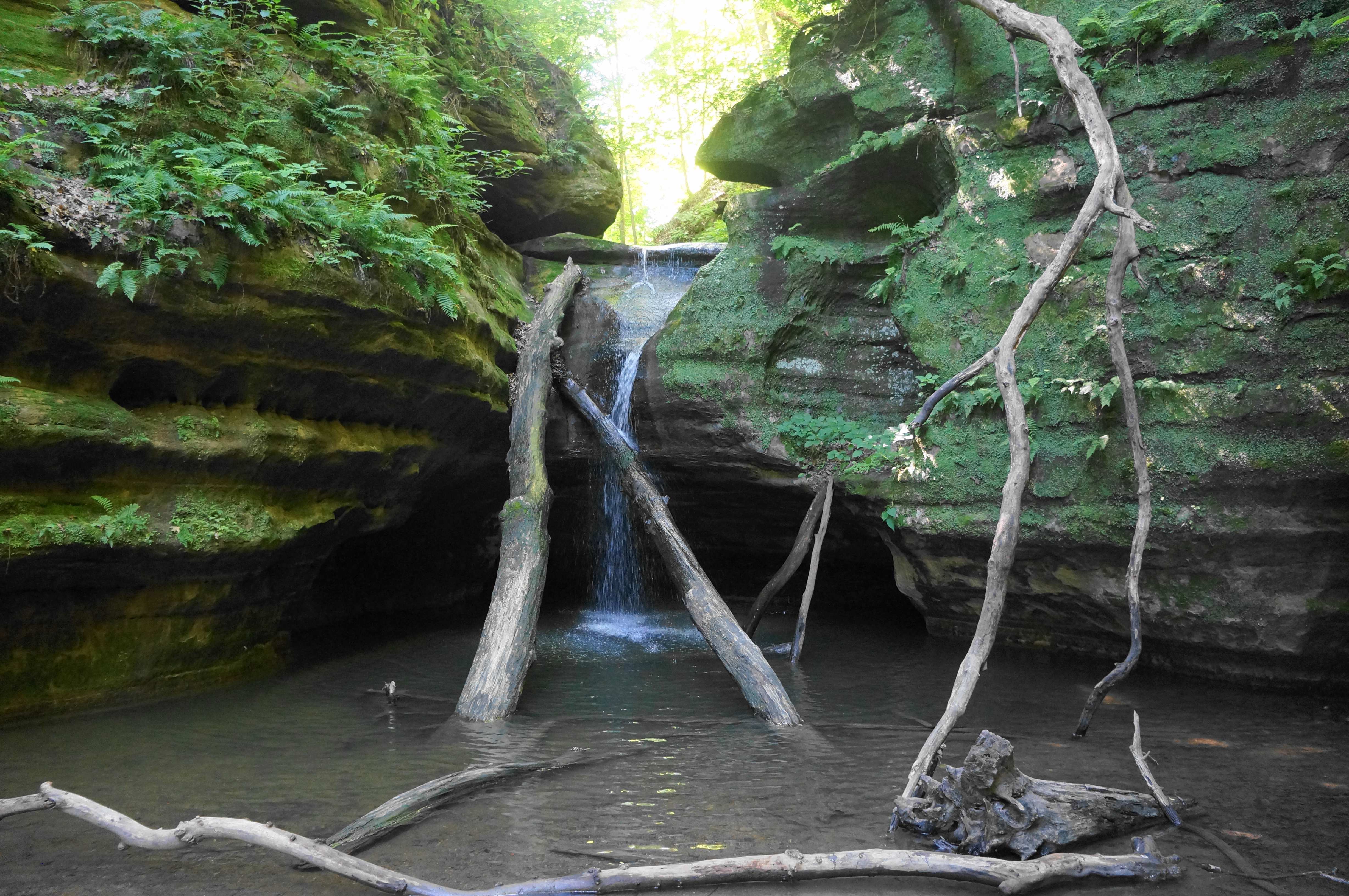
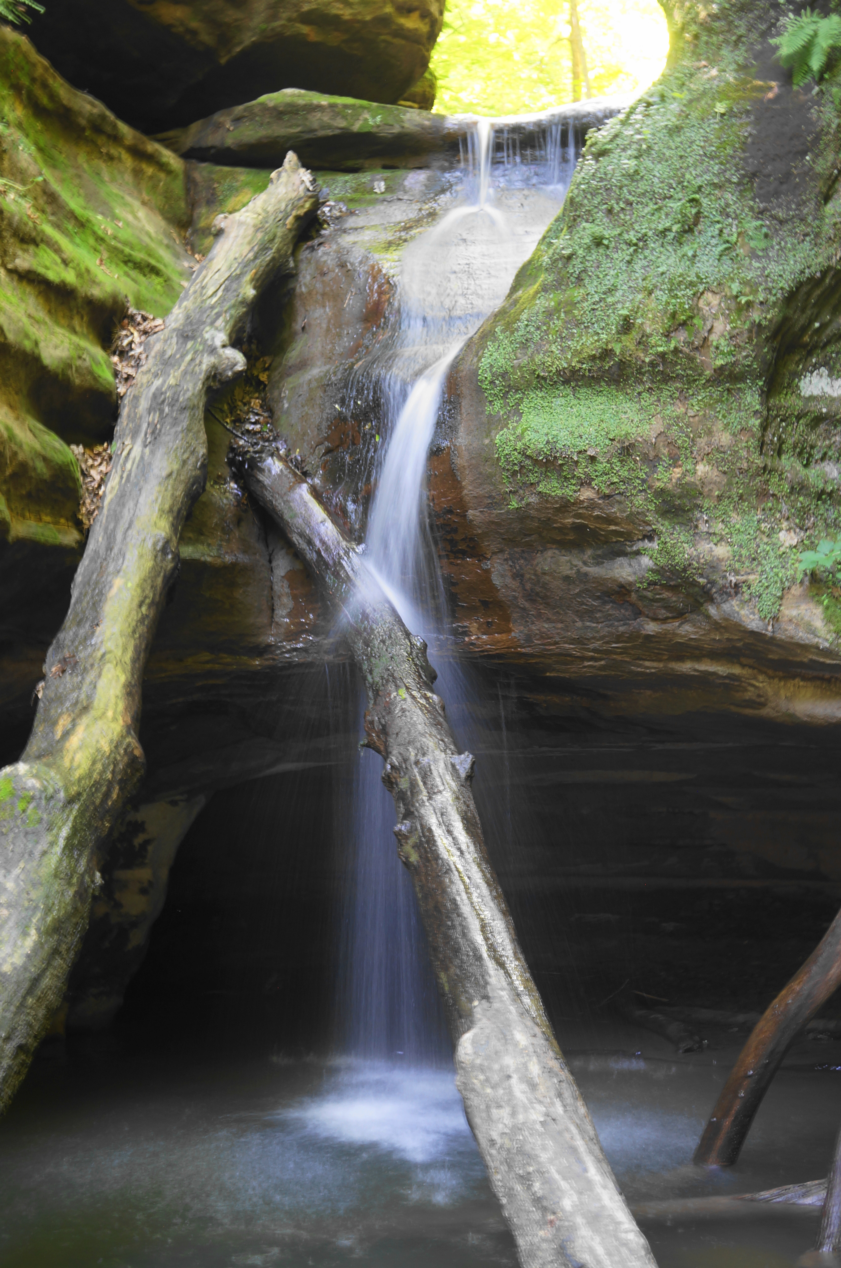
Once ready, return the way you came until the confluence with Kaskaskia Canyon, Ottawa’s sister drainage. Bear right here, heading south again and tracing a longer stream section. The walls in Kaskaskia are not as high, but the passage is narrower and darker, ending again at a dark blue pool and waterfall. Kaskaskia Canyon Falls, although shorter than many others (15 feet) in the park, is one of the most photogenic waterfalls at Starved Rock. Here the water splatters a pair of tenuously-placed logs while dropping in front of a dark cavern, filled by the seasonal bath.
From Kaskaskia Canyon Falls, make your way back to the junction of the two canyons, then continue straight—with the easiest route staying on the west side of the creek before crossing it well clear of Council Overhang. (Note: One can bypass the alcove by staying straight when the path to the overhang heads left.) After the stream, return 2/10 mile to the Ottawa Canyon Trailhead, followed by another ¼ mile to the Illinois Canyon Trailhead.
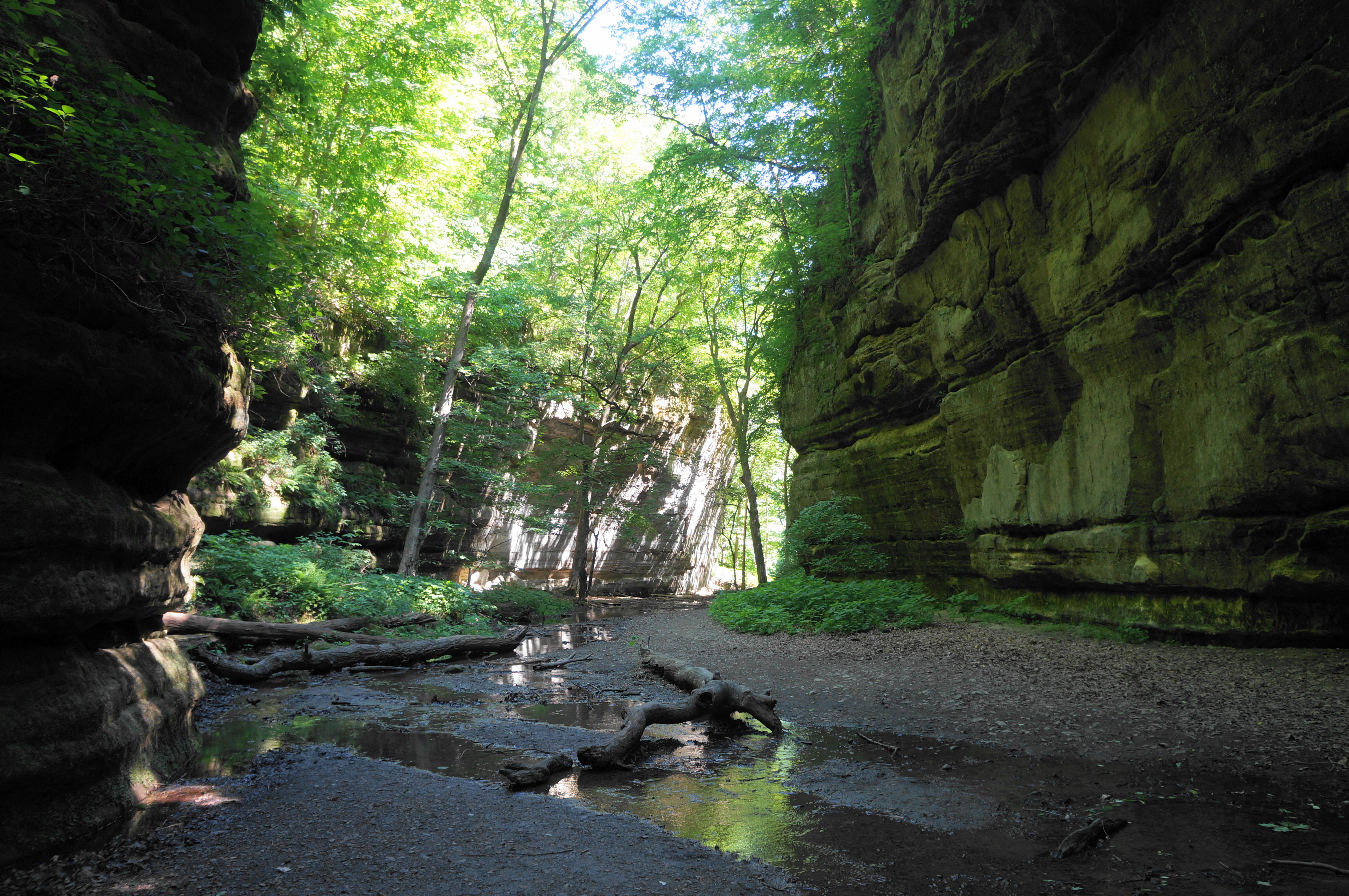
You can end your hike here or continue on to Illinois Canyon, the last and easternmost sandstone canyon in the park. Though lacking the grand waterfalls of Ottawa and Kaskaskia, this gorge is very pretty and considerably longer, requiring hikers to bear south for more than 2/10 mile before the walls narrow. The main track crosses the creek feeding the canyon several times: amid the rocks and fallen logs, hikers will have to decide the best route to take to cross. (Note: After recent rains/snowmelt when the water is high, good luck avoiding wet feet!)

On a nice spring or summer day, expect to see anglers, trying their luck in the gently-flowing waters, especially in the serene alcoves formed at water’s edge. The trail ends at a large pool and a very small (1- to 2-foot) cascade, with onward passage prohibited. The terminus of Illinois Canyon is not as spectacular as Ottawa or Kaskaskia, but the pretty pond and narrow passage make for a nice end point nonetheless.


All told, it is about ½ mile from the trailhead to the end of the hike in Illinois Canyon, and hikers must return the way they came. This one-mile walk, combined with the two other canyons, makes for a pleasant, 1.5- to 2.5-hour jaunt in a scenic section of Starved Rock State Park.
Note: Also be sure to check out the other sections, including A) St. Louis Canyon and Aurora Canyon (2.8 miles); B) French, Wildcat, & LaSalle Canyons Loop (4.4 miles); and C) LaSalle Canyon to Council Overhang via Owl & Hennepin Canyons (2.1 miles).

Pingback: LaSalle Canyon to Council Overhang via Owl & Hennepin Canyons (Starved Rock State Park, IL) | Live and Let Hike
Pingback: French, Wildcat, & LaSalle Canyons Loop (Starved Rock State Park, IL) | Live and Let Hike
Pingback: St. Louis Canyon and Aurora Canyon (Starved Rock State Park, IL) | Live and Let Hike
Pingback: Top 10 Hikes in 2022 | Live and Let Hike