

Note: This is the first of four posts covering hikes in northern Illinois’ Starved Rock State Park, which boasts 18 sandstone canyons, dozens of waterfalls, and an impressive network of trails along the southern shores of the Illinois River. This post covers a 2.75-mile out-and-back from the Starved Rock Visitor Center to St. Louis Canyon, including an alternative return route that passes through Aurora Canyon.
Those accustomed to hiking in the majestic mountains and stunning canyons of the American West may not be so keen on a trip to the seemingly flat, featureless Midwest. Yet amid the endless plains of the U.S. heartland, there are some rare surprises—occasional concentrations of natural beauty that might just rival the Rocky Mountains, the Colorado Plateau, or the Sierra Nevada. Starved Rock State Park in northern Illinois is one of those surprises—a riverside complex of towering bluffs, narrow canyons, tall waterfalls, and cool alcoves that is a local favorite for Chicagoland residents but virtually unknown to the rest of the country. Here, in a park merely two hours from the Windy City, a network of terrific hiking trails crisscrosses the southern flank of the Illinois River, diving in and out of 18 glacier-carved canyons, each featuring high sandstone walls and, after recent rains or snowmelt, surprisingly impressive waterfalls. The trail network, which stretches from Saint Louis Canyon to the west to Illinois Canyon to the east, can be broken down into four sections:
- A) A roughly 1.5-mile section connecting St. Louis Canyon with the Visitor Center area at Starved Rock;
- B) An approximately 4.5-mile loop that covers terrain immediately east of the Visitor Center, including French Canyon, Wildcat Canyon, LaSalle Canyon, and several overlooks along the Illinois River;
- C) An admittedly less scenic, 2-mile one-way stretch that connects sections B and D, by way of Owl and Hennepin Canyons;
- and D) a set of three canyons—Ottawa, Kaskaskia, and Illinois—that can be combined in a roughly 3-mile hike.
In a flurry of activity on a Saturday in June, yours truly combined all four sections (much to the surprise of the rangers at the Visitor Center!) as an out-and-back hike that traversed more than 14 miles. But most visitors will want to bite off only one or two in a day. In this post, I describe section A, an approximately 2.75-mile round-trip hike that begins at the Visitor Center, climbs steeply to a high shelf, and then drops to St. Louis Canyon before returning via an alternative route that skirts the more modest Aurora Canyon. This hike is best done in early spring, when the 80-foot waterfall in St. Louis Canyon (one of the two highest in the park), is in full flow.

The hike
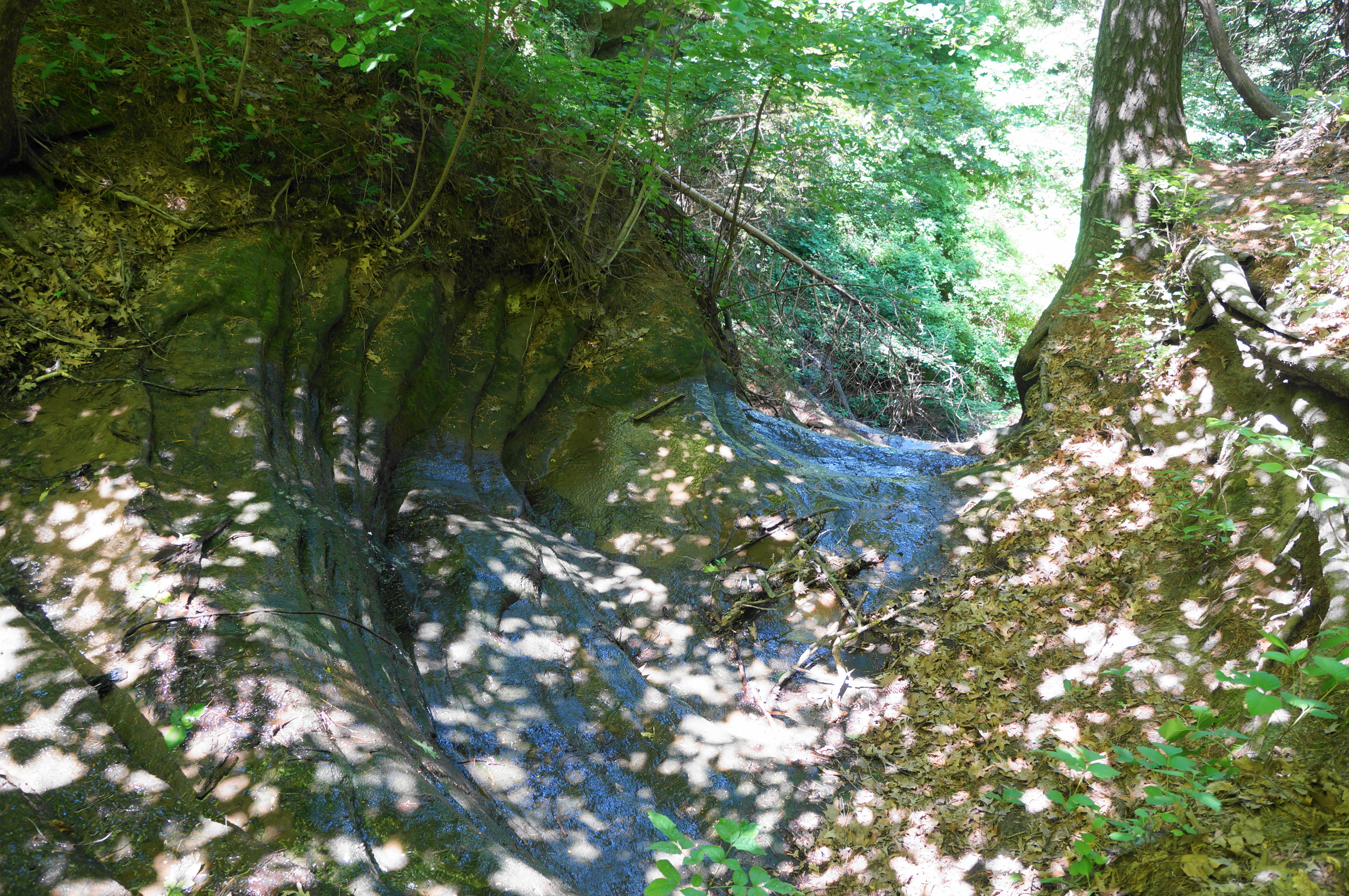
Most hikes begin and end at the Starved Rock Visitor Center, situated on the banks of the Illinois River in the western half of Starved Rock State Park, where there is a large parking lot, river access, and many picnic tables. This area is bustling on weekends and even some weekdays, with hikers, picnickers, paddlers, and anglers converging on one of Illinois’ most popular state parks. The Visitor Center, a short walk from the parking lot, has exhibits on the natural and human history of the area and information on recreational activities in the park.
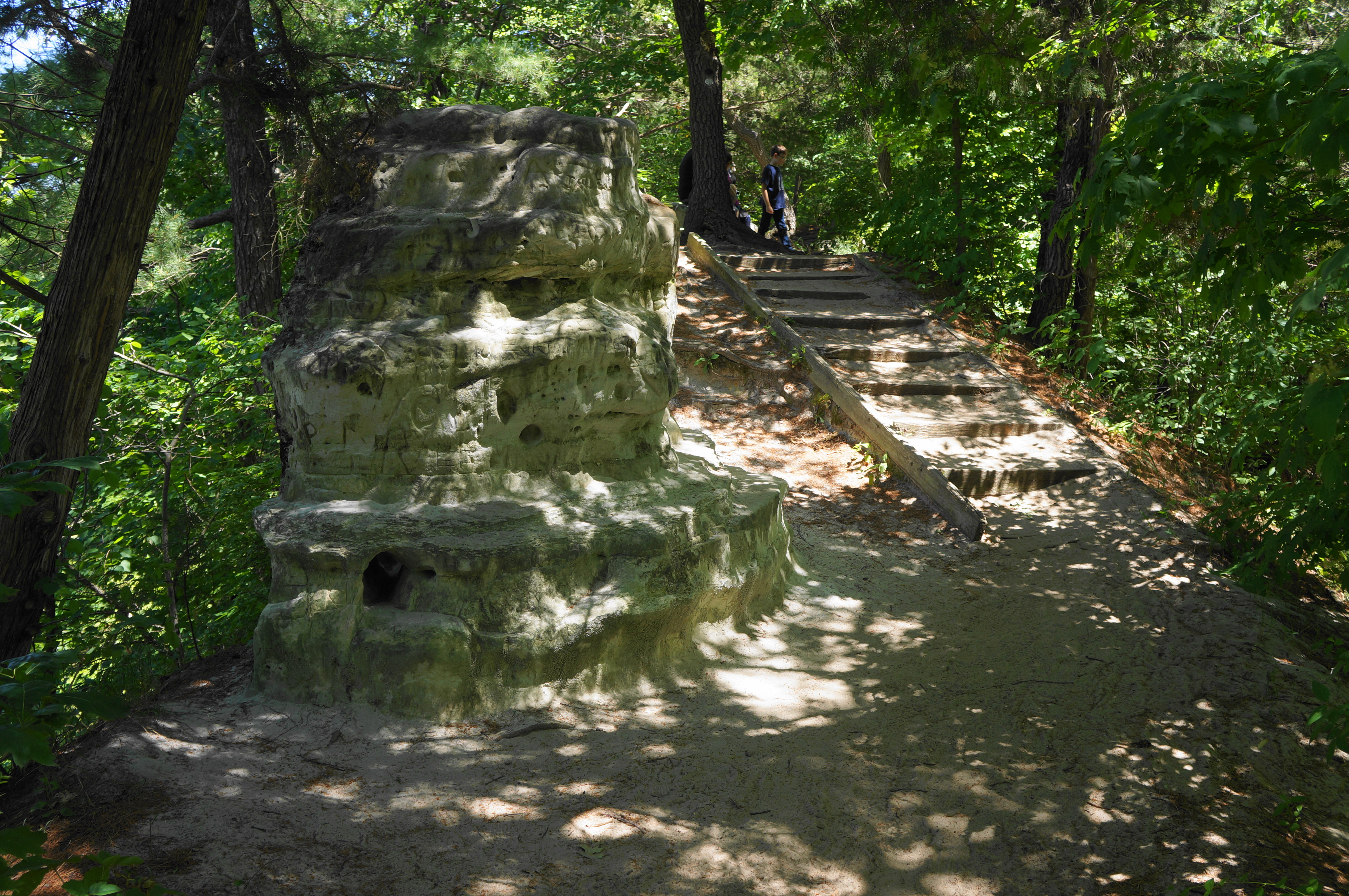
Even as the hike to St. Louis Canyon heads largely west from here, the initial route bears east from the Visitor Center. Follow the very wide, paved track behind the Visitor Center and past a picnic area, entering a wooded area where onward routes branch out in several directions. Bear right at the four-way junction, now heading west and leading to the base of a lengthy staircase. Such a climb—a wake-up call for those expecting just a casual walk—is required to clear a sandstone cliff, rising to a knob occupied by the historic Starved Rock Lodge. Turn right at the junction (marked “St. Louis Canyon”), then pass behind the lodge, cabins, and outdoor restaurant/bar on the left.
Resisting the temptation to stop for lunch and a drink, continue westward as the trail crosses over 875th Road, the entry route for Starved Rock. Immediately the route splits, with a spur heading right to Aurora Canyon. The main route to St. Louis Canyon continues left, rising into the woodlands and leaving the vehicular traffic and lodge guests behind.
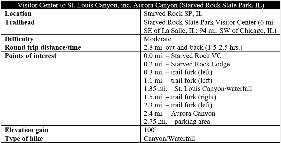
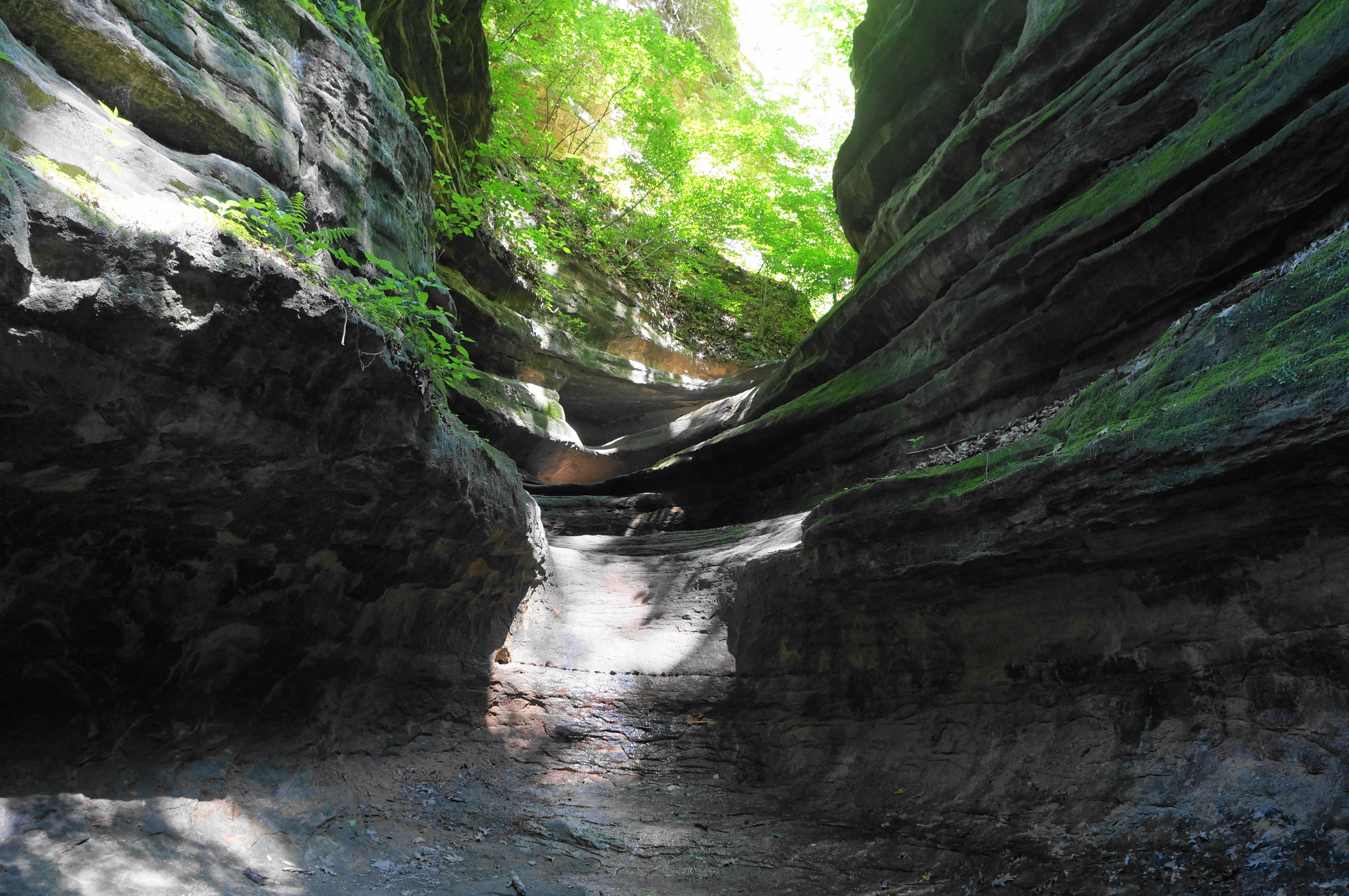
Soon the trail drops down to clear the creek bed that feeds Aurora Canyon (expect it to be dry by mid-summer). Here the drainage is clogged with vegetation, but one can make out the bowl-shaped drop into the canyon below. Thereafter, the route runs out to the end of a small ridgetop, where it appears to split, with an unofficial social trail dropping into the canyon to the right. Stay left, routing back south and passing over a tributary with another pouroff. Astute observers of the map will identify this as Sac Canyon, a short (and largely inaccessible) couloir.
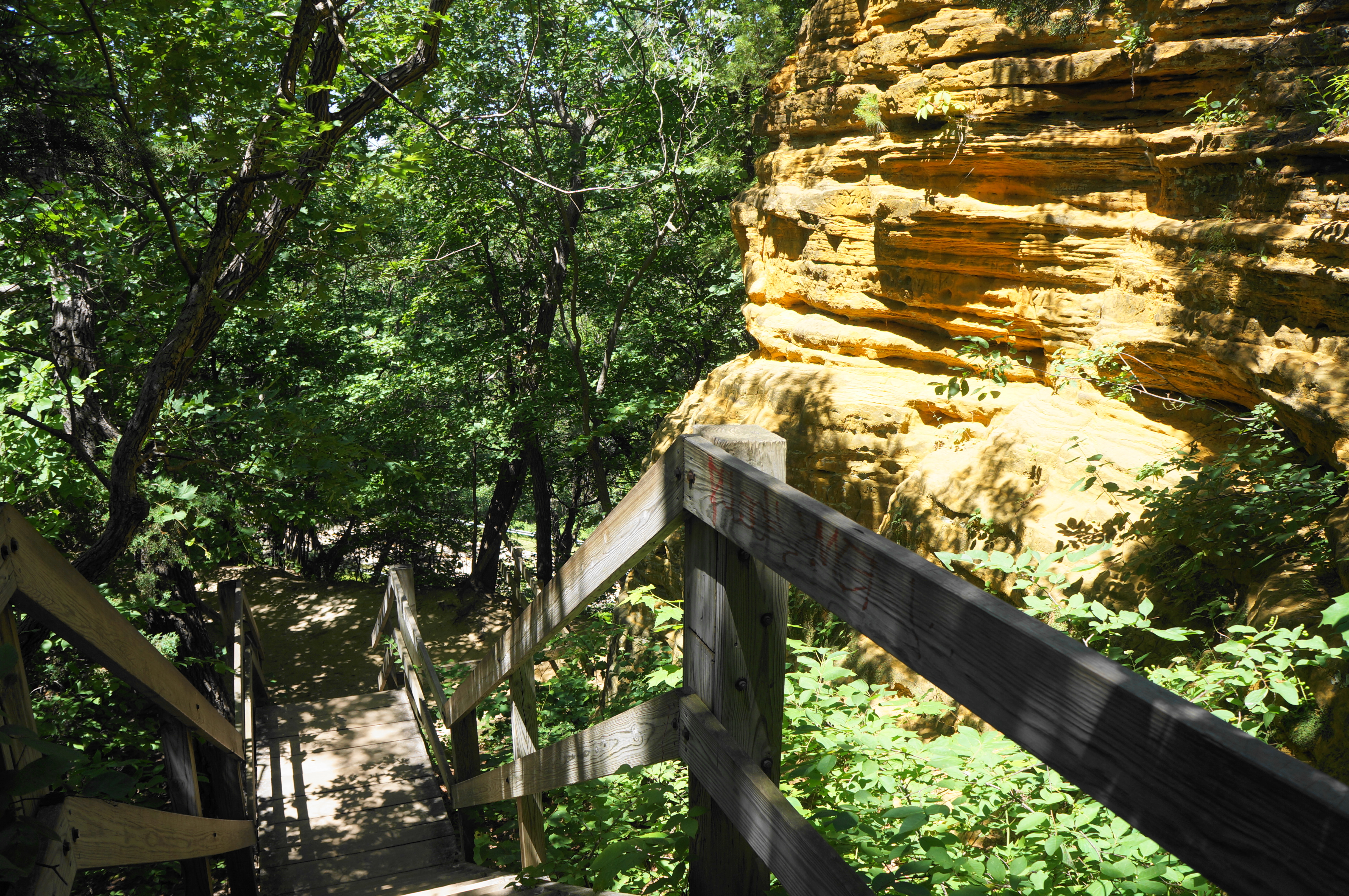
From here the trail stays high up above the bluffs, with limited views off to the right. The route is largely level for the next ½ mile, passing a drop to Kickapoo Canyon on the right before skirting some minor outcrops. At 9/10 mile, the path descends a set of stairs and then passes chalky bluffs situated just above another paved access road. (Note: The hum of passing vehicles never quite dissipates on this hike.) Continue as the onward path descends another wooden staircase, with orange-hued cliffs on the right, then drops again to a junction at around 1.1 miles.
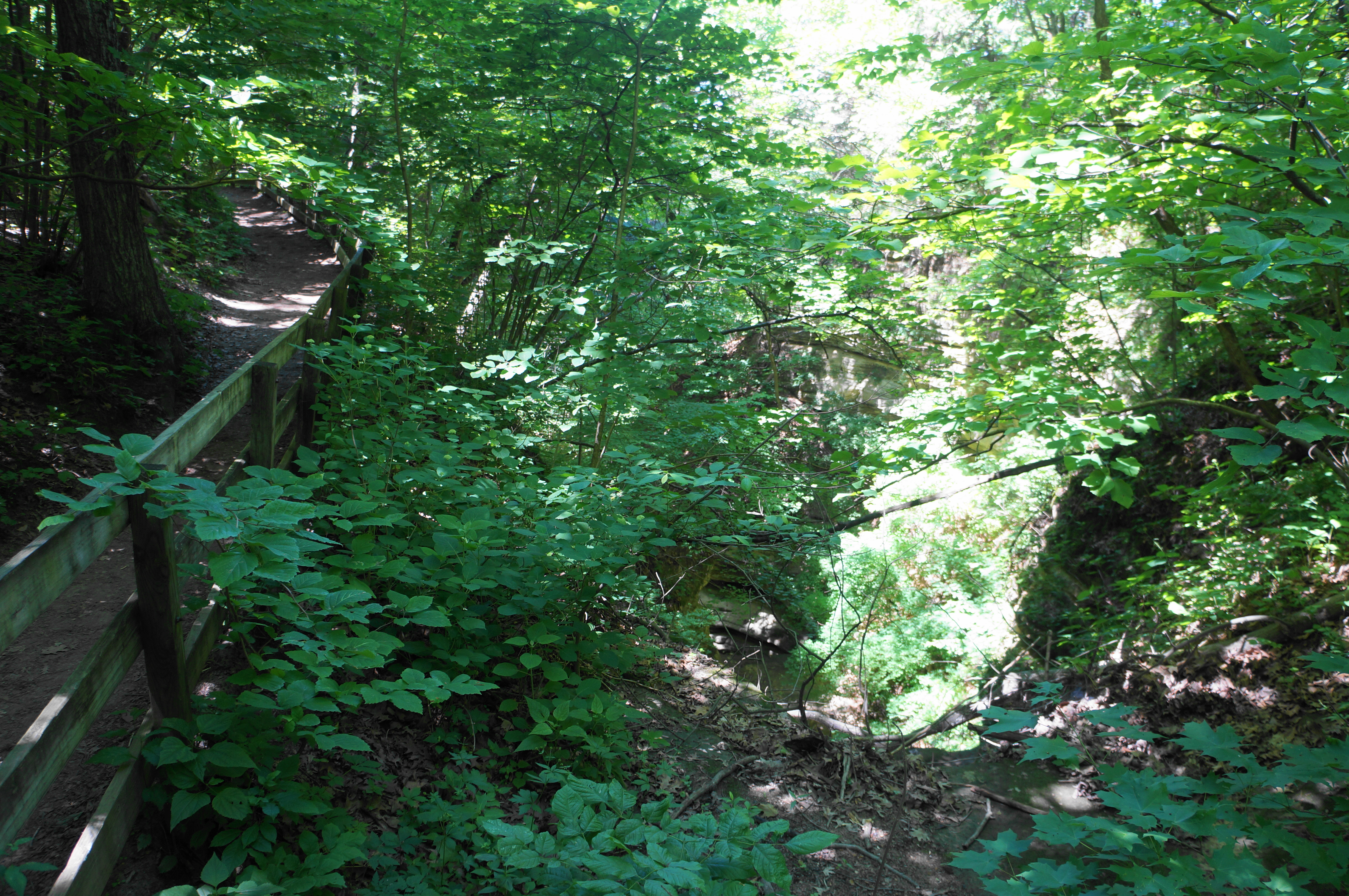
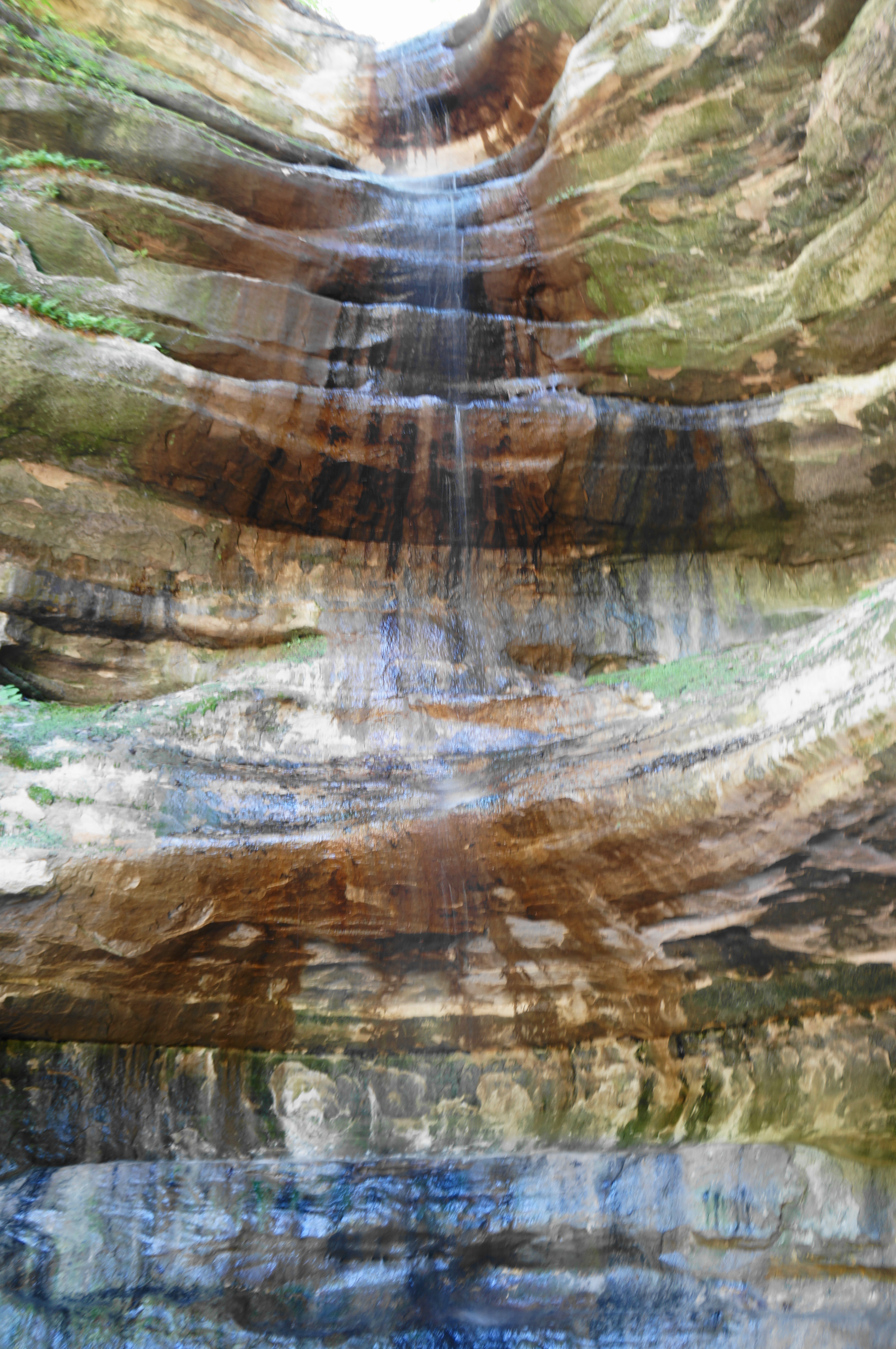
Take a hard left at this turn, heading on the final stretch into St. Louis Canyon. This narrower path skirts the creek on the right before crossing a bridge and ascending a brief set of stairs. From here the path drops again, crosses the stream three more times, and then ends suddenly at a high pour-off, surrounding by striated sandstone walls. In spring and early summer, a magnificent waterfall free-falls around 80 feet, one of the highest cataracts in the state of Illinois.
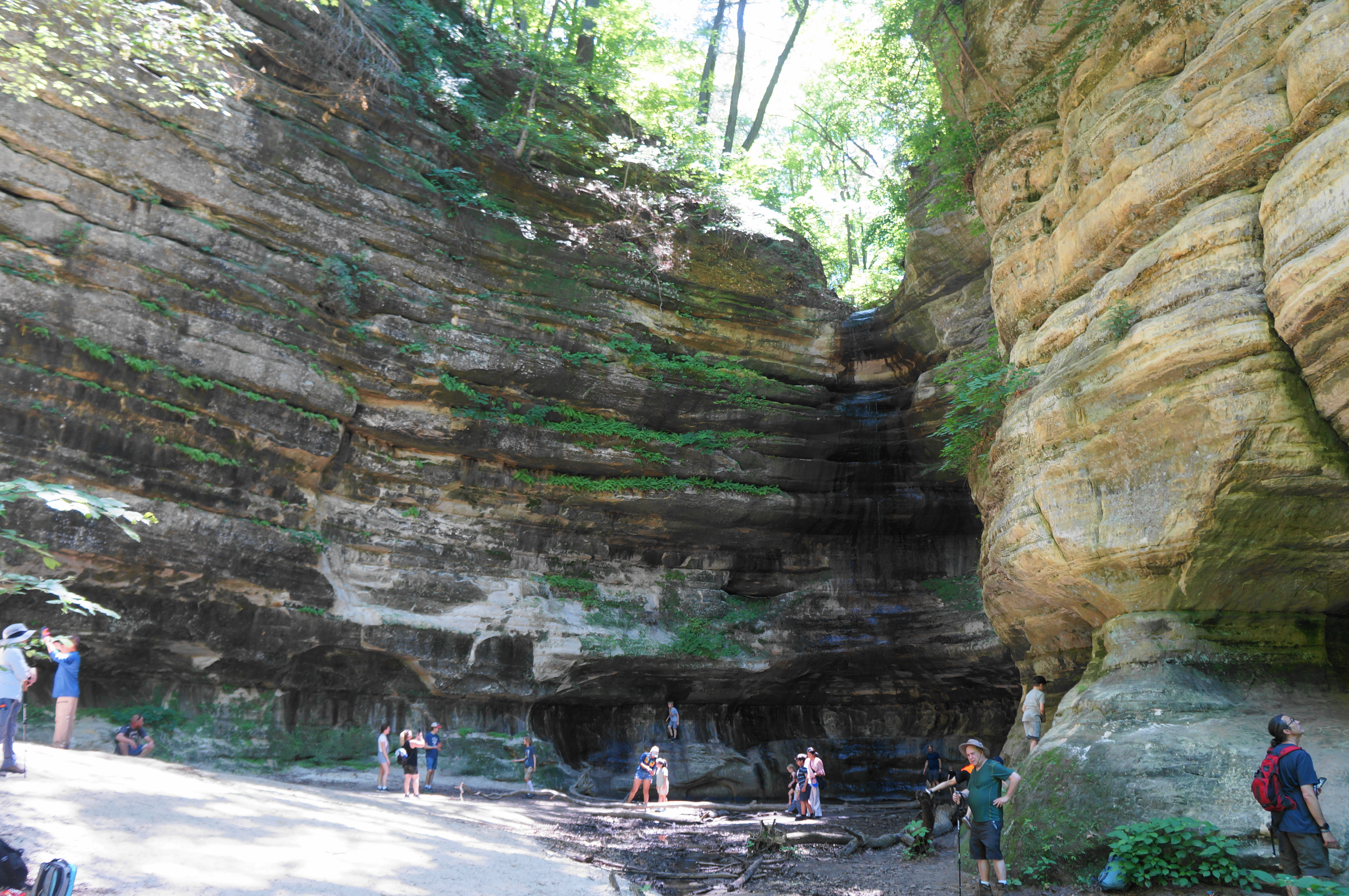
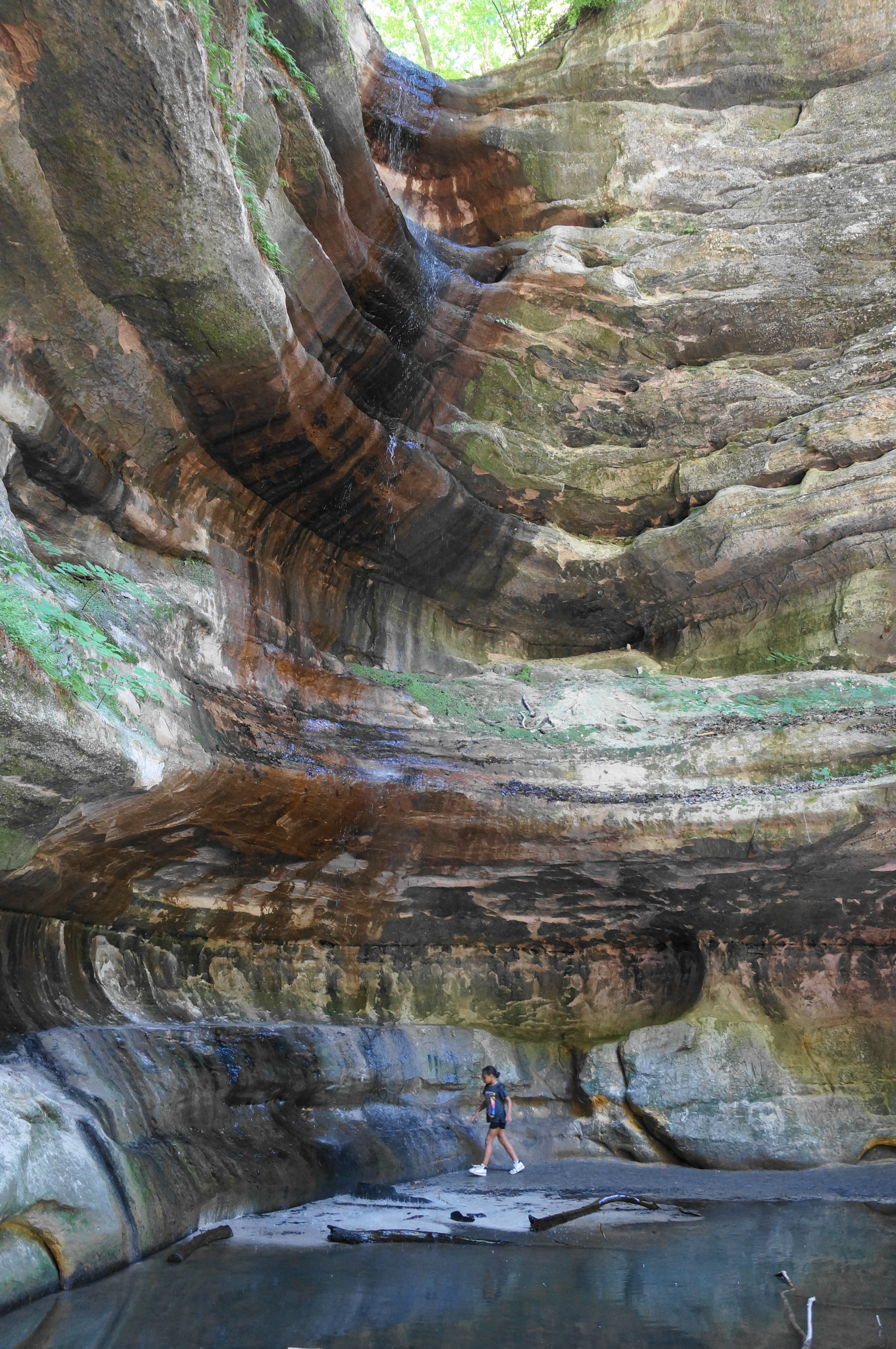
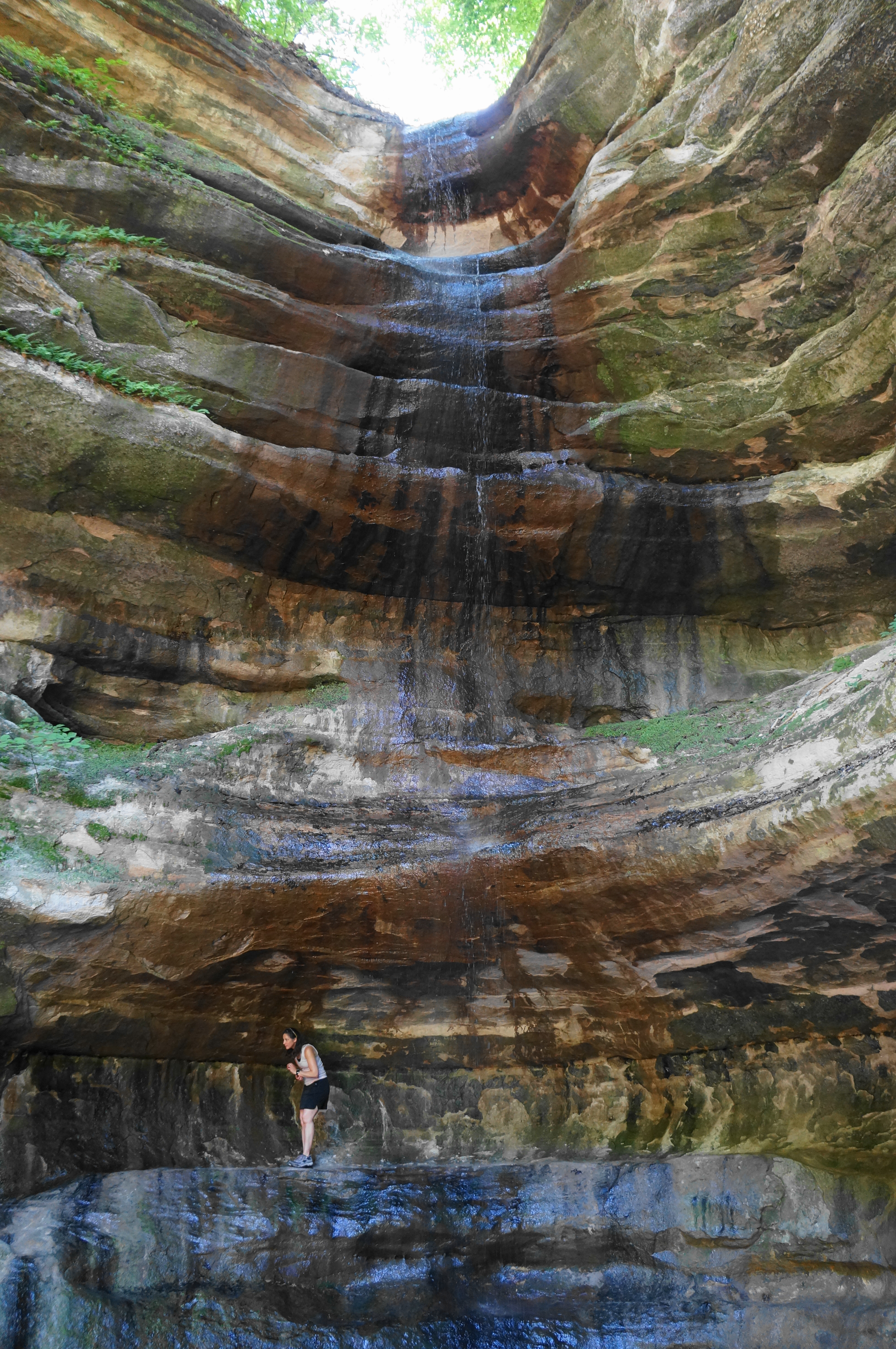
St. Louis Canyon Falls is a popular destination, teeming with visitors on a summer weekend. But the shock and allure of seeing such an impressive waterfall in the middle of the Great Plains is sure to keep a hiker’s attention. Snap some pictures, play in the water, and grab a snack before returning the way you came.
(Note: St. Louis Canyon is also infamous for an incident in 1960, when three women were found killed in a nearby cave. The murders and conviction of lodge employee Chester Weger—now out on parole—are the subject of a recent documentary.)
On the return journey, hikers can walk back past Starved Rock Lodge and the Visitor Center, or they can take an alternative route that dips into Aurora Canyon before leading back to the western edge of the parking lot. For the latter option, take a left at the junction just before the road crossing (2.35 miles into the 2.8-mile hike), following the path as it drops down a set of stairs under dense tree cover. Take a left on the short spur trail leading into the most scenic section of Aurora Canyon: a shady, 10-foot pouroff that bears water into late spring or early summer. You’ll notice that the main Bluff Trail crosses right over the pouroff and Aurora Canyon Falls above.
From Aurora Canyon, retrace your steps back on the spur trail, then head left on the north-south track that descends toward the parking area. After about 125 yards, the trail crosses the paved road seen previously and enters a lowland area with sparser tree coverage. Follow a set of power lines coursing east-west and finally reach the southwest corner of the parking lot, ending the 2.75-mile hike.
This out-and-back hike takes about 1.5-2.5 hours to complete and can be combined with Sections B and/or D to round out a full day of hiking. St. Louis Canyon Falls is certainly one of the most impressive waterfalls in the park (when it is flowing), but more intimate and rewarding experiences can be had elsewhere at Starved Rock. Check out posts to come on Sections B-D.
Note: Also be sure to check out the other sections, including B) French, Wildcat, & LaSalle Canyons Loop (4.4 miles); C) LaSalle Canyon to Council Overhang via Owl & Hennepin Canyons (2.1 miles); and D) Ottawa, Kaskaskia, & Illinois Canyons (2.8 miles).

Pingback: LaSalle Canyon to Council Overhang via Owl & Hennepin Canyons (Starved Rock State Park, IL) | Live and Let Hike
Pingback: Ottawa, Kaskaskia, & Illinois Canyons (Starved Rock State Park, IL) | Live and Let Hike
Pingback: French, Wildcat, & LaSalle Canyons Loop (Starved Rock State Park, IL) | Live and Let Hike
Pingback: Top 10 Hikes in 2022 | Live and Let Hike