
Note: This is the third of four posts covering hikes in northern Illinois’ Starved Rock State Park, which boasts 18 sandstone canyons, dozens of waterfalls, and an impressive network of trails along the southern shores of the Illinois River. This post covers a 2.1-mile one-way section that effectively connects two popular waterfall areas, skirting several sandstone canyons with limited views of the Illinois River.
Those accustomed to hiking in the majestic mountains and stunning canyons of the American West may not be so keen on a trip to the seemingly flat, featureless Midwest. Yet amid the endless plains of the U.S. heartland, there are some rare surprises—occasional concentrations of natural beauty that might just rival the Rocky Mountains, the Colorado Plateau, or the Sierra Nevada. Starved Rock State Park in northern Illinois is one of those surprises—a riverside complex of towering bluffs, narrow canyons, tall waterfalls, and cool alcoves that is a local favorite for Chicagoland residents but virtually unknown to the rest of the country. Here, in a park merely two hours from the Windy City, a network of terrific hiking trails crisscrosses the southern flank of the Illinois River, diving in and out of 18 glacier-carved canyons, each featuring high sandstone walls and, after recent rains or snowmelt, surprisingly impressive waterfalls. The trail network, which stretches from Saint Louis Canyon to the west to Illinois Canyon to the east, can be broken down into four sections:
- A) A roughly 1.5-mile section connecting St. Louis Canyon with the Visitor Center area at Starved Rock;
- B) An approximately 4.5-mile loop that covers terrain immediately east of the Visitor Center, including French Canyon, Wildcat Canyon, LaSalle Canyon, and several overlooks along the Illinois River;
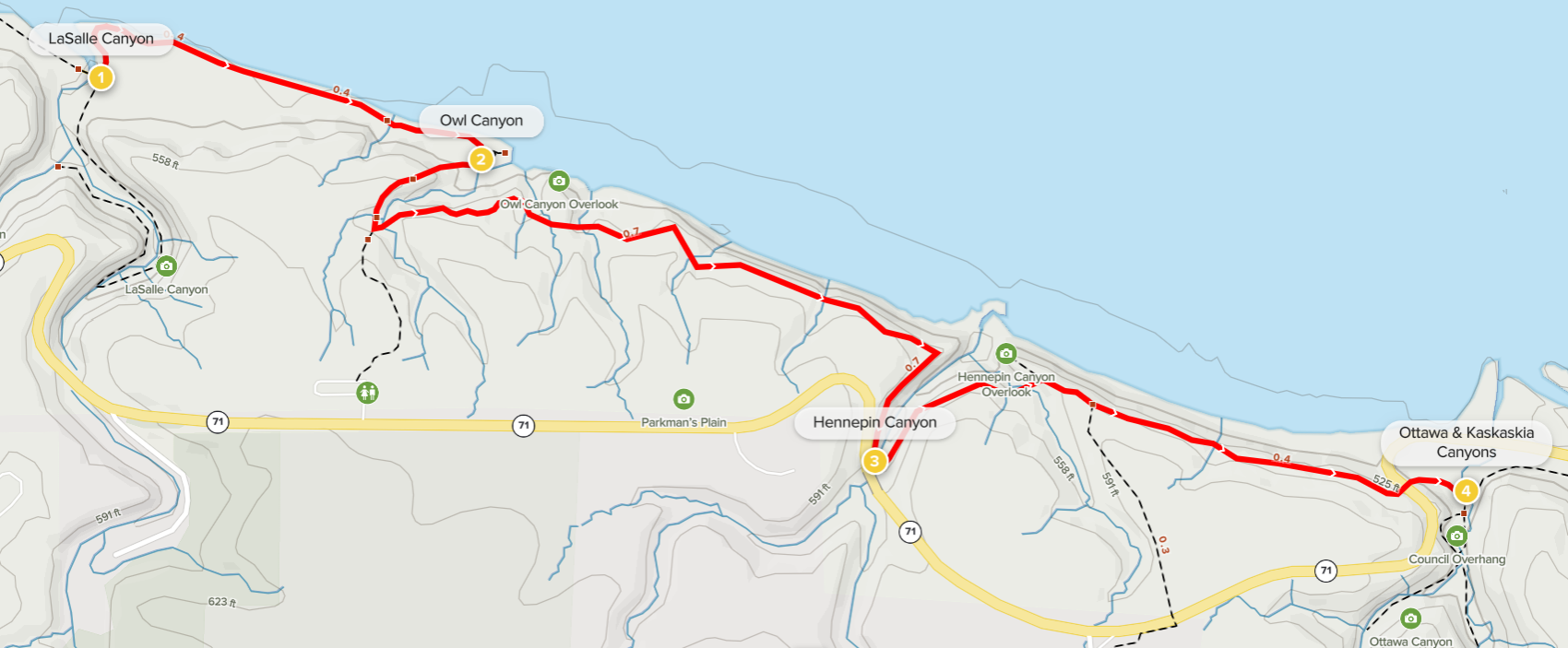
- C) An admittedly less scenic, 2-mile one-way stretch that connects sections B and D, by way of Owl and Hennepin Canyons;
- and D) a set of three canyons—Ottawa, Kaskaskia, and Illinois—that can be combined in a roughly 3-mile hike.
In a flurry of activity on a Saturday in June, yours truly combined all four sections (much to the surprise of the rangers at the Visitor Center!) as an out-and-back hike that traversed more than 14 miles. But most visitors will want to bite off only one or two in a day. In this post, I describe section C, a 2.1-mile connector section that most hikers will likely skip—it perhaps only makes sense if one is determined (like me) to hike from the Visitor Center to the far eastern reaches of the park at Illinois Canyon. The largely utilitarian trail nonetheless does have some decent viewpoints of the Illinois River and skirts a handful of canyons that—especially in winter when vegetation is less obstructive—are interesting to explore.

The hike
This segment begins at the far eastern reaches of Section B, at the junction of the River Trail and the spur leading to LaSalle Canyon, which boasts high sandstone walls and a beautiful 25-waterfall. From here the River Trail heads east, taking 2.1 miles to connect with Section D, near the Council Overhang and Ottawa and Kaskaskia Canyons.
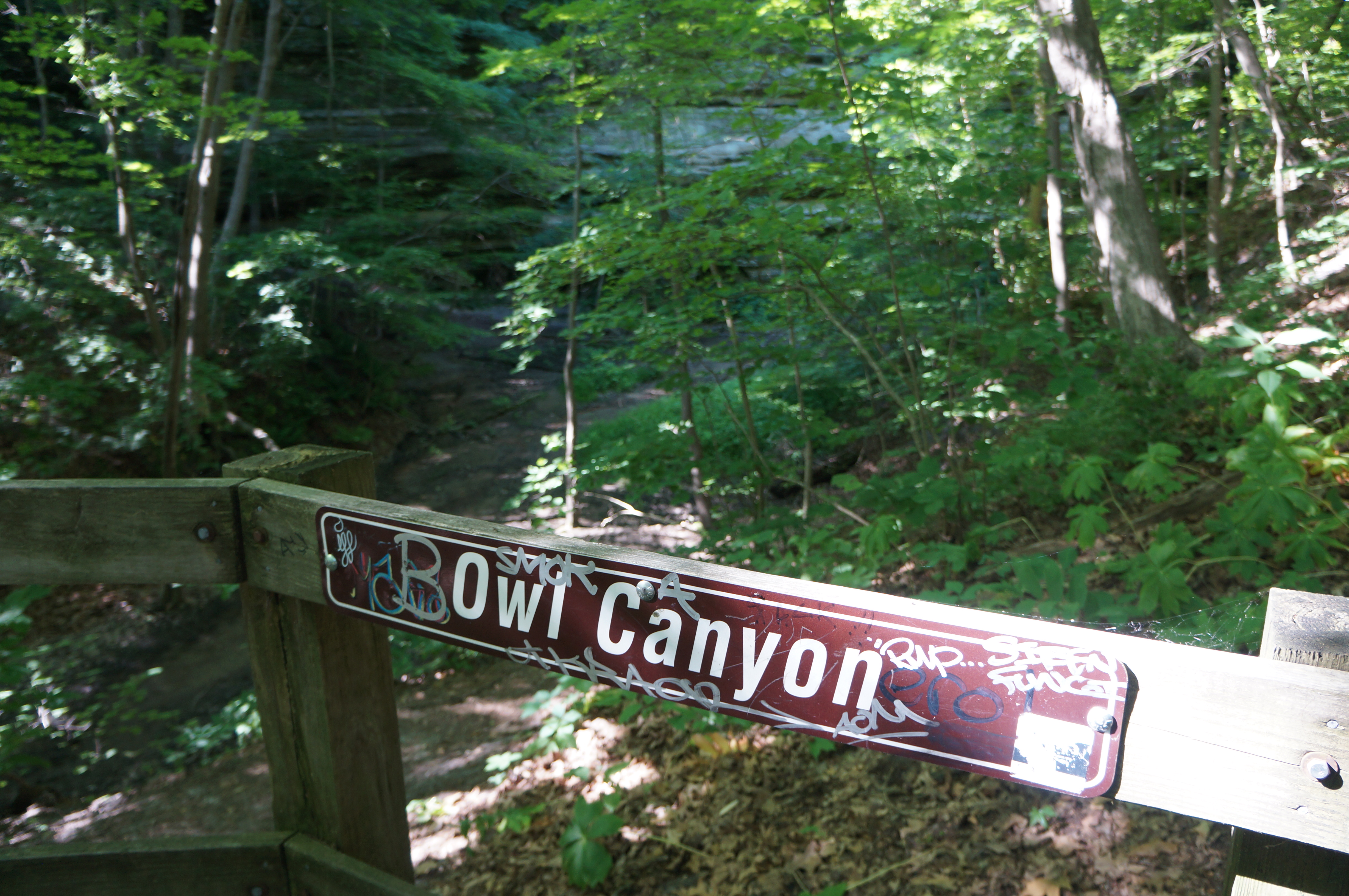
From LaSalle, bear north then east, following the dirt route as it parallels the wide Illinois River on the left. This level floodplain is perhaps a pleasant contrast with the often rocky and hilly terrain of much of the surrounding area. After crossing a wooden bridge over a small drainage at the base of the sandstone bluffs, hikers will reach a short spur heading left at about ½ mile; this short detour leads out to a modest overlook of the Illinois, while the main track actually cuts south, making its way into Owl Canyon.

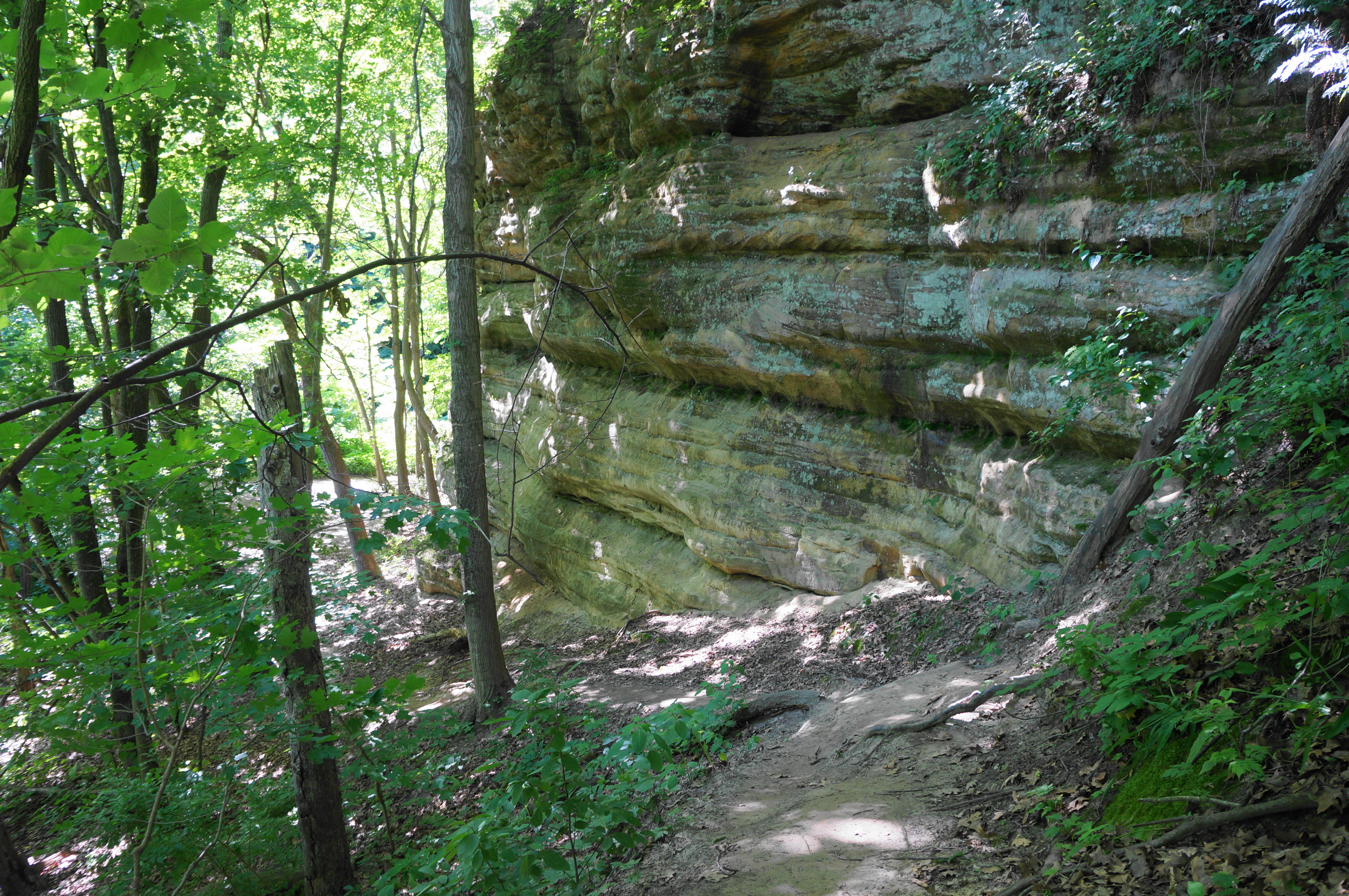
The relaxing stroll ends here. Rather than gradually winding through Owl Canyon, the trail climbs sharply up a hillside to the west. The wooden staircase ascends perhaps 75 feet in elevation before easing, with some intermittent views down into Owl Canyon, often obscured by the dense tree cover. From here the River Trail intersects with a connector route that bears right to Parkman’s Plain, a relatively little-used parking area and trailhead. Stay left, crossing the drainage that carved Owl Canyon below, then come around to the east side of the gorge. Soon the trail resumes its eastward journey, staying relatively high above the Illinois and cutting in and out of a trio of minor tributaries. The last of these is called Hidden Canyon—so-named perhaps because it is difficult to identify and distinguish from the others.
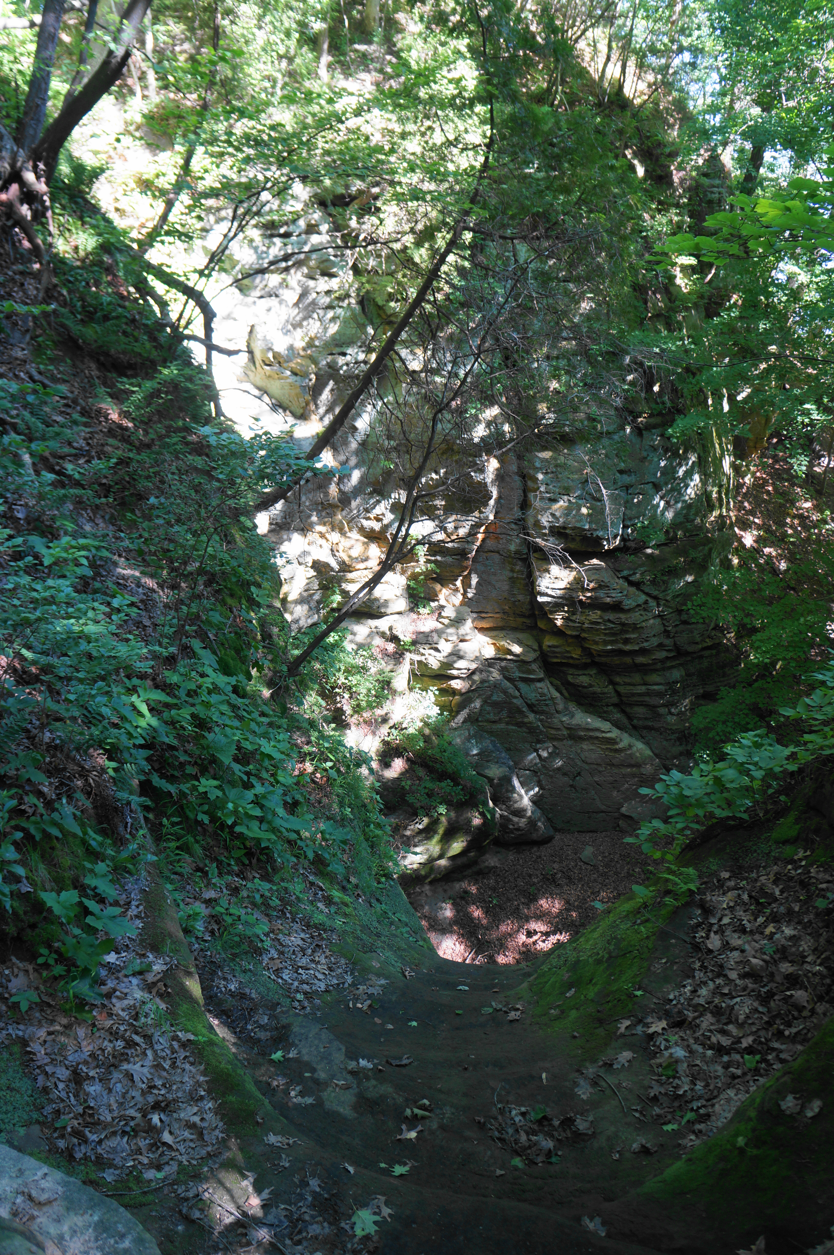

At a point about 1.2 miles from the start of Section C, there is a spur trail heading left, but the views of the Illinois River are relatively modest. Here the main track turns southward again, this time seeking passage around Hennepin Canyon, an impressive and deep gorge with orangish-white walls and a near-perennial water flow. Like Owl, however, unvarnished views into the canyon are rather elusive, especially amid the lush summer foliage.

With the park road lurking just within view off to the south, the trail rounds Hennepin Canyon, crossing a wooden bridge just above a precipitous drop and waterfall. Past Hennepin, the route bounds northeast, crossing a short side drainage with a declivity off to the left. From here it is steps to the spur to Hennepin Canyon Overlook, which offers additional views of the river.
Just past the spur is another junction, this time with an offshoot heading right to another parking area along the main road through Starved Rock State Park. Stay left, with the path continuing to hug the hillside through the final stretch. At about 1.9 miles, the River Trail descends a lengthy staircase and crosses the park road, followed by additional stairs and an ever-growing cliff face on the right. As the height of the wall increases, the trail reaches a popular three-way junction: head right to reach Council Overhang, Ottawa Canyon, and Kaskaskia Canyon; bear left to continue to the nearest parking area, with Illinois Canyon just beyond. This marks the end of the 2.1-mile one-way connector, or Section C. The final segment—Section D (Ottawa, Kaskaskia, and Illinois Canyons)—awaits.
Note: Also be sure to check out the other sections, including A) St. Louis Canyon and Aurora Canyon (2.8 miles); B) French, Wildcat, & LaSalle Canyons Loop (4.4 miles); and D) Ottawa, Kaskaskia, & Illinois Canyons (2.8 miles).

Pingback: Ottawa, Kaskaskia, & Illinois Canyons (Starved Rock State Park, IL) | Live and Let Hike
Pingback: French, Wildcat, & LaSalle Canyons Loop (Starved Rock State Park, IL) | Live and Let Hike
Pingback: St. Louis Canyon and Aurora Canyon (Starved Rock State Park, IL) | Live and Let Hike
Pingback: Top 10 Hikes in 2022 | Live and Let Hike