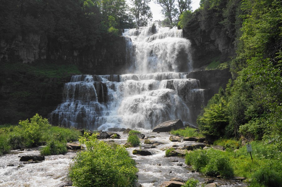
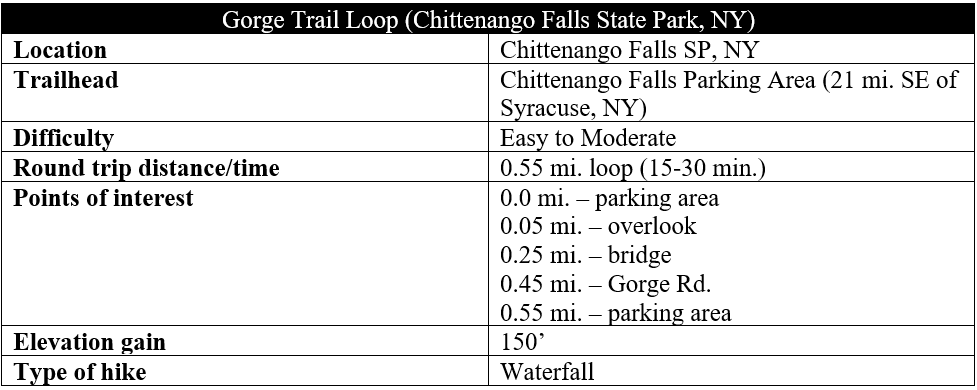
Chittenango Falls—situated roughly 20 miles southeast of Syracuse, New York—tumbles an impressive 167 feet into a limestone gorge and is easily viewed on a short, ½-mile loop hike. The best views are from a pedestrian bridge below the waterfall along the Gorge Trail, the premier walk in Chittenango Falls State Park. While not extremely challenging due to its short length, be prepared for brief sections of steep ascent and descent, dropping 150 feet to the canyon floor before returning back to the rim.
The hike
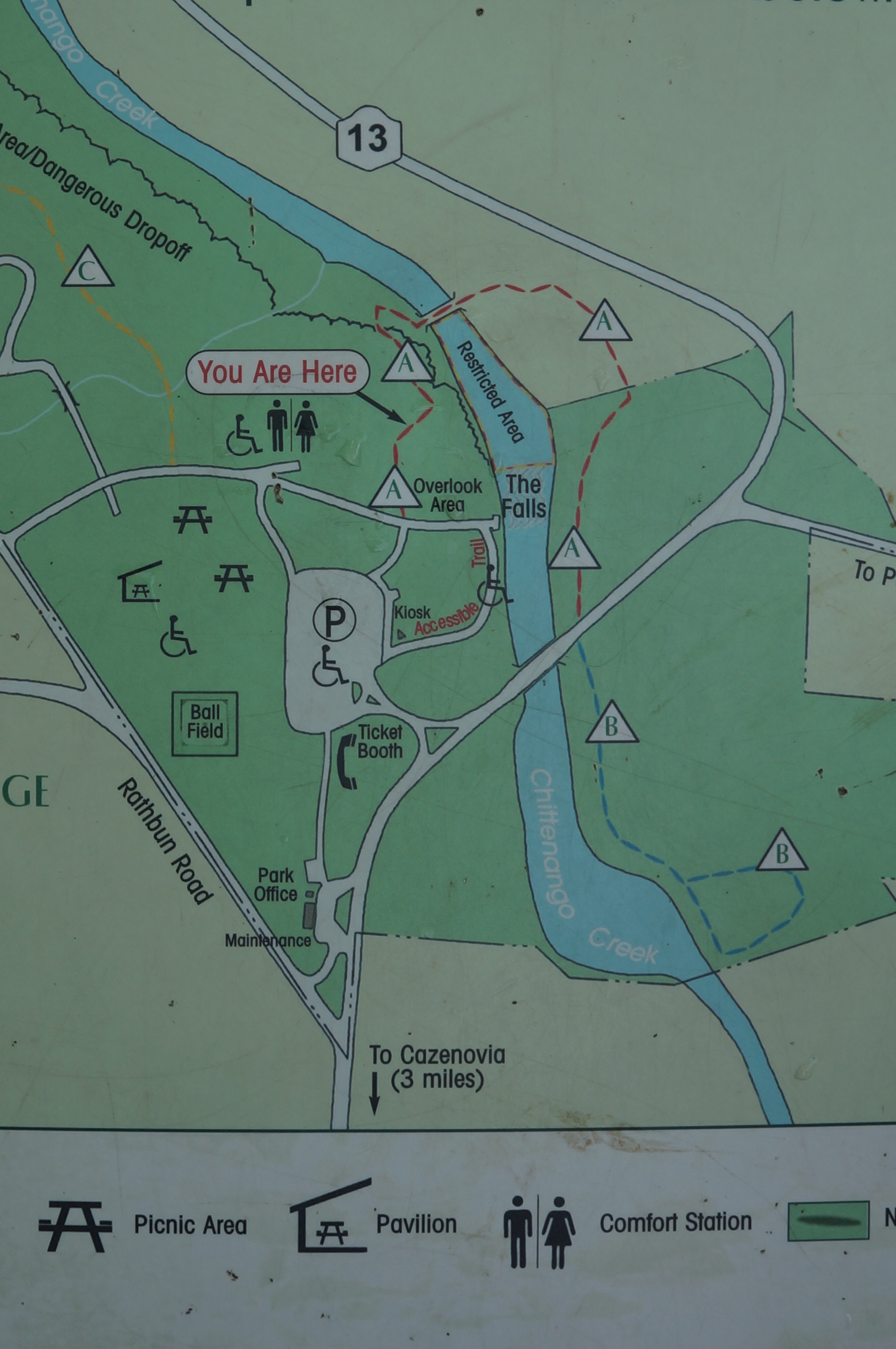
Plan to park at the main parking lot at Chittenango Falls State Park, situated along Route 13 between the quaint towns of Casenovia and Chittenango, about a half-hour drive from Syracuse or two hours from Albany, New York. Facilities are limited at the park, with shelters, picnic tables, and restrooms but no real visitor center. Look for the sign at the northeast corner of the parking area marked “Overlook Shelter & Trails”: this is the access point for the Gorge Trail Loop.
Note: The hike was brief enough that I was able to use my adidas Run 70s men’s running shoes, a casual and comfortable style good for short-distance walks. These running shoes were provided as a gift as part of a collaboration with adidas.
Follow the asphalted track to a brief staircase, dropping down to a grassy shelf at the lip of Chittenango Falls. Head right, along the weathered rim, to an overlook where one can see the top portion of the towering chute. Here there is also an information board with brief details on the falls and its surprising secrets—including being the sole home to the endangered Chittenango ovate amber snail, whose population is monitored by local staff.
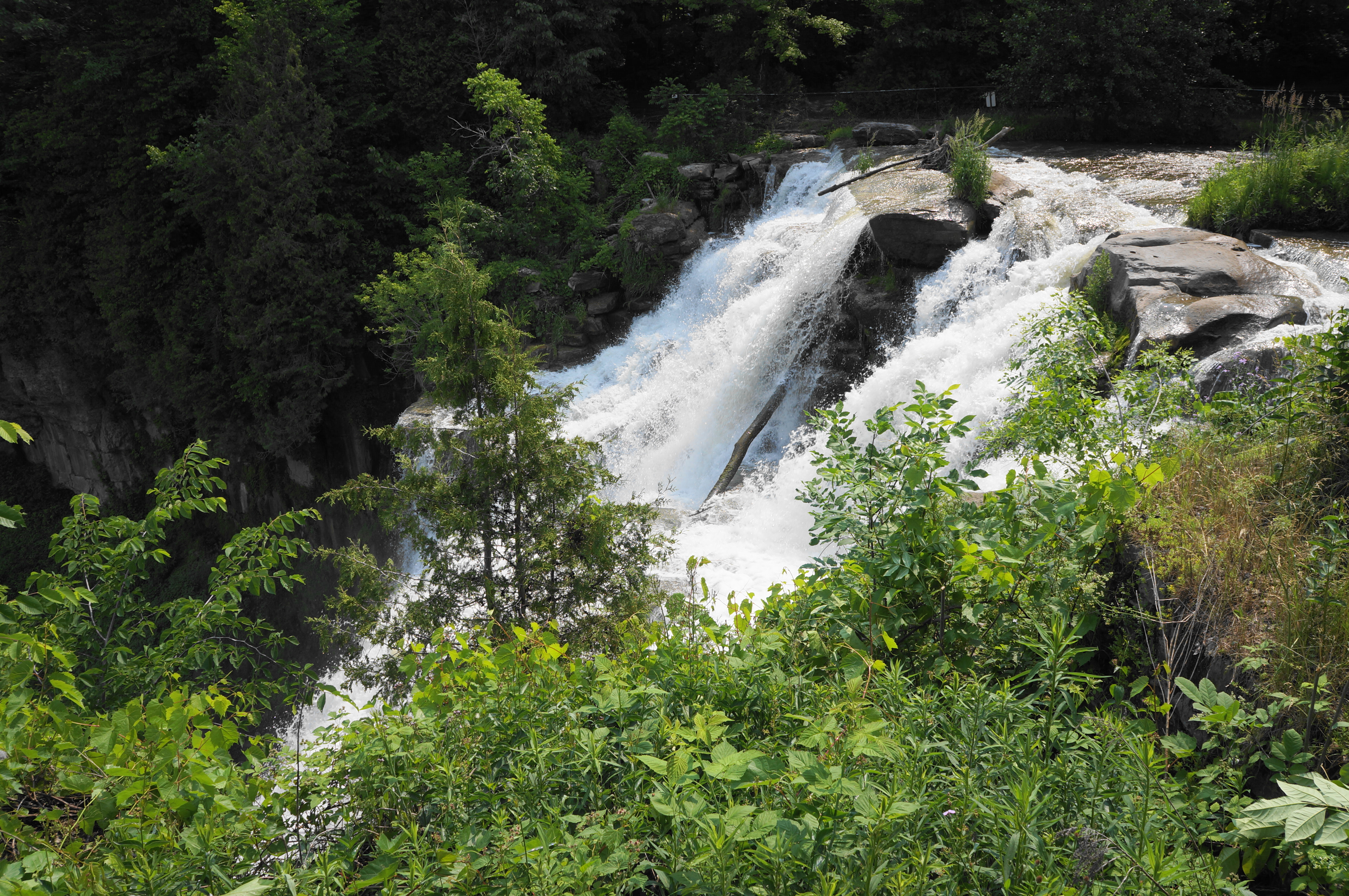
An accessible walkway continues to trace around the green field and back to the parking area, but hikers seeking a better look should turn around and return to a junction with the Gorge Trail, an unpaved track that is closed off in extremely wet or icy conditions. Start down the trail, which begins as a wooden staircase, soon turning to stone steps. Railings assist with the descent, which covers 150 feet in elevation loss.


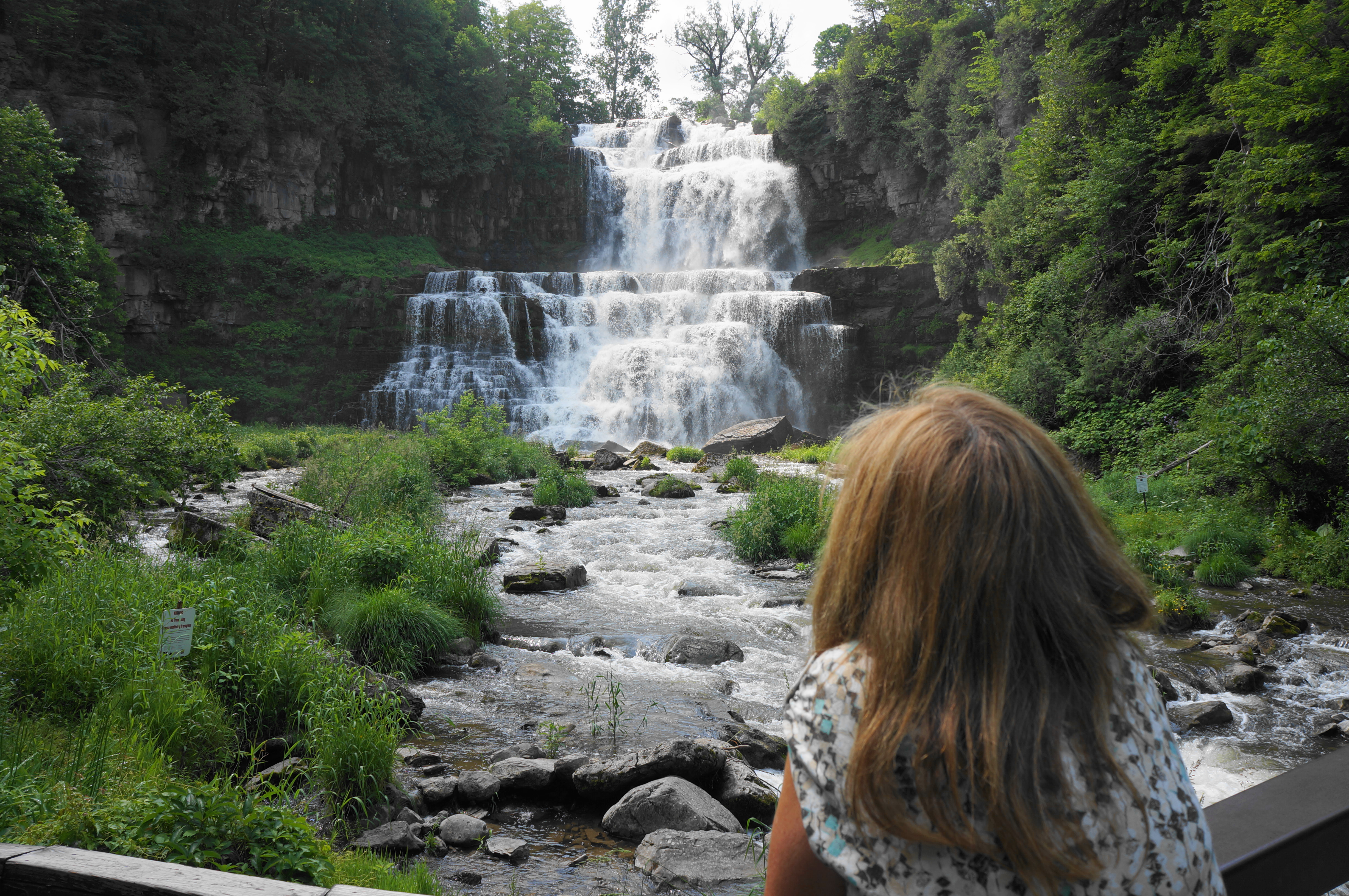
At about 2/10 mile, the route splits, with a brief spur heading left, ending abruptly at a vantage point overlooking a tributary that is usually dry in summer. Instead stay right, completing the final descent to the banks of Chittenango Creek. A left turn leads to the sturdy bridge over the waterway.
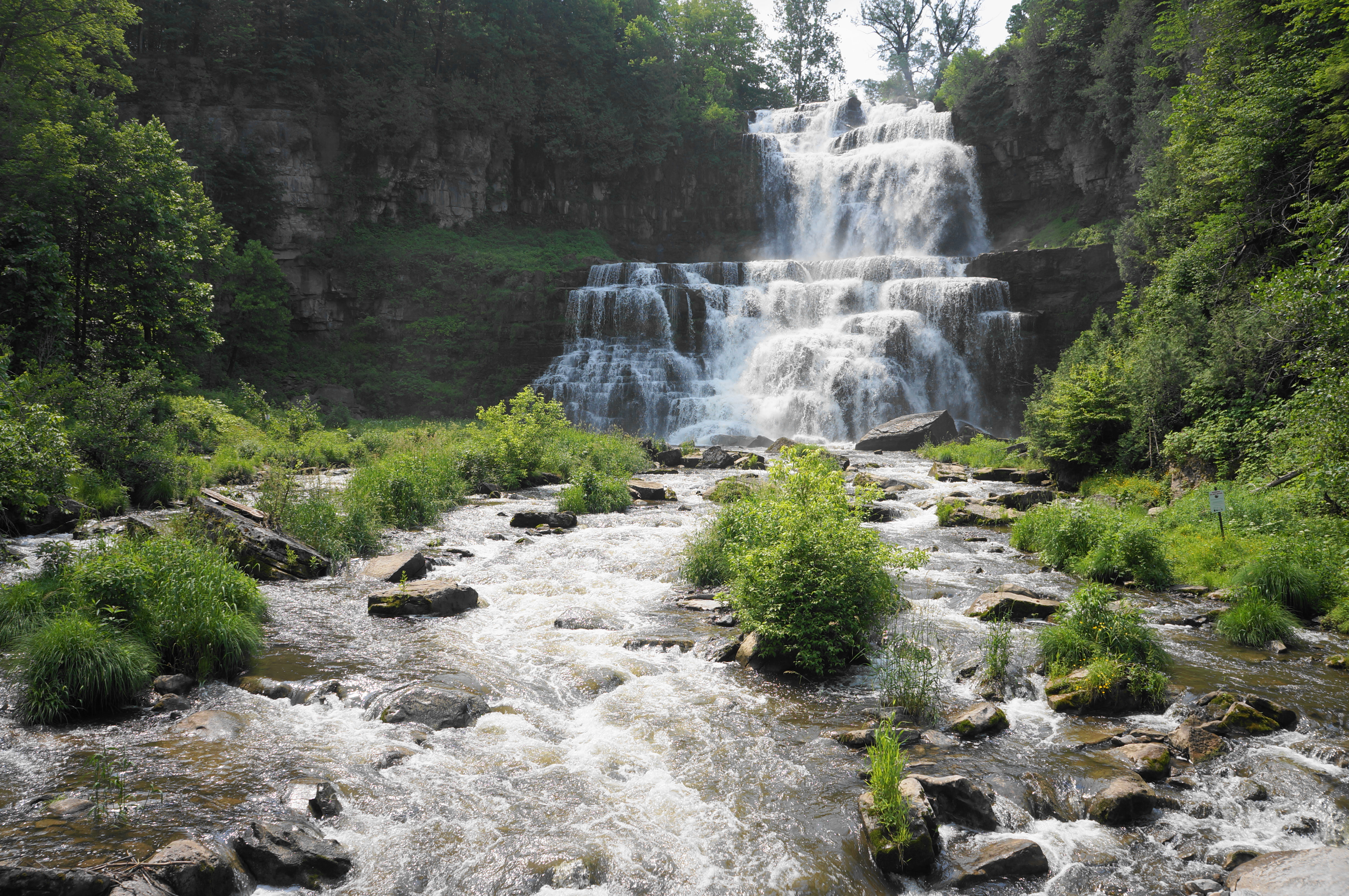
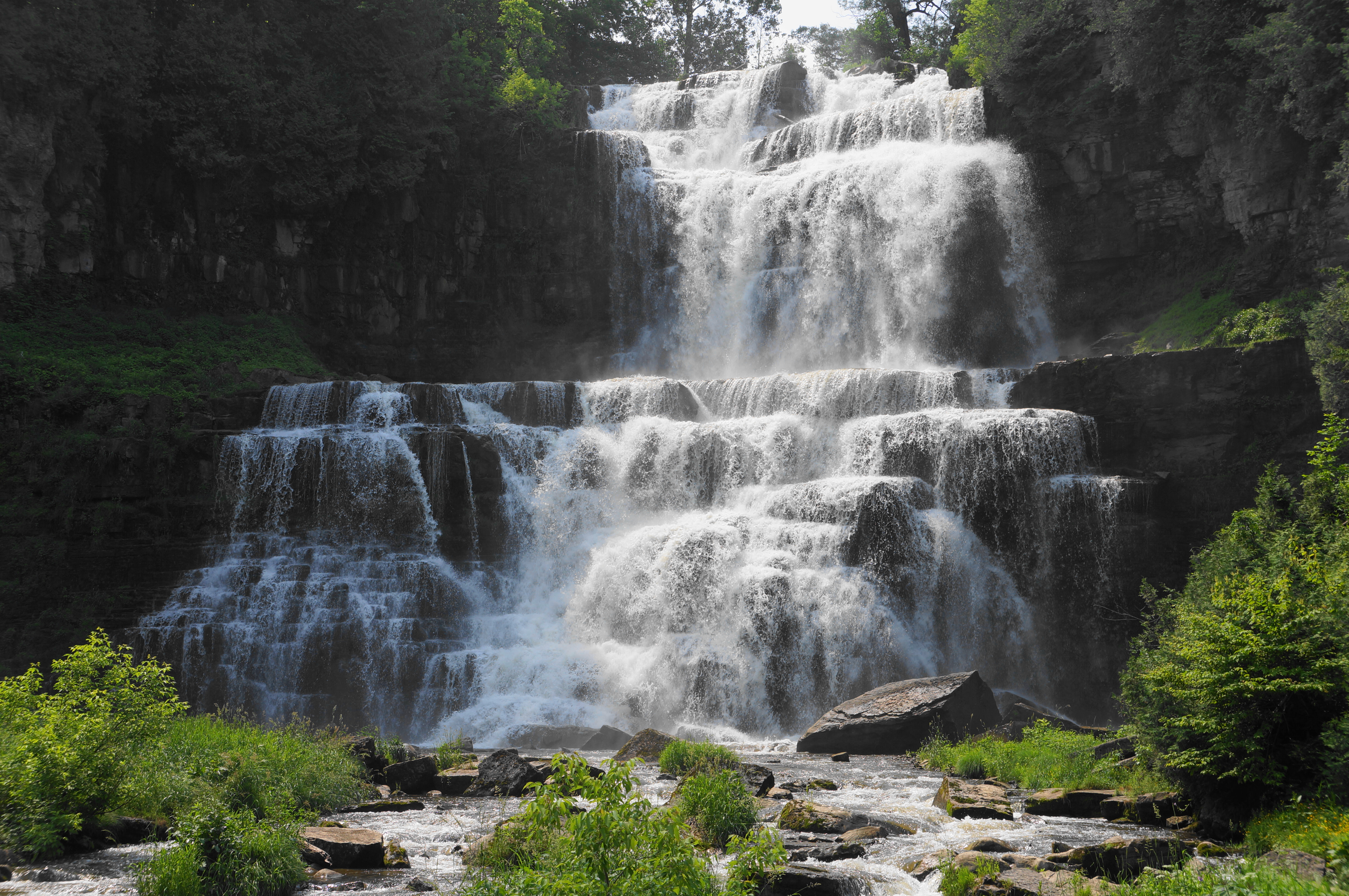
Here one gets an unvarnished look at the mighty waterfall, an impressive perennial flow and roughly two-tiered drop that slices through several limestone layers laid around 300 million years ago. Since then, glaciation and erosion have done their work to carve the deep canyon and produce the stunning 167-foot falls seen today.

After enjoying the vista, continue to the second half of the hike, based largely on the east side of the stream. Cross the bridge and start a steep and steady uphill, assisted first by staircases, followed by a leafy incline that skirts a tributary of the main canyon. Traverse a bridge over the side stream at 0.35 miles, continuing up the final ascent to the rim of the gorge.
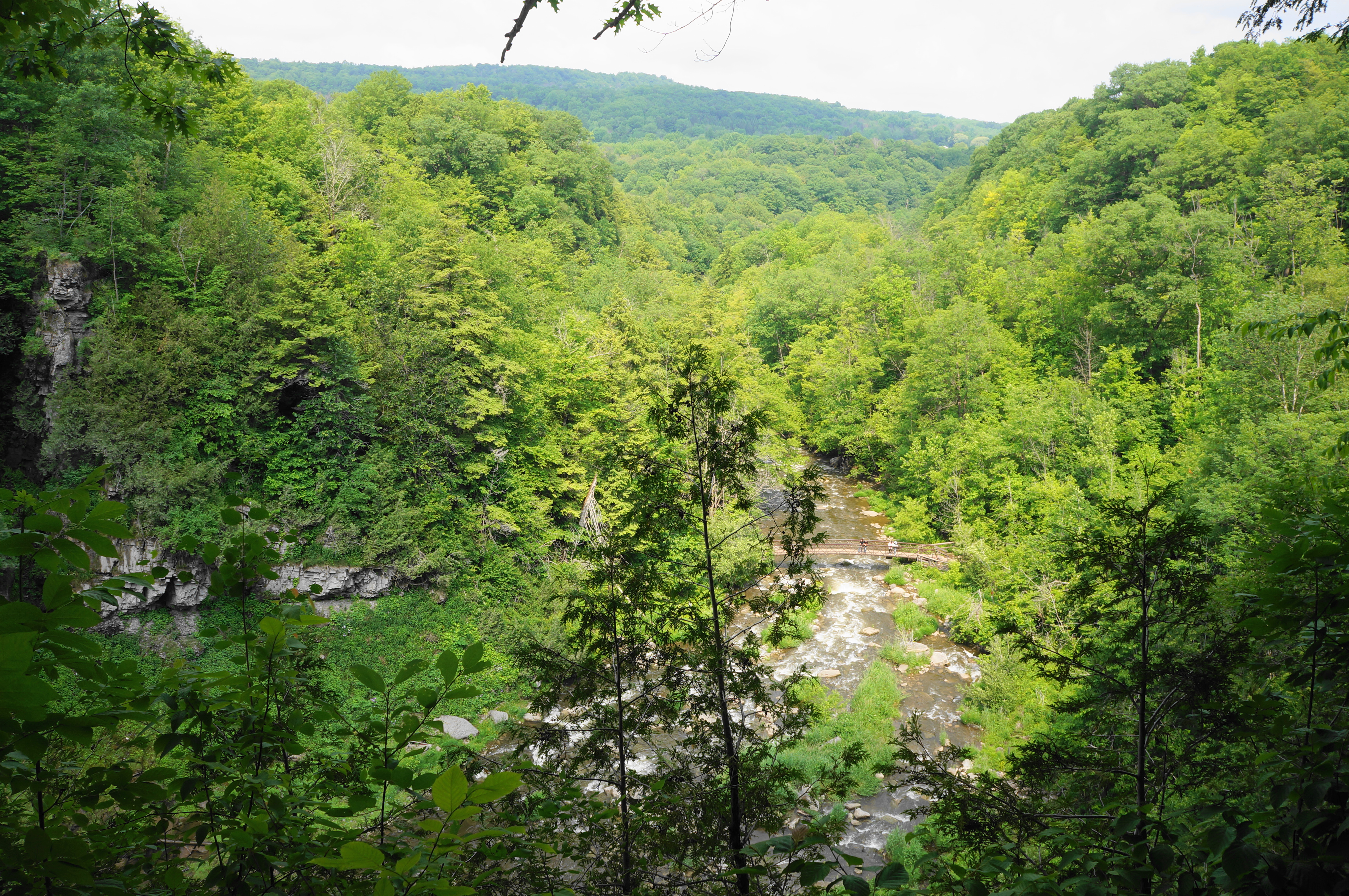
Now at about 4/10 mile, one can again look out across the top of the falls, 167 feet above the pool into which the cascade empties. The bridge below now appears small and distant.

From here it is a short walk to the staircase up to Gorge Road. Follow the road back across a bridge over Chittenango Creek again, then bear southwest on the paved track to return to the shady picnic area and parking lot. This completes the roughly ½-mile jaunt.

That waterfall is beautiful 🙂