

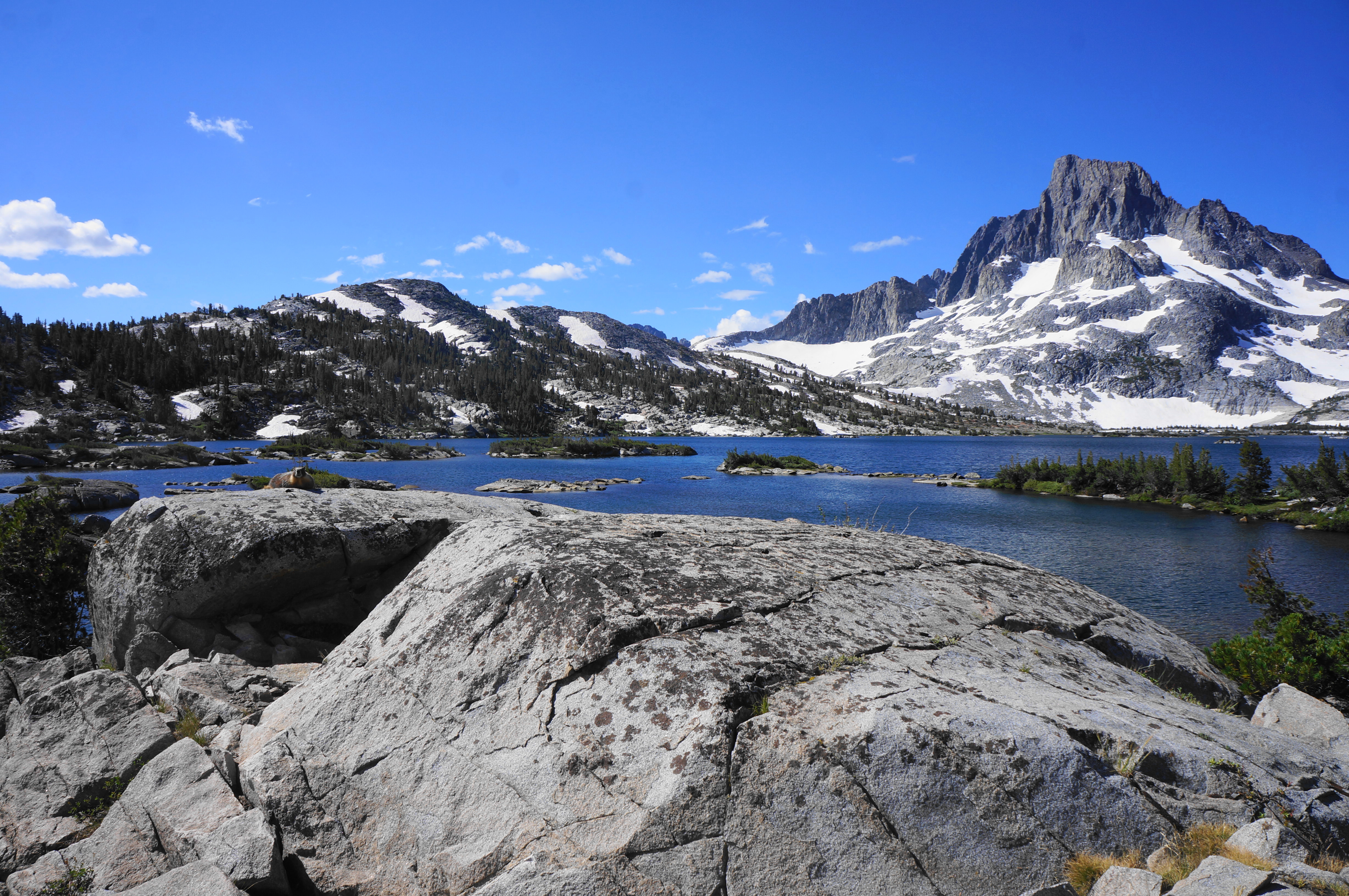
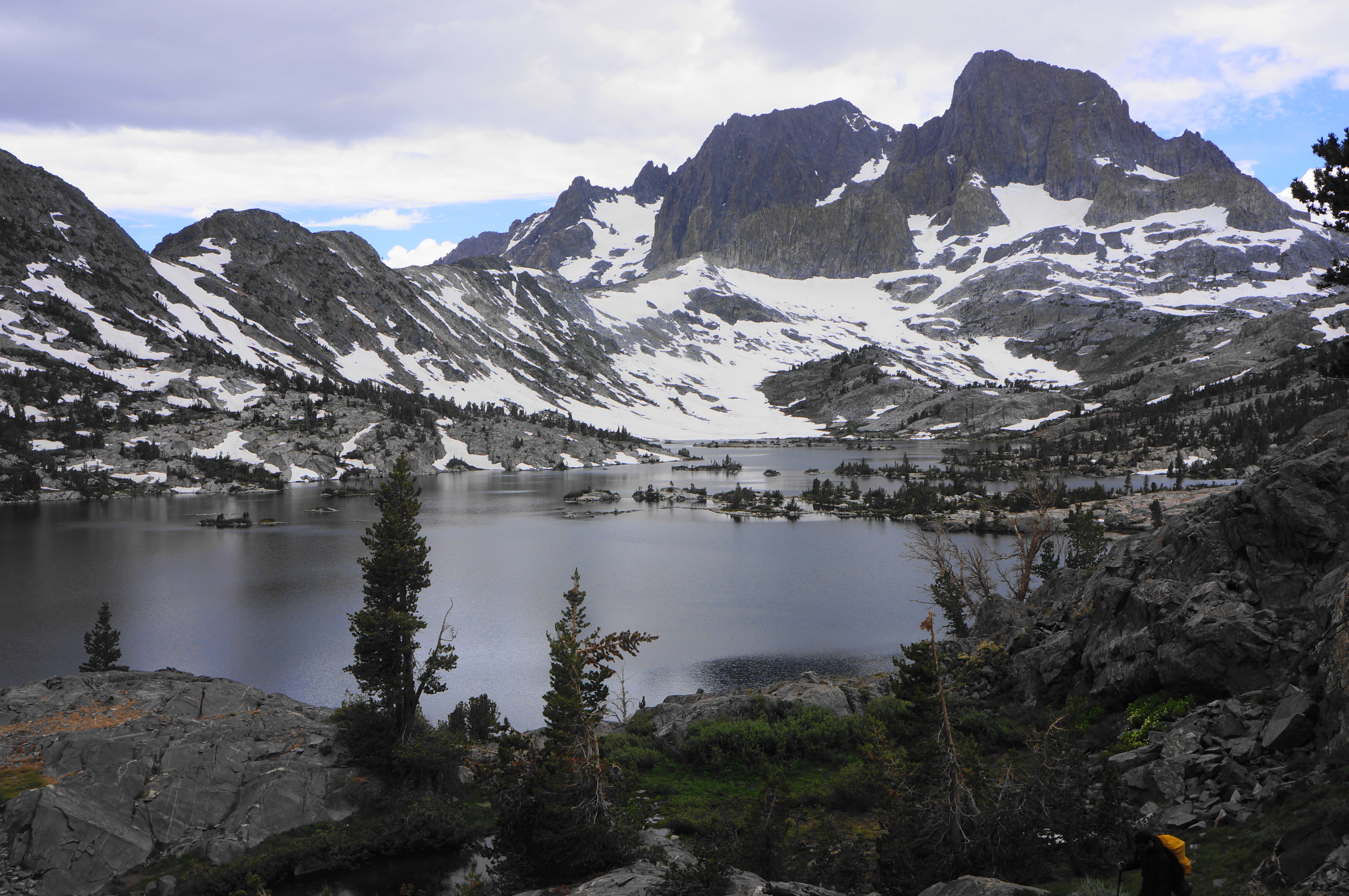
Rising prominently above California’s Mammoth Lakes area, the Ritter Range boasts a clutch of spectacular peaks and majestic alpine lakes best reached on a multi-day backpacking adventure. The largest of the lakes is Thousand Island Lake, set in a basin below iconic Banner Peak (12,945’), and a popular destination for overnighters seeking starry skies and spectacular tranquility in one of the most impressive stretches of the Sierra Nevada. The spectacle of Thousand Island is closely matched by nearby Garnet Lake, another large, snow-fed sink set again against the showy backdrop of Banner Peak.
Both lakes require a bit of a haul to reach, a full day one-way for most backpackers lucky enough to score quota reservations in the summer season. There are multiple ways to reach the area, but perhaps the most rewarding option is to take the High Trail, which doubles as a portion of the mighty Pacific Crest Trail (PCT). This choice offers arguably the best landscape views of the Ritter Range from across the Middle Fork San Joaquin valley. Then one can return via the John Muir Trail (JMT)—which takes hikers from Thousand Island to Emerald, Ruby, Garnet, and Shadow Lakes—before dropping dramatically back toward the trailhead via the impressive Shadow Creek Trail to complete the loop. Expect to take 2-2.5 days to complete the trek, or more if you want to explore nearby detours (such as Ediza Lake or Island Pass). The following description accounts for a roughly 18-mile jaunt, which took yours truly and three hearty companions about two and a half days. Be prepared for rapidly-changing weather conditions, potentially cold temperatures, and high altitude walking.

Preparation and logistics
The usual caveats and advice apply for long-distance hiking in the Sierra Nevada: adequate protection will make this multi-day backpacking adventure run considerably more smoothly. As with most of Inyo National Forest, an overnight permit is required, and entry is regulated by a daily quota system, managed through Reservation.gov. While not as difficult to obtain as some nearby destinations (e.g., Big Pine Lakes or Mount Whitney), reservations for the High Trail entry point do tend to book up quickly. If you are unable to secure a reservation six months in advance of your hike date (when a majority of spots are released), keep an eye on Recreation.gov for cancellations and a new wave of “walk-up” permits (released online) two weeks prior to your proposed hike date.
Hearty and experienced hikers can complete the loop in two full days, while more timid trekkers—or those seeking to spend more time at the lakes—should plan on three. (Note: I also recommend spending the night before somewhere nearby—such as Mammoth or the June Lake area—to help acclimate to the high altitude.) Pack a rain jacket, as afternoon thunderstorms in summer are common, and look out for a report ahead of time on the mosquitoes, which tend to be the worst a few weeks after snowmelt, often in June or early July.
One quirk about the hike is that the trailhead is not always accessible by car. In summer season, visitors going beyond Mammoth Lakes are required to take the Red’s Meadow/Devil’s Postpile Shuttle Bus, which operates from 7am to 7pm and costs $15 round trip. (Note: Exceptions include those who (a) have a handicap placard, (b) have a reservation at Red’s Meadow Resort or one of the roadside campgrounds, or (c) arrive before 7am or after 7pm.) Plan to park at the designated overnight parking (lots B or C) close to the Mammoth Mountain Main Lodge and Adventure Center; here one can purchase tickets and catch the shuttle bus. Agnew Meadows is the first stop after a nine-mile journey on a paved but rather narrow and harrowing road.
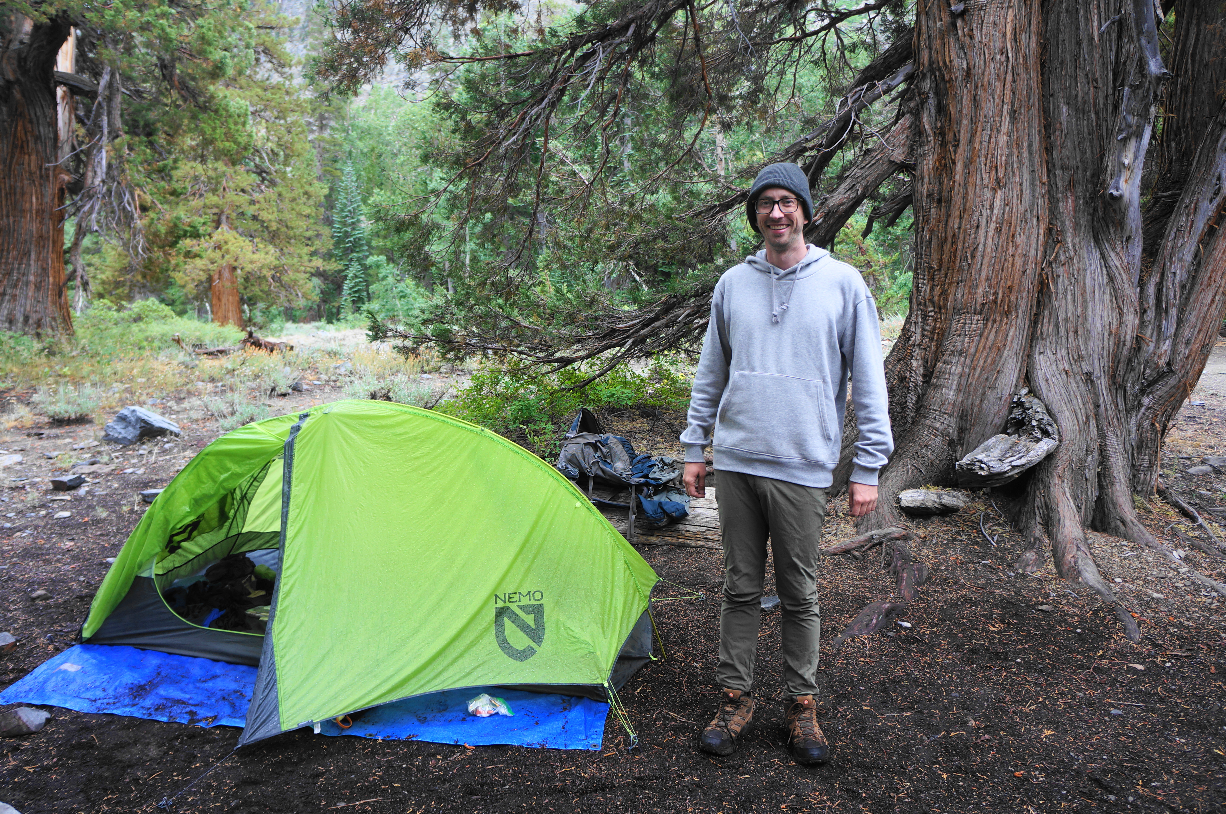
Note: On day 3 of the hike, I wore an adidas ALL SZN fleece hoodie and Ripstop golf pants, which doubled as fine hiking pants. The hoodie and pants were provided as a gift as part of a collaboration with adidas.
Agnew Meadows to Thousand Island Lake via High Trail/Pacific Crest Trail (7.9 miles)
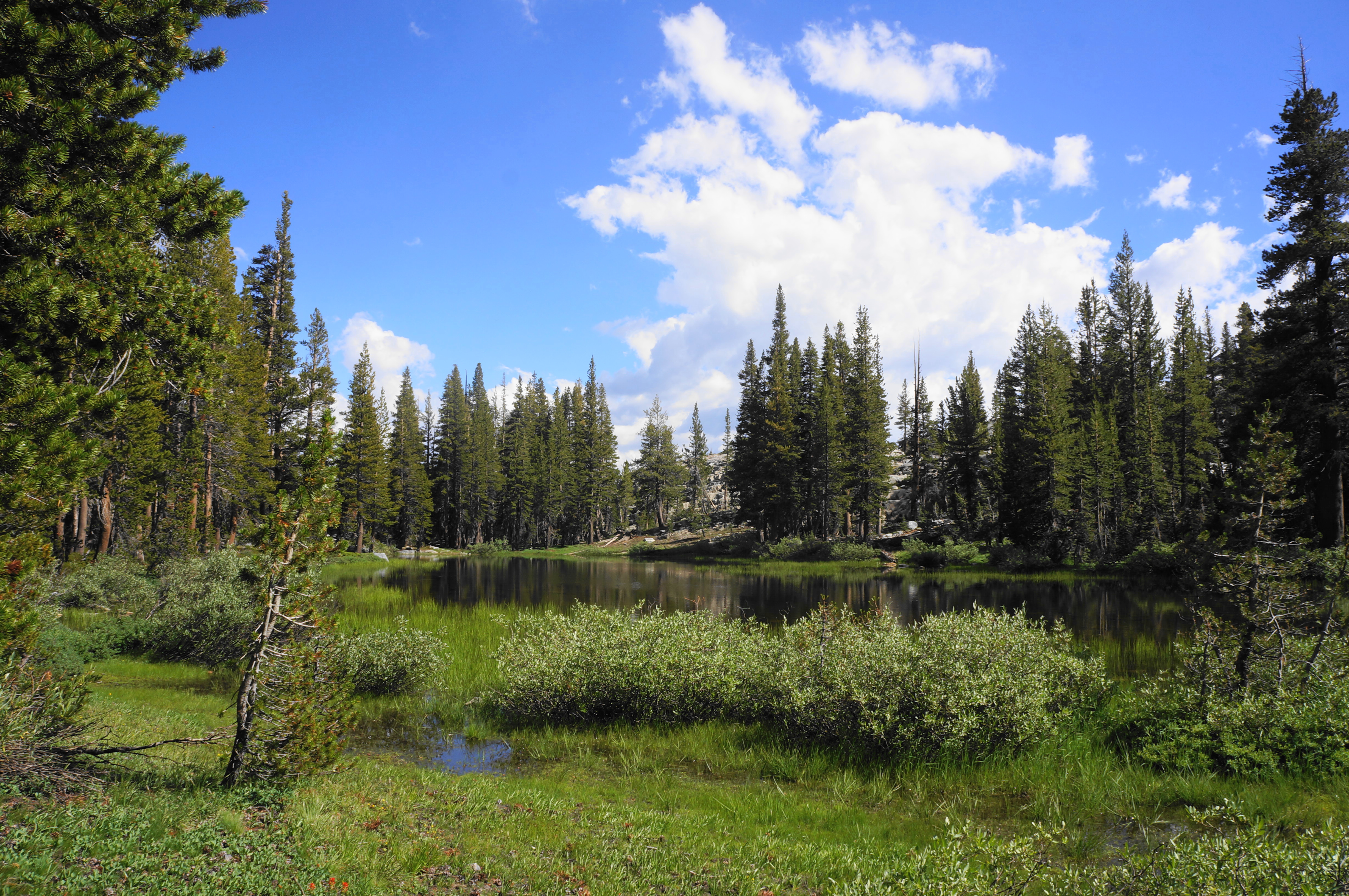
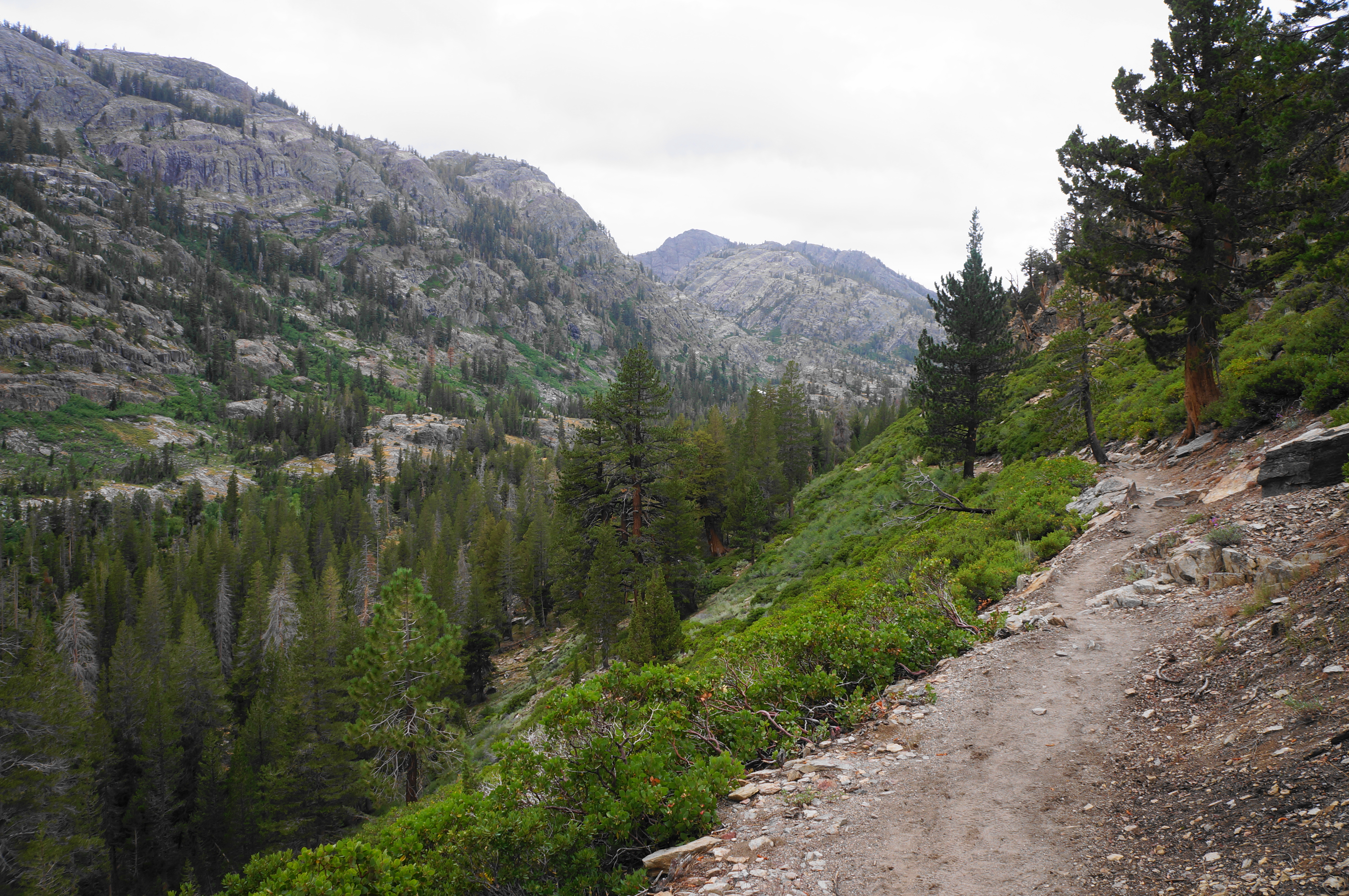
Agnew Meadows appears from the shuttle drop-off point as a largely woody area, interspersed with a buggy bog fed by tributaries draining from the south-facing mountainside. Follow the wide road as it bears westward through the pine forest, en route to the Agnew Meadows family, group, and equestrian campgrounds. Pass stables and other structures on the right, then come to a small parking area on the right (with a much larger one on the left). This is the starting point for both the River and High Trails. (Note: The River Trail offers a shorter, but arguably less interesting, ascent toward Thousand Island Lake.) The High Trailhead is on the right, under a shady canopy of conifers, and includes an information board with a map and hiking notices.
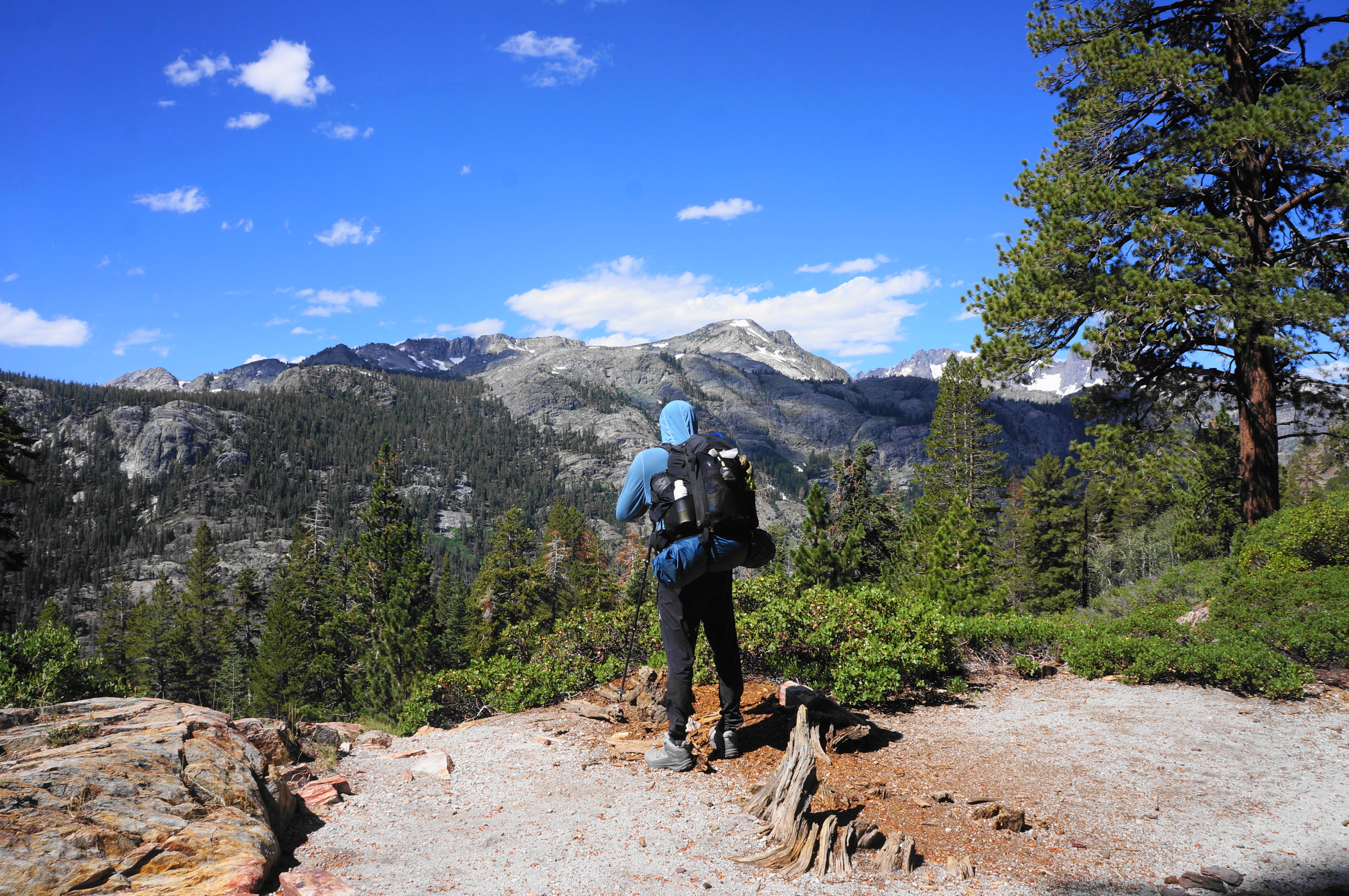
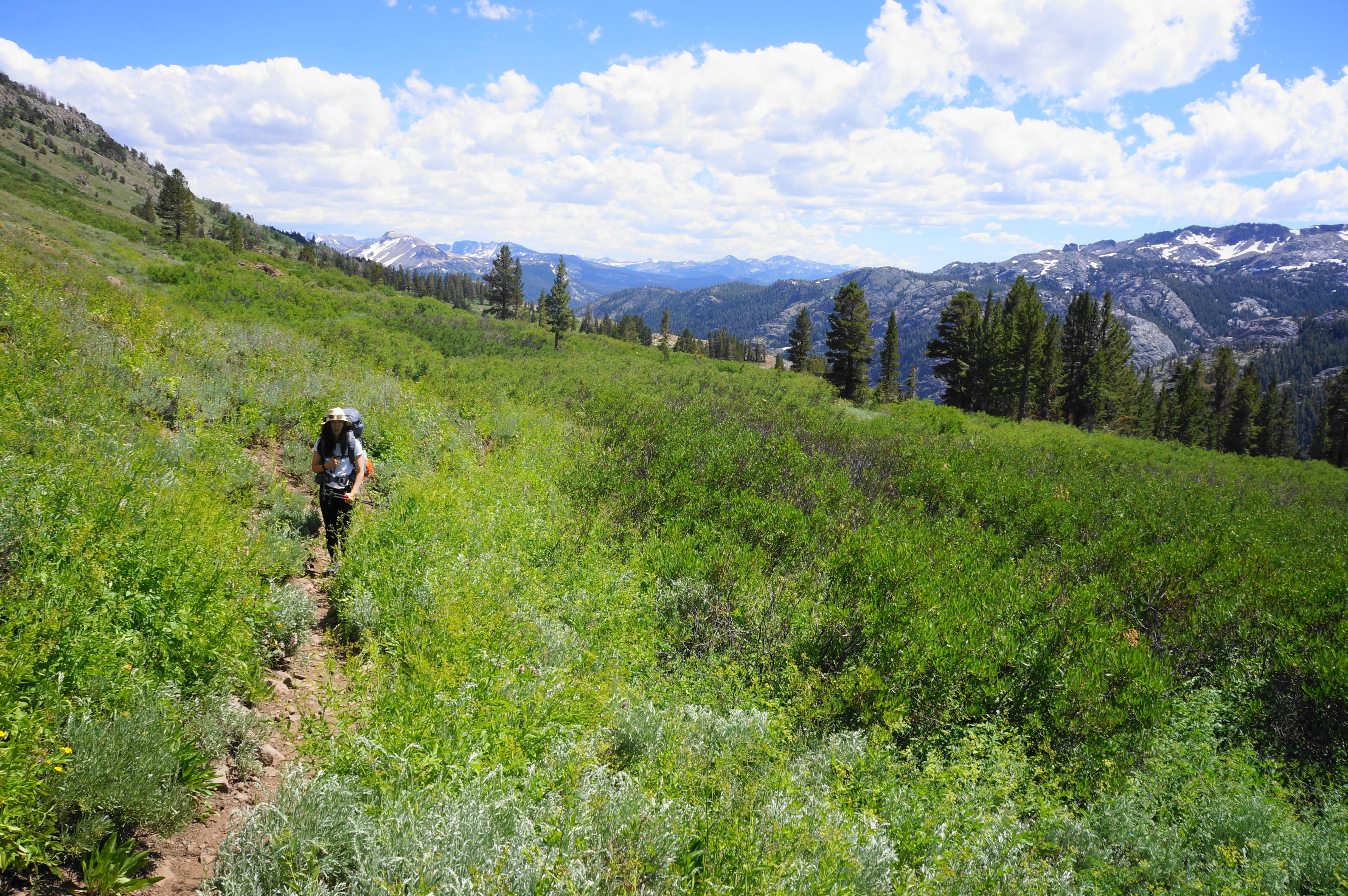
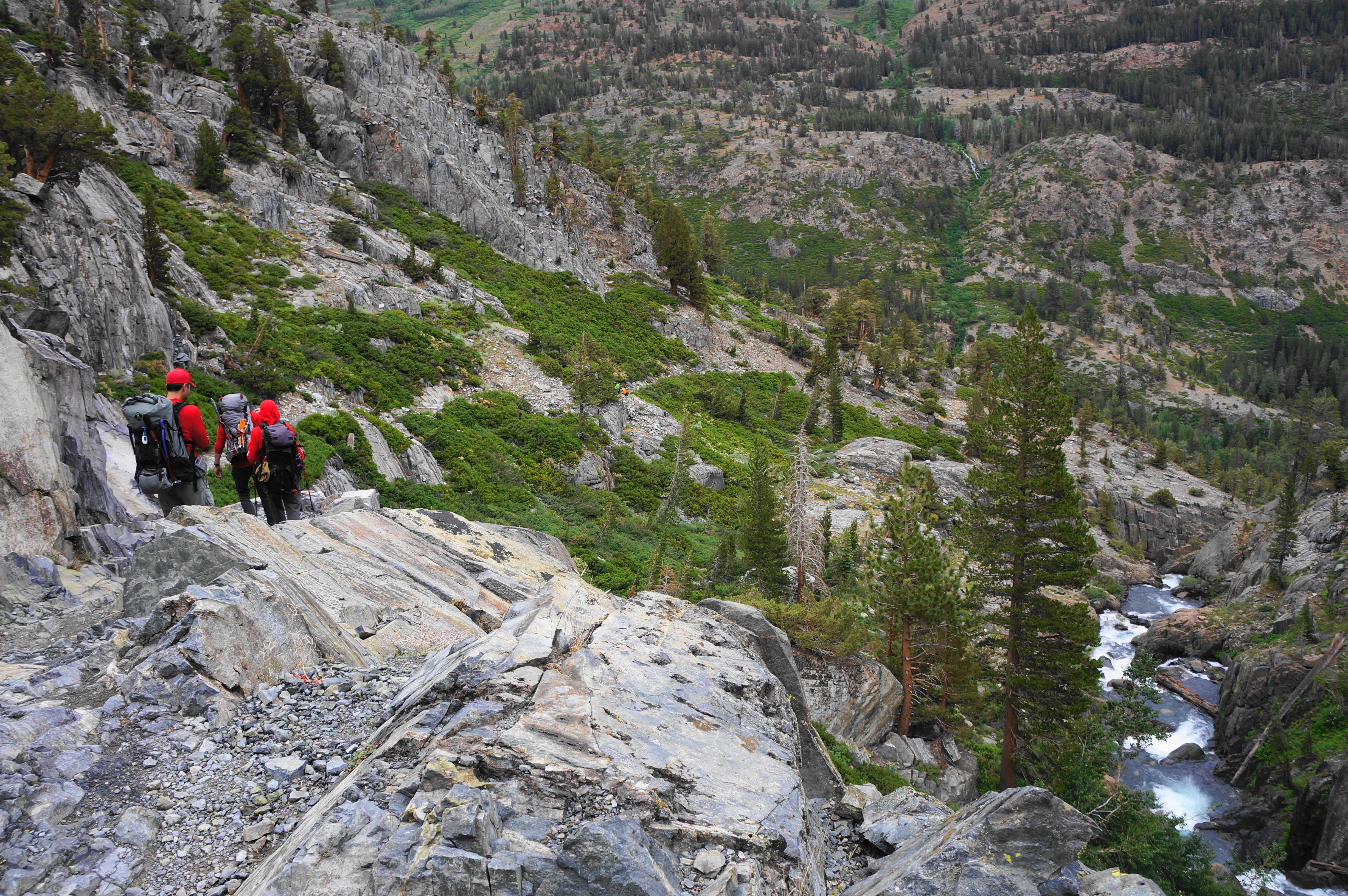
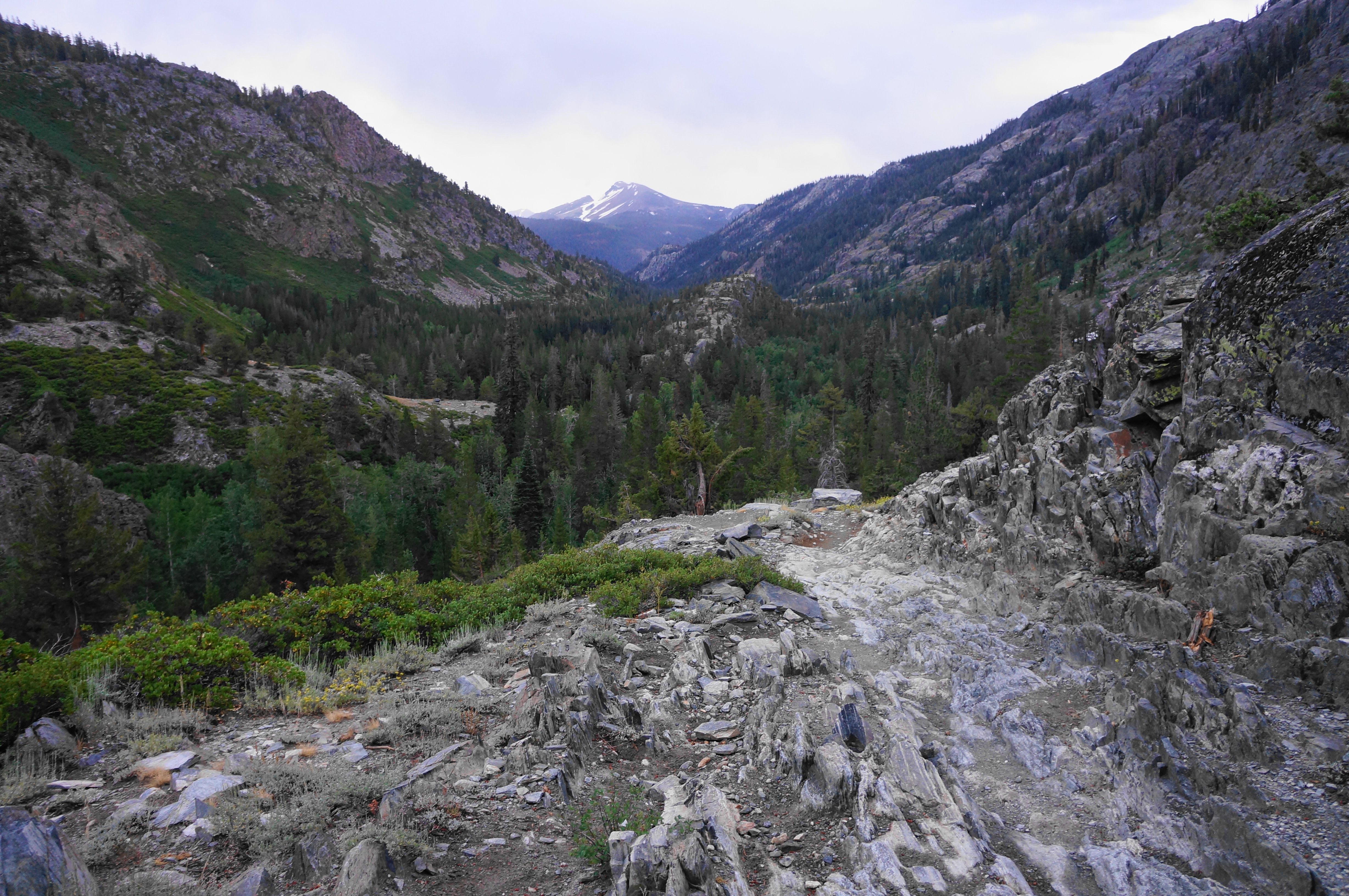
This marks the official start of the hike; the entire next 7.9 miles to Thousand Island Lake will be on the Pacific Crest Trail (PCT), the famed 2,000+ mile route connecting Canada with Mexico. (Note: The PCT and JMT, despite being joined for several miles to the north and more than a hundred miles to the south, are split in this section; they rejoin at Thousand Island Lake, as we shall see…) While not yet evident, Agnew Meadows is situated on a shelf partway up from the floor of the valley carved by the Middle Fork of the San Joaquin River. The High Trail climbs about 1,300 feet in elevation along the eastern flank of the valley; the heights allow for astounding vistas westward to the Ritter Range and the granite bowls that lie below.
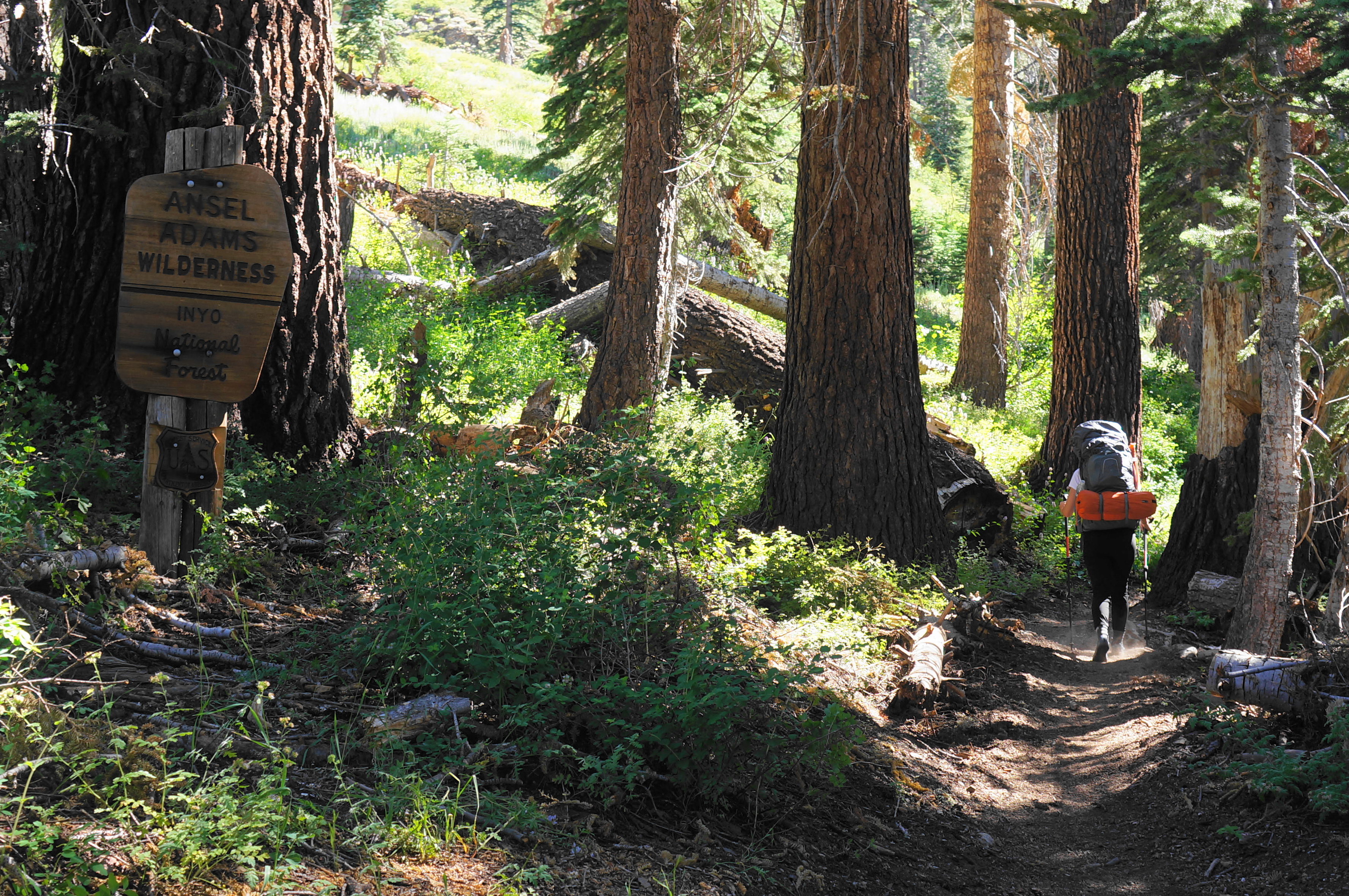
But the start of the hike is in the woods, with the damp and narrow track winding gently at first, then beginning a steady ascent. Snowmelt feeds several minor flows along the trail, and hikers formally enter the Ansel Adams Wilderness after about ¼ mile. Minutes later, the path comes out into the open, with views back southward to Mammoth Mountain (11,053’) and the Red’s Meadow Valley. Ahead to the northwest lie the imposing facades of Banner Peak (12,945’) and Mount Ritter (13,140’). Expect the shrubby hillside to be laced with wildflowers for much of the early summer (they were particularly good in 2023 after a wet winter), adding further to the allure.


The elevation continues to climb as hikers proceed, until coming to a point at about ¾ mile where there is a welcome level section. Soon hikers come to a set of aspens and more tree cover before rising to a couple of outcrops with what appear to be makeshift campsites (probably too close to the trail to be “legal”) and expansive views down the San Joaquin drainage toward Mammoth. At about the one-mile mark, cross a tributary lined with seasonal wildflowers.
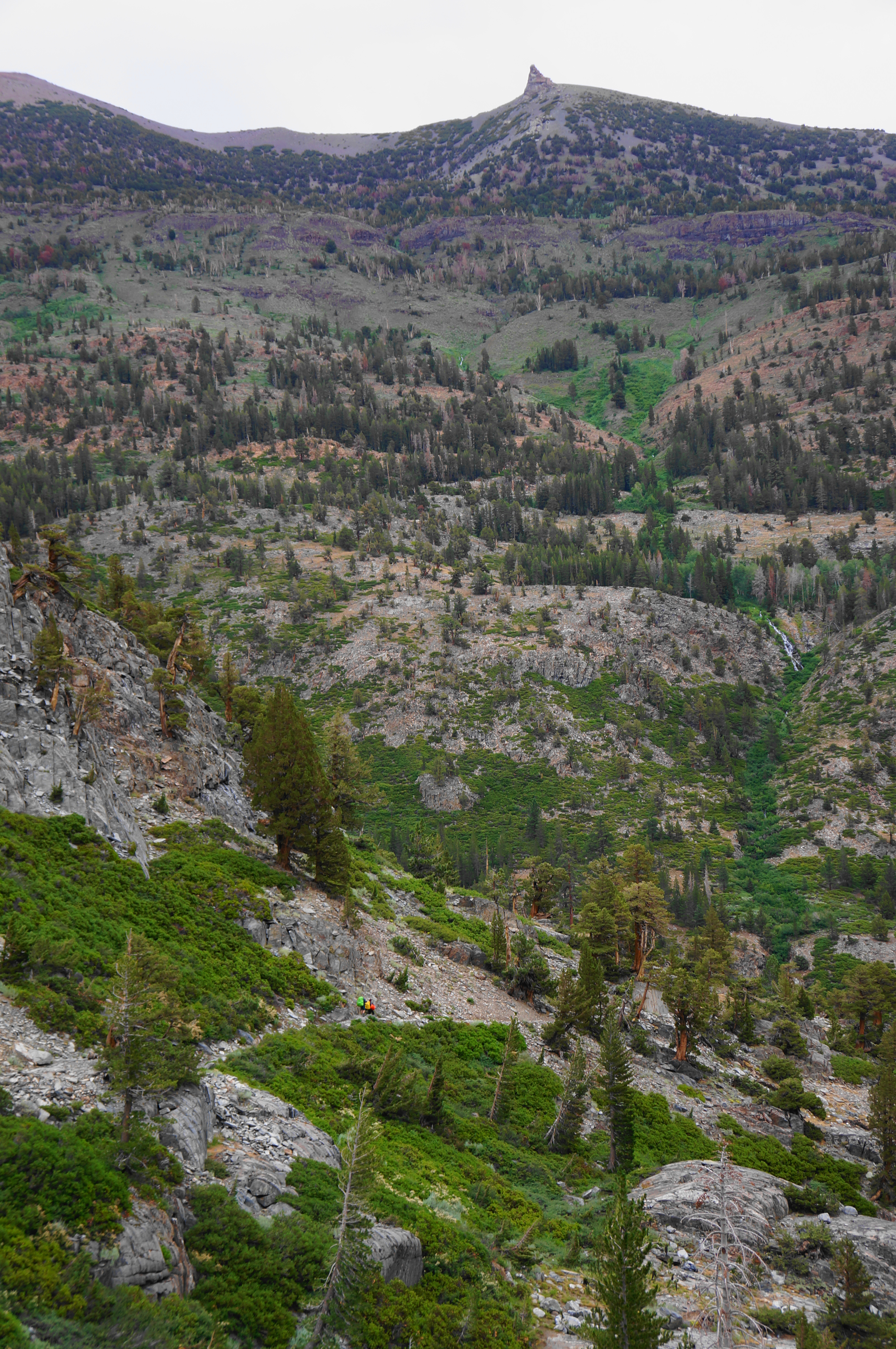
Rise to a rocky cut at about 1.3 miles, then enjoy a brief respite before settling into another ascent. The two-mile mark brings a sharp left-hand bend to clear a woody tributary, followed by a scenic section of outcrops with red-orange hues. Up to the right, one can see one of the two juts that comprise the whimsically-named Two Teats (11,387’).

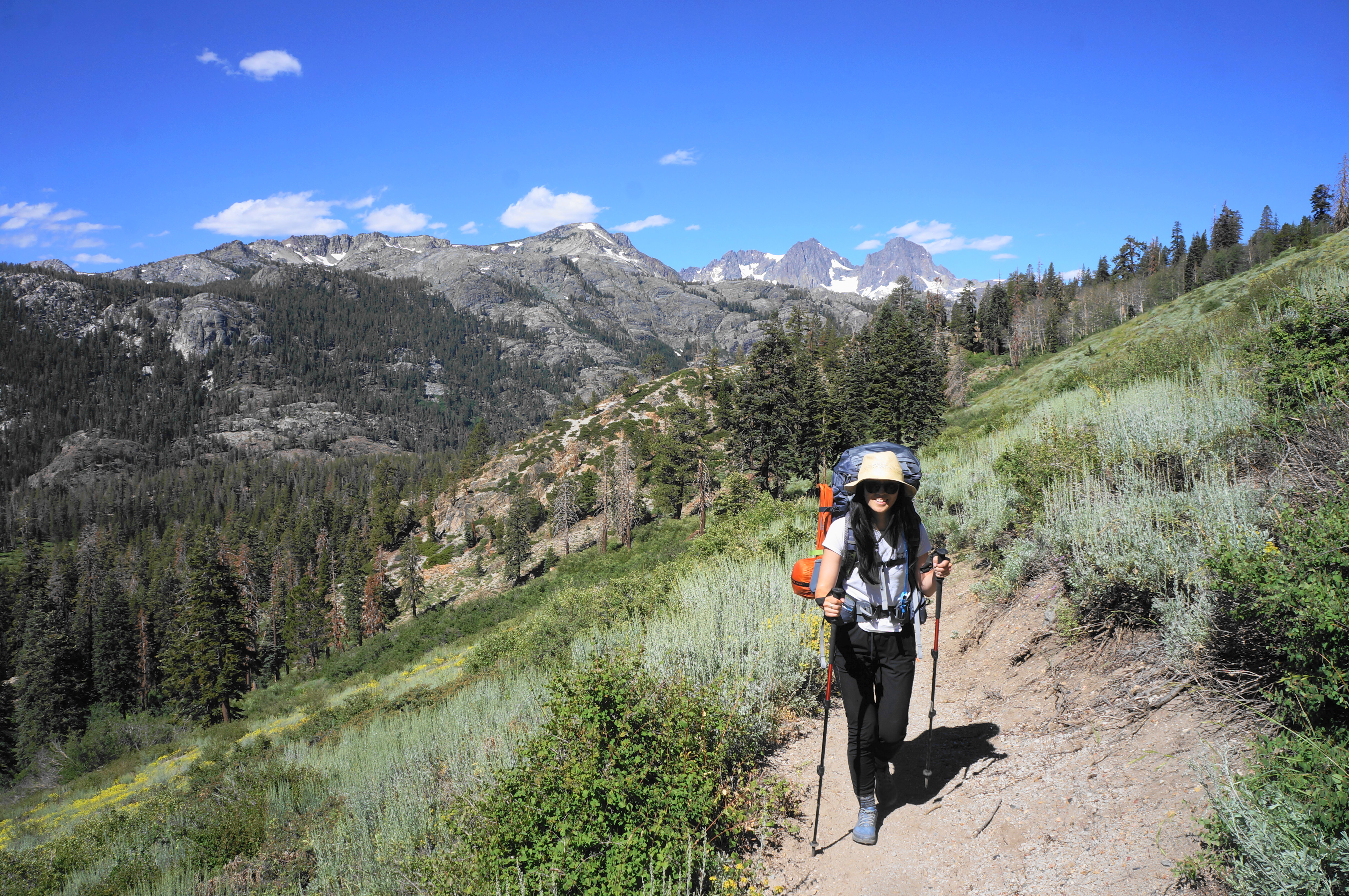
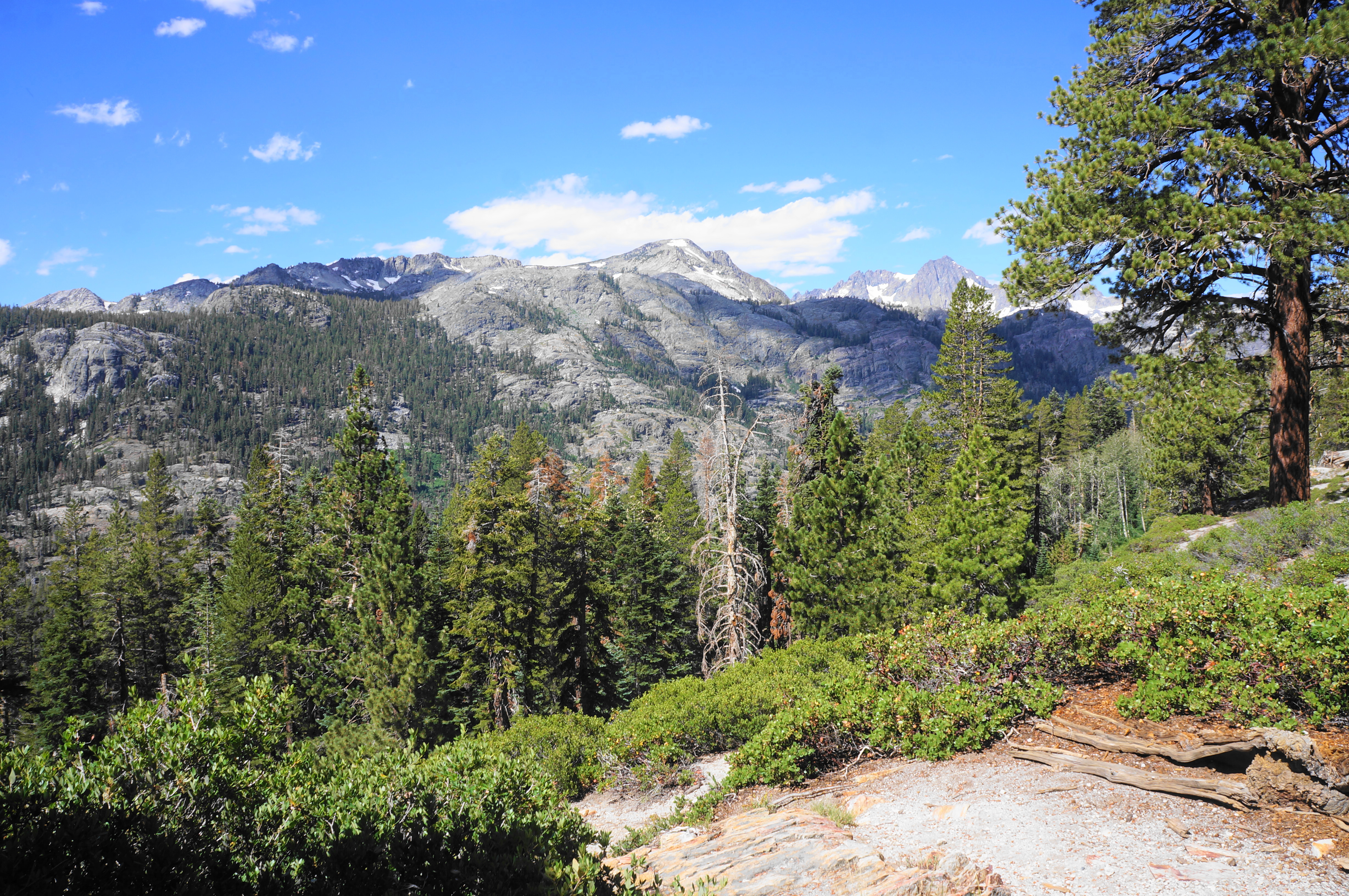
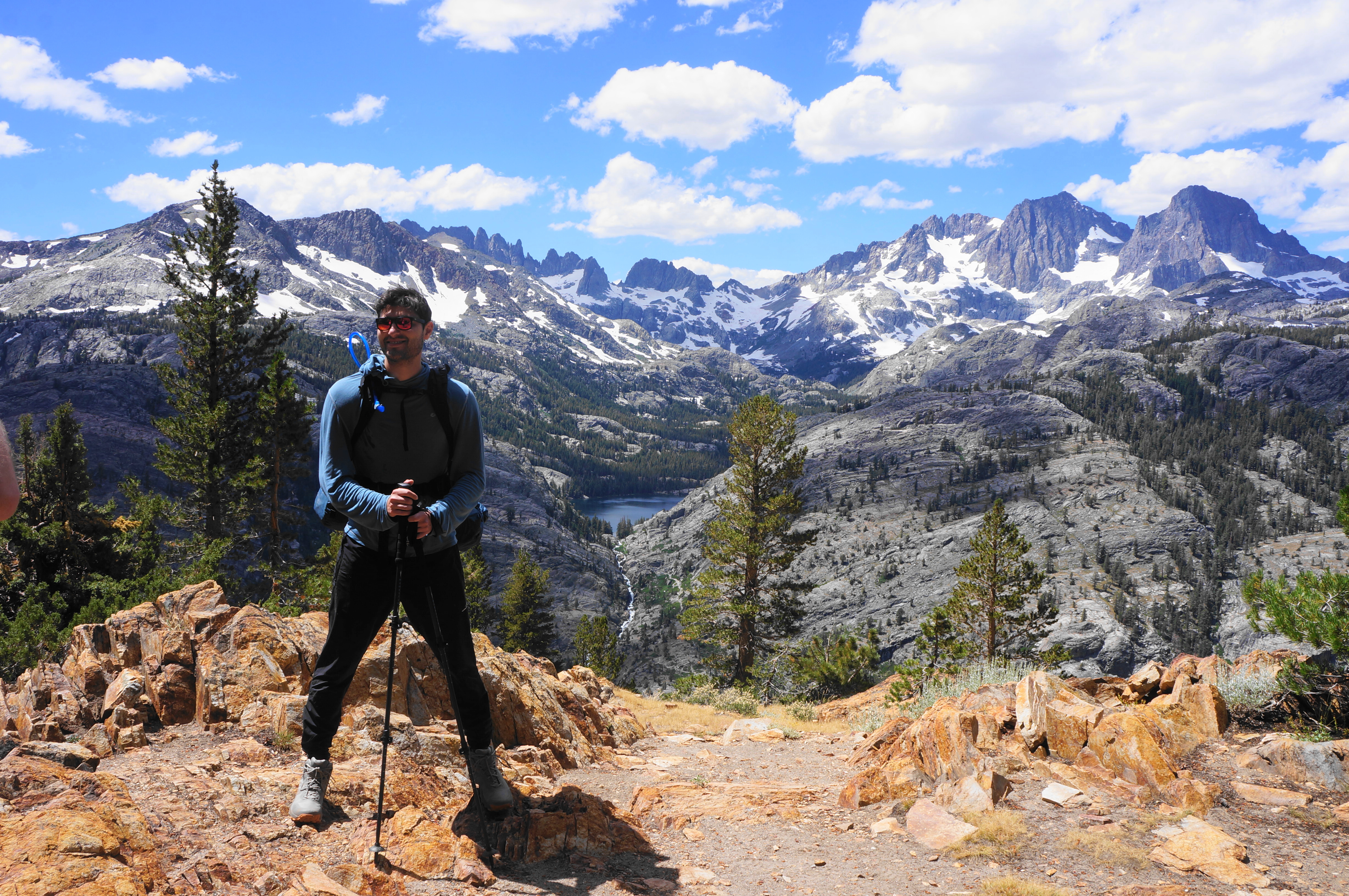
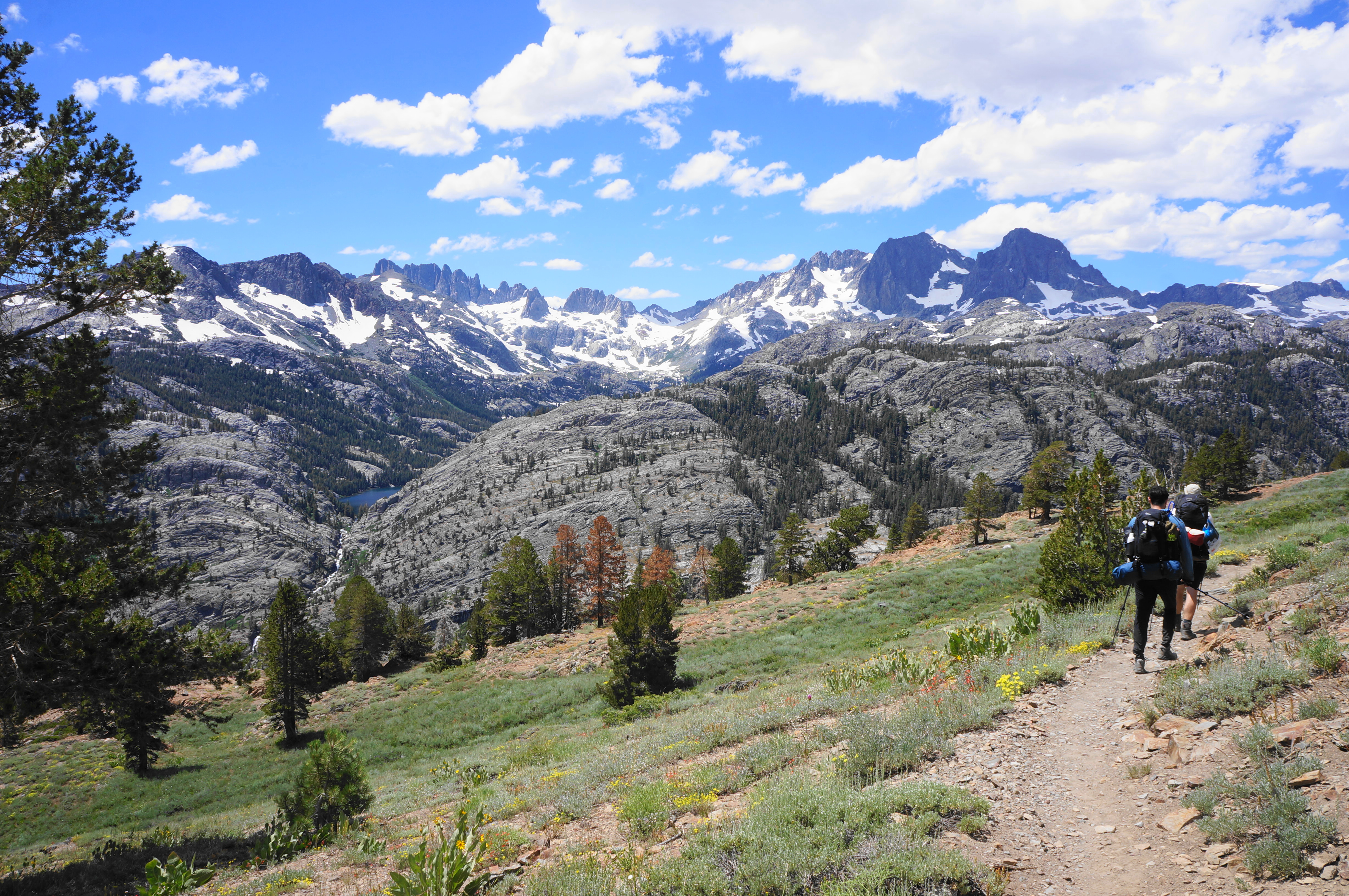
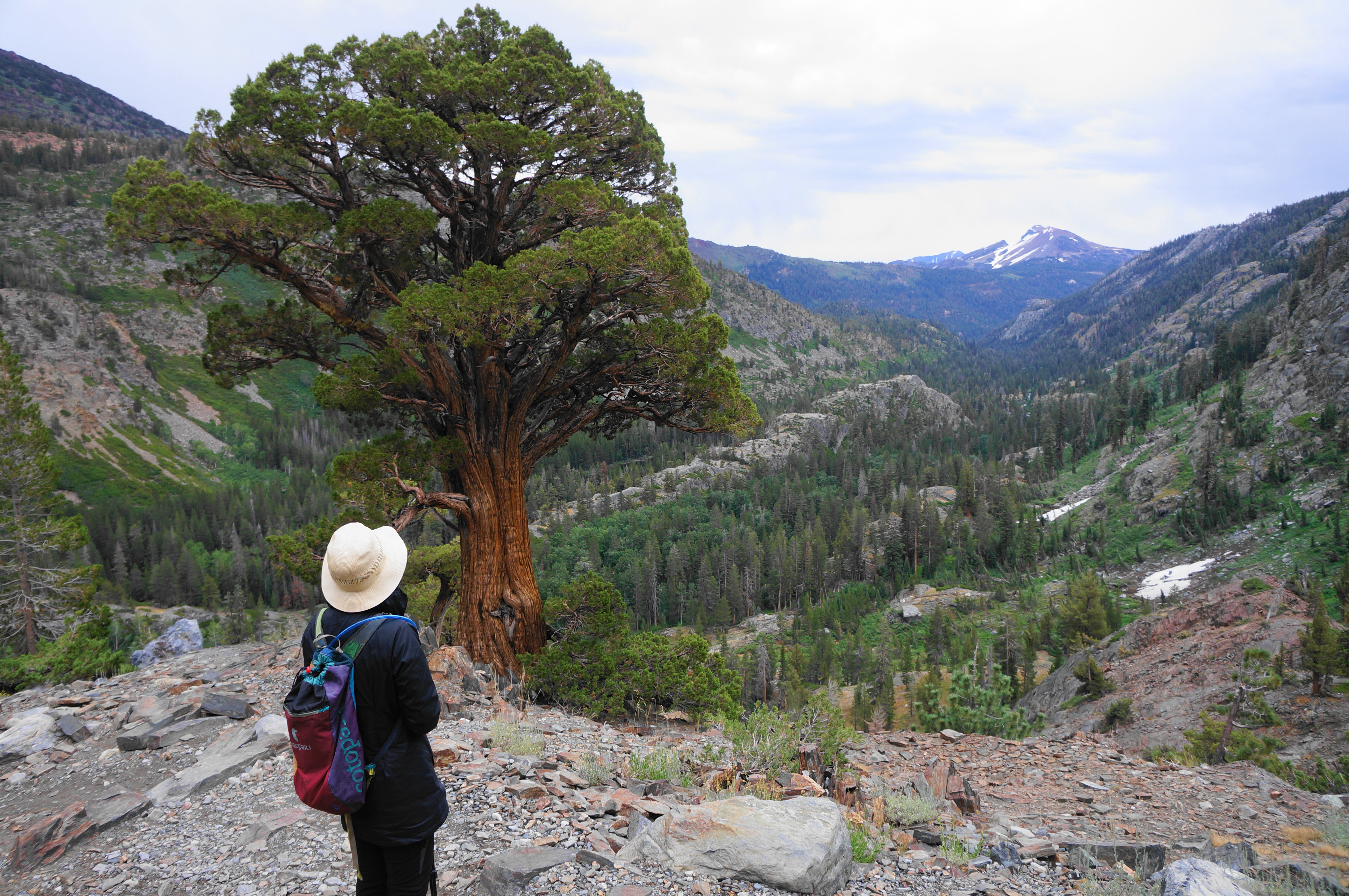
What initially appears as a single granite form on the opposite side of the valley soon reveals itself to be a two-tiered shelf, most dramatically viewed at a spectacular viewpoint at around 2.75 miles. Here a ruddy outcrop reveals picture-perfect views to Shadow Lake, framed by a V-shaped cut, with the incredible ridgeline of Banner Peak, Mount Ritter, and The Minarets forming an amphitheater backdrop. When the sun is out and views are clear, this is perhaps one of the most stunning vistas in the Eastern Sierras (which I can vouch for, having completed the entirety of the JMT, often considered America’s most scenic long-distance hike, in summer 2021).


The scenic heights also offer a wider look up the valley to the northwest, reaching as far as Mount Lyell (13,114’), Donohue Peak (12,023’), the Koip Crest, and the divide separating Inyo National Forest from Yosemite National Park. The views north are better at a second outcrop about 1/10 mile from the first, reaching as far east as Parker Peak (12,861’) and Mount Wood (12,657’).

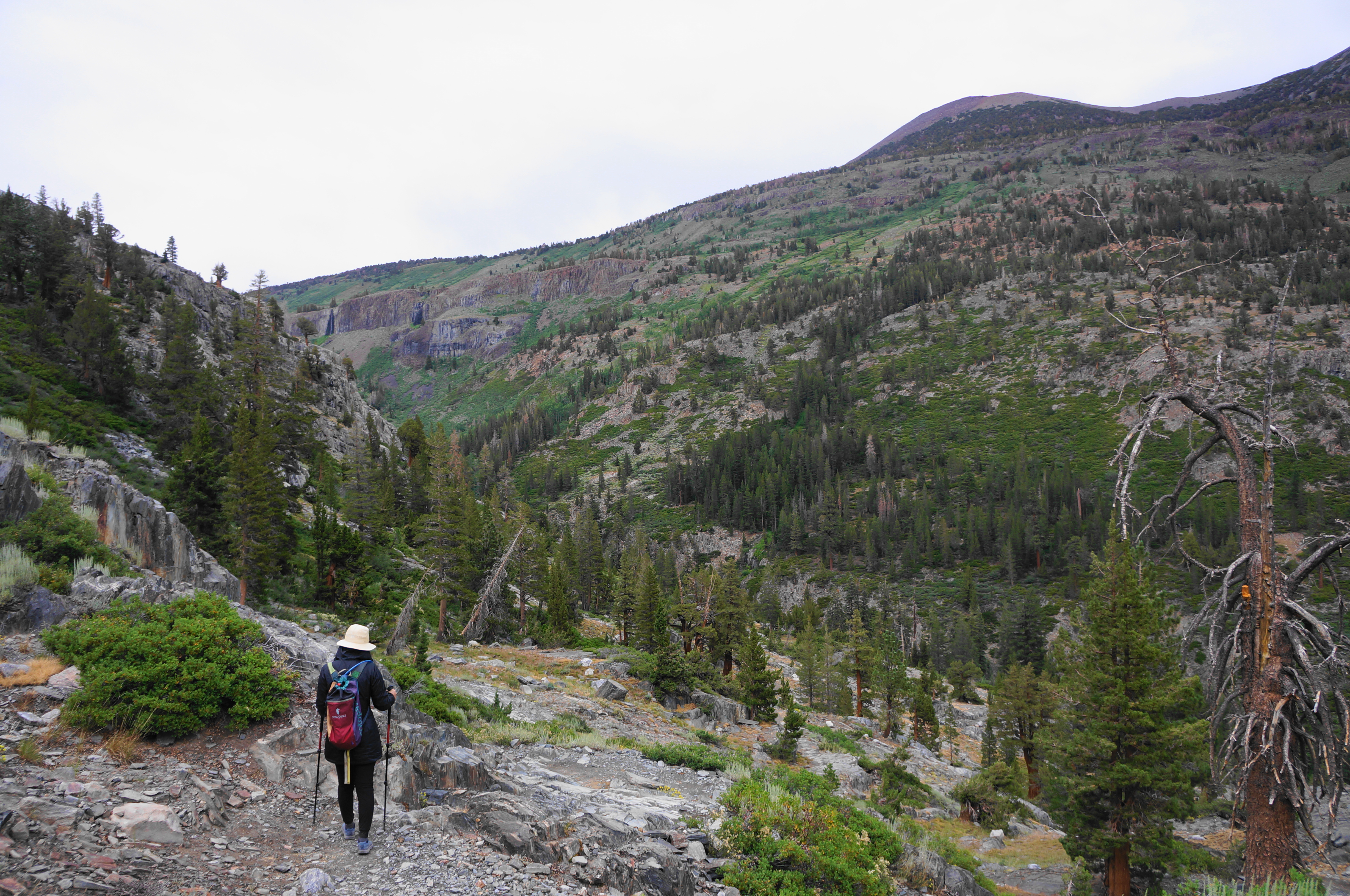
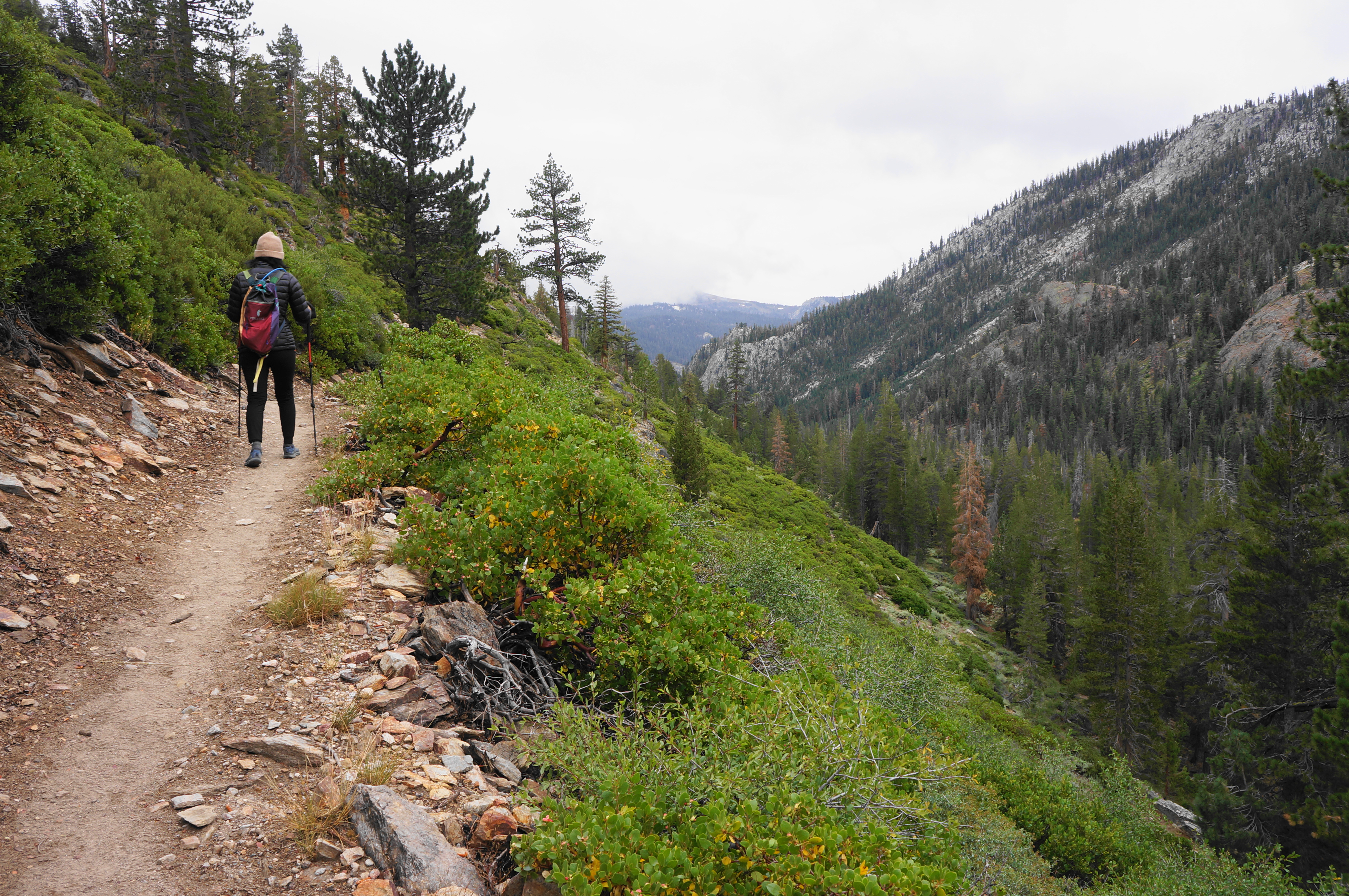
This inaugurates a lengthy open stretch with continual vistas and a very mild slope—mostly level or slight uphill—making this one of the hike’s most pleasant sections. After more than ½ mile with minimal vegetation, the High Trail cuts into an aspen grove and drops down a set of switchbacks, shedding a bit of elevation but avoiding a true descent into the valley.


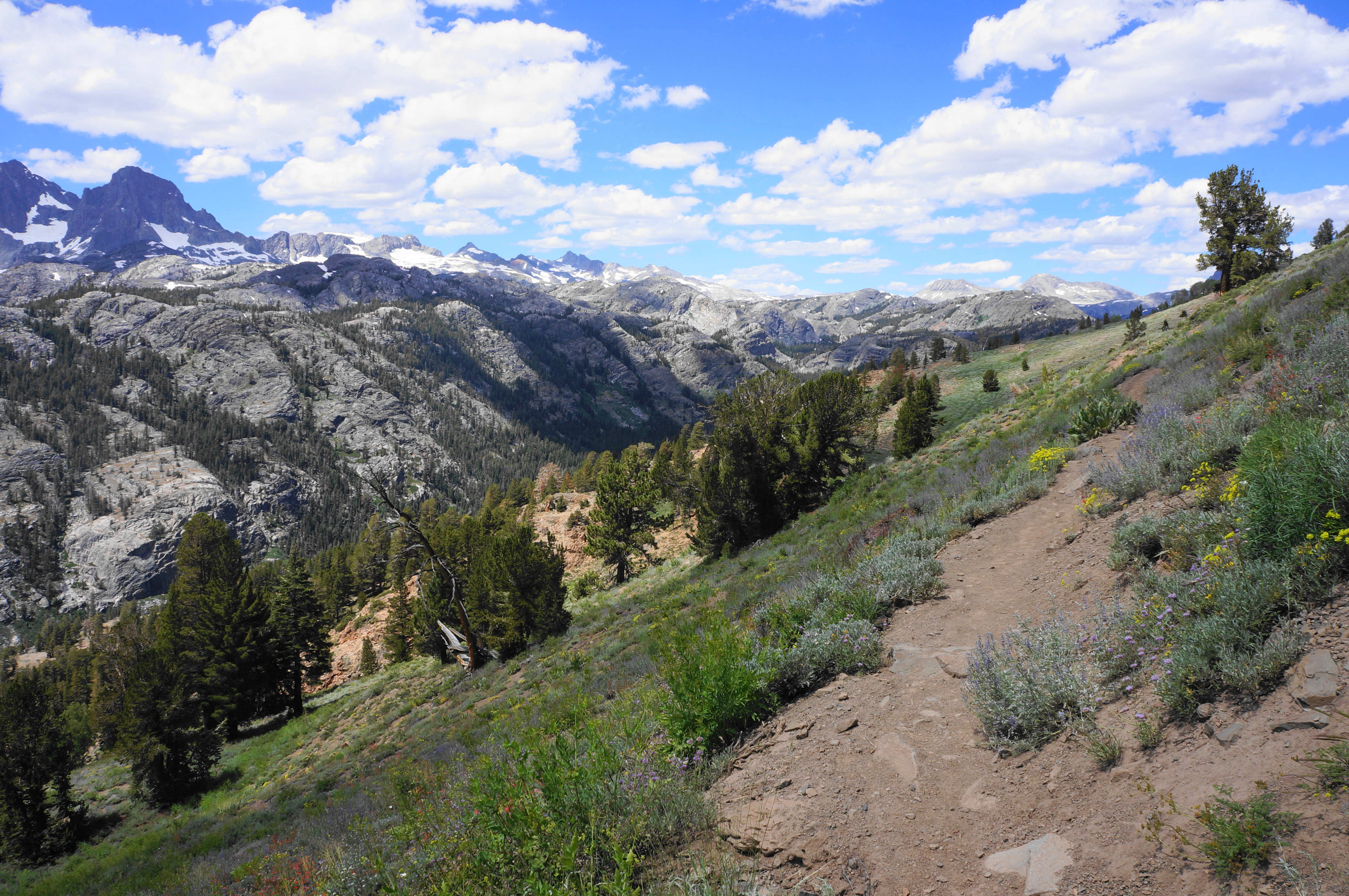

After flirting with clumps of pines, the trail settles again into a level shelf with rolling meadows. Expect to clear a number of small tributaries, at least in the late spring and early summer, with brush rising high and encroaching on the path.


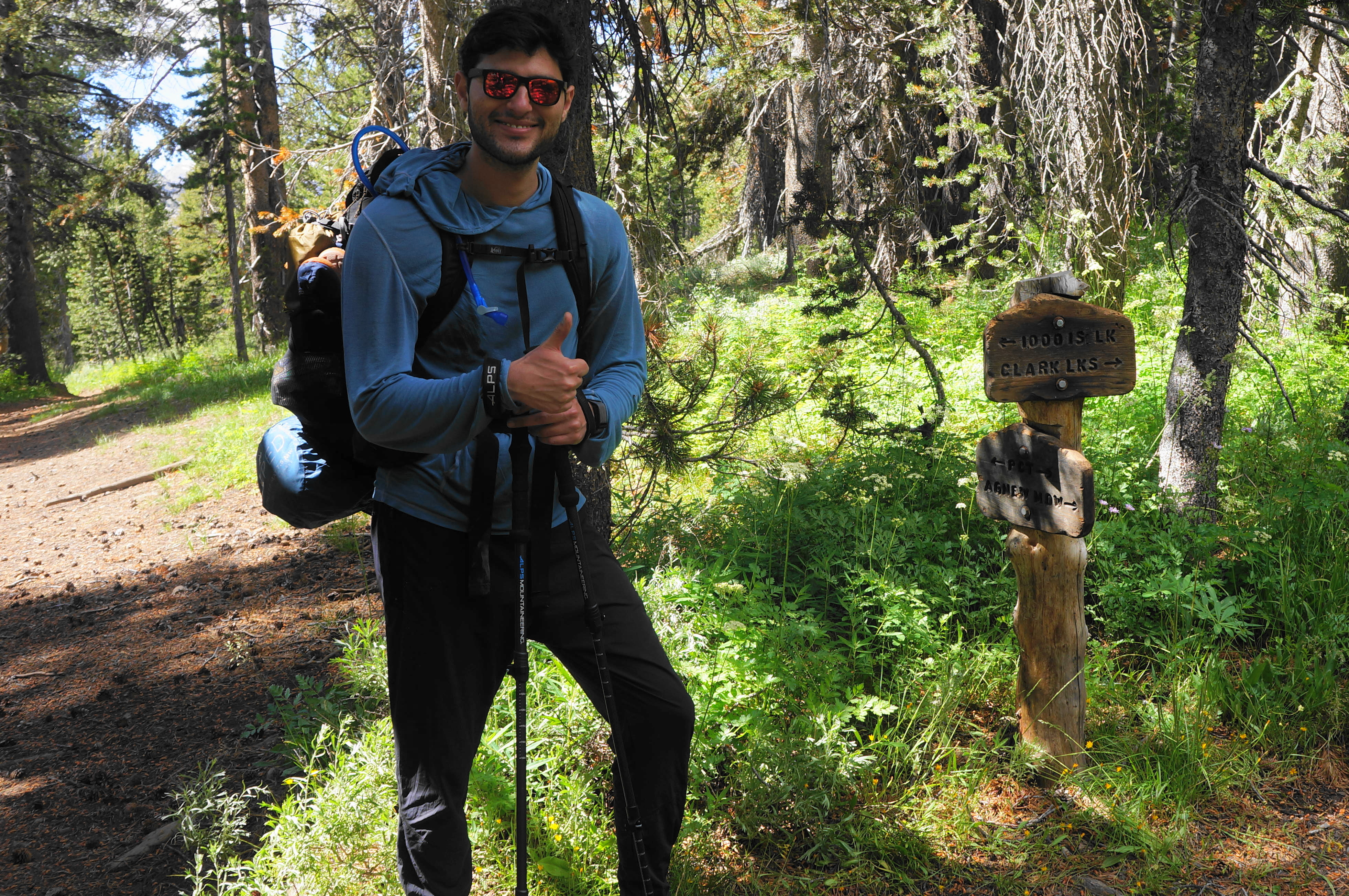
It is a short walk from the return of pine forest to the first trail fork of the hike, marked by a small signpost. This is the junction for the Agnew Pass Trail (although this is not obvious from the trail sign, which instead points to Clark Lakes). Stay left on the PCT toward “1000 Is. Lk.”—the likely final destination for the day.
The next section feels distinctly different from the preceding 5.5 miles, in part because it is largely a sustained downhill, first through a stretch of woods, then down a bushy slope and into another dense and thick pine forest. Cross a creek at about the 6-mile mark, followed by a resumption of the uphill climb.
Come soon to another junction, this time heading straight, remaining on the PCT. By now the mounting fatigue may lead hikers to groan at the steep staircase just beyond. But the route soon levels again and skirts a pair of stagnant ponds (mosquito city!), one on the left and one on the right. An unmarked trail leads left to the largest of what is called the Badger Lakes.
Passing some granite outcrops on the right, enter another sustained climb, rising to a cut at around 6.7 miles. Crest a sunny flat and drop to another junction in a shady gully. Cross a dammed creek, then rise up and over a granite jut again. The PCT drops down a set of bends to a subsequent junction with the River Trail (the alternative route from Agnew Meadows).
The next stretch is a veritable uphill slog made more bearable by the sight and sound of the fast-flowing Middle Fork of the San Joaquin River down to the left. Eventually the trail diverts right, climbing up a (usually dry) side drainage. After some switchbacks and a sustained climb, the path finally levels again at about 7.6 miles and Banner Peak returns to view.


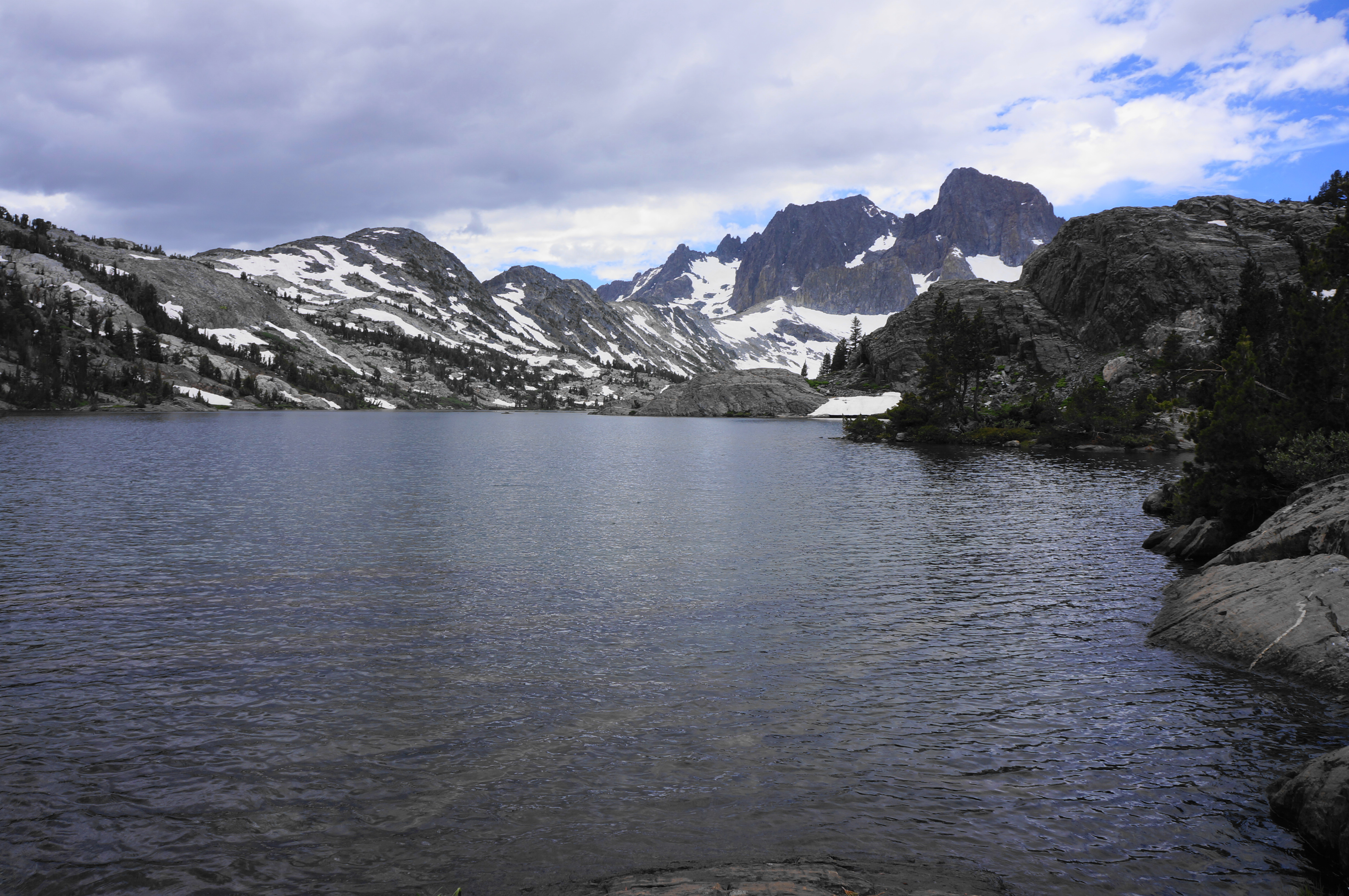
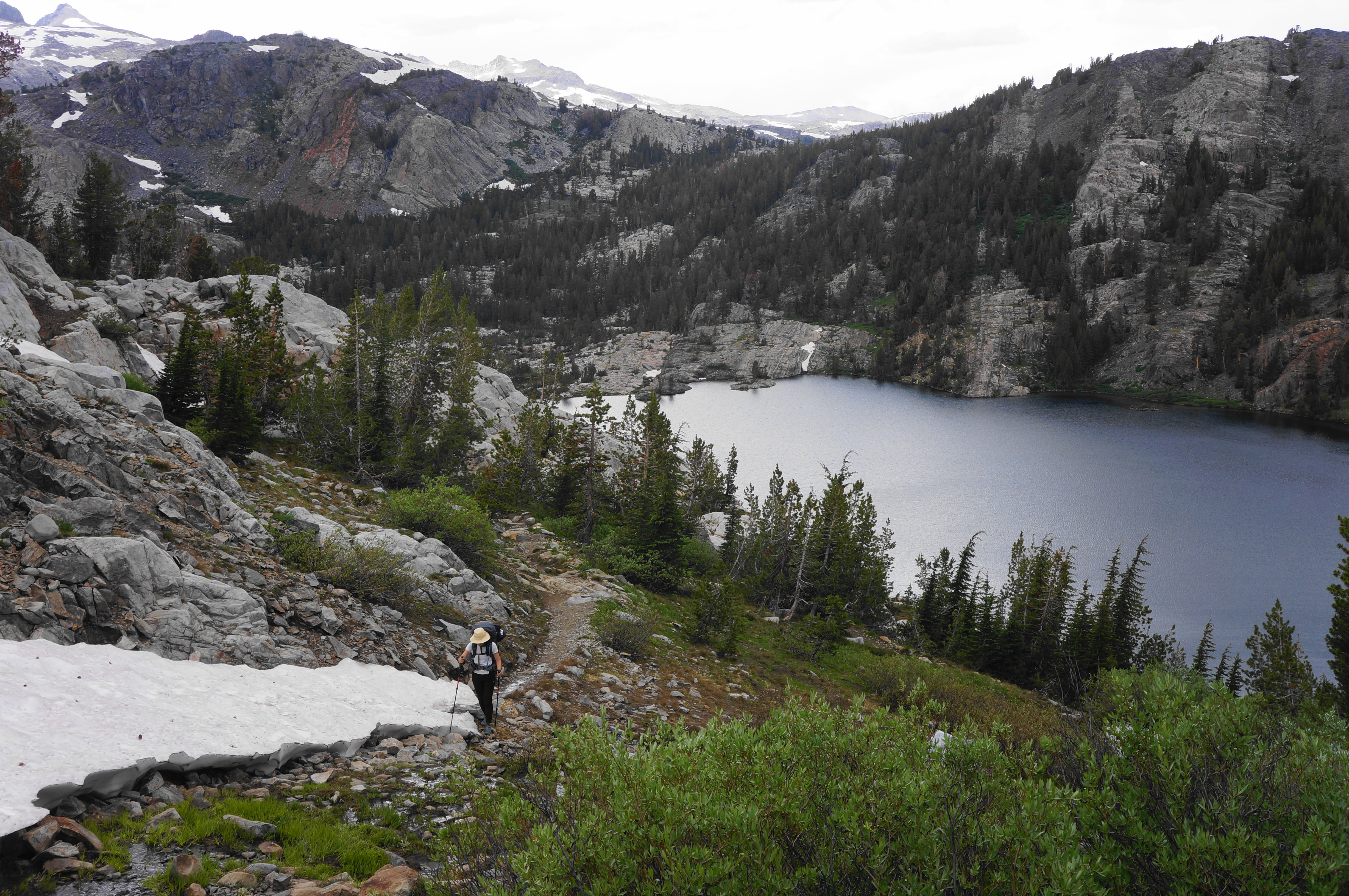
Edging closer to this landmark, the trail descends and comes streamside; cross the waters and skirt a modest pond. Hikers also get a look back toward the Two Teats and the bald San Joaquin Mountain (11,600’). As the trail follows a narrow canyon cut, the first views to Thousand Island Lake emerge, and the panorama improves significantly as the PCT crests a shaly hill and drops to a verdant flat at the mouth of the lake.

The trail splits at 7.9 mile, just steps from the shores of Thousand Island Lake, which can be viewed here in its full splendor. Beyond is the familiar Banner Peak as well as the hulking mass of Mount Davis (12,310’), separated by North Glacier Pass (accessible via off-trail excursions when it is free of snow).


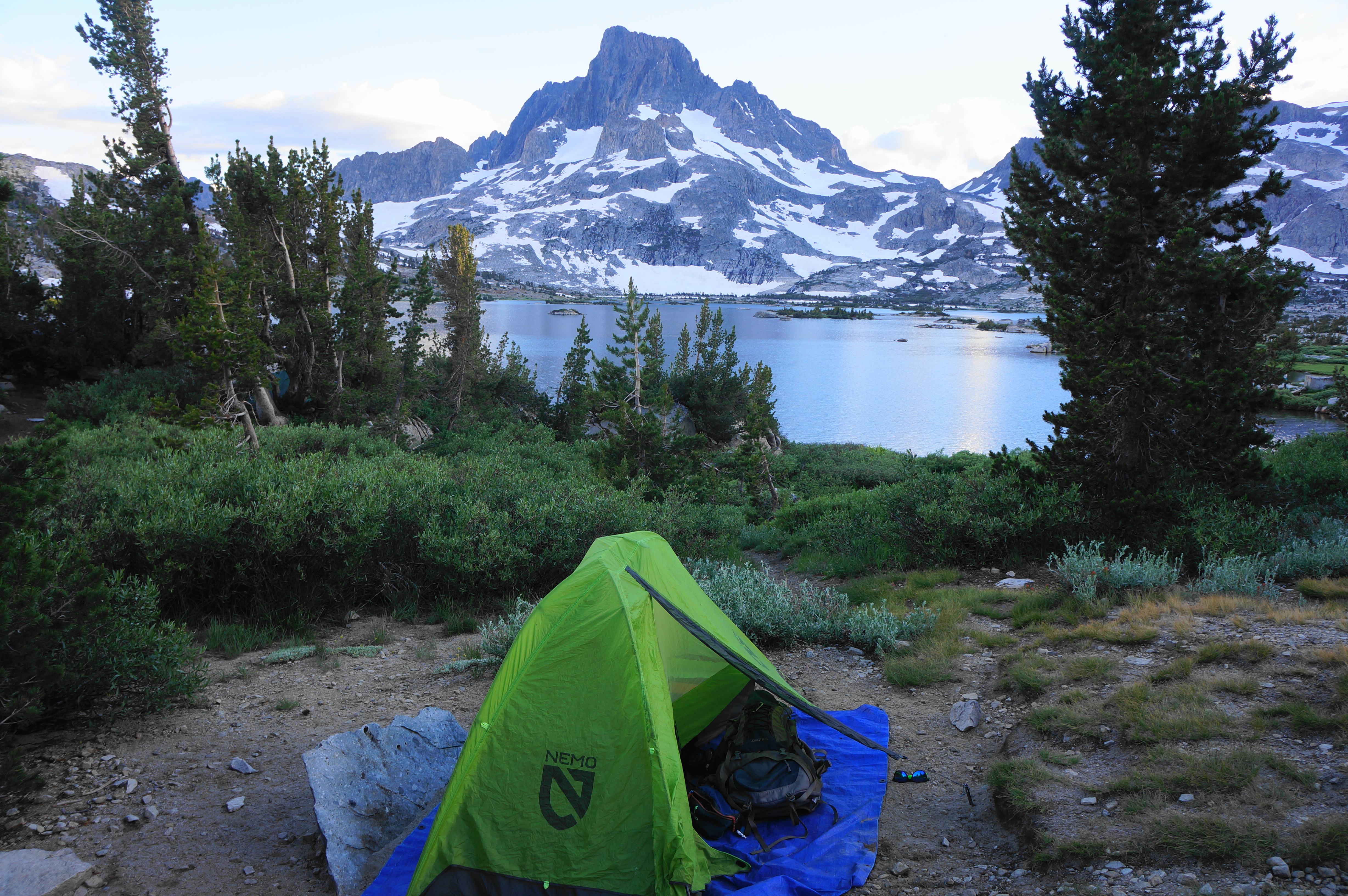

Most hikers will choose to camp near the lake, with the majority heading right at the fork, then bearing left along the lakeside, leaving the PCT in favor of the unsigned Thousand Island Lake Trail. As tempting as it may be to sleep right next to the lake, it is prohibited to set up camp within 100 feet of the water, and campsites must be a good distance as well from the trail. This generally means trekking up to the right, where there are some pleasant, secluded sights with bird’s eye views of Thousand Island Lake. Here you can enjoy the sunset and night sky and attempt to count the many islands (though not likely quite 1000!) that dot the alpine tarn.

Thousand Island Lake to Shadow Lake via John Muir Trail (6.0 miles)
Waking up on Day 2, Banner Peak returns to view above the calm waters, illuminated by the sun rising in the east. When ready, make your way back to the four-way junction at the east shore of Thousand Island Lake. Here the PCT and the John Muir Trail (JMT) diverge, with the latter traversing a high shelf between the Ritter Range and San Joaquin main drainage, back in the direction of Mammoth. This is your route.


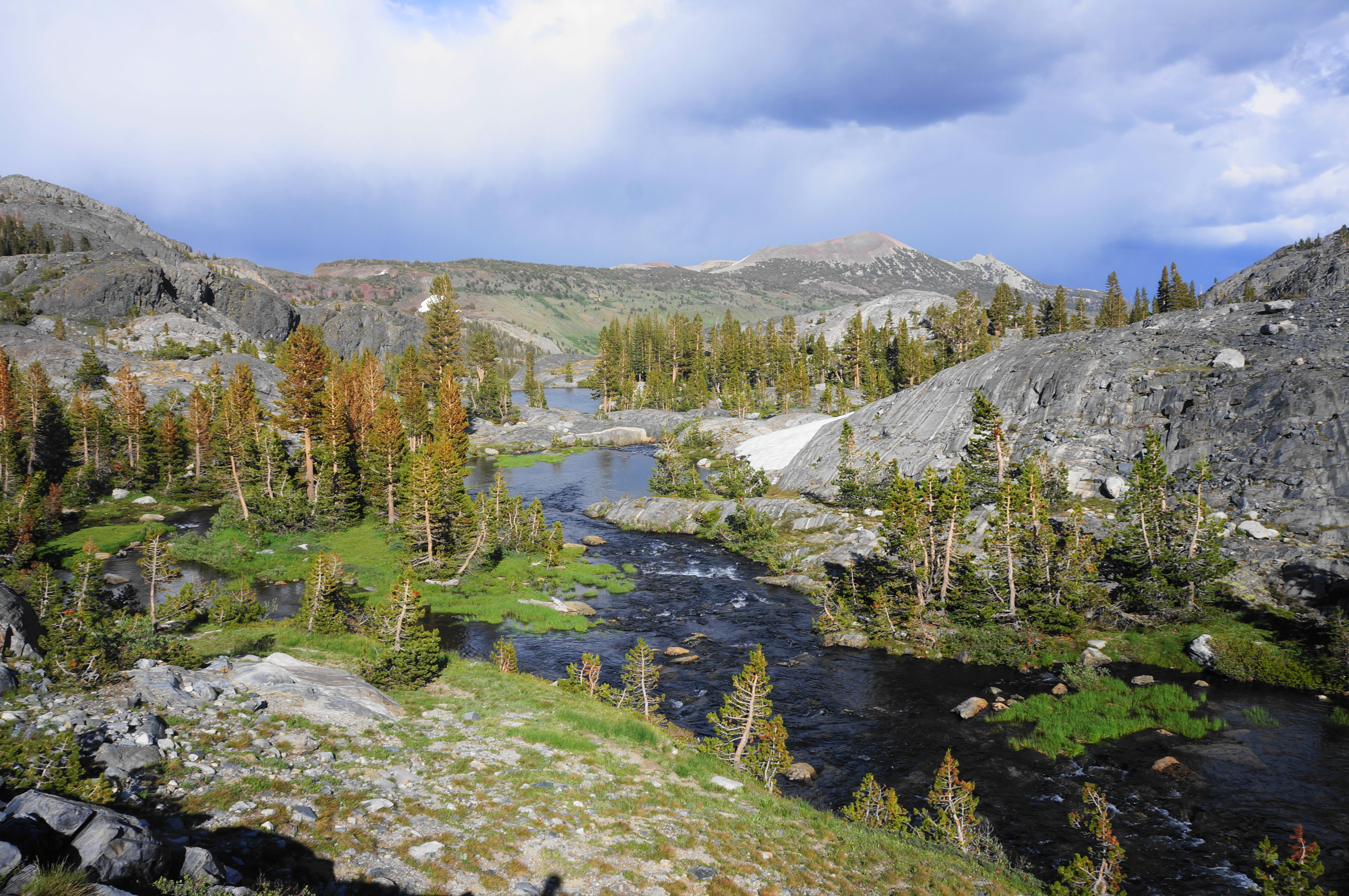
Bear south on the JMT, steering toward a crossing – actually a set of stepping stones – over a flowing stream at the outlet of the lake. From here, the trail leaves the lake behind, climbs a mild granodiorite slope, and drops into a smaller basin, this one filled with another lovely, though much smaller, pool: the shimmering Emerald Lake. There are few obvious campsites here, with much of the shores lined by scaly slopes. But there are views across the lake toward Agnew Pass and the upper reaches of the valley seen from above on the High Trail on the previous day.


From Emerald it is a short uphill to another lovely spot, Ruby Lake. This still lake—roughly the same size as Emerald—is set against a steep backdrop with a scarlet-colored slope, with a handful of prime camping spots set in the woods around the lake.


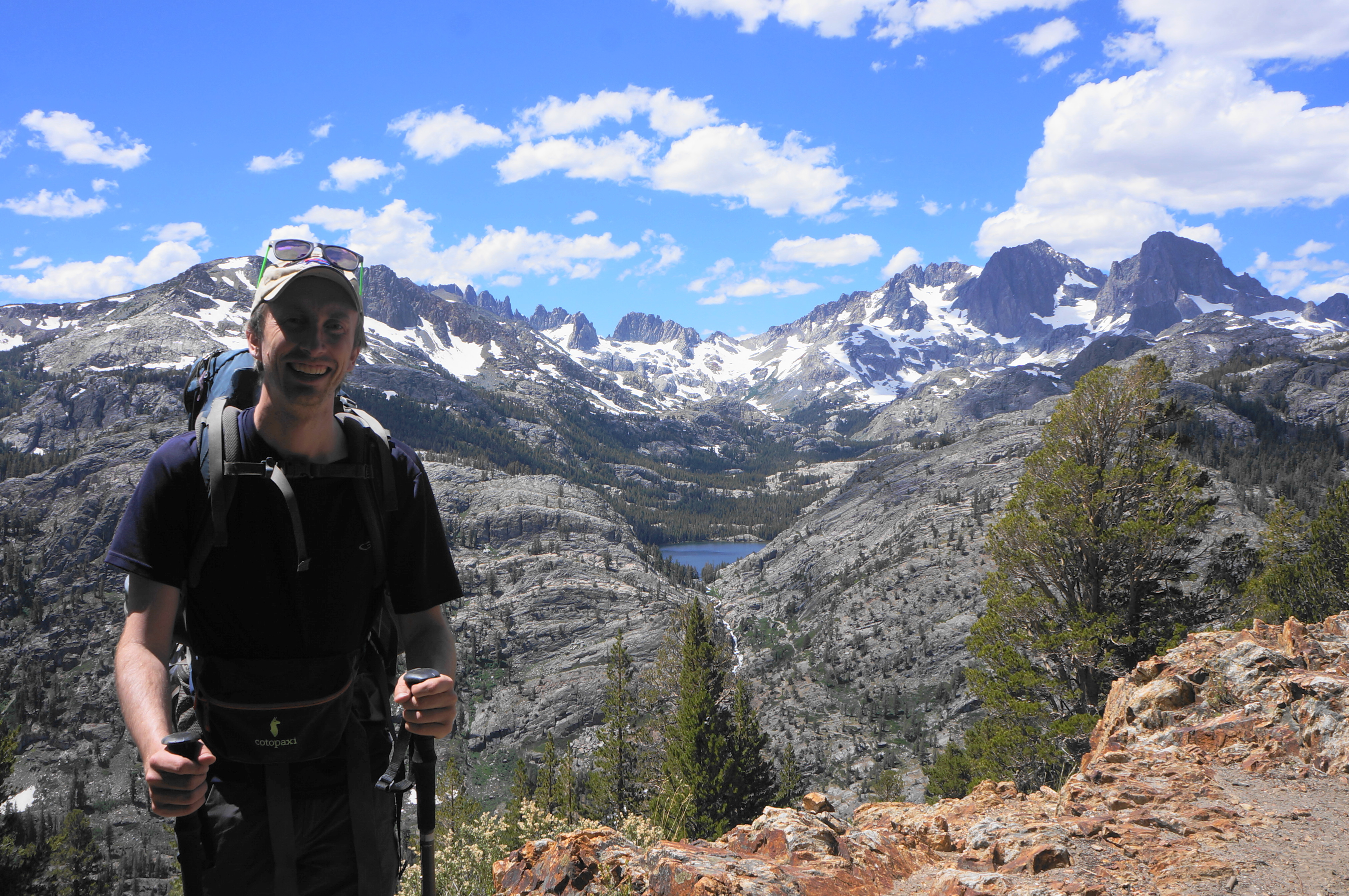
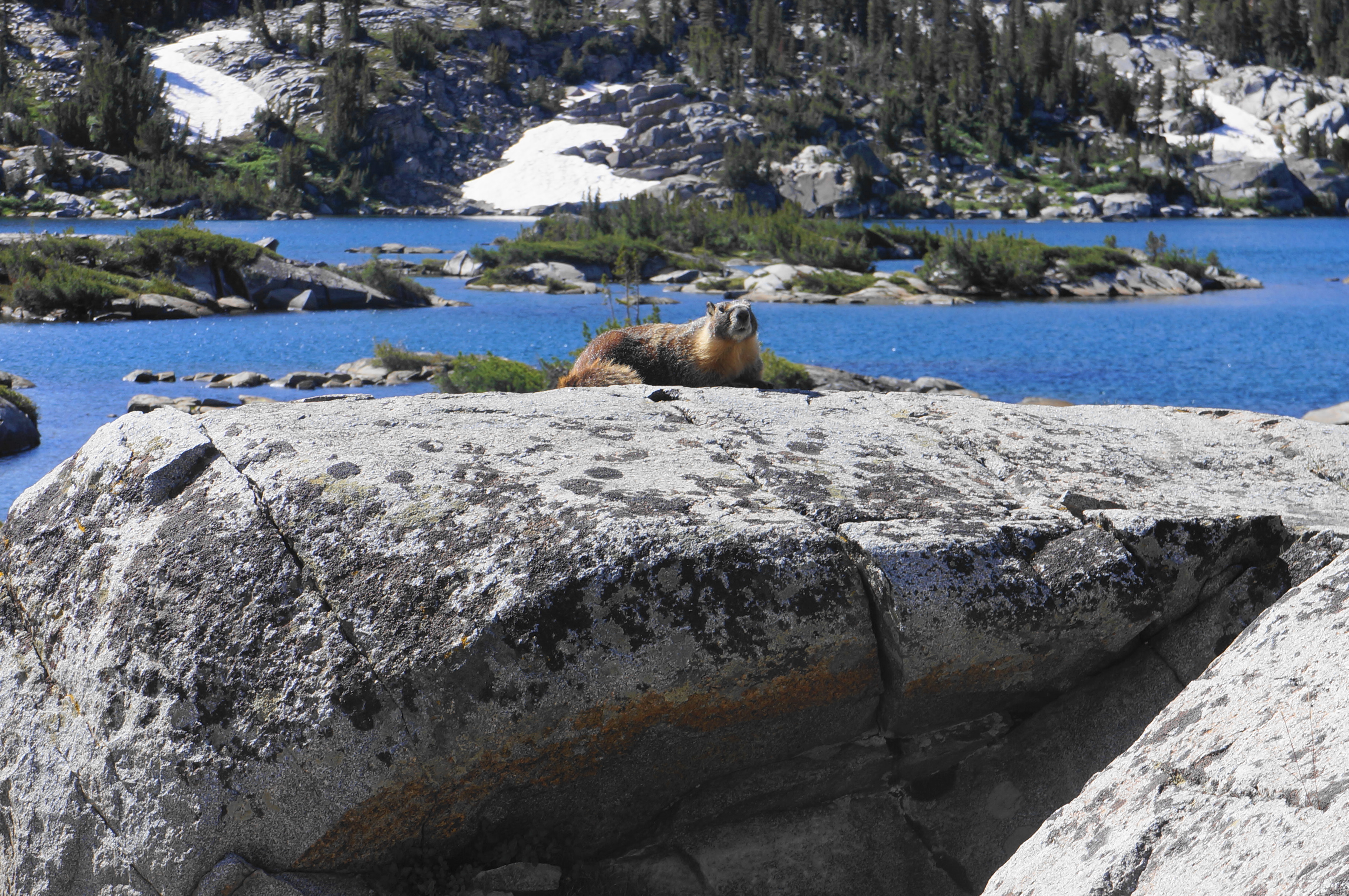
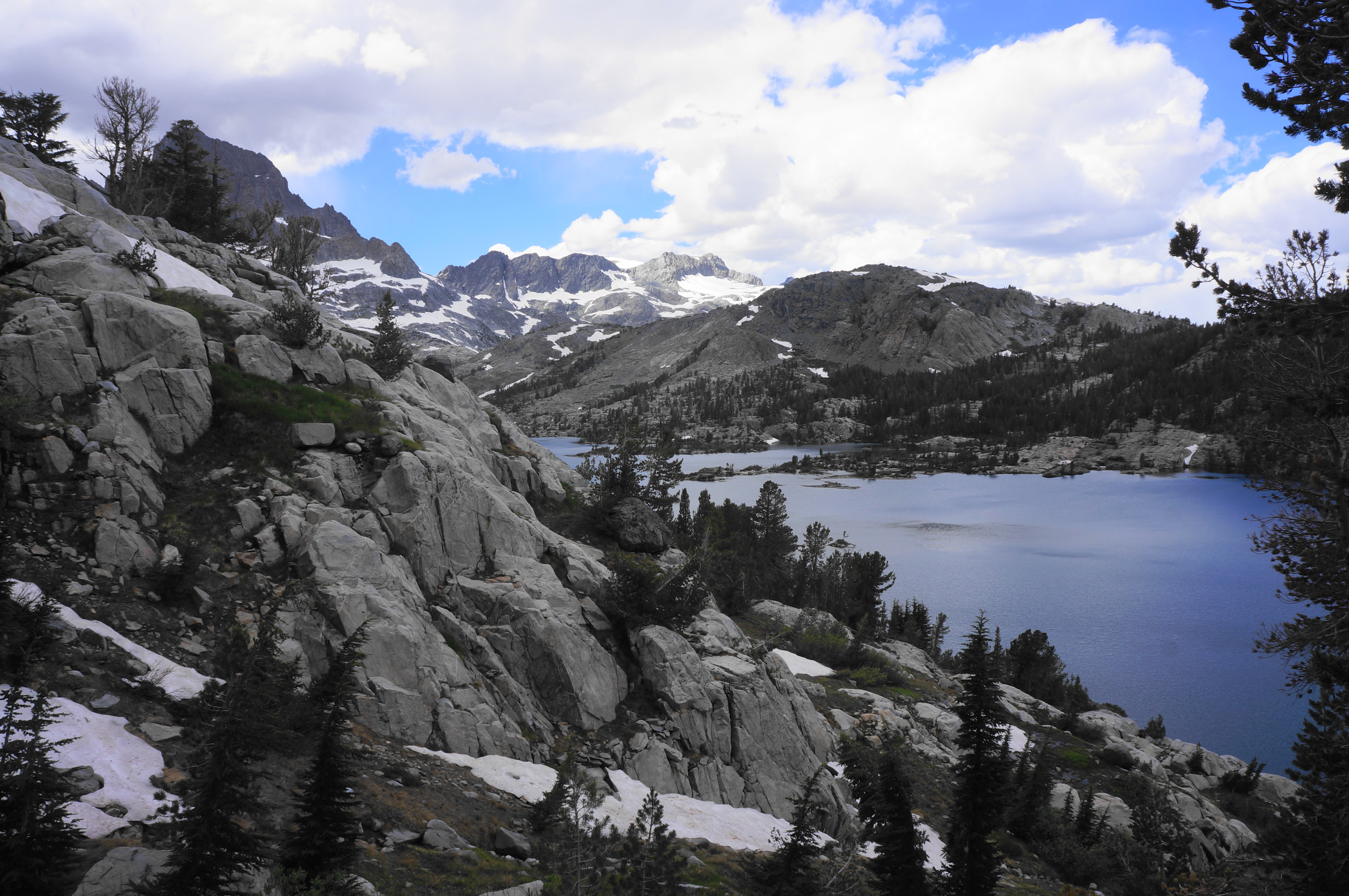
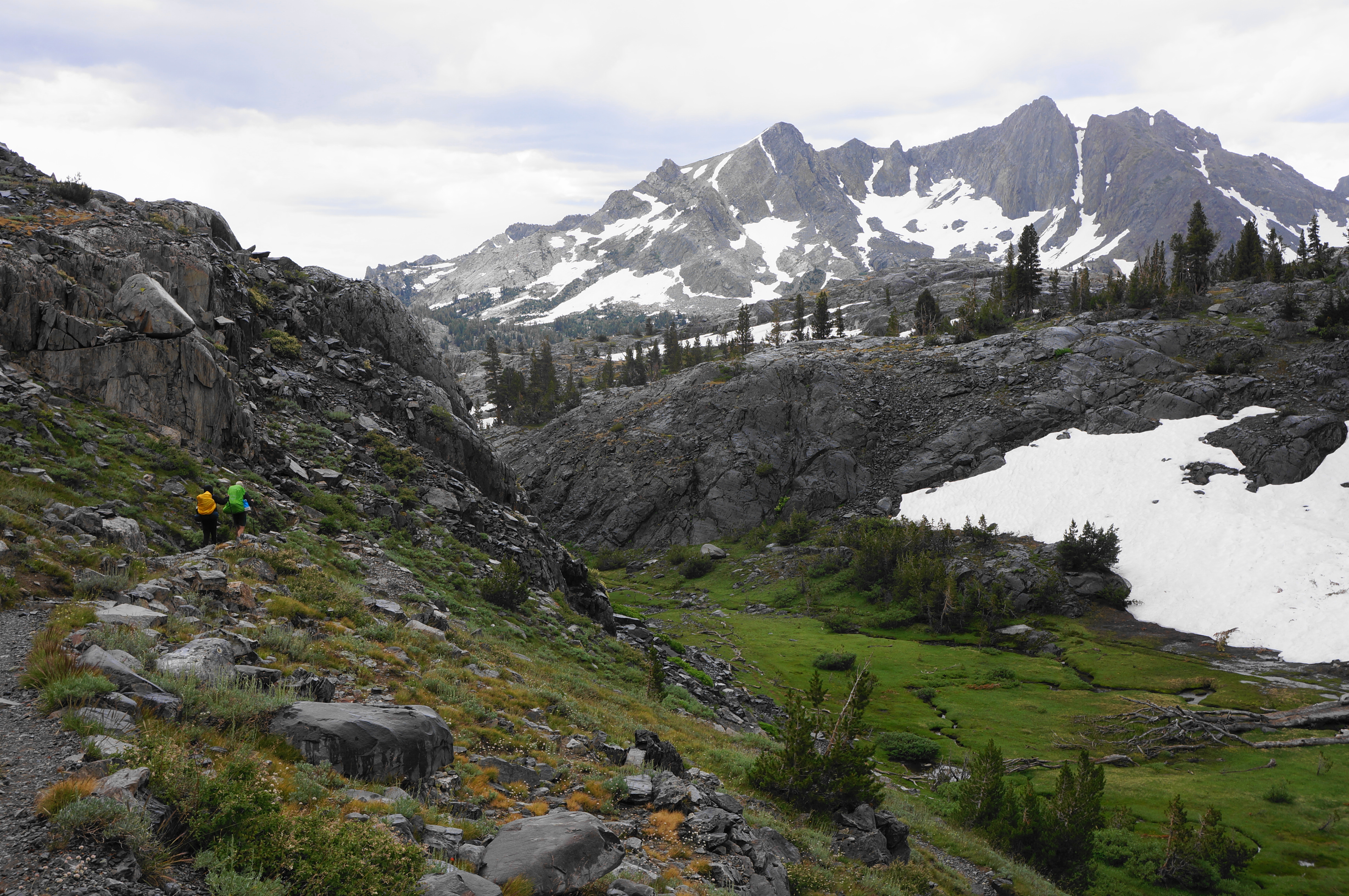
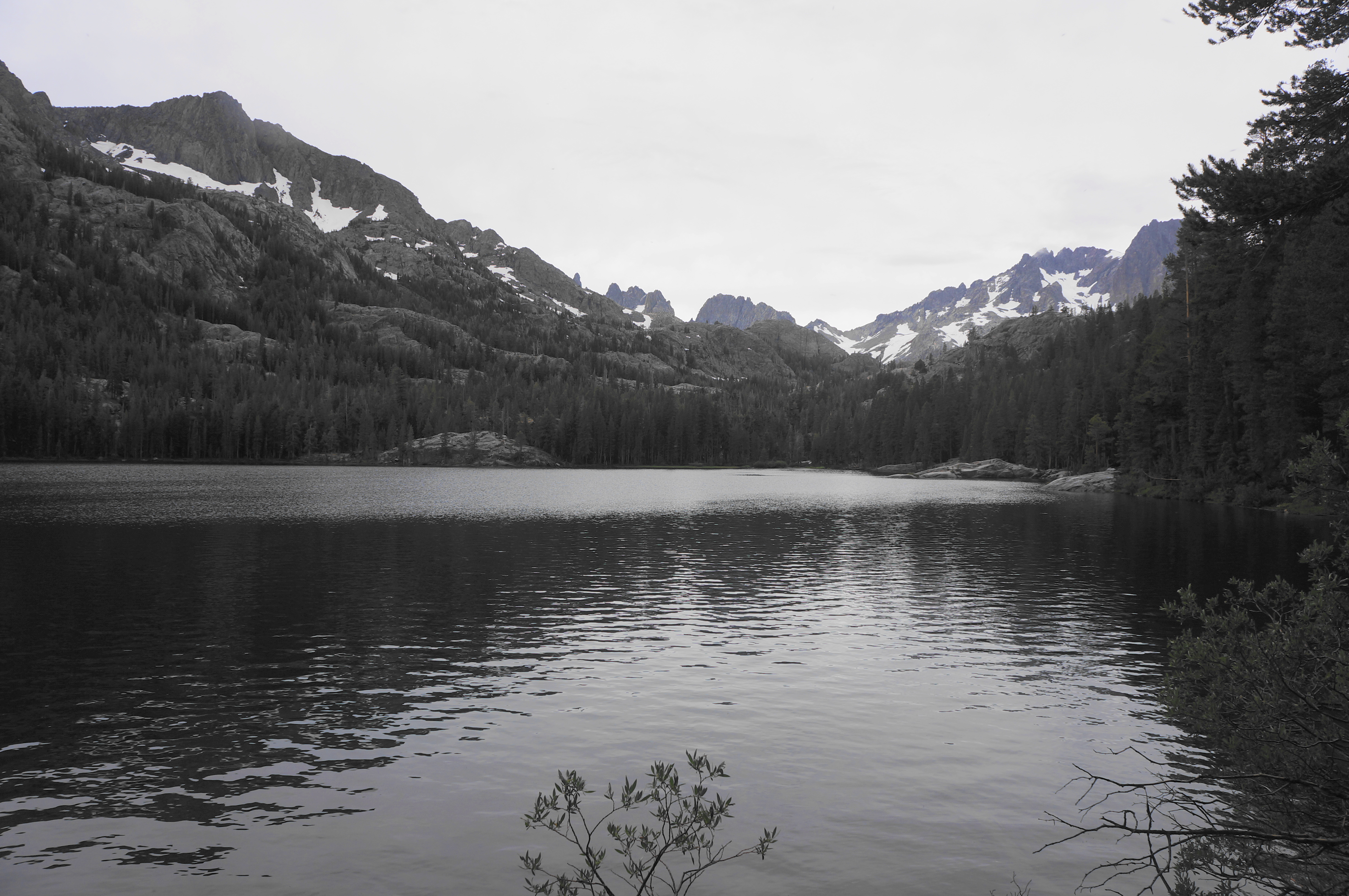
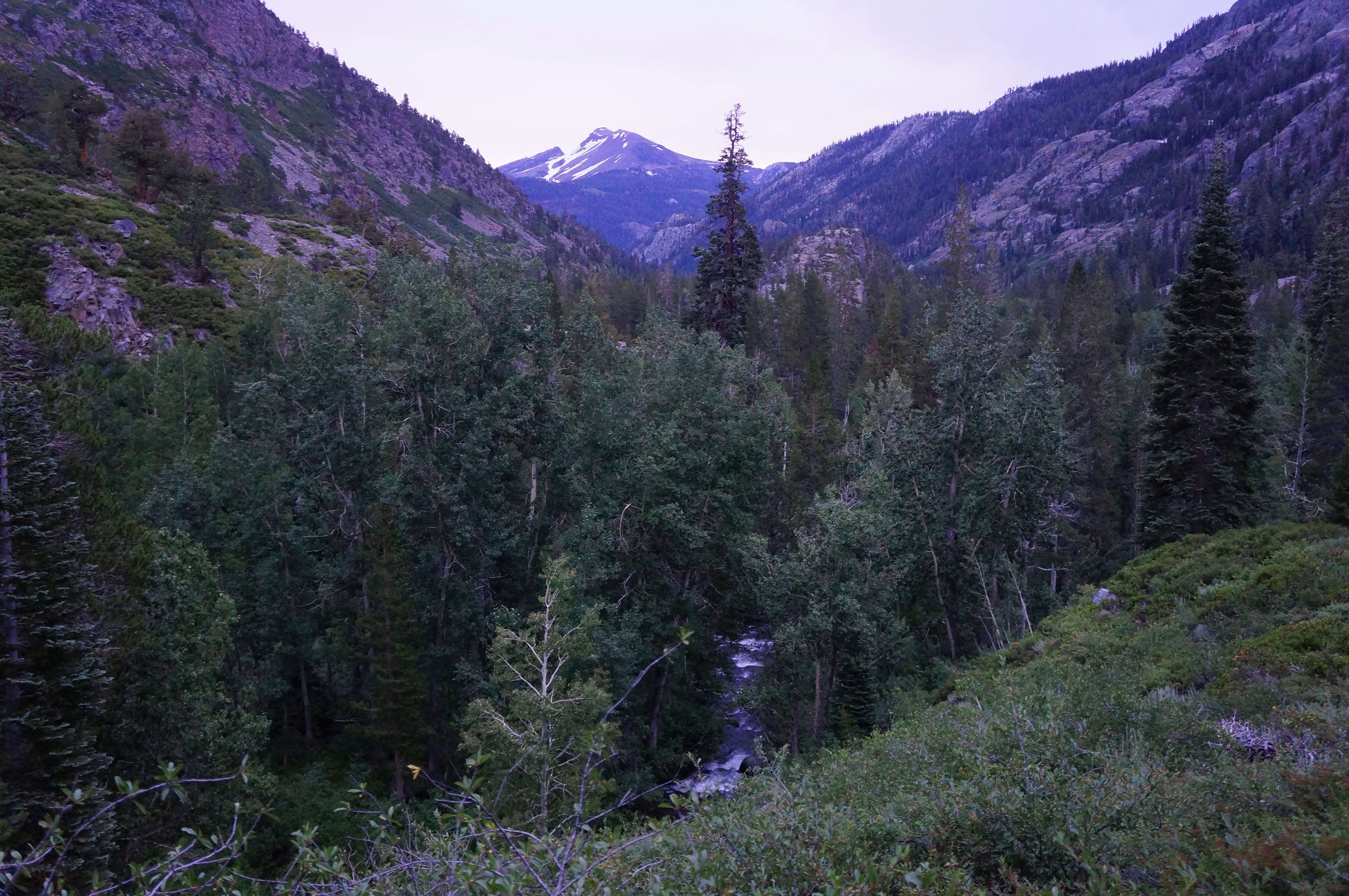
After crossing the outlet of Ruby Lake, the JMT enters a steady uphill section, with eight switchbacks in the shade of a pine forest. Upon rising to a high cut at around 10,200 feet, hikers get their first views to Garnet Lake, rivalling Thousand Island in size and beauty. Again Banner Peak stands tall, with Mount Ritter just beyond. Past the lake to the south lies an unnamed ridge—one you’ll become intimately familiar with soon enough—with the impressive Volcanic Ridge and the Minarets rising beyond.

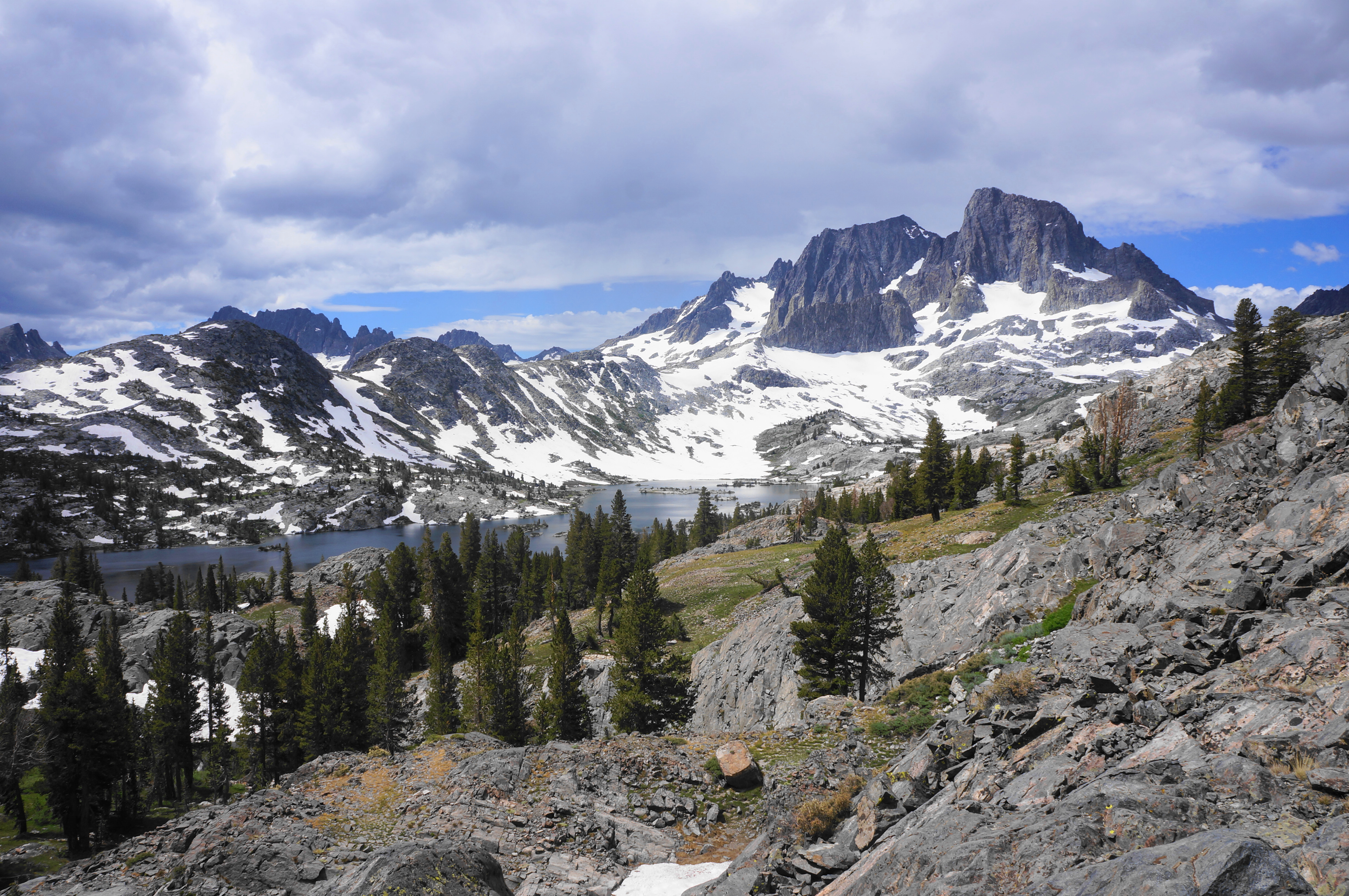
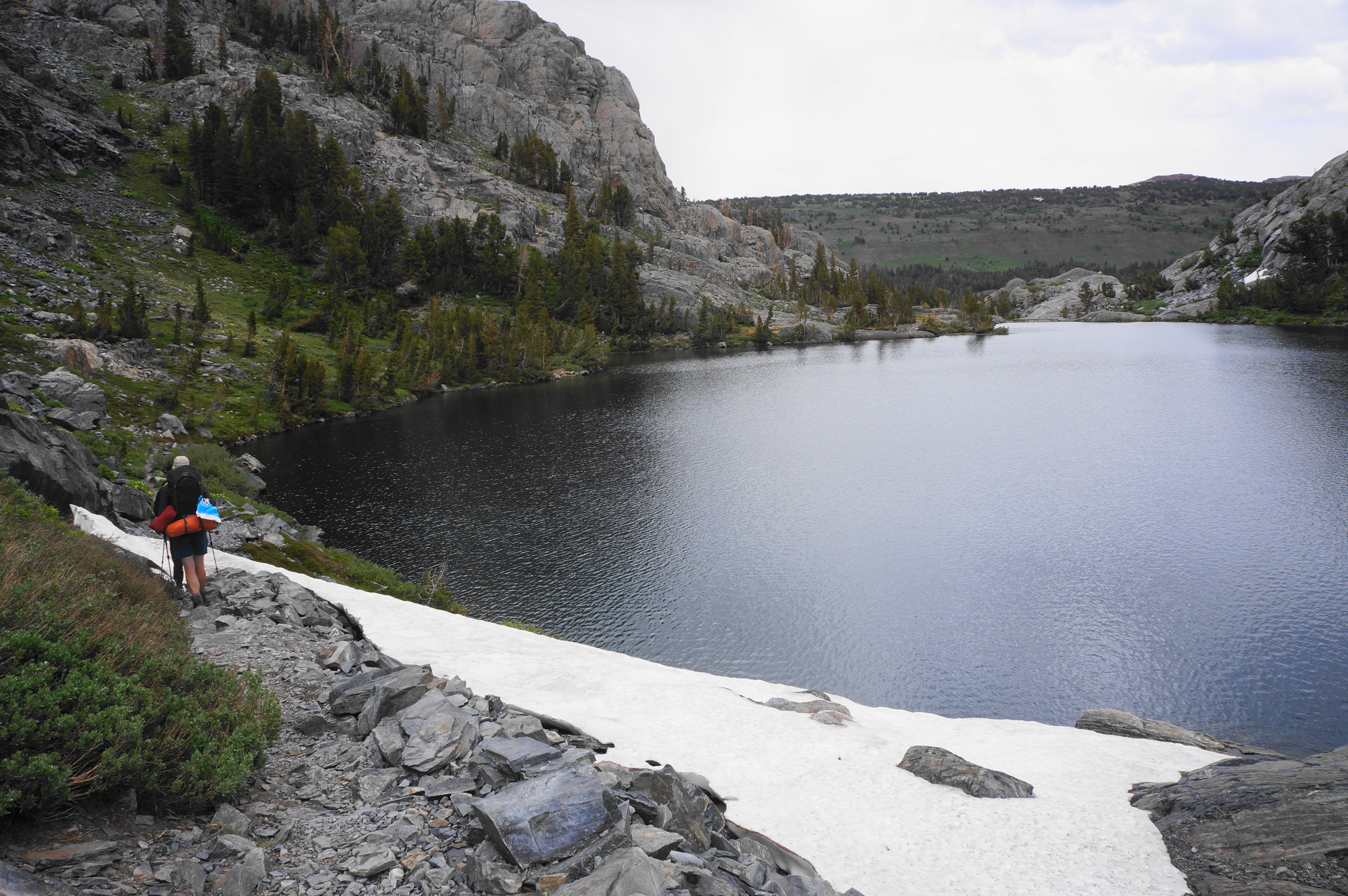
Having cresting the pass, hikers are rewarded with a steady downhill with continued views down to Garnet Lake. The trail weaves and bobs to avoid granite shelves and outcrops, dropping to a junction situated about two miles from Thousand Island Lake. Stay left on the JMT, and descend about a dozen switchbacks as the trail snakes down to the lakeshore. A popular camping area, just as the trail approaches the shores, marks roughly the start of the “legal” camping (setting up tents within ¼ mile of the lake outlet is prohibited).


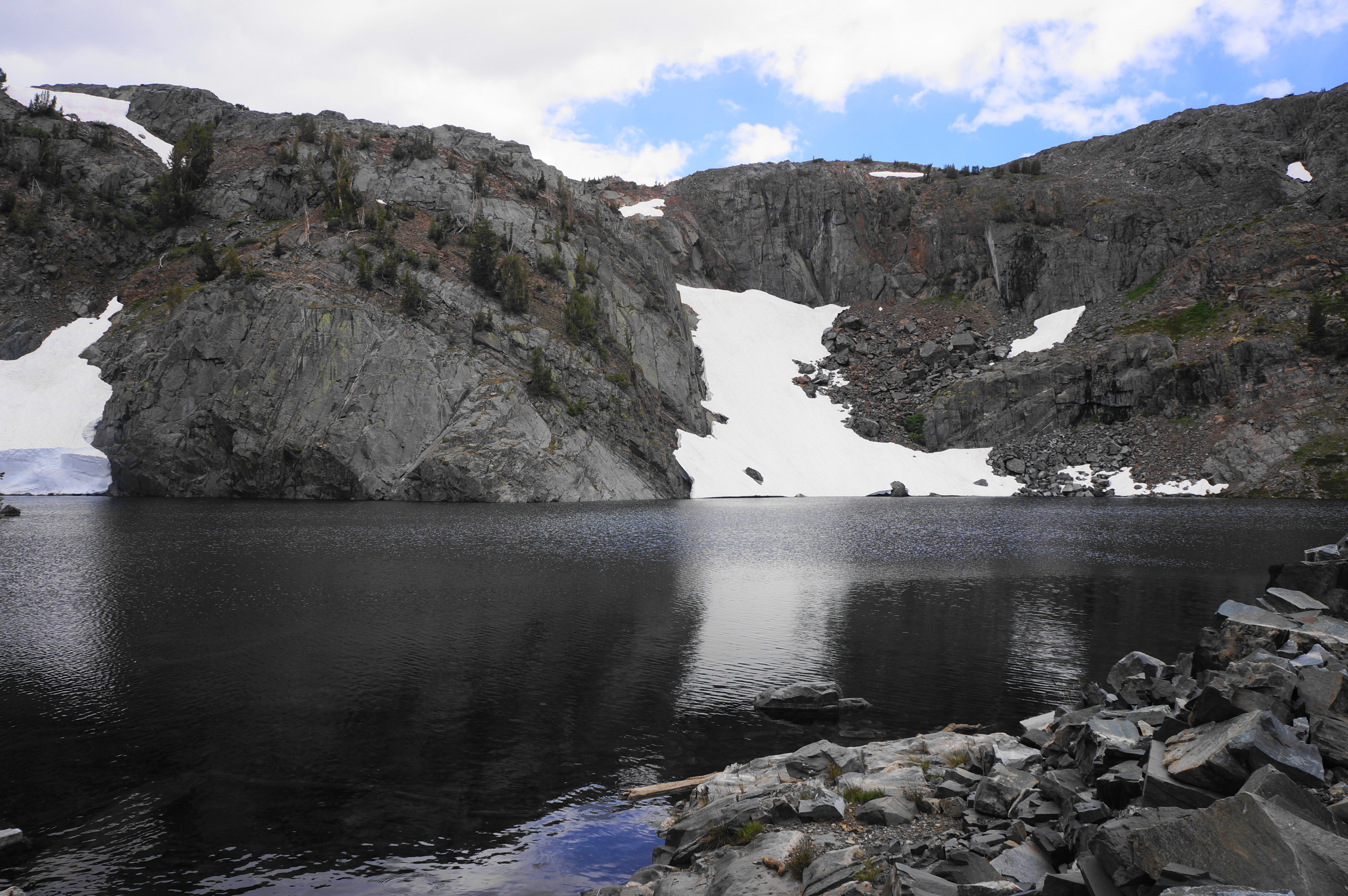
It is relatively easy walking from here down to the outlet at the eastern end of Garnet Lake. Cross a thin bridge over a partially-reinforced dam and stay right at the junction with the unmaintained Garnet River Cutoff Trail, which descends steeply to the San Joaquin. The onward, southbound JMT gently follows the southern lakeshore, eventually coming again to a (smaller, less popular) camping area with lovely views.

The roller coaster continues as hikers enter the most significant remaining uphill of the hike. The elevation gain is only around 150 feet but, with heavy packs, feels tougher, rising up switchbacks to the timberline and a windswept ridgetop. The rock here changes from smooth granite to a red and black metavolcanic mix, and the trail skirts a seasonal tributary as it says goodbye to Garnet Lake.


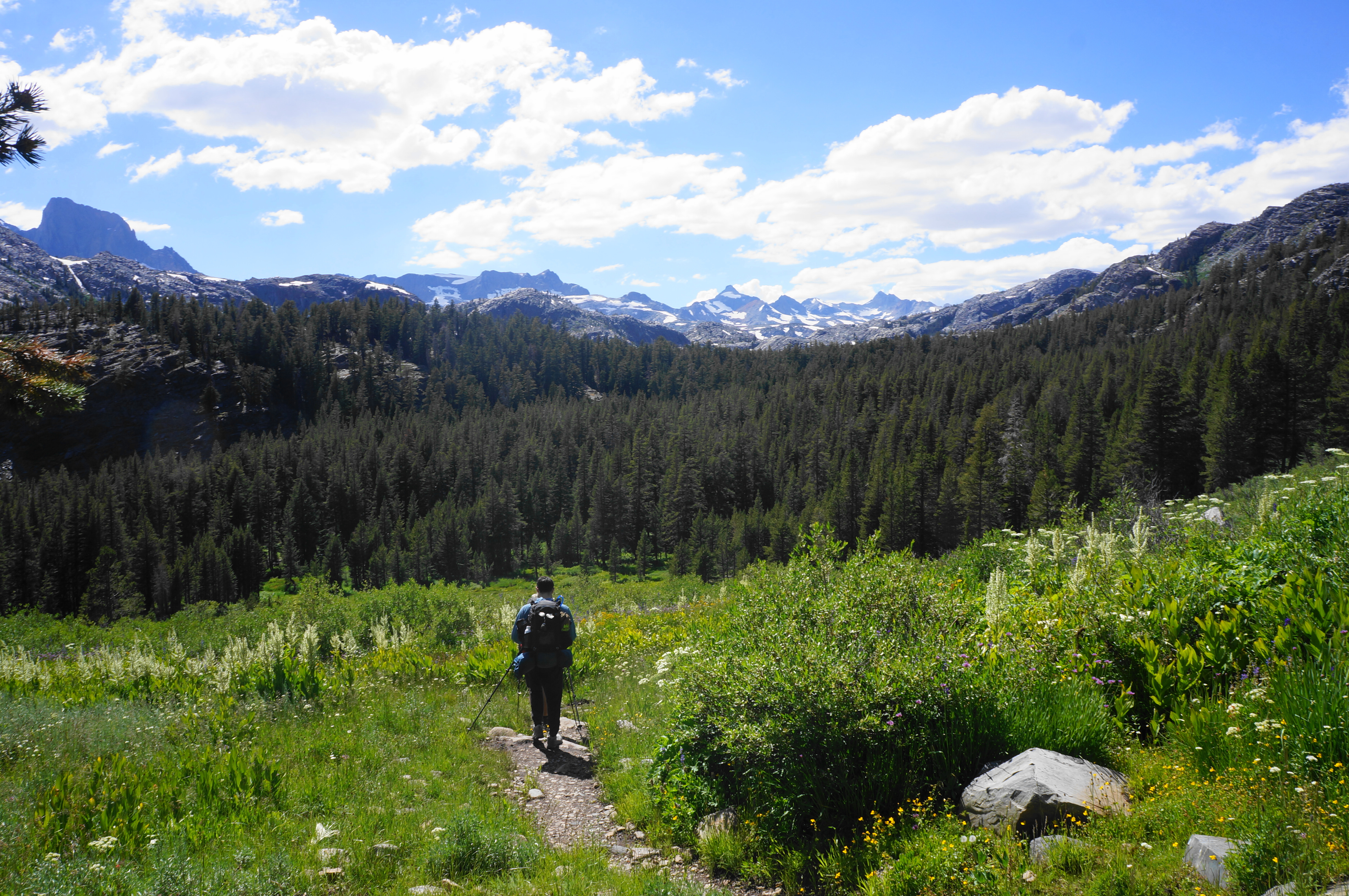
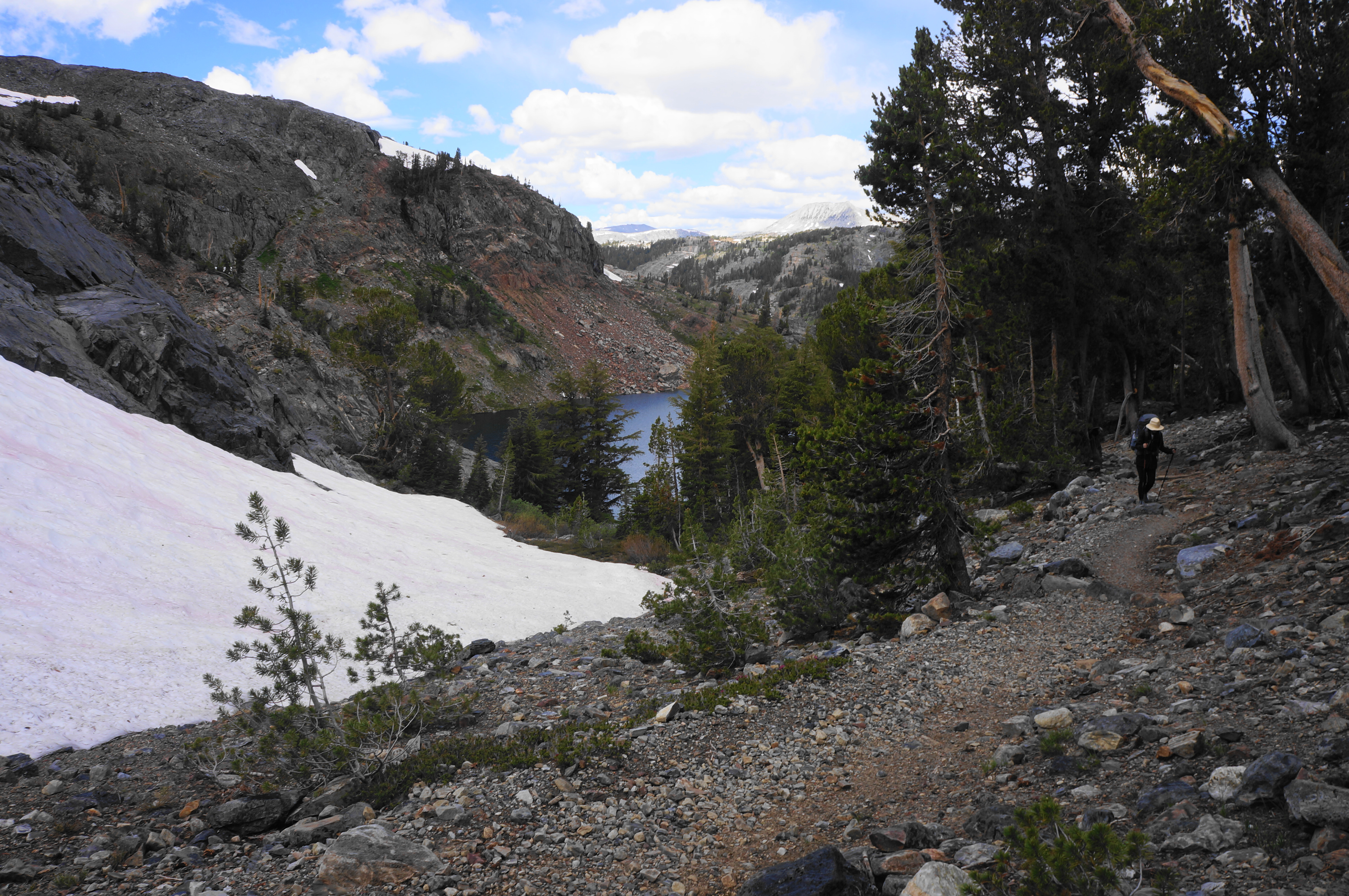
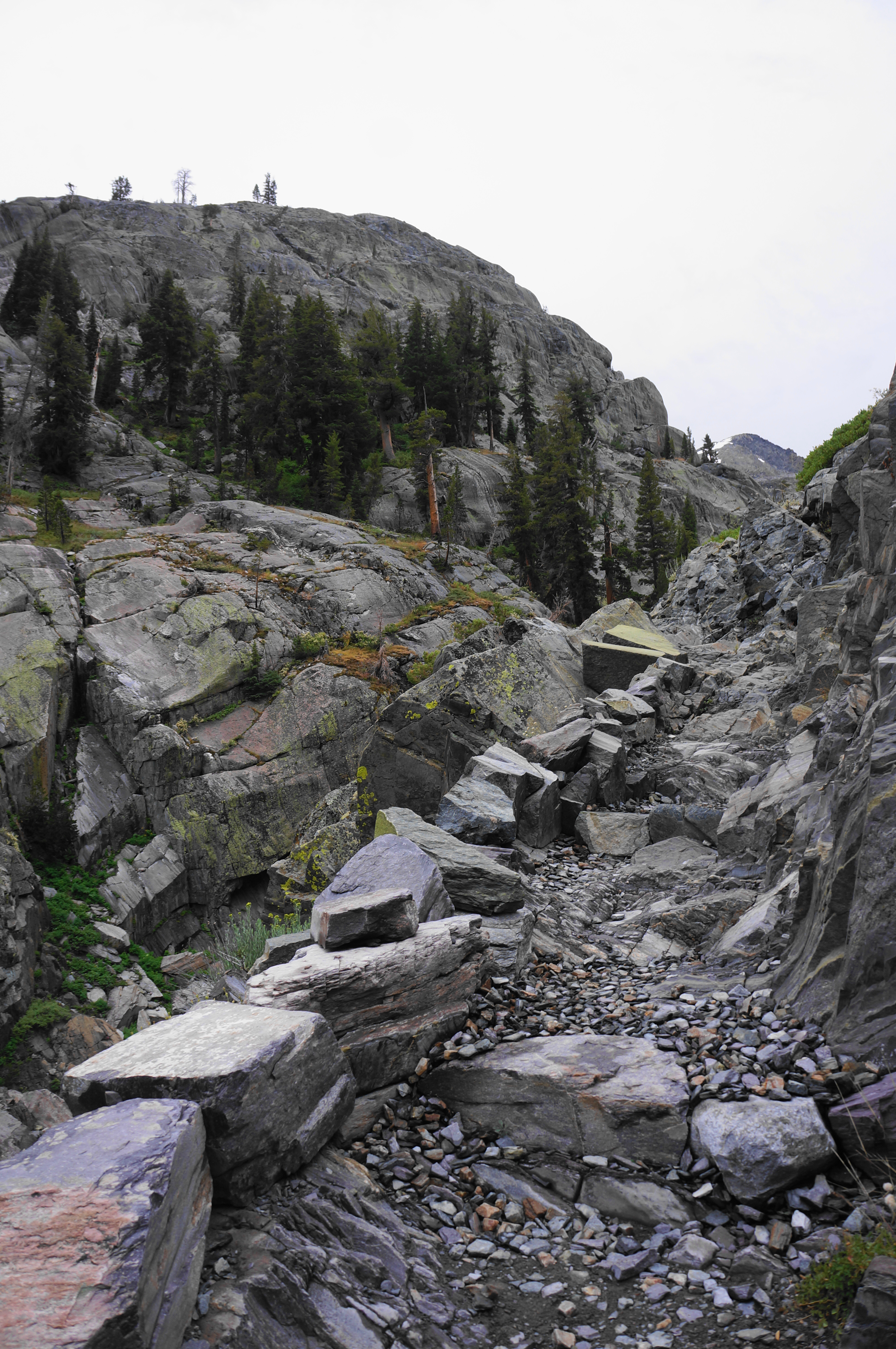
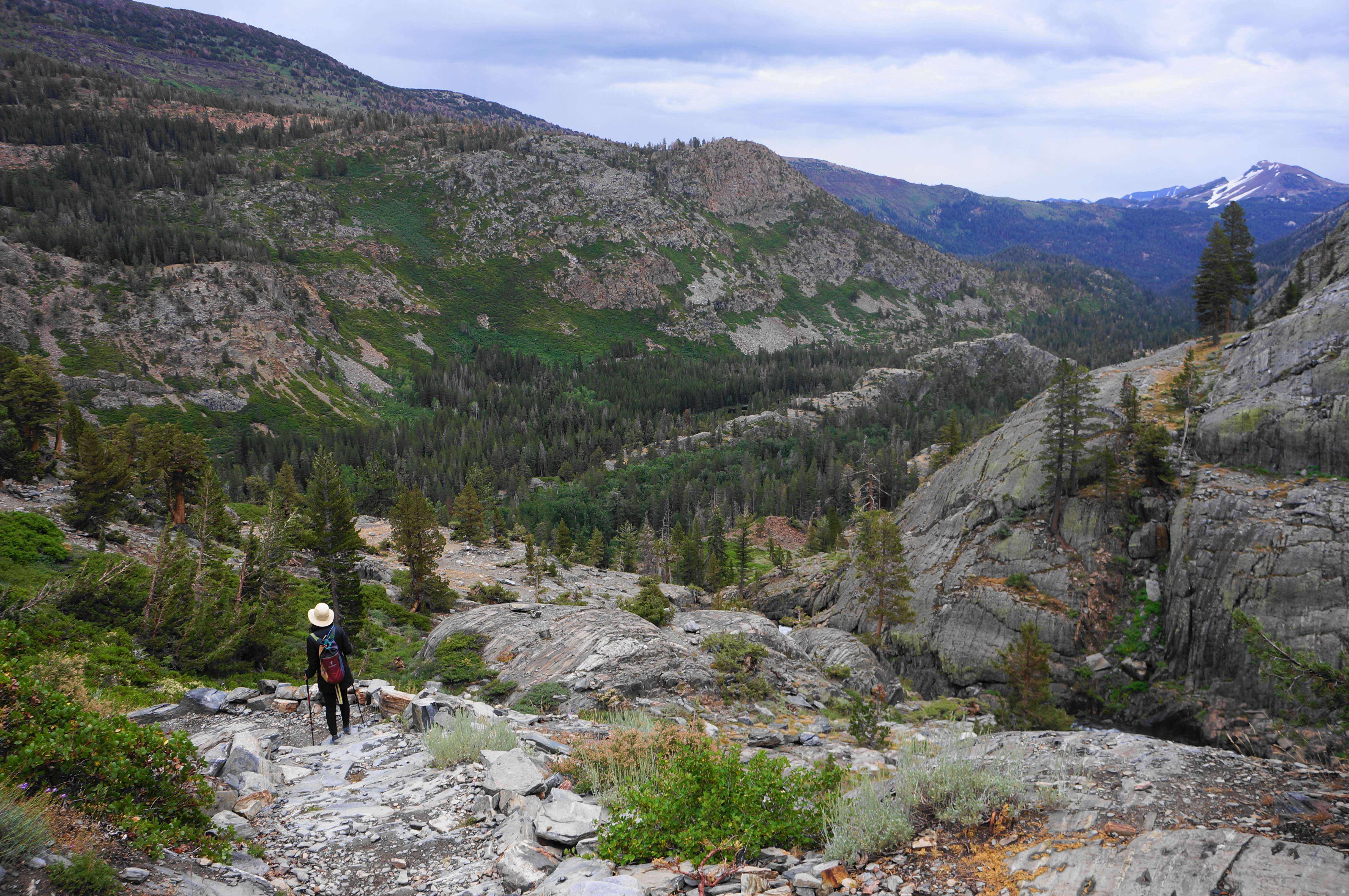
Cresting this unnamed ridge reveals a desolate scree, with loose rock littering the trail. The lush valley beyond, however, is more inviting, set below the crags of the Minarets and Volcanic Ridge. Follow another drainage back into forest cover—sporadic at first, then quite dense. The JMT sheds more than 1,200 feet between the ridgetop and Shadow Lake, but it is spaced out across about 2.5 miles, making for a steady but relatively pleasant descent.


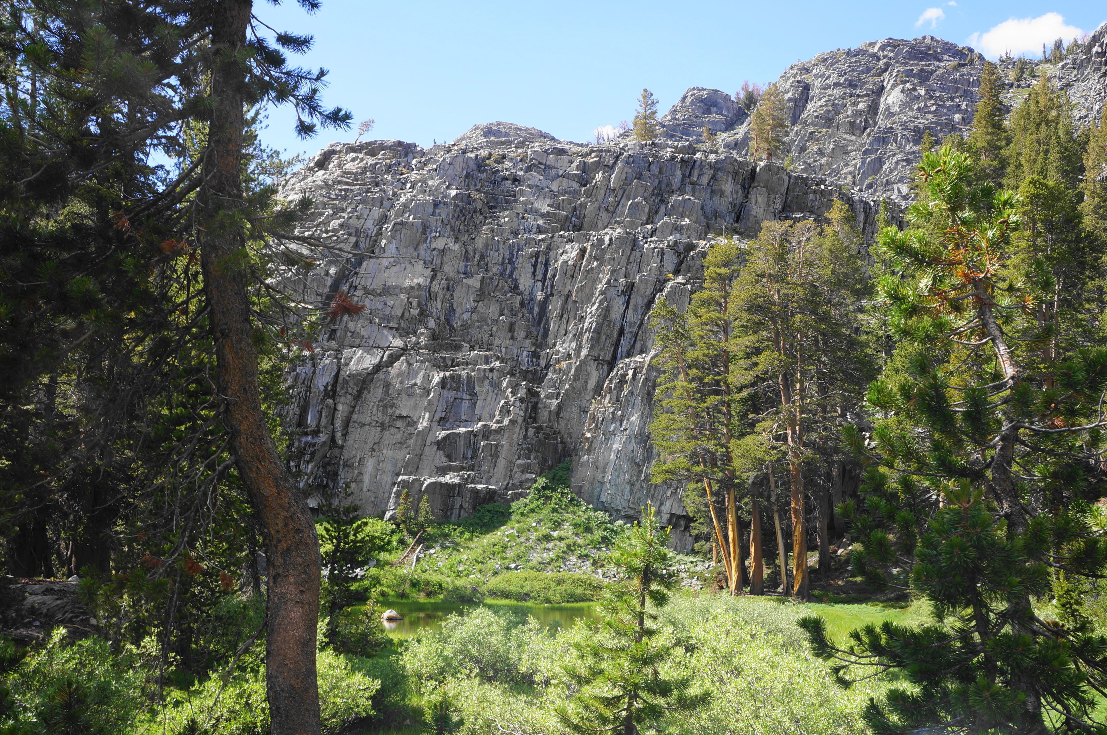
At one point about halfway down to the Shadow Creek drainage, a granitic outcrop reveals nice views to the Minarets. This is a nice place to stop for a short break before continuing on.


Soon the descending path comes to a usually-flowing tributary, which soon turns into cascades that are but a preview of the more impressive flows of Shadow Creek below. Follow the meandering path as it skirts granite slabs and runs in and out of heavy pine forest, eventually culminating at a junction where the JMT merges with the Shadow Creek Trail. Those seeking the detour to Ediza Lake should head right here; the lake is positioned about 1.7 miles up the valley. Others, however, should bear left, continuing on the JMT as it enters a scenic streamside stretch.


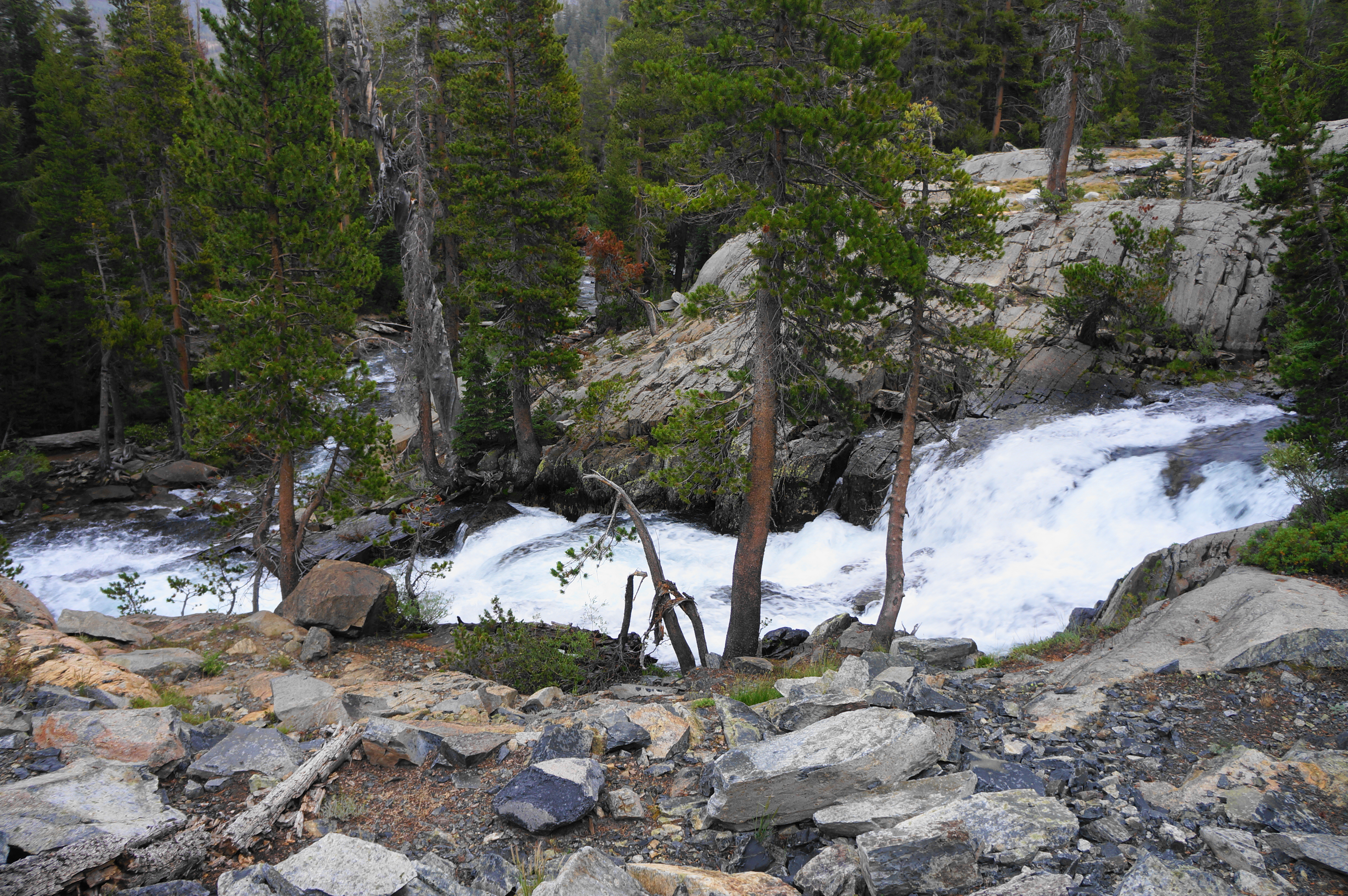
For about ¾ mile, the trail flanks the northern banks of Shadow Creek, which forms an impressive set of cascades and inviting pools. (Note: Camping in this area, however, is prohibited.) One can soon make out part of Shadow Lake (which could be seen across the valley from the High Trail on the prior day).

Shadow Creek Trail to Agnew Meadows (4.0 miles)
The steady descent ends at the spot where Shadow Creek flows into its namesake lake, with the trail splitting again. This time, unless seeking to end up at Red’s Meadow and Devil’s Postpile, hikers should exit the JMT and bear left on the Shadow Creek Trail, which skirts the northern shores of Shadow Lake. (Note: There is no camping allowed on this side of the lake, and few options for setting up camp over the next 1.25 miles.) The next half-mile is mostly level and skirts the lakeshore, making its way toward the outlet.


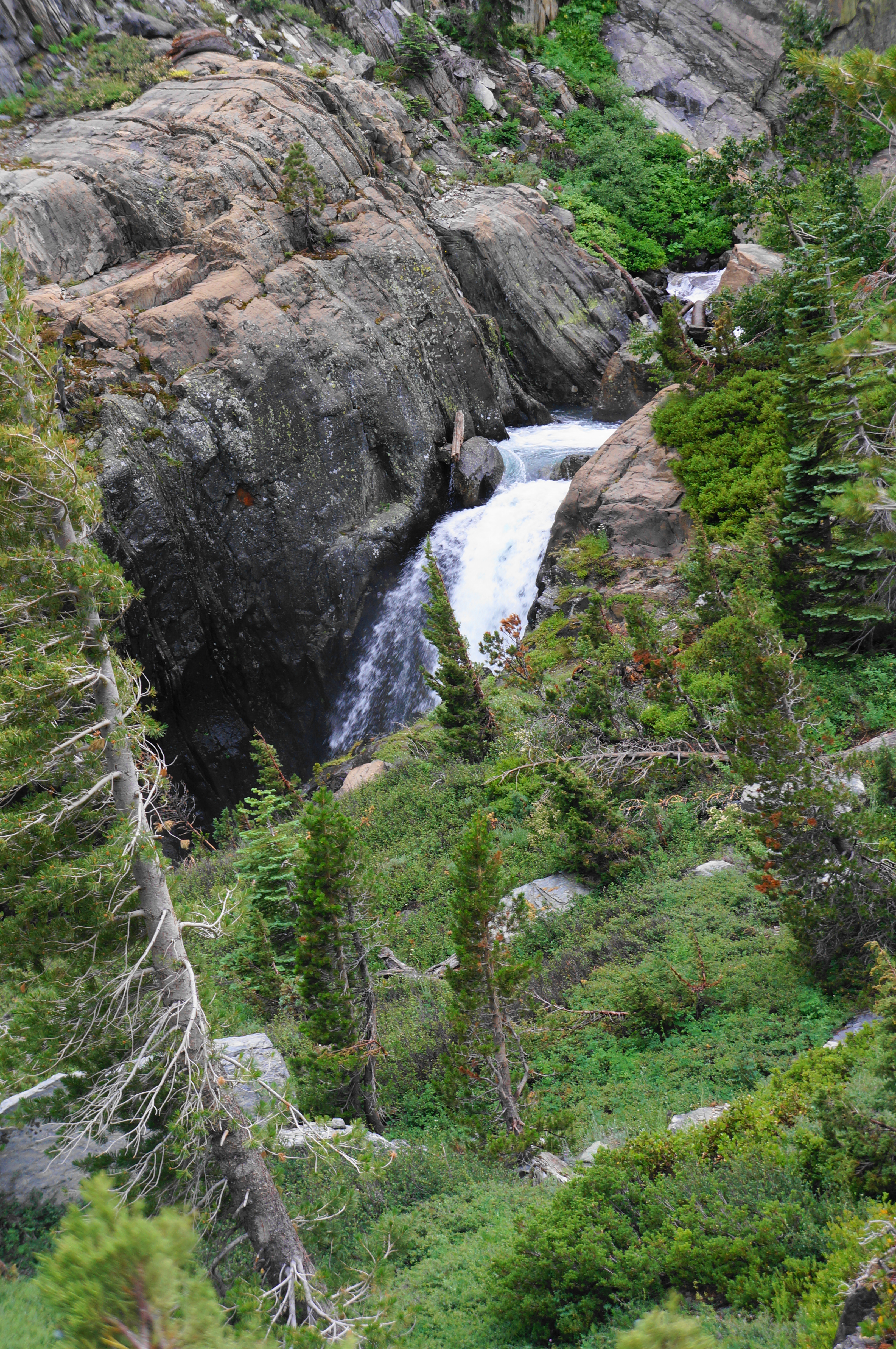
The serene lake eventually gives way to a raucous and awe-inspiring chute, where the water plummets toward the valley below. With the Two Teats visible across the San Joaquin drainage, the Shadow Creek Trail follows a narrow canyon before opening to a cedar-dotted hillscape with expansive views. (Note: Shadow Creek, while beautiful and tempting, lies largely out of reach due to the sharp incision it has cut through the granite cleft.) This downhill stretch offers a dramatic crescendo to the hike, returning to the familiar valley of the San Joaquin.


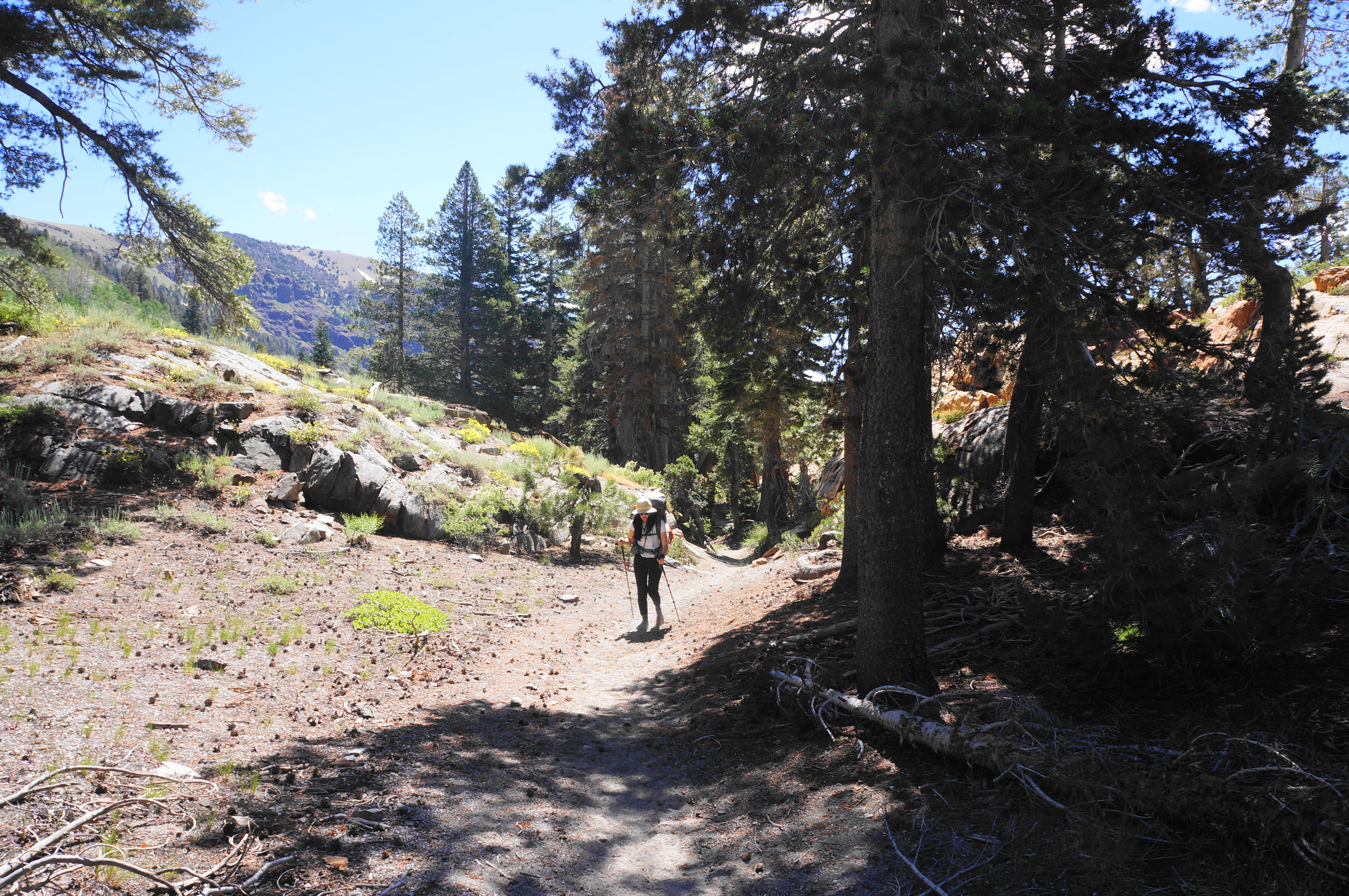
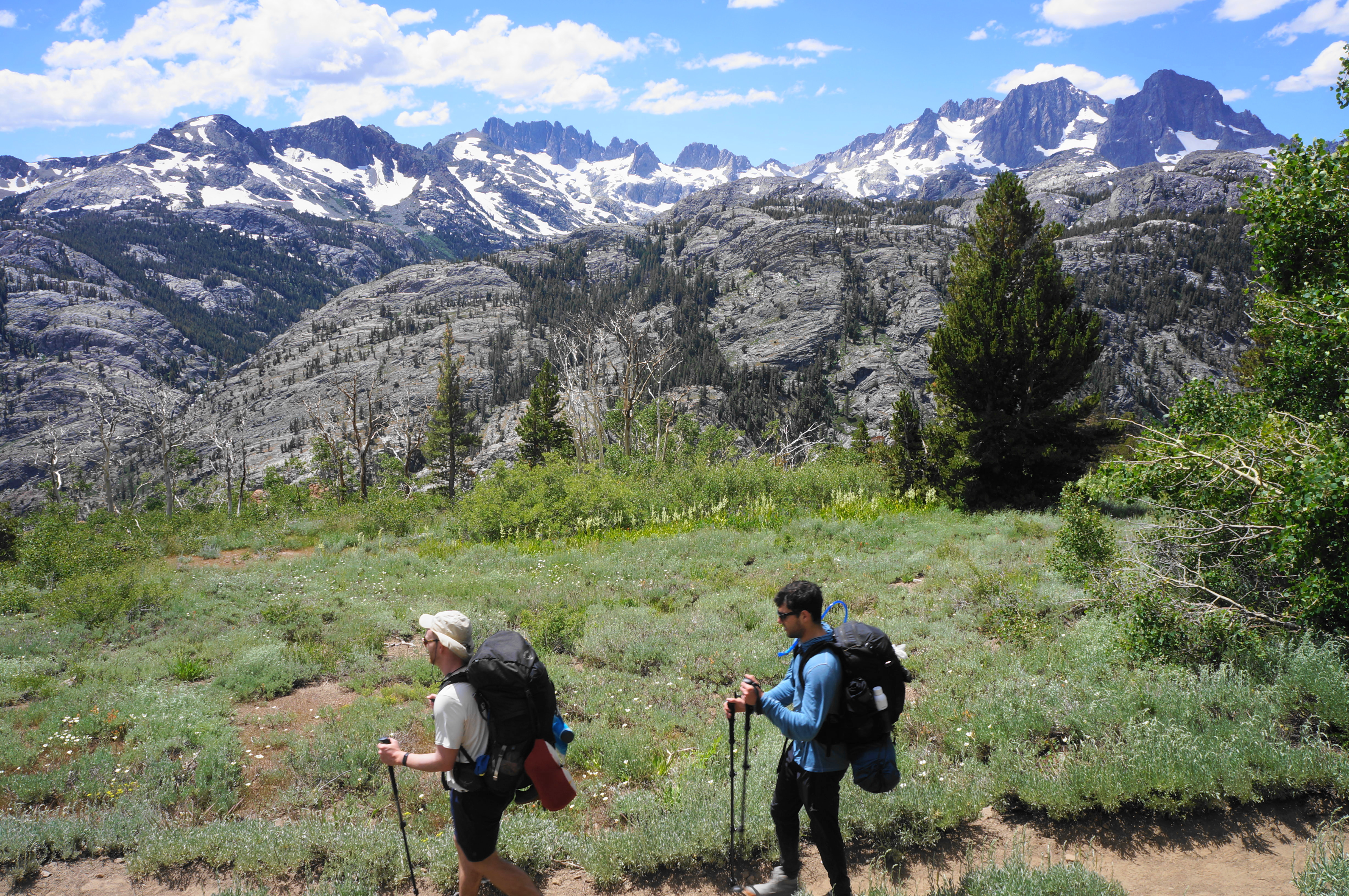
After a steady descent, the trail arcs northward briefly but then cuts back south in the direction of Mammoth Mountain, visible again in the distance. Soon the Shadow Creek Trail comes to a bridge crossing over the Middle Fork of the San Joaquin River, here raging quicker than the last time one traversed the stream near the outlet of Thousand Island Lake.
There are some good camping spots just beyond the crossing, set in a comely, wooded flat. Hikers pushing onward can continue into an easy stretch with a slight downhill, bearing right at a junction with the River Trail. Passing through woods that would appear to be ideal for a bear sighting (alas, we did not see any), the trail is set back from the river but soon passes the buggy Olaine Lake, considerably more modest than the others encountered on the hike.

There is one last surprise in store, however. Just after a junction, with the route to Agnew Meadows bearing left, the trail moves into a steady uphill again. Agnew Meadows are in fact situated on a shelf about 200 feet above the valley floor, and the trail again comes out into the open with some partial views up and down the San Joaquin drainage.
Bearing southeast on a manzanita-lined slope, the trail comes to another junction; this time stay left and continue as the route skirts the partially-fenced and boggy meadow. Soon enough, about 2.7 miles from the crossing of the San Joaquin River, the hike culminates at the large parking area across the street from the High Trailhead, where the loop began. If you parked here, you are done, but if you need the shuttle, plan to bear right on the road, following it for about 10 minutes back to the shuttle stop along Red’s Meadow Road.


All told, the loop measures around 18 miles, generally a 2-3 trek for most visitors. With good weather and spirits, this is one of the most rewarding short backpacking options in the Sierras, and one that whets the appetite for return visits.

Pingback: Top 10 Hikes in 2023 | Live and Let Hike