
Now on Day 9 of the cross-country excursion, we finally caught a break with the weather—a clear morning in the paradise of the Many Glacier section of Glacier National Park. It came with a catch, however—or two. For one, my hiking partner wasn’t feeling well enough to hike, so I was on my own for the day. For another, with Many Glacier day-use permits very challenging to obtain in the summer, we were resigned to having to arrive prior to 6 a.m. In the end, the latter ended up being a blessing—I decided to take on the lengthy but popular out-and-back to Grinnell Glacier and, despite passing hundreds of hikers on my way back, I had the glacier to myself at around 8:30 in the morning. With nearly half of 2024 remaining, I did not know it at the time—but this ended up being my favorite hike of the year.
“Many visitors come to the park hoping to see glaciers. Ironically, Glacier National Park isn’t the easiest place to see an active glacier.” – Glacier National Park’s “Glacier’s Glaciers” webpage
With climate change decimating the remaining glaciers in the contiguous United States, it is becoming harder and harder to catch sight of these icy wonders before they are gone. In Montana’s Glacier National Park, it was never so easy anyway: most alpine glaciers in the park require a lengthy and arduous hike to reach. (To be fair, this has never been too much of a turn-off, as Glacier tends to attract a more rugged and adventurous clientele than, say, Yellowstone.)
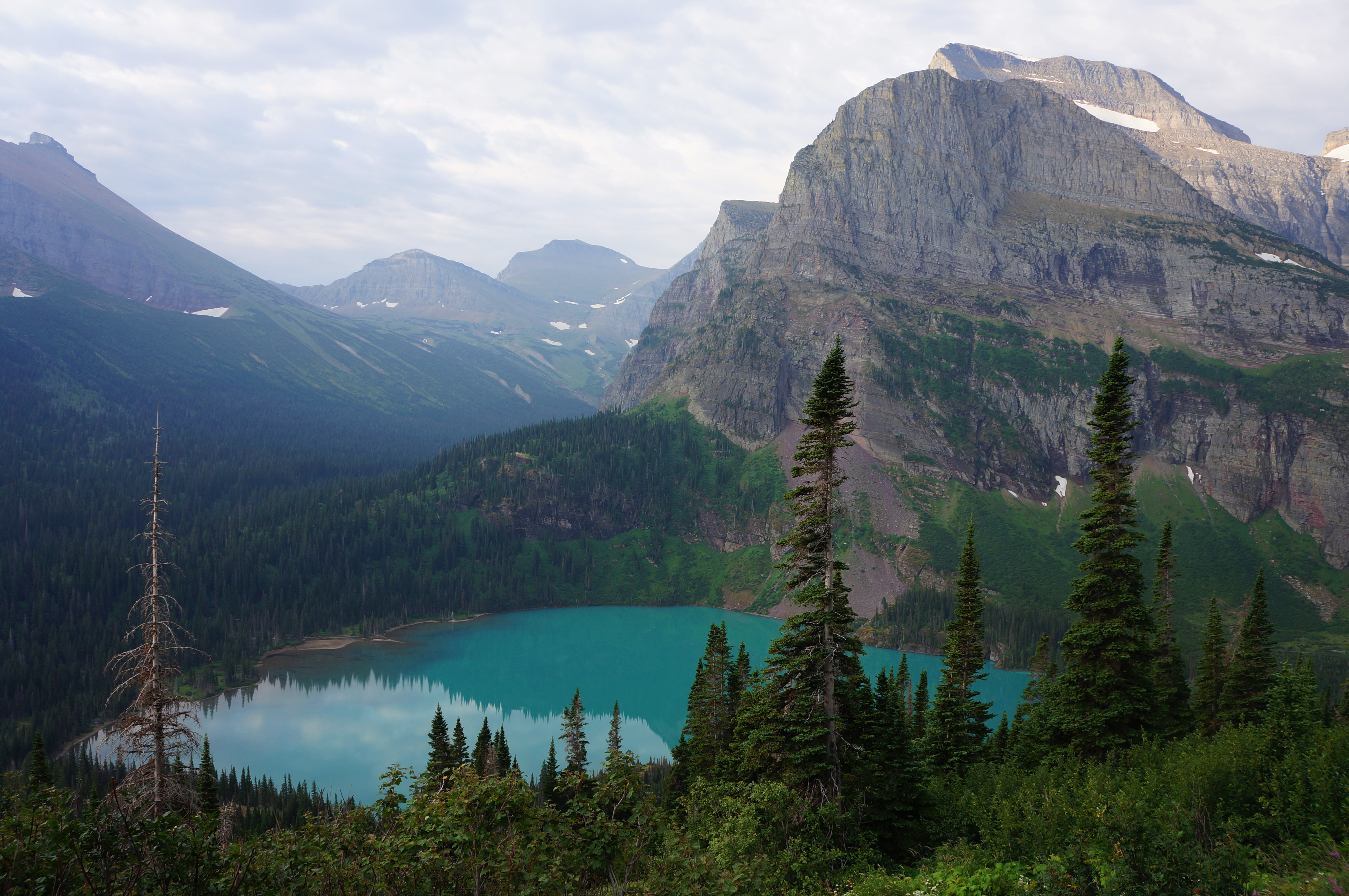
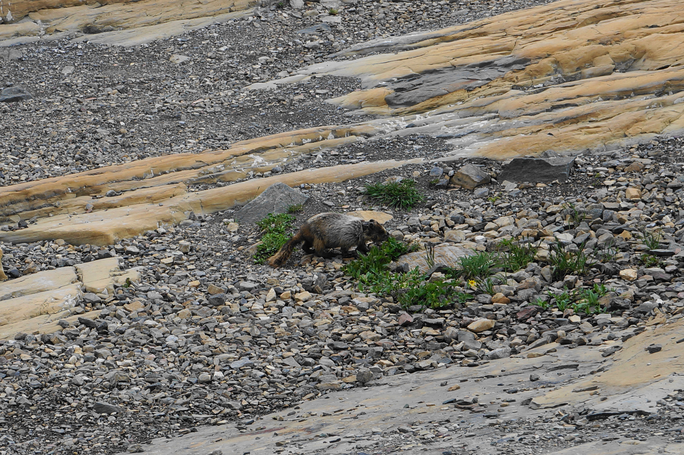
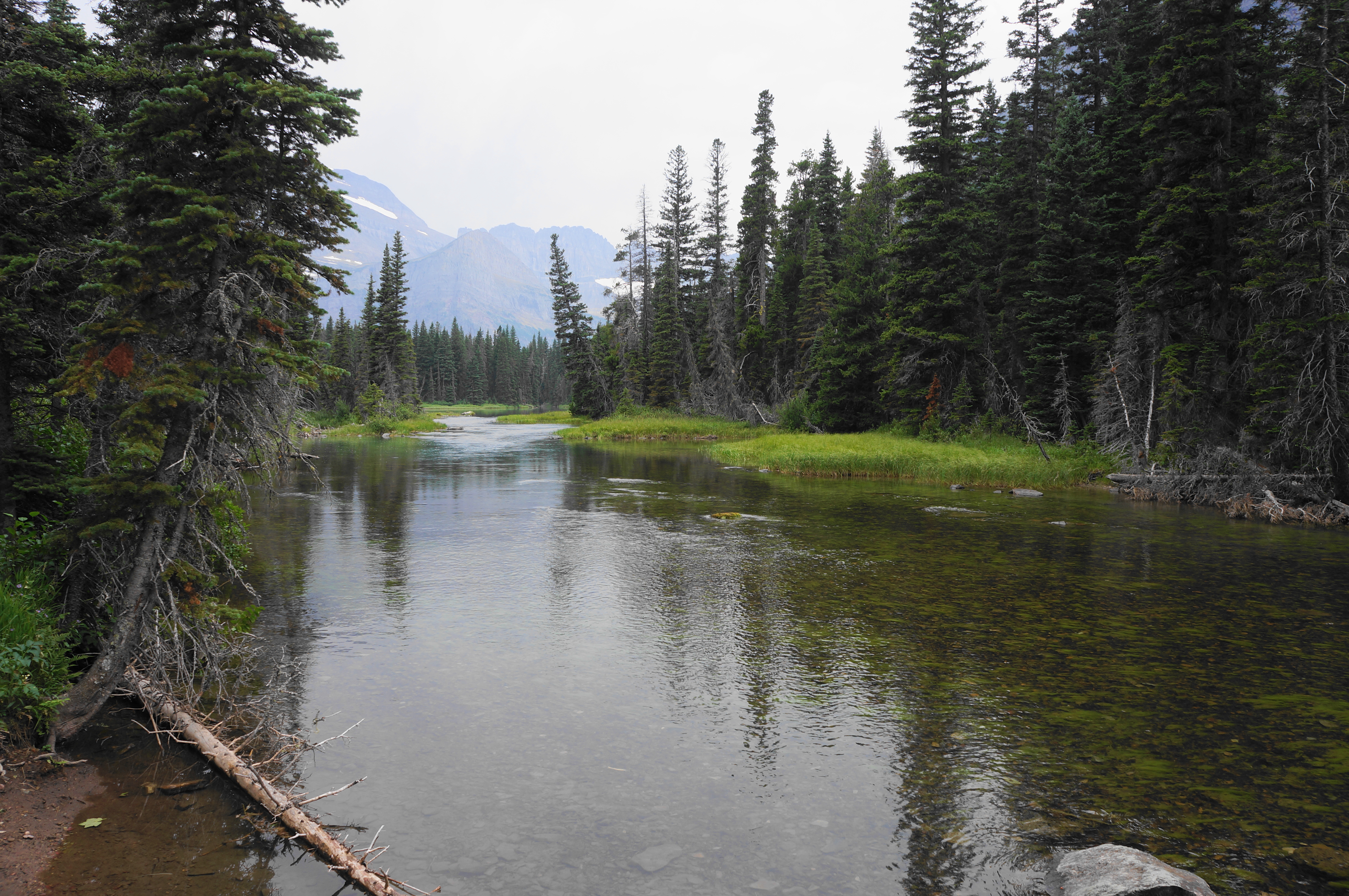
Grinnell Glacier—perhaps the park’s most famous—is a shadow of what it was a half-century ago. But the centuries of glacial activity here have left behind a spectacular set of lakes, valleys, and streamways that are simply dazzling—it does not get much better than this. The strenuous 11-mile hike to Grinnell Glacier described below is not for amateurs (although there are ways—such as taking a pair of boat taxis—to shave off as much as four miles). Visitors here are treated to some of the most scintillating terrain in the Rocky Mountains. Wildlife sightings—including bears, moose, and marmots—are also relatively common, so keep your eyes peeled.

The hike
The “Many Glacier” area is one of the most popular destinations in Glacier National Park, attracting thousands of visitors a day. It’s no wonder why, as the hiking network here is one of the park’s most extensive, with reasonably close access to the Continental Divide. Alas, the summer crowds have put undue strain on the area’s limited parking infrastructure. In recent years, this has meant hikers must obtain a day-use reservation before travelling to Many Glacier. (Note: Visitors can still enter without them, but they must either (a) have a reservation at the lodge or campground or (b) arrive before 6 a.m. In 2025, evidently, a significant construction endeavor is underway, which will require visitors to take a temporary hiker shuttle service—but presumably the driver entry reservation system will return circa 2026.)
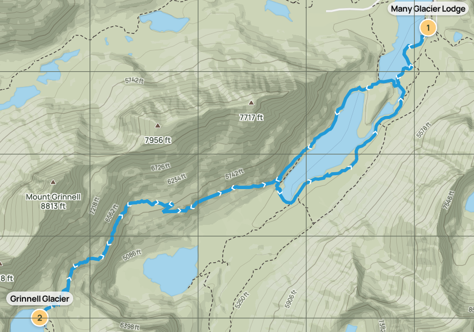
So if you have a day-use permit or arrive before dawn, welcome to Many Glacier! Now, for Grinnell Glacier, there are three main options. First, park at the Many Glacier Lodge and plan on around 11 miles of hiking (the choice described in this post). Second, park instead at the Swiftcurrent/Grinnell Glacier Trailhead, which offers a slightly shorter hike (by about ½ mile) but has a much smaller parking lot. Or third, pay for the round-trip boat tour, which shaves off around four miles of hiking total—but costs a pretty penny ($40.50/person) and often sells out of tickets well ahead of the summer season. If you have all day and are in decent physical shape, I suggest opting for the first: the longest option but also arguably the most scenic (option 2, for example, skips most of beautiful Swiftcurrent Lake).
As an additional wrinkle, I also recommend an alternative return route that follows the lesser-visited eastern shore of Lake Josephine. This adds a ½ mile but offers some variety and more chances to see wildlife before returning to the main route at Swiftcurrent Lake.
Many Glacier Lodge to Grinnell Glacier Trail (1.9 miles)
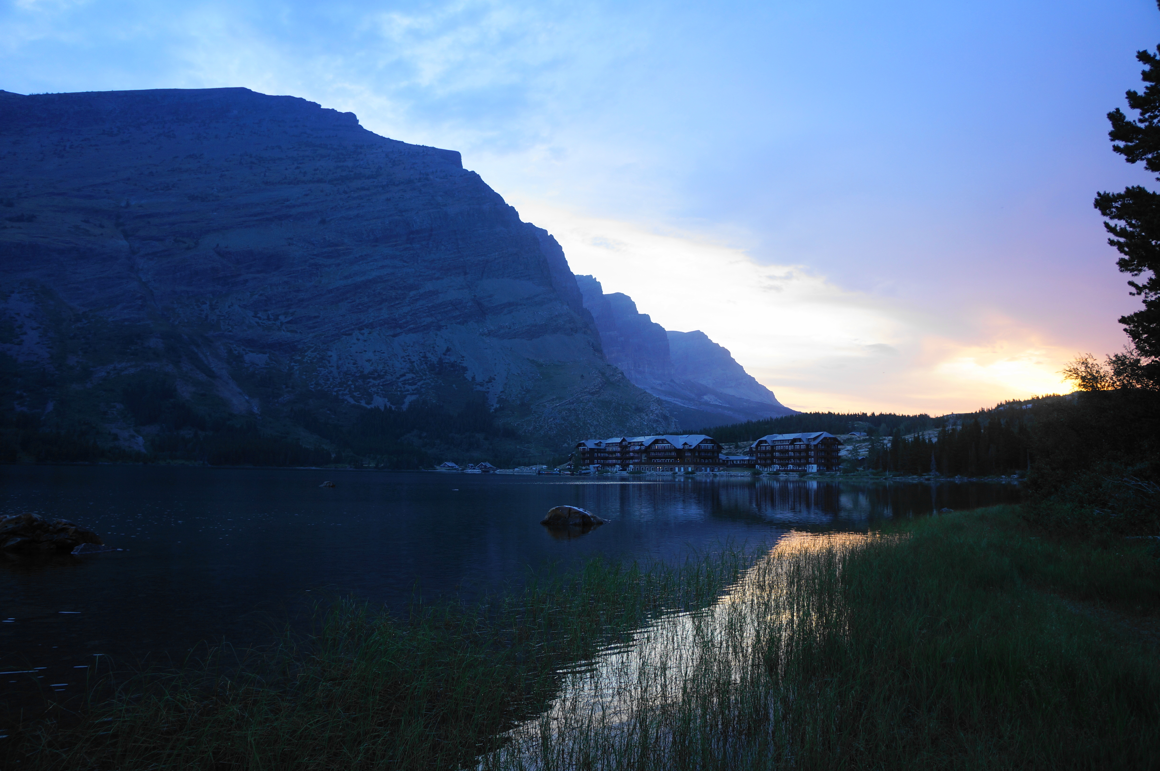
Park in the lot at Many Glacier Lodge, which is set back a bit from the hotel itself. The 3,100-mile Continental Divide Trail (CDT) passes through here—imagine the allure of the mountain lodge (which has all sorts of treats and amenities) after trekking here for months all the way from the southern border with Mexico.
But the CDT is a task for another day—today you are heading for Grinnell Glacier. Look for the trailhead down at the southern end of the lodge, which is flanked here by a gravel driveway (follow the sign for “authorized vehicles only”). Of course, it’s not the road that’s of interest here: the show-stopper lies westward, with the shores of magnificent Swiftcurrent Lake in the foreground, and the spectacular peaks of Mount Gould (9,553’), Grinnell Point (7,716’), Swiftcurrent Mountain (8,436’), and Mount Wilbur (9,321’) beyond. Matched perhaps only by Maroon Bells in Colorado, there are few lakeside trailhead views better than this.

After admiring the view, make your way to the signed trail kiosk, which has a decent map with the hiking options outlined. You are heading for Grinnell Glacier Viewpoint, at the foot of the glacier and shores of Upper Grinnell Lake—5.3 miles away.

Start down the Swiftcurrent Lake Trail as it begins to trace its namesake, visible sporadically through the thick pines. The initial route is woody and partly asphalted, sometimes turning to crushed dirt. After less than 1/10 mile, the path returns to the lakeside. Here one can see Grinnell Point again; this prominent landmark divides the potential hiking thoroughfares roughly in half: it becomes rather clear from the beginning that you are heading left—west and south of the point.


There is another nice vista at around ¼ mile (here I saw a moose in the distance taking a morning bath), with Ptarmigan Valley and Mount Wilbur still visible at this point to the north. At a third turnout at about 1/3 mile, hikers get a better view southwest toward the Grinnell Glacier area—the glacier is not visible (although perhaps it used to be back when it was much larger).

For now, the trail remains level and pleasant, passing a set of cabinets and boat dock before rounding a small cove. From here it is a short walk to the southern end of Swiftcurrent Lake, fed by Cataract Creek. At the junction, bear right and cross a sturdy bridge over the creek, after which the trail soon finds the lakeside again. To the right is the official boat dock for the Glacier Park Boat Company—wasn’t it nice to save a few bucks and walk here yourself?
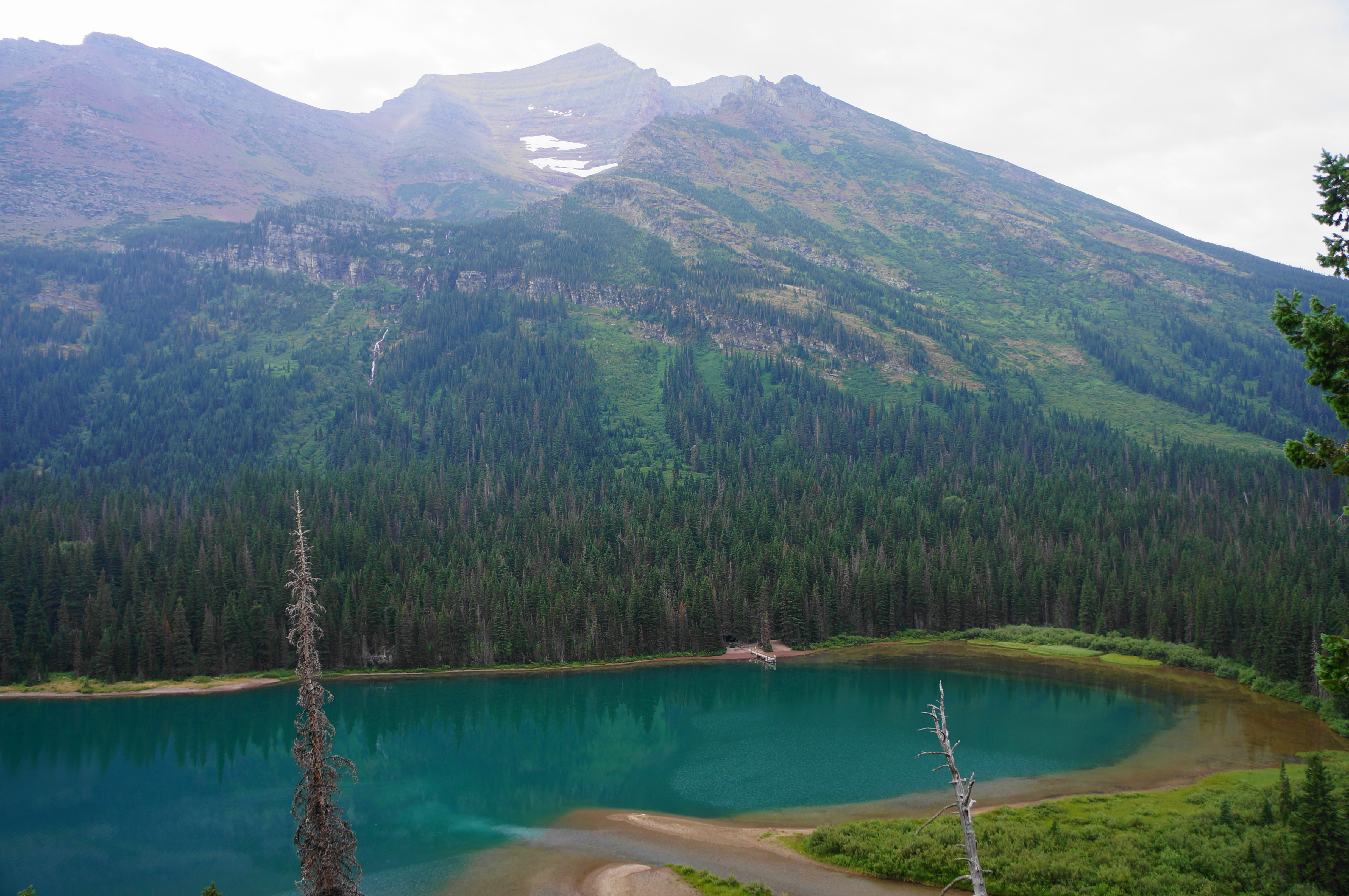
Near the boat dock, there is a four-way junction. The Swiftcurrent Lake Trail continues straight, but your onward journey leads you left—on the North Shore Lake Josephine Lake Trail. This route, bringing the first notable uphill of the hike, still follows a partly-asphalted track, but it soon disintegrates into a dusty and rocky traverse. Rising to a low lip, hikers get their first look at Lake Josephine, larger than Swiftcurrent and hemmed in by steep valley walls on both sides. Rise slightly and stay right at the next fork, with the Lake Josephine boat dock visible down below.
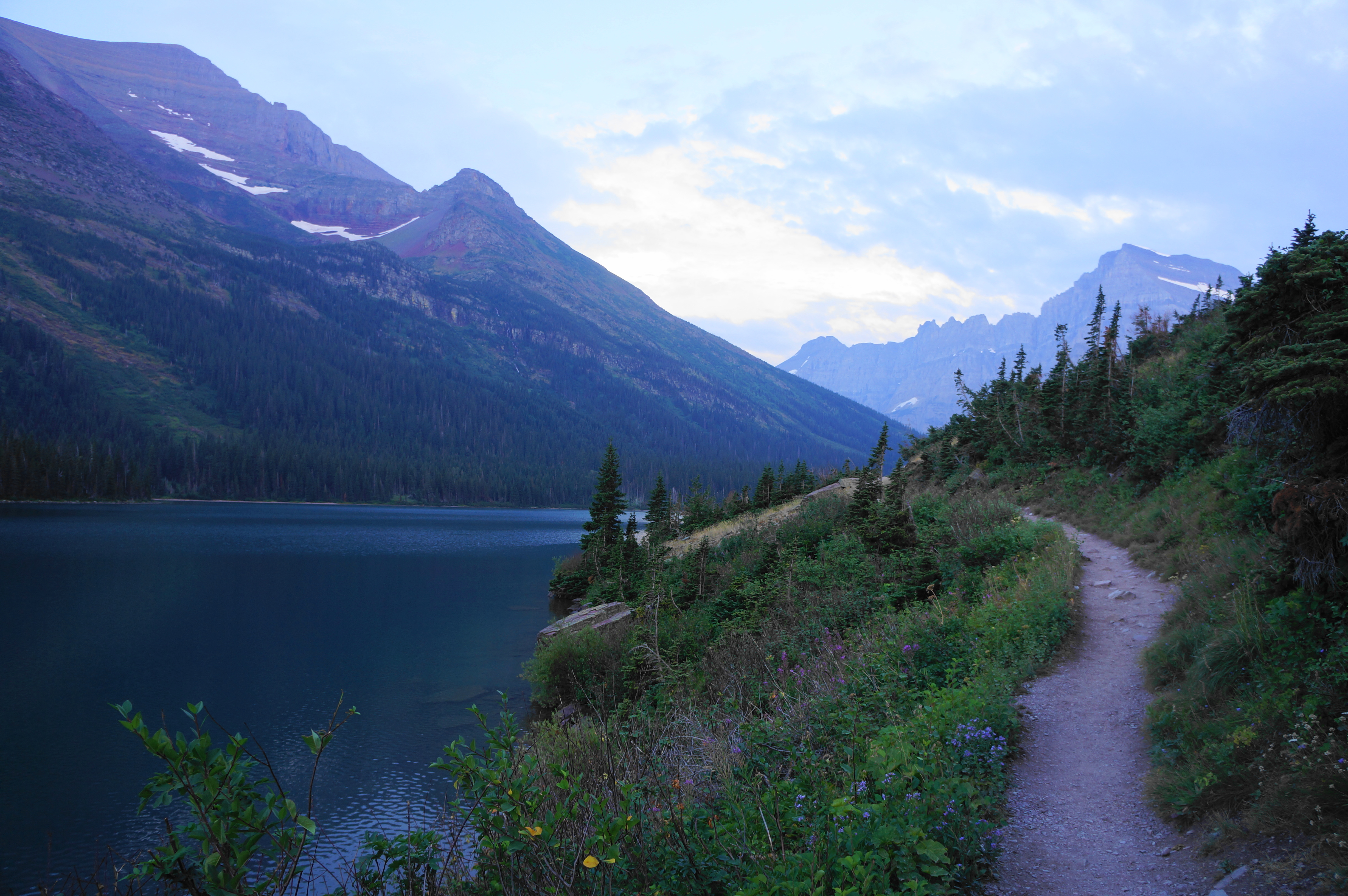
Shedding the thick trees, the trail follows the north shore of Lake Josephine, which is dotted with wildflowers and mountain scrub. The behemoth to the south if Allen Mountain (9,376’), and Mount Gould and the Garden Wall are visible to the southwest.
Just under two miles from the start, with Lake Josephine still down below, the trail ascends and splits again. Take a right, embarking on the Grinnell Glacier Trail, your guide for the next several miles.
Grinnell Glacier Trail (3.4 miles)
Alright, about time. This is where the heart gets pumping and the true magic begins. The Grinnell Glacier Trail continues to rise, with the Lake Josephine Trail paralleling it below. Coming to the base of a craggy wall on the right, the trail splits again; stay right once more. Rise through an initial clump of conifers, with the incline growing stiffer but tempered in part by occasional wooden steps.
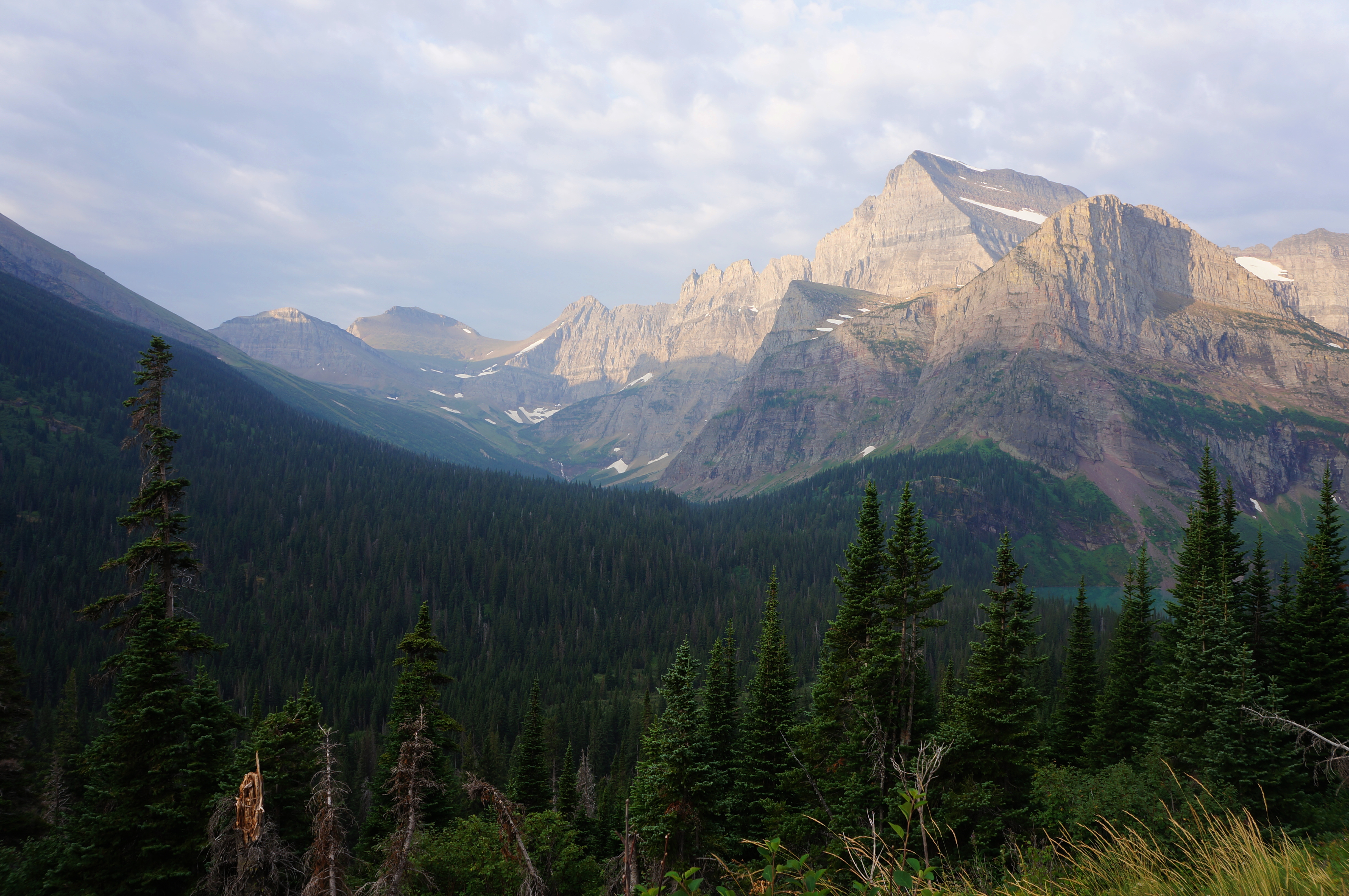
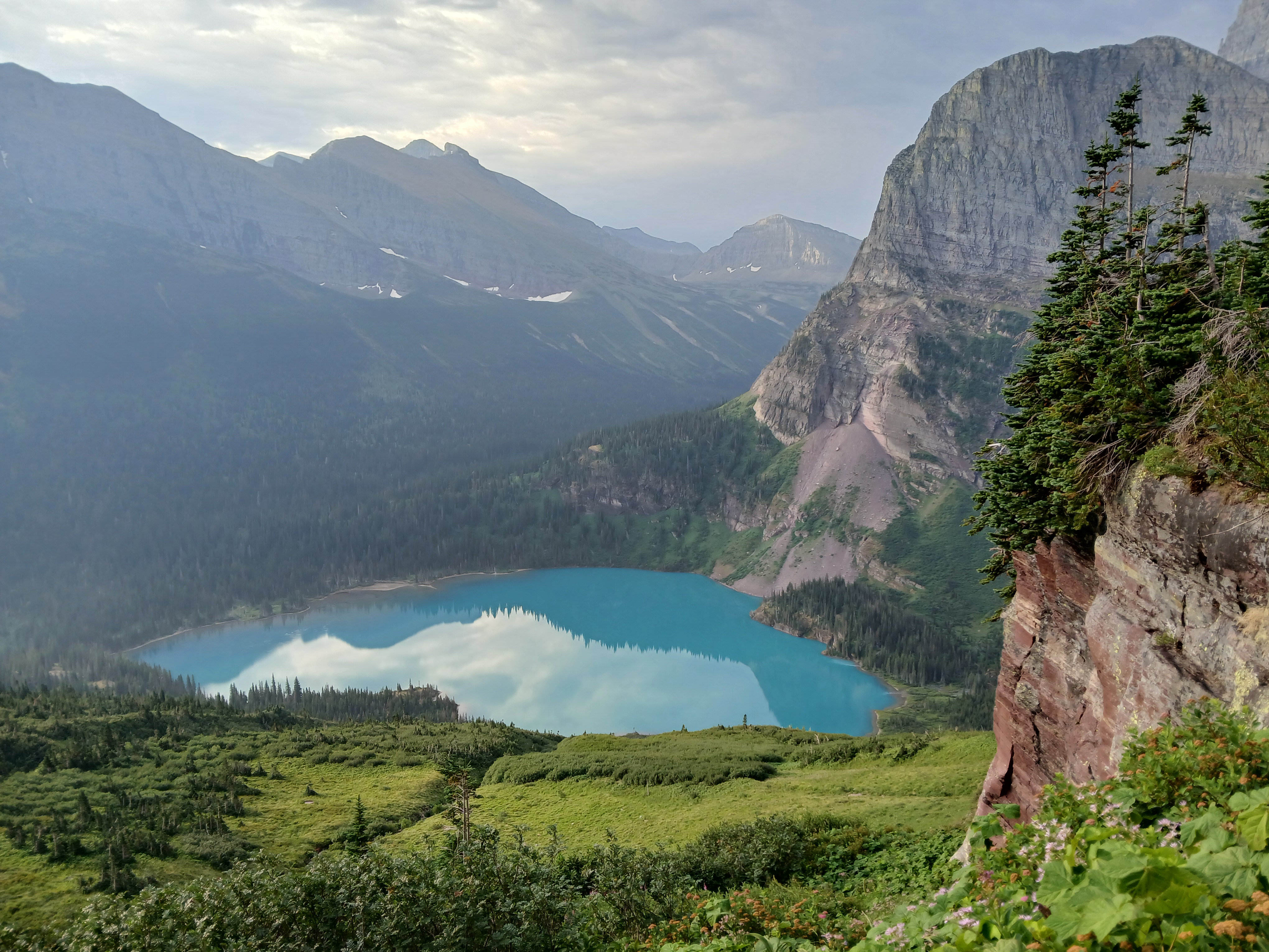
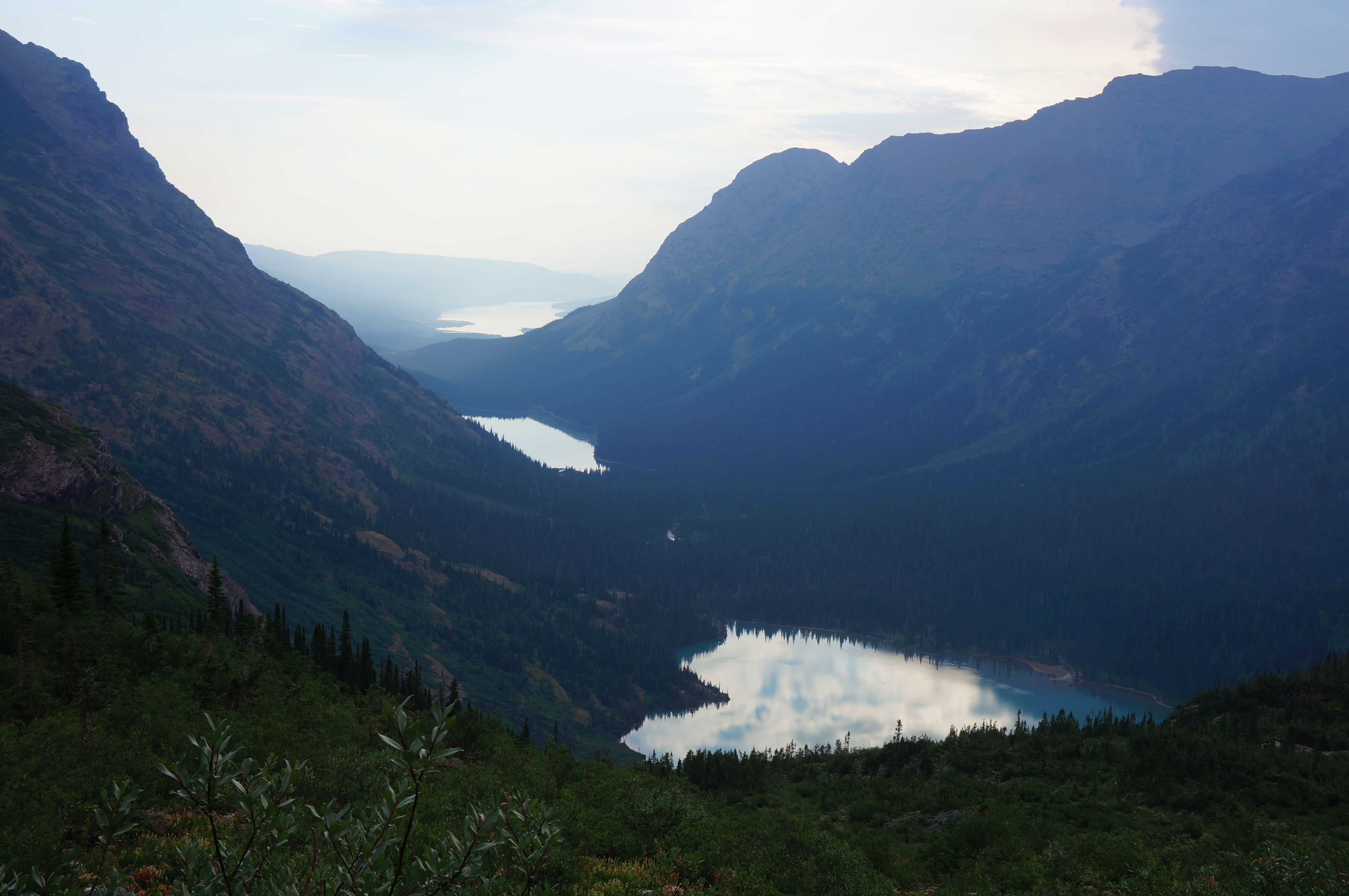
After about ¼ mile from the previous junction, hikers get their first look at Grinnell Lake below, with awesome Grinnell Falls—and the cirque formed by the glacier—beyond. One can also see south nearly to Piegan Pass.

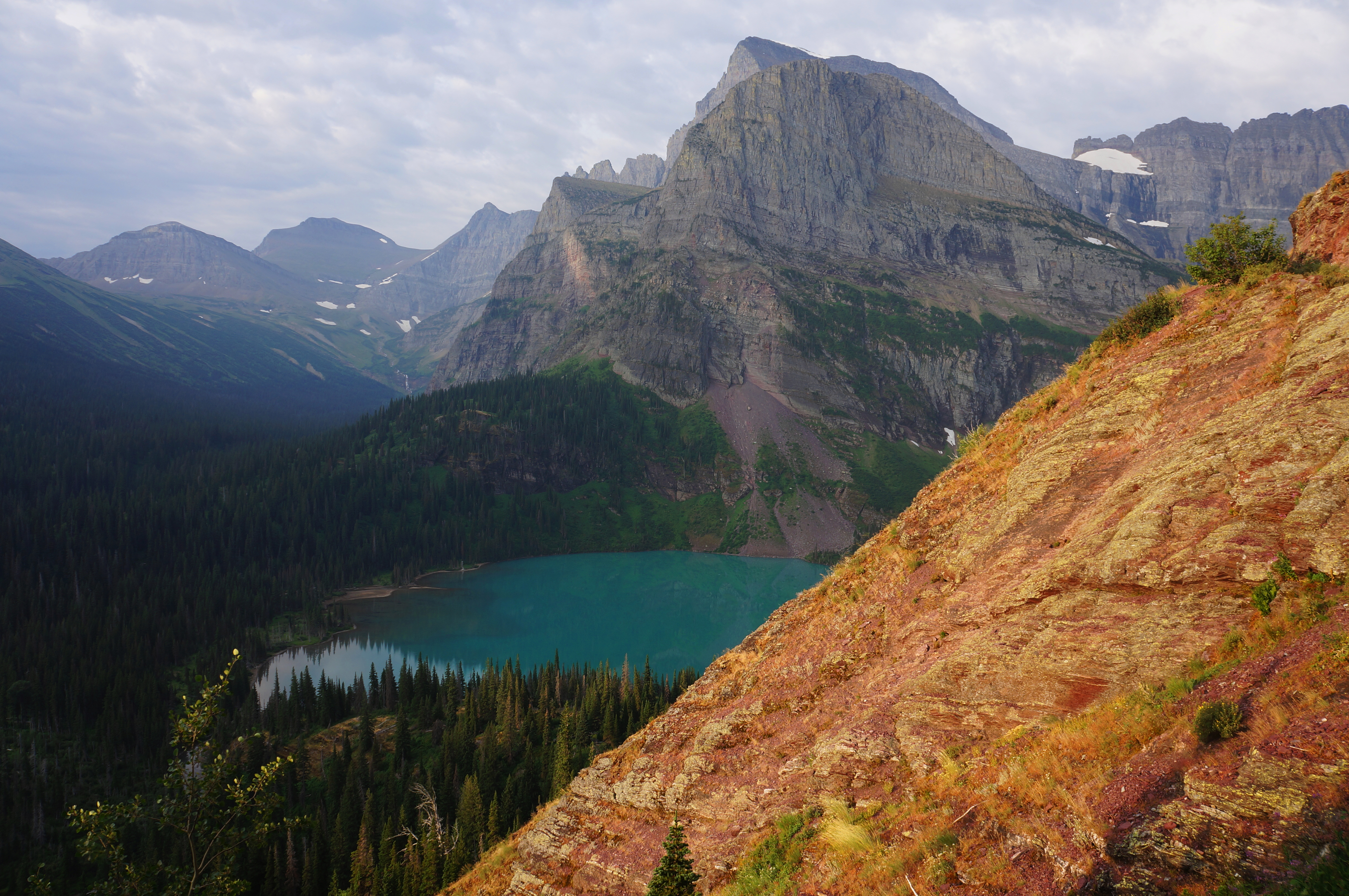
Soon hikers traverse another brushy section with a much milder incline. But the respite is brief, with the rocky scramble continuing soon thereafter as views down to the turquoise waters of Grinnell Lake improve. Climb again, skirting two exposed bends, then tackle a pair of sudden switchbacks, carrying hikers to about 5,700 feet.

The route then traverses another brushy (and sometimes wet) section with seasonal cascades, with at least one coming down basically onto the trail. Be very careful as you negotiate this slippery section, as a fall down the cliffside would make for a nasty rescue.
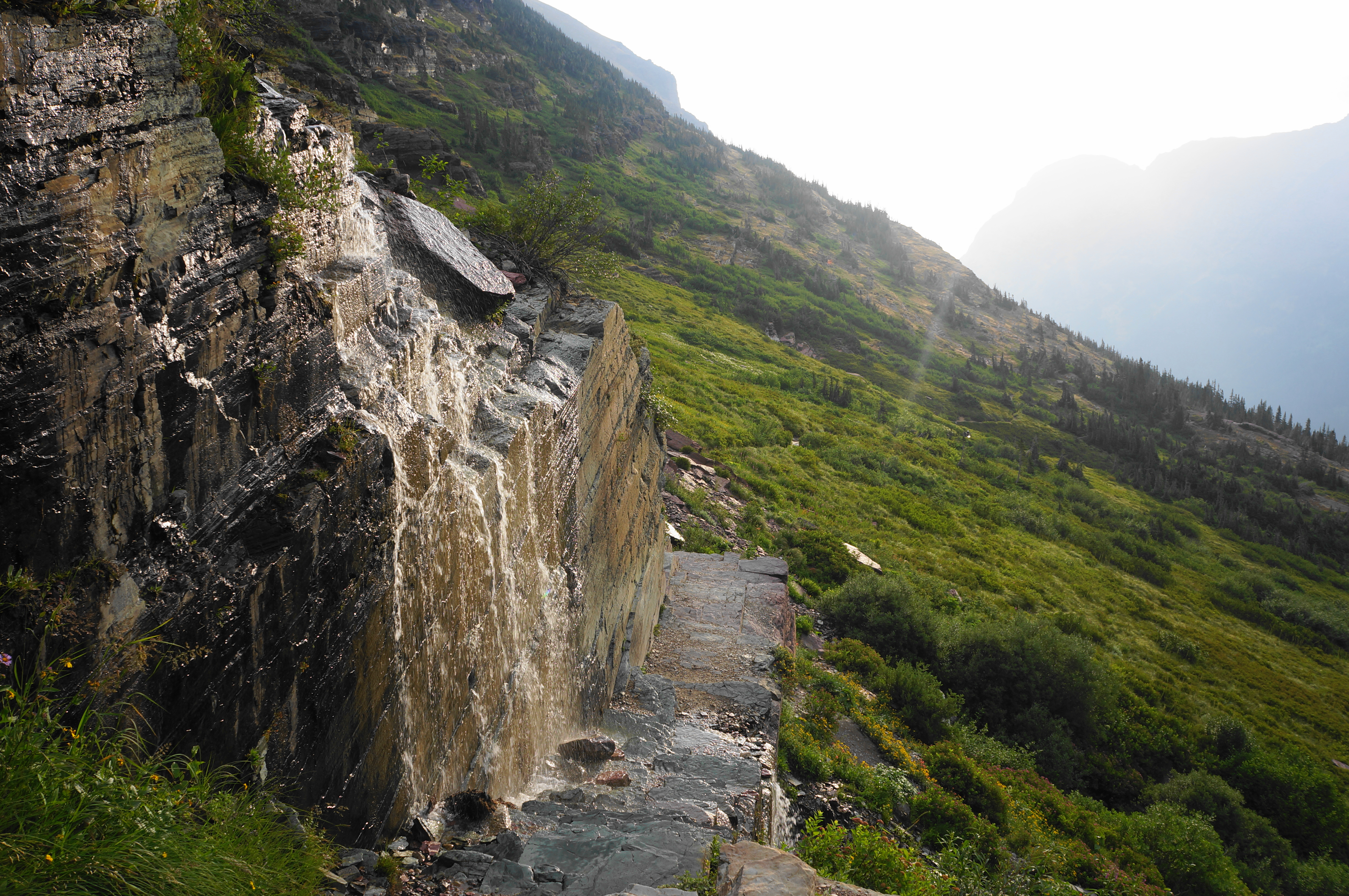

The next half-mile follows a series of stony cliffs, gaining higher ground and coming closer to Grinnell Falls. Hikers can still see back to Lake Josephine and even the very distant Lake Sherburne to the east. With the cliff section conquered, the waterfall views return in full force, and there is a lush wildflower section as the timberline approaches.


Embark soon on a long, left-hand bend, eventually putting the falls in the rear-view mirror. Once back in a spruce-laden moraine, there are two sudden switchbacks, culminating on a shelf with a small picnic area, three benches, and a pit toilet.

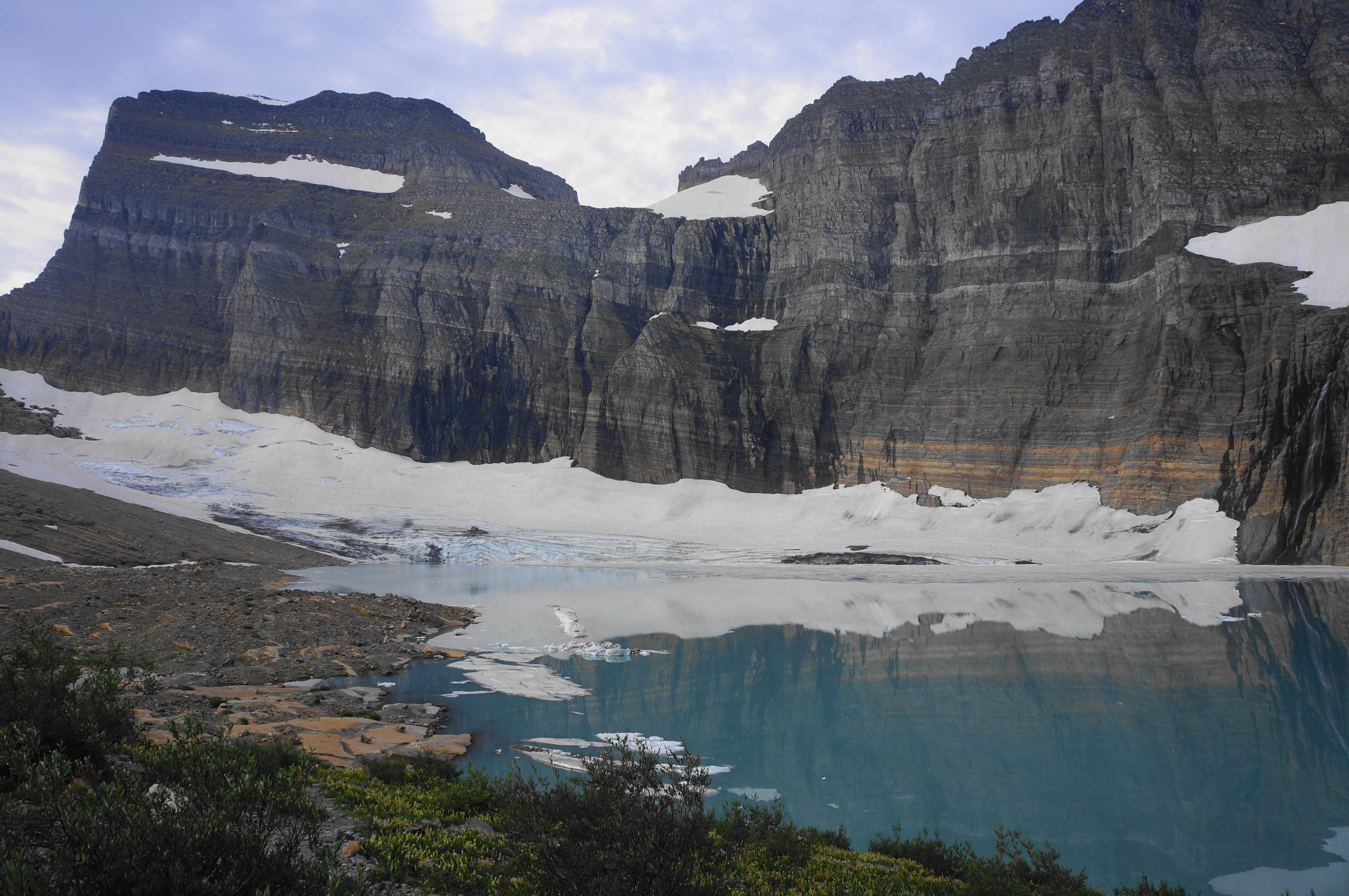
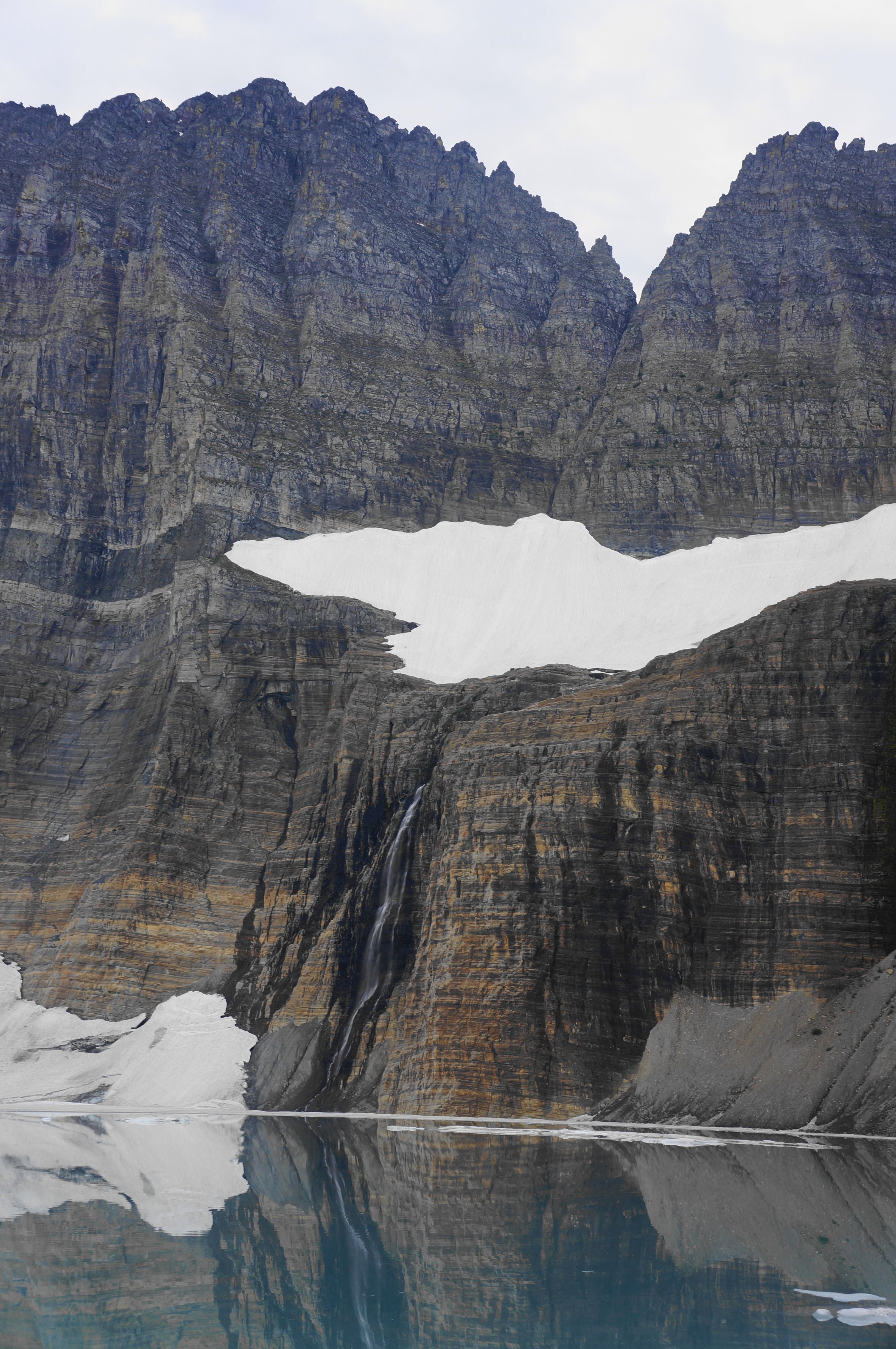
The final stretch is by far the hardest of the entire hike. Hikers must negotiate eight strenuous bends to clear a scree section (left behind by the receding glacier) before cresting a hump that holds the waters of Upper Grinnell Lake—the terminus of the trail. This difficult section is well worth the work, as the destination beyond is sensational: an amphitheater of near-vertical walls, interspersed with patches of snow and a perennial waterfall (Salamander Falls) that drops into the bone-chilling waters. The main Grinnell Glacier—or what’s left of it—is up to the left and flows directly into the lake. (Note: Technically some of the other patches of snow have names too—Salamander Glacier and Gem Glacier—though they are now rather small.)


Alternative Return Route: Grinnell Glacier Trail to Many Glacier Lodge via South Shore Lake Josephine (5.7 miles)
When ready, return the way you came on the Grinnell Glacier Trail, descending for about three miles. (Note: By now, about mid-morning, the throngs of visitors from the boat tours had arrived, making for slow going as yours truly fielded constant questions of: “How much further?” and “Are we there yet?”) At the first signed junction, you have a choice. One is to continue left to retrace your steps along the north shore of Lake Josephine; this makes for a 10.6-mile out-and-back. The other option is to bear right, adding 4/10 mile to your return but traversing new terrain for much of it.
If you choose the latter, descend on a connector path that drops toward the west banks of Lake Josephine, tracing a couple switchbacks before coming to a second fork. Stay right and follow a boardwalk over some brief wetlands before crossing a bridge over Cataract Creek and returning to the woods.
Then cruise on flat terrain to the east shores of the lake, where several trail splits await. The first is a junction with the route to (Lower) Grinnell Lake, which you saw from above earlier. Stay left, bearing north now, then stay straight as you pass several spurs in quick succession: the boat dock (end of the line for the boat tours), the Piegan Pass Trail, and a pit toilet.

The Short Shore Josephine Lake Trail bears east through level but overgrown terrain, with sometimes head-high lush plants blanketing the surface. The easy path cuts through it all—at one point surprisingly rising up two mild switchbacks—before the floodplain gradually becomes more interspersed with small open patches. Eventually putting Lake Josephine behind, the trail comes to another junction (stay left), then skirts the banks of Stump Lake, a small, quiet basin wedged between Josephine and Swiftcurrent.

Enjoy your final look back to Lake Josephine and beyond before returning to the initial bridge over Cataract Creek and an adjacent trail fork. Stay right, following the Swiftcurrent Lake Trail for ¾ mile back to the lodge and trailhead. This caps off an 11-mile, action-packed hike to and from one of Glacier’s most famous and scintillating destinations.

I’ve never done this beautiful hike, but I have been to the Grinnell Glacier Overlook from the Highline Trail side. I’ve also hiked in the Many Glaciers area to Ptarmigan Tunnel. Both of these are also lovely.
Great post!
Wow! Thank you so much for sharing!
Pingback: Twin Falls & Upper Two Medicine Lake (Glacier National Park, MT) – Live and Let Hike
Pingback: Top 10 Hikes in 2024 – Live and Let Hike