Having returned to the Washington, DC area last fall, my opportunities to get out hiking have unfortunately declined. But I have been able to resume my quest to achieve a long-term goal of completing all the nearby Appalachian Trail (AT) sections (see MD Sections 1, 2, and 3). A lovely day in October 2024 brought me to the Harpers Ferry area, where I hauled up past Loudoun Heights on the Virginia/West Virginia border to Keys Gap, completing VA Section 1 of the AT.
The picturesque town of Harpers Ferry, West Virginia—set at the confluence of the Shenandoah and Potomac Rivers—has historic lore as the site of abolitionist John Brown’s famed raid in 1859 and a consequential Civil War battle in 1862. But the town is also widely-celebrated by Appalachian Trail (AT) thru-hikers as roughly the halfway point between the southern end in Georgia and northern terminus in Maine. (Note: The actual midpoint is a few days’ hike north in Pennsylvania, but Harpers Ferry is often thought to be the “psychological” halfway mark).
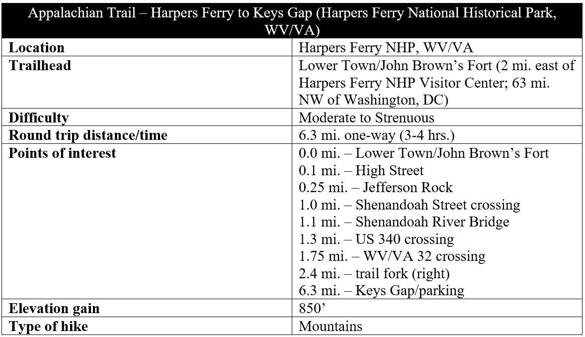
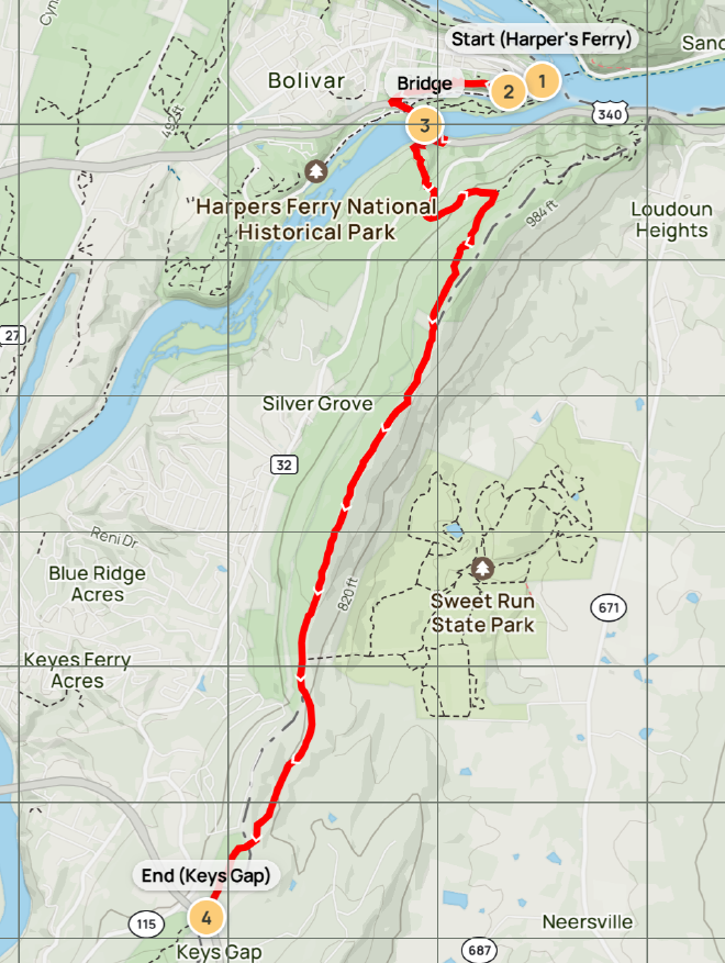
The first, 6.3-mile section in Virginia—dubbed “Section 1” in the AT Conservancy’s Trail Guide to Maryland and Northern Virginia—traverses Lower Town before reaching a historic overlook visited by Thomas Jefferson in 1783, crossing the Shenandoah River, and ascending sharply to Loudoun Heights before levelling off and ending at Keys Gap, on the Virginia/West Virginia border. It’s possible to do this as a long out-and-back, though it’s better done as a shuttle or in conjunction with other adjacent sections. Admittedly, the hike starts with a bang and ends with a whimper, but the combination of the scenic Harpers Ferry section and pleasant mountaintop walking by Loudoun Heights makes for a decent hike.
The hike
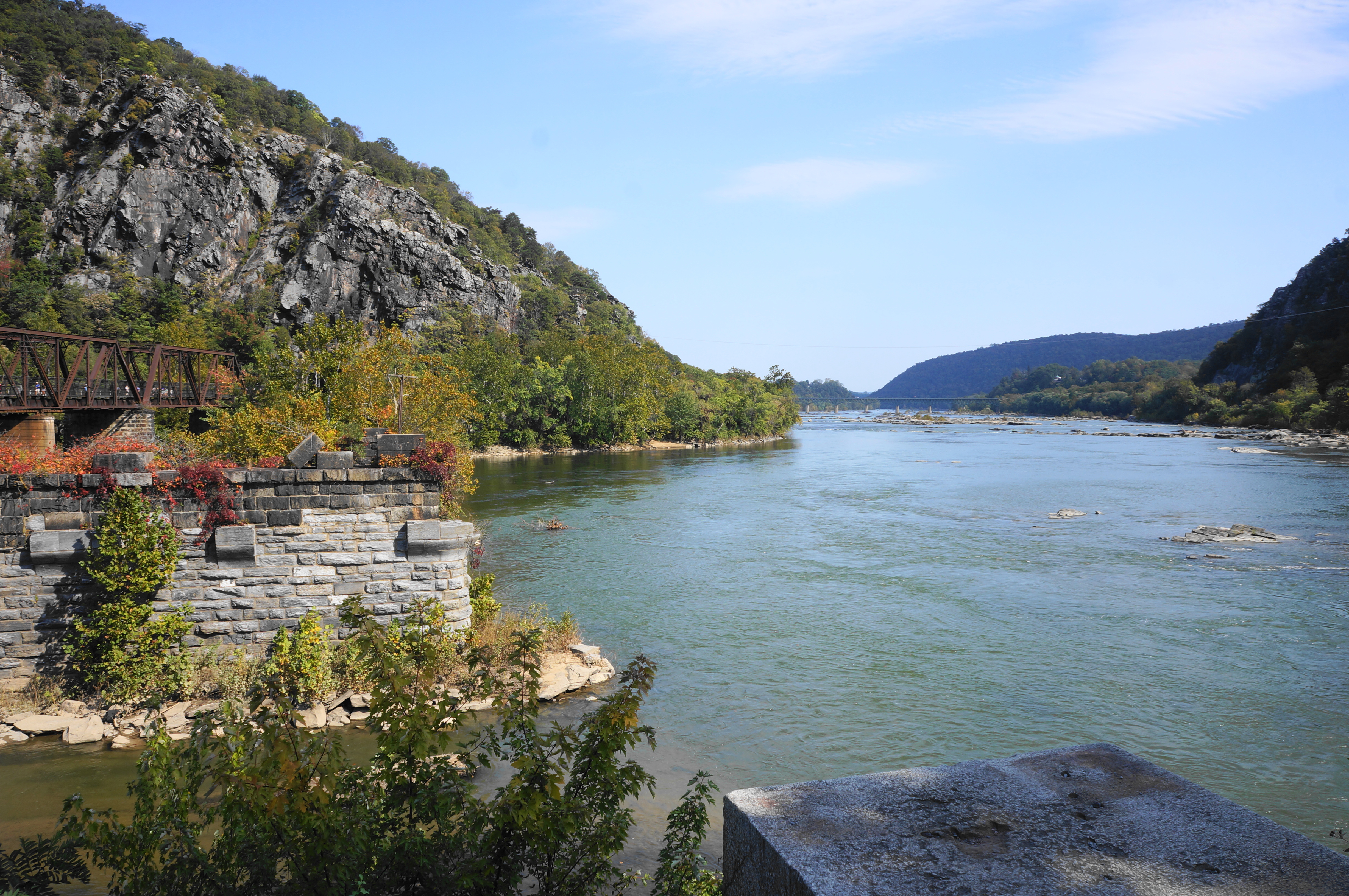
VA/WV Section 1 officially begins in Lower Town at the confluence of the Potomac and Shenandoah Rivers (a.k.a. “The Point”) in Harpers Ferry National Historical Park. Here one can look out on a mix of bridges, old and new, and the imposing cliffs of Maryland Heights, set across the Potomac in neighboring—you guessed it—Maryland.
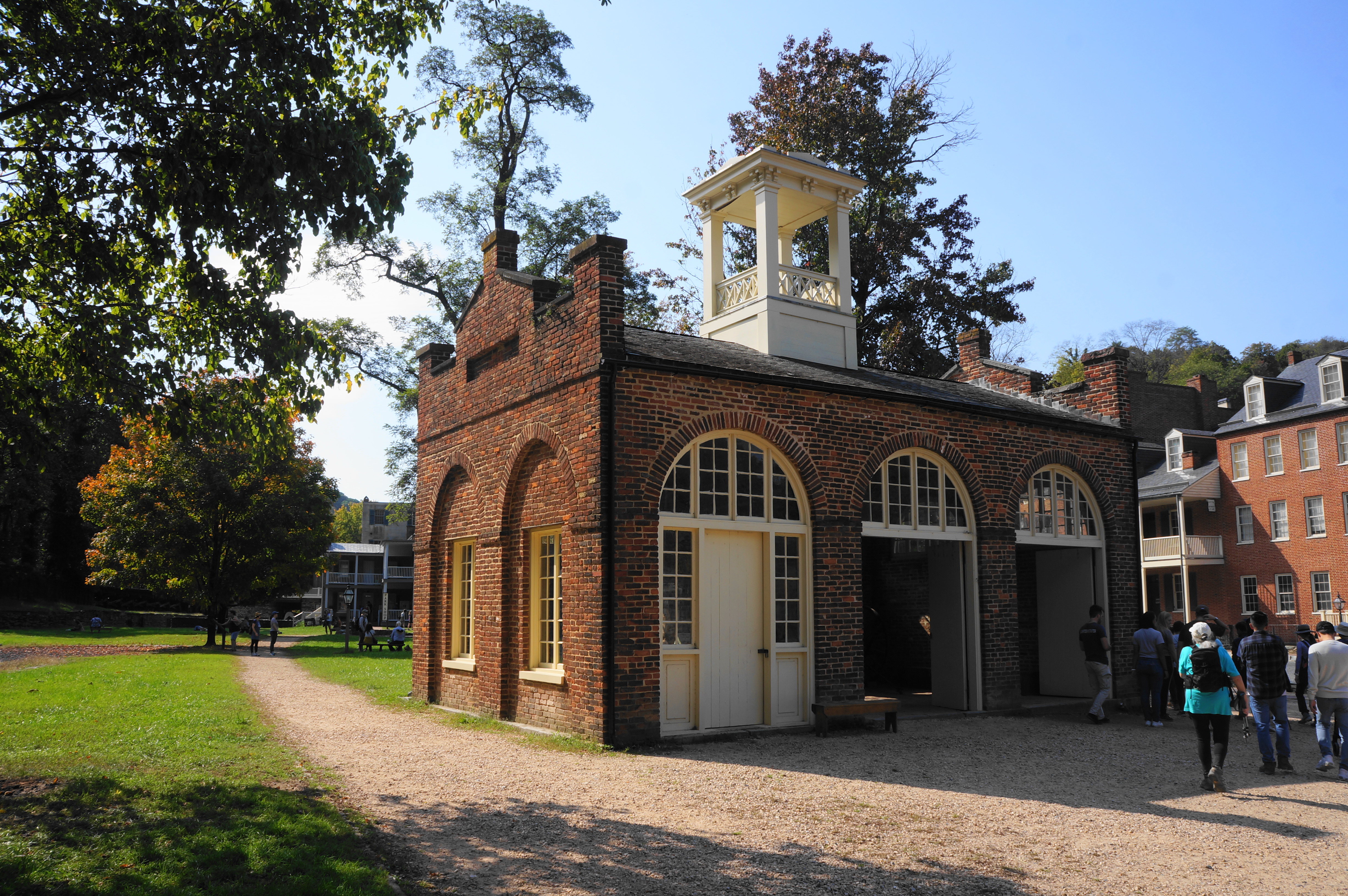
When ready, make your way back to John Brown’s Fort, a fire engine and guardhouse constructed in 1848. It was here, on the grounds of the federal armory at Harpers Ferry, that Brown and his associates barricaded themselves “during the final hours of their ill-fated raid” on October 18, 1859. An ardent abolitionist, Brown was unsuccessful in seizing the armory and ultimately executed in December 1859 on charges of murder and treason. But his cause of abolitionism lived on, becoming a centerpiece of the Civil War and President Lincoln’s 1862 “Emancipation Proclamation.”
The town of Harpers Ferry, which changed hands 12 times during the Civil War, is now a cozy tourist town replete with brick buildings, cobblestone streets, and kitschy antique stores. The corner of Shenandoah and Potomac Streets, where John Brown’s Fort stands, marks the eastern reaches of the town. Hikers should make their way up Potomac Street then look left for a light post with the Appalachian Trail’s classic white blazes. Proceed west along on the brick pathway and then up a set of stairs, through a passage behind the John Brown Museum.
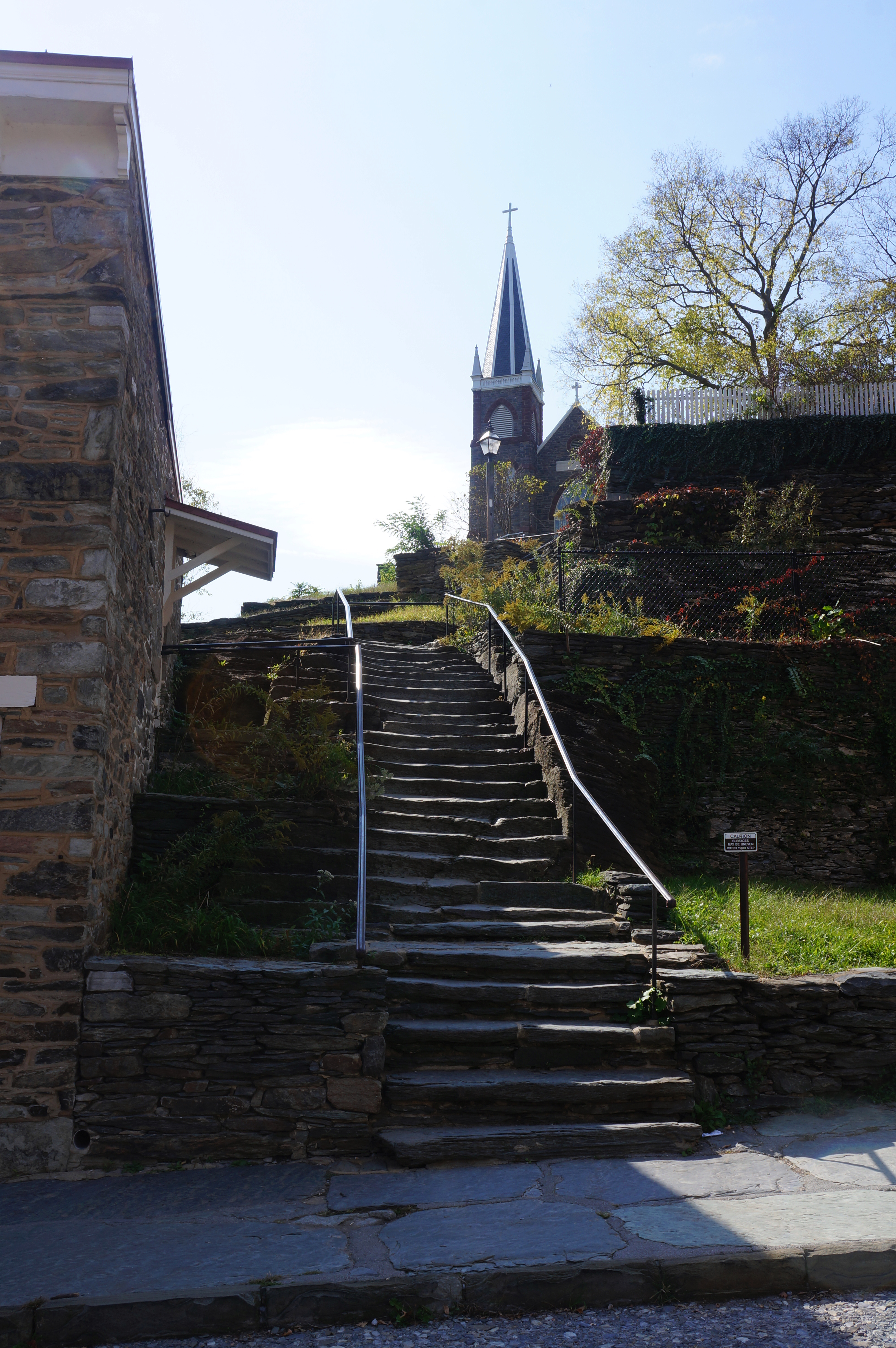
The path soon emerges onto High Street, the main north-south drag through Lower Town. Some of the favorite hangouts for AT through-hikers—celebrating their arrival at the trail’s unofficial halfway point—are situated up the street to the right. The AT continues straight, proceeding up another set of stony steps, climbing to Church Street and the namesake St. Peter’s Roman Catholic Church, constructed in 1833 and remodeled and upgraded in 1896. Stay straight on the road as it passes the small chapel on the left, then find a third set of stairs, this one passing the crumbled ruins of a separate church—St. John’s—over to the right.
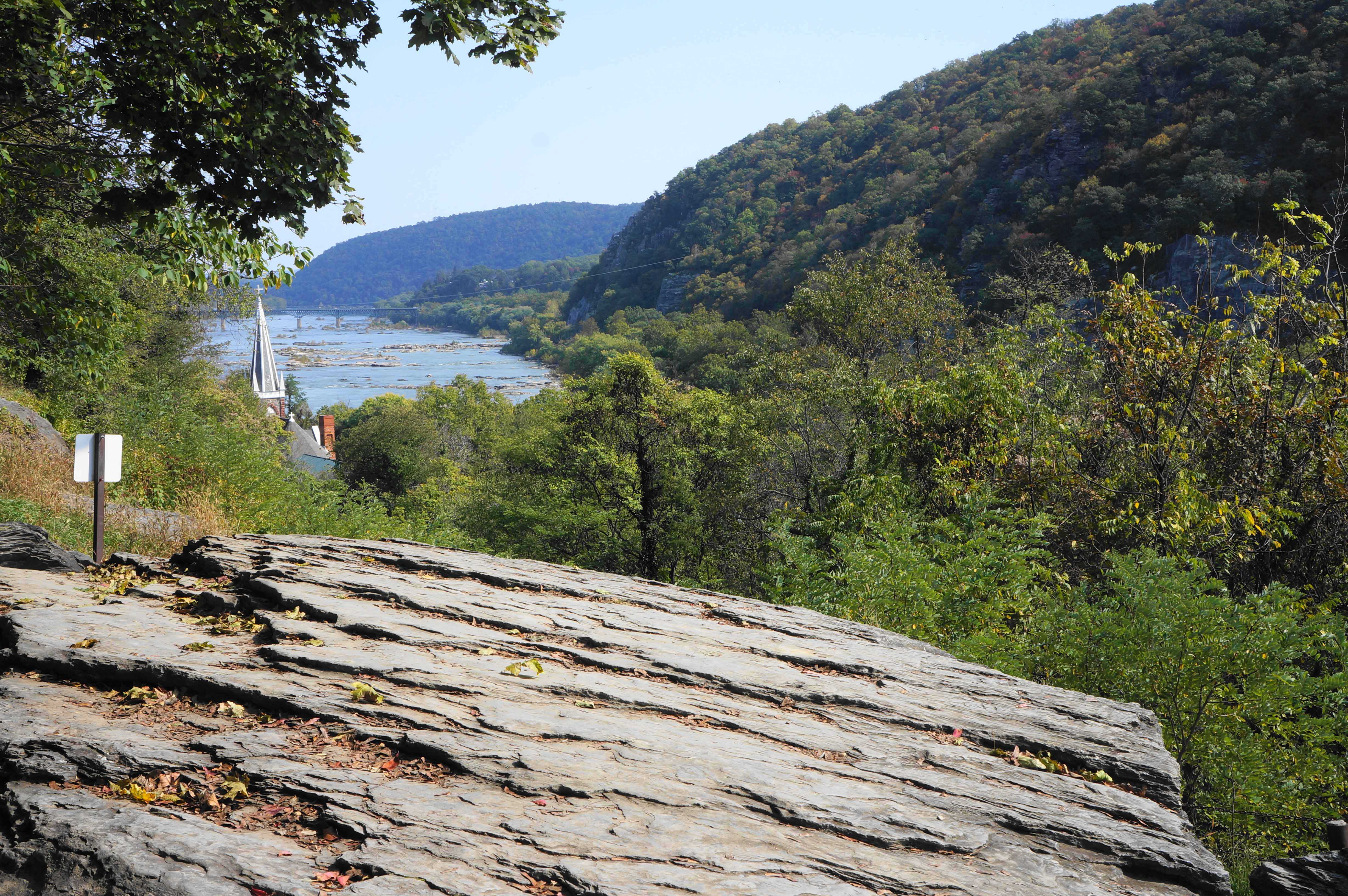
From here the AT continues to climb—a nice leg-stretcher and preview of what’s to come—and passes a couple of hilltop residences on the right. As hikers approach Jefferson Rock, vistas open up across the Shenandoah River to Loudoun Heights. It was here, well before the events of John Brown’s Raid and the Civil War, that America’s third president, Thomas Jefferson, visited in October 1783. He would later describe the view as “worth a voyage across the Atlantic.” John Quincy Adams, the sixth president, however, would later contest this, writing in 1834 that “there is not much of the sublime in the scene, and those who first see it after reading Mr. Jefferson’s description are usually disappointed.” (Today, in wintertime when the trees have shed their leaves, the vistas are sweeping and inspiring as Jefferson had it. But in summer, when dense brush obscures much of the view, JQA may well have been right…)
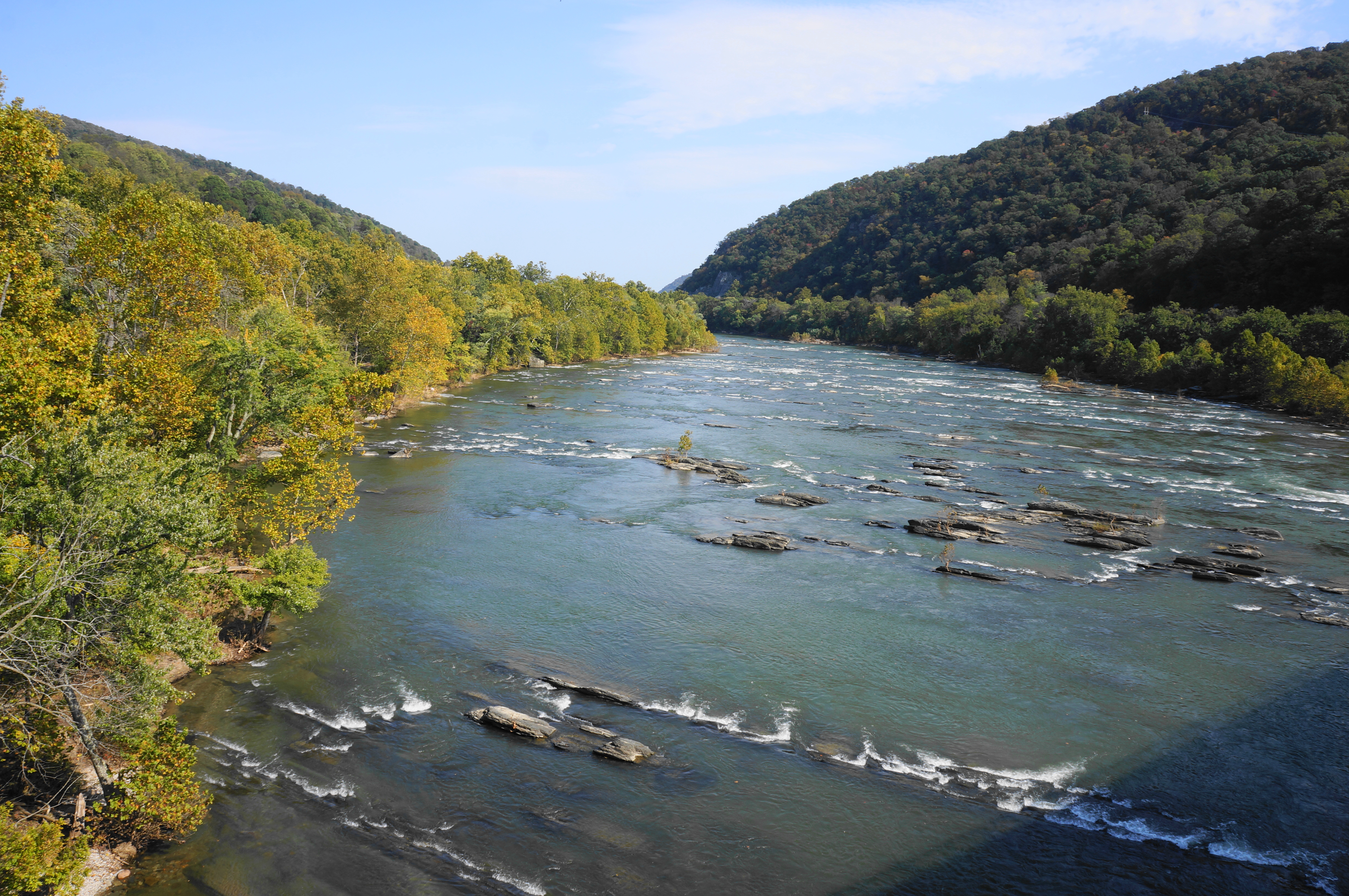
After Jefferson Rock, ascend a stone staircase to return to the main trail and continue westward on the narrower and less-trafficked trail, skirting the southern flank of Camp Hill. Pass a spur that leads right (connecting to the Lockwood House and upper Harpers Ferry), then negotiate a steady downhill followed by an abrupt but brief climb. Stay left at another junction (the path right leads up to the Appalachian Trail Visitor Center), then bear right at an unmarked fork soon thereafter. Following the white blazes, descend to a spot where the AT rounds a corner and emerges at the intersection of Shenandoah Street and bustling Highway 340. Here the trail crosses the former and parallels the latter, heading out across the Shenandoah River Bridge to the south bank.
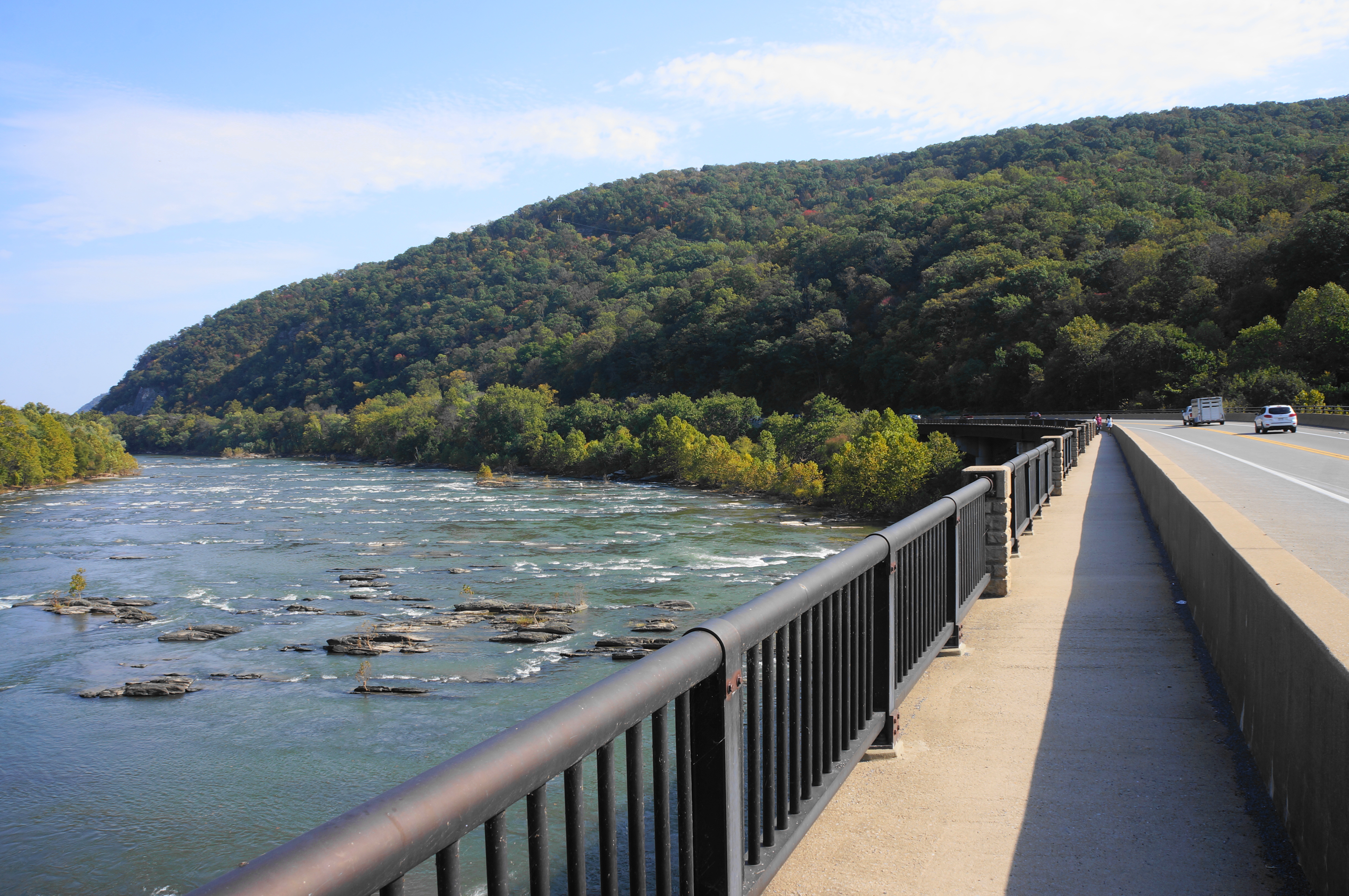
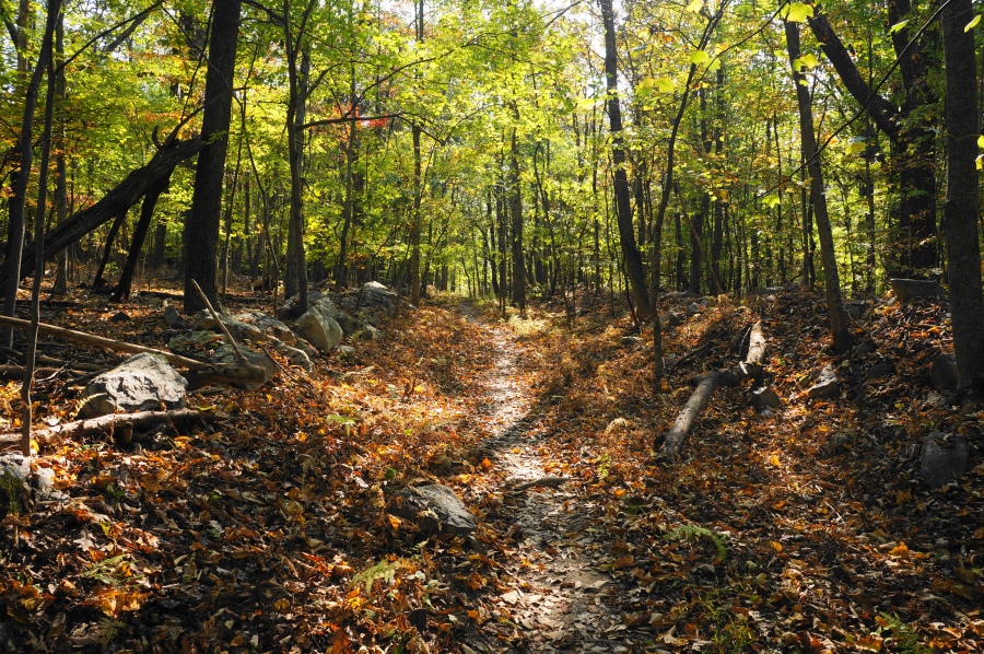
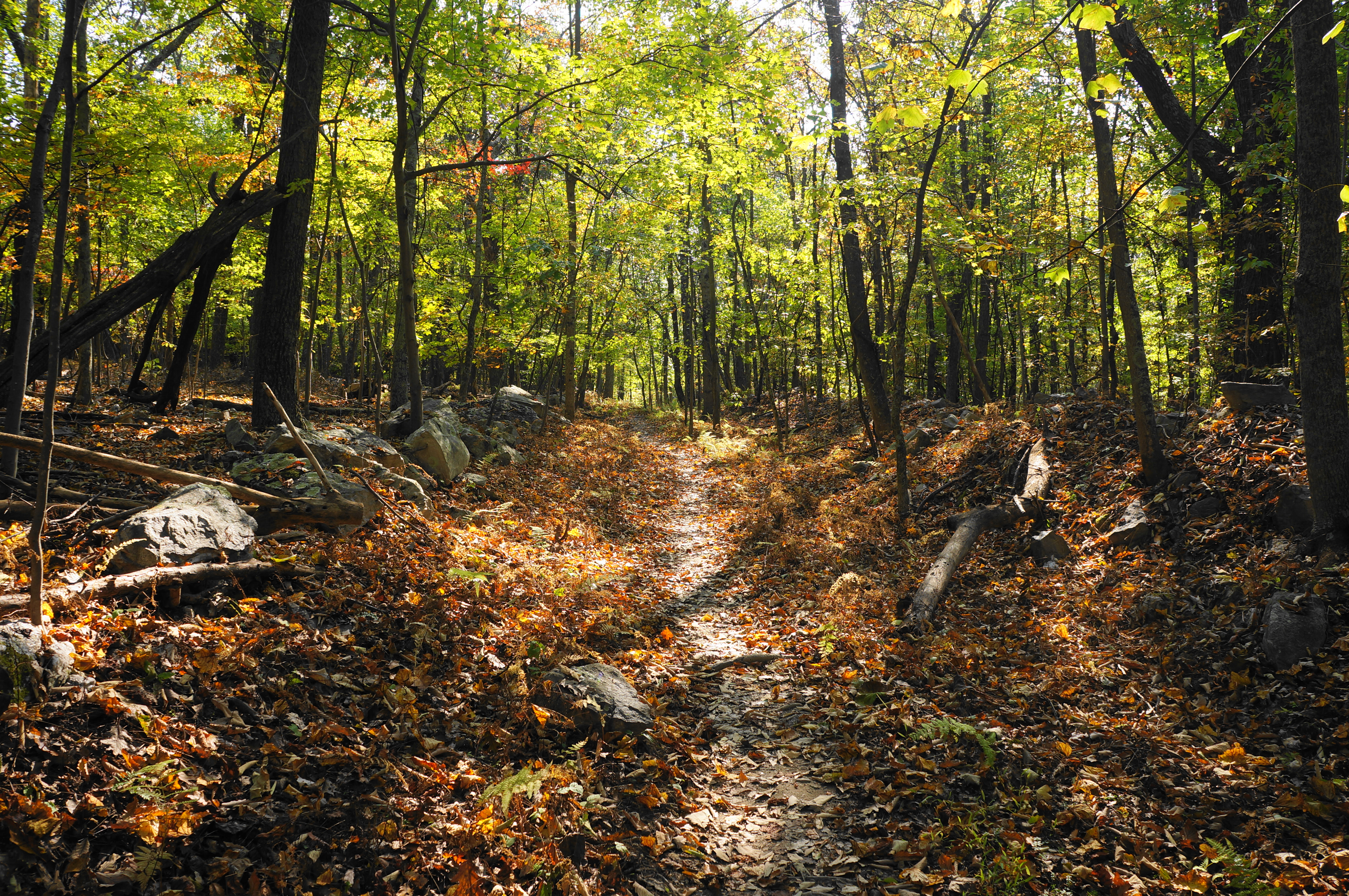
It takes several minutes to traverse the lengthy bridge, enjoying views across the Shenandoah River along the way. Eventually the AT drops down a flight of stairs and passes under the freeway. This marks the start of a relentless uphill, initiated by a stone staircase. From here the trail rounds westward, paralleling the road for a brief period, then the Shenandoah. Round a left-hand bend and ascend another stone staircase, after which the trail grows more rugged, rocky, and wild. The AT soon skirts a drainage before beginning to switchback up the woody hillside. Look for chestnut oaks, black gum, maples, and dogwoods.
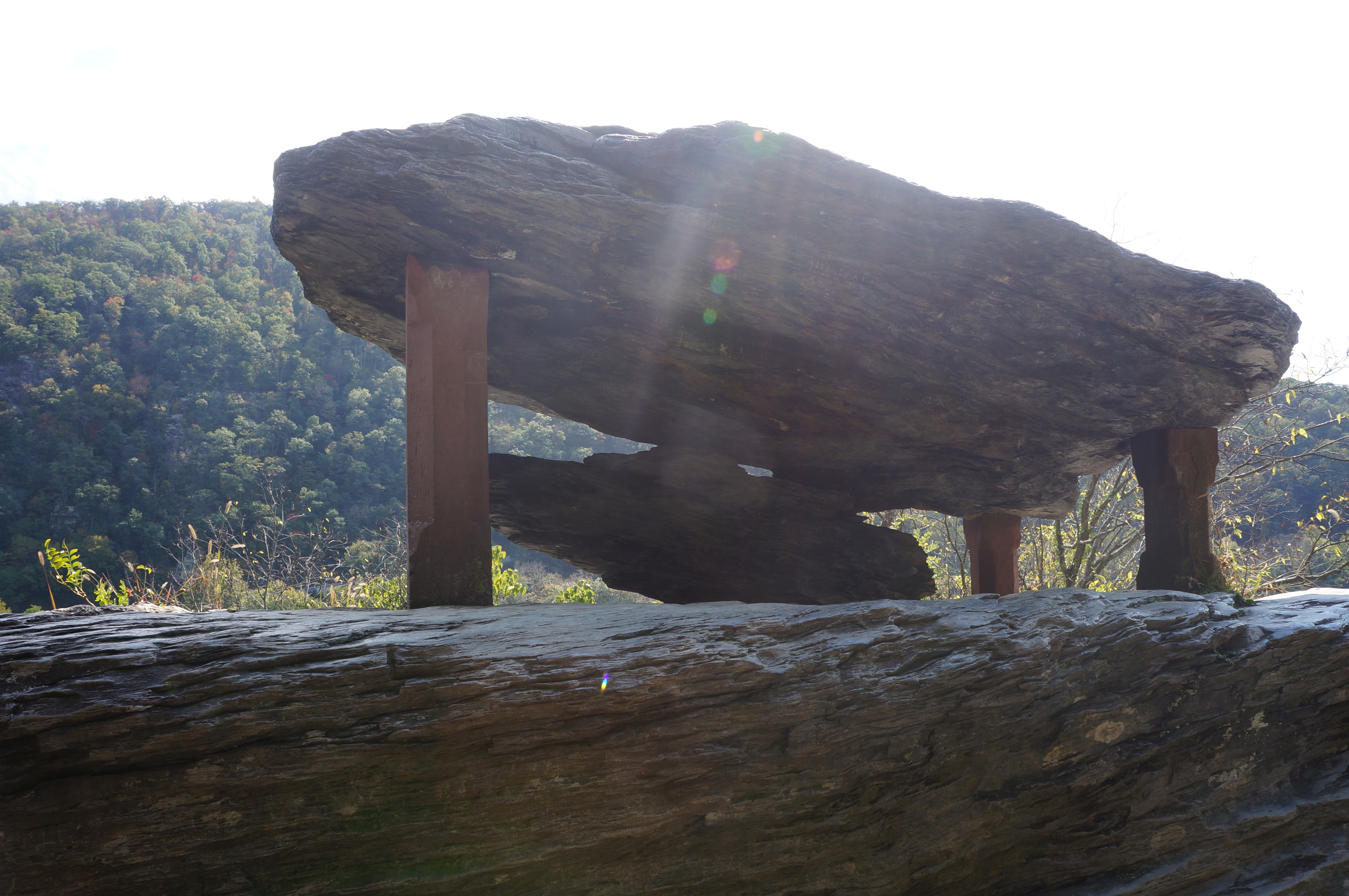
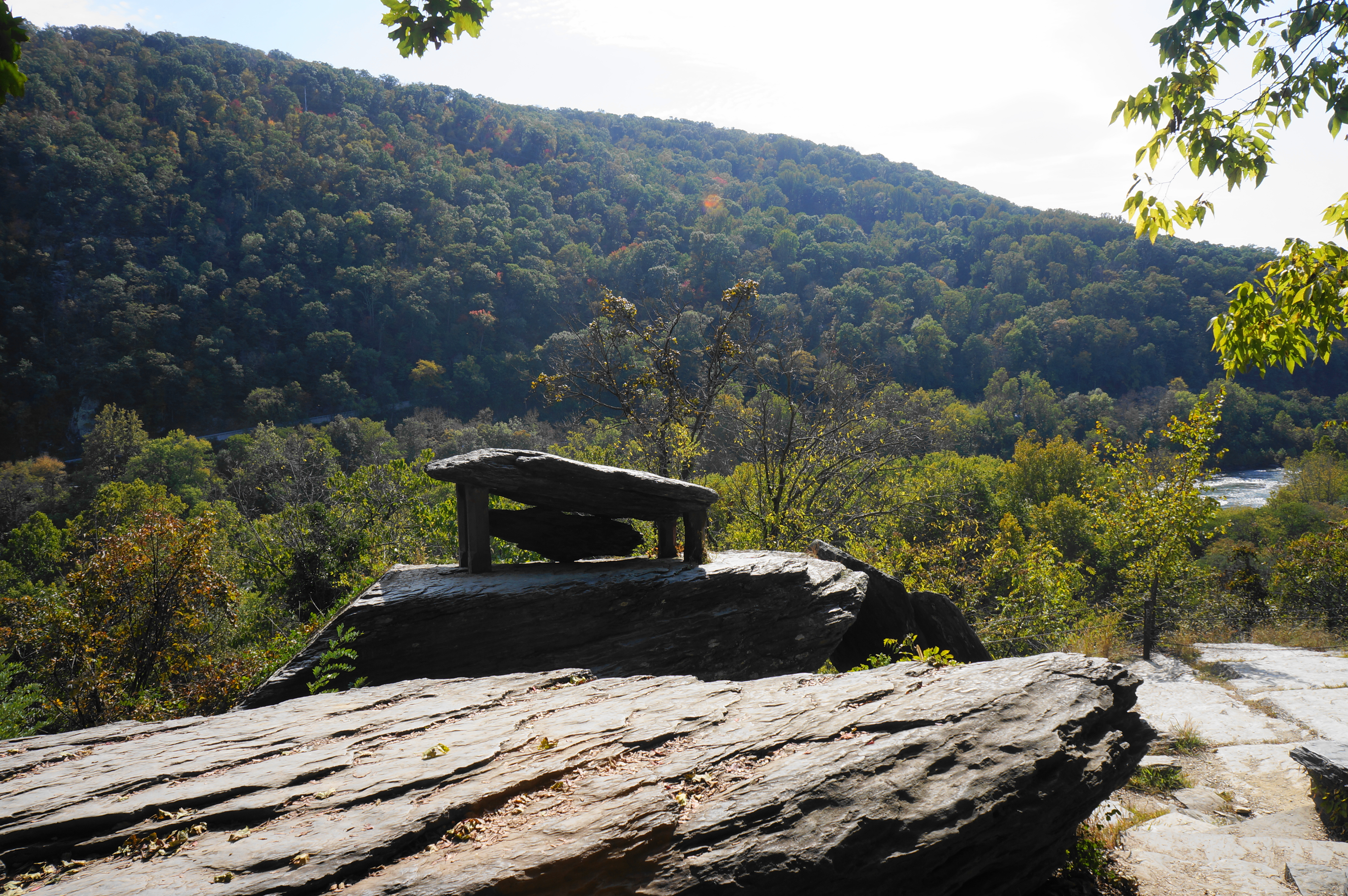
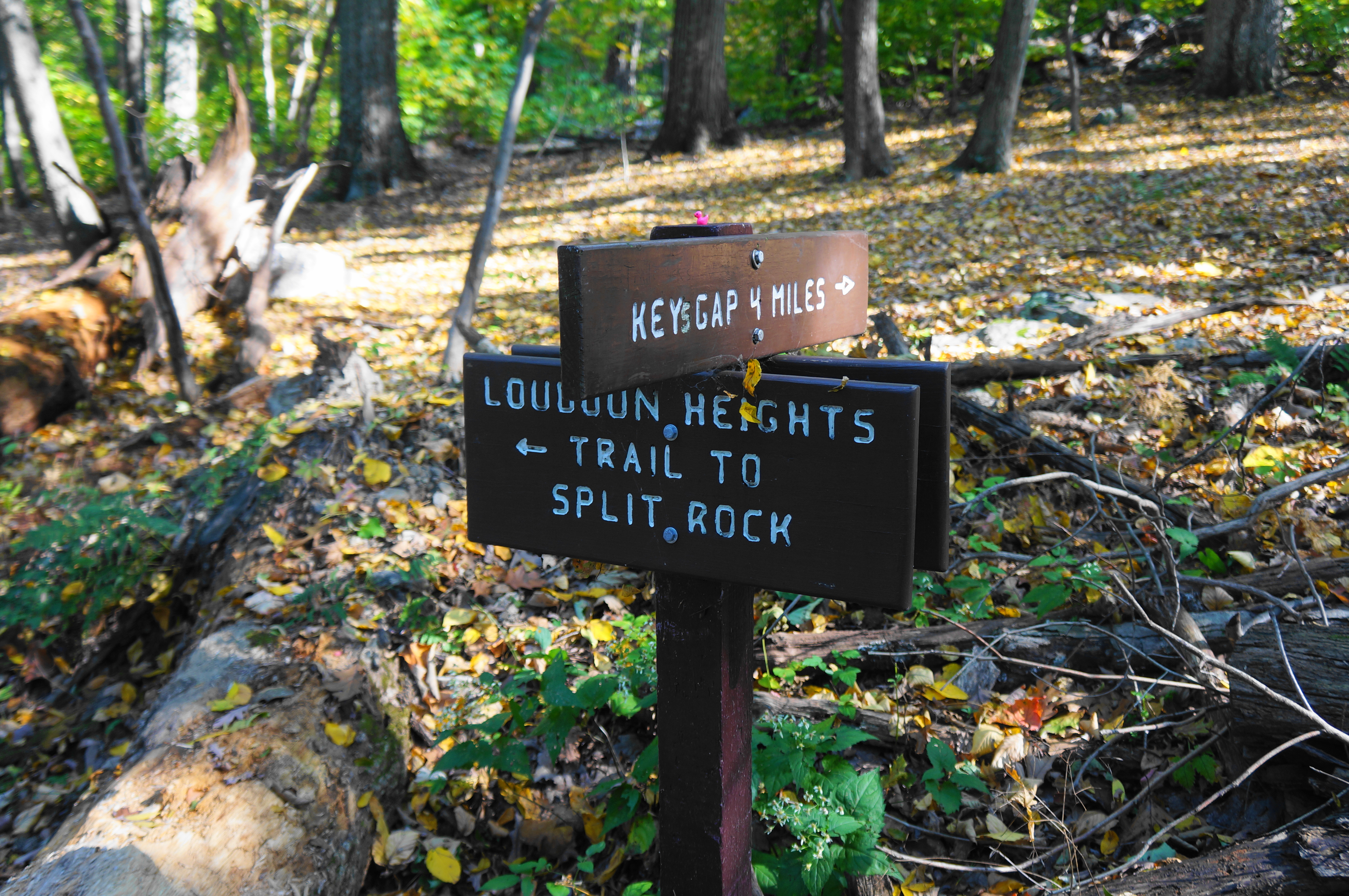
Continue up and around a shady multi-pronged ravine, following the contouring path up to Chestnut Hill Road and a set of power lines. Carefully cross and find the ascending trail continuing beyond, this time heading southwest before cutting east. Gaining 500 feet in the next half-mile, the relentless pitch leads eventually up to an unmarked spur with the Orange Trail, a connector to Split Rock. Stay right, climbing more gently to a second junction 2/10 mile farther on, passing an old roadbed along the way. At the fork, bear right, staying on the AT as the Blue Trail bears right, offering alternative access to the Split Rock overlook.
While the hike to this point involved considerable ups and down, the remaining four miles are much milder. As you crest the ridgetop, leave the boundaries of Harpers Ferry NHP and pass the very top of Loudoun Heights (1,175’) over on your right. From here the rocky trail shifts subtly from a gentle uphill to a downhill stroll between two summits. Eventually the incline reverses again, and hikers clear a new ridgeline.
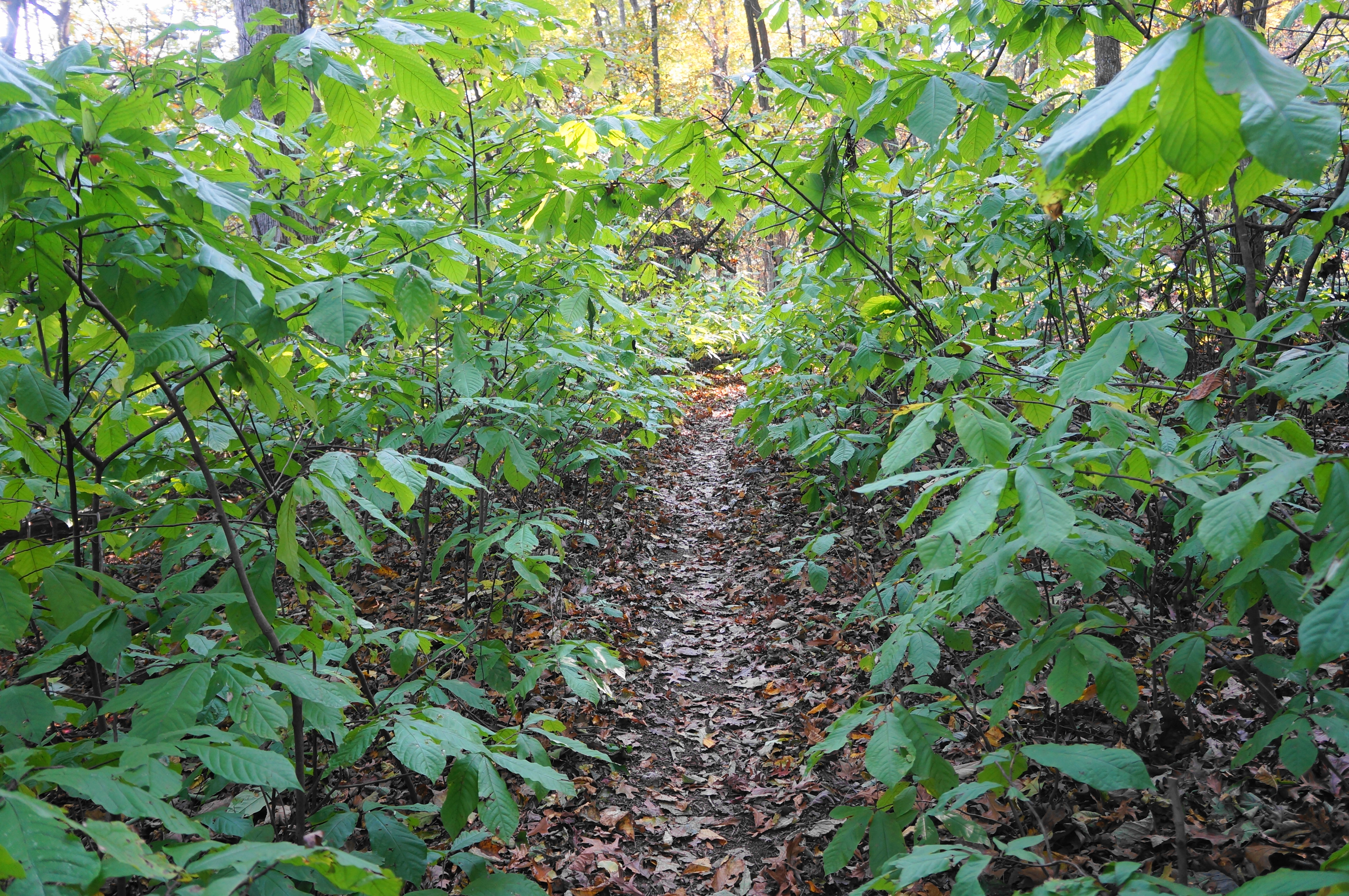
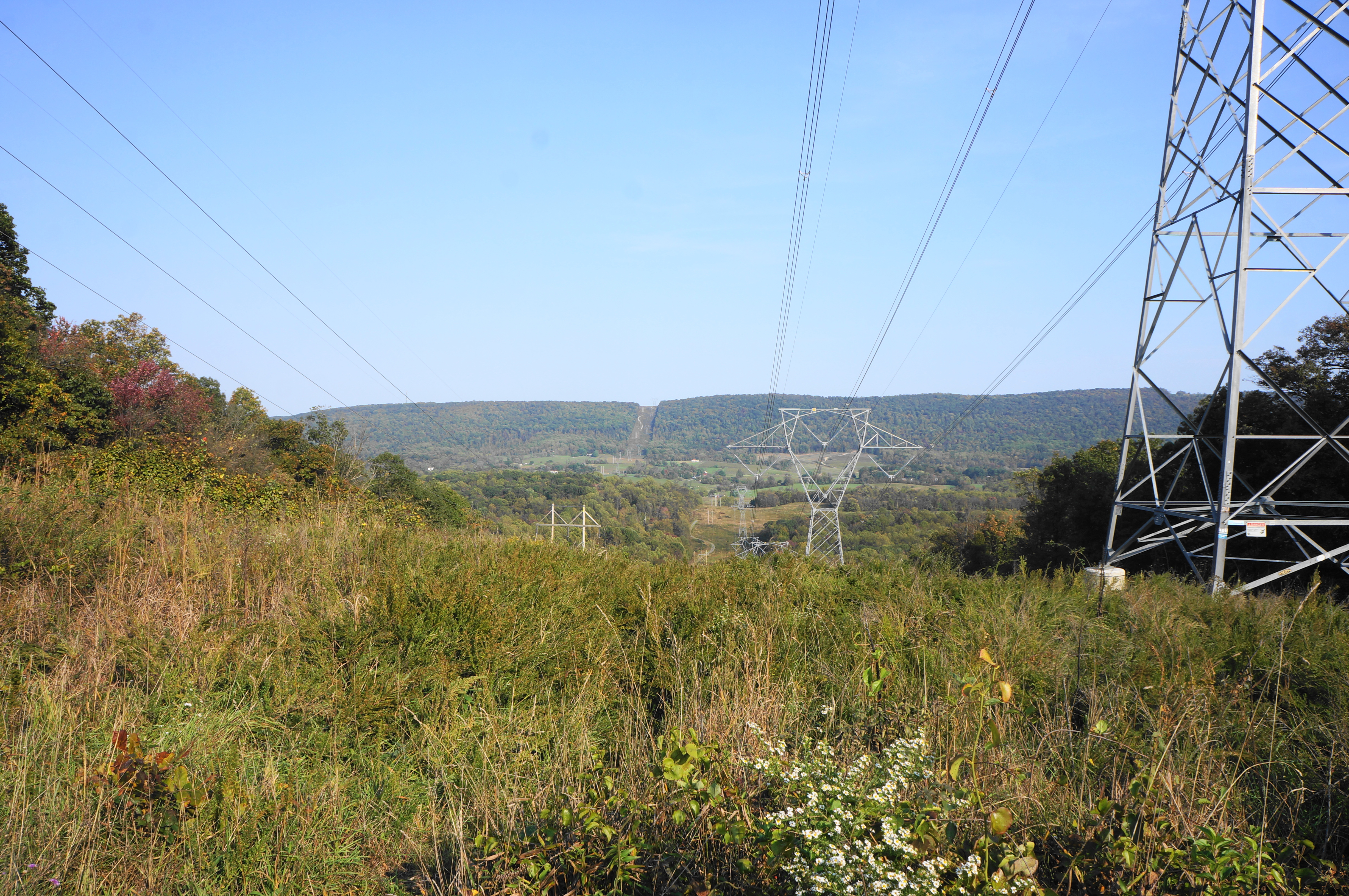
The section thereafter is very mellow, with obscured views through the forest to the west and east. There are few markings, but the AT here is right on the West Virginia/Virginia border. Treading south, traverse another brief rocky stretch, then proceed downhill, passing a campsite on the left and dropping to a power-line cut that offers a window look to the valleys beyond in either direction. (Note: From here one can bear left to access nearby Sweet Run State Park.)
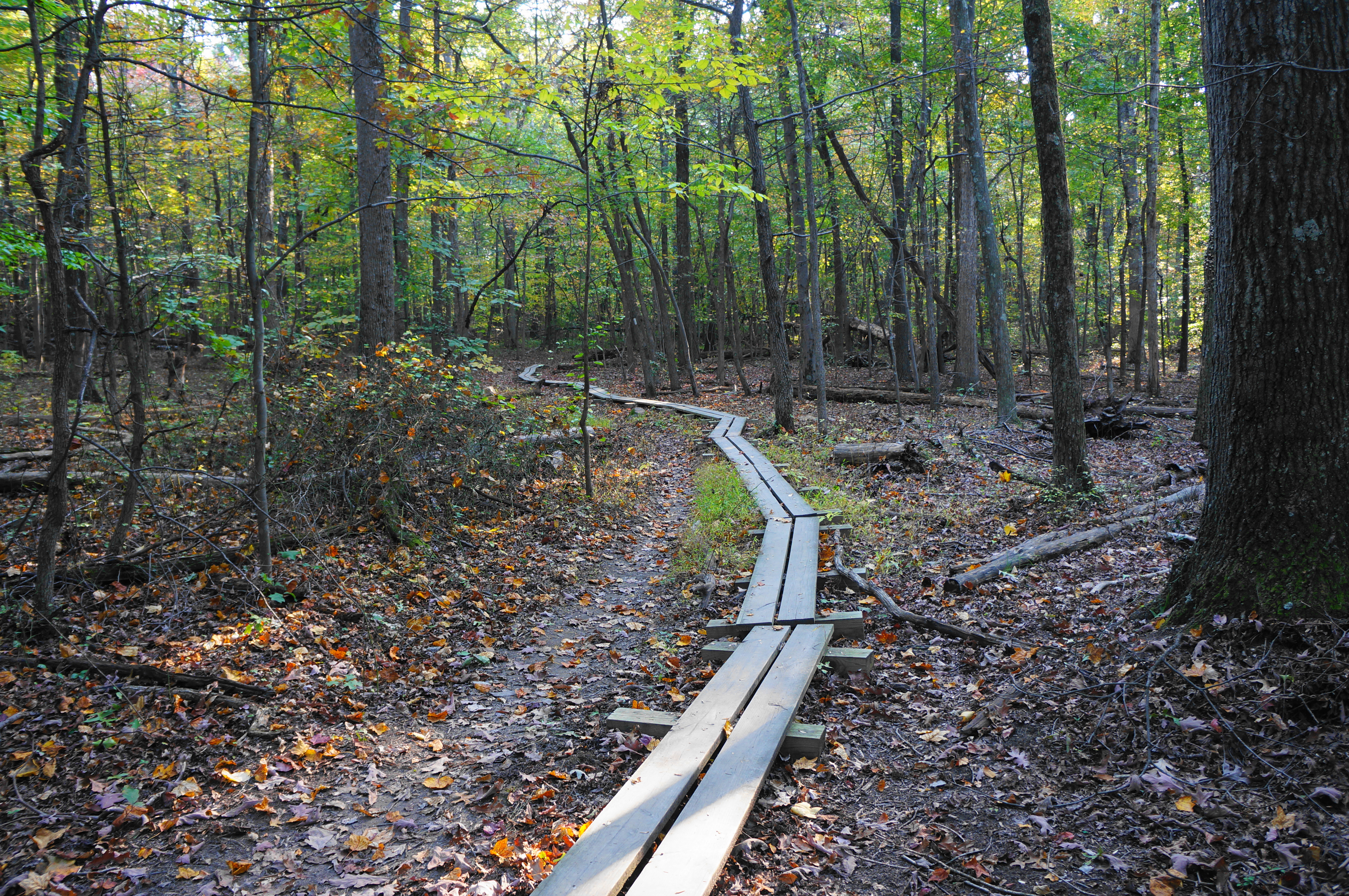
Now almost five miles from the start, the AT continues its gradual downhill, moving more firmly into Virginia. Soon come to a mild ascent and crest a gap, this time dropping down to the West Virginia again. The final stretch involves another decline and a brief muddy section with a boardwalk to guide hikers across. From here it is a short distance to Keys Gap, the end of Section 1, and Virginia State Route 9. There is a modest parking area here, with AT Section 2 continuing across the road to the southwest.
Hopefully you have arranged a two-car shuttle such that a car is waiting for you here. But if not, turn around and slog for 6.3 miles back to Harpers Ferry and the start.
