“Million Dollar Highway” – Ouray to Silverton

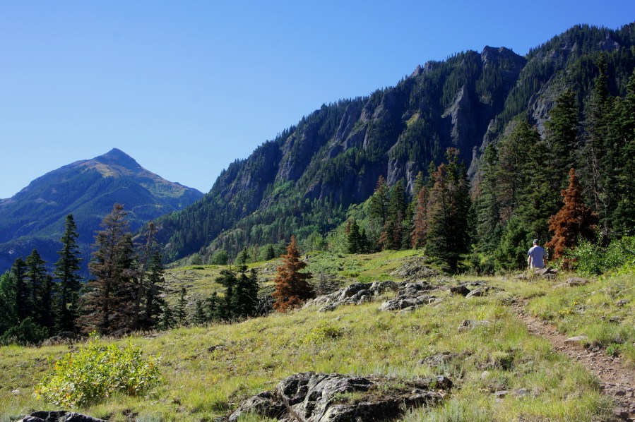
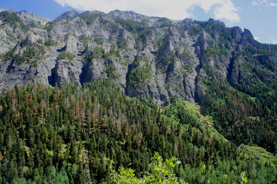
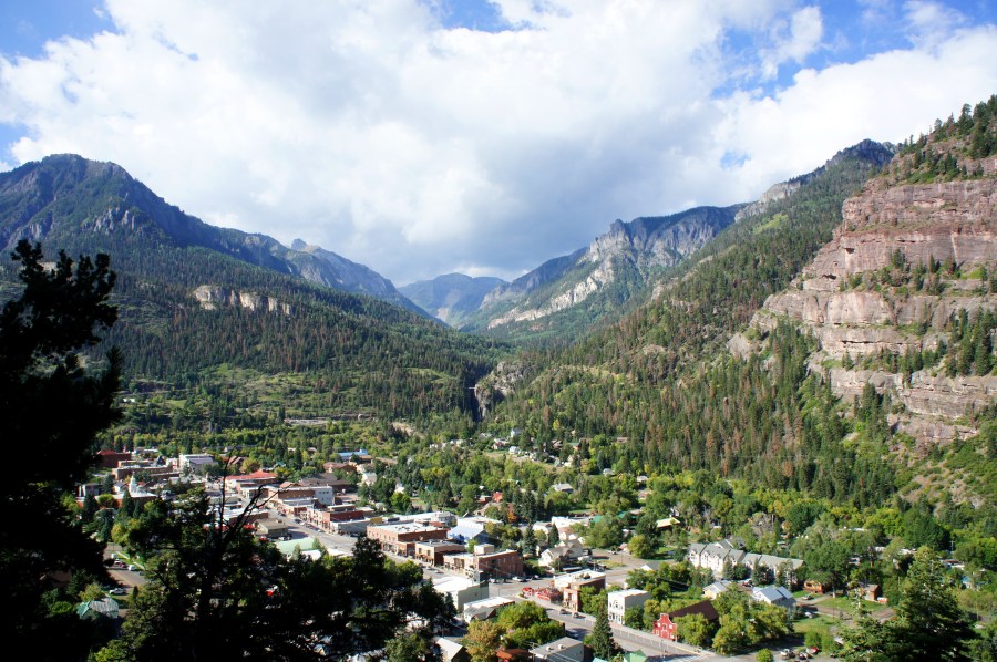
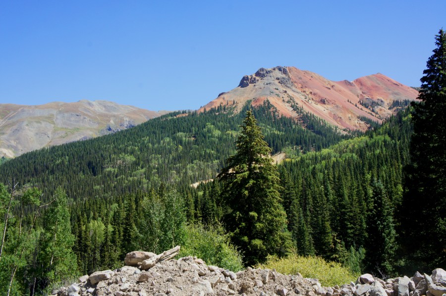
Southwest Colorado’s “Million Dollar Highway”—also known, less memorably, as Route 550—traverses some of the most breathtaking scenery in the state. With sharp curves, steep grades, and a conspicuous lack of guard rails, it is also one of the most harrowing drives in the Rockies. The 23-mile section connecting Ouray to Silverton features historic ghost towns, …

Continue reading “Million Dollar Highway” – Ouray to Silverton

Sutton Mine Trail (Uncompahgre National Forest, CO)

The Sutton Mine Trail—situated just south of Ouray, Colorado—rewards hearty hikers who brave the initial, gut-wrenching ascent with spectacular views of Ouray, Uncompahgre Gorge, Bear Creek Falls, and Abrams Mountain. Ending at an abandoned mine, this 2.2-mile jaunt packs nearly 700 feet in elevation gain into the first half-mile before leveling out atop a rocky …

Continue reading Sutton Mine Trail (Uncompahgre National Forest, CO)

Portland Trail Loop (Uncompahgre National Forest, CO)

The Portland Trail, just outside Ouray in southwest Colorado, offers close-up views of one of the area’s most striking features: a highly sculpted, bowl-shaped cliff face known as the Amphitheater. While composed mainly of grayish, volcanic rock, this west-facing wall is illuminated in the evening light, bringing out the whites, yellows, and purples and allowing …

Continue reading Portland Trail Loop (Uncompahgre National Forest, CO)

Ouray Perimeter Trail (Uncompahgre National Forest, CO)

The Ouray Perimeter Trail, as the name suggests, forms a circuit around the picturesque town of Ouray in southwest Colorado. Far from being an easy city walk, however, this rugged track traverses high ledges, crosses deep canyons, and passes waterfalls and rocky outcrops in a half-day hike that offers vistas of Ouray from all sides. …

Continue reading Ouray Perimeter Trail (Uncompahgre National Forest, CO)

Buzzard Rock via Shawl Gap (George Washington National Forest, VA)

Buzzard Rock, situated at the northeast corner of Virginia’s Massanutten Mountain, is not a singular monolith as the name implies. Rather, it is a razor-toothed spine of sandstone more than a quarter mile long, perched high above Fort Valley and Passage Creek. While it lacks the heights of the nearby Signal Knob Loop, this 4.5-mile …

Continue reading Buzzard Rock via Shawl Gap (George Washington National Forest, VA)

Billy Goat Trail – Section B (Chesapeake & Ohio Canal National Historical Park, MD)

Most DC residents who know the Billy Goat Trail brag of completing the iconic Section A—a rugged and challenging hike in Maryland’s Chesapeake and Ohio Canal National Historical Park. While Section A’s Potomac vistas and rocky traverses make it one of the area’s most popular hikes, there are in fact two other sections of the …

Continue reading Billy Goat Trail – Section B (Chesapeake & Ohio Canal National Historical Park, MD)

Appalachian Trail to Weverton Cliffs (South Mountain State Park, MD)

Perched at the southern tip of South Mountain, more than 500 feet above the Potomac River, Weverton Cliffs in central Maryland is easily one of the state’s most scintillating viewpoints. It is also relatively easily accessible—less than a mile’s hike up the famed Appalachian Trail from the small community of Weverton, which in turn is …

Continue reading Appalachian Trail to Weverton Cliffs (South Mountain State Park, MD)

Fox Hollow Trail (Shenandoah National Park, VA)

Today, Virginia’s Shenandoah National Park is beloved by picnickers, nature-goers, and adventurers on America’s East Coast. While few dispute the merits of conservation to protect majestic lands like the Blue Ridge Mountains, it is important to recognize, however, the costs of seizing land for federal protection. Shenandoah’s Fox Hollow Trail—situated across Skyline Drive from the …

Continue reading Fox Hollow Trail (Shenandoah National Park, VA)

Dickey Ridge Trail – Section 1 (Shenandoah National Park, VA)

Beginning on the outskirts of Front Royal, Virginia, the Dickey Ridge Trail holds the distinction of being the northernmost hike in Shenandoah National Park—and, by association, the closest to I-66 and Washington, DC. While perhaps not the most awe-inspiring ramble, the Dickey Ridge Trail offers at least a sense of accomplishment: climbing from the base …

Continue reading Dickey Ridge Trail – Section 1 (Shenandoah National Park, VA)

The Crossing Trail (Prince William Forest Park, VA)

- Revolutionary War Series - The Crossing Trail in Virginia’s Prince William Forest Park is effectively a walk in the woods with a historic twist: the highlight of this short, easy circuit is where it crosses the old Telegraph Road, which served as the main artery for north-south travelers in the area for centuries. It …

Continue reading The Crossing Trail (Prince William Forest Park, VA)