
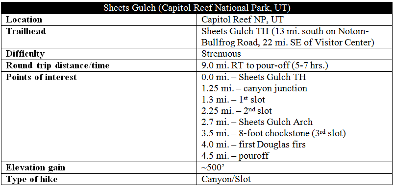
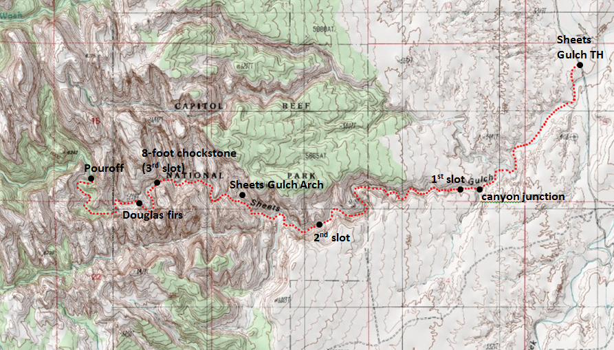
Sheets Gulch constitutes one of Capitol Reef National Park’s three major slot canyon hikes on the east side of the Waterpocket Fold. Less strenuous and more diverse than its northern cousins up the road—Burro Wash and Cottonwood Wash—Sheets boasts three lengthy slot sections, an excellent stretch of deep narrows, an arch, and a wide variety of plant and animal habitats. With its first slot just 1.3 miles from the trailhead, hikers can reach entertaining chockstone obstacles in about half the time it takes to reach those in Burro and Cottonwood. The Sheets Gulch route runs for nine miles through the Waterpocket Fold—connecting the Notom-Bullfrog Road with Tantalus Flats and the South Draw Road—but most visitors will turn around at a point short of halfway, doubling back to Notom-Bullfrog.
The hike
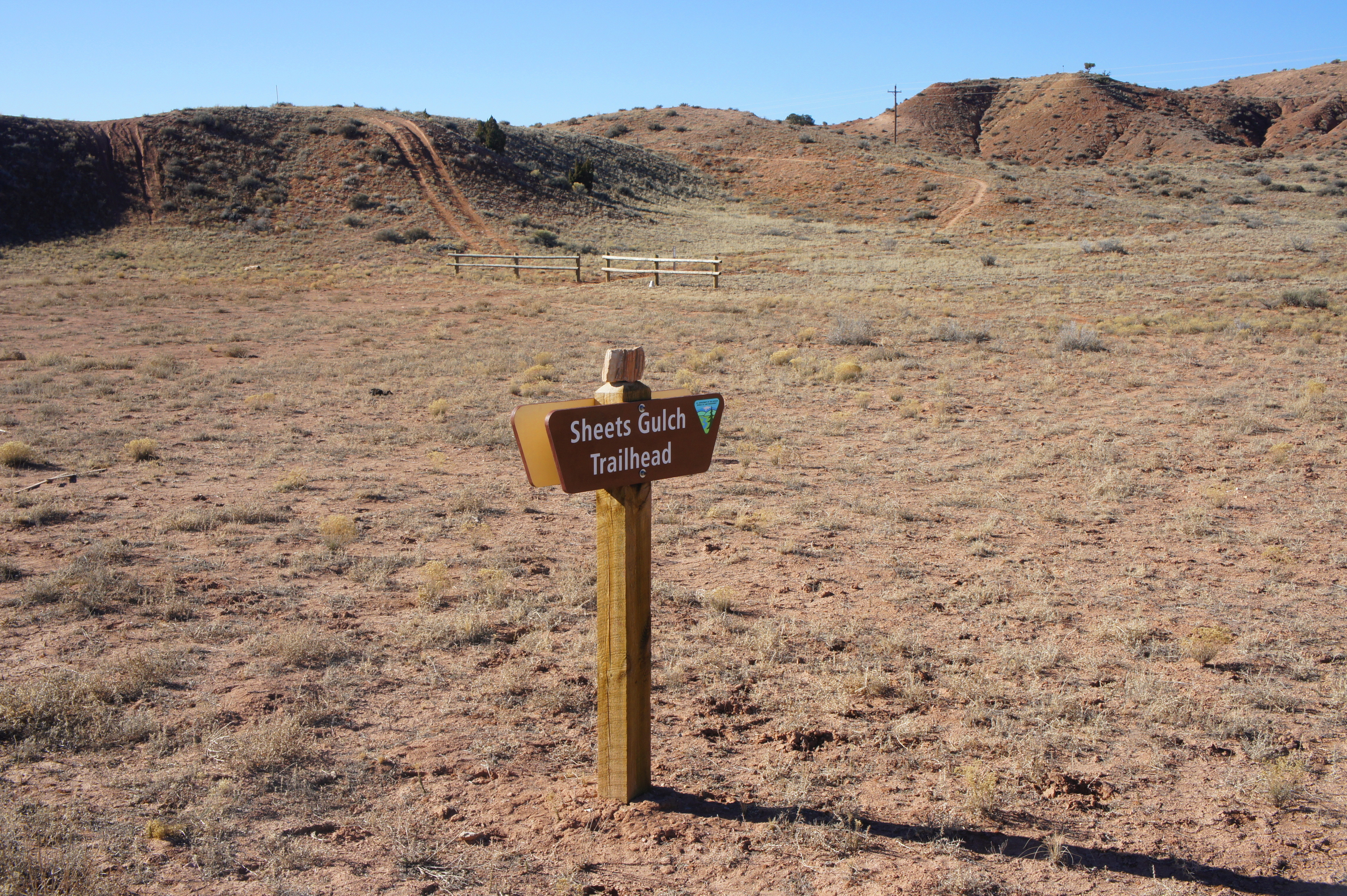
To access the Sheets Gulch Trailhead, drive to the eastern boundary of Capitol Reef National Park on Highway 24 and turn south on the Notom-Bullfrog Road. The route is paved for only the first ten miles, though it continues to be wide and (with few exceptions) well-graded thereafter. 12.7 miles down Notom-Bullfrog, look for a BLM sign marked “Sheets Gulch Trailhead” on your right. (Note that the hike begins about 100 yards north of the actual wash—if you cross over a bridge, you have driven too far.)
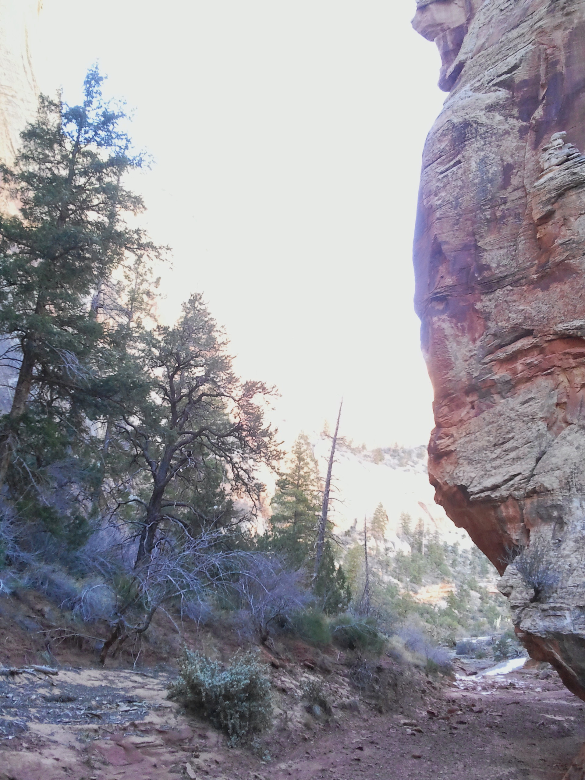
The well-trodden trail begins by cresting over a hillside covered in Russian thistle, a gnarly and invasive plant that predominates along Capitol Reef’s eastern slopes. The path then drops into the broad, sandy wash—Sheets Gulch—which at this point appears far from the narrow and sinuous slot it will eventually become. Cow droppings, stratified, multicolor cliffs, and occasional groves of cottonwoods and tamarisk are the only significant points of interest for the first 1.25 miles of the hike.

At that point, however, a junction appears, and the two canyons beyond begin to constrict. Take a right to continue up Sheets. Within minutes, sandy basins are replaced by sloping, red-tinted slickrock. Here the predominant rock layer is the ledgey, multi-tiered Kayenta formation. Follow the wash bottom for roughly 150 yards to the canyon’s first slot section—which also happens to be one of Sheets Gulch’s best.

It is worth noting that conditions in slot canyons are highly variable. Depending on the season and recent precipitation, some areas may be full of high water, while others are entirely dry. Floods and spring thaws may bring new obstacles—chockstones, logs, and boulder piles—that were not there the previous season. (For example, one rock pile commonly photographed several years ago (see here) is no longer the barrier it once was.) With that caveat, the following are the conditions of the first slot during my hike in February 2015.
The introductory slot section includes four obstacles that require a bit of maneuvering and upper body strength to surmount. The first two—low chockstones/boulder piles—are easily conquered. After passing under a huge boulder wedged in the higher reaches of the slot (other debris, i.e. tree roots, have also collected here), the third and toughest obstacle appears: a 5- to 6-foot boulder jam consisting of two large stones. The jam can be surmounted by wedging your foot into a crack on the left, or—for taller hikers with some strength—straight over the top of the second boulder. A minute or two farther, a boulder pile seven feet high is easily bypassed on the left or right.
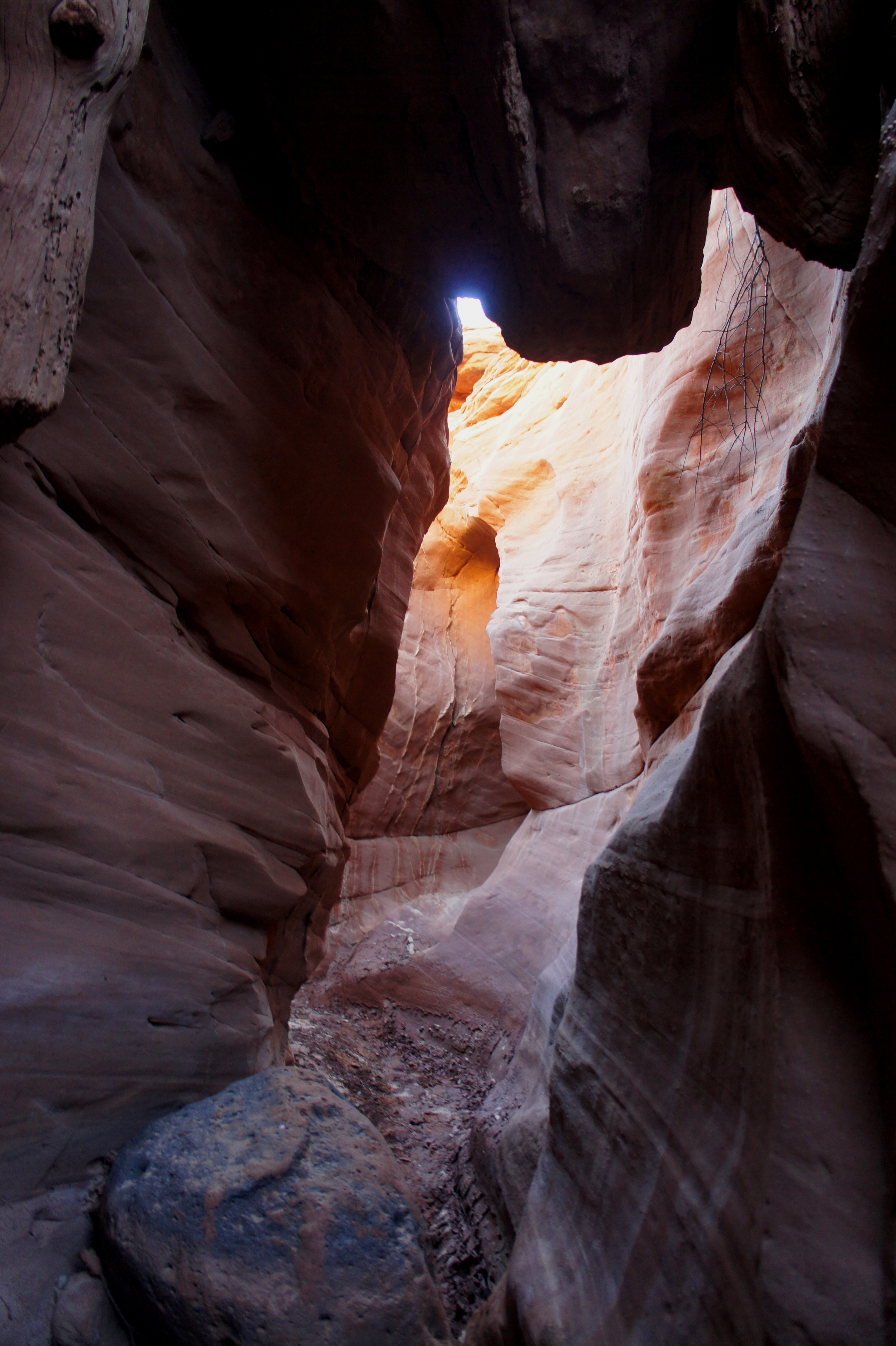
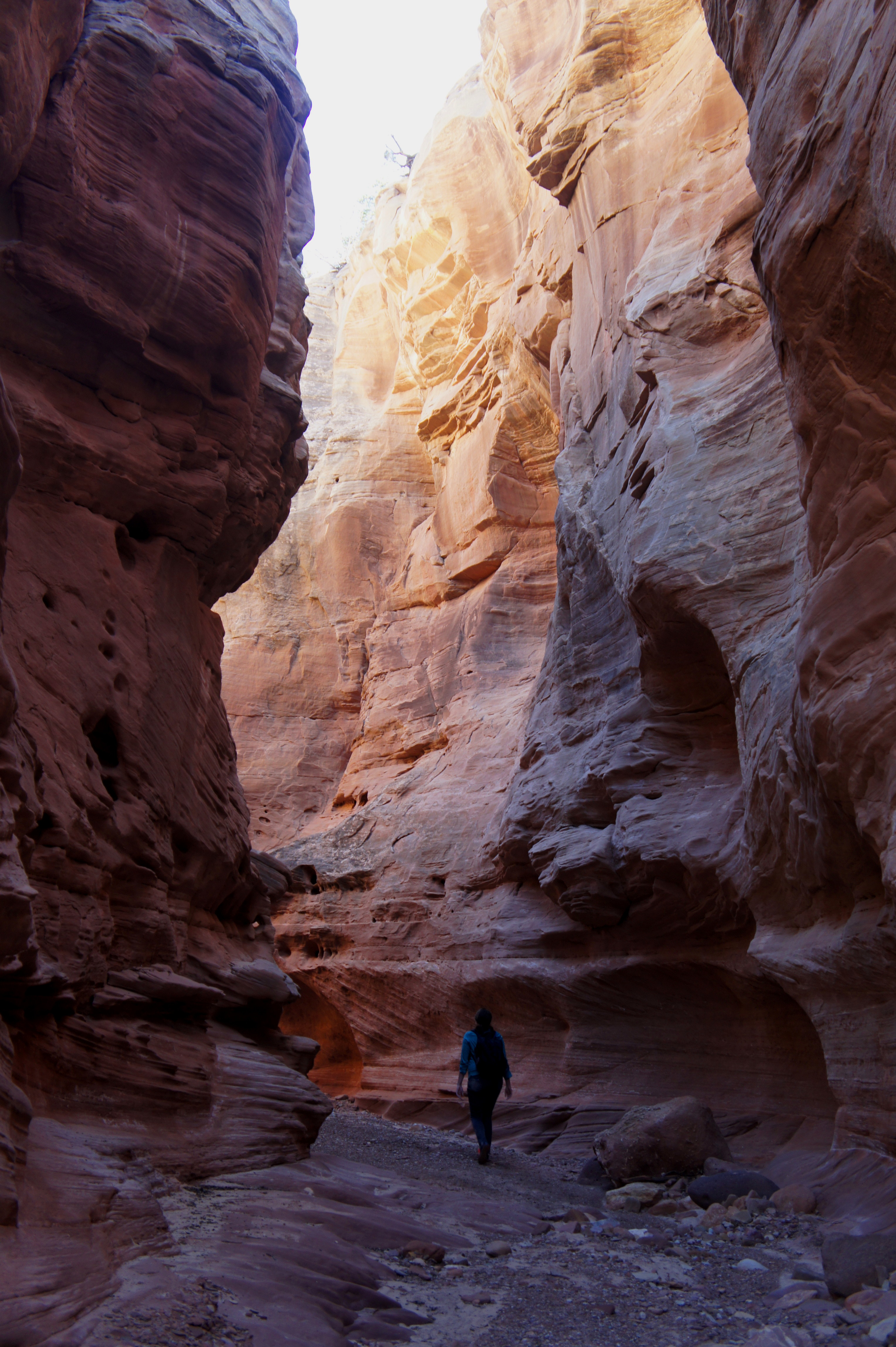
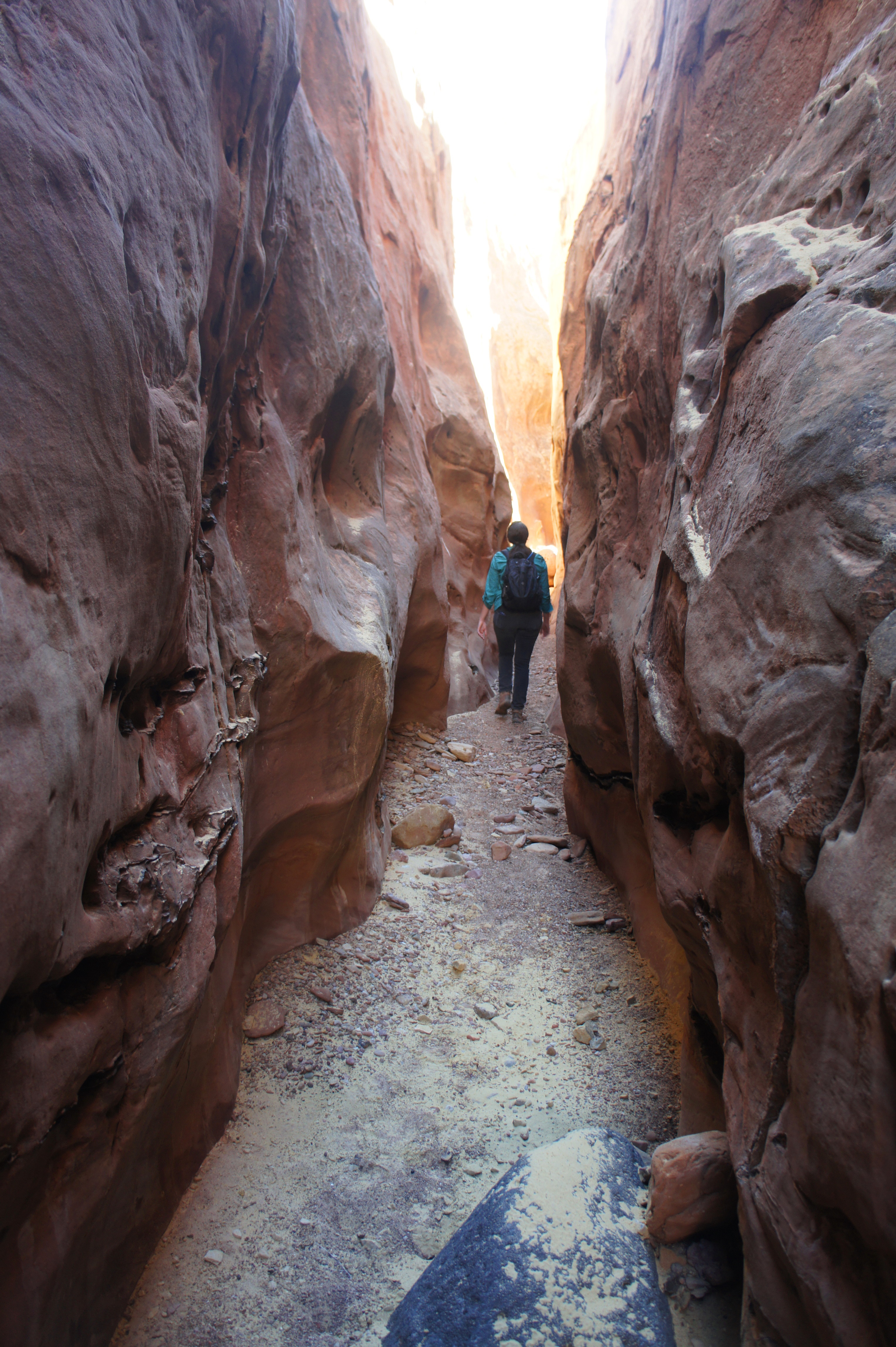
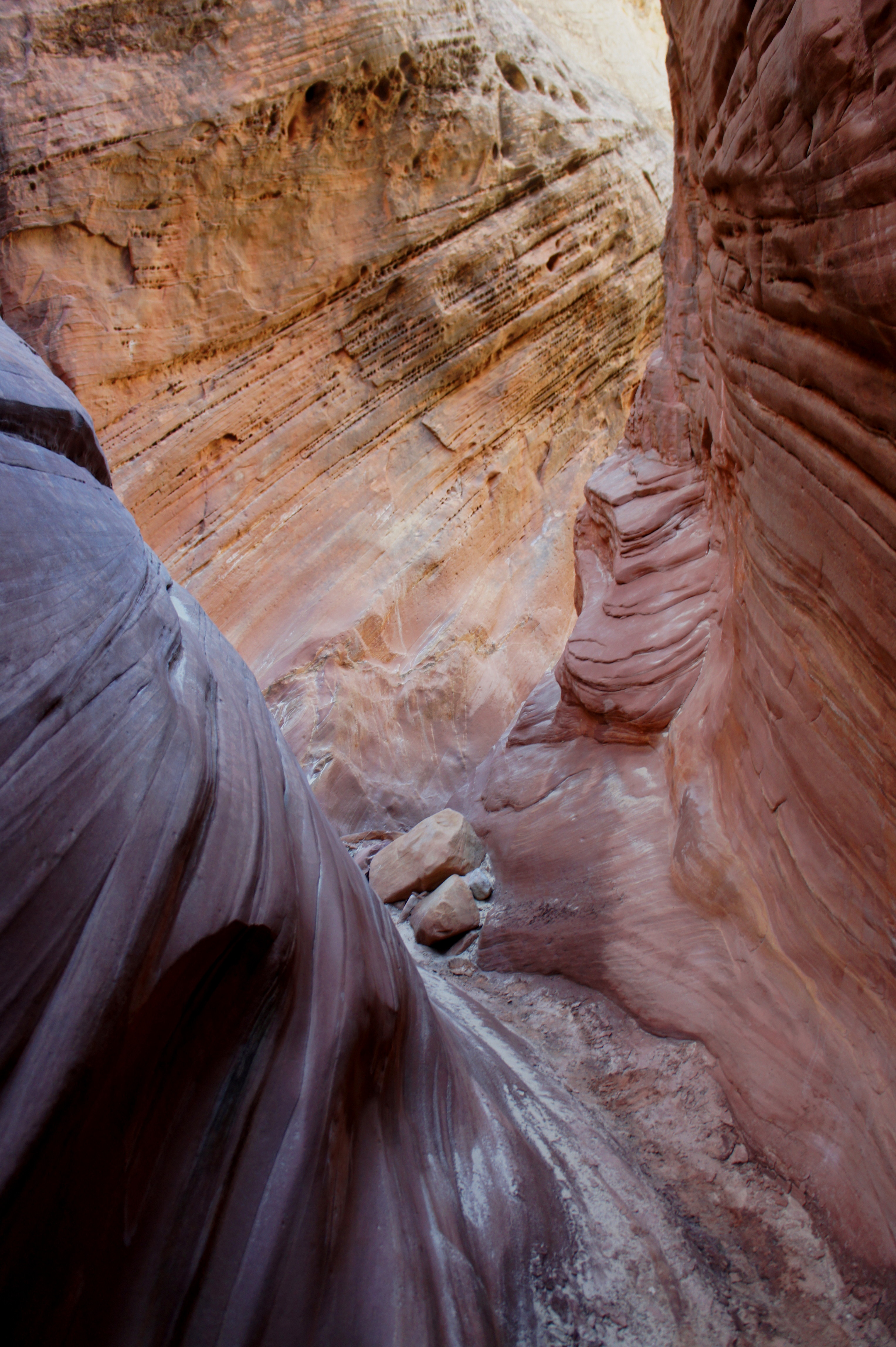
Soon after the first slot comes a stunning stretch of narrows, arguably the highlight of the hike. The 50-75 foot walls are laced with beautiful crossbedding and pockmarked with honeycomb weathering. At least a couple bends receive sunlight, making this area a photographer’s dream. The tall narrows continue for roughly 1/3 mile, after which the canyon opens up enough to view the towering domes of Navajo sandstone above. (Somewhere in this section, the hike officially enters Capitol Reef National Park.)

The walk in the more open wash bottom is pleasant enough, though at about 2.25 miles the canyon constricts again, this time producing a slot in the colorful Navajo sandstone. Barriers to travel are much less frequent here—the hardest is a 4-footer that offers beginners a good opportunity to practice their stemming.
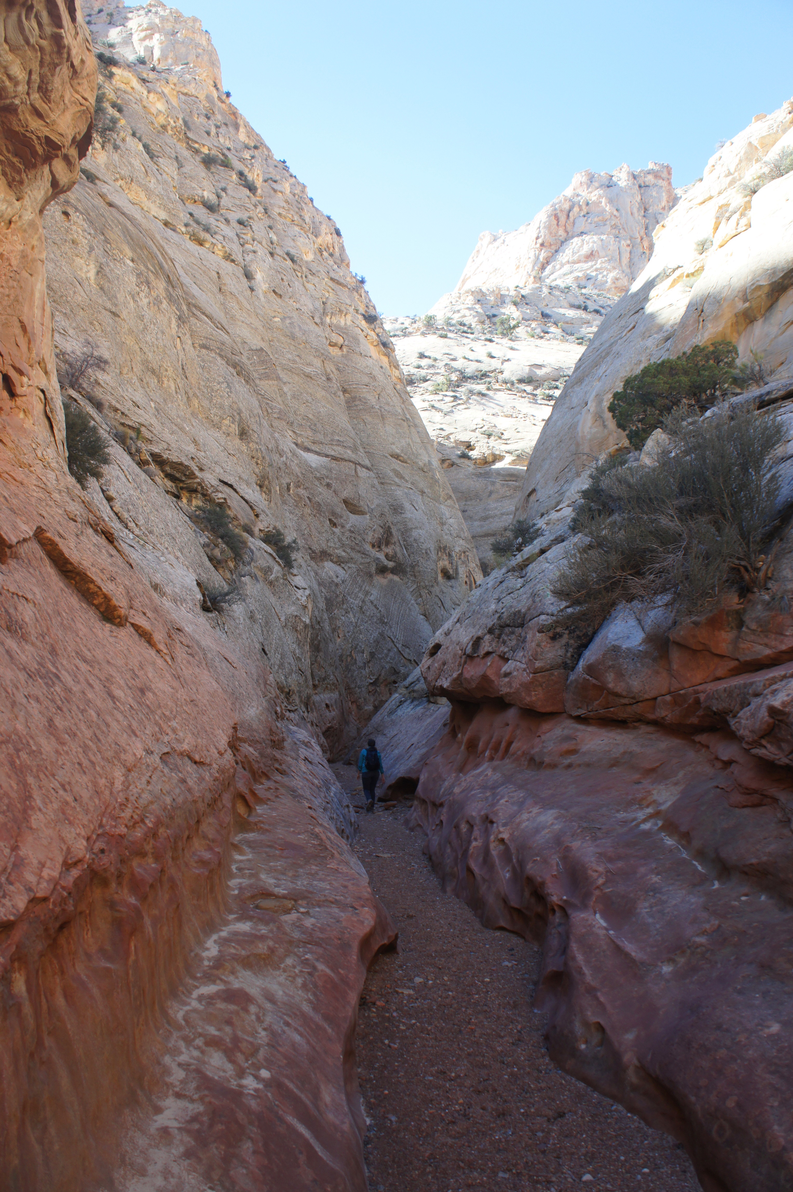
After roughly 100-150 yards, the slot again gives way to a more spacious ravine. From here it is under ½ mile to impressive Sheets Gulch Arch, which juts out of the northern wall like a bowstring. The archway can be difficult to photograph from below, but it is possible to reach its base by climbing the slickrock slope on the right.

Shortly beyond the arch, the route is again engulfed by narrows. In a little under ½ mile, the thin wash bed cuts between two high, steep-sloping sandstone domes. From this point, the canyon remains slender for the next ½ mile. Around 3.5 miles from the trailhead, slot #3 begins. At one point in this section, the sandy wash thins to less than boot’s width.

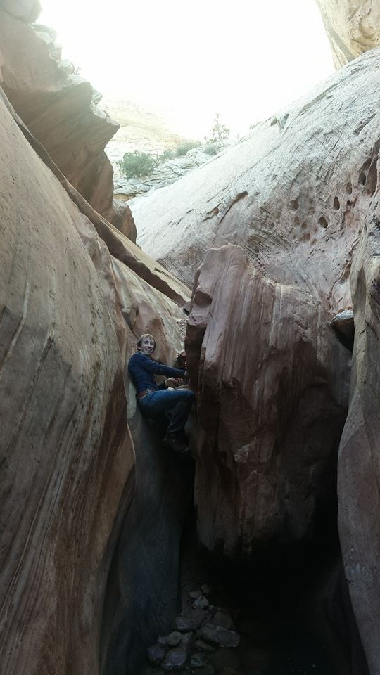
The third slot also hosts the hike’s toughest obstacle—an 8-foot chockstone often preceded by a chilly pool (at the time of our visit, it was a little over ankle-high). This can be a formidable barrier for many, as it requires an awkward bear hug of the chockstone and a good deal of upper body strength. But a decent climber will be able to proceed with little problem.

Beyond this obstacle, two 5-foot chockstones (relatively easily climbed) and a giant log are the only significant impediments before the canyon opens up again. Roughly 1/3-1/2 mile past the 8-footer, hikers encounter a peculiar sight: tall Douglas firs, coniferous evergreen trees best known for their lofty heights. This is a far cry from the Russian thistle, sagebrush, and desert scrub at the beginning of the hike.
Here the bottom of Sheets Gulch returns to the Kayenta formation—jagged ledges protrude out over the canyon floor. A large chockstone (and potentially a pool) in this section is easily bypassed by climbing to the top of the sturdy shelf on the immediate right. The route then rounds three bends to a cavernous room, which ends at a 30-foot pouroff.

Through-hikers can easily sidestep this barrier via a cairned bypass back a couple dozen yards on the south slope. By this point, however, the slot sections are complete, and the canyon becomes progressively less interesting as it exits the Navajo sandstone. This makes the dryfall is a nice place to turn around for a 9-mile round-trip day hike. Allot at least 4-5 hours to get to and from this point.


Pingback: Pleasant Creek slot canyon (Capitol Reef National Park, UT) | Live and Let Hike
Pingback: Cottonwood Wash (Capitol Reef National Park, UT) | Live and Let Hike
Pingback: Oak Creek Canyon (Capitol Reef National Park, UT) | Live and Let Hike
Pingback: Lower South Desert Overlook (Capitol Reef National Park, UT) | Live and Let Hike
Pingback: Top 10 Hikes in Capitol Reef National Park’s “Backcountry” | Live and Let Hike
We did this hike to the Douglas firs in Oct 2020. Excellent and so much fun. Great scenery and a fun slot to navigate. It wasn’t difficult – even for a 65yr old woman with medium body strength. One correction – the Notom-Bullfrog road is now paved all the way to Sheets Gulch and possibly further (we could see it was paved past the trailhead, but we did not travel further down it, so no idea how much is now paved).