
– Civil War Series –
The Civil War’s First Battle of Manassas comprised two major engagements: a Union victory at Matthews Hill in the morning, and a Union defeat at Henry Hill in the afternoon. With Gen. Irvin McDowell’s Federal forces crossing Bull Run at Sudley Ford, Confederate Col. Nathan “Shanks” Evans shifted 900 troops from nearby Stone Bridge to meet the challenge. Despite being outgunned and outmanned, the Confederate brigades—receiving back-up from Col. Francis Bartow and Brig. Gen. Barnard Bee—fought the Federals on Matthews Hill for nearly 90 minutes. The fighting would slow the Union advance, giving the Southerners much need time to bring in additional reinforcements that would ultimately achieve victory at Henry Hill later in the day.
Today, a one-mile loop hike circles the Matthews Hill battlefield. Situated 1.5 miles north of the Henry Hill Visitor Center at Manassas National Battlefield Park, the trail crosses open farm fields (owned during the war by Edgar Matthews) and briefly dips into the woods to the north and east. (Note: The loop is one of five hiking trails that trace the First Battle of Manassas; see also the First Manassas Trail, Sudley Loop Trail, Stone Bridge Loop Trail, and Henry Hill Loop Trail.)


The hike
Starting at the Matthews Hill parking lot—3/4 mile up Sudley Road from Warrenton Turnpike/Lee Highway—the Matthews Hill Loop Trail heads southeast amid tall grasses to the crest of the hill. (Note: Several paths converge at the trailhead; be sure to take the one marked “Matthews Hill Loop Trail.”) Tracking uphill, the trail reaches a junction after 250 yards. With a row of cannons to the right, take a left, peering out across the battlefield.
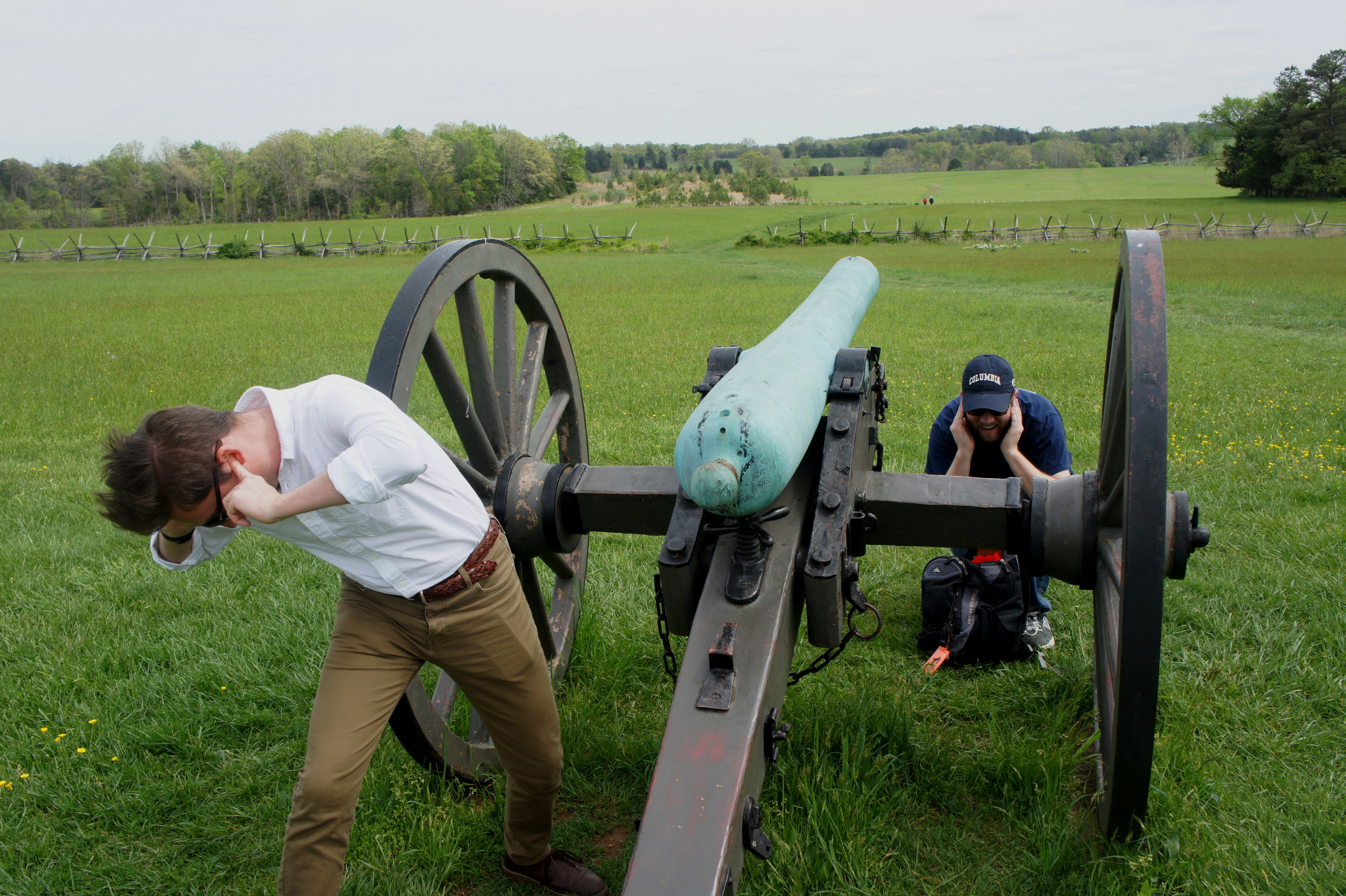


The cannons on Matthews Hill mark the position of Captain William Reynolds’ Rhode Island artillery battery, which boasted six field guns on the day of battle. Looking south, one can see Henry Hill—the site of bloody engagement in the afternoon—in the distance. From here, two Confederate brigades under Col. Bartow and Brig. Gen. Bee came to Evans’ aid at Matthews Hill. It was too little, too late. After about 90 minutes of fighting, a Federal barrage led by Col. Ambrose Burnside sent the Southerners fleeing back to Henry Hill.
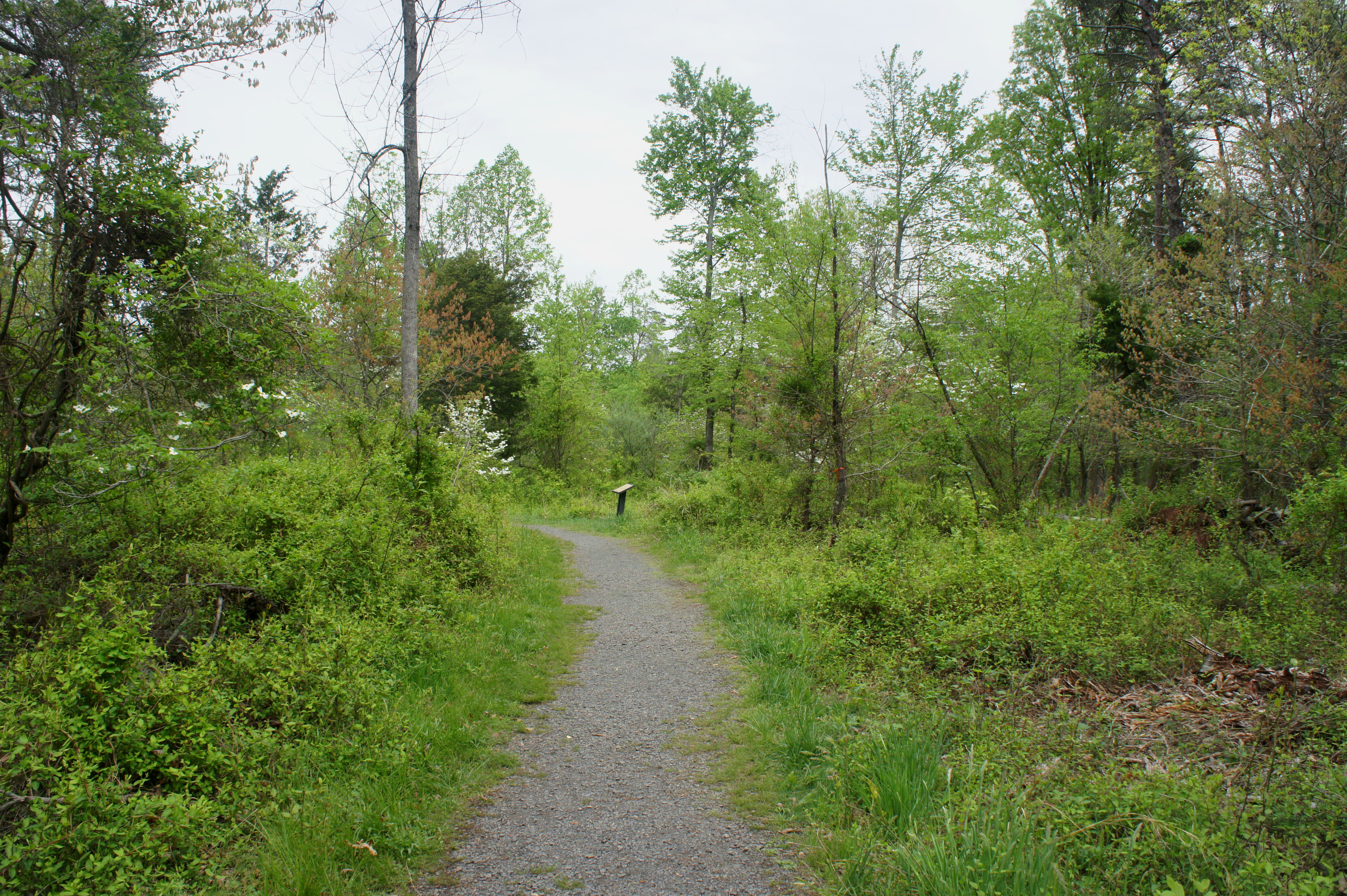
From the artillery display, continue northeast to the edge of the woods at ¼ mile. Bear straight ahead, into the forest, passing several panels that tell the story of individual Federal units and their roles in the battle. Stay straight as a bridle trail intersects the main path at 0.37 miles, then bear right—deviating from the First Manassas Trail—at around the ½-mile mark. Just beyond is the Stovall Monument, dedicated to an obscure member of the 8th regiment of the Georgia Volunteers. There is another trail fork at the monument; stay straight on the Matthews Hill Loop Trail.
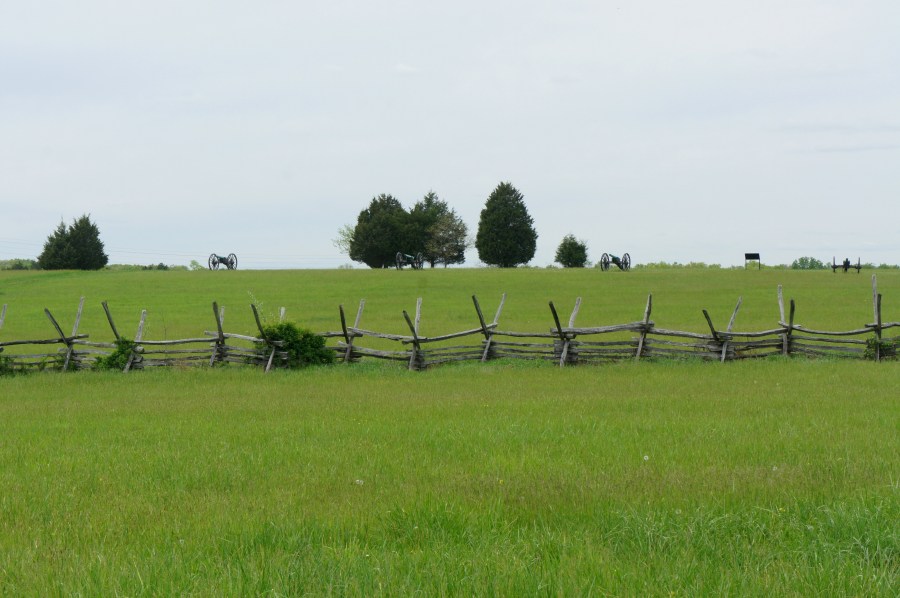
At roughly 0.65 miles, the trail reemerges onto the open fields. Stay straight as the path traces a lesser ridge where Confederate forces were position during the battle. Separating the trail from the summit of Matthews Hill is a small rail fence, a remnant of Edgar Matthews’ farm.
Although the Southerners would retreat from this position, the fighting at Matthews Hill played a key role in the eventual Confederate victory. As the three Confederate brigades bogged down McDowell’s forces, reinforcements were arriving from the south. Moreover, the battle convinced Gen. McDowell to temporary halt the Union advance on Henry Hill until the afternoon; it would be several hours until the US Army finally marched onward.

At ¾ mile, bear right at the trail fork. Walk up Matthews Hill, through a break in the rail fence, arriving back at the cannons at 9/10 mile. From here, it is a short walk back to the Matthews Hill parking area to the north.
Allot around 45 minutes to an hour for this one-mile walk. Pack sunscreen and bug spray, as the open grassland can be a haven for ticks.
Extra credit
Four additional hikes traverse the terrain of the First Battle of Manassas, including:
- First Manassas Trail (5.4 mi. loop)
- Sudley Loop Trail (0.6 mi. stem-and-loop)
- Stone Bridge Loop Trail (1.6 mi. stem-and-loop)
- Henry Hill Loop Trail (1.2 mi. loop)
References
Civil War Trust, “Bull Run,” https://www.civilwar.org/learn/civil-war/battles/bull-run
John J. Hennessy, The First Battle of Manassas, Revised Edition (Stackpole Books: 2015)

Pingback: Henry Hill Loop Trail (Manassas National Battlefield Park, VA) | Live and Let Hike
Pingback: Stone Bridge Loop Trail (Manassas National Battlefield Park, VA) | Live and Let Hike
Pingback: Sudley Loop Trail (Manassas National Battlefield Park, VA) | Live and Let Hike
Pingback: First Manassas Trail (Manassas National Battlefield Park, VA) | Live and Let Hike
Pingback: Road to First Manassas Driving Tour | Live and Let Hike