
– Civil War Series –
On July 21, 1861, Union troops crossed northern Virginia’s Bull Run in pursuit of what was supposed to be the nascent Civil War’s first and only decisive battle. Spirits were high; Gen. Irvin McDowell, tasked by President Lincoln to oversee the offensive, led a hodgepodge of Northern volunteers, enlisted for 90 days, who expected to capture Manassas Junction—a key railroad link held by the Confederacy—by sundown. From there, it would be “on to Richmond,” the Confederate capital.
Of course, things did not go as planned for the inexperienced Federal troops. After initial success in the morning, Confederate resistance and a series of Union blunders in the afternoon sent the Union forces fleeing back to Washington, engulfing hundreds of curious onlookers in their hasty retreat. It was the Confederacy’s first major military victory, a testament to their staying power; it would take another four long years—and several changes of military leadership on both sides—before the war would end.
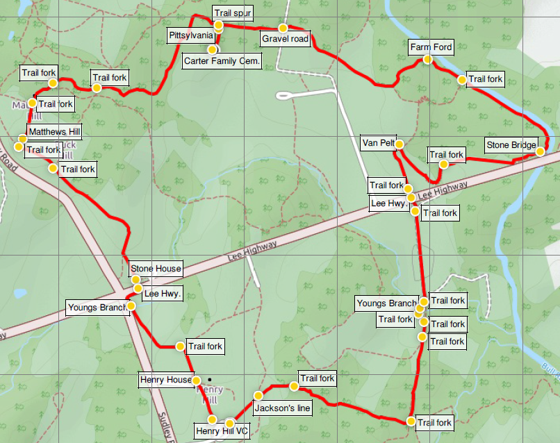
Today, one can retrace the events of the First Battle of Manassas (alternatively, the First Battle of Bull Run) at Manassas National Battlefield Park, preserved by the National Park Service since 1966. Starting and ending at the Visitor Center, the 5.4-mile First Manassas Trail offers the best self-guided tour of the battle, from the feint at Stone Bridge to the bloody combat at Matthews and Henry Hills. Mostly flat, the hike is relatively easy, although its length and plentiful waysides demand at least three hours of walking. (Note: The loop is one of five hiking trails that trace the First Battle of Manassas; see also the Sudley Loop Trail, Stone Bridge Loop Trail, Matthews Hill Loop Trail, and Henry Hill Loop Trail.)

The hike
Manassas National Battlefield Park is conveniently situated just off Interstate 66, roughly 30 miles west of Washington, DC. There is no entrance fee, and Henry Hill Visitor Center serves as the locus point for free guided tours and information about the park. Head inside to grab a park map and trail guide, and check out the indoor exhibits, which cover both the First Battle (July 21, 1861) and the Second Battle of Manassas (August 28-30, 1862). Ranger-led talks on First Manassas are offered at 11am and 2pm daily and include a partial walk around Henry Hill, site of the largest engagements of the battle.
When you’re ready to hike, walk back out to the parking area and take a left, heading toward the northeast corner of the parking lot. Here you will find the hike’s start, marked by a wooden sign reading “First Manassas Trail.”

Henry Hill to Warrenton Turnpike
From here the faint path heads out across the barren hillside toward a string of artillery pieces known as the Jackson line.
It was here, on the afternoon of the battle, that Gen. Thomas Jonathan Jackson would emerge as a popular champion of the Confederacy and earn his famed moniker. Even as the rest of the Confederate lay scattered in disarray following a morning defeat on Matthews Hill, Brig. Gen. Bernard Bee observed of the headstrong Virginian military instructor: “There stands Jackson like a stone wall! Rally behind the Virginians!” Thus the legend of “Stonewall” Jackson was born.
Jackson’s line—which included 2,600 men and more than a dozen artillery pieces—was well-positioned for the Union’s impending attack on Henry Hill. Situated on the reverse slope of the hill at the edge of the woods, it was all but invisible to advancing Federal troops.

It was not until after noon, however, that Jackson had arrived. Thus, as the First Manassas Trail bounds into a sea of trees to the east, hikers should mentally turn back the clock to the wee morning hours of July 21. At that point, the Confederates did not yet know the Union avenue of attack; in fact, commanding Brig. Gen. P.G.T. Beauregard expected that the Federals would engage the Confederate line several miles farther south and thus left only a single contingent—Col. Nathan G. Evans’ 7th Brigade—to defend the Army’s extreme left flank in this area. On the morning of the battle, the woods through which you are walking were quiet; they would see action only later in the day, when it became a principal thoroughfare for Confederate reinforcements.
After passing through an initial line of trees, the First Manassas Trail crosses another field and splits in two. Stay right on the main track. Here the trail shifts from gravel to dirt, and the path weaves eastward amid a mixed forest of holly, oaks, pines, and beech. At 6/10 mile, the route approaches a four-way junction; take a left, following the blue blazes and a sign pointing to “Stone Bridge 1.3 mi.”
Back on gravel again, the northbound track—an old road that predates the Civil War—is lined with pines and junipers. A yellow-blazed bridle path parallels the trail on the left. At 8/10 mile, the trail forks, with spurs heading west across open fields; stay straight on the wide track.

One hundred yards farther, the path splits again. Although the old road continues straight, it leads to a nasty ford of Young’s Branch, a tributary of Bull Run. Fortunately, there’s no need to get your boots wet: head left at the fork, then take a quick right to a wooden footbridge. After crossing the bridge, the trail quickly meets up again with the main track.
For the next ¼ mile, the route heads north across an open plain. During the early morning of July 21, this path connected Confederate Gen. Bee and Col. Francis Bartow’s brigades, who had moved up from the south, with that of Col. Evans, positioned at Stone Bridge to the north. None of them, however, would stay put for long as the Federals approached.

Passing two picnic tables on the right, stay straight at the next fork, then descend to cross Warrenton Turnpike (a.k.a. Lee Highway/Highway 29) at 1.25 miles. A key artery leading to and from Washington, DC, the turnpike effectively bifurcated the battlefield and proved a significant obstacle for Union troops. In the early afternoon of July 21, the Federals were twice repulsed during efforts to break through the Confederate line along the road; it was not until after 2pm that Gen. McDowell’s troops crossed the turnpike en masse to meet Gen. Jackson’s forces at Henry Hill.
Warrenton Turnpike to Stone Bridge
Now north of the turnpike, stay straight at the next junction, where a yellow-blazed bridle path heads west. From here the trail climbs a minor slope, flanked on one side by a thin line of trees, then arrives at the former site of the Van Pelt House at 1.4 miles. This was the home of Abraham Van Pelt, his wife Jemima, and his daughter Elizabeth—all staunch Unionists who nonetheless had to contend with thousands of Confederates, who occupied his 230-acre farm during the battle.
Just around the corner from the Van Pelt sign, the trail forks again: stay right, heading southeast along a grassy ridge. (Note: Here the First Manassas Trail merges with the shorter Stone Bridge Loop Trail.) Here an interpretive sign marks the chronological starting point for the battle. Titled “Opening Shots,” it details the situation facing Col. Evans’ Confederate brigade in the early hours of July 21…
At around 3 am, members of the 4th South Carolina positioned near Stone Bridge—just east of here, where Warrenton Turnpike crosses Bull Run Creek—detected the sounds of soldiers approaching: Union Brig. Gen. Daniel Tyler had directed two of his brigades to march to Stone Bridge to meet Evans’ forces. At around 6 am, Tyler’s troops fired the battle’s famed First Shot: his 30-pounder Parrott rifle let loose a projectile that, according to Union accounts, sailed over Evans’ line and crashed into the Van Pelt House. The battle was on.
While Evans sent troops to meet the advancing Union forces, he did not yet know that Tyler’s move was only a demonstration: a show of force intended to deceive or distract the enemy from a larger movement elsewhere. At about 7:30 am, however, a nearby signalman, Capt. E. Porter Alexander, unmasked the ruse: he spotted a much larger Union contingent—around 13,000 troops—crossing Bull Run two miles to the north at Sudley Ford. Alexander immediately relayed the message to Evans: “Look out for your left, you are turned.” Evans took the cue; he quickly withdrew 900 of his 1,100 men, sending them northward to meet the advancing Federals at Matthews Hill.
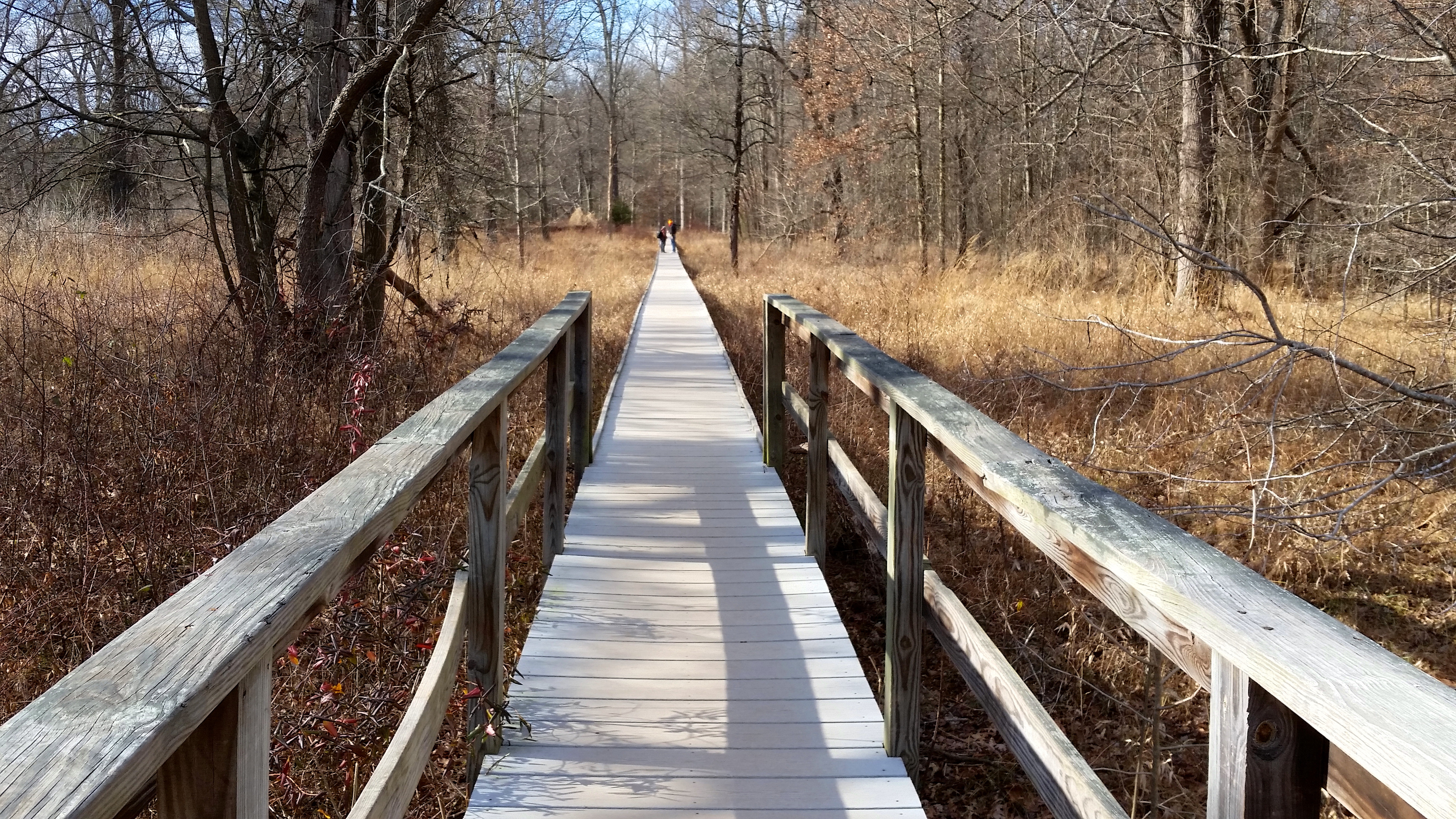
Just beyond the “Opening Shots” sign, the trail rounds a corner and drops precipitously, losing around 60 feet in less than 75 yards. With Lee Highway visible on the right, the path levels out and crosses a marshy flat. At the end of a 350-yard boardwalk lies a reconstructed version of Stone Bridge, the key crossing on Warrenton Turnpike which, after Evans’ withdrawal, was held by only 200 men.

Stone Bridge to Matthews Hill
After exploring the bridge, head north along Bull Run’s western bank as the trail meanders through thick woods. The creek here is more than a dozen feet wide, which proved a formidable challenge for transporting Union artillery, limiting the number of suitable crossing points. Col. William T. Sherman (who would, of course, go on to become one of the Union’s most distinguished Generals) and his five regiments used one such point at Farm Ford, which, from Stone Bridge, is about a half-mile walk and follows a steep uphill climb. (Note: Stay right at the trail junction 4/10 mile from Stone Bridge.) Situated atop a high bluff, a wayside at the overlook tells the story of Sherman’s advance—well south of the Federals’ main crossing at Sudley Ford, a testament to the Ohioan’s fierce independence.
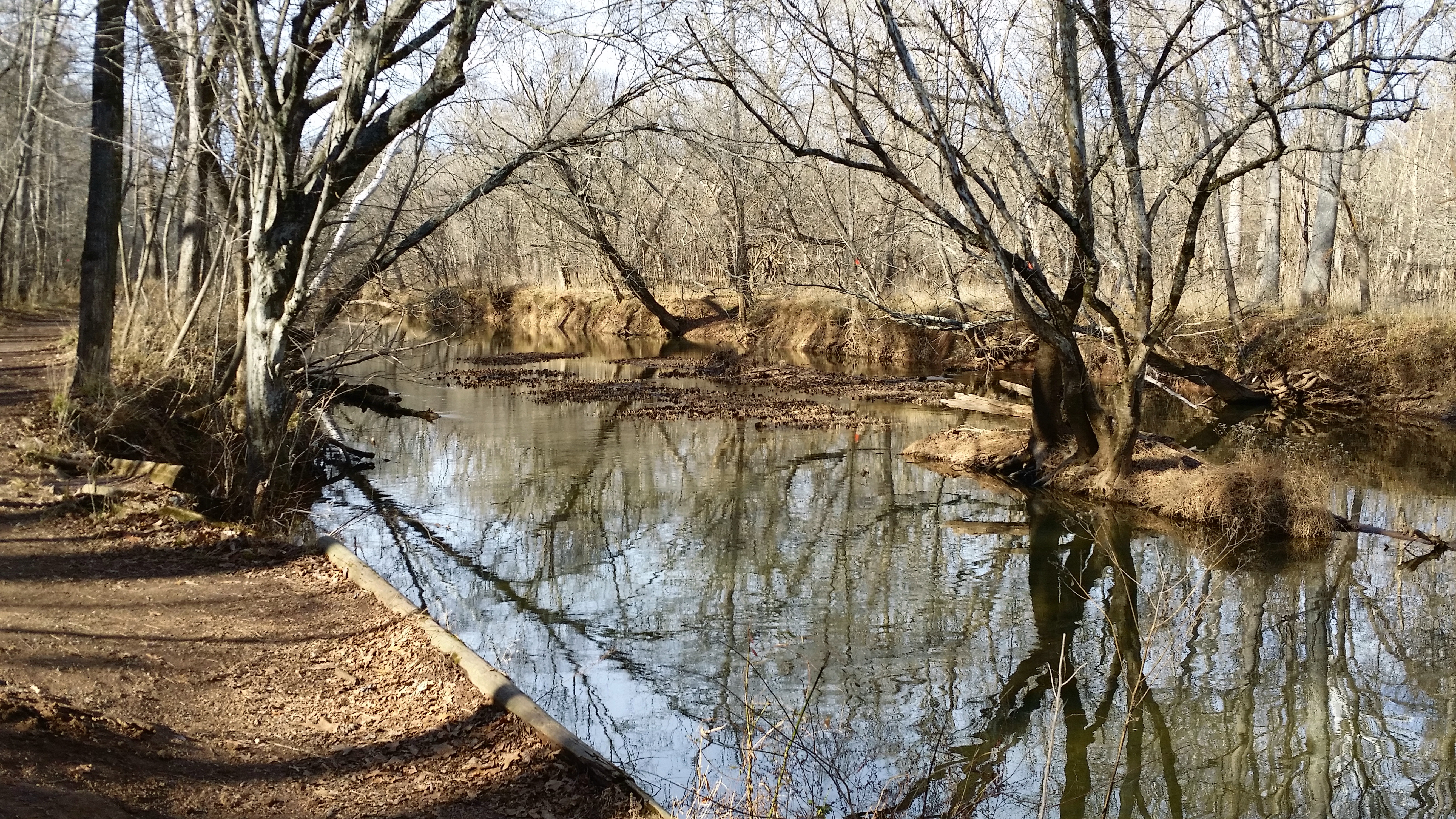
From Farm Ford, the trail bears west, leaving the creek behind, and traces a small ravine laced with pine needles. At 2.6 miles, the trail emerges from the woods and back onto Van Pelt’s old farm. Take a right at the junction, hugging the tree line on the right.

Setting out westward across open fields, hikers here are following the road used by Col. Evans’ forces to move toward Matthews Hill, where they would meet the two Union divisions streaming down from Sudley Ford. At 3.0 miles, the trail crosses a gravel road and reenters the woods, where it will remain for the next mile.
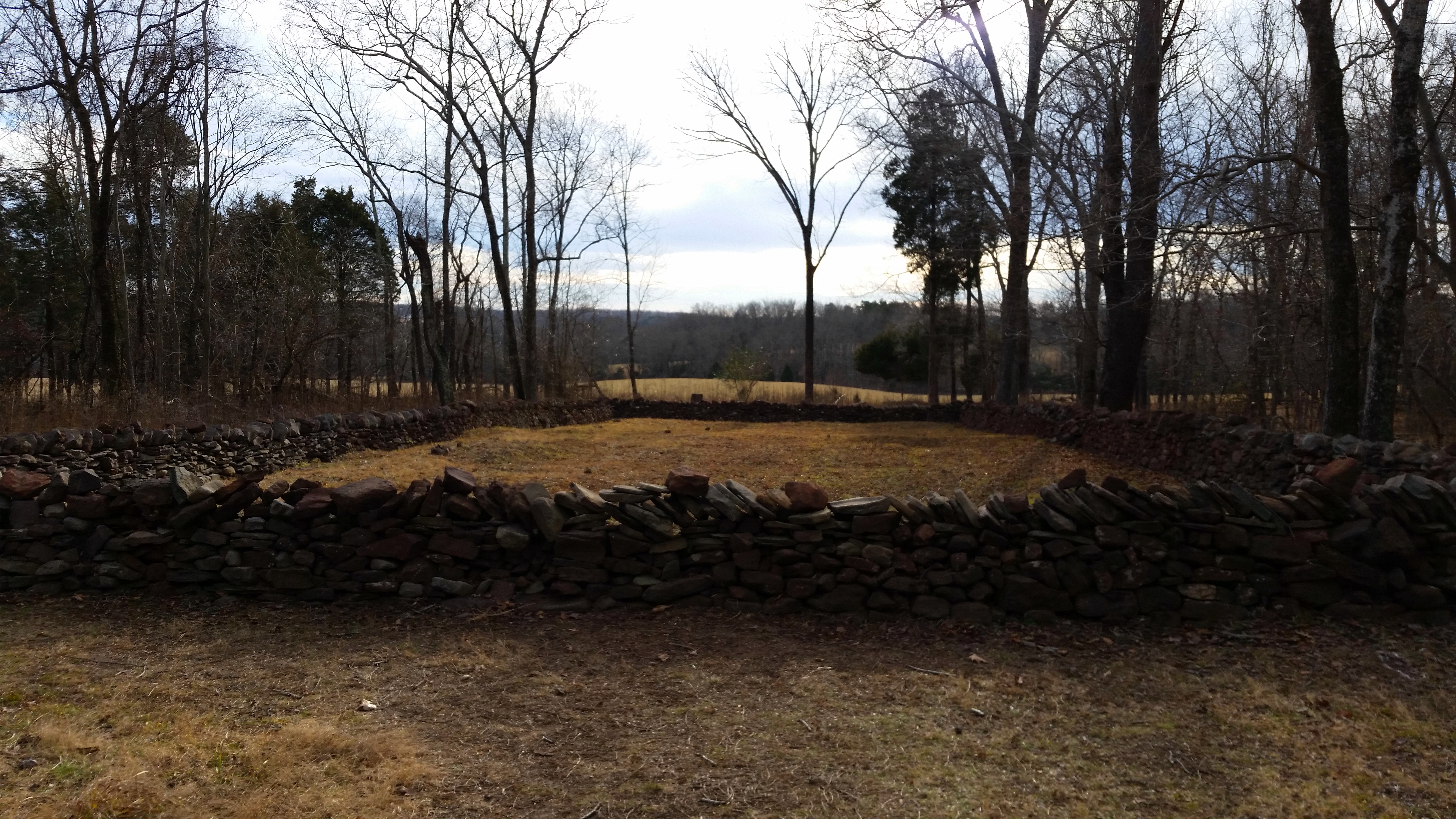
The next attraction of note is Pittsylvania, site of another old house caught in the crossfire. At 3.2 miles, take a left on the small spur trail and note the interpretive sign on the right. Just beyond the sign lie the foundation stones of the Georgian-style home, the centerpiece of a 283-acre estate at the start of the war.
It must have been quite the sight on July 21 for the Carter family, who had owned the estate since 1765: in the morning, Col. Evans’ Confederate forces frantically passed the house as they raced to take up position at Matthews Hill. By afternoon, Pittsylvania was surrounded by Union forces under the command of Massachusetts Col. Erasmus Keyes. Still later, those same Union troops could be seen retreating in disarray across the Carter family’s land after defeat at Henry Hill.
Continue 100 yards farther to the terminus of the spur trail, which ends at the Carter Family Cemetery, where more than 70 members of the Carter family have been laid to rest.
Backtracking to the main trail, take a left and continue for ½ mile as the dusty path snakes southwest to meet the next route junction. Stay right as the First Manassas route merges with the Matthews Hill Loop Trail (though none of this is well-signed).
By mid-morning on the day of battle, this area was swarming with Union columns. The two divisions that had crossed at Sudley Ford—comprising 13,000 men—were led by Col. David Hunter and Col. Samuel Heintzelman, both of whom went on to become generals in their own right but at the time answered to Gen. McDowell.
McDowell’s planned movements had not gone as well as he had hoped. While Hunter and Heintzelman’s divisions had cleared Sudley Ford by midday, they were several hours behind schedule. The flanking maneuver was a solid strategy, but it relied heavily on speed, something at which the young and inexperienced troops did not excel. The delay allowed Evans’ troops to get in position, and the two sides collided at around 10 am.
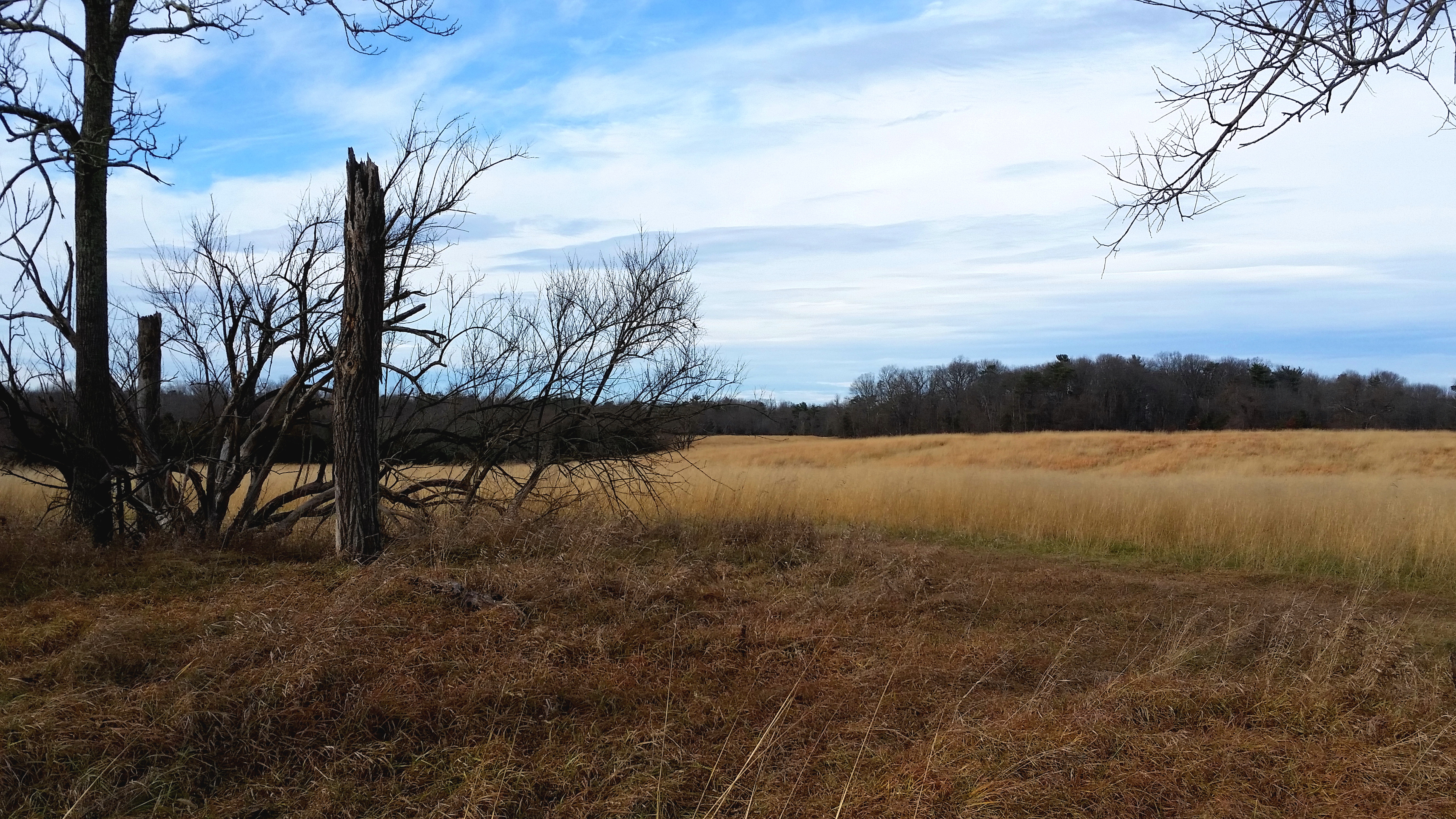
Stay straight at the next junction at 4.0 miles, then emerge onto the open field at Matthews Hill. Head straight across the grassy knoll and make way for a line of five cannons facing southeast, as they were during the battle. Here the 2nd Rhode Island, answering to Brigade Commander Col. Ambrose Burnside, launched the initial Union charge against Evans’ line, positioned at Buck Hill (the smaller hill to the south, just past the cattle guard). For many of the green troops on either side, the fighting at Matthews Hill was their first taste of battle.

Outgunned and outnumbered, Evans’ brigade was forced to retreat after 90 minutes, even as Gen. Bee and Col. Bartow sent reinforcements from Henry Hill to back them up. Forces from Hunter and Heintzelman’s divisions advanced down the slope, taking a new position at Buck Hill.
Matthews Hill to Henry Hill
Just after this success for Union troops, Gen. McDowell made a strategic error: he failed to seize the initiative, allowing Confederate forces to regroup and giving time for Gen. Beauregard to dispatch additional reinforcements, including Stonewall Jackson’s brigade, to the battlefield. Between 11:30 and 1:30, McDowell’s forces largely stayed put. The Federals arrayed themselves along Matthews Hill and Dogan Ridge to the west, awaiting orders from McDowell on how best to proceed.
Meanwhile, the Confederates were setting positions atop Henry Hill. Around midday, a retreating General Bee rode to Jackson and claimed, “General, they are driving us.” Jackson’s response would become famous: “Sir, we will give them the bayonet.”
At 1:30, McDowell finally made a move, sending two regiments under Col. Keyes to cross Warrenton Turnpike. But the advance was repelled by Col. Wade Hampton’s South Carolina Legion. At 2pm, McDowell tried again, calling for the movement of two artillery batteries—commanded by Capt. Charles Griffin and Capt. J.B. Ricketts—to Henry Hill: Napoleon-style, McDowell planned to move artillery to within close striking distance of the Confederates, then fire away. Streams of infantry support would follow—but, as Gen. McDowell would soon learn, they were still not enough to match the Confederate force that awaited.
Atop Matthews Hill, hikers have a good view of the landscape: Buck Hill to the south, then a dip leading down to Warrenton Turnpike and Young’s Branch (not visible); Henry Hill—topped by the Visitor Center—rises beyond. Gen. Barry’s artillery batteries eschewed this open space, instead descending Dogan Ridge to the west, then following Sudley Road to the right flank of Henry Hill.
Leaving Matthews Hill behind, walk past the cannons (toward Sudley Road), then bear left on a faded path that heads southeast through the first of several cattle guards. (Note: This follows the route of the 71st New York infantry after the morning battle at Matthews Hill.) Less than 50 yards past the fence, the trail meets a spur coming in from the left; bear straight, continuing to descend the hillside.
From here, the trail briefly levels, crossing Buck Hill, where McDowell’s troops moved some of their artillery around midday. At 4.4 miles, the trail cuts through a second cattle guard (where there is a wayside on the Battle at Matthews Hill), then crosses Buck Hill, where McDowell’s troops had moved some of their artillery by midday on July 21. At around 4.7 miles, the dusty path passes a wayside on the Second Battle of Manassas (the two battlefields converge here), then drops sharply toward the Stone House, which served as a field hospital during the battle.
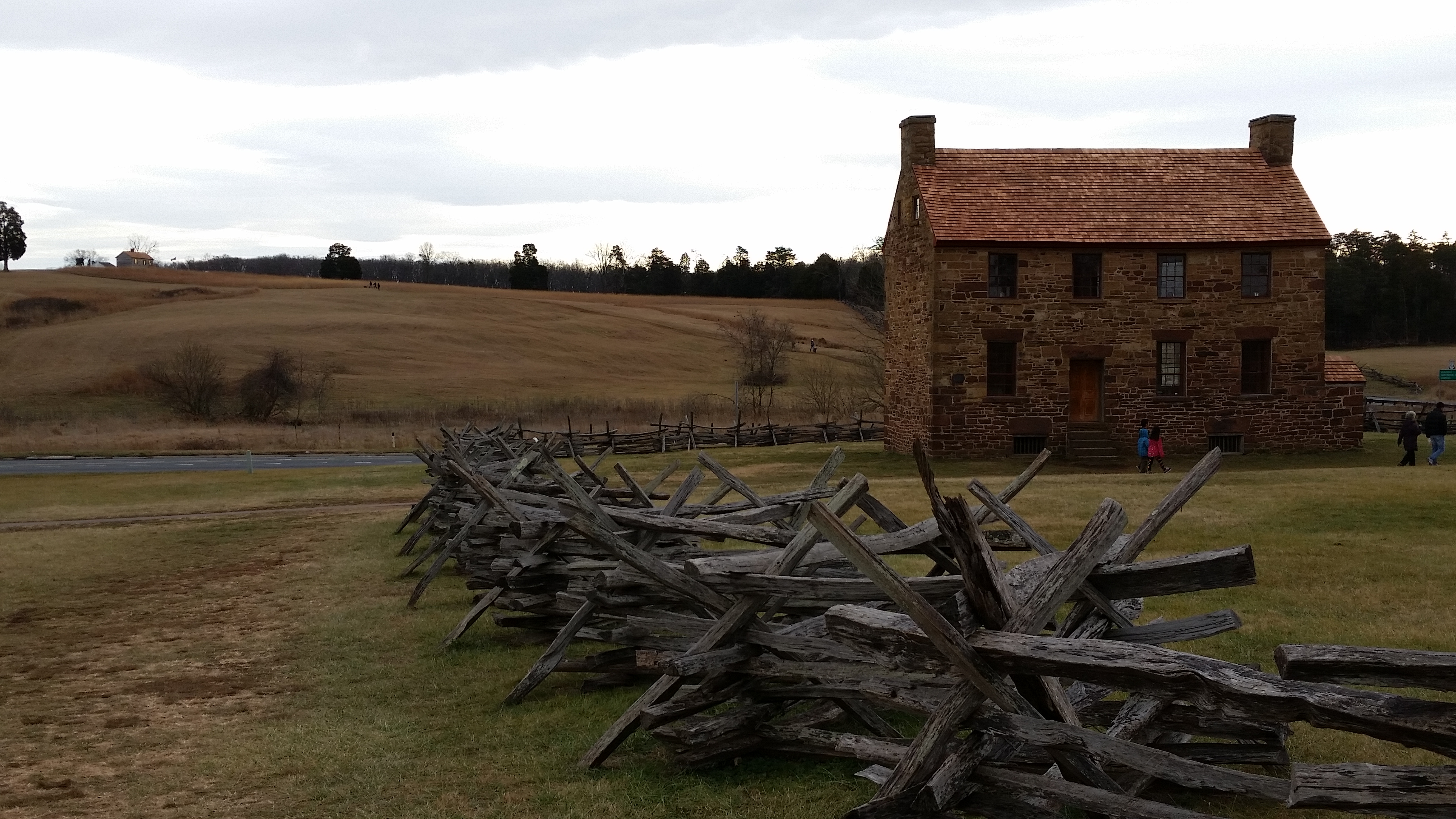
At the Stone House, bear right and head for the crossing of Warrenton Turnpike and Sudley Road (now a busy intersection). Traverse the Turnpike here and pick up the trail again as it traverses a bridge over Young’s Branch at 4.8 miles.
From here on, it is all uphill to the Visitor Center. The trail climbs to a ridgetop where a lone cedar tree shades a weathered wayside about Confederate Capt. John Imboden, who had positioned four cannons here on the morning of July 21. As Evans, Bee, and Bartow retreated from Matthews Hill, Imboden and his men were—for a brief moment, before the midday arrival of Confederate reinforcements—the only obstacle to a Federal attack on Henry Hill. After retreating up Henry Hill, Imboden’s artillerymen would be among the first to meet Capt. Griffin and Capt. Ricketts’ advancing batteries.

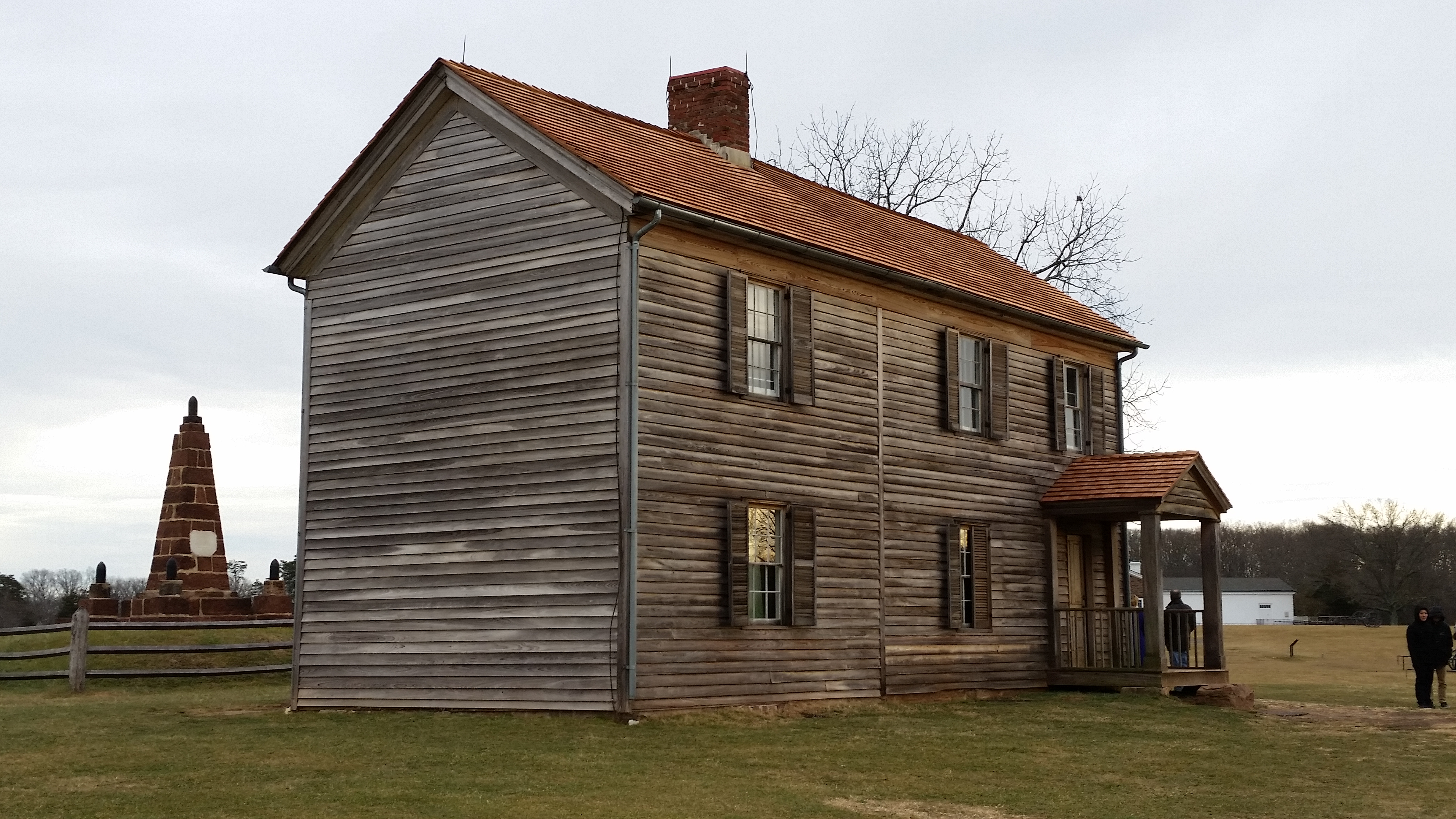
The advancing Federals were also surprised by Confederate sharpshooters hiding in the Henry House, today around 175 yards up the trail from Imboden’s position. Returning fire, Ricketts’ battery opened up on the Henry House, producing the battle’s first and only civilian casualty: 85-year-old Judith Carter Henry, who refused to leave her home even as the fighting approached. (Note: Behind the house is a stone monument, built in 1865 to commemorate the fallen.)
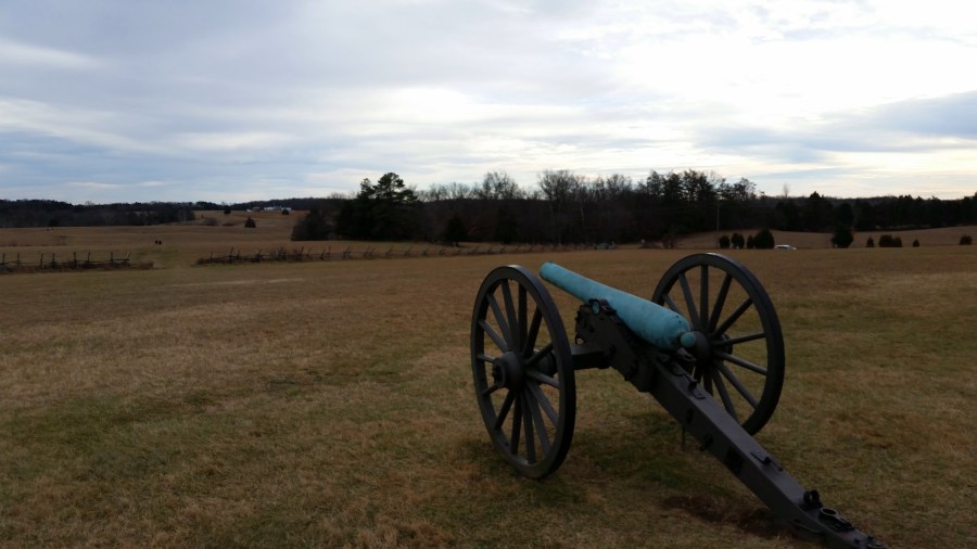
As Ricketts and Griffin rolled their pieces into position at the Henry House, the stage was set for a vigorous battle atop Henry Hill. Gen. Jackson’s line of 13 short-range cannons, just 350 yards away, is visible to the east. Throughout the afternoon, both sides lit up the other with heavy artillery fire. The tall grass to the west (to the hiker’s right) was occupied by the 11th New York and 1st Minnesota, providing infantry support for the gunners.
The turning point of the battle came shortly after 3pm, when the Confederates captured two of Griffin’s howitzers (today situated southeast of the Visitor Center). The Confederates had broken McDowell’s front, and they would do so several times more—capturing, then ceding, then recapturing Ricketts’ line. By now it was a numbers game: the Southerners sent waves of fresh reinforcements, while the Union forces were tired, overstretched, and scattered.
As evening approached, the Federals were spent, forced to retreat up Sudley Road back toward the ford, with others crossing Stone Bridge. What looked in the morning like an all-but-assured Union victory had turned by afternoon into a Confederate rout. The Southerners pursued the Yankees toward Washington before they too hit a wall of exhaustion. Gen. Beauregard, though victorious, would have to wait for another day to advance on the Union capital. With the first major battle in the books, both sides would settle in for a long war ahead.

The final stretch of the hike crosses Henry Hill to the Visitor Center, with a line of cannons representing Ricketts’ positions on the right. The entire loop hike clocks in at around 5.4 miles, roughly a 3-4 hour journey.
Extra credit
Four additional hikes traverse the terrain of the First Battle of Manassas, including:
- Sudley Loop Trail (0.6 mi. stem-and-loop)
- Stone Bridge Loop Trail (1.6 mi. stem-and-loop)
- Matthews Hill Loop Trail (1.0 mi. stem-and-loop)
- Henry Hill Loop Trail (1.2 mi. loop)
References
Civil War Trust, “Bull Run,” http://www.civilwar.org/battlefields/bullrun.html.
John J. Hennessy, The First Battle of Manassas, Revised Edition (Stackpole Books: 2015)

Pingback: Peninsula Campaign Driving Tour – Part 1 | Live and Let Hike
Pingback: Sudley Loop Trail (Manassas National Battlefield Park, VA) | Live and Let Hike
Pingback: Stone Bridge Loop Trail (Manassas National Battlefield Park, VA) | Live and Let Hike
Pingback: Matthews Hill Loop Trail (Manassas National Battlefield Park, VA) | Live and Let Hike
Pingback: Henry Hill Loop Trail (Manassas National Battlefield Park, VA) | Live and Let Hike
Pingback: Top 10 Hikes in 2017 | Live and Let Hike
Pingback: Road to First Manassas Driving Tour | Live and Let Hike
Pingback: Ball’s Bluff Battlefield Interpretive Trail (Ball’s Bluff Battlefield Regional Park, VA) | Live and Let Hike